

Toronto streetcar system
Encyclopedia

Tram
A tram is a passenger rail vehicle which runs on tracks along public urban streets and also sometimes on separate rights of way. It may also run between cities and/or towns , and/or partially grade separated even in the cities...
routes in Toronto
Toronto
Toronto is the provincial capital of Ontario and the largest city in Canada. It is located in Southern Ontario on the northwestern shore of Lake Ontario. A relatively modern city, Toronto's history dates back to the late-18th century, when its land was first purchased by the British monarchy from...
, Ontario
Ontario
Ontario is a province of Canada, located in east-central Canada. It is Canada's most populous province and second largest in total area. It is home to the nation's most populous city, Toronto, and the nation's capital, Ottawa....
, Canada
Canada
Canada is a North American country consisting of ten provinces and three territories. Located in the northern part of the continent, it extends from the Atlantic Ocean in the east to the Pacific Ocean in the west, and northward into the Arctic Ocean...
, operated by the Toronto Transit Commission
Toronto Transit Commission
-Island Ferry:The ferry service to the Toronto Islands was operated by the TTC from 1927 until 1962, when it was transferred to the Metro Parks and Culture department. Since 1998, the ferry service is run by Toronto Parks and Recreation.-Gray Coach:...
(TTC), and is the largest such system in the Americas in terms of ridership, number of cars, and track length. The network is concentrated primarily in downtown
Downtown Toronto
Downtown Toronto is the central business district of Toronto, Ontario, Canada. It is approximately bounded by Bloor Street to the north, Lake Ontario to the south, the Don River to the east, and Bathurst Street to the west...
and in proximity to the city's waterfront
Toronto waterfront
The Toronto waterfront is the lakeshore of Lake Ontario in the City of Toronto, Ontario in Canada. It spans 46 kilometres between the mouth of Etobicoke Creek in the west, and the Rouge River in the East. The entire lakeshore has been significantly altered from its natural glaciated state prior to...
. Much of the streetcar route network dates back to the 19th century. Unlike newer light rail
Light rail
Light rail or light rail transit is a form of urban rail public transportation that generally has a lower capacity and lower speed than heavy rail and metro systems, but higher capacity and higher speed than traditional street-running tram systems...
systems, most of Toronto's streetcar routes operate in the classic style on street trackage shared with car traffic, and streetcars stop on demand at frequent stops like bus
Bus
A bus is a road vehicle designed to carry passengers. Buses can have a capacity as high as 300 passengers. The most common type of bus is the single-decker bus, with larger loads carried by double-decker buses and articulated buses, and smaller loads carried by midibuses and minibuses; coaches are...
es. Some routes do operate wholly or partly within their own rights-of-way, but they still stop on demand at frequent stops.
There are underground connections between streetcars and the subway
Toronto subway and RT
The Toronto subway and RT is a rapid transit system in Toronto, Ontario, Canada, consisting of both underground and elevated railway lines, operated by the Toronto Transit Commission . It was Canada's first completed subway system, with the first line being built under Yonge Street, which opened in...
at Union
Union (TTC)
Union Station is a station on the Yonge–University–Spadina line of the Toronto subway and RT. Opened in 1954 along with the first twelve subway stations of Toronto, it is located between the Yonge Street and University Avenue sections of the line at 55 Front Street West between Bay Street and York...
, Spadina
Spadina (TTC)
Spadina is a station on the Yonge-University-Spadina and Bloor-Danforth lines of the subway system in Toronto, Ontario, Canada. Out of all the interchange stations, this one is the least-used with approximately 47,570 people using both platforms each day...
, and St. Clair West
St. Clair West (TTC)
St. Clair West is a station on the Yonge–University–Spadina line of the subway system in Toronto, Ontario, Canada. It is at 370 St. Clair Avenue West between Bathurst Street and Tweedsmuir Avenue. The sports field of St. Michael's College School is directly above the length of the station; a...
stations, and streetcars enter St. Clair
St. Clair (TTC)
St. Clair is a station on the Yonge–University–Spadina line of the subway system in Toronto, Ontario, Canada. Its address is 1441 Yonge Street, at the intersection with St. Clair Avenue East, but its street entrances are on St. Clair and on Pleasant Boulevard. The station's site has no frontage on...
, Bathurst
Bathurst (TTC)
Bathurst is a station on the Bloor–Danforth line of the subway system in Toronto, Canada. It is located at 565 Bloor Street West at Bathurst Street. It was opened in 1966...
, Broadview
Broadview (TTC)
Broadview is a station on the Bloor–Danforth line of the subway system in Toronto, Canada. It is located at 90 Danforth Avenue and Broadview Avenue.Broadview is the north-eastern terminus of the 504 King and 505 Dundas streetcar routes.-History:...
, Dundas West
Dundas West (TTC)
Dundas West is a station on the Bloor–Danforth line in Toronto, Canada. It now ranks as the 29th busiest station in the system. Its postal address is 1525 Bloor Street West; the main entrance, however, is on Dundas Street, at the corner of Edna Avenue...
, and Main Street
Main Street (TTC)
Main Street is a station on the Bloor–Danforth line of the subway system in Toronto, Canada. It is located at 2550 Danforth Avenue at Main Street, in Danforth Village. 350 metres to the south, Main Street connects to Danforth station on GO Transit's Lakeshore East railway line.This station is...
stations at street level. At these stations, no proof of payment is required to transfer to or from the subway, as the streetcars stop within the stations' fare-paid areas. At the eight downtown stations, excepting Union, from Queen's Park
Queen's Park (TTC)
Queen's Park is a station on the Yonge–University–Spadina line of the subway system in Toronto, Ontario, Canada. Located at 671 University Avenue at College Street, the station opened in 1963....
to College
College (TTC)
College is a subway station on the Yonge–University–Spadina line of the Toronto, Ontario, Canada subway that opened in 1954. It is located at 448 Yonge Street at College Street/Carlton Street.-Entrances:...
on the Yonge–University–Spadina line subway line, streetcars stop on the street outside the station entrances, and proof of payment is required to transfer to or from the subway.
Despite the use of techniques long absent from the streetcar networks of other North America
North America
North America is a continent wholly within the Northern Hemisphere and almost wholly within the Western Hemisphere. It is also considered a northern subcontinent of the Americas...
n cities, Toronto’s streetcars are not heritage streetcar
Heritage streetcar
Heritage streetcars or heritage trams are a development of the heritage railways that are becoming popular across the world. As with modern streetcar systems, the vehicles are referred to as trams or tramcars in the United Kingdom, Australasia and certain other places , but as streetcars or...
s run for tourism or nostalgic purposes; they provide most of the downtown core’s surface transit service, and four of the TTC's five most heavily used surface routes are streetcar routes. In 2006, ridership on the streetcar system totalled more than 52 million.
Early history (1861–1945)


Horsecar
A horsecar or horse-drawn tram is an animal-powered streetcar or tram.These early forms of public transport developed out of industrial haulage routes that had long been in existence, and from the omnibus routes that first ran on public streets in the 1820s, using the newly improved iron or steel...
street railway
Tram
A tram is a passenger rail vehicle which runs on tracks along public urban streets and also sometimes on separate rights of way. It may also run between cities and/or towns , and/or partially grade separated even in the cities...
, after the Williams Omnibus Bus Line
Williams Omnibus Bus Line
Williams Omnibus Bus Lines was the first mass transportation system in the old City of Toronto, Canada with four six-passenger buses. Established in 1849 by local cabinetmaker Burt Williams, it consisted of horse-drawn stagecoaches operating from the St. Lawrence Market to the Red Lion Hotel in...
had become heavily loaded. Alexander Easton's Toronto Street Railway (TSR) opened the first street railway line in Canada on September 11, 1861, operating from Yorkville Town Hall
Yorkville Town Hall
Yorkville Town Hall was the municipal building for the Town of Yorkville before annexation into the City of Toronto. Built in 1859-1860 by architect William Hay and his apprentice Henry Langley, the 3 storey building served as an omnibus stop. Located north of Bloor on Yonge Street, it was...
to the St. Lawrence Market. At the end of the TSR franchise, the city ran the railway for eight months, but ended up granting a new thirty-year franchise to the Toronto Railway Company (TRC) in 1891. The TRC was the first operator of horseless streetcars in Toronto. The first electric car ran on August 15, 1892, and the last horse car ran on August 31, 1894, to meet franchise requirements.
There came to be problems with interpretation of the franchise terms, for the city. By 1912, the city limits had extended significantly, with the annexation of communities to the North (1912: North Toronto
North Toronto
North Toronto was a town located in the northern part of the Old Toronto district in Toronto, Ontario, Canada. It occupies a geographically central location within the current boundaries of the city of Toronto. It is a relatively narrow strip, centred around Yonge Street; it extends from the CP...
) and the East (1908: Town of East Toronto
East Toronto
East Toronto, Ontario was an incorporated community in what is today a part of the city of Toronto, Canada. It covered much of what is today the Upper Beaches neighbourhood, stretching up to Danforth Avenue in the north. The central street in the community was Main Street, running south from...
) and the West (1909: The City of West Toronto - The Junction
The Junction
The Junction is a neighbourhood in Toronto, Ontario, Canada, that is near the junction of four railway lines in the area known as the West Toronto Diamond. The neighbourhood was previously an independent city called West Toronto, that was also its own federal electoral district until amalgamating...
). After many attempts to force the TRC to serve these areas, the city created its own street railway operation, the Toronto Civic Railways
Toronto Civic Railways
Toronto Civic Railways was an agency created and owned by the City of Toronto, Canada, to run streetcars in newly annexed areas of the city that the private operator Toronto Railway Company refused to serve...
to do so, and built several routes. Repeated court battles did force the TRC to build new cars, but they were of old design. When the TRC franchise ended in 1921, the Toronto Transportation Commission
Toronto Transportation Commission
Before 1954, the Toronto Transit Commission was called the Toronto Transportation Commission.-History:Toronto's first public transportation company was the Williams Omnibus Bus Line and owned by undertaker Burt Williams. The franchise carried passengers in horse-drawn stagecoaches along Yonge...
(TTC) was created, combining the city-operated Toronto Civic Railways
Toronto Civic Railways
Toronto Civic Railways was an agency created and owned by the City of Toronto, Canada, to run streetcars in newly annexed areas of the city that the private operator Toronto Railway Company refused to serve...
lines into its new network.
The TTC began in 1921 as solely a streetcar operation, with the bulk of the routes acquired from the private TRC and merged with the publicly operated Toronto Civic Railways. In 1925, routes were operated on behalf of the Township of York
York, Ontario
York is a dissolved municipality in Toronto, Ontario, Canada. Geographically, it is located northwest of Old Toronto, southwest of North York and east of Etobicoke, where it is bounded by the Humber River. Formerly a separate city, it was one of six municipalities that amalgamated in 1998 to form...
(as Township of York Railway), but the TTC was contracted to operate them.
Thoughts of abandonment (1945–1989)
After the Second World WarWorld War II
World War II, or the Second World War , was a global conflict lasting from 1939 to 1945, involving most of the world's nations—including all of the great powers—eventually forming two opposing military alliances: the Allies and the Axis...
, cities across North America began to eliminate their streetcar systems in favour of buses (see also General Motors streetcar conspiracy
General Motors streetcar conspiracy
The General Motors streetcar conspiracy refers to allegations and convictions in relation to a program by General Motors and a number of other companies to purchase and dismantle streetcars and electric trains in many cities across the United States and replace them with bus services; a program...
). During the 1950s the TTC continued to invest in streetcars and the TTC took advantage of other cities' streetcar removals by purchasing extra PCC cars from Cleveland, Birmingham, Kansas City, and Cincinnati.
In 1966 the TTC announced plans to eliminate all streetcar routes by 1980. Streetcars were considered out of date, and their elimination in almost all other towns made it hard to buy new vehicles and maintain the existing ones. Metro Toronto chair William Allen
William Allen (Canadian politician)
William Randall Allen, QC was a Toronto politician who served as the Chairman of the Municipality of Metropolitan Toronto from 1962 to 1969 and is the namesake of the W.R. Allen Expressway . Metropolitan Toronto was created by the Province of Ontario in 1952 and comprised Toronto, North York,...
claimed in 1966 that "streetcars are as obsolete as the horse and buggy." A large number of streetcars were eliminated with the creation of the Bloor–Danforth subway that opened in February 1966.
The plan to abolish the streetcar system was strongly opposed by many in the city, and a group named "Streetcars for Toronto" was formed to work against the plan. The group was led by professor Andrew Biemiller and transit advocate Steve Munro, and had the support of city councillors William Kilbourn
William Kilbourn
William Morley Kilbourn, CM, FRSC was a Canadian author and historian in Toronto, Ontario. Kilbourn's topics cover history, biography, religion and the arts, with a focus on Toronto; he has penned over a dozen books. He was married to the Rev...
and Paul Pickett, and urban advocate Jane Jacobs
Jane Jacobs
Jane Jacobs, was an American-Canadian writer and activist with primary interest in communities and urban planning and decay. She is best known for The Death and Life of Great American Cities , a powerful critique of the urban renewal policies of the 1950s in the United States...
. Streetcars for Toronto presented the TTC board with a report that found retaining the streetcar fleet would in the long run be cheaper than converting to buses. This combined with a strong public preference for streetcars over buses changed the decision of the TTC board.
The TTC then maintained most of their existing network, purchasing new custom-designed Canadian light rail vehicle (CLRV
Canadian Light Rail Vehicle
The Canadian Light Rail Vehicle ' is a type of streetcar that is used by the Toronto Transit Commission in Toronto, Canada.-Background:...
) and articulated light rail vehicle (ALRV) streetcars. They also continued to rebuild and maintain the existing fleet of PCC
PCC streetcar
The PCC streetcar design was first built in the United States in the 1930s. The design proved successful in its native country, and after World War II was licensed for use elsewhere in the world...
(Presidents' Conference Committee) streetcars until they were no longer roadworthy.
The previous policy of eliminating streetcars and using buses for new routes (added as the city developed northward) accounts for the concentration of streetcar lines within five kilometres of the waterfront. The busiest north-south and east-west routes were replaced respectively by the Yonge–University–Spadina and Bloor–Danforth subway lines, and the northernmost streetcar lines, including the North Yonge and Oakwood routes, were replaced by trolley buses
Trolleybus
A trolleybus is an electric bus that draws its electricity from overhead wires using spring-loaded trolley poles. Two wires and poles are required to complete the electrical circuit...
(and later by diesel buses).
Two other lines that operated north of St. Clair Avenue
St. Clair Avenue
St. Clair Avenue is a major east-west street in Toronto, Ontario, Canada. It was laid out in the late 18th century by the British as a concession road , north of Bloor Street and north of Queen Street....
were abandoned for other reasons: the Rogers Road route was abandoned to free up streetcars for expanded service on other routes, and the Mount Pleasant route was removed owing to complaints from drivers that streetcars slowed their cars down, and because the track was aging and needed to be replaced.
Expansion period (1989–2000)
The TTC returned to building new streetcar routes in 1989. The first new line was route 604 Harbourfront, starting from Union StationUnion (TTC)
Union Station is a station on the Yonge–University–Spadina line of the Toronto subway and RT. Opened in 1954 along with the first twelve subway stations of Toronto, it is located between the Yonge Street and University Avenue sections of the line at 55 Front Street West between Bay Street and York...
, travelling underneath Bay Street and rising to a dedicated centre median on Queen's Quay
Queen's Quay (Toronto)
Queen's Quay is a prominent street in the Harbourfront neighbourhood of Toronto, Ontario, Canada. The street was originally commercial in nature due to the many working piers along the waterfront...
(along the edge of Lake Ontario
Lake Ontario
Lake Ontario is one of the five Great Lakes of North America. It is bounded on the north and southwest by the Canadian province of Ontario, and on the south by the American state of New York. Ontario, Canada's most populous province, was named for the lake. In the Wyandot language, ontarío means...
) to the foot of Spadina Avenue
Spadina Avenue
Spadina Avenue is one of the most prominent streets in Toronto, Ontario, Canada. Running through the western section of downtown, the road has a very different character in different neighbourhoods....
. This route was later lengthened northward along Spadina Avenue in 1997, continuing to travel in a dedicated right-of-way in the centre of the street, and ending in an underground terminal at Spadina Station
Spadina (TTC)
Spadina is a station on the Yonge-University-Spadina and Bloor-Danforth lines of the subway system in Toronto, Ontario, Canada. Out of all the interchange stations, this one is the least-used with approximately 47,570 people using both platforms each day...
. At this time, the route was renamed 510 Spadina to fit with the numbering scheme of the other streetcar routes. This new streetcar service replaced the former route 77 Spadina bus, and since 1997 has provided the main north-south transit service through Toronto's Chinatown
Chinatown, Toronto
Chinatown is an ethnic enclave in Downtown Toronto, Ontario, Canada, with a high concentration of ethnic Chinese residents and businesses extending along Dundas Street West and Spadina Avenue. First developed in the late 19th century, it is now one of the largest Chinatowns in North America and...
. The tracks along Queen's Quay were extended to Bathurst Street in 2000 to connect to the existing Bathurst route, providing for a new 509 Harbourfront
509 Harbourfront
509 Harbourfront is a streetcar route in Toronto, Ontario, Canada, operated by the Toronto Transit Commission.-History:The Harbourfront LRT, originally designated 604 Harbourfront, began service in 1990...
route from Union Station to the newly refurbished Exhibition Loop
Exhibition Loop (TTC)
Exhibition Loop is the terminus for the 511 Bathurst and 509 Harbourfront streetcar routes and serves:* CNE at the Exhibition Place* Ricoh Coliseum* Exhibition GO Station* BMO Field-History:...
at the Exhibition grounds
Exhibition Place
Exhibition Place is a mixed-use district in Toronto, Ontario, Canada, by the shoreline of Lake Ontario, just west of downtown. The 197–acre area includes expo, trade, and banquet centres, theatre and music buildings, monuments, parkland, sports facilities, and a number of civic, provincial,...
, where the Canadian National Exhibition
Canadian National Exhibition
Canadian National Exhibition , also known as The Ex, is an annual event that takes place at Exhibition Place in Toronto, Ontario, Canada during the 18 days leading up to and including Labour Day Monday. With an attendance of approximately 1.3 million visitors each season, it is Canada’s largest...
is held.
Scarborough RT
The Scarborough rapid-transit (RT) line was originally proposed to operate with streetcars on a private right-of-way, but the plans were changed when the Ontario government persuaded the TTC and the borough of ScarboroughScarborough, Ontario
Scarborough is a dissolved municipality within the city of Toronto, Ontario, Canada. Geographically, it comprises the eastern part of Toronto. It is bordered on the south by Lake Ontario, on the west by Victoria Park Avenue, on the north by Steeles Avenue East, and on the east by the Rouge River...
to buy its then-new Intermediate Capacity Transit System
Bombardier Advanced Rapid Transit
Advanced Rapid Transit or ART is the current name given to a rapid transit system manufactured by Bombardier Transportation. The original versions look like small subway cars that typically run in two-, four- or six-car trains, but the latest versions are more streamlined two-car articulated...
(ICTS) rapid transit
Rapid transit
A rapid transit, underground, subway, elevated railway, metro or metropolitan railway system is an electric passenger railway in an urban area with a high capacity and frequency, and grade separation from other traffic. Rapid transit systems are typically located either in underground tunnels or on...
trains instead. Another proposed streetcar/rapid transit line from Kipling station
Kipling (TTC)
Kipling is the western terminus station of the Bloor–Danforth line of the subway system in Toronto, Ontario, Canada. It is the westernmost station in the system. It is located on St...
was abandoned, but the ghost platform at the bus level is a hint of a streetcar line.
Recent proposals and developments (2007–present)
Route 512 St. Clair was rebuilt to have a separated right-of-way similar to that of the route 510 on Spadina Avenue, to increase service reliability and was completed on June 30, 2010.On March 14, 2007, Toronto Mayor David Miller
David Miller (Canadian politician)
David Raymond Miller is a Canadian politician. He was the 63rd Mayor of Toronto and the second since the 1998 amalgamation. He was elected to the position in 2003 for a three-year term and re-elected in 2006 for a four-year term...
and the TTC announced Transit City
Transit City
Transit City was a plan for developing public transport in Toronto, Ontario, Canada. It was first proposed and announced by then-Toronto Mayor David Miller and Chair of the Toronto Transit Commission Adam Giambrone on March 16, 2007...
, a major proposal for a 120-kilometre, $
Canadian dollar
The Canadian dollar is the currency of Canada. As of 2007, the Canadian dollar is the 7th most traded currency in the world. It is abbreviated with the dollar sign $, or C$ to distinguish it from other dollar-denominated currencies...
6.1-billion network of new European-style light rail
Light rail
Light rail or light rail transit is a form of urban rail public transportation that generally has a lower capacity and lower speed than heavy rail and metro systems, but higher capacity and higher speed than traditional street-running tram systems...
transit (LRT) lines that would provide rail transit to underserved suburban areas of the city. Since 2008, environmental assessments were made for trams along Eglinton Avenue
Eglinton Avenue
Eglinton Avenue, originally known as the Richview Sideroad within Etobicoke, is an east-west arterial thoroughfare in Toronto and Mississauga, in the Canadian province of Ontario. Within Toronto, Eglinton Avenue is the only road which crosses through all six former boroughs...
, Sheppard Avenue East
Sheppard Avenue
Sheppard Avenue is an east-west principal arterial road in Toronto, Ontario, Canada. A small portion of a continuation of the road in Pickering, Ontario is also called Sheppard Avenue.-History:...
, Finch Avenue West
Finch Avenue
Finch Avenue is an arterial thoroughfare and concession road which travels east–west through the city of Toronto. The road also has short extensions into Peel and Durham Regions as Peel Regional Road 2 and Durham Regional Road 37.-History:...
, Jane Street, Morningside Avenue
Morningside Avenue
Morningside Avenue is a suburban arterial road in the Toronto, Ontario, running north by north-west from the Scarborough Bluffs overlooking Lake Ontario to the eastern terminus of Finch Avenue East near the Rouge River valley...
, Don Mills Road, and the extension of the 509 Harbourfront
509 Harbourfront
509 Harbourfront is a streetcar route in Toronto, Ontario, Canada, operated by the Toronto Transit Commission.-History:The Harbourfront LRT, originally designated 604 Harbourfront, began service in 1990...
route from Exhibition Place
Exhibition Place
Exhibition Place is a mixed-use district in Toronto, Ontario, Canada, by the shoreline of Lake Ontario, just west of downtown. The 197–acre area includes expo, trade, and banquet centres, theatre and music buildings, monuments, parkland, sports facilities, and a number of civic, provincial,...
to Queen Street West
Queen Street West
Queen Street West describes both the western branch of Queen Street, a major east-west thoroughfare, and a series of neighbourhoods or commercial districts, situated west of Yonge Street in downtown Toronto, Ontario, Canada. Queen Street begins in the west at the intersection of King Street, The...
at Roncesvalles Avenue
Roncesvalles Avenue
Roncesvalles Avenue is a north-south arterial street in Toronto, Canada. It connects Queen Street West, King Street West and runs north to Dundas Street West. Roncesvalles Avenue takes its name from the Battle of Roncesvalles, which took place in the Roncesvalles gorge in Spain in 1813...
. Eventually, construction of an LRT line along Sheppard Avenue began in December 2009.
Toronto Mayor Rob Ford
Rob Ford
Robert Bruce "Rob" Ford is the 64th and current Mayor of Toronto, Ontario, Canada. He was first elected to city council in the 2000 Toronto municipal election, and was re-elected to his council seat in 2003 and again in 2006...
, who was elected as Miller's successor in 2010, announced the cancellation of Transit City on the day that he took office. The redesigned Eglinton–Scarborough Crosstown line along with a Sheppard line extension was announced four months later, with the support of Metrolinx and Ontario Premier
Premier of Ontario
The Premier of Ontario is the first Minister of the Crown for the Canadian province of Ontario. The Premier is appointed as the province's head of government by the Lieutenant Governor of Ontario, and presides over the Executive council, or Cabinet. The Executive Council Act The Premier of Ontario...
Dalton McGuinty
Dalton McGuinty
Dalton James Patrick McGuinty, Jr., MPP is a Canadian lawyer, politician and, since October 23, 2003, the 24th and current Premier of the Canadian province of Ontario....
. The redesigned line would put the 19km Eglinton portion completely underground, integrate the Scarborough RT portion, and run contigously from Black Creek Drive to McCowan Road.
On December 16, 2010, the TTC suffered its worst accident since the Russell Hill subway crash in 1995. Up to 17 people including four schoolchildren were sent to hospital with serious but non-life threatening injuries after a 505 Dundas streetcar heading eastbound collided with a Greyhound Canada bus at River Street.
Routes

| Nº | Name | Length | Notes |
|---|---|---|---|
| 501 | Queen | 24.43 km (15.2 mi) | Part of Blue Night Network Blue Night Network The Blue Night Network is the overnight public transit service operated by the Toronto Transit Commission in Toronto, Ontario, Canada. The network consists of a basic grid of 22 bus and 2 streetcar routes, distributed so that almost all of the city is within 2 km of at least one... as 301 Queen |
| 502 | Downtowner | 9.38 km (5.8 mi) | |
| 503 | Kingston Road | 8.97 km (5.6 mi) | Rush hour service only |
| 504 | King | 13.97 km (8.7 mi) | |
| 505 | Dundas | 10.74 km (6.7 mi) | |
| 506 | Carlton | 14.82 km (9.2 mi) | Part of Blue Night Network as 306 Carlton |
| 508 | Lake Shore 508 Lake Shore The 508 Lake Shore is an east-west streetcar route in Toronto, Ontario, Canada, operated by the Toronto Transit Commission. The route serves the downtown financial district from the western limit of the city, and operates as a rush hour service only... |
9.4 km (5.8 mi) | Rush hour service only |
| 509 | Harbourfront 509 Harbourfront 509 Harbourfront is a streetcar route in Toronto, Ontario, Canada, operated by the Toronto Transit Commission.-History:The Harbourfront LRT, originally designated 604 Harbourfront, began service in 1990... |
4.65 km (2.9 mi) | |
| 510 | Spadina | 6.17 km (3.8 mi) | |
| 511 | Bathurst | 6.47 km (4 mi) | |
| 512 | St. Clair | 7.01 km (4.4 mi) | Route reconstruction and new dedicated right-of-way complete. |
Route numbers
The TTC has used route numbers in the 500 series for streetcar routes since 1980; before then, streetcar routes were not numbered, but the destination signDestination sign
A destination sign or destination indicator is a sign mounted on the front or side of a public transport vehicle, such as a bus, tram/streetcar or light rail vehicle, that displays the vehicle's route number and destination, or the route's number and name on transit systems using route names...
s on the new CLRVs were not large enough to display both the route name and destination, according to the TTC. The only exceptions to this numbering scheme are the two streetcar operated 300-series Blue Night Network
Blue Night Network
The Blue Night Network is the overnight public transit service operated by the Toronto Transit Commission in Toronto, Ontario, Canada. The network consists of a basic grid of 22 bus and 2 streetcar routes, distributed so that almost all of the city is within 2 km of at least one...
routes.
The one other exception to the 500 series numbering was the Harbourfront LRT streetcar. When introduced in 1990, this route was numbered 604, which was intended to group it with the old numbering scheme for subway/RT routes
Toronto subway and RT
The Toronto subway and RT is a rapid transit system in Toronto, Ontario, Canada, consisting of both underground and elevated railway lines, operated by the Toronto Transit Commission . It was Canada's first completed subway system, with the first line being built under Yonge Street, which opened in...
. In 1996 the TTC overhauled its Rapid transit route numbers and stopped trying to market the Harbourfront route as 'rapid transit' changing the number to 510; the tracks were later extended in two directions to form the 510 Spadina and 509 Harbourfront routes.
During times when streetcar service on all or a portion of a route has been replaced temporarily by buses (e.g., for track reconstruction, major fire, special event), the replacement bus service is typically identified by the same route number as the corresponding streetcar line.
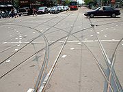
Dedicated rights-of-way
The majority of streetcar routes operate in mixed traffic, generally reflecting the original track configurations dating from the late 19th and early 20th centuries. However, newer trackage has largely been established within dedicated rights-of-way, in order to allow streetcars to operate with fewer disruptions due to delays caused by automobile traffic. Most of the system's dedicated rights-of-way operate within the median of existing streets, separated from general traffic by raised curbs and controlled by specialized traffic signals at intersections. Queen streetcars have operated on such a right-of-way along the QueenswayThe Queensway
The Queensway/Queensway Avenue is a major street in the municipalities of Toronto and Mississauga, Ontario, Canada. It is the western extension of Queen Street, after it merges with King Street near Roncesvalles Avenue in Toronto...
between Humber and Sunnyside loops since 1957. More recently, dedicated rights-of-way have been opened downtown along Queen's Quay
Queen's Quay (Toronto)
Queen's Quay is a prominent street in the Harbourfront neighbourhood of Toronto, Ontario, Canada. The street was originally commercial in nature due to the many working piers along the waterfront...
, Spadina Avenue
Spadina Avenue
Spadina Avenue is one of the most prominent streets in Toronto, Ontario, Canada. Running through the western section of downtown, the road has a very different character in different neighbourhoods....
, St. Clair Avenue
St. Clair Avenue
St. Clair Avenue is a major east-west street in Toronto, Ontario, Canada. It was laid out in the late 18th century by the British as a concession road , north of Bloor Street and north of Queen Street....
West, and Fleet Street.
Short sections of track also operate in tunnel (to connect with Spadina, Union, and St. Clair West subway stations). The most significant section of underground streetcar trackage is a tunnel underneath Bay Street connecting Queens Quay with Union Station; this section, which is approximately 0.7 km long, includes one intermediate underground station at Bay Street and Queens Quay.
During the late 2000s, the TTC reinstated a separated right-of-way — removed between 1928 and 1935 — on St. Clair Avenue, for the entire 512 St. Clair route. A court decision obtained by local merchants in October 2005 had brought construction to a halt and put the project in doubt; the judicial panel then recused themselves, and the delay for a new decision adversely affected the construction schedule. A new judicial panel decided in February 2006 in favour of the city, and construction resumed in summer 2006. One-third of the St. Clair right-of-way was completed by the end of 2006 and streetcars began using it on February 18, 2007. The portion finished was from St. Clair Station
St. Clair (TTC)
St. Clair is a station on the Yonge–University–Spadina line of the subway system in Toronto, Ontario, Canada. Its address is 1441 Yonge Street, at the intersection with St. Clair Avenue East, but its street entrances are on St. Clair and on Pleasant Boulevard. The station's site has no frontage on...
(Yonge St.) to Vaughan Road
Vaughan Road
Vaughan Road is a road in Toronto, Ontario, Canada. It is a contour collector road that is parallel to a buried creek to the north called Castle Frank Brook. Vaughan Road begins on Bathurst Street south of St. Clair Avenue West, then it becomes a north-south street, hence its address numbering...
. The second phase started construction in the summer of 2007 from Dufferin Street to Caledonia Road. Service resumed utilizing the second and third phases on December 20, 2009 extending streetcar service from St. Clair to Earlscourt Loop located just south and west of Lansdowne Avenue. The fourth and final phase from Caledonia to Gunns Loop (just west of Keele St.) is completed and full streetcar service over the entire route was finally restored on June 30, 2010.
In 2008, the tracks on Fleet Street between Bathurst Street
Bathurst Street (Toronto)
Bathurst Street is a main north-south thoroughfare in Toronto. It begins at the Lake Ontario shoreline and continues north to the Toronto boundary of Steeles Avenue...
and the Exhibition loop
Exhibition Loop (TTC)
Exhibition Loop is the terminus for the 511 Bathurst and 509 Harbourfront streetcar routes and serves:* CNE at the Exhibition Place* Ricoh Coliseum* Exhibition GO Station* BMO Field-History:...
were converted to a dedicated right-of-way and opened for the 511 Bathurst and the 509 Harbourfront streetcars
509 Harbourfront
509 Harbourfront is a streetcar route in Toronto, Ontario, Canada, operated by the Toronto Transit Commission.-History:The Harbourfront LRT, originally designated 604 Harbourfront, began service in 1990...
. Streetcar track and overhead power line were also installed at the Fleet loop, which is located at the Queen's Wharf Lighthouse.
Future expansion
The City of Toronto's and the TTC’s Transit CityTransit City
Transit City was a plan for developing public transport in Toronto, Ontario, Canada. It was first proposed and announced by then-Toronto Mayor David Miller and Chair of the Toronto Transit Commission Adam Giambrone on March 16, 2007...
report released on March 16, 2007, proposes creating new light rail lines including:
- Don Mills LRT (along Don Mills Road from Steeles AvenueSteeles AvenueSteeles Avenue is an east-west street that forms the northern city limit of Toronto and the southern limit of York Region, Ontario, Canada. It stretches across the western Greater Toronto Area from Milborough Townline in Halton Region east to the Scarborough-Pickering limit. It runs for within...
to Overlea Boulevard, and continuing to Pape Station along a possible alignment of Overlea Boulevard from Don Mills Road to Millwood Road, continuing adjacent to the Leaside Bridge from Overlea Boulevard to Pape Avenue and along Pape Avenue from Millwood Road to Danforth Avenue) - Eglinton–Scarborough Crosstown line (from Black Creek DriveBlack Creek DriveBlack Creek Drive is a north-south arterial road in Toronto, Ontario that extends from Highway 400 at Jane Street, near Ontario Highway 401 to Weston Road in the south. Originally intended to be a freeway extension of Ontario Highway 400, it was built instead as an arterial road after public...
to McCowan Road, with underground operation to Kennedy) - Etobicoke-Finch West LRT (along Finch AvenueFinch AvenueFinch Avenue is an arterial thoroughfare and concession road which travels east–west through the city of Toronto. The road also has short extensions into Peel and Durham Regions as Peel Regional Road 2 and Durham Regional Road 37.-History:...
West from Yonge Street to Highway 27) - Jane LRT (along Jane Street from Bloor Street to Steeles Avenue and continuing along Steeles Avenue from Jane Street to Steeles WestSteeles West (TTC)Steeles West is a planned station of the Yonge–University–Spadina line of the subway system in Toronto, Ontario, Canada, to be built on its western branch, the Spadina line. If built, it would be a temporary terminus, until the line is extended further to Vaughan Corporate Centre...
on the Spadina extension. This line also includes a stub extension of the St. Clair ROW from Gunns Loop to Jane Street) - Scarborough Malvern LRT (along Eglinton Avenue from Kennedy Station to Kingston Road, continuing along Kingston Road from Eglinton Avenue to Morningside Avenue and along Morningside Avenue from Kingston Road to Finch Avenue)
- Sheppard East LRT (along Sheppard Avenue from Don Mills station to Morningside Avenue, with a connection to an extended Scarborough RT near Markham RoadOntario Highway 48King's Highway 48, also known as Highway 48, is a provincially-maintained highway in southern Ontario that extends from Major Mackenzie Drive in Markham, through Whitchurch-Stouffville, to Highway 12 south-east of Beaverton, Ontario. Prior to 1998, Highway 48 extended from Highway 401 in Toronto to...
) - Waterfront West LRT (along Lakeshore Boulevard from Long Branch Loop to near the South Kingsway, continuing along the Queensway to King Street, and adjacent to the Gardiner ExpresswayGardiner ExpresswayThe Frederick G. Gardiner Expressway, colloquially referred to as "the Gardiner", is a municipal expressway in the Canadian province of Ontario, connecting downtown Toronto with its western suburbs...
to Exhibition Loop; from Exhibition it will continue to Union station in either its own as yet to be determined alignment, or in the Harbourfront West LRT alignment)
The Ontario government has in its MoveOntario 2020
MoveOntario 2020
MoveOntario 2020 is a plan proposed by the Government of Ontario that would fund 52 rapid-transit projects throughout the Greater Toronto and Hamilton Area in Ontario, Canada.-History:...
plan, proposed funding approximately two thirds of the $5.5 billion of the seven Transit City lines, with the expectation that the federal government would fund the remaining third.
Additional proposals include:
- Extending 512 St. Clair to Jane subway stationJane (TTC)Jane is a station on the Bloor–Danforth line of the subway system in Toronto, Canada. It is located at 2440 Bloor Street West at Jane Street. It was opened in 1968.- Entrances :...
- A streetcar in dedicated right-of-way on Sumach and Cherry Streets from King Street to the railway corridor south of Mill Street, serving West Don Lands and the Distillery District
- A route eastward along Queen's Quay, into new developments on the port lands
- A route westward from the Bay Street streetcar tunnel along Bremner Boulevard and Fort York Boulevard to Bathurst Street
- A route running east along Finch Avenue from Yonge Street to Don Mills Road, then turning south along Don Mills Road and continuing to Sheppard Avenue at Don Mills subway stationDon Mills (TTC)Don Mills is the eastern terminus station of the Sheppard line of the subway system in Toronto, Canada. It is also a "Vivastation" on the Viva Green line of York Region's Viva bus rapid transit system...
, linking the Etobicoke-Finch West LRT and the Sheppard East LRT.
Toronto Street Railway
Routes marked to City were operating on May 20, 1891, when the Toronto Street Railway Company's franchise expired and operations were taken over by the City of Toronto.| Route | Started | Ended | Notes |
|---|---|---|---|
| Bathurst | Sep 1889 | 7 Dec 1889 | to SEATON VILLAGE |
| Bloor | 29 May 1891 | to City | |
| Brockton | 4 Sep 1883 | May 1884 | from QUEEN & BROCKTON; to QUEEN & BROCKTON |
| Carlton & College | 2 Aug 1886 | to City | |
| Church | 18 Aug 1881 | to City | |
| Danforth | 8 Jul 1889 | to City | |
| Davenport | 18 Aug 1890 | to City | from SEATON VILLAGE |
| Dovercourt via McCaul | 24 Sep 1888 | to City | from McCAUL & COLLEGE |
| Front & McCaul | 22 Oct 1883 | 28 Jun 1884 | to McCAUL & COLLEGE |
| Front & Parliament | 25 Nov 1878 | 25 Jul 1881 | to PARLIAMENT and WINCHESTER |
| High Park via Queen | Apr 1887 | to City | by this date; from QUEEN & PARKDALE |
| King | 21 Sep 1874 | to City | longest continuously operated route in Toronto |
| King via Strachan | 2 Sep 1879 | 19 Sep 1890 | during Toronto Industrial Exhibition only; to KING |
| Kingston Rd. | 9 Jun 1875 | Apr 1887 | Kingston Road Tramway Co.; by this date; part to WOODBINE |
| Lee | 15 Jul 1889 | to City | |
| McCaul & College | 30 Jun 1884 | 22 Sep 1888 | from FRONT & McCAUL; to DOVERCOURT VIA McCAUL |
| McCaul & College | 15 Jul 1889 | to City | from DOVERCOURT VIA McCAUL |
| Metropolitan | 26 Jan 1885 | to City | Metropolitan Street Railway |
| Parliament | 26 Jul 1881 | to City | from FRONT & PARLIAMENT |
| Queen | 2 Feb 1861 | 7 Dec 1881 | to QUEEN & BROCKTON |
| Queen | 4 Sep 1883 | May 1884 | from QUEEN & BROCKTON; to QUEEN & BROCKTON |
| Queen & Brockton | 8 Dec 1881 | 3 Sep 1883 | from QUEEN; to QUEEN and BROCKTON |
| Queen & Brockton | May 1884 | to City | from BROCKTON and QUEEN |
| Queen & Parkdale | 2 Sep 1879 | Apr 1887 | ended by spring 1887; to HIGH PARK VIA QUEEN |
| Queen East | 11 May 1885 | to City | from SHERBOURNE |
| Seaton Village | 27 Jul 1885 | to City | from SPADINA & BATHURST |
| Sherbourne | 1 Dec 1874 | to City | may have begun a day or two earlier |
| Spadina | Jun 1879 | to City | |
| Spadina & Bathurst | 30 Jun 1884 | 25 Jul 1885 | from SPADINA; to SEATON VILLAGE |
| Toronto Industrial Exhibition | 13 Sep 1883 | 19 Sep 1890 | first electric route; operated by steam during the 1891 season |
| Winchester | 26 Jul 1881 | to City | from FRONT & PARLIAMENT |
| Woodbine | 21 May 1887 | to City | from KINGSTON RD. |
| Yonge | 9 Nov 1861 | to City | first rail transit route in Toronto |
Toronto Railway Company
Routes marked to TTC were operating on September 21, 1921, when the Toronto Railway Company's operations were taken over by the Toronto Transportation Commission.| Route | Started | Ended | Notes |
|---|---|---|---|
| Arthur | 12 Feb 1902 | 1909 | merged with DUNDAS |
| Ashbridge | 5 Nov 1917 | to TTC | |
| Avenue Road | 2 Sep 1895 | to TTC | |
| Bathurst | 27 Jul 1885 | to TTC | |
| Belt Line | 16 Nov 1891 | to TTC | |
| Bloor | 1889 | to TTC | |
| Broadview | Oct 1892 | to TTC | |
| Brockton | 1882 | 9 Oct 1893 | renamed DUNDAS |
| Carlton | Aug 1886 | to TTC | |
| Church | 1881 | to TTC | |
| College | Nov 1893 | to TTC | |
| Danforth | May 1889 | Oct 1892 | renamed BROADVIEW |
| Davenport | Dec 1892 | Nov 1891 | replaced by BATHURST, PARLIAMENT and WINCHESTER |
| Dovercourt | Nov 1888 | to TTC | |
| Dufferin | 1889 | 30 Sep 1891 | merged with DANFORTH |
| Dundas | 9 Oct 1893 | to TTC | |
| Dupont | 29 Aug 1906 | to TTC | |
| Harbord | 29 Aug 1911 | to TTC | |
| High Park | 1886 | 1905 | |
| King | 1874 | to TTC | |
| Lee Avenue | 1889 | 15 May 1893 | merged into KING |
| McCaul | Oct 1883 | 1 Jan 1896 | replaced by BLOOR |
| Parkdale | 1880 | 1886 | renamed HIGH PARK |
| Parliament | 1881 | merged into QUEEN | |
| Queen | 2 Dec 1861 | to TTC | |
| Queen East | 1882 | 16 Oct 1891 | merged with DANFORTH |
| Roncesvalles | 1909 | 20 Dec 1911 | replaced by QUEEN |
| Seaton Village | 27 Jul 1885 | 23 Oct 1891 | replaced by DAVENPORT, PARLIAMENT and WINCHESTER |
| Sherbourne | Nov 1874 | 16 Nov 1891 | merged into BELT LINE |
| Spadina | 1878 | 16 Nov 1891 | merged into BELT LINE |
| Winchester | Nov 1874 | to TTC | |
| Woodbine | May 1887 | 4 Apr 1893 | replaced by KING |
| Yonge | 11 Sep 1861 | to TTC | |
| York | in operation in October 1891 and discontinued prior to 31 December 1891 | ||
Toronto Civic Railways
All routes transferred to the Toronto Transportation Commission.| Route | Started | Ended | Notes |
|---|---|---|---|
| Bloor | 4 Nov 1914 | to TTC | |
| Danforth | 30 Oct 1913 | to TTC | |
| Gerrard | 18 Dec 1912 | to TTC | |
| Lansdowne | 16 Jan 1917 | to TTC | |
| St. Clair | 25 Aug 1913 | to TTC | |
Toronto Transportation Commission / Toronto Transit Commission
| Route | Began | Ended | Number | Notes |
|---|---|---|---|---|
| Belt Line | 1891 | 1923 | ||
| Bloor | 1890 | 1966 | replaced by Bloor–Danforth subway | |
| Coxwell | 1921 | 1966 | replaced by 22 COXWELL bus | |
| Dundas Exhibition | 1980 | 1986 | 522 | also operated for the 1995 season |
| Dupont/Bay | 1926 | 1963 | replaced by 6 BAY bus | |
| Earlscourt | 1954 | 1976 | merged into ST. CLAIR; assigned number 512L | |
| Fort | 1931 | 1966 | merged into BATHURST | |
| Harbord | 1911 | 1966 | replaced by 72 PAPE and 94 WELLESLEY buses | |
| Harbourfront | 1990 | 2000 | 604 | renumbered 509 Harbourfront |
| King Exhibition | 1980 | 2000 | 521 | |
| Long Branch | 1928 | 1995 | 507 | merged in 501 Queen |
| Oakwood | 1922 | 1960 | replaced by 63 OSSINGTON trolleycoach | |
| Parliament | 1910 | 1966 | replaced by 65 PARLIAMENT bus | |
| Winchester | 1910 | 1924 | replaced by YONGE and PARLAIMENT streetcars | |
| Mount Pleasant | 1975 | 1976 | split from ST. CLAIR; replaced by 74 MT. PLEASANT trolleycoach | |
| Rogers Road | 1922 | 1974 | replaced by 63F OSSINGTON VIA ROGERS trolleycoach | |
| Yonge | 1873 | 1954 | replaced by Yonge subway and DOWNTOWN bus |
Rolling stock
Hundreds of cars were acquired from the TTCs predecessor companies, including the Toronto Railway Company, Toronto Civic RailwaysToronto Civic Railways
Toronto Civic Railways was an agency created and owned by the City of Toronto, Canada, to run streetcars in newly annexed areas of the city that the private operator Toronto Railway Company refused to serve...
, Toronto & York Radial Railway
Toronto and York Radial Railway
The Toronto and York Radial Railway operated radial transit services outside of Toronto. Service began in 1904 with the merger of several operators:* Metropolitan Street Railway...
and Toronto Suburban Railway
Toronto Suburban Railway
The Toronto Suburban Railway was an electric railway operator with local routes in west Toronto, and a radial route to Guelph.-History:...
. The current fleet is composed of 248 vehicles.
Streetcars purchased by the TTC
Note that not all numbers within a series were used.| Fleet numbers | Type | In service | Notes |
|---|---|---|---|
| 2300–2678 2900–3018 |
Peter Witt Peter Witt streetcar Peter Witt was a Cleveland Railway commissioner, who designed a model of streetcar known by his name, and used in many North American cities, most notably in Toronto and Cleveland.-Features:... |
1921–1954 | "large" Witts; even numbers only |
| 2700–2898 | Peter Witt Peter Witt streetcar Peter Witt was a Cleveland Railway commissioner, who designed a model of streetcar known by his name, and used in many North American cities, most notably in Toronto and Cleveland.-Features:... |
1922–1965 | "small" Witts; even numbers only |
| 2301–2419 | 2-door trailer | 1921–1938 | odd numbers only |
| 2701-3029 | 3-door trailer | 1923–1954 | "Harvey" trailers; odd numbers only |
| 4000–4299 4575–4601 |
PCC PCC streetcar The PCC streetcar design was first built in the United States in the 1930s. The design proved successful in its native country, and after World War II was licensed for use elsewhere in the world... |
1938–1971 | air-electric |
| 4300–4574 4625–4779 |
PCC | 1947–1995 | all-electric |
| 4000–4199 | CLRV Canadian Light Rail Vehicle The Canadian Light Rail Vehicle ' is a type of streetcar that is used by the Toronto Transit Commission in Toronto, Canada.-Background:... |
1977–2013 | |
| 4200–4251 | ALRV | 1987–2013 | articulated Articulated car Articulated cars are rail vehicles which are consist of a number of smaller, lighter cars which are semi-permanently attached to each other and which share common trucks. They are much longer than single passenger cars, and on the TGV Réseau, for example, 8 cars are joined this way... |
| 4900 | ALRV | 1982–1983 | prototype; never owned by TTC |
Track gauge
Standard gauge
The standard gauge is a widely-used track gauge . Approximately 60% of the world's existing railway lines are built to this gauge...
of . In 1861, 'standard gauge' in North America was non-existent, so there was little advantage selecting it over any other gauge. Faced with this decision, when the agreement between the City of Toronto and the Toronto Street Railway was signed on 26 March 1861, the gauge was selected to allow carts and wagons to ride within the rails:
That the gauge of the said railways shall be such that the ordinary vehicles now in use may travel on the said tracks, and that it shall and may be lawful to and for all and every person and persons whatsoever to travel upon and use the said tracks with their vehicles loaded or empty, when and so often as they may please, provided they do not impede or interfere with the cars of the party of the second part (Toronto Street Railway), running thereon, and subject at all times to the right of the said party of the second part, his executors, and administrators and assigns to keep the said tracks with his and their cars, when meeting or overtaking any other vehicle thereon.
As wagons were normally built at standard gauge, the streetcar rails were selected to be slightly wider, allowing the wagons to ride on the inside sections of the rail, and the streetcars on the outside. The Williams Omnibus Bus Line
Williams Omnibus Bus Line
Williams Omnibus Bus Lines was the first mass transportation system in the old City of Toronto, Canada with four six-passenger buses. Established in 1849 by local cabinetmaker Burt Williams, it consisted of horse-drawn stagecoaches operating from the St. Lawrence Market to the Red Lion Hotel in...
changed the gauge of their buses in 1861 to fit this gauge. At the time, track for horsecars was not our modern 'T' rail, but wide and flat, with a raised section on the outside of the rail.
As the decision was made well over a century ago, and the companies involved no longer exist, a number of apocryphal stories have evolved over the years to explain the odd gauge. One belief, sometimes quoted by the TTC themselves, is that the City of Toronto feared that the street railway franchise operator, first in 1861, the Toronto Street Railway, then in 1891, the Toronto Railway, and in 1921, the TTC, would allow the operation of steam locomotives and freight trains through city streets
Street running
On-street running or street running is when a railroad track or tramway track runs directly along city streets, without any separation. The rails are embedded in the road....
, as was common practice in Hamilton, Ontario (until the 1950s) and in many U.S. cities, such as New York City, and Syracuse, NY. Standard gauge rails in the streets would have allowed this, but steam railway equipment could not follow the abrupt curves in the streetcar network. Opposition to freight operation in city streets precluded interchange even with adjacent radial lines
Toronto radial lines
Toronto radial lines refer to all of these now defunct interurban lines radiating from Toronto.* Halton County Radial Railway, a working museum* Toronto Suburban Railway* Toronto Suburban Railway Company* North Yonge Railways...
even after the lines changed to TTC gauge. Electric railway freight cars could negotiate street curves, but still freight operations to downtown were not allowed until the final few years of radial operation by the TTC.
The unique gauge has remained to this day, since converting all tracks and vehicles would be expensive and would lack any real benefit. Some proposals for the city's subway system involved using streetcars in the tunnels, and possibly having some routes run partially in tunnels and partially on city streets, so the same gauge was used, though the idea was ultimately dropped in the case of dedicated rapid-transit trains. The use of standard-gauge tracks on the Scarborough RT makes it impossible for there to be any track connection between it and the other lines, and so when RT vehicles need anything more than basic service (which is carried out in the RT's own McCowan Yard), they are carried by truck to the Greenwood subway yards.
The proposed Eglinton Crosstown LRT line will be constructed to standard gauge. As the project is receiving a large part of its funding from Metrolinx, the Ontario provincial transit authority, it wants to ensure a degree of commonality with any other proposed tram/LRT projects within Ontario, ensuring a better price for purchasing vehicles.
Properties
Dedicated station
There is one standalone underground station in the network that exclusively serves streetcars, located in the tunnel shared by the 509 Harbourfront509 Harbourfront
509 Harbourfront is a streetcar route in Toronto, Ontario, Canada, operated by the Toronto Transit Commission.-History:The Harbourfront LRT, originally designated 604 Harbourfront, began service in 1990...
and 510 Spadina routes:
- Queens Quay
Loops
Since all of Toronto's current streetcars are unidirectional, they require on- or off-street track loopBalloon loop
A balloon loop or turning loop allows a rail vehicle or train to reverse direction without having to shunt or even stop. Balloon loops can be useful for passenger trains and unit freight trains, such as coal trains....
s in order to change direction.
Carhouses
Toronto's streetcars are housed and maintained at various carhouses or "streetcar barns":| Yard | Location | Year Open | Notes |
| Hillcrest Complex | Davenport Road and Bathurst Street Bathurst Street (Toronto) Bathurst Street is a main north-south thoroughfare in Toronto. It begins at the Lake Ontario shoreline and continues north to the Toronto boundary of Steeles Avenue... |
1924 | former site of farm and later Toronto Driving Club track; services streetcars and buses, repair facilities |
| Roncesvalles Carhouse | Queen Street West Queen Street West Queen Street West describes both the western branch of Queen Street, a major east-west thoroughfare, and a series of neighbourhoods or commercial districts, situated west of Yonge Street in downtown Toronto, Ontario, Canada. Queen Street begins in the west at the intersection of King Street, The... and Roncesvalles Avenue |
1895; rebuilt 1921 | built for the Toronto Railway; indoor and outdoor streetcar storage |
| Russell (Connaught) Carhouse | Connaught Avenue and Queen Street East | 1913 | built for the Toronto Railway; indoor and outdoor streetcar storage |
Inactive carhouses once part of the TTC's streetcar operations:
| Yard | Location | Year Open | Year Closed | Notes |
| Danforth Carhouse | Danforth Avenue Danforth Avenue Danforth Avenue is an east-west arterial road in Toronto, Ontario, Canada. Its western end begins in Old Toronto from the Prince Edward Viaduct as a continuation of Bloor Street and continues through East York until intersecting with Kingston Road in Scarborough... and Coxwell Avenue |
1915 | 2002 | built for the Toronto Civic Railways Toronto Civic Railways Toronto Civic Railways was an agency created and owned by the City of Toronto, Canada, to run streetcars in newly annexed areas of the city that the private operator Toronto Railway Company refused to serve... |
| Dundas Carhouse http://www.stevemunro.ca/?p=392 | Dundas Street Dundas Street Dundas Street, also known as Highway 5 west of Toronto, is a major arterial road connecting the centre of that city with its western suburbs and southwestern Ontario beyond... West and Howard Park Avenue |
1907 | 1936 | storage for 60 cars; wye Wye (railroad) A wye or triangular junction, in rail terminology, is a triangular shaped arrangement of rail tracks with a switch or set of points at each corner. In mainline railroads, this can be used at a rail junction, where three rail lines join, in order to allow trains to pass from any line to any other... and runaround loop since disappeared and area re-developed |
| Eglinton Carhouse | Eglinton Avenue Eglinton Avenue Eglinton Avenue, originally known as the Richview Sideroad within Etobicoke, is an east-west arterial thoroughfare in Toronto and Mississauga, in the Canadian province of Ontario. Within Toronto, Eglinton Avenue is the only road which crosses through all six former boroughs... West and Yonge Street Yonge Street Yonge Street is a major arterial route connecting the shores of Lake Ontario in Toronto to Lake Simcoe, a gateway to the Upper Great Lakes. It was formerly listed in the Guinness Book of Records as the longest street in the world at , and the construction of Yonge Street is designated an "Event of... |
1922 | 2002; demolished | |
| Lansdowne Carhouse | Lansdowne Avenue Lansdowne Avenue Lansdowne Avenue is an arterial road in Toronto, Ontario. It runs north-south and starts at Queen Street West and proceeds north to St. Clair Avenue West. Lansdowne Avenue is primarily a four-lane arterial road, with two lanes regularly used for motor vehicle parking.-Character:Lansdowne Avenue... and Paton Avenue |
1911 | 1996; demolished 2003 | Built for the Toronto Railway |
| St. Clair (Wychwood) Carhouse | Wychwood south of St. Clair Avenue St. Clair Avenue St. Clair Avenue is a major east-west street in Toronto, Ontario, Canada. It was laid out in the late 18th century by the British as a concession road , north of Bloor Street and north of Queen Street.... West |
1913 | 1978 | built for the Toronto Civic Railways Toronto Civic Railways Toronto Civic Railways was an agency created and owned by the City of Toronto, Canada, to run streetcars in newly annexed areas of the city that the private operator Toronto Railway Company refused to serve... |
Source: The TTC's Active Carhouses
A new carhouse is to be constructed for housing and maintaining the new Bombardier Flexity Outlook vehicles; the existing facilities will not accommodate the differences in length and configuration of the different generations of vehicle. A preliminary report recommends a vacant lot at the southeast corner of Leslie Street and Lake Shore Boulevard.
| Yard | Location | Year To Open | Notes |
| Ashbridge's Bay LRV Maintenance and Storage Facility | Leslie Street and Lake Shore Boulevard East - southeast corner | TBD | proposed carhouse for Flexity fleet (100 of the 204 cars) |
Operator training
A mockup of a CLRV is used to train new streetcar operators is located at Hillcrest. The training simulator consist of an operator cab, front steps and part of the front of a streetcar.Operators also train with a real streetcar. Front and rear rollsigns on the vehicle identify it as a training car.
See also
- Toronto Transit Commission buses
- Queen line
- Light rail in CanadaLight rail in CanadaIn Canada light rail has widespread support, yet there are only a few light rail systems in the country.-Vancouver:SkyTrain is an urban rapid transit system in Metro Vancouver, British Columbia and is the longest automated rapid transit system in the world, It uses fully automated trains running...
- Transit CityTransit CityTransit City was a plan for developing public transport in Toronto, Ontario, Canada. It was first proposed and announced by then-Toronto Mayor David Miller and Chair of the Toronto Transit Commission Adam Giambrone on March 16, 2007...
External links
- Toronto Transit Commission
- TTC Transit City - LRT expansion proposals
- TTC's web site for its new vehicle procurement program
- Siemens's proposal for Toronto's new streetcar fleet
- Transit Toronto Streetcar Pages
- The Toronto LRT Information Page
- TTC Schedules by Route Name
- Toronto Star article on the history of Toronto's streetcar system
- Geographically accurate map on Google Maps