

History of Antarctica
Encyclopedia

Terra Australis
Terra Australis, Terra Australis Ignota or Terra Australis Incognita was a hypothesized continent appearing on European maps from the 15th to the 18th century...
, believed to exist in the far south of the globe. The term Antarctic, referring to the opposite of the Arctic Circle
Arctic Circle
The Arctic Circle is one of the five major circles of latitude that mark maps of the Earth. For Epoch 2011, it is the parallel of latitude that runs north of the Equator....
, was coined by Marinus of Tyre
Marinus of Tyre
Marinus of Tyre, was a Greek geographer, cartographer and mathematician, who founded mathematical geography.-Biography and historical context:...
in the 2nd century AD.
The rounding of the Cape of Good Hope
Cape of Good Hope
The Cape of Good Hope is a rocky headland on the Atlantic coast of the Cape Peninsula, South Africa.There is a misconception that the Cape of Good Hope is the southern tip of Africa, because it was once believed to be the dividing point between the Atlantic and Indian Oceans. In fact, the...
and Cape Horn
Cape Horn
Cape Horn is the southernmost headland of the Tierra del Fuego archipelago of southern Chile, and is located on the small Hornos Island...
in the 15th and 16th centuries proved that Terra Australis Incognita ("Unknown Southern Land"), if it existed, was a continent in its own right. In 1773 James Cook
James Cook
Captain James Cook, FRS, RN was a British explorer, navigator and cartographer who ultimately rose to the rank of captain in the Royal Navy...
crossed the Antarctic Circle
Antarctic Circle
The Antarctic Circle is one of the five major circles of latitude that mark maps of the Earth. For 2011, it is the parallel of latitude that runs south of the Equator.-Description:...
for the first time but although he discovered nearby islands, he did not catch sight of Antarctica itself. It is believed he was as close as 150 miles from the mainland.
In 1820, several expeditions claimed to have been the first to have sighted Antarctica, with the very first being the Russia
Russia
Russia or , officially known as both Russia and the Russian Federation , is a country in northern Eurasia. It is a federal semi-presidential republic, comprising 83 federal subjects...
n expedition led by Fabian Gottlieb von Bellingshausen
Fabian Gottlieb von Bellingshausen
Fabian Gottlieb Thaddeus von Bellingshausen was an officer in the Imperial Russian Navy, cartographer and explorer, who ultimately rose to the rank of Admiral...
and Mikhail Lazarev. The first landing was probably just over a year later when American
United States
The United States of America is a federal constitutional republic comprising fifty states and a federal district...
Captain John Davis, a sealer, set foot on the ice.
The first Norwegian expedition to Antarctica was led by Captain Carl Anton Larsen
Carl Anton Larsen
Carl Anton Larsen was a Norwegian Antarctic Explorer, who made important contributions to the exploration of Antarctica, the most significant being the first discovery of fossils, for which he received the Back Grant from the Royal Geographical Society...
aboard the barque
Barque
A barque, barc, or bark is a type of sailing vessel with three or more masts.- History of the term :The word barque appears to have come from the Greek word baris, a term for an Egyptian boat. This entered Latin as barca, which gave rise to the Italian barca, Spanish barco, and the French barge and...
Jason
Jason (Ship)
Jason was a Norwegian whaling vessel laid down in 1881 in Rødsverven, Norway, the same shipyard which later built Ernest Shackleton's ship the Endurance...
in 1892. During the expedition he was the first to discover fossils in Antarctica, for which he received the Back Grant from the Royal Geographical Society
Royal Geographical Society
The Royal Geographical Society is a British learned society founded in 1830 for the advancement of geographical sciences...
. In December 1893 he also became the first person to ski
Ski
A ski is a long, flat device worn on the foot, usually attached through a boot, designed to help the wearer slide smoothly over snow. Originally intended as an aid to travel in snowy regions, they are now mainly used for recreational and sporting purposes...
in Antarctica where the Larsen Ice Shelf
Larsen Ice Shelf
The Larsen Ice Shelf is a long, fringing ice shelf in the northwest part of the Weddell Sea, extending along the east coast of Antarctic Peninsula from Cape Longing to the area just southward of Hearst Island...
was named after him. Larsen is also considered the founder of the Antarctic whaling
Whaling
Whaling is the hunting of whales mainly for meat and oil. Its earliest forms date to at least 3000 BC. Various coastal communities have long histories of sustenance whaling and harvesting beached whales...
industry and the settlement at Grytviken
Grytviken
Grytviken is the principal settlement in the British territory of South Georgia in the South Atlantic. It was so named in 1902 by the Swedish surveyor Johan Gunnar Andersson who found old English try pots used to render seal oil at the site. It is the best harbour on the island, consisting of a...
, South Georgia.
Once the North Pole
North Pole
The North Pole, also known as the Geographic North Pole or Terrestrial North Pole, is, subject to the caveats explained below, defined as the point in the northern hemisphere where the Earth's axis of rotation meets its surface...
had been reached in 1909, several expeditions attempted to reach the South Pole
South Pole
The South Pole, also known as the Geographic South Pole or Terrestrial South Pole, is one of the two points where the Earth's axis of rotation intersects its surface. It is the southernmost point on the surface of the Earth and lies on the opposite side of the Earth from the North Pole...
. Many resulted in injury and death. Norwegian
Norway
Norway , officially the Kingdom of Norway, is a Nordic unitary constitutional monarchy whose territory comprises the western portion of the Scandinavian Peninsula, Jan Mayen, and the Arctic archipelago of Svalbard and Bouvet Island. Norway has a total area of and a population of about 4.9 million...
Roald Amundsen
Roald Amundsen
Roald Engelbregt Gravning Amundsen was a Norwegian explorer of polar regions. He led the first Antarctic expedition to reach the South Pole between 1910 and 1912 and he was the first person to reach both the North and South Poles. He is also known as the first to traverse the Northwest Passage....
finally reached the Pole on December 14, 1911, following a dramatic race with the Englishman
English people
The English are a nation and ethnic group native to England, who speak English. The English identity is of early mediaeval origin, when they were known in Old English as the Anglecynn. England is now a country of the United Kingdom, and the majority of English people in England are British Citizens...
Robert Falcon Scott
Robert Falcon Scott
Captain Robert Falcon Scott, CVO was a Royal Navy officer and explorer who led two expeditions to the Antarctic regions: the Discovery Expedition, 1901–04, and the ill-fated Terra Nova Expedition, 1910–13...
.
The search for Terra Australis Incognita
In the Western worldWestern world
The Western world, also known as the West and the Occident , is a term referring to the countries of Western Europe , the countries of the Americas, as well all countries of Northern and Central Europe, Australia and New Zealand...
, belief in a Cold Land
Terra Australis
Terra Australis, Terra Australis Ignota or Terra Australis Incognita was a hypothesized continent appearing on European maps from the 15th to the 18th century...
—a vast continent located in the far south of the globe to "balance" out the northern lands of Europe
Europe
Europe is, by convention, one of the world's seven continents. Comprising the westernmost peninsula of Eurasia, Europe is generally 'divided' from Asia to its east by the watershed divides of the Ural and Caucasus Mountains, the Ural River, the Caspian and Black Seas, and the waterways connecting...
, Asia
Asia
Asia is the world's largest and most populous continent, located primarily in the eastern and northern hemispheres. It covers 8.7% of the Earth's total surface area and with approximately 3.879 billion people, it hosts 60% of the world's current human population...
and North Africa
North Africa
North Africa or Northern Africa is the northernmost region of the African continent, linked by the Sahara to Sub-Saharan Africa. Geopolitically, the United Nations definition of Northern Africa includes eight countries or territories; Algeria, Egypt, Libya, Morocco, South Sudan, Sudan, Tunisia, and...
—had existed for centuries. Aristotle
Aristotle
Aristotle was a Greek philosopher and polymath, a student of Plato and teacher of Alexander the Great. His writings cover many subjects, including physics, metaphysics, poetry, theater, music, logic, rhetoric, linguistics, politics, government, ethics, biology, and zoology...
had postulated a symmetry of the earth, which meant that there would be equally habitable lands south of the known world. The Greeks suggested that these two hemispheres, north and south, were divided by a 'belt of fire'.
It was not until Prince Henry the Navigator began in 1418 to encourage the penetration of the torrid zone
Tropics
The tropics is a region of the Earth surrounding the Equator. It is limited in latitude by the Tropic of Cancer in the northern hemisphere at approximately N and the Tropic of Capricorn in the southern hemisphere at S; these latitudes correspond to the axial tilt of the Earth...
in the effort to reach India
India
India , officially the Republic of India , is a country in South Asia. It is the seventh-largest country by geographical area, the second-most populous country with over 1.2 billion people, and the most populous democracy in the world...
by circumnavigating Africa
Africa
Africa is the world's second largest and second most populous continent, after Asia. At about 30.2 million km² including adjacent islands, it covers 6% of the Earth's total surface area and 20.4% of the total land area...
that European exploration of the southern hemisphere began. In 1473 Portuguese
Portugal
Portugal , officially the Portuguese Republic is a country situated in southwestern Europe on the Iberian Peninsula. Portugal is the westernmost country of Europe, and is bordered by the Atlantic Ocean to the West and South and by Spain to the North and East. The Atlantic archipelagos of the...
navigator Lopes Gonçalves
Lopes Gonçalves
Lopes Gonçalves or Lopo Gonçalves was a Portuguese explorer of the African coast. He was the first European sailor to cross the equator, the first to reach the point where the coast turns south and the first to reach Gabon...
proved that the equator
Equator
An equator is the intersection of a sphere's surface with the plane perpendicular to the sphere's axis of rotation and containing the sphere's center of mass....
could be crossed, and cartographers and sailors began to assume the existence of another, temperate continent to the south of the known world.

Cape of Good Hope
The Cape of Good Hope is a rocky headland on the Atlantic coast of the Cape Peninsula, South Africa.There is a misconception that the Cape of Good Hope is the southern tip of Africa, because it was once believed to be the dividing point between the Atlantic and Indian Oceans. In fact, the...
in 1487 by Bartolomeu Dias
Bartolomeu Dias
Bartolomeu Dias , a nobleman of the Portuguese royal household, was a Portuguese explorer who sailed around the southernmost tip of Africa in 1488, the first European known to have done so.-Purposes of the Dias expedition:...
first brought explorers within touch of the Antarctic cold, and proved that there was an ocean separating Africa
Africa
Africa is the world's second largest and second most populous continent, after Asia. At about 30.2 million km² including adjacent islands, it covers 6% of the Earth's total surface area and 20.4% of the total land area...
from any Antarctic land that might exist. In 1513, the Ottoman Turkish admiral Piri Reis
Piri Reis
Piri Reis was an Turkish Ottoman admiral, geographer and cartographer born between 1465 and 1470 and died in 1554 or 1555....
drew a world map
Piri Reis map
The Piri Reis map is a pre-modern world map compiled in 1513 from military intelligence by the Ottoman-Turkish admiral and cartographer Piri Reis. The half of the map that survives shows the western coasts of Europe and North Africa and the coast of Brazil with reasonable accuracy...
that has been said to show part of the Antarctic continent.
Ferdinand Magellan
Ferdinand Magellan
Ferdinand Magellan was a Portuguese explorer. He was born in Sabrosa, in northern Portugal, and served King Charles I of Spain in search of a westward route to the "Spice Islands" ....
, who passed through the Straits of Magellan in 1520, assumed that the islands of Tierra del Fuego
Tierra del Fuego
Tierra del Fuego is an archipelago off the southernmost tip of the South American mainland, across the Strait of Magellan. The archipelago consists of a main island Isla Grande de Tierra del Fuego divided between Chile and Argentina with an area of , and a group of smaller islands including Cape...
to the south were an extension of this unknown southern land, and it appeared as such on a map by Ortelius: Terra australis recenter inventa sed nondum plene cognita ("Southern land recently discovered but not yet fully known").
European geographers connected the coast of Tierra del Fuego with the coast of New Guinea on their globes and allowing their imaginations to run riot in the vast unknown spaces of the south Atlantic, south Indian
Indian Ocean
The Indian Ocean is the third largest of the world's oceanic divisions, covering approximately 20% of the water on the Earth's surface. It is bounded on the north by the Indian Subcontinent and Arabian Peninsula ; on the west by eastern Africa; on the east by Indochina, the Sunda Islands, and...
and Pacific
Pacific Ocean
The Pacific Ocean is the largest of the Earth's oceanic divisions. It extends from the Arctic in the north to the Southern Ocean in the south, bounded by Asia and Australia in the west, and the Americas in the east.At 165.2 million square kilometres in area, this largest division of the World...
oceans. They sketched the outlines of the Terra Australis Incognita ("Unknown Southern Land"), a vast continent stretching in parts into the tropics. The search for this great south land or Third World was a leading motive of explorers in the 16th and the early part of the 17th centuries.
The Spaniard
Spanish people
The Spanish are citizens of the Kingdom of Spain. Within Spain, there are also a number of vigorous nationalisms and regionalisms, reflecting the country's complex history....
Gabriel de Castilla
Gabriel de Castilla
Gabriel de Castilla , was a Spanish explorer and navigator. A native of Palencia, he was an early explorer of Antarctica. His contribution to knowledge of the Antarctic continent was ignored in his lifetime and long afterwards...
, who claimed having sighted "snow-covered mountains" beyond the 64° S in 1603, is recognized as the first explorer that discovered the continent, although he was ignored in his time.
Quirós in 1606 took possession for the king of Spain all of the lands he had discovered in Australia del Espiritu Santo (the New Hebrides
New Hebrides
New Hebrides was the colonial name for an island group in the South Pacific that now forms the nation of Vanuatu. The New Hebrides were colonized by both the British and French in the 18th century shortly after Captain James Cook visited the islands...
) and those he would discover "even to the Pole".
Francis Drake
Francis Drake
Sir Francis Drake, Vice Admiral was an English sea captain, privateer, navigator, slaver, and politician of the Elizabethan era. Elizabeth I of England awarded Drake a knighthood in 1581. He was second-in-command of the English fleet against the Spanish Armada in 1588. He also carried out the...
like Spanish explorers before him had speculated that there might be an open channel south of Tierra del Fuego. Indeed, when Schouten
Willem Schouten
Willem Cornelisz Schouten was a Dutch navigator for the Dutch East India Company. He was the first to sail the Cape Horn route to the Pacific Ocean.- Biography :Willem Cornelisz Schouten was born in c...
and Le Maire
Jacob Le Maire
Jacob Le Maire was a Dutch mariner who circumnavigated the earth in 1615-16. The strait between Tierra del Fuego and Isla de los Estados was named the Le Maire Strait in his honor, though not without controversy...
discovered the southern extremity of Tierra del Fuego and named it Cape Horn in 1615, they proved that the Tierra del Fuego archipelago was of small extent and not connected to the southern land.
Finally, in 1642 Tasman
Abel Tasman
Abel Janszoon Tasman was a Dutch seafarer, explorer, and merchant, best known for his voyages of 1642 and 1644 in the service of the VOC . His was the first known European expedition to reach the islands of Van Diemen's Land and New Zealand and to sight the Fiji islands...
showed that even New Holland (Australia)
New Holland (Australia)
New Holland is a historic name for the island continent of Australia. The name was first applied to Australia in 1644 by the Dutch seafarer Abel Tasman as Nova Hollandia, naming it after the Dutch province of Holland, and remained in use for 180 years....
was separated by sea from any continuous southern continent.
Voyagers round the Horn frequently met with contrary winds and were driven southward into snowy skies and ice-encumbered seas; but so far as can be ascertained none of them before 1770 reached the Antarctic Circle, or knew it, if they did. The story of the discovery of land in 64° S. by Dirk Gerritz
Dirck Gerritz Pomp
Dirck Gerritszoon Pomp, alias Dirck China was a Dutch sailor of the 16th-17th century, and the first known Dutchman to visit Japan....
on board the Blijde Boodschap in 1599 was shown to be the result of a mistake of a commentator, Kasper Barlaeus, in 1622.
South of the Antarctic Convergence
The visit to South GeorgiaSouth Georgia and the South Sandwich Islands
South Georgia and the South Sandwich Islands is a British overseas territory and overseas territory of the European Union in the southern Atlantic Ocean. It is a remote and inhospitable collection of islands, consisting of South Georgia and a chain of smaller islands, known as the South Sandwich...
by Anthony de la Roché
Anthony de la Roché
Anthony de la Roché, born sometime in the 17th century, was an English merchant born in London to a French Huguenot father and an English mother...
in 1675 was the first ever discovery of land south of the Antarctic Convergence
Antarctic Convergence
The Antarctic Convergence is a curve continuously encircling Antarctica where cold, northward-flowing Antarctic waters meet the relatively warmer waters of the subantarctic. Antarctic waters predominantly sink beneath subantarctic waters, while associated zones of mixing and upwelling create a zone...
i.e. in the Antarctic
Antarctic
The Antarctic is the region around the Earth's South Pole, opposite the Arctic region around the North Pole. The Antarctic comprises the continent of Antarctica and the ice shelves, waters and island territories in the Southern Ocean situated south of the Antarctic Convergence...
. Soon after the voyage cartographers started to depict ‘Roché Island’, honouring the discoverer. James Cook
James Cook
Captain James Cook, FRS, RN was a British explorer, navigator and cartographer who ultimately rose to the rank of captain in the Royal Navy...
was aware of la Roché's discovery when surveying and mapping the island in 1775.
Edmond Halley
Edmond Halley
Edmond Halley FRS was an English astronomer, geophysicist, mathematician, meteorologist, and physicist who is best known for computing the orbit of the eponymous Halley's Comet. He was the second Astronomer Royal in Britain, following in the footsteps of John Flamsteed.-Biography and career:Halley...
's voyage in HMS Paramour for magnetic investigations in the South Atlantic met the pack ice in 52° S
52nd parallel south
The 52nd parallel south is a circle of latitude that is 52 degrees south of the Earth's equatorial plane. It crosses the Atlantic Ocean, the Indian Ocean, the Pacific Ocean and South America....
in January 1700, but that latitude (he reached 140 mi off the north coast of South Georgia) was his farthest south. A determined effort on the part of the French naval officer Jean-Baptiste Charles Bouvet de Lozier
Jean-Baptiste Charles Bouvet de Lozier
Jean Baptiste Charles Bouvet de Lozier was a French sailor, explorer, and governor of the Mascarene Islands.He was orphaned at the age of seven and after having been educated in Paris, he was sent to Saint Malo to study navigation. He became a lieutenant of the French East India Company in 1731...
to discover the "South Land" - described by a half legendary "sieur de Gonneyville" - resulted in the discovery of Bouvet Island
Bouvet Island
Bouvet Island is an uninhabited Antarctic volcanic island in the South Atlantic Ocean, 2,525 km south-southwest of South Africa. It is a dependent territory of Norway and, lying north of 60°S latitude, is not subject to the Antarctic Treaty. The centre of the island is an ice-filled crater of an...
in 54°10′ S, and in the navigation of 48° of longitude
48th meridian west
The meridian 48° west of Greenwich is a line of longitude that extends from the North Pole across the Arctic Ocean, Greenland, the Atlantic Ocean, South America, the Southern Ocean, and Antarctica to the South Pole....
of ice-cumbered sea nearly in 55° S
55th parallel south
The 55th parallel south is a circle of latitude that is 55 degrees south of the Earth's equatorial plane. It crosses the Atlantic Ocean, the Indian Ocean, the Pacific Ocean and South America....
in 1730 .
In 1771, Yves Joseph Kerguelen
Yves-Joseph de Kerguelen-Trémarec
Yves-Joseph de Kerguelen-Trémarec was a Breton explorer and French naval officer.- Early life:He was born in Landudal, Finistère. During the Seven Years' War, Kerguelen-Trémarec was a privateer, but without much success....
sailed from France
France
The French Republic , The French Republic , The French Republic , (commonly known as France , is a unitary semi-presidential republic in Western Europe with several overseas territories and islands located on other continents and in the Indian, Pacific, and Atlantic oceans. Metropolitan France...
with instructions to proceed south from Mauritius
Mauritius
Mauritius , officially the Republic of Mauritius is an island nation off the southeast coast of the African continent in the southwest Indian Ocean, about east of Madagascar...
in search of "a very large continent." He lighted upon a land in 50° S
50th parallel south
The 50th parallel south is a circle of latitude that is 50 degrees south of the Earth's equatorial plane. It crosses the Atlantic Ocean, the Indian Ocean, the Pacific Ocean and South America....
which he called South France, and believed to be the central mass of the southern continent. He was sent out again to complete the exploration of the new land, and found it to be only an inhospitable island which he renamed the Isle of Desolation, but which was ultimately named after him
Kerguelen Islands
The Kerguelen Islands , also known as the Desolation Islands, are a group of islands in the southern Indian Ocean constituting the emerged part of the otherwise submerged Kerguelen Plateau. The islands, along with Adélie Land, the Crozet Islands and the Amsterdam and Saint Paul Islands are part of...
.
South of the Antarctic Circle
The obsession of the undiscovered continent culminated in the brain of Alexander DalrympleAlexander Dalrymple
Alexander Dalrymple was a Scottish geographer and the first Hydrographer of the British Admiralty. He was the main proponent of the theory that there existed a vast undiscovered continent in the South Pacific, Terra Australis Incognita...
, the brilliant and erratic hydrographer who was nominated by the Royal Society
Royal Society
The Royal Society of London for Improving Natural Knowledge, known simply as the Royal Society, is a learned society for science, and is possibly the oldest such society in existence. Founded in November 1660, it was granted a Royal Charter by King Charles II as the "Royal Society of London"...
to command the Transit of Venus
Transit of Venus
A transit of Venus across the Sun takes place when the planet Venus passes directly between the Sun and Earth, becoming visible against the solar disk. During a transit, Venus can be seen from Earth as a small black disk moving across the face of the Sun...
expedition to Tahiti
Tahiti
Tahiti is the largest island in the Windward group of French Polynesia, located in the archipelago of the Society Islands in the southern Pacific Ocean. It is the economic, cultural and political centre of French Polynesia. The island was formed from volcanic activity and is high and mountainous...
in 1769. The command of the expedition was given by the admiralty to Captain James Cook
James Cook
Captain James Cook, FRS, RN was a British explorer, navigator and cartographer who ultimately rose to the rank of captain in the Royal Navy...
. Sailing in 1772 with the Resolution, a vessel of 462 tons under his own command and the Adventure of 336 tons under Captain Tobias Furneaux
Tobias Furneaux
Captain Tobias Furneaux was an English navigator and Royal Navy officer, who accompanied James Cook on his second voyage of exploration. He was the first man to circumnavigate the world in both directions....
, Cook first searched in vain for Bouvet Island
Bouvet Island
Bouvet Island is an uninhabited Antarctic volcanic island in the South Atlantic Ocean, 2,525 km south-southwest of South Africa. It is a dependent territory of Norway and, lying north of 60°S latitude, is not subject to the Antarctic Treaty. The centre of the island is an ice-filled crater of an...
, then sailed for 20 degrees of longitude to the westward in latitude 58° S
58th parallel south
The 58th parallel south is a circle of latitude that is 58 degrees south of the Earth's equatorial plane. No land lies on the parallel—it crosses nothing but ocean....
, and then 30° eastward for the most part south of 60° S
60th parallel south
The 60th parallel south is a circle of latitude that is 60 degrees south of the Earth's equatorial plane. No land lies on the parallel—it crosses nothing but ocean...
, a higher southern latitude than had ever been voluntarily entered before by any vessel. On 17 January 1773 the Antarctic Circle
Antarctic Circle
The Antarctic Circle is one of the five major circles of latitude that mark maps of the Earth. For 2011, it is the parallel of latitude that runs south of the Equator.-Description:...
was crossed for the first time in history and the two ships reached by , where their course was stopped by ice.
Cook then turned northward to look for French Southern and Antarctic Lands, of the discovery of which he had received news at Cape Town
Cape Town
Cape Town is the second-most populous city in South Africa, and the provincial capital and primate city of the Western Cape. As the seat of the National Parliament, it is also the legislative capital of the country. It forms part of the City of Cape Town metropolitan municipality...
, but from the rough determination of his longitude by Kerguelen, Cook reached the assigned latitude 10° too far east and did not see it. He turned south again and was stopped by ice in by 95° E and continued eastward nearly on the parallel of 60° S
60th parallel south
The 60th parallel south is a circle of latitude that is 60 degrees south of the Earth's equatorial plane. No land lies on the parallel—it crosses nothing but ocean...
to 147° E
147th meridian east
The meridian 147° east of Greenwich is a line of longitude that extends from the North Pole across the Arctic Ocean, Asia, the Pacific Ocean, Australasia, the Southern Ocean, and Antarctica to the South Pole....
. On 16 March, the approaching winter drove him northward for rest to New Zealand
New Zealand
New Zealand is an island country in the south-western Pacific Ocean comprising two main landmasses and numerous smaller islands. The country is situated some east of Australia across the Tasman Sea, and roughly south of the Pacific island nations of New Caledonia, Fiji, and Tonga...
and the tropical islands of the Pacific. In November 1773, Cook left New Zealand, having parted company with the Adventure, and reached 60° S
60th parallel south
The 60th parallel south is a circle of latitude that is 60 degrees south of the Earth's equatorial plane. No land lies on the parallel—it crosses nothing but ocean...
by 177° W
177th meridian west
The meridian 177° west of Greenwich is a line of longitude that extends from the North Pole across the Arctic Ocean, Asia, the Pacific Ocean, the Southern Ocean, and Antarctica to the South Pole....
, whence he sailed eastward keeping as far south as the floating ice allowed. The Antarctic Circle was crossed on 20 December and Cook remained south of it for three days, being compelled after reaching to stand north again in 135° W
135th meridian west
The meridian 135° west of Greenwich is a line of longitude that extends from the North Pole across the Arctic Ocean, North America, the Pacific Ocean, the Southern Ocean, and Antarctica to the South Pole....
.
A long detour to served to show that there was no land connection between New Zealand and Tierra del Fuego
Tierra del Fuego
Tierra del Fuego is an archipelago off the southernmost tip of the South American mainland, across the Strait of Magellan. The archipelago consists of a main island Isla Grande de Tierra del Fuego divided between Chile and Argentina with an area of , and a group of smaller islands including Cape...
. Turning south again, Cook crossed the Antarctic Circle for the third time at before his progress was once again blocked by ice four days later at by . This point, reached on 30 January 1774, was the farthest south attained in the 18th century. With a great detour to the east, almost to the coast of South America, the expedition regained Tahiti for refreshment. In November 1774, Cook started from New Zealand and crossed the South Pacific without sighting land between 53°
53rd parallel south
The 53rd parallel south is a circle of latitude that is 53 degrees south of the Earth's equatorial plane. It crosses the Atlantic Ocean, the Indian Ocean, the Pacific Ocean and South America....
and 57° S
57th parallel south
The 57th parallel south is a circle of latitude that is 57 degrees south of the Earth's equatorial plane. No land lies on the parallel—it crosses nothing but ocean.Starting at the Prime Meridian and heading eastwards, the parallel 57° south passes through:...
to Tierra del Fuego; then, passing Cape Horn on 29 December, he rediscovered Roché Island renaming it Isle of Georgia
South Georgia and the South Sandwich Islands
South Georgia and the South Sandwich Islands is a British overseas territory and overseas territory of the European Union in the southern Atlantic Ocean. It is a remote and inhospitable collection of islands, consisting of South Georgia and a chain of smaller islands, known as the South Sandwich...
, and discovered the South Sandwich Islands
South Georgia and the South Sandwich Islands
South Georgia and the South Sandwich Islands is a British overseas territory and overseas territory of the European Union in the southern Atlantic Ocean. It is a remote and inhospitable collection of islands, consisting of South Georgia and a chain of smaller islands, known as the South Sandwich...
(named Sandwich Land by him), the only ice-clad land he had seen, before crossing the South Atlantic to the Cape of Good Hope between 55°
55th parallel south
The 55th parallel south is a circle of latitude that is 55 degrees south of the Earth's equatorial plane. It crosses the Atlantic Ocean, the Indian Ocean, the Pacific Ocean and South America....
and 60°
60th parallel south
The 60th parallel south is a circle of latitude that is 60 degrees south of the Earth's equatorial plane. No land lies on the parallel—it crosses nothing but ocean...
. He thereby laid open the way for future Antarctic exploration by exploding the myth of a habitable southern continent. Cook's most southerly discovery of land lay on the temperate side of the 60th parallel
60th parallel south
The 60th parallel south is a circle of latitude that is 60 degrees south of the Earth's equatorial plane. No land lies on the parallel—it crosses nothing but ocean...
, and he convinced himself that if land lay farther south it was practically inaccessible and of no economic value.
First sighting of land
60th parallel south
The 60th parallel south is a circle of latitude that is 60 degrees south of the Earth's equatorial plane. No land lies on the parallel—it crosses nothing but ocean...
was discovered by the Englishman William Smith
William Smith (mariner)
William Smith was the English captain who discovered the South Shetland Islands, an archipelago off the Graham Land in Antarctica....
, who sighted Livingston Island on 19 February 1819. A few months later Smith returned to explore the other islands of the South Shetlands
South Shetland Islands
The South Shetland Islands are a group of Antarctic islands, lying about north of the Antarctic Peninsula, with a total area of . By the Antarctic Treaty of 1959, the Islands' sovereignty is neither recognized nor disputed by the signatories and they are free for use by any signatory for...
archipelago, landed on King George Island, and claimed the new territories for Britain
United Kingdom
The United Kingdom of Great Britain and Northern IrelandIn the United Kingdom and Dependencies, other languages have been officially recognised as legitimate autochthonous languages under the European Charter for Regional or Minority Languages...
.
In the meantime, the Spanish Navy ship San Telmo
San Telmo (ship)
San Telmo was a Spanish 74-gun ship of the line, launched in 1788.In 1819 the San Telmo commanded by Captain Rosendo Porlier was the flagship of a Spanish naval squadron bound for Callao to reinforce colonial forces there fighting the independence movements in Spanish America...
sank in September 1819 when trying to cross Cape Horn. Parts of her wreckage were found months later by sealers on the north coast of Livingston Island (South Shetlands). It is unknown if some survivor managed to be the first setting foot on these Antarctic islands.
The first confirmed sighting of mainland Antarctica cannot be accurately attributed to one single person. It can, however, be narrowed down to three individuals. According to various sources, three men all sighted Antarctica within days or months of each other: Fabian von Bellingshausen, a captain in the Russian Imperial Navy; Edward Bransfield
Edward Bransfield
Edward Bransfield was a master of the British Royal Navy and considered the discoverer of the continent of Antarctica.-Early life:...
, a captain in the British navy; and Nathaniel Palmer
Nathaniel Palmer
Nathaniel Brown Palmer was an American seal hunter, explorer, sailing captain, and ship designer. He was born in Stonington, Connecticut.-Sealing career and Antarctic exploration:...
, an American sealer out of Stonington, Connecticut. It is certain that on 28 January 1820 (New Style), the expedition led by Fabian von Bellingshausen and Mikhail Petrovich Lazarev
Mikhail Petrovich Lazarev
Admiral Mikhail Petrovich Lazarev was a Russian fleet commander and explorer who discovered Antarctica.-Education and early career:Lazarev was born in Vladimir, a scion of the old Russian nobility from the Vladimir province. In 1800, he enrolled in Russia's Naval College. Three years later he...
on two ships reached a point within 20 miles (40 km) of the Antarctic mainland and saw ice-fields there. On 30 January 1820, Bransfield sighted Trinity Peninsula
Trinity Peninsula
Trinity Peninsula is the extreme northern portion of the Antarctic Peninsula, extending northeastward for about from a line connecting Cape Kjellman and Cape Longing. Dating back more than a century, chartmakers used various names for this portion of the Antarctic peninsula, each name having some...
, the northernmost point of the Antarctic mainland, while Palmer sighted the mainland in the area south of Trinity Peninsula in November 1820. Bellingshausen's expedition also discovered Peter I Island
Peter I Island
Peter I Island is an uninhabited volcanic island in the Bellingshausen Sea, from Antarctica. It is claimed as a dependency of Norway, and along with Queen Maud Land and Bouvet Island comprises one of the three Norwegian dependent territories in the Antarctic and sub-Antarctic. Peter I Island is ...
and Alexander I Island, the first islands to be discovered south of the circle.
Exploration
John Davis (sealer)
Captain John Davis was a seal hunter from Connecticut, USA who captained men who may have been the first to have set foot on Antarctica on 7 February 1821 shortly after the first sightings of the new continent by Fabian von Bellingshausen, Mikhail Petrovich Lazarev, Edward Bransfield and Nathaniel...
, a sealer, who claimed to have set foot there on 7 February 1821, though this is not accepted by all historians.
In December 1821, Nathaniel Palmer, an American sealer looking for seal breeding grounds, sighted what is now known as the Antarctic Peninsula
Antarctic Peninsula
The Antarctic Peninsula is the northernmost part of the mainland of Antarctica. It extends from a line between Cape Adams and a point on the mainland south of Eklund Islands....
, located in the continent's northwestern quadrant. In 1823, James Weddell
James Weddell
James Weddell was a British sailor, navigator and seal hunter who in the early Spring of 1823 sailed to latitude of 74°15' S and into a region of the Southern Ocean that later became known as the Weddell Sea.-Early life:He entered the merchant service very...
, a British sealer, sailed into what is now known as the Weddell Sea
Weddell Sea
The Weddell Sea is part of the Southern Ocean and contains the Weddell Gyre. Its land boundaries are defined by the bay formed from the coasts of Coats Land and the Antarctic Peninsula. The easternmost point is Cape Norvegia at Princess Martha Coast, Queen Maud Land. To the east of Cape Norvegia is...
.
The first person to realize that he had actually discovered a whole continent was Charles Wilkes
Charles Wilkes
Charles Wilkes was an American naval officer and explorer. He led the United States Exploring Expedition, 1838-1842 and commanded the ship in the Trent Affair during the American Civil War...
, the commander of a United States Navy
United States Navy
The United States Navy is the naval warfare service branch of the United States Armed Forces and one of the seven uniformed services of the United States. The U.S. Navy is the largest in the world; its battle fleet tonnage is greater than that of the next 13 largest navies combined. The U.S...
expedition. His 1840 voyage discovered what is now known as Wilkes Land
Wilkes Land
Wilkes Land is a large district of land in eastern Antarctica, formally claimed by Australia as part of the Australian Antarctic Territory, though the validity of this claim has been placed for the period of the operation of the Antarctic Treaty, to which Australia is a signatory...
, on the southeast quadrant of the continent.
After the North Magnetic Pole
North Magnetic Pole
The Earth's North Magnetic Pole is the point on the surface of the Northern Hemisphere at which the Earth's magnetic field points vertically downwards . Though geographically in the north, it is, by the direction of the magnetic field lines, physically the south pole of the Earth's magnetic field...
was located in 1831, explorers and scientists began looking for the South Magnetic Pole
South Magnetic Pole
The Earth's South Magnetic Pole is the wandering point on the Earth's surface where the geomagnetic field lines are directed vertically upwards...
. One of the explorers, James Clark Ross
James Clark Ross
Sir James Clark Ross , was a British naval officer and explorer. He explored the Arctic with his uncle Sir John Ross and Sir William Parry, and later led his own expedition to Antarctica.-Arctic explorer:...
, a British naval officer, identified its approximate location, but was unable to reach it on his trip in 1841. Commanding the British ships Erebus and Terror, he braved the pack ice and approached what is now known as the Ross Ice Shelf
Ross Ice Shelf
The Ross Ice Shelf is the largest ice shelf of Antarctica . It is several hundred metres thick. The nearly vertical ice front to the open sea is more than 600 km long, and between 15 and 50 metres high above the water surface...
, a massive floating ice shelf
Ice shelf
An ice shelf is a thick, floating platform of ice that forms where a glacier or ice sheet flows down to a coastline and onto the ocean surface. Ice shelves are only found in Antarctica, Greenland and Canada. The boundary between the floating ice shelf and the grounded ice that feeds it is called...
over 100 feet (30.5 m) high. His expedition sailed eastward along the southern Antarctic coast discovering mountains which were since named after his ships: Mount Erebus
Mount Erebus
Mount Erebus in Antarctica is the southernmost historically active volcano on Earth, the second highest volcano in Antarctica , and the 6th highest ultra mountain on an island. With a summit elevation of , it is located on Ross Island, which is also home to three inactive volcanoes, notably Mount...
, the most active volcano on Antarctica, and Mount Terror
Mount Terror (Antarctica)
Mount Terror is a large shield volcano that forms the eastern part of Ross Island, Antarctica. It has numerous cinder cones and domes on the flanks of the shield and is mostly under snow and ice. It is the second largest of the four volcanoes which make up Ross Island and is somewhat overshadowed...
.
The first documented landing on the mainland of East Antarctica
East Antarctica
East Antarctica, also called Greater Antarctica, constitutes the majority of the Antarctic continent, lying on the Indian Ocean side of the Transantarctic Mountains...
was at Victoria Land
Victoria Land
Victoria Land is a region of Antarctica bounded on the east by the Ross Ice Shelf and the Ross Sea and on the west by Oates Land and Wilkes Land. It was discovered by Captain James Clark Ross in January 1841 and named after the UK's Queen Victoria...
by the American sealer Mercator Cooper
Mercator Cooper
Mercator Cooper was a ship's captain who is credited with the first formal American visit to Tokyo, Japan and the first formal landing on the mainland East Antarctica....
on 26 January 1853.
In 1897, an expedition led by Belgian
Belgium
Belgium , officially the Kingdom of Belgium, is a federal state in Western Europe. It is a founding member of the European Union and hosts the EU's headquarters, and those of several other major international organisations such as NATO.Belgium is also a member of, or affiliated to, many...
Adrian de Gerlache left Antwerp, Belgium
Belgium
Belgium , officially the Kingdom of Belgium, is a federal state in Western Europe. It is a founding member of the European Union and hosts the EU's headquarters, and those of several other major international organisations such as NATO.Belgium is also a member of, or affiliated to, many...
for Antarctica. The multi-national crew included a Romania
Romania
Romania is a country located at the crossroads of Central and Southeastern Europe, on the Lower Danube, within and outside the Carpathian arch, bordering on the Black Sea...
n zoologist (Emil Racoviţă
Emil Racovita
Emil Racoviţă was a Romanian biologist, zoologist, speleologist and explorer of Antarctica.Together with Grigore Antipa, he was one of the most noted promoters of natural sciences in Romania...
), a Polish
Poland
Poland , officially the Republic of Poland , is a country in Central Europe bordered by Germany to the west; the Czech Republic and Slovakia to the south; Ukraine, Belarus and Lithuania to the east; and the Baltic Sea and Kaliningrad Oblast, a Russian exclave, to the north...
geologist (Henryk Arctowski
Henryk Arctowski
Henryk Arctowski was a Polish scientist, oceanographer and Antarctica's explorer.Henryck Arctowski, PhD, was born in Warsaw on 15 July 1871, and educated in Paris, Liege, Zurich and Lemberg. He was in charge of physical observations on the Belgian Antarctic Expedition of 1897–1899...
), a Belgian navigator/astronomer (George Lecointe), several Norwegians, including Roald Amundsen
Roald Amundsen
Roald Engelbregt Gravning Amundsen was a Norwegian explorer of polar regions. He led the first Antarctic expedition to reach the South Pole between 1910 and 1912 and he was the first person to reach both the North and South Poles. He is also known as the first to traverse the Northwest Passage....
, and an American surgeon, Dr. Frederick Cook
Frederick Cook
Frederick Albert Cook was an American explorer and physician, noted for his claim of having reached the North Pole on April 21, 1908. This would have been a year before April 6, 1909, the date claimed by Robert Peary....
. In 1898, they became the first men to spend winter on Antarctica, when their ship Belgica
RV Belgica
Belgica was and is the name of two Belgian research vessels, with a name derived ultimately from the Latin Gallia Belgica.See also...
became trapped in the ice. They became stuck on 28 February 1898, and only managed to get out of the ice on 14 March 1899. During their forced stay, several men lost their sanity, not only because of the Antarctic winter night and the endured hardship, but also because of the language problems between the different nationalities. A year later a British expedition commanded by Norwegian Carstens Borchgrevink
Carstens Borchgrevink
Carsten Egeberg Borchgrevink was an Anglo-Norwegian polar explorer and a pioneer of modern Antarctic travel. He was the precursor of Robert Falcon Scott, Ernest Shackleton, Roald Amundsen and other more famous names associated with the Heroic Age of Antarctic Exploration...
became the first to intentionally spend winter on the continent itself.
British National Antarctic Expedition (Discovery)

Great Britain
Great Britain or Britain is an island situated to the northwest of Continental Europe. It is the ninth largest island in the world, and the largest European island, as well as the largest of the British Isles...
National Antarctic Expedition
Discovery Expedition
The British National Antarctic Expedition, 1901–04, generally known as the Discovery Expedition, was the first official British exploration of the Antarctic regions since James Clark Ross's voyage sixty years earlier...
(1901–1904), led by Robert Falcon Scott
Robert Falcon Scott
Captain Robert Falcon Scott, CVO was a Royal Navy officer and explorer who led two expeditions to the Antarctic regions: the Discovery Expedition, 1901–04, and the ill-fated Terra Nova Expedition, 1910–13...
, came to within 857 km (463 nautical miles) of the South Pole from its base at McMurdo Sound
McMurdo Sound
The ice-clogged waters of Antarctica's McMurdo Sound extend about 55 km long and wide. The sound opens into the Ross Sea to the north. The Royal Society Range rises from sea level to 13,205 feet on the western shoreline. The nearby McMurdo Ice Shelf scribes McMurdo Sound's southern boundary...
.
Scottish National Antarctic Expedition (Scotia)
In 1903, the Scottish National Antarctic ExpeditionScottish National Antarctic Expedition
The Scottish National Antarctic Expedition , 1902–04, was organised and led by William Speirs Bruce, a natural scientist and former medical student from the University of Edinburgh. Although overshadowed in prestige terms by Robert Falcon Scott's concurrent Discovery Expedition, the SNAE completed...
established Osmond House, a meteorological
Meteorology
Meteorology is the interdisciplinary scientific study of the atmosphere. Studies in the field stretch back millennia, though significant progress in meteorology did not occur until the 18th century. The 19th century saw breakthroughs occur after observing networks developed across several countries...
observatory on Laurie Island
Laurie Island
Laurie Island is an island in the Antarctic Circle, the second largest of the South Orkney Islands. The island is claimed by both Argentina as part of Argentine Antarctica, and the United Kingdom as part of the British Antarctic Territory...
in the South Orkneys
South Orkney Islands
The South Orkney Islands are a group of islands in the Southern Ocean, about north-east of the tip of the Antarctic Peninsula. They have a total area of about ....
. A year later, ownership of the base was passed to Argentina
Argentina
Argentina , officially the Argentine Republic , is the second largest country in South America by land area, after Brazil. It is constituted as a federation of 23 provinces and an autonomous city, Buenos Aires...
and it was renamed to Orcadas Base
Orcadas Base
Base Orcadas is an Argentine station in Antarctica, and the first permanent Antarctic station in the area defined by the Antarctic Treaty System. It is located on Laurie Island, one of the South Orkney Islands , at above sea level and from the coastline....
. It is the continent's oldest permanent base, and, until World War II, the only one present.
British Imperial Antarctic Expedition (Nimrod)
Ernest ShackletonErnest Shackleton
Sir Ernest Henry Shackleton, CVO, OBE was a notable explorer from County Kildare, Ireland, who was one of the principal figures of the period known as the Heroic Age of Antarctic Exploration...
, who had been a member of Scott's expedition, organized and led the British Imperial Antarctic Expedition
Nimrod Expedition
The British Antarctic Expedition 1907–09, otherwise known as the Nimrod Expedition, was the first of three expeditions to the Antarctic led by Ernest Shackleton. Its main target, among a range of geographical and scientific objectives, was to be first to the South Pole...
(1907–09), again with the primary objective of reaching the South Pole. It came within 180 km (97 nautical miles) before having to turn back. During the expedition, Shackleton discovered the Beardmore Glacier
Beardmore Glacier
The Beardmore Glacier in Antarctica is one of the largest glaciers in the world, with a length exceeding 160 km . The glacier is one of the main passages from the Ross Ice Shelf through the Queen Alexandra and Commonwealth ranges of the Transantarctic Mountains to the Antarctic Plateau, and was one...
and was the first to reach the polar plateau. Parties led by T. W. Edgeworth David also became the first to climb Mount Erebus
Mount Erebus
Mount Erebus in Antarctica is the southernmost historically active volcano on Earth, the second highest volcano in Antarctica , and the 6th highest ultra mountain on an island. With a summit elevation of , it is located on Ross Island, which is also home to three inactive volcanoes, notably Mount...
and to reach the South Magnetic Pole
South Magnetic Pole
The Earth's South Magnetic Pole is the wandering point on the Earth's surface where the geomagnetic field lines are directed vertically upwards...
.
Race to the Pole (Fram and Terra Nova)
On 14 December 1911, a party led by Norwegian polar explorer Roald AmundsenRoald Amundsen
Roald Engelbregt Gravning Amundsen was a Norwegian explorer of polar regions. He led the first Antarctic expedition to reach the South Pole between 1910 and 1912 and he was the first person to reach both the North and South Poles. He is also known as the first to traverse the Northwest Passage....
from the ship Fram
Fram
Fram is a ship that was used in expeditions of the Arctic and Antarctic regions by the Norwegian explorers Fridtjof Nansen, Otto Sverdrup, Oscar Wisting, and Roald Amundsen between 1893 and 1912...
became the first to reach the South Pole
South Pole
The South Pole, also known as the Geographic South Pole or Terrestrial South Pole, is one of the two points where the Earth's axis of rotation intersects its surface. It is the southernmost point on the surface of the Earth and lies on the opposite side of the Earth from the North Pole...
, using a route from the Bay of Whales
Bay of Whales
The Bay of Whales is a natural ice harbor, or iceport, indenting the front of Ross Ice Shelf just north of Roosevelt Island. It is the southernmost point of open ocean not only of the Ross Sea, but worldwide...
(his camp Polheim
Polheim
Polheim was Roald Amundsen's name for his camp at the South Pole. He arrived there on December 14, 1911, along with four other members of his expedition; Helmer Hanssen, Olav Bjaaland, Oscar Wisting, and Sverre Hassel....
and up the Axel Heiberg Glacier
Axel Heiberg Glacier
The Axel Heiberg Glacier is a valley glacier, long, descending from the high-elevations of the Antarctic Plateau into the Ross Ice Shelf between the Herbert Range and Mount Don Pedro Christophersen in the Queen Maud Mountains....
. Amundsen was followed by Robert Falcon Scott
Robert Falcon Scott
Captain Robert Falcon Scott, CVO was a Royal Navy officer and explorer who led two expeditions to the Antarctic regions: the Discovery Expedition, 1901–04, and the ill-fated Terra Nova Expedition, 1910–13...
from the Terra Nova
Terra Nova (ship)
The Terra Nova was built in 1884 for the Dundee whaling and sealing fleet. She worked for 10 years in the annual seal fishery in the Labrador Sea, proving her worth for many years before she was called upon for expedition work.Terra Nova was ideally suited to the polar regions...
over a month later, using the route pioneered by Shackleton. Scott's party later died on the return journey after being delayed by a series of accidents, bad weather, and the declining physical condition of the men. The Amundsen-Scott South Pole Station
Amundsen-Scott South Pole Station
The Amundsen–Scott South Pole Station is the American scientific research station on the high plateau of Antarctica. This station is located at the southernmost place on the Earth, the Geographic South Pole, at an elevation of 2,835 meters above sea level.The original Amundsen-Scott Station was...
was later named after these two men.
Imperial Trans-Antarctic Expedition (Endurance)
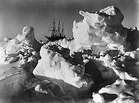
Imperial Trans-Antarctic Expedition
The Imperial Trans-Antarctic Expedition , also known as the Endurance Expedition, is considered the last major expedition of the Heroic Age of Antarctic Exploration. Conceived by Sir Ernest Shackleton, the expedition was an attempt to make the first land crossing of the Antarctic continent...
of 1914, led by Ernest Shackleton, set out to cross the continent via the pole, but their ship, the Endurance
Endurance (1912 ship)
The Endurance was the three-masted barquentine in which Sir Ernest Shackleton sailed for the Antarctic on the 1914 Imperial Trans-Antarctic Expedition...
, was trapped and crushed by pack ice before they even landed. The expedition members survived after an epic journey on sledges over pack ice to Elephant Island. Then Shackleton and five others crossed the Southern Ocean, in an open boat called James Caird
James Caird (boat)
The voyage of the James Caird was an open boat journey from Elephant Island in the South Shetland Islands to South Georgia in the southern Atlantic Ocean, a distance of...
, and then trekked over South Georgia to raise the alarm at the whaling station Grytviken
Grytviken
Grytviken is the principal settlement in the British territory of South Georgia in the South Atlantic. It was so named in 1902 by the Swedish surveyor Johan Gunnar Andersson who found old English try pots used to render seal oil at the site. It is the best harbour on the island, consisting of a...
.
Exploration by air: 1930s to 1950s
US Navy Rear Admiral Richard Evelyn ByrdRichard Evelyn Byrd
Rear Admiral Richard Evelyn Byrd, Jr., USN was a naval officer who specialized in feats of exploration. He was a pioneering American aviator, polar explorer, and organizer of polar logistics...
led five expeditions to Antarctica during the 1930s, 1940s, and 1950s. He overflew the South Pole with pilot Bernt Balchen
Bernt Balchen
Bernt Balchen, , a winner of the Distinguished Flying Cross was a Norwegian native, and later U.S. citizen, known as a pioneer polar aviator, navigator, aircraft mechanical engineer and military leader. His service in the U.S...
on November 28 and 29, 1929, to match his overflight of the North Pole in 1926. Byrd's explorations had science as a major objective and pioneered the use of aircraft on the continent. Byrd is credited with doing more for Antarctic exploration than any other explorer. His expeditions set the scene for modern Antarctic exploration and research.
In 1946, Admiral Byrd and more than 4,700 military personnel returned to Antarctica in an expedition called Operation Highjump
Operation Highjump
Operation Highjump , officially titled The United States Navy Antarctic Developments Program, 1946-1947, was a United States Navy operation organized by RADM Richard E. Byrd Jr. USN, , Officer in Charge, Task Force 68, and led by RADM Richard H. Cruzen, USN, Commanding Officer, Task Force 68....
. Reported to the public as a scientific mission, the details were kept secret and it may have actually been a training or testing mission for the military. The expedition was, in both military or scientific planning terms, put together very quickly. The group contained an unusually high amount of military equipment, including an aircraft carrier, submarines, military support ships, assault troops and military vehicles. The expedition was planned to last for eight months but was unexpectedly terminated after only two months. With the exception of some eccentric entries in Admiral Byrd's diaries, no real explanation for the early termination has ever been officially given.
Captain Finn Ronne
Finn Ronne
Finn Ronne was a U.S. Antarctic explorer.-Background:Finn Ronne was born in Horten, in Vestfold county, Norway. His father, Martin Rønne , was a polar explorer and served in Roald Amundsen's successful expedition to the South Pole...
, Byrd's executive officer, returned to Antarctica with his own expedition in 1947-1948, with Navy support, three planes, and dogs. Ronne disproved the notion that the continent was divided in two and established that East and West Antarctica was one single continent, i.e. that the Weddell Sea and the Ross Sea are not connected. The expedition explored and mapped large parts of Palmer Land and the Weddell Sea coastline, and identified the Ronne Ice Shelf, named by Ronne after his wife Edith Ronne
Edith Ronne
Edith "Jackie" Ronne was an American explorer of Antarctica and the first woman in the world to be a working member of an Antarctic expedition. She is also the namesake of the Ronne Ice Shelf.-Biography:...
. Ronne covered 3,600 miles by ski and dog sled—more than any other explorer in history. The Ronne Antarctic Research Expedition
Ronne Antarctic Research Expedition
The Ronne Antarctic Research Expedition was an expedition from 1947-1948 which researched the area surrounding the head of the Weddell Sea in Antarctica.-Background:...
discovered and mapped the last unknown coastline in the world and was the first Antarctic expedition to ever include women.
It was not until 31 October 1956 that anyone reached the South Pole again; on that day US Navy Rear Admiral George J. Dufek
George J. Dufek
George John Dufek was an American naval officer, naval aviator, and Arctic expert. He served in World War II and the Korean War and in the 1940s and 1950s spent much of his career in the Antarctic, first with Admiral Byrd and later as supervisor of U.S. programs in the South Polar regions...
http://www.history.navy.mil/wars/datesoct.htm and others successfully landed a R4D Skytrain (Douglas DC-3
Douglas DC-3
The Douglas DC-3 is an American fixed-wing propeller-driven aircraft whose speed and range revolutionized air transport in the 1930s and 1940s. Its lasting impact on the airline industry and World War II makes it one of the most significant transport aircraft ever made...
) aircraft.
During the International Geophysical Year
International Geophysical Year
The International Geophysical Year was an international scientific project that lasted from July 1, 1957, to December 31, 1958. It marked the end of a long period during the Cold War when scientific interchange between East and West was seriously interrupted...
of 1957, a large number of expeditions to the Antarctic were mounted.
Commonwealth Trans-Antarctic Expedition
United States Navy
The United States Navy is the naval warfare service branch of the United States Armed Forces and one of the seven uniformed services of the United States. The U.S. Navy is the largest in the world; its battle fleet tonnage is greater than that of the next 13 largest navies combined. The U.S...
expedition set up the first permanent base at the South Pole, Amundsen-Scott South Pole Station
Amundsen-Scott South Pole Station
The Amundsen–Scott South Pole Station is the American scientific research station on the high plateau of Antarctica. This station is located at the southernmost place on the Earth, the Geographic South Pole, at an elevation of 2,835 meters above sea level.The original Amundsen-Scott Station was...
, by airlift, to support the International Geophysical Year
International Geophysical Year
The International Geophysical Year was an international scientific project that lasted from July 1, 1957, to December 31, 1958. It marked the end of a long period during the Cold War when scientific interchange between East and West was seriously interrupted...
. In 1958, Edmund Hillary
Edmund Hillary
Sir Edmund Percival Hillary, KG, ONZ, KBE , was a New Zealand mountaineer, explorer and philanthropist. On 29 May 1953 at the age of 33, he and Sherpa mountaineer Tenzing Norgay became the first climbers known to have reached the summit of Mount Everest – see Timeline of climbing Mount Everest...
's party in the New Zealand party of the Commonwealth Trans-Antarctic Expedition
Commonwealth Trans-Antarctic Expedition
The 1955–58 Commonwealth Trans-Antarctic Expedition was a Commonwealth-sponsored expedition that successfully completed the first overland crossing of Antarctica, via the South Pole...
became the third group in history to reach the South Pole by land, and the first group of motor vehicles to reach the pole. The British team led by Vivian Fuchs
Vivian Fuchs
Sir Vivian Ernest Fuchs FRS was an English explorer whose expeditionary team completed the first overland crossing of Antarctica in 1958.- Biography :...
, met them at the pole shortly afterwards. The expedition completed the first overland crossing of the continent by land via the South Pole. New Zealand mountaineer Sir Edmund Hillary
Edmund Hillary
Sir Edmund Percival Hillary, KG, ONZ, KBE , was a New Zealand mountaineer, explorer and philanthropist. On 29 May 1953 at the age of 33, he and Sherpa mountaineer Tenzing Norgay became the first climbers known to have reached the summit of Mount Everest – see Timeline of climbing Mount Everest...
reached the Pole in early January 1958 using farm tractors equipped for polar travel, the first party since Scott's to reach the South Pole overland. Hillary was laying supply depots as part of the Commonwealth Trans-Antarctic Expedition
Commonwealth Trans-Antarctic Expedition
The 1955–58 Commonwealth Trans-Antarctic Expedition was a Commonwealth-sponsored expedition that successfully completed the first overland crossing of Antarctica, via the South Pole...
and in typical Hillary style "detoured" to the pole because the trip had gone well. British explorer Sir Vivian Fuchs
Vivian Fuchs
Sir Vivian Ernest Fuchs FRS was an English explorer whose expeditionary team completed the first overland crossing of Antarctica in 1958.- Biography :...
then arrived at the Pole from the opposite direction later in January, meeting Hillary. Fuchs continued on, making use of the provisions that Hillary had stored, and on 2 March succeeded in reaching Scott Base
Scott Base
Scott Base is a research facility located in Antarctica and is operated by New Zealand. It was named after Captain Robert Falcon Scott, Royal Navy, leader of two British expeditions to the Ross Sea area of Antarctica...
, completing the overland transpolar crossing that Shackleton had envisaged.
Recent history
Military activity in the Antarctic
As Antarctica has never been permanently settled by humans, there has historically been little military activity in the Antarctic. While the Antarctic Treaty, which came into effect on June 23, 1961, bans military activity in Antarctica, military personnel and equipment may be used for scientific...
to the support of scientific research.
A baby, named Emilio Marcos de Palma
Emilio Palma
Emilio Marcos Palma is an Argentine national who is the first person known to be born on the continent of Antarctica. Emilio weighed 7 pounds and 8 ounces when born in Fortín Sargento Cabral at the Esperanza Base near the tip of the Antarctic peninsula...
, was born near Hope Bay
Hope Bay
Hope Bay on Trinity Peninsula, is long and wide, indenting the tip of Antarctic Peninsula and opening on Antarctic Sound....
on 7 January 1978, becoming the first baby born on the continent. He also was born farther south than anyone in history.
On 28 November 1979, an Air New Zealand
Air New Zealand
Air New Zealand Limited is the national airline and flag carrier of New Zealand. Based in Auckland, New Zealand, the airline operates scheduled passenger flights to 26 domestic destinations and 24 international destinations in 15 countries across Asia, Europe, North America and Oceania, and is...
DC-10 on a sightseeing trip crashed
Air New Zealand Flight 901
Air New Zealand Flight 901 was a scheduled Air New Zealand Antarctic sightseeing flight that operated between 1977 and 1979, from Auckland Airport to Antarctica and return via Christchurch...
into Mount Erebus
Mount Erebus
Mount Erebus in Antarctica is the southernmost historically active volcano on Earth, the second highest volcano in Antarctica , and the 6th highest ultra mountain on an island. With a summit elevation of , it is located on Ross Island, which is also home to three inactive volcanoes, notably Mount...
on Ross Island
Ross Island
Ross Island is an island formed by four volcanoes in the Ross Sea near the continent of Antarctica, off the coast of Victoria Land in McMurdo Sound.-Geography:...
, killing all 257 people on board.
Børge Ousland
Børge Ousland
Børge Ousland is a Norwegian polar explorer, photographer and writer. He made the first unassisted Antarctic solo crossing, finishing on 18 January 1997. He ventured to the South Pole on 8 December 2005...
, a Norwegian explorer, finished the first unassisted Antarctic solo crossing on January 18, 1997.
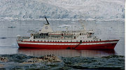
On 23 November 2007, the MS Explorer
MS Explorer
The MS Explorer was a Liberian-registered cruise ship designed for Arctic and Antarctic service, originally commissioned and operated by the Swedish explorer Lars-Eric Lindblad...
struck an iceberg and sank, but all on board were rescued by nearby ships, including a passing Norwegian
Norway
Norway , officially the Kingdom of Norway, is a Nordic unitary constitutional monarchy whose territory comprises the western portion of the Scandinavian Peninsula, Jan Mayen, and the Arctic archipelago of Svalbard and Bouvet Island. Norway has a total area of and a population of about 4.9 million...
cruise ship
Cruise ship
A cruise ship or cruise liner is a passenger ship used for pleasure voyages, where the voyage itself and the ship's amenities are part of the experience, as well as the different destinations along the way...
, the MS Nordnorge
MS Nordnorge
The MS Nordnorge is a Hurtigruten ship. It was built in 1997 by Kværner Kleven in Ulsteinvik, Norway, as a sister ship to MS Polarlys and MS Nordkapp...
.
See also
- History of Livingston Island
- List of Antarctic expeditions
- List of research stations in Antarctica
- Heroic Age of Antarctic ExplorationHeroic Age of Antarctic ExplorationThe Heroic Age of Antarctic Exploration defines an era which extended from the end of the 19th century to the early 1920s. During this 25-year period the Antarctic continent became the focus of an international effort which resulted in intensive scientific and geographical exploration, sixteen...
- History of South Georgia and the South Sandwich IslandsHistory of South Georgia and the South Sandwich IslandsThe history of South Georgia and the South Sandwich Islands is relatively recent. When European explorers found the islands, they were uninhabited, and their hostile climate, mountainous terrain, and remoteness made subsequent settlement difficult...
- List of Russian explorers