

Air New Zealand Flight 901
Encyclopedia
Air New Zealand Flight 901 (TE-901) was a scheduled Air New Zealand
Antarctic sightseeing flight that operated between 1977 and 1979, from Auckland Airport to Antarctica and return via Christchurch
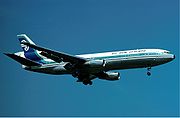
. On 28 November 1979, the fourteenth flight of TE901, a McDonnell Douglas DC-10-30
registered ZK-NZP, collided with Mount Erebus
on Ross Island
, Antarctica, killing all 237 passengers and 20 crew on board. The accident is commonly known as the Mount Erebus disaster.
The initial investigation concluded the accident was caused by pilot error but public outcry led to the establishment of a Royal Commission of Inquiry into the crash. The commission, presided over by Justice Peter Mahon
, concluded that the accident was caused by a correction made to the coordinates of the flight path the night before the disaster, coupled with a failure to inform the flight crew of the change, with the result that the aircraft, instead of being directed by computer down McMurdo Sound
(as the crew assumed), was re-routed into the path of Mount Erebus. In Justice Mahon's report, he accused Air New Zealand of presenting "an orchestrated litany of lies" and this charge in the end led to changes in senior management at the airline. The accident remains New Zealand's deadliest peacetime disaster.
 The flight was designed and marketed as a unique sightseeing experience, carrying an experienced Antarctic guide who pointed out scenic features and landmarks using the aircraft public-address system, while passengers enjoyed a low-flying sweep of McMurdo Sound
. The flights left and returned to New Zealand the same day.
Flight 901 would leave Auckland International Airport at 8:00am for Antarctica, and arrive back at Christchurch International Airport
at 7:00pm after flying a total of 5360 miles (8,626.1 km). The aircraft would make a 45-minute stop at Christchurch for refuelling and crew change, before flying the remaining 464 miles (746.7 km) to Auckland, arriving at 9:00pm. Tickets for the November 1979 flights cost NZ$359 per person (equal to around $1218 in September 2009).
Dignitaries such as Sir Edmund Hillary had acted as guides on previous flights. Hillary was scheduled to act as the guide for the flight but had to cancel owing to other commitments. His long-time friend and climbing companion, Peter Mulgrew
, stood in as guide.
The flights usually operated at about 85% of capacity; the empty seats, usually the centre ones, allowed passengers to move more easily about the cabin to look out of the windows.
The aircraft used on the Antarctic flights were Air New Zealand's eight McDonnell Douglas DC-10-30 trijet
s. The aircraft on 28 November was registered
ZK-NZP.
The 182nd DC-10 to be built, and the fourth DC-10 to be introduced by Air New Zealand, ZK-NZP was handed over to the airline on 12 December 1974 at McDonnell Douglas's Long Beach plant. It was the first Air New Zealand DC-10 to be fitted with General Electric CF6-50C
engines as built, and had logged 20,750 flight hours prior to the crash.
.
Unknown to Captain Collins at the time of the briefing, the flight plan coordinates transcribed into Air New Zealand's ground computer differed from the route flight plan approved in 1977 by the New Zealand Department of Transport Civil Aviation Division. The approved flight plan was along a track directly from Cape Hallett
to the McMurdo Non-Directional Beacon
(NDB), which, coincidentally, entailed flying almost directly over the 12,448 ft peak of Mt Erebus
. However, the print out from Air New Zealand's ground computer system presented at the 9 November briefing corresponded to a southerly flight path down the middle of the wide McMurdo Sound, leaving Mt Erebus approximately 27 miles to the east. The majority of previous flights had also entered this flight plan's coordinates into their aircraft INS
navigational systems and flown the McMurdo Sound route, unaware that the route flown did not correspond with the approved route.
Captain Simpson, the pilot of a previous flight on 14 November, and also present at the 9 November briefing, compared the coordinates of the McMurdo TACAN navigation beacon (approximately three miles east of McMurdo NDB), and the McMurdo waypoint that the flight crew had entered into the INS, and was surprised to find a large distance between the two. After this flight, Captain Simpson advised Air New Zealand's Navigation section of the difference in positions. For reasons that were disputed, this triggered Air New Zealand's Navigation section to subsequently resolve to update the McMurdo waypoint coordinates stored in the ground computer to correspond with the coordinates of the McMurdo TACAN beacon, despite this also not corresponding with the approved route.
The Navigation section changed the McMurdo waypoint coordinate stored in the ground computer system at approximately 1:40 am on the morning of the flight. Crucially, the flight crew of Flight 901 was not notified of the change. The flight plan print-out given to the crew on the morning of the flight, which was subsequently hand entered by the flight crew into the aircraft's INS, differed from the flight plan presented at the 9 November briefing and to Captain Collins' map mark-ups he had prepared the night previously. The key difference between the routes was that the flight plan presented at the November 9 briefing corresponded to a track down McMurdo Sound, giving Mt Erebus a wide berth to the east, whereas the flight plan printed on the morning of the flight corresponded to a track that coincided with Mt Erebus. In contrast to the McMurdo Sound route, the updated route would result in a collision with Mt Erebus if this leg was flown at an altitude of less than 13,000 feet. Additionally, the computer program was altered such that the standard telex forwarded to Air Traffic Controllers at McMurdo displayed the word "McMurdo" rather than the co-ordinates of latitude and longitude, for the final waypoint. During the subsequent inquiry Justice Mahon
concluded that this was a deliberate attempt to conceal from the United States authorities that the flight plan had been changed, and probably because it was known that the United States Air Traffic Control would lodge an objection to the new flight path.
The flight had earlier paused during the approach to McMurdo Sound to carry out a descent, via a figure-eight manoeuvre, through a gap in the low cloud base (later estimated to be at approximately 2,000–3,000 feet) whilst over water in order to establish visible contact with surface landmarks, and afford the passengers a better view. It was established that either the flight crew was unaware of, or ignored, the approved route's Minimum Safe Altitude (MSA) of 16,000 ft for the approach to Mt Erebus, and 6,000 ft in the sector south of Mt Erebus (and then only when the cloud base was at 7,000 ft or better). Photographs and news stories from previous flights showed that many of these had also been flown at levels substantially below the route's MSA. In addition, pre-flight briefings for previous flights had authorised descents to any altitude authorised by the US Air Traffic Controller at McMurdo Station. As the US ATC expected Flight 901 to follow the same route as previous flights down McMurdo Sound, and in accordance with the route waypoints previously advised by Air New Zealand to them, the ATC advised Flight 901 that it had a radar that could let them down to 1,500 ft. The aircraft was not located by the radar equipment, and the crew experienced difficulty establishing VHF communications. The distance measuring equipment (DME) did not lock onto the McMurdo Tactical Air Navigation System (TACAN) for any useful period.
Cockpit Voice Recorder
(CVR) transcripts from the last minutes of the flight before impact with Mt Erebus indicated that the flight crew believed they were flying over McMurdo Sound, well to the west of Mt Erebus and with the Ross Ice Shelf visible on the horizon, when in reality they were flying directly towards the mountain. Despite most of the crew being engaged in identifying visual landmarks at the time, they never perceived the mountain directly in front of them. Approximately six minutes after completing a descent in Visual Meteorological Conditions, Flight 901 collided with the mountain at an altitude of approximately 1,500 ft. Passenger photographs taken seconds before collision removed all doubt of a "flying in cloud" theory, showing perfectly clear visibility well beneath the cloud base, with landmarks 13 miles to the left and 10 miles to the right of the aircraft visible.
, instead of down McMurdo Sound.
About four hours after a smooth take-off the flight was 42 miles (67.6 km) away from McMurdo Station
. The radio communications centre there allowed the pilots to descend to 10000 ft (3,048 m) and to continue "visually." Air safety regulations at the time did not allow flights to descend to lower than 6000 ft (1,828.8 m), even in good weather, although Air New Zealand's own travel magazine showed photographs of previous flights clearly operating below 6000 ft (1,828.8 m). Collins believed the plane was over open water.
At 12:49pm, the ground proximity warning system
(GWPS) began sounding a warning that the plane was dangerously close to terrain. Although Collins immediately requested go-around power, there was no time to divert the aircraft and six seconds later the plane collided
with the side of Mount Erebus and disintegrated, instantly killing all on board. The accident occurred at 12:50pm at a position of , and at an elevation of 1467 feet AMSL
. Most of the aircraft was smashed into small pieces, with the exception of the tail section.
McMurdo Station attempted to contact the flight after the crash, and informed Air New Zealand headquarters in Auckland that communication with the aircraft had been lost. United States search and rescue personnel were placed on standby.
The nationalities of the passengers and crew included:
released a situation report, stating:
Data gathered at 3:43 pm was added to the situation report, stating that the visibility was 40 miles (64.4 km). It also stated that six aircraft had been launched to find the flight.
Flight 901 was supposed to arrive back at Christchurch at 6:05 pm, for a stopover including refuelling and a crew change before completing the journey back to Auckland. Around 50 passengers were also supposed to disembark at Christchurch. Initially airport staff told the waiting families that it was usual for the flight to be slightly late, but as time went on, it became clear that something was wrong.
At 9:00 pm, about half an hour after the plane would have run out of fuel, Air New Zealand informed the press that it believed the aircraft to be lost. Rescue teams searched along the assumed flight path, but found nothing. At 12:55 am, the crew of a United States Navy
aircraft discovered unidentified debris along the side of Mount Erebus. No survivors could be seen. At around 9:00 am, twenty hours after the crash, helicopters with search parties managed to land on the side of the mountain. It was confirmed that the wreckage was that of Flight 901 and that all 237 passengers and 20 crewmembers had been killed. The DC-10's altitude at the time of the collision was 1,465 ft (445 m).
The vertical stabilizer
section of the plane, with the koru
logo clearly visible, was found in the snow. Bodies and fragments of the aircraft were flown back to Auckland for identification. The remains of 44 of the victims were not individually identified, and the funeral for them was held on 22 February 1980.
Efforts for recovery were extensive, owing in part to the pressure from Japan, as 24 passengers had been Japanese. The operation lasted until 9 December 1979, with up to 60 recovery workers on site at a time.
A team of New Zealand Police
officers and a Mountain Face Rescue team were dispatched on a No 40 Squadron
C-130 Hercules
aircraft.
The job of individual identification took many weeks, and was largely done by teams of pathologists, dentists and police. The mortuary team was led by Inspector Jim Morgan, who collated and edited a report on the recovery operation. Record keeping had to be meticulous because of the number and fragmented state of the human remains that had to be identified to the satisfaction of the coroner
. From a purely technical point of view the exercise was both innovative and highly successful, with 83% of the deceased eventually being identified, sometimes from evidence such as a finger capable of yielding a print, or keys in a pocket.
The last searchers off the mountain were Sergeant Mark Penn and Constable Al Windleburn and several DSIR personnel, after a final 36 hours non-stop shift.
In 1979 the post traumatic stress suffered by the body recovery and identification teams was recognised, some of whom broke down under their grim duty. Counselling was offered to all who wished it, and the debriefing report specifically noted the need for officers in command of such operations to know how to recognise and deal with the signs of stress in staff. It took several years more for psychological support to become standard practice in the New Zealand Police
.
There was no official group recognition for the efforts of the police involved on this occasion, but Inspector R. S. Mitchell, leader of the body recovery team, and Inspector Morgan, leader of the DVI team, were awarded the OBE for their services in relation to this disaster.
In 2006 the New Zealand Special Service Medal (Erebus) was instituted to recognise the service of New Zealanders, and citizens of the United States of America and other countries, who were involved in the body recovery, identification and crash investigation phases of Operation Overdue. On 5 June 2009 the New Zealand government recognized some of the Americans who assisted in Operation Overdue during a ceremony in Washington, D.C. A total of 40 Americans, mostly Navy personnel, are eligible to receive the medal.
and the flight data recorder
were still in working order and able to be deciphered. Extensive photographic footage from the moments before the crash was available - being a sightseeing flight, most passengers were carrying cameras, of which the majority of the film was able to be developed.
, was released on 12 June 1980. It cited pilot error
as the principal cause of the accident and attributed blame to the decision of Collins to descend below the customary minimum altitude level, and continue at that height when the crew was unsure of the plane's position. The customary minimum altitude prohibited descent below 6,000 ft (1,830 m) even under good weather conditions, but a combination of factors led the captain to believe the plane was over the sea (the middle of McMurdo Sound and few small low islands), and previous flight 901 pilots had regularly flown low over the area to give passengers a better view, as evidenced by photographs in Air New Zealand's own travel magazine and by first-hand accounts of personnel based on the ground at NZ's Scott Base.
announced a further one-man Royal Commission of Inquiry into the accident, to be performed by the highly respected judge Justice Peter Mahon
.
Mahon's report, released on 27 April 1981, cleared the crew of blame for the disaster. Mahon said the single, dominant and effective cause of the crash was Air New Zealand's alteration of the flight plan waypoint coordinates in the ground navigation computer without advising the crew. The new flight plan took the aircraft directly over the mountain, rather than along its flank. Due to whiteout
conditions, "a malevolent trick of the polar light", the crew were unable to visually identify the mountain in front of them. Furthermore, they may have experienced a rare meteorological phenomenon called sector whiteout which creates the visual illusion of a flat horizon far in the distance (it appeared to be a very broad gap between cloud layers allowing a view of the distant Ross Ice Shelf and beyond). Mahon noted that the flight crew, with many thousands of hours of flight time between them, had considerable experience with the extreme accuracy of the aircraft's inertial navigation system
. Mahon also found that the radio communications centre at McMurdo Station
had authorised Collins to descend to 1,500 ft (450 m), below the minimum safe level.
In para. 377 of his report, Mahon controversially claimed airline executives and senior (management) pilots engaged in a conspiracy
to whitewash the inquiry, accusing them of "an orchestrated litany of lies" by covering up evidence and lying to investigators. Mahon found that in the original report Chippindale had a poor grasp of the flying involved in jet airline operation, as he (and the New Zealand CAA in general) was typically involved in investigating simple light aircraft crashes. Chippindale's investigation techniques were revealed as lacking in rigour, allowing for errors and avoidable gaps in knowledge to occur in reports. Consequently Chippindale entirely missed the importance of the flight plan change and the rare meteorological conditions of Antarctica. Had the pilots been informed of the flight plan change, the crash would have been avoided.
in London. His findings as to the cause of the accident, namely reprogramming of the aircraft's flight plan by the ground crew who then failed to inform the flight crew, had not been challenged before the Court of Appeal, and so were not challenged before the Privy Council. His conclusion that the crash was the result of the aircrew being misdirected as to their flight path, not due to pilot error, therefore remained. But the Board held that Mahon had acted in excess of his jurisdiction and in breach of natural justice by going on to make findings of a conspiracy by Air New Zealand to cover up the errors of the ground staff. In their judgement, delivered on 20 October 1982, the Law Lords dismissed Mahon's appeal and upheld the decision of the Court of Appeal. Aviation researcher John King wrote in his book New Zealand Tragedies, Aviation:
"Exhibit 164" was a photocopied diagram of McMurdo Sound showing a southbound flight path passing west of Ross Island
and a northbound path passing the island on the east. The diagram did not extend sufficiently far south to show where, how, or even if they joined, and left the two paths disconnected. Evidence had been given to the effect that the diagram had been included in the flight crew's briefing documentation.
Justice Mahon's report was finally tabled in Parliament by the then Minister of Transport, Maurice Williamson
, in 1999.
, which killed 256 people. At the time of the disaster, it was the fourth-deadliest air crash of all time, and ranks sixteenth.
Flight 901, in conjunction with the crash of American Airlines Flight 191
earlier that year, severely hurt the reputation of the McDonnell Douglas DC-10. ZK-NZP, along with the other seven Air New Zealand DC-10s, had only just returned to service after being grounded following the crash of Flight 191 when the crash of Flight 901 occurred. Flight 901 was the third deadliest accident involving a DC-10, following Turkish Airways Flight 981 and American Airlines Flight 191.
The crash spelled the end of commercially operated Antarctic sightseeing flights - Air New Zealand cancelled all its Antarctic flights after Flight 901, and Qantas suspended its Antarctic flights in February 1980, only returning on a limited basis again in 1994 (see Tourism in Antarctica
).
The crash marked the beginning of the end for Air New Zealand's DC-10 Fleet, although there had been talk before the accident of replacing the aircraft. The DC-10s were replaced by Boeing 747
aircraft from mid 1981, and the last Air New Zealand DC-10 flew in December 1982.
Almost all of the aircraft's wreckage still lies where it came to rest on the slopes of Mount Erebus, under a layer of snow and ice. During warm periods, when snow recedes, it is still visible from the air.
A television
miniseries
, Erebus: The Aftermath
, focusing on the investigation and the Royal Commission of Inquiry, was broadcast in New Zealand and Australia in 1988.
The phrase "an orchestrated litany of lies" entered New Zealand popular culture for some years.
In the New Zealand Queen's Birthday Honours list in June 2007 Captain Gordon Vette was awarded the ONZM (Officer of the New Zealand Order of Merit), recognising his services in assisting Justice Mahon during the Erebus Inquiry. Vette's book, Impact Erebus, provides a commentary of the flight, its crash and the subsequent investigations.
In 2008, Justice Mahon was posthumously awarded the Jim Collins Memorial Award by the New Zealand Airline Pilots Association for exceptional contributions to air safety, "in forever changing the general approach used in transport accidents investigations world wide."
In 2009, Air New Zealand's CEO Rob Fyfe apologised to all those affected who did not receive appropriate support and compassion from the company following the incident, and unveiled a commemorative sculpture at its headquarters.
The registration of the crashed aircraft, ZK-NZP, has not been reissued.
to commemorate the accident. It was replaced in 1986 with an aluminium
cross after the original was eroded by low temperatures, wind and moisture.
The memorial for the 16 passengers who were unidentifiable and the 28 whose bodies were never found is at Waikumete Cemetery in Glen Eden, Auckland
. Beside the memorial is a Japanese cherry tree
, planted as a memorial to the 24 Japanese passengers who died.
A memorial to the crew members of Flight 901 is located adjacent to Auckland Airport, on Tom Pearce Drive at the eastern end of the airport zone.
In January 2010, a 26 kg sculpted koru
containing letters written by the loved ones of those who died was placed next to the Antarctic cross. It was originally to have been placed at the site by six relatives of the victims on the 30th anniversary of the crash, 28 November 2009, but this was delayed for two months due to bad weather. It is planned for a second koru capsule, mirroring the first capsule, to be placed at the cross in 2011.
Similar aircraft incidents
Air New Zealand
Air New Zealand Limited is the national airline and flag carrier of New Zealand. Based in Auckland, New Zealand, the airline operates scheduled passenger flights to 26 domestic destinations and 24 international destinations in 15 countries across Asia, Europe, North America and Oceania, and is...
Antarctic sightseeing flight that operated between 1977 and 1979, from Auckland Airport to Antarctica and return via Christchurch
Christchurch International Airport
-Facts & figures:As the gateway for Christchurch and the South Island, Christchurch International Airport is New Zealand’s second largest airport.5,908,077 passengers travelled in and out of Christchurch International Airport from 1 July 2008 to 30 June 2009...
. On 28 November 1979, the fourteenth flight of TE901, a McDonnell Douglas DC-10-30
McDonnell Douglas DC-10
The McDonnell Douglas DC-10 is a three-engine widebody jet airliner manufactured by McDonnell Douglas. The DC-10 has range for medium- to long-haul flights, capable of carrying a maximum 380 passengers. Its most distinguishing feature is the two turbofan engines mounted on underwing pylons and a...
registered ZK-NZP, collided with Mount Erebus
Mount Erebus
Mount Erebus in Antarctica is the southernmost historically active volcano on Earth, the second highest volcano in Antarctica , and the 6th highest ultra mountain on an island. With a summit elevation of , it is located on Ross Island, which is also home to three inactive volcanoes, notably Mount...
on Ross Island
Ross Island
Ross Island is an island formed by four volcanoes in the Ross Sea near the continent of Antarctica, off the coast of Victoria Land in McMurdo Sound.-Geography:...
, Antarctica, killing all 237 passengers and 20 crew on board. The accident is commonly known as the Mount Erebus disaster.
The initial investigation concluded the accident was caused by pilot error but public outcry led to the establishment of a Royal Commission of Inquiry into the crash. The commission, presided over by Justice Peter Mahon
Peter Mahon (lawyer)
Peter Thomas Mahon QC was a New Zealand High Court Judge, best known for his Commission of Inquiry into the crash of Air New Zealand Flight 901 . His son, Sam Mahon is a well-known artist.-Military Service:...
, concluded that the accident was caused by a correction made to the coordinates of the flight path the night before the disaster, coupled with a failure to inform the flight crew of the change, with the result that the aircraft, instead of being directed by computer down McMurdo Sound
McMurdo Sound
The ice-clogged waters of Antarctica's McMurdo Sound extend about 55 km long and wide. The sound opens into the Ross Sea to the north. The Royal Society Range rises from sea level to 13,205 feet on the western shoreline. The nearby McMurdo Ice Shelf scribes McMurdo Sound's southern boundary...
(as the crew assumed), was re-routed into the path of Mount Erebus. In Justice Mahon's report, he accused Air New Zealand of presenting "an orchestrated litany of lies" and this charge in the end led to changes in senior management at the airline. The accident remains New Zealand's deadliest peacetime disaster.
Background
McMurdo Sound
The ice-clogged waters of Antarctica's McMurdo Sound extend about 55 km long and wide. The sound opens into the Ross Sea to the north. The Royal Society Range rises from sea level to 13,205 feet on the western shoreline. The nearby McMurdo Ice Shelf scribes McMurdo Sound's southern boundary...
. The flights left and returned to New Zealand the same day.
Flight 901 would leave Auckland International Airport at 8:00am for Antarctica, and arrive back at Christchurch International Airport
Christchurch International Airport
-Facts & figures:As the gateway for Christchurch and the South Island, Christchurch International Airport is New Zealand’s second largest airport.5,908,077 passengers travelled in and out of Christchurch International Airport from 1 July 2008 to 30 June 2009...
at 7:00pm after flying a total of 5360 miles (8,626.1 km). The aircraft would make a 45-minute stop at Christchurch for refuelling and crew change, before flying the remaining 464 miles (746.7 km) to Auckland, arriving at 9:00pm. Tickets for the November 1979 flights cost NZ$359 per person (equal to around $1218 in September 2009).
Dignitaries such as Sir Edmund Hillary had acted as guides on previous flights. Hillary was scheduled to act as the guide for the flight but had to cancel owing to other commitments. His long-time friend and climbing companion, Peter Mulgrew
Peter Mulgrew
Peter David Mulgrew was a New Zealand mountaineer, yachtsman and businessman. He died in the crash of the ill-fated Air New Zealand Flight 901, an Antarctic sightseeing flight that slammed into Mount Erebus, killing all 257 on board...
, stood in as guide.
The flights usually operated at about 85% of capacity; the empty seats, usually the centre ones, allowed passengers to move more easily about the cabin to look out of the windows.
The aircraft used on the Antarctic flights were Air New Zealand's eight McDonnell Douglas DC-10-30 trijet
Trijet
A Trijet is an aircraft powered by three jet engines. Early twin-jet designs were limited by the FAA's "60-minute rule", whereby the flight path of twin-engined jetliners was restricted to within 60 minutes' flying time from a suitable airport, in case of engine failure. In 1964 this rule was...
s. The aircraft on 28 November was registered
Aircraft registration
An aircraft registration is a unique alphanumeric string that identifies a civil aircraft, in similar fashion to a licence plate on an automobile...
ZK-NZP.
The 182nd DC-10 to be built, and the fourth DC-10 to be introduced by Air New Zealand, ZK-NZP was handed over to the airline on 12 December 1974 at McDonnell Douglas's Long Beach plant. It was the first Air New Zealand DC-10 to be fitted with General Electric CF6-50C
General Electric CF6
The General Electric CF6 is a family of high-bypass turbofan engines produced by GE Aviation. A development of the first high-power high-bypass jet engine available, the TF39, the CF6 powers a wide variety of civilian airliners. The basic engine core formed the basis for the LM2500, LM5000, and...
engines as built, and had logged 20,750 flight hours prior to the crash.
Accident
- All times are as at McMurdo Base: New Zealand Standard Time; UTC+12UTC+12UTC+12:00 is an identifier for a +12 hour time offset from UTC. This time is used in:-As standard time :*Kiribati**Gilbert Islands and Banaba*Marshall Islands*Nauru*Russia**Chukotka Autonomous Okrug**Kamchatka Krai**Kuril Islands...
. Mainland New Zealand was running on New Zealand Daylight Time (UTC+13UTC+13UTC+13 is an identifier for a +13 hour time offset from UTC.This time is used as standard time in:*Kiribati**Phoenix Islands *Tonga-Samoa and Tokelau:...
) at the time of the crash.
Circumstances surrounding the accident
Captain Jim Collins and co-pilot Greg Cassin had never flown to Antarctica before, but they were experienced pilots considered qualified for the flight. On 9 November 1979, 19 days before departure, the two pilots had attended a briefing in which they were given a copy of the previous flight's flight planFlight plan
Flight plans are documents filed by pilots or a Flight Dispatcher with the local Civil Aviation Authority prior to departure...
.
Unknown to Captain Collins at the time of the briefing, the flight plan coordinates transcribed into Air New Zealand's ground computer differed from the route flight plan approved in 1977 by the New Zealand Department of Transport Civil Aviation Division. The approved flight plan was along a track directly from Cape Hallett
Cape Hallett
Cape Hallett is a snow-free area on the northern tip of the Hallett Peninsula on the Ross Sea coast of Victoria Land, East Antarctica. A very large Adelie penguin rookery is located at Cape Hallett...
to the McMurdo Non-Directional Beacon
Non-directional beacon
A non-directional beacon is a radio transmitter at a known location, used as an aviation or marine navigational aid. As the name implies, the signal transmitted does not include inherent directional information, in contrast to other navigational aids such as low frequency radio range, VHF...
(NDB), which, coincidentally, entailed flying almost directly over the 12,448 ft peak of Mt Erebus
Mount Erebus
Mount Erebus in Antarctica is the southernmost historically active volcano on Earth, the second highest volcano in Antarctica , and the 6th highest ultra mountain on an island. With a summit elevation of , it is located on Ross Island, which is also home to three inactive volcanoes, notably Mount...
. However, the print out from Air New Zealand's ground computer system presented at the 9 November briefing corresponded to a southerly flight path down the middle of the wide McMurdo Sound, leaving Mt Erebus approximately 27 miles to the east. The majority of previous flights had also entered this flight plan's coordinates into their aircraft INS
Inertial navigation system
An inertial navigation system is a navigation aid that uses a computer, motion sensors and rotation sensors to continuously calculate via dead reckoning the position, orientation, and velocity of a moving object without the need for external references...
navigational systems and flown the McMurdo Sound route, unaware that the route flown did not correspond with the approved route.
Captain Simpson, the pilot of a previous flight on 14 November, and also present at the 9 November briefing, compared the coordinates of the McMurdo TACAN navigation beacon (approximately three miles east of McMurdo NDB), and the McMurdo waypoint that the flight crew had entered into the INS, and was surprised to find a large distance between the two. After this flight, Captain Simpson advised Air New Zealand's Navigation section of the difference in positions. For reasons that were disputed, this triggered Air New Zealand's Navigation section to subsequently resolve to update the McMurdo waypoint coordinates stored in the ground computer to correspond with the coordinates of the McMurdo TACAN beacon, despite this also not corresponding with the approved route.
The Navigation section changed the McMurdo waypoint coordinate stored in the ground computer system at approximately 1:40 am on the morning of the flight. Crucially, the flight crew of Flight 901 was not notified of the change. The flight plan print-out given to the crew on the morning of the flight, which was subsequently hand entered by the flight crew into the aircraft's INS, differed from the flight plan presented at the 9 November briefing and to Captain Collins' map mark-ups he had prepared the night previously. The key difference between the routes was that the flight plan presented at the November 9 briefing corresponded to a track down McMurdo Sound, giving Mt Erebus a wide berth to the east, whereas the flight plan printed on the morning of the flight corresponded to a track that coincided with Mt Erebus. In contrast to the McMurdo Sound route, the updated route would result in a collision with Mt Erebus if this leg was flown at an altitude of less than 13,000 feet. Additionally, the computer program was altered such that the standard telex forwarded to Air Traffic Controllers at McMurdo displayed the word "McMurdo" rather than the co-ordinates of latitude and longitude, for the final waypoint. During the subsequent inquiry Justice Mahon
Peter Mahon (lawyer)
Peter Thomas Mahon QC was a New Zealand High Court Judge, best known for his Commission of Inquiry into the crash of Air New Zealand Flight 901 . His son, Sam Mahon is a well-known artist.-Military Service:...
concluded that this was a deliberate attempt to conceal from the United States authorities that the flight plan had been changed, and probably because it was known that the United States Air Traffic Control would lodge an objection to the new flight path.
The flight had earlier paused during the approach to McMurdo Sound to carry out a descent, via a figure-eight manoeuvre, through a gap in the low cloud base (later estimated to be at approximately 2,000–3,000 feet) whilst over water in order to establish visible contact with surface landmarks, and afford the passengers a better view. It was established that either the flight crew was unaware of, or ignored, the approved route's Minimum Safe Altitude (MSA) of 16,000 ft for the approach to Mt Erebus, and 6,000 ft in the sector south of Mt Erebus (and then only when the cloud base was at 7,000 ft or better). Photographs and news stories from previous flights showed that many of these had also been flown at levels substantially below the route's MSA. In addition, pre-flight briefings for previous flights had authorised descents to any altitude authorised by the US Air Traffic Controller at McMurdo Station. As the US ATC expected Flight 901 to follow the same route as previous flights down McMurdo Sound, and in accordance with the route waypoints previously advised by Air New Zealand to them, the ATC advised Flight 901 that it had a radar that could let them down to 1,500 ft. The aircraft was not located by the radar equipment, and the crew experienced difficulty establishing VHF communications. The distance measuring equipment (DME) did not lock onto the McMurdo Tactical Air Navigation System (TACAN) for any useful period.
Cockpit Voice Recorder
Cockpit voice recorder
A cockpit voice recorder , often referred to as a "black box", is a flight recorder used to record the audio environment in the flight deck of an aircraft for the purpose of investigation of accidents and incidents...
(CVR) transcripts from the last minutes of the flight before impact with Mt Erebus indicated that the flight crew believed they were flying over McMurdo Sound, well to the west of Mt Erebus and with the Ross Ice Shelf visible on the horizon, when in reality they were flying directly towards the mountain. Despite most of the crew being engaged in identifying visual landmarks at the time, they never perceived the mountain directly in front of them. Approximately six minutes after completing a descent in Visual Meteorological Conditions, Flight 901 collided with the mountain at an altitude of approximately 1,500 ft. Passenger photographs taken seconds before collision removed all doubt of a "flying in cloud" theory, showing perfectly clear visibility well beneath the cloud base, with landmarks 13 miles to the left and 10 miles to the right of the aircraft visible.
Changes to the coordinates and departure
The crew input the coordinates into the plane's computer before they departed at 7:21 am from Auckland International Airport (now Auckland Airport). Unknown to them, the coordinates had been modified earlier that morning to correct the error introduced years previously and undetected until then. The crew evidently did not check the destination waypoint against a topographical map (as did Captain Simpson on the flight of November 14) or they would have noticed the change. These new coordinates changed the flight plan to track 27 miles (43.5 km) east of their understanding. The coordinates programmed the plane to overfly Mount Erebus, a 3794 m (12,447.5 ft) high volcanoVolcano
2. Bedrock3. Conduit 4. Base5. Sill6. Dike7. Layers of ash emitted by the volcano8. Flank| 9. Layers of lava emitted by the volcano10. Throat11. Parasitic cone12. Lava flow13. Vent14. Crater15...
, instead of down McMurdo Sound.
About four hours after a smooth take-off the flight was 42 miles (67.6 km) away from McMurdo Station
McMurdo Station
McMurdo Station is a U.S. Antarctic research center located on the southern tip of Ross Island, which is in the New Zealand-claimed Ross Dependency on the shore of McMurdo Sound in Antarctica. It is operated by the United States through the United States Antarctic Program, a branch of the National...
. The radio communications centre there allowed the pilots to descend to 10000 ft (3,048 m) and to continue "visually." Air safety regulations at the time did not allow flights to descend to lower than 6000 ft (1,828.8 m), even in good weather, although Air New Zealand's own travel magazine showed photographs of previous flights clearly operating below 6000 ft (1,828.8 m). Collins believed the plane was over open water.
Collision with Mount Erebus
Collins told McMurdo Station that he would be dropping to 2,000 ft (610 m), at which point he switched control of the aircraft to the automated computer system. At the time there was a layer of cloud that blended with the white of the volcano, forming a sector whiteout – there was no contrast between the two to warn the pilots. The effect was to fool all on the flight deck into thinking that the white mountainside was the Ross Ice Shelf, a huge expanse of floating ice derived from the great ice sheets of Antarctica, which was in fact now behind the mountain. As it was little understood, even by experienced polar pilots, Air New Zealand had provided no training for the flight crew on the sector whiteout phenomenon. Consequently, the crew thought they were flying along McMurdo Sound, when they were flying over Lewis Bay in front of Mt. Erebus.At 12:49pm, the ground proximity warning system
Ground Proximity Warning System
A ground proximity warning system is a system designed to alert pilots if their aircraft is in immediate danger of flying into the ground or an obstacle. The United States Federal Aviation Administration defines GPWS as a type of terrain awareness warning system...
(GWPS) began sounding a warning that the plane was dangerously close to terrain. Although Collins immediately requested go-around power, there was no time to divert the aircraft and six seconds later the plane collided
Controlled flight into terrain
Controlled flight into terrain describes an accident in which an airworthy aircraft, under pilot control, is unintentionally flown into the ground, a mountain, water, or an obstacle. The term was coined by engineers at Boeing in the late 1970s...
with the side of Mount Erebus and disintegrated, instantly killing all on board. The accident occurred at 12:50pm at a position of , and at an elevation of 1467 feet AMSL
Above mean sea level
The term above mean sea level refers to the elevation or altitude of any object, relative to the average sea level datum. AMSL is used extensively in radio by engineers to determine the coverage area a station will be able to reach...
. Most of the aircraft was smashed into small pieces, with the exception of the tail section.
McMurdo Station attempted to contact the flight after the crash, and informed Air New Zealand headquarters in Auckland that communication with the aircraft had been lost. United States search and rescue personnel were placed on standby.
Nationalities of passengers and crew
Air New Zealand had not lost a passenger until this accident.The nationalities of the passengers and crew included:
| Country | Passengers | Crew |
|---|---|---|
| 180 | 20 | |
| 24 | ||
| 22 | ||
| 6 | ||
| 2 | ||
| 1 | ||
| 1 | ||
| 1 | ||
| Total | 237 | 20 |
Initial search and discovery
At 2:00pm the United States NavyUnited States Navy
The United States Navy is the naval warfare service branch of the United States Armed Forces and one of the seven uniformed services of the United States. The U.S. Navy is the largest in the world; its battle fleet tonnage is greater than that of the next 13 largest navies combined. The U.S...
released a situation report, stating:
- Air New Zealand Flight 901 has failed to acknowledge radio transmissions. ... One LC-130 fixed-wing aircraft and two UH-1NUH-1N Twin HueyThe Bell UH-1N Twin Huey is a medium military helicopter that first flew in April, 1969. The UH-1N has a fifteen seat configuration, with one pilot and fourteen passengers. In cargo configuration the UH-1N has an internal capacity of 220 ft³ . An external load of 5,000 lb can be carried...
rotary wing aircraft are preparing to launch for SARSearch and rescueSearch and rescue is the search for and provision of aid to people who are in distress or imminent danger.The general field of search and rescue includes many specialty sub-fields, mostly based upon terrain considerations...
effort.
Data gathered at 3:43 pm was added to the situation report, stating that the visibility was 40 miles (64.4 km). It also stated that six aircraft had been launched to find the flight.
Flight 901 was supposed to arrive back at Christchurch at 6:05 pm, for a stopover including refuelling and a crew change before completing the journey back to Auckland. Around 50 passengers were also supposed to disembark at Christchurch. Initially airport staff told the waiting families that it was usual for the flight to be slightly late, but as time went on, it became clear that something was wrong.
At 9:00 pm, about half an hour after the plane would have run out of fuel, Air New Zealand informed the press that it believed the aircraft to be lost. Rescue teams searched along the assumed flight path, but found nothing. At 12:55 am, the crew of a United States Navy
United States Navy
The United States Navy is the naval warfare service branch of the United States Armed Forces and one of the seven uniformed services of the United States. The U.S. Navy is the largest in the world; its battle fleet tonnage is greater than that of the next 13 largest navies combined. The U.S...
aircraft discovered unidentified debris along the side of Mount Erebus. No survivors could be seen. At around 9:00 am, twenty hours after the crash, helicopters with search parties managed to land on the side of the mountain. It was confirmed that the wreckage was that of Flight 901 and that all 237 passengers and 20 crewmembers had been killed. The DC-10's altitude at the time of the collision was 1,465 ft (445 m).
The vertical stabilizer
Vertical stabilizer
The vertical stabilizers, vertical stabilisers, or fins, of aircraft, missiles or bombs are typically found on the aft end of the fuselage or body, and are intended to reduce aerodynamic side slip. It is analogical to a skeg on boats and ships.On aircraft, vertical stabilizers generally point upwards...
section of the plane, with the koru
Koru
The koru is a spiral shape based on the shape of a new unfurling silver fern frond and symbolizing new life, growth, strength and peace. It is an integral symbol in Māori art, carving and tattoos...
logo clearly visible, was found in the snow. Bodies and fragments of the aircraft were flown back to Auckland for identification. The remains of 44 of the victims were not individually identified, and the funeral for them was held on 22 February 1980.
Operation Overdue
The recovery effort of Flight 901 was called "Operation Overdue".Efforts for recovery were extensive, owing in part to the pressure from Japan, as 24 passengers had been Japanese. The operation lasted until 9 December 1979, with up to 60 recovery workers on site at a time.
A team of New Zealand Police
New Zealand Police
The New Zealand Police is the national police force of New Zealand, responsible for enforcing criminal law, enhancing public safety, maintaining order and keeping the peace throughout New Zealand...
officers and a Mountain Face Rescue team were dispatched on a No 40 Squadron
No. 40 Squadron RNZAF
No. 40 Squadron RNZAF is a transport squadron in the Royal New Zealand Air Force. It remains on active duty.- Origins :...
C-130 Hercules
C-130 Hercules
The Lockheed C-130 Hercules is a four-engine turboprop military transport aircraft designed and built originally by Lockheed, now Lockheed Martin. Capable of using unprepared runways for takeoffs and landings, the C-130 was originally designed as a troop, medical evacuation, and cargo transport...
aircraft.
The job of individual identification took many weeks, and was largely done by teams of pathologists, dentists and police. The mortuary team was led by Inspector Jim Morgan, who collated and edited a report on the recovery operation. Record keeping had to be meticulous because of the number and fragmented state of the human remains that had to be identified to the satisfaction of the coroner
Coroner
A coroner is a government official who* Investigates human deaths* Determines cause of death* Issues death certificates* Maintains death records* Responds to deaths in mass disasters* Identifies unknown dead* Other functions depending on local laws...
. From a purely technical point of view the exercise was both innovative and highly successful, with 83% of the deceased eventually being identified, sometimes from evidence such as a finger capable of yielding a print, or keys in a pocket.
The last searchers off the mountain were Sergeant Mark Penn and Constable Al Windleburn and several DSIR personnel, after a final 36 hours non-stop shift.
In 1979 the post traumatic stress suffered by the body recovery and identification teams was recognised, some of whom broke down under their grim duty. Counselling was offered to all who wished it, and the debriefing report specifically noted the need for officers in command of such operations to know how to recognise and deal with the signs of stress in staff. It took several years more for psychological support to become standard practice in the New Zealand Police
New Zealand Police
The New Zealand Police is the national police force of New Zealand, responsible for enforcing criminal law, enhancing public safety, maintaining order and keeping the peace throughout New Zealand...
.
There was no official group recognition for the efforts of the police involved on this occasion, but Inspector R. S. Mitchell, leader of the body recovery team, and Inspector Morgan, leader of the DVI team, were awarded the OBE for their services in relation to this disaster.
In 2006 the New Zealand Special Service Medal (Erebus) was instituted to recognise the service of New Zealanders, and citizens of the United States of America and other countries, who were involved in the body recovery, identification and crash investigation phases of Operation Overdue. On 5 June 2009 the New Zealand government recognized some of the Americans who assisted in Operation Overdue during a ceremony in Washington, D.C. A total of 40 Americans, mostly Navy personnel, are eligible to receive the medal.
Accident inquiries
Despite Flight 901 crashing in one of the most isolated parts of the world, evidence from the crash site was extensive. Both the cockpit voice recorderCockpit voice recorder
A cockpit voice recorder , often referred to as a "black box", is a flight recorder used to record the audio environment in the flight deck of an aircraft for the purpose of investigation of accidents and incidents...
and the flight data recorder
Flight data recorder
A flight data recorder is an electronic device employed to record any instructions sent to any electronic systems on an aircraft. It is a device used to record specific aircraft performance parameters...
were still in working order and able to be deciphered. Extensive photographic footage from the moments before the crash was available - being a sightseeing flight, most passengers were carrying cameras, of which the majority of the film was able to be developed.
Official accident report
The accident report compiled by New Zealand's chief inspector of air accidents, Ron ChippindaleRon Chippindale
Ronald "Ron" Chippindale was the Chief Inspector of Air Accidents in charge of the New Zealand Office of Air Accidents Investigations.He was born in Kettering, England, and moved to New Zealand in 1938...
, was released on 12 June 1980. It cited pilot error
Pilot error
Pilot error is a term used to describe the cause of an accident involving an airworthy aircraft where the pilot is considered to be principally or partially responsible...
as the principal cause of the accident and attributed blame to the decision of Collins to descend below the customary minimum altitude level, and continue at that height when the crew was unsure of the plane's position. The customary minimum altitude prohibited descent below 6,000 ft (1,830 m) even under good weather conditions, but a combination of factors led the captain to believe the plane was over the sea (the middle of McMurdo Sound and few small low islands), and previous flight 901 pilots had regularly flown low over the area to give passengers a better view, as evidenced by photographs in Air New Zealand's own travel magazine and by first-hand accounts of personnel based on the ground at NZ's Scott Base.
Mahon Inquiry
In response to public demand, the New Zealand GovernmentParliament of New Zealand
The Parliament of New Zealand consists of the Queen of New Zealand and the New Zealand House of Representatives and, until 1951, the New Zealand Legislative Council. The House of Representatives is often referred to as "Parliament".The House of Representatives usually consists of 120 Members of...
announced a further one-man Royal Commission of Inquiry into the accident, to be performed by the highly respected judge Justice Peter Mahon
Peter Mahon (lawyer)
Peter Thomas Mahon QC was a New Zealand High Court Judge, best known for his Commission of Inquiry into the crash of Air New Zealand Flight 901 . His son, Sam Mahon is a well-known artist.-Military Service:...
.
Mahon's report, released on 27 April 1981, cleared the crew of blame for the disaster. Mahon said the single, dominant and effective cause of the crash was Air New Zealand's alteration of the flight plan waypoint coordinates in the ground navigation computer without advising the crew. The new flight plan took the aircraft directly over the mountain, rather than along its flank. Due to whiteout
Whiteout (weather)
Whiteout is a weather condition in which visibility and contrast are severely reduced by snow or sand. The horizon disappears completely and there are no reference points at all, leaving the individual with a distorted orientation...
conditions, "a malevolent trick of the polar light", the crew were unable to visually identify the mountain in front of them. Furthermore, they may have experienced a rare meteorological phenomenon called sector whiteout which creates the visual illusion of a flat horizon far in the distance (it appeared to be a very broad gap between cloud layers allowing a view of the distant Ross Ice Shelf and beyond). Mahon noted that the flight crew, with many thousands of hours of flight time between them, had considerable experience with the extreme accuracy of the aircraft's inertial navigation system
Inertial navigation system
An inertial navigation system is a navigation aid that uses a computer, motion sensors and rotation sensors to continuously calculate via dead reckoning the position, orientation, and velocity of a moving object without the need for external references...
. Mahon also found that the radio communications centre at McMurdo Station
McMurdo Station
McMurdo Station is a U.S. Antarctic research center located on the southern tip of Ross Island, which is in the New Zealand-claimed Ross Dependency on the shore of McMurdo Sound in Antarctica. It is operated by the United States through the United States Antarctic Program, a branch of the National...
had authorised Collins to descend to 1,500 ft (450 m), below the minimum safe level.
In para. 377 of his report, Mahon controversially claimed airline executives and senior (management) pilots engaged in a conspiracy
Conspiracy theory
A conspiracy theory explains an event as being the result of an alleged plot by a covert group or organization or, more broadly, the idea that important political, social or economic events are the products of secret plots that are largely unknown to the general public.-Usage:The term "conspiracy...
to whitewash the inquiry, accusing them of "an orchestrated litany of lies" by covering up evidence and lying to investigators. Mahon found that in the original report Chippindale had a poor grasp of the flying involved in jet airline operation, as he (and the New Zealand CAA in general) was typically involved in investigating simple light aircraft crashes. Chippindale's investigation techniques were revealed as lacking in rigour, allowing for errors and avoidable gaps in knowledge to occur in reports. Consequently Chippindale entirely missed the importance of the flight plan change and the rare meteorological conditions of Antarctica. Had the pilots been informed of the flight plan change, the crash would have been avoided.
Appeals
Air New Zealand appealed against Mahon's findings to the Court of Appeal, which set aside the costs order against the airline. Mahon in turn appealed to the Privy CouncilPrivy Council of the United Kingdom
Her Majesty's Most Honourable Privy Council, usually known simply as the Privy Council, is a formal body of advisers to the Sovereign in the United Kingdom...
in London. His findings as to the cause of the accident, namely reprogramming of the aircraft's flight plan by the ground crew who then failed to inform the flight crew, had not been challenged before the Court of Appeal, and so were not challenged before the Privy Council. His conclusion that the crash was the result of the aircrew being misdirected as to their flight path, not due to pilot error, therefore remained. But the Board held that Mahon had acted in excess of his jurisdiction and in breach of natural justice by going on to make findings of a conspiracy by Air New Zealand to cover up the errors of the ground staff. In their judgement, delivered on 20 October 1982, the Law Lords dismissed Mahon's appeal and upheld the decision of the Court of Appeal. Aviation researcher John King wrote in his book New Zealand Tragedies, Aviation:
- They demolished his case (Mahon's case for a cover-up) item by item, including Exhibit 164 which they said could not "be understood by any experienced pilot to be intended for the purposes of navigation" and went even further, saying there was no clear proof on which to base a finding that a plan of deception, led by the company's chief executive, had ever existed.
"Exhibit 164" was a photocopied diagram of McMurdo Sound showing a southbound flight path passing west of Ross Island
Ross Island
Ross Island is an island formed by four volcanoes in the Ross Sea near the continent of Antarctica, off the coast of Victoria Land in McMurdo Sound.-Geography:...
and a northbound path passing the island on the east. The diagram did not extend sufficiently far south to show where, how, or even if they joined, and left the two paths disconnected. Evidence had been given to the effect that the diagram had been included in the flight crew's briefing documentation.
Justice Mahon's report was finally tabled in Parliament by the then Minister of Transport, Maurice Williamson
Maurice Williamson
Maurice Donald Williamson is a New Zealand politician, representing Pakuranga in the House of Representatives as a member of the National Party...
, in 1999.
Legacy of the disaster
The crash of Flight 901 is one of New Zealand's two deadliest disasters - the other being the 1931 Hawke's Bay earthquake1931 Hawke's Bay earthquake
The 1931 Hawke's Bay earthquake, also known as the Napier earthquake, occurred in New Zealand at 10:47 am on Tuesday 3 February 1931, killing 256 and devastating the Hawke's Bay region. It remains New Zealand's deadliest natural disaster...
, which killed 256 people. At the time of the disaster, it was the fourth-deadliest air crash of all time, and ranks sixteenth.
Flight 901, in conjunction with the crash of American Airlines Flight 191
American Airlines Flight 191
American Airlines Flight 191 was a regularly scheduled passenger flight in the United States from O'Hare International Airport in Chicago, Illinois, to Los Angeles International Airport. On May 25, 1979, the McDonnell Douglas DC-10-10 operating the route crashed moments after takeoff from Chicago....
earlier that year, severely hurt the reputation of the McDonnell Douglas DC-10. ZK-NZP, along with the other seven Air New Zealand DC-10s, had only just returned to service after being grounded following the crash of Flight 191 when the crash of Flight 901 occurred. Flight 901 was the third deadliest accident involving a DC-10, following Turkish Airways Flight 981 and American Airlines Flight 191.
The crash spelled the end of commercially operated Antarctic sightseeing flights - Air New Zealand cancelled all its Antarctic flights after Flight 901, and Qantas suspended its Antarctic flights in February 1980, only returning on a limited basis again in 1994 (see Tourism in Antarctica
Tourism in Antarctica
Tourism in Antarctica started with sea tourism in the 1960s. Air overflights of Antarctica started in the 1970s with sightseeing flights by airliners from Australia and New Zealand, and were resumed in the 1990s. Private yacht trips started in the late 1960s. The tour season lasts from November to...
).
The crash marked the beginning of the end for Air New Zealand's DC-10 Fleet, although there had been talk before the accident of replacing the aircraft. The DC-10s were replaced by Boeing 747
Boeing 747
The Boeing 747 is a wide-body commercial airliner and cargo transport, often referred to by its original nickname, Jumbo Jet, or Queen of the Skies. It is among the world's most recognizable aircraft, and was the first wide-body ever produced...
aircraft from mid 1981, and the last Air New Zealand DC-10 flew in December 1982.
Almost all of the aircraft's wreckage still lies where it came to rest on the slopes of Mount Erebus, under a layer of snow and ice. During warm periods, when snow recedes, it is still visible from the air.
A television
Television
Television is a telecommunication medium for transmitting and receiving moving images that can be monochrome or colored, with accompanying sound...
miniseries
Miniseries
A miniseries , in a serial storytelling medium, is a television show production which tells a story in a limited number of episodes. The exact number is open to interpretation; however, they are usually limited to fewer than a whole season. The term "miniseries" is generally a North American term...
, Erebus: The Aftermath
Erebus: The Aftermath
Erebus: The Aftermath was a 1988 New Zealand television miniseries about Air New Zealand Flight 901, which crashed in Antarctica in 1979. The miniseries, a docudrama, was produced by Television New Zealand, and was broadcast in New Zealand and Australia...
, focusing on the investigation and the Royal Commission of Inquiry, was broadcast in New Zealand and Australia in 1988.
The phrase "an orchestrated litany of lies" entered New Zealand popular culture for some years.
In the New Zealand Queen's Birthday Honours list in June 2007 Captain Gordon Vette was awarded the ONZM (Officer of the New Zealand Order of Merit), recognising his services in assisting Justice Mahon during the Erebus Inquiry. Vette's book, Impact Erebus, provides a commentary of the flight, its crash and the subsequent investigations.
In 2008, Justice Mahon was posthumously awarded the Jim Collins Memorial Award by the New Zealand Airline Pilots Association for exceptional contributions to air safety, "in forever changing the general approach used in transport accidents investigations world wide."
In 2009, Air New Zealand's CEO Rob Fyfe apologised to all those affected who did not receive appropriate support and compassion from the company following the incident, and unveiled a commemorative sculpture at its headquarters.
The registration of the crashed aircraft, ZK-NZP, has not been reissued.
Memorials
A wooden cross was erected on the mountain above Scott BaseScott Base
Scott Base is a research facility located in Antarctica and is operated by New Zealand. It was named after Captain Robert Falcon Scott, Royal Navy, leader of two British expeditions to the Ross Sea area of Antarctica...
to commemorate the accident. It was replaced in 1986 with an aluminium
Aluminium
Aluminium or aluminum is a silvery white member of the boron group of chemical elements. It has the symbol Al, and its atomic number is 13. It is not soluble in water under normal circumstances....
cross after the original was eroded by low temperatures, wind and moisture.
The memorial for the 16 passengers who were unidentifiable and the 28 whose bodies were never found is at Waikumete Cemetery in Glen Eden, Auckland
Glen Eden, New Zealand
Glen Eden is a suburb of Auckland city, in New Zealand. The suburb is in the Waitakere Ward, one of the thirteen administrative areas of Auckland and is governed by the Auckland Council....
. Beside the memorial is a Japanese cherry tree
Cherry Tree
Cherry Tree may refer to:* A tree that produces cherries* An ornamental cherry tree that produces cherry blossomsPlaces* Cherry Tree, Pennsylvania, a borough in Indiana County, Pennsylvania, United States* Cherry Tree, Oklahoma...
, planted as a memorial to the 24 Japanese passengers who died.
A memorial to the crew members of Flight 901 is located adjacent to Auckland Airport, on Tom Pearce Drive at the eastern end of the airport zone.
In January 2010, a 26 kg sculpted koru
Koru
The koru is a spiral shape based on the shape of a new unfurling silver fern frond and symbolizing new life, growth, strength and peace. It is an integral symbol in Māori art, carving and tattoos...
containing letters written by the loved ones of those who died was placed next to the Antarctic cross. It was originally to have been placed at the site by six relatives of the victims on the 30th anniversary of the crash, 28 November 2009, but this was delayed for two months due to bad weather. It is planned for a second koru capsule, mirroring the first capsule, to be placed at the cross in 2011.
See also
- Accidents and incidents in aviation
- Ansett New Zealand Flight 703Ansett New Zealand Flight 703Ansett New Zealand Flight 703 was an Ansett New Zealand scheduled passenger transport flight from Auckland Airport to Palmerston North. On 9 June 1995, the Dash 8 aircraft flying this route crashed west of the Tararua Ranges and 16 km east of Palmerston North airport, during an instrument...
- EGPWS
- List of New Zealand disasters by death toll
- New Zealand National Airways Corporation Flight 441New Zealand National Airways Corporation Flight 441New Zealand National Airways Corporation Flight 441 was a scheduled flight of New Zealand's National Airways Corporation from Whenuapai to Tauranga. On 3 July 1963 at approximately 9:09 am NZST the flight, a Douglas DC-3 Skyliner, flew into a vertical rock face in the Kaimai Ranges near Mount...
- Sensory illusions in aviationSensory Illusions in AviationBecause human senses are adapted for use on the ground, navigating by sensory input alone during flight can be dangerous: sensory input does not always accurately reflect the movement of the aircraft, causing sensory illusions. These illusions can be extremely dangerous for pilots.-Vestibular...
- Tourism in AntarcticaTourism in AntarcticaTourism in Antarctica started with sea tourism in the 1960s. Air overflights of Antarctica started in the 1970s with sightseeing flights by airliners from Australia and New Zealand, and were resumed in the 1990s. Private yacht trips started in the late 1960s. The tour season lasts from November to...
Similar aircraft incidents
- American Airlines Flight 965American Airlines Flight 965American Airlines Flight 965, a Boeing 757 registered , was a scheduled flight from Miami International Airport in Miami, Florida to Alfonso Bonilla Aragón International Airport in Cali, Colombia, which crashed into a mountain in Buga, Colombia on December 20, 1995, killing 151 passengers and 8...
, a flight which crashed into terrain after pilots altered the coordinates. - Aviateca Flight 901Aviateca Flight 901Aviateca Flight 901 was a Boeing 737-200 that crashed into the San Vicente in El Salvador on approach to the airport on 9 August 1995...
, a flight of the same number which also collided with a volcano.
Further reading
- NZAVA Operation Deep Freeze - The New Zealand Story, 2002.
- Operation Overdue–NZAVA Archives 2002.
- C.H.N. L'Estrange, The Erebus enquiry: a tragic miscarriage of justice, Auckland, Air Safety League of New Zealand, 1995
- Stuart Macfarlane, The Erebus papers: edited extracts from the Erebus proceedings with commentary, Auckland, Avon Press, 1991
- Report of the Royal Commission to Inquire into the Crash on Mount Erebus, Antarctica of a DC10 Aircraft Operated by Air New Zealand Limited (66 Mb file), Wellington, Government Printer, 1981 (located at Archives New Zealand; item number ABVX 7333 W4772/5025/3/79-139 part 3)
- R Chippendale, Air New Zealand McDonnell-Douglas DC10-30 ZK-NZP, Ross Island, Antarctica 28 November 1979, Office of Air Accidents Investigation, New Zealand Ministry of Transport, Wellington, 1980 (only some parts there)
- Air New Zealand History Page, including a section about Erebus
External links
- The Erebus Story - Loss of TE901 (includes Newspaper Articles and Video footage) - New Zealand Air Line Pilots' Association
- Aviation Safety Network: Transcript of flight 901
- The original brochure advertising Air New Zealand flights to Antarctica
- (audio file) ABC Radio National program "Ockham's Razor": "Arthur Marcell takes us through some of the events leading up to the crash and has a few questions for modern navigators." transcript
- NZ Special Service Medal (Erebus) 2006
- Erebus disaster (NZHistory.net.nz)–includes previously unpublished images and sound files
- Erebus Aircraft Accident–Christchurch City LibrariesChristchurch City LibrariesChristchurch City Libraries are operated by the Christchurch City Council and are a network of 19 libraries and a mobile book bus. The library was formerly known as the Canterbury Public Library.-Early history:...
- Erebus for Kids–This site is for young school children to provide information about the Erebus Tragedy.
- Erebus Disaster: Lookout - official TV New Zealand YouTube site with programme on the Royal Commission enquiry into the crash.