

National secondary road
Encyclopedia
A national secondary road is a category of road in Ireland
. These roads form an important part of the national route network, but are secondary to the main arterial routes which are classified as national primary road
s. National secondary roads are designated with route numbers higher than those used for primary roads, but with the same "N" prefix. Routes N51
and higher are all national secondary roads.
National secondary roads have a default speed limit
of 100km/h (62.5 mph), as along with national primary routes, they fall into the speed limit category of national roads.
There are 2684km of national secondary roads in Ireland, making up slightly less than 50% of the entire national route (national primary and national secondary) network. National secondary routes are generally more poorly maintained than primary routes (although their quality can vary widely), but often carry more traffic than regional roads
. Almost the entire network of national secondary roads is single carriageway
, although there are some short sections of dual carriageway
on the Tallaght
bypass section of the N81, on the N52
at Dundalk
, on the N85
at Ennis
, on the N62
at Athlone and on the N71
between Cork and Bandon
. Typically, national secondary roads are of a similar standard or higher than regional roads although some are of lower quality than the better sections of regional roads. Many of them have been resurfaced with higher quality pavements in recent years with relatively smooth surfaces and good road markings and signposting
. However, road widths and alignments are often inadequate, with many narrow and winding sections.
National secondary roads generally do not bypass towns on their routes although there are a number of exceptions: the N52 bypasses Nenagh
, Mullingar
and the centre of Dundalk (as a relief road) with a further N52 bypass of Tullamore
planned, the N55
(along with the N3) bypasses Cavan
, the N56
forms part of the Donegal
bypass, the N61
and the N63
bypass Roscommon
, the N71 bypasses Halfway
and Skibbereen
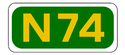
, the N74
bypasses Cashel
, the N76
bypasses Callan, the N77
forms the northern part of the Kilkenny
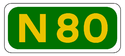
ring road, the N80
bypasses Carlow
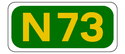
and the N85 bypasses Ennis. The former N8 bypass of Mitchelstown
was re-classified as the N73
when the Fermoy
(Moorepark) to Kilbehenny section of the M8
was completed.
Most national secondary roads were originally Trunk Roads under the old system of road classification
in the Republic of Ireland, although some sections of national secondary routes were formerly Link Roads. A large number of less important Trunk Roads became regional roads when the road classification system changed from 1977 onwards, including some roads, such as the N72
between Killarney
and Killorglin
, the N86
and the N87
, which were originally re-classified as regional roads but later re-classified again as national secondary routes. In 1994, three national secondary roads were reclassified as national primary roads: the N57 between Swinford
and Ballina
became the N26, the N64 between Oranmore
and Claregalway
became part of the N18 and the N79 between New Ross
and Enniscorthy
became the N30. In addition, a section of the N60
between Castlebar
and Westport
became part of the N5.
Some national secondary roads, though not arterial routes between major cities, connect scenic areas to major population centres. For example, the N59
through County Galway
and County Mayo
, the N70
road through County Kerry
(see Ring of Kerry
) and the N71 through West Cork
. For this reason, many national secondary roads are well-travelled by tourists.
Republic of Ireland
Ireland , described as the Republic of Ireland , is a sovereign state in Europe occupying approximately five-sixths of the island of the same name. Its capital is Dublin. Ireland, which had a population of 4.58 million in 2011, is a constitutional republic governed as a parliamentary democracy,...
. These roads form an important part of the national route network, but are secondary to the main arterial routes which are classified as national primary road
National primary road
A national primary road is a road classification in the Republic of Ireland. National primary roads form the major routes between the major urban centres. There are over 2,700km of national primary roads. This category of road has the prefix "N" followed by one or two digits...
s. National secondary roads are designated with route numbers higher than those used for primary roads, but with the same "N" prefix. Routes N51
N51 road (Ireland)
The N51 road is a national secondary road in Ireland.West to east, it starts in Delvin, County Westmeath at a junction with the N52. It passes through Athboy, a junction with M3 motorway, Navan and Slane, all in County Meath, before crossing the M1 motorway and terminating near Drogheda in County...
and higher are all national secondary roads.
National secondary roads have a default speed limit
Road speed limits in the Republic of Ireland
Road speed limits in the Republic of Ireland apply on all public roads in the country. These are signposted and legislated for in kilometres per hour. Speed limits are demarcated by regulatory road signs . These consist of white circular signs with a red outline. Speed limits are marked in black...
of 100km/h (62.5 mph), as along with national primary routes, they fall into the speed limit category of national roads.
There are 2684km of national secondary roads in Ireland, making up slightly less than 50% of the entire national route (national primary and national secondary) network. National secondary routes are generally more poorly maintained than primary routes (although their quality can vary widely), but often carry more traffic than regional roads
Regional road
A regional road in Ireland is a class of road not forming a major route , but nevertheless forming a link in the national route network. There are over 11,600 kilometres of regional roads. Regional roads are numbered with three digit route numbers, prefixed by "R" A regional road in Ireland is a...
. Almost the entire network of national secondary roads is single carriageway
Single carriageway
A single carriageway is a road with 1, 2 or more lanes arranged within a single carriageway with no central reservation to separate opposing flows of traffic. Two-lane road or two-lane highway are single carriageway with one lane for each direction...
, although there are some short sections of dual carriageway
Dual carriageway
A dual carriageway is a class of highway with two carriageways for traffic travelling in opposite directions separated by a central reservation...
on the Tallaght
Tallaght
Tallaght is the largest town, and county town, of South Dublin County, Ireland. The village area, dating from at least the 17th century, held one of the earliest settlements known in the southern part of the island, and one of medieval Ireland's more important monastic centres.Up to the 1960s...
bypass section of the N81, on the N52
N52 road (Ireland)
The N52 road is a national secondary road in Ireland. It links the M7 motorway from just south of Nenagh, County Tipperary to the M1 motorway north of Dundalk in County Louth.The road is long.-Quality of Road:...
at Dundalk
Dundalk
Dundalk is the county town of County Louth in Ireland. It is situated where the Castletown River flows into Dundalk Bay. The town is close to the border with Northern Ireland and equi-distant from Dublin and Belfast. The town's name, which was historically written as Dundalgan, has associations...
, on the N85
N85 road (Ireland)
The N85 road is a national secondary road in Ireland connecting Ennis and Ennistymon. The route connects to the M18 Ennis bypass and forms part of the Ennis outer ring road as the "N85 Western Relief Road". From Ennis the route continues in a north - west direction and terminates at the junction...
at Ennis
Ennis
Ennis is the county town of Clare in Ireland. Situated on the River Fergus, it lies north of Limerick and south of Galway. Its name is a shortening of the original ....
, on the N62
N62 road (Ireland)
The N62 road is a national secondary road in Ireland. It links the M6 motorway east of Athlone, County Westmeath with junction 6 of the M8 motorway south-east of Thurles in County Tipperary...
at Athlone and on the N71
N71 road (Ireland)
-Road standard:The road is mostly relatively poor single carriageway, with better sections towards the Cork end of the route. There are wide sections with climbing/passing lanes, including a very rare configuration with a passing lane on both sides, and a dual carriageway section approaching...
between Cork and Bandon
Bandon, County Cork
Bandon is a town in County Cork, Ireland. With a population of 5,822 as of census 2006, Bandon lies on the River Bandon between two hills. The name in Irish means "Bridge of the Bandon", a reference to the origin of the town as a crossing-point on the river. In 2004 Bandon celebrated its...
. Typically, national secondary roads are of a similar standard or higher than regional roads although some are of lower quality than the better sections of regional roads. Many of them have been resurfaced with higher quality pavements in recent years with relatively smooth surfaces and good road markings and signposting
Road signs in the Republic of Ireland
Road signs in Ireland mostly differ from the traffic signs used elsewhere in Europe. Directional signage is similar to that of the United Kingdom, but is bilingual. Distances are in kilometres. Apart from directional signage, the basic prohibitory signs such as "no left turn" and "no right turn"...
. However, road widths and alignments are often inadequate, with many narrow and winding sections.
National secondary roads generally do not bypass towns on their routes although there are a number of exceptions: the N52 bypasses Nenagh
Nenagh
Nenagh is the county town of North Tipperary in Ireland. It is the administrative centre of North Tipperary and in 2011 it had a recorded population of 7,995. It is a civil parish in the historical barony of Ormond Lower...
, Mullingar
Mullingar
Mullingar is the county town of County Westmeath in Ireland. The Counties of Meath and Westmeath Act of 1542, proclaimed Westmeath a county, separating it from Meath. Mullingar became the administrative centre for County Westmeath...
and the centre of Dundalk (as a relief road) with a further N52 bypass of Tullamore
Tullamore
Tullamore is a town in County Offaly, in the midlands of Ireland. It is Offaly's county town and the centre of the district.Tullamore is an important commercial and industrial centre in the region. Major international employers in the town include 'Tyco Healthcare' and 'Boston Scientific'. In...
planned, the N55
N55 road (Ireland)
The N55 road is a national secondary road in Ireland linking Athlone on the River Shannon in the centre of the country to Cavan town.-Route:...
(along with the N3) bypasses Cavan
Cavan
Cavan is the county town of County Cavan in the Republic of Ireland. The town lies in the north central part of Ireland, near the border with Northern Ireland...
, the N56
N56 road (Ireland)
The N56 road is a national secondary road in Ireland that runs from Donegal town to Letterkenny. As originally designated, it included the section of the N13 between Stranorlar and Letterkenny, forming a circular route including parts of the N15....
forms part of the Donegal
Donegal
Donegal or Donegal Town is a town in County Donegal, Ireland. Its name, which was historically written in English as Dunnagall or Dunagall, translates from Irish as "stronghold of the foreigners" ....
bypass, the N61
N61 road (Ireland)
The N61 road is a national secondary road in County Roscommon, Ireland, linking the N4, N5 and N6 national primary roads.-Route:Starting at Athlone , the road goes Northwards to Knockcroghery, Roscommon, Tulsk , and ends just North of Boyle at the N4....
and the N63
N63 road (Ireland)
The N63 road is a national secondary road in Ireland. It links the N17 northeast of Galway, to the N5 national primary road in Longford.En route it passes through Mountbellew, Roscommon Town, crosses the River Shannon at Lanesborough.The road is long....
bypass Roscommon
Roscommon
Roscommon is the county town of County Roscommon in Ireland. Its population at the 2006 census stood at 5,017 . The town is located near the junctions of the N60, N61 and N63 roads.-History:...
, the N71 bypasses Halfway
Halfway, County Cork
Halfway is a village in County Cork, in Ireland. Halfway got its name from being situated approximately half-way between Cork City and Bandon. However, with today's road infrastructure and the expansion of Cork city, Halfway is now actually closer to Cork than it is to Bandon.The village is...
and Skibbereen
Skibbereen
Skibbereen , is a town in County Cork, Ireland. It is the most southerly town in Ireland. It is located on the N71 national secondary road.The name "Skibbereen" means "little boat harbour." The River Ilen which runs through the town reaches the sea at Baltimore.-History:Prior to 1600 most of the...
, the N74
N74 road (Ireland)
The N74 road is a national secondary road in Ireland. It runs for its entire length in County Tipperary, east to west from Cashel to Tipperary town, passing through the villages of Golden, Thomastown and Kilfeakle.The N74 is in length...
bypasses Cashel
Cashel, County Tipperary
Cashel is a town in South Tipperary in Ireland. Its population was 2936 at the 2006 census. The town gives its name to the ecclesiastical province of Cashel. Additionally, the cathedra of the Roman Catholic Archdiocese of Cashel and Emly was originally in the town prior to the English Reformation....
, the N76
N76 road (Ireland)
The N76 road is a national secondary road in Ireland. It links the N10 national primary on the ring road south of Kilkenny, County Kilkenny to the N24 national primary route east of Clonmel in County Tipperary.The N76 is one of the oldest roads in Ireland...
bypasses Callan, the N77
N77 road (Ireland)
The N77 road is a national secondary road in Ireland. It links the N10 national primary on the ring road south of Kilkenny, County Kilkenny to the N8 national primary road at Durrow in County Laois.-Upgrades and Extensions:...
forms the northern part of the Kilkenny
Kilkenny
Kilkenny is a city and is the county town of the eponymous County Kilkenny in Ireland. It is situated on both banks of the River Nore in the province of Leinster, in the south-east of Ireland...
ring road, the N80
N80 road (Ireland)
The N80 road is a national secondary road in Ireland that runs southeastwards from its junction with the N52 and R443 in the town of Tullamore in County Offaly, to the N11 at Ballynahallin, just north of Enniscorthy in County Wexford, a distance of 116 km...
bypasses Carlow
Carlow
Carlow is the county town of County Carlow in Ireland. It is situated in the south-east of Ireland, 84 km from Dublin. County Carlow is the second smallest county in Ireland by area, however Carlow Town is the 14th largest urban area in Ireland by population according to the 2006 census. The...
and the N85 bypasses Ennis. The former N8 bypass of Mitchelstown
Mitchelstown
Mitchelstown is a town in County Cork, Ireland with a population of approximately 3300. Mitchelstown is situated in the valley to the south of the Galtee Mountains close to the Mitchelstown Caves and is 28 km from Cahir, 50 km from Cork and 59 km from Limerick...
was re-classified as the N73
N73 road (Ireland)
The N73 road is a national secondary road in Ireland. It is made up entirely of single carriageway with few overtaking opportunities and only a small amount of hard shoulder.-Route:...
when the Fermoy
Fermoy
Fermoy is a town in County Cork, Ireland. It is situated on the River Blackwater in the south of Ireland. Its population is some 5,800 inhabitants, environs included ....
(Moorepark) to Kilbehenny section of the M8
M8 motorway (Ireland)
The M8 motorway is an inter-urban motorway in Ireland, which forms part of the road from the capital - Dublin - to Cork city. The 149 km motorway commences in the townland of Aghaboe, County Laois and runs through the counties of Kilkenny, North Tipperary, South Tipperary and Limerick,...
was completed.
Most national secondary roads were originally Trunk Roads under the old system of road classification
Trunk Roads in Ireland
Ireland has an extensive network of public roads which connect all parts of the country with each other. Roads in Ireland are currently classified as motorways, National Primary routes, National secondary routes, Regional roads and Local roads. The introduction of this classification system began...
in the Republic of Ireland, although some sections of national secondary routes were formerly Link Roads. A large number of less important Trunk Roads became regional roads when the road classification system changed from 1977 onwards, including some roads, such as the N72
N72 road (Ireland)
The N72 road is a national secondary road in Ireland that runs east-west from its junction with the N25 near Dungarvan in County Waterford to the N70 in Killorglin in County Kerry....
between Killarney
Killarney
Killarney is a town in County Kerry, southwestern Ireland. The town is located north of the MacGillicuddy Reeks, on the northeastern shore of the Lough Lein/Leane which are part of Killarney National Park. The town and its surrounding region are home to St...
and Killorglin
Killorglin
Killorglin is a town in County Kerry, Ireland. It is located on the river Laune, which has a rowing club and a new boathouse. The population of Killorglin is 4,150 although this expands considerably during Puck Fair due to visitors and returning emigrants.Killorglin is a major activity centre...
, the N86
N86 road (Ireland)
The N86 road is a national secondary road in County Kerry, Ireland. It runs from Tralee to Dingle and passes though Annascaul and Lispole en route. It is in length. It has, in recent years, seen significant improvements to certain stretches of road....
and the N87
N87 road (Ireland)
-Route:Belturbet – Ballyconnell – Swanlinbar – -See also:*Roads in Ireland*Motorways in Ireland*National primary road*Regional road-References:* – Department of Transport...
, which were originally re-classified as regional roads but later re-classified again as national secondary routes. In 1994, three national secondary roads were reclassified as national primary roads: the N57 between Swinford
Swinford
Swinford, historically called Swineford , is a town in County Mayo, Ireland. It is surrounded by the settlements of Midfield, Meelick, Culmore, Cloonaghboy, Killasser and other villages. It is on the N5 road, located 18 km from Ireland West Airport Knock...
and Ballina
Ballina, County Mayo
Ballina is a large town in north County Mayo in Ireland. It lies at the mouth of the River Moy near Killala Bay, in the Moy valley and Parish of Kilmoremoy, with the Ox Mountain range to the east and the Nephin Beg mountains to the west...
became the N26, the N64 between Oranmore
Oranmore
Oranmore is a village in County Galway on the outskirts of Galway city in Ireland. With its major housing developments, Oranmore is rapidly becoming a part of Galway's commuter or suburban belt...
and Claregalway
Claregalway
Claregalway is a village situated about 10 km from the city of Galway in County Galway, Ireland. Claregalway was founded on the banks of the River Clare, hence the derivation of its name: Baile Chláir na Gaillimhe meaning "town on the Clare, in Galway"...
became part of the N18 and the N79 between New Ross
New Ross
New Ross is a town located in southwest County Wexford, in the southeast of Ireland. In 2006 it had a population of 7,709 people, making it the third largest town in the county after Wexford and Enniscorthy.-History:...
and Enniscorthy
Enniscorthy
Enniscorthy is the second largest town in County Wexford, Ireland. The population of the town and environs is 9538. The Placenames Database of Ireland sheds no light on the origins of the town's name. It may refer either to the "Island of Corthaidh" or the "Island of Rocks". With a history going...
became the N30. In addition, a section of the N60
N60 road (Ireland)
The N60 road is a national secondary road in Ireland, linking Castlebar, County Mayo to Roscommon town. The quality of the road varies significantly, with County Roscommon having a better alignment. The worst section of the route is between Castlebar and Claremorris where some stretches are...
between Castlebar
Castlebar
Castlebar is the county town of, and at the centre of, County Mayo in Ireland. It is Mayo's largest town by population. The town's population exploded in the late 1990s, increasing by one-third in just six years, though this massive growth has slowed down greatly in recent years...
and Westport
Westport, County Mayo
Westport is a town in County Mayo, Ireland. It is situated on the west coast at the south-east corner of Clew Bay, an inlet of the Atlantic Ocean....
became part of the N5.
Some national secondary roads, though not arterial routes between major cities, connect scenic areas to major population centres. For example, the N59
N59 road (Ireland)
The N59 road is a national secondary road in Ireland. It commences in County Sligo, south of Sligo Town at the Belladrehid interchange with the N4 north of Ballysadare. The route circles around the west of Ireland, passing west from Sligo into County Mayo and through Ballina. The N59 continues...
through County Galway
County Galway
County Galway is a county in Ireland. It is located in the West Region and is also part of the province of Connacht. It is named after the city of Galway. Galway County Council is the local authority for the county. There are several strongly Irish-speaking areas in the west of the county...
and County Mayo
County Mayo
County Mayo is a county in Ireland. It is located in the West Region and is also part of the province of Connacht. It is named after the village of Mayo, which is now generally known as Mayo Abbey. Mayo County Council is the local authority for the county. The population of the county is 130,552...
, the N70
N70 road (Ireland)
The N70 road is a national secondary road in Ireland. It comprises most of the Ring of Kerry.-Route: – Sneem – Castlecove – Caherdaniel – Waterville – Cahersiveen – Killorglin – – Milltown – Castlemaine – – Tralee.-See also:*Roads...
road through County Kerry
County Kerry
Kerry means the "people of Ciar" which was the name of the pre-Gaelic tribe who lived in part of the present county. The legendary founder of the tribe was Ciar, son of Fergus mac Róich. In Old Irish "Ciar" meant black or dark brown, and the word continues in use in modern Irish as an adjective...
(see Ring of Kerry
Ring of Kerry
The Ring of Kerry is a tourist trail in County Kerry, south-western Ireland. The route covers the 179 km circular road , starting from Killarney, heading around the Iveragh Peninsula and passing through Kenmare, Sneem, Waterville, Cahersiveen and Killorglin...
) and the N71 through West Cork
West Cork
West Cork refers to a geographical area in south-west Ireland, lying within Ireland's largest county, County Cork. Traditionally a popular tourist destination, the area is seen as being distinct from the more populated northern or eastern parts of the county, as well as the more urban area of...
. For this reason, many national secondary roads are well-travelled by tourists.
List of national secondary roads
(XXXX) = Junction with road XXXX, e.g. (N21) = Junction with N21 road| National Secondary Roads in Ireland (31 December 2007) | ||
|---|---|---|
| Road Name | Description | Length |
| N51 N51 road (Ireland) The N51 road is a national secondary road in Ireland.West to east, it starts in Delvin, County Westmeath at a junction with the N52. It passes through Athboy, a junction with M3 motorway, Navan and Slane, all in County Meath, before crossing the M1 motorway and terminating near Drogheda in County... |
Drogheda Drogheda Drogheda is an industrial and port town in County Louth on the east coast of Ireland, 56 km north of Dublin. It is the last bridging point on the River Boyne before it enters the Irish Sea.... – Slane Slane Slane is a village in County Meath, in Ireland. The village stands on a steep hillside on the left bank of the River Boyne at the intersection of the N2 and the N51 . In 2006 Slane's population was 1,099, having grown from 823 in 2002. The population of the village and the surrounding rural area... (N2) – Navan Navan -People:Navan was the childhood home of Pierce Brosnan, who appeared in the television series Remington Steele and was the fifth film actor to play James Bond. TV personality Hector Ó hEochagáin, and comedians Dylan Moran and Tommy Tiernan also hail from Navan.... (N3) – Athboy Athboy Athboy , is a small agricultural town in County Meath in Ireland. It is located on the junction of the N51 and R154 roads. The town is located on the Yellow Ford River, in wooded country near the County Westmeath border.-History:... – Delvin Delvin Delvin is a small town in east County Westmeath, Ireland located on the N52 road at a junction with the N51 to Navan. The town is from Mullingar and is the setting of the book Valley of the Squinting Windows by Delvin native Brinsley MacNamara, described under the fictitious name of "Garradrimna"... (N52 to Mullingar Mullingar Mullingar is the county town of County Westmeath in Ireland. The Counties of Meath and Westmeath Act of 1542, proclaimed Westmeath a county, separating it from Meath. Mullingar became the administrative centre for County Westmeath... ) |
54.367 km (33.8 mi) |
| N52 N52 road (Ireland) The N52 road is a national secondary road in Ireland. It links the M7 motorway from just south of Nenagh, County Tipperary to the M1 motorway north of Dundalk in County Louth.The road is long.-Quality of Road:... |
(runs around the east of) Dundalk Dundalk Dundalk is the county town of County Louth in Ireland. It is situated where the Castletown River flows into Dundalk Bay. The town is close to the border with Northern Ireland and equi-distant from Dublin and Belfast. The town's name, which was historically written as Dundalgan, has associations... (N1) – Ardee Ardee Ardee is a town and townland in County Louth, Ireland. It is located at the intersection of the N2, N52, and N33 roads. Ardee is on the banks of the River Dee and is approximately 20 km from Dundalk, Drogheda, Slane and Carrickmacross... (N2, N33) – Kells Kells, County Meath Kells is a town in County Meath, Ireland. The town lies off the M3 motorway, from Navan and from Dublin. In recent years Kells has grown greatly with many Dublin commuters moving to the town.... (N3) – Delvin Delvin Delvin is a small town in east County Westmeath, Ireland located on the N52 road at a junction with the N51 to Navan. The town is from Mullingar and is the setting of the book Valley of the Squinting Windows by Delvin native Brinsley MacNamara, described under the fictitious name of "Garradrimna"... (N51) – Mullingar Mullingar Mullingar is the county town of County Westmeath in Ireland. The Counties of Meath and Westmeath Act of 1542, proclaimed Westmeath a county, separating it from Meath. Mullingar became the administrative centre for County Westmeath... – Tyrrellspass Tyrrellspass Tyrrellspass is a Georgian village in County Westmeath, Ireland. It is located 81 km from Dublin and is situated in the south of the county on the R446 road. Tyrrellspass won the Irish Tidy Towns Competition in 1969.-History:... (joins N6) Kilbeggan Kilbeggan -Geography:Kilbeggan is situated on the River Brosna, in the south of County Westmeath. It lies southeast of Lough Ennell, north of the boundary with County Offaly, about 9 kilometres north of Tullamore. Kilbeggan is surrounded by the gently rolling Esker Riada, the linear sand hills that stretch... – Durrow – Tullamore Tullamore Tullamore is a town in County Offaly, in the midlands of Ireland. It is Offaly's county town and the centre of the district.Tullamore is an important commercial and industrial centre in the region. Major international employers in the town include 'Tyco Healthcare' and 'Boston Scientific'. In... (N80 N80 road (Ireland) The N80 road is a national secondary road in Ireland that runs southeastwards from its junction with the N52 and R443 in the town of Tullamore in County Offaly, to the N11 at Ballynahallin, just north of Enniscorthy in County Wexford, a distance of 116 km... ) – Birr Birr Birr is a town in County Offaly, Ireland. Once called Parsonstown, after the Parsons family who were local landowners and hereditary Earls of Rosse. It is also a parish in the Roman Catholic Diocese of Killaloe.... (N62) – Borrisokane Borrisokane Borrisokane is a town in North Tipperary, Ireland. In 2006 it had a population of approximately 1,145. It is situated on the N52/N65 National secondary road between Nenagh and Portumna and the N52 between Nenagh and Birr. It is close to Lough Derg which is only 12 km to the west. It is a... (N65) – (N7 east of Nenagh Nenagh Nenagh is the county town of North Tipperary in Ireland. It is the administrative centre of North Tipperary and in 2011 it had a recorded population of 7,995. It is a civil parish in the historical barony of Ormond Lower... ) |
199.615 km (124 mi) |
 N53 N53N53 road (Ireland) The N53 road is a national secondary road in Ireland. The N53 meets the M1 Dublin-Belfast motorway to the west of Dundalk at junction 17.-Route:*Dundalk to Castleblayney... |
Dundalk Dundalk Dundalk is the county town of County Louth in Ireland. It is situated where the Castletown River flows into Dundalk Bay. The town is close to the border with Northern Ireland and equi-distant from Dublin and Belfast. The town's name, which was historically written as Dundalgan, has associations... to Castleblayney Castleblayney Castleblayney or Castleblaney is a town in County Monaghan, Ireland. The town has a population of about 3,000.Castleblayney lies near the border with County Armagh and is on the N2 road from Dublin to Derry... (a short section of the road becomes the A37 where it runs through County Armagh County Armagh -History:Ancient Armagh was the territory of the Ulaid before the fourth century AD. It was ruled by the Red Branch, whose capital was Emain Macha near Armagh. The site, and subsequently the city, were named after the goddess Macha... ) |
18.191 km (11.3 mi) |
| N54 N54 road (Ireland) The N54 road is a national secondary road in Ireland.-Route:*Monaghan – Clones – Butlersbridge near Cavan... |
Monaghan Monaghan Monaghan is the county town of County Monaghan in Ireland. Its population at the 2006 census stood at 7,811 . The town is located on the main road, the N2 road, from Dublin north to both Derry and Letterkenny.-Toponym:... (N2) – Clones Clones Clones is a small town in western County Monaghan, in the 'border area' of the Republic of Ireland. The area is part of the Border Region, earmarked for economic development by the Irish Government due to its currently below-average economic situation... – Cavan Cavan Cavan is the county town of County Cavan in the Republic of Ireland. The town lies in the north central part of Ireland, near the border with Northern Ireland... (N3) (a short section of the road becomes the A3 where it runs through County Fermanagh County Fermanagh Fermanagh District Council is the only one of the 26 district councils in Northern Ireland that contains all of the county it is named after. The district council also contains a small section of County Tyrone in the Dromore and Kilskeery road areas.... ) |
34.513 km (21.4 mi) |
| N55 N55 road (Ireland) The N55 road is a national secondary road in Ireland linking Athlone on the River Shannon in the centre of the country to Cavan town.-Route:... |
(N3 just outside Cavan Cavan Cavan is the county town of County Cavan in the Republic of Ireland. The town lies in the north central part of Ireland, near the border with Northern Ireland... ) – Granard Granard Granard is a town in the north of County Longford, Ireland and has a traceable history going back to 236 A.D.. It is situated just south of the boundary between the watersheds of the Shannon and the Erne, at the point where the N55 national secondary road and the R194 regional road... – Edgeworthstown Edgeworthstown Edgeworthstown or Mostrim is a town in County Longford, Ireland. The Edgeworthstown name is derived from the Edgeworth Family who have a long association with the town as the family estate of Henry Essex Edgeworth de Firmont was nearby, while Mostrim is an anglicisation of the town's pre-conquest... (N4) – (N6 Athlone ringroad) |
79.206 km (49.2 mi) |
 N56 N56N56 road (Ireland) The N56 road is a national secondary road in Ireland that runs from Donegal town to Letterkenny. As originally designated, it included the section of the N13 between Stranorlar and Letterkenny, forming a circular route including parts of the N15.... |
(N15 just east of Donegal Donegal Donegal or Donegal Town is a town in County Donegal, Ireland. Its name, which was historically written in English as Dunnagall or Dunagall, translates from Irish as "stronghold of the foreigners" .... ) – (R263 near Killybegs Killybegs Killybegs is the largest fishing port in County Donegal and in Ireland. It is located on the south coast of the county, north of Donegal Bay, near Donegal Town. The town is situated at the head of a scenic harbour and at the base of a vast mountainous tract extending northward... ) – Glenties Glenties Glenties is a village in the northwest of Ireland in central County Donegal. It is situated where two glens meet, northwest of the Blue Stack Mountains, near the confluence of two rivers. Glenties is the largest centre of population in the parish of Iniskeel... – Dungloe Dungloe Dungloe is a Gaeltacht town in County Donegal, Ireland. It is the main town in the Rosses and the largest in the Donegal Gaeltacht... – Gweedore Gweedore Gweedore is an Irish-speaking district located on the Atlantic coast of County Donegal, part of the Province of Ulster in Ireland. Gweedore stretches some 16 miles from Meenaclady in the north to Crolly in the south and around 9 miles from Dunlewey in the east to Magheraclogher in the west, and... – Dunfanaghy Dunfanaghy Dunfanaghy is a small village, formerly a fishing port and commercial centre, in County Donegal, Ireland.... – Letterkenny Letterkenny Letterkenny , with a population of 17,568, is the largest town in County Donegal, part of the Province of Ulster in Ireland. The town is located on the River Swilly... (N14) |
156.206 km (97.1 mi) |
 N58 N58N58 road (Ireland) The N58 road is a national secondary road in Ireland. It links the N26 national primary road at Foxford in Co Mayo to the N5 national primary road at Bellavary, 11km to the south... |
Foxford Foxford Foxford, historically called Bellasa , is a small village 16 km south of Ballina in County Mayo, Ireland. The village stands on the N26 national primary route from Swinford to Ballina and has a railway station served by trains between Dublin and Ballina.Situated between the Nephin and Ox... (N26) – (N5 between Swinford Swinford Swinford, historically called Swineford , is a town in County Mayo, Ireland. It is surrounded by the settlements of Midfield, Meelick, Culmore, Cloonaghboy, Killasser and other villages. It is on the N5 road, located 18 km from Ireland West Airport Knock... and Castlebar Castlebar Castlebar is the county town of, and at the centre of, County Mayo in Ireland. It is Mayo's largest town by population. The town's population exploded in the late 1990s, increasing by one-third in just six years, though this massive growth has slowed down greatly in recent years... ) |
11.273 km (7 mi) |
| N59 N59 road (Ireland) The N59 road is a national secondary road in Ireland. It commences in County Sligo, south of Sligo Town at the Belladrehid interchange with the N4 north of Ballysadare. The route circles around the west of Ireland, passing west from Sligo into County Mayo and through Ballina. The N59 continues... |
(N4 to Sligo Sligo Sligo is the county town of County Sligo in Ireland. The town is a borough and has a charter and a town mayor. It is sometimes referred to as a city, and sometimes as a town, and is the second largest urban area in Connacht... ) – Ballina Ballina, County Mayo Ballina is a large town in north County Mayo in Ireland. It lies at the mouth of the River Moy near Killala Bay, in the Moy valley and Parish of Kilmoremoy, with the Ox Mountain range to the east and the Nephin Beg mountains to the west... (N26) – Bangor Erris Bangor Erris Bangor Erris is a town in Kiltane parish in Erris, County Mayo, Ireland with a population of 500. It is on the banks of the Owenmore River and is the gateway to the Erris Peninsula linking Belmullet with Ballina and Westport, nestled at the foot of the "Bangor Trail" a 22-mile mountain pass across... – Rosturk – Westport Westport, County Mayo Westport is a town in County Mayo, Ireland. It is situated on the west coast at the south-east corner of Clew Bay, an inlet of the Atlantic Ocean.... (N5) – Clifden Clifden Clifden is a town on the coast of County Galway, Ireland and being Connemara's largest town, it is often referred to as "the Capital of Connemara". It is located on the Owenglen River where it flows into Clifden Bay... – Oughterard Oughterard Oughterard is a small town on the banks of the Owenriff River close to the western shore of Lough Corrib in County Galway, Ireland. The population of the town in 2006 was 1,305... – Moycullen Moycullen Moycullen Moycullen Moycullen (official name: Maigh Cuilinn, Plain of Holly, or Plain of Cullen (a local giant) is a suburban village in County Galway, Ireland, about 10 km (7 mi) north west of Galway city. It is located near Lough Corrib, on the N59 road to Oughterard and Clifden in... – Galway Galway Galway or City of Galway is a city in County Galway, Republic of Ireland. It is the sixth largest and the fastest-growing city in Ireland. It is also the third largest city within the Republic and the only city in the Province of Connacht. Located on the west coast of Ireland, it sits on the... (N6) |
296.683 km (184.4 mi) |
 N60 N60N60 road (Ireland) The N60 road is a national secondary road in Ireland, linking Castlebar, County Mayo to Roscommon town. The quality of the road varies significantly, with County Roscommon having a better alignment. The worst section of the route is between Castlebar and Claremorris where some stretches are... |
Castlebar Castlebar Castlebar is the county town of, and at the centre of, County Mayo in Ireland. It is Mayo's largest town by population. The town's population exploded in the late 1990s, increasing by one-third in just six years, though this massive growth has slowed down greatly in recent years... – Claremorris Claremorris Claremorris , is a town in County Mayo in the west of Ireland, at the junction of the N17 and the N60 national routes. The population of Claremoris in the 2011 Census was 3,979.... (N17) – Ballyhaunis Ballyhaunis Ballyhaunis is a town in County Mayo, Ireland. It is situated at the crossroads of the N60 and N83 National secondary roads and on the railway line connecting Dublin to Westport and Ballina.... – Castlerea Castlerea Castlerea is located in the west of County Roscommon, Ireland. It is the second largest town in the county with a population of 3,055 . Roughly translated from Irish, Castlerea can mean Brindled Castle or King's Castle... – Ballymoe Ballymoe Ballymoe is a village in County Galway, Ireland. Ballymoe is situated on the western side of the River Suck that separates counties Galway and Roscommon... – Roscommon Roscommon Roscommon is the county town of County Roscommon in Ireland. Its population at the 2006 census stood at 5,017 . The town is located near the junctions of the N60, N61 and N63 roads.-History:... |
92.282 km (57.3 mi) |
 N61 N61N61 road (Ireland) The N61 road is a national secondary road in County Roscommon, Ireland, linking the N4, N5 and N6 national primary roads.-Route:Starting at Athlone , the road goes Northwards to Knockcroghery, Roscommon, Tulsk , and ends just North of Boyle at the N4.... |
Athlone (N6) – Knockcroghery Knockcroghery Knockcroghery is a rural village in County Roscommon, Ireland. It is located on the N61 road between Athlone and Roscommon town, near Lough Ree on the River Shannon.-Name:... – Roscommon Roscommon Roscommon is the county town of County Roscommon in Ireland. Its population at the 2006 census stood at 5,017 . The town is located near the junctions of the N60, N61 and N63 roads.-History:... – Tulsk (N5) – Boyle Boyle, County Roscommon Boyle is a town in County Roscommon, Ireland. It is located at the foot of the Curlew Mountains near Lough Key in the north of the county. Carrowkeel Megalithic Cemetery, the Drumanone Dolmen and the popular fishing lakes of Lough Arrow and Lough Gara are also close by... (N4) |
74.752 km (46.4 mi) |
 N62 N62N62 road (Ireland) The N62 road is a national secondary road in Ireland. It links the M6 motorway east of Athlone, County Westmeath with junction 6 of the M8 motorway south-east of Thurles in County Tipperary... |
N6 near Athlone to M8 M8 motorway (Ireland) The M8 motorway is an inter-urban motorway in Ireland, which forms part of the road from the capital - Dublin - to Cork city. The 149 km motorway commences in the townland of Aghaboe, County Laois and runs through the counties of Kilkenny, North Tipperary, South Tipperary and Limerick,... at Horse and Jockey Horse and Jockey Horse and Jockey is a village in North Tipperary, Ireland. It lies on the R639 road, where it meets the N62 road to Thurles. It lies just off junction 6 of the M8 motorway, which by-passed the village in December 2008... ) N6 – Ferbane Ferbane Ferbane is a small town on the north bank of the River Brosna in County Offaly, Ireland, between Birr and Athlone at the junction of the N62 National secondary road and the R436 regional road... – Cloghan – Birr Birr Birr is a town in County Offaly, Ireland. Once called Parsonstown, after the Parsons family who were local landowners and hereditary Earls of Rosse. It is also a parish in the Roman Catholic Diocese of Killaloe.... – Roscrea Roscrea Roscrea is a small heritage town in North Tipperary, Ireland. The town has a population of 4,910. Its main industries include meat processing and pharmaceuticals. It is a civil parish in the historical barony of Ikerrin... – Templemore Templemore Templemore is a town in North Tipperary, Ireland. It is a civil parish in the historical barony of Eliogarty. It is part of the Roman Catholic parish of Templemore, Clonmore and Killea.... – Thurles Thurles Thurles is a town situated in North Tipperary, Ireland. It is a civil parish in the historical barony of Eliogarty and is also an ecclesiastical parish in the Roman Catholic Archdiocese of Cashel and Emly... – Horse and Jockey Horse and Jockey Horse and Jockey is a village in North Tipperary, Ireland. It lies on the R639 road, where it meets the N62 road to Thurles. It lies just off junction 6 of the M8 motorway, which by-passed the village in December 2008... (M8 M8 motorway (Ireland) The M8 motorway is an inter-urban motorway in Ireland, which forms part of the road from the capital - Dublin - to Cork city. The 149 km motorway commences in the townland of Aghaboe, County Laois and runs through the counties of Kilkenny, North Tipperary, South Tipperary and Limerick,... ) |
93.648 km (58.2 mi) |
| N63 N63 road (Ireland) The N63 road is a national secondary road in Ireland. It links the N17 northeast of Galway, to the N5 national primary road in Longford.En route it passes through Mountbellew, Roscommon Town, crosses the River Shannon at Lanesborough.The road is long.... |
(N63 Galway city to Longford town) Galway Galway Galway or City of Galway is a city in County Galway, Republic of Ireland. It is the sixth largest and the fastest-growing city in Ireland. It is also the third largest city within the Republic and the only city in the Province of Connacht. Located on the west coast of Ireland, it sits on the... – Claregalway Claregalway Claregalway is a village situated about 10 km from the city of Galway in County Galway, Ireland. Claregalway was founded on the banks of the River Clare, hence the derivation of its name: Baile Chláir na Gaillimhe meaning "town on the Clare, in Galway"... – Lackagh Lackagh The parish of Lackagh or Lacagh is located in County Galway in the West of Ireland, approximately half way between Galway city and Tuam . It is bounded by the parishes of Athenry, Abbeyknockmoy, Corofin, Annaghdown and Claregalway... – Turloughmore Turloughmore Turloughmore is a village in County Galway, Ireland. The name means "the large lake," a notable feature of the area, together with the Clare River .... – Abbeyknockmoy Abbeyknockmoy Abbeyknockmoy is a village and parish in County Galway, Ireland. It is best known for the nearby ruins of the 12th century Cistercian abbey, established with the Kings of Connacht as its benefactors. The abbey was the burial site of King Cathal Crobhdearg Ua Conchobair and contains fine examples... – Moylough Moylough Moylough is a small rural village located in County Galway in Ireland. It is located on the N63 national secondary road , and is served also by the R328 and R364 regional roads. It is 50 km from Galway, 30 km from Roscommon, and 5 km northwest of Mountbellew... – Mountbellew Mountbellew Mountbellew or Mountbellew Bridge is a village in County Galway, Ireland. It lies mostly within the townland of Treanrevagh on the N63 national primary road.... – Newbridge Newbridge, County Galway Newbridge is a small rural village located in County Galway in Ireland. It is located on a National secondary road, the N63 Galway City - Longford and is 55 km from Galway City and 25 km from Roscommon Town.... – Ballygar Ballygar Ballygar is a town in County Galway, Ireland. It is 11.7 km from Roscommon town.- Ballygar - A timeline :The name Ballygar, historically Beallagarr, comes from... – Mount Talbot Mount Talbot Mount Talbot is located on the border of Alberta and British Columbia. It was named in 1923 after Talbot, F.A..-See also:* List of peaks on the British Columbia-Alberta border* Mountains of Alberta* Mountains of British Columbia... – Athleague – Roscommon Roscommon Roscommon is the county town of County Roscommon in Ireland. Its population at the 2006 census stood at 5,017 . The town is located near the junctions of the N60, N61 and N63 roads.-History:... – Lanesborough-Ballyleague Lanesborough-Ballyleague Lanesborough and Ballyleague is a town composed of two villages in the midlands of Ireland. Lanesborough is on the County Longford side and Ballyleague on the County Roscommon side of the River Shannon... – Longford Longford Longford is the county town of County Longford in Ireland. It has a population of 7,622 according to the 2006 census. Approximately one third of the county's population resides in the town. Longford town is also the biggest town in the county... (N5) |
94.733 km (58.9 mi) |
 N65 N65N65 road (Ireland) The N65 road is a national secondary road in Ireland. It links the N52 at Borrisokane, County Tipperary to the M6 north of Loughrea in County Galway.En route it crosses the River Shannon at Portumna.The road is long.-See also:*Roads in Ireland... |
N6 near Loughrea Loughrea Loughrea is a town in County Galway, Ireland. The town lies north of a range of wooded hills, the Slieve Aughty Mountains.The town expanded in recent years as it increasingly becomes a commuter town for the city of Galway.- Name :... to N52 N52 road (Ireland) The N52 road is a national secondary road in Ireland. It links the M7 motorway from just south of Nenagh, County Tipperary to the M1 motorway north of Dundalk in County Louth.The road is long.-Quality of Road:... at Borrisokane Borrisokane Borrisokane is a town in North Tipperary, Ireland. In 2006 it had a population of approximately 1,145. It is situated on the N52/N65 National secondary road between Nenagh and Portumna and the N52 between Nenagh and Birr. It is close to Lough Derg which is only 12 km to the west. It is a... ; crossing the River Shannon River Shannon The River Shannon is the longest river in Ireland at . It divides the west of Ireland from the east and south . County Clare, being west of the Shannon but part of the province of Munster, is the major exception... at Portumna Portumna Portumna is a market town in the south-east of County Galway, Ireland, on the border with County Tipperary. The town is located to the west of the point where the River Shannon enters Lough Derg. This historic crossing point over the River Shannon between counties Tipperary and Galway has a long... |
40.53 km (25.2 mi) |
 N66 N66N66 road (Ireland) The N66 road is a national secondary road in Ireland. It links the M18 at Gort, County Galway to the N65 outside Loughrea. The N65 continues north and forms an interchange with the M6... |
N6 near Loughrea Loughrea Loughrea is a town in County Galway, Ireland. The town lies north of a range of wooded hills, the Slieve Aughty Mountains.The town expanded in recent years as it increasingly becomes a commuter town for the city of Galway.- Name :... to N18 at Gort Gort Gort is a town in south County Galway in the west of Ireland. An Gort is the official Irish name for the town, as defined by the Placenames Commission. In spoken Irish, however, the town is known by its traditional name Gort Inse Guaire. It lies just north of the border with County Clare on the... |
24.659 km (15.3 mi) |
 N67 N67N67 road (Ireland) The N67 road is a national secondary road in Ireland. It runs from Kilcolgan to Tarbert and passes though Kinvara, Ballyvaughan, Lisdoonvarna, Ennistymon, Lahinch, Miltown Malbay, Quilty, Doonbeg and Kilkee.-See also:*Roads in Ireland*Motorways in Ireland... |
Kilcolgan Kilcolgan Kilcolgan , is a village on the mouth of the Kilcolgan River at Dunkellin Bay in County Galway, Ireland. The N18 passes through the settlement. There are also two public houses, Donoghue's and Raftery's Rest... – Kinvara Kinvara Kinvara is a sea port village located in the south of County Galway in the province of Connacht on the west coast of Ireland. Kinvara is also the name of the parish in which the village is situated. Kinvara is occasionally spelled Kinvarra in English; this may be seen on some maps and road signs,... – Ballyvaughan Ballyvaughan Ballyvaughan or Ballyvaghan is a small harbour village in County Clare, Ireland. It is located on the south shores of Galway Bay, in the northwest corner of The Burren, an area of great rocky expanse, considered by many to be a unique landscape.... – Lisdoonvarna – Ennistymon (N85 N85 road (Ireland) The N85 road is a national secondary road in Ireland connecting Ennis and Ennistymon. The route connects to the M18 Ennis bypass and forms part of the Ennis outer ring road as the "N85 Western Relief Road". From Ennis the route continues in a north - west direction and terminates at the junction... ) – Kilkee Kilkee Kilkee is a small coastal town in County Clare, Ireland. It is located midway between Kilrush and Doonbeg on the N67 road. The town, one of the most famous resorts in Ireland, is particularly popular as a seaside resort with people from Limerick City... – Kilrush Kilrush Kilrush is a coastal town in County Clare, Ireland. It is located near the mouth of the River Shannon in the south-west of the county. Kilrush is a town of great historical significance, being one of the listed Heritage Towns of Ireland.-History:... (N68 N68 road (Ireland) The N68 road is a national secondary road in Ireland. It runs from Ennis to Kilrush. It is entirely in County Clare.-See also:*Roads in Ireland*Motorways in Ireland*National primary road*Regional road-References:* – Department of Transport... ) – (ferry pier near Killimer) (ferry pier near Tarbert Tarbert, County Kerry Tarbert is a town in the north of County Kerry, with woodland to the south and the Shannon estuary to the north. It lies on the N69 coast road that runs along the estuary from Limerick before turning inland at Tarbert towards Listowel, and has two schools Tarbert Primary and Tarbert... ) – Tarbert (N69 N69 road (Ireland) The N69 road is a national secondary road in Ireland. It runs from Limerick to Tralee and passes though Mungret, Clarina, Kildimo, Askeaton , Foynes, Loughill, Glin, Tarbert and Listowel.-References:* – Department of Transport... ) |
128.781 km (80 mi) |
 N68 N68N68 road (Ireland) The N68 road is a national secondary road in Ireland. It runs from Ennis to Kilrush. It is entirely in County Clare.-See also:*Roads in Ireland*Motorways in Ireland*National primary road*Regional road-References:* – Department of Transport... |
Kilrush Kilrush Kilrush is a coastal town in County Clare, Ireland. It is located near the mouth of the River Shannon in the south-west of the county. Kilrush is a town of great historical significance, being one of the listed Heritage Towns of Ireland.-History:... to Ennis Ennis Ennis is the county town of Clare in Ireland. Situated on the River Fergus, it lies north of Limerick and south of Galway. Its name is a shortening of the original .... |
40.865 km (25.4 mi) |
 N69 N69N69 road (Ireland) The N69 road is a national secondary road in Ireland. It runs from Limerick to Tralee and passes though Mungret, Clarina, Kildimo, Askeaton , Foynes, Loughill, Glin, Tarbert and Listowel.-References:* – Department of Transport... |
Dock Road (Limerick Limerick Limerick is the third largest city in the Republic of Ireland, and the principal city of County Limerick and Ireland's Mid-West Region. It is the fifth most populous city in all of Ireland. When taking the extra-municipal suburbs into account, Limerick is the third largest conurbation in the... ) – Mungret – Clarina – Kildimo Kildimo Kildimo is a village in County Limerick, Ireland. The village is located on the N69 National Route about 13 km west of Limerick city close to the River Shannon estuary.... – (Askeaton Askeaton Askeaton is a town in County Limerick, Ireland. Located on the N69, the town is built on the banks of the River Deel some 3 km upstream from the estuary of the River Shannon. There is also a secondary school in Askeaton... ) – Foynes Foynes Foynes is a village and major port in County Limerick in the midwest of Ireland, located at the edge of hilly land on the southern bank of the Shannon Estuary. The population of the town was 606 as of the 2006 census.-Foynes's role in aviation:... – Tarbert Tarbert, County Kerry Tarbert is a town in the north of County Kerry, with woodland to the south and the Shannon estuary to the north. It lies on the N69 coast road that runs along the estuary from Limerick before turning inland at Tarbert towards Listowel, and has two schools Tarbert Primary and Tarbert... (N67 N67 road (Ireland) The N67 road is a national secondary road in Ireland. It runs from Kilcolgan to Tarbert and passes though Kinvara, Ballyvaughan, Lisdoonvarna, Ennistymon, Lahinch, Miltown Malbay, Quilty, Doonbeg and Kilkee.-See also:*Roads in Ireland*Motorways in Ireland... ) – Listowel – Tralee (N70 N70 road (Ireland) The N70 road is a national secondary road in Ireland. It comprises most of the Ring of Kerry.-Route: – Sneem – Castlecove – Caherdaniel – Waterville – Cahersiveen – Killorglin – – Milltown – Castlemaine – – Tralee.-See also:*Roads... , N86 N86 road (Ireland) The N86 road is a national secondary road in County Kerry, Ireland. It runs from Tralee to Dingle and passes though Annascaul and Lispole en route. It is in length. It has, in recent years, seen significant improvements to certain stretches of road.... , N21) |
101.273 km (62.9 mi) |
 N70 N70N70 road (Ireland) The N70 road is a national secondary road in Ireland. It comprises most of the Ring of Kerry.-Route: – Sneem – Castlecove – Caherdaniel – Waterville – Cahersiveen – Killorglin – – Milltown – Castlemaine – – Tralee.-See also:*Roads... |
(Comprises most of the Ring of Kerry Ring of Kerry The Ring of Kerry is a tourist trail in County Kerry, south-western Ireland. The route covers the 179 km circular road , starting from Killarney, heading around the Iveragh Peninsula and passing through Kenmare, Sneem, Waterville, Cahersiveen and Killorglin... ) - (N70 Killarney Road at Kenmare Kenmare Kenmare is a small town in the south of County Kerry, Ireland. The name Kenmare is the anglicised form of Ceann Mara meaning "head of the sea", referring to the head of Kenmare Bay.-Location:... ) – Sneem Sneem Sneem is a town situated on the Iveragh Peninsula in County Kerry in the southwest of Ireland. It lies on the estuary of the River Sneem. National route N70 runs through the town.... – Castlecove Castlecove Castlecove is a village in County Kerry, Ireland, located on the Iveragh peninsula on the N70 road which forms part of the Ring of Kerry. It is situated on the southwestern side of the peninsula... – Caherdaniel – Waterville Waterville, County Kerry Waterville, historically known as Carrean , is a village in County Kerry, Ireland, on the Iveragh peninsula. The town is sited on a narrow isthmus, with Lough Currane on the east side of the town, and Ballinskelligs Bay on the west, and the Currane River connecting the two.The town's name in Irish... – Cahersiveen Cahirciveen Cahersiveen —alternate spellings Cahirsiveen, Cahirciveen or Caherciveen—is a town in County Kerry, Ireland. It is located on the Iveragh Peninsula near Valentia Island. Cahersiveen is connected to the Irish road network by the N70 national secondary route... – Killorglin Killorglin Killorglin is a town in County Kerry, Ireland. It is located on the river Laune, which has a rowing club and a new boathouse. The population of Killorglin is 4,150 although this expands considerably during Puck Fair due to visitors and returning emigrants.Killorglin is a major activity centre... – (N72 N72 road (Ireland) The N72 road is a national secondary road in Ireland that runs east-west from its junction with the N25 near Dungarvan in County Waterford to the N70 in Killorglin in County Kerry.... ) – Milltown Milltown, County Kerry Milltown is a small town on the N70 national secondary road between major towns Tralee and Killarney in County Kerry, Ireland.Milltown stands roughly four miles from Killorglin. Milltown is packed with seven pubs, two take-away restaurants, a vet, a butchers shop, a local church, three schools and... – Castlemaine Castlemaine, County Kerry Castlemaine is a small town in County Kerry, southwest Ireland. It lies on the N70 national secondary road between Killorglin and Tralee.-History:... – (N86 N86 road (Ireland) The N86 road is a national secondary road in County Kerry, Ireland. It runs from Tralee to Dingle and passes though Annascaul and Lispole en route. It is in length. It has, in recent years, seen significant improvements to certain stretches of road.... ) – (N21, N69 N69 road (Ireland) The N69 road is a national secondary road in Ireland. It runs from Limerick to Tralee and passes though Mungret, Clarina, Kildimo, Askeaton , Foynes, Loughill, Glin, Tarbert and Listowel.-References:* – Department of Transport... ) Tralee |
142.654 km (88.6 mi) |
 N71 N71N71 road (Ireland) -Road standard:The road is mostly relatively poor single carriageway, with better sections towards the Cork end of the route. There are wide sections with climbing/passing lanes, including a very rare configuration with a passing lane on both sides, and a dual carriageway section approaching... |
(N22) Cork Cork (city) Cork is the second largest city in the Republic of Ireland and the island of Ireland's third most populous city. It is the principal city and administrative centre of County Cork and the largest city in the province of Munster. Cork has a population of 119,418, while the addition of the suburban... (Wilton Road, Bishopstown Road, Bandon Road) – Halfway Halfway, County Cork Halfway is a village in County Cork, in Ireland. Halfway got its name from being situated approximately half-way between Cork City and Bandon. However, with today's road infrastructure and the expansion of Cork city, Halfway is now actually closer to Cork than it is to Bandon.The village is... bypass – Innishannon Innishannon Innishannon or Inishannon , is a large village on the main Cork–Bandon road in County Cork, Province of Munster, Ireland. Situated on the River Bandon, the village has rapidly grown in recent years due to its proximity to Cork, and has now become a dormitory town for city workers.The... – Bandon Bandon, County Cork Bandon is a town in County Cork, Ireland. With a population of 5,822 as of census 2006, Bandon lies on the River Bandon between two hills. The name in Irish means "Bridge of the Bandon", a reference to the origin of the town as a crossing-point on the river. In 2004 Bandon celebrated its... – Ballinascarty – Clonakilty Clonakilty Clonakilty , often referred to by locals simply as Clon, is a small town on the N71 national secondary road in West County Cork, Ireland, approximately 45 minutes away by road to the west of Cork City. The town is on the southern coast of the island, and is surrounded by hilly country devoted... – Rosscarbery Rosscarbery Rosscarbery or Roscarbery is a town in County Cork, Ireland. The town is on a shallow estuary, which opens onto Rosscarbery Bay.-History:... – Leap – Skibbereen Skibbereen Skibbereen , is a town in County Cork, Ireland. It is the most southerly town in Ireland. It is located on the N71 national secondary road.The name "Skibbereen" means "little boat harbour." The River Ilen which runs through the town reaches the sea at Baltimore.-History:Prior to 1600 most of the... – (R592 to Ballydehob Ballydehob Ballydehob is a coastal village in the southwest of County Cork, Ireland, located on the N71 national secondary road.-History:Ballydehob is a microcosm of Irish local history, and legends and folklore abound in the locality. At the dawn of the Bronze Age , copper was mined on Mount Gabriel, just... ) – Bantry Bantry Bantry is a town on the coast of County Cork, Ireland. It lies on the N71 national secondary road at the head of Bantry Bay, a deep-water gulf extending for 30 km to the west... – Ballylickey Ballylickey Ballylickey or Ballylicky is a village on the N71 national secondary road near Bantry, County Cork, Ireland. The River Ovane flows into Bantry Bay at Ballylickey.-Tourism:* The area is notable for the Seaview Hotel.... – Glengarriff Glengarriff Glengarriff is a village of approximately 800 people on the N71 national secondary road in the south-west region of County Cork, Ireland. Known internationally as a tourism venue, it boasts many natural attractions... – Kenmare Kenmare Kenmare is a small town in the south of County Kerry, Ireland. The name Kenmare is the anglicised form of Ceann Mara meaning "head of the sea", referring to the head of Kenmare Bay.-Location:... – (N70 N70 road (Ireland) The N70 road is a national secondary road in Ireland. It comprises most of the Ring of Kerry.-Route: – Sneem – Castlecove – Caherdaniel – Waterville – Cahersiveen – Killorglin – – Milltown – Castlemaine – – Tralee.-See also:*Roads... ) – Muckross Muckross Muckross may refer to various places in Ireland:* Muckross Estate, now Killarney National Park, County Kerry; including** Muckross Abbey** Muckross House** Muckross Lake, one of the Lakes of Killarney* Muckross Head, County Donegal... – Killarney Killarney Killarney is a town in County Kerry, southwestern Ireland. The town is located north of the MacGillicuddy Reeks, on the northeastern shore of the Lough Lein/Leane which are part of Killarney National Park. The town and its surrounding region are home to St... (N22, N72 N72 road (Ireland) The N72 road is a national secondary road in Ireland that runs east-west from its junction with the N25 near Dungarvan in County Waterford to the N70 in Killorglin in County Kerry.... ) |
188.089 km (116.9 mi) |
 N72 N72N72 road (Ireland) The N72 road is a national secondary road in Ireland that runs east-west from its junction with the N25 near Dungarvan in County Waterford to the N70 in Killorglin in County Kerry.... |
Killorglin Killorglin Killorglin is a town in County Kerry, Ireland. It is located on the river Laune, which has a rowing club and a new boathouse. The population of Killorglin is 4,150 although this expands considerably during Puck Fair due to visitors and returning emigrants.Killorglin is a major activity centre... – Killarney Killarney Killarney is a town in County Kerry, southwestern Ireland. The town is located north of the MacGillicuddy Reeks, on the northeastern shore of the Lough Lein/Leane which are part of Killarney National Park. The town and its surrounding region are home to St... (N22) – Rathmore – Mallow Mallow, County Cork Mallow is the "Crossroads of Munster" and the administrative capital of north County Cork, in Ireland. The Northern Divisional Offices of Cork County Council are located in the town.... (N20) – Fermoy Fermoy Fermoy is a town in County Cork, Ireland. It is situated on the River Blackwater in the south of Ireland. Its population is some 5,800 inhabitants, environs included .... (N8) – Lismore Lismore, County Waterford Lismore is a town in County Waterford, Ireland. It is located where the N72 road crosses the River Blackwater.-History:It was founded by Saint Mochuda, also known as Saint Carthage. In the 7th century, Lismore was the site of the well-known Lismore Abbey. It is also home to Lismore Castle, the... – Dungarvan Dungarvan Dungarvan is a town and harbour on the south coast of Ireland in the province of Munster. Dungarvan is the county town and administrative centre of County Waterford. The town's Irish name means "Garbhan's fort", referring to Saint Garbhan who founded a church there in the seventh century... (N25) |
166.124 km (103.2 mi) |
 N73 N73N73 road (Ireland) The N73 road is a national secondary road in Ireland. It is made up entirely of single carriageway with few overtaking opportunities and only a small amount of hard shoulder.-Route:... |
Mitchelstown Mitchelstown Mitchelstown is a town in County Cork, Ireland with a population of approximately 3300. Mitchelstown is situated in the valley to the south of the Galtee Mountains close to the Mitchelstown Caves and is 28 km from Cahir, 50 km from Cork and 59 km from Limerick... (N8) – (N72 N72 road (Ireland) The N72 road is a national secondary road in Ireland that runs east-west from its junction with the N25 near Dungarvan in County Waterford to the N70 in Killorglin in County Kerry.... east of Mallow Mallow, County Cork Mallow is the "Crossroads of Munster" and the administrative capital of north County Cork, in Ireland. The Northern Divisional Offices of Cork County Council are located in the town.... ) |
28.172 km (17.5 mi) |
 N74 N74N74 road (Ireland) The N74 road is a national secondary road in Ireland. It runs for its entire length in County Tipperary, east to west from Cashel to Tipperary town, passing through the villages of Golden, Thomastown and Kilfeakle.The N74 is in length... |
(N8) Cashel Cashel, County Tipperary Cashel is a town in South Tipperary in Ireland. Its population was 2936 at the 2006 census. The town gives its name to the ecclesiastical province of Cashel. Additionally, the cathedra of the Roman Catholic Archdiocese of Cashel and Emly was originally in the town prior to the English Reformation.... – Golden Golden, County Tipperary Golden is a village in South Tipperary in Ireland. The village is situated on the River Suir. It is located between the towns of Cashel and Tipperary on the N74 road. In older times the village was known as Goldenbridge... – Kilfeakle – Tipperary Tipperary Tipperary is a town and a civil parish in South Tipperary in Ireland. Its population was 4,415 at the 2006 census. It is also an ecclesiastical parish in the Roman Catholic Archdiocese of Cashel and Emly, and is in the historical barony of Clanwilliam.... (N24) |
20.131 km (12.5 mi) |
 N75 N75N75 road (Ireland) The N75 road is a national secondary road in Ireland. It runs for its entire length in County Tipperary, east to west from Thurles to its junction with the M8 motorway close to the village of Two-Mile-Borris.The N75 is only in length.-See also:... |
Thurles Thurles Thurles is a town situated in North Tipperary, Ireland. It is a civil parish in the historical barony of Eliogarty and is also an ecclesiastical parish in the Roman Catholic Archdiocese of Cashel and Emly... to the N8 near Two-Mile Borris Two-Mile Borris Two-Mile Borris or Twomileborris is a small village in the townland of Borris in North Tipperary, Ireland. The village is located on the L4202 road at the junction with the Ballyduff Road, close to the N75 and from Thurles town centre. It is also situated 1.5 km from junction 5 of the M8... |
8.993 km (5.6 mi) |
 N76 N76N76 road (Ireland) The N76 road is a national secondary road in Ireland. It links the N10 national primary on the ring road south of Kilkenny, County Kilkenny to the N24 national primary route east of Clonmel in County Tipperary.The N76 is one of the oldest roads in Ireland... |
(N10) Kilkenny Kilkenny Kilkenny is a city and is the county town of the eponymous County Kilkenny in Ireland. It is situated on both banks of the River Nore in the province of Leinster, in the south-east of Ireland... Ring Road – Ballymack – Callan bypass – Ninemilehouse Ninemilehouse Ninemilehouse , historically called Killcullen is a village in County Tipperary, Ireland. It lies on the N76 national secondary road at its junction with the R690 regional road. It is on the border with County Kilkenny, on a pass through the eastern foothills of Slievenamon.-See also:*List of... – (N24 east of Clonmel Clonmel Clonmel is the county town of South Tipperary in Ireland. It is the largest town in the county. While the borough had a population of 15,482 in 2006, another 17,008 people were in the rural hinterland. The town is noted in Irish history for its resistance to the Cromwellian army which sacked both... ) |
43.818 km (27.2 mi) |
 N77 N77N77 road (Ireland) The N77 road is a national secondary road in Ireland. It links the N10 national primary on the ring road south of Kilkenny, County Kilkenny to the N8 national primary road at Durrow in County Laois.-Upgrades and Extensions:... |
(N10) Kilkenny Kilkenny Kilkenny is a city and is the county town of the eponymous County Kilkenny in Ireland. It is situated on both banks of the River Nore in the province of Leinster, in the south-east of Ireland... Ring Road – (N78 N78 road (Ireland) The N78 road is a national secondary road in Ireland. The 50km long road links the N77 national secondary road north of Kilkenny, County Kilkenny to the M9 national primary route at Mullamast in County Kildare. En route it passes through the towns of Castlecomer in County Kilkenny, Ballylynan in... ) – Ballyragget Ballyragget Ballyragget is a small town in County Kilkenny in Ireland. It is situated along the river Nore in the north of the county. It is located in the province of Leinster in the south-east of the island of Ireland. Ballyragget situated on the N77 north of Kilkenny and has a population of 1,451... – (N8) at Durrow Durrow, County Laois Durrow is a small town located in south County Laois, Ireland. Bypassed by the M8 motorway on 28 May 2010, the town is located on the R639 road at its junction with the N77. The river Erkina flows through Durrow and joins the River Nore about 1.5 km east of the town... |
27.177 km (16.9 mi) |
 N78 N78N78 road (Ireland) The N78 road is a national secondary road in Ireland. The 50km long road links the N77 national secondary road north of Kilkenny, County Kilkenny to the M9 national primary route at Mullamast in County Kildare. En route it passes through the towns of Castlecomer in County Kilkenny, Ballylynan in... |
(N77 N77 road (Ireland) The N77 road is a national secondary road in Ireland. It links the N10 national primary on the ring road south of Kilkenny, County Kilkenny to the N8 national primary road at Durrow in County Laois.-Upgrades and Extensions:... ) – Castlecomer Castlecomer Castlecomer is a town in the barony of Fassadinin, County Kilkenny in Ireland.The Irish name for the town translates to "The castle at the confluence of the rivers"; the "rivers" refers to the rivers Deen, Brocagh and Clohogue while the "castle" refers to the castle built by the Normans in 1171... – (N80 N80 road (Ireland) The N80 road is a national secondary road in Ireland that runs southeastwards from its junction with the N52 and R443 in the town of Tullamore in County Offaly, to the N11 at Ballynahallin, just north of Enniscorthy in County Wexford, a distance of 116 km... ) – Athy Athy The town developed from a 12th century Anglo-Norman settlement to an important British military outpost on the border of the Pale.The first town charter dates from the 16th century and the town hall was constructed in the early 18th century... – (M9) at Kilcullen Kilcullen Kilcullen , formally Kilcullen Bridge, is a small town on the River Liffey in County Kildare, Ireland. Its population of 2,985 makes it the 12th largest settlement in County Kildare and the fastest growing in the county, having doubled in population from 1,483 in the census of 2002... |
62.252 km (38.7 mi) |
 N80 N80N80 road (Ireland) The N80 road is a national secondary road in Ireland that runs southeastwards from its junction with the N52 and R443 in the town of Tullamore in County Offaly, to the N11 at Ballynahallin, just north of Enniscorthy in County Wexford, a distance of 116 km... |
(N6) in Moate Moate Moate is a town in County Westmeath, Ireland.The name An Móta is derived from the term motte-and-bailey as the Normans built an example of this type of fortification here. The earthwork is still visible behind the buildings on the main street.... – Clara Clara Clara is a town on the River Brosna in County Offaly and is the 10th largest town in the midlands of Ireland. The town has a population of 3001 , however a number of well populated housing estates lie outside the town boundary making the actual population higher... – (N52 N52 road (Ireland) The N52 road is a national secondary road in Ireland. It links the M7 motorway from just south of Nenagh, County Tipperary to the M1 motorway north of Dundalk in County Louth.The road is long.-Quality of Road:... ) in Tullamore Tullamore Tullamore is a town in County Offaly, in the midlands of Ireland. It is Offaly's county town and the centre of the district.Tullamore is an important commercial and industrial centre in the region. Major international employers in the town include 'Tyco Healthcare' and 'Boston Scientific'. In... – Mountmellick Mountmellick Other than that its a 15th-century settlement on the narrow Owenass river with an encampment on its banks at Irishtown. Overlooking this valley with its trees and wildlife was a small church called Kilmongan which was closed by the Penal Laws in 1640... – crosses the (M7) at Portlaoise (connects to M7 via R445 R445 road The R445 road is a regional road in Ireland. The route is a non-motorway alternative route to the N7/M7 motorway between Dublin and Limerick. Indeed, much of the route comprises roads that were formerly part of the N7 between the cities, prior to motorway and other bypasses... ) – Stradbally – (N78 N78 road (Ireland) The N78 road is a national secondary road in Ireland. The 50km long road links the N77 national secondary road north of Kilkenny, County Kilkenny to the M9 national primary route at Mullamast in County Kildare. En route it passes through the towns of Castlecomer in County Kilkenny, Ballylynan in... ) Carlow Carlow Carlow is the county town of County Carlow in Ireland. It is situated in the south-east of Ireland, 84 km from Dublin. County Carlow is the second smallest county in Ireland by area, however Carlow Town is the 14th largest urban area in Ireland by population according to the 2006 census. The... – Ballon Ballon, County Carlow Ballon is a village in County Carlow, Ireland. It is located on the N80 road near Carlow.The village has two pubs, Joe Doyle's and Kavanagh's Lounge, both on the Main Street in the centre of the village. Nolan's stonecutter and monumental works are also situated on the main street.There is a... – (N81) – Kildavin Kildavin Kildavin is a small village in County Carlow, Ireland. Situated on at the junction of the N80 National secondary road and the R724 regional road, it lies 5 km north of Bunclody, County Wexford at the northern end of the Blackstairs Mountains.-See also:... – Bunclody Bunclody Bunclody is a small town located on the River Slaney, on the border between counties Wexford and Carlow, Ireland. The R746 regional road intersects the N80 in the centre of the town. It is a picturesque town near the foot of Mount Leinster. Most of the town is situated in County Wexford... – (N11) near Enniscorthy Enniscorthy Enniscorthy is the second largest town in County Wexford, Ireland. The population of the town and environs is 9538. The Placenames Database of Ireland sheds no light on the origins of the town's name. It may refer either to the "Island of Corthaidh" or the "Island of Rocks". With a history going... |
138.385 km (86 mi) |
 N81 N81 |
Dublin (Terenure Terenure Terenure is a mainly residential suburb of Dublin, Ireland, largely in the administrative area of Dublin City Council but with parts in the administrative county of South Dublin County .-Location and transport:... , Tallaght Tallaght Tallaght is the largest town, and county town, of South Dublin County, Ireland. The village area, dating from at least the 17th century, held one of the earliest settlements known in the southern part of the island, and one of medieval Ireland's more important monastic centres.Up to the 1960s... ) – (N82) – Baltinglass Baltinglass Baltinglass or Baltinglas is a town in south-west County Wicklow, Ireland. It is situated on the River Slaney near the border with County Carlow and County Kildare, on the N81 road. Its Irish name means "the way of Conglas", Conglas being a member of the mythological warrior collective, the Fianna... – Tullow Tullow Tullow is a town in County Carlow, Ireland. It is located on the River Slaney where the N81 road intersects with the R762.-History:There is a statue of Father John Murphy, one of the leaders of the 1798 Rebellion, who was captured near Tullow and executed in the Market Square on 2 July... – (N80 N80 road (Ireland) The N80 road is a national secondary road in Ireland that runs southeastwards from its junction with the N52 and R443 in the town of Tullamore in County Offaly, to the N11 at Ballynahallin, just north of Enniscorthy in County Wexford, a distance of 116 km... just east of Ballon Ballon, County Carlow Ballon is a village in County Carlow, Ireland. It is located on the N80 road near Carlow.The village has two pubs, Joe Doyle's and Kavanagh's Lounge, both on the Main Street in the centre of the village. Nolan's stonecutter and monumental works are also situated on the main street.There is a... ) |
85.476 km (53.1 mi) |
 N82 N82 |
Citywest Road (N81 near Tallaght Tallaght Tallaght is the largest town, and county town, of South Dublin County, Ireland. The village area, dating from at least the 17th century, held one of the earliest settlements known in the southern part of the island, and one of medieval Ireland's more important monastic centres.Up to the 1960s... ) – (J3 N7 near Clondalkin Clondalkin -Today:Modern Clondalkin is a busy satellite town of Dublin, with a population of 43,929 in 2006. Retail facilities include Tesco Ireland- and Dunnes Stores-led shopping centres, and Aldi and Lidl stores on the Fonthill Road and New Nangor Road respectively, and the village centre is a base for... ) |
2.554 km (1.6 mi) |
 N83 N83N83 road (Ireland) The N83 road is a national secondary road in Ireland that runs from its junction with the N17 just south of Ireland West Airport Knock in County Mayo to a point just north of Tuam, County Galway where it rejoins the N17.Total length is .... |
Tuam Tuam Tuam is a town in County Galway, Ireland. The name is pronounced choo-um . It is situated west of the midlands of Ireland, and north of Galway city.-History:... – Dunmore – Cloonfad Cloonfad Cloonfad is a village in County Roscommon, Ireland. It is located at the crossroads of the N83 National secondary road and the R327 regional road.Cloonfad is located around 10 km from the town of Ballyhaunis in Co. Mayo.... – Ballyhaunis Ballyhaunis Ballyhaunis is a town in County Mayo, Ireland. It is situated at the crossroads of the N60 and N83 National secondary roads and on the railway line connecting Dublin to Westport and Ballina.... – Tooreen – N17 south of Charlestown Charlestown, County Mayo Charlestown , once named Newtown-Dillon or Ballycattell, is a town in the Barony of Costello, County Mayo, Ireland. It is located at the intersection of two National Primary routes, the N17 and the N5. Until the N5 bypass opened in November 2007, traffic congestion was a problem in the town... |
45.219 km (28.1 mi) |
 N84 N84N84 road (Ireland) The N84 road is a national secondary road in Ireland. It is a major route in the West connecting Galway city with Castlebar. The route is of poor quality with a few short good sections in County Mayo between Ballintubber and Ballinrobe. Ballinrobe has become a bottleneck on the route in recent... |
Galway Galway Galway or City of Galway is a city in County Galway, Republic of Ireland. It is the sixth largest and the fastest-growing city in Ireland. It is also the third largest city within the Republic and the only city in the Province of Connacht. Located on the west coast of Ireland, it sits on the... – Cloonboo – Headford Headford Headford is a town in County Galway, located 26 km north of Galway city in the west of Ireland. The N84 national secondary route from Galway to Castlebar passes through the town. The R333 road travels from Headford to Tuam. There are many other 'boreens' and third-class roads on the... – Shrule Shrule Shrule is a village in County Mayo, Ireland. The boundary between Mayo and County Galway lies on the edge of the village. The Black River divides Shrule between Galway and Mayo.... – Kilmaine Kilmaine Kilmaine or Kilmain is a barony and village in County Mayo, Ireland.-History:The great cairns and other monuments in the country between Ballinchalla and Cross show it to have been of significance in prehistoric times. Around the time of St. Patrick in the 4th century AD, the tribe known as... – Ballinrobe Ballinrobe -Early history:Dating back to 1390, Ballinrobe is said to be the oldest town in South Mayo. The registry of the Dominican friary of Athenry mentions the monastery de Roba, an Augustinian friary whose recently restored ruins are one of the historical landmarks of the town today... – Castlebar Castlebar Castlebar is the county town of, and at the centre of, County Mayo in Ireland. It is Mayo's largest town by population. The town's population exploded in the late 1990s, increasing by one-third in just six years, though this massive growth has slowed down greatly in recent years... |
73.51 km (45.7 mi) |
 N85 N85N85 road (Ireland) The N85 road is a national secondary road in Ireland connecting Ennis and Ennistymon. The route connects to the M18 Ennis bypass and forms part of the Ennis outer ring road as the "N85 Western Relief Road". From Ennis the route continues in a north - west direction and terminates at the junction... |
Ennis Ennis Ennis is the county town of Clare in Ireland. Situated on the River Fergus, it lies north of Limerick and south of Galway. Its name is a shortening of the original .... (N68 N68 road (Ireland) The N68 road is a national secondary road in Ireland. It runs from Ennis to Kilrush. It is entirely in County Clare.-See also:*Roads in Ireland*Motorways in Ireland*National primary road*Regional road-References:* – Department of Transport... ) – Ennistymon (N67 N67 road (Ireland) The N67 road is a national secondary road in Ireland. It runs from Kilcolgan to Tarbert and passes though Kinvara, Ballyvaughan, Lisdoonvarna, Ennistymon, Lahinch, Miltown Malbay, Quilty, Doonbeg and Kilkee.-See also:*Roads in Ireland*Motorways in Ireland... ) |
32.226 km (20 mi) |
 N86 N86N86 road (Ireland) The N86 road is a national secondary road in County Kerry, Ireland. It runs from Tralee to Dingle and passes though Annascaul and Lispole en route. It is in length. It has, in recent years, seen significant improvements to certain stretches of road.... |
Tralee – Annascaul Annascaul Annascaul or Anascaul is a village on the Dingle Peninsula in County Kerry, Ireland.Different suggestions as to the original meaning of the name include "Scáil's River" , "River of the Shadows", or "Ford of the Heroes".-Geography:The Dingle Way walking route passes through the... – Lispole Lispole Lispole is a Gaeltacht village in County Kerry, Ireland. It is situated on the Dingle Peninsula 5 miles east of the town of Dingle and 25 miles west of Tralee on the N86 National Secondary Route.-Transport:... – Dingle Dingle Dingle is a town in County Kerry, Ireland. The only town on the Dingle Peninsula, it sits on the Atlantic coast, about 49 kilometres southwest of Tralee and 71 kilometres northwest of Killarney.... |
49.564 km (30.8 mi) |
 N87 N87N87 road (Ireland) -Route:Belturbet – Ballyconnell – Swanlinbar – -See also:*Roads in Ireland*Motorways in Ireland*National primary road*Regional road-References:* – Department of Transport... |
Belturbet Belturbet Belturbet is a town in County Cavan, Ireland. It is from Cavan town from Dublin city. Belturbet lies on the N3 road. It is from the border with Northern Ireland between the counties of Cavan and Fermanagh and is south of Enniskillen.- History :... (N3) – Ballyconnell Ballyconnell Ballyconnell is a town in County Cavan, Ireland. It is situated on the N87 national secondary road at the junction of four townlands Annagh, Cullyleenan, Doon and Derryginny in the parish of Tomregan, Barony of Tullyhaw. The town has an altitude of 55 metres above sea level... – Swanlinbar Swanlinbar Swanlinbar is a small village on the N87 national secondary road in north-west County Cavan, Ireland, close to the Cladagh river and near the Fermanagh border.The village is in the barony of Tullyhaw.... – (border with Northern Ireland Northern Ireland Northern Ireland is one of the four countries of the United Kingdom. Situated in the north-east of the island of Ireland, it shares a border with the Republic of Ireland to the south and west... where it becomes the A32) |
28.053 km (17.4 mi) |
| Total | National Secondary route network | 2683.974 km (1,667.7 mi) |
Defunct routes
- N57 road – Defunct route designation. SwinfordSwinfordSwinford, historically called Swineford , is a town in County Mayo, Ireland. It is surrounded by the settlements of Midfield, Meelick, Culmore, Cloonaghboy, Killasser and other villages. It is on the N5 road, located 18 km from Ireland West Airport Knock...
– BallinaBallina, County MayoBallina is a large town in north County Mayo in Ireland. It lies at the mouth of the River Moy near Killala Bay, in the Moy valley and Parish of Kilmoremoy, with the Ox Mountain range to the east and the Nephin Beg mountains to the west...
route prior to its redesignation as the N26 National primary roadNational primary roadA national primary road is a road classification in the Republic of Ireland. National primary roads form the major routes between the major urban centres. There are over 2,700km of national primary roads. This category of road has the prefix "N" followed by one or two digits...
. - N64 road – Defunct route designation. OranmoreOranmoreOranmore is a village in County Galway on the outskirts of Galway city in Ireland. With its major housing developments, Oranmore is rapidly becoming a part of Galway's commuter or suburban belt...
– ClaregalwayClaregalwayClaregalway is a village situated about 10 km from the city of Galway in County Galway, Ireland. Claregalway was founded on the banks of the River Clare, hence the derivation of its name: Baile Chláir na Gaillimhe meaning "town on the Clare, in Galway"...
route prior to its redesignation as the N18 National primary road. - N79 road – Defunct route designation. EnniscorthyEnniscorthyEnniscorthy is the second largest town in County Wexford, Ireland. The population of the town and environs is 9538. The Placenames Database of Ireland sheds no light on the origins of the town's name. It may refer either to the "Island of Corthaidh" or the "Island of Rocks". With a history going...
– New RossNew RossNew Ross is a town located in southwest County Wexford, in the southeast of Ireland. In 2006 it had a population of 7,709 people, making it the third largest town in the county after Wexford and Enniscorthy.-History:...
route prior to its redesignation as the N30 National primary road.
See also
- Roads in IrelandRoads in IrelandThe island of Ireland, comprising Northern Ireland and the Republic of Ireland, has an extensive network of tens of thousands of kilometres of public roads, usually surfaced. These roads have been developed and modernised over centuries, from trackways suitable only for walkers and horses, to...
- Motorways in the Republic of IrelandMotorways in the Republic of IrelandIn Ireland, the highest category of road is a Motorway , indicated by the prefix M followed by one or two digits...
- National primary roadNational primary roadA national primary road is a road classification in the Republic of Ireland. National primary roads form the major routes between the major urban centres. There are over 2,700km of national primary roads. This category of road has the prefix "N" followed by one or two digits...
- Regional roadRegional roadA regional road in Ireland is a class of road not forming a major route , but nevertheless forming a link in the national route network. There are over 11,600 kilometres of regional roads. Regional roads are numbered with three digit route numbers, prefixed by "R" A regional road in Ireland is a...
- Local Roads in IrelandLocal Roads in IrelandA Local Road in Ireland is a class of public road not classified as a National road or as a Regional road but nevertheless forming a link in the national network of roads...
- Atlantic CorridorAtlantic CorridorThe Atlantic Corridor is a road project in Ireland that eventually will link Waterford in the South-East to Letterkenny in the North-West by high-quality dual carriageway or motorway. A major infrastructure project, the scheme was announced as part of the Transport 21 project launch in 2005, and is...
- Dublin Port TunnelDublin Port TunnelThe Dublin Port Tunnel is a road traffic tunnel in Dublin, Ireland, that forms part of the M50 motorway....
- Jack Lynch TunnelJack Lynch TunnelThe Jack Lynch Tunnel is an immersed tube tunnel and an integral part of the N25 southern ring road of Cork in Ireland. It is named after former Taoiseach, Jack Lynch, a native of Cork....
- History of Roads in IrelandHistory of Roads in IrelandThere have been routes and trackways in Ireland connecting settlements and facilitating trade since ancient times and the country now has an extensive network of public roads connecting all parts of the island.-Early history:...
- Trunk Roads in IrelandTrunk Roads in IrelandIreland has an extensive network of public roads which connect all parts of the country with each other. Roads in Ireland are currently classified as motorways, National Primary routes, National secondary routes, Regional roads and Local roads. The introduction of this classification system began...
- National Roads AuthorityNational Roads AuthorityThe National Roads Authority is a state body in the Republic of Ireland, responsible for the national road network. The NRA was established as part of the Roads Act 1993 and commenced operations on 23 December 1993 in accordance with S.I. 407 of 1993.County councils remain responsible for local...
- Road signs in the Republic of IrelandRoad signs in the Republic of IrelandRoad signs in Ireland mostly differ from the traffic signs used elsewhere in Europe. Directional signage is similar to that of the United Kingdom, but is bilingual. Distances are in kilometres. Apart from directional signage, the basic prohibitory signs such as "no left turn" and "no right turn"...
- Road speed limits in the Republic of IrelandRoad speed limits in the Republic of IrelandRoad speed limits in the Republic of Ireland apply on all public roads in the country. These are signposted and legislated for in kilometres per hour. Speed limits are demarcated by regulatory road signs . These consist of white circular signs with a red outline. Speed limits are marked in black...
- Vehicle registration plates of Ireland
- Northern Irish Vehicle Registration Plates
- Transport in IrelandTransport in IrelandMost of the transport system in Ireland is in public hands, either side of the Irish border. The Irish road network has evolved separately in the two jurisdictions Ireland is divided up into, while the Irish rail network was mostly created prior to the partition of Ireland.In the Republic of...
- List of Ireland-related topics