

R445 road
Encyclopedia
The R445 road is a regional road
in Ireland
. The route is a non-motorway alternative route to the N7/M7 motorway between Dublin and Limerick
. Indeed, much of the route comprises roads that were formerly part of the N7 between the cities, prior to motorway and other bypasses. Some of the R445 route also comprises local link roads to new N7/M7 route sections.
 Ancillary roads constructed as part of the N7 Naas Road widening and junction separation scheme are classified as the R445. These offer local access to Johnstown
and Kill
. They connect to the existing R445 at Maudlin's Interchange (Junction 9 on the N7, start of the M7 motorway).
Here the R445 route follows the Dublin Road into Naas
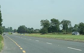
(this route was the N7 prior to the construction of the M7 in 1983). The route continues through Naas along Poplar Street and Main Street, before leaving the town along the Limerick Road. South of Naas, the R445 becomes a dual carriageway for 8 km (5 mi) and crosses the M7 motorway at Junction 10, continuing west to Newbridge
along the town's Dublin Road, crossing the River Liffey
via Liffey Bridge onto Main Street. The route continues along Edward Street, leaving the town as the Kildare Road. The R445 links to the M7 motorway at Junction 12, and crosses the Curragh beside the motorway before veering into Kildare Town. The route sections through Newbridge and Kildare formed the N7 until the extension of the M7 motorway between J10 and J13.
. This runs through the town via Dublin Street, Claregate Street and the Limerick/Cork Road. The R445 meets Junction 14 of the M7 motorway at Mayfield. From here, the route continues west through Monasterevin
via Mooreabbey and Dublin Street. The R445 passes through Ballybrittas
on the way to Portlaoise, meeting the M7 motorway again at Junction 16. The Dublin Road brings the R445 into Portlaoise where it joins the N80
. The R445 begins again where it leaves the N80 at the junction of Grattan Street and Abbeyleix Road, following the former street out of the town, to meet the M7/N7 at Junction 18. The R445 route from east of Kildare to west of Portlaoise consists of redesignated roads which formed part of the N7 route prior to the opening of the M7 Kildare Bypass (2003), Monasterevin Bypass (2004) and Portlaoise Bypass (1997).
, Castletown and Borris-in-Ossory
was reclassified in May 2010 followed the opening of the M7/M8 tolled motorway.
Following the bypass of Nenagh
in 2000, and resulting realignment of the N7, the old route through the town was reclassified as part of the R445. The R445 passes through Nenagh via the Dublin Road, Thomas McDonagh Street, Pierce Street, Kickham Street, Ash Road and Clare Street. The route meets the N52
west of Nenagh. From the Carrigatogher Roundabout the R445 leaves the N52 road and continues along the old N7 route to Birdhill
which was redesignated in April 2010. The route between Birdhill and Annacotty was redesignated as R445 in September 2010 following the opening of the Birdhill to Limerick section of the M7.
On 22 December 2010, following the opening of the M7 Castletown to Nenagh motorway project the old N7 route was reclassified as R445 from Borris-in-Ossory to Nenagh and the route continues through the towns of Roscrea
, Moneygall
and Toomevara
.
The route passes by Annacotty
, and enters Limerick along the Dublin Road through Castletroy
. The road crosses the Groody Bridge at the beginning of a new road section also opened in 2004 (also designated the N7 at the time). This brings the Dublin Road and R445 to the Parkway Roundabout, where it meets the Childers Road. The R445 continues as the Dublin Road, Clare Street and Lock Quay before crossing the Abbey Bridge across the Abbey River. The R445 passes through King's Island as the Northern Relief Road and Castle Street (passing by King John's Castle). The route crosses the River Shannon
via Thomond Bridge and follows High Street, Sexton Street and the Northern Ring Road (past LIT
). At Caherdavin Cross (Ivan's Cross) the route follows the Ennis Road west out of the city to meet the N18 at the Coonagh Roundabout.
Regional road
A regional road in Ireland is a class of road not forming a major route , but nevertheless forming a link in the national route network. There are over 11,600 kilometres of regional roads. Regional roads are numbered with three digit route numbers, prefixed by "R" A regional road in Ireland is a...
in Ireland
Republic of Ireland
Ireland , described as the Republic of Ireland , is a sovereign state in Europe occupying approximately five-sixths of the island of the same name. Its capital is Dublin. Ireland, which had a population of 4.58 million in 2011, is a constitutional republic governed as a parliamentary democracy,...
. The route is a non-motorway alternative route to the N7/M7 motorway between Dublin and Limerick
Limerick
Limerick is the third largest city in the Republic of Ireland, and the principal city of County Limerick and Ireland's Mid-West Region. It is the fifth most populous city in all of Ireland. When taking the extra-municipal suburbs into account, Limerick is the third largest conurbation in the...
. Indeed, much of the route comprises roads that were formerly part of the N7 between the cities, prior to motorway and other bypasses. Some of the R445 route also comprises local link roads to new N7/M7 route sections.
Dublin to southwest of Newbridge
Johnstown
- Places :Canada* Johnstown, Nova Scotia* Johnstown, Ontario, United Counties of Leeds and Grenville* Johnstown, Hastings County, OntarioRepublic of Ireland*Johnstown, County Dublin*Johnstown, County Kildare*Johnstown, County Kilkenny...
and Kill
Kill, County Kildare
Kill is a village and parish in County Kildare, Ireland near the county's border with Dublin beside the N7. Its population of 2,510 makes it the 13th largest town in County Kildare. Kill is the birthpace of the Fenian John Devoy, sometimes regarded as the "grandfather of the modern Irish state"...
. They connect to the existing R445 at Maudlin's Interchange (Junction 9 on the N7, start of the M7 motorway).
Here the R445 route follows the Dublin Road into Naas
Naas
Naas is the county town of County Kildare in Ireland. With a population of just over twenty thousand, it is also the largest town in the county. Naas is a major commuter suburb, with many people residing there and working in Dublin...
(this route was the N7 prior to the construction of the M7 in 1983). The route continues through Naas along Poplar Street and Main Street, before leaving the town along the Limerick Road. South of Naas, the R445 becomes a dual carriageway for 8 km (5 mi) and crosses the M7 motorway at Junction 10, continuing west to Newbridge
Newbridge, County Kildare
The earliest known mention of Newbridge was by traveller and bookseller John Dunton in 1698, though he does not refer to any settlement other than at Ballymany....
along the town's Dublin Road, crossing the River Liffey
River Liffey
The Liffey is a river in Ireland, which flows through the centre of Dublin. Its major tributaries include the River Dodder, the River Poddle and the River Camac. The river supplies much of Dublin's water, and a range of recreational opportunities.-Name:The river was previously named An Ruirthech,...
via Liffey Bridge onto Main Street. The route continues along Edward Street, leaving the town as the Kildare Road. The R445 links to the M7 motorway at Junction 12, and crosses the Curragh beside the motorway before veering into Kildare Town. The route sections through Newbridge and Kildare formed the N7 until the extension of the M7 motorway between J10 and J13.
R445 through Kildare, Monasterevin and Portlaoise
The R445 continues on the Dublin Road east of KildareKildare
-External links:*******...
. This runs through the town via Dublin Street, Claregate Street and the Limerick/Cork Road. The R445 meets Junction 14 of the M7 motorway at Mayfield. From here, the route continues west through Monasterevin
Monasterevin
Situated 63 km from Dublin on the R445 road, Monasterevin has been relieved of much through traffic by the opening in 2004 of a new section of the M7 motorway bypassing the town on the N7 Dublin to Limerick route...
via Mooreabbey and Dublin Street. The R445 passes through Ballybrittas
Ballybrittas
Ballybrittas is a small village in the northeast of County Laois, Ireland situated on the R445 about 5 km SE of Monasterevin, County Kildare. Formerly on the N7 Dublin - Limerick road, the village is now bypassed by the M7 motorway. Ballybrittas is the current County Laois East Division Tidy...
on the way to Portlaoise, meeting the M7 motorway again at Junction 16. The Dublin Road brings the R445 into Portlaoise where it joins the N80
N80 road (Ireland)
The N80 road is a national secondary road in Ireland that runs southeastwards from its junction with the N52 and R443 in the town of Tullamore in County Offaly, to the N11 at Ballynahallin, just north of Enniscorthy in County Wexford, a distance of 116 km...
. The R445 begins again where it leaves the N80 at the junction of Grattan Street and Abbeyleix Road, following the former street out of the town, to meet the M7/N7 at Junction 18. The R445 route from east of Kildare to west of Portlaoise consists of redesignated roads which formed part of the N7 route prior to the opening of the M7 Kildare Bypass (2003), Monasterevin Bypass (2004) and Portlaoise Bypass (1997).
R445 sections between Portlaoise and Limerick
In 2010 all of the old N7 route between Portlaoise and Limerick was replaced with motorway and was reclassified as R445. The first section through MountrathMountrath
Mountrath is a small town in County Laois, Ireland. Bypassed by the M7 motorway in 2010, the town lies on the R445 midway between Dublin and Limerick, exactly 96.5 km from both cities.In 2006 it had a population of 1,435...
, Castletown and Borris-in-Ossory
Borris-in-Ossory
Borris-in-Ossory is a village in west County Laois, Ireland. Bypassed by the M7 motorway on 28 May, 2010, the village is situated on the R445 road close to the County Tipperary border between the towns of Mountrath and Roscrea.-Features:...
was reclassified in May 2010 followed the opening of the M7/M8 tolled motorway.
Following the bypass of Nenagh
Nenagh
Nenagh is the county town of North Tipperary in Ireland. It is the administrative centre of North Tipperary and in 2011 it had a recorded population of 7,995. It is a civil parish in the historical barony of Ormond Lower...
in 2000, and resulting realignment of the N7, the old route through the town was reclassified as part of the R445. The R445 passes through Nenagh via the Dublin Road, Thomas McDonagh Street, Pierce Street, Kickham Street, Ash Road and Clare Street. The route meets the N52
N52 road (Ireland)
The N52 road is a national secondary road in Ireland. It links the M7 motorway from just south of Nenagh, County Tipperary to the M1 motorway north of Dundalk in County Louth.The road is long.-Quality of Road:...
west of Nenagh. From the Carrigatogher Roundabout the R445 leaves the N52 road and continues along the old N7 route to Birdhill
Birdhill
Birdhill is a village in North Tipperary, Ireland. It is in the barony of Owney and Arra and is part of the parish of Newport, Bridhill and Toor in the Roman Catholic Archdiocese of Cashel and Emly...
which was redesignated in April 2010. The route between Birdhill and Annacotty was redesignated as R445 in September 2010 following the opening of the Birdhill to Limerick section of the M7.
On 22 December 2010, following the opening of the M7 Castletown to Nenagh motorway project the old N7 route was reclassified as R445 from Borris-in-Ossory to Nenagh and the route continues through the towns of Roscrea
Roscrea
Roscrea is a small heritage town in North Tipperary, Ireland. The town has a population of 4,910. Its main industries include meat processing and pharmaceuticals. It is a civil parish in the historical barony of Ikerrin...
, Moneygall
Moneygall
Moneygall is a small village on the border of counties Offaly and North Tipperary, in Ireland. It is situated on the R445 road between Dublin and Limerick. At the time of the 2006 census, the village had a population of 298. Moneygall has a Catholic church, five shops, a post office, a national...
and Toomevara
Toomevara
Toomevara, officially Toomyvara , is a village in North Tipperary, Ireland. The village is at the junction on the R445 where it meets the R499 regional road. The village was bypassed in December 2010 by the M7 Dublin - Limerick motorway. It is also a parish in the Roman Catholic Diocese of...
.
R445 through Limerick
Finally, the route through Limerick city, which formed the N7 prior to the opening of the Southern Ring Road in 2004, is also now the R445.The route passes by Annacotty
Annacotty
Annacotty is a town on the outskirts of Limerick, Ireland, from the centre of the city. It is situated where the old N7 main road between Limerick and Dublin crosses the Mulkear River, upstream of where it flows into the River Shannon....
, and enters Limerick along the Dublin Road through Castletroy
Castletroy
Castletroy is a rapidly growing and predominantly middle-class suburb of Limerick, Ireland and is the largest suburb in Munster. Its population is estimated at 40,000 as of 2010....
. The road crosses the Groody Bridge at the beginning of a new road section also opened in 2004 (also designated the N7 at the time). This brings the Dublin Road and R445 to the Parkway Roundabout, where it meets the Childers Road. The R445 continues as the Dublin Road, Clare Street and Lock Quay before crossing the Abbey Bridge across the Abbey River. The R445 passes through King's Island as the Northern Relief Road and Castle Street (passing by King John's Castle). The route crosses the River Shannon
River Shannon
The River Shannon is the longest river in Ireland at . It divides the west of Ireland from the east and south . County Clare, being west of the Shannon but part of the province of Munster, is the major exception...
via Thomond Bridge and follows High Street, Sexton Street and the Northern Ring Road (past LIT
Limerick Institute of Technology
Limerick Institute of Technology is an institution of higher education in Limerick, Ireland and is one of 13 institutes that are members of the Institutes of Technology Ireland . The Institute has four campuses in Limerick City, one in both Thurles and Clonmel in County Tipperary and a regional...
). At Caherdavin Cross (Ivan's Cross) the route follows the Ennis Road west out of the city to meet the N18 at the Coonagh Roundabout.