

List of U.S. state secession proposals
Encyclopedia
This is a list of official or otherwise noteworthy proposals for dividing existing U.S. states into multiple states. It does not specifically address statewide or other movements to secede from the United States. The word secession
can refer to political separation at different levels of government organization, from city to state to country; this list focuses on secession from (rather than by) U.S. states, particularly to form new U.S. states.
Article IV
of the United States Constitution
provides for the creation of new states of the Union
, requiring that any such creation be approved by the legislature of the affected state(s), as well as the United States Congress
.
Since the adoption of the U.S. Constitution, four states have been created from parts of an existing state: Maine
(from Massachusetts
), West Virginia
(from Virginia
), Kentucky
(also from Virginia
), and Vermont
(from New York
) — though New York's claim to Vermont was weak, as it was asked for its consent and Vermont was essentially an independent republic until 1791. In the case of West Virginia, it formed itself as the legitimate government of Virginia within the Union
, then essentially gave itself permission to leave Virginia in order to avoid annexation by the Confederacy.
Many other state secession attempts resulted from internal divisions over the formation of the Confederate States of America
. While majorities of states may have voted to secede and join the Confederacy, or remain in the Union, even in those years regional and cultural ties prompted portions of the populations of those states to strongly favor the other side.
Since the creation of West Virginia
in 1864, no states have been successfully created from parts of already existing states.
On February 10, 2011, Tucson
politicians and activists representing at least three political parties launched the Facebook page "Start our State", seeking to secede from Arizona. The idea, first proposed in the 1980s by Hugh Holub, began to gather steam quickly after a front-page article about the movement in the Arizona Daily Star on February 24, 2011. Around 1986, Holub proposed to separate Arizona at the Gila River (between Phoenix and Tucson, which until the Gadsden Purchase
in 1853 also formed part of the Mexico – United States border) following the election of Governor Evan Mecham
, who, before being impeached and removed from office, cancelled the state's celebration of Martin Luther King Day
. (This led to a widespread economic boycott of Arizona.)
The nascent movement, which excoriates Brewer's "open chauvinism," appears committed to making Pima County (and possibly surrounding counties, and part of New Mexico) the State of Baja Arizona. Pima County, by itself, is larger in area than both New Jersey and Connecticut, and has a population greater than Vermont and Delaware.
Up until 1786, Connecticut
enforced a claim to land in Pennsylvania
, extending into the Wyoming Valley
, that had been granted to the state in its colonial charter. Connecticut formed one county in this territory called Westmoreland County
(distinct from present-day Westmoreland County, Pennsylvania
) and encouraged settlement by Connecticuters. Between 1752 and 1782, there were a series of armed conflicts between Pennsylvanians and the Connecticut settlers, until Congress declared the area to be part of Pennsylvania. In response to the ruling in their favor, Pennsylvania annulled the voting and land rights of the Connecticuters and drove them out. In late 1784, the ousted settlers returned in force, overtook Fort Dickinson
, and seceded the county from both states as the State of Westmoreland
. To avoid civil war, Pennsylvania reversed itself in 1786 and granted Pennsylvania citizenship and property titles to the Connecticuters, and Westmoreland agreed to be subsumed into Pennsylvania as Luzerne County
.
Prior to the American Revolution, the three counties of Delaware were known as the Lower Counties on the Delaware River
, part of the Province of Pennsylvania
but with a separate tax structure and court system. In 1776, after being granted "independence" from Pennsylvania control, Delaware declared independence from Great Britain
as an outright state.
Politicians in the South Florida metropolitan area
have made numerous proposals to split Florida into two states -- North Florida and South Florida. They argue that southern Florida is politically and culturally distinct from northern Florida, and that not enough tax money goes to the Miami area. They also argue that politicians in Tallahassee ignore southern Florida. If South Florida became the 51st state, it would be made up of 4 counties: Palm Beach
, Broward
, Miami-Dade
, and Monroe
.
An attempt was made in 2008 to split Florida into North Florida and South Florida, but that proposal failed. However, as recently as 2011 proposals were still being made to split Florida in half, as in this quote from South Floridians:
Maine
was initially part of the Commonwealth of Massachusetts.
Politicians of Aroostook County
have proposed spinning off the county as a new state since the 1990s. As recently as 2005 the question has been brought up before the state legislature. Proposed names for this state include Aroostook, Acadia, and North Maine.
Representative Henry Joy
submitted legislation March 9, 2010 after seeing a report that a group called Restore: The North Woods submitted a plan to preserve 3200000 acres (12,950 km²) of forest in northern Maine. Rep. Joy says environmentalists have a plan to take control of 10 million acres (40,468.6 km²) in northern Maine and hand it over to the government for preservation, kicking everyone out of their homes and not allowing any further development in the region.
Rep. Joy says Maine needs to be split into two states "so the people of northern Maine can decide their own destiny. They don't like being used as pawns in some giant environmental chess game."
Under Rep. Joy's plan, Maine would include Aroostook, Piscataquis
, Somerset
, Franklin
, Penobscot
, and parts of Washington
, Hancock
and Oxford
Counties. The newly created state of Northern Massachusetts would include York
, Cumberland
, Androscoggin
, Sagadahoc
, Lincoln
, Waldo
, Knox
and Kennebec
Counties.
Three times in the Maryland General Assembly
legislators have submitted a bill for the 9 Eastern Shore counties of Maryland to secede from the western half of the state and combine with the three counties of the State of Delaware
to the northeast and the two Virginia
counties to the south to form the state of Delmarva. The most recent was in 1998.
In the 1890s residents of the Nebraska Panhandle
tired of the state government's refusal to enact water laws (like Wyoming
had) to encourage irrigation into the area. Area leaders threatened to secede from Nebraska and join Wyoming, which finally prompted the state to enact the desired laws.
With so much disparity between Las Vegas
and Nevada's state capital, Carson City
, 450 miles (724.2 km) away, some have proposed splitting Nevada into two or more states. One proposal has northern Nevada linking with northern California, Southern Nevada splitting away with other regional areas, and eastern Nevada becoming part of Utah.
There has also been talk of the city of Wendover, Utah
merging with West Wendover, Nevada
to become Wendover, Nevada, due to tax and economic divides.
New Hampshire's history is dotted with various movements of communities desiring to secede from the state.
The residents of South Jersey
in the counties of Cape May
, Cumberland
, Salem
, Atlantic
, Camden
, Gloucester
, and Burlington
have had a long resentment toward North Jersey under the opinion that they are being slighted and ignored by the state government, which is heavily weighted toward North Jersey. As recently as 1980, a non-binding referendum proposing secession from North Jersey was passed by these counties. It was also voted on in Ocean County, but did not pass in Ocean County
.
In the New York City mayoral election of 1969, writer Norman Mailer
ran in the Democratic Party primary on a ticket with columnist Jimmy Breslin
, who ran for City Council President. Part of their joint platform was a proposal that New York City
should secede from New York State and become the 51st state. At around the same time, a public-affairs series on the local educational TV station, WNET-TV, channel 13, was called The Fifty-First State.
New York City has existed in its current five-borough configuration since 1898. One of those five, Staten Island
, is connected to the rest of the city and state only by one of its four bridges and the Staten Island Ferry
. After the U.S. Supreme Court ruled in its 1989 Board of Estimate of City of New York v. Morris
decision that the city's New York City Board of Estimate
was a violation of the constitutional principle of one man, one vote, the borough's residents began grumbling about seceding from the city, or even the state, since as the least populous borough their political influence in a more equitable setup would be diminished. Borough residents, a more suburban and middle-class population than the city as a whole, had long felt either ignored or slighted by the rest of the city's population as well. Upon taking office as borough president, former congressman Guy Molinari
fired a mock cannon across Upper New York Bay
at city government, signalling an intention to secede from the city if the island's concerns were not addressed somehow. So far the island has remained part of the city.
Staten Island's complaints also triggered some talk of secession in Queens
, parts of which are demographically similar to those on Staten Island. This, too, has not had any results.
In 1784, the western counties of Greene, Washington, Sullivan, and part of Hawkins
county, all of which were then part of the Washington District, North Carolina
, voted to secede from the state. They formed the provisional State of Franklin
, with Revolutionary War
hero John Sevier
elected as governor. By 1789, the provisional government had collapsed.
In 1790, the North Carolina state government, tired of the troublesome region, relinquished it to the federal government, creating the Territory South of the River Ohio
. Six years later, the territory (including the former counties of Franklin) became the State of Tennessee, with Sevier as governor.
In 2005, James B. McCarthy, the county executive of Summit County
, which contains Akron
, publicly advocated that his county (and the rest of Northeast Ohio) secede as a new state.
Northeastern Ohio has a history of being distinct from the remainder of the state, once known as "New Connecticut" and claimed as the Connecticut Western Reserve
.
The remote Oklahoma Panhandle
has often cited the distant state government for neglect, and support for secession as a new state has been voiced. Alternate proposals have the region merging with Texas
, as the closest major city to the area is Amarillo
.
Another proposal would merge Texas's Panhandle with the State of Oklahoma, since residents in that area have more in common with neighboring Oklahomans than they do with more distant Dallas, Austin and Houston.
The ongoing state secessionist movement for Eastern Oklahoma
with Tulsa as its largest city and possible state capital has resurfaced at times.
A state of Sequoyah
separate from the Oklahoma Territory
, to consist of the lands of five Native American tribes (the Cherokee Nation
, Chickasaw Nation
, Choctaw Nation
, Creek Nation (or Muskogees), Seminole Nation and Osage County
), was proposed but rejected in favor of the state of Oklahoma in 1907.
The town of Killington
has twice voted (March 2004 and March 2005) to secede from Vermont and become part of the state of New Hampshire
. Because the town is not adjacent to the New Hampshire border, this would create an enclave. A similar motion was attempted in Winhall
, but was voted down.
The District of Columbia is an insular federal district
separate from any state and under direct control of the United States Congress
. Residents of the capital have no voting representation
in Congress, nor complete control over their local government
. There has been a recurring movement since the 1960s to make the District of Columbia into a state in order to permit residents full voting representation in Congress and control over local affairs. An alternate proposal is for Congress to return most of the District of Columbia (excepting the immediate vicinity of the Capitol and White House) to the state of Maryland (a process known as retrocession), as was done with the Virginia portion of the District in 1846.
According to legend, upon the secession of Alabama
from the United States during the American Civil War
, Winston County
seceded from the state as the Republic of Winston
, and pledged its alliance with the Union. Today citizens of the county still refer to it as the Free State of Winston, which drives the local tourist industry.
During the Civil War, five counties, including Madison County
and possibly Marion County, voted against secession from the Union at the second Arkansas Secession Convention. When called upon to renege, four counties did, but Madison, represented by Isaac Murphy
, later the state's governor under Reconstruction, resisted. Men of his county fought for the North during the war.
In the 1850s many from Dade County
, in the far northwestern corner of the state, threatened to secede from Georgia (and the U.S.) if the state itself did not secede.
Shortly before the Civil War, southern Illinois considered seceding from Illinois and joining the Confederacy; a proposed name for the new state was Little Egypt
after the region's local name. However, speeches by Union General John A. Logan
, a native of the region, convinced many in the region to remain in the Union.
On November 20, 1861, representatives from several counties met at Russellville
calling themselves "the Convention of the People of Kentucky" (later known as the Russellville Convention) and passed an Ordinance of Secession. It established a Confederate government of Kentucky
with its capital in Bowling Green. Although it remained in the Union, Kentucky was represented by a star on the Confederate battle flag and national flag.
During the Civil War, David Pierson, a young attorney, was elected to represent Winn Parish in northwest central Louisiana at the Secession Convention called by Governor Thomas Overton Moore
in Baton Rouge
in January 1861. Pierson voted against secession in all votes taken and refused, along with several others, to change his "no" vote at the end of the process when asked to do so in order that the vote for secession be made unanimous. This act of voting "no" has confused some into thinking that Winn Parish refused to secede from the Union
and was a de facto Union enclave in the Confederate
state of Louisiana called the Free State of Winn.
Local legend has it that Jones County
, a haven for Confederate military deserters, declared its independence from both countries. Most people in the county had reservations about the strong central government that the Confederate States of America
instated and few if any in the county owned slaves. Although some claim that these rumors turned out to be completely false, the county did serve as a safe haven for Confederate defectors such as Newton Knight
. This event was inaccurately dramatized in the 1948 movie Tap Roots.
Secession
Secession is the act of withdrawing from an organization, union, or especially a political entity. Threats of secession also can be a strategy for achieving more limited goals.-Secession theory:...
can refer to political separation at different levels of government organization, from city to state to country; this list focuses on secession from (rather than by) U.S. states, particularly to form new U.S. states.
Article IV
Article Four of the United States Constitution
Article Four of the United States Constitution relates to the states. The article outlines the duties states have to each other, as well as those the federal government has to the states...
of the United States Constitution
United States Constitution
The Constitution of the United States is the supreme law of the United States of America. It is the framework for the organization of the United States government and for the relationship of the federal government with the states, citizens, and all people within the United States.The first three...
provides for the creation of new states of the Union
United States
The United States of America is a federal constitutional republic comprising fifty states and a federal district...
, requiring that any such creation be approved by the legislature of the affected state(s), as well as the United States Congress
United States Congress
The United States Congress is the bicameral legislature of the federal government of the United States, consisting of the Senate and the House of Representatives. The Congress meets in the United States Capitol in Washington, D.C....
.
Since the adoption of the U.S. Constitution, four states have been created from parts of an existing state: Maine
Maine
Maine is a state in the New England region of the northeastern United States, bordered by the Atlantic Ocean to the east and south, New Hampshire to the west, and the Canadian provinces of Quebec to the northwest and New Brunswick to the northeast. Maine is both the northernmost and easternmost...
(from Massachusetts
Massachusetts
The Commonwealth of Massachusetts is a state in the New England region of the northeastern United States of America. It is bordered by Rhode Island and Connecticut to the south, New York to the west, and Vermont and New Hampshire to the north; at its east lies the Atlantic Ocean. As of the 2010...
), West Virginia
West Virginia
West Virginia is a state in the Appalachian and Southeastern regions of the United States, bordered by Virginia to the southeast, Kentucky to the southwest, Ohio to the northwest, Pennsylvania to the northeast and Maryland to the east...
(from Virginia
Virginia
The Commonwealth of Virginia , is a U.S. state on the Atlantic Coast of the Southern United States. Virginia is nicknamed the "Old Dominion" and sometimes the "Mother of Presidents" after the eight U.S. presidents born there...
), Kentucky
Kentucky
The Commonwealth of Kentucky is a state located in the East Central United States of America. As classified by the United States Census Bureau, Kentucky is a Southern state, more specifically in the East South Central region. Kentucky is one of four U.S. states constituted as a commonwealth...
(also from Virginia
Virginia
The Commonwealth of Virginia , is a U.S. state on the Atlantic Coast of the Southern United States. Virginia is nicknamed the "Old Dominion" and sometimes the "Mother of Presidents" after the eight U.S. presidents born there...
), and Vermont
Vermont
Vermont is a state in the New England region of the northeastern United States of America. The state ranks 43rd in land area, , and 45th in total area. Its population according to the 2010 census, 630,337, is the second smallest in the country, larger only than Wyoming. It is the only New England...
(from New York
New York
New York is a state in the Northeastern region of the United States. It is the nation's third most populous state. New York is bordered by New Jersey and Pennsylvania to the south, and by Connecticut, Massachusetts and Vermont to the east...
) — though New York's claim to Vermont was weak, as it was asked for its consent and Vermont was essentially an independent republic until 1791. In the case of West Virginia, it formed itself as the legitimate government of Virginia within the Union
Union (American Civil War)
During the American Civil War, the Union was a name used to refer to the federal government of the United States, which was supported by the twenty free states and five border slave states. It was opposed by 11 southern slave states that had declared a secession to join together to form the...
, then essentially gave itself permission to leave Virginia in order to avoid annexation by the Confederacy.
Many other state secession attempts resulted from internal divisions over the formation of the Confederate States of America
Confederate States of America
The Confederate States of America was a government set up from 1861 to 1865 by 11 Southern slave states of the United States of America that had declared their secession from the U.S...
. While majorities of states may have voted to secede and join the Confederacy, or remain in the Union, even in those years regional and cultural ties prompted portions of the populations of those states to strongly favor the other side.
Since the creation of West Virginia
West Virginia
West Virginia is a state in the Appalachian and Southeastern regions of the United States, bordered by Virginia to the southeast, Kentucky to the southwest, Ohio to the northwest, Pennsylvania to the northeast and Maryland to the east...
in 1864, no states have been successfully created from parts of already existing states.
 Alaska Alaska
- In 1923, some people in the Southeastern Division of the Territory of Alaska, headquartered at Juneau, openly agitated for a complete separation of and statehood for the Southeast. This was in response to some comments made by President Warren G. HardingWarren G. HardingWarren Gamaliel Harding was the 29th President of the United States . A Republican from Ohio, Harding was an influential self-made newspaper publisher. He served in the Ohio Senate , as the 28th Lieutenant Governor of Ohio and as a U.S. Senator...
on his visit to the region.
 Arizona Arizona
On February 10, 2011, TucsonTucson, Arizona
Tucson is a city in and the county seat of Pima County, Arizona, United States. The city is located 118 miles southeast of Phoenix and 60 miles north of the U.S.-Mexico border. The 2010 United States Census puts the city's population at 520,116 with a metropolitan area population at 1,020,200...
politicians and activists representing at least three political parties launched the Facebook page "Start our State", seeking to secede from Arizona. The idea, first proposed in the 1980s by Hugh Holub, began to gather steam quickly after a front-page article about the movement in the Arizona Daily Star on February 24, 2011. Around 1986, Holub proposed to separate Arizona at the Gila River (between Phoenix and Tucson, which until the Gadsden Purchase
Gadsden Purchase
The Gadsden Purchase is a region of present-day southern Arizona and southwestern New Mexico that was purchased by the United States in a treaty signed by James Gadsden, the American ambassador to Mexico at the time, on December 30, 1853. It was then ratified, with changes, by the U.S...
in 1853 also formed part of the Mexico – United States border) following the election of Governor Evan Mecham
Evan Mecham
Evan Mecham was the 17th Governor of Arizona. A decorated veteran of World War II, Mecham earned his living as an automotive dealership owner and occasional newspaper publisher...
, who, before being impeached and removed from office, cancelled the state's celebration of Martin Luther King Day
Martin Luther King Day
Martin Luther King, Jr. Day is a United States federal holiday marking the birthday of Rev. Dr. Martin Luther King, Jr. It is observed on the third Monday of January each year, which is around the time of King's birthday, January 15. The floating holiday is similar to holidays set under the Uniform...
. (This led to a widespread economic boycott of Arizona.)
The nascent movement, which excoriates Brewer's "open chauvinism," appears committed to making Pima County (and possibly surrounding counties, and part of New Mexico) the State of Baja Arizona. Pima County, by itself, is larger in area than both New Jersey and Connecticut, and has a population greater than Vermont and Delaware.
 Colorado Colorado
- Two counties have, in the past, proposed leaving Colorado and joining with New MexicoNew MexicoNew Mexico is a state located in the southwest and western regions of the United States. New Mexico is also usually considered one of the Mountain States. With a population density of 16 per square mile, New Mexico is the sixth-most sparsely inhabited U.S...
: the San Luis ValleySan Luis ValleyThe San Luis Valley is an extensive alpine valley in the U.S. states of Colorado and New Mexico covering approximately and sitting at an average elevation of above sea level. The valley sits atop the Rio Grande Rift and is drained to the south by the Rio Grande River, which rises in the San Juan...
in the 1950s, and Costilla CountyCostilla County, ColoradoCostilla County is the ninth least populous of the 64 counties in the state of Colorado of the United States. The county population was 3,663 at U.S. Census 2000. The county seat is San Luis, the oldest town in Colorado.- History :...
in 1973. - In the mid-1930s, the Walsenburg World-Independent proposed that Huerfano CountyHuerfano County, ColoradoHuerfano County is one of the 64 counties of the State of Colorado of the United States. The county was named for the Huerfano Butte, a local landmark. The county population was 7,862 at U.S. Census 2000...
secede from the state. This was a pet project of Sam T. Taylor, sports editor, who went on to become a long-serving state senator where he also unsuccessfully pushed the idea.
 Connecticut Connecticut
Up until 1786, ConnecticutConnecticut
Connecticut is a state in the New England region of the northeastern United States. It is bordered by Rhode Island to the east, Massachusetts to the north, and the state of New York to the west and the south .Connecticut is named for the Connecticut River, the major U.S. river that approximately...
enforced a claim to land in Pennsylvania
Pennsylvania
The Commonwealth of Pennsylvania is a U.S. state that is located in the Northeastern and Mid-Atlantic regions of the United States. The state borders Delaware and Maryland to the south, West Virginia to the southwest, Ohio to the west, New York and Ontario, Canada, to the north, and New Jersey to...
, extending into the Wyoming Valley
Wyoming Valley
Wyoming Valley is a region of northeastern Pennsylvania. As a metropolitan area, it is also known as the Scranton/Wilkes-Barre area, after its principal cities, Scranton and Wilkes-Barre....
, that had been granted to the state in its colonial charter. Connecticut formed one county in this territory called Westmoreland County
Westmoreland County, Connecticut
Westmoreland County, Connecticut was a county established by the State of Connecticut in the present day area of Wyoming Valley, Pennsylvania, until it was ceded to Pennsylvania in 1784, of which it now forms the northeastern corner. It briefly seceded to become the State of Westmoreland...
(distinct from present-day Westmoreland County, Pennsylvania
Westmoreland County, Pennsylvania
-Demographics:As of the census of 2000, there were 369,993 people, 149,813 households, and 104,569 families residing in the county. The population density was 361 people per square mile . There were 161,058 housing units at an average density of 157 per square mile...
) and encouraged settlement by Connecticuters. Between 1752 and 1782, there were a series of armed conflicts between Pennsylvanians and the Connecticut settlers, until Congress declared the area to be part of Pennsylvania. In response to the ruling in their favor, Pennsylvania annulled the voting and land rights of the Connecticuters and drove them out. In late 1784, the ousted settlers returned in force, overtook Fort Dickinson
Fort Dickinson
Fort Dickinson was a Pennamite fort with four small blockhouses, armed with four guns, manned by 100 men constructed as part of the Pennamite Wars....
, and seceded the county from both states as the State of Westmoreland
State of Westmoreland
The State of Westmoreland was a proposed self-proclaimed state that would have seceded from Pennsylvania.Both Pennsylvania and Connecticut claimed ownership of the lands between 41° N and 42° N, and this gave rise to a series of land-conflicts collectively referred to as the Yankee-Pennamite Wars...
. To avoid civil war, Pennsylvania reversed itself in 1786 and granted Pennsylvania citizenship and property titles to the Connecticuters, and Westmoreland agreed to be subsumed into Pennsylvania as Luzerne County
Luzerne County, Pennsylvania
- Demographics :As of the 2010 census, the county was 90.7% White, 3.4% Black or African American, 0.2% Native American, 1.0% Asian, 3.3% were of some other race, and 1.5% were two or more races. 6.7% of the population was of Hispanic or Latino ancestry...
.
 Delaware Delaware
Prior to the American Revolution, the three counties of Delaware were known as the Lower Counties on the Delaware RiverDelaware River
The Delaware River is a major river on the Atlantic coast of the United States.A Dutch expedition led by Henry Hudson in 1609 first mapped the river. The river was christened the South River in the New Netherland colony that followed, in contrast to the North River, as the Hudson River was then...
, part of the Province of Pennsylvania
Province of Pennsylvania
The Province of Pennsylvania, also known as Pennsylvania Colony, was founded in British America by William Penn on March 4, 1681 as dictated in a royal charter granted by King Charles II...
but with a separate tax structure and court system. In 1776, after being granted "independence" from Pennsylvania control, Delaware declared independence from Great Britain
Kingdom of Great Britain
The former Kingdom of Great Britain, sometimes described as the 'United Kingdom of Great Britain', That the Two Kingdoms of Scotland and England, shall upon the 1st May next ensuing the date hereof, and forever after, be United into One Kingdom by the Name of GREAT BRITAIN. was a sovereign...
as an outright state.
 Florida Florida
Politicians in the South Florida metropolitan areaSouth Florida metropolitan area
The South Florida metropolitan area, also known as the Miami metropolitan area, and designated the Miami–Fort Lauderdale–Pompano Beach, FL Metropolitan Statistical Area by the U.S...
have made numerous proposals to split Florida into two states -- North Florida and South Florida. They argue that southern Florida is politically and culturally distinct from northern Florida, and that not enough tax money goes to the Miami area. They also argue that politicians in Tallahassee ignore southern Florida. If South Florida became the 51st state, it would be made up of 4 counties: Palm Beach
Palm Beach County, Florida
Palm Beach County is the largest county in the state of Florida in total area, and third in population. As of 2010, the county's estimated population was 1,320,134, making it the twenty-eighth most populous in the United States...
, Broward
Broward County, Florida
-2000 Census:As of the census of 2000, there were 1,623,018 people, 654,445 households, and 411,645 families residing in the county. The population density was 1,346 people per square mile . There were 741,043 housing units at an average density of 615 per square mile...
, Miami-Dade
Miami-Dade County, Florida
Miami-Dade County is a county located in the southeastern part of the state of Florida. As of 2010 U.S. Census, the county had a population of 2,496,435, making it the most populous county in Florida and the eighth-most populous county in the United States...
, and Monroe
Monroe County, Florida
Monroe County is a county located in the state of Florida. As of 2000, the population was 79,589. The U.S. Census Bureau 2006 estimate for the county was 74,737....
.
An attempt was made in 2008 to split Florida into North Florida and South Florida, but that proposal failed. However, as recently as 2011 proposals were still being made to split Florida in half, as in this quote from South Floridians:
"We'd have Fort Lauderdale, West Palm Beach and Miami. They'd have Orlando, Tampa and Jacksonville. We'd have Donald Trump. They'd have Donald Duck. We'd have the Keys. They'd have the Redneck Riviera. We'd have Big Sugar. They'd have Big Citrus. We'd have the Dolphins and the Hurricanes. They'd have the Gators and the 'Noles. We'd have the Everglades. They'd have Busch Gardens. We'd have casinos. They'd have school prayer. We'd have same-sex marriages. They'd have the defense-of-marriage act."
 Georgia (U.S. state) Georgia
- Dade CountyDade County, GeorgiaDade County is a county located in the U.S. state of Georgia. As of 2000, the population is 15,154. The 2007 Census Estimate shows a population of 16,098...
, in the northwest corner, had no roads connecting it to the rest of Georgia until 1939; the only ways to access Dade County were through either Alabama or Tennessee. In the days leading to the Civil War a local politician seceded Dade from the state of Georgia, and thus the Union, rather than wait for Georgia to secede. This created the Independent State of Dade. In 1939, when the state of Georgia purchased land that would become Cloudland Canyon State Park, the State of Dade finally became connected to Georgia. In 1945 the State of Dade passed a resolution "officially" rejoining Georgia and the Union over 80 years after the end of the Civil War. The area is still known today as the State of Dade. - In January 2008, columnist Bill Shipp wrote an editorial urging the creation of two Georgian states. This proposal in the article was largely attributed to a severe drought and concerns over infringement of the water rights of citizens in southern Georgia by politicians and officials from the Metro Atlanta area and North Georgia.
- Other calls for statehood for the Southern half of Georgia and Atlantic coasts are lesser known.
 Illinois Illinois
- In 1925, Cook CountyCook County, IllinoisCook County is a county in the U.S. state of Illinois, with its county seat in Chicago. It is the second most populous county in the United States after Los Angeles County. The county has 5,194,675 residents, which is 40.5 percent of all Illinois residents. Cook County's population is larger than...
, which contains ChicagoChicagoChicago is the largest city in the US state of Illinois. With nearly 2.7 million residents, it is the most populous city in the Midwestern United States and the third most populous in the US, after New York City and Los Angeles...
, considered seceding from Illinois as a new state named Chicago. This proposal was revived in November 2011 by State Representatives Bill MitchellBill Mitchell (politician)Bill Mitchell is a Republican member of the Illinois House of Representatives, representing the 87th district since 1999.Bill Mitchell is a graduate of Eastern Illinois University, receiving a B.A. in Political Science in 1982. He has been a Decatur City Councilman, Macon County Republican...
and Adam Brown, who felt that all of Illinois outside of Cook County should become a separate state due to Chicago "dictating its views" to the rest of the state. - In 1861, the southern region of Illinois, known as Little EgyptLittle Egypt (region)-Early history:The earliest inhabitants of Illinois were thought to have arrived about 12,000 B.C. They were hunter-gatherers, but developed a primitive system of agriculture. After 1000 AD, their agricultural surpluses enabled them to develop complex, hierarchical societies...
, made a proposal to secede from the rest of Illinois due to cultural and political differences from Chicago and much of CentralCentral IllinoisCentral Illinois is a region of the U.S. state of Illinois that consists of the entire central section of the state, divided in thirds from north to south. It is an area of mostly flat prairie. The western section was originally part of the Military Tract of 1812 and forms the distinctive western...
and Northern IllinoisNorthern IllinoisNorthern Illinois is a region generally covering the northern third of the U.S. state of Illinois.-Economics:Northern Illinois is dominated by the metropolitan areas of Chicago, Rockford, and the Quad Cities, which contain a majority of Illinois' population and economic activity, including...
. - In the early 1970s residents of ForgottoniaForgottoniaForgottonia is the name given to a fourteen-county region in Western Illinois in the late 1960s and early 1970s. This geographic region forms the western bulge of Illinois that is roughly equivalent to "The Tract," the Illinois portion of the Military Tract of 1812, along and west of the Fourth...
in western Illinois protested what they felt was a lack of concern for its needs, sparking a secession proposal.
 Kansas Kansas
- In 1992, a group in southwestern Kansas advocated the secession of a number of counties in that region from the state. The group was nominally headed by Don O. Concannon, a lawyer and former gubernatorial candidate from HugotonHugoton, KansasHugoton is a city in and the county seat of Stevens County, Kansas, United States. As of the 2010 census, the city population was 3,904.-History:...
. Various media reports indicated as few as five or as many as two dozen counties were involved in the movement. The state was to be called "West Kansas", and early meetings included proposals for official state bird (the pheasantPheasantPheasants refer to some members of the Phasianinae subfamily of Phasianidae in the order Galliformes.Pheasants are characterised by strong sexual dimorphism, males being highly ornate with bright colours and adornments such as wattles and long tails. Males are usually larger than females and have...
) and state flower (the yuccaYuccaYucca is a genus of perennial shrubs and trees in the family Asparagaceae, subfamily Agavoideae. Its 40-50 species are notable for their rosettes of evergreen, tough, sword-shaped leaves and large terminal panicles of white or whitish flowers. They are native to the hot and dry parts of North...
). The proposal stemmed from state laws raising the state property tax and shifting state education funding away from rural school districts and into more urban areas, though the secessionists' call was the fairly generic "Give us equality or set us free." Though organizers arranged for a series of straw polls that demonstrated widespread support for secession in at least nine of the counties, the movement died out by the mid 1990s.
 Kentucky Kentucky
- In 1849, part of Pike CountyPike County, KentuckyPike County is a county located in the U.S. state of Kentucky. As of 2010, the population was 65,024. Its county seat is Pikeville. Pike is Kentucky's largest county in terms of land area. Pike County is the 11th largest county in Kentucky in terms of population preceded by Bullitt County and...
petitioned the state to allow it to join VirginiaVirginiaThe Commonwealth of Virginia , is a U.S. state on the Atlantic Coast of the Southern United States. Virginia is nicknamed the "Old Dominion" and sometimes the "Mother of Presidents" after the eight U.S. presidents born there...
(which then included West VirginiaWest VirginiaWest Virginia is a state in the Appalachian and Southeastern regions of the United States, bordered by Virginia to the southeast, Kentucky to the southwest, Ohio to the northwest, Pennsylvania to the northeast and Maryland to the east...
). - In the 1950s, Letcher CountyLetcher County, KentuckyLetcher County is a county located in the U.S. state of Kentucky. As of 2000, the population was 25,277. Its county seat is Whitesburg. The county is named for Robert P...
threatened to secede from the state, demanding better roads in the area.
 Maine Maine
MaineMaine
Maine is a state in the New England region of the northeastern United States, bordered by the Atlantic Ocean to the east and south, New Hampshire to the west, and the Canadian provinces of Quebec to the northwest and New Brunswick to the northeast. Maine is both the northernmost and easternmost...
was initially part of the Commonwealth of Massachusetts.
Politicians of Aroostook County
Aroostook County, Maine
Aroostook County is a county located in the U.S. state of Maine. In 2010, its population was 71,870. In land area, it is the largest county in the state and the largest U.S. county east of the Mississippi River. Its seat is Houlton...
have proposed spinning off the county as a new state since the 1990s. As recently as 2005 the question has been brought up before the state legislature. Proposed names for this state include Aroostook, Acadia, and North Maine.
Representative Henry Joy
Henry Joy (Maine)
Henry L. Joy is a Maine politician and retired teacher. He is from Crystal, Maine. He was first elected as a Republican to the Maine House of Representatives in 1992, which was the 116th Legislature, and has served in every consecutive Legislature except for the 120th Legislature, when he made an...
submitted legislation March 9, 2010 after seeing a report that a group called Restore: The North Woods submitted a plan to preserve 3200000 acres (12,950 km²) of forest in northern Maine. Rep. Joy says environmentalists have a plan to take control of 10 million acres (40,468.6 km²) in northern Maine and hand it over to the government for preservation, kicking everyone out of their homes and not allowing any further development in the region.
Rep. Joy says Maine needs to be split into two states "so the people of northern Maine can decide their own destiny. They don't like being used as pawns in some giant environmental chess game."
Under Rep. Joy's plan, Maine would include Aroostook, Piscataquis
Piscataquis County, Maine
Piscataquis County is a county located in the U.S. state of Maine. In 2010, its population was 17,535, making it Maine's least-populous county. Its county seat is Dover-Foxcroft....
, Somerset
Somerset County, Maine
Somerset County is a county located in the U.S. state of Maine. As of 2010, the population was 52,228. Its county seat is Skowhegan.-History:...
, Franklin
Franklin County, Maine
Franklin County is a county located in the U.S. state of Maine. As of 2010, the population was 30,768. Its county seat is Farmington.Franklin County was established on 9 May 1838.-Geography:...
, Penobscot
Penobscot County, Maine
Penobscot County is a county located in the U.S. state of Maine. For U.S. Census statistical purposes, it is part of the Bangor, Maine, New England County Metropolitan Area . As of 2010, the population was 153,923...
, and parts of Washington
Washington County, Maine
Washington County is a county located in the U.S. state of Maine. In 2010, its population was 32,856. Its county seat is Machias.Sometimes referred to as "Sunrise County" because it is the easternmost county in the United States, and it is often where the rising sun first shines on the 48...
, Hancock
Hancock County, Maine
Hancock County is a county located in the U.S. state of Maine. As of 2010, the population was 54,418. Its county seat is Ellsworth. It was incorporated on June 25, 1789...
and Oxford
Oxford County, Maine
Oxford County is a county located in the U.S. state of Maine with a population of 57,833 as of the 2010 U.S. census. Its county seat is Paris.Part of Oxford County is included in the Lewiston-Auburn, Maine, metropolitan New England City and Town Area while a different part of Oxford County is...
Counties. The newly created state of Northern Massachusetts would include York
York County, Maine
York County is a county located in the U.S. state of Maine. In 2010, the population was 197,131. Its county seat is Alfred.Founded in 1636, it is the oldest county in Maine and one of the oldest in the United States....
, Cumberland
Cumberland County, Maine
Cumberland County is a county located in the U.S. state of Maine. As of 2010, the population was 281,674. Its county seat is Portland, and is the most populous of the sixteen Maine counties, as well as the most affluent. Cumberland County has the deepest and second largest body of water in the...
, Androscoggin
Androscoggin County, Maine
Androscoggin County is a county located in the U.S. state of Maine. As of the 2010 U.S. census, the county's population was 107,702. Its county seat is Auburn...
, Sagadahoc
Sagadahoc County, Maine
Sagadahoc County is a county located in the U.S. state of Maine. As of 2010, the population was 35,293. Its county seat is Bath. In total area, it is the smallest county in Maine....
, Lincoln
Lincoln County, Maine
Lincoln County is a county located in the U.S. state of Maine. As of 2010, the population was 34,457. Its county seat is Wiscasset. It was founded in 1760 and named after the English city Lincoln. At its founding, it accounted for three-fifths of the State's land, and stretched east to Nova...
, Waldo
Waldo County, Maine
Waldo County is a county located in the U.S. state of Maine. As of 2010, the population was 38,786. Its county seat is Belfast.Waldo County was founded on 7 February 1827 from a portion of Hancock County...
, Knox
Knox County, Maine
Knox County is a county located in the U.S. state of Maine. As of 2010, the population was 39,736. Its county seat is Rockland. The county is named for American Revolutionary War general and Secretary of War Henry Knox, who lived in the county from 1795 until his death in 1806. The county was...
and Kennebec
Kennebec County, Maine
Kennebec County is a county located in the U.S. state of Maine. In 2010, its population was 122,151. Its county seat is Augusta. The center of population of Maine is located in Kennebec County, in the city of Augusta....
Counties.
 Maryland Maryland
Three times in the Maryland General AssemblyMaryland General Assembly
The Maryland General Assembly is the state legislature of the U.S. state of Maryland. It is a bicameral body. The upper chamber, the Maryland State Senate, has 47 representatives and the lower chamber, the Maryland House of Delegates, has 141 representatives...
legislators have submitted a bill for the 9 Eastern Shore counties of Maryland to secede from the western half of the state and combine with the three counties of the State of Delaware
Delaware
Delaware is a U.S. state located on the Atlantic Coast in the Mid-Atlantic region of the United States. It is bordered to the south and west by Maryland, and to the north by Pennsylvania...
to the northeast and the two Virginia
Virginia
The Commonwealth of Virginia , is a U.S. state on the Atlantic Coast of the Southern United States. Virginia is nicknamed the "Old Dominion" and sometimes the "Mother of Presidents" after the eight U.S. presidents born there...
counties to the south to form the state of Delmarva. The most recent was in 1998.
 Massachusetts Massachusetts
- MaineMaineMaine is a state in the New England region of the northeastern United States, bordered by the Atlantic Ocean to the east and south, New Hampshire to the west, and the Canadian provinces of Quebec to the northwest and New Brunswick to the northeast. Maine is both the northernmost and easternmost...
, which is not connected to Massachusetts by land, was separated from it as a new state in 1820, as one of the provisions of the Missouri CompromiseMissouri CompromiseThe Missouri Compromise was an agreement passed in 1820 between the pro-slavery and anti-slavery factions in the United States Congress, involving primarily the regulation of slavery in the western territories. It prohibited slavery in the former Louisiana Territory north of the parallel 36°30'...
. - During the abolitionismAbolitionismAbolitionism is a movement to end slavery.In western Europe and the Americas abolitionism was a movement to end the slave trade and set slaves free. At the behest of Dominican priest Bartolomé de las Casas who was shocked at the treatment of natives in the New World, Spain enacted the first...
era some supporters of William Lloyd GarrisonWilliam Lloyd GarrisonWilliam Lloyd Garrison was a prominent American abolitionist, journalist, and social reformer. He is best known as the editor of the abolitionist newspaper The Liberator, and as one of the founders of the American Anti-Slavery Society, he promoted "immediate emancipation" of slaves in the United...
sought the secession of Essex CountyEssex County, Massachusetts-National protected areas:* Parker River National Wildlife Refuge* Salem Maritime National Historic Site* Saugus Iron Works National Historic Site* Thacher Island National Wildlife Refuge-Demographics:...
from the state. - In 1977 a Martha's VineyardMartha's VineyardMartha's Vineyard is an island located south of Cape Cod in Massachusetts, known for being an affluent summer colony....
Statehood Support Committee existed, promoting the secession of Martha's Vineyard and Nantucket from MassachusettsMassachusettsThe Commonwealth of Massachusetts is a state in the New England region of the northeastern United States of America. It is bordered by Rhode Island and Connecticut to the south, New York to the west, and Vermont and New Hampshire to the north; at its east lies the Atlantic Ocean. As of the 2010...
largely in response to redistrictingRedistrictingRedistricting is the process of drawing United States electoral district boundaries, often in response to population changes determined by the results of the decennial census. In 36 states, the state legislature has primary responsibility for creating a redistricting plan, in many cases subject to...
which associated the islands with Cape CodCape CodCape Cod, often referred to locally as simply the Cape, is a cape in the easternmost portion of the state of Massachusetts, in the Northeastern United States...
. All three areas are known for their status as oceanfront summer resort and vacation communities.
 Michigan Michigan
- As part of the most geographically divided of the contiguous states, Michigan's Upper Peninsula has a distinct and proud regional identity. A few have called for the Upper Peninsula, along with portions of Wisconsin and Minnesota, to become a new State (possibly named "SuperiorSuperior (proposed state)The proposed State of Superior is the name of a longstanding "51st state" proposal involving the secession of the Upper Peninsula of Michigan from the rest of the state of Michigan, due to cultural differences, geographic separation, as well as the feeling that the capital in Lansing ignores the...
", after Lake SuperiorLake SuperiorLake Superior is the largest of the five traditionally-demarcated Great Lakes of North America. It is bounded to the north by the Canadian province of Ontario and the U.S. state of Minnesota, and to the south by the U.S. states of Wisconsin and Michigan. It is the largest freshwater lake in the...
) or to secede from the United States. - On several occasions after the Missouri CompromiseMissouri CompromiseThe Missouri Compromise was an agreement passed in 1820 between the pro-slavery and anti-slavery factions in the United States Congress, involving primarily the regulation of slavery in the western territories. It prohibited slavery in the former Louisiana Territory north of the parallel 36°30'...
of 1820 it was proposed that, if certain territories were to enter the Union as slave states, such as CubaCubaThe Republic of Cuba is an island nation in the Caribbean. The nation of Cuba consists of the main island of Cuba, the Isla de la Juventud, and several archipelagos. Havana is the largest city in Cuba and the country's capital. Santiago de Cuba is the second largest city...
or KansasKansasKansas is a US state located in the Midwestern United States. It is named after the Kansas River which flows through it, which in turn was named after the Kansa Native American tribe, which inhabited the area. The tribe's name is often said to mean "people of the wind" or "people of the south...
, the Upper Peninsula of Michigan would enter the Union as a Free State in order to keep a balance in representatives in the SenateUnited States SenateThe United States Senate is the upper house of the bicameral legislature of the United States, and together with the United States House of Representatives comprises the United States Congress. The composition and powers of the Senate are established in Article One of the U.S. Constitution. Each...
.
 Minnesota Minnesota
- On July 13, 1977, the town of KinneyKinney, MinnesotaKinney is a city in Saint Louis County, Minnesota, United States. The population was 169 at the 2010 census.U.S. Highway 169 is nearby.-Geography:...
in northern Minnesota announced its secession in hopes of receiving foreign aid from the U.S. government. The new nation was called the Republic of Kinney. The national news story broke on February 7, 1978. To this day many in the town still claim its independence. - There has been intermittent advocacy for the Arrowhead of MinnesotaArrowhead RegionThe Arrowhead Region is located in the northeastern part of the U.S. state of Minnesota, so called because of its pointed shape. The predominantly rural region encompasses of land area and comprises Carlton, Cook, Lake and St. Louis Counties. Its population at the 2000 census was 248,425 residents...
, the three northeast counties of the state adjacent to Lake Superior, to join with northwestern WisconsinWisconsinWisconsin is a U.S. state located in the north-central United States and is part of the Midwest. It is bordered by Minnesota to the west, Iowa to the southwest, Illinois to the south, Lake Michigan to the east, Michigan to the northeast, and Lake Superior to the north. Wisconsin's capital is...
and the Upper Peninsula of MichiganMichiganMichigan is a U.S. state located in the Great Lakes Region of the United States of America. The name Michigan is the French form of the Ojibwa word mishigamaa, meaning "large water" or "large lake"....
to form a new state to be named "North Country" or Superior, with Duluth as its capital.
 Missouri Missouri
- McDonald CountyMcDonald County, MissouriMcDonald County is a county located in Southwest Missouri in the United States of America. As of the 2010 U.S. Census, the population was 23,083. Its county seat is Pineville...
declared itself a territory (the McDonald TerritoryMcDonald TerritoryMcDonald Territory was an extralegal, unrecognized territory of the United States that existed for a short time in 1961. The area comprised all of present-day McDonald County, Missouri, USA. A provisional government chose the name when they attempted to secede the county from the state of Missouri...
) for a brief period of time in July 1961. - Southern and central Missouri was often in the proposed state of Ozarkia to include northern and western ArkansasArkansasArkansas is a state located in the southern region of the United States. Its name is an Algonquian name of the Quapaw Indians. Arkansas shares borders with six states , and its eastern border is largely defined by the Mississippi River...
. - Both northern and eastern Missouri including St. LouisSt. Louis, MissouriSt. Louis is an independent city on the eastern border of Missouri, United States. With a population of 319,294, it was the 58th-largest U.S. city at the 2010 U.S. Census. The Greater St...
attempted state secession drives in the early 20th century.
 Montana Montana
- The geographic, political, and sociological similarities of Western MontanaWestern MontanaWestern Montana is the western region of the state of Montana, United States. Although there is no firm definition, Western Montana is roughly considered by some the western third of the state.-Geography, Biomes and Climate:...
and Northern Idaho have led some to suggest the formation of a "State of KootenaiKootenai, IdahoKootenai is a city in Bonner County, Idaho, United States. The population was 678 at the 2010 census.-Geography:Kootenai is located at .According to the United States Census Bureau, the city has a total area of , all of it land....
", a proposed union of the six northernmost counties of IdahoIdahoIdaho is a state in the Rocky Mountain area of the United States. The state's largest city and capital is Boise. Residents are called "Idahoans". Idaho was admitted to the Union on July 3, 1890, as the 43rd state....
with the six westernmost counties of MontanaMontanaMontana is a state in the Western United States. The western third of Montana contains numerous mountain ranges. Smaller, "island ranges" are found in the central third of the state, for a total of 77 named ranges of the Rocky Mountains. This geographical fact is reflected in the state's name,...
. The proposed state would have 524,888 residents, a larger population than WyomingWyomingWyoming is a state in the mountain region of the Western United States. The western two thirds of the state is covered mostly with the mountain ranges and rangelands in the foothills of the Eastern Rocky Mountains, while the eastern third of the state is high elevation prairie known as the High...
. - In 1939, a brief state secessionist movement proposed the State of Absaroka to be drawn in portions of Montana, with adjacent areas of WyomingWyomingWyoming is a state in the mountain region of the Western United States. The western two thirds of the state is covered mostly with the mountain ranges and rangelands in the foothills of the Eastern Rocky Mountains, while the eastern third of the state is high elevation prairie known as the High...
, NebraskaNebraskaNebraska is a state on the Great Plains of the Midwestern United States. The state's capital is Lincoln and its largest city is Omaha, on the Missouri River....
and parts of NorthNorth DakotaNorth Dakota is a state located in the Midwestern region of the United States of America, along the Canadian border. The state is bordered by Canada to the north, Minnesota to the east, South Dakota to the south and Montana to the west. North Dakota is the 19th-largest state by area in the U.S....
and South DakotaSouth DakotaSouth Dakota is a state located in the Midwestern region of the United States. It is named after the Lakota and Dakota Sioux American Indian tribes. Once a part of Dakota Territory, South Dakota became a state on November 2, 1889. The state has an area of and an estimated population of just over...
. The craze was reflected in state automobile license plates bearing the name; the only "Miss Absaroka" contest, held in that year; and a minor league baseball team called the Absaroka (Rapid CityRapid City, South DakotaRapid City is the second-largest city in the U.S. state of South Dakota, and the county seat of Pennington County. Named after Rapid Creek on which the city is established, it is set against the eastern slope of the Black Hills mountain range. The population was 67,956 as of the 2010 Census. Rapid...
) Eagles.
 Nebraska Nebraska
In the 1890s residents of the Nebraska PanhandleNebraska Panhandle
The Nebraska Panhandle is an area in the west of the state of Nebraska. A panhandle is an area extending from the rest of a political unit; the Nebraska panhandle is two-thirds as broad as the rest of the state. It is approximately 100 miles east to west and 125 miles north to south...
tired of the state government's refusal to enact water laws (like Wyoming
Wyoming
Wyoming is a state in the mountain region of the Western United States. The western two thirds of the state is covered mostly with the mountain ranges and rangelands in the foothills of the Eastern Rocky Mountains, while the eastern third of the state is high elevation prairie known as the High...
had) to encourage irrigation into the area. Area leaders threatened to secede from Nebraska and join Wyoming, which finally prompted the state to enact the desired laws.
 Nevada Nevada
With so much disparity between Las VegasLas Vegas, Nevada
Las Vegas is the most populous city in the U.S. state of Nevada and is also the county seat of Clark County, Nevada. Las Vegas is an internationally renowned major resort city for gambling, shopping, and fine dining. The city bills itself as The Entertainment Capital of the World, and is famous...
and Nevada's state capital, Carson City
Carson City, Nevada
The Consolidated Municipality of Carson City is the capital of the state of Nevada. The words Consolidated Municipality refer to a series of changes in 1969 which abolished Ormsby County and merged all the settlements contained within its borders into Carson City. Since that time Carson City has...
, 450 miles (724.2 km) away, some have proposed splitting Nevada into two or more states. One proposal has northern Nevada linking with northern California, Southern Nevada splitting away with other regional areas, and eastern Nevada becoming part of Utah.
There has also been talk of the city of Wendover, Utah
Wendover, Utah
Wendover is a city in Tooele County, Utah, United States. It is part of the Elko Micropolitan Statistical Area. The population was 1,537 at the 2000 census, with a 2006 estimated population of 1,632....
merging with West Wendover, Nevada
West Wendover, Nevada
West Wendover is a city in Elko County, Nevada, United States. The population was 4,721 at the 2000 census. It is part of the Elko Micropolitan Statistical Area. West Wendover is located on the eastern border of Nevada and the western edge of the Great Salt Lake Desert, and is contiguous with...
to become Wendover, Nevada, due to tax and economic divides.
 New Hampshire New Hampshire
New Hampshire's history is dotted with various movements of communities desiring to secede from the state.- On the signing of the United States Declaration of IndependenceUnited States Declaration of IndependenceThe Declaration of Independence was a statement adopted by the Continental Congress on July 4, 1776, which announced that the thirteen American colonies then at war with Great Britain regarded themselves as independent states, and no longer a part of the British Empire. John Adams put forth a...
, the state of New Hampshire hastily enacted a state constitution. Dismayed at the lack of prudence, leaders of Grafton CountyGrafton County, New HampshireGrafton County is a county located in the U.S. state of New Hampshire. As of the 2010 census, the population was 89,118. Its county seat is North Haverhill, which is a village within the town of Haverhill. Until 1972, the county courthouse and other offices were located in downtown Woodsville, a...
effectively seceded from the state by refusing to pay state taxes and fees, and attempted to form a new state ("New Connecticut") or merge with VermontVermontVermont is a state in the New England region of the northeastern United States of America. The state ranks 43rd in land area, , and 45th in total area. Its population according to the 2010 census, 630,337, is the second smallest in the country, larger only than Wyoming. It is the only New England...
. - Between 1776 and 1781, numerous communities along the Connecticut RiverConnecticut RiverThe Connecticut River is the largest and longest river in New England, and also an American Heritage River. It flows roughly south, starting from the Fourth Connecticut Lake in New Hampshire. After flowing through the remaining Connecticut Lakes and Lake Francis, it defines the border between the...
(the border with Vermont), from LymanLyman, New HampshireLyman is a town in Grafton County, New Hampshire, United States. The population was 533 at the 2010 census.- History :Lyman, along with Grantham, Lisbon, and eleven Vermont towns, was granted as compensation to General Phineas Lyman, a commander in the French and Indian War...
to NewportNewport, New HampshireNewport is a town in and the county seat of Sullivan County, New Hampshire, United States. It is west-northwest of Concord. The population was 6,507 at the 2010 census. A covered bridge is in the northwest...
, expressed their stronger ties with the then-independent Republic of Vermont and voted to join it instead. Eventually 36 towns had been accepted by the Republic, but were still claimed by New Hampshire. General George WashingtonGeorge WashingtonGeorge Washington was the dominant military and political leader of the new United States of America from 1775 to 1799. He led the American victory over Great Britain in the American Revolutionary War as commander-in-chief of the Continental Army from 1775 to 1783, and presided over the writing of...
settled the dispute by threatening military action if Vermont did not give up its claim to the towns. In exchange, Vermont was accepted as a U.S. state. - In the 1830s, a portion of New Hampshire called the Republic of Indian StreamRepublic of Indian StreamThe Republic of Indian Stream was a small, unrecognized, constitutional republic in North America, along the section of the US–Canada border that divides the Canadian province of Quebec from the US state of New Hampshire. It existed from July 9, 1832 to 1835...
declared its independence in protest at being claimed and taxed by both the United States and British Canada. It maintained its own organized, elected government for three years before being occupied by the New Hampshire MilitiaNew Hampshire MilitiaThe New Hampshire Militia was first organized in March 1680, by New Hampshire Colonial President John Cutt. The King of England authorized the Provincial President to give commissions to persons who shall be best qualified for regulating and discipline of the militia. President Cutt placed Major...
. - In 2001, the communities of NewingtonNewington, New HampshireNewington is a town in Rockingham County, New Hampshire, United States. The population was 753 at the 2010 census. It is bounded to the west by Great Bay, northwest by Little Bay and northeast by the Piscataqua River. It is home to Portsmouth International Airport at Pease , and to the New...
and RyeRye, New HampshireRye is a town in Rockingham County, New Hampshire, United States. The population was 5,298 at the 2010 census.-History:The first settlement in New Hampshire, originally named Pannaway, was established in 1623 at Odiorne's Point. The first settler in Rye was William Berry...
considered seceding from the state in response to the enactment of a uniform statewide property tax.
 New JerseyNew Jersey
The residents of South JerseySouth Jersey
South Jersey comprises the southern portions of the U.S. state of New Jersey between the lower Delaware River and the Atlantic Ocean. The designation is a colloquial one, reflecting not only geographical but perceived cultural differences from the northern part of the state, with no official...
in the counties of Cape May
Cape May County, New Jersey
-Climate:Being the southernmost point in New Jersey, Cape May has fairly mild wintertime temperatures. Contrary to that, the summertime has lower temperatures than most places in the state, making the county a popular place to escape the heat. It is in zone 7a/7b, which is the same as parts of...
, Cumberland
Cumberland County, New Jersey
Cumberland County is a county located in the U.S. state of New Jersey. As of the 2010 Census, the population is 156,898. Its county seat is Bridgeton. Cumberland County is named for Prince William, Duke of Cumberland....
, Salem
Salem County, New Jersey
-Demographics:As of the census of 2000, there were 64,285 people, 24,295 households, and 17,370 families residing in the county. The population density was 190 people per square mile . There were 26,158 housing units at an average density of 77 per square mile...
, Atlantic
Atlantic County, New Jersey
-National protected areas:* Edwin B. Forsythe National Wildlife Refuge * Great Egg Harbor Scenic and Recreational River -Demographics:...
, Camden
Camden County, New Jersey
-Demographics:As of the 2010 Census the population of Camden County was 60.28% Non-Hispanic white, 18.45% Non-Hispanic black, 1.12% Hispanic blacks, 0.17% Non-Hispanic Native American, 0.15% Hispanic Native Americans, 5.07% Non-Hispanic Asian, and 0.14% non-Hispanics reporting some other race...
, Gloucester
Gloucester County, New Jersey
Gloucester County is a county located in the U.S. state of New Jersey. As of the 2010 Census, the population was 288,288. Its county seat is Woodbury....
, and Burlington
Burlington County, New Jersey
There were 154,371 households out of which 34.30% had children under the age of 18 living with them, 57.70% were married couples living together, 10.90% had a female householder with no husband present, and 27.70% were non-families. 22.90% of all households were made up of individuals and 8.50% had...
have had a long resentment toward North Jersey under the opinion that they are being slighted and ignored by the state government, which is heavily weighted toward North Jersey. As recently as 1980, a non-binding referendum proposing secession from North Jersey was passed by these counties. It was also voted on in Ocean County, but did not pass in Ocean County
Ocean County, New Jersey
-Demographics:As of the census of 2000, there were 510,916 people, 200,402 households, and 137,876 families residing in the county. The population density was 803 people per square mile . There were 248,711 housing units at an average density of 151/km²...
.
 New Mexico New Mexico
- Between 1970 and 1990, local activists proposed that the southern half of the state become part of Trans-PecosTrans-PecosThe term Trans-Pecos, as originally defined in 1887 by the Texas geologist Robert T. Hill, refers to the portion of Texas that lies west of the Pecos River. The term is considered synonymous with "Far West Texas", a subdivision of West Texas...
(West TexasWest TexasWest Texas is a vernacular term applied to a region in the southwestern quadrant of the United States that primarily encompasses the arid and semi-arid lands in the western portion of the state of Texas....
). - The eastern half of the state, known as Llano EstacadoLlano EstacadoLlano Estacado , commonly known as the Staked Plains, is a region in the Southwestern United States that encompasses parts of eastern New Mexico and northwestern Texas, including the South Plains and parts of the Texas Panhandle...
, wanted to join the proposed state of JeffersonJefferson (South state)The name State of Jefferson was a name proposed for a new state in two plans for the division of the State of Texas.-Background:In the bill that annexed the Republic of Texas to the United States, allows the State to divided itself into additional states up to four...
/Lincoln (North TexasNorth TexasNorth Texas is a distinct cultural and geographic area forming the central-northeastern section of the U.S. state of Texas. North Texas is generally considered to include the area south of Oklahoma, east of Abilene, and north of Waco...
).
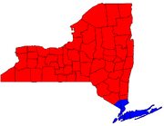
 New York New York
- New York City has had proponents of its independent statehood (and even nationhood) as far back as 1787. It has long been commonly recognized that much of the upstateUpstate New YorkUpstate New York is the region of the U.S. state of New York that is located north of the core of the New York metropolitan area.-Definition:There is no clear or official boundary between Upstate New York and Downstate New York...
is of a different world than ultra-urban NYC (NYC itself contains multiple counties and collects its own income tax). Such proposals have been supported from the upstate side as well, as some upstate residents also feel that voters in New York City either ignore their economic woes or use their dominance in state government to enact exploitative legislation that favors New York City to the direct detriment of the upstate counties, such as New York State ThruwayNew York State ThruwayThe New York State Thruway is a system of limited-access highways located within the state of New York in the United States. The system, known officially as the Governor Thomas E. Dewey Thruway for former New York Governor Thomas E. Dewey, is operated by the New York State Thruway Authority and...
tolls, state regulated electric rates, water supply availability, garbage disposal, farm labor regulations, natural gas drilling regulations, ineffective economic development schemes, and laws perceived to be too friendly to public service labor unionsTaylor LawThe Public Employees Fair Employment Act refers to Article 14 of the New York State Civil Service Law, which defines the rights and limitations of unions for public employees in New York....
, and thus want to split off into their own state as well. - Long IslandLong IslandLong Island is an island located in the southeast part of the U.S. state of New York, just east of Manhattan. Stretching northeast into the Atlantic Ocean, Long Island contains four counties, two of which are boroughs of New York City , and two of which are mainly suburban...
residents have discussed becoming a new state, on the grounds that their tax money gets sent to the state, yet the money is not used to fund programs in their counties. These proposals may include the entire island (KingsBrooklynBrooklyn is the most populous of New York City's five boroughs, with nearly 2.6 million residents, and the second-largest in area. Since 1896, Brooklyn has had the same boundaries as Kings County, which is now the most populous county in New York State and the second-most densely populated...
, QueensQueensQueens is the easternmost of the five boroughs of New York City. The largest borough in area and the second-largest in population, it is coextensive with Queens County, an administrative division of New York state, in the United States....
, NassauNassau County, New YorkNassau County is a suburban county on Long Island, east of New York City in the U.S. state of New York, within the New York Metropolitan Area. As of the 2010 census, the population was 1,339,532...
, and SuffolkSuffolk County, New YorkSuffolk County is a county located in the U.S. state of New York on the eastern portion of Long Island. As of the 2010 census, the population was 1,493,350. It was named for the county of Suffolk in England, from which its earliest settlers came...
counties) or the two counties (Nassau and Suffolk) that are outside the realm of New York City (with the possible formation of a third, PeconicPeconic County, New YorkPeconic County is a proposed new county in New York that would secede the five easternmost towns of Suffolk County: East Hampton, Riverhead, Shelter Island, Southampton and Southold, plus the Shinnecock Indian Reservation....
, from the eastern portion of Suffolk). - In the early 1980s, when Governor Mario CuomoMario CuomoMario Matthew Cuomo served as the 52nd Governor of New York from 1983 to 1994, and is the father of Andrew Cuomo, the current governor of New York.-Early life:...
proposed the creation of a second Temporary Commission to Study the Future of the AdirondacksAdirondack MountainsThe Adirondack Mountains are a mountain range located in the northeastern part of New York, that runs through Clinton, Essex, Franklin, Fulton, Hamilton, Herkimer, Lewis, Saint Lawrence, Saratoga, Warren, and Washington counties....
, several towns in northern Warren CountyWarren County, New YorkWarren County is a county in the U.S. state of New York. It is part of the Glens Falls, New York, Metropolitan Statistical Area. As of the 2010 census, the population was 65,707. It is named in honor of General Joseph Warren, an American Revolutionary War hero of the Battle of Bunker Hill...
passed resolutions declaring their intention to leave New York for Vermont, since the first Temporary Commission had led to the creation of the Adirondack Park Agency, whose heavy hand in enforcing its restrictive zoning code had been widely resented. After Cuomo backed off, the proposals died.
 New York City New York City
In the New York City mayoral election of 1969, writer Norman MailerNorman Mailer
Norman Kingsley Mailer was an American novelist, journalist, essayist, poet, playwright, screenwriter, and film director.Along with Truman Capote, Joan Didion, Hunter S...
ran in the Democratic Party primary on a ticket with columnist Jimmy Breslin
Jimmy Breslin
Jimmy Breslin is an American journalist and author. He currently writes a column for the New York Daily News' Sunday edition. He has written numerous novels, and columns of his have appeared regularly in various newspapers in his hometown of New York City...
, who ran for City Council President. Part of their joint platform was a proposal that New York City
New York City
New York is the most populous city in the United States and the center of the New York Metropolitan Area, one of the most populous metropolitan areas in the world. New York exerts a significant impact upon global commerce, finance, media, art, fashion, research, technology, education, and...
should secede from New York State and become the 51st state. At around the same time, a public-affairs series on the local educational TV station, WNET-TV, channel 13, was called The Fifty-First State.
New York City has existed in its current five-borough configuration since 1898. One of those five, Staten Island
Staten Island
Staten Island is a borough of New York City, New York, United States, located in the southwest part of the city. Staten Island is separated from New Jersey by the Arthur Kill and the Kill Van Kull, and from the rest of New York by New York Bay...
, is connected to the rest of the city and state only by one of its four bridges and the Staten Island Ferry
Staten Island Ferry
The Staten Island Ferry is a passenger ferry service operated by the New York City Department of Transportation that runs between the boroughs of Manhattan and Staten Island.-Overview:...
. After the U.S. Supreme Court ruled in its 1989 Board of Estimate of City of New York v. Morris
Board of Estimate of City of New York v. Morris
Board of Estimate of City of New York v. Morris, 489 U.S. 688 , was a case argued before the United States Supreme Court regarding the structure of the New York City Board of Estimate....
decision that the city's New York City Board of Estimate
New York City Board of Estimate
The New York City Board of Estimate was a governmental body in New York City, responsible for budget and land-use decisions. Under the charter of the newly amalgamated City of Greater New York the Board of Estimate and Apportionment was composed of eight ex officio members: the Mayor of New York...
was a violation of the constitutional principle of one man, one vote, the borough's residents began grumbling about seceding from the city, or even the state, since as the least populous borough their political influence in a more equitable setup would be diminished. Borough residents, a more suburban and middle-class population than the city as a whole, had long felt either ignored or slighted by the rest of the city's population as well. Upon taking office as borough president, former congressman Guy Molinari
Guy Molinari
Gaetano Victor "Guy" Molinari is a former United States Representative and borough president of Staten Island, New York.-Education and Military Service:...
fired a mock cannon across Upper New York Bay
Upper New York Bay
Upper New York Bay, or Upper Bay, is the traditional heart of the Port of New York and New Jersey, and often called New York Harbor. It is enclosed by the New York City boroughs of Manhattan, Brooklyn, and Staten Island and the Hudson County, New Jersey municipalities of Jersey City and Bayonne.It...
at city government, signalling an intention to secede from the city if the island's concerns were not addressed somehow. So far the island has remained part of the city.
Staten Island's complaints also triggered some talk of secession in Queens
Queens
Queens is the easternmost of the five boroughs of New York City. The largest borough in area and the second-largest in population, it is coextensive with Queens County, an administrative division of New York state, in the United States....
, parts of which are demographically similar to those on Staten Island. This, too, has not had any results.
 North Carolina North Carolina
In 1784, the western counties of Greene, Washington, Sullivan, and part of HawkinsHawkins County, Tennessee
Hawkins County is a county located in the U.S. state of Tennessee. As of 2010, the population was 56,833. Its county seat is Rogersville, Tennessee's second-oldest town....
county, all of which were then part of the Washington District, North Carolina
Washington District, North Carolina
The Washington District of North Carolina was in a remote area west of the Appalachian Mountains, officially existing for only a short period of time , although it had been self-proclaimed and functioning as an independent governing entity since the spring of 1775...
, voted to secede from the state. They formed the provisional State of Franklin
State of Franklin
The State of Franklin, known also as the Free Republic of Franklin or the State of Frankland , was an unrecognized autonomous United States territory created in 1784 from part of the territory west of the Appalachian Mountains that had been offered,...
, with Revolutionary War
American Revolutionary War
The American Revolutionary War , the American War of Independence, or simply the Revolutionary War, began as a war between the Kingdom of Great Britain and thirteen British colonies in North America, and ended in a global war between several European great powers.The war was the result of the...
hero John Sevier
John Sevier
John Sevier served four years as the only governor of the State of Franklin and twelve years as Governor of Tennessee. As a U.S. Representative from Tennessee from 1811 until his death...
elected as governor. By 1789, the provisional government had collapsed.
In 1790, the North Carolina state government, tired of the troublesome region, relinquished it to the federal government, creating the Territory South of the River Ohio
Southwest Territory
The Territory South of the River Ohio, more commonly known as the Southwest Territory, was an organized incorporated territory of the United States that existed from May 26, 1790, until June 1, 1796, when it was admitted to the United States as the State of Tennessee.The Southwest Territory was...
. Six years later, the territory (including the former counties of Franklin) became the State of Tennessee, with Sevier as governor.
 Ohio Ohio
In 2005, James B. McCarthy, the county executive of Summit CountySummit County, Ohio
Summit County is an urban county located in the state of Ohio, United States. As of the 2000 census, the population was 542,899. In the 2010 Census the population was 541,781. Its county seat is Akron...
, which contains Akron
Akron, Ohio
Akron , is the fifth largest city in the U.S. state of Ohio and the county seat of Summit County. It is located in the Great Lakes region approximately south of Lake Erie along the Little Cuyahoga River. As of the 2010 census, the city had a population of 199,110. The Akron Metropolitan...
, publicly advocated that his county (and the rest of Northeast Ohio) secede as a new state.
Northeastern Ohio has a history of being distinct from the remainder of the state, once known as "New Connecticut" and claimed as the Connecticut Western Reserve
Connecticut Western Reserve
The Connecticut Western Reserve was land claimed by Connecticut from 1662 to 1800 in the Northwest Territory in what is now northeastern Ohio.-History:...
.
 Oklahoma Oklahoma
The remote Oklahoma PanhandleOklahoma Panhandle
The Oklahoma Panhandle is the extreme western region of the state of Oklahoma, comprising Cimarron County, Texas County, and Beaver County. Its name comes from the similarity of shape to the handle of a cooking pan....
has often cited the distant state government for neglect, and support for secession as a new state has been voiced. Alternate proposals have the region merging with Texas
Texas
Texas is the second largest U.S. state by both area and population, and the largest state by area in the contiguous United States.The name, based on the Caddo word "Tejas" meaning "friends" or "allies", was applied by the Spanish to the Caddo themselves and to the region of their settlement in...
, as the closest major city to the area is Amarillo
Amarillo, Texas
Amarillo is the 14th-largest city, by population, in the state of Texas, the largest in the Texas Panhandle, and the seat of Potter County. A portion of the city extends into Randall County. The population was 190,695 at the 2010 census...
.
Another proposal would merge Texas's Panhandle with the State of Oklahoma, since residents in that area have more in common with neighboring Oklahomans than they do with more distant Dallas, Austin and Houston.
The ongoing state secessionist movement for Eastern Oklahoma
Eastern Oklahoma
See Also: Green CountryEastern Oklahoma is usually defined as east of Oklahoma City and east of Interstate 35 in Oklahoma. The region includes Tulsa.The region is usually divided into two main areas: Northeast Oklahoma, and Southeast Oklahoma....
with Tulsa as its largest city and possible state capital has resurfaced at times.
A state of Sequoyah
State of Sequoyah
The State of Sequoyah was the proposed name for a state to be established in the eastern part of present-day Oklahoma. In 1905, faced by proposals to end their tribal governments, Native Americans of the Five Civilized Tribes in Indian Territory proposed such a state as a means to retain some...
separate from the Oklahoma Territory
Oklahoma Territory
The Territory of Oklahoma was an organized incorporated territory of the United States that existed from May 2, 1890, until November 16, 1907, when it was joined with the Indian Territory under a new constitution and admitted to the Union as the State of Oklahoma.-Organization:Oklahoma Territory's...
, to consist of the lands of five Native American tribes (the Cherokee Nation
Cherokee Nation
The Cherokee Nation is the largest of three Cherokee federally recognized tribes in the United States. It was established in the 20th century, and includes people descended from members of the old Cherokee Nation who relocated voluntarily from the Southeast to Indian Territory and Cherokees who...
, Chickasaw Nation
Chickasaw Nation
The Chickasaw Nation is a federally recognized Native American nation, located in Oklahoma. They are one of the members of the Five Civilized Tribes. The Five Civilized Tribes were differentiated from other Indian reservations in that they had semi-autonomous constitutional governments and...
, Choctaw Nation
Choctaw Nation of Oklahoma
The Choctaw Nation of Oklahoma is a semi-autonomous Native American homeland comprising twelve tribal districts. The Choctaw Nation maintains a special relationship with both the United States and Oklahoma governments...
, Creek Nation (or Muskogees), Seminole Nation and Osage County
Osage County, Oklahoma
Osage County is a county in the northern part of the U.S. state of Oklahoma. Coterminous with the Osage Indian Reservation, it is the home of the federally recognized Osage Nation. As of the 2010 census, the population was 47,472 a 6.8 percent increase from 2000, when the population was 44,437...
), was proposed but rejected in favor of the state of Oklahoma in 1907.
 Oregon Oregon
- In 1941 some counties of southwestern Oregon joined counties of Northern CaliforniaNorthern CaliforniaNorthern California is the northern portion of the U.S. state of California. The San Francisco Bay Area , and Sacramento as well as its metropolitan area are the main population centers...
and ceremonially seceded as the State of Jefferson. See also California above. - In the wake of controversy over the issue of same-sex marriageSame-sex marriage in the United StatesThe federal government does not recognize same-sex marriage in the United States, but such marriages are recognized by some individual states. The lack of federal recognition was codified in 1996 by the Defense of Marriage Act, before Massachusetts became the first state to grant marriage licenses...
as well as rifts with the rest of the state over tax laws and the flow of capital funding, the secession of Multnomah CountyMultnomah County, OregonMultnomah County is one of 36 counties in the U.S. state of Oregon. Though smallest in area, it is the most populous as its county seat, Portland, is the state's largest city...
, which contains most of the city of PortlandPortland, OregonPortland is a city located in the Pacific Northwest, near the confluence of the Willamette and Columbia rivers in the U.S. state of Oregon. As of the 2010 Census, it had a population of 583,776, making it the 29th most populous city in the United States...
, has been proposed in some local media. - Some talk has also been made of Eastern OregonEastern OregonEastern Oregon is the eastern part of the U.S. state of Oregon. It is not an officially recognized geographic entity, thus the boundaries of the region vary according to context. It is sometimes understood to include only the eight easternmost counties in the state; in other contexts, it includes...
following suit (and perhaps merging) with Eastern WashingtonEastern WashingtonEastern Washington is the portion of the U.S. state of Washington east of the Cascade Range. The region contains the city of Spokane , the Tri-Cities, the Columbia River and the Grand Coulee Dam, the Hanford Nuclear Reservation and the fertile farmlands of the Yakima Valley and the...
were it to secede from its parent state (see Washington below). In both states distinct political, geographic, and cultural divides exist on either side of the Cascade Mountains. A more formal movement was proposed in 2008.
 Pennsylvania Pennsylvania
- In 1787 the residents of the Wyoming ValleyWyoming ValleyWyoming Valley is a region of northeastern Pennsylvania. As a metropolitan area, it is also known as the Scranton/Wilkes-Barre area, after its principal cities, Scranton and Wilkes-Barre....
attempted to secede from the state as the State of WestmorelandState of WestmorelandThe State of Westmoreland was a proposed self-proclaimed state that would have seceded from Pennsylvania.Both Pennsylvania and Connecticut claimed ownership of the lands between 41° N and 42° N, and this gave rise to a series of land-conflicts collectively referred to as the Yankee-Pennamite Wars...
. Before the issue was decided, the state militia was mobilized to put down any attempt to make good on the threat. - During the era following the American Revolution, there were proposals to split Western PennsylvaniaWestern PennsylvaniaWestern Pennsylvania consists of the western third of the state of Pennsylvania in the United States. Pittsburgh is the largest city in the region, with a metropolitan area population of about 2.4 million people, and serves as its economic and cultural center. Erie, Altoona, and Johnstown are its...
from the rest of the state to form WestsylvaniaWestsylvaniaWestsylvania was a proposed state of the United States located primarily in what is now western Pennsylvania and West Virginia. First proposed early in the American Revolution, Westsylvania would have been the fourteenth state in the newly formed United States had it been recognized.-Background:In...
. Western Pennsylvania retains a distinct identity from the rest of the Commonwealth today, having more in common with OhioOhioOhio is a Midwestern state in the United States. The 34th largest state by area in the U.S.,it is the 7th‑most populous with over 11.5 million residents, containing several major American cities and seven metropolitan areas with populations of 500,000 or more.The state's capital is Columbus...
, West VirginiaWest VirginiaWest Virginia is a state in the Appalachian and Southeastern regions of the United States, bordered by Virginia to the southeast, Kentucky to the southwest, Ohio to the northwest, Pennsylvania to the northeast and Maryland to the east...
, Western New YorkWestern New YorkWestern New York is the westernmost region of the state of New York. It includes the cities of Buffalo, Rochester, Niagara Falls, the surrounding suburbs, as well as the outlying rural areas of the Great Lakes lowlands, the Genesee Valley, and the Southern Tier. Some historians, scholars and others...
, and Western MarylandWestern MarylandWestern Maryland is the portion of the U.S. state of Maryland that consists of Frederick, Washington, Allegany, and Garrett counties. The region is bounded by the Mason-Dixon line to the north, Preston County, West Virginia to the west, and the Potomac River to the south. There is dispute over the...
than the eastern side of the state.
 Rhode Island Rhode Island
- In 1790, the urban center of ProvidenceProvidence, Rhode IslandProvidence is the capital and most populous city of Rhode Island and was one of the first cities established in the United States. Located in Providence County, it is the third largest city in the New England region...
was frustrated with the state government's reluctance to ratify the ConstitutionUnited States ConstitutionThe Constitution of the United States is the supreme law of the United States of America. It is the framework for the organization of the United States government and for the relationship of the federal government with the states, citizens, and all people within the United States.The first three...
and join the United States. In response, Providence threatened to secede and ratify on its own as its own state. The threat finally compelled the state to ratify by a narrow majority under the name of Rhode Island and the Providence Plantations. - In 1984, angered over the state's refusal to enact noise pollutionNoise pollutionNoise pollution is excessive, displeasing human, animal or machine-created environmental noise that disrupts the activity or balance of human or animal life...
laws, the township of New ShorehamNew Shoreham, Rhode IslandNew Shoreham is the town located on Block Island in Washington County, Rhode Island, United States. The population was 1,051 at the 2010 census...
, located on Block IslandBlock IslandBlock Island is part of the U.S. state of Rhode Island and is located in the Atlantic Ocean approximately south of the coast of Rhode Island, east of Montauk Point on Long Island, and is separated from the Rhode Island mainland by Block Island Sound. The United States Census Bureau defines Block...
, threatened to secede from the state. Reportedly, both MassachusettsMassachusettsThe Commonwealth of Massachusetts is a state in the New England region of the northeastern United States of America. It is bordered by Rhode Island and Connecticut to the south, New York to the west, and Vermont and New Hampshire to the north; at its east lies the Atlantic Ocean. As of the 2010...
and ConnecticutConnecticutConnecticut is a state in the New England region of the northeastern United States. It is bordered by Rhode Island to the east, Massachusetts to the north, and the state of New York to the west and the south .Connecticut is named for the Connecticut River, the major U.S. river that approximately...
expressed interest in annexing the island. The state compromised, giving the island ability to limit the sale of noisy mopeds.
 Republic of Texas Texas
- While it would not technically constitute secession, under the joint resolution of Congress by which the Republic of TexasRepublic of TexasThe Republic of Texas was an independent nation in North America, bordering the United States and Mexico, that existed from 1836 to 1846.Formed as a break-away republic from Mexico by the Texas Revolution, the state claimed borders that encompassed an area that included all of the present U.S...
was admitted to the Union, it had the right to divide itself into as many as five different states. It is not clear whether this provides any power beyond that already provided by the Constitution. What is clear is that the Texas LegislatureTexas LegislatureThe Legislature of the state of Texas is the state legislature of the U.S. state of Texas. The legislature is a bicameral body composed of a 31-member Senate and a 150-member House of Representatives. The Legislature meets at the Capitol in Austin...
would have to approve any proposal to divide the state using this prerogative. There was a significant number of Texans who supported dividing the state in its early decades. They were generally called divisionistsTexas divisionismTexas divisionism is a mainly historical movement that advocates the division of the U.S. state of Texas into as many as five states, a prerogative guaranteed to Texas as a condition of the former Republic of Texas joining the Union in 1845....
. However, no state has ever been allowed to secede from the Union.
 Utah Utah
- In 2002, the United States House of Representatives voted to allow WendoverWendover, UtahWendover is a city in Tooele County, Utah, United States. It is part of the Elko Micropolitan Statistical Area. The population was 1,537 at the 2000 census, with a 2006 estimated population of 1,632....
to leave the state and join NevadaNevadaNevada is a state in the western, mountain west, and southwestern regions of the United States. With an area of and a population of about 2.7 million, it is the 7th-largest and 35th-most populous state. Over two-thirds of Nevada's people live in the Las Vegas metropolitan area, which contains its...
, merging with the city of West WendoverWest Wendover, NevadaWest Wendover is a city in Elko County, Nevada, United States. The population was 4,721 at the 2000 census. It is part of the Elko Micropolitan Statistical Area. West Wendover is located on the eastern border of Nevada and the western edge of the Great Salt Lake Desert, and is contiguous with...
. The opposition of Nevada Senator Harry ReidHarry ReidHarry Mason Reid is the senior United States Senator from Nevada, serving since 1987. A member of the Democratic Party, he has been the Senate Majority Leader since January 2007, having previously served as Minority Leader and Minority and Majority Whip.Previously, Reid was a member of the U.S...
blocked the bill's consideration in the Senate. - In 2008, Joint Resolution 6 'Consenting to Creation of New State Within Utah' was proposed by Representative Neal Hendrickson. This resolution called for "the creation of a separate state, consisting of the southern portion of the present state of Utah with a northern boundary stretching east and west across the present state of Utah at the southern border of Utah CountyUtah County, UtahUtah County is a county located in the U.S. state of Utah. As of 2000, the population was 368,536 and by 2008 was estimated at 530,837. It was named for the Spanish name for the Ute Indians. The county seat and largest city is Provo...
". The bill died in committee in March 2008.
 Vermont Vermont
The town of KillingtonKillington, Vermont
Killington is a town in Rutland County, Vermont, United States. The population was 811 at the 2010 census. Killington Ski Resort is located here....
has twice voted (March 2004 and March 2005) to secede from Vermont and become part of the state of New Hampshire
New Hampshire
New Hampshire is a state in the New England region of the northeastern United States of America. The state was named after the southern English county of Hampshire. It is bordered by Massachusetts to the south, Vermont to the west, Maine and the Atlantic Ocean to the east, and the Canadian...
. Because the town is not adjacent to the New Hampshire border, this would create an enclave. A similar motion was attempted in Winhall
Winhall, Vermont
Winhall is a town in Bennington County, Vermont, United States. The population was 702 at the 2000 census.-Geography:According to the United States Census Bureau, the town has a total area of 44.0 square miles , of which 43.7 square miles are land and 0.3 square mile is...
, but was voted down.
 Virginia Virginia
- For years, residents and businesses of Northern VirginiaNorthern VirginiaNorthern Virginia consists of several counties and independent cities in the Commonwealth of Virginia, in a widespread region generally radiating southerly and westward from Washington, D.C...
have complained that their region, which has about a third of the state's population, sends about half its tax revenues to the State and gets back only 25 cents on the dollar. Some residents argue that Northern Virginia is part of the state in name only, saying that the region is so different from the rest of Virginia, it’s as though the New Jersey suburbs were grafted onto South Carolina. This situation has led some to propose that northern split into the separate state of Northern Virginia. More recently, John McCainJohn McCainJohn Sidney McCain III is the senior United States Senator from Arizona. He was the Republican nominee for president in the 2008 United States election....
adviser Nancy PfotenhauerNancy PfotenhauerNancy Mitchell Pfotenhauer is currently the president of MediaSpeak Strategies. She was former Senior Policy Advisor and National Spokesperson with the 2008 John McCain presidential campaign and political commentator on Fox News, CNN and MSNBC She was also former Executive Vice President of...
created a minor controversy making a distinction between northern Virginia and “real Virginia,” which she said is the “part of the state that is more Southern in nature...” - Minor localities have recently grumbled over state secession possibilities in response to various state government decisions on both sides of the political spectrum.
 Washington Washington
- Over the latter half of the 20th century (and reportedly as far back as 1889), the counties of Eastern WashingtonEastern WashingtonEastern Washington is the portion of the U.S. state of Washington east of the Cascade Range. The region contains the city of Spokane , the Tri-Cities, the Columbia River and the Grand Coulee Dam, the Hanford Nuclear Reservation and the fertile farmlands of the Yakima Valley and the...
have occasionally raised the possibility of splitting largely conservative and rural Eastern Washington (and sometimes the Idaho PanhandleIdaho PanhandleThe Idaho Panhandle is the northern region of the U.S. State of Idaho that encompasses the ten northernmost counties of Benewah, Bonner, Boundary, Clearwater, Idaho, Kootenai, Latah, Lewis, Nez Perce, Shoshone. Residents of the panhandle refer to the region as North Idaho...
) away from urban and liberal Western WashingtonWestern WashingtonWestern Washington is a region of the United States defined as that part of Washington west of the Cascade Mountains.It is known as being far wetter in climate than the eastern portion of the state, which...
. As recently as 2005, this has been officially proposed in the state legislature, amid the fallout of the 2004 governor's electionWashington gubernatorial election, 2004The election for governor of Washington on November 2, 2004 gained national attention for its legal twists and extremely close finish. Notable for being among the closest political races in United States election history, Republican Dino Rossi was declared the winner in the initial automated count...
. Suggested names for such a state include East Washington, Columbia, Lincoln, and CascadiaCascadia (independence movement)Cascadia is the proposed name for a bioregional political entity and/or an independent nation located within the Cascadian bioregion of the Pacific Northwest of North America...
.
 Washington, D.C. Washington, D.C.
The District of Columbia is an insular federal districtFederal district
Federal districts are a type of administrative division of a federation, under the direct control of a federal government. They exist in various countries and states all over the world.-United States:...
separate from any state and under direct control of the United States Congress
United States Congress
The United States Congress is the bicameral legislature of the federal government of the United States, consisting of the Senate and the House of Representatives. The Congress meets in the United States Capitol in Washington, D.C....
. Residents of the capital have no voting representation
District of Columbia voting rights
Voting rights of citizens in the District of Columbia differ from those of United States citizens in each of the fifty states. District of Columbia residents do not have voting representation in the United States Senate, but D.C. is entitled to three electoral votes for President. In the U.S...
in Congress, nor complete control over their local government
District of Columbia home rule
District of Columbia home rule is a term to describe the various means by which residents of the District of Columbia are able to govern their local affairs...
. There has been a recurring movement since the 1960s to make the District of Columbia into a state in order to permit residents full voting representation in Congress and control over local affairs. An alternate proposal is for Congress to return most of the District of Columbia (excepting the immediate vicinity of the Capitol and White House) to the state of Maryland (a process known as retrocession), as was done with the Virginia portion of the District in 1846.
 West Virginia West Virginia
- In 2002, inhabitants of the western part of Mingo CountyMingo County, West VirginiaAs of the census of 2000, there were 28,253 people, 11,303 households, and 8,217 families residing in the county. The population density was 67 people per square mile . There were 12,898 housing units at an average density of 30 per square mile...
petitioned the county to allow it to break off and join KentuckyKentuckyThe Commonwealth of Kentucky is a state located in the East Central United States of America. As classified by the United States Census Bureau, Kentucky is a Southern state, more specifically in the East South Central region. Kentucky is one of four U.S. states constituted as a commonwealth...
on the other side of the Tug River. Neither state has seriously considered the request. - The southern areas of the state have grumbled about the lack of representation and respect from the state capital in Charleston. Some southern counties, such as McDowellMcDowell County, West VirginiaMcDowell County is a county in the U.S. state of West Virginia. The land that became McDowell was originally part of Tazewell County, Virginia. As of the 2010 census, the population was 22,113. Its county seat is Welch. McDowell county is the southern-most county in the state, geographically...
, MercerMercer County, West Virginia-External links:* * * * * * *...
, RaleighRaleigh County, West VirginiaAs of the census of 2000, there were 79,220 people, 31,793 households, and 22,096 families residing in the county. The population density was 130 people per square mile . There were 35,678 housing units at an average density of 59 per square mile...
and MonroeMonroe County, West VirginiaAs of the census of 2000, there were 14,583 people, 5,447 households, and 3,883 families residing in the county. The population density was 31 people per square mile . There were 7,267 housing units at an average density of 15 per square mile...
, have rhetorically raised the idea of joining rural counties in southwestern Virginia (which feel equally disenfranchised from their state government in Richmond) to form a new state. No serious proposals have ever made it to the state capitol for debate, however.
 Wisconsin Wisconsin
- In 1967, the village of WinneconneWinneconne, WisconsinWinneconne is a village in Winnebago County, Wisconsin, United States. The population was 2,401 at the 2000 census. The village is located within the Town of Winneconne...
seceded from Wisconsin for one day to protest its omission from the new state highway map. - A culture common to the northern counties of WisconsinWisconsinWisconsin is a U.S. state located in the north-central United States and is part of the Midwest. It is bordered by Minnesota to the west, Iowa to the southwest, Illinois to the south, Lake Michigan to the east, Michigan to the northeast, and Lake Superior to the north. Wisconsin's capital is...
, together with MichiganMichiganMichigan is a U.S. state located in the Great Lakes Region of the United States of America. The name Michigan is the French form of the Ojibwa word mishigamaa, meaning "large water" or "large lake"....
's Upper PeninsulaUpper Peninsula of MichiganThe Upper Peninsula of Michigan is the northern of the two major land masses that make up the U.S. state of Michigan. It is commonly referred to as the Upper Peninsula, the U.P., or Upper Michigan. It is also known as the land "above the Bridge" linking the two peninsulas. The peninsula is bounded...
and northeastern counties of MinnesotaMinnesotaMinnesota is a U.S. state located in the Midwestern United States. The twelfth largest state of the U.S., it is the twenty-first most populous, with 5.3 million residents. Minnesota was carved out of the eastern half of the Minnesota Territory and admitted to the Union as the thirty-second state...
that is not shared as strongly with the southern portions of each state has resulted in considerations of forming a state known as Superior. These have not been taken very seriously, as most of the northern counties are dependent on the southern parts of their states for funding. - It is often suggested around election times (sometimes humorously) that Milwaukee and/or MadisonMadison, WisconsinMadison is the capital of the U.S. state of Wisconsin and the county seat of Dane County. It is also home to the University of Wisconsin–Madison....
should form their own state based on their generally left-wing politicsLeft-wing politicsIn politics, Left, left-wing and leftist generally refer to support for social change to create a more egalitarian society...
and cultural differences compared to the rest of Wisconsin. Similarly, Kenosha CountyKenosha County, Wisconsin-Demographics: As of the census of 2000, there were 149,577 people, 56,057 households, and 38,455 families residing in the county. The population density was 548 people per square mile . There were 59,989 housing units at an average density of 220 per square mile...
is often (sometimes pejoratively) referred to as "Northern Illinois" based on its status (as of the 2000 census) as a suburb of Chicago, and urged to formally join Illinois.
 Alabama Alabama
According to legend, upon the secession of AlabamaAlabama
Alabama is a state located in the southeastern region of the United States. It is bordered by Tennessee to the north, Georgia to the east, Florida and the Gulf of Mexico to the south, and Mississippi to the west. Alabama ranks 30th in total land area and ranks second in the size of its inland...
from the United States during the American Civil War
American Civil War
The American Civil War was a civil war fought in the United States of America. In response to the election of Abraham Lincoln as President of the United States, 11 southern slave states declared their secession from the United States and formed the Confederate States of America ; the other 25...
, Winston County
Winston County, Alabama
Winston County is a county of the U.S. state of Alabama, formerly known as Hancock County before 1858.Its name is in honor of John A. Winston, the 15th Governor of Alabama. As of 2010, the population was 24,484. Its county seat is Double Springs....
seceded from the state as the Republic of Winston
Republic of Winston
The "Republic" of Winston was one of several places in the Confederate States of America where disaffection during the American Civil War was strong...
, and pledged its alliance with the Union. Today citizens of the county still refer to it as the Free State of Winston, which drives the local tourist industry.
 Arkansas Arkansas
During the Civil War, five counties, including Madison CountyMadison County, Arkansas
Madison County is a county located in the U.S. state of Arkansas. As of 2010, the population was 15,717. The county seat is Huntsville. The county was formed on September 30, 1836, and named for James Madison, President of the United States...
and possibly Marion County, voted against secession from the Union at the second Arkansas Secession Convention. When called upon to renege, four counties did, but Madison, represented by Isaac Murphy
Isaac Murphy
For the African-American Hall of Fame jockey see: Isaac Burns MurphyIsaac Murphy was the first Reconstruction Governor of Arkansas. He was the first reconstruction governor to come to power under President Abraham Lincoln's conciliatory policy...
, later the state's governor under Reconstruction, resisted. Men of his county fought for the North during the war.
Georgia (U.S. state) Georgia
In the 1850s many from Dade CountyDade County, Georgia
Dade County is a county located in the U.S. state of Georgia. As of 2000, the population is 15,154. The 2007 Census Estimate shows a population of 16,098...
, in the far northwestern corner of the state, threatened to secede from Georgia (and the U.S.) if the state itself did not secede.
Illinois Illinois
Shortly before the Civil War, southern Illinois considered seceding from Illinois and joining the Confederacy; a proposed name for the new state was Little EgyptLittle Egypt (region)
-Early history:The earliest inhabitants of Illinois were thought to have arrived about 12,000 B.C. They were hunter-gatherers, but developed a primitive system of agriculture. After 1000 AD, their agricultural surpluses enabled them to develop complex, hierarchical societies...
after the region's local name. However, speeches by Union General John A. Logan
John A. Logan
John Alexander Logan was an American soldier and political leader. He served in the Mexican-American War and was a general in the Union Army in the American Civil War. He served the state of Illinois as a state senator, congressman and senator and was an unsuccessful candidate for Vice President...
, a native of the region, convinced many in the region to remain in the Union.
Kentucky Kentucky
On November 20, 1861, representatives from several counties met at RussellvilleRussellville, Kentucky
As of the census of 2000, there were 7,149 people, 3,064 households, and 1,973 families residing in the city. The population density was 672.1 people per square mile . There were 3,458 housing units at an average density of 325.1 per square mile...
calling themselves "the Convention of the People of Kentucky" (later known as the Russellville Convention) and passed an Ordinance of Secession. It established a Confederate government of Kentucky
Confederate government of Kentucky
The Confederate government of Kentucky was a shadow government established for the Commonwealth of Kentucky by a self-constituted group of Confederate sympathizers during the American Civil War. The shadow government never replaced the elected government in Frankfort, which had strong Union...
with its capital in Bowling Green. Although it remained in the Union, Kentucky was represented by a star on the Confederate battle flag and national flag.
 Louisiana Louisiana
During the Civil War, David Pierson, a young attorney, was elected to represent Winn Parish in northwest central Louisiana at the Secession Convention called by Governor Thomas Overton MooreThomas Overton Moore
Thomas Overton Moore was an attorney and politician who was the 16th Governor of Louisiana from 1860 until 1864 during the American Civil War.-Early years:...
in Baton Rouge
Baton Rouge, Louisiana
Baton Rouge is the capital of the U.S. state of Louisiana. It is located in East Baton Rouge Parish and is the second-largest city in the state.Baton Rouge is a major industrial, petrochemical, medical, and research center of the American South...
in January 1861. Pierson voted against secession in all votes taken and refused, along with several others, to change his "no" vote at the end of the process when asked to do so in order that the vote for secession be made unanimous. This act of voting "no" has confused some into thinking that Winn Parish refused to secede from the Union
Union (American Civil War)
During the American Civil War, the Union was a name used to refer to the federal government of the United States, which was supported by the twenty free states and five border slave states. It was opposed by 11 southern slave states that had declared a secession to join together to form the...
and was a de facto Union enclave in the Confederate
Confederate States of America
The Confederate States of America was a government set up from 1861 to 1865 by 11 Southern slave states of the United States of America that had declared their secession from the U.S...
state of Louisiana called the Free State of Winn.
 Mississippi Mississippi
Local legend has it that Jones CountyJones County, Mississippi
-History:Jones County, formed out parts of Covington and Wayne counties, was established on January 24, 1826 and was named for John Paul Jones. There are other counties named Jones, but it appears that this is the only one named for John Paul Jones...
, a haven for Confederate military deserters, declared its independence from both countries. Most people in the county had reservations about the strong central government that the Confederate States of America
Confederate States of America
The Confederate States of America was a government set up from 1861 to 1865 by 11 Southern slave states of the United States of America that had declared their secession from the U.S...
instated and few if any in the county owned slaves. Although some claim that these rumors turned out to be completely false, the county did serve as a safe haven for Confederate defectors such as Newton Knight
Newton Knight
Captain Newton Knight was the grandson of John "Jackie" Knight, who was awarded land grants for his service in the War of 1812 in Jones County, Mississippi and owned slaves. Unlike many in his family and his state Newton Knight was against slavery and favored equality between races...
. This event was inaccurately dramatized in the 1948 movie Tap Roots.
Missouri Missouri
- During the Civil War, congressman Frank Blair urged St. LouisSt. Louis, MissouriSt. Louis is an independent city on the eastern border of Missouri, United States. With a population of 319,294, it was the 58th-largest U.S. city at the 2010 U.S. Census. The Greater St...
to secede from the state if it decided to join the Confederacy. - Around the same time, Callaway CountyCallaway County, MissouriCallaway County is a county located in the U.S. state of Missouri. It is part of the Jefferson City, Missouri Metropolitan Statistical Area. As of 2010, the population was 44,332. Its county seat is Fulton. The county was organized in 1820. It was named for Capt. James Callaway, a grandson of...
proposed seceding from Missouri, but with the opposite inclination. Callaway County is sometimes still called "Kingdom of Callaway" and hosts an annual "Kingdom Days" celebration. There is also a city named Kingdom CityKingdom City, MissouriKingdom City is a village in Callaway County, Missouri, United States. It is part of the Jefferson City Metropolitan Statistical Area. The population was 128 at the 2010 census. It is at the intersection of Interstate 70 and U.S...
there.
New York New York
- In 1861, the hamlet of Town LineTown Line, New YorkTown Line is a census-designated place in Erie County, New York, United States. The population was 2,521 at the 2000 census. It is part of the Buffalo–Niagara Falls Metropolitan Statistical Area....
voted to secede from the Union and join the Confederacy. The town contributed several troops to the Confederate Army over the course of the war, but there is no evidence that the Confederacy ever officially recognized Town Line as one of its own. During Reconstruction, the status of Town Line was eventually forgotten, but the area was still technically sovereign. It was eventually discovered in the 1920s that Town Line residents were not paying taxes and were still "outside the Union." In 1946, after significant media attention, town residents voted to rejoin the union.
 Tennessee Tennessee
- In February 1861, in the early days of the Confederacy, the Southern-sympathetic county of FranklinFranklin County, TennesseeFranklin County is a county located in the U.S. state of Tennessee. As of 2010, the population was 41,052. Its county seat is Winchester.Franklin County is part of the Tullahoma, Tennessee, Micropolitan Statistical Area.-History:...
petitioned the state to allow it to secede and join AlabamaAlabamaAlabama is a state located in the southeastern region of the United States. It is bordered by Tennessee to the north, Georgia to the east, Florida and the Gulf of Mexico to the south, and Mississippi to the west. Alabama ranks 30th in total land area and ranks second in the size of its inland...
which had recently seceded from the Union. By June Tennessee had decided to secede as well, eliminating the reason for Franklin to secede. - Conversely, the more pro-Union East TennesseeEast TennesseeEast Tennessee is a name given to approximately the eastern third of the U.S. state of Tennessee, one of the three Grand Divisions of Tennessee defined in state law. East Tennessee consists of 33 counties, 30 located within the Eastern Time Zone and three counties in the Central Time Zone, namely...
area disapproved of state secession and some proposed seceding from Tennessee to rejoin the Union. Some, however, have characterized this sentiment as mere contrarianism against the sentiment of the western half. - Scott County in eastern Tennessee did officially pass a proclamation during the Civil War to secede from Tennessee and form the "Free and Independent State of ScottState of ScottThe State of Scott was the result of a secessionist movement by Scott County , which officially passed a proclamation during the Civil War to secede from Tennessee and form the Free and Independent State of Scott in protest of the state's separation from the United States...
." In 1986 when it was discovered that this county law was still on the books the proclamation was finally repealed and Scott County actually petitioned the state of Tennessee for readmission even though the secession had never been recognized by either the state or federal governments.
Virginia Virginia
- In the early days of the Confederacy, Lunenburg CountyLunenburg County, VirginiaAs of the census of 2000, there were 13,146 people, 4,998 households, and 3,383 families residing in the county. The population density was 30 people per square mile . There were 5,736 housing units at an average density of 13 per square mile...
grew impatient that the state had not yet seceded from the Union, and threatened to secede from Virginia itself, possibly to join North CarolinaNorth CarolinaNorth Carolina is a state located in the southeastern United States. The state borders South Carolina and Georgia to the south, Tennessee to the west and Virginia to the north. North Carolina contains 100 counties. Its capital is Raleigh, and its largest city is Charlotte...
. - After Virginia declared its secession from the U.S. in 1861, its mountainous western half formed the pro-Union Restored Government of VirginiaRestored government of VirginiaThe Restored Government of Virginia, or the Reorganized Government of Virginia, was the Unionist government of Virginia during the American Civil War. From 1861 until mid-1863 it met in Wheeling, and from 26 August 1863 until June 1865 it met in Alexandria...
; the Union Congress recognized this as Virginia's legitimate government, with authority to approve its own partition. In 1863, the area was admitted to the Union as the state of West VirginiaWest VirginiaWest Virginia is a state in the Appalachian and Southeastern regions of the United States, bordered by Virginia to the southeast, Kentucky to the southwest, Ohio to the northwest, Pennsylvania to the northeast and Maryland to the east...
. - Two islands on the Atlantic coast of the Delmarva PeninsulaDelmarva PeninsulaThe Delmarva Peninsula is a large peninsula on the East Coast of the United States, occupied by most of Delaware and portions of Maryland and Virginia...
– ChincoteagueChincoteague, VirginiaChincoteague is a town on Chincoteague Island in Accomack County, Virginia, United States. The population was 4,317 at the 2000 census. The town is perhaps best known for the Chincoteague Ponies, although these are not actually on the island of Chincoteague but on nearby Assateague Island...
and Assateague – also sided with the Union, and provided the Union with seafood and a Southern base of operations. Because of its loyalty the US Navy helped Chincoteague reconstruct its lighthouse after a devastating storm; the lighthouse still stands today.
See also
- List of active autonomist and secessionist movements
- List of U.S. county secession proposals
- Urban secessionUrban secessionUrban secession is a city's secession from its surrounding region, to form a new political unit. This new unit is usually a subdivision of the same country as its surroundings, but in some cases, full sovereignty may be attained, in which case the unit is usually called a city-state...
- Hawaiian sovereignty movementHawaiian sovereignty movementThe Hawaiian sovereignty movement is a political movement seeking some form of sovereignty for Hawai'i. Generally, the movement's focus is on self-determination and self-governance, either for Hawaiʻi as an independent nation, or for people of whole or part native Hawaiian ancestry, or for...