

Eastern Oregon
Encyclopedia
U.S. state
A U.S. state is any one of the 50 federated states of the United States of America that share sovereignty with the federal government. Because of this shared sovereignty, an American is a citizen both of the federal entity and of his or her state of domicile. Four states use the official title of...
of Oregon
Oregon
Oregon is a state in the Pacific Northwest region of the United States. It is located on the Pacific coast, with Washington to the north, California to the south, Nevada on the southeast and Idaho to the east. The Columbia and Snake rivers delineate much of Oregon's northern and eastern...
. It is not an officially recognized geographic entity, thus the boundaries of the region vary according to context. It is sometimes understood to include only the eight easternmost counties in the state; in other contexts, it includes the entire area east of the Cascade Range
Cascade Range
The Cascade Range is a major mountain range of western North America, extending from southern British Columbia through Washington and Oregon to Northern California. It includes both non-volcanic mountains, such as the North Cascades, and the notable volcanoes known as the High Cascades...
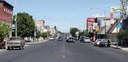
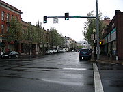
. Cities in the broadest definition include Baker City
Baker City, Oregon
Baker City is a city in and the county seat of Baker County, Oregon, United States. It was named after Edward D. Baker. The population was 9,828 at the 2010 census.-History:...
, Bend
Bend, Oregon
Bend is a city in and the county seat of Deschutes County, Oregon, United States, and the principal city of the Bend, Oregon Metropolitan Statistical Area. Bend is Central Oregon's largest city, and, despite its modest size, is the de facto metropolis of the region, owing to the low population...
, Burns
Burns, Oregon
Burns is a city in and the county seat of Harney County, Oregon, United States. As of the 2010 census the population was 2,806.-History:Burns was established in the early 1880s and incorporated upon Harney county's creation in 1889...
, John Day
John Day, Oregon
John Day is a city located about north of Canyon City in Grant County, Oregon, at the intersection of U.S. Routes 26 and 395. The city was named for the nearby John Day River, which had been named for a Virginian member of the 1811 Astor Expedition, John Day...
, Klamath Falls
Klamath Falls, Oregon
Klamath Falls is a city in Klamath County, Oregon, United States. Originally called Linkville when George Nurse founded the town in 1867, after the Link River on whose falls this city sat, although no falls currently exist; the name was changed to Klamath Falls in 1892...
, La Grande
La Grande, Oregon
-Demographics:As of the census of 2000, there were 12,327 people, 5,124 households, and 2,982 families residing in the city. The population density was 2,833.5 people per square mile . There were 5,483 housing units at an average density of 1,260.3 per square mile...
, Ontario
Ontario, Oregon
Ontario is the largest city in Malheur County, Oregon, United States. It lies along the Snake River at the Idaho border. The population was 10,985 at the 2000 census, with an estimated population of 11,245 in 2006...
, Pendleton
Pendleton, Oregon
Pendleton is a city in Umatilla County, Oregon, United States. Pendleton was named in 1868 by the county commissioners for George H. Pendleton, Democratic candidate for Vice-President in the 1864 presidential campaign. The population was 16,612 at the 2010 census...
, and The Dalles
The Dalles, Oregon
The Dalles is the largest city and county seat of Wasco County, Oregon, United States. The name of the city comes from the French word dalle The Dalles is the largest city and county seat of Wasco County, Oregon, United States. The name of the city comes from the French word dalle The Dalles is...
. Major industries include timber, agriculture, and tourism, with the main transportation corridors consisting of I-84, U.S. Route 395, U.S. Route 97
U.S. Route 97 in Oregon
In the U.S. state of Oregon, U.S. Route 97 is a major north–south United States highway which runs through the state of Oregon . In Oregon, it runs from the Oregon-California border, south of Klamath Falls, to the Oregon-Washington border on the Columbia River, between Biggs Junction, Oregon and...
, U.S. Route 26, U.S. Route 30, and U.S. Route 20.
Compared to the climate of Western Oregon
Western Oregon
Western Oregon is a geographical term that is generally taken to mean the part of Oregon within 120 miles of the Oregon Coast, on the west side of the crest of the Cascade Range. The term is applied somewhat loosely however, and is sometimes taken to exclude the southwestern areas of the state,...
, the climate of Eastern Oregon is a drier continental climate, with much greater seasonal variations in temperature. Unlike the Willamette Valley
Willamette Valley
The Willamette Valley is the most populated region in the state of Oregon of the United States. Located in the state's northwest, the region is surrounded by tall mountain ranges to the east, west and south and the valley's floor is broad, flat and fertile because of Ice Age conditions...
, Eastern Oregon receives a significant amount of snow in the winter. Some parts of Eastern Oregon receive fewer than 10 inches (254 mm) of rain yearly, classifying them as desert
Desert
A desert is a landscape or region that receives an extremely low amount of precipitation, less than enough to support growth of most plants. Most deserts have an average annual precipitation of less than...
s. This desert climate is in part due to a rain shadow
Rain shadow
A rain shadow is a dry area on the lee side of a mountainous area. The mountains block the passage of rain-producing weather systems, casting a "shadow" of dryness behind them. As shown by the diagram to the right, the warm moist air is "pulled" by the prevailing winds over a mountain...
effect caused by the Cascade Range
Cascade Range
The Cascade Range is a major mountain range of western North America, extending from southern British Columbia through Washington and Oregon to Northern California. It includes both non-volcanic mountains, such as the North Cascades, and the notable volcanoes known as the High Cascades...
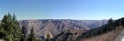
. Pine and juniper forests cover 35% of Eastern Oregon, much in the mountains that include the Blue Mountains
Blue Mountains (Oregon)
The Blue Mountains are a mountain range in the western United States, located largely in northeastern Oregon and stretching into southeastern Washington...
, Strawberry Mountains
Strawberry Mountains
The Strawberry Range, also known as the Strawberry Mountains, is a mountain range in the U.S. state of Oregon. It is east of John Day, within Malheur National Forest...
, Wallowa Mountains
Wallowa Mountains
The Wallowa Mountains are a mountain range located in the Columbia Plateau of northeastern Oregon in the United States. The range runs approximately 40 mi northwest to southeast in southwestern Wallowa County between the Blue Mountains to the west and the Snake River to the east. The range is...
, Trout Creek Mountains
Trout Creek Mountains
The Trout Creek Mountains are a remote mountain range in southeastern Oregon and northern Nevada, United States. The highest point in the range is Orevada View Benchmark. Most of the Trout Creek Mountains are public lands, administered by the Bureau of Land Management. There is very little human...
, Ochoco Mountains
Ochoco Mountains
The Ochoco Mountains are a mountain range in central Oregon. The Ochoco Mountains form the western end of the Blue Mountains province. The mountains were formed when Permian, Triassic, and Jurassic rocks were slowly uplifted by volcanic eruptions to form the Clarno Formation. Today, the highest...
, and Steens Mountain
Steens Mountain
Steens Mountain is a large fault-block mountain in the southeastern part of the U.S. state of Oregon. Located in Harney County, it stretches some and rises from an elevation of about above the Alvord Desert to its peak at...
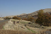
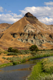
. Volcanic basalt flows from the Columbia River Basalt Group
Columbia River Basalt Group
The Columbia River Basalt Group is a large igneous province that lies across parts of the Western United States. It is found in the U.S. states of Washington, Oregon, Idaho, Nevada, and California...
covered large sections of Eastern Oregon 6 to 17 million years ago. Other landforms include the Alvord Desert
Alvord Desert
The Alvord Desert is a desert located in Harney County, in southeastern Oregon in the western United States. It is roughly southeast of Steens Mountain. The Alvord Desert is a dry lake bed and averages of rain a year. Two mountain ranges separate it from the Pacific Ocean—the Coast Range, and...
, Owyhee Desert
Owyhee Desert
The Owyhee Desert ecoregion, within the Deserts and xeric shrublands Biome, is in the Northwestern United States. The Owyhee Uplands Bypass passes through the desert.-Geography:...
, Warner Valley, Deschutes River, Owyhee River
Owyhee River
The Owyhee River is a tributary of the Snake River located in northern Nevada, southwestern Idaho and southeastern Oregon in the United States. It is long. The river's drainage basin is in area, one of the largest subbasins of the Columbia Basin...
, Grande Ronde River
Grande Ronde River
The Grande Ronde River is a tributary of the Snake River, long, in northeastern Oregon and southeastern Washington in the United States. It drains an area southeast of the Blue Mountains and northwest of the Wallowa Mountains, on the Columbia Plateau...
, Joseph Canyon
Joseph Canyon
Joseph Canyon is a deep basalt canyon in northern Wallowa County, Oregon, and southern Asotin County, Washington, United States. It contains Joseph Creek, a tributary of the Grande Ronde River, which flows into the Snake River and then into the Columbia...
, The Honeycombs
The Honeycombs (Oregon)
The Honeycombs is a canyon containing a series of rock formations located on the eastern shore of Owyhee Lake in Malheur County, Oregon, north of Leslie Gulch...
, and Malheur Butte
Malheur Butte
Malheur Butte is an extinct volcano located in Malheur County, Oregon. Between 20 and 15 million years ago, the region from north-central Washington to northeastern California experienced a series of volcanic eruptions and basalt lava floods that covered thousands of square miles...
.
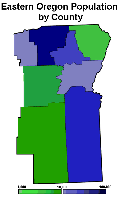
Geography
Morrow County, Oregon
Morrow County is a county located in the U.S. state of Oregon, on the south side of the Columbia River. It is included in the 8 county definition of Eastern Oregon. The county is named for one of its first white settlers, Jackson L. Morrow, who was a member of the state legislature when the county...
, Umatilla
Umatilla County, Oregon
Umatilla County is a county located in the U.S. state of Oregon. It is included in the 8 county definition of Eastern Oregon. The county is named for the Umatilla River. In 2010, its population was 75,889...
, Union
Union County, Oregon
Union County is a county located in the U.S. state of Oregon. It is included in the 8 county definition of Eastern Oregon. The county is named for the town of Union, which is located within its boundaries; in 2010, the county population was 25,748. The county seat is La Grande.-History:Union County...
, Wallowa
Wallowa County, Oregon
Wallowa County is a county located in the U.S. state of Oregon. It is included in the 8 county definition of Eastern Oregon. According to Oregon Geographic Names, the origins of the county's name are uncertain, with the most likely explanation being that it is derived from the Nez Perce term for a...
, Grant
Grant County, Oregon
Grant County is a county located in the U.S. state of Oregon. It is included in the 8 county definition of Eastern Oregon. In 2010, its population was 7,445. It is named for President Ulysses S. Grant, who served as an army officer in the Oregon Territory, and at the time of the county's creation...
, Baker
Baker County, Oregon
Baker County is a county located in the U.S. state of Oregon. It is included in the 8 county definition of Eastern Oregon. It is named for Edward Dickinson Baker, a senator from Oregon who was killed at Ball's Bluff, a battle of the Civil War in Virginia in 1861. It was split from the eastern part...
, Harney
Harney County, Oregon
-National protected areas:*Malheur National Forest *Malheur National Wildlife Refuge*Ochoco National Forest -Demographics:As of the census of 2000, there were 7,609 people, 3,036 households, and 2,094 families residing in the county. The population density was 1 people per square mile...
, and Malheur
Malheur County, Oregon
Malheur County is a county located in the southeast corner of the U.S. state of Oregon. It is included in the eight-county definition of Eastern Oregon. Most of the county observes the Mountain Time Zone, although the southern quarter of the county observes the Pacific Time Zone along with the...
. Other definitions of the region are sometimes more restrictive, others include the base eight counties listed above plus several adjacent counties, while some definitions include the entire area east of the Cascade Range; this meaning would also include Sherman
Sherman County, Oregon
Sherman County is a county located in the U.S. state of Oregon. The county is named for William Tecumseh Sherman, a Union general in the American Civil War. In 2010, its population was 1,765. The seat of the county is Moro. The largest city is Wasco....
, Crook
Crook County, Oregon
-Demographics:As of the census of 2000, there were 19,182 people, 7,354 households, and 5,427 families residing in the county. The population density was 6 people per square mile . There were 8,264 housing units at an average density of 3 per square mile...
, Deschutes
Deschutes County, Oregon
-National protected areas:* Deschutes National Forest * Newberry National Volcanic Monument-Demographics:As of the census of 2000, there were 115,367 people, 45,595 households, and 31,962 families residing in the county. The population density was 38 people per square mile . There were 54,583...
, Gilliam
Gilliam County, Oregon
-Demographics:As of the census of 2000, there were 1,915 people, 819 households, and 543 families residing in the county. The population density was 2 people per square mile . There were 1,043 housing units at an average density of 1 per square mile...
, Jefferson
Jefferson County, Oregon
Jefferson County is a county located in the U.S. state of Oregon. In 2010, its population was 21,720. It is named after Mount Jefferson. The seat of the county is Madras.-History:...
, Klamath
Klamath County, Oregon
-National protected areas:* Bear Valley National Wildlife Refuge* Crater Lake National Park * Deschutes National Forest * Fremont National Forest * Klamath Marsh National Wildlife Refuge* Lower Klamath National Wildlife Refuge...
, Lake
Lake County, Oregon
Lake County is a county in the high desert south central region of the U.S. state of Oregon, so named for the many lakes found within its boundaries, including Lake Abert, Hart Lake Reservoir, and Goose Lake. While Lake is among Oregon's largest counties, it is sparsely populated with 7,895...
, Wasco
Wasco County, Oregon
Wasco County is a county located in the U.S. state of Oregon. The county is named for a local tribe of Native Americans, the Wasco, a Chinook tribe who lived on the south side of the Columbia River. In 2010, its population was 25,213...
, and Wheeler
Wheeler County, Oregon
As of the census of 2000, there were 1,547 people, 653 households, and 444 families residing in the county. The population density was 1 people per square mile . There were 842 housing units at an average density of 0 per square mile...
counties.
The extreme eastern section of Oregon in the Snake River
Snake River
The Snake is a major river of the greater Pacific Northwest in the United States. At long, it is the largest tributary of the Columbia River, the largest North American river that empties into the Pacific Ocean...
Valley, including Ontario, is part of the Treasure Valley
Treasure Valley
The Treasure Valley is the area of the Western United States where the Payette, Boise, Weiser, Malheur, Owyhee, and Burnt rivers drain into the Snake River. Treasure Valley includes all the lowland areas from Vale, Oregon on the west to Boise, Idaho on the east. Formerly, the valley had been known...
, which extends east to Boise, Idaho
Boise, Idaho
Boise is the capital and most populous city of the U.S. state of Idaho, as well as the county seat of Ada County. Located on the Boise River, it anchors the Boise City-Nampa metropolitan area and is the largest city between Salt Lake City, Utah and Portland, Oregon.As of the 2010 Census Bureau,...
; unlike the rest of the state, that section lies within the Mountain Time Zone
Mountain Time Zone
The Mountain Time Zone of North America keeps time by subtracting seven hours from Coordinated Universal Time, also known as Greenwich Mean Time, during the shortest days of autumn and winter , and by subtracting six hours during daylight saving time in the spring, summer, and early autumn...
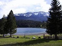
. Mount Heaton is the region's highest mountain.
Cities
Top 15 most populated Eastern Oregon Cities (according to the 8 county definition)| City | Population (2010) |
County |
|---|---|---|
| Hermiston Hermiston, Oregon As of the census of 2010, there were 16,745 people, 4,964 households, and 3,360 families residing in the city. The population density was 2,035.4 people per square mile . There were 5,383 housing units at an average density of 832.9 per square mile... |
16,745 | Umatilla Umatilla County, Oregon Umatilla County is a county located in the U.S. state of Oregon. It is included in the 8 county definition of Eastern Oregon. The county is named for the Umatilla River. In 2010, its population was 75,889... |
| Pendleton Pendleton, Oregon Pendleton is a city in Umatilla County, Oregon, United States. Pendleton was named in 1868 by the county commissioners for George H. Pendleton, Democratic candidate for Vice-President in the 1864 presidential campaign. The population was 16,612 at the 2010 census... |
16,612 | Umatilla Umatilla County, Oregon Umatilla County is a county located in the U.S. state of Oregon. It is included in the 8 county definition of Eastern Oregon. The county is named for the Umatilla River. In 2010, its population was 75,889... |
| La Grande La Grande, Oregon -Demographics:As of the census of 2000, there were 12,327 people, 5,124 households, and 2,982 families residing in the city. The population density was 2,833.5 people per square mile . There were 5,483 housing units at an average density of 1,260.3 per square mile... |
13,082 | Union Union County, Oregon Union County is a county located in the U.S. state of Oregon. It is included in the 8 county definition of Eastern Oregon. The county is named for the town of Union, which is located within its boundaries; in 2010, the county population was 25,748. The county seat is La Grande.-History:Union County... |
| Ontario Ontario, Oregon Ontario is the largest city in Malheur County, Oregon, United States. It lies along the Snake River at the Idaho border. The population was 10,985 at the 2000 census, with an estimated population of 11,245 in 2006... |
11,366 | Malheur Malheur County, Oregon Malheur County is a county located in the southeast corner of the U.S. state of Oregon. It is included in the eight-county definition of Eastern Oregon. Most of the county observes the Mountain Time Zone, although the southern quarter of the county observes the Pacific Time Zone along with the... |
| Baker City Baker City, Oregon Baker City is a city in and the county seat of Baker County, Oregon, United States. It was named after Edward D. Baker. The population was 9,828 at the 2010 census.-History:... |
9,828 | Baker Baker County, Oregon Baker County is a county located in the U.S. state of Oregon. It is included in the 8 county definition of Eastern Oregon. It is named for Edward Dickinson Baker, a senator from Oregon who was killed at Ball's Bluff, a battle of the Civil War in Virginia in 1861. It was split from the eastern part... |
| Milton-Freewater Milton-Freewater, Oregon Milton-Freewater is a city in Umatilla County, Oregon, United States. The city received its current name in 1951 when the neighboring rival cities of Milton and Freewater voted to merge. The population was 6,470 at the 2000 census... |
7,050 | Umatilla Umatilla County, Oregon Umatilla County is a county located in the U.S. state of Oregon. It is included in the 8 county definition of Eastern Oregon. The county is named for the Umatilla River. In 2010, its population was 75,889... |
| Umatilla Umatilla, Oregon Umatilla is a city in Umatilla County, Oregon, United States. It is named for the Umatilla River, which enters the Columbia River on the side of the city. The river is named after the Umatilla Tribe. The city is located on the south side of the Columbia River, and is located on U.S... |
6,906 | Umatilla Umatilla County, Oregon Umatilla County is a county located in the U.S. state of Oregon. It is included in the 8 county definition of Eastern Oregon. The county is named for the Umatilla River. In 2010, its population was 75,889... |
| Nyssa Nyssa, Oregon Nyssa is a city in Malheur County, Oregon, United States. The population was 3,163 at the 2000 census. The city is located along the Snake River on the Idaho border, in the region of far eastern Oregon known as the "Treasure Valley"... |
3,267 | Malheur Malheur County, Oregon Malheur County is a county located in the southeast corner of the U.S. state of Oregon. It is included in the eight-county definition of Eastern Oregon. Most of the county observes the Mountain Time Zone, although the southern quarter of the county observes the Pacific Time Zone along with the... |
| Boardman Boardman, Oregon Boardman is a city in Morrow County, Oregon, United States on the Columbia River and Interstate 84. As of the 2010 census the population was 3,220. It is part of the Pendleton–Hermiston Micropolitan Statistical Area.-History:... |
3,220 | Morrow Morrow County, Oregon Morrow County is a county located in the U.S. state of Oregon, on the south side of the Columbia River. It is included in the 8 county definition of Eastern Oregon. The county is named for one of its first white settlers, Jackson L. Morrow, who was a member of the state legislature when the county... |
| Burns Burns, Oregon Burns is a city in and the county seat of Harney County, Oregon, United States. As of the 2010 census the population was 2,806.-History:Burns was established in the early 1880s and incorporated upon Harney county's creation in 1889... |
2,806 | Harney Harney County, Oregon -National protected areas:*Malheur National Forest *Malheur National Wildlife Refuge*Ochoco National Forest -Demographics:As of the census of 2000, there were 7,609 people, 3,036 households, and 2,094 families residing in the county. The population density was 1 people per square mile... |
| Union Union, Oregon Union is a city in Union County, Oregon, United States. The population was 1,926 at the 2000 census.- History :Union was platted on November 11, 1864 along the Oregon Trail. The name references the Union states, or Northern States, of the American Civil War.... |
2,121 | Union Union County, Oregon Union County is a county located in the U.S. state of Oregon. It is included in the 8 county definition of Eastern Oregon. The county is named for the town of Union, which is located within its boundaries; in 2010, the county population was 25,748. The county seat is La Grande.-History:Union County... |
| Stanfield Stanfield, Oregon Stanfield is a city in Umatilla County, Oregon, United States. The population was 1,979 at the 2000 census. It is part of the Pendleton–Hermiston Micropolitan Statistical Area.-Geography:... |
2,043 | Umatilla Umatilla County, Oregon Umatilla County is a county located in the U.S. state of Oregon. It is included in the 8 county definition of Eastern Oregon. The county is named for the Umatilla River. In 2010, its population was 75,889... |
| Enterprise Enterprise, Oregon Enterprise is a city in and the county seat of Wallowa County, Oregon, United States. The population was 1,895 at the 2000 census, with an estimated population of 1,940 in 2007.- History :... |
1,940 | Wallowa Wallowa County, Oregon Wallowa County is a county located in the U.S. state of Oregon. It is included in the 8 county definition of Eastern Oregon. According to Oregon Geographic Names, the origins of the county's name are uncertain, with the most likely explanation being that it is derived from the Nez Perce term for a... |
| Vale Vale, Oregon Vale is a city in Malheur County, Oregon, United States, about west of the Idaho border. It is at the intersection of U.S. Routes 20 and 26, on the Malheur River.Vale was selected as Malheur's county seat in 1955, 68 years after the county was founded... |
1,874 | Malheur Malheur County, Oregon Malheur County is a county located in the southeast corner of the U.S. state of Oregon. It is included in the eight-county definition of Eastern Oregon. Most of the county observes the Mountain Time Zone, although the southern quarter of the county observes the Pacific Time Zone along with the... |
| Irrigon Irrigon, Oregon Irrigon is a city in Morrow County, Oregon, United States, on the Columbia River and U.S. Route 730. Irrigon was incorporated on February 28, 1957. The Umatilla Chemical Depot, and the Umatilla Chemical Agent Disposal Facility, is located four-miles south of the city, northeast of the intersection... |
1,826 | Morrow Morrow County, Oregon Morrow County is a county located in the U.S. state of Oregon, on the south side of the Columbia River. It is included in the 8 county definition of Eastern Oregon. The county is named for one of its first white settlers, Jackson L. Morrow, who was a member of the state legislature when the county... |
By extending the boundary outside to include neighboring counties, Eastern Oregon would include four of the largest population centers east of the Cascade Range
Cascade Range
The Cascade Range is a major mountain range of western North America, extending from southern British Columbia through Washington and Oregon to Northern California. It includes both non-volcanic mountains, such as the North Cascades, and the notable volcanoes known as the High Cascades...
– Bend
Bend, Oregon
Bend is a city in and the county seat of Deschutes County, Oregon, United States, and the principal city of the Bend, Oregon Metropolitan Statistical Area. Bend is Central Oregon's largest city, and, despite its modest size, is the de facto metropolis of the region, owing to the low population...
, Redmond
Redmond, Oregon
Redmond is a city in Deschutes County, Oregon, United States. Incorporated on July 6, 1910, the city is located on the eastern side of Oregon's Cascade Range, in the High Desert, and is considered the geographical heart of Central Oregon...
, Klamath Falls, and The Dalles. However, these lie outside the stricter boundary.
Climate and ecology
Compared to the maritime rainforestTemperate rain forest
Temperate rainforests are coniferous or broadleaf forests that occur in the temperate zone and receive high rainfall.-Definition:For temperate rain forests of North America, Alaback's definition is widely recognized:-Global distribution:...
climate of Western Oregon
Western Oregon
Western Oregon is a geographical term that is generally taken to mean the part of Oregon within 120 miles of the Oregon Coast, on the west side of the crest of the Cascade Range. The term is applied somewhat loosely however, and is sometimes taken to exclude the southwestern areas of the state,...
, which is adjacent to the Pacific Ocean
Pacific Ocean
The Pacific Ocean is the largest of the Earth's oceanic divisions. It extends from the Arctic in the north to the Southern Ocean in the south, bounded by Asia and Australia in the west, and the Americas in the east.At 165.2 million square kilometres in area, this largest division of the World...
, the climate of Eastern Oregon is a drier continental climate, with much greater seasonal variations in temperature. Unlike the Willamette Valley, Eastern Oregon gets a significant amount of snow in the winter. Some parts of Eastern Oregon receive fewer than 10 inches (254 mm) of rain yearly, classifying them as desert
Desert
A desert is a landscape or region that receives an extremely low amount of precipitation, less than enough to support growth of most plants. Most deserts have an average annual precipitation of less than...
s. The driest parts are the southeast and the area near Redmond
Redmond, Oregon
Redmond is a city in Deschutes County, Oregon, United States. Incorporated on July 6, 1910, the city is located on the eastern side of Oregon's Cascade Range, in the High Desert, and is considered the geographical heart of Central Oregon...
. This desert climate is in part due to a rain shadow
Rain shadow
A rain shadow is a dry area on the lee side of a mountainous area. The mountains block the passage of rain-producing weather systems, casting a "shadow" of dryness behind them. As shown by the diagram to the right, the warm moist air is "pulled" by the prevailing winds over a mountain...
effect caused by the Cascade Range
Cascade Range
The Cascade Range is a major mountain range of western North America, extending from southern British Columbia through Washington and Oregon to Northern California. It includes both non-volcanic mountains, such as the North Cascades, and the notable volcanoes known as the High Cascades...
. Pine and juniper forests cover 35% of Eastern Oregon, especially in the mountains east of Klamath Falls
Klamath Falls, Oregon
Klamath Falls is a city in Klamath County, Oregon, United States. Originally called Linkville when George Nurse founded the town in 1867, after the Link River on whose falls this city sat, although no falls currently exist; the name was changed to Klamath Falls in 1892...
and in the Blue Mountains
Blue Mountains (Oregon)
The Blue Mountains are a mountain range in the western United States, located largely in northeastern Oregon and stretching into southeastern Washington...
.
Economy
The region's economy is primarily agriculturalAgriculture
Agriculture is the cultivation of animals, plants, fungi and other life forms for food, fiber, and other products used to sustain life. Agriculture was the key implement in the rise of sedentary human civilization, whereby farming of domesticated species created food surpluses that nurtured the...
. Timber
Timber
Timber may refer to:* Timber, a term common in the United Kingdom and Australia for wood materials * Timber, Oregon, an unincorporated community in the U.S...
and mining
Mining
Mining is the extraction of valuable minerals or other geological materials from the earth, from an ore body, vein or seam. The term also includes the removal of soil. Materials recovered by mining include base metals, precious metals, iron, uranium, coal, diamonds, limestone, oil shale, rock...
, while formerly key industries, have decreased in importance in recent years. Historical tourism
Tourism
Tourism is travel for recreational, leisure or business purposes. The World Tourism Organization defines tourists as people "traveling to and staying in places outside their usual environment for not more than one consecutive year for leisure, business and other purposes".Tourism has become a...
is on the rise. The wheat
Wheat
Wheat is a cereal grain, originally from the Levant region of the Near East, but now cultivated worldwide. In 2007 world production of wheat was 607 million tons, making it the third most-produced cereal after maize and rice...
growing region of Eastern Oregon includes the Columbia Plateau
Columbia Plateau
The Columbia Plateau is a geologic and geographic region that lies across parts of the U.S. states of Washington, Oregon, and Idaho. It is a wide flood basalt plateau between the Cascade Range and the Rocky Mountains, cut through by the Columbia River...
portion of northeastern Oregon, which begins with very marginal wheat fields in central Wasco County and extends east through Umatilla County. South of the wheat lands of northeast Oregon, agricultural activity is generally limited to livestock grazing except where irrigation is available. Irrigated
Irrigation
Irrigation may be defined as the science of artificial application of water to the land or soil. It is used to assist in the growing of agricultural crops, maintenance of landscapes, and revegetation of disturbed soils in dry areas and during periods of inadequate rainfall...
areas are often used to produce alfalfa
Alfalfa
Alfalfa is a flowering plant in the pea family Fabaceae cultivated as an important forage crop in the US, Canada, Argentina, France, Australia, the Middle East, South Africa, and many other countries. It is known as lucerne in the UK, France, Australia, South Africa and New Zealand, and known as...
hay.
Transportation
Western Oregon
Western Oregon is a geographical term that is generally taken to mean the part of Oregon within 120 miles of the Oregon Coast, on the west side of the crest of the Cascade Range. The term is applied somewhat loosely however, and is sometimes taken to exclude the southwestern areas of the state,...
, due to the difficulty of crossing the Cascades. Early settlers floated down the Columbia River
Columbia River
The Columbia River is the largest river in the Pacific Northwest region of North America. The river rises in the Rocky Mountains of British Columbia, Canada, flows northwest and then south into the U.S. state of Washington, then turns west to form most of the border between Washington and the state...
from The Dalles to reach Western Oregon. In 1845, Sam Barlow
Sam Barlow
Samuel Kimbrough Barlow was a pioneer in the area that became the U.S. state of Oregon, and was key in establishing the Barlow Road, the most widely chosen final segment to the Oregon Trail.-Biography:...
built a road
Barlow Road
The Barlow Road is a historic road in what is now the U.S. state of Oregon. It was built in 1846 by Sam Barlow and Philip Foster, with authorization of the Provisional Legislature of Oregon, and served as the last overland segment of the Oregon Trail...
around the south side of Mount Hood
Mount Hood
Mount Hood, called Wy'east by the Multnomah tribe, is a stratovolcano in the Cascade Volcanic Arc of northern Oregon. It was formed by a subduction zone and rests in the Pacific Northwest region of the United States...
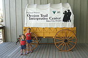
, which served as the final leg of the Oregon Trail
Oregon Trail
The Oregon Trail is a historic east-west wagon route that connected the Missouri River to valleys in Oregon and locations in between.After 1840 steam-powered riverboats and steamboats traversing up and down the Ohio, Mississippi and Missouri rivers sped settlement and development in the flat...
. The Applegate Trail
Applegate Trail
The Applegate Trail was a wilderness trail through today's U.S. states of Idaho, Nevada, California, and Oregon, and was originally intended as a less dangerous route to the Oregon Territory.-Background:...
and Santiam Wagon Road
Santiam Wagon Road
The Santiam Wagon Road was a freight route in the U.S. state of Oregon between the Willamette Valley and Central Oregon regions from 1865 to the 1930s. It is considered one of the most important historical routes in the state...
were constructed soon after, connecting eastern and western Oregon in the southern and central parts of the state. In the early 20th century, Samuel Hill
Samuel Hill
Samuel Hill , usually known as Sam Hill, was a businessman, lawyer, railroad executive and advocate of good roads in the Pacific Northwest...
built the Columbia River Highway, allowing automobiles to pass through the Columbia River Gorge
Columbia River Gorge
The Columbia River Gorge is a canyon of the Columbia River in the Pacific Northwest of the United States. Up to deep, the canyon stretches for over as the river winds westward through the Cascade Range forming the boundary between the State of Washington to the north and Oregon to the south...
.
Railroads began to be important as early as 1858 with the construction of the Oregon Portage Railroad
Oregon Portage Railroad
The Oregon Portage Railroad was the first railroad in the U.S. state of Oregon. It originally ran for with of telegraph line, and was later extended to a length of...
which built a 4.5 miles (7.2 km) bypass around the rapids at Cascade Locks
Cascade Locks, Oregon
Cascade Locks is a city in Hood River County, Oregon, United States. The city took its name from a set of locks built to improve navigation past the Cascades Rapids of the Columbia River. The U.S. federal government approved the plan for the locks in 1875, construction began in 1878, and the locks...
. This was followed by the 1862 incorporation of the Oregon Steam Navigation Company whose operations included building a rail bypass from The Dalles
The Dalles, Oregon
The Dalles is the largest city and county seat of Wasco County, Oregon, United States. The name of the city comes from the French word dalle The Dalles is the largest city and county seat of Wasco County, Oregon, United States. The name of the city comes from the French word dalle The Dalles is...
to Celilo Falls
Celilo Falls
Celilo Falls was a tribal fishing area on the Columbia River, just east of the Cascade Mountains, on what is today the border between the U.S. states of Oregon and Washington...
. In 1880 these two short sections of rail were incorporated into the Oregon Railway and Navigation Company (OR&N). Shortly thereafter Henry Villard
Henry Villard
Henry Villard was an American journalist and financier who was an early president of the Northern Pacific Railway....
, who then controlled OR&N, moved aggressively to block entry of the then under construction Northern Pacific Railway
Northern Pacific Railway
The Northern Pacific Railway was a railway that operated in the west along the Canadian border of the United States. Construction began in 1870 and the main line opened all the way from the Great Lakes to the Pacific when former president Ulysses S. Grant drove in the final "golden spike" in...
into the Columbia Gorge.
In an agreement first made in March 1880 and formalized in the fall of 1880, the Northern Pacific Railway, then controlled by Frederick Billings, and the OR&N, at that time controlled by Henry Villard, agreed to divide the Columbia Plateau
Columbia Plateau
The Columbia Plateau is a geologic and geographic region that lies across parts of the U.S. states of Washington, Oregon, and Idaho. It is a wide flood basalt plateau between the Cascade Range and the Rocky Mountains, cut through by the Columbia River...
at the Snake River
Snake River
The Snake is a major river of the greater Pacific Northwest in the United States. At long, it is the largest tributary of the Columbia River, the largest North American river that empties into the Pacific Ocean...
, with the Northern Pacific staying to the north and the OR&N staying to the south. Northern Pacific was not to build down the gorge into Portland, but would receive trackage rights on the tracks that OR&N was building on the south bank into Portland. The first St. Paul-Portland Northern Pacific train arrived in Portland on September 12, 1883, via OR&N trackage down the Oregon side of the Columbia River from Wallula, Washington
Wallula, Washington
Wallula is a census-designated place in Walla Walla County, Washington, United States. The population was 179 at the 2010 census.-History:Lewis and Clark reached the area April 27, 1806, on their return journey from the Pacific...
forever ending the isolation of at least the northern portion of Eastern Oregon. A year later in November 1884, the Oregon Short Line was completed across southern Idaho, and met the OR&N at the border station of Huntington
Huntington, Oregon
Huntington is a city in Baker County, on the eastern border of Oregon, United States. It is located on the Snake River and along Interstate 84 and U.S. Route 30. The population was 515 at the 2000 census.- History:...
providing rail service that essentially paralleled the Oregon Trail all the way from Omaha, Nebraska. Later the OR&N became part of the Union Pacific Railway.
The only other railroad ever built east over the Cascade Mountains was trackage that was to become part of the Southern Pacific Transportation Company which was opened in 1926 over Willamette Pass
Willamette Pass
Willamette Pass is a mountain pass crossing the crest of the Cascade Range in the U.S. state of Oregon. The pass is traversed by Oregon Route 58. The Willamette Pass Resort ski area is located at the pass....
to Klamath Falls
Klamath Falls, Oregon
Klamath Falls is a city in Klamath County, Oregon, United States. Originally called Linkville when George Nurse founded the town in 1867, after the Link River on whose falls this city sat, although no falls currently exist; the name was changed to Klamath Falls in 1892...
to bypass the difficult line south of Eugene, Oregon
Eugene, Oregon
Eugene is the second largest city in the U.S. state of Oregon and the seat of Lane County. It is located at the south end of the Willamette Valley, at the confluence of the McKenzie and Willamette rivers, about east of the Oregon Coast.As of the 2010 U.S...
to Ashland, Oregon
Ashland, Oregon
Ashland is a city in Jackson County, Oregon, United States, near Interstate 5 and the California border, and located in the south end of the Rogue Valley. It was named after Ashland County, Ohio, point of origin of Abel Helman and other founders, and secondarily for Ashland, Kentucky, where other...
.
All-weather highways over the Cascade Mountains were not completed until the 1930s and 1940s.
Major road routes through eastern Oregon include I-84 from Ontario
Ontario, Oregon
Ontario is the largest city in Malheur County, Oregon, United States. It lies along the Snake River at the Idaho border. The population was 10,985 at the 2000 census, with an estimated population of 11,245 in 2006...
to the Columbia River Gorge
Columbia River Gorge
The Columbia River Gorge is a canyon of the Columbia River in the Pacific Northwest of the United States. Up to deep, the canyon stretches for over as the river winds westward through the Cascade Range forming the boundary between the State of Washington to the north and Oregon to the south...
. The only other interstate freeway in the region is an eleven mile (18 km) stretch of Interstate 82 that ends at the Columbia River
Columbia River
The Columbia River is the largest river in the Pacific Northwest region of North America. The river rises in the Rocky Mountains of British Columbia, Canada, flows northwest and then south into the U.S. state of Washington, then turns west to form most of the border between Washington and the state...
in Umatilla
Umatilla, Oregon
Umatilla is a city in Umatilla County, Oregon, United States. It is named for the Umatilla River, which enters the Columbia River on the side of the city. The river is named after the Umatilla Tribe. The city is located on the south side of the Columbia River, and is located on U.S...
. U.S. Route 395 is a major North-South route, passing through Pendleton
Pendleton, Oregon
Pendleton is a city in Umatilla County, Oregon, United States. Pendleton was named in 1868 by the county commissioners for George H. Pendleton, Democratic candidate for Vice-President in the 1864 presidential campaign. The population was 16,612 at the 2010 census...
, Burns
Burns, Oregon
Burns is a city in and the county seat of Harney County, Oregon, United States. As of the 2010 census the population was 2,806.-History:Burns was established in the early 1880s and incorporated upon Harney county's creation in 1889...
, John Day
John Day, Oregon
John Day is a city located about north of Canyon City in Grant County, Oregon, at the intersection of U.S. Routes 26 and 395. The city was named for the nearby John Day River, which had been named for a Virginian member of the 1811 Astor Expedition, John Day...
, and Lakeview
Lakeview, Oregon
Lakeview is a city in Lake County, Oregon, United States. The population was 2,294 at the 2010 census. It is the county seat of Lake County. Although it is an incorporated city, the municipal government refers to the community as "The Town of Lakeview", and bills itself as "Tallest Town in Oregon"...
. Further west, U.S. Route 97
U.S. Route 97 in Oregon
In the U.S. state of Oregon, U.S. Route 97 is a major north–south United States highway which runs through the state of Oregon . In Oregon, it runs from the Oregon-California border, south of Klamath Falls, to the Oregon-Washington border on the Columbia River, between Biggs Junction, Oregon and...
runs North and South from the California border through Klamath Falls
Klamath Falls, Oregon
Klamath Falls is a city in Klamath County, Oregon, United States. Originally called Linkville when George Nurse founded the town in 1867, after the Link River on whose falls this city sat, although no falls currently exist; the name was changed to Klamath Falls in 1892...
, Bend
Bend, Oregon
Bend is a city in and the county seat of Deschutes County, Oregon, United States, and the principal city of the Bend, Oregon Metropolitan Statistical Area. Bend is Central Oregon's largest city, and, despite its modest size, is the de facto metropolis of the region, owing to the low population...
, and Redmond
Redmond, Oregon
Redmond is a city in Deschutes County, Oregon, United States. Incorporated on July 6, 1910, the city is located on the eastern side of Oregon's Cascade Range, in the High Desert, and is considered the geographical heart of Central Oregon...
to Biggs Junction
Biggs Junction, Oregon
Biggs Junction is an unincorporated community in Sherman County, Oregon, United States. For statistical purposes, the United States Census Bureau has defined Biggs Junction as a census-designated place...
on the Columbia River
Columbia River
The Columbia River is the largest river in the Pacific Northwest region of North America. The river rises in the Rocky Mountains of British Columbia, Canada, flows northwest and then south into the U.S. state of Washington, then turns west to form most of the border between Washington and the state...
. Other major east-west routes include U.S. Route 26, U.S. Route 30, U.S. Route 20 and U.S. Route 730
U.S. Route 730
U.S. Route 730 is a U.S. highway in the U.S. states of Oregon and Washington. It is numbered as a spur of U.S. Route 30, which runs from Astoria, Oregon to Atlantic City, New Jersey. US 730 stretches 42 miles from Interstate 84 and U.S. Route 30 east of Boardman, Oregon northeast to U.S. Route 12...
.
Secessionist movement
Some residents of Eastern Oregon feel that the state of Oregon, with the majority of its population and political control based in the western part of the state, has neglected the eastern part of the state, preventing it from developing along with the western part. A movement to have Eastern Oregon secede and join the United StatesUnited States
The United States of America is a federal constitutional republic comprising fifty states and a federal district...
as a 51st state
51st state
The 51st state, in United States political discourse, is a phrase that refers to areas either seriously or derisively considered candidates for addition to the 50 states already part of the United States. Before 1959, when Alaska and Hawaii joined the U.S., the term "the 49th state" was used...
was underway in 2008. This movement is similar to other Northwest secession proposals such as Jefferson, Lincoln, and Cascadia
Cascadia (independence movement)
Cascadia is the proposed name for a bioregional political entity and/or an independent nation located within the Cascadian bioregion of the Pacific Northwest of North America...
.