
List of Hewitts and Nuttalls in England
Encyclopedia
| Class | Prominence |
|---|---|
| 600 m Metre The metre , symbol m, is the base unit of length in the International System of Units . Originally intended to be one ten-millionth of the distance from the Earth's equator to the North Pole , its definition has been periodically refined to reflect growing knowledge of metrology... prominences Topographic prominence In topography, prominence, also known as autonomous height, relative height, shoulder drop , or prime factor , categorizes the height of the mountain's or hill's summit by the elevation between it and the lowest contour line encircling it and no higher summit... |
600 m + |
| 2,000 foot Marilyns Marilyn (hill) A Marilyn is a mountain or hill in the United Kingdom, Republic of Ireland or Isle of Man with a relative height of at least 150 metres , regardless of absolute height or other merit... |
150 – 599 m |
| Hewitts | 30 – 149 m |
| Nuttalls | 15 – 29 m |
This is a list of mountains in England over 2,000 feet.
Nuttalls are hills in England
England
England is a country that is part of the United Kingdom. It shares land borders with Scotland to the north and Wales to the west; the Irish Sea is to the north west, the Celtic Sea to the south west, with the North Sea to the east and the English Channel to the south separating it from continental...
and Wales
Wales
Wales is a country that is part of the United Kingdom and the island of Great Britain, bordered by England to its east and the Atlantic Ocean and Irish Sea to its west. It has a population of three million, and a total area of 20,779 km²...
that are at least 2,000 feet
Foot (unit of length)
A foot A foot A foot (plural: feet; abbreviation or symbol: ft or ′ (the prime symbol) is a unit of length in a number of different systems including Ancient Greek, Ancient Roman, English units, Imperial units, United States customary units and the units of many Continental European...
(610 metre
Metre
The metre , symbol m, is the base unit of length in the International System of Units . Originally intended to be one ten-millionth of the distance from the Earth's equator to the North Pole , its definition has been periodically refined to reflect growing knowledge of metrology...
s) high with a relative height
Topographic prominence
In topography, prominence, also known as autonomous height, relative height, shoulder drop , or prime factor , categorizes the height of the mountain's or hill's summit by the elevation between it and the lowest contour line encircling it and no higher summit...
of at least 15 metre
Metre
The metre , symbol m, is the base unit of length in the International System of Units . Originally intended to be one ten-millionth of the distance from the Earth's equator to the North Pole , its definition has been periodically refined to reflect growing knowledge of metrology...
s (49.2 feet). The list was compiled by John and Anne Nuttall and published in The Mountains of England & Wales.
Hewitts are hills in England, Wales and Ireland
Ireland
Ireland is an island to the northwest of continental Europe. It is the third-largest island in Europe and the twentieth-largest island on Earth...
that are at least 2,000 feet high with a relative height of at least 30 m. This list was compiled by Alan Dawson and originally published in The Relative Hills of Britain under the name Sweats. The list was subsequently renamed Hewitts, updated, and published in The Hewitts and Marilyns of England.
Other than the inclusion of Ireland, the only difference between Nuttalls and Hewitts is that hills with a relative height between 15 and 30 m are Nuttalls but not Hewitts. This corresponds to roughly a quarter of all Nuttalls, and the exclusion of these least prominent Nuttalls was one of the reasons why the list of Hewitts was produced.
In the tables below, rows have been coloured according to which list(s) the hills are on. Hills that are additionally Marilyns
Marilyn (hill)
A Marilyn is a mountain or hill in the United Kingdom, Republic of Ireland or Isle of Man with a relative height of at least 150 metres , regardless of absolute height or other merit...
or that are on the list of hills with a 600 m drop are also distinguished. In the parent column, the prominence parent is used where possible. The prominence parent of a peak can be found by dividing the island or region in question into territories by tracing the runoff from the key col of every higher peak in the region. The prominence parent is the higher peak in whose territory the original peak resides.
There are 253 Nuttalls on the list, of which 178 are Hewitts, and 51 are Marilyns.
The Cheviots
| Peak | Height (m) |
Prom. (m) |
Grid ref. | Class | Parent | |
|---|---|---|---|---|---|---|
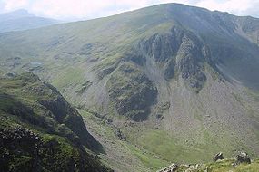
| 815 | 556 | Marilyn | Broad Law Broad Law Broad Law is the second highest hill in the wide expanse of hill country in Southern Scotland, the Southern Uplands, and the highest for 30 miles in all directions. It is only ten feet lower than its parent, Merrick... |
 The Cheviot The Cheviot The Cheviot is the highest summit in the Cheviot Hills in the far north of England, only 2 km from the Scottish border. It is the last major peak on the Pennine Way, if travelling from south to north, before the descent into Kirk Yetholm.... |
||
| Hedgehope Hill Hedgehope Hill Hedgehope Hill is a mountain in the Cheviot Hills of North Northumberland in North East England.At a height of and a distance of about from the Scottish border, it is best climbed from Langleeford in the Harthorpe Valley, over which it looms. A slightly gentler climb, though a longer distance is... |
714 | 148 | Hewitt | The Cheviot The Cheviot The Cheviot is the highest summit in the Cheviot Hills in the far north of England, only 2 km from the Scottish border. It is the last major peak on the Pennine Way, if travelling from south to north, before the descent into Kirk Yetholm.... |
||
| Comb Fell | 652 | 69 | Hewitt | The Cheviot The Cheviot The Cheviot is the highest summit in the Cheviot Hills in the far north of England, only 2 km from the Scottish border. It is the last major peak on the Pennine Way, if travelling from south to north, before the descent into Kirk Yetholm.... |
||
| Windy Gyle Windy Gyle Windy Gyle is a hill in the Cheviot Hills, right on the border between England and Scotland. It lies on the border ridge, and like the other hills in the area is rounded and grass-covered. Although maps show the border passing right through the summit, the summit cairn lies a few metres north of... |
619 | 113 | Hewitt | The Cheviot The Cheviot The Cheviot is the highest summit in the Cheviot Hills in the far north of England, only 2 km from the Scottish border. It is the last major peak on the Pennine Way, if travelling from south to north, before the descent into Kirk Yetholm.... |
||
| Cushat Law | 615 | 147 | Hewitt | The Cheviot The Cheviot The Cheviot is the highest summit in the Cheviot Hills in the far north of England, only 2 km from the Scottish border. It is the last major peak on the Pennine Way, if travelling from south to north, before the descent into Kirk Yetholm.... |
||
| Bloodybush Edge | 610 | 114 | Hewitt | The Cheviot The Cheviot The Cheviot is the highest summit in the Cheviot Hills in the far north of England, only 2 km from the Scottish border. It is the last major peak on the Pennine Way, if travelling from south to north, before the descent into Kirk Yetholm.... |
||
Northern FellsNorthern FellsThe Northern Fells are a group of hills in the English Lake District. Including Skiddaw, they occupy a wide area to the north of Keswick. Smooth sweeping slopes predominate with a minimum of tarns or crags...
| Peak | Height (m) |
Prom. (m) |
Grid ref. | Class | Parent | |
|---|---|---|---|---|---|---|
| Skiddaw Skiddaw Skiddaw is a mountain in the Lake District National Park in England. With a summit at 931 m above sea level it is the fourth highest mountain in England. It lies just north of the town of Keswick, Cumbria, and dominates the skyline in this part of the northern lakes... |
931 | 709 | P600 | Helvellyn Helvellyn Helvellyn is a mountain in the English Lake District, the apex of the Eastern Fells. At above sea level, it is the third highest peak in both the Lake District and England... |
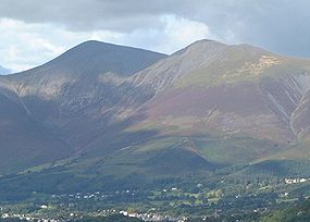 Skiddaw Skiddaw Skiddaw is a mountain in the Lake District National Park in England. With a summit at 931 m above sea level it is the fourth highest mountain in England. It lies just north of the town of Keswick, Cumbria, and dominates the skyline in this part of the northern lakes... |
|
| Blencathra Blencathra Blencathra, also known as Saddleback, is one of the most northerly mountains in the English Lake District. It has six separate fell tops, of which the highest is the Hallsfell Top.-Name:... |
868 | 461 | Marilyn | Skiddaw Skiddaw Skiddaw is a mountain in the Lake District National Park in England. With a summit at 931 m above sea level it is the fourth highest mountain in England. It lies just north of the town of Keswick, Cumbria, and dominates the skyline in this part of the northern lakes... |
||
| Skiddaw Little Man Skiddaw Little Man Skiddaw Little Man also called Little Man is a fell in the English Lake District, it is situated four kilometres north of the town of Keswick and reaches a height of 865 m .-Topography:... |
865 | 61 | Hewitt | Skiddaw Skiddaw Skiddaw is a mountain in the Lake District National Park in England. With a summit at 931 m above sea level it is the fourth highest mountain in England. It lies just north of the town of Keswick, Cumbria, and dominates the skyline in this part of the northern lakes... |
||
| Gategill Fell Top | 851 | 17 | Nuttall | Blencathra Blencathra Blencathra, also known as Saddleback, is one of the most northerly mountains in the English Lake District. It has six separate fell tops, of which the highest is the Hallsfell Top.-Name:... |
||
| Atkinson Pike | 845 | 16 | Nuttall | Blencathra Blencathra Blencathra, also known as Saddleback, is one of the most northerly mountains in the English Lake District. It has six separate fell tops, of which the highest is the Hallsfell Top.-Name:... |
||
| Carl Side Carl Side Carl Side is a fell in the English Lake District, forming a part of the Skiddaw "family" near the town of Keswick and prominently visible from its streets... |
746 | 30 | Hewitt | Skiddaw Skiddaw Skiddaw is a mountain in the Lake District National Park in England. With a summit at 931 m above sea level it is the fourth highest mountain in England. It lies just north of the town of Keswick, Cumbria, and dominates the skyline in this part of the northern lakes... |
||
| Long Side Long Side Long Side is a fell in the English Lake District, it is situated six kilometres north west of Keswick in the northern sector of the national park and is part of the Skiddaw group of fells. Long Side which reaches a height of 734 m is located on Skiddaw’s north western ridge, the middle... |
734 | 40 | Hewitt | Skiddaw Skiddaw Skiddaw is a mountain in the Lake District National Park in England. With a summit at 931 m above sea level it is the fourth highest mountain in England. It lies just north of the town of Keswick, Cumbria, and dominates the skyline in this part of the northern lakes... |
||
| Lonscale Fell Lonscale Fell Lonscale Fell is a hill in the English Lake District. Its pointed second top is instantly recognisable, standing at the eastern end of the Skiddaw massif. The fell is easily climbed from Keswick or from Skiddaw House to the north... |
715 | 50 | Hewitt | Skiddaw Little Man Skiddaw Little Man Skiddaw Little Man also called Little Man is a fell in the English Lake District, it is situated four kilometres north of the town of Keswick and reaches a height of 865 m .-Topography:... |
||
| Knott Knott Knott is a mountain in the northern part of the English Lake District. It is the highest point of the Back o'Skiddaw region, an area of wild and unfrequented moorland to the north of Skiddaw and Blencathra. Other tops in this region include High Pike, Carrock Fell and Great Calva. The fell's slopes... |
710 | 242 | Marilyn | Skiddaw Skiddaw Skiddaw is a mountain in the Lake District National Park in England. With a summit at 931 m above sea level it is the fourth highest mountain in England. It lies just north of the town of Keswick, Cumbria, and dominates the skyline in this part of the northern lakes... |
||
| Bowscale Fell Bowscale Fell Bowscale Fell is a hill in the English Lake District. It rises above the village of Mungrisdale in the Northern Fells. Bowscale Fell stands at the extreme north east the Blencathra group, connected to this higher fell by the intervening Bannerdale Crags... |
702 | 87 | Hewitt | Blencathra Blencathra Blencathra, also known as Saddleback, is one of the most northerly mountains in the English Lake District. It has six separate fell tops, of which the highest is the Hallsfell Top.-Name:... |
Blencathra Blencathra Blencathra, also known as Saddleback, is one of the most northerly mountains in the English Lake District. It has six separate fell tops, of which the highest is the Hallsfell Top.-Name:... |
|
| Great Calva Great Calva Great Calva is a fell in the Lake District, England. It is in the Northern Fells, lying roughly at the centre of this region of high ground. As a result it is distant from roads and quite remote by Lakeland standards... |
690 | 142 | Hewitt | Knott Knott Knott is a mountain in the northern part of the English Lake District. It is the highest point of the Back o'Skiddaw region, an area of wild and unfrequented moorland to the north of Skiddaw and Blencathra. Other tops in this region include High Pike, Carrock Fell and Great Calva. The fell's slopes... |
||
| Bannerdale Crags Bannerdale Crags Bannerdale Crags is a fell in the English Lake District. It stands between Blencathra and Bowscale Fell in the Northern Fells.-Topography:Bannerdale Crags is a ridge running north west to south east... |
683 | 37 | Hewitt | Bowscale Fell Bowscale Fell Bowscale Fell is a hill in the English Lake District. It rises above the village of Mungrisdale in the Northern Fells. Bowscale Fell stands at the extreme north east the Blencathra group, connected to this higher fell by the intervening Bannerdale Crags... |
||
| Sale How | 666 | 18 | Nuttall | Skiddaw Skiddaw Skiddaw is a mountain in the Lake District National Park in England. With a summit at 931 m above sea level it is the fourth highest mountain in England. It lies just north of the town of Keswick, Cumbria, and dominates the skyline in this part of the northern lakes... |
||
| Carrock Fell Carrock Fell Carrock Fell is a fell in the English Lake District, situated in the northern region of the national park 13 kilometres north east of Keswick. The fell's name means "Rocky Fell" and comes from a combination of the Old Welsh language with the word "carrec" meaning rock and the Old Norse language... |
663 | 91 | Hewitt | Knott Knott Knott is a mountain in the northern part of the English Lake District. It is the highest point of the Back o'Skiddaw region, an area of wild and unfrequented moorland to the north of Skiddaw and Blencathra. Other tops in this region include High Pike, Carrock Fell and Great Calva. The fell's slopes... |
||
| High Pike High Pike (Caldbeck) High Pike is a fell in the northern part of the English Lake District, it is located 4.5 kilometres south of Caldbeck. It has a height of 658 metres and is the most northerly of the Lakeland fells over 2000 feet. It is a large fell with its northern slopes falling away towards the lower ground... |
658 | 69 | Hewitt | Knott Knott Knott is a mountain in the northern part of the English Lake District. It is the highest point of the Back o'Skiddaw region, an area of wild and unfrequented moorland to the north of Skiddaw and Blencathra. Other tops in this region include High Pike, Carrock Fell and Great Calva. The fell's slopes... |
||
| Little Calva | 642 | 15 | Nuttall | Great Calva Great Calva Great Calva is a fell in the Lake District, England. It is in the Northern Fells, lying roughly at the centre of this region of high ground. As a result it is distant from roads and quite remote by Lakeland standards... |
||
| Hare Stones High Pike (Caldbeck) High Pike is a fell in the northern part of the English Lake District, it is located 4.5 kilometres south of Caldbeck. It has a height of 658 metres and is the most northerly of the Lakeland fells over 2000 feet. It is a large fell with its northern slopes falling away towards the lower ground... |
627 | 16 | Nuttall | High Pike High Pike (Caldbeck) High Pike is a fell in the northern part of the English Lake District, it is located 4.5 kilometres south of Caldbeck. It has a height of 658 metres and is the most northerly of the Lakeland fells over 2000 feet. It is a large fell with its northern slopes falling away towards the lower ground... |
||
| Great Lingy Hill High Pike (Caldbeck) High Pike is a fell in the northern part of the English Lake District, it is located 4.5 kilometres south of Caldbeck. It has a height of 658 metres and is the most northerly of the Lakeland fells over 2000 feet. It is a large fell with its northern slopes falling away towards the lower ground... |
616 | 18 | Nuttall | High Pike High Pike (Caldbeck) High Pike is a fell in the northern part of the English Lake District, it is located 4.5 kilometres south of Caldbeck. It has a height of 658 metres and is the most northerly of the Lakeland fells over 2000 feet. It is a large fell with its northern slopes falling away towards the lower ground... |
||
North Western FellsNorth Western FellsThe North Western Fells are a group of hills in the English Lake District. Including such favourites as Catbells and Grisedale Pike, they occupy an oval area beneath the Buttermere and Borrowdale valley systems...
| Peak | Height (m) |
Prom. (m) |
Grid ref. | Class | Parent | |
|---|---|---|---|---|---|---|
| Grasmoor Grasmoor Grasmoor is a mountain in the north-western part of the Lake District, northern England. It is the highest peak in a group of hills between the villages of Lorton, Braithwaite and Buttermere, and overlooks Crummock Water.... |
852 | 519 | Marilyn | Scafell Pike Scafell Pike Scafell Pike is the highest mountain in England at . It is located in Lake District National Park sometimes confused with the neighbouring Sca Fell, to which it is connected by the col of Mickledore... |
 Grasmoor Grasmoor Grasmoor is a mountain in the north-western part of the Lake District, northern England. It is the highest peak in a group of hills between the villages of Lorton, Braithwaite and Buttermere, and overlooks Crummock Water.... |
|
| Crag Hill Crag Hill Crag Hill is a mountain in the North Western part of the English Lake District. It was formerly known as Eel Crag; however, the Ordnance Survey now marks Eel Crag as referring to the northern crags of the fell.... |
839 | 117 | Hewitt | Grasmoor Grasmoor Grasmoor is a mountain in the north-western part of the Lake District, northern England. It is the highest peak in a group of hills between the villages of Lorton, Braithwaite and Buttermere, and overlooks Crummock Water.... |
||
| Grisedale Pike Grisedale Pike Grisedale Pike is a fell in the Lake District, Cumbria, England situated west of the town of Keswick in the north-western sector of the national park. At a height of 791 m it is the 40th highest Wainwright in the Lake District; it also qualifies as a Hewitt, Marilyn and Nuttall... |
791 | 189 | Marilyn | Grasmoor Grasmoor Grasmoor is a mountain in the north-western part of the Lake District, northern England. It is the highest peak in a group of hills between the villages of Lorton, Braithwaite and Buttermere, and overlooks Crummock Water.... |
||
| Sail Sail (Lake District) Sail is a hill in the English Lake District, lying between Derwentwater and Crummock Water.-Topography:The North Western Fells occupy the area between the rivers Derwent and Cocker, a broadly oval swathe of hilly country, elongated on a north-south axis. Two roads cross from east to west, dividing... |
773 | 32 | Hewitt | Crag Hill Crag Hill Crag Hill is a mountain in the North Western part of the English Lake District. It was formerly known as Eel Crag; however, the Ordnance Survey now marks Eel Crag as referring to the northern crags of the fell.... |
||
| Wandope Wandope Wandope is a fell in the north-western area of the English Lake District. It lies to the east of Crummock Water and south of Crag Hill... |
772 | 30 | Hewitt | Crag Hill Crag Hill Crag Hill is a mountain in the North Western part of the English Lake District. It was formerly known as Eel Crag; however, the Ordnance Survey now marks Eel Crag as referring to the northern crags of the fell.... |
||
| Hopegill Head Hopegill Head Hopegill Head is a fell in the English Lake District in Cumbria. It is located nine kilometres west of the town of Keswick and is well seen from the B5292 road which crosses the Whinlatter Pass.-Topography:... |
770 | 97 | Hewitt | Grisedale Pike Grisedale Pike Grisedale Pike is a fell in the Lake District, Cumbria, England situated west of the town of Keswick in the north-western sector of the national park. At a height of 791 m it is the 40th highest Wainwright in the Lake District; it also qualifies as a Hewitt, Marilyn and Nuttall... |
||
| Sand Hill | 756 | 18 | Nuttall | Hopegill Head Hopegill Head Hopegill Head is a fell in the English Lake District in Cumbria. It is located nine kilometres west of the town of Keswick and is well seen from the B5292 road which crosses the Whinlatter Pass.-Topography:... |
||
| Dale Head Dale Head Dale Head is a fell in the northwestern sector of the Lake District, in northern England. It is 753 metres or 2,470 feet above sea level and stands immediately north of Honister Pass, the road between Borrowdale and Buttermere.-Topography:... |
753 | 397 | Marilyn | Great Gable Great Gable Great Gable is a mountain lying at the very heart of the English Lake District, appearing as a pyramid from Wasdale , but as a dome from most other directions. It is one of the most popular of the Lakeland fells, and there are many different routes to the summit... |
||
| Hobcarton Crag | 739 | 37 | Hewitt | Grisedale Pike Grisedale Pike Grisedale Pike is a fell in the Lake District, Cumbria, England situated west of the town of Keswick in the north-western sector of the national park. At a height of 791 m it is the 40th highest Wainwright in the Lake District; it also qualifies as a Hewitt, Marilyn and Nuttall... |
||
| Robinson Robinson (Lake District) thumb|Robinson seen from the [[Ard Crags]] ridge, with Hindscarth to the leftRobinson is a fell in the English Lake District, its southern slopes descending to Buttermere, while its northern side is set in the Newlands Valley... |
737 | 161 | Marilyn | Dale Head Dale Head Dale Head is a fell in the northwestern sector of the Lake District, in northern England. It is 753 metres or 2,470 feet above sea level and stands immediately north of Honister Pass, the road between Borrowdale and Buttermere.-Topography:... |
||
| Hindscarth Hindscarth Hindscarth is a mountain between the valleys of Buttermere and Newlands, in the north-western part of the English Lake District. The fell's name is derived from two words from the Old Norse language, Hind and Skarth, and means the pass used by the red deer.-Topography:The North Western Fells occupy... |
727 | 71 | Hewitt | Dale Head Dale Head Dale Head is a fell in the northwestern sector of the Lake District, in northern England. It is 753 metres or 2,470 feet above sea level and stands immediately north of Honister Pass, the road between Borrowdale and Buttermere.-Topography:... |
 Dale Head Dale Head Dale Head is a fell in the northwestern sector of the Lake District, in northern England. It is 753 metres or 2,470 feet above sea level and stands immediately north of Honister Pass, the road between Borrowdale and Buttermere.-Topography:... |
|
| Whiteside Whiteside (Lake District) Whiteside is a fell in the north-western area of the English Lake District. It stands at the western end of the Grisedale Pike- Hopegill Head ridge overlooking Crummock Water.-Topography:... east top |
719 | 39 | Hewitt | Hopegill Head Hopegill Head Hopegill Head is a fell in the English Lake District in Cumbria. It is located nine kilometres west of the town of Keswick and is well seen from the B5292 road which crosses the Whinlatter Pass.-Topography:... |
||
| Whiteside Whiteside (Lake District) Whiteside is a fell in the north-western area of the English Lake District. It stands at the western end of the Grisedale Pike- Hopegill Head ridge overlooking Crummock Water.-Topography:... |
707 | 18 | Nuttall | Whiteside east top Whiteside (Lake District) Whiteside is a fell in the north-western area of the English Lake District. It stands at the western end of the Grisedale Pike- Hopegill Head ridge overlooking Crummock Water.-Topography:... |
||
| Ladyside Pike | 703 | 28 | Nuttall | Hopegill Head Hopegill Head Hopegill Head is a fell in the English Lake District in Cumbria. It is located nine kilometres west of the town of Keswick and is well seen from the B5292 road which crosses the Whinlatter Pass.-Topography:... |
||
| Scar Crags Scar Crags Scar Crags is a fell in the north western part of the English Lake District in the county of Cumbria. It is one of the Coledale group of fells situated seven kilometres south west of Keswick and reaches a height of 672 metres .-Topography:... |
672 | 55 | Hewitt | Crag Hill Crag Hill Crag Hill is a mountain in the North Western part of the English Lake District. It was formerly known as Eel Crag; however, the Ordnance Survey now marks Eel Crag as referring to the northern crags of the fell.... |
||
| Whiteless Pike Whiteless Pike Whiteless Pike is a fell in the north-western English Lake District. It stands immediately east of Crummock Water and forms a perfect pyramid shape when viewed from Rannerdale. In his celebrated guide to the Lakeland fells, Alfred Wainwright called it "the Weisshorn of Buttermere"... |
660 | 36 | Hewitt | Crag Hill Crag Hill Crag Hill is a mountain in the North Western part of the English Lake District. It was formerly known as Eel Crag; however, the Ordnance Survey now marks Eel Crag as referring to the northern crags of the fell.... |
||
| High Spy High Spy High Spy is a fell in the English Lake District it is situated on the ridge that separates the Newlands Valley from Borrowdale, eight kilometres south of Keswick.-Topography:... |
653 | 148 | Hewitt | Dale Head Dale Head Dale Head is a fell in the northwestern sector of the Lake District, in northern England. It is 753 metres or 2,470 feet above sea level and stands immediately north of Honister Pass, the road between Borrowdale and Buttermere.-Topography:... |
||
| Causey Pike Causey Pike Causey Pike is a fell in the English Lake District. It is situated in the Newlands Valley, 5 km south west of the town of Keswick. Even though it has a modest height of 637 metres it is one of the most distinctive fells when viewed from the Derwent Water and Keswick area due to its... |
637 | 40 | Hewitt | Scar Crags Scar Crags Scar Crags is a fell in the north western part of the English Lake District in the county of Cumbria. It is one of the Coledale group of fells situated seven kilometres south west of Keswick and reaches a height of 672 metres .-Topography:... |
||
| High Spy High Spy High Spy is a fell in the English Lake District it is situated on the ridge that separates the Newlands Valley from Borrowdale, eight kilometres south of Keswick.-Topography:... north top |
634 | 16 | Nuttall | High Spy High Spy High Spy is a fell in the English Lake District it is situated on the ridge that separates the Newlands Valley from Borrowdale, eight kilometres south of Keswick.-Topography:... |
||
| Hobcarton End | 634 | 15 | Nuttall | Grisedale Pike Grisedale Pike Grisedale Pike is a fell in the Lake District, Cumbria, England situated west of the town of Keswick in the north-western sector of the national park. At a height of 791 m it is the 40th highest Wainwright in the Lake District; it also qualifies as a Hewitt, Marilyn and Nuttall... |
||
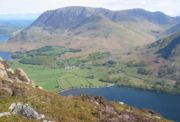
Western FellsWestern FellsThe Western Fells are a group of hills in the English Lake District. Centred on Great Gable they occupy a triangular area between Buttermere and Wasdale...
| Peak | Height (m) |
Prom. (m) |
Grid ref. | Class | Parent | |
|---|---|---|---|---|---|---|
| Great Gable Great Gable Great Gable is a mountain lying at the very heart of the English Lake District, appearing as a pyramid from Wasdale , but as a dome from most other directions. It is one of the most popular of the Lakeland fells, and there are many different routes to the summit... |
899 | 425 | Marilyn | Scafell Pike Scafell Pike Scafell Pike is the highest mountain in England at . It is located in Lake District National Park sometimes confused with the neighbouring Sca Fell, to which it is connected by the col of Mickledore... |
 Great Gable Great Gable Great Gable is a mountain lying at the very heart of the English Lake District, appearing as a pyramid from Wasdale , but as a dome from most other directions. It is one of the most popular of the Lakeland fells, and there are many different routes to the summit... |
|
| Pillar Pillar (Lake District) Pillar is a mountain in the western part of the English Lake District. Situated between the valleys of Ennerdale to the north and Wasdale to the south, it is the highest point of the Pillar group . At 892 metres it is the eighth highest mountain in the Lake District... |
892 | 348 | Marilyn | Great Gable Great Gable Great Gable is a mountain lying at the very heart of the English Lake District, appearing as a pyramid from Wasdale , but as a dome from most other directions. It is one of the most popular of the Lakeland fells, and there are many different routes to the summit... |
||
| Scoat Fell Scoat Fell Scoat Fell is a fell in the western part of the English Lake District. It stands at the head of the Mosedale Horseshoe with its back to Ennerdale... |
841 | 86 | Hewitt | Pillar Pillar (Lake District) Pillar is a mountain in the western part of the English Lake District. Situated between the valleys of Ennerdale to the north and Wasdale to the south, it is the highest point of the Pillar group . At 892 metres it is the eighth highest mountain in the Lake District... |
||
| Black Crag | 828 | 34 | Hewitt | Pillar Pillar (Lake District) Pillar is a mountain in the western part of the English Lake District. Situated between the valleys of Ennerdale to the north and Wasdale to the south, it is the highest point of the Pillar group . At 892 metres it is the eighth highest mountain in the Lake District... |
||
| Red Pike (Wasdale) Red Pike (Wasdale) Red Pike is a fell in the English Lake District. It is 826 m or high and lies due north of Wast Water. It is often climbed as part of the Mosedale Horseshoe, a walk which also includes Pillar.... |
826 | 62 | Hewitt | Pillar Pillar (Lake District) Pillar is a mountain in the western part of the English Lake District. Situated between the valleys of Ennerdale to the north and Wasdale to the south, it is the highest point of the Pillar group . At 892 metres it is the eighth highest mountain in the Lake District... |
||
| Steeple Steeple (Lake District) Steeple is a fell in the English Lake District. It is situated in the mountainous area between Ennerdale and Wasdale and reaches a height of 819 metres . Steeple is really part of Scoat Fell, being just the rocky northern projection of that fell, however because of its prominent peak and steep... |
819 | 24 | Nuttall | Scoat Fell Scoat Fell Scoat Fell is a fell in the western part of the English Lake District. It stands at the head of the Mosedale Horseshoe with its back to Ennerdale... |
||
| High Stile High Stile High Stile is a mountain in the western part of the Lake District in northwest England. It is the eleventh highest English Marilyn, standing 807 metres high, and has a relative height of 362 metres .... |
807 | 362 | Marilyn | Great Gable Great Gable Great Gable is a mountain lying at the very heart of the English Lake District, appearing as a pyramid from Wasdale , but as a dome from most other directions. It is one of the most popular of the Lakeland fells, and there are many different routes to the summit... |
||
| Kirk Fell Kirk Fell Kirk Fell is a fell in the Western part of the English Lake District. It is situated between Great Gable and Pillar on the long ring of fells surrounding the valley of Ennerdale, and also stands over Wasdale to the south... |
802 | 181 | Marilyn | Great Gable Great Gable Great Gable is a mountain lying at the very heart of the English Lake District, appearing as a pyramid from Wasdale , but as a dome from most other directions. It is one of the most popular of the Lakeland fells, and there are many different routes to the summit... |
||
| Green Gable Green Gable Green Gable is a fell in the English Lake District often traversed by walkers on route to its more famous neighbour Great Gable. It can be ascended from Honister Pass, Seathwaite in Borrowdale, or Ennerdale... |
801 | 50 | Hewitt | Great Gable Great Gable Great Gable is a mountain lying at the very heart of the English Lake District, appearing as a pyramid from Wasdale , but as a dome from most other directions. It is one of the most popular of the Lakeland fells, and there are many different routes to the summit... |
||
| Haycock | 797 | 94 | Hewitt | Pillar Pillar (Lake District) Pillar is a mountain in the western part of the English Lake District. Situated between the valleys of Ennerdale to the north and Wasdale to the south, it is the highest point of the Pillar group . At 892 metres it is the eighth highest mountain in the Lake District... |
||
| Kirk Fell Kirk Fell Kirk Fell is a fell in the Western part of the English Lake District. It is situated between Great Gable and Pillar on the long ring of fells surrounding the valley of Ennerdale, and also stands over Wasdale to the south... east top |
787 | 36 | Hewitt | Kirk Fell Kirk Fell Kirk Fell is a fell in the Western part of the English Lake District. It is situated between Great Gable and Pillar on the long ring of fells surrounding the valley of Ennerdale, and also stands over Wasdale to the south... |
 Pillar Pillar (Lake District) Pillar is a mountain in the western part of the English Lake District. Situated between the valleys of Ennerdale to the north and Wasdale to the south, it is the highest point of the Pillar group . At 892 metres it is the eighth highest mountain in the Lake District... |
|
| Pillar Rock | 780 | 15 | Nuttall | Pillar Pillar (Lake District) Pillar is a mountain in the western part of the English Lake District. Situated between the valleys of Ennerdale to the north and Wasdale to the south, it is the highest point of the Pillar group . At 892 metres it is the eighth highest mountain in the Lake District... |
||
| Red Pike (Buttermere) Red Pike (Buttermere) Red Pike is a fell in the High Stile range in the western English Lake District, which separates Ennerdale from the valley of Buttermere and Crummock Water. It is high... |
755 | 40 | Hewitt | High Stile High Stile High Stile is a mountain in the western part of the Lake District in northwest England. It is the eleventh highest English Marilyn, standing 807 metres high, and has a relative height of 362 metres .... |
||
| High Crag High Crag High Crag stands at the southern end of the High Stile ridge which divides the valleys of Ennerdale and Buttermere in the west of the English Lake District. It is often climbed as part of a popular ridge walk, from Black Sail youth hostel, or from Buttermere via Scarth Gap... |
744 | 35 | Hewitt | High Stile High Stile High Stile is a mountain in the western part of the Lake District in northwest England. It is the eleventh highest English Marilyn, standing 807 metres high, and has a relative height of 362 metres .... |
||
| Little Gowder Crag | 733 | 17 | Nuttall | Haycock | ||
| Brandreth Brandreth Brandreth is a fell in the English Lake District. It stands between Great Gable and Haystacks in the Western Fells.-Topography:The Western Fells occupy a triangular sector of the Lake District, bordered by the River Cocker to the north east and Wasdale to the south east. Westwards the hills... |
715 | 61 | Hewitt | Great Gable Great Gable Great Gable is a mountain lying at the very heart of the English Lake District, appearing as a pyramid from Wasdale , but as a dome from most other directions. It is one of the most popular of the Lakeland fells, and there are many different routes to the summit... |
||
| Caw Fell Caw Fell Caw Fell is a fell in the English Lake District, standing between Haycock the Lank Rigg group. It occupies a wide upland area with Ennerdale to the north and Blengdale to the south... |
697 | 22 | Nuttall | Haycock | ||
| Grey Knotts Grey Knotts Grey Knotts is a fell in the English Lake District, it is situated one kilometre south of the B5289 road as it crosses the Honister Pass, it is well seen from mid Borrowdale as it rises above Seatoller... |
697 | 16 | Nuttall | Brandreth Brandreth Brandreth is a fell in the English Lake District. It stands between Great Gable and Haystacks in the Western Fells.-Topography:The Western Fells occupy a triangular sector of the Lake District, bordered by the River Cocker to the north east and Wasdale to the south east. Westwards the hills... |
||
| Seatallan Seatallan Seatallan is a mountain in the western part of the English Lake District. It is rounded, grassy and fairly unassuming, occupying a large amount of land. However, it is classed as a Marilyn because of the low elevation of the col connecting it to Haycock, its nearest higher neighbour to the north... |
692 | 193 | Marilyn | Pillar Pillar (Lake District) Pillar is a mountain in the western part of the English Lake District. Situated between the valleys of Ennerdale to the north and Wasdale to the south, it is the highest point of the Pillar group . At 892 metres it is the eighth highest mountain in the Lake District... |
||
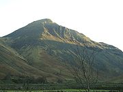
| Fleetwith Pike Fleetwith Pike Fleetwith Pike is a fell in the English Lake District in the county of Cumbria which reaches a height of 648 metres . The fell is a well-known feature of the area as it casts an imposing presence over Buttermere and the Honister Pass on the B5289 motor road between Borrowdale and... |
648 | 117 | Hewitt | Great Gable Great Gable Great Gable is a mountain lying at the very heart of the English Lake District, appearing as a pyramid from Wasdale , but as a dome from most other directions. It is one of the most popular of the Lakeland fells, and there are many different routes to the summit... |
.jpg) Fleetwith Pike Fleetwith Pike Fleetwith Pike is a fell in the English Lake District in the county of Cumbria which reaches a height of 648 metres . The fell is a well-known feature of the area as it casts an imposing presence over Buttermere and the Honister Pass on the B5289 motor road between Borrowdale and... |
|
| Base Brown Base Brown Base Brown is a fell in England's Lake District, near the head of the Borrowdale Valley. It forms one side of the Seathwaite Valley, and on the western side it is flanked by the hanging valley of Gillercomb.-Topography:... |
646 | 38 | Hewitt | Green Gable Green Gable Green Gable is a fell in the English Lake District often traversed by walkers on route to its more famous neighbour Great Gable. It can be ascended from Honister Pass, Seathwaite in Borrowdale, or Ennerdale... |
||
| Dodd | 641 | 20 | Nuttall | Red Pike Red Pike (Buttermere) Red Pike is a fell in the High Stile range in the western English Lake District, which separates Ennerdale from the valley of Buttermere and Crummock Water. It is high... |
||
| Iron Crag Iron Crag Iron Crag is a mountain in the English Lake District, standing between Crag Fell and Caw Fell. The name of the fell is the source of some confusion, as the summit is unnamed on Ordnance Survey maps. Iron Crag apparently refers to the rocky outcrop below the summit, while the lower slopes are... |
640 | 56 | Hewitt | Haycock | ||
| Starling Dodd Starling Dodd Starling Dodd is a fell in the western part of the English Lake District, located between the valleys of Ennerdale and Buttermere, on the ridge between Great Borne to its west and Red Pike to its east... |
633 | 73 | Hewitt | High Stile High Stile High Stile is a mountain in the western part of the Lake District in northwest England. It is the eleventh highest English Marilyn, standing 807 metres high, and has a relative height of 362 metres .... |
||
| Honister Crag | 630 | 20 | Nuttall | Fleetwith Pike Fleetwith Pike Fleetwith Pike is a fell in the English Lake District in the county of Cumbria which reaches a height of 648 metres . The fell is a well-known feature of the area as it casts an imposing presence over Buttermere and the Honister Pass on the B5289 motor road between Borrowdale and... |
||
| Yewbarrow Yewbarrow Yewbarrow is a fell in the English Lake District which lies immediately north of the head of Wast Water. It is 628 metres high and in shape resembles the upturned hull of a boat or a barrow. Yewbarrow is on the left in the classic view of Great Gable and Wast Water.The top of Stirrup Crag... |
627 | 142 | Hewitt | Pillar Pillar (Lake District) Pillar is a mountain in the western part of the English Lake District. Situated between the valleys of Ennerdale to the north and Wasdale to the south, it is the highest point of the Pillar group . At 892 metres it is the eighth highest mountain in the Lake District... |
||
| Looking Stead | 627 | 20 | Nuttall | Pillar Pillar (Lake District) Pillar is a mountain in the western part of the English Lake District. Situated between the valleys of Ennerdale to the north and Wasdale to the south, it is the highest point of the Pillar group . At 892 metres it is the eighth highest mountain in the Lake District... |
||
| Great Borne Great Borne Great Borne is a fell in the English Lake District with a height of . It is a rather secluded hill situated at the western end of the long ridge which divides the Ennerdale and Buttermere valleys.-Name:... |
616 | 113 | Hewitt | High Stile High Stile High Stile is a mountain in the western part of the Lake District in northwest England. It is the eleventh highest English Marilyn, standing 807 metres high, and has a relative height of 362 metres .... |
||
| Yewbarrow Yewbarrow Yewbarrow is a fell in the English Lake District which lies immediately north of the head of Wast Water. It is 628 metres high and in shape resembles the upturned hull of a boat or a barrow. Yewbarrow is on the left in the classic view of Great Gable and Wast Water.The top of Stirrup Crag... north top |
616 | 33 | Hewitt | Yewbarrow Yewbarrow Yewbarrow is a fell in the English Lake District which lies immediately north of the head of Wast Water. It is 628 metres high and in shape resembles the upturned hull of a boat or a barrow. Yewbarrow is on the left in the classic view of Great Gable and Wast Water.The top of Stirrup Crag... |
||
Central FellsCentral FellsThe Central Fells are a group of hills in the English Lake District. Reaching their highest point at High Raise , they occupy a broad area to the east of Borrowdale. Perhaps unexpectedly the Central Fells are generally lower than the surrounding hills, the Lake District's general dome-like...
| Peak | Height (m) |
Prom. (m) |
Grid ref. | Class | Parent | |
|---|---|---|---|---|---|---|
| High Raise High Raise (Langdale) High Raise is a fell in the Central Fells of the English Lake District not to be confused with another High Raise situated in the Far Eastern Fells... |
762 | 283 | Marilyn | Scafell Pike Scafell Pike Scafell Pike is the highest mountain in England at . It is located in Lake District National Park sometimes confused with the neighbouring Sca Fell, to which it is connected by the col of Mickledore... |
Pavey Ark Pavey Ark Pavey Ark is a fell in the English county of Cumbria. It is one of the Langdale Pikes, lying to the north of Great Langdale, in the heart of the Lake District, immediately to the north-east of Harrison Stickle.-Topography:... |
|
| Harrison Stickle Harrison Stickle Harrison Stickle is a fell in the central part of the English Lake District, situated above Great Langdale. The fell is one of the three fells which make up the picturesque Langdale Pikes, the others being Pike of Stickle and Loft Crag. Together they make up one of the most picturesque, and... |
736 | 53 | Hewitt | High Raise High Raise (Langdale) High Raise is a fell in the Central Fells of the English Lake District not to be confused with another High Raise situated in the Far Eastern Fells... |
||
| Codale Head | 732 | 15 | Nuttall | High Raise High Raise (Langdale) High Raise is a fell in the Central Fells of the English Lake District not to be confused with another High Raise situated in the Far Eastern Fells... |
||
| Ullscarf Ullscarf Ullscarf is a fell in the English Lake District close to the geographical centre of the Cumbrian hills. It forms part of the watershed between the Derwentwater and Thirlmere catchments, a ridge running broadly north-south.-Topography:... |
726 | 118 | Hewitt | High Raise High Raise (Langdale) High Raise is a fell in the Central Fells of the English Lake District not to be confused with another High Raise situated in the Far Eastern Fells... |
||
| Thunacar Knott Thunacar Knott Thunacar Knott is a fell in the central part of the English Lake District in the county of Cumbria.-Topography:The main spine of the Central Fells runs south from Bleaberry Fell to High Raise, before turning sharply east en route for Blea Rigg and Loughrigg Fell. A secondary ridge projects... |
723 | 27 | Nuttall | Harrison Stickle Harrison Stickle Harrison Stickle is a fell in the central part of the English Lake District, situated above Great Langdale. The fell is one of the three fells which make up the picturesque Langdale Pikes, the others being Pike of Stickle and Loft Crag. Together they make up one of the most picturesque, and... |
||
| Pike of Stickle Pike of Stickle Pike of Stickle, also known as Pike O’ Stickle, is a fell in the English Lake District. It reaches a height of 709 metres and is situated in the central part of the national park in the valley of Great Langdale... |
709 | 54 | Hewitt | High Raise High Raise (Langdale) High Raise is a fell in the Central Fells of the English Lake District not to be confused with another High Raise situated in the Far Eastern Fells... |
||
| Pavey Ark Pavey Ark Pavey Ark is a fell in the English county of Cumbria. It is one of the Langdale Pikes, lying to the north of Great Langdale, in the heart of the Lake District, immediately to the north-east of Harrison Stickle.-Topography:... |
700 | 15 | Nuttall | Thunacar Knott Thunacar Knott Thunacar Knott is a fell in the central part of the English Lake District in the county of Cumbria.-Topography:The main spine of the Central Fells runs south from Bleaberry Fell to High Raise, before turning sharply east en route for Blea Rigg and Loughrigg Fell. A secondary ridge projects... |
||
| Loft Crag Loft Crag Loft Crag is a fell in the English Lake District, it is situated 9 kilometres west of Ambleside in the valley of Great Langdale and along with the neighbouring fells of Harrison Stickle and Pike of Stickle it forms the picturesque Langdale Pikes which when viewed from the area around... |
680 | 22 | Nuttall | Pike of Stickle Pike of Stickle Pike of Stickle, also known as Pike O’ Stickle, is a fell in the English Lake District. It reaches a height of 709 metres and is situated in the central part of the national park in the valley of Great Langdale... |
||
| Low Saddle | 656 | 21 | Nuttall | Ullscarf Ullscarf Ullscarf is a fell in the English Lake District close to the geographical centre of the Cumbrian hills. It forms part of the watershed between the Derwentwater and Thirlmere catchments, a ridge running broadly north-south.-Topography:... |
||
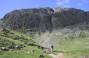
Southern FellsSouthern FellsImage:Annotated Scafell range.jpg|thumb|300px|The Scafellsrect 23 372 252 419 Slight Side rect 173 794 560 834 Scafell East Buttressrect 707 787 893 861 Esk Pike or Crag rect 245 303 409 358 Sca Fell rect 408 238 637 280 Mickledore Image:Annotated Scafell range.jpg|thumb|300px|The Scafellsrect 23...
| Peak | Height (m) |
Prom. (m) |
Grid ref. | Class | Parent | |
|---|---|---|---|---|---|---|
| Scafell Pike Scafell Pike Scafell Pike is the highest mountain in England at . It is located in Lake District National Park sometimes confused with the neighbouring Sca Fell, to which it is connected by the col of Mickledore... |
978 | 912 | P600 | Snowdon Snowdon Snowdon is the highest mountain in Wales, at an altitude of above sea level, and the highest point in the British Isles outside Scotland. It is located in Snowdonia National Park in Gwynedd, and has been described as "probably the busiest mountain in Britain"... |
 Sca Fell Sca Fell Sca Fell is a mountain in the English Lake District. Its height of 964 metres makes it the second-highest mountain in England after Scafell Pike, from which it is separated by the col of Mickledore.... |
|
| Sca Fell Sca Fell Sca Fell is a mountain in the English Lake District. Its height of 964 metres makes it the second-highest mountain in England after Scafell Pike, from which it is separated by the col of Mickledore.... |
964 | 133 | Hewitt | Scafell Pike Scafell Pike Scafell Pike is the highest mountain in England at . It is located in Lake District National Park sometimes confused with the neighbouring Sca Fell, to which it is connected by the col of Mickledore... |
||
| Symonds Knott | 959 | 21 | Nuttall | Sca Fell Sca Fell Sca Fell is a mountain in the English Lake District. Its height of 964 metres makes it the second-highest mountain in England after Scafell Pike, from which it is separated by the col of Mickledore.... |
||
| Ill Crag Ill Crag Ill Crag is a fell in the English Lake District. By some counts it is the fourth highest peak in England, although many people, including Alfred Wainwright, consider it to be a subsidiary summit of Scafell Pike... |
935 | 57 | Hewitt | Scafell Pike Scafell Pike Scafell Pike is the highest mountain in England at . It is located in Lake District National Park sometimes confused with the neighbouring Sca Fell, to which it is connected by the col of Mickledore... |
||
| Broad Crag Broad Crag Broad Crag is a fell in the English Lake District. By some counts, it is the fifth highest peak in England at a height of 934 metres .-Topography:It forms part of the Scafell chain, and lies about northeast of Scafell Pike... |
934 | 52 | Hewitt | Ill Crag Ill Crag Ill Crag is a fell in the English Lake District. By some counts it is the fourth highest peak in England, although many people, including Alfred Wainwright, consider it to be a subsidiary summit of Scafell Pike... |
||
| Great End Great End Great End is the most northerly mountain in the Scafell chain, in the English Lake District. From the south it is simply a lump continuing this chain.... |
910 | 56 | Hewitt | Ill Crag Ill Crag Ill Crag is a fell in the English Lake District. By some counts it is the fourth highest peak in England, although many people, including Alfred Wainwright, consider it to be a subsidiary summit of Scafell Pike... |
||
| Bowfell Bowfell Bowfell is a pyramid-shaped mountain lying at the heart of the English Lake District, in the Southern Fells area. It is the sixth highest mountain in the lakes and one of the most popular of the Lake District fells... |
902 | 146 | Hewitt | Scafell Pike Scafell Pike Scafell Pike is the highest mountain in England at . It is located in Lake District National Park sometimes confused with the neighbouring Sca Fell, to which it is connected by the col of Mickledore... |
||
| Esk Pike Esk Pike Esk Pike is a fell in the English Lake District, one of the great cirque of hills forming the head of Eskdale.-Topography:The Southern Fells include the highest ground in England, a horseshoe which begins with Scafell and Scafell Pike in the west and then curves around the north of Upper Eskdale to... |
885 | 112 | Hewitt | Bowfell Bowfell Bowfell is a pyramid-shaped mountain lying at the heart of the English Lake District, in the Southern Fells area. It is the sixth highest mountain in the lakes and one of the most popular of the Lake District fells... |
||
| Bowfell Bowfell Bowfell is a pyramid-shaped mountain lying at the heart of the English Lake District, in the Southern Fells area. It is the sixth highest mountain in the lakes and one of the most popular of the Lake District fells... north top |
866 | 15 | Nuttall | Bowfell Bowfell Bowfell is a pyramid-shaped mountain lying at the heart of the English Lake District, in the Southern Fells area. It is the sixth highest mountain in the lakes and one of the most popular of the Lake District fells... |
||
| Crinkle Crags Crinkle Crags Crinkle Crags is a fell in the English Lake District in the county of Cumbria. It forms part of two major rings of mountains, surrounding the valleys of Great Langdale and Upper Eskdale. The name reflects the fell's physical appearance as its summit ridge is a series of five rises and depressions ... |
859 | 138 | Hewitt | Bowfell Bowfell Bowfell is a pyramid-shaped mountain lying at the heart of the English Lake District, in the Southern Fells area. It is the sixth highest mountain in the lakes and one of the most popular of the Lake District fells... |
 Great End Great End Great End is the most northerly mountain in the Scafell chain, in the English Lake District. From the south it is simply a lump continuing this chain.... |
|
| Crinkle Crags Crinkle Crags Crinkle Crags is a fell in the English Lake District in the county of Cumbria. It forms part of two major rings of mountains, surrounding the valleys of Great Langdale and Upper Eskdale. The name reflects the fell's physical appearance as its summit ridge is a series of five rises and depressions ... south top |
834 | 32 | Hewitt | Crinkle Crags Crinkle Crags Crinkle Crags is a fell in the English Lake District in the county of Cumbria. It forms part of two major rings of mountains, surrounding the valleys of Great Langdale and Upper Eskdale. The name reflects the fell's physical appearance as its summit ridge is a series of five rises and depressions ... |
||
| Shelter Crags Crinkle Crags Crinkle Crags is a fell in the English Lake District in the county of Cumbria. It forms part of two major rings of mountains, surrounding the valleys of Great Langdale and Upper Eskdale. The name reflects the fell's physical appearance as its summit ridge is a series of five rises and depressions ... |
815 | 31 | Hewitt | Crinkle Crags Crinkle Crags Crinkle Crags is a fell in the English Lake District in the county of Cumbria. It forms part of two major rings of mountains, surrounding the valleys of Great Langdale and Upper Eskdale. The name reflects the fell's physical appearance as its summit ridge is a series of five rises and depressions ... |
||
| Lingmell Lingmell Lingmell is a fell in the English Lake District, standing above the village of Wasdale Head. It is an outlier on the north-west flank of Scafell Pike, England's highest mountain.-Topography:... |
807 | 72 | Hewitt | Scafell Pike Scafell Pike Scafell Pike is the highest mountain in England at . It is located in Lake District National Park sometimes confused with the neighbouring Sca Fell, to which it is connected by the col of Mickledore... |
||
| 803 | 416 | Marilyn | Scafell Pike Scafell Pike Scafell Pike is the highest mountain in England at . It is located in Lake District National Park sometimes confused with the neighbouring Sca Fell, to which it is connected by the col of Mickledore... |
|||
| Swirl How Swirl How Swirl How is a fell in the English Lake District. It stands between Coniston and the Duddon Valley in the southern part of the District.The Coniston Fells form the watershed between Coniston Water and the Duddon valley to the west. The range begins at Wrynose Pass and runs south for around... |
802 | 120 | Hewitt | |||
| Brim Fell Brim Fell Brim Fell is a fell in the English Lake District. It stands to the west of Coniston village in the southern part of the District.-Topography:The Coniston Fells form the watershed between Coniston Water and the Duddon valley to the west... |
796 | 21 | Nuttall | |||
| Allen Crags Allen Crags Allen Crags is a fell in the English Lake District, it lies in a group of very popular hills and is regarded as part of the Scafell group of fells... |
785 | 60 | Hewitt | Scafell Pike Scafell Pike Scafell Pike is the highest mountain in England at . It is located in Lake District National Park sometimes confused with the neighbouring Sca Fell, to which it is connected by the col of Mickledore... |
||
| Great Carrs Great Carrs Great Carrs is a fell in the English Lake District. It stands above Wrynose Pass in the southern part of the District.-Topography:The Coniston Fells form the watershed between Coniston Water and the Duddon valley to the west. The range begins at Wrynose Pass and runs south for around 10 miles... |
785 | 20 | Nuttall | Swirl How Swirl How Swirl How is a fell in the English Lake District. It stands between Coniston and the Duddon Valley in the southern part of the District.The Coniston Fells form the watershed between Coniston Water and the Duddon valley to the west. The range begins at Wrynose Pass and runs south for around... |
||
| Glaramara Glaramara Glaramara is a fell in the English Lake District in Cumbria. It is a substantial fell that is part of a long ridge that stretches for over six kilometres from Stonethwaite in Borrowdale up to the important mountain pass of Esk Hause... |
783 | 121 | Hewitt | Scafell Pike Scafell Pike Scafell Pike is the highest mountain in England at . It is located in Lake District National Park sometimes confused with the neighbouring Sca Fell, to which it is connected by the col of Mickledore... |
 Crinkle Crags Crinkle Crags Crinkle Crags is a fell in the English Lake District in the county of Cumbria. It forms part of two major rings of mountains, surrounding the valleys of Great Langdale and Upper Eskdale. The name reflects the fell's physical appearance as its summit ridge is a series of five rises and depressions ... |
|
| Dow Crag Dow Crag Dow Crag is a fell in the English Lake District near Coniston, Cumbria. The eastern face is one of the many rock faces in the Lake District used for rock climbing.... |
778 | 129 | Hewitt | |||
| Shelter Crags Crinkle Crags Crinkle Crags is a fell in the English Lake District in the county of Cumbria. It forms part of two major rings of mountains, surrounding the valleys of Great Langdale and Upper Eskdale. The name reflects the fell's physical appearance as its summit ridge is a series of five rises and depressions ... north top |
775 | Nuttall | Shelter Crags | |||
| Looking Steads | 775 | 22 | Nuttall | Glaramara Glaramara Glaramara is a fell in the English Lake District in Cumbria. It is a substantial fell that is part of a long ridge that stretches for over six kilometres from Stonethwaite in Borrowdale up to the important mountain pass of Esk Hause... |
||
| Grey Friar Grey Friar Grey Friar is a fell in the English Lake District, it is one of the Coniston Fells and is situated 13 kilometres west-south-west of Ambleside. It reaches a height of 770 metres and stands to the north west of the other Coniston Fells, a little off the beaten track and tends to be the least visited... |
773 | 78 | Hewitt | Swirl How Swirl How Swirl How is a fell in the English Lake District. It stands between Coniston and the Duddon Valley in the southern part of the District.The Coniston Fells form the watershed between Coniston Water and the Duddon valley to the west. The range begins at Wrynose Pass and runs south for around... |
||
| Wetherlam Wetherlam Wetherlam is a mountain in the English Lake District. It is the most northerly of the Coniston Fells, the range of fells to the north-west of Coniston village; its north-east slopes descend to Little Langdale.-Topography:... |
763 | 145 | Hewitt | |||
| Black Sails | 745 | 37 | Hewitt | Wetherlam Wetherlam Wetherlam is a mountain in the English Lake District. It is the most northerly of the Coniston Fells, the range of fells to the north-west of Coniston village; its north-east slopes descend to Little Langdale.-Topography:... |
||
| Round How Great End Great End is the most northerly mountain in the Scafell chain, in the English Lake District. From the south it is simply a lump continuing this chain.... |
741 | 23 | Nuttall | Great End Great End Great End is the most northerly mountain in the Scafell chain, in the English Lake District. From the south it is simply a lump continuing this chain.... |
||
| Little Stand | 740 | 25 | Nuttall | Crinkle Crags Crinkle Crags Crinkle Crags is a fell in the English Lake District in the county of Cumbria. It forms part of two major rings of mountains, surrounding the valleys of Great Langdale and Upper Eskdale. The name reflects the fell's physical appearance as its summit ridge is a series of five rises and depressions ... |
The Old Man of Coniston |
|
| Combe Head | 735 | 28 | Nuttall | Glaramara Glaramara Glaramara is a fell in the English Lake District in Cumbria. It is a substantial fell that is part of a long ridge that stretches for over six kilometres from Stonethwaite in Borrowdale up to the important mountain pass of Esk Hause... |
||
| Red Beck Top | 721 | 37 | Hewitt | Glaramara Glaramara Glaramara is a fell in the English Lake District in Cumbria. It is a substantial fell that is part of a long ridge that stretches for over six kilometres from Stonethwaite in Borrowdale up to the important mountain pass of Esk Hause... |
||
| Pike of Blisco Pike of Blisco Pike of Blisco, or Pike o' Blisco, is a mountain in the Lake District in Cumbria, England. Located between the valleys of Great Langdale and Little Langdale, its relative isolation from neighbouring fells together with slopes falling away immediately from the summit in all directions mean it has... |
705 | 177 | Marilyn | Scafell Pike Scafell Pike Scafell Pike is the highest mountain in England at . It is located in Lake District National Park sometimes confused with the neighbouring Sca Fell, to which it is connected by the col of Mickledore... |
||
| Middleboot Knotts | 703 | Nuttall | Broad Crag Broad Crag Broad Crag is a fell in the English Lake District. By some counts, it is the fifth highest peak in England at a height of 934 metres .-Topography:It forms part of the Scafell chain, and lies about northeast of Scafell Pike... |
|||
| Cold Pike Cold Pike Cold Pike is a fell in the English Lake District. It is a satellite of Crinkle Crags and stands above the Upper Duddon Valley.-Topography:... |
701 | 46 | Hewitt | Crinkle Crags Crinkle Crags Crinkle Crags is a fell in the English Lake District in the county of Cumbria. It forms part of two major rings of mountains, surrounding the valleys of Great Langdale and Upper Eskdale. The name reflects the fell's physical appearance as its summit ridge is a series of five rises and depressions ... |
||
| Great Knott Crinkle Crags Crinkle Crags is a fell in the English Lake District in the county of Cumbria. It forms part of two major rings of mountains, surrounding the valleys of Great Langdale and Upper Eskdale. The name reflects the fell's physical appearance as its summit ridge is a series of five rises and depressions ... |
696 | Nuttall | Crinkle Crags South Top Crinkle Crags Crinkle Crags is a fell in the English Lake District in the county of Cumbria. It forms part of two major rings of mountains, surrounding the valleys of Great Langdale and Upper Eskdale. The name reflects the fell's physical appearance as its summit ridge is a series of five rises and depressions ... |
|||
| High House Tarn Top | 684 | Nuttall | Allen Crags Allen Crags Allen Crags is a fell in the English Lake District, it lies in a group of very popular hills and is regarded as part of the Scafell group of fells... |
|||
| Cold Pike Cold Pike Cold Pike is a fell in the English Lake District. It is a satellite of Crinkle Crags and stands above the Upper Duddon Valley.-Topography:... west top |
683 | 20 | Nuttall | Cold Pike Cold Pike Cold Pike is a fell in the English Lake District. It is a satellite of Crinkle Crags and stands above the Upper Duddon Valley.-Topography:... |
||
| Combe Door Top | 676 | Nuttall | Combe Head |  Pike of Blisco Pike of Blisco Pike of Blisco, or Pike o' Blisco, is a mountain in the Lake District in Cumbria, England. Located between the valleys of Great Langdale and Little Langdale, its relative isolation from neighbouring fells together with slopes falling away immediately from the summit in all directions mean it has... |
||
| Cold Pike Cold Pike Cold Pike is a fell in the English Lake District. It is a satellite of Crinkle Crags and stands above the Upper Duddon Valley.-Topography:... far west top |
670 | Nuttall | Cold Pike Cold Pike Cold Pike is a fell in the English Lake District. It is a satellite of Crinkle Crags and stands above the Upper Duddon Valley.-Topography:... west top |
|||
| Harter Fell Harter Fell (Eskdale) Harter Fell is a mountain in the western part of the English Lake District located between the Eskdale and Duddon valleys. Its height is 649 m . There are several walking routes to the summit.-Topography:... |
654 | 276 | Marilyn | Scafell Pike Scafell Pike Scafell Pike is the highest mountain in England at . It is located in Lake District National Park sometimes confused with the neighbouring Sca Fell, to which it is connected by the col of Mickledore... |
||
| Rossett Pike Rossett Pike Rossett Pike is a fell in the English Lake District. It is located at the head of Mickleden, one of two tributary valleys of Great Langdale.-Topography:... |
651 | 40 | Hewitt | Bowfell Bowfell Bowfell is a pyramid-shaped mountain lying at the heart of the English Lake District, in the Southern Fells area. It is the sixth highest mountain in the lakes and one of the most popular of the Lake District fells... |
||
| Seathwaite Fell Seathwaite Fell Seathwaite Fell is an area of the Lake District in Cumbria, England. It stands above the hamlet of the same name at the head of Borrowdale.-Position of the summit:... |
632 | 31 | Hewitt | Great End Great End Great End is the most northerly mountain in the Scafell chain, in the English Lake District. From the south it is simply a lump continuing this chain.... |
||
| Dovenest Top | 632 | 36 | Hewitt | Glaramara Glaramara Glaramara is a fell in the English Lake District in Cumbria. It is a substantial fell that is part of a long ridge that stretches for over six kilometres from Stonethwaite in Borrowdale up to the important mountain pass of Esk Hause... |
||
| Seathwaite Fell Seathwaite Fell Seathwaite Fell is an area of the Lake District in Cumbria, England. It stands above the hamlet of the same name at the head of Borrowdale.-Position of the summit:... south top |
631 | Nuttall | Seathwaite Fell Seathwaite Fell Seathwaite Fell is an area of the Lake District in Cumbria, England. It stands above the hamlet of the same name at the head of Borrowdale.-Position of the summit:... |
|||
| Walna Scar Walna Scar Walna Scar is a hill in the English Lake District, lying just south of a pass of the same name in the Coniston Hills. Its summit is only slightly higher than the pass, but few reach it, preferring instead to head north from the top of the pass to Dow Crag and the other Coniston Fells... |
621 | Nuttall | Dow Crag Dow Crag Dow Crag is a fell in the English Lake District near Coniston, Cumbria. The eastern face is one of the many rock faces in the Lake District used for rock climbing.... |
|||
| Rosthwaite Fell Rosthwaite Fell Rosthwaite Fell is a fell in the English Lake District. It is situated some due south of Keswick and south of the village of Rosthwaite in Borrowdale.Rosthwaite Fell also has loose connections to the Scafell group of fells... |
612 | 24 | Nuttall | Dovenest Top | ||
| White Maiden | 610 | 23 | Nuttall | Dow Crag Dow Crag Dow Crag is a fell in the English Lake District near Coniston, Cumbria. The eastern face is one of the many rock faces in the Lake District used for rock climbing.... |
||
Eastern FellsEastern FellsThe Eastern Fells are a group of hills in the English Lake District. Centred on Helvellyn they primarily comprise a north south ridge running between Ullswater and Lakeland's Central Valley.-Partition of the Lakeland Fells:...
| Peak | Height (m) |
Prom. (m) |
Grid ref. | Class | Parent | |
|---|---|---|---|---|---|---|
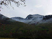
| Helvellyn Helvellyn Helvellyn is a mountain in the English Lake District, the apex of the Eastern Fells. At above sea level, it is the third highest peak in both the Lake District and England... |
950 | 712 | P600 | Scafell Pike Scafell Pike Scafell Pike is the highest mountain in England at . It is located in Lake District National Park sometimes confused with the neighbouring Sca Fell, to which it is connected by the col of Mickledore... |
dec2004.jpg) Helvellyn Helvellyn Helvellyn is a mountain in the English Lake District, the apex of the Eastern Fells. At above sea level, it is the third highest peak in both the Lake District and England... |
|
| Helvellyn Helvellyn Helvellyn is a mountain in the English Lake District, the apex of the Eastern Fells. At above sea level, it is the third highest peak in both the Lake District and England... Lower Man |
925 | 18 | Nuttall | Helvellyn Helvellyn Helvellyn is a mountain in the English Lake District, the apex of the Eastern Fells. At above sea level, it is the third highest peak in both the Lake District and England... |
||
| Nethermost Pike Nethermost Pike Nethermost Pike is a fell in Cumbria, England, and a part of the Lake District. At it is the second highest Wainwright in the Helvellyn range, the tallest of which is Helvellyn itself. It is located close to the southern end of the ridge, with Helvellyn to the north, and High Crag and Dollywaggon... |
891 | 29 | Nuttall | Helvellyn Helvellyn Helvellyn is a mountain in the English Lake District, the apex of the Eastern Fells. At above sea level, it is the third highest peak in both the Lake District and England... |
||
| Catstye Cam Catstye Cam Catstye Cam is a fell in the English Lake District. It is an outlier of Helvellyn in the Eastern Fells.-Name:The name of the fell is also given as 'Catstycam', a spelling preferred by Alfred Wainwright in his influential Pictorial Guide to the Lakeland Fells. A third variant, 'Catchedicam', is also... |
890 | 63 | Hewitt | Helvellyn Helvellyn Helvellyn is a mountain in the English Lake District, the apex of the Eastern Fells. At above sea level, it is the third highest peak in both the Lake District and England... |
||
| Raise | 883 | 91 | Hewitt | Helvellyn Helvellyn Helvellyn is a mountain in the English Lake District, the apex of the Eastern Fells. At above sea level, it is the third highest peak in both the Lake District and England... |
||
| Fairfield Fairfield (Lake District) Fairfield is a fell in the English Lake District. It is the highest of a group of hills in the Eastern Fells, standing to the south of the Helvellyn range.-Topography:... |
873 | 299 | Marilyn | Helvellyn Helvellyn Helvellyn is a mountain in the English Lake District, the apex of the Eastern Fells. At above sea level, it is the third highest peak in both the Lake District and England... |
||
| Striding Edge | 863 | 28 | Nuttall | Helvellyn Helvellyn Helvellyn is a mountain in the English Lake District, the apex of the Eastern Fells. At above sea level, it is the third highest peak in both the Lake District and England... |
||
| White Side White Side White Side is a fell in the English Lake District. It is situated to the east of Thirlmere and to the west of Glenridding valley. This places White Side in the Helvellyn range of the Eastern Fells, with Raise to the north and Helvellyn Lower Man to the south, both of which are of greater... |
863 | 42 | Hewitt | Raise | ||
| Dollywaggon Pike Dollywaggon Pike Dollywaggon Pike is a fell in the English Lake District. It stands on the main spine of the Helvellyn range in the Eastern Fells, between Thirlmere and the Ullswater catchment.-Name:... |
858 | 50 | Hewitt | Helvellyn Helvellyn Helvellyn is a mountain in the English Lake District, the apex of the Eastern Fells. At above sea level, it is the third highest peak in both the Lake District and England... |
 Striding Edge |
|
| Great Dodd Great Dodd Great Dodd is a fell in the English Lake District. It stands on the main spine of the Helvellyn range in the Eastern Fells, between the Vale of St John and Dockray.-Topography:... |
857 | 109 | Hewitt | Helvellyn Helvellyn Helvellyn is a mountain in the English Lake District, the apex of the Eastern Fells. At above sea level, it is the third highest peak in both the Lake District and England... |
||
| Stybarrow Dodd Stybarrow Dodd Stybarrow Dodd is a fell in the English Lake District. It stands on the main spine of the Helvellyn range in the Eastern Fells, situated between Thirlmere and the Ullswater catchment.-Topography:... |
843 | 68 | Hewitt | Great Dodd Great Dodd Great Dodd is a fell in the English Lake District. It stands on the main spine of the Helvellyn range in the Eastern Fells, between the Vale of St John and Dockray.-Topography:... |
||
| St Sunday Crag St Sunday Crag St Sunday Crag is a fell in the English Lake District, part of the Fairfield group in the Eastern Fells. It is a prominent feature in the Patterdale skyline, with a distinctive rounded shape... |
841 | 159 | Marilyn | Fairfield Fairfield (Lake District) Fairfield is a fell in the English Lake District. It is the highest of a group of hills in the Eastern Fells, standing to the south of the Helvellyn range.-Topography:... |
||
| Hart Crag Hart Crag Hart Crag is a fell in the English Lake District, being one of the Fairfield group of hills in the Eastern Fells.-Topography:The fell stands on the ridge running south east from Fairfield to Dove Crag, at the point where a long subsidiary spur sweeps off to the north east... |
822 | 48 | Hewitt | Fairfield Fairfield (Lake District) Fairfield is a fell in the English Lake District. It is the highest of a group of hills in the Eastern Fells, standing to the south of the Helvellyn range.-Topography:... |
||
| Green Side | 795 | 30 | Hewitt | Stybarrow Dodd Stybarrow Dodd Stybarrow Dodd is a fell in the English Lake District. It stands on the main spine of the Helvellyn range in the Eastern Fells, situated between Thirlmere and the Ullswater catchment.-Topography:... |
||
| Dove Crag Dove Crag Dove Crag is a fell in the English Lake District. Situated in the Eastern Fells of the national park, seven kilometres south-south-west of Glenridding, it reaches a height of 792 metres... |
792 | 50 | Hewitt | Hart Crag Hart Crag Hart Crag is a fell in the English Lake District, being one of the Fairfield group of hills in the Eastern Fells.-Topography:The fell stands on the ridge running south east from Fairfield to Dove Crag, at the point where a long subsidiary spur sweeps off to the north east... |
||
| Red Screes Red Screes Red Screes is a fell in the English Lake District, situated between the villages of Patterdale and Ambleside. It is an outlier of the Fairfield group in the Eastern Fells, but is separated from its neighbours by low cols... |
776 | 260 | Marilyn | Fairfield Fairfield (Lake District) Fairfield is a fell in the English Lake District. It is the highest of a group of hills in the Eastern Fells, standing to the south of the Helvellyn range.-Topography:... |
||
| Great Rigg Great Rigg Great Rigg is a fell in the English Lake District, it is situated 7 kilometres north northwest of Ambleside and reaches a height of 766 metres . It is most often climbed as part of the Fairfield horseshoe, a 16 km circular walk which starts and finishes in Ambleside... |
766 | 31 | Hewitt | Fairfield Fairfield (Lake District) Fairfield is a fell in the English Lake District. It is the highest of a group of hills in the Eastern Fells, standing to the south of the Helvellyn range.-Topography:... |
||
| Hart Side Hart Side Hart Side is a fell in the English Lake District, being an outlier of the Helvellyn range in the Eastern Fells. The Ordnance Survey maps give the name to a broad saddle dropping from White Stones on Stybarrow Dodd, but Wainwright in his Pictorial Guide to the Lakeland Fells gave the name to the... |
756 | 23 | Nuttall | Green Side | ||
| Seat Sandal Seat Sandal Seat Sandal is a fell in the English Lake District, it is situated four kilometers north of the village of Grasmere from where it is very well seen... |
736 | 150 | Marilyn | Fairfield Fairfield (Lake District) Fairfield is a fell in the English Lake District. It is the highest of a group of hills in the Eastern Fells, standing to the south of the Helvellyn range.-Topography:... |
||
| Clough Head Clough Head Clough Head is a fell in the English Lake District. It is the northernmost top of the Helvellyn range in the Eastern Fells, standing to the south of Threlkeld and the A66.-Topography:... |
726 | 108 | Hewitt | Great Dodd Great Dodd Great Dodd is a fell in the English Lake District. It stands on the main spine of the Helvellyn range in the Eastern Fells, between the Vale of St John and Dockray.-Topography:... |
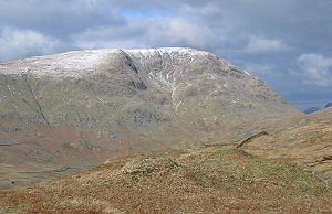 Red Screes Red Screes Red Screes is a fell in the English Lake District, situated between the villages of Patterdale and Ambleside. It is an outlier of the Fairfield group in the Eastern Fells, but is separated from its neighbours by low cols... |
|
| Birkhouse Moor Birkhouse Moor Birkhouse Moor is a fell in the English Lake District, an outlier of the Helvellyn range in the Eastern Fells. It is properly an eastern ridge of Helvellyn, but was treated as a separate fell by Alfred Wainwright in his Pictorial Guide to the Lakeland Fells... |
718 | 21 | Nuttall | Helvellyn Helvellyn Helvellyn is a mountain in the English Lake District, the apex of the Eastern Fells. At above sea level, it is the third highest peak in both the Lake District and England... |
||
| Sheffield Pike Sheffield Pike Sheffield Pike is a fell in the English Lake District, an outlier of the Helvellyn range in the Eastern Fells. It stands on the eastern side of the range, looking down on Ullswater.-Topography:... |
675 | 91 | Hewitt | Great Dodd Great Dodd Great Dodd is a fell in the English Lake District. It stands on the main spine of the Helvellyn range in the Eastern Fells, between the Vale of St John and Dockray.-Topography:... |
||
| Little Hart Crag Little Hart Crag Little Hart Crag is a fell in the Lake District area of England. It stands at the head of Scandale, six kilometres north of Ambleside, at a height of 637 metres . It is an eastern outlier of Dove Crag in the Eastern Fells, although it does have 34 metres of prominence from that fell making it both... |
637 | 34 | Hewitt | Dove Crag Dove Crag Dove Crag is a fell in the English Lake District. Situated in the Eastern Fells of the national park, seven kilometres south-south-west of Glenridding, it reaches a height of 792 metres... |
||
| Birks Birks (Lake District) Birks is a fell in the English Lake District situated two kilometres south west of the village of Patterdale in the Eastern Fells. The fells summit sits on a shoulder of the north east ridge of the higher and better known fell of St Sunday Crag, by which it is dominated, walkers often pass over the... |
622 | 20 | Nuttall | St Sunday Crag St Sunday Crag St Sunday Crag is a fell in the English Lake District, part of the Fairfield group in the Eastern Fells. It is a prominent feature in the Patterdale skyline, with a distinctive rounded shape... |
||
| Heron Pike Heron Pike Heron Pike is a fell in the English Lake District, two kilometres east of Grasmere. It is part of the Fairfield group in the Eastern Fells.-Topography:... north top |
621 | 23 | Nuttall | Great Rigg Great Rigg Great Rigg is a fell in the English Lake District, it is situated 7 kilometres north northwest of Ambleside and reaches a height of 766 metres . It is most often climbed as part of the Fairfield horseshoe, a 16 km circular walk which starts and finishes in Ambleside... |
||
| Heron Pike Heron Pike Heron Pike is a fell in the English Lake District, two kilometres east of Grasmere. It is part of the Fairfield group in the Eastern Fells.-Topography:... |
612 | 21 | Nuttall | Heron Pike Heron Pike Heron Pike is a fell in the English Lake District, two kilometres east of Grasmere. It is part of the Fairfield group in the Eastern Fells.-Topography:... north top |
||
Far Eastern FellsFar Eastern FellsThe Far Eastern Fells are a group of hills in the English Lake District. Reaching their highest point at High Street they occupy a broad area to the east of Ullswater and Kirkstone Pass. Much quieter than the central areas of Lakeland they offer in general easier but less exciting walking as the...
| Peak | Height (m) |
Prom. (m) |
Grid ref. | Class | Parent | |
|---|---|---|---|---|---|---|
| High Street High Street (Lake District) High Street is a fell in the English Lake District. At 828 metres , its summit is the highest point in the far eastern part of the national park. The fell is named after the Roman road which ran over the summit.-History and Naming:... |
828 | 373 | Marilyn | Helvellyn Helvellyn Helvellyn is a mountain in the English Lake District, the apex of the Eastern Fells. At above sea level, it is the third highest peak in both the Lake District and England... |
Stony Cove Pike Stony Cove Pike Stony Cove Pike is a fell in the Far Eastern part of the English Lake District. It stands on the other side of the Kirkstone Pass from Red Screes, and is on the end of a ridge coming down from High Street... |
|
| High Raise High Raise (High Street) High Raise is a fell in the English Lake District, standing to the west of Haweswater Reservoir in the Far Eastern Fells. Note that another High Raise is the highpoint of the Central Fells.-Topography:... |
802 | 88 | Hewitt | High Street High Street (Lake District) High Street is a fell in the English Lake District. At 828 metres , its summit is the highest point in the far eastern part of the national park. The fell is named after the Roman road which ran over the summit.-History and Naming:... |
||
| Rampsgill Head Rampsgill Head Rampsgill Head is a fell in the English Lake District, standing to the west of Haweswater Reservoir in the Far Eastern Fells. It forms the focal point of three ridges which fan out north east, north west and south.-Topography:... |
792 | 41 | Hewitt | High Raise High Raise (High Street) High Raise is a fell in the English Lake District, standing to the west of Haweswater Reservoir in the Far Eastern Fells. Note that another High Raise is the highpoint of the Central Fells.-Topography:... |
||
| Thornthwaite Crag Thornthwaite Crag Thornthwaite Crag is a fell in the English Lake District, standing to the west of Haweswater Reservoir. It is a focal point of the Far Eastern Fells, standing at the head of several valleys.-Topography:... |
784 | 31 | Hewitt | High Street High Street (Lake District) High Street is a fell in the English Lake District. At 828 metres , its summit is the highest point in the far eastern part of the national park. The fell is named after the Roman road which ran over the summit.-History and Naming:... |
||
| Kidsty Pike Kidsty Pike Kidsty Pike is a fell in the English Lake District, standing to the west of Haweswater Reservoir. It is a subsidiary top of Rampsgill Head, but has long achieved the status of a separate fell, thanks to its classic peaked profile... |
780 | Nuttall | Rampsgill Head Rampsgill Head Rampsgill Head is a fell in the English Lake District, standing to the west of Haweswater Reservoir in the Far Eastern Fells. It forms the focal point of three ridges which fan out north east, north west and south.-Topography:... |
|||
| Harter Fell Harter Fell (Mardale) Harter Fell is a fell in the far eastern part of the English Lake District. The summit at lies the meeting point of three ridges, and Harter Fell forms the head of three valleys: Mardale, Longsleddale and the valley of the River Kent.-Topography:... |
778 | 149 | Hewitt | High Street High Street (Lake District) High Street is a fell in the English Lake District. At 828 metres , its summit is the highest point in the far eastern part of the national park. The fell is named after the Roman road which ran over the summit.-History and Naming:... |
||
| Stony Cove Pike Stony Cove Pike Stony Cove Pike is a fell in the Far Eastern part of the English Lake District. It stands on the other side of the Kirkstone Pass from Red Screes, and is on the end of a ridge coming down from High Street... |
763 | 171 | Marilyn | High Street High Street (Lake District) High Street is a fell in the English Lake District. At 828 metres , its summit is the highest point in the far eastern part of the national park. The fell is named after the Roman road which ran over the summit.-History and Naming:... |
||
| Ill Bell Ill Bell Ill Bell is a fell in the English Lake District, in the county of Cumbria, standing on the narrow ridge between the valleys of Kentmere and Troutbeck.-Topography:... |
757 | 124 | Hewitt | High Street High Street (Lake District) High Street is a fell in the English Lake District. At 828 metres , its summit is the highest point in the far eastern part of the national park. The fell is named after the Roman road which ran over the summit.-History and Naming:... |
||
| Kentmere Pike Kentmere Pike Kentmere Pike is a fell in the English Lake District, rising between the valleys of Kentmere and Longsleddale. It is the highpoint on the ridge between Harter Fell and Shipman Knotts.-Topography:... |
730 | 39 | Hewitt | Harter Fell Harter Fell (Mardale) Harter Fell is a fell in the far eastern part of the English Lake District. The summit at lies the meeting point of three ridges, and Harter Fell forms the head of three valleys: Mardale, Longsleddale and the valley of the River Kent.-Topography:... |
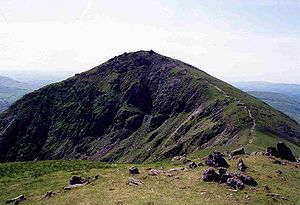 Ill Bell Ill Bell Ill Bell is a fell in the English Lake District, in the county of Cumbria, standing on the narrow ridge between the valleys of Kentmere and Troutbeck.-Topography:... |
|
| Froswick Froswick Froswick is a fell in the English Lake District, standing on the fine narrow ridge between the valleys of Kentmere and Troutbeck.-Topography:To the north is Thornthwaite Crag, while the adjoining fell to the south is Ill Bell. Froswick is shorter in stature than either of its neighbours and also... |
720 | 75 | Hewitt | Ill Bell Ill Bell Ill Bell is a fell in the English Lake District, in the county of Cumbria, standing on the narrow ridge between the valleys of Kentmere and Troutbeck.-Topography:... |
||
| Branstree Branstree Branstree is a fell in the Far Eastern part of the English Lake District. It overlooks the valley of Mardale and Haweswater Reservoir.-Topography:... |
713 | 137 | Hewitt | Harter Fell Harter Fell (Mardale) Harter Fell is a fell in the far eastern part of the English Lake District. The summit at lies the meeting point of three ridges, and Harter Fell forms the head of three valleys: Mardale, Longsleddale and the valley of the River Kent.-Topography:... |
||
| Yoke Yoke (Lake District) Yoke is a fell in the Lake District in Cumbria, England. It has a height of 706 m and is situated in the far eastern sector of the national park, 7 kilometres north east of the town of Ambleside. Yoke is the southern extremity of the long ridge that runs southwards from the fell of High... |
706 | 38 | Hewitt | Ill Bell Ill Bell Ill Bell is a fell in the English Lake District, in the county of Cumbria, standing on the narrow ridge between the valleys of Kentmere and Troutbeck.-Topography:... |
||
| Gray Crag Gray Crag -Topography:The fell reaches a height of 699 metres at the northern end of its summit ridge and this is the accepted highest point which gives the best views, although there is a spot height of 710 metres less than a kilometre to the south. Both tops have small cairns set on grass... |
699 | Nuttall | Thornthwaite Crag Thornthwaite Crag Thornthwaite Crag is a fell in the English Lake District, standing to the west of Haweswater Reservoir. It is a focal point of the Far Eastern Fells, standing at the head of several valleys.-Topography:... |
|||
| Rest Dodd Rest Dodd Rest Dodd is a fell in the English Lake District. It is situated in the quieter far eastern region of the national park and reaches a height of 696 metres... |
696 | 111 | Hewitt | High Street High Street (Lake District) High Street is a fell in the English Lake District. At 828 metres , its summit is the highest point in the far eastern part of the national park. The fell is named after the Roman road which ran over the summit.-History and Naming:... |
||
| Branstree Branstree Branstree is a fell in the Far Eastern part of the English Lake District. It overlooks the valley of Mardale and Haweswater Reservoir.-Topography:... NE top |
673 | 24 | Nuttall | Branstree Branstree Branstree is a fell in the Far Eastern part of the English Lake District. It overlooks the valley of Mardale and Haweswater Reservoir.-Topography:... |
||
| Loadpot Hill Loadpot Hill Loadpot Hill is a fell in the English Lake District, between Haweswater and Ullswater.-Topography:Although of moderate height, Loadpot Hill and its descending ridges cover an area of around... |
671 | 48 | Hewitt | High Raise High Raise (High Street) High Raise is a fell in the English Lake District, standing to the west of Haweswater Reservoir in the Far Eastern Fells. Note that another High Raise is the highpoint of the Central Fells.-Topography:... |
||
| Wether Hill Wether Hill (Lake District) Wether Hill is a fell in the English Lake District, between Martindale and Haweswater. It lies on the main north-south ridge of the Far Eastern Fells between Loadpot Hill and High Raise. Lesser ridges also radiate out to the east and north-west.-Topography:... |
670 | Nuttall | High Raise High Raise (High Street) High Raise is a fell in the English Lake District, standing to the west of Haweswater Reservoir in the Far Eastern Fells. Note that another High Raise is the highpoint of the Central Fells.-Topography:... |
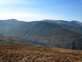 Gray Crag Gray Crag -Topography:The fell reaches a height of 699 metres at the northern end of its summit ridge and this is the accepted highest point which gives the best views, although there is a spot height of 710 metres less than a kilometre to the south. Both tops have small cairns set on grass... |
||
| Tarn Crag Tarn Crag (Far Eastern Fells) Tarn Crag is a fell in the English Lake District. It stands to the east of Longsleddale in the Far Eastern Fells. There is another Tarn Crag in the Central Fells near Grasmere.-Topography:... |
664 | 160 | Marilyn | High Street High Street (Lake District) High Street is a fell in the English Lake District. At 828 metres , its summit is the highest point in the far eastern part of the national park. The fell is named after the Roman road which ran over the summit.-History and Naming:... |
||
| Place Fell Place Fell Place Fell is a hill in the English Lake District. It stands at the corner of the upper and middle reaches of Ullswater, with steep western flanks overlooking the villages of Glenridding and Patterdale.-Topography:... |
657 | 262 | Marilyn | High Street High Street (Lake District) High Street is a fell in the English Lake District. At 828 metres , its summit is the highest point in the far eastern part of the national park. The fell is named after the Roman road which ran over the summit.-History and Naming:... |
||
| Selside Pike Selside Pike Selside Pike is a fell in the English Lake District. It stands between the valleys of Mardale and Swindale in the Far Eastern Fells.-Topography:... |
655 | 36 | Hewitt | Branstree Branstree Branstree is a fell in the Far Eastern part of the English Lake District. It overlooks the valley of Mardale and Haweswater Reservoir.-Topography:... |
||
| Grey Crag Grey Crag Grey Crag is a fell in the English Lake District. It stands to the east of Longsleddale in the Far Eastern Fells. There is another fell named Gray Crag in the Lake District near Hartsop.-Topography:... |
638 | 41 | Hewitt | Tarn Crag Tarn Crag (Far Eastern Fells) Tarn Crag is a fell in the English Lake District. It stands to the east of Longsleddale in the Far Eastern Fells. There is another Tarn Crag in the Central Fells near Grasmere.-Topography:... |
||
| Harrop Pike | 637 | Nuttall | Grey Crag Grey Crag Grey Crag is a fell in the English Lake District. It stands to the east of Longsleddale in the Far Eastern Fells. There is another fell named Gray Crag in the Lake District near Hartsop.-Topography:... |
|||
| Rough Crag | 628 | 33 | Hewitt | High Street High Street (Lake District) High Street is a fell in the English Lake District. At 828 metres , its summit is the highest point in the far eastern part of the national park. The fell is named after the Roman road which ran over the summit.-History and Naming:... |
||
| Hartsop Dodd Hartsop Dodd Hartsop Dodd is a fell in the English Lake District, standing to the south east of Brothers Water. It is a subsidiary top on the north ridge of Caudale Moor, but was given separate fell status by Wainwright in his Pictorial Guide to the Lakeland Fells... |
618 | 24 | Nuttall | Stony Cove Pike Stony Cove Pike Stony Cove Pike is a fell in the Far Eastern part of the English Lake District. It stands on the other side of the Kirkstone Pass from Red Screes, and is on the end of a ridge coming down from High Street... |
||
North Pennines — Western Fells
| Peak | Height (m) |
Prom. (m) |
Grid ref. | Class | Parent | |
|---|---|---|---|---|---|---|
| Cross Fell Cross Fell Cross Fell is the highest point in the Pennine Hills of northern England and the highest point in England outside of the Lake District.The summit, at , is a stony plateau, part of a long ridge running North West to South East, which also incorporates Little Dun Fell at and Great Dun Fell at... |
893 | 651 | P600 | Helvellyn Helvellyn Helvellyn is a mountain in the English Lake District, the apex of the Eastern Fells. At above sea level, it is the third highest peak in both the Lake District and England... |
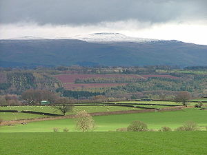 Cross Fell Cross Fell Cross Fell is the highest point in the Pennine Hills of northern England and the highest point in England outside of the Lake District.The summit, at , is a stony plateau, part of a long ridge running North West to South East, which also incorporates Little Dun Fell at and Great Dun Fell at... |
|
| Great Dun Fell Great Dun Fell Great Dun Fell is the second-highest hill in the Pennine range, United Kingdom, lying two miles south along the watershed from Cross Fell, its higher neighbour... |
848 | 76 | Hewitt | Cross Fell Cross Fell Cross Fell is the highest point in the Pennine Hills of northern England and the highest point in England outside of the Lake District.The summit, at , is a stony plateau, part of a long ridge running North West to South East, which also incorporates Little Dun Fell at and Great Dun Fell at... |
||
| Little Dun Fell | 842 | 61 | Hewitt | Great Dun Fell Great Dun Fell Great Dun Fell is the second-highest hill in the Pennine range, United Kingdom, lying two miles south along the watershed from Cross Fell, its higher neighbour... |
||
| Knock Fell | 794 | 48 | Hewitt | Great Dun Fell Great Dun Fell Great Dun Fell is the second-highest hill in the Pennine range, United Kingdom, lying two miles south along the watershed from Cross Fell, its higher neighbour... |
||
| Mickle Fell Mickle Fell Mickle Fell is a mountain in the Pennines, the range of hills and moors running down the middle of Northern England. It is 788 m high and lies slightly off the main watershed of the Pennines, about ten miles south of Cross Fell.... |
788 | 210 | Marilyn | Cross Fell Cross Fell Cross Fell is the highest point in the Pennine Hills of northern England and the highest point in England outside of the Lake District.The summit, at , is a stony plateau, part of a long ridge running North West to South East, which also incorporates Little Dun Fell at and Great Dun Fell at... |
||
| Meldon Hill | 767 | 65 | Hewitt | Great Dun Fell Great Dun Fell Great Dun Fell is the second-highest hill in the Pennine range, United Kingdom, lying two miles south along the watershed from Cross Fell, its higher neighbour... |
||
| Little Fell | 748 | 73 | Hewitt | Mickle Fell Mickle Fell Mickle Fell is a mountain in the Pennines, the range of hills and moors running down the middle of Northern England. It is 788 m high and lies slightly off the main watershed of the Pennines, about ten miles south of Cross Fell.... |
||
| Melmerby Fell | 709 | 43 | Hewitt | Cross Fell Cross Fell Cross Fell is the highest point in the Pennine Hills of northern England and the highest point in England outside of the Lake District.The summit, at , is a stony plateau, part of a long ridge running North West to South East, which also incorporates Little Dun Fell at and Great Dun Fell at... |
||
| Backstone Edge | 699 | 26 | Nuttall | Knock Fell | ||
| Round Hill | 686 | 71 | Hewitt | Cross Fell Cross Fell Cross Fell is the highest point in the Pennine Hills of northern England and the highest point in England outside of the Lake District.The summit, at , is a stony plateau, part of a long ridge running North West to South East, which also incorporates Little Dun Fell at and Great Dun Fell at... |
||
| Murton Fell | 675 | 74 | Hewitt | Mickle Fell Mickle Fell Mickle Fell is a mountain in the Pennines, the range of hills and moors running down the middle of Northern England. It is 788 m high and lies slightly off the main watershed of the Pennines, about ten miles south of Cross Fell.... |
||
| Black Fell Black Fell (Pennines) Black Fell is a hill in the North Pennines, England. It is located just north of the A686 road, west of Alston and is one of the most northerly parts of the Pennines.... |
664 | 89 | Hewitt | Cross Fell Cross Fell Cross Fell is the highest point in the Pennine Hills of northern England and the highest point in England outside of the Lake District.The summit, at , is a stony plateau, part of a long ridge running North West to South East, which also incorporates Little Dun Fell at and Great Dun Fell at... |
Mickle Fell Mickle Fell Mickle Fell is a mountain in the Pennines, the range of hills and moors running down the middle of Northern England. It is 788 m high and lies slightly off the main watershed of the Pennines, about ten miles south of Cross Fell.... |
|
| Long Man Hill | 658 | Nuttall | Cross Fell Cross Fell Cross Fell is the highest point in the Pennine Hills of northern England and the highest point in England outside of the Lake District.The summit, at , is a stony plateau, part of a long ridge running North West to South East, which also incorporates Little Dun Fell at and Great Dun Fell at... |
|||
| Grey Nag | 656 | 40 | Hewitt | Black Fell Black Fell (Pennines) Black Fell is a hill in the North Pennines, England. It is located just north of the A686 road, west of Alston and is one of the most northerly parts of the Pennines.... |
||
| Viewing Hill | 649 | 66 | Hewitt | Burnhope Seat Burnhope Seat Burnhope Seat is a moor in the North Pennines of England. It lies between the heads of the Rivers Tees, South Tyne and Wear. The summit is crossed by the boundary between County Durham and Cumbria... |
||
| Tom Smith's Stone Top | 637 | Nuttall | Grey Nag | |||
| Fiend's Fell | 634 | 27 | Nuttall | Melmerby Fell | ||
| Cold Fell | 621 | 168 | Marilyn | Cross Fell Cross Fell Cross Fell is the highest point in the Pennine Hills of northern England and the highest point in England outside of the Lake District.The summit, at , is a stony plateau, part of a long ridge running North West to South East, which also incorporates Little Dun Fell at and Great Dun Fell at... |
||
| Bellbeaver Rigg | 620 | 28 | Nuttall | Burnhope Seat Burnhope Seat Burnhope Seat is a moor in the North Pennines of England. It lies between the heads of the Rivers Tees, South Tyne and Wear. The summit is crossed by the boundary between County Durham and Cumbria... |
||
| Bink Moss | 619 | 43 | Hewitt | Mickle Fell Mickle Fell Mickle Fell is a mountain in the Pennines, the range of hills and moors running down the middle of Northern England. It is 788 m high and lies slightly off the main watershed of the Pennines, about ten miles south of Cross Fell.... |
||
| Bullman Hills | 614 | Nuttall | Cross Fell Cross Fell Cross Fell is the highest point in the Pennine Hills of northern England and the highest point in England outside of the Lake District.The summit, at , is a stony plateau, part of a long ridge running North West to South East, which also incorporates Little Dun Fell at and Great Dun Fell at... |
|||
North Pennines — Eastern Fells
| Peak | Height (m) |
Prom. (m) |
Grid ref. | Class | Parent |
|---|---|---|---|---|---|
| Burnhope Seat Burnhope Seat Burnhope Seat is a moor in the North Pennines of England. It lies between the heads of the Rivers Tees, South Tyne and Wear. The summit is crossed by the boundary between County Durham and Cumbria... |
747 | 190 | Marilyn | Cross Fell Cross Fell Cross Fell is the highest point in the Pennine Hills of northern England and the highest point in England outside of the Lake District.The summit, at , is a stony plateau, part of a long ridge running North West to South East, which also incorporates Little Dun Fell at and Great Dun Fell at... |
|
| Harwood Common | 718 | Nuttall | Burnhope Seat Burnhope Seat Burnhope Seat is a moor in the North Pennines of England. It lies between the heads of the Rivers Tees, South Tyne and Wear. The summit is crossed by the boundary between County Durham and Cumbria... |
||
| Dead Stones | 710 | 33 | Hewitt | Burnhope Seat Burnhope Seat Burnhope Seat is a moor in the North Pennines of England. It lies between the heads of the Rivers Tees, South Tyne and Wear. The summit is crossed by the boundary between County Durham and Cumbria... |
|
| Great Stony Hill | 708 | 54 | Hewitt | Burnhope Seat Burnhope Seat Burnhope Seat is a moor in the North Pennines of England. It lies between the heads of the Rivers Tees, South Tyne and Wear. The summit is crossed by the boundary between County Durham and Cumbria... |
|
| Chapelfell Top | 703 | 142 | Hewitt | Burnhope Seat Burnhope Seat Burnhope Seat is a moor in the North Pennines of England. It lies between the heads of the Rivers Tees, South Tyne and Wear. The summit is crossed by the boundary between County Durham and Cumbria... |
|
| Fendrith Hill | 696 | Nuttall | Chapelfell Top | ||
| Westernhope Moor | 675 | 68 | Hewitt | Chapelfell Top | |
| Killhope Law | 673 | 48 | Hewitt | Burnhope Seat Burnhope Seat Burnhope Seat is a moor in the North Pennines of England. It lies between the heads of the Rivers Tees, South Tyne and Wear. The summit is crossed by the boundary between County Durham and Cumbria... |
|
| Three Pikes | 651 | 30 | Hewitt | Great Stony Hill | |
| Flinty Fell | 614 | 43 | Hewitt | Burnhope Seat Burnhope Seat Burnhope Seat is a moor in the North Pennines of England. It lies between the heads of the Rivers Tees, South Tyne and Wear. The summit is crossed by the boundary between County Durham and Cumbria... |
|
| 614 | 31 | Hewitt | Killhope Law | ||
| Middlehope Moor | 612 | 38 | Hewitt | Killhope Law | |
Yorkshire Dales — Northern Fells
| Peak | Height (m) |
Prom. (m) |
Grid ref. | Class | Parent |
|---|---|---|---|---|---|
| Great Shunner Fell Great Shunner Fell Great Shunner Fell is the third highest mountain in the Yorkshire Dales, North Yorkshire, England, and the highest point in Wensleydale; at 716 metres above sea level.The Pennine Way passes over its summit, on the way from Hawes to Keld... |
716 | 297 | Marilyn | Cross Fell Cross Fell Cross Fell is the highest point in the Pennine Hills of northern England and the highest point in England outside of the Lake District.The summit, at , is a stony plateau, part of a long ridge running North West to South East, which also incorporates Little Dun Fell at and Great Dun Fell at... |
|
| High Seat High Seat (Yorkshire Dales) High Seat is a fell in the dale of Mallerstang, Cumbria. With a summit at 709 metres, it is the fourth highest fell in the Yorkshire Dales, although outside the National Park, after Whernside, Ingleborough and Great Shunner Fell... |
709 | 112 | Hewitt | Great Shunner Fell Great Shunner Fell Great Shunner Fell is the third highest mountain in the Yorkshire Dales, North Yorkshire, England, and the highest point in Wensleydale; at 716 metres above sea level.The Pennine Way passes over its summit, on the way from Hawes to Keld... |
|
| Wild Boar Fell Wild Boar Fell Wild Boar Fell is a mountain in Mallerstang on the eastern edge of Cumbria, England. At , it is either the 4th highest fell in the Yorkshire Dales or the 5th, whether counting nearby High Seat or not... |
708 | 344 | Marilyn | Cross Fell Cross Fell Cross Fell is the highest point in the Pennine Hills of northern England and the highest point in England outside of the Lake District.The summit, at , is a stony plateau, part of a long ridge running North West to South East, which also incorporates Little Dun Fell at and Great Dun Fell at... |
|
| Gregory Chapel Gregory Chapel Gregory Chapel is one of the high points of the fells on the border between Cumbria and North Yorkshire.The summit is marked by a nearby sheep shelter and an unusual and conspicuous cairn - taller and more rectangular than most others locally. The main rock in the area is limestone, with Millstone... (Archie Styrigg) |
695 | 28 | Nuttall | High Seat High Seat (Yorkshire Dales) High Seat is a fell in the dale of Mallerstang, Cumbria. With a summit at 709 metres, it is the fourth highest fell in the Yorkshire Dales, although outside the National Park, after Whernside, Ingleborough and Great Shunner Fell... |
|
| Hugh Seat Hugh Seat Hugh Seat is a mountain, or more accurately a fell, in Mallerstang on the eastern edge of Cumbria, England. It lies on the present border between Cumbria and the Yorkshire Dales National Park.... |
689 | 24 | Nuttall | Gregory Chapel Gregory Chapel Gregory Chapel is one of the high points of the fells on the border between Cumbria and North Yorkshire.The summit is marked by a nearby sheep shelter and an unusual and conspicuous cairn - taller and more rectangular than most others locally. The main rock in the area is limestone, with Millstone... |
|
| Swarth Fell Swarth Fell Swarth Fell is an approximately 1 mile stretch of high ground situated to the south of Wild Boar Fell, of which it is a continuation... |
681 | 76 | Hewitt | Wild Boar Fell Wild Boar Fell Wild Boar Fell is a mountain in Mallerstang on the eastern edge of Cumbria, England. At , it is either the 4th highest fell in the Yorkshire Dales or the 5th, whether counting nearby High Seat or not... |
|
| Baugh Fell Baugh Fell Baugh Fell is a large, flat-topped hill in the northern Pennines of England. It lies in the north-western corner of the Yorkshire Dales National Park, immediately to the east of the Howgill Fells and to the north of Whernside, the highest of the Yorkshire Three Peaks... |
678 | 265 | Marilyn | Wild Boar Fell Wild Boar Fell Wild Boar Fell is a mountain in Mallerstang on the eastern edge of Cumbria, England. At , it is either the 4th highest fell in the Yorkshire Dales or the 5th, whether counting nearby High Seat or not... |
|
| 676 | 383 | Marilyn | Cross Fell Cross Fell Cross Fell is the highest point in the Pennine Hills of northern England and the highest point in England outside of the Lake District.The summit, at , is a stony plateau, part of a long ridge running North West to South East, which also incorporates Little Dun Fell at and Great Dun Fell at... |
||
| Knoutberry Haw | 676 | 20 | Nuttall | Baugh Fell Baugh Fell Baugh Fell is a large, flat-topped hill in the northern Pennines of England. It lies in the north-western corner of the Yorkshire Dales National Park, immediately to the east of the Howgill Fells and to the north of Whernside, the highest of the Yorkshire Three Peaks... |
|
| Lovely Seat Lovely Seat Lovely Seat is a fell in the Yorkshire Dales National Park in North Yorkshire, England which reaches a height of 675 metres . It is situated at grid reference five kilometres north of the town of Hawes, and is part of the high ground which separates Wensleydale from Swaledale. It is the highest... |
675 | 150 | Marilyn | Great Shunner Fell Great Shunner Fell Great Shunner Fell is the third highest mountain in the Yorkshire Dales, North Yorkshire, England, and the highest point in Wensleydale; at 716 metres above sea level.The Pennine Way passes over its summit, on the way from Hawes to Keld... |
|
| Calders | 674 | 33 | Hewitt | ||
| Rogan's Seat Rogan's Seat Rogan's Seat is a remote hill located near East Stonesdale and Gunnerside Gill, in the Yorkshire Dales in England.It is a high expanse of moorland that stretches alongside Swaledale, Swinner Gill and Gunnerside Gill... |
672 | 195 | Marilyn | Great Shunner Fell Great Shunner Fell Great Shunner Fell is the third highest mountain in the Yorkshire Dales, North Yorkshire, England, and the highest point in Wensleydale; at 716 metres above sea level.The Pennine Way passes over its summit, on the way from Hawes to Keld... |
|
| Bram Rigg Top | 672 | 15 | Nuttall | Calders | |
| Water Crag | 668 | 25 | Nuttall | Rogan's Seat Rogan's Seat Rogan's Seat is a remote hill located near East Stonesdale and Gunnerside Gill, in the Yorkshire Dales in England.It is a high expanse of moorland that stretches alongside Swaledale, Swinner Gill and Gunnerside Gill... |
|
| Little Fell | 667 | 49 | Hewitt | High Seat High Seat (Yorkshire Dales) High Seat is a fell in the dale of Mallerstang, Cumbria. With a summit at 709 metres, it is the fourth highest fell in the Yorkshire Dales, although outside the National Park, after Whernside, Ingleborough and Great Shunner Fell... |
|
| Nine Standards Rigg Nine Standards Rigg Nine Standards Rigg is the summit of Hartley Fell in the Pennine Hills of England. It lies near the boundary between Cumbria and North Yorkshire, a few miles south-east of Kirkby Stephen and approx 700 metres outside the Yorkshire Dales National Park. The name is derived from a group of standing... |
662 | 157 | Marilyn | Great Shunner Fell Great Shunner Fell Great Shunner Fell is the third highest mountain in the Yorkshire Dales, North Yorkshire, England, and the highest point in Wensleydale; at 716 metres above sea level.The Pennine Way passes over its summit, on the way from Hawes to Keld... |
|
| Fell Head | 640 | 86 | Hewitt | ||
| Yarlside Yarlside Yarlside is a hill in the Howgill Fells, Cumbria, England.... |
639 | 208 | Marilyn | ||
| Randygill Top | 624 | 131 | Hewitt | Yarlside Yarlside Yarlside is a hill in the Howgill Fells, Cumbria, England.... |
|
| Bush Howe | 623 | 16 | Nuttall | ||
Yorkshire DalesYorkshire DalesThe Yorkshire Dales is the name given to an upland area in Northern England.The area lies within the historic county boundaries of Yorkshire, though it spans the ceremonial counties of North Yorkshire, West Yorkshire and Cumbria...
— Southern Fells
| Peak | Height (m) |
Prom. (m) |
Grid ref. | Class | Parent | |
|---|---|---|---|---|---|---|
| Whernside Whernside Whernside is a mountain in the Yorkshire Dales and is one of the Yorkshire Three Peaks, the other two being Ingleborough and Pen-y-ghent. It is the highest point in the ceremonial county of North Yorkshire,Mickle Fell in southern Teesdale is the highest point within the boundaries of the historic... |
736 | 408 | Marilyn | Cross Fell Cross Fell Cross Fell is the highest point in the Pennine Hills of northern England and the highest point in England outside of the Lake District.The summit, at , is a stony plateau, part of a long ridge running North West to South East, which also incorporates Little Dun Fell at and Great Dun Fell at... |
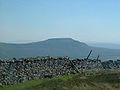 Ingleborough Ingleborough Ingleborough is the second highest mountain in the Yorkshire Dales. It is one of the Yorkshire Three Peaks, the other two being Whernside and Pen-y-ghent. Ingleborough is frequently climbed as part of the Yorkshire Three Peaks Challenge, which is a 24-mile circular challenge walk starting and... |
|
| Ingleborough Ingleborough Ingleborough is the second highest mountain in the Yorkshire Dales. It is one of the Yorkshire Three Peaks, the other two being Whernside and Pen-y-ghent. Ingleborough is frequently climbed as part of the Yorkshire Three Peaks Challenge, which is a 24-mile circular challenge walk starting and... |
724 | 428 | Marilyn | Cross Fell Cross Fell Cross Fell is the highest point in the Pennine Hills of northern England and the highest point in England outside of the Lake District.The summit, at , is a stony plateau, part of a long ridge running North West to South East, which also incorporates Little Dun Fell at and Great Dun Fell at... |
||
| Great Whernside Great Whernside Great Whernside is a mountain in the Yorkshire Dales, England, not to be confused with the better known Whernside, some to the west. Its summit is the highest point of the eastern flank of Wharfedale above Kettlewell... |
704 | 288 | Marilyn | Whernside Whernside Whernside is a mountain in the Yorkshire Dales and is one of the Yorkshire Three Peaks, the other two being Ingleborough and Pen-y-ghent. It is the highest point in the ceremonial county of North Yorkshire,Mickle Fell in southern Teesdale is the highest point within the boundaries of the historic... |
||
| Buckden Pike Buckden Pike Buckden Pike is a mountain at the head of Wharfedale, a valley in the Yorkshire Dales, that stands above the village of Buckden. At , it narrowly misses out on being the highest peak in the area, the title instead going to nearby Great Whernside... |
702 | 207 | Marilyn | Great Whernside Great Whernside Great Whernside is a mountain in the Yorkshire Dales, England, not to be confused with the better known Whernside, some to the west. Its summit is the highest point of the eastern flank of Wharfedale above Kettlewell... |
||
| Pen-y-ghent Pen-y-ghent Pen-y-ghent is a fell in the Yorkshire Dales. It is one of the Yorkshire Three Peaks, the other two being Ingleborough and Whernside. It lies some 3 km east of Horton in Ribblesdale... |
694 | 306 | Marilyn | Whernside Whernside Whernside is a mountain in the Yorkshire Dales and is one of the Yorkshire Three Peaks, the other two being Ingleborough and Pen-y-ghent. It is the highest point in the ceremonial county of North Yorkshire,Mickle Fell in southern Teesdale is the highest point within the boundaries of the historic... |
||
| Great Coum Great Coum Great Coum is a hill in the Yorkshire Dales. Despite this it actually lies in Cumbria.Its neighbours include Crag Hill, Green Hill and Gragareth.... |
687 | 221 | Marilyn | Whernside Whernside Whernside is a mountain in the Yorkshire Dales and is one of the Yorkshire Three Peaks, the other two being Ingleborough and Pen-y-ghent. It is the highest point in the ceremonial county of North Yorkshire,Mickle Fell in southern Teesdale is the highest point within the boundaries of the historic... |
||
| Plover Hill Plover Hill Plover Hill is an area of moorland north of Pen-y-ghent in the Yorkshire Dales, England and connected to it by an unbroken area of high ground. Whilst the area is now on Access Land the main right of way footpaths come directly from the north off Foxup Road and directly from the south from the... |
680 | 59 | Hewitt | Pen-y-ghent Pen-y-ghent Pen-y-ghent is a fell in the Yorkshire Dales. It is one of the Yorkshire Three Peaks, the other two being Ingleborough and Whernside. It lies some 3 km east of Horton in Ribblesdale... |
||
| Great Knoutberry Hill Great Knoutberry Hill Great Knoutberry Hill, also commonly known as Widdale Fell, is a mountain located near Dent at the heads of Ribblesdale, Dentdale and Wensleydale in the Yorkshire Dales National Park. The Cumbria/North Yorkshire border runs over the fell... |
672 | 254 | Marilyn | Great Whernside Great Whernside Great Whernside is a mountain in the Yorkshire Dales, England, not to be confused with the better known Whernside, some to the west. Its summit is the highest point of the eastern flank of Wharfedale above Kettlewell... |
||
| Dodd Fell Hill Dodd Fell Hill Dodd Fell Hill is a Marilyn in the Yorkshire Dales, in North Yorkshire, England.... |
668 | 230 | Marilyn | Great Knoutberry Hill Great Knoutberry Hill Great Knoutberry Hill, also commonly known as Widdale Fell, is a mountain located near Dent at the heads of Ribblesdale, Dentdale and Wensleydale in the Yorkshire Dales National Park. The Cumbria/North Yorkshire border runs over the fell... |
||
| Fountains Fell Fountains Fell Fountains Fell is a mountain in the Yorkshire Dales, England. The main summit has a height of and a relative height or topographic prominence of and thus qualifies as a Marilyn. Its subsidiary south top reaches and qualifies as a Nuttall... |
668 | 243 | Marilyn | Pen-y-ghent Pen-y-ghent Pen-y-ghent is a fell in the Yorkshire Dales. It is one of the Yorkshire Three Peaks, the other two being Ingleborough and Whernside. It lies some 3 km east of Horton in Ribblesdale... |
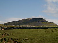 Pen-y-ghent Pen-y-ghent Pen-y-ghent is a fell in the Yorkshire Dales. It is one of the Yorkshire Three Peaks, the other two being Ingleborough and Whernside. It lies some 3 km east of Horton in Ribblesdale... |
|
| Fountains Fell Fountains Fell Fountains Fell is a mountain in the Yorkshire Dales, England. The main summit has a height of and a relative height or topographic prominence of and thus qualifies as a Marilyn. Its subsidiary south top reaches and qualifies as a Nuttall... south top |
662 | 15 | Nuttall | Fountains Fell Fountains Fell Fountains Fell is a mountain in the Yorkshire Dales, England. The main summit has a height of and a relative height or topographic prominence of and thus qualifies as a Marilyn. Its subsidiary south top reaches and qualifies as a Nuttall... |
||
| Simon Fell Simon Fell (Yorkshire Dales) Simon Fell is a subsidiary summit on the north east ridge of Ingleborough, a mountain in the Yorkshire Dales in Northern England.With a height of and a prominence of , it is classified as a Hewitt.... |
650 | 35 | Hewitt | Ingleborough Ingleborough Ingleborough is the second highest mountain in the Yorkshire Dales. It is one of the Yorkshire Three Peaks, the other two being Whernside and Pen-y-ghent. Ingleborough is frequently climbed as part of the Yorkshire Three Peaks Challenge, which is a 24-mile circular challenge walk starting and... |
||
| Yockenthwaite Moor | 643 | 86 | Hewitt | Dodd Fell Hill Dodd Fell Hill Dodd Fell Hill is a Marilyn in the Yorkshire Dales, in North Yorkshire, England.... |
||
| Green Hill Green Hill (Lancashire) Green Hill is a mountain in north west England. Its summit is above sea level. It is located above Cowan Bridge, Lancashire, between Kirkby Lonsdale, Cumbria and Ingleton, North Yorkshire... |
628 | 24 | Nuttall | Great Coum Great Coum Great Coum is a hill in the Yorkshire Dales. Despite this it actually lies in Cumbria.Its neighbours include Crag Hill, Green Hill and Gragareth.... |
||
| Gragareth Gragareth Gragareth is a mountain in Lancashire, England. At it is claimed to be the highest point in Lancashire, although Green Hill , 2 km north and on the Lancashire-Cumbria border, takes this title in List of English counties by highest point... |
627 | 30 | Hewitt | Great Coum Great Coum Great Coum is a hill in the Yorkshire Dales. Despite this it actually lies in Cumbria.Its neighbours include Crag Hill, Green Hill and Gragareth.... |
||
| Darnbrook Fell | 624 | 40 | Hewitt | Fountains Fell Fountains Fell Fountains Fell is a mountain in the Yorkshire Dales, England. The main summit has a height of and a relative height or topographic prominence of and thus qualifies as a Marilyn. Its subsidiary south top reaches and qualifies as a Nuttall... |
||
| Drumaldrace | 614 | 66 | Hewitt | Dodd Fell Hill Dodd Fell Hill Dodd Fell Hill is a Marilyn in the Yorkshire Dales, in North Yorkshire, England.... |
||
| Birks Fell Birks Fell Birks Fell is a Marilyn in the Yorkshire Dales, near to Hubberholme in North Yorkshire, England. Birks Fell only became an official Marilyn in 2006 as it was resurveyed and discovered to be 610 m and not 608 m as previously thought. This raises it above neighbouring Horse Head Moor , making it the... |
610 | 158 | Marilyn | Pen-y-ghent Pen-y-ghent Pen-y-ghent is a fell in the Yorkshire Dales. It is one of the Yorkshire Three Peaks, the other two being Ingleborough and Whernside. It lies some 3 km east of Horton in Ribblesdale... |
||
The Peak DistrictPeak DistrictThe Peak District is an upland area in central and northern England, lying mainly in northern Derbyshire, but also covering parts of Cheshire, Greater Manchester, Staffordshire, and South and West Yorkshire....
| Peak | Height (m) |
Prom. (m) |
Grid ref. | Class | Parent |
|---|---|---|---|---|---|
| Kinder Scout Kinder Scout Kinder Scout is a moorland plateau in the Dark Peak of the Derbyshire Peak District in England. Part of the moor, at 636 m above sea level, is the highest point in the Peak District, the highest point in Derbyshire, and the highest point in the East Midlands. It is accessible from the villages of... |
636 | 488 | Marilyn | Cross Fell Cross Fell Cross Fell is the highest point in the Pennine Hills of northern England and the highest point in England outside of the Lake District.The summit, at , is a stony plateau, part of a long ridge running North West to South East, which also incorporates Little Dun Fell at and Great Dun Fell at... |
|
| Bleaklow Head | 633 | 128 | Hewitt | Kinder Scout Kinder Scout Kinder Scout is a moorland plateau in the Dark Peak of the Derbyshire Peak District in England. Part of the moor, at 636 m above sea level, is the highest point in the Peak District, the highest point in Derbyshire, and the highest point in the East Midlands. It is accessible from the villages of... |
|
| Higher Shelf Stones | 621 | 15 | Nuttall | Bleaklow Head | |
DartmoorDartmoorDartmoor is an area of moorland in south Devon, England. Protected by National Park status, it covers .The granite upland dates from the Carboniferous period of geological history. The moorland is capped with many exposed granite hilltops known as tors, providing habitats for Dartmoor wildlife. The...
| Peak | Height (m) |
Prom. (m) |
Grid ref. | Class | Parent | |
|---|---|---|---|---|---|---|
| High Willhays High Willhays High Willhays or, according to some authors, High Willes is the highest point on Dartmoor, Devon, at 621 metres above sea level, and the highest point in Great Britain south of the Brecon Beacons.-Toponymy:... |
621 | 537 | Marilyn | Cross Fell Cross Fell Cross Fell is the highest point in the Pennine Hills of northern England and the highest point in England outside of the Lake District.The summit, at , is a stony plateau, part of a long ridge running North West to South East, which also incorporates Little Dun Fell at and Great Dun Fell at... |
 High Willhays with Yes Tor Yes Tor Yes Tor is the second highest point on Dartmoor, Devon, South West England, at above sea level. Together with nearby High Willhays they are the only two peaks above south of the English Peak District National Park.... beyond |
|
| Yes Tor Yes Tor Yes Tor is the second highest point on Dartmoor, Devon, South West England, at above sea level. Together with nearby High Willhays they are the only two peaks above south of the English Peak District National Park.... |
619 | 24 | Nuttall | High Willhays High Willhays High Willhays or, according to some authors, High Willes is the highest point on Dartmoor, Devon, at 621 metres above sea level, and the highest point in Great Britain south of the Brecon Beacons.-Toponymy:... |
||
See also
- Hill lists in the British IslesHill lists in the British IslesThe mountains and hills of Great Britain, and to a lesser extent Ireland, are the subject of a considerable number of lists that categorise them by height, topographic prominence, or other criteria. They are commonly used as a basis for peak bagging, whereby hillwalkers attempt to reach all the...
- List of Hewitts and Nuttalls in Wales
- MarilynMarilyn (hill)A Marilyn is a mountain or hill in the United Kingdom, Republic of Ireland or Isle of Man with a relative height of at least 150 metres , regardless of absolute height or other merit...
- List of mountains of the British Isles by relative height — a full list of mountains in the 'P600' class.
- List of hills in the Lake District, which applies the 30m drop criterion below 2000 ft in height.