

List of hills in the Lake District
Encyclopedia
This is a list of hill
s in the Lake District
. To avoid the list becoming infinitely long and arbitrary, only hills with more than 30 m relative height (rising over 30 metres (98 ft)) are included. This includes most, but not all, Wainwrights as well as many other hills.
Topographical
ly, the boundaries of the Lake District trace the flow of streams from the lowest point between it and the Pennines
. This occurs just north of the Howgill Fells
and gives the boundaries as, primarily, the River Eden
and River Lune
. This list therefore includes all hills to the west of those rivers including the so-called 'Westmorland Plateau' to the north of the Howgills.
Hills are grouped as topographically as possible, according to their 'parent Marilyn
'. The parent Marilyn of hill A can be found by dividing the nearby area into territories, by tracing the runoff from the key col
of each Marilyn. The parent is the Marilyn whose territory hill A resides in. Marilyns are given in bold-faced font.
In the table headers, H stands for height and RH for relative height.
| valign="top" width="50%" |
 |}
|}
| valign="top" width="50%" |
 |}
|}
| valign="top" width="50%" |
|}
class="wikitable sortable" style="border-collapse: collapse; background:#ffffff;">
ID
Hill
H
RH
Grid ref.
HRS-16
Helm Crag
405
c 70
HRS-17
Knotts
400
c 45
HRS-18
King's How
392
c 56
HRS-19
Shepherds Crag
c 233
c 36
HRS-20
Grange Crags
194
c 36
HRS-21
Castlehead
161
c 55
HRS-22
Butharlyp Howe
106
c 30
HRG-1
High Rigg
357
189
HRG-2
Low Rigg
277
c 55
LRG-1
Loughrigg Fell
335
172
LRG-2
Fox How
246
c 38
LRG-3
Lanty Scar
230
40
LRG-4
Todd Crag
224
c 30
LRG-5
Little Loughrigg
c 155
c 42
class="wikitable sortable" style="border-collapse: collapse; background:#ffffff;">
ID
Hill
H
RH
Grid ref.
SFP-24
Goat Crag
312
c 36
SFP-25
Great Barrow
c 248
c 40
SFP-26
Dalegarth How
121
c 55
SFP-27
Hodge How
101
c 33
POB-1
Pike of Blisco
705
177
IGH-1
Illgill Head
609
314
IGH-2
Whin Rigg
535
c 57
IGH-3
Boat How
337
c 81
IGH-4
Bleatarn Hill
290
c 32
IGH-5
Latterbarrow
c 201
c 87
IGH-6
Plumgarth Hill
134
c 30
IGH-7
Greengate Wood
c 107
c 39
HKN-1
Hard Knott
549
154
HKN-2
Yew Bank
499
c 35
LMR-1
Lingmoor Fell
469
245
LMR-2
Oakhowe Crag
417
c 30
LMR-3
Side Pike
362
c 57
LMR-4
Fletcher's Wood
203
c 38
MCF-1
Muncaster Fell
231
194
MCF-2
Silver Knott
174
c 58
MCF-3
Barrow Crag
127
c 39
MCF-4
Muncaster Castle Hill
114
c 47
| valign="top" width="50%" |
Helvellyn range
|}
| valign="top" width="50%" |
|}
Hill
A hill is a landform that extends above the surrounding terrain. Hills often have a distinct summit, although in areas with scarp/dip topography a hill may refer to a particular section of flat terrain without a massive summit A hill is a landform that extends above the surrounding terrain. Hills...
s in the Lake District
Lake District
The Lake District, also commonly known as The Lakes or Lakeland, is a mountainous region in North West England. A popular holiday destination, it is famous not only for its lakes and its mountains but also for its associations with the early 19th century poetry and writings of William Wordsworth...
. To avoid the list becoming infinitely long and arbitrary, only hills with more than 30 m relative height (rising over 30 metres (98 ft)) are included. This includes most, but not all, Wainwrights as well as many other hills.
Topographical
Topography
Topography is the study of Earth's surface shape and features or those ofplanets, moons, and asteroids...
ly, the boundaries of the Lake District trace the flow of streams from the lowest point between it and the Pennines
Pennines
The Pennines are a low-rising mountain range, separating the North West of England from Yorkshire and the North East.Often described as the "backbone of England", they form a more-or-less continuous range stretching from the Peak District in Derbyshire, around the northern and eastern edges of...
. This occurs just north of the Howgill Fells
Howgill Fells
The Howgill Fells are hills in Northern England between the Lake District and the Yorkshire Dales, lying roughly in between the vertices of a triangle made by the towns of Sedbergh, Kirkby Stephen and Tebay....
and gives the boundaries as, primarily, the River Eden
River Eden, Cumbria
The River Eden is a river that flows through Cumbria, England on its way to the Solway Firth.-Course of river:The Eden rises in Black Fell Moss, Mallerstang, on the high ground between High Seat, Yorkshire Dales and Hugh Seat. Here it forms the boundary between the counties of Cumbria and North...
and River Lune
River Lune
The River Lune is a river in Cumbria and Lancashire, England.It is formed at Wath, in the parish of Ravenstonedale, Cumbria, at the confluence of Sandwath Beck and Weasdale Beck...
. This list therefore includes all hills to the west of those rivers including the so-called 'Westmorland Plateau' to the north of the Howgills.
Hills are grouped as topographically as possible, according to their 'parent Marilyn
Marilyn (hill)
A Marilyn is a mountain or hill in the United Kingdom, Republic of Ireland or Isle of Man with a relative height of at least 150 metres , regardless of absolute height or other merit...
'. The parent Marilyn of hill A can be found by dividing the nearby area into territories, by tracing the runoff from the key col
Mountain pass
A mountain pass is a route through a mountain range or over a ridge. If following the lowest possible route, a pass is locally the highest point on that route...
of each Marilyn. The parent is the Marilyn whose territory hill A resides in. Marilyns are given in bold-faced font.
In the table headers, H stands for height and RH for relative height.
Skiddaw Group
| ID | Hill | H | RH | Grid ref. |
|---|---|---|---|---|
| SKD-1 | Skiddaw Skiddaw Skiddaw is a mountain in the Lake District National Park in England. With a summit at 931 m above sea level it is the fourth highest mountain in England. It lies just north of the town of Keswick, Cumbria, and dominates the skyline in this part of the northern lakes... |
931 | 709 | |
| SKD-2 | Skiddaw Little Man Skiddaw Little Man Skiddaw Little Man also called Little Man is a fell in the English Lake District, it is situated four kilometres north of the town of Keswick and reaches a height of 865 m .-Topography:... |
865 | 61 | |
| SKD-3 | Carl Side Carl Side Carl Side is a fell in the English Lake District, forming a part of the Skiddaw "family" near the town of Keswick and prominently visible from its streets... |
746 | c 30 | |
| SKD-4 | Long Side Long Side Long Side is a fell in the English Lake District, it is situated six kilometres north west of Keswick in the northern sector of the national park and is part of the Skiddaw group of fells. Long Side which reaches a height of 734 m is located on Skiddaw’s north western ridge, the middle... |
734 | c 40 | |
| SKD-5 | Lonscale Fell Lonscale Fell Lonscale Fell is a hill in the English Lake District. Its pointed second top is instantly recognisable, standing at the eastern end of the Skiddaw massif. The fell is easily climbed from Keswick or from Skiddaw House to the north... |
715 | c 50 | |
| SKD-6 | Dodd | 502 | c 110 | |
| SKD-7 | Latrigg Latrigg Latrigg is one of the lowest fells in the Lake District, but is a popular climb due to its convenient location overlooking the town of Keswick and the beautiful views down the valley of Borrowdale from the summit. It is the least mountainous of the Skiddaw fells, the summit being almost entirely... |
368 | c 72 | |
Blencathra Group
| ID | Hill | H | RH | Grid ref. |
|---|---|---|---|---|
| BCT-1 | Blencathra Blencathra Blencathra, also known as Saddleback, is one of the most northerly mountains in the English Lake District. It has six separate fell tops, of which the highest is the Hallsfell Top.-Name:... |
868 | 461 | |
| BCT-2 | Bowscale Fell Bowscale Fell Bowscale Fell is a hill in the English Lake District. It rises above the village of Mungrisdale in the Northern Fells. Bowscale Fell stands at the extreme north east the Blencathra group, connected to this higher fell by the intervening Bannerdale Crags... |
702 | 87 | |
| BCT-3 | Bannerdale Crags Bannerdale Crags Bannerdale Crags is a fell in the English Lake District. It stands between Blencathra and Bowscale Fell in the Northern Fells.-Topography:Bannerdale Crags is a ridge running north west to south east... |
683 | 37 | |
| BCT-4 | Souther Fell Souther Fell Souther Fell is a fell in the English Lake District. It stands to the south of Mungrisdale village in the Northern Fells. It is most famous for the appearance of a "spectral army", said to have been seen marching along its crest on Midsummer's Day, 1745... |
522 | c 87 | |
Ellen to Derwent
| ID | Hill | H | RH | Grid ref. |
|---|---|---|---|---|
| BSY-1 | Binsey Binsey Binsey is a hill on the northern edge of the Lake District in Cumbria, England. It is detached from the rest of the Lakeland hills, and thus provides a good spot to look out at the Northern and North Western Fells of the Lake District, as well as the coastal plain and, across the Solway Firth,... |
447 | 242 | |
| BSY-2 | Latrigg | 322 | c 66 | |
| BSY-3 | Caer Mote Caer Mote Caer Mote is a small hill in the north of the Lake District in Cumbria, England. It is classified as one of Wainwright's "outlying fells". It offers a view of Bassenthwaite Lake from its summit, upon which is an ancient earthwork enclosure of undetermined age, known as "The Battery".... |
285 | c 58 | |
| BSY-4 | Bassenthwaite Hill | 263 | 49 | |
| BSY-5 | Moota Hill | 251 | c 65 | |
| BSY-6 | Clints Crags | 250 | c 53 | |
| BSY-7 | Broughton Moor Broughton Moor Broughton Moor is a village and civil parish in the Borough of Allerdale in Cumbria, England. It is situated on an extensive moor about north of Broughton and north west of Cockermouth. According to the 2001 census it had a population of 726. The village is about south of Maryport. The... |
c 132 | c 68 | |
| valign="top" width="50%" |
Back o' Skiddaw and Plain of Carlisle
| ID | Hill | H | RH | Grid ref. |
|---|---|---|---|---|
| KNT-1 | Knott | 710 | 242 | |
| KNT-2 | Great Calva Great Calva Great Calva is a fell in the Lake District, England. It is in the Northern Fells, lying roughly at the centre of this region of high ground. As a result it is distant from roads and quite remote by Lakeland standards... |
690 | 142 | |
| KNT-3 | Carrock Fell Carrock Fell Carrock Fell is a fell in the English Lake District, situated in the northern region of the national park 13 kilometres north east of Keswick. The fell's name means "Rocky Fell" and comes from a combination of the Old Welsh language with the word "carrec" meaning rock and the Old Norse language... |
663 | 91 | |
| KNT-4 | High Pike High Pike (Caldbeck) High Pike is a fell in the northern part of the English Lake District, it is located 4.5 kilometres south of Caldbeck. It has a height of 658 metres and is the most northerly of the Lakeland fells over 2000 feet. It is a large fell with its northern slopes falling away towards the lower ground... |
658 | 69 | |
| KNT-5 | Meal Fell Meal Fell Meal Fell is a small fell in the northern region of the English Lake District, it is situated seven kilometres south west of the village of Caldbeck and is one of the four main Uldale Fells .... |
550 | 30 | |
| KNT-6 | Great Cockup Great Cockup Great Cockup is a fell in the northern region of the English Lake District, one of the four Uldale Fells .- Description :... |
526 | c 89 | |
| KNT-7 | Lowthwaite Fell Lowthwaite Fell Lowthwaite Fell is a hill in the Northern Fells of the Lake District in England. It is a grassy eminence, rising to a height of , above sea level, on the ridge between Longlands Fell and Great Sca Fell.-See also:*List of hills in the Lake District... |
509 | c 31 | |
| KNT-8 | Longlands Fell Longlands Fell Longlands Fell is a small fell in the northern part of the English Lake District. It is situated in the high ground known as the Uldale Fells, 5.5 kilometres south west of the village of Caldbeck... |
483 | c 36 | |
| KNT-9 | Sandale Hill | 373 | c 117 | |
| KNT-10 | Green How | 321 | 34 | |
| KNT-11 | Warnell Fell | 303 | c 54 | |
| KNT-12 | Crosby Hill | 87 | c 50 | |
| KNT-13 | Parson's Thorn | 78 | c 36 | |
| KNT-14 | Alavna Roman Fort | 56 | c 43 | |
| KNT-15 | Hards Farm Hill | c 50 | c 35 | |
| KNT-16 | Moorhouse Hall Top | 47 | c 34 | |
Lord's Seat group
| ID | Hill | H | RH | Grid ref. |
|---|---|---|---|---|
| LDS-1 | Lord's Seat Lord's Seat Lord's Seat is a fell in the English Lake District. It is the highest of the group of hills north of Whinlatter Pass in the North Western Fells. The slopes of Lord's Seat are extensively forested.-Topography:... |
552 | 237 | |
| LDS-2 | Whinlatter Whinlatter Whinlatter is a small fell in the north west of the English Lake District, just north of the Whinlatter Pass. It is easily climbed from the top of the Whinlatter Pass, through the Forestry Commission plantations. The Whinlatter Visitor's Centre, a popular tourist attraction, is on the south side of... |
525 | c 59 | |
| LDS-3 | Ullister Hill | 525 | c 33 | |
| LDS-4 | Barf Barf (Lake District) Barf is a fell in the north-western Lake District in Cumbria, UK. It stands on the south-western shore of Bassenthwaite Lake. Barf is well known for a whitewashed pillar of rock on the lower slopes, the so-called "Bishop's Rock" or "Bishop of Barf".... |
468 | c 34 | |
| LDS-5 | Graystones Graystones Graystones is a fell in the English Lake District. It lies in the North Western Fells region and is one of the peaks on the ridge which encircles the valley of Aiken Beck.-Name:... |
456 | c 79 | |
| LDS-6 | Ling Fell Ling Fell Ling Fell is a small hill in the north west of the Lake District in the United Kingdom. It is close to the village of Wythop Mill, from where it can easily be climbed. The fell is shaped like a wide dome, with no particular dangers. Its name derives from the fact that it is largely covered in... |
373 | c 97 | |
| LDS-7 | Sale Fell Sale Fell Sale Fell is a small hill near Cockermouth in the English Lake District. It is one of the smallest Wainwrights, but is nevertheless popular with locals, as it offers gentle walking and lovely views across Bassenthwaite Lake to Skiddaw.-Topography:... |
359 | c 137 | |
| LDS-8 | Ladies Table | 296 | c 65 | |
| LDS-9 | Harrot | 292 | c 37 | |
| LDS-10 | Powter How | c 135 | c 38 | |
| WCH-1 | Watch Hill Watch Hill (Cockermouth) Watch Hill is a small hill lying on the north-western fringe of the Lake District in England. The name Setmurthy Common is sometimes used to refer to the area including the highest point, with "Watch Hill" describing the area to the west of the summit... |
254 | 157 | |
| WCH-2 | Cockermouth Golf Course | 208 | c 40 | |
| WCH-3 | Slate Fell Slate Fell Slate Fell is a low hill in the North Western part of the English Lake District. It lies only about a mile from the busy market town of Cockermouth, and as such is a popular walk for local dog walkers, the amount of climb being only about 80 metres . A public right of way passes over the summit... |
171 | c 45 | |
Newlands Fells
| ID | Hill | H | RH | Grid ref. |
|---|---|---|---|---|
| DHD-1 | Dale Head Dale Head Dale Head is a fell in the northwestern sector of the Lake District, in northern England. It is 753 metres or 2,470 feet above sea level and stands immediately north of Honister Pass, the road between Borrowdale and Buttermere.-Topography:... |
753 | 397 | |
| DHD-2 | Hindscarth Hindscarth Hindscarth is a mountain between the valleys of Buttermere and Newlands, in the north-western part of the English Lake District. The fell's name is derived from two words from the Old Norse language, Hind and Skarth, and means the pass used by the red deer.-Topography:The North Western Fells occupy... |
727 | 71 | |
| DHD-3 | High Spy High Spy High Spy is a fell in the English Lake District it is situated on the ridge that separates the Newlands Valley from Borrowdale, eight kilometres south of Keswick.-Topography:... |
653 | 148 | |
| DHD-4 | Catbells Catbells Catbells is a fell in the English Lake District in the county of Cumbria. It has a modest height of but despite this it is one of the most popular fells in the area. It is situated on the western shore of Derwent Water within of the busy tourist town of Keswick... |
451 | c 88 | |
| DHD-5 | Castle Crag Castle Crag Castle Crag is a hill in the North Western Fells of the English Lake District. It is the smallest hill included in Alfred Wainwright's influential Pictorial Guide to the Lakeland Fells, the only Wainwright below 1,000 ft.... |
290 | c 75 | |
| DHD-6 | High Doat | 283 | c 34 | |
| DHD-7 | Holm Crag | c 118 | c 30 | |
| RBS-1 | Robinson Robinson (Lake District) thumb|Robinson seen from the [[Ard Crags]] ridge, with Hindscarth to the leftRobinson is a fell in the English Lake District, its southern slopes descending to Buttermere, while its northern side is set in the Newlands Valley... |
737 | 161 | |
| RBS-2 | High Snockrigg | 526 | 45 | |
| SWS-1 | Swinside Swinside (Derwent Water) Swinside is a hill in the northwestern area of the English Lake District. It is small, wooded and surrounded by much bigger and more popular fells, meaning it is often overlooked... |
244 | 152 | |
| valign="top" width="50%" |
Braithwaite to Buttermere
| ID | Hill | H | RH | Grid ref. |
|---|---|---|---|---|
| GSM-1 | Grasmoor Grasmoor Grasmoor is a mountain in the north-western part of the Lake District, northern England. It is the highest peak in a group of hills between the villages of Lorton, Braithwaite and Buttermere, and overlooks Crummock Water.... |
852 | 519 | |
| GSM-2 | Crag Hill Crag Hill Crag Hill is a mountain in the North Western part of the English Lake District. It was formerly known as Eel Crag; however, the Ordnance Survey now marks Eel Crag as referring to the northern crags of the fell.... |
839 | 117 | |
| GSM-3 | Sail Sail (Lake District) Sail is a hill in the English Lake District, lying between Derwentwater and Crummock Water.-Topography:The North Western Fells occupy the area between the rivers Derwent and Cocker, a broadly oval swathe of hilly country, elongated on a north-south axis. Two roads cross from east to west, dividing... |
773 | 32 | |
| GSM-4 | Wandope Wandope Wandope is a fell in the north-western area of the English Lake District. It lies to the east of Crummock Water and south of Crag Hill... |
772 | 30 | |
| GSM-5 | Scar Crags Scar Crags Scar Crags is a fell in the north western part of the English Lake District in the county of Cumbria. It is one of the Coledale group of fells situated seven kilometres south west of Keswick and reaches a height of 672 metres .-Topography:... |
672 | 55 | |
| GSM-6 | Whiteless Pike Whiteless Pike Whiteless Pike is a fell in the north-western English Lake District. It stands immediately east of Crummock Water and forms a perfect pyramid shape when viewed from Rannerdale. In his celebrated guide to the Lakeland fells, Alfred Wainwright called it "the Weisshorn of Buttermere"... |
660 | 36 | |
| GSM-7 | Causey Pike Causey Pike Causey Pike is a fell in the English Lake District. It is situated in the Newlands Valley, 5 km south west of the town of Keswick. Even though it has a modest height of 637 metres it is one of the most distinctive fells when viewed from the Derwent Water and Keswick area due to its... |
637 | 40 | |
| GSM-8 | Ard Crags Ard Crags Ard Crags is a fell in the Lake District in Cumbria, England, it is situated in the Newlands Valley just off the minor road between Keswick and Buttermere... |
581 | c 116 | |
| GSM-9 | Outerside Outerside Outerside is a fell in the Lake District in Cumbria, England. It is located 6 kilometres west of Keswick in the north western part of the national park and is a smaller member of the Coledale group of fells with a height of 568 metres... |
568 | c 75 | |
| GSM-10 | Knott Rigg Knott Rigg Knott Rigg is a fell at the head of the Newlands Valley in the English Lake District. It is situated some 8.5 kilometres south west of Keswick and has a modest height of 556 metres . Its name is derived from the Old English language and means “hill on a knobbly ridge”... |
556 | c 53 | |
| GSM-11 | Barrow Barrow (Lake District) Barrow is small fell in the English Lake District in the county of Cumbria which reaches a height of 455 metres . It is situated in the quiet and picturesque Newlands Valley just 4 kilometres south west of the town of Keswick. Although modest in height, Barrow commands a fine all round... |
455 | c 70 | |
| GSM-12 | Stile End | 447 | c 35 | |
| GSM-13 | Rannerdale Knotts Rannerdale Knotts Rannerdale Knotts is a fell in the Lake District of Cumbria, England. Rising from the Buttermere valley, it is one of the smaller Cumbrian hills and is overlooked by a number of surrounding fells, such as Grasmoor, Whiteless Pike and, across Crummock Water, Mellbreak and the High Stile ridge... |
355 | c 67 | |
| GSM-14 | Brackenthwaite Hows | 208 | c 60 | |
| GDP-1 | Grisedale Pike Grisedale Pike Grisedale Pike is a fell in the Lake District, Cumbria, England situated west of the town of Keswick in the north-western sector of the national park. At a height of 791 m it is the 40th highest Wainwright in the Lake District; it also qualifies as a Hewitt, Marilyn and Nuttall... |
791 | 189 | |
| GDP-2 | Hopegill Head Hopegill Head Hopegill Head is a fell in the English Lake District in Cumbria. It is located nine kilometres west of the town of Keswick and is well seen from the B5292 road which crosses the Whinlatter Pass.-Topography:... |
770 | 97 | |
| GDP-3 | Hobcarton Crag | 739 | 37 | |
| GDP-4 | Whiteside Whiteside -Places:United Kingdom* Whiteside, Northumberland, a village in England* Whiteside , a fell in the English Lake District* Whiteside, West Lothian, a village in ScotlandUnited States* Whiteside County, Illinois, county in Illinois... |
719 | c 39 | |
| GDP-5 | Dodd | 454 | c 37 | |
| GDP-6 | Braithwaite How | 172 | c 55 | |
Loweswater Fells and West Cumberland
| ID | Hill | H | RH | Grid ref. |
|---|---|---|---|---|
| BKF-1 | Blake Fell Blake Fell Blake Fell is a hill in the Western part of the English Lake District. It is the highest point of the Loweswater Fells, an area of low grassy hills with steep sides overlooking the lake of Loweswater. The fell also overlooks the village of Loweswater, from which it can be climbed. An alternative... |
573 | 164 | |
| BKF-2 | Carling Knott | 544 | c 32 | |
| BKF-3 | Gavel Fell Gavel Fell Gavel Fell is a hill in the English Lake District. Centremost of the five Loweswater Fells in the western part of the District, it stands between Hen Comb and Blake Fell... |
526 | c 74 | |
| BKF-4 | Hen Comb Hen Comb Hen Comb is a fell in the west of the English Lake District. One of the Loweswater Fells it lies to the south of Loweswater lake and Loweswater village... |
509 | 140 | |
| BKF-5 | Banna Fell | 456 | c 40 | |
| BKF-6 | Knock Murton | 447 | 141 | |
| BKF-7 | High Hows | 313 | c 41 | |
| BKF-8 | Keltonfell Top | 296 | c 45 | |
| BKF-9 | High Park | 247 | c 119 | |
| BKF-10 | Mockerkin How | 247 | c 30 | |
| BKF-11 | Howside Hill | 212 | c 44 | |
| BKF-12 | High Leys High Leys High Leys is located to the south east of Rowrah in Cumbria , along the C2C cycle route prior to Sheriffs Gate.The status of National Nature Reserve was awarded to High Leys due to its meadow status and the traditional hay-making and grazing methods employed during the land's working lifetime.... |
211 | c 43 | |
| BKF-13 | Branthwaite Edge Branthwaite Edge Branthwaite Edge is a village in Cumbria, England.... |
199 | c 40 | |
| BKF-14 | Hannah Moor | 141 | c 122 | |
| BKF-15 | Winscales Hill | 140 | c 43 | |
| BKF-16 | Ivy Hill | 135 | 62 | |
| BKF-17 | Stanley Hill | 111 | c 34 | |
| BKF-18 | Syke Whinns Hill | 103 | c 36 | |
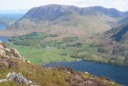
| MBK-1 | Mellbreak Mellbreak Mellbreak is a hill in the Western part of the English Lake District. Despite being surrounded on all sides by higher fells , it stands in isolation. It is surrounded on three sides by a 'moat' of deep marshy land, and on the east side by the lake of Crummock Water... |
512 | 260 | |
| MBK-2 | Mellbreak North Top | 509 | 62 | |
| LWF-1 | Low Fell Low Fell Low Fell is a fell in the English Lake District. It overlooks the lake of Loweswater to the south and to the north is bordered by its neighbour Fellbarrow. It is usually climbed from the villages of Loweswater or Thackthwaite. The fell is largely occupied by grassed enclosures, although there are... |
423 | 270 | |
| LWF-2 | Fellbarrow Fellbarrow Fellbarrow is a low hill in the north west of the English Lake District. It is not far from the town of Cockermouth, near to Loweswater and can most easily be climbed from Low Lorton, or Thackthwaite... |
416 | c 50 | |
| LWF-3 | Sourfoot Fell | 412 | c 35 | |
| LWF-4 | Darling Fell | 391 | c 45 | |
| LWF-5 | Pardshaw Crag | 191 | c 63 | |
| LWF-6 | Redhow Crags | c 166 | c 43 | |
| LWF-7 | Crag Hills | 165 | c 44 | |
| LWF-8 | Harrot Hill | 118 | c 31 | |
High Stile range
| ID | Hill | H | RH | Grid ref. |
|---|---|---|---|---|
| HSL-1 | High Stile High Stile High Stile is a mountain in the western part of the Lake District in northwest England. It is the eleventh highest English Marilyn, standing 807 metres high, and has a relative height of 362 metres .... |
807 | 362 | |
| HSL-2 | Red Pike Red Pike (Buttermere) Red Pike is a fell in the High Stile range in the western English Lake District, which separates Ennerdale from the valley of Buttermere and Crummock Water. It is high... |
755 | c 40 | |
| HSL-3 | High Crag High Crag High Crag stands at the southern end of the High Stile ridge which divides the valleys of Ennerdale and Buttermere in the west of the English Lake District. It is often climbed as part of a popular ridge walk, from Black Sail youth hostel, or from Buttermere via Scarth Gap... |
744 | 35 | |
| HSL-4 | Starling Dodd Starling Dodd Starling Dodd is a fell in the western part of the English Lake District, located between the valleys of Ennerdale and Buttermere, on the ridge between Great Borne to its west and Red Pike to its east... |
633 | c 73 | |
| HSL-5 | Great Borne Great Borne Great Borne is a fell in the English Lake District with a height of . It is a rather secluded hill situated at the western end of the long ridge which divides the Ennerdale and Buttermere valleys.-Name:... |
616 | 113 | |
| HSL-6 | Seat | 561 | 31 | |
| HSL-7 | Bowness Knott | 333 | c 40 | |
| valign="top" width="50%" |
Gable Group
| ID | Hill | H | RH | Grid ref. |
|---|---|---|---|---|
| GGB-1 | Great Gable Great Gable Great Gable is a mountain lying at the very heart of the English Lake District, appearing as a pyramid from Wasdale , but as a dome from most other directions. It is one of the most popular of the Lakeland fells, and there are many different routes to the summit... |
899 | 425 | |
| GGB-2 | Green Gable Green Gable Green Gable is a fell in the English Lake District often traversed by walkers on route to its more famous neighbour Great Gable. It can be ascended from Honister Pass, Seathwaite in Borrowdale, or Ennerdale... |
801 | 50 | |
| GGB-3 | Brandreth Brandreth Brandreth is a fell in the English Lake District. It stands between Great Gable and Haystacks in the Western Fells.-Topography:The Western Fells occupy a triangular sector of the Lake District, bordered by the River Cocker to the north east and Wasdale to the south east. Westwards the hills... |
715 | 61 | |
| GGB-4 | Fleetwith Pike Fleetwith Pike Fleetwith Pike is a fell in the English Lake District in the county of Cumbria which reaches a height of 648 metres . The fell is a well-known feature of the area as it casts an imposing presence over Buttermere and the Honister Pass on the B5289 motor road between Borrowdale and... |
648 | 117 | |
| GGB-5 | Base Brown Base Brown Base Brown is a fell in England's Lake District, near the head of the Borrowdale Valley. It forms one side of the Seathwaite Valley, and on the western side it is flanked by the hanging valley of Gillercomb.-Topography:... |
646 | 38 | |
| GGB-6 | Haystacks | 597 | c 92 | |
| GGB-7 | Green Crag | 528 | c 32 | |
| KKF-1 | Kirk Fell Kirk Fell Kirk Fell is a fell in the Western part of the English Lake District. It is situated between Great Gable and Pillar on the long ring of fells surrounding the valley of Ennerdale, and also stands over Wasdale to the south... |
802 | 181 | |
| KKF-2 | Kirk Fell East Top | 787 | 36 | |
Pillar Group and the far western fells
| ID | Hill | H | RH | Grid ref. |
|---|---|---|---|---|
| PLR-1 | Pillar Pillar (Lake District) Pillar is a mountain in the western part of the English Lake District. Situated between the valleys of Ennerdale to the north and Wasdale to the south, it is the highest point of the Pillar group . At 892 metres it is the eighth highest mountain in the Lake District... |
892 | 348 | |
| PLR-2 | Scoat Fell Scoat Fell Scoat Fell is a fell in the western part of the English Lake District. It stands at the head of the Mosedale Horseshoe with its back to Ennerdale... |
841 | 86 | |
| PLR-3 | Black Crag | 828 | 34 | |
| PLR-4 | Red Pike Red Pike (Wasdale) Red Pike is a fell in the English Lake District. It is 826 m or high and lies due north of Wast Water. It is often climbed as part of the Mosedale Horseshoe, a walk which also includes Pillar.... |
826 | c 62 | |
| PLR-5 | Haycock | 797 | 94 | |
| PLR-6 | Iron Crag Iron Crag Iron Crag is a mountain in the English Lake District, standing between Crag Fell and Caw Fell. The name of the fell is the source of some confusion, as the summit is unnamed on Ordnance Survey maps. Iron Crag apparently refers to the rocky outcrop below the summit, while the lower slopes are... |
642 | c 56 | |
| PLR-7 | Yewbarrow Yewbarrow Yewbarrow is a fell in the English Lake District which lies immediately north of the head of Wast Water. It is 628 metres high and in shape resembles the upturned hull of a boat or a barrow. Yewbarrow is on the left in the classic view of Great Gable and Wast Water.The top of Stirrup Crag... |
627 | 142 | |
| PLR-8 | Stirrup Crag | 616 | 33 | |
| PLR-9 | Lank Rigg Lank Rigg Lank Rigg is a fell in the English Lake District. It stands to the south of Ennerdale in the Western Fells. A sprawling hill with gentle grassy slopes it can be climbed from various points on the Coldfell road... |
541 | c 111 | |
| PLR-10 | Crag Fell Crag Fell Crag Fell is a hill in the English Lake District. It is part of the Lank Rigg group, standing above Ennerdale Water in the Western Fells. The craggy northern face above the lake gives the fell its name, prominent in views from the car park at Bowness Knott... |
523 | c 114 | |
| PLR-11 | Grike Grike (Lake District) Grike is a hill in the west of the English Lake District, near Ennerdale Water. It is part of the Lank Rigg group, the most westerly Wainwright as the fells diminish toward the coastal plain... |
488 | 37 | |
| PLR-12 | Blakeley Raise Blakeley Raise Blakeley Raise is a fell in the English Lake District, standing at 389m. Unlike its neighbours Grike, Crag Fell and Lank Rigg it is not listed as a Wainwright... |
389 | c 32 | |
| PLR-13 | Swainson Knott | 345 | c 132 | |
| PLR-14 | Swarth Fell | 335 | c 38 | |
| PLR-15 | Ponsonby Fell | 315 | c 34 | |
| PLR-16 | Wilton Fell | 302 | c 33 | |
| PLR-17 | Cold Fell | 293 | c 85 | |
| PLR-18 | Flat Fell Flat Fell Flat Fell is a hill located on the edge of the English Lake District, standing at 272m. It is included in Alfred Wainwright's Outlying Fells of Lakeland book, sharing a chapter with Dent.-Topography:... |
272 | c 74 | |
| PLR-19 | Head of Haile | 183 | c 33 | |
| PLR-20 | In Fell | c 177 | c 42 | |
| SAL-1 | Seatallan Seatallan Seatallan is a mountain in the western part of the English Lake District. It is rounded, grassy and fairly unassuming, occupying a large amount of land. However, it is classed as a Marilyn because of the low elevation of the col connecting it to Haycock, its nearest higher neighbour to the north... |
692 | 193 | |
| SAL-2 | Middle Fell Middle Fell Middle Fell is a hill or fell in the English Lake District. It is a satellite of Seatallan standing above the northern shore of Wastwater. Middle Fell can be climbed from Greendale near the foot of Wastwater, and a fine view of the lake backed by the Wastwater Screes is visible from the... |
582 | 117 | |
| SAL-3 | High Birkhow | 124 | c 58 | |
| DNT-1 | Dent Dent (fell) Dent is a small fell on the fringe of the English Lake District near the towns of Cleator Moor and Egremont. Sometimes known as Long Barrow, it is traditionally the first fell encountered by hikers following Wainwright's Coast to Coast Walk... |
352 | 175 | |
| DNT-2 | Winscales Hill | 143 | c 50 | |
|}
Central Fells
| ID | Hill | H | RH | Grid ref. |
|---|---|---|---|---|
| HRS-1 | High Raise High Raise (Langdale) High Raise is a fell in the Central Fells of the English Lake District not to be confused with another High Raise situated in the Far Eastern Fells... |
762 | 283 | |
| HRS-2 | Harrison Stickle Harrison Stickle Harrison Stickle is a fell in the central part of the English Lake District, situated above Great Langdale. The fell is one of the three fells which make up the picturesque Langdale Pikes, the others being Pike of Stickle and Loft Crag. Together they make up one of the most picturesque, and... |
736 | c 53 | |
| HRS-3 | Ullscarf Ullscarf Ullscarf is a fell in the English Lake District close to the geographical centre of the Cumbrian hills. It forms part of the watershed between the Derwentwater and Thirlmere catchments, a ridge running broadly north-south.-Topography:... |
726 | c 118 | |
| HRS-4 | Pike o'Stickle | 709 | c 54 | |
| HRS-5 | High Seat High Seat (Lake District) High Seat is a fell in the centre of the English Lake District. Despite being below 2,000 ft it is the highest point for about 5 miles in any direction; a consequence of the curious fact that the centre of the district is lower than the surrounding parts.-Topography:The main watershed of... |
608 | 136 | |
| HRS-6 | Bleaberry Fell Bleaberry Fell Bleaberry Fell is a fell in the Lake District in Cumbria, England, with a height of 590 metres . It stands on the main watershed between Borrowdale and Thirlmere and can be climbed from either flank... |
590 | c 43 | |
| HRS-7 | Sergeant's Crag Sergeant's Crag Sergeant's Crag is a fell in the English Lake District. It is an intermediate height on the ridge between the Langstrath and Greenup valleys in the Central Fells.-Topography:... |
571 | c 46 | |
| HRS-8 | Bell Crags | 558 | c 32 | |
| HRS-9 | Steel Fell Steel Fell Steel Fell is a fell in the English Lake District, lying between Thirlmere and Grasmere. It is triangular in plan, the ridges running north, west and south east... |
553 | c 82 | |
| HRS-10 | Calf Crag Calf Crag Calf Crag is a fell in the English Lake District, on the eastern side of the High Raise massif.-Topography:The spine of the Central Fells runs on a north-south axis with the highpoint at High Raise... |
537 | c 56 | |
| HRS-11 | Brown Rigg | 463 | c 30 | |
| HRS-12 | Raven Crag Raven Crag Raven Crag is a fell in the English Lake District. It acts as a superb vantage point for, and backdrop to, views across Thirlmere reservoir.-Topography:... |
461 | c 44 | |
| HRS-13 | The Benn | 446 | c 53 | |
| HRS-14 | Grange Fell Grange Fell Grange Fell is a small fell in the English Lake District in the county of Cumbria, situated in the Borrowdale valley overlooking the villages of Grange in Borrowdale and Rosthwaite.-Topography:... |
415 | c 90 | |
| HRS-15 | Ether Knott | 415 | c 38 | |
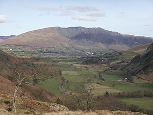
Helm Crag
Helm Crag is a fell in the English Lake District situated in the Central Fells to the north of Grasmere. Despite its low height it sits prominently at the end of a ridge, easily seen from the village...
High Rigg
High Rigg is a small fell located in the English Lake District, approximately three miles southeast of the town of Keswick. It occupies an unusual position, surrounded on all sides by higher fells but not connected by any obvious ridge...
Low Rigg
Low Rigg is a small hill located in the English Lake District a few miles east of the town of Keswick and slightly to the north of its larger neighbour High Rigg. It is a hill of modest elevation, being of insufficient size to merit inclusion in the famous Lake District guides produced by Alfred...
Loughrigg Fell
Loughrigg Fell is a hill in the central part of the English Lake District. It stands on the end of the long ridge coming down from High Raise over Silver How towards Ambleside, and is separated from its neighbours by the depression of Red Bank....
Mid-Western Fells
| ID | Hill | H | RH | Grid ref. |
|---|---|---|---|---|
| SFP-1 | Scafell Pike Scafell Pike Scafell Pike is the highest mountain in England at . It is located in Lake District National Park sometimes confused with the neighbouring Sca Fell, to which it is connected by the col of Mickledore... |
978 | 912 | |
| SFP-2 | Scafell | 964 | 133 | |
| SFP-3 | Ill Crag Ill Crag Ill Crag is a fell in the English Lake District. By some counts it is the fourth highest peak in England, although many people, including Alfred Wainwright, consider it to be a subsidiary summit of Scafell Pike... |
935 | 57 | |
| SFP-4 | Broad Crag Broad Crag Broad Crag is a fell in the English Lake District. By some counts, it is the fifth highest peak in England at a height of 934 metres .-Topography:It forms part of the Scafell chain, and lies about northeast of Scafell Pike... |
934 | 52 | |
| SFP-5 | Great End Great End Great End is the most northerly mountain in the Scafell chain, in the English Lake District. From the south it is simply a lump continuing this chain.... |
910 | 56 | |
| SFP-6 | Bow Fell | 902 | 146 | |
| SFP-7 | Esk Pike Esk Pike Esk Pike is a fell in the English Lake District, one of the great cirque of hills forming the head of Eskdale.-Topography:The Southern Fells include the highest ground in England, a horseshoe which begins with Scafell and Scafell Pike in the west and then curves around the north of Upper Eskdale to... |
885 | 112 | |
| SFP-8 | Crinkle Crags Crinkle Crags Crinkle Crags is a fell in the English Lake District in the county of Cumbria. It forms part of two major rings of mountains, surrounding the valleys of Great Langdale and Upper Eskdale. The name reflects the fell's physical appearance as its summit ridge is a series of five rises and depressions ... |
859 | 138 | |
| SFP-9 | First Crinkle | 834 | 32 | |
| SFP-10 | Shelter Crags | 815 | 31 | |
| SFP-11 | Lingmell Lingmell Lingmell is a fell in the English Lake District, standing above the village of Wasdale Head. It is an outlier on the north-west flank of Scafell Pike, England's highest mountain.-Topography:... |
807 | c 72 | |
| SFP-12 | Allen Crags Allen Crags Allen Crags is a fell in the English Lake District, it lies in a group of very popular hills and is regarded as part of the Scafell group of fells... |
785 | 60 | |
| SFP-13 | Glaramara Glaramara Glaramara is a fell in the English Lake District in Cumbria. It is a substantial fell that is part of a long ridge that stretches for over six kilometres from Stonethwaite in Borrowdale up to the important mountain pass of Esk Hause... |
783 | 121 | |
| SFP-14 | Lincomb Head | 721 | 37 | |
| SFP-15 | Cold Pike Cold Pike Cold Pike is a fell in the English Lake District. It is a satellite of Crinkle Crags and stands above the Upper Duddon Valley.-Topography:... |
701 | 46 | |
| SFP-16 | Rossett Pike Rossett Pike Rossett Pike is a fell in the English Lake District. It is located at the head of Mickleden, one of two tributary valleys of Great Langdale.-Topography:... |
651 | 40 | |
| SFP-17 | Woofgill Pike | 632 | c 36 | |
| SFP-18 | Seathwaite Fell Seathwaite Fell Seathwaite Fell is an area of the Lake District in Cumbria, England. It stands above the hamlet of the same name at the head of Borrowdale.-Position of the summit:... |
632 | c 31 | |
| SFP-19 | Black Crags | 588 | c 33 | |
| SFP-20 | Bessyboot | 548 | c 41 | |
| SFP-21 | Great How | 522 | 52 | |
| SFP-22 | Throstlehow Crag | 404 | c 36 | |
| SFP-23 | Round Scar | 395 | c 30 | |
Pike of Blisco
Pike of Blisco, or Pike o' Blisco, is a mountain in the Lake District in Cumbria, England. Located between the valleys of Great Langdale and Little Langdale, its relative isolation from neighbouring fells together with slopes falling away immediately from the summit in all directions mean it has...
Illgill Head
Illgill Head is a fell in the English Lake District. It is known more commonly as the northern portion of the Wastwater Screes. The fell is 609 metres high and stands along the south-east shore of Wast Water, the deepest lake in England.-Topography:...
Whin Rigg
Whin Rigg is a fell is the English Lake District, situated in the western segment of the national park, 22 kilometres south east of the town of Whitehaven...
Hard Knott
Hard Knott is a hill in the English Lake District, at the head of Eskdale.-Topography:The headwaters of the River Esk and the Duddon are separated by a ridge falling south west from the summit of Crinkle Crags. This line of high ground continues over many twists and turns for , finally meeting the...
Lingmoor Fell
Lingmoor Fell is a fell in the English Lake District, situated eight kilometres west of Ambleside. The fell reaches a modest height of 469 m and divides the valleys of Great Langdale and Little Langdale. The fell's name originates from the Old Norse word lyng meaning “heather covered”...
Muncaster Fell
Muncaster Fell is a fell at the far western edge of the Lake District National Park, in Cumbria, England. Muncaster Fell is a long, narrow ridge of land, approximately 1.2 km wide and 6 km long, lying between the River Mite to the north, and River Esk to the south. The fell rises from the...
Mell Fells and north-eastern fringe
| Hill | H | RH | Grid ref. |
|---|---|---|---|
| Great Mell Fell Great Mell Fell Great Mell Fell is a hill in the Eastern Fells of the English Lake District. It is a north-eastern outlier of the Helvellyn range, but, like its twin Little Mell Fell, is isolated from its fellows, standing in the middle of a flat plain... |
537 | 198 | |
| Greystoke Forest | 365 | c 90 | |
| Murrah Hill | 364 | c 32 | |
| Summerground Crags | 361 | c 33 | |
| Dacre Bank | 302 | c 40 | |
| Beacon Hill | 286 | c 143 | |
| How Top | 277 | c 30 | |
| Wan Fell | 273 | 50 | |
| Lazonby Fell | 247 | c 80 | |
| Banks Farm Hill | 246 | c 50 | |
| Blaze Fell | 242 | c 110 | |
| Brown Rigg | 226 | c 49 | |
| Barrock Fell | 223 | c 97 | |
| Hill Rigg | 197 | c 50 | |
| Thiefside Hill | 178 | c 51 | |
| High Stand Hill | c 173 | c 47 | |
| Highbarn Hill | 148 | c 31 | |
| Wreay Signal Station | 117 | c 32 | |
| Carleton Hill | 101 | c 32 | |
| Little Mell Fell Little Mell Fell Little Mell Fell is a fell in the English Lake District. It is an outlier of the Eastern Fells, standing to the north of Ullswater. Two miles to the north west is Great Mell Fell, often thought of as its 'twin'.-Topography:... |
505 | 226 | |
| Gowbarrow Fell Gowbarrow Fell Gowbarrow Fell is a fell in the English Lake District. It is an outlier of the Eastern Fells, standing to the north of Ullswater and above the famous Aira Force waterfall.-Topography:... |
481 | c 98 | |
| Great Meldrum | 437 | c 39 | |
| Underwood Hill | 424 | c 39 | |
| Hagg Hill | 342 | c 34 | |
| Bennethead Banks | 295 | c 49 | |
| Soulby Fell | 290 | c 43 | |
| Salmond's Hill | 289 | c 41 | |
| Soulby Fell North Top | c 288 | c 40 | |
| The Knotts | 274 | c 48 | |
| Dunmallard Hill | c 247 | c 85 | |
| valign="top" width="50%" |
Helvellyn rangeHelvellyn rangeHelvellyn range is the name given to a part of the Eastern Fells in the English Lake District, fell being the local word for hill. The name comes from Helvellyn, the highest point of the group....
| Hill | H | RH | Grid ref. |
|---|---|---|---|
| Helvellyn Helvellyn Helvellyn is a mountain in the English Lake District, the apex of the Eastern Fells. At above sea level, it is the third highest peak in both the Lake District and England... |
950 | 712 | |
| Catstye Cam Catstye Cam Catstye Cam is a fell in the English Lake District. It is an outlier of Helvellyn in the Eastern Fells.-Name:The name of the fell is also given as 'Catstycam', a spelling preferred by Alfred Wainwright in his influential Pictorial Guide to the Lakeland Fells. A third variant, 'Catchedicam', is also... |
890 | 63 | |
| Raise | 883 | 91 | |
| White Side White Side White Side is a fell in the English Lake District. It is situated to the east of Thirlmere and to the west of Glenridding valley. This places White Side in the Helvellyn range of the Eastern Fells, with Raise to the north and Helvellyn Lower Man to the south, both of which are of greater... |
863 | 42 | |
| Dollywagon Pike | 858 | 50 | |
| Great Dodd Great Dodd Great Dodd is a fell in the English Lake District. It stands on the main spine of the Helvellyn range in the Eastern Fells, between the Vale of St John and Dockray.-Topography:... |
857 | 109 | |
| Stybarrow Dodd Stybarrow Dodd Stybarrow Dodd is a fell in the English Lake District. It stands on the main spine of the Helvellyn range in the Eastern Fells, situated between Thirlmere and the Ullswater catchment.-Topography:... |
843 | 68 | |
| Green Side | 795 | 30 | |
| Clough Head Clough Head Clough Head is a fell in the English Lake District. It is the northernmost top of the Helvellyn range in the Eastern Fells, standing to the south of Threlkeld and the A66.-Topography:... |
726 | 108 | |
| Sheffield Pike Sheffield Pike Sheffield Pike is a fell in the English Lake District, an outlier of the Helvellyn range in the Eastern Fells. It stands on the eastern side of the range, looking down on Ullswater.-Topography:... |
675 | 91 | |
| Cockley Moor | 455 | c 39 | |
| Glenridding Dodd Glenridding Dodd Glenridding Dodd is a fell in the English Lake District, an outlier of the Helvellyn range in the Eastern Fells. It looks down the upper reach of Ullswater.-Topography:... |
442 | c 45 | |
| Great How | 339 | c 142 | |
| Keldas | 311 | c 35 | |
Fairfield Group
| Hill | H | RH | Grid ref. |
|---|---|---|---|
| Fairfield Fairfield -Australia:*Fairfield, New South Wales, the most populous place in Australia with that place name**Electoral district of Fairfield, the corresponding seat in the New South Wales Legislative Assembly*Fairfield, Queensland*Fairfield, Victoria... |
873 | 299 | |
| Hart Crag Hart Crag Hart Crag is a fell in the English Lake District, being one of the Fairfield group of hills in the Eastern Fells.-Topography:The fell stands on the ridge running south east from Fairfield to Dove Crag, at the point where a long subsidiary spur sweeps off to the north east... |
822 | c 48 | |
| Dove Crag Dove Crag Dove Crag is a fell in the English Lake District. Situated in the Eastern Fells of the national park, seven kilometres south-south-west of Glenridding, it reaches a height of 792 metres... |
792 | 50 | |
| Great Rigg Great Rigg Great Rigg is a fell in the English Lake District, it is situated 7 kilometres north northwest of Ambleside and reaches a height of 766 metres . It is most often climbed as part of the Fairfield horseshoe, a 16 km circular walk which starts and finishes in Ambleside... |
766 | 31 | |
| Little Hart Crag Little Hart Crag Little Hart Crag is a fell in the Lake District area of England. It stands at the head of Scandale, six kilometres north of Ambleside, at a height of 637 metres . It is an eastern outlier of Dove Crag in the Eastern Fells, although it does have 34 metres of prominence from that fell making it both... |
637 | c 34 | |
| St Sunday Crag St Sunday Crag St Sunday Crag is a fell in the English Lake District, part of the Fairfield group in the Eastern Fells. It is a prominent feature in the Patterdale skyline, with a distinctive rounded shape... |
841 | 159 | |
| Red Screes Red Screes Red Screes is a fell in the English Lake District, situated between the villages of Patterdale and Ambleside. It is an outlier of the Fairfield group in the Eastern Fells, but is separated from its neighbours by low cols... |
776 | 260 | |
| Seat Sandal Seat Sandal Seat Sandal is a fell in the English Lake District, it is situated four kilometers north of the village of Grasmere from where it is very well seen... |
736 | 150 | |
|}
High Street range, Pooley Bridge - Kendal
| ID | Hill | H | RH | Grid ref. |
|---|---|---|---|---|
| HST-1 | High Street High Street (Lake District) High Street is a fell in the English Lake District. At 828 metres , its summit is the highest point in the far eastern part of the national park. The fell is named after the Roman road which ran over the summit.-History and Naming:... |
828 | 373 | |
| HST-2 | High Raise High Raise (High Street) High Raise is a fell in the English Lake District, standing to the west of Haweswater Reservoir in the Far Eastern Fells. Note that another High Raise is the highpoint of the Central Fells.-Topography:... |
802 | 88 | |
| HST-3 | Rampsgill Head Rampsgill Head Rampsgill Head is a fell in the English Lake District, standing to the west of Haweswater Reservoir in the Far Eastern Fells. It forms the focal point of three ridges which fan out north east, north west and south.-Topography:... |
792 | 41 | |
| HST-4 | Thornthwaite Crag Thornthwaite Crag Thornthwaite Crag is a fell in the English Lake District, standing to the west of Haweswater Reservoir. It is a focal point of the Far Eastern Fells, standing at the head of several valleys.-Topography:... |
784 | 31 | |
| HST-5 | Harter Fell Harter Fell (Eskdale) Harter Fell is a mountain in the western part of the English Lake District located between the Eskdale and Duddon valleys. Its height is 649 m . There are several walking routes to the summit.-Topography:... |
778 | 149 | |
| HST-6 | Ill Bell Ill Bell Ill Bell is a fell in the English Lake District, in the county of Cumbria, standing on the narrow ridge between the valleys of Kentmere and Troutbeck.-Topography:... |
757 | 124 | |
| HST-7 | Kentmere Pike Kentmere Pike Kentmere Pike is a fell in the English Lake District, rising between the valleys of Kentmere and Longsleddale. It is the highpoint on the ridge between Harter Fell and Shipman Knotts.-Topography:... |
730 | 39 | |
| HST-8 | Froswick Froswick Froswick is a fell in the English Lake District, standing on the fine narrow ridge between the valleys of Kentmere and Troutbeck.-Topography:To the north is Thornthwaite Crag, while the adjoining fell to the south is Ill Bell. Froswick is shorter in stature than either of its neighbours and also... |
720 | 75 | |
| HST-9 | Branstree Branstree Branstree is a fell in the Far Eastern part of the English Lake District. It overlooks the valley of Mardale and Haweswater Reservoir.-Topography:... |
713 | 137 | |
| HST-10 | Yoke Yoke (Lake District) Yoke is a fell in the Lake District in Cumbria, England. It has a height of 706 m and is situated in the far eastern sector of the national park, 7 kilometres north east of the town of Ambleside. Yoke is the southern extremity of the long ridge that runs southwards from the fell of High... |
706 | 38 | |
| HST-11 | Rest Dodd Rest Dodd Rest Dodd is a fell in the English Lake District. It is situated in the quieter far eastern region of the national park and reaches a height of 696 metres... |
696 | 111 | |
| HST-12 | Loadpot Hill Loadpot Hill Loadpot Hill is a fell in the English Lake District, between Haweswater and Ullswater.-Topography:Although of moderate height, Loadpot Hill and its descending ridges cover an area of around... |
671 | c 48 | |
| HST-13 | Selside Pike Selside Pike Selside Pike is a fell in the English Lake District. It stands between the valleys of Mardale and Swindale in the Far Eastern Fells.-Topography:... |
655 | 36 | |
| HST-14 | Rough Crag | 628 | c 33 | |
| HST-15 | The Nab The Nab The Nab is a fell in the English Lake District. It has a moderate height of 576 metres , and lies in the quieter eastern high ground between Ullswater and Haweswater Reservoir... |
576 | 61 | |
| HST-16 | Angletarn Pikes Angletarn Pikes Angletarn Pikes, is a fell in the English Lake District, near the village of Patterdale. Its most notable feature is the summit tarn from which it derives its name.-Topography:... |
567 | c 79 | |
| HST-17 | Sallows Sallows Sallows is a fell in the English Lake District, rising between the valleys of Kentmere and Troutbeck. It is the highest point in the upland area to the south of Garburn Pass, variously termed Kentmere Park and Applethwaite Common on Ordnance Survey maps.... |
516 | 69 | |
| HST-18 | Beda Head | 509 | c 61 | |
| HST-19 | Bampton Common | 489 | c 34 | |
| HST-20 | Sour Howes Sour Howes Sour Howes is a small fell in the English Lake District. It is situated five kilometres east of Ambleside, between the Troutbeck and Kentmere valleys and is one of the two separate fells on Applethwaite Common .-Topography:... |
483 | c 36 | |
| HST-21 | Steel Knotts Steel Knotts Steel Knotts is a fell in the English Lake District, near to Ullswater in the Far Eastern Fells. It stands between the valleys of Fusedale and Martindale on a ridge running north-south.-Topography:... |
432 | c 50 | |
| HST-22 | Sleddale Forest | 429 | c 115 | |
| HST-23 | Hollow Moor | 426 | c 78 | |
| HST-24 | Potter Fell Potter Fell Potter Fell is a fell near Burneside, Cumbria, England. A number of tarns are present on the fell, including Gurnal Dubs Tarn and Potter Tarn. Potter Fell has four major summits, two of which are mentioned in Alfred Wainwright's The Outlying Fells of Lakeland.-Summits:Potter Fell is made up of... |
395 | c 30 | |
| HST-25 | Potter Fell East Top | 390 | c 45 | |
| HST-26 | Heughscar Hill | 375 | c 52 | |
| HST-27 | Troutbeck Tongue Troutbeck Tongue Troutbeck Tongue is a small fell located in the English Lake District, three miles east of Ambleside. It is one of 214 hills listed in Alfred Wainwright's Pictorial Guides to the Lakeland Fells, which makes it a popular attraction for walkers who are aiming to complete all the "Wainwrights"... |
364 | c 71 | |
| HST-28 | Millrigg Knott | 300 | c 58 | |
| HST-29 | High Knott | 275 | c 56 | |
| HST-30 | Hugill Fell | 273 | c 37 | |
| HST-31 | Banner Rigg | 265 | c 56 | |
| HST-32 | Crook Knott | 256 | c 107 | |
| HST-33 | Grandsire | 251 | c 75 | |
| HST-34 | Borwick Hill | 249 | c 43 | |
| HST-35 | Cleabarrow Hill | 247 | c 30 | |
| HST-36 | Orrest Head Orrest Head Orrest Head is a fell in the English Lake District on the eastern shores of Windermere. It is one of Wainwright's The Outlying Fells of Lakeland - and the first fell he climbed... |
238 | c 63 | |
| HST-37 | Scout Scar | 235 | c 126 | |
| HST-38 | School Knott | 232 | c 41 | |
| HST-39 | Kerris Hill | 230 | c 41 | |
| HST-40 | Lord's Lot | 215 | c 60 | |
| HST-41 | Cunswick Scar Cunswick Scar Cunswick Scar is a limestone scar in the Lake District, England. There are extensive views from the large cairn at the top . The scar is listed in Wainwright's Outlying Fells book. Fossils can be found in the limestone on the scar and Cunswick Fell.... |
207 | c 39 | |
| HST-42 | Kendal Fell | 198 | c 40 | |
| HST-43 | Brant Fell | 191 | c 65 | |
| HST-44 | Elfhowe Hill | 188 | c 31 | |
| HST-45 | Tarn Hill | 188 | c 42 | |
| HST-46 | Cat Crag | 186 | 37 | |
| HST-47 | Scott Howe | 169 | c 32 | |
| HST-48 | Barker Knott | 158 | c 39 | |
| HST-49 | Capple Rigg | 144 | c 30 | |
| HST-50 | Cowan Head | c 141 | c 44 | |
| HST-51 | Bell Hill | 139 | c 30 | |
| HST-52 | Sizergh Fell | 124 | c 60 | |
| Place Fell Place Fell Place Fell is a hill in the English Lake District. It stands at the corner of the upper and middle reaches of Ullswater, with steep western flanks overlooking the villages of Glenridding and Patterdale.-Topography:... |
657 | 262 | ||
| High Dodd | 501 | c 46 | ||
| Wansfell Wansfell Wansfell is a fell in English Lake District it is situated 2.5 kilometres east of the town of Ambleside. The fell is part of the long southern ridge of Caudale Moor and occupies the swathe of territory between Ambleside and the Troutbeck valley.-Topography:... |
488 | 150 | ||
| Hallin Fell Hallin Fell Hallin Fell is a hill in the English Lake District surrounded on three sides by Ullswater.-Topography:The fell is a continuation of the ridge leading down from Steel Knotts, but the depression at The Coombs is so profound that Hallin Fell appears totally independent in almost any view... |
388 | 163 | ||
| valign="top" width="50%" |
Shap Fells and Westmorland Plateau
| Hill | H | RH | Grid ref. |
|---|---|---|---|
| Tarn Crag Tarn Crag (Far Eastern Fells) Tarn Crag is a fell in the English Lake District. It stands to the east of Longsleddale in the Far Eastern Fells. There is another Tarn Crag in the Central Fells near Grasmere.-Topography:... |
664 | 160 | |
| Grey Crag Grey Crag Grey Crag is a fell in the English Lake District. It stands to the east of Longsleddale in the Far Eastern Fells. There is another fell named Gray Crag in the Lake District near Hartsop.-Topography:... |
638 | 41 | |
| Swinklebank Crag | 553 | c 45 | |
| High Wether Howe | 531 | 66 | |
| White Howe | 530 | c 74 | |
| The Forest | 528 | c 40 | |
| Lord's Seat | 524 | c 36 | |
| Seat Robert | 515 | c 30 | |
| High House Bank | 495 | 80 | |
| Long Crag | 493 | 31 | |
| Robin Hood | 493 | 30 | |
| Whatshaw Common | 490 | 71 | |
| Pipers Hill | 485 | c 77 | |
| Whinash | 471 | c 40 | |
| Long Fell | 452 | c 42 | |
| Knott | 412 | c 120 | |
| Coalpit Hill | 401 | c 65 | |
| Whiteside Pike | 397 | c 47 | |
| Beacon Hill | 397 | c 36 | |
| Nettle Hill | 382 | c 124 | |
| Jeffrey's Mount | 378 | c 49 | |
| Thorny Bank | 375 | c 30 | |
| Hardendale Nab | 372 | c 46 | |
|}