
Lüneburg Heath
Encyclopedia

Heath (habitat)
A heath or heathland is a dwarf-shrub habitat found on mainly low quality acidic soils, characterised by open, low growing woody vegetation, often dominated by plants of the Ericaceae. There are some clear differences between heath and moorland...
, geest
Geest (topography)
Geest is a type of slightly raised landscape that occurs in the plains of in Northern Germany, the Northern Netherlands and Denmark. It is a landscape of sandy and gravelly soils, usually mantled by a heathland vegetation, comprising glacial deposits left behind after the last ice age during the...
and woodland
Woodland
Ecologically, a woodland is a low-density forest forming open habitats with plenty of sunlight and limited shade. Woodlands may support an understory of shrubs and herbaceous plants including grasses. Woodland may form a transition to shrubland under drier conditions or during early stages of...
in northeastern part of the state of Lower Saxony
Lower Saxony
Lower Saxony is a German state situated in north-western Germany and is second in area and fourth in population among the sixteen states of Germany...
in northern Germany
Germany
Germany , officially the Federal Republic of Germany , is a federal parliamentary republic in Europe. The country consists of 16 states while the capital and largest city is Berlin. Germany covers an area of 357,021 km2 and has a largely temperate seasonal climate...
. It forms part of the hinterland for the cities of Hamburg
Hamburg
-History:The first historic name for the city was, according to Claudius Ptolemy's reports, Treva.But the city takes its modern name, Hamburg, from the first permanent building on the site, a castle whose construction was ordered by the Emperor Charlemagne in AD 808...
, Hanover
Hanover
Hanover or Hannover, on the river Leine, is the capital of the federal state of Lower Saxony , Germany and was once by personal union the family seat of the Hanoverian Kings of Great Britain, under their title as the dukes of Brunswick-Lüneburg...
, and Bremen
Bremen
The City Municipality of Bremen is a Hanseatic city in northwestern Germany. A commercial and industrial city with a major port on the river Weser, Bremen is part of the Bremen-Oldenburg metropolitan area . Bremen is the second most populous city in North Germany and tenth in Germany.Bremen is...
and is named after the town of Lüneburg
Lüneburg
Lüneburg is a town in the German state of Lower Saxony. It is located about southeast of fellow Hanseatic city Hamburg. It is part of the Hamburg Metropolitan Region, and one of Hamburg's inner suburbs...
. Most of the area is a nature reserve. Northern Low Saxon
Northern Low Saxon
Northern Low Saxon is a West Low German dialect.As such, it covers a great part of the West Low-German-speaking areas of northern Germany, with the exception of the border regions where Eastphalian and Westphalian are spoken...
is still widely spoken in the region.
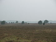
The Lüneburg Heath has extensive areas of heathland
Heath (habitat)
A heath or heathland is a dwarf-shrub habitat found on mainly low quality acidic soils, characterised by open, low growing woody vegetation, often dominated by plants of the Ericaceae. There are some clear differences between heath and moorland...
, typical of those that covered most of the North German countryside until about 1800, but which have almost completely disappeared in other areas. The heaths were formed after the Neolithic
Neolithic
The Neolithic Age, Era, or Period, or New Stone Age, was a period in the development of human technology, beginning about 9500 BC in some parts of the Middle East, and later in other parts of the world. It is traditionally considered as the last part of the Stone Age...
period by overgrazing
Overgrazing
Overgrazing occurs when plants are exposed to intensive grazing for extended periods of time, or without sufficient recovery periods. It can be caused by either livestock in poorly managed agricultural applications, or by overpopulations of native or non-native wild animals.Overgrazing reduces the...
of the once widespread forests on the poor sandy soils of the geest
Geestland
Geest is a type of slightly raised landscape that occurs in the plains of in Northern Germany, the Northern Netherlands and Denmark. It is a landscape of sandy and gravelly soils, usually mantled by a heathland vegetation, comprising glacial deposits left behind after the last ice age during the...
, as this slightly hilly and sandy terrain in northern Europe is called. The Lüneburg Heath is therefore a historic cultural landscape
Cultural landscape
Cultural Landscapes have been defined by the World Heritage Committee as distinct geographical areas or properties uniquely "..represent[ing] the combined work of nature and of man.."....
. The remaining areas of heath are kept clear mainly through grazing, especially by a North German breed of moorland sheep called the Heidschnucke
Heidschnucke
The Heidschnucke is a group of three types of moorland sheep from northern Germany. Like a number of other types from Scandinavia and Great Britain, they are Northern European short-tailed sheep...
. Due to its unique landscape, the Lüneburg Heath is a popular tourist destination in North Germany.
Location


Natural region
A Natural region is one which is distinguished by its natural features of geography and usually more important, geology. The natural ecology of the region is likely to be significant but one of these factors tends to influence the others....
, that is an area distinguished by a specific combination of abiotic factors (climate, relief, water resources, soil, geology) and biotic factors (flora
Flora
Flora is the plant life occurring in a particular region or time, generally the naturally occurring or indigenous—native plant life. The corresponding term for animals is fauna.-Etymology:...
and fauna
Fauna
Fauna or faunæ is all of the animal life of any particular region or time. The corresponding term for plants is flora.Zoologists and paleontologists use fauna to refer to a typical collection of animals found in a specific time or place, e.g. the "Sonoran Desert fauna" or the "Burgess shale fauna"...
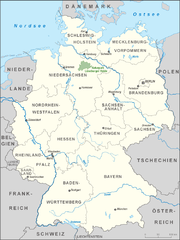
). The Lüneburg Heath is a sub-division of the North European Plain. In the list of the major natural regions of Germany issued by the Federal Office for Nature Conservation (Bundesamt für Naturschutz) it is region number D28.
The Lüneburg Heath covers an area which includes the districts (Landkreise) of Celle, Gifhorn, Soltau-Fallingbostel, Uelzen, Lüneburg, Lüchow-Dannenberg, southeast Rotenburg (the town of Visselhövede
Visselhövede
Visselhövede is a town in the district of Rotenburg in Lower Saxony, Germany. Nearby towns include the district capital Rotenburg, Walsrode and Verden. Larger cities within a 100 km radius are Bremen, Hanover and Hamburg....
, Fintel
Fintel
Fintel is a municipality in the district of Rotenburg, in Lower Saxony, Germany. Fintel is located on the Wümme, a tributary of the Weser River, and has about 3,000 inhabitants.Fintel belonged to the Prince-Bishopric of Verden, established in 1180...
, part of the municipality of Scheeßel
Scheeßel
Scheeßel is a municipality in the district of Rotenburg, in Lower Saxony, Germany. It is situated on the river Wümme, approx. 10 km northeast of Rotenburg, 45 km east of Bremen, and 70 km southwest of Hamburg....
and the eastern half of Bothel
Bothel
Bothel is a small town in the district of Rotenburg, Germany in the Luneburg Heath region of central Lower Saxony. It has 2,500 inhabitants. Bothel was founded by workers of the nearby Trochel Forest. The name developed from Borstel which is Old Saxon and means "little woods".Bothel belonged to the...
) and the rural district of Harburg. The westernmost fringes of the Lüneburg Heath belonging to Landkreis Verden are called the Linteln Geest
Linteln Geest
The Linteln Geest , shown on some maps as the Verden Heath, is a geest region in the north German state of Lower Saxony and belongs administratively to the borough of Kirchlinteln.- Geography :The Linteln Geest covers the historic Duchy of Verden which nowadays comprises the fringes of the Lüneburg...
(Lintelner Geest) or Verden Heath (Verdener Heide) and form part of the municipality of Kirchlinteln
Kirchlinteln
Kirchlinteln is a municipality in the district of Verden, in Lower Saxony, Germany. Its central village is situated approximately 6 km east of Verden, and 40 km southeast of Bremen. It is surrounded by the Linteln Geest which is dominated by woods, hills, heath and small villages...
.
The Lüneburg Heath lies between the rivers Elbe
Elbe
The Elbe is one of the major rivers of Central Europe. It rises in the Krkonoše Mountains of the northwestern Czech Republic before traversing much of Bohemia , then Germany and flowing into the North Sea at Cuxhaven, 110 km northwest of Hamburg...
to the north, the Drawehn
Drawehn
The Drawehn is a partly wooded and partly agricultural region of hills in the northeastern part of the German state of Lower Saxony, lying between the districts of Lüneburg and Uelzen in the west and Lüchow-Dannenberg in the east.- Definition :...
to the east, the Aller
Aller
The Aller is a river, long, in the states of Saxony-Anhalt and Lower Saxony in Germany. It is a right-hand, and hence eastern, tributary of the River Weser and is also its largest tributary. Its last form the Lower Aller federal waterway...
to the south and southwest, the middle course of the Wümme to the west and the Harburg Hills
Harburg Hills
The Harburg Hills are a low ridge in the northeastern part of the German state of Lower Saxony and the southern part of the city state of Hamburg...
(Harburger Bergen) to the northwest.
On the northwestern edge of the Lüneburg Heath are the Harburg Hills and south of Schneverdingen
Schneverdingen
Schneverdingen is a town in the northern part of the district of Heidekreis, in Lower Saxony, Germany. It is situated approx. 15 km north of Soltau, and 50 km south of Hamburg....
there are bogs, such as the Pietzmoor
Pietzmoor
The Pietzmoor is named after the little village of Pietz, and is the largest contiguous area of bog on the Lüneburg Heath in northern Germany. The bog lies southeast of the town of Schneverdingen and is bordered to the south by the village of Heber. The Pietzmoor has an average peat depth of 4 m,...
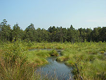
(see photo). Also of note are other smaller bogs in sinkhole
Sinkhole
A sinkhole, also known as a sink, shake hole, swallow hole, swallet, doline or cenote, is a natural depression or hole in the Earth's surface caused by karst processes — the chemical dissolution of carbonate rocks or suffosion processes for example in sandstone...
s, like the Grundloses Moor ("bottomless bog") near Walsrode or the Bullenkuhle near Bokel (part of Sprakensehl
Sprakensehl
Sprakensehl is a municipality in the district of Gifhorn, in Lower Saxony, Germany....
). The eastern boundary to the Wendland is formed by the Göhrde
Göhrde
Göhrde is a municipality in the district of Lüchow-Dannenberg, in Lower Saxony, Germany.The municipality was named after the Göhrde State Forest, which has an area of about , famous for its oaks, beeches and game preserves. The hunting lodge situated in the forest was built in 1689 and was restored...
-Drawehn
Drawehn
The Drawehn is a partly wooded and partly agricultural region of hills in the northeastern part of the German state of Lower Saxony, lying between the districts of Lüneburg and Uelzen in the west and Lüchow-Dannenberg in the east.- Definition :...
Hills (the Ostheide natural region). Parts of the Lüneburg Heath are in the Südheide Nature Park
Südheide Nature Park
The Südheide Nature Park is a large protected area of forest and heathland in the southern part of the Lüneburg Heath in North Germany...
, others in the Lüneburg Heath Nature Park
Lüneburg Heath Nature Park
In the north of the area known as the Lüneburg Heath in northern Germany, lies the Lüneburg Heath Nature Park with an area of...
.
Hills and elevations

Wilseder Berg
At the Wilseder Berg is the highest point on the Lüneburg Heath in North Germany.- Description :The Wilseder Berg is part of a nature reserve within the Lüneburg Heath and lies near the villages of Wilsede and Bispingen in the Heidekreis. The hill was formed during the penultimate ice age, the...
(169.2 metres (555.1 ft) above NN). Other hills over 100 metres (328.1 ft) high are: Falkenberg (150 m), near Bergen, Ahrberg (145 m), Hakenberg (143 m), Hoher Mechtin
Hoher Mechtin
At a height of the Hoher Mechtin is the highest elevation in the Wendland in the district of Lüchow-Dannenberg in northern Germany, and is at the same time a significant high point on the entire North German Plain. It lies roughly at the centre point of the Drawehn ridge, which is also described...
(142 m), Pampower Berg (140 m), Lüßberg (130 m), Brunsberg
Brunsberg (Harburg)
The Brunsberg is a high hill on the northwestern edge of the Lüneburg Heath in northern Germany. It lies in the Brunsberg Nature Reserve, reserve no. LÜ 010 with an area of , near Sprötze between the towns of Buchholz in der Nordheide and Tostedt...
, near Sprötze
Sprötze
The former independent municipality of Sprötze in the north German state of Lower Saxony was merged in 1972 with another five villages into the town of Buchholz in der Nordheide.- Transportation :...
(129 m), Goldbockenberg (129 m), Hingstberg (126 m), Staffelberg (126 m), Hengstberg (121 m), Höpenberg near Schneverdingen (120), Haußelberg
Haußelberg
The Haußelberg is a above NN high hill in the Lüneburg Heath in the north German district of Celle. It is a popular viewing point in the otherwise very flat terrain of the Südheide Nature Park....
(119.1 m), Breithorn (118 m), Mützenberg (115 m), Tellmer Berg (113 m), Wümmeberg (107.9 m), Schiffberg (107 m), Hummelsberg and Wulfsberg (each 106 m), Drullberg and Thonhopsberg (each 104 m), Kruckberg and Wietzer Berg
Wietzer Berg
The Wietzer Berg is a low hill, 102 metres above sea level, on the Lüneburg Heath in the north German district of Celle. It lies about 2 kilometres west-southwest of the tourist village of Müden and is a popular destination in the generally flat landscape of the Südheide Nature Park...
(each 102 m) and Höllenberg (101 m).
Several of these hills - the Wilseder Berg, the Falkenberg, the Haußelberg and the Breithorn - were used by the mathematician, Carl Friedrich Gauß, as triangulation station
Triangulation station
A triangulation station, also known as a triangulation pillar, trigonometrical station, trigonometrical point, trig station, trig beacon or trig point, and sometimes informally as a trig, is a fixed surveying station, used in geodetic surveying and other surveying projects in its vicinity...
s in his topographical surveys of the Kingdom of Hanover
Kingdom of Hanover
The Kingdom of Hanover was established in October 1814 by the Congress of Vienna, with the restoration of George III to his Hanoverian territories after the Napoleonic era. It succeeded the former Electorate of Brunswick-Lüneburg , and joined with 38 other sovereign states in the German...
from 1821–1825.
Rivers and streams
RiverRiver
A river is a natural watercourse, usually freshwater, flowing towards an ocean, a lake, a sea, or another river. In a few cases, a river simply flows into the ground or dries up completely before reaching another body of water. Small rivers may also be called by several other names, including...
s in the area, beside the numerous small heathland streams
Stream
A stream is a body of water with a current, confined within a bed and stream banks. Depending on its locale or certain characteristics, a stream may be referred to as a branch, brook, beck, burn, creek, "crick", gill , kill, lick, rill, river, syke, bayou, rivulet, streamage, wash, run or...
, include the Wümme, which rises on the western slopes of the Wilseder Berg, in the south the Lachte
Lachte
The Lachte is a roughly long right-hand tributary of the River Aller in the Südheide Nature Park in the north German state of Lower Saxony.- Course :The Lachte rises in the northern part of the district of Gifhorn southwest of Sprakensehl...
with its tributary the Lutter
Lutter (Lachte)
The Lutter is a small river in the Lüneburg Heath, Lower Saxony, Germany, right tributary of the Lachte. It has its source near Weyhausen, 7 km southeast of Unterlüß. It passes Bargfeld , Eldingen, and Luttern. It flows into the river Lachte at Jarnsen, near Lachendorf, east of Celle....
, and the Aller
Aller
The Aller is a river, long, in the states of Saxony-Anhalt and Lower Saxony in Germany. It is a right-hand, and hence eastern, tributary of the River Weser and is also its largest tributary. Its last form the Lower Aller federal waterway...
, the Vissel
Vissel
The Vissel is a stream on the Lüneburg Heath in northern Germany, that rises at Visselhövede and flows into the Rodau southwest of Bothel....
, the Böhme
Böhme
Böhme may refer to:* Böhme , in Lower Saxony, Germany.* Böhme, Lower Saxony, a municipality in Lower Saxony, Germany.* Boehme's giant day gecko* Bohemian, the inhabitants of BohemiaBöhme is the surname of:...
, the Grindau
Grindau
The Grindau is an 11 kilometre long right-hand tributary of the River Leine in Lower Saxony .- Course :The Grindau rises in the Viehbruch near Wedemark-Plumhof and flows initially westwards via Lindwedel, Adolfsglück, Hope, Esperke to the village of Grindau, where it discharges into the Leine....
, the Meiße
Meiße
The Meiße is a German river in the state of Lower Saxony, near the Lüneburg Heath, and a right-hand tributary of the River Aller.- Origin and course :The Meiße emerges south of Wietzendorf in the nature reserve of Großes Moor bei Becklingen...
and the Örtze
Örtze
The Örtze is a river in the North German state of Lower Saxony, which rises north of Munster in the Große Heide and, after , joins the Aller southeast of Winsen.- Source and course :...
. They all belong to the Weser river system. Those flowing into the Elbe
Elbe
The Elbe is one of the major rivers of Central Europe. It rises in the Krkonoše Mountains of the northwestern Czech Republic before traversing much of Bohemia , then Germany and flowing into the North Sea at Cuxhaven, 110 km northwest of Hamburg...
are the Aue
Aue (Elbe)
The Aue is a river in northern Germany in the district of Stade in Lower Saxony. It has a length of about 26 km.- Course :The Aue rises in the vicinity of Klethen near Ahlerstedt and flows through the towns and villages of:*Oersdorf,*Kakerbeck,...
, the Ilmenau
Ilmenau River
The Ilmenau is a river in Lower Saxony, Germany, which is one of the left tributaries of the Elbe. It originates in the Lüneburg Heath, south of Uelzen. It empties into the Elbe near Winsen . The Ilmenau is 107 km long. The largest towns along the Ilmenau are Uelzen and Lüneburg...
, the Luhe and the Seeve
Seeve
The River Seeve is a tributary of the Elbe in northern Germany. It is approximately long. Its source is near Wehlen in the northern part of the Lüneburg Heath. It flows into the Elbe in Over, Seevetal...
.
Geology
The immediate subsurface layers on the Lüneburg Heath are almoste exclusively made up of deposits from the quaternary ice age. The landscape consists of flat plains of ground moraines, ridges of hilly terminal moraineTerminal moraine
A terminal moraine, also called end moraine, is a moraine that forms at the end of the glacier called the snout.Terminal moraines mark the maximum advance of the glacier. An end moraine is at the present boundary of the glacier....
s and also of sandar
Sandar
Sandar is a former municipality in Vestfold county, Norway.Sandar was established as a municipality January 1, 1838...
- glacial outwash plains deposited at the edge of the ice sheet.
During the Saalian Stage (230,000–130,000 years ago) the area of the present-day Lüneburg Heath was covered three times by a continental ice sheet. In the last glacial period (110,000–10,000 years ago) the ice sheet no longer covered the Lüneburg Heath area; it reached only as far as the River Elbe. Due to the lack of vegetation, the much more rugged terrain at that time was heavily eroded by water, wind and by soil fluction; this resulted in valleys like the Totengrund. The material displaced by erosion
Erosion
Erosion is when materials are removed from the surface and changed into something else. It only works by hydraulic actions and transport of solids in the natural environment, and leads to the deposition of these materials elsewhere...
is referred to as sediment
Sediment
Sediment is naturally occurring material that is broken down by processes of weathering and erosion, and is subsequently transported by the action of fluids such as wind, water, or ice, and/or by the force of gravity acting on the particle itself....
(Geschiebedecksand) and, in the Lüneburg Heath, has a depth of 0.4 to 0.8 metres (on slopes up to 1.5 metres).
See also: Drawehn
Drawehn
The Drawehn is a partly wooded and partly agricultural region of hills in the northeastern part of the German state of Lower Saxony, lying between the districts of Lüneburg and Uelzen in the west and Lüchow-Dannenberg in the east.- Definition :...
, Bullenkuhle
Bullenkuhle
The Bullenkuhle is a predominantly marshy lake in the extreme north of the district of Gifhorn in the north German state of Lower Saxony. This strange biotope and geotope has been formed into a natural hollow in the terrain that is termed a sinkhole...
, Kieselgur.
The region is mostly covered by a heathland
Heath (habitat)
A heath or heathland is a dwarf-shrub habitat found on mainly low quality acidic soils, characterised by open, low growing woody vegetation, often dominated by plants of the Ericaceae. There are some clear differences between heath and moorland...
landscape consisting of big heather
Calluna
Calluna vulgaris is the sole species in the genus Calluna in the family Ericaceae. It is a low-growing perennial shrub growing to tall, or rarely to and taller, and is found widely in Europe and Asia Minor on acidic soils in open sunny situations and in moderate shade...
and juniper
Juniperus communis
Juniperus communis, the Common Juniper, is a species in the genus Juniperus, in the family Cupressaceae. It has the largest range of any woody plant, throughout the cool temperate Northern Hemisphere from the Arctic south in mountains to around 30°N latitude in North America, Europe and Asia.-...
areas, forests and some smaller swamp
Swamp
A swamp is a wetland with some flooding of large areas of land by shallow bodies of water. A swamp generally has a large number of hammocks, or dry-land protrusions, covered by aquatic vegetation, or vegetation that tolerates periodical inundation. The two main types of swamp are "true" or swamp...
s. In contrast to the areas in the north of the Lüneburg Heath, the landscape is very hilly, as it is placed on a terminal moraine
Terminal moraine
A terminal moraine, also called end moraine, is a moraine that forms at the end of the glacier called the snout.Terminal moraines mark the maximum advance of the glacier. An end moraine is at the present boundary of the glacier....
.
Natural divisions
The Lüneburg Heath is divided into the following natural sub-divisions:- Hohe Heide
- The Hohe Heide ("High Heath") consists of a series of end moraines from the glacierGlacierA glacier is a large persistent body of ice that forms where the accumulation of snow exceeds its ablation over many years, often centuries. At least 0.1 km² in area and 50 m thick, but often much larger, a glacier slowly deforms and flows due to stresses induced by its weight...
s of the Saalian glaciation (230,000–130,000 years ago) with the Wilseder BergWilseder BergAt the Wilseder Berg is the highest point on the Lüneburg Heath in North Germany.- Description :The Wilseder Berg is part of a nature reserve within the Lüneburg Heath and lies near the villages of Wilsede and Bispingen in the Heidekreis. The hill was formed during the penultimate ice age, the...
at its heart. Unlike the other natural divisions of the Lüneburg Heath the terrain is quite rugged. Characteristic of the area are dry hilltops, periglacial dry valleys and hollows like the Totengrund. Heathland dominates the landscape. They are part of the Lüneburg Heath Nature ParkLüneburg Heath Nature ParkIn the north of the area known as the Lüneburg Heath in northern Germany, lies the Lüneburg Heath Nature Park with an area of...
and of great importance for tourism. In addition there are also extensive pine forests.- South HeathSüdheide Nature ParkThe Südheide Nature Park is a large protected area of forest and heathland in the southern part of the Lüneburg Heath in North Germany...
- South Heath
- The South Heath (Südheide) is dominated by expanses of gently undulating, hilly SanderSanderA sander is a power tool used to smooth wood and automotive or wood finishes by abrasion with sandpaper. Sanders have a means to attach the sandpaper and a mechanism to move it rapidly contained within a housing with means to hand-hold it or fix it to a workbench. Woodworking sanders are usually...
plains, and sheets of ground moraine and the remains of end moraines from earlier ice ageIce ageAn ice age or, more precisely, glacial age, is a generic geological period of long-term reduction in the temperature of the Earth's surface and atmosphere, resulting in the presence or expansion of continental ice sheets, polar ice sheets and alpine glaciers...
s. There are still large areas of heath on the military training areas near Bad FallingbostelBergen-Hohne Training AreaBergen-Hohne Training Area is a NATO military training area in the southern part of the Lüneburg Heath, in the state of Lower Saxony in northern Germany. It covers an area of , which makes it the largest military training area in Germany.It was established by the German armed forces, the...
and Munster (Örtze)Munster Training AreaMunster Training Area is a military training area in Germany on the Lüneburg Heath. It comprises two separate areas with different purposes: Munster North and Munster South . The two areas are separated geographically by the town of Munster and several barracks...
; these are out-of-bounds to visitors however. The OsterheideOsterheideOsterheide is an unincorporated area in the district of Heidekreis, in Lower Saxony, Germany.The area has 815 inhabitants . Its administrative seat is the village of Oerbke; other villages are Ostenholz and Wense...
near SchneverdingenSchneverdingenSchneverdingen is a town in the northern part of the district of Heidekreis, in Lower Saxony, Germany. It is situated approx. 15 km north of Soltau, and 50 km south of Hamburg....
also belongs to this natural subdivision. It is part of the Lüneburg Heath Nature ReserveLüneburg Heath Nature ReserveThe Lüneburg Heath Nature Reserve is one of the oldest and largest nature reserves in Germany, and the oldest and largest in Lower Saxony...
. Near Schneverdingen and south of SoltauSoltau- Middle Ages :The region of the Lüneburg Heath had already been settled by the start of the New Stone Age about 4,000 years ago. The Soltau area was initially occupied by a few individual farms. The parish of Soltau was probably founded around 830 and the first wooden church Sante Johannis...
there are several bogs. A large area of the Südheide is covered by pine forests.- OstheideOstheideOstheide is a Samtgemeinde in the district of Lüneburg, in Lower Saxony, Germany. It is situated approx. 8 km east of Lüneburg. Its seat is in the village Barendorf.-Division of the municipality:...
- Ostheide
- Numerous end moraines run through the Ostheide ("East Heath") which stretches on the eastern edge of the Lüneburg Heath from Lüneburg to north of Wolfsburg. In parts of this region the land is intensively cultivated. The northern area, the so-called GöhrdeGöhrdeGöhrde is a municipality in the district of Lüchow-Dannenberg, in Lower Saxony, Germany.The municipality was named after the Göhrde State Forest, which has an area of about , famous for its oaks, beeches and game preserves. The hunting lodge situated in the forest was built in 1689 and was restored...
and the DrawehnDrawehnThe Drawehn is a partly wooded and partly agricultural region of hills in the northeastern part of the German state of Lower Saxony, lying between the districts of Lüneburg and Uelzen in the west and Lüchow-Dannenberg in the east.- Definition :...
, are by contrast mostly wooded like the southern ridge of end moraine.- Uelzen Basin and Ilmenau depression
- The ground moraine landscape of the UelzenUelzenUelzen is a town in northeast Lower Saxony, Germany, and capital of the county of Uelzen. It is part of the Hamburg Metropolitan Region, a Hanseatic town and an independent municipality....
Basin is predominantly used for agriculture. On the surrounding ridges there are also a few pine forests however. There are still large areas of heath here as well, for example the Ellerndorfer Heide ("Ellerndorf Heath") in western Uelzen district or the Klein Bünstorfer Heide ("Klein Bünstorf Heath").- Luheheide
- The ridges of end moraine on the Luheheide have clearly defined slopes that fall away sharply to the Elbe ValleyElbe valleyThe Elbe Valley is most often used as a term for that section of the river valley in which most of the quarters of Dresden are located. The Dresden Elbe Valley was declared a UNESCO World Heritage Site in 2005 and has lost the title June 25, 2009 due to a dispute between UNESCO and the City of...
. The heath is deeply incised by all the rivers that drain northwards to the ElbeElbeThe Elbe is one of the major rivers of Central Europe. It rises in the Krkonoše Mountains of the northwestern Czech Republic before traversing much of Bohemia , then Germany and flowing into the North Sea at Cuxhaven, 110 km northwest of Hamburg...
; rivers such as the SeeveSeeveThe River Seeve is a tributary of the Elbe in northern Germany. It is approximately long. Its source is near Wehlen in the northern part of the Lüneburg Heath. It flows into the Elbe in Over, Seevetal...
, AueAue (Elbe)The Aue is a river in northern Germany in the district of Stade in Lower Saxony. It has a length of about 26 km.- Course :The Aue rises in the vicinity of Klethen near Ahlerstedt and flows through the towns and villages of:*Oersdorf,*Kakerbeck,...
, Luhe (Ilmenau). The ridges between them are wooded and sparsely populated. Settlements are crowded together in the valleys. There is hardly any heathland left in this area, it has been largely reforested by pinePinePines are trees in the genus Pinus ,in the family Pinaceae. They make up the monotypic subfamily Pinoideae. There are about 115 species of pine, although different authorities accept between 105 and 125 species.-Etymology:...
s.
Climate
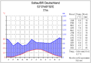
The Lüneburg Heath lies in a temperate maritime climatic region moderated by the Atlantic, with mild winters, cool summers and precipation all-year round. The Hohe Heide, however, has a "low mountain climate" with lower temperatures and higher precipitation than in the surrounding area.Nature parks and nature reserves
Lüneburg Heath Nature Park
In the north of the area known as the Lüneburg Heath in northern Germany, lies the Lüneburg Heath Nature Park with an area of...
which covers an area of 1130 square kilometres (436.3 sq mi). At its heart, around the Wilseder Berg
Wilseder Berg
At the Wilseder Berg is the highest point on the Lüneburg Heath in North Germany.- Description :The Wilseder Berg is part of a nature reserve within the Lüneburg Heath and lies near the villages of Wilsede and Bispingen in the Heidekreis. The hill was formed during the penultimate ice age, the...
, is the Lüneburg Heath Nature Reserve
Lüneburg Heath Nature Reserve
The Lüneburg Heath Nature Reserve is one of the oldest and largest nature reserves in Germany, and the oldest and largest in Lower Saxony...
(Naturschutzgebiet or NSG) founded as long ago as 1921 with 234 square kilometres (90.3 sq mi) of land which is roughly 58% woods and 20% heathland. Other nature parks in the Lüneburg Heath region are the Südheide Nature Park
Südheide Nature Park
The Südheide Nature Park is a large protected area of forest and heathland in the southern part of the Lüneburg Heath in North Germany...
and Elbufer-Drawehn Nature Park
Elbufer-Drawehn Nature Park
The Elbhöhen-Wendland Nature Park , formerly known as the Elbufer-Drawehn Nature Park is a German nature park east of Lüneburg in Lower Saxony.- Location:...
. Right in the north of the area is the Harburg Hills
Harburg Hills
The Harburg Hills are a low ridge in the northeastern part of the German state of Lower Saxony and the southern part of the city state of Hamburg...
Nature Park. The Lüneburg Heath NSG, together with the open heathland of the huge Munster Nord and Süd training areas
Munster Training Area
Munster Training Area is a military training area in Germany on the Lüneburg Heath. It comprises two separate areas with different purposes: Munster North and Munster South . The two areas are separated geographically by the town of Munster and several barracks...
and the Bergen-Hohne Training Area
Bergen-Hohne Training Area
Bergen-Hohne Training Area is a NATO military training area in the southern part of the Lüneburg Heath, in the state of Lower Saxony in northern Germany. It covers an area of , which makes it the largest military training area in Germany.It was established by the German armed forces, the...
, is the largest single area of heathland in Central Europe
Central Europe
Central Europe or alternatively Middle Europe is a region of the European continent lying between the variously defined areas of Eastern and Western Europe...
. And within the former province (Regierungsbezirk) of Lüneburg there are no less than 212 individual nature reserves (as at 31 December 2006).
Formation of the heath landscape
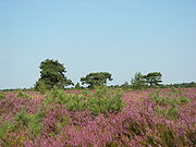
Ecological succession
Ecological succession, is the phenomenon or process by which a community progressively transforms itself until a stable community is formed. It is a fundamental concept in ecology, and refers to more or less predictable and orderly changes in the composition or structure of an ecological community...
and encouraged by a gradual improvement in the climate, progressed from birch
Birch
Birch is a tree or shrub of the genus Betula , in the family Betulaceae, closely related to the beech/oak family, Fagaceae. The Betula genus contains 30–60 known taxa...
and pine forest through hazel
Hazel
The hazels are a genus of deciduous trees and large shrubs native to the temperate northern hemisphere. The genus is usually placed in the birch family Betulaceae, though some botanists split the hazels into a separate family Corylaceae.They have simple, rounded leaves with double-serrate margins...
woods to light woods of sessile oak
Sessile Oak
Quercus petraea , the Sessile Oak, also known as the Durmast Oak, is a species of oak native to most of Europe, and into Anatolia.-Description:...
s.
The heath and its surrounding area belong to those regions of the North German Plain
North German plain
The North German Plain or Northern Lowland is one of the major geographical regions of Germany. It is the German part of the North European Plain...
in which the hunter culture of the Mesolithic
Mesolithic
The Mesolithic is an archaeological concept used to refer to certain groups of archaeological cultures defined as falling between the Paleolithic and the Neolithic....
era was superseded quite early on by Neolithic
Neolithic
The Neolithic Age, Era, or Period, or New Stone Age, was a period in the development of human technology, beginning about 9500 BC in some parts of the Middle East, and later in other parts of the world. It is traditionally considered as the last part of the Stone Age...
farmers. By about 3000 BC, during the New Stone Age, large open areas appeared on the lightly undulating, sandy stretches of geest
Geest (topography)
Geest is a type of slightly raised landscape that occurs in the plains of in Northern Germany, the Northern Netherlands and Denmark. It is a landscape of sandy and gravelly soils, usually mantled by a heathland vegetation, comprising glacial deposits left behind after the last ice age during the...
on the Lüneburg Heath. This was a result of the intensive grazing of the sessile oak woods and the associated destruction of successive new stands of trees. These open areas became dominated by the Common Heather (Calluna vulgaris), a largely grazing-resistant species of plant. Nevertheless oak and beech woods succeeded time and again in establishing themselves wherever man left areas of heath untended. Over a long period of time the region of the Lüneburg Heath alternated between periods when the heathlands spread and dominated the scene and times when it was largely covered with forest and only small areas of heath existed. Finally, after the migration period
Migration Period
The Migration Period, also called the Barbarian Invasions , was a period of intensified human migration in Europe that occurred from c. 400 to 800 CE. This period marked the transition from Late Antiquity to the Early Middle Ages...
, the wooded areas of the region increased considerably.
Not until after 1000 AD does the pollen analysis
Pollen analysis
Analysis of the distribution of pollen grains of various species contained in surface layer deposits, especially peat bogs and lake sediments, from which a record of past climate may be inferred. Because the lake sediments accumulate over time, a core of the mud will show that the mud at the bottom...
show a continuous reduction in the woodlands and a considerable increase in heather
Calluna
Calluna vulgaris is the sole species in the genus Calluna in the family Ericaceae. It is a low-growing perennial shrub growing to tall, or rarely to and taller, and is found widely in Europe and Asia Minor on acidic soils in open sunny situations and in moderate shade...
. This was brought about by a change from nomadic farming to settled farming with permanent settlements. The typical heath farming economy emerged: due to the poor soils the few available nutrients from a large area were concentrated on relatively small fields, from which grain, in particular, could be produced. This was achieved by the regular removal of the turf (a method known as Plaggen), which was used as hay for the pens of the moorland sheep, the Heidschnucke
Heidschnucke
The Heidschnucke is a group of three types of moorland sheep from northern Germany. Like a number of other types from Scandinavia and Great Britain, they are Northern European short-tailed sheep...
n. This was then enriched with the manure and urine of the sheep – and spread over the fields as fertiliser.
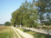
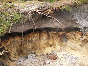
Podsolisation
Podsolisation is an extreme form of leaching which causes the eluviation of iron and aluminium sesquioxides.The process generally occurs in areas where precipitation is greater than evapotranspiration. The minerals are removed by a process known as leaching.When organic material is broken down...
. Soil life is severely damaged, which results in a hard layer of earth underneath the root zone on the heath at a depth of about 40 centimetres (15.7 in). The iron and humus particles released by the topsoil precipitate onto this impervious hardpan
Hardpan
In soil science, agriculture and gardening, hardpan or ouklip is a general term for a dense layer of soil, usually found below the uppermost topsoil layer. There are different types of hardpan, all sharing the general characteristic of being a distinct soil layer that is largely impervious to water...
. The subsoil thus separates itself from the topsoil. The nutrients are largely washed out of the topsoil which leads to leaching and causes the typical grey-white coloration of the paths on the heath.
The oft-expressed view in the literature that the heath arose in the Middle Ages
Middle Ages
The Middle Ages is a periodization of European history from the 5th century to the 15th century. The Middle Ages follows the fall of the Western Roman Empire in 476 and precedes the Early Modern Era. It is the middle period of a three-period division of Western history: Classic, Medieval and Modern...
as a result of the demand for wood by the Lüneburg salt pan
Salt evaporation pond
Salt evaporation ponds, also called salterns or salt pans, are shallow artificial ponds designed to produce salts from sea water or other brines. The seawater or brine is fed into large ponds and water is drawn out through natural evaporation which allows the salt to be subsequently harvested...
s is incorrect. The Lüneburg salt ponds certainly needed firewood for the production of salt, but they did not appear until around 1000 AD, by which time the heath had already been around for 4,000 years.. The amount required, even in the heyday of production, could have been continuously supplied by an area of woodland about 50 km² in area, yet the heath covers over 7000 km². In any case the wood certainly did not come from the heath, but via the waterways, especially from Mecklenburg
Mecklenburg
Mecklenburg is a historical region in northern Germany comprising the western and larger part of the federal-state Mecklenburg-Vorpommern...
up the Elbe and from the area of the Schaalsee
Schaalsee
Schaalsee is a lake in Germany. It forms part of the border between Schleswig-Holstein and Mecklenburg-Vorpommern . The town of Zarrentin is located on its southern shores...
. Transportation overland would have been far too expensive (apart from the River Ilmenau which was navigable at the time, no rivers flow from the main areas of heathland to Lüneburg), as can be seen not only from some of the delivery notes which still survive, but also from the fact that there are still large woods around Lüneburg itself, such as the Göhrde
Göhrde
Göhrde is a municipality in the district of Lüchow-Dannenberg, in Lower Saxony, Germany.The municipality was named after the Göhrde State Forest, which has an area of about , famous for its oaks, beeches and game preserves. The hunting lodge situated in the forest was built in 1689 and was restored...
. Finally heathland has frequentely developed in areas where there are no salt pans, such as the sheep-grazing regions on the coasts of Norway to Portugal and in Scotland and Ireland.
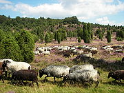
Natural landscape
A natural landscape is a landscape that is unaffected by human activity. A natural landscape is intact when all living and nonliving elements are free to move and change. The nonliving elements distinguish a natural landscape from a wilderness. A wilderness includes areas within which natural...
, but a cultural landscape
Cultural landscape
Cultural Landscapes have been defined by the World Heritage Committee as distinct geographical areas or properties uniquely "..represent[ing] the combined work of nature and of man.."....
created by the intervention of man. In order to prevent its semi-open heathland from being repopulated by trees, especially pine
Pine
Pines are trees in the genus Pinus ,in the family Pinaceae. They make up the monotypic subfamily Pinoideae. There are about 115 species of pine, although different authorities accept between 105 and 125 species.-Etymology:...
s and, to a lesser extent, silver birch
Silver Birch
Betula pendula is a widespread European birch, though in southern Europe it is only found at higher altitudes. Its range extends into southwest Asia in the mountains of northern Turkey and the Caucasus...
es, which would cause the loss of this millennia-old environment and its many inhabitants, including often very rare animal and plant species, sheep are allowed to graze it regularly; these are almost exclusively the local German moorland sheep, the Heidschnucke
Heidschnucke
The Heidschnucke is a group of three types of moorland sheep from northern Germany. Like a number of other types from Scandinavia and Great Britain, they are Northern European short-tailed sheep...
.
Plant population / Phytocenosis
In the 20th century numerous conservation measures were implemented on the Lüneburg Heath; as a result it is one of the best researched regions of central Europe.Heathland
Sand heaths form about 20% of the Lüneburg Heath Nature Reserve and may be broken down into further sub-divisions, the most important being: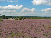
- Ordinary sand heath (Typische Sandheide, Genisto-Callunetum)
- In addition to the Common Heather (Calluna vulgaris) only a few taller plants occur here, none of which can be classed as characteristic species. Amongst them are the Wavy Hair-grass (Deschampsia flexuosa) and Common juniper (Juniperus communis). Ordinary sand heath is the most widespread of the heathland types. Its proportion has increased in recent decades at the expense of other heath habitats. This reduction in the variety of heathland types may be due to increasing nitrogen levels from the air, the increase in plant litter (Rohhumusauflagen) and the natural ageing of the heathland.
- Lichen-rich sand heath (Flechtenreiche Sandheide, Genisto-Callunetum cladonietosum)
- The lichen-rich sand heaths can be told apart from the other types of heathland by the presence of various cup lichensCladoniaCladonia is a genus of moss-like lichens in the family Cladoniaceae. They are the primary food source for reindeer and caribou. Cladonia species are of economic importance to reindeer-herders, such as the Sami in Scandinavia or the Nenets in Russia. Antibiotic compounds are extracted from some...
(CladoniaCladoniaCladonia is a genus of moss-like lichens in the family Cladoniaceae. They are the primary food source for reindeer and caribou. Cladonia species are of economic importance to reindeer-herders, such as the Sami in Scandinavia or the Nenets in Russia. Antibiotic compounds are extracted from some...
), Ciliated fringewortMarchantiophytaThe Marchantiophyta are a division of bryophyte plants commonly referred to as hepatics or liverworts. Like other bryophytes, they have a gametophyte-dominant life cycle, in which cells of the plant carry only a single set of genetic information....
(Ptilidium ciliare) and Juniper HaircapPolytrichaceaeThe Polytrichaceae is a common family of mosses. Members of this family tend to be larger than other mosses with a thickened central stem and a rhizome. The leaves have a midrib that bears lamellae on the upper surface. Species in this group are dioicous. Another characteristic that identifies...
(Polytrichum juniperinum). They occur frequently on dry, south-facing slopes. This type of heath is found west of Niederhaverbeck and near Sundermühlen.
- Clay heath (Lehmheide, Genisto-callunetum danthonietusum)
- This can be identified by the presence of Heath GrassDanthoniaDanthonia is a genus of grass species. Grasses of this genus are sometimes referred to as oatgrass, but that common name is not restricted to this genus.Species include:*Danthonia alpina Vest*Danthonia cachemyriana Jaub. & Spach...
(Danthonia decumbens), Pill SedgeCarex piluliferaCarex pilulifera is a European species of sedge found in acid heaths, woods and grassland from Macaronesia to Scandinavia. It grows up to tall, with 2–4 female spikes and 1 male spike in an inflorescence...
(Carex pilulifera), Mat grass (Nardus stricta), Fine-leaved Sheep's-fescue (Festuca filiformis), Mouse-ear HawkweedMouse-ear HawkweedMouse-ear Hawkweed is a yellow-flowered species of Asteraceae, native to Europe and northern Asia. It produces single, citrus-colored inflorescences. It is an allelopathic plant...
(Hieracium pilosella) and Field Wood-rush (Luzula campestris). Clay heaths have become very rare within the Lüneburg Heath. They are found on the Wilseder BergWilseder BergAt the Wilseder Berg is the highest point on the Lüneburg Heath in North Germany.- Description :The Wilseder Berg is part of a nature reserve within the Lüneburg Heath and lies near the villages of Wilsede and Bispingen in the Heidekreis. The hill was formed during the penultimate ice age, the...
and south of Niederhaverbeck.
- Blueberry sand heath (Heidelbeer-Sandheide, Genisto-Callunetum, Vaccinium myrtillus Rasse)
- BlueberriesBlueberryBlueberries are flowering plants of the genus Vaccinium with dark-blue berries and are perennial...
(Vaccinium myrtillus) are the signature species of this type of heath and, more rarely, cranberriesCranberryCranberries are a group of evergreen dwarf shrubs or trailing vines in the subgenus Oxycoccus of the genus Vaccinium. In some methods of classification, Oxycoccus is regarded as a genus in its own right...
(Vaccinium vitis-idaea). Blueberry heath is the second most common type of vegetation on the heathlands and occurs especially on northern slopes, the edges of woods and thick juniper hedges. This type of heath is particularly characteristic of the northern slopes of the Wilseder BergWilseder BergAt the Wilseder Berg is the highest point on the Lüneburg Heath in North Germany.- Description :The Wilseder Berg is part of a nature reserve within the Lüneburg Heath and lies near the villages of Wilsede and Bispingen in the Heidekreis. The hill was formed during the penultimate ice age, the...
, as well as the Steingrund and Totengrund. In those places cranberries have even ousted the heatherCallunaCalluna vulgaris is the sole species in the genus Calluna in the family Ericaceae. It is a low-growing perennial shrub growing to tall, or rarely to and taller, and is found widely in Europe and Asia Minor on acidic soils in open sunny situations and in moderate shade...
(Calluna vulgaris) in places.
- Wet sand heath (Feuchte Sandheide, Genisto-Callunetum, Molinia-Variante)
- Wet sand heath is the ideal habitat for Purple Moor GrassPurple Moor GrassMolinia caerulea is a perennial grass native to Europe, west Asia, and north Africa. It grows in locations from the lowlands up to 2,300 m in the Alps. Like most grasses, it grows best in acid soils, ideally pH values of between 3.5 and 5, however, it can continue to live under more extreme...
(Molinia caerulea), Cross-leaved Heath (Erica tetralix) und ScirpusScirpusThe plant genus Scirpus consists of a large number of aquatic, grass-like species in the family Cyperaceae , many with the common names club-rush or bulrush . Other common names are deergrass or grassweed.The genus has a cosmopolitan distribution, and grows in wetlands and moist soil...
(Scirpus cespitosus). It occurs in places close to the water table and in the transition zone around bogs. Its primary locations are areas north of Wilsede and near the Hörpel Ponds (Hörpeler Teichen).
Woods
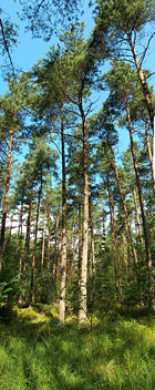

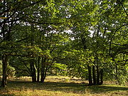
Pine
Pines are trees in the genus Pinus ,in the family Pinaceae. They make up the monotypic subfamily Pinoideae. There are about 115 species of pine, although different authorities accept between 105 and 125 species.-Etymology:...
forest
Forest
A forest, also referred to as a wood or the woods, is an area with a high density of trees. As with cities, depending where you are in the world, what is considered a forest may vary significantly in size and have various classification according to how and what of the forest is composed...
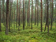
s, which were planted in the second half of the 19th century on former heathland and drifting sand. In some cases the dunes simply became naturally overgrown, again with pines. There are only a very few old stands of sessile oak
Sessile Oak
Quercus petraea , the Sessile Oak, also known as the Durmast Oak, is a species of oak native to most of Europe, and into Anatolia.-Description:...
s, which stem from the logging industry during the time of the Kingdom of Hanover
Kingdom of Hanover
The Kingdom of Hanover was established in October 1814 by the Congress of Vienna, with the restoration of George III to his Hanoverian territories after the Napoleonic era. It succeeded the former Electorate of Brunswick-Lüneburg , and joined with 38 other sovereign states in the German...
. In many parts of the nature reserve there are so-called Stühbüsche (a form of coppice), trees that were coppiced by repeatedly being cut short. In the meantime they have grown wild again and have a characteristic and unusual appearance with their multiple trunks. Near Wilsede
Bispingen
Bispingen is a municipality in the Heidekreis district in Lower Saxony, Germany. It is situated on the River Luhe and is approximately northeast of Soltau, or south of Hamburg.-Subdivisions:*Bispingen*Hützel*Steinbeck an der Luhe...
there is the remnant of a Hutewald - a wood pasture with giant, multi-stemmed beech trees.
Bogs
The largest bog on the Lüneburg Heath is the PietzmoorPietzmoor
The Pietzmoor is named after the little village of Pietz, and is the largest contiguous area of bog on the Lüneburg Heath in northern Germany. The bog lies southeast of the town of Schneverdingen and is bordered to the south by the village of Heber. The Pietzmoor has an average peat depth of 4 m,...
, which lies east of Schneverdingen
Schneverdingen
Schneverdingen is a town in the northern part of the district of Heidekreis, in Lower Saxony, Germany. It is situated approx. 15 km north of Soltau, and 50 km south of Hamburg....
. It was drained however and peat was cut there until the 1960s. The Nature Park Association carried out work in the 1980s to try and turn it back to its natural waterlogged state. For example, some of the drainage ditches were filled which led to a considerable rise in the water levels of the former peat cuts. However typical bog vegetation has not yet re-established itself.
Animals
Many species of animal live on the terrain of the Lüneburg Heath, particularly birds that are at home in the wide, open landscape, some of which are seriously threatened by the intensive-farming techniques in other areas. These include the: Black GrouseBlack Grouse
The Black Grouse or Blackgame is a large bird in the grouse family. It is a sedentary species, breeding across northern Eurasia in moorland and bog areas near to woodland, mostly boreal...
(Tetrao tetrix), the Nightjar
Nightjar
Nightjars are medium-sized nocturnal or crepuscular birds with long wings, short legs and very short bills. They are sometimes referred to as goatsuckers from the mistaken belief that they suck milk from goats . Some New World species are named as nighthawks...
(Caprimulgus europaeus), the Woodlark
Woodlark
The Woodlark is the only lark in the genus Lullula. It breeds across most of Europe, the Middle East Asia and the mountains of north Africa. It is mainly resident in the west of its range, but eastern populations of this passerine bird are more migratory, moving further south in winter...
(Lullula arborea), the Great Grey Shrike
Great Grey Shrike
The Great Grey Shrike or Northern Grey Shrike is a large songbird species in the shrike family . It forms a superspecies with its parapatric southern relatives, the Southern Grey Shrike , the Chinese Grey Shrike and the Loggerhead Shrike...
(Lanius excubitor), the Red-backed Shrike
Red-backed Shrike
The Red-backed Shrike is a carnivorous passerine bird and member of the shrike family Laniidae.English common names include 'Wariangle' and 'worrier'.-Description:...
(Lanius collurio), the Stonechat (Oenanthe oenanthe), the Wryneck
Wryneck
The wrynecks are a small but distinctive group of small Old World woodpeckers.Like the true woodpeckers, wrynecks have large heads, long tongues which they use to extract their insect prey and zygodactyl feet, with two toes pointing forward, and two backwards...
(Jynx torquilla), the European Green Woodpecker (Picus viridis), the Wheatear
Wheatear
The wheatears are passerine birds of the genus Oenanthe. They were formerly considered to be members of the thrush family Turdidae, but are now more commonly placed in the flycatcher family Muscicapidae...
(Saxicola torquata), the Curlew
Curlew
The curlews , genus Numenius, are a group of eight species of birds, characterised by long, slender, downcurved bills and mottled brown plumage. They are one of the most ancient lineages of scolopacid waders, together with the godwits which look similar but have straight bills...
(Numenius arquata), the Quail
Quail
Quail is a collective name for several genera of mid-sized birds generally considered in the order Galliformes. Old World quail are found in the family Phasianidae, while New World quail are found in the family Odontophoridae...
(Coturnix coturnix) and the Black Stork
Black Stork
The Black Stork Ciconia nigra is a large wading bird in the stork family Ciconiidae. It is a widespread, but rare, species that breeds in the warmer parts of Europe, predominantly in central and eastern regions. This is a shy and wary species, unlike the closely related White Stork. It is seen in...
(Ciconia nigra). In the Lüneburg Heath the population of the very rare Black Grouse is rising continually. In 2007 78 were counted, 13 more than in the previous year. Since 2003 the number of grouse has doubled.
Numerous species including European Bison, Moose
Moose
The moose or Eurasian elk is the largest extant species in the deer family. Moose are distinguished by the palmate antlers of the males; other members of the family have antlers with a dendritic configuration...
and Brown Bear
Brown Bear
The brown bear is a large bear distributed across much of northern Eurasia and North America. It can weigh from and its largest subspecies, the Kodiak Bear, rivals the polar bear as the largest member of the bear family and as the largest land-based predator.There are several recognized...
which once inhabited the region may be seen in the Lüneburg Heath Wildlife Park
Lüneburg Heath Wildlife Park
The Lüneburg Heath Wildlife Park is a wildlife park near Nindorf in the municipality of Hanstedt in the north German state of Lower Saxony. The park is home to around 1,000 animals of over 120 species in an area of...
alongside more exotic animals like Snow Leopard
Snow Leopard
The snow leopard is a moderately large cat native to the mountain ranges of South Asia and Central Asia...
s and Arctic Wolves.
Culture and history
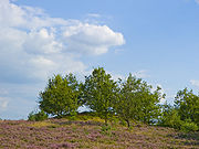
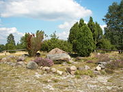

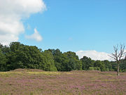
Early history
Pollen analysesPalynology
Palynology is the science that studies contemporary and fossil palynomorphs, including pollen, spores, orbicules, dinoflagellate cysts, acritarchs, chitinozoans and scolecodonts, together with particulate organic matter and kerogen found in sedimentary rocks and sediments...
show that the dry geest soils of North Germany have been cultivated since about 3000 BC. Clearance by fire and the cultivation of crops on the Pleistocene
Pleistocene
The Pleistocene is the epoch from 2,588,000 to 11,700 years BP that spans the world's recent period of repeated glaciations. The name pleistocene is derived from the Greek and ....
sandy soils quickly led however to soil degradation. So the land cleared by fire could only be used for a short time. The settlements moved frequently and woods elsewhere were cleared. Even at that time the first Calluna
Calluna
Calluna vulgaris is the sole species in the genus Calluna in the family Ericaceae. It is a low-growing perennial shrub growing to tall, or rarely to and taller, and is found widely in Europe and Asia Minor on acidic soils in open sunny situations and in moderate shade...
(heather) heaths appeared (see above). Evidence of relatively dense settlement is found especially in Uelzen district. On the terrain of the Lüneburg Heath there are numerous Megalithic sites and tumuli from the New Stone Age and the early Bronze Age
Bronze Age
The Bronze Age is a period characterized by the use of copper and its alloy bronze as the chief hard materials in the manufacture of some implements and weapons. Chronologically, it stands between the Stone Age and Iron Age...
. The most famous are the Oldendorfer Totenstatt
Oldendorfer Totenstatt
The Oldendorfer Totenstatt is a group of six burial mounds and megalith sites in Oldendorf north of Amelinghausen in the valley of the River Luhe in Lüneburg district in the German state of Lower Saxony...
("Oldendorf Gravesite") and the Sieben Steinhäuser
Sieben Steinhäuser
The Sieben Steinhäuser is a group of five dolmens on the Lüneburg Heath in the NATO training area of Bergen-Hohne, in the state of Lower Saxony in northern Germany. The stones are considered to be part of the funnelbeaker culture...
("Seven Stone Houses"). But even in the Lüneburg Heath Nature Reserve there are more than a thousand tumuli, especially near Nieder- and Oberhaverbeck. The largest of these tumuli is the so-called Prince's Grave (Fürstengrab). Near Wilsede there is also a well-known stone and juniper group with the name Hannibal's Grave (Hannibals Grab).
Transition to settlement culture
After the withdrawal of the LombardsLombards
The Lombards , also referred to as Longobards, were a Germanic tribe of Scandinavian origin, who from 568 to 774 ruled a Kingdom in Italy...
during the migration period
Migration Period
The Migration Period, also called the Barbarian Invasions , was a period of intensified human migration in Europe that occurred from c. 400 to 800 CE. This period marked the transition from Late Antiquity to the Early Middle Ages...
the Lüneburg Heath belonged to the Duchy of Saxony
Duchy of Saxony
The medieval Duchy of Saxony was a late Early Middle Ages "Carolingian stem duchy" covering the greater part of Northern Germany. It covered the area of the modern German states of Bremen, Hamburg, Lower Saxony, North Rhine-Westphalia, and Saxony-Anhalt and most of Schleswig-Holstein...
from about 700 AD, which was conquered by Charlemagne
Charlemagne
Charlemagne was King of the Franks from 768 and Emperor of the Romans from 800 to his death in 814. He expanded the Frankish kingdom into an empire that incorporated much of Western and Central Europe. During his reign, he conquered Italy and was crowned by Pope Leo III on 25 December 800...
in the 9th century and became part of the Frankish Empire
Frankish Empire
Francia or Frankia, later also called the Frankish Empire , Frankish Kingdom , Frankish Realm or occasionally Frankland, was the territory inhabited and ruled by the Franks from the 3rd to the 10th century...
. The resulting close control of the population and the Christianization
Christianization
The historical phenomenon of Christianization is the conversion of individuals to Christianity or the conversion of entire peoples at once...
meant that the rural settlements had to stay in one place and could no longer move about freely. The land had to be more intensively farmed which led to the heathland spreading.
Settlements


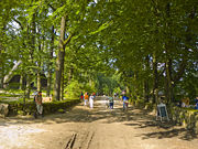
Beekeeping
Beekeeping is the maintenance of honey bee colonies, commonly in hives, by humans. A beekeeper keeps bees in order to collect honey and other products of the hive , to pollinate crops, or to produce bees for sale to other beekeepers...
. The villages were usually encircled by small tracts of woodland, sometimes interrupted by fields or meadows, and merged without clear boundaries into the surrounding landscape. The farmsteads were arranged relatively arbitrarily, many stood very close to one another; others were spread out at some distance from each other. They were loose cluster villages (lockere Haufendörfer). In order to prevent cattle trampling flat the gardens attached to the houses, village roads were enclosed with wooden fences and, later, with characteristic stone walls. The typical design of farmhouse was the Fachhallenhaus
Fachhallenhaus
The Low German house or Fachhallenhaus is a type of German timber-framed farmhouse, which combines living quarters, byre and barn under one roof.. It is built as a large hall with bays on the sides for livestock and storage and with the living accommodation at one end...
, a large timber-framed single building, in which people and animals lived under a single roof. Each village had relatively few complete farms; in Wilsede
Bispingen
Bispingen is a municipality in the Heidekreis district in Lower Saxony, Germany. It is situated on the River Luhe and is approximately northeast of Soltau, or south of Hamburg.-Subdivisions:*Bispingen*Hützel*Steinbeck an der Luhe...
there were only four, in the church village (Kirchdorf) of Undeloh
Undeloh
Undeloh is a village in the district of Harburg, in Lower Saxony, Germany.- Location :Undeloh lies on the Lüneburg Heath near its highest hill, the Wilseder Berg.- Neighbouring communities :...
there were eleven, but that was an exception. In addition there were Koten (small, single houses), sheep pens and shared bakehouses. The farms themselves, however, were very large. In Wilsede all the features of a heath village described here may still be seen. The Wilsede Heath Museum (Heidemuseum Wilsede) was established in a Fachhallenhaus
Fachhallenhaus
The Low German house or Fachhallenhaus is a type of German timber-framed farmhouse, which combines living quarters, byre and barn under one roof.. It is built as a large hall with bays on the sides for livestock and storage and with the living accommodation at one end...
and it gives an insight into the working and living conditions of a heathland farm around 1850. The Walsrode Heath Museum
Rischmannshof Heath Museum
The Rischmannshof Heath Museum is an open-air museum in Walsrode, Germany.- History :Rischmannshof was opened in 1912 as one of the first open-air museums in Germany. The museum consists of a rural farmyard with outbuildings and other exhibits...
was one of the first German open air museums and also portrays the life of heathland folk. In rural parts of the region they still sometimes use today a Low German dialect called Heidjerisch. This word derives from the name given to inhabitants of the Lüneburg Heath – the Heidjer.
Heath convents
In the Lüneburg Heath region six nunneries from the Middle AgesMiddle Ages
The Middle Ages is a periodization of European history from the 5th century to the 15th century. The Middle Ages follows the fall of the Western Roman Empire in 476 and precedes the Early Modern Era. It is the middle period of a three-period division of Western history: Classic, Medieval and Modern...
survived, which became Protestant convents after the Reformation
Protestant Reformation
The Protestant Reformation was a 16th-century split within Western Christianity initiated by Martin Luther, John Calvin and other early Protestants. The efforts of the self-described "reformers", who objected to the doctrines, rituals and ecclesiastical structure of the Roman Catholic Church, led...
. The convents contain interesting works of art that may be viewed. These establishments are the abbeys of: Ebstorf
Ebstorf Abbey
Ebstorf Abbey is a German convent near the Lower Saxon town of Uelzen that was founded around 1160 as monastery called Kloster St. Mauritius for the Premonstratensian order of canons...
, Isenhagen
Isenhagen Abbey
Isenhagen Abbey is a convent in Hankensbüttel in the district of Gifhorn in the German state of Lower Saxony. It was founded by the Cistercian order but is now a Lutheran convent. It is managed by the monastic chamber in Hanover.- Origins :...
, Lüne
Lüne Abbey
Lüne Abbey is an abbey in Lüneburg, in the German state of Lower Saxony, which was originally built for Benedictine nuns and today is home to a chapter of Lutheran nuns. It is one of several monasteries administered by the Hanoverian monastic chamber .- History :Lüne Abbey was founded in 1172 by...
, Medingen
Medingen (Bad Bevensen)
Medingen is a village in the borough of Bad Bevensen in the German state of Lower Saxony. In the 14th century it was called Zellensen.In the 17th century a monastic farm estate known as Klosterhof Medingen where, 50 years ago, a Trakehner stud was established.- Medingen Abbey :In 1228 the convent...
, Wienhausen and Walsrode
Walsrode Abbey
Walsrode Abbey in Walsrode, Germany, is one of the historic monasteries on the Lüneburg Heath in North Germany which are collectively known as the Lüneklöster...
.
The end of heathland farming in the 19th century

Feudalism
Feudalism was a set of legal and military customs in medieval Europe that flourished between the 9th and 15th centuries, which, broadly defined, was a system for ordering society around relationships derived from the holding of land in exchange for service or labour.Although derived from the...
was abolished in the Kingdom of Hanover
Kingdom of Hanover
The Kingdom of Hanover was established in October 1814 by the Congress of Vienna, with the restoration of George III to his Hanoverian territories after the Napoleonic era. It succeeded the former Electorate of Brunswick-Lüneburg , and joined with 38 other sovereign states in the German...
and those heathland areas that were common land
Common land
Common land is land owned collectively or by one person, but over which other people have certain traditional rights, such as to allow their livestock to graze upon it, to collect firewood, or to cut turf for fuel...
for the villages were divided amongst the individual farmers. Heathland farming died out at the end of the 19th century. Many farmers sold their land to the Prussian treasury
Treasury
A treasury is either*A government department related to finance and taxation.*A place where currency or precious items is/are kept....
or the Hanover monastic chamber, who afforested the land with pines. As a result the area of heath was drastically reduced.
In 1800 large parts of Northwest Germany were covered with heaths and bog. Today, by contrast the only large, continuous areas of heath remaining are in the Lüneburg Heath Nature Reserve and on a few military training areas.
Landscape perception in the course of time
As late as the turn of the 18th/19th century the barren and almost treeless heathlands were still perceived as hostile and threatening environments, as evinced by two travel logs of journeys from Celle to HamburgHamburg
-History:The first historic name for the city was, according to Claudius Ptolemy's reports, Treva.But the city takes its modern name, Hamburg, from the first permanent building on the site, a castle whose construction was ordered by the Emperor Charlemagne in AD 808...
from the years 1804 and 1803:
(Küttner 1804, taken from Cordes et al. 1997, p. 35)
(Mangourit 1803, taken from Cordes et al. 1997, p. 35)
Towards the middle of the 19th century the first positive descriptions of the heath emerged, initially inspired by the romantic
Romanticism
Romanticism was an artistic, literary and intellectual movement that originated in the second half of the 18th century in Europe, and gained strength in reaction to the Industrial Revolution...
movement. With the industrial revolution
Industrial Revolution
The Industrial Revolution was a period from the 18th to the 19th century where major changes in agriculture, manufacturing, mining, transportation, and technology had a profound effect on the social, economic and cultural conditions of the times...
in Germany, unspoilt nature was even more important for people, providing a welcome contrast with the rapidly burgeoning cities. Because the heathlands of North Germany were being increasingly decimated by cultivation and reforestation, they now appeared to be worth protecting. Numerous writers and painters portrayed the beauty of the heath, particularly when it was in bloom in August and September. One important heathland artist was Eugen Bracht. And the most famous heath poet was the local writer Hermann Löns
Hermann Löns
Hermann Löns was a German journalist and writer. He is most famous as "The Poet of the Heath" for his novels and poems celebrating the people and landscape of the North German moors, particularly the Lüneburg Heath in Lower Saxony. Löns is well known in Germany for his famous folksongs...
(1866–1914), who spent some time living in a hunting lodge near Westenholz. He worked the heath countryside into his books and promoted the foundation of the first German nature reserve
Nature reserve
A nature reserve is a protected area of importance for wildlife, flora, fauna or features of geological or other special interest, which is reserved and managed for conservation and to provide special opportunities for study or research...
on the Lüneburg Heide. He was buried in a juniper copse at Tietlingen near Walsrode in 1934. His works were a source for homeland films
Heimatfilm
Heimatfilm is the name given to a film genre that was popular in Germany, Switzerland and Austria from the late 40s to the early 70s. They were usually shot in the Alps, the Black Forest or the Lüneburg Heath and always involved the outdoors...
(Heimatfilme) that were produced in the Lüneburg Heath, such as Grün ist die Heide ("Green is the Heath") from 1932 and its 1951 remake, as well as Rot ist die Liebe ("Red is Love") from 1956.
History of conservation in the Lüneburg Heath
Around 1900 there were growing demands to save the heathland and bogs of northwest Germany, which were threatened by reforestation and drainage. On the Lüneburg Heath Wilhelm Bode, then the pastorPastor
The word pastor usually refers to an ordained leader of a Christian congregation. When used as an ecclesiastical styling or title, this role may be abbreviated to "Pr." or often "Ps"....
at Egestorf
Egestorf
Egestorf is a municipality in the district of Harburg, in Lower Saxony, Germany....
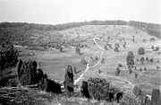
, was particularly active in pressing for the preservation of the endangered countryside. He had learned in 1905 of plans for building weekend houses on the Totengrund. In order to prevent this, he persuaded Prof. Dr. Andreas Thomsen from Münster to acquired the area as a nature reserve. In 1909 Pastor Bode and district administrator (Landrat) Fritz Ecker prevented the planned afforestation of the Wilseder Berg
Wilseder Berg
At the Wilseder Berg is the highest point on the Lüneburg Heath in North Germany.- Description :The Wilseder Berg is part of a nature reserve within the Lüneburg Heath and lies near the villages of Wilsede and Bispingen in the Heidekreis. The hill was formed during the penultimate ice age, the...
.
United States
The United States of America is a federal constitutional republic comprising fifty states and a federal district...
– for national park
National park
A national park is a reserve of natural, semi-natural, or developed land that a sovereign state declares or owns. Although individual nations designate their own national parks differently A national park is a reserve of natural, semi-natural, or developed land that a sovereign state declares or...
s to be founded in Germany. In order to realise this goal, the Nature Park Society (Verein Naturschutzpark (VNP)) was founded in Munich
Munich
Munich The city's motto is "" . Before 2006, it was "Weltstadt mit Herz" . Its native name, , is derived from the Old High German Munichen, meaning "by the monks' place". The city's name derives from the monks of the Benedictine order who founded the city; hence the monk depicted on the city's coat...
on 23 October 1909. They planned to create national park
National park
A national park is a reserve of natural, semi-natural, or developed land that a sovereign state declares or owns. Although individual nations designate their own national parks differently A national park is a reserve of natural, semi-natural, or developed land that a sovereign state declares or...
s in the Alps
Alps
The Alps is one of the great mountain range systems of Europe, stretching from Austria and Slovenia in the east through Italy, Switzerland, Liechtenstein and Germany to France in the west....
, the Central Uplands
Central Uplands
The Central Uplands is one of the three major natural regions of Germany and covers most of the land area of the country. To the north lies the North German Plain or Northern Lowland; to the south, the Alps and the Alpine Foreland.- Formation :...
and in the north German geest
Geest (topography)
Geest is a type of slightly raised landscape that occurs in the plains of in Northern Germany, the Northern Netherlands and Denmark. It is a landscape of sandy and gravelly soils, usually mantled by a heathland vegetation, comprising glacial deposits left behind after the last ice age during the...
region. By 1913 the society already had 13,000 members with their associated membership income and donations.
The Lüneburg Heath near Wilsede
Bispingen
Bispingen is a municipality in the Heidekreis district in Lower Saxony, Germany. It is situated on the River Luhe and is approximately northeast of Soltau, or south of Hamburg.-Subdivisions:*Bispingen*Hützel*Steinbeck an der Luhe...
was selected as the location for the north German national park. Using the VNP's funds, more than 30 km² of heathland were purchased or rented by 1913. In 1921 a police ordinance placed more than 200 km² of the Lüneburg Heath under protection, the first time this had been achieved in Germany. One problem that arose as early as the 1920s was the steadily increasing number of visitors. In 1924, in order to keep visitors away from sensitive areas of heathland, the Heath Guard (Heidewacht) – a volunteer body – was founded.
The Reich conservation law was passed in 1933, during the Nazi era. The Lüneburg Heath was now designated as an official nature reserve. In the years that followed the society was able to prevent plans for a motorway to be built through the park and for the heath to be used as a military training area. In 1933 the Heidewacht was disbanded, mainly because it was made up of members of social-democratic youth organisations. In 1939 the society passed a new law that granted the chairmen – now called Führers – wide-ranging powers. Jews could no longer be members of the society.

Bergen-Hohne Training Area
Bergen-Hohne Training Area is a NATO military training area in the southern part of the Lüneburg Heath, in the state of Lower Saxony in northern Germany. It covers an area of , which makes it the largest military training area in Germany.It was established by the German armed forces, the...
on the Südheide. Here the heathland has largely been preserved, albeit no longer accessible to the general public.
A large area of the nature park belonging to the society near Schneverdingen
Schneverdingen
Schneverdingen is a town in the northern part of the district of Heidekreis, in Lower Saxony, Germany. It is situated approx. 15 km north of Soltau, and 50 km south of Hamburg....
was taken over by the British Army of the Rhine
British Army of the Rhine
There have been two formations named British Army of the Rhine . Both were originally occupation forces in Germany, one after the First World War, and the other after the Second World War.-1919–1929:...
in 1945 for use as a tank training area. In the 1950s, during military exercises, British tanks even pushed forward as far as the Wilseder Berg. Not until the Soltau-Lüneburg Treaty, that was signed in 1959 between the Federal Republic of Germany, the United Kingdom
United Kingdom
The United Kingdom of Great Britain and Northern IrelandIn the United Kingdom and Dependencies, other languages have been officially recognised as legitimate autochthonous languages under the European Charter for Regional or Minority Languages...
and Canada
Canada
Canada is a North American country consisting of ten provinces and three territories. Located in the northern part of the continent, it extends from the Atlantic Ocean in the east to the Pacific Ocean in the west, and northward into the Arctic Ocean...
, were the boundaries of the tank training area fixed. Continual exercising over the area by armoured vehicles completely destroyed the vegetation on the Osterheide near Schneverdingen
Schneverdingen
Schneverdingen is a town in the northern part of the district of Heidekreis, in Lower Saxony, Germany. It is situated approx. 15 km north of Soltau, and 50 km south of Hamburg....
, forming large areas of sand dunes. In 1994 the British returned the so-called Red Areas to the Nature Park Society who, with the help of money from the federal government, set about the work of renaturation. Nowadays hardly any traces of the tank training area are left.
Forest fire
In August 1975 fire broke out on the SüdheideSüdheide Nature Park
The Südheide Nature Park is a large protected area of forest and heathland in the southern part of the Lüneburg Heath in North Germany...
which turned out to be the biggest forest fire in West Germany to that date.
Serious forest fires broke out in the southern part of the area near Stüde
Sassenburg-Stüde
Stüde is a village in the municipality of Sassenburg in Gifhorn district in the German state of Lower Saxony. In March 2005 it had 714 main residences and 339 secondary residences. It has an area of about 1,900 ha which consists mainly of woodland, including many clumps of pines on sandy soil. The...
, Neudorf-Platendorf
Neudorf-Platendorf
Neudorf-Platendorf is a village in the municipality of Sassenburg in Gifhorn district in the German state of Lower Saxony.- Location :The village lies east of the River Ise and the state forest of Dragen....
, Meinersen
Meinersen
Meinersen is a municipality in the district of Gifhorn, in Lower Saxony, Germany. It is situated between the rivers Oker and Aller, approx. 12 km west of Gifhorn, and 25 km southeast of Celle....
and then by Eschede
Eschede
Eschede is a municipality in the district of Celle, in Lower Saxony, Germany. Situated approximately 15 km northeast of Celle, Eschede lies at the border of the renowned Südheide Nature Park, a protected area of large forests and heaths. Today around 20 small villages are part of the...
near Celle
Celle
Celle is a town and capital of the district of Celle, in Lower Saxony, Germany. The town is situated on the banks of the River Aller, a tributary of the Weser and has a population of about 71,000...
, which due to their devastating effect and fatalities became known as the forest fire disaster on the Lüneburg Heath
Fire on the Lüneburg Heath
The fire on the Lüneburg Heath was a major forest fire in 1975 on the southern part of the Lüneburg Heath in north Germany, with various points of origin near Gifhorn, Eschede and Meinersen. It has been to this day the largest forest fire in the Federal Republic of Germany.- Causes :The fire was...
.
German surrender at the end of World War II
The heath was the scene of the unconditional surrender of German forces in northern Germany, Denmark and the Netherlands to the Allies, under Field MarshalField Marshal
Field Marshal is a military rank. Traditionally, it is the highest military rank in an army.-Etymology:The origin of the rank of field marshal dates to the early Middle Ages, originally meaning the keeper of the king's horses , from the time of the early Frankish kings.-Usage and hierarchical...
Bernard Montgomery, on May 4, 1945, at the end of World War II in Europe
End of World War II in Europe
The final battles of the European Theatre of World War II as well as the German surrender to the Western Allies and the Soviet Union took place in late April and early May 1945.-Timeline of surrenders and deaths:...
. It is also the area where the body of Heinrich Himmler
Heinrich Himmler
Heinrich Luitpold Himmler was Reichsführer of the SS, a military commander, and a leading member of the Nazi Party. As Chief of the German Police and the Minister of the Interior from 1943, Himmler oversaw all internal and external police and security forces, including the Gestapo...
, a leading figure in Nazi Germany
Nazi Germany
Nazi Germany , also known as the Third Reich , but officially called German Reich from 1933 to 1943 and Greater German Reich from 26 June 1943 onward, is the name commonly used to refer to the state of Germany from 1933 to 1945, when it was a totalitarian dictatorship ruled by...
and head of the SS
Schutzstaffel
The Schutzstaffel |Sig runes]]) was a major paramilitary organization under Adolf Hitler and the Nazi Party. Built upon the Nazi ideology, the SS under Heinrich Himmler's command was responsible for many of the crimes against humanity during World War II...
, was secretly buried in an unmarked grave
Unmarked grave
The phrase unmarked grave has metaphorical meaning in the context of cultures that mark burial sites.As a figure of speech, a common meaning of the term "unmarked grave" is consignment to oblivion, i.e., an ignominious end. A grave monument is a sign of respect and fondness, erected with the...
, following his suicide
Suicide
Suicide is the act of intentionally causing one's own death. Suicide is often committed out of despair or attributed to some underlying mental disorder, such as depression, bipolar disorder, schizophrenia, alcoholism, or drug abuse...
.
Road
Three motorways (Autobahnen) run across the Lüneburg Heath, the A 7, A 27Bundesautobahn 27
branches off the A 7 at Autobahndreieck Walsrode to the northwest, crossing A 1 at the Bremer Kreuz and continuing eastwards of Bremen, toward Cuxhaven....
and A 250
Bundesautobahn 250
is an autobahn in north Germany, which is colloquially referred to as the Maschener Autobahn . It begins near Hamburg and runs in an easterly direction for 28 kilometres to Lüneburg, where it becomes the B 4 and later the B 209...
, as well as various federal roads, the B 3, B 71
Bundesstraße 71
The Bundesstraße 71 is one of the longer German federal roads numbered in the 60s and 70s series. It begins at the B 6 in Bremerhaven by the Unterweser and ends in Könnern near Halle in Saxony-Anhalt...
, B 440
Bundesstraße 440
The B 440 is a German federal road in Lower Saxony. It runs from the district town of Rotenburg an der Wümme to Bad Fallingbostel. It was based on an old Army road built by Napoléon Bonaparte.- Course :...
and others.
Railways
The Lüneburg Heath is served by the following railway lines:- The Hanover–Hamburg railwayHanover–Hamburg railwayThe Hanover–Hamburg railway is one of the most important railway lines in Lower Saxony and Germany. It links the Lower Saxon state capital of Hanover with Hamburg, running through Celle, Uelzen and Lüneburg.- History :...
: HamburgHamburg-History:The first historic name for the city was, according to Claudius Ptolemy's reports, Treva.But the city takes its modern name, Hamburg, from the first permanent building on the site, a castle whose construction was ordered by the Emperor Charlemagne in AD 808...
–LüneburgLüneburgLüneburg is a town in the German state of Lower Saxony. It is located about southeast of fellow Hanseatic city Hamburg. It is part of the Hamburg Metropolitan Region, and one of Hamburg's inner suburbs...
–UelzenUelzenUelzen is a town in northeast Lower Saxony, Germany, and capital of the county of Uelzen. It is part of the Hamburg Metropolitan Region, a Hanseatic town and an independent municipality....
–CelleCelleCelle is a town and capital of the district of Celle, in Lower Saxony, Germany. The town is situated on the banks of the River Aller, a tributary of the Weser and has a population of about 71,000...
–HanoverHanoverHanover or Hannover, on the river Leine, is the capital of the federal state of Lower Saxony , Germany and was once by personal union the family seat of the Hanoverian Kings of Great Britain, under their title as the dukes of Brunswick-Lüneburg... - The RollbahnWanne-Eickel–Hamburg railwayThe Wanne-Eickel–Hamburg railway is the shortest railway link between the Ruhr and the Hamburg Metropolitan Region and hence one of the most important railway lines in northwest Germany...
: HamburgHamburg-History:The first historic name for the city was, according to Claudius Ptolemy's reports, Treva.But the city takes its modern name, Hamburg, from the first permanent building on the site, a castle whose construction was ordered by the Emperor Charlemagne in AD 808...
–Buchholz in der NordheideBuchholz in der NordheideBuchholz in der Nordheide is the largest town in the district of Harburg, in Lower Saxony, Germany. It is situated approx. 25 km southwest of Hamburg.-Geography:Buchholz is home to the Brunsberg, the region's highest mountain...
–Rotenburg (Wümme)–BremenBremenThe City Municipality of Bremen is a Hanseatic city in northwestern Germany. A commercial and industrial city with a major port on the river Weser, Bremen is part of the Bremen-Oldenburg metropolitan area . Bremen is the second most populous city in North Germany and tenth in Germany.Bremen is... - The Heath RailwayHeath RailwayThe Heath Railway is a regional railway line in North Germany that crosses the Lüneburg Heath from which it derives its name. Most of the line is unelectrified and single-tracked. It links Buchholz in der Nordheide with Hanover, the capital city of Lower Saxony...
(Heidebahn): (Hamburg)–Buchholz in der Nordheide–SoltauSoltau- Middle Ages :The region of the Lüneburg Heath had already been settled by the start of the New Stone Age about 4,000 years ago. The Soltau area was initially occupied by a few individual farms. The parish of Soltau was probably founded around 830 and the first wooden church Sante Johannis...
–Bad FallingbostelBad FallingbostelBad Fallingbostel is the district town of the Heidekreis district in the German state of Lower Saxony. Since 1976 the town has had a state-recognised Kneipp spa and has held the title of Bad since 5 August 2002. It has close ties to Walsrode, a few miles to the west...
–WalsrodeWalsrode-Middle Ages:986 Foundation of Walsrode Abbey by Count Walo. The first recorded mentionof the town is dated May 7, 986.1383 The dukes of Brunswick and Lüneburg grant Walsrode a town charter.1479 First recorded instance of Walsrode's coat of arms...
–Bennemühlen–Hanover - The Uelzen–Langwedel railwayUelzen–Langwedel railwayThe Uelzen–Langwedel railway runs through the Lüneburg Heath in north Germany in an east-west direction.- Imperial era :The Bremen State Railway, as it was first called, was originally built by the Bremen Senate and opened in 1873. It runs from Lower Saxon Langwedel eastwards through the Lüneburg...
: Bremen–VisselhövedeVisselhövedeVisselhövede is a town in the district of Rotenburg in Lower Saxony, Germany. Nearby towns include the district capital Rotenburg, Walsrode and Verden. Larger cities within a 100 km radius are Bremen, Hanover and Hamburg....
–Soltau–Munster–Uelzen - The Brunswick–Uelzen railway: Uelzen–WierenWierenWieren is a village and a former municipality in the district of Uelzen, in Lower Saxony, Germany. Since 1 November 2011, it is part of the municipality Wrestedt....
–WittingenWittingenWittingen is a town in the district of Gifhorn, Lower Saxony, Germany. It is situated approx. 30 km northeast of Gifhorn, and 30 km southeast of Uelzen.- Division of the town :Wittingen consists of 27 districts:- Demographic data :...
–GifhornGifhornGifhorn is a town and capital of the district Gifhorn in the east of Lower Saxony, Germany. It has a population of about 42,000 and is mainly influenced by the small distance to the industrial and commercially important cities nearby, Brunswick and Wolfsburg...
–BraunschweigBraunschweigBraunschweig , is a city of 247,400 people, located in the federal-state of Lower Saxony, Germany. It is located north of the Harz mountains at the farthest navigable point of the Oker river, which connects to the North Sea via the rivers Aller and Weser.... - The East Hanoverian Railways (Osthannoversche Eisenbahnen or OHE) maintains a railway network, the greater part of which lies in the Lüneburg Heath (only for freight and museum services and sometimes the Heath Express (Heide-Express).
Important towns
- AmelinghausenAmelinghausenAmelinghausen is a municipality in the district of Lüneburg in Lower Saxony, Germany. It is also the seat of the collective municipality of Amelinghausen.- Geography :The municipality lies in the middle of the Lüneburg Heath Nature Park...
- Bad FallingbostelBad FallingbostelBad Fallingbostel is the district town of the Heidekreis district in the German state of Lower Saxony. Since 1976 the town has had a state-recognised Kneipp spa and has held the title of Bad since 5 August 2002. It has close ties to Walsrode, a few miles to the west...
- BispingenBispingenBispingen is a municipality in the Heidekreis district in Lower Saxony, Germany. It is situated on the River Luhe and is approximately northeast of Soltau, or south of Hamburg.-Subdivisions:*Bispingen*Hützel*Steinbeck an der Luhe...
- Buchholz in der NordheideBuchholz in der NordheideBuchholz in der Nordheide is the largest town in the district of Harburg, in Lower Saxony, Germany. It is situated approx. 25 km southwest of Hamburg.-Geography:Buchholz is home to the Brunsberg, the region's highest mountain...
- CelleCelleCelle is a town and capital of the district of Celle, in Lower Saxony, Germany. The town is situated on the banks of the River Aller, a tributary of the Weser and has a population of about 71,000...
- GifhornGifhornGifhorn is a town and capital of the district Gifhorn in the east of Lower Saxony, Germany. It has a population of about 42,000 and is mainly influenced by the small distance to the industrial and commercially important cities nearby, Brunswick and Wolfsburg...
- LüneburgLüneburgLüneburg is a town in the German state of Lower Saxony. It is located about southeast of fellow Hanseatic city Hamburg. It is part of the Hamburg Metropolitan Region, and one of Hamburg's inner suburbs...
- Munster
- SchneverdingenSchneverdingenSchneverdingen is a town in the northern part of the district of Heidekreis, in Lower Saxony, Germany. It is situated approx. 15 km north of Soltau, and 50 km south of Hamburg....
- SoltauSoltau- Middle Ages :The region of the Lüneburg Heath had already been settled by the start of the New Stone Age about 4,000 years ago. The Soltau area was initially occupied by a few individual farms. The parish of Soltau was probably founded around 830 and the first wooden church Sante Johannis...
- UelzenUelzenUelzen is a town in northeast Lower Saxony, Germany, and capital of the county of Uelzen. It is part of the Hamburg Metropolitan Region, a Hanseatic town and an independent municipality....
- WalsrodeWalsrode-Middle Ages:986 Foundation of Walsrode Abbey by Count Walo. The first recorded mentionof the town is dated May 7, 986.1383 The dukes of Brunswick and Lüneburg grant Walsrode a town charter.1479 First recorded instance of Walsrode's coat of arms...
Tourism
Today the area is a popular tourist destination. Contributing to this are the theme park, Heidepark Soltau, the Walsrode Bird ParkWalsrode Bird Park
Weltvogelpark Walsrode ia s bird park located in the middle of the Lüneburg Heath in North Germany within the municipality of Bomlitz near Walsrode in the state of Lower Saxony, Germany....
and the Serengeti Safari Park
Serengeti Park
The Serengeti Park in Hodenhagen, Lower Saxony, is a zoo and leisure park in North Germany.-History:In 1972 the Duke of Bedford had the idea of building the largest safari park in Europe with partners from America. In 1974 this plan was realised and, since then, the Sepe family has run the park...
at Hodenhagen as well as the many farms offering holiday stays, making the Lüneburg Heath especially attractive to families. Another group of tourists are the elderly on free guided bus tours (Kaffeefahrten), stopping for coffee and wool plaids at a farm before touring Lüneburg for an hour.
See also
- Lüneburg Heath Nature ParkLüneburg Heath Nature ParkIn the north of the area known as the Lüneburg Heath in northern Germany, lies the Lüneburg Heath Nature Park with an area of...
- Lüneburg Heath Nature ReserveLüneburg Heath Nature ReserveThe Lüneburg Heath Nature Reserve is one of the oldest and largest nature reserves in Germany, and the oldest and largest in Lower Saxony...
- Castle of AhldenCastle of AhldenAhlden House is a stately home at Ahlden on the Lüneburg Heath in Lower Saxony, Germany. It was built in 1549 as a water castle on the river Aller, which has since changed its course...
- Auf der Lüneburger HeideAuf der Lüneburger HeideThe song Auf der Lüneburger Heide was composed in 1912 by Ludwig Rahlfs based on a poem from the collection Der kleine Rosengarten by Hermann Löns....
(song)

