
John Day Fossil Beds National Monument
Encyclopedia
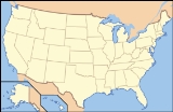
John Day Fossil Beds National Monument is a U.S. National Monument in Wheeler
and Grant
counties in east-central Oregon
. Located within the John Day River
basin and managed by the National Park Service
, the park is known for its well-preserved layers of fossil
plants and mammal
s that lived in the region between the late Eocene
, about 44 million years ago, and the late Miocene
, about 7 million years ago. The monument consists of three geographically separate units: Sheep Rock, Painted Hills, and Clarno.
The units cover a total of 13944 acres (5,642.9 ha) of semi-desert shrublands, riparian zone
s, and colorful badlands
. About 125,000 people visit the park each year for outdoor activities such as hiking and sightseeing or to visit the Thomas Condon Paleontology Center or the James Cant Ranch Historic District
.
Before the arrival of Euro-Americans in the 19th century, the John Day basin was frequented by Sahaptin people
who hunted, fished, and gathered roots and berries in the region. After road-building made the valley more accessible, settlers established farms, ranches, and a few small towns along the river and its tributaries. Paleontologists
have been unearthing and studying the fossils in the region since 1864, when Thomas Condon
, a missionary and amateur geologist, recognized their importance and made them known globally. Parts of the basin became a National Monument in 1975.
Averaging about 2200 feet (670.6 m) in elevation, the monument has a dry climate with temperatures that vary from summer highs of about 90 °F (32.2 °C) to winter lows below freezing. The monument has more than 80 soil types that support a wide variety of flora, ranging from willow trees near the river to grasses on alluvial fan
s to cactus among rocks at higher elevations. Fauna include more than 50 species of resident and migratory birds. Large mammals like elk
and smaller animals such as raccoon
s, coyote
s, and voles frequent these units, which are also populated by a wide variety of reptiles, fish, butterflies, and other creatures adapted to particular niches of a mountainous semi-desert terrain.
basin of east-central Oregon. Located in rugged terrain in the counties of Wheeler
and Grant
, the park units are characterized by hills, deep ravines, and eroded fossil-bearing rock formations. To the west lies the Cascade Range
, to the south the Ochoco Mountains
, and to the east the Blue Mountains
. Elevations within the 13944 acres (5,642.9 ha) park range from 2000 to 4500 ft (609.6 to 1,371.6 m).
The Clarno Unit, the westernmost of the three units, consists of 1969 acres (796.8 ha) located 18 miles (29 km) west of Fossil
along Oregon Route 218. The Painted Hills Unit, which lies about halfway between the other two, covers 3132 acres (1,267.5 ha). It is situated about 9 miles (14.5 km) northwest of Mitchell
along Burnt Ranch Road, which intersects U.S. Route 26
west of Mitchell. These two units are entirely within Wheeler County. The remaining 8843 acres (3,578.6 ha) of the park, the Sheep Rock Unit, are located along Oregon Route 19
and the John Day River upstream of the unincorporated
community of Kimberly
. This unit is mostly in Grant County, although a small part extends into Wheeler County. The Sheep Rock Unit is further subdivided into the Mascall Formation Overlook, Picture Gorge, the James Cant Ranch Historic District
, Cathedral Rock, Blue Basin, and the Foree Area. Some of these are separated from one another by farms, ranches, and other parcels of land that are not part of the park.
The park headquarters and main visitor center, both in the Sheep Rock Unit, are 122 miles (196.3 km) northeast of Bend
and 240 miles (386.2 km) southeast of Portland
by highway. The shortest highway distances from unit to unit within the park are Sheep Rock to Painted Hills, 45 miles (72.4 km); Painted Hills to Clarno, 75 miles (120.7 km), and Clarno to Sheep Rock, 81 miles (130.4 km).
The John Day River, a tributary of the Columbia River
, flows generally north between the Mascall Formation Overlook and Kimberly, generally west from Kimberly to downstream of the unincorporated community of Twickenham
, and generally north thereafter. Rock Creek enters the river at the north end of Picture Gorge. Bridge Creek passes through Mitchell, then north along the eastern edge of the Painted Hills Unit to meet the John Day downstream of Twickenham. Intermittent streams in the Clarno Unit empty into Pine Creek, which flows just beyond the south edge of the unit and enters the John Day upstream of the unincorporated community of Clarno
.
people of the Umatilla, Wasco, and Warm Springs tribes as well as the Northern Paiutes, speakers of a Uzo-Aztecan (Shoshonean)
language. All were hunter-gatherer
s competing for resources such as elk, huckleberries
, and salmon
. Researchers have identified 36 sites of related archeological interest, including rock shelters and cairn
s, in or adjacent to the John Day Fossil Beds National Monument. Most significant among the prehistoric sites are the Picture Gorge pictograph
s, consisting of six panels of rock art in the canyon at the south end of the Sheep Rock Unit. The art is of undetermined origin and age but is "centuries old".
The John Day basin remained largely unexplored by non-natives until the mid-19th century. Lewis and Clark
noted but did not explore the John Day River while traveling along the Columbia River in 1805. John Day
, for whom the river is named, apparently visited only its confluence with the Columbia in 1812. In 1829, Peter Skene Ogden
, working for the Hudson's Bay Company
(HBC), led a company of explorers and fur trappers along the river through what would later become the Sheep Rock Unit. John Work of the HBC also visited this part of the river in 1831.
In the 1840s, thousands of settlers, attracted in part by the lure of free land, began emigrating west over the Oregon Trail
. Leaving drought, worn-out farms, and economic problems behind, they emigrated from states like Missouri, Illinois, and Iowa in the Midwest
to Oregon, especially the Willamette Valley
in the western part of the state. After passage of the Homestead Act
of 1862 and the discovery of gold in the upper John Day basin, a fraction of these newcomers abandoned the Willamette Valley in favor of eastern Oregon. Some established villages and engaged in subsistence farming and ranching near streams. Settlement was made more practical by a supply route from The Dalles
on the Columbia River to gold mines at Canyon City
in the upper John Day valley. By the late 1860s, the route became formalized as the The Dalles–Boise
Military Road, which passed along Bridge Creek and south of Sheep Rock. Clashes between natives and non-natives and the desire of the U.S. Government to populate the region with Euro-Americans led to the gradual removal of native residents to reservation
s, including three in north-central Oregon: Warm Springs
, Burns Paiute
, and Umatilla
.
In 1864, a company of soldiers sent to protect mining camps from raids by Northern Paiutes discovered fossils in the Crooked River
region, south of the John Day basin. One of their leaders, Captain John M. Drake
, collected some of these fossils for Thomas Condon
, a missionary pastor and amateur geologist who lived in The Dalles. Recognizing the scientific importance of the fossils, Condon accompanied soldiers traveling through the region. He discovered rich fossil beds along Bridge Creek and near Sheep Rock in 1865. Condon's trips to the area and his public lectures and reports about his finds led to wide interest in the fossil beds among scientists such as Edward Drinker Cope
of the Academy of Natural Sciences
. One of them, paleontologist Othneil C. Marsh
of Yale
, accompanied Condon on a trip to the region in 1871. Condon's work led to his appointment in 1872 as Oregon's first state geologist and to international fame for the fossil beds. Specimens from the beds were sent to the Smithsonian Institution
and other museums worldwide, and by 1900 more than 100 articles and books had been published about the John Day Fossil Beds. During the first half of the 20th century, scientists such as John C. Merriam
, Ralph Chaney, Frank H. Knowlton, and Alonzo W. Hancock continued work in the fossil beds, including those discovered near Clarno in about 1890.
Remote and arid, the John Day basin near the fossil beds was slow to attract homesteaders. The first settler in what became the Sheep Rock Unit is thought to have been Frank Butler, who built a cabin along the river in 1877. In 1881, Eli Casey Officer began grazing sheep on a homestead claim in same general area. His son Floyd later lived there with his family and sometimes accompanied Condon on his fossil hunts. In 1910, James and Elizabeth Cant bought 700 acres (283.3 ha) from the Officer family. and converted it to a sheep ranch, which was eventually expanded to a sheep-and-cattle ranch of about 6000 acres (2,428.1 ha).
Merriam, a University of California
paleontologist who had led expeditions to the region in 1899 and 1900, encouraged the State of Oregon to protect the area. In the early 1930s the state began to buy land for state parks at Picture Gorge, the Painted Hills, and Clarno that later became part of the national monument. In 1951 the Oregon Museum of Science and Industry
established Camp Hancock, a field school for young students of geology, paleontology, and other sciences, on public lands surrounded by what would later become the Clarno Unit. In 1974 Congress authorized the National Park Service to establish the national monument, and President Gerald R. Ford signed the authorization. After the State of Oregon had completed the land transfer of the three state parks to the Federal government, the monument was officially established on October 8, 1975.
The Cant Ranch House and associated land and outbuildings were listed on the National Register of Historic Places
as the 200 acres (80.9 ha) James Cant Ranch Historic District
in 1984. After the monument opened in 1975, the ranch house served as headquarters for all three units. In 2004, it became home to the Cant Ranch Historical Museum, with two rooms of public exhibits about the native cultures, the Canyon City
gold rush, ranching, and other topics related to region. The Thomas Condon Paleontology Center, a $7.5 million museum and visitor center at the Sheep Rock Unit, opened in 1984. Among the center's offerings are displays of fossils, murals depicting life in the basin during eight geologic times ranging from about 45 million to about 5 million years ago, and views of the paleontology laboratory.
In March 2011, the Park Service installed two webcams at the Sheep Rock Unit. Both transmit continuous real-time images; one shows the paleontology lab at the Condon Center and the other depicts Sheep Rock and nearby features. In June 2011, work was finished on a new ranger residence in the Painted Hills Unit that makes the unit almost carbon-neutral. Solar panels generate enough electricity to power the house as well as the ranger's electric vehicle, on loan from its manufacturer for a year. The project is part of ongoing efforts to make the whole park carbon-neutral.
, which originated during the late Jurassic
and early Cretaceous
, about 118 to 93 million years ago. Northeastern Oregon was assembled in large blocks (exotic terrane
s) of Permian
, Triassic
, and Jurassic
rock shifted by tectonic
forces and accreted
to what was then the western edge of the North American continent, near the Idaho border. By the beginning of the Cenozoic
era, 65 million years ago, the Blue Mountains province was uplifting
(that is, was being pushed higher by tectonic forces), and the Pacific Ocean shoreline, formerly near Idaho
, had shifted to the west.
Volcanic eruptions about 44 million years ago during the Eocene
deposited lavas accompanied by debris flows (lahar
s) atop the older rocks in the western part of the province. Containing fragments of shale
, siltstone
, conglomerates
, and breccia
s, the debris flows entombed plants and animals caught in their paths; the remnants of these ancient flows comprise the rock formations exposed in the Clarno Unit. Preserved in the Clarno Nut Beds are fossils of tropical and subtropical nuts, fruits, roots, branches, and seeds. Large mammals that inhabited this region between 50 and 35 million years ago included browsers such as brontotheres and amynodonts, scavengers like the hyaenodont
s, as well as Patriofelis
and other predators. Eroded remnants of the Clarno stratovolcano
es, once the size of Mount Hood
, are still visible near the monument, for example Black Butte, White Butte, and other butte
s near Mitchell
.
After the Clarno volcanoes had subsided, they were replaced about 36 million years ago by eruptions from volcanoes to the west, in the general vicinity of what would become the Cascade Range
. The John Day volcanoes, as they are called, emitted large volumes of ash and dust, much of which settled in the John Day basin. As with the earlier Clarno debris flows, the rapid deposition of ash preserved the remains of plants and animals living in the region. Because ash and other debris fell during varied climatic and volcanic conditions and accumulated from many eruptions extending into the early Miocene
(about 20 million years ago), the sediment layers in the fossil beds vary in their chemical composition and color. Laid down on top of the Clarno Strata, the younger John Day Strata
consist of several distinct groups of layers. The lowermost contains red ash such as that exposed in the Painted Hills Unit. The layer above it is mainly pea-green clay. On top of the pea-green layer are buff-colored layers. Fossils found in the John Day Strata include a wide variety of plants and more than 100 species of mammals, including dogs, cats, oreodont
s, horses, camels, and rodents. Among the notable plant fossils are the Metasequoia
(dawn redwood), a genus
thought to have gone extinct worldwide until it was discovered alive in China in the early 20th century.
After another period of erosion, a series of lava
eruptions from fissures across northeastern Oregon, southeastern Washington, and western Idaho inundated much of the Blue Mountain province with liquid basalt
. Extruded in the middle Miocene between 17 and 12 million years ago, more than 40 separate flows contributing to the Columbia River Basalt Group
have been identified, the largest of which involved up to 400 cubic miles (1,667.3 km³) of lava. The most prominent of these formations within the monument is the Picture Gorge Basalt, which rests above the John Day Strata.
Subsequent ashfall from eruptions in the Cascade Range in the late Miocene contributed to the Mascall Strata, layers of stream-deposited volcanic tuff
s laid atop the Picture Gorge Basalt. Preserved in the Mascall are fossils of horses, camels, bears, broadleaf plants, and other life forms that thrived in the monument's open woodland and savannah between 15 and 12 million years ago. The last major eruption occurred in the late Miocene, about 7 million years ago. The resulting stratum, the Rattlesnake, lies on top of the Mascall and is capped by an ignimbrite
. The Rattlesnake has fossils of mastodon
s, camels, rhinoceroses, and others that grazed on the grasslands of the time. Two fossilized teeth found recently in the Rattlesnake stratum near Dayville are the earliest record of beaver (Castor canadensis) in North America. The beaver teeth, which are about 7 million years old, have been scheduled for display at the Condon Center.
The monument contains extensive deposits of well-preserved fossils from various periods spanning more than 40 million years. Taken as a whole, the fossils present an unusually detailed view of plants and animals since the late Eocene. In addition, analysis of the John Day fossils has contributed to paleoclimatology
(the study of Earth's past climates) and the study of evolution
.
Paleontologists at the monument find, describe the location of, and collect fossil-bearing rocks from more than 700 sites. They take them to the paleontology lab at the visitor center, where the fossils are stabilized, separated from their rock matrix
, and cleaned. The fossil specimens are then catalogued, indexed, stored in climate-controlled cabinets, and made available for research. In addition to preparing fossils, the paleontologists coordinate the monument's basic research in paleobotany
and other scientific areas and manage the fossil museum in the visitor center.
effects of the Cascade Range and the Ochoco Mountains, varies from 9 to 16 in (228.6 to 406.4 mm) a year. In winter, much of the precipitation arrives as snow.
Weather data for the city of Mitchell, near the Painted Hills Unit, show that July and August are the warmest months, with an average high of 86 °F (30 °C) and an average low of 52 °F (11.1 °C). January is the coldest month, when highs average 42 °F (5.6 °C) and lows average 24 °F (-4.4 °C). The highest recorded temperature in Mitchell was 107 °F (41.7 °C) in 1972, and the lowest was -27 F in 1983. May is generally the wettest month, when precipitation averages 1.65 inches (41.9 mm).
 More than 80 soil types support a wide variety of flora within the monument. These soils stem from past and present geologic activity as well as ongoing additions of organic matter from life forms on or near the surface. Adapted to particular soil types and surface conditions, these plant communities range from riparian
vegetation near the river to greasewood
and saltgrass on the alluvial fan
s to plants such as hedgehog cactus
in rocky outcrops at high elevation. Important to many of these communities is a black cryptobiotic crust
that resists erosion, stores water, and fixes nitrogen
used by the plants. The crust is composed of algae, lichens, mosses, fungi, and bacteria. Other areas of the monument have little or no flora. Volcanic tuffs and claystones that lack essential nutrients support few microorganisms and plants. Likewise, hard rock surfaces and steep slopes from which soils wash or blow away tend to remain bare.
Native grasses thrive in many parts of the monument despite competition from western juniper
s, medusahead rye
, Dalmatian toadflax
, cheatgrass
, and other invasive species. Bunchgrasses
in the park include basin wildrye
, Idaho fescue
, Thurber's needlegrass
, Indian ricegrass, and bottlebrush squirreltail
, among others. Native grasses that form sod
in parts of the monument include Sandberg's bluegrass
and other bluegrass
species. Reed canary grass
, if mowed, also forms sod along stream banks.
Limited by their need for water, trees such as willow
s, alder
s, and ponderosa pines are found only near the monument's streams or springs. Serviceberry bushes and shrubs like mountain mahogany are found in places where moisture collects near rock slides and ledges. Elsewhere long-rooted rabbitbrush
has adapted to survive in dry areas. Other shrubs with adaptive properties include greasewood, sagebrush
, shadscale
, broom snakeweed
, antelope bitterbrush
, and purple sage
. Western junipers, which have extensive root systems, thrive in the dry climate; in the absence of periodic fires they tend to displace grasses and sagebrush and to create relatively barren landscapes. The Park Service is considering controlled burning to limit the junipers and to create open areas for bunchgrasses that re-sprout from their roots after a fire.
Wildflowers, which bloom mainly in the spring and early summer, include pincushions
, golden bee plant
, dwarf purple monkey flower
, and sagebrush mariposa lily
at the Painted Hills Unit. Munro's globemallow
, lupines, yellow fritillary
, hedgehog cactus, and Applegate's Indian paintbrush
are commonly seen at the Clarno and Sheep Rock units.
s, American Kestrel
s, Great Horned Owl
s, Common Nighthawk
s, and Great Blue Heron
s. Geese nest in the park each summer, and flocks of Sandhill Crane
s and swans pass overhead each year on their migratory flights. California Quail
, Chukar Partridges, and Mourning Dove
s are also common. Others seen near the Cant Ranch and the visitor's center include Rufous Hummingbird
s, Say's Phoebe
, Yellow Warbler
s, Western Meadowlark
s, and American Goldfinch
es. Visitors on trails may encounter Canyon Wren
s, Mountain Bluebird
s, Mountain Chickadee
s, Black-billed Magpie
s, and other birds.
Large animals that frequent the park include elk
, deer, cougar, and antelope
. Beaver
, otter
, mink
, and raccoon
s are found in or near the river. Coyote
s, bats, and badger
s are among the park's other mammals. Predators hunt smaller animals such as the rabbits, vole
s, mice, and shrew
s found in the park's grasslands and sagebrush-covered hills. Bushy-tailed woodrat
s inhabit caves and crevices in the monument's rock formations. Bighorn sheep
, wiped out in this region in the early 20th century, were reintroduced in the Foree Area of the Sheep Rock Unit in 2010.
Many habitats in the monument support populations of snakes and lizards. Southern alligator
and western fence
lizards are common; others that live here include short-horned
and common side-blotched
lizards and western skink
s. Garter
and gopher snakes and western yellow-bellied racer
s frequent floodplains and canyon bottoms. Rattlesnakes
, though poisonous, are shy and usually flee before being seen. The springs and seeps
in the park contain isolated populations of western toad
s, American spadefoot toads, Pacific tree frog
s, and long-toed salamander
s.
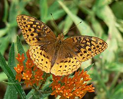 A 2003–04 survey of the monument found 55 species of butterflies such as the common sootywing
, orange sulphur
, great spangled fritillary
, and monarch. The monument's other insects have not been completely inventoried.
The John Day River, which passes through the Sheep Rock Unit, is the longest undammed tributary of the Columbia River, although two Columbia River dams below the John Day River mouth impede migratory fish travel to some degree. Chinook salmon
and steelhead
pass through the monument on their way to and from upstream spawn
ing beds and the Pacific Ocean. Species observed at the Sheep Rock Unit also include those able to tolerate warm summer river temperatures: bridgelip sucker
s, northern pikeminnow, redside shiner
s, and smallmouth bass
. From October through June, when the water is cooler, redband trout
and sculpin
are among species that move downriver through the park. The Park Service has removed or replaced irrigation diversions along the river or Rock Creek that formerly impeded fish movement, and it is restoring riparian vegetation such as black cottonwood
trees that shade the water in summer and provide habitat for aquatic insects.
The Sheep Rock Unit has eight trails ranging in length from 300 feet (91.4 m) at the Mascall Formation Overlook to 3 miles (4.8 km) at Blue Basin. Four trails of a quarter-mile to 1.5 miles (2.4 km) long cross parts of the Painted Hills Unit. At the Clarno Unit, three separate quarter-mile trails begin at a parking lot along Oregon Route 218, below the face of the Clarno Palisades. Many of the trails have interpretive signs about the history, geology, and fossils of the region, and three trails—Story in Stone at the Sheep Rock Unit, and Painted Cove and Leaf Hill at the Painted Hills Unit—are accessible by wheelchair. Visitors are asked to stay on the trails and off bare rock and hardpan
to avoid damage to fossils and fragile soils.
Ranger-led events at the monument include indoor and outdoor talks, showings of an 18-minute orientation film, hikes in Blue Basin, Cant Ranch walking tours, and astronomy programs at the Painted Hills Unit. These events are free and do not require reservations. Specific times for the activities are available from rangers at the monument. For students and teachers, the Park Service offers programs at the monument as well as fossil kits and other materials for classroom use.
Pets are allowed in developed areas and along hiking trails but must be leashed or otherwise restrained. Horses are not allowed on hiking trails, in picnic areas, or on bare rock exposures in undeveloped areas of the monument. Digging, disturbing, or collecting any of the park's natural resources, including fossils, is prohibited. Fossil theft is an ongoing problem. No mountain biking is allowed on monument land, although the Malheur National Forest
east of Dayville has biking trails. Fishing is legal from monument lands along the John Day River for anyone with an Oregon fishing license. Rafting on the John Day River is seasonally popular, although the favored runs begin at or downstream of Service Creek
and do not pass through the monument. Risks to monument visitors include extremely hot summer temperatures and icy winter roads, two species of poisonous rattlesnakes, two species of poisonous spiders, tick
s, scorpions, puncturevine
, and poison ivy.
Wheeler County, Oregon
As of the census of 2000, there were 1,547 people, 653 households, and 444 families residing in the county. The population density was 1 people per square mile . There were 842 housing units at an average density of 0 per square mile...
and Grant
Grant County, Oregon
Grant County is a county located in the U.S. state of Oregon. It is included in the 8 county definition of Eastern Oregon. In 2010, its population was 7,445. It is named for President Ulysses S. Grant, who served as an army officer in the Oregon Territory, and at the time of the county's creation...
counties in east-central Oregon
Oregon
Oregon is a state in the Pacific Northwest region of the United States. It is located on the Pacific coast, with Washington to the north, California to the south, Nevada on the southeast and Idaho to the east. The Columbia and Snake rivers delineate much of Oregon's northern and eastern...
. Located within the John Day River
John Day River
The John Day River is a tributary of the Columbia River, approximately long, in northeastern Oregon in the United States. Undammed along its entire length, the river is the third longest free-flowing river in the conterminous United States. There is extensive use of its waters for irrigation. Its...
basin and managed by the National Park Service
National Park Service
The National Park Service is the U.S. federal agency that manages all national parks, many national monuments, and other conservation and historical properties with various title designations...
, the park is known for its well-preserved layers of fossil
Fossil
Fossils are the preserved remains or traces of animals , plants, and other organisms from the remote past...
plants and mammal
Mammal
Mammals are members of a class of air-breathing vertebrate animals characterised by the possession of endothermy, hair, three middle ear bones, and mammary glands functional in mothers with young...
s that lived in the region between the late Eocene
Eocene
The Eocene Epoch, lasting from about 56 to 34 million years ago , is a major division of the geologic timescale and the second epoch of the Paleogene Period in the Cenozoic Era. The Eocene spans the time from the end of the Palaeocene Epoch to the beginning of the Oligocene Epoch. The start of the...
, about 44 million years ago, and the late Miocene
Miocene
The Miocene is a geological epoch of the Neogene Period and extends from about . The Miocene was named by Sir Charles Lyell. Its name comes from the Greek words and and means "less recent" because it has 18% fewer modern sea invertebrates than the Pliocene. The Miocene follows the Oligocene...
, about 7 million years ago. The monument consists of three geographically separate units: Sheep Rock, Painted Hills, and Clarno.
The units cover a total of 13944 acres (5,642.9 ha) of semi-desert shrublands, riparian zone
Riparian zone
A riparian zone or riparian area is the interface between land and a river or stream. Riparian is also the proper nomenclature for one of the fifteen terrestrial biomes of the earth. Plant habitats and communities along the river margins and banks are called riparian vegetation, characterized by...
s, and colorful badlands
Badlands
A badlands is a type of dry terrain where softer sedimentary rocks and clay-rich soils have been extensively eroded by wind and water. It can resemble malpaís, a terrain of volcanic rock. Canyons, ravines, gullies, hoodoos and other such geological forms are common in badlands. They are often...
. About 125,000 people visit the park each year for outdoor activities such as hiking and sightseeing or to visit the Thomas Condon Paleontology Center or the James Cant Ranch Historic District
James Cant Ranch Historic District
The James Cant Ranch is a pioneer ranch complex in Grant County in eastern Oregon, United States. The ranch is located on both sides of the John Day River in the John Day Fossil Beds National Monument. The ranch was originally homesteaded by Floyd Officer in 1890. Officer sold the property to...
.
Before the arrival of Euro-Americans in the 19th century, the John Day basin was frequented by Sahaptin people
Sahaptin people
The Sahaptin people are a Native American people that inhabited territory along the Columbia River. The Nez Perce tribe is one of the major Sahaptin groups.-Territory:...
who hunted, fished, and gathered roots and berries in the region. After road-building made the valley more accessible, settlers established farms, ranches, and a few small towns along the river and its tributaries. Paleontologists
Paleontology
Paleontology "old, ancient", ὄν, ὀντ- "being, creature", and λόγος "speech, thought") is the study of prehistoric life. It includes the study of fossils to determine organisms' evolution and interactions with each other and their environments...
have been unearthing and studying the fossils in the region since 1864, when Thomas Condon
Thomas Condon
Thomas Condon was an Irish Congregational minister, geologist, and paleontologist who gained recognition for his work in the U.S. state of Oregon....
, a missionary and amateur geologist, recognized their importance and made them known globally. Parts of the basin became a National Monument in 1975.
Averaging about 2200 feet (670.6 m) in elevation, the monument has a dry climate with temperatures that vary from summer highs of about 90 °F (32.2 °C) to winter lows below freezing. The monument has more than 80 soil types that support a wide variety of flora, ranging from willow trees near the river to grasses on alluvial fan
Alluvial fan
An alluvial fan is a fan-shaped deposit formed where a fast flowing stream flattens, slows, and spreads typically at the exit of a canyon onto a flatter plain. A convergence of neighboring alluvial fans into a single apron of deposits against a slope is called a bajada, or compound alluvial...
s to cactus among rocks at higher elevations. Fauna include more than 50 species of resident and migratory birds. Large mammals like elk
Elk
The Elk is the large deer, also called Cervus canadensis or wapiti, of North America and eastern Asia.Elk may also refer to:Other antlered mammals:...
and smaller animals such as raccoon
Raccoon
Procyon is a genus of nocturnal mammals, comprising three species commonly known as raccoons, in the family Procyonidae. The most familiar species, the common raccoon , is often known simply as "the" raccoon, as the two other raccoon species in the genus are native only to the tropics and are...
s, coyote
Coyote
The coyote , also known as the American jackal or the prairie wolf, is a species of canine found throughout North and Central America, ranging from Panama in the south, north through Mexico, the United States and Canada...
s, and voles frequent these units, which are also populated by a wide variety of reptiles, fish, butterflies, and other creatures adapted to particular niches of a mountainous semi-desert terrain.
Geography
The John Day Fossil Beds National Monument consists of three widely separated units—Sheep Rock, Painted Hills, and Clarno—in the John Day RiverJohn Day River
The John Day River is a tributary of the Columbia River, approximately long, in northeastern Oregon in the United States. Undammed along its entire length, the river is the third longest free-flowing river in the conterminous United States. There is extensive use of its waters for irrigation. Its...
basin of east-central Oregon. Located in rugged terrain in the counties of Wheeler
Wheeler County, Oregon
As of the census of 2000, there were 1,547 people, 653 households, and 444 families residing in the county. The population density was 1 people per square mile . There were 842 housing units at an average density of 0 per square mile...
and Grant
Grant County, Oregon
Grant County is a county located in the U.S. state of Oregon. It is included in the 8 county definition of Eastern Oregon. In 2010, its population was 7,445. It is named for President Ulysses S. Grant, who served as an army officer in the Oregon Territory, and at the time of the county's creation...
, the park units are characterized by hills, deep ravines, and eroded fossil-bearing rock formations. To the west lies the Cascade Range
Cascade Range
The Cascade Range is a major mountain range of western North America, extending from southern British Columbia through Washington and Oregon to Northern California. It includes both non-volcanic mountains, such as the North Cascades, and the notable volcanoes known as the High Cascades...
, to the south the Ochoco Mountains
Ochoco Mountains
The Ochoco Mountains are a mountain range in central Oregon. The Ochoco Mountains form the western end of the Blue Mountains province. The mountains were formed when Permian, Triassic, and Jurassic rocks were slowly uplifted by volcanic eruptions to form the Clarno Formation. Today, the highest...
, and to the east the Blue Mountains
Blue Mountains (Oregon)
The Blue Mountains are a mountain range in the western United States, located largely in northeastern Oregon and stretching into southeastern Washington...
. Elevations within the 13944 acres (5,642.9 ha) park range from 2000 to 4500 ft (609.6 to 1,371.6 m).
The Clarno Unit, the westernmost of the three units, consists of 1969 acres (796.8 ha) located 18 miles (29 km) west of Fossil
Fossil, Oregon
Fossil is a city in and the county seat of Wheeler County, Oregon, United States. The name was chosen by the first postmaster, Thomas B. Hoover, who had found some fossil remains on his ranch. The population was 473 at the 2010 census.- History :...
along Oregon Route 218. The Painted Hills Unit, which lies about halfway between the other two, covers 3132 acres (1,267.5 ha). It is situated about 9 miles (14.5 km) northwest of Mitchell
Mitchell, Oregon
-Demographics:As of the census of 2000, there were 170 people, 75 households, and 42 families residing in the city. The population density was 144.6 people per square mile . There were 91 housing units at an average density of 77.4 per square mile...
along Burnt Ranch Road, which intersects U.S. Route 26
U.S. Route 26 in Oregon
In the U.S. state of Oregon, U.S. Route 26 is a major cross-state state highway, connecting U.S. Route 101 on the Oregon Coast near Seaside with the Idaho state line east of Nyssa. Local highway names include the Sunset Highway No. 47, Mount Hood Highway No. 26, and John Day Highway No...
west of Mitchell. These two units are entirely within Wheeler County. The remaining 8843 acres (3,578.6 ha) of the park, the Sheep Rock Unit, are located along Oregon Route 19
Oregon Route 19
Oregon Route 19 is an Oregon state highway in the north-central part of the state. It runs from Interstate 84 at Arlington in the Columbia River Gorge to a junction with U.S. Route 26 in Grant County, near the Sheep Rock Unit of the John Day Fossil Beds National Monument. Oregon Route 19 is the...
and the John Day River upstream of the unincorporated
Unincorporated area
In law, an unincorporated area is a region of land that is not a part of any municipality.To "incorporate" in this context means to form a municipal corporation, a city, town, or village with its own government. An unincorporated community is usually not subject to or taxed by a municipal government...
community of Kimberly
Kimberly, Oregon
Kimberly is an unincorporated community in Grant County, Oregon, United States. It is located at the intersection of Oregon Route 19 and Oregon Route 402 and the confluence of the John Day and the North Fork John Day rivers....
. This unit is mostly in Grant County, although a small part extends into Wheeler County. The Sheep Rock Unit is further subdivided into the Mascall Formation Overlook, Picture Gorge, the James Cant Ranch Historic District
James Cant Ranch Historic District
The James Cant Ranch is a pioneer ranch complex in Grant County in eastern Oregon, United States. The ranch is located on both sides of the John Day River in the John Day Fossil Beds National Monument. The ranch was originally homesteaded by Floyd Officer in 1890. Officer sold the property to...
, Cathedral Rock, Blue Basin, and the Foree Area. Some of these are separated from one another by farms, ranches, and other parcels of land that are not part of the park.
The park headquarters and main visitor center, both in the Sheep Rock Unit, are 122 miles (196.3 km) northeast of Bend
Bend, Oregon
Bend is a city in and the county seat of Deschutes County, Oregon, United States, and the principal city of the Bend, Oregon Metropolitan Statistical Area. Bend is Central Oregon's largest city, and, despite its modest size, is the de facto metropolis of the region, owing to the low population...
and 240 miles (386.2 km) southeast of Portland
Portland, Oregon
Portland is a city located in the Pacific Northwest, near the confluence of the Willamette and Columbia rivers in the U.S. state of Oregon. As of the 2010 Census, it had a population of 583,776, making it the 29th most populous city in the United States...
by highway. The shortest highway distances from unit to unit within the park are Sheep Rock to Painted Hills, 45 miles (72.4 km); Painted Hills to Clarno, 75 miles (120.7 km), and Clarno to Sheep Rock, 81 miles (130.4 km).
The John Day River, a tributary of the Columbia River
Columbia River
The Columbia River is the largest river in the Pacific Northwest region of North America. The river rises in the Rocky Mountains of British Columbia, Canada, flows northwest and then south into the U.S. state of Washington, then turns west to form most of the border between Washington and the state...
, flows generally north between the Mascall Formation Overlook and Kimberly, generally west from Kimberly to downstream of the unincorporated community of Twickenham
Twickenham, Oregon
Twickenham is an unincorporated community in Wheeler County, in the U.S. state of Oregon. It is located along the John Day River between Service Creek and Clarno. A bridge at Twickenham carries North Twickenham Road over the river....
, and generally north thereafter. Rock Creek enters the river at the north end of Picture Gorge. Bridge Creek passes through Mitchell, then north along the eastern edge of the Painted Hills Unit to meet the John Day downstream of Twickenham. Intermittent streams in the Clarno Unit empty into Pine Creek, which flows just beyond the south edge of the unit and enters the John Day upstream of the unincorporated community of Clarno
Clarno, Oregon
Clarno is an unincorporated community in Wasco County, in the U.S. state of Oregon. It is located along Oregon Route 19 near the John Day River....
.
History
Early inhabitants of north-central Oregon included Sahaptin-speakingSahaptin language
Sahaptin , Sħáptənəxw, is a Plateau Penutian language of the Sahaptian branch spoken in a section of the northwestern plateau along the Columbia River and its tributaries in southern Washington, northern Oregon, and southwestern Idaho....
people of the Umatilla, Wasco, and Warm Springs tribes as well as the Northern Paiutes, speakers of a Uzo-Aztecan (Shoshonean)
Uto-Aztecan languages
Uto-Aztecan or Uto-Aztekan is a Native American language family consisting of over 30 languages. Uto-Aztecan languages are found from the Great Basin of the Western United States , through western, central and southern Mexico Uto-Aztecan or Uto-Aztekan is a Native American language family...
language. All were hunter-gatherer
Hunter-gatherer
A hunter-gatherer or forage society is one in which most or all food is obtained from wild plants and animals, in contrast to agricultural societies which rely mainly on domesticated species. Hunting and gathering was the ancestral subsistence mode of Homo, and all modern humans were...
s competing for resources such as elk, huckleberries
Huckleberry
Huckleberry is a common name used in North America for several species of plants in two closely related genera in the family Ericaceae:* Vaccinium* GaylussaciaHuckleberry may also refer to:-Plants:...
, and salmon
Salmon
Salmon is the common name for several species of fish in the family Salmonidae. Several other fish in the same family are called trout; the difference is often said to be that salmon migrate and trout are resident, but this distinction does not strictly hold true...
. Researchers have identified 36 sites of related archeological interest, including rock shelters and cairn
Cairn
Cairn is a term used mainly in the English-speaking world for a man-made pile of stones. It comes from the or . Cairns are found all over the world in uplands, on moorland, on mountaintops, near waterways and on sea cliffs, and also in barren desert and tundra areas...
s, in or adjacent to the John Day Fossil Beds National Monument. Most significant among the prehistoric sites are the Picture Gorge pictograph
Pictogram
A pictograph, also called pictogram or pictogramme is an ideogram that conveys its meaning through its pictorial resemblance to a physical object. Pictographs are often used in writing and graphic systems in which the characters are to considerable extent pictorial in appearance.Pictography is a...
s, consisting of six panels of rock art in the canyon at the south end of the Sheep Rock Unit. The art is of undetermined origin and age but is "centuries old".
The John Day basin remained largely unexplored by non-natives until the mid-19th century. Lewis and Clark
Lewis and Clark Expedition
The Lewis and Clark Expedition, or ″Corps of Discovery Expedition" was the first transcontinental expedition to the Pacific Coast by the United States. Commissioned by President Thomas Jefferson and led by two Virginia-born veterans of Indian wars in the Ohio Valley, Meriwether Lewis and William...
noted but did not explore the John Day River while traveling along the Columbia River in 1805. John Day
John Day (trapper)
John Day was an American hunter and fur trapper in the old Oregon Country--the area then jointly occupied by the United States and Great Britain, including present-day Oregon, Washington, Idaho, western Montana and southern British Columbia.Day was born in Culpeper County, Virginia and came west...
, for whom the river is named, apparently visited only its confluence with the Columbia in 1812. In 1829, Peter Skene Ogden
Peter Skene Ogden
Peter Skene Ogden , was a fur trader and a Canadian explorer of what is now British Columbia and the American West...
, working for the Hudson's Bay Company
Hudson's Bay Company
The Hudson's Bay Company , abbreviated HBC, or "The Bay" is the oldest commercial corporation in North America and one of the oldest in the world. A fur trading business for much of its existence, today Hudson's Bay Company owns and operates retail stores throughout Canada...
(HBC), led a company of explorers and fur trappers along the river through what would later become the Sheep Rock Unit. John Work of the HBC also visited this part of the river in 1831.
In the 1840s, thousands of settlers, attracted in part by the lure of free land, began emigrating west over the Oregon Trail
Oregon Trail
The Oregon Trail is a historic east-west wagon route that connected the Missouri River to valleys in Oregon and locations in between.After 1840 steam-powered riverboats and steamboats traversing up and down the Ohio, Mississippi and Missouri rivers sped settlement and development in the flat...
. Leaving drought, worn-out farms, and economic problems behind, they emigrated from states like Missouri, Illinois, and Iowa in the Midwest
Midwestern United States
The Midwestern United States is one of the four U.S. geographic regions defined by the United States Census Bureau, providing an official definition of the American Midwest....
to Oregon, especially the Willamette Valley
Willamette Valley
The Willamette Valley is the most populated region in the state of Oregon of the United States. Located in the state's northwest, the region is surrounded by tall mountain ranges to the east, west and south and the valley's floor is broad, flat and fertile because of Ice Age conditions...
in the western part of the state. After passage of the Homestead Act
Homestead Act
A homestead act is one of three United States federal laws that gave an applicant freehold title to an area called a "homestead" – typically 160 acres of undeveloped federal land west of the Mississippi River....
of 1862 and the discovery of gold in the upper John Day basin, a fraction of these newcomers abandoned the Willamette Valley in favor of eastern Oregon. Some established villages and engaged in subsistence farming and ranching near streams. Settlement was made more practical by a supply route from The Dalles
The Dalles, Oregon
The Dalles is the largest city and county seat of Wasco County, Oregon, United States. The name of the city comes from the French word dalle The Dalles is the largest city and county seat of Wasco County, Oregon, United States. The name of the city comes from the French word dalle The Dalles is...
on the Columbia River to gold mines at Canyon City
Canyon City, Oregon
Canyon City is a city in Grant County, Oregon, United States. It is the county seat of Grant County, and is about a mile south of John Day on U.S. Highway 395. As of the 2010 census, the city had a total population of 703.-History:...
in the upper John Day valley. By the late 1860s, the route became formalized as the The Dalles–Boise
Boise, Idaho
Boise is the capital and most populous city of the U.S. state of Idaho, as well as the county seat of Ada County. Located on the Boise River, it anchors the Boise City-Nampa metropolitan area and is the largest city between Salt Lake City, Utah and Portland, Oregon.As of the 2010 Census Bureau,...
Military Road, which passed along Bridge Creek and south of Sheep Rock. Clashes between natives and non-natives and the desire of the U.S. Government to populate the region with Euro-Americans led to the gradual removal of native residents to reservation
Indian reservation
An American Indian reservation is an area of land managed by a Native American tribe under the United States Department of the Interior's Bureau of Indian Affairs...
s, including three in north-central Oregon: Warm Springs
Warm Springs Indian Reservation
The Warm Springs Indian Reservation consists of 1,019.385 sq mi in north central Oregon, in the United States, and is occupied and governed by the Confederated Tribes of Warm Springs.-Tribes:...
, Burns Paiute
Burns Paiute Tribe
The Burns Paiute Tribe of the Burns Paiute Indian Colony of Oregon is a federally recognized tribe of Northern Paiute Indians in Harney County, Oregon, United States...
, and Umatilla
Umatilla Indian Reservation
The Umatilla Indian Reservation is an Indian reservation in eastern Oregon in the United States, mostly located in Umatilla County, with a very small part extending south into Union County...
.
In 1864, a company of soldiers sent to protect mining camps from raids by Northern Paiutes discovered fossils in the Crooked River
Crooked River (Oregon)
The Crooked River is a tributary, long, of the Deschutes River in the U.S. state of Oregon. The river begins at the confluence of South Fork Crooked River and Beaver Creek. Of the two tributaries, the South Fork Crooked River is the larger and is sometimes considered part of the Crooked River proper...
region, south of the John Day basin. One of their leaders, Captain John M. Drake
John M. Drake
John Miller Drake was a Union Army officer in the 1st Oregon Cavalry and the 1st Oregon Infantry regiments during the American Civil War. He eventually reached the rank of Lieutenant Colonel. He led one of the first campaigns to respond to the threat Chief Paulina posed to settlers and rival...
, collected some of these fossils for Thomas Condon
Thomas Condon
Thomas Condon was an Irish Congregational minister, geologist, and paleontologist who gained recognition for his work in the U.S. state of Oregon....
, a missionary pastor and amateur geologist who lived in The Dalles. Recognizing the scientific importance of the fossils, Condon accompanied soldiers traveling through the region. He discovered rich fossil beds along Bridge Creek and near Sheep Rock in 1865. Condon's trips to the area and his public lectures and reports about his finds led to wide interest in the fossil beds among scientists such as Edward Drinker Cope
Edward Drinker Cope
Edward Drinker Cope was an American paleontologist and comparative anatomist, as well as a noted herpetologist and ichthyologist. Born to a wealthy Quaker family, Cope distinguished himself as a child prodigy interested in science; he published his first scientific paper at the age of nineteen...
of the Academy of Natural Sciences
Academy of Natural Sciences
The Academy of Natural Sciences of Drexel University, formerly Academy of Natural Sciences of Philadelphia, is the oldest natural science research institution and museum in the New World...
. One of them, paleontologist Othneil C. Marsh
Othniel Charles Marsh
Othniel Charles Marsh was an American paleontologist. Marsh was one of the preeminent scientists in the field; the discovery or description of dozens of news species and theories on the origins of birds are among his legacies.Born into a modest family, Marsh was able to afford higher education...
of Yale
Yale University
Yale University is a private, Ivy League university located in New Haven, Connecticut, United States. Founded in 1701 in the Colony of Connecticut, the university is the third-oldest institution of higher education in the United States...
, accompanied Condon on a trip to the region in 1871. Condon's work led to his appointment in 1872 as Oregon's first state geologist and to international fame for the fossil beds. Specimens from the beds were sent to the Smithsonian Institution
Smithsonian Institution
The Smithsonian Institution is an educational and research institute and associated museum complex, administered and funded by the government of the United States and by funds from its endowment, contributions, and profits from its retail operations, concessions, licensing activities, and magazines...
and other museums worldwide, and by 1900 more than 100 articles and books had been published about the John Day Fossil Beds. During the first half of the 20th century, scientists such as John C. Merriam
John C. Merriam
John Campbell Merriam was an American paleontologist. The first vertebrate paleontologist on the West Coast of the United States, he is best known for his taxonomy of vertebrate fossils at the La Brea Tar Pits in Los Angeles, particularly with the genus Smilodon, more commonly known as the...
, Ralph Chaney, Frank H. Knowlton, and Alonzo W. Hancock continued work in the fossil beds, including those discovered near Clarno in about 1890.
Remote and arid, the John Day basin near the fossil beds was slow to attract homesteaders. The first settler in what became the Sheep Rock Unit is thought to have been Frank Butler, who built a cabin along the river in 1877. In 1881, Eli Casey Officer began grazing sheep on a homestead claim in same general area. His son Floyd later lived there with his family and sometimes accompanied Condon on his fossil hunts. In 1910, James and Elizabeth Cant bought 700 acres (283.3 ha) from the Officer family. and converted it to a sheep ranch, which was eventually expanded to a sheep-and-cattle ranch of about 6000 acres (2,428.1 ha).
Merriam, a University of California
University of California
The University of California is a public university system in the U.S. state of California. Under the California Master Plan for Higher Education, the University of California is a part of the state's three-tier public higher education system, which also includes the California State University...
paleontologist who had led expeditions to the region in 1899 and 1900, encouraged the State of Oregon to protect the area. In the early 1930s the state began to buy land for state parks at Picture Gorge, the Painted Hills, and Clarno that later became part of the national monument. In 1951 the Oregon Museum of Science and Industry
Oregon Museum of Science and Industry
The Oregon Museum of Science and Industry is a museum located in Portland, Oregon, United States. It contains two auditoriums, including an IMAX Dome theatre, and a variety of hands-on permanent exhibits focused on natural sciences, industry, and technology...
established Camp Hancock, a field school for young students of geology, paleontology, and other sciences, on public lands surrounded by what would later become the Clarno Unit. In 1974 Congress authorized the National Park Service to establish the national monument, and President Gerald R. Ford signed the authorization. After the State of Oregon had completed the land transfer of the three state parks to the Federal government, the monument was officially established on October 8, 1975.
The Cant Ranch House and associated land and outbuildings were listed on the National Register of Historic Places
National Register of Historic Places
The National Register of Historic Places is the United States government's official list of districts, sites, buildings, structures, and objects deemed worthy of preservation...
as the 200 acres (80.9 ha) James Cant Ranch Historic District
James Cant Ranch Historic District
The James Cant Ranch is a pioneer ranch complex in Grant County in eastern Oregon, United States. The ranch is located on both sides of the John Day River in the John Day Fossil Beds National Monument. The ranch was originally homesteaded by Floyd Officer in 1890. Officer sold the property to...
in 1984. After the monument opened in 1975, the ranch house served as headquarters for all three units. In 2004, it became home to the Cant Ranch Historical Museum, with two rooms of public exhibits about the native cultures, the Canyon City
Canyon City, Oregon
Canyon City is a city in Grant County, Oregon, United States. It is the county seat of Grant County, and is about a mile south of John Day on U.S. Highway 395. As of the 2010 census, the city had a total population of 703.-History:...
gold rush, ranching, and other topics related to region. The Thomas Condon Paleontology Center, a $7.5 million museum and visitor center at the Sheep Rock Unit, opened in 1984. Among the center's offerings are displays of fossils, murals depicting life in the basin during eight geologic times ranging from about 45 million to about 5 million years ago, and views of the paleontology laboratory.
In March 2011, the Park Service installed two webcams at the Sheep Rock Unit. Both transmit continuous real-time images; one shows the paleontology lab at the Condon Center and the other depicts Sheep Rock and nearby features. In June 2011, work was finished on a new ranger residence in the Painted Hills Unit that makes the unit almost carbon-neutral. Solar panels generate enough electricity to power the house as well as the ranger's electric vehicle, on loan from its manufacturer for a year. The project is part of ongoing efforts to make the whole park carbon-neutral.
Geology and paleontology
The John Day Fossil Beds National Monument lies within the Blue Mountains physiographic provincePhysiographic province
A physiographic province is a geographic region with a specific geomorphology and often specific subsurface rock type or structural elements.A continent may be subdivided into various physiographic provinces, each having a specific character, relief, and environment which contributes to its...
, which originated during the late Jurassic
Jurassic
The Jurassic is a geologic period and system that extends from about Mya to Mya, that is, from the end of the Triassic to the beginning of the Cretaceous. The Jurassic constitutes the middle period of the Mesozoic era, also known as the age of reptiles. The start of the period is marked by...
and early Cretaceous
Cretaceous
The Cretaceous , derived from the Latin "creta" , usually abbreviated K for its German translation Kreide , is a geologic period and system from circa to million years ago. In the geologic timescale, the Cretaceous follows the Jurassic period and is followed by the Paleogene period of the...
, about 118 to 93 million years ago. Northeastern Oregon was assembled in large blocks (exotic terrane
Terrane
A terrane in geology is short-hand term for a tectonostratigraphic terrane, which is a fragment of crustal material formed on, or broken off from, one tectonic plate and accreted or "sutured" to crust lying on another plate...
s) of Permian
Permian
The PermianThe term "Permian" was introduced into geology in 1841 by Sir Sir R. I. Murchison, president of the Geological Society of London, who identified typical strata in extensive Russian explorations undertaken with Edouard de Verneuil; Murchison asserted in 1841 that he named his "Permian...
, Triassic
Triassic
The Triassic is a geologic period and system that extends from about 250 to 200 Mya . As the first period of the Mesozoic Era, the Triassic follows the Permian and is followed by the Jurassic. Both the start and end of the Triassic are marked by major extinction events...
, and Jurassic
Jurassic
The Jurassic is a geologic period and system that extends from about Mya to Mya, that is, from the end of the Triassic to the beginning of the Cretaceous. The Jurassic constitutes the middle period of the Mesozoic era, also known as the age of reptiles. The start of the period is marked by...
rock shifted by tectonic
Tectonics
Tectonics is a field of study within geology concerned generally with the structures within the lithosphere of the Earth and particularly with the forces and movements that have operated in a region to create these structures.Tectonics is concerned with the orogenies and tectonic development of...
forces and accreted
Accretion (geology)
Accretion is a process by which material is added to a tectonic plate or a landmass. This material may be sediment, volcanic arcs, seamounts or other igneous features.-Description:...
to what was then the western edge of the North American continent, near the Idaho border. By the beginning of the Cenozoic
Cenozoic
The Cenozoic era is the current and most recent of the three Phanerozoic geological eras and covers the period from 65.5 mya to the present. The era began in the wake of the Cretaceous–Tertiary extinction event at the end of the Cretaceous that saw the demise of the last non-avian dinosaurs and...
era, 65 million years ago, the Blue Mountains province was uplifting
Tectonic uplift
Tectonic uplift is a geological process most often caused by plate tectonics which increases elevation. The opposite of uplift is subsidence, which results in a decrease in elevation. Uplift may be orogenic or isostatic.-Orogenic uplift:...
(that is, was being pushed higher by tectonic forces), and the Pacific Ocean shoreline, formerly near Idaho
Idaho
Idaho is a state in the Rocky Mountain area of the United States. The state's largest city and capital is Boise. Residents are called "Idahoans". Idaho was admitted to the Union on July 3, 1890, as the 43rd state....
, had shifted to the west.
Volcanic eruptions about 44 million years ago during the Eocene
Eocene
The Eocene Epoch, lasting from about 56 to 34 million years ago , is a major division of the geologic timescale and the second epoch of the Paleogene Period in the Cenozoic Era. The Eocene spans the time from the end of the Palaeocene Epoch to the beginning of the Oligocene Epoch. The start of the...
deposited lavas accompanied by debris flows (lahar
Lahar
A lahar is a type of mudflow or debris flow composed of a slurry of pyroclastic material, rocky debris, and water. The material flows down from a volcano, typically along a river valley. The term is a shortened version of "berlahar" which originated in the Javanese language of...
s) atop the older rocks in the western part of the province. Containing fragments of shale
Shale
Shale is a fine-grained, clastic sedimentary rock composed of mud that is a mix of flakes of clay minerals and tiny fragments of other minerals, especially quartz and calcite. The ratio of clay to other minerals is variable. Shale is characterized by breaks along thin laminae or parallel layering...
, siltstone
Siltstone
Siltstone is a sedimentary rock which has a grain size in the silt range, finer than sandstone and coarser than claystones.- Description :As its name implies, it is primarily composed of silt sized particles, defined as grains 1/16 - 1/256 mm or 4 to 8 on the Krumbein phi scale...
, conglomerates
Conglomerate (geology)
A conglomerate is a rock consisting of individual clasts within a finer-grained matrix that have become cemented together. Conglomerates are sedimentary rocks consisting of rounded fragments and are thus differentiated from breccias, which consist of angular clasts...
, and breccia
Breccia
Breccia is a rock composed of broken fragments of minerals or rock cemented together by a fine-grained matrix, that can be either similar to or different from the composition of the fragments....
s, the debris flows entombed plants and animals caught in their paths; the remnants of these ancient flows comprise the rock formations exposed in the Clarno Unit. Preserved in the Clarno Nut Beds are fossils of tropical and subtropical nuts, fruits, roots, branches, and seeds. Large mammals that inhabited this region between 50 and 35 million years ago included browsers such as brontotheres and amynodonts, scavengers like the hyaenodont
Hyaenodontidae
Hyaenodontidae is a family of the extinct order Creodonta, which contains several dozen genera.The Hyaenodontids were important mammalian predators that arose during the late Paleocene and persisted well into the Miocene...
s, as well as Patriofelis
Patriofelis
Patriofelis was a large, cat-like oxyaenid creodont of middle Eocene, some 45 million years ago in North America. It was around long, not including the tail, making it around the same size as a modern panther. It had short legs with broad feet, suggesting that it may have been a poor runner, but...
and other predators. Eroded remnants of the Clarno stratovolcano
Stratovolcano
A stratovolcano, also known as a composite volcano, is a tall, conical volcano built up by many layers of hardened lava, tephra, pumice, and volcanic ash. Unlike shield volcanoes, stratovolcanoes are characterized by a steep profile and periodic, explosive eruptions...
es, once the size of Mount Hood
Mount Hood
Mount Hood, called Wy'east by the Multnomah tribe, is a stratovolcano in the Cascade Volcanic Arc of northern Oregon. It was formed by a subduction zone and rests in the Pacific Northwest region of the United States...
, are still visible near the monument, for example Black Butte, White Butte, and other butte
Butte
A butte is a conspicuous isolated hill with steep, often vertical sides and a small, relatively flat top; it is smaller than mesas, plateaus, and table landform tables. In some regions, such as the north central and northwestern United States, the word is used for any hill...
s near Mitchell
Mitchell, Oregon
-Demographics:As of the census of 2000, there were 170 people, 75 households, and 42 families residing in the city. The population density was 144.6 people per square mile . There were 91 housing units at an average density of 77.4 per square mile...
.
After the Clarno volcanoes had subsided, they were replaced about 36 million years ago by eruptions from volcanoes to the west, in the general vicinity of what would become the Cascade Range
Cascade Range
The Cascade Range is a major mountain range of western North America, extending from southern British Columbia through Washington and Oregon to Northern California. It includes both non-volcanic mountains, such as the North Cascades, and the notable volcanoes known as the High Cascades...
. The John Day volcanoes, as they are called, emitted large volumes of ash and dust, much of which settled in the John Day basin. As with the earlier Clarno debris flows, the rapid deposition of ash preserved the remains of plants and animals living in the region. Because ash and other debris fell during varied climatic and volcanic conditions and accumulated from many eruptions extending into the early Miocene
Miocene
The Miocene is a geological epoch of the Neogene Period and extends from about . The Miocene was named by Sir Charles Lyell. Its name comes from the Greek words and and means "less recent" because it has 18% fewer modern sea invertebrates than the Pliocene. The Miocene follows the Oligocene...
(about 20 million years ago), the sediment layers in the fossil beds vary in their chemical composition and color. Laid down on top of the Clarno Strata, the younger John Day Strata
John Day Formation
The John Day Formation is series of rock strata exposed in the John Day River basin of north-central Oregon in the United States. The strata, which vary in age from 39 million years to 18 million years, were formed mainly from ashfalls from volcanoes to the west...
consist of several distinct groups of layers. The lowermost contains red ash such as that exposed in the Painted Hills Unit. The layer above it is mainly pea-green clay. On top of the pea-green layer are buff-colored layers. Fossils found in the John Day Strata include a wide variety of plants and more than 100 species of mammals, including dogs, cats, oreodont
Oreodont
Oreodons, sometimes called prehistoric "ruminating hogs," were a family of cud-chewing plant-eater with a short face and tusk-like canine teeth...
s, horses, camels, and rodents. Among the notable plant fossils are the Metasequoia
Metasequoia
Metasequoia is a fast-growing, deciduous tree, and the sole living species, Metasequoia glyptostroboides, is one of three species of conifers known as redwoods. It is native to the Sichuan-Hubei region of China. Although the least tall of the redwoods, it grows to at least 200 feet in height...
(dawn redwood), a genus
Genus
In biology, a genus is a low-level taxonomic rank used in the biological classification of living and fossil organisms, which is an example of definition by genus and differentia...
thought to have gone extinct worldwide until it was discovered alive in China in the early 20th century.
After another period of erosion, a series of lava
Lava
Lava refers both to molten rock expelled by a volcano during an eruption and the resulting rock after solidification and cooling. This molten rock is formed in the interior of some planets, including Earth, and some of their satellites. When first erupted from a volcanic vent, lava is a liquid at...
eruptions from fissures across northeastern Oregon, southeastern Washington, and western Idaho inundated much of the Blue Mountain province with liquid basalt
Basalt
Basalt is a common extrusive volcanic rock. It is usually grey to black and fine-grained due to rapid cooling of lava at the surface of a planet. It may be porphyritic containing larger crystals in a fine matrix, or vesicular, or frothy scoria. Unweathered basalt is black or grey...
. Extruded in the middle Miocene between 17 and 12 million years ago, more than 40 separate flows contributing to the Columbia River Basalt Group
Columbia River Basalt Group
The Columbia River Basalt Group is a large igneous province that lies across parts of the Western United States. It is found in the U.S. states of Washington, Oregon, Idaho, Nevada, and California...
have been identified, the largest of which involved up to 400 cubic miles (1,667.3 km³) of lava. The most prominent of these formations within the monument is the Picture Gorge Basalt, which rests above the John Day Strata.
Subsequent ashfall from eruptions in the Cascade Range in the late Miocene contributed to the Mascall Strata, layers of stream-deposited volcanic tuff
Tuff
Tuff is a type of rock consisting of consolidated volcanic ash ejected from vents during a volcanic eruption. Tuff is sometimes called tufa, particularly when used as construction material, although tufa also refers to a quite different rock. Rock that contains greater than 50% tuff is considered...
s laid atop the Picture Gorge Basalt. Preserved in the Mascall are fossils of horses, camels, bears, broadleaf plants, and other life forms that thrived in the monument's open woodland and savannah between 15 and 12 million years ago. The last major eruption occurred in the late Miocene, about 7 million years ago. The resulting stratum, the Rattlesnake, lies on top of the Mascall and is capped by an ignimbrite
Ignimbrite
An ignimbrite is the deposit of a pyroclastic density current, or pyroclastic flow, a hot suspension of particles and gases that flows rapidly from a volcano, driven by a greater density than the surrounding atmosphere....
. The Rattlesnake has fossils of mastodon
Mastodon
Mastodons were large tusked mammal species of the extinct genus Mammut which inhabited Asia, Africa, Europe, North America and Central America from the Oligocene through Pleistocene, 33.9 mya to 11,000 years ago. The American mastodon is the most recent and best known species of the group...
s, camels, rhinoceroses, and others that grazed on the grasslands of the time. Two fossilized teeth found recently in the Rattlesnake stratum near Dayville are the earliest record of beaver (Castor canadensis) in North America. The beaver teeth, which are about 7 million years old, have been scheduled for display at the Condon Center.
The monument contains extensive deposits of well-preserved fossils from various periods spanning more than 40 million years. Taken as a whole, the fossils present an unusually detailed view of plants and animals since the late Eocene. In addition, analysis of the John Day fossils has contributed to paleoclimatology
Paleoclimatology
Paleoclimatology is the study of changes in climate taken on the scale of the entire history of Earth. It uses a variety of proxy methods from the Earth and life sciences to obtain data previously preserved within rocks, sediments, ice sheets, tree rings, corals, shells and microfossils; it then...
(the study of Earth's past climates) and the study of evolution
Evolution
Evolution is any change across successive generations in the heritable characteristics of biological populations. Evolutionary processes give rise to diversity at every level of biological organisation, including species, individual organisms and molecules such as DNA and proteins.Life on Earth...
.
Paleontologists at the monument find, describe the location of, and collect fossil-bearing rocks from more than 700 sites. They take them to the paleontology lab at the visitor center, where the fossils are stabilized, separated from their rock matrix
Matrix (geology)
The matrix or groundmass of rock is the finer grained mass of material in which larger grains, crystals or clasts are embedded.The matrix of an igneous rock consists of finer grained, often microscopic, crystals in which larger crystals are embedded. This porphyritic texture is indicative of...
, and cleaned. The fossil specimens are then catalogued, indexed, stored in climate-controlled cabinets, and made available for research. In addition to preparing fossils, the paleontologists coordinate the monument's basic research in paleobotany
Paleobotany
Paleobotany, also spelled as palaeobotany , is the branch of paleontology or paleobiology dealing with the recovery and identification of plant remains from geological contexts, and their use for the biological reconstruction of past environments , and both the evolutionary history of plants, with a...
and other scientific areas and manage the fossil museum in the visitor center.
Climate
Average precipitation, limited by the rain shadowRain shadow
A rain shadow is a dry area on the lee side of a mountainous area. The mountains block the passage of rain-producing weather systems, casting a "shadow" of dryness behind them. As shown by the diagram to the right, the warm moist air is "pulled" by the prevailing winds over a mountain...
effects of the Cascade Range and the Ochoco Mountains, varies from 9 to 16 in (228.6 to 406.4 mm) a year. In winter, much of the precipitation arrives as snow.
Weather data for the city of Mitchell, near the Painted Hills Unit, show that July and August are the warmest months, with an average high of 86 °F (30 °C) and an average low of 52 °F (11.1 °C). January is the coldest month, when highs average 42 °F (5.6 °C) and lows average 24 °F (-4.4 °C). The highest recorded temperature in Mitchell was 107 °F (41.7 °C) in 1972, and the lowest was -27 F in 1983. May is generally the wettest month, when precipitation averages 1.65 inches (41.9 mm).
Flora
Riparian zone
A riparian zone or riparian area is the interface between land and a river or stream. Riparian is also the proper nomenclature for one of the fifteen terrestrial biomes of the earth. Plant habitats and communities along the river margins and banks are called riparian vegetation, characterized by...
vegetation near the river to greasewood
Greasewood
Greasewood, Sarcobatus, is a genus of one or two species of flowering plants. Traditionally it has been treated in the family Chenopodiaceae, but the APG II system, of 2003, places it in the family Sarcobataceae....
and saltgrass on the alluvial fan
Alluvial fan
An alluvial fan is a fan-shaped deposit formed where a fast flowing stream flattens, slows, and spreads typically at the exit of a canyon onto a flatter plain. A convergence of neighboring alluvial fans into a single apron of deposits against a slope is called a bajada, or compound alluvial...
s to plants such as hedgehog cactus
Pediocactus
Pediocactus is a genus of cacti. The genus comprises between 6 and 11 species, depending upon the authority...
in rocky outcrops at high elevation. Important to many of these communities is a black cryptobiotic crust
Cryptobiotic soil
A Cryptobiotic soil is a biological soil crust composed of living cyanobacteria, green algae, brown algae, fungi, lichens, and/or mosses. Commonly found in arid regions around the world, cryptobiotic soils go by many names, including cryptogamic, microbiotic, or microphytic soils or crusts...
that resists erosion, stores water, and fixes nitrogen
Nitrogen fixation
Nitrogen fixation is the natural process, either biological or abiotic, by which nitrogen in the atmosphere is converted into ammonia . This process is essential for life because fixed nitrogen is required to biosynthesize the basic building blocks of life, e.g., nucleotides for DNA and RNA and...
used by the plants. The crust is composed of algae, lichens, mosses, fungi, and bacteria. Other areas of the monument have little or no flora. Volcanic tuffs and claystones that lack essential nutrients support few microorganisms and plants. Likewise, hard rock surfaces and steep slopes from which soils wash or blow away tend to remain bare.
Native grasses thrive in many parts of the monument despite competition from western juniper
Juniperus occidentalis
Juniperus occidentalis is a shrub or tree native to the western United States, growing in mountains at altitudes of 800-3,000 m .-Description:...
s, medusahead rye
Taeniatherum caput-medusae
Taeniatherum caput-medusae is a species of grass known by the common name medusahead. This aggressive winter annual grass is changing the ecology of western rangelands in North America. Forty-eight percent of the total land area of the United States is rangeland, pastureland, national parks, nature...
, Dalmatian toadflax
Linaria dalmatica
Linaria dalmatica is a herbaceous plant native to western Asia and southeastern Europe that has become a weed in other areas. Its common names include Balkan toadflax, broadleaf toadflax, and Dalmatian toadflax.- External Links :...
, cheatgrass
Drooping Brome
Drooping brome or Cheat Grass, Bromus tectorum, is a grass native to Europe, southwestern Asia and northern Africa.-Description:...
, and other invasive species. Bunchgrasses
Tussock (grass)
Tussock grasses or bunch grasses are found as native plants in natural ecosystems, as forage in pastures, and as ornamental grasses in gardens....
in the park include basin wildrye
Elymus (genus)
Elymus is a genus of perennial grasses in the tribe which contains many of the main cereal grains. Plants of this genus are known generally as wildrye or wheatgrass...
, Idaho fescue
Festuca idahoensis
Festuca idahoensis is a species of grass known by the common names Idaho fescue and blue bunchgrass. It is native to western North America, where it is widespread and common...
, Thurber's needlegrass
Achnatherum
Achnatherum is a genus of plants which includes several species of needlegrass. Several needlegrass species have been switched between Achnatherum and genus Stipa; taxonomy between the two closely related genera is still uncertain....
, Indian ricegrass, and bottlebrush squirreltail
Elymus elymoides
Elymus elymoides is a species of wild rye known by the common name squirreltail. This grass is native to most of North America west of the Mississippi River. It occurs in a number of ecosystems, from alpine forest to desert sage scrub to valley grassland.-Description:Elymus elymoides is a perennial...
, among others. Native grasses that form sod
Sod
Sod or turf is grass and the part of the soil beneath it held together by the roots, or a piece of thin material.The term sod may be used to mean turf grown and cut specifically for the establishment of lawns...
in parts of the monument include Sandberg's bluegrass
Poa secunda
Poa secunda is a widespread species of grass native to North America. It is highly resistant to drought conditions, and provides excellent fodder.-External links:**...
and other bluegrass
Poa
Poa is a genus of about 500 species of grasses, native to the temperate regions of both hemispheres. Common names include meadow-grass , bluegrass , tussock , and speargrass. "Poa" is Greek for fodder...
species. Reed canary grass
Reed canary grass
Reed canarygrass, Phalaris arundinacea, is a tall, perennial bunchgrass that commonly forms extensive single-species stands along the margins of lakes and streams and in wet open areas, with a wide distribution in Europe, Asia, northern Africa and North America.-Description:The stems can reach 2.5...
, if mowed, also forms sod along stream banks.
Limited by their need for water, trees such as willow
Willow
Willows, sallows, and osiers form the genus Salix, around 400 species of deciduous trees and shrubs, found primarily on moist soils in cold and temperate regions of the Northern Hemisphere...
s, alder
Alder
Alder is the common name of a genus of flowering plants belonging to the birch family . The genus comprises about 30 species of monoecious trees and shrubs, few reaching large size, distributed throughout the North Temperate Zone and in the Americas along the Andes southwards to...
s, and ponderosa pines are found only near the monument's streams or springs. Serviceberry bushes and shrubs like mountain mahogany are found in places where moisture collects near rock slides and ledges. Elsewhere long-rooted rabbitbrush
Chrysothamnus
Chrysothamnus is a member of the plant family Asteraceae. It is a semi-deciduous shrub, sometimes also called sagebrush. The native distribution is in the arid western United States and northern Mexico...
has adapted to survive in dry areas. Other shrubs with adaptive properties include greasewood, sagebrush
Artemisia tridentata
Artemisia tridentata is a shrub or small tree from the family Asteraceae. Some botanists treat it in the segregate genus Seriphidium, as S. tridentatum W. A. Weber, but this is not widely followed...
, shadscale
Atriplex confertifolia
Atriplex confertifolia is a species of evergreen shrub in the Chenopodiaceae family, which is native to the western United States.-Habitat:Shadscale is a common, often dominant, shrub in the lowest and driest areas of the Great Basin...
, broom snakeweed
Gutierrezia sarothrae
Gutierrezia sarothrae is a species of flowering plant in the daisy family known by the common names broom snakeweed and perennial matchweed. It is native to much of the western half of North America, from central Canada to northern Mexico...
, antelope bitterbrush
Purshia tridentata
Purshia tridentata is a nitrogen fixing shrub in the genus Purshia, native to mountainous areas of western North America ranging from southeastern British Columbia in the north, east to Montana and south to California and New Mexico...
, and purple sage
Purple sage
Purple sage has various uses, mostly referring to plants.-Plants:The term was made famous by Zane Grey's novel Riders of the Purple Sage, set in Utah...
. Western junipers, which have extensive root systems, thrive in the dry climate; in the absence of periodic fires they tend to displace grasses and sagebrush and to create relatively barren landscapes. The Park Service is considering controlled burning to limit the junipers and to create open areas for bunchgrasses that re-sprout from their roots after a fire.
Wildflowers, which bloom mainly in the spring and early summer, include pincushions
Chaenactis
Chaenactis is a genus of plants in the daisy family which are known generally as pincushions or dustymaidens. These wildflowers are native to western North America, especially the desert southwest of the United States. There are 18 species, many of which are quite variable in appearance. They are...
, golden bee plant
Cleome platycarpa
Cleome platycarpa is a species of flowering plant in the cleome family known by the common names golden bee plant and golden spiderflower. It is native to the western United States from northeastern California to Idaho, including the Modoc Plateau, where it grows on clay and volcanic soils in the...
, dwarf purple monkey flower
Mimulus nanus
Mimulus nanus is a species of monkeyflower known by the common name dwarf purple monkeyflower. It is native to the western United States from California to Montana, where it grows in moist habitat, often in bare or disturbed soils. It is a hairy annual herb growing at ground level or erect to 10...
, and sagebrush mariposa lily
Calochortus macrocarpus
Calochortus macrocarpus, also known as sagebrush mariposa lily, occurs in northwestern United States and a small part of southern British Columbia. The leaves are blue-green and grass-like. The flowers are large, bloom in June, are three-petaled, and are pink and purple. The bulbs are tapering,...
at the Painted Hills Unit. Munro's globemallow
Sphaeralcea munroana
Sphaeralcea munroana is a species of flowering plant in the mallow family known by the common name Munro's globemallow. It is native to the western United States, where it can be found in the Great Basin and surrounding regions. It grows in sagebrush, desert flats, and mountain slopes...
, lupines, yellow fritillary
Fritillaria pudica
Fritillaria pudica is a small, charming plant of sagebrush country in the western U.S and Canada. It is a member of the Lily family, or Liliaceae. Another name is "yellowbells", since it has a bell-shaped yellow flower...
, hedgehog cactus, and Applegate's Indian paintbrush
Castilleja applegatei
Castilleja applegatei is a species of Castilleja known by the common names Applegate's Indian paintbrush and wavyleaf Indian paintbrush.It is native to the western United States. It is a short perennial with sticky, wavy-edged leaves...
are commonly seen at the Clarno and Sheep Rock units.
Fauna
Birds are the animals most often seen in the monument. Included among the more than 50 species observed are Red-tailed HawkRed-tailed Hawk
The Red-tailed Hawk is a bird of prey, one of three species colloquially known in the United States as the "chickenhawk," though it rarely preys on standard sized chickens. It breeds throughout most of North America, from western Alaska and northern Canada to as far south as Panama and the West...
s, American Kestrel
American Kestrel
The American Kestrel , sometimes colloquially known as the Sparrow Hawk, is a small falcon, and the only kestrel found in the Americas. It is the most common falcon in North America, and is found in a wide variety of habitats. At long, it is also the smallest falcon in North America...
s, Great Horned Owl
Great Horned Owl
The Great Horned Owl, , also known as the Tiger Owl, is a large owl native to the Americas. It is an adaptable bird with a vast range and is the most widely distributed true owl in the Americas.-Description:...
s, Common Nighthawk
Common Nighthawk
The Common Nighthawk is a medium-sized crepuscular or nocturnal bird, whose presence and identity are best revealed by its vocalization. Typically dark , displaying cryptic colouration and intricate patterns, this bird becomes invisible by day. Once aerial, with its buoyant but erratic flight,...
s, and Great Blue Heron
Great Blue Heron
The Great Blue Heron is a large wading bird in the heron family Ardeidae, common near the shores of open water and in wetlands over most of North and Central America as well as the West Indies and the Galápagos Islands. It is a rare vagrant to Europe, with records from Spain, the Azores and England...
s. Geese nest in the park each summer, and flocks of Sandhill Crane
Sandhill Crane
The Sandhill Crane is a large crane of North America and extreme northeastern Siberia. The common name of this bird references habitat like that at the Platte River, on the edge of Nebraska's Sandhills in the American Midwest...
s and swans pass overhead each year on their migratory flights. California Quail
California Quail
The California Quail, Callipepla californica, also known as the California Valley Quail or Valley Quail, is a small ground-dwelling bird in the New World quail family...
, Chukar Partridges, and Mourning Dove
Mourning Dove
The Mourning Dove is a member of the dove family . The bird is also called the Turtle Dove or the American Mourning Dove or Rain Dove, and formerly was known as the Carolina Pigeon or Carolina Turtledove. It is one of the most abundant and widespread of all North American birds...
s are also common. Others seen near the Cant Ranch and the visitor's center include Rufous Hummingbird
Rufous Hummingbird
The Rufous Hummingbird is a small hummingbird, about 8 cm long with a long, straight and very slender bill. The female is slightly larger than the male.-Description:...
s, Say's Phoebe
Say's Phoebe
The Say's Phoebe is a passerine bird in the tyrant flycatcher family.Adults have brownish-gray upperparts with an orange-brown belly and light gray on the throat and breast. Juveniles have cinnamon wing bars; adults have no wing bars....
, Yellow Warbler
Yellow Warbler
Dendroica petechia is a New World warbler species or superspecies; the subspecies group around D. aestiva is increasingly treated as good species Dendroica aestiva again. The name for the entire cryptic species complex is Mangrove Warbler, and another group of subspecies is known as Golden Warbler...
s, Western Meadowlark
Western Meadowlark
Not to be confused with Eastern MeadowlarkThe Western Meadowlark is a medium-sized icterid bird, about 8.5 in long. It nests on the ground in open country in western and central North America. It feeds mostly on insects, but also seeds and berries...
s, and American Goldfinch
American Goldfinch
The American Goldfinch , also known as the Eastern Goldfinch and Wild Canary, is a small North American bird in the finch family...
es. Visitors on trails may encounter Canyon Wren
Canyon Wren
The Canyon Wren is a small North American wren, and is about 14.5 cm long. It ranges from far southern British Columbia and Montana south through much of Mexico to western Chiapas and east to Oklahoma and Texas...
s, Mountain Bluebird
Mountain Bluebird
The Mountain Bluebird is a medium-sized bird weighing about 2-5 ounces, with a length from 15–20 cm . They have light underbellies and black eyes. Adult males have thin bills are bright turquoise-blue and somewhat lighter beneath. Adult females have duller blue wings and tail, grey breast,...
s, Mountain Chickadee
Mountain Chickadee
The Mountain Chickadee is a small songbird, a passerine bird in the tit family Paridae. Often, it is still placed in the genus Parus with most other tits, but mtDNA cytochrome b sequence data and morphology suggest that separating Poecile more adequately expresses these birds' relationships...
s, Black-billed Magpie
Black-billed Magpie
The Black-billed Magpie is a bird in the crow family that inhabits the western half of North America. It is notable for its domed nests, and for being one of only four North American songbirds whose tail makes up half or more of the total body length The Black-billed Magpie (Pica hudsonia) is a...
s, and other birds.
Large animals that frequent the park include elk
Elk
The Elk is the large deer, also called Cervus canadensis or wapiti, of North America and eastern Asia.Elk may also refer to:Other antlered mammals:...
, deer, cougar, and antelope
Antelope
Antelope is a term referring to many even-toed ungulate species indigenous to various regions in Africa and Eurasia. Antelopes comprise a miscellaneous group within the family Bovidae, encompassing those old-world species that are neither cattle, sheep, buffalo, bison, nor goats...
. Beaver
Beaver
The beaver is a primarily nocturnal, large, semi-aquatic rodent. Castor includes two extant species, North American Beaver and Eurasian Beaver . Beavers are known for building dams, canals, and lodges . They are the second-largest rodent in the world...
, otter
Otter
The Otters are twelve species of semi-aquatic mammals which feed on fish and shellfish, and also other invertebrates, amphibians, birds and small mammals....
, mink
Mink
There are two living species referred to as "mink": the European Mink and the American Mink. The extinct Sea Mink is related to the American Mink, but was much larger. All three species are dark-colored, semi-aquatic, carnivorous mammals of the family Mustelidae, which also includes the weasels and...
, and raccoon
Raccoon
Procyon is a genus of nocturnal mammals, comprising three species commonly known as raccoons, in the family Procyonidae. The most familiar species, the common raccoon , is often known simply as "the" raccoon, as the two other raccoon species in the genus are native only to the tropics and are...
s are found in or near the river. Coyote
Coyote
The coyote , also known as the American jackal or the prairie wolf, is a species of canine found throughout North and Central America, ranging from Panama in the south, north through Mexico, the United States and Canada...
s, bats, and badger
Badger
Badgers are short-legged omnivores in the weasel family, Mustelidae. There are nine species of badger, in three subfamilies : Melinae , Mellivorinae , and Taxideinae...
s are among the park's other mammals. Predators hunt smaller animals such as the rabbits, vole
Vole
A vole is a small rodent resembling a mouse but with a stouter body, a shorter hairy tail, a slightly rounder head, smaller ears and eyes, and differently formed molars . There are approximately 155 species of voles. They are sometimes known as meadow mice or field mice in North America...
s, mice, and shrew
Shrew
A shrew or shrew mouse is a small molelike mammal classified in the order Soricomorpha. True shrews are also not to be confused with West Indies shrews, treeshrews, otter shrews, or elephant shrews, which belong to different families or orders.Although its external appearance is generally that of...
s found in the park's grasslands and sagebrush-covered hills. Bushy-tailed woodrat
Bushy-tailed Woodrat
The Bushy-tailed Woodrat, Packrat, or Woodrat is a species of rodent in the family Cricetidae.It is found in Canada and the United States....
s inhabit caves and crevices in the monument's rock formations. Bighorn sheep
Bighorn Sheep
The bighorn sheep is a species of sheep in North America named for its large horns. These horns can weigh up to , while the sheep themselves weigh up to . Recent genetic testing indicates that there are three distinct subspecies of Ovis canadensis, one of which is endangered: Ovis canadensis sierrae...
, wiped out in this region in the early 20th century, were reintroduced in the Foree Area of the Sheep Rock Unit in 2010.
Many habitats in the monument support populations of snakes and lizards. Southern alligator
Southern Alligator Lizard
The Southern alligator lizard is a lizard native to the Pacific coast of North America. It is common throughout Southern California and can be found in grasslands, chaparral, and forests as well as urban areas. In dry climates, it is likely to be found in moist areas or near streams. Three...
and western fence
Western fence lizard
The western fence lizard is a common lizard of California and the surrounding area. Because the ventral abdomen of an adult is characteristically blue, it is also known as the blue-belly...
lizards are common; others that live here include short-horned
Short-horned Lizard
The Short-horned Lizard is a small lizard that occurs in North America. Like other horned lizards, it is often wrongly called the "Horned Toad" or "Horny Toad," but it is not a toad at all. It is a reptile, not an amphibian. It is one of five species of lizards in Canada...
and common side-blotched
Common side-blotched lizard
The common side-blotched lizard is a species of side-blotched lizard common on the Pacific coast of North America, from Washington to western Texas and NW Mexico...
lizards and western skink
Western Skink
The Western Skink is a small, smooth-scaled lizard with relatively small limbs, measuring about 100 to 200 mm long. It is one of five species of lizards in Canada. Western skinks are very adaptable. They spend much of their day basking in the sun. Their diet ranges widely, including spiders...
s. Garter
Garter snake
The Garter snake is a Colubrid snake genus common across North America, ranging from Alaska and Canada to Central America. It is the single most widely distributed genus of reptile in North America. The garter snake is also the Massachusettsstate reptile.There is no real consensus on the...
and gopher snakes and western yellow-bellied racer
Coluber constrictor
Coluber constrictor is a species of nonvenomous, colubrid snakes commonly referred to as the eastern racers. They are primarily found throughout the United States, east of the Rocky Mountains, but they range north into Canada, and south into Mexico, Guatemala and Belize...
s frequent floodplains and canyon bottoms. Rattlesnakes
Western rattlesnake
Western rattlesnake* Crotalus oreganus, a venomous pitviper species found in North America in the western United States, parts of British Columbia and northwestern Mexico....
, though poisonous, are shy and usually flee before being seen. The springs and seeps
Seep (hydrology)
A Seep is a moist or wet place where water, usually groundwater, reaches the earth's surface from an underground aquifer.-Description:Seeps are usually not of sufficient volume to be flowing beyond their above-ground location. They are part of the limnology-geomorphology system...
in the park contain isolated populations of western toad
Western toad
The Western toad more commonly known as is a large toad species, between 5.6 and 13 cm long, of western North America. It has a white or cream dorsal stripe, and is dusky gray or greenish dorsally with skin glands concentrated within the dark blotches...
s, American spadefoot toads, Pacific tree frog
Pacific Tree Frog
The Pacific Tree Frog has a range from the West Coast of the United States to British Columbia, in Canada. They live from sea level to more than 10,000 feet in many types of habitats, reproducing in aquatic settings. They are the only frogs that go "ribbit"...
s, and long-toed salamander
Long-toed Salamander
The long-toed salamander is a mole salamander in the family Ambystomatidae. This species, typically 4.1–8.9 cm long when mature, is characterized by its mottled black, brown and yellow pigmentation, and its long outer fourth toe on the hind limbs...
s.
Pholisora catullus
Pholisora catullus is a butterfly of the Hesperiidae family. It is found from the central parts of the United States, south to central Mexico. Strays may colonizes up to southern British Columbia, northern Michigan, southern Quebec and southern Maine. It is not found on Peninsular Florida.The...
, orange sulphur
Orange Sulphur
The Orange Sulphur , also known as the Alfalfa Butterfly and in its larval stage as Alfalfa Caterpillar, is a butterfly of the family Pieridae, where it belongs to the "yellows and sulphurs" subfamily Coliadinae. It is found throughout North America from southern Canada to Mexico, but is absent...
, great spangled fritillary
Great Spangled Fritillary
- Description :The Great Spangled Fritillary is a butterfly of the Nymphalidae family. It reaches 2 1/8 to 3" in wingspan. It is characterized by its orange color above with five black dashes near fore wing base and several iregualer black dashes at the base of the hind wing. In addition, two rows...
, and monarch. The monument's other insects have not been completely inventoried.
The John Day River, which passes through the Sheep Rock Unit, is the longest undammed tributary of the Columbia River, although two Columbia River dams below the John Day River mouth impede migratory fish travel to some degree. Chinook salmon
Chinook salmon
The Chinook salmon, Oncorhynchus tshawytscha, is the largest species in the pacific salmon family. Other commonly used names for the species include King salmon, Quinnat salmon, Spring salmon and Tyee salmon...
and steelhead
Rainbow trout
The rainbow trout is a species of salmonid native to tributaries of the Pacific Ocean in Asia and North America. The steelhead is a sea run rainbow trout usually returning to freshwater to spawn after 2 to 3 years at sea. In other words, rainbow trout and steelhead trout are the same species....
pass through the monument on their way to and from upstream spawn
Spawn (biology)
Spawn refers to the eggs and sperm released or deposited, usually into water, by aquatic animals. As a verb, spawn refers to the process of releasing the eggs and sperm, also called spawning...
ing beds and the Pacific Ocean. Species observed at the Sheep Rock Unit also include those able to tolerate warm summer river temperatures: bridgelip sucker
Bridgelip Sucker
Bridgelip Sucker is a fish in the family Catostomidae....
s, northern pikeminnow, redside shiner
Richardsonius
Richardsonius is a genus of cyprinid fish consisting of two species native to western North America. Commonly known as redside shiners, that term is also used to refer to Richardsonius balteatus specifically....
s, and smallmouth bass
Smallmouth bass
The smallmouth bass is a species of freshwater fish in the sunfish family of the order Perciformes. It is the type species of its genus...
. From October through June, when the water is cooler, redband trout
Redband trout
Redband trout is a fish name that may be a synonym for the rainbow trout, Oncorhynchus mykiss, but is also used more narrowly for inland subspecies with well-defined geographical distributions in the United States...
and sculpin
Sculpin
A Sculpin is a fish that belongs to the order Scorpaeniformes, suborder Cottoidei and superfamily Cottoidea, that contains 11 families, 149 genera, and 756 species...
are among species that move downriver through the park. The Park Service has removed or replaced irrigation diversions along the river or Rock Creek that formerly impeded fish movement, and it is restoring riparian vegetation such as black cottonwood
Populus trichocarpa
Populus trichocarpa is a deciduous broadleaf tree species native to western North America. It is used for timber, and is notable as a model organism in plant biology. Its full genome sequence was published in 2006...
trees that shade the water in summer and provide habitat for aquatic insects.
Activities
Entrance to the park and its visitor center, museums, and exhibits is free, and trails, overlooks, and picnic sites at all three units are open during daylight hours year-round. No food, lodging, or fuel is available at the park, and camping is not allowed. However, lodging, groceries, gasoline, campsites, and other amenities are available elsewhere in the region. Hours of operation for the Cant Ranch vary seasonally. The ranch house contains a cultural museum, restrooms, and a drinking fountain as well as park staff headquarters. Other park buildings are open every day from March to October. They are closed on Federal holidays between Thanksgiving (the fourth Thursday of November) and Presidents Day (the third Monday of February). Operating hours for the main visitor center (Thomas Condon Paleontology Center) are from 9 a.m. to 5 p.m. Its amenities include a fossil museum, theater, education classroom, bookstore, restrooms, and drinking fountains. There is no cell phone or pay telephone service in the monument.The Sheep Rock Unit has eight trails ranging in length from 300 feet (91.4 m) at the Mascall Formation Overlook to 3 miles (4.8 km) at Blue Basin. Four trails of a quarter-mile to 1.5 miles (2.4 km) long cross parts of the Painted Hills Unit. At the Clarno Unit, three separate quarter-mile trails begin at a parking lot along Oregon Route 218, below the face of the Clarno Palisades. Many of the trails have interpretive signs about the history, geology, and fossils of the region, and three trails—Story in Stone at the Sheep Rock Unit, and Painted Cove and Leaf Hill at the Painted Hills Unit—are accessible by wheelchair. Visitors are asked to stay on the trails and off bare rock and hardpan
Hardpan
In soil science, agriculture and gardening, hardpan or ouklip is a general term for a dense layer of soil, usually found below the uppermost topsoil layer. There are different types of hardpan, all sharing the general characteristic of being a distinct soil layer that is largely impervious to water...
to avoid damage to fossils and fragile soils.
Ranger-led events at the monument include indoor and outdoor talks, showings of an 18-minute orientation film, hikes in Blue Basin, Cant Ranch walking tours, and astronomy programs at the Painted Hills Unit. These events are free and do not require reservations. Specific times for the activities are available from rangers at the monument. For students and teachers, the Park Service offers programs at the monument as well as fossil kits and other materials for classroom use.
Pets are allowed in developed areas and along hiking trails but must be leashed or otherwise restrained. Horses are not allowed on hiking trails, in picnic areas, or on bare rock exposures in undeveloped areas of the monument. Digging, disturbing, or collecting any of the park's natural resources, including fossils, is prohibited. Fossil theft is an ongoing problem. No mountain biking is allowed on monument land, although the Malheur National Forest
Malheur National Forest
The Malheur National Forest is a National Forest in the U.S. state of Oregon. It contains 1.7 million acres in the Blue Mountains of eastern Oregon. The forest include high desert grasslands, sage, juniper, pine, fir, and other tree species. Elevations vary from about 4000 feet to the 9038...
east of Dayville has biking trails. Fishing is legal from monument lands along the John Day River for anyone with an Oregon fishing license. Rafting on the John Day River is seasonally popular, although the favored runs begin at or downstream of Service Creek
Service Creek, Oregon
Service Creek is an unincorporated community in Wheeler County, in the U.S. state of Oregon. Service Creek lies on Oregon Route 19 near its intersection with Oregon Route 207. It is also near the mouth of a stream, Service Creek, formerly Sarvis Creek, that empties into the John Day River.A...
and do not pass through the monument. Risks to monument visitors include extremely hot summer temperatures and icy winter roads, two species of poisonous rattlesnakes, two species of poisonous spiders, tick
Tick
Ticks are small arachnids in the order Ixodida, along with mites, constitute the subclass Acarina. Ticks are ectoparasites , living by hematophagy on the blood of mammals, birds, and sometimes reptiles and amphibians...
s, scorpions, puncturevine
Tribulus terrestris
Tribulus terrestris is a flowering plant in the family Zygophyllaceae, native to warm temperate and tropical regions of the Old World in southern Europe, southern Asia, throughout Africa, and Australia. It can thrive even in desert climates and poor soil...
, and poison ivy.
Works cited
- Beckham, Stephen Dow, with Lentz, Florence K. (2000). John Day Fossil Beds National Monument: Rocks & Hard Places: Historic Resources Study. Seattle, Washington: National Park Service. . Retrieved July 13, 2011.
- Bishop, Ellen Morris (2003). In Search of Ancient Oregon: A Geological and Natural History. Portland, Oregon: Timber Press. ISBN 978-0-88192-789-4
- DeRooey, et al. (2008). John Day Fossil Beds National Monument Museum Management Plan. National Park Service. Retrieved September 8, 2011.
- Mark, Stephen R. (1996). Floating in the Stream of Time: An Administrative History of John Day Fossil Beds National Monument. National Park Service. . Retrieved July 16, 2011.
- McArthur, Lewis A., and McArthur, Lewis L. (2003) [1928]. Oregon Geographic Names, 7th ed. Portland, Oregon: Oregon Historical Society Press. ISBN 0-87595-277-1.
- Orr, Elizabeth L., and Orr, William N. (1999). Geology of Oregon, 5th ed. Dubuque, Iowa: Kendall/Hunt Publishing Company. ISBN 0-7872-6608-6.
External links
- Social media – Links to the park's Twitter, Facebook, Flickr, YouTube, and blog sites
- Virtual tour of the monument – National Park Service, interactive
- Webcams – Real-time views of the Paleontology Lab and Sheep Rock
- Wild Flowers at John Day Fossil Beds – National Park Service, illustrated