

Geography of Bulgaria
Encyclopedia
|
|
||
| Continent Continent A continent is one of several very large landmasses on Earth. They are generally identified by convention rather than any strict criteria, with seven regions commonly regarded as continents—they are : Asia, Africa, North America, South America, Antarctica, Europe, and Australia.Plate tectonics is... |
Europe Europe Europe is, by convention, one of the world's seven continents. Comprising the westernmost peninsula of Eurasia, Europe is generally 'divided' from Asia to its east by the watershed divides of the Ural and Caucasus Mountains, the Ural River, the Caspian and Black Seas, and the waterways connecting... |
|
| Subregion Subregion A subregion is a conceptual unit which derives from a larger region or continent and is usually based on location. Cardinal directions, such as south or southern, are commonly used to define a subregion.- United Nations subregions :... |
Balkan Peninsula | |
| Geographic coordinates | 43°00′N 25°00′E | |
| Area Area Area is a quantity that expresses the extent of a two-dimensional surface or shape in the plane. Area can be understood as the amount of material with a given thickness that would be necessary to fashion a model of the shape, or the amount of paint necessary to cover the surface with a single coat... - Total - Water |
Ranked 104 110,879 km2 2,390 km2 |
|
| Coastline | 354 km | |
| Land boundaries | 1,808 km | |
| Countries bordered | Romania Romania Romania is a country located at the crossroads of Central and Southeastern Europe, on the Lower Danube, within and outside the Carpathian arch, bordering on the Black Sea... 608 km, Serbia Serbia Serbia , officially the Republic of Serbia , is a landlocked country located at the crossroads of Central and Southeast Europe, covering the southern part of the Carpathian basin and the central part of the Balkans... 318 km, Republic of Macedonia Republic of Macedonia Macedonia , officially the Republic of Macedonia , is a country located in the central Balkan peninsula in Southeast Europe. It is one of the successor states of the former Yugoslavia, from which it declared independence in 1991... 148 km, Greece Greece Greece , officially the Hellenic Republic , and historically Hellas or the Republic of Greece in English, is a country in southeastern Europe.... 494 km, Turkey Turkey Turkey , known officially as the Republic of Turkey , is a Eurasian country located in Western Asia and in East Thrace in Southeastern Europe... 240 km |
|
| Maritime claims | 200 nm | |
| Highest point | Musala Musala Musala is the highest peak in Bulgaria and the entire Balkan Peninsula, standing at 2,925 m . The summit of the Rila mountain in southwestern Bulgaria, Musala is the highest peak between the Alps and the Caucasus and the highest in Eastern Europe bar the Caucasus.Between 1949–1962 the peak was... , 2,925 m |
|
| Lowest point | Black Sea Black Sea The Black Sea is bounded by Europe, Anatolia and the Caucasus and is ultimately connected to the Atlantic Ocean via the Mediterranean and the Aegean seas and various straits. The Bosphorus strait connects it to the Sea of Marmara, and the strait of the Dardanelles connects that sea to the Aegean... , 0 m |
|
| Longest river | Iskar River, 368 km | |
| Largest lake | Lake Burgas Lake Burgas Lake Burgas or Lake Vaya , located near the Black Sea west of the city of Burgas, is the largest natural lake in Bulgaria, with an area of 27.60 km², a length of 9.6 km and a width of 2.5 to 5 km. It is up to 103 feet deep.... 27 km2 |
|
| Land Use - Arable land - Permanent crops - Forests and woodlands - Other |
29,9 % 1,9 % 34 % 34,2 % (2005 est.) |
|
| Climate Climate Climate encompasses the statistics of temperature, humidity, atmospheric pressure, wind, rainfall, atmospheric particle count and other meteorological elemental measurements in a given region over long periods... : |
Temperate Temperate In geography, temperate or tepid latitudes of the globe lie between the tropics and the polar circles. The changes in these regions between summer and winter are generally relatively moderate, rather than extreme hot or cold... ; cold, damp winters; hot, dry summers |
|
| Terrain Terrain Terrain, or land relief, is the vertical and horizontal dimension of land surface. When relief is described underwater, the term bathymetry is used... : |
mostly mountain Mountain Image:Himalaya_annotated.jpg|thumb|right|The Himalayan mountain range with Mount Everestrect 58 14 160 49 Chomo Lonzorect 200 28 335 52 Makalurect 378 24 566 45 Mount Everestrect 188 581 920 656 Tibetan Plateaurect 250 406 340 427 Rong River... s with lowlands in north and southeast |
|
| Natural resources | bauxite Bauxite Bauxite is an aluminium ore and is the main source of aluminium. This form of rock consists mostly of the minerals gibbsite Al3, boehmite γ-AlO, and diaspore α-AlO, in a mixture with the two iron oxides goethite and hematite, the clay mineral kaolinite, and small amounts of anatase TiO2... , copper Copper Copper is a chemical element with the symbol Cu and atomic number 29. It is a ductile metal with very high thermal and electrical conductivity. Pure copper is soft and malleable; an exposed surface has a reddish-orange tarnish... , lead Lead Lead is a main-group element in the carbon group with the symbol Pb and atomic number 82. Lead is a soft, malleable poor metal. It is also counted as one of the heavy metals. Metallic lead has a bluish-white color after being freshly cut, but it soon tarnishes to a dull grayish color when exposed... , zinc Zinc Zinc , or spelter , is a metallic chemical element; it has the symbol Zn and atomic number 30. It is the first element in group 12 of the periodic table. Zinc is, in some respects, chemically similar to magnesium, because its ion is of similar size and its only common oxidation state is +2... , coal Coal Coal is a combustible black or brownish-black sedimentary rock usually occurring in rock strata in layers or veins called coal beds or coal seams. The harder forms, such as anthracite coal, can be regarded as metamorphic rock because of later exposure to elevated temperature and pressure... , timber Timber Timber may refer to:* Timber, a term common in the United Kingdom and Australia for wood materials * Timber, Oregon, an unincorporated community in the U.S... , arable land |
|
| Natural hazards | earthquakes (in certain areas), landslides | |
| Environmental issues | air Air pollution Air pollution is the introduction of chemicals, particulate matter, or biological materials that cause harm or discomfort to humans or other living organisms, or cause damage to the natural environment or built environment, into the atmosphere.... and water pollution Water pollution Water pollution is the contamination of water bodies . Water pollution occurs when pollutants are discharged directly or indirectly into water bodies without adequate treatment to remove harmful compounds.... , deforestation Deforestation Deforestation is the removal of a forest or stand of trees where the land is thereafter converted to a nonforest use. Examples of deforestation include conversion of forestland to farms, ranches, or urban use.... , soil contamination |
|
Bulgaria
Bulgaria
Bulgaria , officially the Republic of Bulgaria , is a parliamentary democracy within a unitary constitutional republic in Southeast Europe. The country borders Romania to the north, Serbia and Macedonia to the west, Greece and Turkey to the south, as well as the Black Sea to the east...
is a country situated in south-eastern Europe
Europe
Europe is, by convention, one of the world's seven continents. Comprising the westernmost peninsula of Eurasia, Europe is generally 'divided' from Asia to its east by the watershed divides of the Ural and Caucasus Mountains, the Ural River, the Caspian and Black Seas, and the waterways connecting...
, bordering Romania
Romania
Romania is a country located at the crossroads of Central and Southeastern Europe, on the Lower Danube, within and outside the Carpathian arch, bordering on the Black Sea...
, Serbia
Serbia
Serbia , officially the Republic of Serbia , is a landlocked country located at the crossroads of Central and Southeast Europe, covering the southern part of the Carpathian basin and the central part of the Balkans...
, the Republic of Macedonia
Republic of Macedonia
Macedonia , officially the Republic of Macedonia , is a country located in the central Balkan peninsula in Southeast Europe. It is one of the successor states of the former Yugoslavia, from which it declared independence in 1991...
, Greece
Greece
Greece , officially the Hellenic Republic , and historically Hellas or the Republic of Greece in English, is a country in southeastern Europe....
, Turkey
Turkey
Turkey , known officially as the Republic of Turkey , is a Eurasian country located in Western Asia and in East Thrace in Southeastern Europe...
and the Black Sea
Black Sea
The Black Sea is bounded by Europe, Anatolia and the Caucasus and is ultimately connected to the Atlantic Ocean via the Mediterranean and the Aegean seas and various straits. The Bosphorus strait connects it to the Sea of Marmara, and the strait of the Dardanelles connects that sea to the Aegean...
. Its northern border with Romania follows the Danube
Danube
The Danube is a river in the Central Europe and the Europe's second longest river after the Volga. It is classified as an international waterway....
river until Silistra
Silistra
Silistra is a port city of northeastern Bulgaria, lying on the southern bank of the lower Danube at the country's border with Romania. Silistra is the administrative centre of Silistra Province and one of the important cities of the historical region of Southern Dobrudzha...
. The land area of Bulgaria is 110,550 square kilometers, slightly larger than that of Iceland
Iceland
Iceland , described as the Republic of Iceland, is a Nordic and European island country in the North Atlantic Ocean, on the Mid-Atlantic Ridge. Iceland also refers to the main island of the country, which contains almost all the population and almost all the land area. The country has a population...
or the U.S. state
U.S. state
A U.S. state is any one of the 50 federated states of the United States of America that share sovereignty with the federal government. Because of this shared sovereignty, an American is a citizen both of the federal entity and of his or her state of domicile. Four states use the official title of...
of Tennessee
Tennessee
Tennessee is a U.S. state located in the Southeastern United States. It has a population of 6,346,105, making it the nation's 17th-largest state by population, and covers , making it the 36th-largest by total land area...
. The country is situated on the west coast of the Black Sea, with Romania to the north, Greece and Turkey to the south, and Serbia and Macedonia to the west. Considering its small size, Bulgaria has a great variety of topographical features. Even within small parts of the country, the land may be divided into plains, plateaus, hills, mountains, basins, gorges, and deep river valleys. The geographic center of Bulgaria is located in Uzana
Uzana
This article is about the ski resort. For the Burmese monarchs, please see Uzana .The winter resort Uzana in Bulgaria is located at the foot of Ispolin peak near the Bulgarka Nature Park and the Central Balkan National Park in the Starina Planina. It consists of large meadows surrounded by...
.
Bulgaria features notable diversity with the landscape ranging from the Alpine
Alpine climate
Alpine climate is the average weather for a region above the tree line. This climate is also referred to as mountain climate or highland climate....
snow-capped peaks in Rila
Rila
Rila is a mountain range in southwestern Bulgaria and the highest mountain range of Bulgaria and the Balkans, with its highest peak being Musala at 2,925 m...
, Pirin
Pirin
The Pirin Mountains are a mountain range in southwestern Bulgaria, with Vihren the highest peak, situated at . The range extends about 40 km northwest-southeast, and about 25 km wide. Most of the range is protected in the Pirin National Park...
and the Balkan Mountains
Balkan Mountains
The Balkan mountain range is a mountain range in the eastern part of the Balkan Peninsula. The Balkan range runs 560 km from the Vrashka Chuka Peak on the border between Bulgaria and eastern Serbia eastward through central Bulgaria to Cape Emine on the Black Sea...
to the mild and sunny Black Sea coast; from the typically continental
Continental climate
Continental climate is a climate characterized by important annual variation in temperature due to the lack of significant bodies of water nearby...
Danubian Plain
Danubian Plain (Bulgaria)
The Danubian Plain constitutes the northern part of Bulgaria, situated north of the Balkan Mountains and south of the Danube. Its western border is the Timok River and to the east it borders the Black Sea. The plain has an area of . It is about long and wide.The relief of the Danubian Plain is...
(ancient Moesia
Moesia
Moesia was an ancient region and later Roman province situated in the Balkans, along the south bank of the Danube River. It included territories of modern-day Southern Serbia , Northern Republic of Macedonia, Northern Bulgaria, Romanian Dobrudja, Southern Moldova, and Budjak .-History:In ancient...
) in the north to the strong Mediterranean climatic influence
Mediterranean climate
A Mediterranean climate is the climate typical of most of the lands in the Mediterranean Basin, and is a particular variety of subtropical climate...
in the valleys of Macedonia
Macedonia (region)
Macedonia is a geographical and historical region of the Balkan peninsula in southeastern Europe. Its boundaries have changed considerably over time, but nowadays the region is considered to include parts of five Balkan countries: Greece, the Republic of Macedonia, Bulgaria, Albania, Serbia, as...
and in the lowlands in the southernmost parts of Thrace
Thrace
Thrace is a historical and geographic area in southeast Europe. As a geographical concept, Thrace designates a region bounded by the Balkan Mountains on the north, Rhodope Mountains and the Aegean Sea on the south, and by the Black Sea and the Sea of Marmara on the east...
.
Phytogeographically
Phytogeography
Phytogeography , also called geobotany, is the branch of biogeography that is concerned with the geographic distribution of plant species...
, Bulgaria straddles the Illyria
Illyria
In classical antiquity, Illyria was a region in the western part of the Balkan Peninsula inhabited by the Illyrians....
n and Euxinian provinces of the Circumboreal region
Circumboreal Region
The Circumboreal Region is a floristic region within the Holarctic Kingdom in Eurasia and North America, as delineated by such geobotanists as Josias Braun-Blanquet and Armen Takhtajan....
within the Boreal kingdom
Boreal Kingdom
The Boreal Kingdom or Holarctic Kingdom is a floristic kingdom identified by botanist Ronald Good , which includes the temperate to Arctic portions of North America and Eurasia. Its flora is inherited from the ancient supercontinent of Laurasia...
. According to the WWF
World Wide Fund for Nature
The World Wide Fund for Nature is an international non-governmental organization working on issues regarding the conservation, research and restoration of the environment, formerly named the World Wildlife Fund, which remains its official name in Canada and the United States...
and to the European Environment Agency
European Environment Agency
European Environment Agency is an agency of the European Union. Its task is to provide sound, independent information on the environment. It is a major information source for those involved in developing, adopting, implementing and evaluating environmental policy, and also the general public...
's Digital Map of European Ecological Regions, the territory of Bulgaria subdivides into two main ecoregion
Ecoregion
An ecoregion , sometimes called a bioregion, is an ecologically and geographically defined area that is smaller than an ecozone and larger than an ecosystem. Ecoregions cover relatively large areas of land or water, and contain characteristic, geographically distinct assemblages of natural...
s: the Balkan mixed forests
Balkan mixed forests
The Balkan mixed forests constitute a terrestrial ecoregion of Europe according to both the WWF and Digital Map of European Ecological Regions by the European Environment Agency...
and Rhodope montane mixed forests. Small parts of four other ecoregions also occur on Bulgarian territory.
Geographic coordinates:
43°N 25°E
Boundaries
Although external historical events often changed Bulgaria's national boundaries in its first century of existence, natural terrain features defined most boundaries after 1944, and no significant group of people suffered serious economic hardship because of border delineation. Postwar Bulgaria contained a large percentage of the ethnic Bulgarian people, although numerous migrations into and out of Bulgaria occurred at various times. None of the country's borders was officially disputed in 1991, although nationalist Bulgarians continue to claim that Bulgaria's share of MacedoniaMacedonia (region)
Macedonia is a geographical and historical region of the Balkan peninsula in southeastern Europe. Its boundaries have changed considerably over time, but nowadays the region is considered to include parts of five Balkan countries: Greece, the Republic of Macedonia, Bulgaria, Albania, Serbia, as...
—which it shares with both Republic of Macedonia
Republic of Macedonia
Macedonia , officially the Republic of Macedonia , is a country located in the central Balkan peninsula in Southeast Europe. It is one of the successor states of the former Yugoslavia, from which it declared independence in 1991...
and Greece—is less than just because of the ethnic connection between Macedonians and Bulgarians.
Bulgaria has a total border of about 2,264 km. Rivers account for about 680 km and the Black Sea coast
Bulgarian Black Sea Coast
The Bulgarian Black Sea Coast covers the entire eastern bound of Bulgaria stretching from the Romanian Black Sea resorts in the north to European Turkey in the south, along 378 km of coastline. White and golden sandy beaches occupy approximately 130 km of the 378 km long coast...
for 400 km; the southern and western borders are mainly defined by ridge
Ridge
A ridge is a geological feature consisting of a chain of mountains or hills that form a continuous elevated crest for some distance. Ridges are usually termed hills or mountains as well, depending on size. There are several main types of ridges:...
s in high terrain. The western and northern boundaries are shared with Serbia
Serbia
Serbia , officially the Republic of Serbia , is a landlocked country located at the crossroads of Central and Southeast Europe, covering the southern part of the Carpathian basin and the central part of the Balkans...
and Romania, respectively, and the Black Sea coastline constitutes the entire eastern border. The Romanian border follows the Danube for 464 km from the northwestern corner of the country to the city of Silistra
Silistra
Silistra is a port city of northeastern Bulgaria, lying on the southern bank of the lower Danube at the country's border with Romania. Silistra is the administrative centre of Silistra Province and one of the important cities of the historical region of Southern Dobrudzha...
and then cuts to the east-southeast for 136 km. The Danube, with steep bluffs on the Bulgarian side and a wide area of swamps and marshes on the Romanian side, is one of the most effective river boundaries in Europe. The line through Dobruja
Dobruja
Dobruja is a historical region shared by Bulgaria and Romania, located between the lower Danube river and the Black Sea, including the Danube Delta, Romanian coast and the northernmost part of the Bulgarian coast...
is arbitrary and was redrawn several times according to international treaties. In that process, most inhabitants with strong national preferences resettled in the country of their choice. Borders to the south are with Greece and Turkey, the border with Greece being 491 kilometres long, and the Turkish border having a length of 240 kilometres.
Topography
The reliefTerrain
Terrain, or land relief, is the vertical and horizontal dimension of land surface. When relief is described underwater, the term bathymetry is used...
of Bulgaria is varied. In the relatively small territory of the country there are extensive lowlands, plains, hills, low and high mountains, many valleys and deep gorges. The main characteristic of Bulgaria's topography is alternating bands of high and low terrain that extend east to west across the country. From north to south, those bands (called geomorphological regions) are the Danubian Plain
Danubian Plain (Bulgaria)
The Danubian Plain constitutes the northern part of Bulgaria, situated north of the Balkan Mountains and south of the Danube. Its western border is the Timok River and to the east it borders the Black Sea. The plain has an area of . It is about long and wide.The relief of the Danubian Plain is...
, Stara Planina, the Transitional region and the Rilo
Rila
Rila is a mountain range in southwestern Bulgaria and the highest mountain range of Bulgaria and the Balkans, with its highest peak being Musala at 2,925 m...
-Rhodope
Rhodope Mountains
The Rhodopes are a mountain range in Southeastern Europe, with over 83% of its area in southern Bulgaria and the remainder in Greece. Its highest peak, Golyam Perelik , is the seventh highest Bulgarian mountain...
Massif
Massif
In geology, a massif is a section of a planet's crust that is demarcated by faults or flexures. In the movement of the crust, a massif tends to retain its internal structure while being displaced as a whole...
. The easternmost sections near the Black Sea
Black Sea
The Black Sea is bounded by Europe, Anatolia and the Caucasus and is ultimately connected to the Atlantic Ocean via the Mediterranean and the Aegean seas and various straits. The Bosphorus strait connects it to the Sea of Marmara, and the strait of the Dardanelles connects that sea to the Aegean...
are hilly, but they gradually gain height to the west until the westernmost part of the country is entirely high ground.
| Height zones | Height (m) | Area (km2) | Area (%) |
|---|---|---|---|
| Lowland Lowland In physical geography, a lowland is any broad expanse of land with a general low level. The term is thus applied to the landward portion of the upward slope from oceanic depths to continental highlands, to a region of depression in the interior of a mountainous region, to a plain of denudation, or... s |
0-200 | 34,858 | 31,42 |
| Hill Hill A hill is a landform that extends above the surrounding terrain. Hills often have a distinct summit, although in areas with scarp/dip topography a hill may refer to a particular section of flat terrain without a massive summit A hill is a landform that extends above the surrounding terrain. Hills... s |
200-600 | 45,516 | 41,00 |
| Low mountain Mountain Image:Himalaya_annotated.jpg|thumb|right|The Himalayan mountain range with Mount Everestrect 58 14 160 49 Chomo Lonzorect 200 28 335 52 Makalurect 378 24 566 45 Mount Everestrect 188 581 920 656 Tibetan Plateaurect 250 406 340 427 Rong River... s |
600-1000 | 16,918 | 15,24 |
| Medium-high mountains | 1000-1600 | 10,904 | 9,82 |
| High mountains | 1600-2925 | 2,798 | 2,52 |
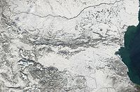
More than two-thirds of the country is plains, plateaus, or hilly land at an altitude less than 600 m. Plains (below 200 m) make up 31 % of the land, plateaus and hills (200 to 600 m) 41 %, low mountains (600 to 1,000 m) 10 %, medium-sized mountains (1,000 to 1,500 m) 10 %, and high mountains (over 1,500 m) 3 %. The average altitude in Bulgaria is 470 m.
The contemporary relief of the country is a result of continuous geological evolution. Due to that evolution there are magmatic, sedimentary and metamorphic rocks of different origin, age and composition. Their formation began more than 500 million years ago during the Precambrian
Precambrian
The Precambrian is the name which describes the large span of time in Earth's history before the current Phanerozoic Eon, and is a Supereon divided into several eons of the geologic time scale...
and continues till now. The Bulgarian lands were often submerged by ancient seas and lakes, some land layers rose others sank. Volcanic eruptions were common both on land and in the water basins.
Danubian plain
The Danubian Plain extends from the western borders to the Black Sea. It encompasses the area between the DanubeDanube
The Danube is a river in the Central Europe and the Europe's second longest river after the Volga. It is classified as an international waterway....
River, which forms most of the country's northern border, and Stara Planina to the south. It covers the Moesian plate. As a result of the rock weathering processes the relief is uneaven with flat rising grounds along the valleys and plateaus to the east. The plateau slopes gently from cliffs along the river, then it abuts into the low northern mountains of the Balkan range. The highest point is Tarnov Dyal (502 m) in the Shumen Plateau. The valleys of Vit
Vit
The Vit also Vid is a river in central northern Bulgaria with a length of 18 km. It is a tributary of Danube. The source of the Vit is in Stara Planina, below Vezhen Peak at an altitude of 2,030 m, and it empties into the Danube close to Somovit...
and Yantra
Yantra River
The Yantra is a river in northern Bulgaria, a right tributary of the Danube. It is 285 km long and has a watershed of 7,862 km²....
divide the Danubian plain into three parts - western, central and eastern. The altitude rises from west to east. To the north the plain has steep shores along the Danube or forms fertile alluvial plain
Alluvial plain
An alluvial plain is a relatively flat landform created by the deposition of sediment over a long period of time by one or more rivers coming from highland regions, from which alluvial soil forms...
s (Vidinska, Chernopolska, Belenska, Pobrezhie, Aidemirska).
Hilly heights and plateaus are typical for the topography of plain. Most of the heights and all plateaus are situated into the eastern parts. There are 14 basalt
Basalt
Basalt is a common extrusive volcanic rock. It is usually grey to black and fine-grained due to rapid cooling of lava at the surface of a planet. It may be porphyritic containing larger crystals in a fine matrix, or vesicular, or frothy scoria. Unweathered basalt is black or grey...
mounds between Svishtov
Svishtov
Svishtov is a town in northern Bulgaria, located in Veliko Tarnovo Province on the right bank of the Danube river opposite the Romanian town of Zimnicea. It is the administrative centre of the homonymous Svishtov Municipality...
and the village of Dragomirovo
Dragomirovo
Dragomirovo is the name of the following settlements:*Dragomirovo, Pernik Province, Bulgaria*Dragomirovo, Veliko Tarnovo Province, Bulgaria*Dragomirovo, Tajikistan, in Sughd province...
.
Stara Planina
The southern edge of the Danubian Plain blends into the foothills of Stara Planina, sometimes thought of as the Bulgarian part of the Carpathian MountainsCarpathian Mountains
The Carpathian Mountains or Carpathians are a range of mountains forming an arc roughly long across Central and Eastern Europe, making them the second-longest mountain range in Europe...
. The Carpathians resemble a reversed S as they run eastward from the Czech Republic and Slovakia
Slovakia
The Slovak Republic is a landlocked state in Central Europe. It has a population of over five million and an area of about . Slovakia is bordered by the Czech Republic and Austria to the west, Poland to the north, Ukraine to the east and Hungary to the south...
across the northern portion of Romania, swinging southward to the middle of Romania and then running westward, where they are known as the Transylvanian Alps. The mountains turn eastward again at the Iron Gate
Iron Gate
Iron Gate can refer to* Gates of Alexander, iron gates built by Alexander the Great* Iron Gates , a pass through the Bibans mountains in Algeria* Iron Gate Pass, a gorge in central Xinjiang, People's Republic of China...
, a gorge of the Danube River at the Romanian-Serbian border. At that point, they become Stara Planina of Bulgaria.
Stara Planina originates at the Timok Valley in Serbia
Serbia
Serbia , officially the Republic of Serbia , is a landlocked country located at the crossroads of Central and Southeast Europe, covering the southern part of the Carpathian basin and the central part of the Balkans...
and run southward towards the Sofia Basin in west central Bulgaria. From there they run east to the Black Sea. The Balkans are about 600 km long and 30 to 50 km wide. They retain their height well into central Bulgaria, where Botev Peak
Botev Peak
Botev Peak is, at 2,376 m above sea level, the highest peak of the Balkan Mountains. It is located close to the geographic centre of Bulgaria, and is part of the Central Balkan National Park....
, the highest point in the Balkan Mountains, rises to about 2,376 m. The range then continues at lower altitude to the cliffs of the Black Sea. Through most of Bulgaria, the Balkans form the watershed from which rivers drain north to the Danube River or south to the Aegean Sea
Aegean Sea
The Aegean Sea[p] is an elongated embayment of the Mediterranean Sea located between the southern Balkan and Anatolian peninsulas, i.e., between the mainlands of Greece and Turkey. In the north, it is connected to the Marmara Sea and Black Sea by the Dardanelles and Bosporus...
. Some smaller rivers in the east drain directly to the Black Sea. The Sredna Gora
Sredna Gora
Sredna Gora is a mountain range in central Bulgaria, situated south of and parallel to Balkan mountain range and extending from the river Iskar to the west and the elbow of Tundzha north of Yambol to the east. Sredna Gora is 285 km long, reaching 50 km at its greatest width...
is a narrow ridge about 160 km long and 1,600 m high, running east to west parallel to the Balkans. Nested between both ranges is the Rose Valley
Rose Valley
Rose Valley may refer to:* Rose Valley, Bulgaria* Rose Valley, Chişinău* Rose Valley, India* Rose Valley, New South Wales , Australia* Rose Valley, New South Wales , Australia* Rose Valley , United States of America...
, famous for rose oil used in perfume and liqueurs.
Subbalkan Valleys and Thracian Plain
The southern slopes of the Balkan Mountains and the Sredna Gora give way to the Thracian Plain and the Sofia Basin. Roughly triangular in shape, the Thracian Plain originates at a point east of the mountains near SofiaSofia
Sofia is the capital and largest city of Bulgaria and the 12th largest city in the European Union with a population of 1.27 million people. It is located in western Bulgaria, at the foot of Mount Vitosha and approximately at the centre of the Balkan Peninsula.Prehistoric settlements were excavated...
and broadens eastward to the Black Sea. It includes the Maritsa
Maritsa
The Maritsa or Evros , ) is, with a length of 480 km, the longest river that runs solely in the interior of the Balkans. It has its origin in the Rila Mountains in Western Bulgaria, flowing southeast between the Balkan and Rhodope Mountains, past Plovdiv and Parvomay to Edirne, Turkey...
valley and the lowlands that extend from the river to the Black Sea. Like the Danubian Plateau, much of the Thracian Plain is somewhat hilly and not a true plain. Most of its terrain is moderate enough to cultivate.
The largest basin in Bulgaria is the Sofia Basin. About 24 km wide and 96 km long, the basin contains the capital city and the area immediately surrounding it. The route through basins and valleys from Belgrade
Belgrade
Belgrade is the capital and largest city of Serbia. It is located at the confluence of the Sava and Danube rivers, where the Pannonian Plain meets the Balkans. According to official results of Census 2011, the city has a population of 1,639,121. It is one of the 15 largest cities in Europe...
to Istanbul
Istanbul
Istanbul , historically known as Byzantium and Constantinople , is the largest city of Turkey. Istanbul metropolitan province had 13.26 million people living in it as of December, 2010, which is 18% of Turkey's population and the 3rd largest metropolitan area in Europe after London and...
(formerly Constantinople
Constantinople
Constantinople was the capital of the Roman, Eastern Roman, Byzantine, Latin, and Ottoman Empires. Throughout most of the Middle Ages, Constantinople was Europe's largest and wealthiest city.-Names:...
) via Sofia has been historically important since Roman times
Ancient Rome
Ancient Rome was a thriving civilization that grew on the Italian Peninsula as early as the 8th century BC. Located along the Mediterranean Sea and centered on the city of Rome, it expanded to one of the largest empires in the ancient world....
, determining the strategic significance of the Balkan Peninsula. Bulgaria's largest cities were founded on this route. Paradoxically, although the mountains made many Bulgarian villages and towns relatively inaccessible, Bulgaria has always been susceptible to invasion because no natural obstacle blocked the route through Sofia.
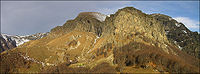
Rilo-Rhodope massif
Relatively high mountains occupy the area between the Thracian Plain and Sofia Basin and the Greek border to the south. The western parts consist of three ranges: the Vitosha Mountain south of SofiaSofia
Sofia is the capital and largest city of Bulgaria and the 12th largest city in the European Union with a population of 1.27 million people. It is located in western Bulgaria, at the foot of Mount Vitosha and approximately at the centre of the Balkan Peninsula.Prehistoric settlements were excavated...
, the Rila Mountains
Rila
Rila is a mountain range in southwestern Bulgaria and the highest mountain range of Bulgaria and the Balkans, with its highest peak being Musala at 2,925 m...
further south, and the Pirin Mountains in the southwestern corner of the country. They are the most outstanding topographic feature of Bulgaria and of the entire Balkan Peninsula. The Rila range includes Mount Musala, whose 2,925-metre peak is the highest in any Balkan country. About a dozen other peaks in Rila are over 2,600 meters. The highest peaks are characterized by sparse bare rocks and remote lakes above the tree line. The lower peaks, however, are covered with alpine meadows that give the range an overall impression of green beauty. The Pirin range is characterized by rocky peaks and stony slopes. Its highest peak is Mount Vihren
Vihren
Vihren is the highest peak of Bulgaria's Pirin Mountains. Reaching 2914 m, it is Bulgaria's second and the Balkans' third highest, after Musala and Mount Olympus. The peak is located in Pirin's northern parts. The easiest route is from the Vihren chalet , reaching the summit from the south...
, at 2,915 meters the second-highest peak in Bulgaria. Further east are the extensive Rhodope Mountains
Rhodope Mountains
The Rhodopes are a mountain range in Southeastern Europe, with over 83% of its area in southern Bulgaria and the remainder in Greece. Its highest peak, Golyam Perelik , is the seventh highest Bulgarian mountain...
.
A significant part of Bulgaria's land is prone to earthquakes. Two especially sensitive areas are the borders of the North Bulgarian Swell (rounded elevation), the center of which is in the Gorna Oryahovitsa
Gorna Oryahovitsa
Gorna Oryahovitsa is a town in northern Bulgaria, situated in Veliko Tarnovo Province, not far from the city of Veliko Tarnovo. It is the administrative centre of the homonymous Gorna Oryahovitsa Municipality...
area in north-central Bulgaria, and the West Rhodopes Vault, a wide area extending through the Rila and northern Pirin regions to Plovdiv
Plovdiv
Plovdiv is the second-largest city in Bulgaria after Sofia with a population of 338,153 inhabitants according to Census 2011. Plovdiv's history spans some 6,000 years, with traces of a Neolithic settlement dating to roughly 4000 BC; it is one of the oldest cities in Europe...
in south-central Bulgaria. Especially strong tremors also occur along diagonal lines running between Skopje
Skopje
Skopje is the capital and largest city of the Republic of Macedonia with about a third of the total population. It is the country's political, cultural, economic, and academic centre...
in the Republic of Macedonia and Razgrad
Razgrad
Razgrad is a city in northeastern Bulgaria, administrative and industrial centre of the homonymous Razgrad Province. As of February 2011, it has a population of 33,238 inhabitants.-History:...
in northeast Bulgaria, and from Albania
Albania
Albania , officially known as the Republic of Albania , is a country in Southeastern Europe, in the Balkans region. It is bordered by Montenegro to the northwest, Kosovo to the northeast, the Republic of Macedonia to the east and Greece to the south and southeast. It has a coast on the Adriatic Sea...
eastward across the southern third of Bulgaria through Plovdiv. Sixteen major earthquakes struck Bulgaria between 1900 and 1986, the last two in Strazhitsa
Strazhitsa
Strazhitsa is a town in northeastern Bulgaria, part of Veliko Tarnovo Province. It is the administrative centre of the homonymous Strazhitsa Municipality, which lies in the eastern part of the Province. The town is located in the central Danubian Plain, not far from the Balkan Mountains, 45...
on the Skopje-Razgrad fault line. Together the two quakes damaged over 16,000 buildings, half of them severely. One village was almost completely leveled, others badly damaged. Many inhabitants were still living in temporary housing four years later.
Hydrography
Bulgaria has a dense network of about 540 rivers, but with the notable exception of the DanubeDanube
The Danube is a river in the Central Europe and the Europe's second longest river after the Volga. It is classified as an international waterway....
, most have short lengths and low water-levels.
Most rivers flow through mountainous areas; fewer in the Danubian Plain, Upper Thracian Plain
Upper Thracian Plain
The Upper Thracian Plain constitutes the northern part of the historical region of Thrace. It is located in southern Bulgaria, between the Sredna Gora mountains to the north and west; the Rhodopes, Sakar and Strandzha to the south; and the Black Sea to the east. A fertile agricultural region, the...
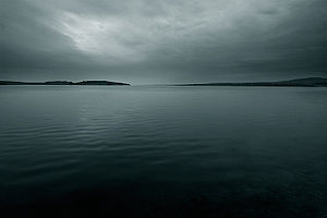
and especially Dobrudzha. Two catchment basins exist: the Black Sea
Black Sea
The Black Sea is bounded by Europe, Anatolia and the Caucasus and is ultimately connected to the Atlantic Ocean via the Mediterranean and the Aegean seas and various straits. The Bosphorus strait connects it to the Sea of Marmara, and the strait of the Dardanelles connects that sea to the Aegean...
(57% of the territory and 42% of the rivers) and the Aegean Sea
Aegean Sea
The Aegean Sea[p] is an elongated embayment of the Mediterranean Sea located between the southern Balkan and Anatolian peninsulas, i.e., between the mainlands of Greece and Turkey. In the north, it is connected to the Marmara Sea and Black Sea by the Dardanelles and Bosporus...
(43% of the territory and 58% of the rivers) basins. The longest river located solely in Bulgarian territory, the Iskar River, has a length of 368 km (229 mi). Other major rivers include the Struma
Struma River
The Struma or Strymónas is a river in Bulgaria and Greece. Its ancient name was Strymōn . Its catchment area is 10,800 km²...
and the Maritsa River
Maritsa
The Maritsa or Evros , ) is, with a length of 480 km, the longest river that runs solely in the interior of the Balkans. It has its origin in the Rila Mountains in Western Bulgaria, flowing southeast between the Balkan and Rhodope Mountains, past Plovdiv and Parvomay to Edirne, Turkey...
in the south.
The Balkan Mountains
Balkan Mountains
The Balkan mountain range is a mountain range in the eastern part of the Balkan Peninsula. The Balkan range runs 560 km from the Vrashka Chuka Peak on the border between Bulgaria and eastern Serbia eastward through central Bulgaria to Cape Emine on the Black Sea...
divide Bulgaria into two nearly equal drainage systems
Drainage system (Geomorphology)
In geomorphology, a drainage system is the pattern formed by the streams, rivers, and lakes in a particular drainage basin. They are governed by the topography of the land, whether a particular region is dominated by hard or soft rocks, and the gradient of the land. Geomorphologists and...
. The larger system drains northward to the Black Sea
Black Sea
The Black Sea is bounded by Europe, Anatolia and the Caucasus and is ultimately connected to the Atlantic Ocean via the Mediterranean and the Aegean seas and various straits. The Bosphorus strait connects it to the Sea of Marmara, and the strait of the Dardanelles connects that sea to the Aegean...
, mainly by way of the Danube River. This system includes the entire Danubian Plateau and a stretch of land running forty-eight to eighty kilometers inland from the coastline. The second system drains the Thracian Plain and most of the higher lands of the south and southwest to the Aegean Sea
Aegean Sea
The Aegean Sea[p] is an elongated embayment of the Mediterranean Sea located between the southern Balkan and Anatolian peninsulas, i.e., between the mainlands of Greece and Turkey. In the north, it is connected to the Marmara Sea and Black Sea by the Dardanelles and Bosporus...
. Although only the Danube is navigable, many of the other rivers and streams in Bulgaria have a high potential for the production of hydroelectric power and are sources of irrigation water.
The Danube gets slightly more than 4 % of its total volume from its Bulgarian tributaries. As it flows along the northern border, the Danube averages 1.6 to 2.4 kilometers in width. The river's highest water levels usually occur during June floods; it is frozen over an average of forty days per year.
Several major rivers flow directly to the Aegean Sea
Aegean Sea
The Aegean Sea[p] is an elongated embayment of the Mediterranean Sea located between the southern Balkan and Anatolian peninsulas, i.e., between the mainlands of Greece and Turkey. In the north, it is connected to the Marmara Sea and Black Sea by the Dardanelles and Bosporus...
. Most of these streams fall swiftly from the mountains and have cut deep, scenic gorges. Maritsa
Maritsa
The Maritsa or Evros , ) is, with a length of 480 km, the longest river that runs solely in the interior of the Balkans. It has its origin in the Rila Mountains in Western Bulgaria, flowing southeast between the Balkan and Rhodope Mountains, past Plovdiv and Parvomay to Edirne, Turkey...
with its tributaries is by far the largest draining all of the western Thracian Plain, all of the Sredna Gora
Sredna Gora
Sredna Gora is a mountain range in central Bulgaria, situated south of and parallel to Balkan mountain range and extending from the river Iskar to the west and the elbow of Tundzha north of Yambol to the east. Sredna Gora is 285 km long, reaching 50 km at its greatest width...
, the southern slopes of the Balkan Mountains, and the northern slopes of the eastern Rhodopes. After it leaves Bulgaria, the Maritsa forms most of the Greek-Turkish border. Struma
Struma
The Struma was a ship chartered to carry Jewish refugees from Axis-allied Romania to British-controlled Palestine during World War II. On February 23, 1942, with its engine inoperable and its refugee passengers aboard, Turkish authorities towed the ship from Istanbul harbor through the Bosphorus...
and the Mesta
Mesta River
The Nestos or Mesta , formerly the Mesta Karasu , is a river in Bulgaria and Greece. It rises in the Rila Mountains and flows into the Aegean Sea near the island of Thasos. It plunges down towering canyons toward the Aegean Sea through mostly metamorphic formations...
(which separate the Pirin Mountains from the main Rhodopes ranges) are the next largest Bulgarian rivers flowing to the Aegean. Struma and Mesta reach the sea through Greece.
The Rila and Pirin mountain ranges feature around 260 glacial lakes; the country also has several large lakes on the Black Sea coast and more than 2,200 dam lakes. Many mineral springs exist, located mainly in the south-western and central parts of the country along the faults between the mountains.
The Bulgarian word for spa, баня, transliterated as banya, appears in some of the names of more than 50 spa town
Spa town
A spa town is a town situated around a mineral spa . Patrons resorted to spas to "take the waters" for their purported health benefits. The word comes from the Belgian town Spa. In continental Europe a spa was known as a ville d'eau...
s and resorts including Sapareva Banya
Sapareva Banya
Sapareva Banya is a town in southwestern Bulgaria, part of Kyustendil Province. It is located at the north foot of the Rila mountain 15 km east of Dupnitsa...
, Hisarya
Hisarya, Bulgaria
Hisarya is a small resort town in Bulgaria, in Plovdiv Province.Located in the outskirts of the Sredna Gora mountain range, it boasts of a very mild climate and over two dozen different mineral springs, which make it a favorite spa for many Bulgarian and foreign tourists.The town's population is...
, Sandanski
Sandanski
-Municipality:Sandanski is the seat of Sandanski municipality , which includes the following 54 places:-Honour:Sandanski Point on Livingston Island in the South Shetland Islands, Antarctica is named after the town of Sandanski....
, Bankya
Bankya
Bankya is an upscale town and district in western Bulgaria. It is administratively part of greater Sofia.The district is famous for the mineral springs and baths that have been used for their medicinal properties for hundreds of years. Prime Minister of Bulgaria Boyko Borisov is a native...
, Varshets
Varshets
Varshets is a spa town in Montana Province, northwestern Bulgaria. It is the administrative centre of the homonymous Varshets Municipality. As of December 2009, its population is 6,538. The town is located on the northern slopes of the western part of the Balkan mountains in the small valley of...
, Pavel Banya
Pavel Banya
Pavel Banya is a small town in Stara Zagora Province, South-central Bulgaria, located between the towns of Kalofer and Kazanlak. It is the administrative centre of the homonymous Pavel Banya Municipality. As of December 2009, the town has a population of 2,918 inhabitants...
, Devin
Devin, Bulgaria
Devin is a town in Smolyan Province in the far south of Bulgaria. It is the administrative centre of the homonymous Devin Municipality. As of December 2009, the town has a population of 7,054 inhabitants.-Location and geography:...
, Velingrad
Velingrad
Velingrad is a town in Pazardzhik Province, Southern Bulgaria, located at the western end of Chepino Valley, part of the Rhodope Mountains. It is the administrative center of the homonymous Velingrad Municipality and one of the most popular Bulgarian balneological resorts...
and many others.
Climate
Continental climate
Continental climate is a climate characterized by important annual variation in temperature due to the lack of significant bodies of water nearby...
and Mediterranean
Mediterranean climate
A Mediterranean climate is the climate typical of most of the lands in the Mediterranean Basin, and is a particular variety of subtropical climate...
climatic zones. Bulgarian mountains and valleys act as barriers or channels for air masses, causing sharp contrasts in weather over relatively short distances. The continental zone is predominant, because continental air masses flow easily into the unobstructed Danubian Plain
Danubian Plain
Danubian Plain can be a translation of:*the approximate Serbian name for the Serbian part of the Pannonian plain, see Danubian Plain...
. The continental influence, stronger during the winter, produces abundant snowfalls; the Mediterranean influence increases during the second half of summer and produces hot and dry weather. The barrier effect of the Balkan Mountains is felt throughout the country: on the average, northern Bulgaria is about one degree cooler and receives about 192 millimetres (7.6 in) more rain than lowlands of southern Bulgaria. Because the Black Sea
Black Sea
The Black Sea is bounded by Europe, Anatolia and the Caucasus and is ultimately connected to the Atlantic Ocean via the Mediterranean and the Aegean seas and various straits. The Bosphorus strait connects it to the Sea of Marmara, and the strait of the Dardanelles connects that sea to the Aegean...
is too small to be a primary influence over much of the country's weather, it only affects the immediate area along its coastline.
The Balkan Mountains
Balkan Mountains
The Balkan mountain range is a mountain range in the eastern part of the Balkan Peninsula. The Balkan range runs 560 km from the Vrashka Chuka Peak on the border between Bulgaria and eastern Serbia eastward through central Bulgaria to Cape Emine on the Black Sea...
are the northern boundary of the area in which continental air masses circulate freely. The Rhodope
Rhodope
Rhodope may mean:* Queen Rhodope, a figure of Greek mythology* Rhodope Mountains, in Bulgaria and Greece* Rhodope Prefecture, of Greece* Rhodope * 166 Rhodope, an asteroid...
Mountains mark the northern limits of domination by Mediterranean weather systems. The area between, which includes the Northern Thracian Plain, is influenced by a combination of the two systems, with the continental predominating. This combination produces a plains climate resembling that of the Corn Belt
Corn Belt
The Corn Belt is a region of the Midwestern United States where corn has, since the 1850s, been the predominant crop, replacing the native tall grasses. By 1950, 99% of the corn was grown from hybrids. Most corn is fed to livestock, especially hogs and poultry. In recent decades soybeans have...
in the United States, with long summers and high humidity. The climate in this region is generally more severe than that of other parts of Europe in the same latitude. Because it is a transitional area, average temperatures and precipitation are erratic and may vary widely from year to year.
Average precipitation
Precipitation (meteorology)
In meteorology, precipitation In meteorology, precipitation In meteorology, precipitation (also known as one of the classes of hydrometeors, which are atmospheric water phenomena is any product of the condensation of atmospheric water vapor that falls under gravity. The main forms of precipitation...
in Bulgaria is about 630 millimetres (24.8 in) per year. Dobrudja in the northeast, the Black Sea coastal area, and small part of the Northern Thracian Plain usually receive less than 500 millimetres. The remainder of the Northern Thracian Plain and the Danubian Plateau get less than the country average; the Northern Thracian Plain is often subject to summer droughts. Higher elevations, which receive the most rainfall in the country, may average over 2540 millimetres (100 in) per year.
The many valley basins scattered through the uplands have temperature inversions resulting in stagnant air. Sofia is located in such a basin, but its elevation (about 530 metres (1,739 ft)) tends to moderate summer temperature and relieve oppressive high humidity. Sofia is also sheltered from the northern European winds by the mountains that surround its troughlike basin. Temperatures in Sofia
Sofia
Sofia is the capital and largest city of Bulgaria and the 12th largest city in the European Union with a population of 1.27 million people. It is located in western Bulgaria, at the foot of Mount Vitosha and approximately at the centre of the Balkan Peninsula.Prehistoric settlements were excavated...
average -3 °C in January and about 28 °C (82.4 °F) in August. The city's rainfall is near the country average, and the overall climate is pleasant.
In summer, temperatures in the southest Bulgaria often exceed 40 °C (104 °F) but remain cooler by the coast. The town of Sadovo
Sadovo
Sadovo is a small town in the Plovdiv Province, central Bulgaria. The population is 2 551. Most of the people are employed in agriculture, which due to the fertile soils and the high levels of mechanisation is efficient and highly productive. Major crops are apples, tomatoes, peppers, wheat,...
, near Plovdiv
Plovdiv
Plovdiv is the second-largest city in Bulgaria after Sofia with a population of 338,153 inhabitants according to Census 2011. Plovdiv's history spans some 6,000 years, with traces of a Neolithic settlement dating to roughly 4000 BC; it is one of the oldest cities in Europe...
, has recorded the highest known temperature: 45.2 °C (113.4 °F). The recorded absolute minimum temperature of -39.3 °C occurred west of Sofia, near the town of Trun
Tran, Bulgaria
Tran |thorn]]") is a small town in Pernik Province, western Bulgaria. It is 27 kilometres away from the town of Breznik and 15 km from the border with Serbia....
. The usual temperature around the Stara Planina region averages 10 °C (50 °F) to 15 °C (59 °F).
The highest mountains – over 900 or above sea-level – have an alpine climate. The lowest parts of the Struma and Maritza river valleys are subjected to subtropical (Mediterranean) influence, as are the Eastern Rhodope or Low Rhodope mountains. The extreme south-west part of Bulgaria (near the towns of Sandanski
Sandanski
-Municipality:Sandanski is the seat of Sandanski municipality , which includes the following 54 places:-Honour:Sandanski Point on Livingston Island in the South Shetland Islands, Antarctica is named after the town of Sandanski....
and Petrich
Petrich
Petrich is a town in Blagoevgrad Province in southwestern Bulgaria, located at the foot of the Belasica Mountains in the Strumeshnitsa Valley. , the town has 29920 inhabitants.Petrich is located close to the borders with Greece and the Republic of Macedonia...
) has one of the warmest climates in the country.
The coastal climate is moderated by the Black Sea, but strong winds and violent local storms are frequent during the winter. Winters along the Danube
Danube
The Danube is a river in the Central Europe and the Europe's second longest river after the Volga. It is classified as an international waterway....
River are bitterly cold, while sheltered low valleys opening to the south along the Greek and Turkish borders may be as mild as areas along the Mediterranean or Aegean coasts.
Environment
Like other former European members of the Council for Mutual Economic Assistance, Bulgaria saw unimpeded industrial growth as a vital sign of social welfare and progress toward the socialist ideal. Because this approach made environmental issues a taboo subject in socialist Bulgaria, the degree of damage by postwar industrial policy went unassessed until the government of Todor ZhivkovTodor Zhivkov
Todor Khristov Zhivkov was a communist politician and leader of the People's Republic of Bulgaria from March 4, 1954 until November 10, 1989....
(1962–1989) was overthrown in late 1989. The Zhivkov government's commitment to heavy industry and lack of money to spend on protective measures forced it to conceal major environmental hazards, especially when relations with other countries were at stake. Factories that did not meet environmental standards paid symbolic fines and had no incentive to institute real environmental protection measures.
In 1991 Bulgarian environmentalists estimated that 60 % of the country's agricultural land was damaged by excessive use of pesticides and fertilizers and by industrial fallout. In 1991 two thirds of Bulgarian rivers were polluted, and the Yantra River
Yantra River
The Yantra is a river in northern Bulgaria, a right tributary of the Danube. It is 285 km long and has a watershed of 7,862 km²....
was classified as the dirtiest river in Europe. By that time, about two-thirds of the primary forests had been cut. However, despite its recognition of the need for greater environmental protection, Bulgaria budgeted only 10.4 billion leva
Bulgarian lev
The lev is the currency of Bulgaria. It is divided in 100 stotinki . In archaic Bulgarian the word "lev" meant "lion".It is speculated that Bulgaria, as a member of the European Union will adopt the Euro in 2015 .- First lev, 1881–1952 :...
.
Perhaps the most serious environmental problem in Bulgaria was in the Danube port city of Rousse
Rousse
Ruse is the fifth-largest city in Bulgaria. Ruse is situated in the northeastern part of the country, on the right bank of the Danube, opposite the Romanian city of Giurgiu, from the capital Sofia and from the Bulgarian Black Sea Coast...
. From 1981 to 1989, the chemical pollution that spread from a chlorine
Chlorine
Chlorine is the chemical element with atomic number 17 and symbol Cl. It is the second lightest halogen, found in the periodic table in group 17. The element forms diatomic molecules under standard conditions, called dichlorine...
and sodium
Sodium
Sodium is a chemical element with the symbol Na and atomic number 11. It is a soft, silvery-white, highly reactive metal and is a member of the alkali metals; its only stable isotope is 23Na. It is an abundant element that exists in numerous minerals, most commonly as sodium chloride...
plant across the Danube in Giurgiu
Giurgiu
Giurgiu is the capital city of Giurgiu County, Romania, in the Greater Wallachia. It is situated amid mud-flats and marshes on the left bank of the Danube facing the Bulgarian city of Rousse on the opposite bank. Three small islands face the city, and a larger one shelters its port, Smarda...
, Romania, was a forbidden subject in Bulgaria because it posed a threat to good relations between two Warsaw Pact countries. Chemical plants in Rousse also contributed to the pollution. Citizen environmentalists opposing the situation in Rousse organized the first demonstrations and the first independent political group to oppose the Zhivkov regime. During the Giurgiu plant's first year of operation, chlorine levels in Rousse almost doubled, reaching two times the permissible maximum in the summer of 1990. Over 3,000 families left the city in the 1980s despite government restrictions aimed at covering up the problem. Besides chlorine and its byproducts, the plant produced chemical agents for the rubber industry, and in 1991 some sources reported that the plant was processing industrial waste from Western countries—both activities likely to further damage Rousse's environment. International experts claimed that half of Rousse's pollutants came from Giurgiu, and the others came from Bulgarian industries. In response to the formidable Bulgarian environmental movement, some Bulgarian plants have been closed or have added protective measures; the Giurgiu plant, however, was planning to expand in 1991.
Pollution of agricultural land from a copper plant near the town of Srednogorie
Pirdop
Pirdop is a town located in South-West Bulgaria of Sofia Province in the southeastern part of the Zlatitsa - Pirdop Valley at 670 m above sea level. It is surrounded by the Balkan Range to the north, Sredna Gora Mountain to the south, and Koznitsa and Galabets saddles to the east and west,...
provoked harsh public criticism. The plant emitted toxic clouds containing copper
Copper
Copper is a chemical element with the symbol Cu and atomic number 29. It is a ductile metal with very high thermal and electrical conductivity. Pure copper is soft and malleable; an exposed surface has a reddish-orange tarnish...
, lead
Lead
Lead is a main-group element in the carbon group with the symbol Pb and atomic number 82. Lead is a soft, malleable poor metal. It is also counted as one of the heavy metals. Metallic lead has a bluish-white color after being freshly cut, but it soon tarnishes to a dull grayish color when exposed...
, and arsenic
Arsenic
Arsenic is a chemical element with the symbol As, atomic number 33 and relative atomic mass 74.92. Arsenic occurs in many minerals, usually in conjunction with sulfur and metals, and also as a pure elemental crystal. It was first documented by Albertus Magnus in 1250.Arsenic is a metalloid...
. In 1988 it released toxic wastewater into nearby rivers used to irrigate land in the Plovdiv-Pazardzhik
Pazardzhik
Pazardzhik is a city situated along the banks of the Maritsa river, Southern Bulgaria. It is the capital of Pazardzhik Province and centre for the homonymous Pazardzhik Municipality...
Plain, which includes some of Bulgaria's best agricultural land. The groundwater beneath the plain also was poisoned. Work has begun on a plan to drain toxic wastewater from the plant's reservoir into the Maritsa River. Environmental improvements for the copper plant and three other factories in the Plovdiv area (a lead and zinc factory, a chemical factory, and a uranium factory) also were planned, but they would take years to implement.
None of Bulgaria's large cities escaped serious environmental pollution. Statistics showed that 70 to 80 % of Sofia's air pollution is caused by emissions from cars, trucks, and buses. Temperature inversions over the city aggravated the problem. Two other major polluters, the Kremikovtzi AD
Kremikovtzi AD
Kremikovtzi AD is Bulgaria's largest metalworking company. The construction of its facilities began on 5 November 1960 and the first production capacities were put into operation in 1963 to produce cast iron and coke, with production extending to cover other areas in the 1960s and 1970s...
Metallurgy Works and the Buhovo
Buhovo
Bukhovo is a town in Western Bulgaria. It is located in Sofia city and is close to the capital Sofia....
uranium
Uranium
Uranium is a silvery-white metallic chemical element in the actinide series of the periodic table, with atomic number 92. It is assigned the chemical symbol U. A uranium atom has 92 protons and 92 electrons, of which 6 are valence electrons...
mine (both in southwestern Bulgaria), contaminated the region with lead, sulfur dioxide
Sulfur dioxide
Sulfur dioxide is the chemical compound with the formula . It is released by volcanoes and in various industrial processes. Since coal and petroleum often contain sulfur compounds, their combustion generates sulfur dioxide unless the sulfur compounds are removed before burning the fuel...
, hydrogen sulfide
Hydrogen sulfide
Hydrogen sulfide is the chemical compound with the formula . It is a colorless, very poisonous, flammable gas with the characteristic foul odor of expired eggs perceptible at concentrations as low as 0.00047 parts per million...
, ethanol
Ethanol
Ethanol, also called ethyl alcohol, pure alcohol, grain alcohol, or drinking alcohol, is a volatile, flammable, colorless liquid. It is a psychoactive drug and one of the oldest recreational drugs. Best known as the type of alcohol found in alcoholic beverages, it is also used in thermometers, as a...
, and mercury
Mercury (element)
Mercury is a chemical element with the symbol Hg and atomic number 80. It is also known as quicksilver or hydrargyrum...
. The city of Kardzhali
Kardzhali
Kardzhali or Kurdzhali is a town in Bulgaria, capital of Kardzhali Province in the Eastern Rhodopes. Near the town is the noted Kardzhali Dam.-Geography:...
became heavily polluted with lead from its lead and zinc complex. In 1973 the petroleum and chemical plant near the Black Sea port of Burgas
Burgas
-History:During the rule of the Ancient Romans, near Burgas, Debeltum was established as a military colony for veterans by Vespasian. In the Middle Ages, a small fortress called Pyrgos was erected where Burgas is today and was most probably used as a watchtower...
released large amounts of chlorine in an incident similar to the one in Srednogorie. Environmentalists estimated that the area within a thirty-kilometer radius of the plant was rendered uninhabitable by that release. The air in Burgas was also heavily polluted with carbon and sulfur dioxide in 1990.
In 1990 environmental scientists claimed that two-thirds of Bulgaria's population suffered from the polluted environment to some degree. In 1991 Bulgaria began seeking international assistance in solving environmental problems. Besides joining Romania, Turkey, and Russia in joint scientific studies of the critically polluted Black Sea, Bulgaria actively sought environmental technology and expertise from Western Europe
Western Europe
Western Europe is a loose term for the collection of countries in the western most region of the European continents, though this definition is context-dependent and carries cultural and political connotations. One definition describes Western Europe as a geographic entity—the region lying in the...
and the United States.
Political geography
Bulgaria's political geography has changed greatly since the restoration of statehood in 1878. Russia, whose military victories had led to its creation, pushed for a "big Bulgaria" that would include much of MacedoniaMacedonia (region)
Macedonia is a geographical and historical region of the Balkan peninsula in southeastern Europe. Its boundaries have changed considerably over time, but nowadays the region is considered to include parts of five Balkan countries: Greece, the Republic of Macedonia, Bulgaria, Albania, Serbia, as...
. At the Congress of Berlin, however, the powers insisted upon a much reduced area, divided until 1885 between the principalities of Bulgaria proper and Eastern Rumelia
Eastern Rumelia
Eastern Rumelia or Eastern Roumelia was an administratively autonomous province in the Ottoman Empire and Principality of Bulgaria from 1878 to 1908. It was under full Bulgarian control from 1885 on, when it willingly united with the tributary Principality of Bulgaria after a bloodless revolution...
.
An independent kingdom from 1908 to 1946 and thereafter a republic, Bulgaria sought to expand its territory in the two Balkan Wars
Balkan Wars
The Balkan Wars were two conflicts that took place in the Balkans in south-eastern Europe in 1912 and 1913.By the early 20th century, Montenegro, Bulgaria, Greece and Serbia, the countries of the Balkan League, had achieved their independence from the Ottoman Empire, but large parts of their ethnic...
of 1912-13 and in World Wars I
World War I
World War I , which was predominantly called the World War or the Great War from its occurrence until 1939, and the First World War or World War I thereafter, was a major war centred in Europe that began on 28 July 1914 and lasted until 11 November 1918...
and II
World War II
World War II, or the Second World War , was a global conflict lasting from 1939 to 1945, involving most of the world's nations—including all of the great powers—eventually forming two opposing military alliances: the Allies and the Axis...
. Defeat in the last three conflicts led to a large loss of territory in 1913 and 1919, though the 1940 recovery of the Southern Dobruja
Southern Dobruja
Southern Dobruja is an area of north-eastern Bulgaria comprising the administrative districts named for its two principal cities of Dobrich and Silistra...
was confirmed by the Paris Peace Treaty
Paris Peace Treaties, 1947
The Paris Peace Conference resulted in the Paris Peace Treaties signed on February 10, 1947. The victorious wartime Allied powers negotiated the details of treaties with Italy, Romania, Hungary, Bulgaria, and Finland .The...
of 1947.
Natural hazards:
earthquakes, landslides
Environment - current issues:
air pollution from industrial emissions; rivers polluted from raw sewage, heavy metals, detergents; deforestation
Deforestation
Deforestation is the removal of a forest or stand of trees where the land is thereafter converted to a nonforest use. Examples of deforestation include conversion of forestland to farms, ranches, or urban use....
; forest damage from air pollution and resulting acid rain
Acid rain
Acid rain is a rain or any other form of precipitation that is unusually acidic, meaning that it possesses elevated levels of hydrogen ions . It can have harmful effects on plants, aquatic animals, and infrastructure. Acid rain is caused by emissions of carbon dioxide, sulfur dioxide and nitrogen...
; soil contamination from heavy metals from metallurgical plants and industrial wastes
Environment - international agreements:
party to:
Air Pollution
Air pollution
Air pollution is the introduction of chemicals, particulate matter, or biological materials that cause harm or discomfort to humans or other living organisms, or cause damage to the natural environment or built environment, into the atmosphere....
, Air Pollution-Nitrogen Oxides, Air Pollution-Sulphur 85, Air Pollution-Volatile Organic Compounds, Antarctic-Environmental Protocol, Antarctic Treaty, Biodiversity
Biodiversity
Biodiversity is the degree of variation of life forms within a given ecosystem, biome, or an entire planet. Biodiversity is a measure of the health of ecosystems. Biodiversity is in part a function of climate. In terrestrial habitats, tropical regions are typically rich whereas polar regions...
, Climate Change
United Nations Framework Convention on Climate Change
The United Nations Framework Convention on Climate Change is an international environmental treaty produced at the United Nations Conference on Environment and Development , informally known as the Earth Summit, held in Rio de Janeiro from June 3 to 14, 1992...
, Climate Change-Kyoto Protocol, Endangered Species
Endangered species
An endangered species is a population of organisms which is at risk of becoming extinct because it is either few in numbers, or threatened by changing environmental or predation parameters...
, Environmental Modification, Hazardous Wastes, Law of the Sea
Law of the sea
Law of the sea may refer to:* United Nations Convention on the Law of the Sea* Admiralty law* The Custom of the Sea...
, Nuclear Test Ban, Ozone Layer Protection, Ship Pollution (MARPOL 73/78
MARPOL 73/78
Marpol 73/78 is the International Convention for the Prevention of Pollution From Ships, 1973 as modified by the Protocol of 1978....
), Wetlands
signed, but not ratified:
Air Pollution-Persistent Organic Pollutants, Air Pollution-Sulphur 94
Area and boundaries
Area:total:
110,910 km2
land:
110,550 km2
water:
360 km2
Area - comparative:
slightly larger than Tennessee
Tennessee
Tennessee is a U.S. state located in the Southeastern United States. It has a population of 6,346,105, making it the nation's 17th-largest state by population, and covers , making it the 36th-largest by total land area...
Land boundaries:
total:
1,808 km
border countries:
Greece 494 km, The Republic of Macedonia
Republic of Macedonia
Macedonia , officially the Republic of Macedonia , is a country located in the central Balkan peninsula in Southeast Europe. It is one of the successor states of the former Yugoslavia, from which it declared independence in 1991...
148 km, Romania
Romania
Romania is a country located at the crossroads of Central and Southeastern Europe, on the Lower Danube, within and outside the Carpathian arch, bordering on the Black Sea...
608 km, Serbia
Serbia
Serbia , officially the Republic of Serbia , is a landlocked country located at the crossroads of Central and Southeast Europe, covering the southern part of the Carpathian basin and the central part of the Balkans...
318 km, Turkey
Turkey
Turkey , known officially as the Republic of Turkey , is a Eurasian country located in Western Asia and in East Thrace in Southeastern Europe...
240 km
Coastline:
354 km
Maritime claims:
contiguous zone:
24 nmi (44.4 km; 27.6 mi)
exclusive economic zone:
200 nmi (370.4 km; 230.2 mi)
territorial sea:
12 nmi (22.2 km; 13.8 mi)
Elevation extremes:
lowest point:
Black Sea
Black Sea
The Black Sea is bounded by Europe, Anatolia and the Caucasus and is ultimately connected to the Atlantic Ocean via the Mediterranean and the Aegean seas and various straits. The Bosphorus strait connects it to the Sea of Marmara, and the strait of the Dardanelles connects that sea to the Aegean...
0 m
highest point:
Musala
Musala
Musala is the highest peak in Bulgaria and the entire Balkan Peninsula, standing at 2,925 m . The summit of the Rila mountain in southwestern Bulgaria, Musala is the highest peak between the Alps and the Caucasus and the highest in Eastern Europe bar the Caucasus.Between 1949–1962 the peak was...
2,925 m
Resources and land use
Natural resources:bauxite
Bauxite
Bauxite is an aluminium ore and is the main source of aluminium. This form of rock consists mostly of the minerals gibbsite Al3, boehmite γ-AlO, and diaspore α-AlO, in a mixture with the two iron oxides goethite and hematite, the clay mineral kaolinite, and small amounts of anatase TiO2...
, copper
Copper
Copper is a chemical element with the symbol Cu and atomic number 29. It is a ductile metal with very high thermal and electrical conductivity. Pure copper is soft and malleable; an exposed surface has a reddish-orange tarnish...
, lead
Lead
Lead is a main-group element in the carbon group with the symbol Pb and atomic number 82. Lead is a soft, malleable poor metal. It is also counted as one of the heavy metals. Metallic lead has a bluish-white color after being freshly cut, but it soon tarnishes to a dull grayish color when exposed...
, zinc
Zinc
Zinc , or spelter , is a metallic chemical element; it has the symbol Zn and atomic number 30. It is the first element in group 12 of the periodic table. Zinc is, in some respects, chemically similar to magnesium, because its ion is of similar size and its only common oxidation state is +2...
, uranium
Uranium
Uranium is a silvery-white metallic chemical element in the actinide series of the periodic table, with atomic number 92. It is assigned the chemical symbol U. A uranium atom has 92 protons and 92 electrons, of which 6 are valence electrons...
, bismuth
Bismuth
Bismuth is a chemical element with symbol Bi and atomic number 83. Bismuth, a trivalent poor metal, chemically resembles arsenic and antimony. Elemental bismuth may occur naturally uncombined, although its sulfide and oxide form important commercial ores. The free element is 86% as dense as lead...
, nickel
Nickel
Nickel is a chemical element with the chemical symbol Ni and atomic number 28. It is a silvery-white lustrous metal with a slight golden tinge. Nickel belongs to the transition metals and is hard and ductile...
, coal
Coal
Coal is a combustible black or brownish-black sedimentary rock usually occurring in rock strata in layers or veins called coal beds or coal seams. The harder forms, such as anthracite coal, can be regarded as metamorphic rock because of later exposure to elevated temperature and pressure...
, timber
Timber
Timber may refer to:* Timber, a term common in the United Kingdom and Australia for wood materials * Timber, Oregon, an unincorporated community in the U.S...
, arable land
Land use:
arable land:
43%
permanent crops:
2%
permanent pastures:
14%
forests and woodland:
38%
other:
3% (1999 est.)
Irrigated land:
12,370 km2 (1993 est.)
Geography - note:
strategic location near Turkish Straits
Turkish Straits
The term Turkish Straits refers to the two narrow straits in northwestern Turkey, the Bosphorus and the Dardanelles, that connect the Sea of Marmara with the Black Sea on one side and the Aegean arm of the Mediterranean Sea on the other. They are conventionally considered the boundary between the...
; controls key land routes from Europe to Asia
See also
- BulgariaBulgariaBulgaria , officially the Republic of Bulgaria , is a parliamentary democracy within a unitary constitutional republic in Southeast Europe. The country borders Romania to the north, Serbia and Macedonia to the west, Greece and Turkey to the south, as well as the Black Sea to the east...
- Extreme points of BulgariaExtreme points of BulgariaThe extreme points of Bulgaria include the coordinates that are further north, south, east or west than any other location in Bulgaria; and the highest and the lowest elevations in the country. Also included in this list is the southern-most Bulgaria station in Antarctica...
- Reservoirs and dams in Bulgaria
- Rivers of Bulgaria
- List of cities in Bulgaria
- List of islands of Bulgaria
- Geography of EuropeGeography of EuropeEurope is traditionally reckoned as one of seven continents. Physiographically, however, it is the northwestern peninsula of the larger landmass known as Eurasia : Asia occupies the eastern bulk of this continuous landmass and all share a common continental shelf...