
Iron Horse Regional Trail
Encyclopedia

Rail trail
A rail trail is the conversion of a disused railway easement into a multi-use path, typically for walking, cycling and sometimes horse riding. The characteristics of former tracks—flat, long, frequently running through historical areas—are appealing for various development. The term sometimes also...
in the East San Francisco Bay Area
East Bay (San Francisco Bay Area)
The East Bay is a commonly used, informal term for the lands on the eastern side of the San Francisco Bay, in the San Francisco Bay Area, in California, United States...
in California
California
California is a state located on the West Coast of the United States. It is by far the most populous U.S. state, and the third-largest by land area...
.
This trail is located in inland central Alameda
Alameda County, California
Alameda County is a county in the U.S. state of California. It occupies most of the East Bay region of the San Francisco Bay Area. As of the 2010 census it had a population of 1,510,271, making it the 7th most populous county in the state...
and Contra Costa
Contra Costa County, California
Contra Costa County is a primarily suburban county in the San Francisco Bay Area of the U.S. state of California. As of the 2010 census, it had a population of 1,049,025...
counties, mostly following a Southern Pacific Railroad
Southern Pacific Railroad
The Southern Pacific Transportation Company , earlier Southern Pacific Railroad and Southern Pacific Company, and usually simply called the Southern Pacific or Espee, was an American railroad....
right of way established in 1891 and abandoned in 1977. The two counties purchased the right of way at that time, intending to use it as a transportation corridor; the Iron Horse Trail was first established in 1986.
The trail passes through the cities of Pleasanton
Pleasanton, California
Pleasanton is a city in Alameda County, California, incorporated in 1894. It is a suburb in the San Francisco Bay Area located about east of Oakland, and west of Livermore. The population was 70,285 at the 2010 census. In 2005 and 2007, Pleasanton was ranked the wealthiest middle-sized city in...
, Dublin
Dublin, California
Dublin is a suburban city of the East Bay region of Alameda County, California, United States. Located along the north side of Interstate 580 at the intersection with Interstate 680, roughly east of Hayward, west of Livermore and north of San Jose, it was named after the city of Dublin in...
, San Ramon
San Ramon, California
-2010 census:The 2010 United States Census reported that San Ramon had a population of 72,148. The population density was 3,991.1 people per square mile...
, Danville
Danville, California
The Town of Danville is located in the San Ramon Valley in Contra Costa County, California. It is one of the incorporated municipalities in California that uses "town" in its name instead of "city". The population was 42,039 in 2010. Danville is one of the wealthiest suburbs of Oakland and San...
, Alamo
Alamo, California
Alamo is an unincorporated community and census-designated place in Contra Costa County, California, in the United States. It is located in the East Bay region of the San Francisco Bay Area...
, Walnut Creek
Walnut Creek, California
Walnut Creek is an incorporated city located east of the city of Oakland. It lies in the East Bay region of the San Francisco Bay Area. While not as large as neighboring Concord, Walnut Creek serves as the business and entertainment hub for the neighboring cities within central Contra Costa...
, Pleasant Hill
Pleasant Hill, California
Pleasant Hill is a city in Contra Costa County, California, United States, in the East Bay of the San Francisco Bay Area. The population was 33,152 at the 2010 census. It was incorporated in 1961...
and Concord
Concord, California
Concord is the largest city in Contra Costa County, California, USA. At the 2010 census, the city had a population of 122,067. Originally founded in 1869 as the community of Todos Santos by Salvio Pacheco, the name was changed to Concord within months...
. When completed, the trail will span from Livermore
Livermore, California
Livermore is a city in Alameda County. The population as of 2010 was 80,968. Livermore is located on the eastern edge of California's San Francisco Bay Area....
in central Alameda County to Suisun Bay
Suisun Bay
Suisun Bay is a shallow tidal estuary at in northern California, USA. It lies at the confluence of the Sacramento and San Joaquin Rivers, forming the entrance to the Sacramento-San Joaquin River Delta, an inverted river delta...
at the northern edge of Contra Costa County, a distance of over 40 miles (64.4 km) connecting two counties and nine communities. The trail also directly connects to both the Dublin/Pleasanton and Pleasant Hill BART stations.
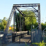
The Iron Horse Regional Trail has several bridges over busy thoroughfares to help improve traffic flow; two notable ones cross over Ygnacio Valley Road and Treat Boulevard in Walnut Creek. Additional bridges are in the planning process.
The Pleasanton "gap"
In the early 1980s, the city of Pleasanton chose not to preserve the portion of the right of way going through the city, and no work to develop the Iron Horse Trail in Pleasanton was done until 2006. In the intervening period, multiple developments were built along the corridor, most notably Hacienda Business ParkHacienda Business Park
Hacienda Business Park is a 900 acre mixed used job center and housing development in Pleasanton, California.-History:Approved in 1982 and ratified by Pleasanton voters in 1983, the business park covers approximately 20 square blocks and features many multi-story office buildings and headquarters...
, although the East Bay Regional Park District
East Bay Regional Park District
The East Bay Regional Park District is a special district operating in Alameda County and Contra Costa County, California, within the East Bay area of the San Francisco Bay Area...
still controlled the right of way.
In March 2006, work began on a new leg of the trail, about 1 miles long, on the south side of Pleasanton. This segment opened in March 2008, leaving a gap in the trail extending from the Dublin side of the Dublin/Pleasanton BART station for approximately 1.6 miles to Santa Rita Road near the Stoneridge Drive intersection, where the new leg began on the east side of Santa Rita Road.
In June 2010, the East Bay Regional Park District, City of Pleasanton and contracted company Callander Associates held the first of a series of public meetings to discuss options for completing the trail along the corridor gap. Numerous challenges will need to be addressed, including providing a route through the BART station itself, several at-grade crossings of busy roads, and paths through and alongside the business park, two city parks, a residential development with playgrounds on the corridor, and an apartment complex.