
1990 Atlantic hurricane season
Encyclopedia
The 1990 Atlantic hurricane season was the most active Atlantic hurricane season
since 1969
. It officially began on June 1, 1990, and lasted until November 30, 1990. These dates conventionally delimit the period of each year when most tropical cyclone
s form in the Atlantic basin
. One tropical depression did form before the season officially started, however.
Though very active, the season featured relatively weak systems, most of which stayed at sea. The 1990 season was unusual in that no tropical cyclone of at least tropical storm strength made landfall in the United States
, although Tropical Storm Marco
weakened to a depression just before landfall. Records show that this had not happened since the 1890 season
.
Two of the season's hurricanes were notable. Hurricane Diana
killed an estimated 139 in the Mexican states of Veracruz and Hidalgo; property damage estimates are unavailable, but damage was widespread. Hurricane Klaus
brought flooding to Martinique
, then, after combining with Tropical Storm Marco and a frontal boundary, caused torrential rainfall across the southeastern United States
. As a result of effects from Diana and Klaus, both names were retired following the season.
Forecasts of hurricane activity are issued before each hurricane season by noted hurricane experts such as Dr. William M. Gray
and his associates at Colorado State University
(CSU). A normal season as defined by the National Oceanic and Atmospheric Administration
(NOAA), has eleven named storms, of which six reach hurricane strength, and two major hurricanes. In April 1990, it was forecast that six storms would reach hurricane status, and there would be "three additional storms" from the previous year
, which would indicate 14 named storms. The forecast did not specify how many hurricanes would reach major hurricane status. In early June 1990, CSU released their predictions of tropical cyclonic activity within the Atlantic basin during the 1990 season. The forecast from CSU called for 11 named storms, seven of which to intensify into a hurricane, and three would strengthen further into a major hurricane.
formed. Fourteen depressions attained tropical storm status, and eight of these attained hurricane status. There was only one tropical cyclone to reach major hurricane status (Category 3+ on the Saffir–Simpson Hurricane Scale), which was slightly below the 1950-2005 average of two per season. One hurricane and five tropical storms made landfall
during the season and caused 168 deaths and $152 million (1990 USD
; $ USD) in damage. The last storm of the season, Hurricane Nana, dissipated on October 21, over a month before the official end of the season on November 30.
The activity in the first two months of the season were limited in tropical cyclogenesis
, with the second tropical depression of the season not developing until July 22. Following that, the season was very active, and there was a quick succession of tropical cyclone development from late-July to mid-August. The Atlantic briefly remained dormant, and activity resumed on August 24 with the development of Tropical Depression Eight (Hurricane Gustav). Although August was a very active month, there were only two named storms in September, both of which became hurricanes. Activity in October was high then average, with five tropical cyclones to either form or exist in the month. Following an active October, no tropical cyclogenesis occurred in the final month of the season, which is November.
The season's activity was reflected with a cumulative accumulated cyclone energy
(ACE) rating of 97, which is categorized as being "near normal" since it is slightly below the mean value of 103 x 104kt2. ACE is, broadly speaking, a measure of the power of the hurricane multiplied by the length of time it existed, so storms that last a long time, as well as particularly strong hurricanes, have high ACEs. ACE is only calculated for full advisories on tropical systems at or exceeding 34 knots (39 mph, 63 km/h) or tropical storm strength. Subtropical cyclone
s are excluded from the total.
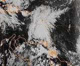
Timeline of tropical activity in the 1990 Atlantic hurricane season
to the west of Jamaica
, which had been producing scattered showers over the island during the preceding days. The depression moved across Cuba
shortly after forming, although the convection was located to the east of its poorly defined center. As it headed toward Florida
, it was absorbed by an approaching cold front
.
The depression did not cause significant damage. In Florida, the depression was forecast to ease drought
conditions that persisted for about two years. While crossing Cuba, the depression dropped heavy rainfall, and predictions stated that precipitation amounts could reach as high as 10 in (254 mm), but the greatest amount measured was at 6 in (152.4 mm) east of Havana
. Heavy rainfall also occurred across much of south Florida, peaking at 6.20 in (157.5 mm) at the Royal Palm Ranger Station in Everglades National Park
. While the depression was affecting south Florida, the National Weather Service
issued "urban flood statements" warning of flooded streets in mainly low lying areas, especially in Dade and Broward
counties. Standing water on many Florida expressways
caused automobile accidents, especially in Dade County, where 28 accidents were reported.
nearly midway between the Lesser Antilles
and Cape Verde
. The depression slowly intensified, and was eventually upgraded to Tropical Storm Arthur, two days later. On July 25, Tropical Storm Arthur crossed the Windward Islands
chain, and it was noted that the storm made landfall on Tobago. Emerging into the Caribbean Sea
, Arthur reached nearly attained hurricane status on July 25. Thereafter, wind shear began increasing over Arthur, and a weakening trend began after peak intensity. As Arthur headed further into the Caribbean Sea, it significantly weakened and was downgraded to a tropical depression on July 27. Later that day, Air Force reconnaissance and satellite imagery did not show a low-level circulation, indicating that Arthur had degenerated into open tropical wave 130 mi (209.2 km) southeast of Kingston, Jamaica
.
Shortly after Arthur became a tropical storm on July 24, a tropical storm warning was issued for Trinidad, Tobago, and Grenada
; six hours later, it was extended to the Grenadines
. About 24 hours later, all of the tropical storm warnings were discontinued. As Arthur headed further into the Caribbean Sea, a tropical storm watches and warnings were issued for Hispaniola
and Puerto Rico
on July 26. All of the tropical storm watches and warnings were discontinued after Arthur weakened to a tropical depression. After Arthur made landfall on Tobago, several landslides occurred, and a major bridge had collapsed; electrical and water services were significantly disrupted. Damage was also reported on Grenada, where two bridges were damaged, electricity and telephone service was disrupted, and crops were affected as well. In addition, Arthur caused damage to four hotels and hundreds of houses. Wind gusts on the island of Grenada reportedly reached 55 mph (85 km/h). As Arthur passed south of Puerto Rico, there were reports of strong winds and heavy rainfall. Heavy rainfall was also reported on the south coast of Haiti as Arthur approached the country.
and an area of low pressure, developed into a subtropical depression on July 24, offshore of North Carolina
near Cape Hatteras
. The subtropical depression slowly acquired tropical characteristics, and was reclassified as Tropical Depression Three on July 27. On the following day, the National Hurricane Center upgraded the depression to Tropical Storm Bertha. It drifted northeast and became a hurricane 500 mi (804.7 km) west-southwest of Bermuda
on July 29. As Bertha continued parallel to the East Coast of the United States
, it had experienced strong wind shear and was downgraded back to a tropical storm later on July 29. However, by July 30, Air Force reconnaissance flights reported at hurricane force winds, and Bertha had re-intensified into a hurricane at that time. After becoming a hurricane again, Bertha continued northeastward, but transitioned into an extratropical cyclone over Nova Scotia
on August 2.
Nine deaths were attributed to Bertha, including six crew members of the Greek
freighter Corazon who perished off the Canadian
coast after their ship broke up. Another fatality was caused when one person fell off the ship Patricia Star and into the Atlantic; the other two deaths were from two people drowning in north Florida. Damage to crops and a suspension bridge were reported from Nova Scotia and Prince Edward Island
; this damage totaled to $4.427 million (1990 CAD
; $3.912 million 1990 USD, $ USD).
, Quintana Roo
, on the Yucatán Peninsula
. Diana weakened somewhat over the Yucatán Peninsula, but was still a tropical storm when it entered the Gulf of Mexico
. While over the Gulf of Mexico, Diana again rapidly intensified, and became a hurricane on August 7. Later that day, Diana further strengthened into a Category 2 hurricane, and peaked with winds of 100 mph (155 km/h). Only two hours, Diana made landfall near Tampico, Tamaulipas, Mexico
at the same intensity. After moving ashore, Diana rapidly weakened, and had deteriorated to a tropical storm only four hours after landfall. By August 8, Diana weakened back to a tropical depression near Mexico City
. Diana briefly entered the Eastern Pacific Basin on August, but was not re-classified, and it rapidly dissipated at the south end of the Gulf of California
.
In preparations for Diana, there were several tropical storm watches and warning issued along the Yucatán Peninsula and several areas along the Gulf Coast of Mexico
; hurricane watches and warnings were also put into effect. While crossing the Yucatán Peninsula, Diana produced near-tropical storm force winds, and heavy rainfall, but not damage or fatalities. However, the mainland of Mexico fared much worse, where torrential rainfall caused mudslides in the states of Hidalgo and Veracruz
. As a result of heavy rainfall, many houses were destroyed, and approximately 3,500 became homeless. Diana also produced high winds across Mexico, which toppled tree and fell electricity poles, leaving many without telephone service and block several roads. In addition, the remnants of Diana brought rainfall to the southwestern United States. Contemporary reports indicated that 139 people had been killed, with an additional 25,000 people being injured. Damage as a result of Diana was estimated at $90.7 million (1990 USD, $ USD).
formed near the Azores in early August. When thunderstorm activity grew near its center, it was deemed a subtropical depression on August 2 just east of the Azores. Associated with an upper-level cold low, it intensified into a subtropical storm on August 3, although water temperatures were cooler than what is usually required for tropical cyclogenesis
. It tracking westward and passed near Graciosa
before weakening back to a depression on August 4. The depression executed a small cyclonic loop, developing deep and organized convection near the circulation. Late on August 6, it transitioned into Tropical Depression Six. The depression moved northeastward toward the Azores, intensifying into Tropical Storm Edouard on August 8. Shortly thereafter it reached peak winds of 45 mph (72.4 km/h), and subsequently it moved past the northern Azores. On August 10, Edouard weakened again to depression status, and became extratropical on the following day. The remnants of Edouard dissipated on August 13, a few hundred miles west of Portugal
.
Much of the western Azores reported winds of at 35 mph (55 km/h). The island of Horta
reported winds gusts from 35 to 65 mph (55 to 100 km/h). Lajes Air Force Base on Terceira Island
reported a maximum wind gust of 38 mph (61.2 km/h). Also a tower on the island of Terceira reported sustained winds at 50 mph (80 km/h), while a gusts as high as 67 mph (107.8 km/h) were recorded.
, and the system had degenerated back into a tropical wave early on August 13. After weakening back to a tropical wave, the system quickly re-organized, and re-developed into a tropical depression twelve hours later. Later that day, the depression further intensified, and was upgraded to Tropical Storm Fran. No significant change in intensity occurred after Fran became a tropical storm and maximum sustained winds never exceeded 40 mph (65 km/h). By the next day, Fran made landfall on Trinidad at the same intensity. While on Trinidad, Fran significantly interacted with the South America
n mainland, and quickly dissipated on August 15.
After Fran became a tropical storm on August 13, a tropical storm warning was issued for Trinidad, Tobago, and Grenada. Simultaneously, a tropical storm watch came into effect for Barbados
and Saint Vincent and the Grenadines
. As Fran was passing through the Windward Islands, the tropical storm watch was discontinued. Only two hours before Fran dissipated, the tropical storm warning was discontinued for Trinidad, Tobago, and Grenada. As a result of Fran, only heavy rains were reported on the Windward Islands. Light rainfall was reported on Trinidad, peaking at 2.6 in (66 mm). In addition, wind gusts were reported up to 29 mph (46 km/h).
on August 24. After forming, the depression moved westward and on the next day intensified into a tropical storm on the following day. After becoming a tropical storm, Gustav continued to intensify as it headed west-northwestward. Intensification into a hurricane occurred on August 26, as the storm began slowly curving northward under the influence of a trough. After reaching Category 2 intensity, Gustav was affected by wind shear, and weakened, but eventually re-intensified. The hurricane ultimately peaked as a Category 3 hurricane on August 31, and was also the most intense tropical cyclone of the season, in addition to being the only major hurricane in the Atlantic that year. Around the time of attaining peak intensity, Gustav began a fujiwhara interaction with nearby Tropical Storm Hortense. After attaining peak intensity on August 31, Gustav weakened back, at nearly the same rate as it had intensified, and deteriorated to a tropical storm on September 2. By September 3, Gustav transitioned into an extratropical cyclone, 230 mi (370 km) south of Iceland
.
Gustav initially appeared as a significant threat to the Lesser Antilles
, which was devastated by Hurricane Hugo
about a year prior. As a result, several hurricane watches and warnings were issued on August 27, but all were discontinued later that day as Gustav turned northward. The only effects reported on the Lesser Antilles were large swells, light winds, and light rains. Following the passage of Gustav, no damage or fatalities were reported.
suggested a peak intensity of 100 mph (165 km/h) and a minimum barometric pressure of 978 mbar
(hPa
; 28.88 inHg).
After peaking, Isidore entered a region of stronger upper-level winds and quickly weakened. By September 8 it had deteriorated into a tropical storm, although re-intensification occurred after the shear decreased. An eye feature redeveloped in the center of the convection, and Isidore re-intensified into a hurricane on September 9. It ultimately reached a secondary peak intensity of 90 mph (150 km/h). Isidore's motion slowed, briefly becoming stationary, although it remained a hurricane for several days. Cooler waters imparted weakening to a tropical storm on September 16, and the next day it became extratropical to the east of Newfoundland. There were a few ships that came in contact with Hurricane Isidore, one of which reported hurricane force wind gusts. The storm never approached land during its duration, and no damage or casualties were reported.
and the Lesser Antilles
from a tropical wave
. Ship and reconnaissance aircraft observations reported that the depression almost reached tropical storm strength. It was sheared by strong upper-level winds until it dissipated on September 21. The system never affected land.
. Without intensifying further, the depression turned northward, due to a weakness caused by the deepening of a 200 mbar cut-off low near the Iberian Peninsula
. Under the influence of a building high pressure area, the depression turned to a northwest and later westward drift. It into Tropical Storm Josephine on September 24, although increased wind shear from a trough weakened the storm back to a tropical depression on September 26. It remained weak for several days, gradually turning to the north due to a weak trough over the northwestern Atlantic. On October 1, another high pressure area halted its northward movement, causing Josephine to turn to the east. That day, it re-intensified into a tropical storm as it began to execute a small cyclonic loop. An approaching trough caused Josephine to accelerate north-northeastward, and with favorable conditions it intensified into a hurricane on October 5, after existing nearly two weeks.
Hurricane Josephine intensified slight more on October 5, attained its peak intensity later that day, with maximum sustained winds of 85 mph (140 km/h) and a minimum barometric pressure of 980 mbar (hPa; 28.94 inHg). A large mid-latitude storm began developing on October 5, and Hurricane Josephine accelerated around the east periphery on the system. Josephine weakened back to a tropical storm early on October 6, while moving to the north of the mid-latitude system. After tracking near the mid-latitude cyclone, Tropical Storm Josephine transitioned into an extratropical storm on October 6 before being absorbed by it. The mid-latitude cyclone late developed into Hurricane Lili.
. The depression rapidly intensified into a tropical storm, and was classified as Tropical Storm Klaus only six hours later. Because Klaus was in an area of weak steering current, it was drifting west-northwestward. On October 5, Klaus briefly intensified into a hurricane, and passed only 12 mi (19 km) east of Barbuda
later that day. By the following day, Klaus had weakened back into a tropical storm. After weakening to a tropical storm, Klaus began to accelerate, while turning westward. Klaus became significantly affected by wind shear, as it weakened to a tropical depression to the north of Puerto Rico
on October 8. Later that day, deep convection began to re-developed near the low-level circulation of Klaus, and it had re-intensified into a tropical storm. As Klaus tracked northwestward near the Bahamas on October 9, it was absorbed by an area of low pressure, which would eventually develop into Tropical Storm Marco.
Since Klaus passed very close to the Leeward Islands, tropical storm watches and warnings were issued, as well as hurricane watches and warning, starting on October 4. In addition, tropical storm watches and warnings were also issued for the British
and United States Virgin Islands
, and the Bahamas. After several watches and warnings were issued, all were discontinued by October 9, around the time when Klaus was absorbed by the area of low pressure. In Martinique
, flooding caused seven fatalities, and displaced 1,500 other people. Heavy rainfall also occurred on other Leeward Islands, with estimates as high as 15 in (381 mm) of precipitation. However, no effects were reported in the Bahamas. The remnants brought large waves and heavy rainfall to southeastern United States, which caused four deaths when a dam burst in South Carolina
. In total, Klaus caused 11 fatalities, but only $1 million (1990 USD; $ USD) in damage.
which affected the latter stages of Josephine developed at the surface and became a subtropical storm on October 6, about 875 mi (1,408.1 km) southeast of Cape Race
, Newfoundland
. The subtropical storm moved southwest and slowly curved westward, nearly intensifying into a hurricane. On October 11, the subtropical storm finally acquired tropical characteristics. Simultaneously, the now-tropical cyclone intensified into a hurricane, and was re-classified as Hurricane Lili. After becoming a hurricane, Lili headed rapidly west-southwestward, and did not intensify past maximum sustained winds of 75 mph (120 km/h). After passing 140 mi (230 km) south of Bermuda later that day, Lili began to curve slowly northward, thereby avoiding landfall in the United States. While about 200 mi (321.9 km) east-southeast of Cape Hatteras
, Lili weakened back to tropical storm intensity. Weakening to a tropical storm, Lili curved northeastward and accelerated toward Atlantic Canada. However, Lili transitioned into an extratropical storm on October 14, just offshore of Nova Scotia. The extratropical remnants of Lili eventually made landfall on Newfoundland.
Lili posed a threat to Bermuda, and a hurricane warning as the storm approached, but only gusty winds and light rainfall was reported. As Lili continued westward, it had also posed a significant threat to the East Coast of the United States, since some of the computer models did not predict a northward curve. As a result, several hurricane watches and warnings were issued from Little River Inlet, South Carolina, to Cape Henlopen
, Delaware
. However, Lili later curved northward, and only caused minor coastal erosion in North Carolina
and rainfall in Pennsylvania
. Lili began impacting Atlantic Canada as it was transitioning an extratropical cyclone, and the storm reportedly caused strong winds in Nova Scotia and Newfoundland. No damage total or fatalities were reported.
, and quickly intensified into a tropical storm on October 10. After becoming a tropical storm, Marco steadily intensified and eventually peaked with winds of 65 mph (100 km/h). Marco headed towards Florida, and remained just offshore of the western coast and nearly made landfall near St. Petersburg, Florida
on October 12. However, Marco continued to interact with land, and weakened to a tropical depression before actually making landfall near Cedar Key, Florida
with winds of 35 mph (55 km/h). It rapidly weakened over land, and dissipated in Georgia later that day. Although it had dissipated, Marco added to the heavy rainfall already brought to the southeastern states by the remnants Hurricane Klaus.
Although only a depression at final landfall, this was officially counted as a tropical storm hit on the United States as much of the circulation was on land before landfall in the area of St. Petersburg, Florida. In preparations for Marco, a tropical storm warning was issued for nearly the entire Gulf and Atlantic coast of Florida. In Florida, Marco caused flooding damage to houses and roads, in addition to producing tropical storm force winds across the state. However, Marco is more notable for the impact from the remnants, especially in Georgia
and South Carolina, where rainfall from the storm peaked at 19.89 in (505 mm) near Louisville, Georgia
. In combination with the remnants of Hurricane Klaus, Marco caused heavy rainfall in South Carolina, causing a dam to burst, leading to three fatalities. Several more fatalities were caused by the remnants of Marco and Klaus, and the system caused 12 deaths. It also caused $57 million (1990 USD, $ USD) in damage, most of it from damage or destruction of residences in Georgia.
Nana initially posed a threat to Bermuda, and as a result, a hurricane watch was issued late on October 18. However, after Nana weakened to a tropical storm on October 20, the hurricane watch was downgraded to a tropical storm watch. Furthermore, Nana began to curve southeastward away from Bermuda, and later on October 20, the tropical storm watch was discontinued. The only known effect from Nana on Bermuda was 0.33 in (8.4 mm) of rain. Nana was a very small hurricane, the circulation probably being only 30–40 mi (50–60 km) wide. Nana was the first storm to receive the 'N' name since naming began in the Atlantic basin in 1950, and the first of twelve storms to do so.
. This is the same list used for the 1984 season
. Storms were named Marco and Nana for the first time in 1990. Names that were not assigned are marked in .
retired two names in the spring of 1991: Diana and Klaus. They were replaced in the 1996 season
by Dolly and Kyle.
Atlantic hurricane season
The Atlantic hurricane season is the period in a year when hurricanes usually form in the Atlantic Ocean. Tropical cyclones in the North Atlantic are called hurricanes, tropical storms, or tropical depressions. In addition, there have been several storms over the years that have not been fully...
since 1969
1969 Atlantic hurricane season
The 1969 Atlantic hurricane season officially began on June 1, 1969, and lasted until November 30, 1969. These dates conventionally delimit the period of each year when most tropical cyclones form in the Atlantic basin. The season was among the most active on record, with 18 tropical cyclones, 12...
. It officially began on June 1, 1990, and lasted until November 30, 1990. These dates conventionally delimit the period of each year when most tropical cyclone
Tropical cyclone
A tropical cyclone is a storm system characterized by a large low-pressure center and numerous thunderstorms that produce strong winds and heavy rain. Tropical cyclones strengthen when water evaporated from the ocean is released as the saturated air rises, resulting in condensation of water vapor...
s form in the Atlantic basin
Atlantic Basin
The Atlantic Basin is the Atlantic Ocean.Atlantic Basin may also refer to:* Atlantic Basin Iron Works, an ironworks that operated in Brooklyn, New York, in the early to mid-20th century...
. One tropical depression did form before the season officially started, however.
Though very active, the season featured relatively weak systems, most of which stayed at sea. The 1990 season was unusual in that no tropical cyclone of at least tropical storm strength made landfall in the United States
United States
The United States of America is a federal constitutional republic comprising fifty states and a federal district...
, although Tropical Storm Marco
Tropical Storm Marco (1990)
Tropical Storm Marco was the only tropical cyclone to make landfall on the United States during the 1990 Atlantic hurricane season. The 13th named storm of the season, Marco formed from a cold-core low pressure area along the northern coast of Cuba on October 9, and tracked northwestward...
weakened to a depression just before landfall. Records show that this had not happened since the 1890 season
1890 Atlantic hurricane season
The 1890 Atlantic hurricane season ran through the summer and the first half of fall in 1890.The 1890 season was fairly inactive, with only four storms forming. Two became hurricanes, two were tropical storms...
.
Two of the season's hurricanes were notable. Hurricane Diana
Hurricane Diana
Hurricane Diana was the deadliest tropical cyclone during the 1990 Atlantic hurricane season, killing 139 people in Mexico. Forming out of a tropical wave on August 4, the system brushed Honduras before intensifying into a tropical storm the following day. Gradually gaining strength, Diana...
killed an estimated 139 in the Mexican states of Veracruz and Hidalgo; property damage estimates are unavailable, but damage was widespread. Hurricane Klaus
Hurricane Klaus
Hurricane Klaus was a minimal Atlantic hurricane that dropped heavy rainfall across the Lesser Antilles in October 1990. The eleventh tropical cyclone and sixth hurricane of the 1990 Atlantic hurricane season, Klaus developed from a tropical wave on October 3 a short distance east of Dominica. It...
brought flooding to Martinique
Martinique
Martinique is an island in the eastern Caribbean Sea, with a land area of . Like Guadeloupe, it is an overseas region of France, consisting of a single overseas department. To the northwest lies Dominica, to the south St Lucia, and to the southeast Barbados...
, then, after combining with Tropical Storm Marco and a frontal boundary, caused torrential rainfall across the southeastern United States
Southeastern United States
The Southeastern United States, colloquially referred to as the Southeast, is the eastern portion of the Southern United States. It is one of the most populous regions in the United States of America....
. As a result of effects from Diana and Klaus, both names were retired following the season.
Pre-season forecasts
| Source | Date | b>Named storms |
b>Hurricanes | b>Major hurricanes |
| NOAA National Oceanic and Atmospheric Administration The National Oceanic and Atmospheric Administration , pronounced , like "noah", is a scientific agency within the United States Department of Commerce focused on the conditions of the oceans and the atmosphere... |
April 20, 1990 | 14 | 6 | Unknown |
| CSU Colorado State University Colorado State University is a public research university located in Fort Collins, Colorado. The university is the state's land grant university, and the flagship university of the Colorado State University System.The enrollment is approximately 29,932 students, including resident and... |
June 5, 1990 | 11 | 7 | 3 |
| Record high activity | 28 2005 Atlantic hurricane season The 2005 Atlantic hurricane season was the most active Atlantic hurricane season in recorded history, repeatedly shattering numerous records. The impact of the season was widespread and ruinous with an estimated 3,913 deaths and record damage of about $159.2 billion... |
15 2005 Atlantic hurricane season The 2005 Atlantic hurricane season was the most active Atlantic hurricane season in recorded history, repeatedly shattering numerous records. The impact of the season was widespread and ruinous with an estimated 3,913 deaths and record damage of about $159.2 billion... |
8 1950 Atlantic hurricane season The 1950 Atlantic hurricane season was the first year in which tropical cyclones were given official names in the Atlantic basin. Names were taken from the Joint Army/Navy Phonetic Alphabet, with the first named storm being designated "Able", the second "Baker", and so on. It was an active season... |
|
| Record low activity | 1 1914 Atlantic hurricane season The 1914 Atlantic hurricane season was the least active Atlantic hurricane season on record, with only one known tropical storm. Although hurricane season typically encompasses a much larger time-span, actual activity was confined to the middle of September... |
0 1914 Atlantic hurricane season The 1914 Atlantic hurricane season was the least active Atlantic hurricane season on record, with only one known tropical storm. Although hurricane season typically encompasses a much larger time-span, actual activity was confined to the middle of September... (tie 1907 Atlantic hurricane season The 1907 Atlantic hurricane season ran through the summer and the first half of fall in 1907. The season was a very quiet with only five tropical storms forming, with none of them reaching hurricane strength. This feat has only been accomplished one other season, the 1914 season... ) |
0 | |
| Actual activity | 14 | 8 | 1 | |
Forecasts of hurricane activity are issued before each hurricane season by noted hurricane experts such as Dr. William M. Gray
William M. Gray
William M. "Bill" Gray is Emeritus Professor of Atmospheric Science at Colorado State University , and head of the Tropical Meteorology Project at CSU's Department of Atmospheric Sciences. He is a pioneer in the science of forecasting hurricanes and one of the world's leading experts on tropical...
and his associates at Colorado State University
Colorado State University
Colorado State University is a public research university located in Fort Collins, Colorado. The university is the state's land grant university, and the flagship university of the Colorado State University System.The enrollment is approximately 29,932 students, including resident and...
(CSU). A normal season as defined by the National Oceanic and Atmospheric Administration
National Oceanic and Atmospheric Administration
The National Oceanic and Atmospheric Administration , pronounced , like "noah", is a scientific agency within the United States Department of Commerce focused on the conditions of the oceans and the atmosphere...
(NOAA), has eleven named storms, of which six reach hurricane strength, and two major hurricanes. In April 1990, it was forecast that six storms would reach hurricane status, and there would be "three additional storms" from the previous year
1989 Atlantic hurricane season
The 1989 Atlantic hurricane season was an active season that produced fifteen tropical cyclones, eleven named storms, seven hurricanes, and two major hurricanes. The season was officially designated from June 1, 1989, to November 30, 1989, dates which conventionally...
, which would indicate 14 named storms. The forecast did not specify how many hurricanes would reach major hurricane status. In early June 1990, CSU released their predictions of tropical cyclonic activity within the Atlantic basin during the 1990 season. The forecast from CSU called for 11 named storms, seven of which to intensify into a hurricane, and three would strengthen further into a major hurricane.
Season activity
The Atlantic hurricane season officially began on June 1, but activity in 1990 began five days earlier with the formation of Tropical Depression One on May 25. It was an above average season in which 16 tropical depressionsTropical cyclone
A tropical cyclone is a storm system characterized by a large low-pressure center and numerous thunderstorms that produce strong winds and heavy rain. Tropical cyclones strengthen when water evaporated from the ocean is released as the saturated air rises, resulting in condensation of water vapor...
formed. Fourteen depressions attained tropical storm status, and eight of these attained hurricane status. There was only one tropical cyclone to reach major hurricane status (Category 3+ on the Saffir–Simpson Hurricane Scale), which was slightly below the 1950-2005 average of two per season. One hurricane and five tropical storms made landfall
Landfall (meteorology)
Landfall is the event of a tropical cyclone or a waterspout coming onto land after being over water. When a waterspout makes landfall it is reclassified as a tornado, which can then cause damage inland...
during the season and caused 168 deaths and $152 million (1990 USD
United States dollar
The United States dollar , also referred to as the American dollar, is the official currency of the United States of America. It is divided into 100 smaller units called cents or pennies....
; $ USD) in damage. The last storm of the season, Hurricane Nana, dissipated on October 21, over a month before the official end of the season on November 30.
The activity in the first two months of the season were limited in tropical cyclogenesis
Tropical cyclogenesis
Tropical cyclogenesis is the term that describes the development and strengthening of a tropical cyclone in the atmosphere. The mechanisms through which tropical cyclogenesis occurs are distinctly different from those through which mid-latitude cyclogenesis occurs...
, with the second tropical depression of the season not developing until July 22. Following that, the season was very active, and there was a quick succession of tropical cyclone development from late-July to mid-August. The Atlantic briefly remained dormant, and activity resumed on August 24 with the development of Tropical Depression Eight (Hurricane Gustav). Although August was a very active month, there were only two named storms in September, both of which became hurricanes. Activity in October was high then average, with five tropical cyclones to either form or exist in the month. Following an active October, no tropical cyclogenesis occurred in the final month of the season, which is November.
The season's activity was reflected with a cumulative accumulated cyclone energy
Accumulated cyclone energy
Accumulated cyclone energy is a measure used by the National Oceanic and Atmospheric Administration to express the activity of individual tropical cyclones and entire tropical cyclone seasons, particularly the North Atlantic hurricane season. It uses an approximation of the energy used by a...
(ACE) rating of 97, which is categorized as being "near normal" since it is slightly below the mean value of 103 x 104kt2. ACE is, broadly speaking, a measure of the power of the hurricane multiplied by the length of time it existed, so storms that last a long time, as well as particularly strong hurricanes, have high ACEs. ACE is only calculated for full advisories on tropical systems at or exceeding 34 knots (39 mph, 63 km/h) or tropical storm strength. Subtropical cyclone
Subtropical cyclone
A subtropical cyclone is a weather system that has some characteristics of a tropical and an extratropical cyclone. As early as the 1950s, meteorologists were unclear whether they should be characterized as tropical or extratropical cyclones. They were officially recognized by the National...
s are excluded from the total.
Storms
Timeline of tropical activity in the 1990 Atlantic hurricane season
Timeline of the 1990 Atlantic hurricane season
The Timeline of the 1990 Atlantic hurricane season documents all the storm formations, strengthening, weakening, landfalls, extratropical transitions, as well as dissipation...
Tropical Depression One
Tropical Depression One formed on May 25 from a weak low pressure areaLow pressure area
A low-pressure area, or "low", is a region where the atmospheric pressure at sea level is below that of surrounding locations. Low-pressure systems form under areas of wind divergence which occur in upper levels of the troposphere. The formation process of a low-pressure area is known as...
to the west of Jamaica
Jamaica
Jamaica is an island nation of the Greater Antilles, in length, up to in width and 10,990 square kilometres in area. It is situated in the Caribbean Sea, about south of Cuba, and west of Hispaniola, the island harbouring the nation-states Haiti and the Dominican Republic...
, which had been producing scattered showers over the island during the preceding days. The depression moved across Cuba
Cuba
The Republic of Cuba is an island nation in the Caribbean. The nation of Cuba consists of the main island of Cuba, the Isla de la Juventud, and several archipelagos. Havana is the largest city in Cuba and the country's capital. Santiago de Cuba is the second largest city...
shortly after forming, although the convection was located to the east of its poorly defined center. As it headed toward Florida
Florida
Florida is a state in the southeastern United States, located on the nation's Atlantic and Gulf coasts. It is bordered to the west by the Gulf of Mexico, to the north by Alabama and Georgia and to the east by the Atlantic Ocean. With a population of 18,801,310 as measured by the 2010 census, it...
, it was absorbed by an approaching cold front
Cold front
A cold front is defined as the leading edge of a cooler mass of air, replacing a warmer mass of air.-Development of cold front:The cooler and denser air wedges under the less-dense warmer air, lifting it...
.
The depression did not cause significant damage. In Florida, the depression was forecast to ease drought
Drought
A drought is an extended period of months or years when a region notes a deficiency in its water supply. Generally, this occurs when a region receives consistently below average precipitation. It can have a substantial impact on the ecosystem and agriculture of the affected region...
conditions that persisted for about two years. While crossing Cuba, the depression dropped heavy rainfall, and predictions stated that precipitation amounts could reach as high as 10 in (254 mm), but the greatest amount measured was at 6 in (152.4 mm) east of Havana
Havana
Havana is the capital city, province, major port, and leading commercial centre of Cuba. The city proper has a population of 2.1 million inhabitants, and it spans a total of — making it the largest city in the Caribbean region, and the most populous...
. Heavy rainfall also occurred across much of south Florida, peaking at 6.20 in (157.5 mm) at the Royal Palm Ranger Station in Everglades National Park
Everglades National Park
Everglades National Park is a national park in the U.S. state of Florida that protects the southern 25 percent of the original Everglades. It is the largest subtropical wilderness in the United States, and is visited on average by one million people each year. It is the third-largest...
. While the depression was affecting south Florida, the National Weather Service
National Weather Service
The National Weather Service , once known as the Weather Bureau, is one of the six scientific agencies that make up the National Oceanic and Atmospheric Administration of the United States government...
issued "urban flood statements" warning of flooded streets in mainly low lying areas, especially in Dade and Broward
Broward County, Florida
-2000 Census:As of the census of 2000, there were 1,623,018 people, 654,445 households, and 411,645 families residing in the county. The population density was 1,346 people per square mile . There were 741,043 housing units at an average density of 615 per square mile...
counties. Standing water on many Florida expressways
Limited-access road
A limited-access road known by various terms worldwide, including limited-access highway, dual-carriageway and expressway, is a highway or arterial road for high-speed traffic which has many or most characteristics of a controlled-access highway , including limited or no access to adjacent...
caused automobile accidents, especially in Dade County, where 28 accidents were reported.
Tropical Storm Arthur
The second tropical depression of the season developed on July 22 from a tropical waveTropical wave
Tropical waves, easterly waves, or tropical easterly waves, also known as African easterly waves in the Atlantic region, are a type of atmospheric trough, an elongated area of relatively low air pressure, oriented north to south, which move from east to west across the tropics causing areas of...
nearly midway between the Lesser Antilles
Lesser Antilles
The Lesser Antilles are a long, partly volcanic island arc in the Western Hemisphere. Most of its islands form the eastern boundary of the Caribbean Sea with the Atlantic Ocean, with the remainder located in the southern Caribbean just north of South America...
and Cape Verde
Cape Verde
The Republic of Cape Verde is an island country, spanning an archipelago of 10 islands located in the central Atlantic Ocean, 570 kilometres off the coast of Western Africa...
. The depression slowly intensified, and was eventually upgraded to Tropical Storm Arthur, two days later. On July 25, Tropical Storm Arthur crossed the Windward Islands
Windward Islands
The Windward Islands are the southern islands of the Lesser Antilles, within the West Indies.-Name and geography:The Windward Islands are called such because they were more windward to sailing ships arriving in the New World than the Leeward Islands, given that the prevailing trade winds in the...
chain, and it was noted that the storm made landfall on Tobago. Emerging into the Caribbean Sea
Caribbean Sea
The Caribbean Sea is a sea of the Atlantic Ocean located in the tropics of the Western hemisphere. It is bounded by Mexico and Central America to the west and southwest, to the north by the Greater Antilles, and to the east by the Lesser Antilles....
, Arthur reached nearly attained hurricane status on July 25. Thereafter, wind shear began increasing over Arthur, and a weakening trend began after peak intensity. As Arthur headed further into the Caribbean Sea, it significantly weakened and was downgraded to a tropical depression on July 27. Later that day, Air Force reconnaissance and satellite imagery did not show a low-level circulation, indicating that Arthur had degenerated into open tropical wave 130 mi (209.2 km) southeast of Kingston, Jamaica
Kingston, Jamaica
Kingston is the capital and largest city of Jamaica, located on the southeastern coast of the island. It faces a natural harbour protected by the Palisadoes, a long sand spit which connects the town of Port Royal and the Norman Manley International Airport to the rest of the island...
.
Shortly after Arthur became a tropical storm on July 24, a tropical storm warning was issued for Trinidad, Tobago, and Grenada
Grenada
Grenada is an island country and Commonwealth Realm consisting of the island of Grenada and six smaller islands at the southern end of the Grenadines in the southeastern Caribbean Sea...
; six hours later, it was extended to the Grenadines
Grenadines
The Grenadines is a Caribbean island chain of over 600 islands in the Windward Islands.-Geographic boundaries:They are divided between the island nations of Saint Vincent and the Grenadines and Grenada. They lie between the islands of Saint Vincent in the north and Grenada in the south. Neither...
. About 24 hours later, all of the tropical storm warnings were discontinued. As Arthur headed further into the Caribbean Sea, a tropical storm watches and warnings were issued for Hispaniola
Hispaniola
Hispaniola is a major island in the Caribbean, containing the two sovereign states of the Dominican Republic and Haiti. The island is located between the islands of Cuba to the west and Puerto Rico to the east, within the hurricane belt...
and Puerto Rico
Puerto Rico
Puerto Rico , officially the Commonwealth of Puerto Rico , is an unincorporated territory of the United States, located in the northeastern Caribbean, east of the Dominican Republic and west of both the United States Virgin Islands and the British Virgin Islands.Puerto Rico comprises an...
on July 26. All of the tropical storm watches and warnings were discontinued after Arthur weakened to a tropical depression. After Arthur made landfall on Tobago, several landslides occurred, and a major bridge had collapsed; electrical and water services were significantly disrupted. Damage was also reported on Grenada, where two bridges were damaged, electricity and telephone service was disrupted, and crops were affected as well. In addition, Arthur caused damage to four hotels and hundreds of houses. Wind gusts on the island of Grenada reportedly reached 55 mph (85 km/h). As Arthur passed south of Puerto Rico, there were reports of strong winds and heavy rainfall. Heavy rainfall was also reported on the south coast of Haiti as Arthur approached the country.
Hurricane Bertha
A tropical wave emerged off the coast of Africa, and after interacting with a cold frontCold front
A cold front is defined as the leading edge of a cooler mass of air, replacing a warmer mass of air.-Development of cold front:The cooler and denser air wedges under the less-dense warmer air, lifting it...
and an area of low pressure, developed into a subtropical depression on July 24, offshore of North Carolina
North Carolina
North Carolina is a state located in the southeastern United States. The state borders South Carolina and Georgia to the south, Tennessee to the west and Virginia to the north. North Carolina contains 100 counties. Its capital is Raleigh, and its largest city is Charlotte...
near Cape Hatteras
Cape Hatteras
Cape Hatteras is a cape on the coast of North Carolina. It is the point that protrudes the farthest to the southeast along the northeast-to-southwest line of the Atlantic coast of North America...
. The subtropical depression slowly acquired tropical characteristics, and was reclassified as Tropical Depression Three on July 27. On the following day, the National Hurricane Center upgraded the depression to Tropical Storm Bertha. It drifted northeast and became a hurricane 500 mi (804.7 km) west-southwest of Bermuda
Bermuda
Bermuda is a British overseas territory in the North Atlantic Ocean. Located off the east coast of the United States, its nearest landmass is Cape Hatteras, North Carolina, about to the west-northwest. It is about south of Halifax, Nova Scotia, Canada, and northeast of Miami, Florida...
on July 29. As Bertha continued parallel to the East Coast of the United States
East Coast of the United States
The East Coast of the United States, also known as the Eastern Seaboard, refers to the easternmost coastal states in the United States, which touch the Atlantic Ocean and stretch up to Canada. The term includes the U.S...
, it had experienced strong wind shear and was downgraded back to a tropical storm later on July 29. However, by July 30, Air Force reconnaissance flights reported at hurricane force winds, and Bertha had re-intensified into a hurricane at that time. After becoming a hurricane again, Bertha continued northeastward, but transitioned into an extratropical cyclone over Nova Scotia
Nova Scotia
Nova Scotia is one of Canada's three Maritime provinces and is the most populous province in Atlantic Canada. The name of the province is Latin for "New Scotland," but "Nova Scotia" is the recognized, English-language name of the province. The provincial capital is Halifax. Nova Scotia is the...
on August 2.
Nine deaths were attributed to Bertha, including six crew members of the Greek
Greece
Greece , officially the Hellenic Republic , and historically Hellas or the Republic of Greece in English, is a country in southeastern Europe....
freighter Corazon who perished off the Canadian
Canada
Canada is a North American country consisting of ten provinces and three territories. Located in the northern part of the continent, it extends from the Atlantic Ocean in the east to the Pacific Ocean in the west, and northward into the Arctic Ocean...
coast after their ship broke up. Another fatality was caused when one person fell off the ship Patricia Star and into the Atlantic; the other two deaths were from two people drowning in north Florida. Damage to crops and a suspension bridge were reported from Nova Scotia and Prince Edward Island
Prince Edward Island
Prince Edward Island is a Canadian province consisting of an island of the same name, as well as other islands. The maritime province is the smallest in the nation in both land area and population...
; this damage totaled to $4.427 million (1990 CAD
Canadian dollar
The Canadian dollar is the currency of Canada. As of 2007, the Canadian dollar is the 7th most traded currency in the world. It is abbreviated with the dollar sign $, or C$ to distinguish it from other dollar-denominated currencies...
; $3.912 million 1990 USD, $ USD).
Tropical Storm Cesar
While Bertha was approaching Atlantic Canada, a tropical wave emerged into a Atlantic from the west coast of Africa, and quickly developed into Tropical Depression Four 336 mi (540.7 km) south of Cape Verde. The depression headed northwestward due to the weakness of a subtropical ridge and slowly intensified. While the depression was well west of Cape Verde, it intensified into Tropical Storm Cesar on August 2. Cesar continued on the generally northwestward path and no significant change in intensity occurred, as it peaked at 50 mph (85 km/h) shortly after becoming a tropical storm. Later in its duration, wind shear significantly increased, causing the low-level circulation to be removed from the deep convection on August 6, and Cesar weakened back to a tropical depression as a result. As it was weakening to a tropical depression, Cesar became nearly stationary, and turned abruptly eastward. On the following day, Cesar dissipated almost 1,151 mi (1,852.3 km) east-southeast of Bermuda.Hurricane Diana
A tropical wave uneventfully crossed the Atlantic Ocean and entered the Caribbean Sea either late July or early August 1990. As the system entered the southwest Caribbean, it began to further develop, and became Tropical Depression Five on August 4. The depression headed northwestward, and intensified enough to be upgraded to Tropical Storm Diana on August 5. After becoming a tropical storm, Diana continued to quickly intensify, and maximum sustained winds were 65 mph (105 km/h) before landfall occurred in Felipe Carrillo PuertoFelipe Carrillo Puerto, Quintana Roo
See also Felipe Carrillo Puerto, Oaxaca, for the town in Oaxaca.Felipe Carrillo Puerto or simply Carrillo Puerto is the name of a municipality for which the city of the same name serves its the municipal seat. The municipality is located south-central part of the Mexican state of Quintana Roo. It...
, Quintana Roo
Quintana Roo
Quintana Roo officially Estado Libre y Soberano de Quintana Roo is one of the 31 states which, with the Federal District, comprise the 32 Federal Entities of Mexico. It is divided in 10 municipalities and its capital city is Chetumal....
, on the Yucatán Peninsula
Yucatán Peninsula
The Yucatán Peninsula, in southeastern Mexico, separates the Caribbean Sea from the Gulf of Mexico, with the northern coastline on the Yucatán Channel...
. Diana weakened somewhat over the Yucatán Peninsula, but was still a tropical storm when it entered the Gulf of Mexico
Gulf of Mexico
The Gulf of Mexico is a partially landlocked ocean basin largely surrounded by the North American continent and the island of Cuba. It is bounded on the northeast, north and northwest by the Gulf Coast of the United States, on the southwest and south by Mexico, and on the southeast by Cuba. In...
. While over the Gulf of Mexico, Diana again rapidly intensified, and became a hurricane on August 7. Later that day, Diana further strengthened into a Category 2 hurricane, and peaked with winds of 100 mph (155 km/h). Only two hours, Diana made landfall near Tampico, Tamaulipas, Mexico
Mexico
The United Mexican States , commonly known as Mexico , is a federal constitutional republic in North America. It is bordered on the north by the United States; on the south and west by the Pacific Ocean; on the southeast by Guatemala, Belize, and the Caribbean Sea; and on the east by the Gulf of...
at the same intensity. After moving ashore, Diana rapidly weakened, and had deteriorated to a tropical storm only four hours after landfall. By August 8, Diana weakened back to a tropical depression near Mexico City
Mexico City
Mexico City is the Federal District , capital of Mexico and seat of the federal powers of the Mexican Union. It is a federal entity within Mexico which is not part of any one of the 31 Mexican states but belongs to the federation as a whole...
. Diana briefly entered the Eastern Pacific Basin on August, but was not re-classified, and it rapidly dissipated at the south end of the Gulf of California
Gulf of California
The Gulf of California is a body of water that separates the Baja California Peninsula from the Mexican mainland...
.
In preparations for Diana, there were several tropical storm watches and warning issued along the Yucatán Peninsula and several areas along the Gulf Coast of Mexico
Gulf Coast of Mexico
The Gulf Coast of Mexico stretches along the Gulf of Mexico from the border with the United states at Matamoros, Tamaulipas all the way to the tip of the Yucatán Peninsula at Cancún. It includes the coastal regions along the Bay of Campeche. Major cities include Veracruz, Tampico, and...
; hurricane watches and warnings were also put into effect. While crossing the Yucatán Peninsula, Diana produced near-tropical storm force winds, and heavy rainfall, but not damage or fatalities. However, the mainland of Mexico fared much worse, where torrential rainfall caused mudslides in the states of Hidalgo and Veracruz
Veracruz
Veracruz, formally Veracruz de Ignacio de la Llave officially Estado Libre y Soberano de Veracruz de Ignacio de la Llave , is one of the 31 states that, along with the Federal District, comprise the 32 federative entities of Mexico. It is divided in 212 municipalities and its capital city is...
. As a result of heavy rainfall, many houses were destroyed, and approximately 3,500 became homeless. Diana also produced high winds across Mexico, which toppled tree and fell electricity poles, leaving many without telephone service and block several roads. In addition, the remnants of Diana brought rainfall to the southwestern United States. Contemporary reports indicated that 139 people had been killed, with an additional 25,000 people being injured. Damage as a result of Diana was estimated at $90.7 million (1990 USD, $ USD).
Tropical Storm Edouard
A frontal waveExtratropical cyclone
Extratropical cyclones, sometimes called mid-latitude cyclones or wave cyclones, are a group of cyclones defined as synoptic scale low pressure weather systems that occur in the middle latitudes of the Earth having neither tropical nor polar characteristics, and are connected with fronts and...
formed near the Azores in early August. When thunderstorm activity grew near its center, it was deemed a subtropical depression on August 2 just east of the Azores. Associated with an upper-level cold low, it intensified into a subtropical storm on August 3, although water temperatures were cooler than what is usually required for tropical cyclogenesis
Tropical cyclogenesis
Tropical cyclogenesis is the term that describes the development and strengthening of a tropical cyclone in the atmosphere. The mechanisms through which tropical cyclogenesis occurs are distinctly different from those through which mid-latitude cyclogenesis occurs...
. It tracking westward and passed near Graciosa
Graciosa
Graciosa Island is referred to as the White Island, the northernmost of the Central Group of islands in the Azores. The ovular Portuguese island has an area of 60.65 km², a length of 10 km and a width of 7 km...
before weakening back to a depression on August 4. The depression executed a small cyclonic loop, developing deep and organized convection near the circulation. Late on August 6, it transitioned into Tropical Depression Six. The depression moved northeastward toward the Azores, intensifying into Tropical Storm Edouard on August 8. Shortly thereafter it reached peak winds of 45 mph (72.4 km/h), and subsequently it moved past the northern Azores. On August 10, Edouard weakened again to depression status, and became extratropical on the following day. The remnants of Edouard dissipated on August 13, a few hundred miles west of Portugal
Portugal
Portugal , officially the Portuguese Republic is a country situated in southwestern Europe on the Iberian Peninsula. Portugal is the westernmost country of Europe, and is bordered by the Atlantic Ocean to the West and South and by Spain to the North and East. The Atlantic archipelagos of the...
.
Much of the western Azores reported winds of at 35 mph (55 km/h). The island of Horta
Horta
-Meaning:* horta, 'orchard' or 'vegetable garden' in Portuguese and Valencian/Catalan, Spanish huerta-People:* Nelson Horta , a Cuban Journalist, now living in Miami,Florida USA* Adolfo Horta , a Cuban boxer...
reported winds gusts from 35 to 65 mph (55 to 100 km/h). Lajes Air Force Base on Terceira Island
Terceira Island
Referred to as the “Ilha Lilás” , Terceira is an island in the Azores archipelago, in the middle of the North Atlantic Ocean. It is one of the larger islands of the archipelago, with a population of 56,000 inhabitants in an area of approximately 396.75 km²...
reported a maximum wind gust of 38 mph (61.2 km/h). Also a tower on the island of Terceira reported sustained winds at 50 mph (80 km/h), while a gusts as high as 67 mph (107.8 km/h) were recorded.
Tropical Storm Fran
On August 11, a tropical wave developed into the seventh tropical depression of the season, while situated several hundred miles southwest of Cape Verde. The depression moved rapidly westwards, and intensified to just under tropical storm status on August 12. However, later that day, the depression began to lose its low-level circulation, while deep convection was diminishing. As a result, the depression became "too weak to classify" for Dvorak techniqueDvorak technique
The Dvorak technique is a widely used system to subjectively estimate tropical cyclone intensity based solely on visible and infrared satellite images. Several agencies issue Dvorak intensity numbers for cyclones of sufficient intensity...
, and the system had degenerated back into a tropical wave early on August 13. After weakening back to a tropical wave, the system quickly re-organized, and re-developed into a tropical depression twelve hours later. Later that day, the depression further intensified, and was upgraded to Tropical Storm Fran. No significant change in intensity occurred after Fran became a tropical storm and maximum sustained winds never exceeded 40 mph (65 km/h). By the next day, Fran made landfall on Trinidad at the same intensity. While on Trinidad, Fran significantly interacted with the South America
South America
South America is a continent situated in the Western Hemisphere, mostly in the Southern Hemisphere, with a relatively small portion in the Northern Hemisphere. The continent is also considered a subcontinent of the Americas. It is bordered on the west by the Pacific Ocean and on the north and east...
n mainland, and quickly dissipated on August 15.
After Fran became a tropical storm on August 13, a tropical storm warning was issued for Trinidad, Tobago, and Grenada. Simultaneously, a tropical storm watch came into effect for Barbados
Barbados
Barbados is an island country in the Lesser Antilles. It is in length and as much as in width, amounting to . It is situated in the western area of the North Atlantic and 100 kilometres east of the Windward Islands and the Caribbean Sea; therein, it is about east of the islands of Saint...
and Saint Vincent and the Grenadines
Saint Vincent and the Grenadines
Saint Vincent and the Grenadines is an island country in the Lesser Antilles chain, namely in the southern portion of the Windward Islands, which lie at the southern end of the eastern border of the Caribbean Sea where the latter meets the Atlantic Ocean....
. As Fran was passing through the Windward Islands, the tropical storm watch was discontinued. Only two hours before Fran dissipated, the tropical storm warning was discontinued for Trinidad, Tobago, and Grenada. As a result of Fran, only heavy rains were reported on the Windward Islands. Light rainfall was reported on Trinidad, peaking at 2.6 in (66 mm). In addition, wind gusts were reported up to 29 mph (46 km/h).
Hurricane Gustav
A tropical depression developed from a tropical wave approximately 1,000 mi (1,609.3 km) east of BarbadosBarbados
Barbados is an island country in the Lesser Antilles. It is in length and as much as in width, amounting to . It is situated in the western area of the North Atlantic and 100 kilometres east of the Windward Islands and the Caribbean Sea; therein, it is about east of the islands of Saint...
on August 24. After forming, the depression moved westward and on the next day intensified into a tropical storm on the following day. After becoming a tropical storm, Gustav continued to intensify as it headed west-northwestward. Intensification into a hurricane occurred on August 26, as the storm began slowly curving northward under the influence of a trough. After reaching Category 2 intensity, Gustav was affected by wind shear, and weakened, but eventually re-intensified. The hurricane ultimately peaked as a Category 3 hurricane on August 31, and was also the most intense tropical cyclone of the season, in addition to being the only major hurricane in the Atlantic that year. Around the time of attaining peak intensity, Gustav began a fujiwhara interaction with nearby Tropical Storm Hortense. After attaining peak intensity on August 31, Gustav weakened back, at nearly the same rate as it had intensified, and deteriorated to a tropical storm on September 2. By September 3, Gustav transitioned into an extratropical cyclone, 230 mi (370 km) south of Iceland
Iceland
Iceland , described as the Republic of Iceland, is a Nordic and European island country in the North Atlantic Ocean, on the Mid-Atlantic Ridge. Iceland also refers to the main island of the country, which contains almost all the population and almost all the land area. The country has a population...
.
Gustav initially appeared as a significant threat to the Lesser Antilles
Lesser Antilles
The Lesser Antilles are a long, partly volcanic island arc in the Western Hemisphere. Most of its islands form the eastern boundary of the Caribbean Sea with the Atlantic Ocean, with the remainder located in the southern Caribbean just north of South America...
, which was devastated by Hurricane Hugo
Hurricane Hugo
Hurricane Hugo was a classical, destructive and rare Cape Verde-type hurricane which struck the Caribbean islands of Guadeloupe, Montserrat, St. Croix, Puerto Rico and the USA mainland in South Carolina as a Category 4 hurricane during September of the 1989 Atlantic hurricane season...
about a year prior. As a result, several hurricane watches and warnings were issued on August 27, but all were discontinued later that day as Gustav turned northward. The only effects reported on the Lesser Antilles were large swells, light winds, and light rains. Following the passage of Gustav, no damage or fatalities were reported.
Tropical Storm Hortense
The ninth tropical depression of the season developed from a tropical wave 700 mi (1,126.5 km) west-southwest of Cape Verde on August 25. The depression headed west-northwestward, while slowly intensifying and establishing better-defined upper-level outflow. By August 26, the depression intensified enough to be upgraded to Tropical Storm Hortense. After becoming a tropical storm, Hortense was steered nearly due north, under the influence on an upper-level low. Hortense later headed generally northwestward, after the upper-level low degenerated into a trough and moved eastward. Although intensification was somewhat slow, Hortense managed to peak as a 65 mph (100 km/h) tropical storm on August 28. On August 29, nearby Hurricane Gustav was rapidly intensifying, and began to significantly affect Hortense with increasing wind shear. Wind shear induced by Gustav caused weakening of Hortense, and the storm weakened to a tropical depression on August 30. Further weakening occurred, and Hortense dissipated on August 31 805.5 mi (1,296.3 km) east-southeast of Bermuda.Hurricane Isidore
A vigorous tropical wave exited the west coast of Africa on September 3. It quickly developed an area of deep convection with a well-defined circulation, which prompted it being classified a tropical depression on September 4. At the time it was situated hundreds of miles south of Cape Verde at a very low latitude of 7.2°N. Initial intensification was slow as the system moved northwestward, a movement caused by a large mid-level trough over the central Atlantic. On September 5 the NHC upgraded the depression to Tropical Storm Isidore. Subsequently it intensified at a faster rate, becoming a hurricane on September 6. The following day, satellite estimates from the Dvorak techniqueDvorak technique
The Dvorak technique is a widely used system to subjectively estimate tropical cyclone intensity based solely on visible and infrared satellite images. Several agencies issue Dvorak intensity numbers for cyclones of sufficient intensity...
suggested a peak intensity of 100 mph (165 km/h) and a minimum barometric pressure of 978 mbar
Bar (unit)
The bar is a unit of pressure equal to 100 kilopascals, and roughly equal to the atmospheric pressure on Earth at sea level. Other units derived from the bar are the megabar , kilobar , decibar , centibar , and millibar...
(hPa
Pascal (unit)
The pascal is the SI derived unit of pressure, internal pressure, stress, Young's modulus and tensile strength, named after the French mathematician, physicist, inventor, writer, and philosopher Blaise Pascal. It is a measure of force per unit area, defined as one newton per square metre...
; 28.88 inHg).
After peaking, Isidore entered a region of stronger upper-level winds and quickly weakened. By September 8 it had deteriorated into a tropical storm, although re-intensification occurred after the shear decreased. An eye feature redeveloped in the center of the convection, and Isidore re-intensified into a hurricane on September 9. It ultimately reached a secondary peak intensity of 90 mph (150 km/h). Isidore's motion slowed, briefly becoming stationary, although it remained a hurricane for several days. Cooler waters imparted weakening to a tropical storm on September 16, and the next day it became extratropical to the east of Newfoundland. There were a few ships that came in contact with Hurricane Isidore, one of which reported hurricane force wind gusts. The storm never approached land during its duration, and no damage or casualties were reported.
Tropical Depression Eleven
On September 18, Tropical Depression Eleven formed midway between AfricaAfrica
Africa is the world's second largest and second most populous continent, after Asia. At about 30.2 million km² including adjacent islands, it covers 6% of the Earth's total surface area and 20.4% of the total land area...
and the Lesser Antilles
Lesser Antilles
The Lesser Antilles are a long, partly volcanic island arc in the Western Hemisphere. Most of its islands form the eastern boundary of the Caribbean Sea with the Atlantic Ocean, with the remainder located in the southern Caribbean just north of South America...
from a tropical wave
Tropical wave
Tropical waves, easterly waves, or tropical easterly waves, also known as African easterly waves in the Atlantic region, are a type of atmospheric trough, an elongated area of relatively low air pressure, oriented north to south, which move from east to west across the tropics causing areas of...
. Ship and reconnaissance aircraft observations reported that the depression almost reached tropical storm strength. It was sheared by strong upper-level winds until it dissipated on September 21. The system never affected land.
Hurricane Josephine
A tropical wave exited the coast of Africa on September 16 with copious convection. It tracked westward, developing into Tropical Depression Twelve on September 21 while located a few hundred miles west of Cape VerdeCape Verde
The Republic of Cape Verde is an island country, spanning an archipelago of 10 islands located in the central Atlantic Ocean, 570 kilometres off the coast of Western Africa...
. Without intensifying further, the depression turned northward, due to a weakness caused by the deepening of a 200 mbar cut-off low near the Iberian Peninsula
Iberian Peninsula
The Iberian Peninsula , sometimes called Iberia, is located in the extreme southwest of Europe and includes the modern-day sovereign states of Spain, Portugal and Andorra, as well as the British Overseas Territory of Gibraltar...
. Under the influence of a building high pressure area, the depression turned to a northwest and later westward drift. It into Tropical Storm Josephine on September 24, although increased wind shear from a trough weakened the storm back to a tropical depression on September 26. It remained weak for several days, gradually turning to the north due to a weak trough over the northwestern Atlantic. On October 1, another high pressure area halted its northward movement, causing Josephine to turn to the east. That day, it re-intensified into a tropical storm as it began to execute a small cyclonic loop. An approaching trough caused Josephine to accelerate north-northeastward, and with favorable conditions it intensified into a hurricane on October 5, after existing nearly two weeks.
Hurricane Josephine intensified slight more on October 5, attained its peak intensity later that day, with maximum sustained winds of 85 mph (140 km/h) and a minimum barometric pressure of 980 mbar (hPa; 28.94 inHg). A large mid-latitude storm began developing on October 5, and Hurricane Josephine accelerated around the east periphery on the system. Josephine weakened back to a tropical storm early on October 6, while moving to the north of the mid-latitude system. After tracking near the mid-latitude cyclone, Tropical Storm Josephine transitioned into an extratropical storm on October 6 before being absorbed by it. The mid-latitude cyclone late developed into Hurricane Lili.
Hurricane Klaus
A tropical wave developed into Tropical Depression Thirteen on October 3 115 mi (185 km/h) east of DominicaDominica
Dominica , officially the Commonwealth of Dominica, is an island nation in the Lesser Antilles region of the Caribbean Sea, south-southeast of Guadeloupe and northwest of Martinique. Its size is and the highest point in the country is Morne Diablotins, which has an elevation of . The Commonwealth...
. The depression rapidly intensified into a tropical storm, and was classified as Tropical Storm Klaus only six hours later. Because Klaus was in an area of weak steering current, it was drifting west-northwestward. On October 5, Klaus briefly intensified into a hurricane, and passed only 12 mi (19 km) east of Barbuda
Barbuda
Barbuda is an island in the Eastern Caribbean, and forms part of the state of Antigua and Barbuda. It has a population of about 1,500, most of whom live in the town of Codrington.-Location:...
later that day. By the following day, Klaus had weakened back into a tropical storm. After weakening to a tropical storm, Klaus began to accelerate, while turning westward. Klaus became significantly affected by wind shear, as it weakened to a tropical depression to the north of Puerto Rico
Puerto Rico
Puerto Rico , officially the Commonwealth of Puerto Rico , is an unincorporated territory of the United States, located in the northeastern Caribbean, east of the Dominican Republic and west of both the United States Virgin Islands and the British Virgin Islands.Puerto Rico comprises an...
on October 8. Later that day, deep convection began to re-developed near the low-level circulation of Klaus, and it had re-intensified into a tropical storm. As Klaus tracked northwestward near the Bahamas on October 9, it was absorbed by an area of low pressure, which would eventually develop into Tropical Storm Marco.
Since Klaus passed very close to the Leeward Islands, tropical storm watches and warnings were issued, as well as hurricane watches and warning, starting on October 4. In addition, tropical storm watches and warnings were also issued for the British
British Virgin Islands
The Virgin Islands, often called the British Virgin Islands , is a British overseas territory and overseas territory of the European Union, located in the Caribbean to the east of Puerto Rico. The islands make up part of the Virgin Islands archipelago, the remaining islands constituting the U.S...
and United States Virgin Islands
United States Virgin Islands
The Virgin Islands of the United States are a group of islands in the Caribbean that are an insular area of the United States. The islands are geographically part of the Virgin Islands archipelago and are located in the Leeward Islands of the Lesser Antilles.The U.S...
, and the Bahamas. After several watches and warnings were issued, all were discontinued by October 9, around the time when Klaus was absorbed by the area of low pressure. In Martinique
Martinique
Martinique is an island in the eastern Caribbean Sea, with a land area of . Like Guadeloupe, it is an overseas region of France, consisting of a single overseas department. To the northwest lies Dominica, to the south St Lucia, and to the southeast Barbados...
, flooding caused seven fatalities, and displaced 1,500 other people. Heavy rainfall also occurred on other Leeward Islands, with estimates as high as 15 in (381 mm) of precipitation. However, no effects were reported in the Bahamas. The remnants brought large waves and heavy rainfall to southeastern United States, which caused four deaths when a dam burst in South Carolina
South Carolina
South Carolina is a state in the Deep South of the United States that borders Georgia to the south, North Carolina to the north, and the Atlantic Ocean to the east. Originally part of the Province of Carolina, the Province of South Carolina was one of the 13 colonies that declared independence...
. In total, Klaus caused 11 fatalities, but only $1 million (1990 USD; $ USD) in damage.
Hurricane Lili
A cold-core lowCold-core low
A cold-core low, also known as a cold low or cold-core cyclone, is a cyclone aloft which has an associated cold pool of air residing at high altitude within the Earth's troposphere. It is a low pressure system which strengthens with height in accordance with the thermal wind relationship. These...
which affected the latter stages of Josephine developed at the surface and became a subtropical storm on October 6, about 875 mi (1,408.1 km) southeast of Cape Race
Cape Race
Cape Race is a point of land located at the southeastern tip of the Avalon Peninsula on the island of Newfoundland, Canada. Its name is thought to come from the original Portuguese name for this cape, "Raso", or "bare"...
, Newfoundland
Newfoundland and Labrador
Newfoundland and Labrador is the easternmost province of Canada. Situated in the country's Atlantic region, it incorporates the island of Newfoundland and mainland Labrador with a combined area of . As of April 2011, the province's estimated population is 508,400...
. The subtropical storm moved southwest and slowly curved westward, nearly intensifying into a hurricane. On October 11, the subtropical storm finally acquired tropical characteristics. Simultaneously, the now-tropical cyclone intensified into a hurricane, and was re-classified as Hurricane Lili. After becoming a hurricane, Lili headed rapidly west-southwestward, and did not intensify past maximum sustained winds of 75 mph (120 km/h). After passing 140 mi (230 km) south of Bermuda later that day, Lili began to curve slowly northward, thereby avoiding landfall in the United States. While about 200 mi (321.9 km) east-southeast of Cape Hatteras
Cape Hatteras
Cape Hatteras is a cape on the coast of North Carolina. It is the point that protrudes the farthest to the southeast along the northeast-to-southwest line of the Atlantic coast of North America...
, Lili weakened back to tropical storm intensity. Weakening to a tropical storm, Lili curved northeastward and accelerated toward Atlantic Canada. However, Lili transitioned into an extratropical storm on October 14, just offshore of Nova Scotia. The extratropical remnants of Lili eventually made landfall on Newfoundland.
Lili posed a threat to Bermuda, and a hurricane warning as the storm approached, but only gusty winds and light rainfall was reported. As Lili continued westward, it had also posed a significant threat to the East Coast of the United States, since some of the computer models did not predict a northward curve. As a result, several hurricane watches and warnings were issued from Little River Inlet, South Carolina, to Cape Henlopen
Cape Henlopen
Cape Henlopen is the southern cape of the Delaware Bay along the Atlantic coast of the United States. It lies in the state of Delaware, near the town of Lewes, Delaware...
, Delaware
Delaware
Delaware is a U.S. state located on the Atlantic Coast in the Mid-Atlantic region of the United States. It is bordered to the south and west by Maryland, and to the north by Pennsylvania...
. However, Lili later curved northward, and only caused minor coastal erosion in North Carolina
North Carolina
North Carolina is a state located in the southeastern United States. The state borders South Carolina and Georgia to the south, Tennessee to the west and Virginia to the north. North Carolina contains 100 counties. Its capital is Raleigh, and its largest city is Charlotte...
and rainfall in Pennsylvania
Pennsylvania
The Commonwealth of Pennsylvania is a U.S. state that is located in the Northeastern and Mid-Atlantic regions of the United States. The state borders Delaware and Maryland to the south, West Virginia to the southwest, Ohio to the west, New York and Ontario, Canada, to the north, and New Jersey to...
. Lili began impacting Atlantic Canada as it was transitioning an extratropical cyclone, and the storm reportedly caused strong winds in Nova Scotia and Newfoundland. No damage total or fatalities were reported.
Tropical Storm Marco
As Klaus was dissipating, a new cold low developed over Cuba and developed down to the surface as a tropical depression on October 9. The depression emerged the Straits of FloridaStraits of Florida
The Straits of Florida, Florida Straits, or Florida Strait is a strait located south-southeast of the North American mainland, generally accepted to be between the Gulf of Mexico and the Atlantic Ocean, and between the Florida Keys and Cuba. The strait carries the Florida Current, the beginning of...
, and quickly intensified into a tropical storm on October 10. After becoming a tropical storm, Marco steadily intensified and eventually peaked with winds of 65 mph (100 km/h). Marco headed towards Florida, and remained just offshore of the western coast and nearly made landfall near St. Petersburg, Florida
St. Petersburg, Florida
St. Petersburg is a city in Pinellas County, Florida, United States. It is known as a vacation destination for both American and foreign tourists. As of 2008, the population estimate by the U.S. Census Bureau is 245,314, making St...
on October 12. However, Marco continued to interact with land, and weakened to a tropical depression before actually making landfall near Cedar Key, Florida
Cedar Key, Florida
Cedar Key is a city in Levy County, Florida, United States. The population was 790 at the 2000 census. According to the U.S Census estimates of 2005, the city had a population of 958. The Cedar Keys are a cluster of islands close to the mainland. Most of the developed area of the city has been on...
with winds of 35 mph (55 km/h). It rapidly weakened over land, and dissipated in Georgia later that day. Although it had dissipated, Marco added to the heavy rainfall already brought to the southeastern states by the remnants Hurricane Klaus.
Although only a depression at final landfall, this was officially counted as a tropical storm hit on the United States as much of the circulation was on land before landfall in the area of St. Petersburg, Florida. In preparations for Marco, a tropical storm warning was issued for nearly the entire Gulf and Atlantic coast of Florida. In Florida, Marco caused flooding damage to houses and roads, in addition to producing tropical storm force winds across the state. However, Marco is more notable for the impact from the remnants, especially in Georgia
Georgia (U.S. state)
Georgia is a state located in the southeastern United States. It was established in 1732, the last of the original Thirteen Colonies. The state is named after King George II of Great Britain. Georgia was the fourth state to ratify the United States Constitution, on January 2, 1788...
and South Carolina, where rainfall from the storm peaked at 19.89 in (505 mm) near Louisville, Georgia
Louisville, Georgia
Louisville is a city in Jefferson County, Georgia, United States. It is the former capital of Georgia and is the county seat of Jefferson County. It is located southwest of Augusta on the Ogeechee River, and its population was 2,712 at the 2000 census. The local pronunciation is the Americanized...
. In combination with the remnants of Hurricane Klaus, Marco caused heavy rainfall in South Carolina, causing a dam to burst, leading to three fatalities. Several more fatalities were caused by the remnants of Marco and Klaus, and the system caused 12 deaths. It also caused $57 million (1990 USD, $ USD) in damage, most of it from damage or destruction of residences in Georgia.
Hurricane Nana
On October 7, a vigorous tropical wave emerged off the coast of Africa near Cape Verde, and despite semi-favorable conditions, the wave did not develop initially, due to embedded westerlies, which caused the wave to remain disorganized, despite having deep convection. Six days later, the wave had reached the Lesser Antilles, and split, the northern portion of the wave then developed into Tropical Depression Sixteen on October 16. The depression rapidly intensified to a tropical storm, and then a hurricane the next day, receiving the name Nana. Development increased slightly and the system reached its peak intensity of 85 mph (140 km/h) that same day. Nana dissipated while heading southward on October 21.Nana initially posed a threat to Bermuda, and as a result, a hurricane watch was issued late on October 18. However, after Nana weakened to a tropical storm on October 20, the hurricane watch was downgraded to a tropical storm watch. Furthermore, Nana began to curve southeastward away from Bermuda, and later on October 20, the tropical storm watch was discontinued. The only known effect from Nana on Bermuda was 0.33 in (8.4 mm) of rain. Nana was a very small hurricane, the circulation probably being only 30–40 mi (50–60 km) wide. Nana was the first storm to receive the 'N' name since naming began in the Atlantic basin in 1950, and the first of twelve storms to do so.
Storm names
The following names were used for named storms that formed in the north Atlantic in 1990. The names not retired from this list were used again in the 1996 season1996 Atlantic hurricane season
The 1996 Atlantic hurricane season was the first season since 1965 in which all tropical cyclones reached tropical storm status. It officially began on June 1, 1996, and lasted until November 30, 1996...
. This is the same list used for the 1984 season
1984 Atlantic hurricane season
The 1984 Atlantic hurricane season officially began on June 1, 1984, and lasted until November 30, 1984. These dates conventionally delimit the period of each year when most tropical cyclones form in the Atlantic basin. The 1984 season was an active one in terms of named storms, but most of them...
. Storms were named Marco and Nana for the first time in 1990. Names that were not assigned are marked in .
|
Hurricane Klaus Hurricane Klaus was a minimal Atlantic hurricane that dropped heavy rainfall across the Lesser Antilles in October 1990. The eleventh tropical cyclone and sixth hurricane of the 1990 Atlantic hurricane season, Klaus developed from a tropical wave on October 3 a short distance east of Dominica. It... Hurricane Lili (1990) Hurricane Lili was a moderate tropical cyclone of the 1990 Atlantic hurricane season. It began as a subtropical cyclone over the central Atlantic and became a hurricane while moving westward toward the United States. Lili did not gain any additional strength before curving away from land and... Tropical Storm Marco (1990) Tropical Storm Marco was the only tropical cyclone to make landfall on the United States during the 1990 Atlantic hurricane season. The 13th named storm of the season, Marco formed from a cold-core low pressure area along the northern coast of Cuba on October 9, and tracked northwestward... |
Retirement
The World Meteorological OrganizationWorld Meteorological Organization
The World Meteorological Organization is an intergovernmental organization with a membership of 189 Member States and Territories. It originated from the International Meteorological Organization , which was founded in 1873...
retired two names in the spring of 1991: Diana and Klaus. They were replaced in the 1996 season
1996 Atlantic hurricane season
The 1996 Atlantic hurricane season was the first season since 1965 in which all tropical cyclones reached tropical storm status. It officially began on June 1, 1996, and lasted until November 30, 1996...
by Dolly and Kyle.
Season effects
This is a table of the storms in 1990 and the affected regions, if any. Deaths in parentheses are additional and indirect (an example of an indirect death would be a traffic accident), but are still storm-related. Damage and deaths include totals while the storm was extratropical or a wave or low.| Storm Name | Dates active | Storm category Tropical cyclone scales Tropical systems are officially ranked on one of several tropical cyclone scales according to their maximum sustained winds and in what oceanic basin they are located... at peak intensity | 1-min sustained windspeeds | Pressure | Areas affected | Damage | Deaths |
|---|---|---|---|---|---|---|---|
| One | Cuba, Florida | ||||||
| Arthur | Windward Islands | ||||||
| Bertha Hurricane Bertha (1990) Hurricane Bertha was a Category 1 tropical cyclone that formed in late July and lasted though early August of the 1990 Atlantic hurricane season. The second named storm and first hurricane of the 1990 season, Bertha formed as a subtropical cyclone on July 24 and moved southward where it gained... |
Florida, Atlantic Canada | ||||||
| Cesar | None | ||||||
| Diana Hurricane Diana Hurricane Diana was the deadliest tropical cyclone during the 1990 Atlantic hurricane season, killing 139 people in Mexico. Forming out of a tropical wave on August 4, the system brushed Honduras before intensifying into a tropical storm the following day. Gradually gaining strength, Diana... |
Yucatán Peninsula Yucatán Peninsula The Yucatán Peninsula, in southeastern Mexico, separates the Caribbean Sea from the Gulf of Mexico, with the northern coastline on the Yucatán Channel... , Mexico Mexico The United Mexican States , commonly known as Mexico , is a federal constitutional republic in North America. It is bordered on the north by the United States; on the south and west by the Pacific Ocean; on the southeast by Guatemala, Belize, and the Caribbean Sea; and on the east by the Gulf of... |
||||||
| Edouard | Azores Azores The Archipelago of the Azores is composed of nine volcanic islands situated in the middle of the North Atlantic Ocean, and is located about west from Lisbon and about east from the east coast of North America. The islands, and their economic exclusion zone, form the Autonomous Region of the... |
Unknown | |||||
| Fran | Windward Islands | ||||||
| Gustav Hurricane Gustav (1990) Hurricane Gustav was the only major hurricane to form during the 1990 Atlantic hurricane season. Developing out of a tropical wave on August 24, Gustav tracked westward across the Atlantic Ocean, steadily intensifying. The storm reached hurricane-status on August 26 and reached its... |
Northern Leeward Islands | ||||||
| Hortense | None | ||||||
| Isidore | None | ||||||
| Eleven | None | ||||||
| Josephine | None | ||||||
| Klaus Hurricane Klaus Hurricane Klaus was a minimal Atlantic hurricane that dropped heavy rainfall across the Lesser Antilles in October 1990. The eleventh tropical cyclone and sixth hurricane of the 1990 Atlantic hurricane season, Klaus developed from a tropical wave on October 3 a short distance east of Dominica. It... |
Lesser Antilles, the Bahamas | ||||||
| Lili Hurricane Lili (1990) Hurricane Lili was a moderate tropical cyclone of the 1990 Atlantic hurricane season. It began as a subtropical cyclone over the central Atlantic and became a hurricane while moving westward toward the United States. Lili did not gain any additional strength before curving away from land and... |
Bermuda, North Carolina, Atlantic Canada | ||||||
| Marco Tropical Storm Marco (1990) Tropical Storm Marco was the only tropical cyclone to make landfall on the United States during the 1990 Atlantic hurricane season. The 13th named storm of the season, Marco formed from a cold-core low pressure area along the northern coast of Cuba on October 9, and tracked northwestward... |
Florida, Georgia, United States East Coast | ||||||
| Nana | Bermuda | ||||||
| 16 storms | May 25 – October 21 | 120 mph (195 km/h) | 956 hPa (28.23 inHg) | 152.61 | 168 |
See also
- List of Atlantic hurricanes
- List of Atlantic hurricane seasons
- 1990 Pacific hurricane season1990 Pacific hurricane seasonThe 1990 Pacific hurricane season is the fifth most active season on record. The 1990 season officially started on May 15 in the eastern Pacific, and on June 1 in the central Pacific, and lasted until November 30. These dates conventionally delimit the period of each year when most tropical...
- 1990 Pacific typhoon season1990 Pacific typhoon seasonTropical Storm Lewis was a minimal tropical storm that only held said intensity for 2 days.-Severe Tropical Storm Nathan :A tropical disturbance trekked across the Philippines in mid June, upon entering the South China Sea a depression formed. The depression was upgraded to Tropical Storm Nathan...
- 1990 North Indian Ocean cyclone season1990 North Indian Ocean cyclone seasonOn April 17, an area of convective activity formed to the east of Sri Lanka, and organized itself rapidly before a Tropical Cyclone Formation Alert, was issued later that day. It was designated as Tropical Depression 01B by the JTWC early the next day...
- Southern Hemisphere tropical cyclone seasons: 1989–90, 1990–91