
1989 Atlantic hurricane season
Encyclopedia
The 1989 Atlantic hurricane season was an active season
that produced fifteen tropical cyclone
s, eleven named storms, seven hurricanes, and two major hurricanes. The season was officially designated from June 1, 1989, to November 30, 1989, dates which conventionally delimit the period of each year when most tropical cyclones develop in the Atlantic basin
. The season began with Tropical Storm Allison
on June 24, and ended with Tropical Storm Karen, which dissipated on December 4.
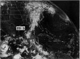
The most notable storm of the season was Hurricane Hugo
, which caused $10 billion (1989 USD
, $ USD) in damage and 111 fatalities as it ravaged the Lesser Antilles
and South Carolina
of the United States
. Hugo ranked as the costliest Atlantic hurricane until Hurricane Andrew
in the 1992 season
, and has since fallen to the eighth costliest hurricane following the even more destructive storms during the 2000s decade. Few other storms in 1989 caused significant damage; Tropical Storm Allison, Hurricane Chantal
, and Hurricane Jerry
combined caused extensive damage in Texas
; Hurricane Dean also caused light damage in Bermuda
and the Canadian
province
of Newfoundland
. Overall, the storms of the season collectively caused 147 fatalities and $10.74 billion (1989 USD, $ USD) in damage.
Forecasts of hurricane activity are issued before each hurricane season by noted hurricane experts such as Dr. William M. Gray
and his associates at Colorado State University
(CSU). A normal season as defined by the National Oceanic and Atmospheric Administration
(NOAA), has eleven named storms, of which six reach hurricane strength, and two major hurricanes. On May 31, 1989, it was forecast by CSU that there would be seven named storms, four of which would intensify into a hurricane; there was no prediction of the number of major hurricanes (Category 3+ on the Saffir–Simpson Hurricane Scale).
. Four hurricanes and one tropical storm made landfall during the season and caused 147 deaths and $10.74 billion in damage (1989 USD; $ USD). The last storm of the season, Tropical Storm Karen, dissipated on December 4, four days after the official end of the season on November 30.
Tropical cyclogenesis
in the 1989 Atlantic hurricane season began with a tropical depression developing on June 16. Later that month, another tropical depression developed, and intensified, eventually becoming Tropical Storm Allison. After June, the month of July was slightly more active with three tropical depressions developing; however, the latter two (Hurricane Chantal and Hurricane Dean) did not form until extremely late in the month. August was the most active month of the season, with a total of seven tropical cyclones either existing or developing in that period. Although September is the climatological peak of hurricane season, only two tropical cyclones developed in that month, and both of which later become Hurricane Hugo and Tropical Storm Iris. Two tropical cyclones also developed in October, and the latter one in that month eventually became Hurricane Jerry. Finally, one tropical cyclone developed in November; it eventually became Tropical Storm Karen, and lasted outside the bounds of hurricane season, dissipating on December 4.
The season's activity was reflected with a cumulative accumulated cyclone energy
(ACE) rating of 135, which is classified as "above normal". ACE is, broadly speaking, a measure of the power of the hurricane multiplied by the length of time it existed, so storms that last a long time, as well as particularly strong hurricanes, have high ACEs. ACE is only calculated for full advisories on tropical systems at or exceeding 34 knots (39 mph, 63 km/h) or tropical storm strength. Subtropical cyclone
s are excluded from the total.
Timeline of tropical activity in the 1989 Atlantic hurricane season
. The depression headed southeastward toward Mexico, and did not intensify into a tropical storm as predicted. Nearing the coast of Mexico, the tropical depression was absorbed into a larger extratropical system on June 17. Although the tropical depression was in close proximity to land, there was no effects on land, and as such, there was no damage or fatalities reported.
influenced and the remnants of eastern Pacific Hurricane Cosme
. Heading northward, the tropical depression slowly intensified, becoming Tropical Storm Allison two days later. Allison continued to slowly intensify, and made landfall near Freeport
with winds of 50 mph (80 km/h) on the following day. While just inland, the storm dropped heavy rains, especially in Louisiana
and Texas, where rainfall from Allison had peaked at 25.67 in (652 mm) in Winnfield, Louisiana
. Continuing over Texas, Allison rapidly weakened over eastern Texas, and transitioned into an extratropical storm on June 28. Although it rapidly became extratropical over land, the remnants of Allison wandered over the southern United States, but reached as far north as Indiana
before turning south again and finally dissipating over Arkansas
on July 7.
Allison caused significant flooding in several states, especially Louisiana and Texas, where rain fell at over 20 in (508 mm) in some areas. Furthermore, Allison produced 13.9 in (353 mm) of rain in Arkansas, which made it the wettest tropical cyclone recorded in that state. Eleven deaths by drowning were attributed to the rains associated with Allison, and flood damage in Texas, Louisiana and Mississippi
was estimated at $560 million (1989 USD, $ USD).
on July 7. The wave quickly developed a low-level circulation by July 9 and was designated Tropical Depression Three. The depression was located midway between Africa and the Lesser Antilles
and traveling to the northwest in response to an area of high pressure
located north of the Azores
. The depression was upgraded to Tropical Storm Barry on July 11. Barry slowly intensified and reached its peak intensity of 55 mph (85 km/h) the next day. By July 13, Barry weakened back to a depression and dissipated shortly after while located 545 mi (880 km) northeast of the Lesser Antilles.
disturbance first observed near Trinidad
, but did not develop into Tropical Depression Four until north of the Yucatan Peninsula
on July 31. The tropical depression quickly intensified into a tropical storm as it northward, receiving the name Chantal. Chantal further intensified into a Category 1 hurricane before landfall at High Island, Texas
on August 1. After making landfall, Chantal initially rapidly weakened inland, deteriorating back to a tropical storm only five hours later. Chantal continued rapidly weaken inland, and was downgraded to a tropical depression early on August 2. The weak tropical depression tracked north-northwestward, and dissipated over Oklahoma
on August 3. The remnants of Chantal crossed the Central and Eastern United States, before reaching Atlantic Canada. The remnants of Chantal were last noted over Canada, passing over Newfoundland on August 7 as Hurricane Dean
approached.
Similar to Tropical Storm Allison, there was heavy rainfall in Louisiana and Texas, although lesser amounts were recorded, peaking at 20 in (508 mm) in Friendswood, Texas
. There were 13 fatalities associated with Chantal, including a crew of 10 on the oil-rig construction vessel Avco 5, which capsized off Morgan City, Louisiana
. Damage caused by wind and flooding was estimated at $100 million (1989 USD, $ USD).
and the Lesser Antilles
, and intensified into Tropical Storm Dean on August 1. Dean headed generally west-northwestward, and eventually intensified into a hurricane on the following day. Dean remained a weak Category 1 hurricane as it curved northward, bypassing the Lesser Antilles. Tracking northward, Dean accelerated and intensified into a Category 2 hurricane as it crossed Bermuda late on August 6. Continuing to accelerate, Dean curved northeastward, and weakened back to a tropical storm before making landfall in southern Newfoundland on August 8. Dean continued in the northeast direction and lost tropical characteristics south of Greenland
on the following day.
As Dean approached the Lesser Antilles, heavy rainfall and strong winds were reported in Antigua
and Barbuda
. Effects were similar on Bermuda, with winds gusting up to 113 mph (182 km/h) and 3-5 in (76.2–127 mm) of rainfall. Flooding was reported on Bermuda, and damage on the island was nearly $9 million (1989 USD, $ USD). Although Dean caused no fatalities, 16 people were injured in Bermuda. In Atlantic Canada, light to moderate rainfall was reported, and tropical storm force winds were observed in some areas. Furthermore, waves at 26 ft (7.92 m) were reported on Sable Island
.
. Because of its close proximity to the Lesser Antilles, a tropical storm watch was issued for that area of the Caribbean Sea
. After less than 24 hours as a tropical depression, an upper-level low increased wind shear on the system, and it dissipated later that day. The wave eventually split in two, with the south part eventually becoming Hurricane Lorena in the eastern Pacific Ocean
.
satellite imagery. Once the system emerged off the coast of Africa into the cool eastern Atlantic Ocean, its convection diminished but left a small, well-organized low-level circulation. Slowly the tropical wave began to regain its convection and it became a tropical depression just southeast of the Cape Verde Islands early on August 18 based on Dvorak satellite
observations. Erin became a tropical storm on August 19 while 500 mi (804.7 km) west of Cape Verde. The interaction
between the tropical depression, a tropical wave moving through the central Atlantic, and a subtropical system to the north, caused Erin to move north-northwestward. It continued to be steered north-northwestward until August 21, when it turned northwards.
Erin became a hurricane on August 22 after being in the environment of the northeastern quadrant of an upper-level low, which caused the stream above to become weaker and more conflicting. It slowed and began to move more northwestward while northeast of the upper-level low. However, shortly afterward, a wave moving westward into Erin forced it to move north and eventually north-northeast. The storm then began weakening and degenerated into a tropical storm on August 27. Shortly thereafter, Erin transitioned into an extratropical cyclone.
on September 9.
on August 27. However, on the following day, an Air Force plane did not indicate a low-level circulation, and Tropical Depression Nine had degenerated back into a tropical wave. Tropical Depression Nine did not re-develop in the Atlantic or the Caribbean Sea, although the remnants entered the Pacific and regenerated into Hurricane Octave
on September 8.
, Newfoundland. Remaining nearly stationary, Gabrielle weakened to a tropical storm, and headed due westward on September 10. After heading westward, Gabrielle made a sharp turn to the northeast on September 11, and it weakened to a tropical depression on the following day. By September 13, the depression merged with a storm developing off Newfoundland.
Although it never approached land, Gabrielle was an extremely large and powerful storm that generated swells up to 20 ft (6 m) all the way from the Lesser Antilles to Canada; waves reached a height of 30 ft (9 m) in Nova Scotia. Large waves responsible for eight deaths on the East Coast of the United States
; almost all of the fatalities occurred in New England
. In addition, one fatality was reported in Canada, when a man drowned near Ketch Harbor, Nova Scotia.
and Montserrat
with winds near 140 mph (230 km/h) and later made landfall on St. Croix at the same intensity. After weakening to a Category 3, Hugo made landfall on eastern Puerto Rico
, and re-emerged into the Atlantic on September 18. After re-emerging into the Atlantic, Hugo weakened further to a Category 2 hurricane. As Hugo accelerated to the northwest, re-intensification occurred, and it eventually reached a secondary peak intensity as a low-end Category 4 hurricane. Early on September 22, Hugo made landfall near Charleston, South Carolina
with winds of 140 mph (225 km/h). After landfall, Hugo rapidly weakened as it turned to the northeast, and transitioned into an extratropical cyclone in northwestern Pennsylvania
on September 23. The remnants continued rapidly northeastward, and dissipated on September 25 near Greenland
.
Hugo posed a significant threat to much of the eastern Caribbean and to the East Coast of the United States, as a result, over 30 tropical storm/hurricane watches and warnings were issued in relation to the storm. While crossing through the Caribbean, Hugo dropped heavy rainfall and caused very high winds resulting in the damage or destruction of houses and crops. Hugo responsible for $3 billion (1989 USD, $ USD) in damages and over 70 deaths. In the United States, the hurricane caused $7 billion (1989 USD, $ USD) in damages and 35 deaths, mostly in South Carolina. Hugo was the costliest tropical cyclone in American history and in the Atlantic basin at the time, however, it was later surpassed by Hurricane Andrew of 1992; it was further surpassed by Hurricanes Charley
, Frances
, Ivan
, and Jeanne
of 2004
; Hurricanes Katrina
(which also surpassed Andrew), Rita
, and Wilma
in 2005
; and Hurricane Ike
in the 2008 Atlantic hurricane season
. As a result, Hugo is now the ninth costliest hurricane in the Atlantic basin (tied with Hurricane Jeanne).
, or binary interaction with Hugo. On September 19, Iris attained peak winds of 70 mph (110 km/h) about 260 mi (418.4 km) northeast of Barbuda. After reaching peak intensity, Iris weakened due to increased wind shear from Hugo. On September 21, the winds decreased below tropical storm status, after the center became exposed from the convection. The next day Iris dissipated, although a remnant circulation persisted and tracked toward southern Florida.
As Iris approached the Lesser Antilles, a tropical storm warning was issued for Barbados and St. Vincent and the Grenadines on September 18. Simultaneously, a tropical storm watch was issued for Trinidad and Tobago
. Six hours later, both the tropical storm watch and warning was discontinued. While Iris was a strong tropical storm, it produced 7.53 in (191.3 mm) of rainfall on Saint John
in the U.S. Virgin Islands, resulting in flooding. There were few reports of winds or rainfall on other islands, due to Hugo destroying observation stations a few days prior.
in the east Pacific basin. Tropical Depression Thirteen was predicted to intensify into near hurricane status by October 5, although a mid-latitude trough increased wind shear, inducing weakening. As a result, forecasts for strengthening were lowered, although intensification into a tropical storm was still expected. However, later on October 3, the National Hurricane Center instead began to forecast weakening on the depression. Shortly before 0000 UTC on October 4, it was noted that satellite imagery only indicated a swirl of low-level clouds, and the depression was then declared dissipated.
n tropical wave that failed to developed until crossing the Yucatán Peninsula and emerging into the Bay of Campeche
on October 12. Developed as the fourteenth tropical depression of the season, the system quickly intensified into Tropical Storm Jerry on the following day. It tracked generally northwards while intensifying, and reached hurricane strength on October 15. After intensifying slightly more, Jerry made landfall near Jamaica Beach, Texas
with winds of 85 mph (140 km/h). Jerry rapidly weakened after moving inland, and dissipated by October 16. The remnants moved through the Tennessee Valley
ahead of a frontal zone, and eventually offshore the coast of the Mid-Atlantic
states.
As Jerry approached the coast, light storm surge occurred in Louisiana and Texas, with the highest waves reaching 7 ft (2.1 m) in Baytown, Texas
. Three people died when an automobile was blown off the Galveston, Texas seawall and State Highway 87
was washed away from High Island, Texas
to the eastern portion of Sea Rim State Park
. This was the last time that Highway 87 was open to traffic across much of Jefferson County
due to increasing erosion. In addition, light to moderate rainfall fell in the path of Jerry and its remnants, with precipitation peaking at 6.4 in (162.6 mm) in Silsbee, Texas
, and 6.71 in (170.4 mm) in eastern Kentucky. Damage is estimated at $70 million (1989 USD, $ USD).
While Karen was still a tropical depression, tropical storm watches were issued for Cozumel
on the Yucatan Peninsula, Isle de la Juventud, and western Cuba; the latter two were upgraded to warnings after Karen attained tropical storm intensity. The storm dropped heavy rainfall in Cuba, reaching over 15 in (381 mm) on Isle de la Juventud. Wind gusts reached 60 mph (96.6 km/h), and there were reports of a tornado, but no damage or fatalities were reported. After affecting Cuba, Karen turned to the southwest while steadily weakening. It briefly threatened Belize
, prompting a tropical storm watch, but the storm turned to the southeast and dissipated on December 4; its remnants later moved over Nicaragua
. Karen was the last tropical cyclone to exist in December until Hurricane Nicole
in 1998.
. This is the same list used for the 1983 season
except for Allison, which replaced Alicia
. Storms were named Allison, Erin, Felix, Gabrielle, Hugo, Iris, Jerry, and Karen for the first time in 1989. Names that were not assigned are marked in .
retired one name in the spring of 1990: Hugo. It was replaced in the 1995 season
by Humberto.
Atlantic hurricane season
The Atlantic hurricane season is the period in a year when hurricanes usually form in the Atlantic Ocean. Tropical cyclones in the North Atlantic are called hurricanes, tropical storms, or tropical depressions. In addition, there have been several storms over the years that have not been fully...
that produced fifteen tropical cyclone
Tropical cyclone
A tropical cyclone is a storm system characterized by a large low-pressure center and numerous thunderstorms that produce strong winds and heavy rain. Tropical cyclones strengthen when water evaporated from the ocean is released as the saturated air rises, resulting in condensation of water vapor...
s, eleven named storms, seven hurricanes, and two major hurricanes. The season was officially designated from June 1, 1989, to November 30, 1989, dates which conventionally delimit the period of each year when most tropical cyclones develop in the Atlantic basin
Atlantic Basin
The Atlantic Basin is the Atlantic Ocean.Atlantic Basin may also refer to:* Atlantic Basin Iron Works, an ironworks that operated in Brooklyn, New York, in the early to mid-20th century...
. The season began with Tropical Storm Allison
Tropical Storm Allison (1989)
Tropical Storm Allison was a tropical cyclone that produced severe flooding in the southern United States. The second tropical cyclone and the first named storm of the 1989 Atlantic hurricane season, Allison formed on June 24 in the northwestern Gulf of Mexico. Development of Allison was a result...
on June 24, and ended with Tropical Storm Karen, which dissipated on December 4.
The most notable storm of the season was Hurricane Hugo
Hurricane Hugo
Hurricane Hugo was a classical, destructive and rare Cape Verde-type hurricane which struck the Caribbean islands of Guadeloupe, Montserrat, St. Croix, Puerto Rico and the USA mainland in South Carolina as a Category 4 hurricane during September of the 1989 Atlantic hurricane season...
, which caused $10 billion (1989 USD
United States dollar
The United States dollar , also referred to as the American dollar, is the official currency of the United States of America. It is divided into 100 smaller units called cents or pennies....
, $ USD) in damage and 111 fatalities as it ravaged the Lesser Antilles
Lesser Antilles
The Lesser Antilles are a long, partly volcanic island arc in the Western Hemisphere. Most of its islands form the eastern boundary of the Caribbean Sea with the Atlantic Ocean, with the remainder located in the southern Caribbean just north of South America...
and South Carolina
South Carolina
South Carolina is a state in the Deep South of the United States that borders Georgia to the south, North Carolina to the north, and the Atlantic Ocean to the east. Originally part of the Province of Carolina, the Province of South Carolina was one of the 13 colonies that declared independence...
of the United States
United States
The United States of America is a federal constitutional republic comprising fifty states and a federal district...
. Hugo ranked as the costliest Atlantic hurricane until Hurricane Andrew
Hurricane Andrew
Hurricane Andrew was the third Category 5 hurricane to make landfall in the United States, after the Labor Day Hurricane of 1935 and Hurricane Camille in 1969. Andrew was the first named storm and only major hurricane of the otherwise inactive 1992 Atlantic hurricane season...
in the 1992 season
1992 Atlantic hurricane season
The 1992 Atlantic hurricane season had one of the latest dates on record for the first named storm. The season officially began on June 1, 1992, and lasted until November 30, 1992. It was the least active hurricane season in nine years due to a strong El Niño...
, and has since fallen to the eighth costliest hurricane following the even more destructive storms during the 2000s decade. Few other storms in 1989 caused significant damage; Tropical Storm Allison, Hurricane Chantal
Hurricane Chantal (1989)
Hurricane Chantal was one of three tropical cyclones to make landfall in Texas during the 1989 Atlantic hurricane season. The third named storm and the first hurricane of the season, Chantal slowly developed on July 30 in the southern Gulf of Mexico from a tropical disturbance within that was...
, and Hurricane Jerry
Hurricane Jerry (1989)
Hurricane Jerry was the tenth named storm and the sixth and final hurricane of the 1989 Atlantic hurricane season. Jerry was also the fourth U.S. landfalling storm and the third storm to strike Texas during the 1989 season; the two previous storms were Allison in June and Chantal in August. When it...
combined caused extensive damage in Texas
Texas
Texas is the second largest U.S. state by both area and population, and the largest state by area in the contiguous United States.The name, based on the Caddo word "Tejas" meaning "friends" or "allies", was applied by the Spanish to the Caddo themselves and to the region of their settlement in...
; Hurricane Dean also caused light damage in Bermuda
Bermuda
Bermuda is a British overseas territory in the North Atlantic Ocean. Located off the east coast of the United States, its nearest landmass is Cape Hatteras, North Carolina, about to the west-northwest. It is about south of Halifax, Nova Scotia, Canada, and northeast of Miami, Florida...
and the Canadian
Canada
Canada is a North American country consisting of ten provinces and three territories. Located in the northern part of the continent, it extends from the Atlantic Ocean in the east to the Pacific Ocean in the west, and northward into the Arctic Ocean...
province
Provinces and territories of Canada
The provinces and territories of Canada combine to make up the world's second-largest country by area. There are ten provinces and three territories...
of Newfoundland
Newfoundland and Labrador
Newfoundland and Labrador is the easternmost province of Canada. Situated in the country's Atlantic region, it incorporates the island of Newfoundland and mainland Labrador with a combined area of . As of April 2011, the province's estimated population is 508,400...
. Overall, the storms of the season collectively caused 147 fatalities and $10.74 billion (1989 USD, $ USD) in damage.
Pre-season forecasts
| Source | Date | b>Named storms |
b>Hurricanes | b>Major hurricanes |
| CSU Colorado State University Colorado State University is a public research university located in Fort Collins, Colorado. The university is the state's land grant university, and the flagship university of the Colorado State University System.The enrollment is approximately 29,932 students, including resident and... |
May 31 | 7 | 4 | Unknown |
| Record high activity | 28 2005 Atlantic hurricane season The 2005 Atlantic hurricane season was the most active Atlantic hurricane season in recorded history, repeatedly shattering numerous records. The impact of the season was widespread and ruinous with an estimated 3,913 deaths and record damage of about $159.2 billion... |
15 2005 Atlantic hurricane season The 2005 Atlantic hurricane season was the most active Atlantic hurricane season in recorded history, repeatedly shattering numerous records. The impact of the season was widespread and ruinous with an estimated 3,913 deaths and record damage of about $159.2 billion... |
8 1950 Atlantic hurricane season The 1950 Atlantic hurricane season was the first year in which tropical cyclones were given official names in the Atlantic basin. Names were taken from the Joint Army/Navy Phonetic Alphabet, with the first named storm being designated "Able", the second "Baker", and so on. It was an active season... |
|
| Record low activity | 1 1914 Atlantic hurricane season The 1914 Atlantic hurricane season was the least active Atlantic hurricane season on record, with only one known tropical storm. Although hurricane season typically encompasses a much larger time-span, actual activity was confined to the middle of September... |
0 1914 Atlantic hurricane season The 1914 Atlantic hurricane season was the least active Atlantic hurricane season on record, with only one known tropical storm. Although hurricane season typically encompasses a much larger time-span, actual activity was confined to the middle of September... (tie 1907 Atlantic hurricane season The 1907 Atlantic hurricane season ran through the summer and the first half of fall in 1907. The season was a very quiet with only five tropical storms forming, with none of them reaching hurricane strength. This feat has only been accomplished one other season, the 1914 season... ) |
0 | |
| Actual activity | 11 | 7 | 2 | |
Forecasts of hurricane activity are issued before each hurricane season by noted hurricane experts such as Dr. William M. Gray
William M. Gray
William M. "Bill" Gray is Emeritus Professor of Atmospheric Science at Colorado State University , and head of the Tropical Meteorology Project at CSU's Department of Atmospheric Sciences. He is a pioneer in the science of forecasting hurricanes and one of the world's leading experts on tropical...
and his associates at Colorado State University
Colorado State University
Colorado State University is a public research university located in Fort Collins, Colorado. The university is the state's land grant university, and the flagship university of the Colorado State University System.The enrollment is approximately 29,932 students, including resident and...
(CSU). A normal season as defined by the National Oceanic and Atmospheric Administration
National Oceanic and Atmospheric Administration
The National Oceanic and Atmospheric Administration , pronounced , like "noah", is a scientific agency within the United States Department of Commerce focused on the conditions of the oceans and the atmosphere...
(NOAA), has eleven named storms, of which six reach hurricane strength, and two major hurricanes. On May 31, 1989, it was forecast by CSU that there would be seven named storms, four of which would intensify into a hurricane; there was no prediction of the number of major hurricanes (Category 3+ on the Saffir–Simpson Hurricane Scale).
Season activity
The Atlantic hurricane season officially began on June 1, 1989. It was an above average season in which 15 tropical depressions formed. Eleven depressions attained tropical storm status, and seven of these attained hurricane status. Two hurricanes further intensified into major hurricanes. The season was above average most likely because of relatively small amounts of dust within the Saharan Air LayerSaharan Air Layer
The Saharan Air Layer is an intensely dry, warm and sometimes dust-laden layer of the atmosphere which often overlies the cooler, more-humid surface air of the Atlantic Ocean. In the Sahara Desert region of North Africa, where it originates, it is the prevalent atmosphere, extending from the...
. Four hurricanes and one tropical storm made landfall during the season and caused 147 deaths and $10.74 billion in damage (1989 USD; $ USD). The last storm of the season, Tropical Storm Karen, dissipated on December 4, four days after the official end of the season on November 30.
Tropical cyclogenesis
Tropical cyclogenesis
Tropical cyclogenesis is the term that describes the development and strengthening of a tropical cyclone in the atmosphere. The mechanisms through which tropical cyclogenesis occurs are distinctly different from those through which mid-latitude cyclogenesis occurs...
in the 1989 Atlantic hurricane season began with a tropical depression developing on June 16. Later that month, another tropical depression developed, and intensified, eventually becoming Tropical Storm Allison. After June, the month of July was slightly more active with three tropical depressions developing; however, the latter two (Hurricane Chantal and Hurricane Dean) did not form until extremely late in the month. August was the most active month of the season, with a total of seven tropical cyclones either existing or developing in that period. Although September is the climatological peak of hurricane season, only two tropical cyclones developed in that month, and both of which later become Hurricane Hugo and Tropical Storm Iris. Two tropical cyclones also developed in October, and the latter one in that month eventually became Hurricane Jerry. Finally, one tropical cyclone developed in November; it eventually became Tropical Storm Karen, and lasted outside the bounds of hurricane season, dissipating on December 4.
The season's activity was reflected with a cumulative accumulated cyclone energy
Accumulated cyclone energy
Accumulated cyclone energy is a measure used by the National Oceanic and Atmospheric Administration to express the activity of individual tropical cyclones and entire tropical cyclone seasons, particularly the North Atlantic hurricane season. It uses an approximation of the energy used by a...
(ACE) rating of 135, which is classified as "above normal". ACE is, broadly speaking, a measure of the power of the hurricane multiplied by the length of time it existed, so storms that last a long time, as well as particularly strong hurricanes, have high ACEs. ACE is only calculated for full advisories on tropical systems at or exceeding 34 knots (39 mph, 63 km/h) or tropical storm strength. Subtropical cyclone
Subtropical cyclone
A subtropical cyclone is a weather system that has some characteristics of a tropical and an extratropical cyclone. As early as the 1950s, meteorologists were unclear whether they should be characterized as tropical or extratropical cyclones. They were officially recognized by the National...
s are excluded from the total.
Storms
Timeline of tropical activity in the 1989 Atlantic hurricane season
Timeline of the 1989 Atlantic hurricane season
The Timeline of the 1989 Atlantic hurricane season documents all the storm formations, strengthening, weakening, landfalls, extratropical transitions, as well as dissipation...
Tropical Depression One
The first tropical depression of the season developed on June 15 from a frontal zone situated 440 mi (710 km) east of Tampico, MexicoMexico
The United Mexican States , commonly known as Mexico , is a federal constitutional republic in North America. It is bordered on the north by the United States; on the south and west by the Pacific Ocean; on the southeast by Guatemala, Belize, and the Caribbean Sea; and on the east by the Gulf of...
. The depression headed southeastward toward Mexico, and did not intensify into a tropical storm as predicted. Nearing the coast of Mexico, the tropical depression was absorbed into a larger extratropical system on June 17. Although the tropical depression was in close proximity to land, there was no effects on land, and as such, there was no damage or fatalities reported.
Tropical Storm Allison
The second tropical depression developed on June 24 in the northwestern Gulf of Mexico, from the interaction of a tropical waveTropical wave
Tropical waves, easterly waves, or tropical easterly waves, also known as African easterly waves in the Atlantic region, are a type of atmospheric trough, an elongated area of relatively low air pressure, oriented north to south, which move from east to west across the tropics causing areas of...
influenced and the remnants of eastern Pacific Hurricane Cosme
Hurricane Cosme (1989)
Hurricane Cosme was the third tropical cyclone and second hurricane of the 1989 Pacific hurricane season. Forming on June 19 from a tropical wave, the storm initially moved westward before being upgraded into Tropical Storm Cosme. It ultimately intensifying into a Category 1 hurricane. Cosme turned...
. Heading northward, the tropical depression slowly intensified, becoming Tropical Storm Allison two days later. Allison continued to slowly intensify, and made landfall near Freeport
Freeport, Texas
Freeport is a city in Brazoria County, Texas within the Houston–Sugar Land–Baytown metropolitan area and is situated in Southeast Texas. As of the 2000 U.S...
with winds of 50 mph (80 km/h) on the following day. While just inland, the storm dropped heavy rains, especially in Louisiana
Louisiana
Louisiana is a state located in the southern region of the United States of America. Its capital is Baton Rouge and largest city is New Orleans. Louisiana is the only state in the U.S. with political subdivisions termed parishes, which are local governments equivalent to counties...
and Texas, where rainfall from Allison had peaked at 25.67 in (652 mm) in Winnfield, Louisiana
Winnfield, Louisiana
Winnfield is a city in and the parish seat of Winn Parish, Louisiana, United States. The population was 5,749 at the 2000 census. It has long been associated with the Long faction of the Louisiana Democratic Party and was home to three governors of Louisiana.-Geography:Winnfield is located at ...
. Continuing over Texas, Allison rapidly weakened over eastern Texas, and transitioned into an extratropical storm on June 28. Although it rapidly became extratropical over land, the remnants of Allison wandered over the southern United States, but reached as far north as Indiana
Indiana
Indiana is a US state, admitted to the United States as the 19th on December 11, 1816. It is located in the Midwestern United States and Great Lakes Region. With 6,483,802 residents, the state is ranked 15th in population and 16th in population density. Indiana is ranked 38th in land area and is...
before turning south again and finally dissipating over Arkansas
Arkansas
Arkansas is a state located in the southern region of the United States. Its name is an Algonquian name of the Quapaw Indians. Arkansas shares borders with six states , and its eastern border is largely defined by the Mississippi River...
on July 7.
Allison caused significant flooding in several states, especially Louisiana and Texas, where rain fell at over 20 in (508 mm) in some areas. Furthermore, Allison produced 13.9 in (353 mm) of rain in Arkansas, which made it the wettest tropical cyclone recorded in that state. Eleven deaths by drowning were attributed to the rains associated with Allison, and flood damage in Texas, Louisiana and Mississippi
Mississippi
Mississippi is a U.S. state located in the Southern United States. Jackson is the state capital and largest city. The name of the state derives from the Mississippi River, which flows along its western boundary, whose name comes from the Ojibwe word misi-ziibi...
was estimated at $560 million (1989 USD, $ USD).
Tropical Storm Barry
Tropical Storm Barry developed out of a tropical wave which moved off the west coast of AfricaAfrica
Africa is the world's second largest and second most populous continent, after Asia. At about 30.2 million km² including adjacent islands, it covers 6% of the Earth's total surface area and 20.4% of the total land area...
on July 7. The wave quickly developed a low-level circulation by July 9 and was designated Tropical Depression Three. The depression was located midway between Africa and the Lesser Antilles
Lesser Antilles
The Lesser Antilles are a long, partly volcanic island arc in the Western Hemisphere. Most of its islands form the eastern boundary of the Caribbean Sea with the Atlantic Ocean, with the remainder located in the southern Caribbean just north of South America...
and traveling to the northwest in response to an area of high pressure
High pressure area
A high-pressure area is a region where the atmospheric pressure at the surface of the planet is greater than its surrounding environment. Winds within high-pressure areas flow outward due to the higher density air near their center and friction with land...
located north of the Azores
Azores
The Archipelago of the Azores is composed of nine volcanic islands situated in the middle of the North Atlantic Ocean, and is located about west from Lisbon and about east from the east coast of North America. The islands, and their economic exclusion zone, form the Autonomous Region of the...
. The depression was upgraded to Tropical Storm Barry on July 11. Barry slowly intensified and reached its peak intensity of 55 mph (85 km/h) the next day. By July 13, Barry weakened back to a depression and dissipated shortly after while located 545 mi (880 km) northeast of the Lesser Antilles.
Hurricane Chantal
Hurricane Chantal originated from an Intertropical Convergence ZoneIntertropical Convergence Zone
The Intertropical Convergence Zone , known by sailors as The Doldrums, is the area encircling the earth near the equator where winds originating in the northern and southern hemispheres come together....
disturbance first observed near Trinidad
Trinidad
Trinidad is the larger and more populous of the two major islands and numerous landforms which make up the island nation of Trinidad and Tobago. It is the southernmost island in the Caribbean and lies just off the northeastern coast of Venezuela. With an area of it is also the fifth largest in...
, but did not develop into Tropical Depression Four until north of the Yucatan Peninsula
Yucatán Peninsula
The Yucatán Peninsula, in southeastern Mexico, separates the Caribbean Sea from the Gulf of Mexico, with the northern coastline on the Yucatán Channel...
on July 31. The tropical depression quickly intensified into a tropical storm as it northward, receiving the name Chantal. Chantal further intensified into a Category 1 hurricane before landfall at High Island, Texas
High Island, Texas
High Island is an unincorporated area located in the Bolivar Peninsula census-designated place, Galveston County, Texas, United States. The community is located in the extreme eastern part of the county on Bolivar Peninsula, less than one mile from Chambers County and less than two miles from...
on August 1. After making landfall, Chantal initially rapidly weakened inland, deteriorating back to a tropical storm only five hours later. Chantal continued rapidly weaken inland, and was downgraded to a tropical depression early on August 2. The weak tropical depression tracked north-northwestward, and dissipated over Oklahoma
Oklahoma
Oklahoma is a state located in the South Central region of the United States of America. With an estimated 3,751,351 residents as of the 2010 census and a land area of 68,667 square miles , Oklahoma is the 28th most populous and 20th-largest state...
on August 3. The remnants of Chantal crossed the Central and Eastern United States, before reaching Atlantic Canada. The remnants of Chantal were last noted over Canada, passing over Newfoundland on August 7 as Hurricane Dean
Hurricane Dean (1989)
Hurricane Dean was the fourth named storm and second hurricane of the 1989 Atlantic hurricane season. Dean formed on July 31 and reached tropical storm status the following day east of the Leeward Islands...
approached.
Similar to Tropical Storm Allison, there was heavy rainfall in Louisiana and Texas, although lesser amounts were recorded, peaking at 20 in (508 mm) in Friendswood, Texas
Friendswood, Texas
Friendswood is a city in the U.S. state of Texas within the Houston–Sugar Land–Baytown metropolitan area. The city lies in Galveston and Harris counties. As of the 2000 U.S...
. There were 13 fatalities associated with Chantal, including a crew of 10 on the oil-rig construction vessel Avco 5, which capsized off Morgan City, Louisiana
Morgan City, Louisiana
Morgan City is a city in St. Martin and St. Mary parishes in the U.S. state of Louisiana. The population was 12,404 at the 2010 census....
. Damage caused by wind and flooding was estimated at $100 million (1989 USD, $ USD).
Hurricane Dean
Hurricane Dean originated from a tropical wave that developed into Tropical Depression Five on July 31. The tropical depression was situated about half way between Cape VerdeCape Verde
The Republic of Cape Verde is an island country, spanning an archipelago of 10 islands located in the central Atlantic Ocean, 570 kilometres off the coast of Western Africa...
and the Lesser Antilles
Lesser Antilles
The Lesser Antilles are a long, partly volcanic island arc in the Western Hemisphere. Most of its islands form the eastern boundary of the Caribbean Sea with the Atlantic Ocean, with the remainder located in the southern Caribbean just north of South America...
, and intensified into Tropical Storm Dean on August 1. Dean headed generally west-northwestward, and eventually intensified into a hurricane on the following day. Dean remained a weak Category 1 hurricane as it curved northward, bypassing the Lesser Antilles. Tracking northward, Dean accelerated and intensified into a Category 2 hurricane as it crossed Bermuda late on August 6. Continuing to accelerate, Dean curved northeastward, and weakened back to a tropical storm before making landfall in southern Newfoundland on August 8. Dean continued in the northeast direction and lost tropical characteristics south of Greenland
Greenland
Greenland is an autonomous country within the Kingdom of Denmark, located between the Arctic and Atlantic Oceans, east of the Canadian Arctic Archipelago. Though physiographically a part of the continent of North America, Greenland has been politically and culturally associated with Europe for...
on the following day.
As Dean approached the Lesser Antilles, heavy rainfall and strong winds were reported in Antigua
Antigua
Antigua , also known as Waladli, is an island in the West Indies, in the Leeward Islands in the Caribbean region, the main island of the country of Antigua and Barbuda. Antigua means "ancient" in Spanish and was named by Christopher Columbus after an icon in Seville Cathedral, Santa Maria de la...
and Barbuda
Barbuda
Barbuda is an island in the Eastern Caribbean, and forms part of the state of Antigua and Barbuda. It has a population of about 1,500, most of whom live in the town of Codrington.-Location:...
. Effects were similar on Bermuda, with winds gusting up to 113 mph (182 km/h) and 3-5 in (76.2–127 mm) of rainfall. Flooding was reported on Bermuda, and damage on the island was nearly $9 million (1989 USD, $ USD). Although Dean caused no fatalities, 16 people were injured in Bermuda. In Atlantic Canada, light to moderate rainfall was reported, and tropical storm force winds were observed in some areas. Furthermore, waves at 26 ft (7.92 m) were reported on Sable Island
Sable Island
Sable Island is a small Canadian island situated 300 km southeast of mainland Nova Scotia in the Atlantic Ocean. The island is a year-round home to approximately five people...
.
Tropical Depression Six
Tropical Depression Six had developed on August 16 from a tropical wave about 600 mi (965 km) east of the Leeward IslandsLeeward Islands
The Leeward Islands are a group of islands in the West Indies. They are the northern islands of the Lesser Antilles chain. As a group they start east of Puerto Rico and reach southward to Dominica. They are situated where the northeastern Caribbean Sea meets the western Atlantic Ocean...
. Because of its close proximity to the Lesser Antilles, a tropical storm watch was issued for that area of the Caribbean Sea
Caribbean Sea
The Caribbean Sea is a sea of the Atlantic Ocean located in the tropics of the Western hemisphere. It is bounded by Mexico and Central America to the west and southwest, to the north by the Greater Antilles, and to the east by the Lesser Antilles....
. After less than 24 hours as a tropical depression, an upper-level low increased wind shear on the system, and it dissipated later that day. The wave eventually split in two, with the south part eventually becoming Hurricane Lorena in the eastern Pacific Ocean
Pacific Ocean
The Pacific Ocean is the largest of the Earth's oceanic divisions. It extends from the Arctic in the north to the Southern Ocean in the south, bounded by Asia and Australia in the west, and the Americas in the east.At 165.2 million square kilometres in area, this largest division of the World...
.
Hurricane Erin
An organized tropical wave was seen emerging off the coast of Africa on August 16 by METEOSATMeteosat
The Meteosat series of satellites are geostationary meteorological satellites operated by EUMETSAT under the Meteosat Transition Programme and the Meteosat Second Generation program....
satellite imagery. Once the system emerged off the coast of Africa into the cool eastern Atlantic Ocean, its convection diminished but left a small, well-organized low-level circulation. Slowly the tropical wave began to regain its convection and it became a tropical depression just southeast of the Cape Verde Islands early on August 18 based on Dvorak satellite
Dvorak technique
The Dvorak technique is a widely used system to subjectively estimate tropical cyclone intensity based solely on visible and infrared satellite images. Several agencies issue Dvorak intensity numbers for cyclones of sufficient intensity...
observations. Erin became a tropical storm on August 19 while 500 mi (804.7 km) west of Cape Verde. The interaction
Fujiwhara effect
The Fujiwhara effect or Fujiwara interaction, named after Sakuhei Fujiwhara, is a type of interaction between two nearby cyclonic vortices, causing them to appear to "orbit" each other.-Description:...
between the tropical depression, a tropical wave moving through the central Atlantic, and a subtropical system to the north, caused Erin to move north-northwestward. It continued to be steered north-northwestward until August 21, when it turned northwards.
Erin became a hurricane on August 22 after being in the environment of the northeastern quadrant of an upper-level low, which caused the stream above to become weaker and more conflicting. It slowed and began to move more northwestward while northeast of the upper-level low. However, shortly afterward, a wave moving westward into Erin forced it to move north and eventually north-northeast. The storm then began weakening and degenerated into a tropical storm on August 27. Shortly thereafter, Erin transitioned into an extratropical cyclone.
Hurricane Felix
The eighth tropical depression of the season developed on August 26, from a tropical wave that emerged from Africa two days prior. Quickly intensifying, the tropical depression had become Tropical Storm Felix near Cape Verde. Felix headed northward thereafter, and then northwestward, weakening back to a tropical depression by August 29 from strong upper-level wind shear. Heading northwestward, Felix eventually curved to the north by September 1. While remaining near stationary as it headed northward, Felix re-intensified into a tropical storm. Felix then curved to the west-northwest, intensifying further as it did so. Finally, after 13 days, Felix intensified enough to be considered a hurricane.Upper level wind shear increased again on Felix, and it weakened back to a tropical storm on September 7. Felix gradually weakened thereafter, and meandered in the northern Atlantic until becoming extratropical far to the northwest of the AzoresAzores
The Archipelago of the Azores is composed of nine volcanic islands situated in the middle of the North Atlantic Ocean, and is located about west from Lisbon and about east from the east coast of North America. The islands, and their economic exclusion zone, form the Autonomous Region of the...
on September 9.
Tropical Depression Nine
Tropical Depression Nine developed from a tropical wave 490 mi (790 km) east of BarbadosBarbados
Barbados is an island country in the Lesser Antilles. It is in length and as much as in width, amounting to . It is situated in the western area of the North Atlantic and 100 kilometres east of the Windward Islands and the Caribbean Sea; therein, it is about east of the islands of Saint...
on August 27. However, on the following day, an Air Force plane did not indicate a low-level circulation, and Tropical Depression Nine had degenerated back into a tropical wave. Tropical Depression Nine did not re-develop in the Atlantic or the Caribbean Sea, although the remnants entered the Pacific and regenerated into Hurricane Octave
Hurricane Octave (1989)
Hurricane Octave was a Category 4 hurricane which existed during the above-average 1989 Pacific hurricane season. The remnants of Atlantic Tropical Depression Nine tracked westward across the Caribbean Sea, entering the Pacific Ocean on September 3. It slowly developed, and organized into a...
on September 8.
Hurricane Gabrielle
The tenth tropical depression of the season developed from a tropical wave on August 30. The depression quickly intensified into Tropical Storm Gabrielle on the following day. Gabrielle moved generally westward, but curved slightly west-northwestward after intensifying into a hurricane on September 1. Further intensification continued, and Gabrielle eventually peaked as a moderately strong Category 4 hurricane on September 5. After becoming a Category 4 hurricane, Gabrielle slowly curved nearly due north. Gabrielle significantly weakened while heading northward, and maximum sustained winds dropped from a low-end Category 4 hurricane intensity, to a strong Category 2 hurricane, within 12 hours on September 7. While weakening as it headed northward, Gabrielle bypassed the island of Bermuda early on September 8. Gabrielle further weakened to a Category 1 hurricane late on September 8, and became nearly stationary roughly almost halfway between Bermuda and Cape RaceCape Race
Cape Race is a point of land located at the southeastern tip of the Avalon Peninsula on the island of Newfoundland, Canada. Its name is thought to come from the original Portuguese name for this cape, "Raso", or "bare"...
, Newfoundland. Remaining nearly stationary, Gabrielle weakened to a tropical storm, and headed due westward on September 10. After heading westward, Gabrielle made a sharp turn to the northeast on September 11, and it weakened to a tropical depression on the following day. By September 13, the depression merged with a storm developing off Newfoundland.
Although it never approached land, Gabrielle was an extremely large and powerful storm that generated swells up to 20 ft (6 m) all the way from the Lesser Antilles to Canada; waves reached a height of 30 ft (9 m) in Nova Scotia. Large waves responsible for eight deaths on the East Coast of the United States
East Coast of the United States
The East Coast of the United States, also known as the Eastern Seaboard, refers to the easternmost coastal states in the United States, which touch the Atlantic Ocean and stretch up to Canada. The term includes the U.S...
; almost all of the fatalities occurred in New England
New England
New England is a region in the northeastern corner of the United States consisting of the six states of Maine, New Hampshire, Vermont, Massachusetts, Rhode Island, and Connecticut...
. In addition, one fatality was reported in Canada, when a man drowned near Ketch Harbor, Nova Scotia.
Hurricane Hugo
Hugo developed from a tropical wave near Cape Verde on September 10. Classified as Tropical Depression Eleven, it headed generally westward, and intensified into Tropical Storm Hugo on September 11. Further intensification was somewhat slow, and Hugo became a hurricane by September 13. After becoming a major hurricane early on September 15, rapid intensification commenced, and less than 24 hours later, Hugo peaked as a low-end Category 5 hurricane. Hugo was therefore, the most intense tropical cyclone of the 1989 Atlantic hurricane season. Six hours later, Hugo weakened back to a Category 4 hurricane. After weakening down to a low-end Category 4 hurricane on September 17, Hugo entered the Caribbean Sea after passing between GuadeloupeGuadeloupe
Guadeloupe is an archipelago located in the Leeward Islands, in the Lesser Antilles, with a land area of 1,628 square kilometres and a population of 400,000. It is the first overseas region of France, consisting of a single overseas department. As with the other overseas departments, Guadeloupe...
and Montserrat
Montserrat
Montserrat is a British overseas territory located in the Leeward Islands, part of the chain of islands called the Lesser Antilles in the West Indies. This island measures approximately long and wide, giving of coastline...
with winds near 140 mph (230 km/h) and later made landfall on St. Croix at the same intensity. After weakening to a Category 3, Hugo made landfall on eastern Puerto Rico
Puerto Rico
Puerto Rico , officially the Commonwealth of Puerto Rico , is an unincorporated territory of the United States, located in the northeastern Caribbean, east of the Dominican Republic and west of both the United States Virgin Islands and the British Virgin Islands.Puerto Rico comprises an...
, and re-emerged into the Atlantic on September 18. After re-emerging into the Atlantic, Hugo weakened further to a Category 2 hurricane. As Hugo accelerated to the northwest, re-intensification occurred, and it eventually reached a secondary peak intensity as a low-end Category 4 hurricane. Early on September 22, Hugo made landfall near Charleston, South Carolina
Charleston, South Carolina
Charleston is the second largest city in the U.S. state of South Carolina. It was made the county seat of Charleston County in 1901 when Charleston County was founded. The city's original name was Charles Towne in 1670, and it moved to its present location from a location on the west bank of the...
with winds of 140 mph (225 km/h). After landfall, Hugo rapidly weakened as it turned to the northeast, and transitioned into an extratropical cyclone in northwestern Pennsylvania
Pennsylvania
The Commonwealth of Pennsylvania is a U.S. state that is located in the Northeastern and Mid-Atlantic regions of the United States. The state borders Delaware and Maryland to the south, West Virginia to the southwest, Ohio to the west, New York and Ontario, Canada, to the north, and New Jersey to...
on September 23. The remnants continued rapidly northeastward, and dissipated on September 25 near Greenland
Greenland
Greenland is an autonomous country within the Kingdom of Denmark, located between the Arctic and Atlantic Oceans, east of the Canadian Arctic Archipelago. Though physiographically a part of the continent of North America, Greenland has been politically and culturally associated with Europe for...
.
Hugo posed a significant threat to much of the eastern Caribbean and to the East Coast of the United States, as a result, over 30 tropical storm/hurricane watches and warnings were issued in relation to the storm. While crossing through the Caribbean, Hugo dropped heavy rainfall and caused very high winds resulting in the damage or destruction of houses and crops. Hugo responsible for $3 billion (1989 USD, $ USD) in damages and over 70 deaths. In the United States, the hurricane caused $7 billion (1989 USD, $ USD) in damages and 35 deaths, mostly in South Carolina. Hugo was the costliest tropical cyclone in American history and in the Atlantic basin at the time, however, it was later surpassed by Hurricane Andrew of 1992; it was further surpassed by Hurricanes Charley
Hurricane Charley
Hurricane Charley was the third named storm, the second hurricane, and the second major hurricane of the 2004 Atlantic hurricane season. Charley lasted from August 9 to August 15, and at its peak intensity it attained 150 mph winds, making it a strong Category 4 hurricane on the...
, Frances
Hurricane Frances
Hurricane Frances was the sixth named storm, the fourth hurricane, and the third major hurricane of the 2004 Atlantic hurricane season. The system crossing the open Atlantic during mid to late August, moving to the north of the Lesser Antilles while strengthening. Its outer bands affected Puerto...
, Ivan
Hurricane Ivan
Hurricane Ivan was a large, long-lived, Cape Verde-type hurricane that caused widespread damage in the Caribbean and United States. The cyclone was the ninth named storm, the sixth hurricane and the fourth major hurricane of the active 2004 Atlantic hurricane season...
, and Jeanne
Hurricane Jeanne
Hurricane Jeanne was the deadliest hurricane in the 2004 Atlantic hurricane season. It was the tenth named storm, the seventh hurricane, and the fifth major hurricane of the season, as well as the third hurricane and fourth named storm of the season to make landfall in Florida...
of 2004
2004 Atlantic hurricane season
The 2004 Atlantic hurricane season officially began on June 1, 2004, and lasted until November 30, 2004. These dates conventionally delimit the period of each year when most tropical cyclones form in the Atlantic basin...
; Hurricanes Katrina
Hurricane Katrina
Hurricane Katrina of the 2005 Atlantic hurricane season was a powerful Atlantic hurricane. It is the costliest natural disaster, as well as one of the five deadliest hurricanes, in the history of the United States. Among recorded Atlantic hurricanes, it was the sixth strongest overall...
(which also surpassed Andrew), Rita
Hurricane Rita
Hurricane Rita was the fourth-most intense Atlantic hurricane ever recorded and the most intense tropical cyclone ever observed in the Gulf of Mexico. Rita caused $11.3 billion in damage on the U.S. Gulf Coast in September 2005...
, and Wilma
Hurricane Wilma
Hurricane Wilma was the most intense tropical cyclone ever recorded in the Atlantic basin. Wilma was the twenty-second storm , thirteenth hurricane, sixth major hurricane, and fourth Category 5 hurricane of the record-breaking 2005 season...
in 2005
2005 Atlantic hurricane season
The 2005 Atlantic hurricane season was the most active Atlantic hurricane season in recorded history, repeatedly shattering numerous records. The impact of the season was widespread and ruinous with an estimated 3,913 deaths and record damage of about $159.2 billion...
; and Hurricane Ike
Hurricane Ike
Hurricane Ike was the second-costliest hurricane ever to make landfall in the United States, the costliest hurricane ever to impact Cuba and the second most active hurricane to reach the Canadian mainland in the Great Lakes Region after Hurricane Hazel in 1954...
in the 2008 Atlantic hurricane season
2008 Atlantic hurricane season
The 2008 Atlantic hurricane season was a very active hurricane season with sixteen named storms formed, including eight that became hurricanes and five that became major hurricanes. The season officially started on June 1 and ended on November 30. These dates conventionally delimit the period of...
. As a result, Hugo is now the ninth costliest hurricane in the Atlantic basin (tied with Hurricane Jeanne).
Tropical Storm Iris
A tropical wave moved off the coast of northwest Africa on September 12, showing signs of organization three days later. Late on September 16, the National Hurricane Center classified it as Tropical Depression Twelve, about halfway between the southern Lesser Antilles and the Cape Verde islands. It slowly strengthened despite its proximity to Hurricane Hugo, and intensified into Tropical Storm Iris early on September 18. After attaining that status, Iris turned to the north-northwest, paralleling the Leeward Islands, and initially there was uncertainty in its path due to potential FujiwharaFujiwhara effect
The Fujiwhara effect or Fujiwara interaction, named after Sakuhei Fujiwhara, is a type of interaction between two nearby cyclonic vortices, causing them to appear to "orbit" each other.-Description:...
, or binary interaction with Hugo. On September 19, Iris attained peak winds of 70 mph (110 km/h) about 260 mi (418.4 km) northeast of Barbuda. After reaching peak intensity, Iris weakened due to increased wind shear from Hugo. On September 21, the winds decreased below tropical storm status, after the center became exposed from the convection. The next day Iris dissipated, although a remnant circulation persisted and tracked toward southern Florida.
As Iris approached the Lesser Antilles, a tropical storm warning was issued for Barbados and St. Vincent and the Grenadines on September 18. Simultaneously, a tropical storm watch was issued for Trinidad and Tobago
Tobago
Tobago is the smaller of the two main islands that make up the Republic of Trinidad and Tobago. It is located in the southern Caribbean, northeast of the island of Trinidad and southeast of Grenada. The island lies outside the hurricane belt...
. Six hours later, both the tropical storm watch and warning was discontinued. While Iris was a strong tropical storm, it produced 7.53 in (191.3 mm) of rainfall on Saint John
Saint John, U.S. Virgin Islands
Saint John is an island in the Caribbean Sea and a constituent district of the United States Virgin Islands , an unincorporated territory of the United States. St...
in the U.S. Virgin Islands, resulting in flooding. There were few reports of winds or rainfall on other islands, due to Hugo destroying observation stations a few days prior.
Tropical Depression Thirteen
Tropical Depression Thirteen developed on October 2 from a tropical wave a few hundred miles east of the Lesser Antilles. The National Hurricane Center monitored the tropical depression and issued marine advisories, although they were accidentally included in the database for the 1989 season1989 Pacific hurricane season
-Tropical Storm Adolph:The first storm of the season developed out of a weak area of low pressure situated about 570 mi south-southwest of Acapulco, Mexico. Tracking towards the west, the circluation briefly dissipated on May 30, before redeveloping the following day into Tropical...
in the east Pacific basin. Tropical Depression Thirteen was predicted to intensify into near hurricane status by October 5, although a mid-latitude trough increased wind shear, inducing weakening. As a result, forecasts for strengthening were lowered, although intensification into a tropical storm was still expected. However, later on October 3, the National Hurricane Center instead began to forecast weakening on the depression. Shortly before 0000 UTC on October 4, it was noted that satellite imagery only indicated a swirl of low-level clouds, and the depression was then declared dissipated.
Hurricane Jerry
Hurricane Jerry formed from an AfricaAfrica
Africa is the world's second largest and second most populous continent, after Asia. At about 30.2 million km² including adjacent islands, it covers 6% of the Earth's total surface area and 20.4% of the total land area...
n tropical wave that failed to developed until crossing the Yucatán Peninsula and emerging into the Bay of Campeche
Bay of Campeche
The Bay of Campeche is the southern bight of the Gulf of Mexico. It is surrounded on three sides by the Mexican states of Campeche, Tabasco and Veracruz. It was named by Francisco Hernández de Córdoba and Antonio de Alaminos during their expedition in 1517...
on October 12. Developed as the fourteenth tropical depression of the season, the system quickly intensified into Tropical Storm Jerry on the following day. It tracked generally northwards while intensifying, and reached hurricane strength on October 15. After intensifying slightly more, Jerry made landfall near Jamaica Beach, Texas
Jamaica Beach, Texas
Jamaica Beach is a city in Galveston County, Texas, United States. As of the 2000 census, the city population was 1,075.-History:Prior to its development, Jamaica Beach was a Karankawa burial ground. Johnny Goyen and Earl Galceran of the Jamaica Corporation developed Jamaica Beach as a 2,000-lot...
with winds of 85 mph (140 km/h). Jerry rapidly weakened after moving inland, and dissipated by October 16. The remnants moved through the Tennessee Valley
Tennessee Valley
The Tennessee Valley is the drainage basin of the Tennessee River and is largely within the U.S. state of Tennessee. It stretches from southwest Kentucky to northwest Georgia and from northeast Mississippi to the mountains of Virginia and North Carolina...
ahead of a frontal zone, and eventually offshore the coast of the Mid-Atlantic
Mid-Atlantic States
The Mid-Atlantic states, also called middle Atlantic states or simply the mid Atlantic, form a region of the United States generally located between New England and the South...
states.
As Jerry approached the coast, light storm surge occurred in Louisiana and Texas, with the highest waves reaching 7 ft (2.1 m) in Baytown, Texas
Baytown, Texas
Baytown is a city within Harris County and partially in Chambers County in the Gulf Coast region of the U.S. state of Texas. Located within the Houston–Sugar Land–Baytown metropolitan area, it lies along both State Highway 146 and Interstate 10. As of 2010, Baytown had an population of 71,802...
. Three people died when an automobile was blown off the Galveston, Texas seawall and State Highway 87
State Highway 87 (Texas)
State Highway 87 or SH 87 runs for between Galveston, Texas to U.S. Highway 59 and U.S. Highway 84 in Timpson, Texas....
was washed away from High Island, Texas
High Island, Texas
High Island is an unincorporated area located in the Bolivar Peninsula census-designated place, Galveston County, Texas, United States. The community is located in the extreme eastern part of the county on Bolivar Peninsula, less than one mile from Chambers County and less than two miles from...
to the eastern portion of Sea Rim State Park
Sea Rim State Park
Sea Rim State Park is a state park in southeast Texas.The park is located on the Gulf of Mexico in southern Jefferson County, south of Port Arthur and just west of Sabine Pass. The park was closed for several years due to extensive damage from Hurricanes Rita and Ike . The park has recently...
. This was the last time that Highway 87 was open to traffic across much of Jefferson County
Jefferson County, Texas
Jefferson County is a county located in the state of Texas, United States. As of 2000, the population was 252,051. Its county seat is Beaumont, and it is named for the former U.S...
due to increasing erosion. In addition, light to moderate rainfall fell in the path of Jerry and its remnants, with precipitation peaking at 6.4 in (162.6 mm) in Silsbee, Texas
Silsbee, Texas
Silsbee is a city in Hardin County, Texas, United States. It is located at the intersection of U.S. Highway 96 and State Highway 327. The population was 6,393 at the 2000 census...
, and 6.71 in (170.4 mm) in eastern Kentucky. Damage is estimated at $70 million (1989 USD, $ USD).
Tropical Storm Karen
A tropical wave moved off the coast of Africa on November 13, and failed to organize until reaching the western Caribbean Sea. An upper-level anticyclone provided favorable conditions, allowing thunderstorms to concentrate around a developing low-level circulation. On November 28, satellite imagery and reconnaissance aircraft indicated the development of Tropical Depression Fifteen just north of the Honduras coast. It moved northwestward then northeastward, intensifying into Tropical Storm Karen on November 30 while southwest of Isla de la Juventud off the south coast of Cuba; it was named on the last day of the hurricane season. Within 12 hours of reaching tropical storm intensity, Karen reached peak winds of 60 mph (95 km/h), and around the same time a building ridge in the Gulf of Mexico forced it southeastward.While Karen was still a tropical depression, tropical storm watches were issued for Cozumel
Cozumel
Cozumel is an island in the Caribbean Sea off the eastern coast of Mexico's Yucatan Peninsula, opposite Playa del Carmen, and close to the Yucatan Channel. Cozumel is one of the ten municipalities of the state of Quintana Roo...
on the Yucatan Peninsula, Isle de la Juventud, and western Cuba; the latter two were upgraded to warnings after Karen attained tropical storm intensity. The storm dropped heavy rainfall in Cuba, reaching over 15 in (381 mm) on Isle de la Juventud. Wind gusts reached 60 mph (96.6 km/h), and there were reports of a tornado, but no damage or fatalities were reported. After affecting Cuba, Karen turned to the southwest while steadily weakening. It briefly threatened Belize
Belize
Belize is a constitutional monarchy and the northernmost country in Central America. Belize has a diverse society, comprising many cultures and languages. Even though Kriol and Spanish are spoken among the population, Belize is the only country in Central America where English is the official...
, prompting a tropical storm watch, but the storm turned to the southeast and dissipated on December 4; its remnants later moved over Nicaragua
Nicaragua
Nicaragua is the largest country in the Central American American isthmus, bordered by Honduras to the north and Costa Rica to the south. The country is situated between 11 and 14 degrees north of the Equator in the Northern Hemisphere, which places it entirely within the tropics. The Pacific Ocean...
. Karen was the last tropical cyclone to exist in December until Hurricane Nicole
Hurricane Nicole (1998)
Hurricane Nicole was the last hurricane in the 1998 Atlantic hurricane season. It developed from a frontal low to the south of the Azores on November 24, and quickly strengthened to reach winds of 70 mph as it moved to the west-southwest...
in 1998.
Storm names
The following names were used for named storms that formed in the north Atlantic in 1989. The names not retired from this list were used again in the 1995 season1995 Atlantic hurricane season
The 1995 Atlantic hurricane season was the third most active Atlantic hurricane season on record. It officially began on June 1, 1995, and lasted until November 30, 1995. These dates conventionally delimit the period of each year when most tropical cyclones form in the north Atlantic ocean...
. This is the same list used for the 1983 season
1983 Atlantic hurricane season
The 1983 Atlantic hurricane season was the least active Atlantic hurricane season in 53 years, with only four tropical storms forming. The season officially began on June 1, 1983, and lasted until November 30, 1983. These dates conventionally delimit the period of each year when most storms...
except for Allison, which replaced Alicia
Hurricane Alicia
Hurricane Alicia was the costliest tropical cyclone in the Atlantic since Hurricane Agnes in 1972. Alicia was the third depression, the first tropical storm, and the only major hurricane of the 1983 Atlantic hurricane season...
. Storms were named Allison, Erin, Felix, Gabrielle, Hugo, Iris, Jerry, and Karen for the first time in 1989. Names that were not assigned are marked in .
|
Hurricane Hugo Hurricane Hugo was a classical, destructive and rare Cape Verde-type hurricane which struck the Caribbean islands of Guadeloupe, Montserrat, St. Croix, Puerto Rico and the USA mainland in South Carolina as a Category 4 hurricane during September of the 1989 Atlantic hurricane season... Hurricane Jerry (1989) Hurricane Jerry was the tenth named storm and the sixth and final hurricane of the 1989 Atlantic hurricane season. Jerry was also the fourth U.S. landfalling storm and the third storm to strike Texas during the 1989 season; the two previous storms were Allison in June and Chantal in August. When it... |
Retirement
The World Meteorological OrganizationWorld Meteorological Organization
The World Meteorological Organization is an intergovernmental organization with a membership of 189 Member States and Territories. It originated from the International Meteorological Organization , which was founded in 1873...
retired one name in the spring of 1990: Hugo. It was replaced in the 1995 season
1995 Atlantic hurricane season
The 1995 Atlantic hurricane season was the third most active Atlantic hurricane season on record. It officially began on June 1, 1995, and lasted until November 30, 1995. These dates conventionally delimit the period of each year when most tropical cyclones form in the north Atlantic ocean...
by Humberto.
Season effects
This is a table of the storms in 1989 and their landfall(s), if any. Deaths in parentheses are additional and indirect (an example of an indirect death would be a traffic accident), but are still storm-related. Damage and deaths include totals while the storm was extratropical or a wave or low.See also
- List of Atlantic hurricanes
- List of Atlantic hurricane seasons
- 1989 Pacific hurricane season1989 Pacific hurricane season-Tropical Storm Adolph:The first storm of the season developed out of a weak area of low pressure situated about 570 mi south-southwest of Acapulco, Mexico. Tracking towards the west, the circluation briefly dissipated on May 30, before redeveloping the following day into Tropical...
- 1989 Pacific typhoon season1989 Pacific typhoon seasonThe 1989 Pacific typhoon season has no official bounds; it ran year-round in 1989, but most tropical cyclones tend to form in the northwestern Pacific Ocean between May and November. These dates conventionally delimit the period of each year when most tropical cyclones form in the northwestern...
- 1989 North Indian Ocean cyclone season
- Southern Hemisphere tropical cyclone seasons: 1988–89, 1989–90