
1969 Atlantic hurricane season
Encyclopedia
The 1969 Atlantic hurricane season officially began on June 1, 1969, and lasted until November 30, 1969. These dates conventionally delimit the period of each year when most tropical cyclone
s form in the Atlantic basin
. The season
was among the most active on record, with 18 tropical cyclones, 12 of which reached hurricane status. Despite the high activity, most of the storms either stayed at sea or made landfall with minimal strength.
The most notable storm of the season was Hurricane Camille
, the seventh-strongest storm recorded in the Atlantic basin
and the second-strongest to make landfall in the United States
. Camille made landfall near Bay St. Louis, Mississippi
as a Category 5 hurricane on the Saffir-Simpson Hurricane Scale
, killing 256 and causing $1.4 billion ($9.2 billion in 2005 dollars) in property damage.
Other notable storms include Hurricane Francelia
, which caused serious flooding in Belize
that killed 100; Hurricane Inga, which lasted almost 25 days and was at the time the second longest-lasting hurricane; and Hurricane Martha
, which caused flooding and landslides in Costa Rica
and Panama
.
. This record was broken in the 2005 season
by Hurricane Wilma
, with a season total of 15 hurricanes. Meteorologists were just beginning to understand the traits of tropical and subtropical storms; as a result, a large number of the eighteen cyclones that formed in 1969 went unnamed. In addition, many of the storms were dubbed hurricanes after the fact.
on June 7. The depression moved north reaching western Cuba
on June 8. As Tropical Depression moved towards Florida
, small-craft warnings were issued for the southern coast. Tropical Depression Seven made landfall in Florida
on June 9. It dissipated the same day. The depression left two to three in (76 mm) of rain in southern Cuba
and Radio Havana warned of a flash flood. Gusts of 40 mi/h and 15 mi/h sustained winds were also reported in Cuba
. Damage was catastrophic in Jamaica
with landslides, flooding, broken coummunciation lines, cancellation of its railway service and evacuating scores of adults and children from their homes.
The Jamaica Railway Corporation's trains were disrupted by landslides blocking the tracks from Spanish Town to Port Antonio and floodwaters blocking a bridge in Gregory Park. The Kingston- Montego Bay train was disrupted by the flooded bridge. A diesel tram also couldn't pass the bridge, so both trains were stuck at Richmond. The Montego Bay – Kingston train did not reach Kingston due to landslides.
The Jamaica Telephone Company reported troubles due to waterlogged telephone lines. Schools and colleges in the Corporate Area suspended classes and motorists had troubles going around due to waterlogged, also disrupting the Jamaican Omnibus Service's road schedules. Correspondents from Kingston's newspaper, The Gleaner, reported heavy rains which disrupted roads, washed away livestock and destroyed cultivations. The Jamaican Public Works Department expected clearance of most of the blocked roads by June 11.
On June 9, the Church Welfare Organization of the West Indies Junior Seventh Day Adventists set out food, money and blankets to victims of Tropical Depression Seven.
islands on July 25. After two days, it became a tropical storm, and while conditions appeared favorable for Anna to become a hurricane, a large upper-level cyclone stopped Anna from strengthening past its peak of 70 mi/h. It weakened to a tropical depression on July 31, but on August 3, while moving northeastward out to sea, it re-strengthened to a 65 mi/h tropical storm with more favorable conditions. Later that day, it reached cooler waters and became extratropical.
. It hit western Cuba
as a 115 mi/h hurricane, and after weakening to a 100 mi/h hurricane it again strengthened rapidly in the Gulf of Mexico
, this time to a 190 mi/h Category 5 hurricane. It hit Bay St. Louis, Mississippi
on August 17, and weakened rapidly over land. The depression brought torrential rain over the Ohio Valley. It moved out to sea, strengthening to a tropical storm before dissipating on August 22. Hurricane Camille was one of three category 5
hurricanes to strike the U.S. (the other two being the 1935 Labor Day Hurricane, and Hurricane Andrew
of 1992.)
and the coast of Africa
. It reached tropical storm strength the next day, and hurricane strength a day later. Hurricane Debbie passed to the north of the islands, but did manage to become a Category 3 hurricane on August 18. Over the next three days, silver iodide
was used in a seeding experiment to weaken the hurricane. While Hurricane Debbie's intensity fluctuated greatly over those days, it is not confirmed whether the rapid weakening is due to the seeding or due to other forces. Regardless, Debbie raced to the north after its peak of 120 mi/h. It passed southeast of Newfoundland on August 24, and lost its low level circulation on August 25 near Greenland
.
. The next day, it reached its peak of 60 mi/h winds, but the cooler air to the north caused Eve to dissipate on August 27.
as a Category 2 hurricane. It rapidly dissipated over Central America
, causing around 100 deaths.
. On September 10, it made landfall near Eastport, Maine
, but caused little damage and no deaths, and became extratropical over Labrador
later that day.
, based on Hurricane Hunter observations of an organized circulation. It quickly organized and was soon upgraded to Tropical Storm Holly. Continuing northwestward, it steadily intensified, and the Hurricane Hunters reported that Holly attained hurricane status on September 16, with peak winds of 85 mph (140 km/h). Initially, it was not expected to threaten land. Hurricane Holly weakened slightly as it turned westward toward the Lesser Antilles. Due to the lack of good upper-level outflow
, as well as unfavorable water, Holly quickly weakened to tropical storm status on September 18, as confirmed by the Hurricane Hunters. By the next day, it weakened to tropical depression status, and it later moved through the Lesser Antilles. There were no reports of damage or deaths, and Holly dissipated on September 21 in the Caribbean Sea.
and Port St. Joe
. A high-pressure ridge blocked the system's movement, moving it to the east. By September 23, the low pressure system became a low pressure trough. Upper-level wind shear moved the circulation to the east-northeast and moved into the Atlantic Ocean the next day.
Rainfall peaked at 23.4 in (594.4 mm) in Havana, Florida, with up to 15 in (381 mm) throughout the rest of the state. Both Alabama and Georgia reported peak rains of 7 in (177.8 mm). Tennessee, the Carolinas and Virginia all reported peak rains of up to 3 in (76.2 mm).
. It reached tropical storm strength the next day, but unfavorable conditions weakened Inga to a tropical depression. Those conditions would persist throughout its life. On September 28, it restrengthened to a tropical storm, and Inga became a hurricane two days later. It executed a small loop south of Bermuda
, and as it headed northeastward, it reached Category 3 strength. The adverse conditions it found earlier weakened it, and a cold low to the east forced Inga southward. Inga would last until October 15, wandering aimlessly around the central Atlantic. Inga lasted for 25 days, making it the fourth longest-lasting tropical cyclone on record.
on September 24. After a day of drifting west-southwest, it moved westward where it became a subtropical storm, and later a tropical storm. "Eleven" reached its 70 mi/h peak on September 27 while moving northward. It retained that intensity for two days, but on September 29, it dissipated due to cool air and shear east of Newfoundland.
and Caribbean Sea
, forming three weather systems. The second formed a subtropical depression on September 29, which was known in real-time as Tropical Depression Thirty-two. The tropical depression was reclassified as a Subtropical cyclone
, with its strongest winds away from the center and the convection not very well organized. Unfavorable conditions did not allow the system to become tropical, but it was able to become a 60 mi/h subtropical storm before cool air and shear weakened it to a subtropical depression prior to its Florida Panhandle
landfall on October 1. The depression moved through the Southeast into the Ohio Valley. The system dissipated as it crossed the Great Lakes into southeast Canada.
, became a tropical storm just before its landfall between Fort Myers and Naples, Florida
on October 2, bringing heavy rains. Jenny made it to the western Atlantic as a tropical depression, but increased ridging forced the storm over the already soaked Florida peninsula. It was unable to strengthen further, and Jenny dissipated on October 6 south of Louisiana
.
warmed on the eastern end, becoming a tropical depression on October 7. The trough brought it northeastward, strengthening it to a tropical storm on October 9. An upper level low formed to Kara's west, and when the two merged on October 11, their motions became erratic. At this time it was not very tropical, but as it moved southward towards warm waters, it became more tropical, and became a hurricane on the October 15. Upper level westerlies forced it northeastward, and after reaching a peak of 105 mph (165 km/h), Kara became extratropical on October 19.
on October 15 from a westward-moving system, and on October 17, a tropical depression was able to form in the western Caribbean Sea
. The depression moved northwestward where favorable conditions allowed strengthening, but because the depression was not vertically stacked, it remained a depression. On October 19, after passing the Yucatán Peninsula
, the depression was named Tropical Storm Laurie, and the next day, Hurricane Laurie. Hurricane watches were issued for a large portion of the Gulf coast, but when Laurie turned eastward and southeastward, they were dropped. Dry air entrained the system as the storm looped around, causing it to weaken to a tropical depression on October 24. Laurie eventually made landfall on Mexico on October 27 as a weak depression, and dissipated that day.
, but weakened prior to passing through the islands. "Seventeen" lost its tropical characteristics on November 7.
in late November. Convection became more organized, and by November 21, it became a tropical storm. Martha quickly intensified, reaching 90 mi/h winds the next day, but the hurricane lost strength as it drifted southward. It reached the coast of Panama
as a 70 mi/h tropical storm on November 24, becoming the first tropical storm on record to hit the country. Martha dissipated over Panama
on November 25. The system caused heavy flooding and landslides over San José, Costa Rica
, where five fatalities and $30 million (1969 USD, $ USD) in damage occurred.
Although the 'M' name has been used nearly every year to name storms in the Atlantic
since 1990, this marked only the second time since naming began in 1950 that the 'M' name was used (and the first to be properly classified), and the last one until Marco in the 1990 season
. The first season to use 'M' was 1950 when Tropical Storm Mike was named, but the system was likely not tropical, since it was not included in the Best Track for the Atlantic basin.
. The depression tracked northeastward, and passed through the Bahamas on the Abaco Islands
later that day. After crossing the Bahamas, the depression continued northeastward, and eventually dissipated 430 mi (692 km) southwest of Bermuda on May 30. No impact was reported in the Bahamas.
Simultaneously to when Tropical Depression Five developed, Tropical Depression Six was also forming. The depression was centered 38 mi (61.2 km) south-southwest of San Andrés
Island, Colombia
. The depression headed west-northwestward toward the coast of Nicaragua
, however, it quickly veered away to the northeast. For the rest of its duration, the depression mainly headed north or north-northeastward across the Caribbean Sea. On June 1, the day that the 1969 Atlantic hurricane season officially began, Tropical Depression Six had made landfall on the Zapata Peninsula
in Cuba. The depression dissipated early on June 2. No impact was reported in Cuba or Nicaragua.
in 1969. Storms were named Blanche, Camille, Eve, Francelia, Holly, Kara, Laurie and Martha for the first time in 1969. Names that were not assigned are marked in . At some point between June 1 and August 14, 1969, the name Carol (originally the C name on this year's list) was replaced with Camille.
Tropical cyclone
A tropical cyclone is a storm system characterized by a large low-pressure center and numerous thunderstorms that produce strong winds and heavy rain. Tropical cyclones strengthen when water evaporated from the ocean is released as the saturated air rises, resulting in condensation of water vapor...
s form in the Atlantic basin
Atlantic Basin
The Atlantic Basin is the Atlantic Ocean.Atlantic Basin may also refer to:* Atlantic Basin Iron Works, an ironworks that operated in Brooklyn, New York, in the early to mid-20th century...
. The season
Atlantic hurricane season
The Atlantic hurricane season is the period in a year when hurricanes usually form in the Atlantic Ocean. Tropical cyclones in the North Atlantic are called hurricanes, tropical storms, or tropical depressions. In addition, there have been several storms over the years that have not been fully...
was among the most active on record, with 18 tropical cyclones, 12 of which reached hurricane status. Despite the high activity, most of the storms either stayed at sea or made landfall with minimal strength.
The most notable storm of the season was Hurricane Camille
Hurricane Camille
Hurricane Camille was the third and strongest tropical cyclone and second hurricane during the 1969 Atlantic hurricane season. The second of three catastrophic Category 5 hurricanes to make landfall in the United States during the 20th century , which it did near the mouth of the Mississippi River...
, the seventh-strongest storm recorded in the Atlantic basin
Atlantic Basin
The Atlantic Basin is the Atlantic Ocean.Atlantic Basin may also refer to:* Atlantic Basin Iron Works, an ironworks that operated in Brooklyn, New York, in the early to mid-20th century...
and the second-strongest to make landfall in the United States
United States
The United States of America is a federal constitutional republic comprising fifty states and a federal district...
. Camille made landfall near Bay St. Louis, Mississippi
Bay St. Louis, Mississippi
Bay Saint Louis is a city located in Hancock County, Mississippi. It is part of the Gulfport–Biloxi, Mississippi Metropolitan Statistical Area. As of the 2000 census, the city had a total population of 8,209. It is the county seat of Hancock County...
as a Category 5 hurricane on the Saffir-Simpson Hurricane Scale
Saffir-Simpson Hurricane Scale
The Saffir–Simpson Hurricane Scale , or the Saffir–Simpson Hurricane Wind Scale , classifies hurricanes — Western Hemisphere tropical cyclones that exceed the intensities of tropical depressions and tropical storms — into five categories distinguished by the intensities of their sustained winds...
, killing 256 and causing $1.4 billion ($9.2 billion in 2005 dollars) in property damage.
Other notable storms include Hurricane Francelia
Hurricane Francelia
Hurricane Francelia was the second-deadliest hurricane of the 1969 Atlantic hurricane season behind Hurricane Camille, killing 100 people as it made landfall on Central America in Belize...
, which caused serious flooding in Belize
Belize
Belize is a constitutional monarchy and the northernmost country in Central America. Belize has a diverse society, comprising many cultures and languages. Even though Kriol and Spanish are spoken among the population, Belize is the only country in Central America where English is the official...
that killed 100; Hurricane Inga, which lasted almost 25 days and was at the time the second longest-lasting hurricane; and Hurricane Martha
Hurricane Martha (1969)
Hurricane Martha, one of the most southerly tropical storms recorded in the Caribbean, made landfall farther south than any tropical cyclone recorded in the Atlantic basin. The hurricane was the eighteenth tropical storm and eleventh hurricane of the 1969 Atlantic hurricane season...
, which caused flooding and landslides in Costa Rica
Costa Rica
Costa Rica , officially the Republic of Costa Rica is a multilingual, multiethnic and multicultural country in Central America, bordered by Nicaragua to the north, Panama to the southeast, the Pacific Ocean to the west and the Caribbean Sea to the east....
and Panama
Panama
Panama , officially the Republic of Panama , is the southernmost country of Central America. Situated on the isthmus connecting North and South America, it is bordered by Costa Rica to the northwest, Colombia to the southeast, the Caribbean Sea to the north and the Pacific Ocean to the south. The...
.
Season summary
The 1969 season once held the record for the most hurricanes (12 in all) to form than in any other year in the Atlantic basinAtlantic Basin
The Atlantic Basin is the Atlantic Ocean.Atlantic Basin may also refer to:* Atlantic Basin Iron Works, an ironworks that operated in Brooklyn, New York, in the early to mid-20th century...
. This record was broken in the 2005 season
2005 Atlantic hurricane season
The 2005 Atlantic hurricane season was the most active Atlantic hurricane season in recorded history, repeatedly shattering numerous records. The impact of the season was widespread and ruinous with an estimated 3,913 deaths and record damage of about $159.2 billion...
by Hurricane Wilma
Hurricane Wilma
Hurricane Wilma was the most intense tropical cyclone ever recorded in the Atlantic basin. Wilma was the twenty-second storm , thirteenth hurricane, sixth major hurricane, and fourth Category 5 hurricane of the record-breaking 2005 season...
, with a season total of 15 hurricanes. Meteorologists were just beginning to understand the traits of tropical and subtropical storms; as a result, a large number of the eighteen cyclones that formed in 1969 went unnamed. In addition, many of the storms were dubbed hurricanes after the fact.
Tropical Depression Seven
A tropical depression formed off the Yucatan PeninsulaYucatán Peninsula
The Yucatán Peninsula, in southeastern Mexico, separates the Caribbean Sea from the Gulf of Mexico, with the northern coastline on the Yucatán Channel...
on June 7. The depression moved north reaching western Cuba
Cuba
The Republic of Cuba is an island nation in the Caribbean. The nation of Cuba consists of the main island of Cuba, the Isla de la Juventud, and several archipelagos. Havana is the largest city in Cuba and the country's capital. Santiago de Cuba is the second largest city...
on June 8. As Tropical Depression moved towards Florida
Florida
Florida is a state in the southeastern United States, located on the nation's Atlantic and Gulf coasts. It is bordered to the west by the Gulf of Mexico, to the north by Alabama and Georgia and to the east by the Atlantic Ocean. With a population of 18,801,310 as measured by the 2010 census, it...
, small-craft warnings were issued for the southern coast. Tropical Depression Seven made landfall in Florida
Florida
Florida is a state in the southeastern United States, located on the nation's Atlantic and Gulf coasts. It is bordered to the west by the Gulf of Mexico, to the north by Alabama and Georgia and to the east by the Atlantic Ocean. With a population of 18,801,310 as measured by the 2010 census, it...
on June 9. It dissipated the same day. The depression left two to three in (76 mm) of rain in southern Cuba
Cuba
The Republic of Cuba is an island nation in the Caribbean. The nation of Cuba consists of the main island of Cuba, the Isla de la Juventud, and several archipelagos. Havana is the largest city in Cuba and the country's capital. Santiago de Cuba is the second largest city...
and Radio Havana warned of a flash flood. Gusts of 40 mi/h and 15 mi/h sustained winds were also reported in Cuba
Cuba
The Republic of Cuba is an island nation in the Caribbean. The nation of Cuba consists of the main island of Cuba, the Isla de la Juventud, and several archipelagos. Havana is the largest city in Cuba and the country's capital. Santiago de Cuba is the second largest city...
. Damage was catastrophic in Jamaica
Jamaica
Jamaica is an island nation of the Greater Antilles, in length, up to in width and 10,990 square kilometres in area. It is situated in the Caribbean Sea, about south of Cuba, and west of Hispaniola, the island harbouring the nation-states Haiti and the Dominican Republic...
with landslides, flooding, broken coummunciation lines, cancellation of its railway service and evacuating scores of adults and children from their homes.
The Jamaica Railway Corporation's trains were disrupted by landslides blocking the tracks from Spanish Town to Port Antonio and floodwaters blocking a bridge in Gregory Park. The Kingston- Montego Bay train was disrupted by the flooded bridge. A diesel tram also couldn't pass the bridge, so both trains were stuck at Richmond. The Montego Bay – Kingston train did not reach Kingston due to landslides.
The Jamaica Telephone Company reported troubles due to waterlogged telephone lines. Schools and colleges in the Corporate Area suspended classes and motorists had troubles going around due to waterlogged, also disrupting the Jamaican Omnibus Service's road schedules. Correspondents from Kingston's newspaper, The Gleaner, reported heavy rains which disrupted roads, washed away livestock and destroyed cultivations. The Jamaican Public Works Department expected clearance of most of the blocked roads by June 11.
On June 9, the Church Welfare Organization of the West Indies Junior Seventh Day Adventists set out food, money and blankets to victims of Tropical Depression Seven.
Tropical Storm Anna
Tropical Storm Anna began from a tropical wave near the Cape VerdeCape Verde
The Republic of Cape Verde is an island country, spanning an archipelago of 10 islands located in the central Atlantic Ocean, 570 kilometres off the coast of Western Africa...
islands on July 25. After two days, it became a tropical storm, and while conditions appeared favorable for Anna to become a hurricane, a large upper-level cyclone stopped Anna from strengthening past its peak of 70 mi/h. It weakened to a tropical depression on July 31, but on August 3, while moving northeastward out to sea, it re-strengthened to a 65 mi/h tropical storm with more favorable conditions. Later that day, it reached cooler waters and became extratropical.
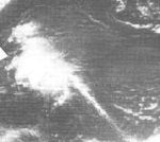
Hurricane Blanche
A tropical wave that moved rapidly through the Atlantic organized to a tropical depression on August 11 northeast of the Bahamas. It rapidly organized, becoming a hurricane by nightfall, but as it moved rapidly northeastward, cooler waters on August 12 caused Blanche to become extratropical.Hurricane Camille
Hurricane Camille began its life on August 14 near Grand CaymanGrand Cayman
Grand Cayman is the largest of the three Cayman Islands and the location of the nation's capital, George Town. In relation to the other two Cayman Islands, it is approximately 75 miles southwest of Little Cayman and 90 miles southwest of Cayman Brac.-Geography:Grand Cayman encompasses 76% of...
. It hit western Cuba
Cuba
The Republic of Cuba is an island nation in the Caribbean. The nation of Cuba consists of the main island of Cuba, the Isla de la Juventud, and several archipelagos. Havana is the largest city in Cuba and the country's capital. Santiago de Cuba is the second largest city...
as a 115 mi/h hurricane, and after weakening to a 100 mi/h hurricane it again strengthened rapidly in the Gulf of Mexico
Gulf of Mexico
The Gulf of Mexico is a partially landlocked ocean basin largely surrounded by the North American continent and the island of Cuba. It is bounded on the northeast, north and northwest by the Gulf Coast of the United States, on the southwest and south by Mexico, and on the southeast by Cuba. In...
, this time to a 190 mi/h Category 5 hurricane. It hit Bay St. Louis, Mississippi
Bay St. Louis, Mississippi
Bay Saint Louis is a city located in Hancock County, Mississippi. It is part of the Gulfport–Biloxi, Mississippi Metropolitan Statistical Area. As of the 2000 census, the city had a total population of 8,209. It is the county seat of Hancock County...
on August 17, and weakened rapidly over land. The depression brought torrential rain over the Ohio Valley. It moved out to sea, strengthening to a tropical storm before dissipating on August 22. Hurricane Camille was one of three category 5
Saffir-Simpson Hurricane Scale
The Saffir–Simpson Hurricane Scale , or the Saffir–Simpson Hurricane Wind Scale , classifies hurricanes — Western Hemisphere tropical cyclones that exceed the intensities of tropical depressions and tropical storms — into five categories distinguished by the intensities of their sustained winds...
hurricanes to strike the U.S. (the other two being the 1935 Labor Day Hurricane, and Hurricane Andrew
Hurricane Andrew
Hurricane Andrew was the third Category 5 hurricane to make landfall in the United States, after the Labor Day Hurricane of 1935 and Hurricane Camille in 1969. Andrew was the first named storm and only major hurricane of the otherwise inactive 1992 Atlantic hurricane season...
of 1992.)
Hurricane Debbie
A westward-moving tropical wave became a tropical depression on August 14, midway between the Lesser AntillesLesser Antilles
The Lesser Antilles are a long, partly volcanic island arc in the Western Hemisphere. Most of its islands form the eastern boundary of the Caribbean Sea with the Atlantic Ocean, with the remainder located in the southern Caribbean just north of South America...
and the coast of Africa
Africa
Africa is the world's second largest and second most populous continent, after Asia. At about 30.2 million km² including adjacent islands, it covers 6% of the Earth's total surface area and 20.4% of the total land area...
. It reached tropical storm strength the next day, and hurricane strength a day later. Hurricane Debbie passed to the north of the islands, but did manage to become a Category 3 hurricane on August 18. Over the next three days, silver iodide
Silver iodide
Silver iodide is a yellow, inorganic, photosensitive iodide of silver used in photography, in medicine as an antiseptic, and in rainmaking for cloud seeding.-Crystal structure:...
was used in a seeding experiment to weaken the hurricane. While Hurricane Debbie's intensity fluctuated greatly over those days, it is not confirmed whether the rapid weakening is due to the seeding or due to other forces. Regardless, Debbie raced to the north after its peak of 120 mi/h. It passed southeast of Newfoundland on August 24, and lost its low level circulation on August 25 near Greenland
Greenland
Greenland is an autonomous country within the Kingdom of Denmark, located between the Arctic and Atlantic Oceans, east of the Canadian Arctic Archipelago. Though physiographically a part of the continent of North America, Greenland has been politically and culturally associated with Europe for...
.
Tropical Storm Eve
A strong, stationary cold front developed convection via convergence between the cool air and the warm waters, from which a tropical depression formed on August 25 100 mi (160.9 km) east of Jacksonville, FloridaJacksonville, Florida
Jacksonville is the largest city in the U.S. state of Florida in terms of both population and land area, and the largest city by area in the contiguous United States. It is the county seat of Duval County, with which the city government consolidated in 1968...
. The next day, it reached its peak of 60 mi/h winds, but the cooler air to the north caused Eve to dissipate on August 27.
Hurricane Francelia
Hurricane Francelia began its life on August 29 from a tropical wave over the southern Lesser Antilles. It moved through the Caribbean, and ultimately hit BelizeBelize
Belize is a constitutional monarchy and the northernmost country in Central America. Belize has a diverse society, comprising many cultures and languages. Even though Kriol and Spanish are spoken among the population, Belize is the only country in Central America where English is the official...
as a Category 2 hurricane. It rapidly dissipated over Central America
Central America
Central America is the central geographic region of the Americas. It is the southernmost, isthmian portion of the North American continent, which connects with South America on the southeast. When considered part of the unified continental model, it is considered a subcontinent...
, causing around 100 deaths.
Hurricane Gerda
A westward moving tropical wave organized enough on September 6 over the Bahamas to become a tropical depression. After two days of moving through Florida and moving back offshore, the depression began to strengthen, reaching tropical storm intensity on September 8. Gerda rapidly intensified as well as moving rapidly northeastward, reaching hurricane strength that night and its peak of 130 mi/h the following day east of New JerseyNew Jersey
New Jersey is a state in the Northeastern and Middle Atlantic regions of the United States. , its population was 8,791,894. It is bordered on the north and east by the state of New York, on the southeast and south by the Atlantic Ocean, on the west by Pennsylvania and on the southwest by Delaware...
. On September 10, it made landfall near Eastport, Maine
Eastport, Maine
Eastport is a small city in Washington County, Maine, United States. The population was 1,640 at the 2000 census. The principal island is Moose Island, which is connected to the mainland by causeway...
, but caused little damage and no deaths, and became extratropical over Labrador
Labrador
Labrador is the distinct, northerly region of the Canadian province of Newfoundland and Labrador. It comprises the mainland portion of the province, separated from the island of Newfoundland by the Strait of Belle Isle...
later that day.
Hurricane Holly
A tropical wave moved off the coast of Africa on September 8. Moving westward to west-northwestward, it is estimated it became a tropical depression on September 14 about 1250 mi (2315 km) southeast of Puerto RicoPuerto Rico
Puerto Rico , officially the Commonwealth of Puerto Rico , is an unincorporated territory of the United States, located in the northeastern Caribbean, east of the Dominican Republic and west of both the United States Virgin Islands and the British Virgin Islands.Puerto Rico comprises an...
, based on Hurricane Hunter observations of an organized circulation. It quickly organized and was soon upgraded to Tropical Storm Holly. Continuing northwestward, it steadily intensified, and the Hurricane Hunters reported that Holly attained hurricane status on September 16, with peak winds of 85 mph (140 km/h). Initially, it was not expected to threaten land. Hurricane Holly weakened slightly as it turned westward toward the Lesser Antilles. Due to the lack of good upper-level outflow
Outflow (meteorology)
Outflow, in meteorology, is air that flows outwards from a storm system. It is associated with ridging, or anticyclonic flow. In the low levels of the troposphere, outflow radiates from thunderstorms in the form of a wedge of rain-cooled air, which is visible as a thin rope-like cloud on weather...
, as well as unfavorable water, Holly quickly weakened to tropical storm status on September 18, as confirmed by the Hurricane Hunters. By the next day, it weakened to tropical depression status, and it later moved through the Lesser Antilles. There were no reports of damage or deaths, and Holly dissipated on September 21 in the Caribbean Sea.
Tropical Depression Twenty-Nine
A low-level center formed off of the western coast of Cuba on September 19. The depression made landfall on September 21 between Panama City, FloridaPanama City, Florida
-Personal income:The median income for a household in the city was $31,572, and the median income for a family was $40,890. Males had a median income of $30,401 versus $21,431 for females. The per capita income for the city was $17,830...
and Port St. Joe
Port St. Joe, Florida
Port St. Joe is a city located at the intersection of U.S. Highway 98 and State Road 71 in Gulf County, Florida, United States. As of 2007, the population estimated by the U.S. Census Bureau is 3,579. The population was 3,644 as of the 2000 census. Port St. Joe became the county seat of Gulf County...
. A high-pressure ridge blocked the system's movement, moving it to the east. By September 23, the low pressure system became a low pressure trough. Upper-level wind shear moved the circulation to the east-northeast and moved into the Atlantic Ocean the next day.
Rainfall peaked at 23.4 in (594.4 mm) in Havana, Florida, with up to 15 in (381 mm) throughout the rest of the state. Both Alabama and Georgia reported peak rains of 7 in (177.8 mm). Tennessee, the Carolinas and Virginia all reported peak rains of up to 3 in (76.2 mm).
Hurricane Inga
The tropical depression that became Hurricane Inga formed on September 20, east of the Lesser AntillesLesser Antilles
The Lesser Antilles are a long, partly volcanic island arc in the Western Hemisphere. Most of its islands form the eastern boundary of the Caribbean Sea with the Atlantic Ocean, with the remainder located in the southern Caribbean just north of South America...
. It reached tropical storm strength the next day, but unfavorable conditions weakened Inga to a tropical depression. Those conditions would persist throughout its life. On September 28, it restrengthened to a tropical storm, and Inga became a hurricane two days later. It executed a small loop south of Bermuda
Bermuda
Bermuda is a British overseas territory in the North Atlantic Ocean. Located off the east coast of the United States, its nearest landmass is Cape Hatteras, North Carolina, about to the west-northwest. It is about south of Halifax, Nova Scotia, Canada, and northeast of Miami, Florida...
, and as it headed northeastward, it reached Category 3 strength. The adverse conditions it found earlier weakened it, and a cold low to the east forced Inga southward. Inga would last until October 15, wandering aimlessly around the central Atlantic. Inga lasted for 25 days, making it the fourth longest-lasting tropical cyclone on record.
Hurricane Ten
A subtropical depression formed off the coast of North Carolina on September 21. It reached subtropical storm strength that night, and over the next couple of days, it reached hurricane strength while moving to the northeast. "Ten" dissipated on September 26, 200 mi (321.9 km) south of Newfoundland.Tropical Storm Eleven
Tropical Storm Eleven developed from a subtropical depression southwest of the AzoresAzores
The Archipelago of the Azores is composed of nine volcanic islands situated in the middle of the North Atlantic Ocean, and is located about west from Lisbon and about east from the east coast of North America. The islands, and their economic exclusion zone, form the Autonomous Region of the...
on September 24. After a day of drifting west-southwest, it moved westward where it became a subtropical storm, and later a tropical storm. "Eleven" reached its 70 mi/h peak on September 27 while moving northward. It retained that intensity for two days, but on September 29, it dissipated due to cool air and shear east of Newfoundland.
Subtropical Storm One
A cutoff low in the upper troposphere led to widespread showers and convection over the Gulf of MexicoGulf of Mexico
The Gulf of Mexico is a partially landlocked ocean basin largely surrounded by the North American continent and the island of Cuba. It is bounded on the northeast, north and northwest by the Gulf Coast of the United States, on the southwest and south by Mexico, and on the southeast by Cuba. In...
and Caribbean Sea
Caribbean Sea
The Caribbean Sea is a sea of the Atlantic Ocean located in the tropics of the Western hemisphere. It is bounded by Mexico and Central America to the west and southwest, to the north by the Greater Antilles, and to the east by the Lesser Antilles....
, forming three weather systems. The second formed a subtropical depression on September 29, which was known in real-time as Tropical Depression Thirty-two. The tropical depression was reclassified as a Subtropical cyclone
Subtropical cyclone
A subtropical cyclone is a weather system that has some characteristics of a tropical and an extratropical cyclone. As early as the 1950s, meteorologists were unclear whether they should be characterized as tropical or extratropical cyclones. They were officially recognized by the National...
, with its strongest winds away from the center and the convection not very well organized. Unfavorable conditions did not allow the system to become tropical, but it was able to become a 60 mi/h subtropical storm before cool air and shear weakened it to a subtropical depression prior to its Florida Panhandle
Florida Panhandle
The Florida Panhandle, an informal, unofficial term for the northwestern part of Florida, is a strip of land roughly 200 miles long and 50 to 100 miles wide , lying between Alabama on the north and the west, Georgia also on the north, and the Gulf of Mexico to the south. Its eastern boundary is...
landfall on October 1. The depression moved through the Southeast into the Ohio Valley. The system dissipated as it crossed the Great Lakes into southeast Canada.
Tropical Storm Jenny
Tropical Storm Jenny formed from the same cutoff low that formed Subtropical Storm One. Jenny began as a tropical depression in the northwest Caribbean Sea, and after moving across CubaCuba
The Republic of Cuba is an island nation in the Caribbean. The nation of Cuba consists of the main island of Cuba, the Isla de la Juventud, and several archipelagos. Havana is the largest city in Cuba and the country's capital. Santiago de Cuba is the second largest city...
, became a tropical storm just before its landfall between Fort Myers and Naples, Florida
Naples, Florida
Naples is a city in Collier County, Florida, United States. As of July 1, 2007, the U.S. Census Bureau estimated the city's population at 21,653. Naples is a principal city of the Naples–Marco Island Metropolitan Statistical Area, which had an estimated total population of 315,839 on July 1, 2007...
on October 2, bringing heavy rains. Jenny made it to the western Atlantic as a tropical depression, but increased ridging forced the storm over the already soaked Florida peninsula. It was unable to strengthen further, and Jenny dissipated on October 6 south of Louisiana
Louisiana
Louisiana is a state located in the southern region of the United States of America. Its capital is Baton Rouge and largest city is New Orleans. Louisiana is the only state in the U.S. with political subdivisions termed parishes, which are local governments equivalent to counties...
.
Hurricane Kara
A cold core trough of low pressure over the western Atlantic OceanAtlantic Ocean
The Atlantic Ocean is the second-largest of the world's oceanic divisions. With a total area of about , it covers approximately 20% of the Earth's surface and about 26% of its water surface area...
warmed on the eastern end, becoming a tropical depression on October 7. The trough brought it northeastward, strengthening it to a tropical storm on October 9. An upper level low formed to Kara's west, and when the two merged on October 11, their motions became erratic. At this time it was not very tropical, but as it moved southward towards warm waters, it became more tropical, and became a hurricane on the October 15. Upper level westerlies forced it northeastward, and after reaching a peak of 105 mph (165 km/h), Kara became extratropical on October 19.
Hurricane Laurie
A mid level circulation developed near the Swan IslandsSwan Islands, Honduras
The Swan Islands, or Islas Santanilla, are a chain of three islands located in the northwestern Caribbean Sea, approximately ninety miles off the coastline of Honduras, with a land area of .-Detailed location and features:...
on October 15 from a westward-moving system, and on October 17, a tropical depression was able to form in the western Caribbean Sea
Caribbean Sea
The Caribbean Sea is a sea of the Atlantic Ocean located in the tropics of the Western hemisphere. It is bounded by Mexico and Central America to the west and southwest, to the north by the Greater Antilles, and to the east by the Lesser Antilles....
. The depression moved northwestward where favorable conditions allowed strengthening, but because the depression was not vertically stacked, it remained a depression. On October 19, after passing the Yucatán Peninsula
Yucatán Peninsula
The Yucatán Peninsula, in southeastern Mexico, separates the Caribbean Sea from the Gulf of Mexico, with the northern coastline on the Yucatán Channel...
, the depression was named Tropical Storm Laurie, and the next day, Hurricane Laurie. Hurricane watches were issued for a large portion of the Gulf coast, but when Laurie turned eastward and southeastward, they were dropped. Dry air entrained the system as the storm looped around, causing it to weaken to a tropical depression on October 24. Laurie eventually made landfall on Mexico on October 27 as a weak depression, and dissipated that day.
Tropical Storm Sixteen
A subtropical depression formed west-southwest of the Azores on October 28. It moved northwestward, reaching tropical storm strength on October 29, and after turning sharply east it reached its peak of 70 mi/h winds. "Sixteen" became extratropical on October 31 west of the Azores.Hurricane Seventeen
A large extratropical storm over the North Atlantic formed a subtropical storm on October 31 south of Newfoundland. It moved southeast, gaining tropical characteristics and strength on the way. It reached hurricane strength on November 4, peaking as a minimal Category 1 storm while approaching the AzoresAzores
The Archipelago of the Azores is composed of nine volcanic islands situated in the middle of the North Atlantic Ocean, and is located about west from Lisbon and about east from the east coast of North America. The islands, and their economic exclusion zone, form the Autonomous Region of the...
, but weakened prior to passing through the islands. "Seventeen" lost its tropical characteristics on November 7.
Hurricane Martha
A cyclonic circulation persisted over the southwest Caribbean SeaCaribbean Sea
The Caribbean Sea is a sea of the Atlantic Ocean located in the tropics of the Western hemisphere. It is bounded by Mexico and Central America to the west and southwest, to the north by the Greater Antilles, and to the east by the Lesser Antilles....
in late November. Convection became more organized, and by November 21, it became a tropical storm. Martha quickly intensified, reaching 90 mi/h winds the next day, but the hurricane lost strength as it drifted southward. It reached the coast of Panama
Panama
Panama , officially the Republic of Panama , is the southernmost country of Central America. Situated on the isthmus connecting North and South America, it is bordered by Costa Rica to the northwest, Colombia to the southeast, the Caribbean Sea to the north and the Pacific Ocean to the south. The...
as a 70 mi/h tropical storm on November 24, becoming the first tropical storm on record to hit the country. Martha dissipated over Panama
Panama
Panama , officially the Republic of Panama , is the southernmost country of Central America. Situated on the isthmus connecting North and South America, it is bordered by Costa Rica to the northwest, Colombia to the southeast, the Caribbean Sea to the north and the Pacific Ocean to the south. The...
on November 25. The system caused heavy flooding and landslides over San José, Costa Rica
San José, Costa Rica
San José is the capital and largest city of Costa Rica. Located in the Central Valley, San José is the seat of national government, the focal point of political and economic activity, and the major transportation hub of this Central American nation.Founded in 1738 by order of Cabildo de León, San...
, where five fatalities and $30 million (1969 USD, $ USD) in damage occurred.
Although the 'M' name has been used nearly every year to name storms in the Atlantic
Atlantic Ocean
The Atlantic Ocean is the second-largest of the world's oceanic divisions. With a total area of about , it covers approximately 20% of the Earth's surface and about 26% of its water surface area...
since 1990, this marked only the second time since naming began in 1950 that the 'M' name was used (and the first to be properly classified), and the last one until Marco in the 1990 season
1990 Atlantic hurricane season
The 1990 Atlantic hurricane season was the most active Atlantic hurricane season since 1969. It officially began on June 1, 1990, and lasted until November 30, 1990. These dates conventionally delimit the period of each year when most tropical cyclones form in the Atlantic basin...
. The first season to use 'M' was 1950 when Tropical Storm Mike was named, but the system was likely not tropical, since it was not included in the Best Track for the Atlantic basin.
Other storms
In addition to the 20 other tropical cyclones of the season, two other tropical depressions occurred in late May and early June. The first tropical depression (numbered five), developed on May 29 about 85 mi (136.8 km) southeast of Cutler Bay, FloridaCutler Bay, Florida
Cutler Bay, historically called Cutler Ridge, is an incorporated town in Miami-Dade County, Florida from SW 184th Street east of US-1 to the coast, and north of Black Point Marina, at...
. The depression tracked northeastward, and passed through the Bahamas on the Abaco Islands
Abaco Islands
The Abaco Islands lie in the northern Bahamas and comprise the main islands of Great Abaco and Little Abaco, together with the smaller Wood Cay, Elbow Cay, Lubbers Quarters Cay, Green Turtle Cay, Great Guana Cay, Castaway Cay, Man-o-War Cay, Stranger's Cay, Umbrella Cay, Walker's Cay, Little Grand...
later that day. After crossing the Bahamas, the depression continued northeastward, and eventually dissipated 430 mi (692 km) southwest of Bermuda on May 30. No impact was reported in the Bahamas.
Simultaneously to when Tropical Depression Five developed, Tropical Depression Six was also forming. The depression was centered 38 mi (61.2 km) south-southwest of San Andrés
San Andrés (island)
San Andrés is a coral island among the Colombian islands in the Caribbean Sea; it is the largest island of the southern group of islands. Together with the nearby island of Providencia and some smaller islands of the southern group of the Colombian archipelago, San Andrés forms the department of...
Island, Colombia
Colombia
Colombia, officially the Republic of Colombia , is a unitary constitutional republic comprising thirty-two departments. The country is located in northwestern South America, bordered to the east by Venezuela and Brazil; to the south by Ecuador and Peru; to the north by the Caribbean Sea; to the...
. The depression headed west-northwestward toward the coast of Nicaragua
Nicaragua
Nicaragua is the largest country in the Central American American isthmus, bordered by Honduras to the north and Costa Rica to the south. The country is situated between 11 and 14 degrees north of the Equator in the Northern Hemisphere, which places it entirely within the tropics. The Pacific Ocean...
, however, it quickly veered away to the northeast. For the rest of its duration, the depression mainly headed north or north-northeastward across the Caribbean Sea. On June 1, the day that the 1969 Atlantic hurricane season officially began, Tropical Depression Six had made landfall on the Zapata Peninsula
Zapata Peninsula
Zapata Peninsula is a large peninsula in Matanzas Province, southern Cuba, at . Ciénaga de Zapata National Park is located on the peninsula....
in Cuba. The depression dissipated early on June 2. No impact was reported in Cuba or Nicaragua.
Storm names
The following names were used for named storms that formed in the Atlantic basinAtlantic Basin
The Atlantic Basin is the Atlantic Ocean.Atlantic Basin may also refer to:* Atlantic Basin Iron Works, an ironworks that operated in Brooklyn, New York, in the early to mid-20th century...
in 1969. Storms were named Blanche, Camille, Eve, Francelia, Holly, Kara, Laurie and Martha for the first time in 1969. Names that were not assigned are marked in . At some point between June 1 and August 14, 1969, the name Carol (originally the C name on this year's list) was replaced with Camille.
|
Hurricane Inga (1969) Hurricane Inga is the third longest-lived Atlantic hurricane on record. The 11th tropical cyclone and 9th named storm of the 1969 Atlantic hurricane season, Inga developed on September 20 in the central Atlantic and tracked westward. After attaining tropical storm status, the system deteriorated... |
Retirement
The name Camille was later retired.See also
- 1969 Pacific hurricane season1969 Pacific hurricane seasonThe 1969 Pacific hurricane season was an event in meteorology. It officially started on May 15, 1969 in the eastern Pacific and lasted until November 30, 1969. However, the first named storm, Ava, did not form until July 1, the latest date that the first named storm of a season formed...
- List of Atlantic hurricanes
- List of Atlantic hurricane seasons