

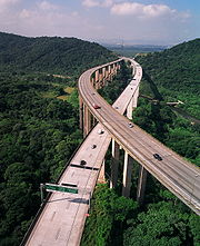
Highway
Encyclopedia
Road
A road is a thoroughfare, route, or way on land between two places, which typically has been paved or otherwise improved to allow travel by some conveyance, including a horse, cart, or motor vehicle. Roads consist of one, or sometimes two, roadways each with one or more lanes and also any...
. In American English, the term is common and almost always designates major roads. In British English, the term (which is not particularly common) designates any road open to the public. Any interconnected set of highways can be variously referred to as a "highway system", a "highway network", or a "highway transportation system". Each country has its own national highway system
Highway systems by country
Highway systems by country describes the highway systems available in selected countries.-Australia:In Australia, a highway is a distinct type of road from freeways, expressways, and motorways. The word highway is generally used to mean major roads connecting large cities, towns and different parts...
.
Overview
Major highways are often named and numbered by the governments that typically develop and maintain them. Australia's Highway 1Highway 1 (Australia)
Australia's Highway 1 is a network of highways that circumnavigate the Australian continent, joining all mainland state capitals. At a total length of approximately it is the longest national highway in the world, longer than the Trans-Siberian Highway and the Trans-Canada Highway...
is the longest national highway in the world at over 14500 km (9,009.9 mi) and runs almost the entire way around the continent. The United States has the world's largest network of highways, including both the Interstate Highway System
Interstate Highway System
The Dwight D. Eisenhower National System of Interstate and Defense Highways, , is a network of limited-access roads including freeways, highways, and expressways forming part of the National Highway System of the United States of America...
and the U.S. Highway System
United States Numbered Highways
The system of United States Numbered Highways is an integrated system of roads and highways in the United States numbered within a nationwide grid...
. At least one of these networks is present in every state and they interconnect most major cities. Some highways, like the Pan-American Highway
Pan-American Highway
The Pan-American Highway is a network of roads measuring about in total length. Except for an rainforest break, called the Darién Gap, the road links the mainland nations of the Americas in a connected highway system. According to Guinness World Records, the Pan-American Highway is the world's...
or the European routes, span multiple countries. Some major highway routes include ferry
Ferry
A ferry is a form of transportation, usually a boat, but sometimes a ship, used to carry primarily passengers, and sometimes vehicles and cargo as well, across a body of water. Most ferries operate on regular, frequent, return services...
services, such as U.S. Route 10
U.S. Route 10
U.S. Route 10 is an east–west United States highway formed in 1926. Though it never became the cross-country highway suggested by the "0" as the last digit of its route number, U.S...
, which crosses Lake Michigan
Lake Michigan
Lake Michigan is one of the five Great Lakes of North America and the only one located entirely within the United States. It is the second largest of the Great Lakes by volume and the third largest by surface area, after Lake Superior and Lake Huron...
.
Traditionally highways were used by people on foot
Pedestrian
A pedestrian is a person traveling on foot, whether walking or running. In some communities, those traveling using roller skates or skateboards are also considered to be pedestrians. In modern times, the term mostly refers to someone walking on a road or footpath, but this was not the case...
or on horse
Horse
The horse is one of two extant subspecies of Equus ferus, or the wild horse. It is a single-hooved mammal belonging to the taxonomic family Equidae. The horse has evolved over the past 45 to 55 million years from a small multi-toed creature into the large, single-toed animal of today...
s. Later they also accommodated carriage
Carriage
A carriage is a wheeled vehicle for people, usually horse-drawn; litters and sedan chairs are excluded, since they are wheelless vehicles. The carriage is especially designed for private passenger use and for comfort or elegance, though some are also used to transport goods. It may be light,...
s, bicycles and eventually motor cars, facilitated by advancements in road construction. In the 1920s and 1930s many nations began investing heavily in progressively more modern highway systems to spur commerce
Commerce
While business refers to the value-creating activities of an organization for profit, commerce means the whole system of an economy that constitutes an environment for business. The system includes legal, economic, political, social, cultural, and technological systems that are in operation in any...
and bolster national defense.
Major modern highways that connect cities in populous developed and developing countries usually incorporate features intended to enhance the road's capacity, efficiency, and safety to various degrees. Such features include a reduction in the number of locations for user access, the use of dual carriageway
Dual carriageway
A dual carriageway is a class of highway with two carriageways for traffic travelling in opposite directions separated by a central reservation...
s with two or more lanes on each carriageway, and grade-separated junctions with other roads and modes of transport. These features are typically present on highways built as motorways (freeways).
Terminology
In English lawEnglish law
English law is the legal system of England and Wales, and is the basis of common law legal systems used in most Commonwealth countries and the United States except Louisiana...
, parliament and more formal situations the term is used to denote any public road used which include street
Street
A street is a paved public thoroughfare in a built environment. It is a public parcel of land adjoining buildings in an urban context, on which people may freely assemble, interact, and move about. A street can be as simple as a level patch of dirt, but is more often paved with a hard, durable...
s and lane
Lane
A lane is a part of the roadway within a road marked out for use by a single line of vehicles in such a way as to control and guide drivers for the purpose of reducing traffic conflicts. Most public roads have at least two lanes, one for traffic in each direction, separated by Lane markings...
s as well as main roads, trunk road
Trunk road
A trunk road, trunk highway, or strategic road is a major road—usually connecting two or more cities, ports, airports, and other things.—which is the recommended route for long-distance and freight traffic...
s and motorways. Acts of parliament have used the term throughout history from the Highways Act 1555
Highways Act 1555
The Highways Act 1555 , sometimes the First Statute of Highways, was an Act of Parliament of the Parliament of England passed in 1555...
through to the Highways Act 1980
Highways Act 1980
The Highways Act 1980 is an Act of the Parliament of the United Kingdom dealing with the management and operation of the road network in England and Wales. It consolidated with amendments several earlier pieces of legislation. Many amendments relate only to changes of highway authority, to include...
. The rules of the road are outlined in the Highway Code
Highway Code
The Highway Code is the official road user guide for Great Britain. In Northern Ireland the applies while the Republic of Ireland has its own Rules of the Road. It contains 306 numbered rules and 9 annexes covering pedestrians, animals, cyclists, motorcyclists and drivers...
.
In England and Wales, a "Public Highway" is a road or footpath over which the public has the right of access, i.e. the opposite of a "private road".
In American law, the word "highway" is sometimes used to denote any public way used for travel, whether major highway, freeway, turnpike, street, lane, alley, pathway, dirt track, footpaths, and trails, and navigable waterways; however, in practical and useful meaning, a "highway" is a major and significant, well-constructed road that is capable of carrying reasonably heavy to extremely heavy traffic.
Highways generally have a route number designated by the state and federal road comptroller offices.
California Vehicle Code, Sections 360, 590, define a "highway" as only a way open for use of motor vehicles, but the California Supreme Court has held that "the definition of 'highway' in the Vehicle Code is used for special purposes of that act," and that canals in the town of Venice, California, are "highways" that are entitled to be maintained with state highway funds.
Smaller roads may be termed byways
Byway (road)
A byway in the United Kingdom is a minor secondary or tertiary road. In 2000 the legal term 'restricted byway' was introduced to cover roads on which it is possible to travel by any mode but not using 'mechanically propelled vehicles'.-Byway Open to All Traffic :In England & Wales, a Byway Open to...
.
History
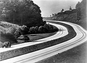
Modern highway systems developed in the 20th century as the automobile
Automobile
An automobile, autocar, motor car or car is a wheeled motor vehicle used for transporting passengers, which also carries its own engine or motor...
gained popularity. The world's first limited access road was constructed in Italy
Italy
Italy , officially the Italian Republic languages]] under the European Charter for Regional or Minority Languages. In each of these, Italy's official name is as follows:;;;;;;;;), is a unitary parliamentary republic in South-Central Europe. To the north it borders France, Switzerland, Austria and...
in 1922 (see autostrade
Autostrade of Italy
The Autostrada is the Italian national system of motorways. The total length of the system is about 6,400 km. In North and Central Italy this is mainly as tollways, with the biggest portion in concession to the Atlantia group which operates some 3,408 km...
). Construction of the Bonn-Cologne autobahn began in 1929 and was opened in 1932 by the mayor of Cologne.
The Special Roads Act 1949
Special Roads Act 1949
The Special Roads Act 1949 was an Act of the Parliament of the United Kingdom that:*Authorised the construction of special roads*Allowed these roads to be restricted to specific types of vehicles...
in the United Kingdom
United Kingdom
The United Kingdom of Great Britain and Northern IrelandIn the United Kingdom and Dependencies, other languages have been officially recognised as legitimate autochthonous languages under the European Charter for Regional or Minority Languages...
provided the legislative basis for roads for restricted classes of vehicles (later termed motorway). The first section of motorway in the UK opened in 1958 (part of the M6 motorway) and then in 1959 the first section of the M1 motorway
M1 motorway
The M1 is a north–south motorway in England primarily connecting London to Leeds, where it joins the A1 near Aberford. While the M1 is considered to be the first inter-urban motorway to be completed in the United Kingdom, the first road to be built to motorway standard in the country was the...
.
The Federal Aid Highway Act of 1956
Federal Aid Highway Act of 1956
The Federal-Aid Highway Act of 1956, popularly known as the National Interstate and Defense Highways Act , was enacted on June 29, 1956, when Dwight D. Eisenhower signed the bill into law...
provided appropriating $25 billion for the construction of 41000 miles (65,982.9 km) of Interstate Highways over a 20-year period in the United States.
Social effects
Reducing travel times relative to city or town streets, modern highways with limited access and grade separation create increased opportunities for people to travel for business, trade or pleasure and also provide trade routes for goods. Modern highways reduce commute and other travel time but additional road capacity can also create new induced traffic demandInduced demand
Induced demand, or latent demand, is the phenomenon that after supply increases, more of a good is consumed. This is entirely consistent with the economic theory of supply and demand; however, this idea has become important in the debate over the expansion of transportation systems, and is often...
. If not accurately predicted at the planning stage, this extra traffic may lead to the new road becoming congested sooner than anticipated. More roads add on to car-dependence, which can mean that a new road brings only short-term mitigation of traffic congestion.
Where highways are created through existing communities, there can be reduced community cohesion
Community cohesion
Community cohesion refers to the aspect of togetherness and bonding exhibited by members of a community, the "glue" that holds a community together...
and more difficult local access. Consequently property values have decreased in many cutoff neighborhoods, leading to decreased housing quality over time.
Economic effects
In transport, demandDemand (economics)
In economics, demand is the desire to own anything, the ability to pay for it, and the willingness to pay . The term demand signifies the ability or the willingness to buy a particular commodity at a given point of time....
can be measured in numbers of journeys made or in total distance travelled across all journeys (e.g. passenger-kilometres for public transport
Public transport
Public transport is a shared passenger transportation service which is available for use by the general public, as distinct from modes such as taxicab, car pooling or hired buses which are not shared by strangers without private arrangement.Public transport modes include buses, trolleybuses, trams...
or vehicle-kilometres of travel (VKT) for private transport
Private transport
Private transport, as opposed to public transport, is transportation service which is not available for use by the general public. Private transport is the dominant form of transportation in most of the world. In the United States, for example, 86.2% of passenger miles traveled occur by passenger...
). Supply
Supply (economics)
In economics, supply is the amount of some product producers are willing and able to sell at a given price all other factors being held constant. Usually, supply is plotted as a supply curve showing the relationship of price to the amount of product businesses are willing to sell.In economics the...
is considered to be a measure of capacity. The price
Price
-Definition:In ordinary usage, price is the quantity of payment or compensation given by one party to another in return for goods or services.In modern economies, prices are generally expressed in units of some form of currency...
of the good (travel) is measured using the generalised cost
Generalised cost
In transport economics, the generalized cost is the sum of the monetary and non-monetary costs of a journey.Monetary costs might include a fare on a public transport journey, or the costs of fuel, wear and tear and any parking charge, toll or congestion charge on a car journey.Non-monetary costs...
of travel, which includes both money
Money
Money is any object or record that is generally accepted as payment for goods and services and repayment of debts in a given country or socio-economic context. The main functions of money are distinguished as: a medium of exchange; a unit of account; a store of value; and, occasionally in the past,...
and time
Time
Time is a part of the measuring system used to sequence events, to compare the durations of events and the intervals between them, and to quantify rates of change such as the motions of objects....
expenditure.
The effect of increases in supply (capacity) are of particular interest in transport economics (see induced demand
Induced demand
Induced demand, or latent demand, is the phenomenon that after supply increases, more of a good is consumed. This is entirely consistent with the economic theory of supply and demand; however, this idea has become important in the debate over the expansion of transportation systems, and is often...
), as the potential environmental consequences are significant (see externalities below).
In addition to providing benefits to their users, transport networks impose both positive and negative externalities on non-users. The consideration of these externalities - particularly the negative ones - is a part of transport economics. Positive externalities of transport networks may include the ability to provide emergency services, increases in land
Land (economics)
In economics, land comprises all naturally occurring resources whose supply is inherently fixed. Examples are any and all particular geographical locations, mineral deposits, and even geostationary orbit locations and portions of the electromagnetic spectrum. Natural resources are fundamental to...
value and agglomeration benefits
Economies of agglomeration
The term economies of agglomeration is used in urban economics to describe the benefits that firms obtain when locating near each other . This concept relates to the idea of economies of scale and network effects...
. Negative externalities are wide-ranging and may include local air pollution
Air pollution
Air pollution is the introduction of chemicals, particulate matter, or biological materials that cause harm or discomfort to humans or other living organisms, or cause damage to the natural environment or built environment, into the atmosphere....
, noise pollution
Noise pollution
Noise pollution is excessive, displeasing human, animal or machine-created environmental noise that disrupts the activity or balance of human or animal life...
, light pollution
Light pollution
Light pollution, also known as photopollution or luminous pollution, is excessive or obtrusive artificial light.The International Dark-Sky Association defines light pollution as:...
, safety hazards, community severance and congestion
Traffic congestion
Traffic congestion is a condition on road networks that occurs as use increases, and is characterized by slower speeds, longer trip times, and increased vehicular queueing. The most common example is the physical use of roads by vehicles. When traffic demand is great enough that the interaction...
. The contribution of transport systems to potentially hazardous climate change
Climate change
Climate change is a significant and lasting change in the statistical distribution of weather patterns over periods ranging from decades to millions of years. It may be a change in average weather conditions or the distribution of events around that average...
is a significant negative externality which is difficult to evaluate quantitatively, making it difficult (but not impossible) to include in transport economics-based research and analysis. Congestion is considered a negative externality
Externality
In economics, an externality is a cost or benefit, not transmitted through prices, incurred by a party who did not agree to the action causing the cost or benefit...
by economists.
Environment effects
Highways are extended linear sourcesLine source
A line source is a source of air, noise, water contamination or electromagnetic radiation that emanates from a linear geometry...
of pollution
Pollution
Pollution is the introduction of contaminants into a natural environment that causes instability, disorder, harm or discomfort to the ecosystem i.e. physical systems or living organisms. Pollution can take the form of chemical substances or energy, such as noise, heat or light...
:
Roadway noise
Roadway noise
Roadway noise is the collective sound energy emanating from motor vehicles. In the USA it contributes more to environmental noise exposure than any other noise source, and is constituted chiefly of engine, tire, aerodynamic and braking elements...
increases with operating speed so major highways generate more noise than arterial
Arterial road
An arterial road, or arterial thoroughfare, is a high-capacity urban road. The primary function of an arterial road is to deliver traffic from collector roads to freeways, and between urban centres at the highest level of service possible. As such, many arteries are limited-access roads, or feature...
streets. Therefore, considerable noise health effects
Noise health effects
Noise health effects are the health consequences of elevated sound levels. Elevated workplace or other noise can cause hearing impairment, hypertension, ischemic heart disease, annoyance and sleep disturbance. Changes in the immune system and birth defects have been attributed to noise exposure...
are expected from highway systems. Noise mitigation
Noise mitigation
Noise mitigation is a set of strategies to reduce noise pollution. The main areas of noise mitigation or abatement are: transportation noise control, architectural design, and occupational noise control...
strategies exist to reduce sound levels at nearby sensitive receptors. The idea that highway design could be influenced by acoustical engineering
Acoustical engineering
Acoustical engineering is the branch of engineering dealing with sound and vibration. It is the application of acoustics, the science of sound and vibration, in technology. Acoustical engineers are typically concerned with the manipulation and control of sound....
considerations first arose about 1973.
Air quality issues: Highways may contribute fewer emissions than arterials carrying the same vehicle volumes. This is because high, constant-speed operation creates an emissions reduction compared to vehicular flows with stops and starts. However, concentrations of air pollutants near highways may be higher due to increased traffic volumes. Therefore, the risk of exposure to elevated levels of air pollutants from a highway may be considerable, and further magnified when highways have traffic congestion
Traffic congestion
Traffic congestion is a condition on road networks that occurs as use increases, and is characterized by slower speeds, longer trip times, and increased vehicular queueing. The most common example is the physical use of roads by vehicles. When traffic demand is great enough that the interaction...
.
New highways can also cause habitat fragmentation
Habitat fragmentation
Habitat fragmentation as the name implies, describes the emergence of discontinuities in an organism's preferred environment , causing population fragmentation...
, encourage urban sprawl
Urban sprawl
Urban sprawl, also known as suburban sprawl, is a multifaceted concept, which includes the spreading outwards of a city and its suburbs to its outskirts to low-density and auto-dependent development on rural land, high segregation of uses Urban sprawl, also known as suburban sprawl, is a...
and allow human intrusion into previously untouched areas, as well as (counterintuitively) increasing congestion, by increasing the number of intersections. They can also reduce the use of public transport
Public transport
Public transport is a shared passenger transportation service which is available for use by the general public, as distinct from modes such as taxicab, car pooling or hired buses which are not shared by strangers without private arrangement.Public transport modes include buses, trolleybuses, trams...
, indirectly leading to greater pollution.
High-occupancy vehicle lane
High-occupancy vehicle lane
In transportation engineering and transportation planning, a high-occupancy vehicle lane is a lane reserved for vehicles with a driver and one or more passengers...
s are being added to some newer/reconstructed highways in North America and other countries around the world to encourage carpooling and mass-transit. These lanes help reduce the number of cars on the highway and thus reduces pollution and traffic congestion by promoting the use of carpooling in order to be able to use these lanes. However, they tend to require dedicated lanes on a highway, which makes them difficult to construct in dense urban areas where they are the most effective.
Road traffic safety
Road traffic safety aims to reduce the harm (deaths, injuries, and property damage) on the highway system from traffic collisions and includes the design, construction and regulation of the roads, the vehicleVehicle
A vehicle is a device that is designed or used to transport people or cargo. Most often vehicles are manufactured, such as bicycles, cars, motorcycles, trains, ships, boats, and aircraft....
s that use them and also the training of drivers and other road-users. Improvement of road safety needs to be balanced with the provision of an effective efficient transport system. A report published by the World Health Organization
World Health Organization
The World Health Organization is a specialized agency of the United Nations that acts as a coordinating authority on international public health. Established on 7 April 1948, with headquarters in Geneva, Switzerland, the agency inherited the mandate and resources of its predecessor, the Health...
in 2004 estimated that some 1.2m people were killed and 50m injured on the roads around the world each year and was the leading cause of death among children 10 – 19 years of age. The report also noted that the problem was most severe in developing countries and that simple prevention measures could halve the number of deaths. For reasons of clear data collection, only harm involving a road vehicle is included. A person tripping with fatal consequences or dying for some unrelated reason on a public road is not included in the relevant statistics.
Statistics
Interstate Highway System
The Dwight D. Eisenhower National System of Interstate and Defense Highways, , is a network of limited-access roads including freeways, highways, and expressways forming part of the National Highway System of the United States of America...
and the U.S. Highway System. At least one of these networks is present in every state and they interconnect most major cities.
China's highway network is the second most extensive in the world, with a total length of about 3.573 million km. China's expressway
Controlled-access highway
A controlled-access highway is a highway designed exclusively for high-speed vehicular traffic, with all traffic flow and ingress/egress regulated...
network is also the second longest in the world, and it is quickly expanding, stretching some 60,300 km at the end of 2008, In 2008 alone, 6,433 km expressways were added to the network.
- Longest international highway: the Pan-American HighwayPan-American HighwayThe Pan-American Highway is a network of roads measuring about in total length. Except for an rainforest break, called the Darién Gap, the road links the mainland nations of the Americas in a connected highway system. According to Guinness World Records, the Pan-American Highway is the world's...
, which connects many countries in the AmericasAmericasThe Americas, or America , are lands in the Western hemisphere, also known as the New World. In English, the plural form the Americas is often used to refer to the landmasses of North America and South America with their associated islands and regions, while the singular form America is primarily...
, is nearly 25000 kilometres (15,534 mi) long . The Pan-American Highway is discontinuous because there is a significant gapDarién GapThe Darién Gap is a large swath of undeveloped swampland and forest separating Panama's Darién Province in Central America from Colombia in South America. It measures just over long and about wide. Roadbuilding through this area is expensive, and the environmental toll is steep. Political...
in it in southeastern PanamaPanamaPanama , officially the Republic of Panama , is the southernmost country of Central America. Situated on the isthmus connecting North and South America, it is bordered by Costa Rica to the northwest, Colombia to the southeast, the Caribbean Sea to the north and the Pacific Ocean to the south. The...
, where the rainfall is immense and the terrain is entirely unsuitable for highway construction.
- Longest national highway (point to point): The Trans-Canada HighwayTrans-Canada HighwayThe Trans-Canada Highway is a federal-provincial highway system that joins the ten provinces of Canada. It is, along with the Trans-Siberian Highway and Australia's Highway 1, one of the world's longest national highways, with the main route spanning 8,030 km...
is 7821 km (4,859.8 mi) long . The T.C.H. runs east-west across southern Canada, the populated portion of the country, and it connects many of the major urban centers along its route crossing almost all of the provinces, and reaching almost all of the capital cities. The T.C.H. begins on the east coastAtlantic CanadaAtlantic Canada is the region of Canada comprising the four provinces located on the Atlantic coast, excluding Quebec: the three Maritime provinces – New Brunswick, Prince Edward Island, and Nova Scotia – and Newfoundland and Labrador...
in NewfoundlandNewfoundland and LabradorNewfoundland and Labrador is the easternmost province of Canada. Situated in the country's Atlantic region, it incorporates the island of Newfoundland and mainland Labrador with a combined area of . As of April 2011, the province's estimated population is 508,400...
, traverses that island, and crosses to the mainland by ferry. It reaches most of the Maritime Provinces of eastern Canada, and a side route using ferries traverses the province of Prince Edward IslandPrince Edward IslandPrince Edward Island is a Canadian province consisting of an island of the same name, as well as other islands. The maritime province is the smallest in the nation in both land area and population...
. After crossing the two most populous provinces of QuebecQuebecQuebec or is a province in east-central Canada. It is the only Canadian province with a predominantly French-speaking population and the only one whose sole official language is French at the provincial level....
and OntarioOntarioOntario is a province of Canada, located in east-central Canada. It is Canada's most populous province and second largest in total area. It is home to the nation's most populous city, Toronto, and the nation's capital, Ottawa....
, the T.C.H. continues westward across ManitobaManitobaManitoba is a Canadian prairie province with an area of . The province has over 110,000 lakes and has a largely continental climate because of its flat topography. Agriculture, mostly concentrated in the fertile southern and western parts of the province, is vital to the province's economy; other...
, SaskatchewanSaskatchewanSaskatchewan is a prairie province in Canada, which has an area of . Saskatchewan is bordered on the west by Alberta, on the north by the Northwest Territories, on the east by Manitoba, and on the south by the U.S. states of Montana and North Dakota....
, AlbertaAlbertaAlberta is a province of Canada. It had an estimated population of 3.7 million in 2010 making it the most populous of Canada's three prairie provinces...
, and British ColumbiaBritish ColumbiaBritish Columbia is the westernmost of Canada's provinces and is known for its natural beauty, as reflected in its Latin motto, Splendor sine occasu . Its name was chosen by Queen Victoria in 1858...
. After reaching Vancouver, B.C., on the Pacific CoastBritish Columbia CoastThe British Columbia Coast or BC Coast is Canada's western continental coastline on the Pacific Ocean. The usage is synonymous with the term West Coast of Canada....
, there is a ferry route west to Vancouver IslandVancouver IslandVancouver Island is a large island in British Columbia, Canada. It is one of several North American locations named after George Vancouver, the British Royal Navy officer who explored the Pacific Northwest coast of North America between 1791 and 1794...
and the provincial capital city of Victoria, B.C.
- Longest national highway (circuit): Australia's Highway 1Highway 1 (Australia)Australia's Highway 1 is a network of highways that circumnavigate the Australian continent, joining all mainland state capitals. At a total length of approximately it is the longest national highway in the world, longer than the Trans-Siberian Highway and the Trans-Canada Highway...
at over 20000 km (12,427.5 mi). It runs almost the entire way around the continent's coastline. With the exception of the Federal Capital of CanberraCanberraCanberra is the capital city of Australia. With a population of over 345,000, it is Australia's largest inland city and the eighth-largest city overall. The city is located at the northern end of the Australian Capital Territory , south-west of Sydney, and north-east of Melbourne...
, which is far inland, Highway 1 links all of Australia's capital cities, although Brisbane and Darwin are not directly connected, but rather are bypassed short distances away. Also, there is a ferry connection to the island state of TasmaniaTasmaniaTasmania is an Australian island and state. It is south of the continent, separated by Bass Strait. The state includes the island of Tasmania—the 26th largest island in the world—and the surrounding islands. The state has a population of 507,626 , of whom almost half reside in the greater Hobart...
, and then a stretch of Highway 1 that links the major towns and cities of Tasmania, including Launceston and Hobart (this state’s capital city).
- Largest national highway system: The United States of America has approximately 6430366 kilometres (3,995,654 mi) of highway within its borders .
- Busiest highway: Highway 401 in OntarioOntarioOntario is a province of Canada, located in east-central Canada. It is Canada's most populous province and second largest in total area. It is home to the nation's most populous city, Toronto, and the nation's capital, Ottawa....
, Canada, has volumes surpassing an average of 500,000 vehicles per day in some sections of Toronto .
- Widest highway (maximum number of lanes): The Katy Freeway (part of Interstate 10Interstate 10Interstate 10 is the fourth-longest Interstate Highway in the United States, after I-90, I-80, and I-40. It is the southernmost east–west, coast-to-coast Interstate Highway, although I-4 and I-8 are further south. It stretches from the Pacific Ocean at State Route 1 in Santa Monica,...
) in Houston, TexasTexasTexas is the second largest U.S. state by both area and population, and the largest state by area in the contiguous United States.The name, based on the Caddo word "Tejas" meaning "friends" or "allies", was applied by the Spanish to the Caddo themselves and to the region of their settlement in...
, has a total of 26 lanes in some sections . However, they are divided up into general use/ frontage roadFrontage roadA frontage road is a non-limited access road running parallel to a higher-speed road, usually a freeway, and feeding it at appropriate points of access...
s/ HOV lanes, restricting the traverse traffic flow.
- Widest highway (maximum number of through lanes): Interstate 5Interstate 5 in CaliforniaInterstate 5 is a major north–south route of the Interstate Highway System in the U.S. state of California. It begins at the Mexico – United States border at the San Ysidro crossing, goes north across the length of California and crosses into Oregon south of the Medford-Ashland metropolitan...
along a 2-mile section between Interstate 805Interstate 805Interstate 805 is a major north–south Interstate Highway in Southern California. It is a bypass of Interstate 5, running along the eastern areas of the Greater San Diego area from San Ysidro near the Mexico–U.S...
and California State Route 56California State Route 56State Route 56 runs from Interstate 5 in the Carmel Valley neighborhood of San Diego to Interstate 15. Route 56 was originally planned in 1964 to connect to the north end of State Route 125 and continue east to State Route 67, but the city of Poway worked to make sure that would not be possible...
in San Diego, CaliforniaSan Diego, CaliforniaSan Diego is the eighth-largest city in the United States and second-largest city in California. The city is located on the coast of the Pacific Ocean in Southern California, immediately adjacent to the Mexican border. The birthplace of California, San Diego is known for its mild year-round...
, which was completed in April 2007, is 22 lanes wide.
- Highest international highway: The Karakoram HighwayKarakoram HighwayThe Karakoram Highway is the highest paved international road in the world, but at its peak at the China-Pakistan border it is only paved on the Chinese side. It connects China and Pakistan across the Karakoram mountain range, through the Khunjerab Pass, at an altitude of as confirmed by both...
, between PakistanPakistanPakistan , officially the Islamic Republic of Pakistan is a sovereign state in South Asia. It has a coastline along the Arabian Sea and the Gulf of Oman in the south and is bordered by Afghanistan and Iran in the west, India in the east and China in the far northeast. In the north, Tajikistan...
and China, is at an altitude of 4,693 m/15,397 ft.
Bus lane
Some countries incorporate bus lanes onto highways.| Country | Highway | Bus lanes (km) | Section |
|---|---|---|---|
| Canada Canada Canada is a North American country consisting of ten provinces and three territories. Located in the northern part of the continent, it extends from the Atlantic Ocean in the east to the Pacific Ocean in the west, and northward into the Arctic Ocean... |
Ontario Highway 417 | 7 | Eagleson Road – Ontario Highway 417 (Ottawa Ottawa Ottawa is the capital of Canada, the second largest city in the Province of Ontario, and the fourth largest city in the country. The city is located on the south bank of the Ottawa River in the eastern portion of Southern Ontario... ) |
| Canada Canada Canada is a North American country consisting of ten provinces and three territories. Located in the northern part of the continent, it extends from the Atlantic Ocean in the east to the Pacific Ocean in the west, and northward into the Arctic Ocean... |
Ontario Highway 403 | 6 | Mavis Road – Winston Churchiil Blvd. (Mississauga) |
| South Korea South Korea The Republic of Korea , , is a sovereign state in East Asia, located on the southern portion of the Korean Peninsula. It is neighbored by the People's Republic of China to the west, Japan to the east, North Korea to the north, and the East China Sea and Republic of China to the south... |
Gyeongbu Expressway Gyeongbu Expressway The Gyeongbu Expressway is the second oldest and most heavily travelled expressway in South Korea, connecting Seoul to Suwon, Daejeon, Gumi, Daegu, and Busan. It has the route number 1, signifying its role as South Korea's most important expressway... |
137.4 | Hannam IC(Seoul Seoul Seoul , officially the Seoul Special City, is the capital and largest metropolis of South Korea. A megacity with a population of over 10 million, it is the largest city proper in the OECD developed world... ) ~ Sintanjin IC(Daejeon Daejeon Daejeon is South Korea's fifth largest metropolis and the provincial capital of Chungnam. Located in the center of the country, Daejeon had a population of over 1.5 million in 2010. It is at the crossroads of Gyeongbu railway, Honam railway, Gyeongbu Expressway, and Honam Expressway. Within the... ) |
Korea
In South KoreaSouth Korea
The Republic of Korea , , is a sovereign state in East Asia, located on the southern portion of the Korean Peninsula. It is neighbored by the People's Republic of China to the west, Japan to the east, North Korea to the north, and the East China Sea and Republic of China to the south...
, in February 1995 - Bus lane
Bus lane
A bus lane or bus only lane is a lane restricted to buses, and generally used to speed up public transport that would be otherwise held up by traffic congestion...
(essentially an HOV
HOV
HOV may refer to:* High-occupancy vehicle lane* Ørsta-Volda Airport, Hovden in Hovden, Norway* Hovig* A small street gang located in Naperville* see Hov...
-9) established between the northern terminus and Sintanjin for important holidays and in 1 July 2008 - Bus lane enforcement between Seoul and Osan (Sintanjin on weekends) becomes daily between 6 AM and 10 PM. On 1 October this is adjusted to 7 AM to 9 PM weekdays, 9 AM to 9 PM weekends.
Hong KongHong KongHong Kong is one of two Special Administrative Regions of the People's Republic of China , the other being Macau. A city-state situated on China's south coast and enclosed by the Pearl River Delta and South China Sea, it is renowned for its expansive skyline and deep natural harbour...
In Hong KongHong Kong
Hong Kong is one of two Special Administrative Regions of the People's Republic of China , the other being Macau. A city-state situated on China's south coast and enclosed by the Pearl River Delta and South China Sea, it is renowned for its expansive skyline and deep natural harbour...
, some highways are set up with bus lanes to solve the traffic congestion.
| district | Highway | Section |
|---|---|---|
| Tuen Mun | Tuen Mun Road | So Kun Wat to Sam Tseng |
| Sha Tin | Lion Rock Hill Tunnel | The entry of the tunnel |
PhilippinesPhilippinesThe Philippines , officially known as the Republic of the Philippines , is a country in Southeast Asia in the western Pacific Ocean. To its north across the Luzon Strait lies Taiwan. West across the South China Sea sits Vietnam...
Traffic Congestion was a principal problem in major roads and highways in the Philippines, especially in Metro ManilaMetro Manila
Metropolitan Manila , the National Capital Region , or simply Metro Manila, is the metropolitan region encompassing the City of Manila and its surrounding areas in the Philippines...
and other major cities. The government decided to set up some bus lanes in Metro Manila like in the Epifanio delos Santos Avenue.
See also
General information relating to highways- Bypass route
- Divided highwayDivided HighwayDivided Highway is a compilation album by American rock band The Doobie Brothers, released in 2003. . All tracks are taken from the albums Cycles and Brotherhood .-Track listing:...
(dual carriageway) - Freeway
- Earthquake engineeringEarthquake engineeringEarthquake engineering is the scientific field concerned with protecting society, the natural and the man-made environment from earthquakes by limiting the seismic risk to socio-economically acceptable levels...
- FHWA Series fontsFHWA Series fontsThe FHWA Series fonts are a set of sans-serif typefaces developed by the United States Federal Highway Administration and used for road signage in the U.S., Canada, Mexico, Australia, Spain, The Netherlands, Turkey, Brazil and New Zealand. The fonts were created to maximize legibility at a...
, the standard typeface for highway signs in the United States and Canada - Highway advisory radioHighway advisory radioTravelers Information Radio Stations , are sometimes also called Highway Advisory Radio Stations by Departments of Transportation in the United States. These radio stations are licensed low-power AM radio stations set up by local transport departments to provide bulletins to motorists and other...
- HighwaymanHighwaymanA highwayman was a thief and brigand who preyed on travellers. This type of outlaw, usually, travelled and robbed by horse, as compared to a footpad who traveled and robbed on foot. Mounted robbers were widely considered to be socially superior to footpads...
- Highway systems by countryHighway systems by countryHighway systems by country describes the highway systems available in selected countries.-Australia:In Australia, a highway is a distinct type of road from freeways, expressways, and motorways. The word highway is generally used to mean major roads connecting large cities, towns and different parts...
- InfrastructureInfrastructureInfrastructure is basic physical and organizational structures needed for the operation of a society or enterprise, or the services and facilities necessary for an economy to function...
- List of roads and highways
- List of OECD countries by highway network size
- Roadway noiseRoadway noiseRoadway noise is the collective sound energy emanating from motor vehicles. In the USA it contributes more to environmental noise exposure than any other noise source, and is constituted chiefly of engine, tire, aerodynamic and braking elements...
- Roadway air dispersion modelingRoadway air dispersion modelingRoadway air dispersion modeling is the study of air pollutant transport from a roadway or other linear emitter. Computer models are required to conduct this analysis, because of the complex variables involved, including vehicle emissions, vehicle speed, meteorology, and terrain geometry...
- Passing lanePassing laneA passing lane or overtaking lane is the lane on a multi-lane highway or motorway closest to the center of the road ....
- Ring roadRing roadA ring road, orbital motorway, beltway, circumferential highway, or loop highway is a road that encircles a town or city...
- RoadRoadA road is a thoroughfare, route, or way on land between two places, which typically has been paved or otherwise improved to allow travel by some conveyance, including a horse, cart, or motor vehicle. Roads consist of one, or sometimes two, roadways each with one or more lanes and also any...
- Road junction
- Road safety
- Road transportRoad transportRoad transport or road transportation is transport on roads of passengers or goods. A hybrid of road transport and ship transport is the historic horse-drawn boat.-History:...
- Toll roadToll roadA toll road is a privately or publicly built road for which a driver pays a toll for use. Structures for which tolls are charged include toll bridges and toll tunnels. Non-toll roads are financed using other sources of revenue, most typically fuel tax or general tax funds...
- Undivided highway (single carriageway)
For information on the history and local styles of highways around the world, refer to
- List of highways in Israel
- Motorways of PakistanMotorways of PakistanThe Motorways of Pakistan are the nationally coordinated high-speed, limited-access or controlled-access highways in Pakistan, and maintained and operated by the National Highway Authority.-Features:...
- National Highways of Pakistan
- Autobahns of AustriaAutobahns of AustriaThe Austrian autobahns are controlled-access highways in Austria. They are officially called Bundesstraßen A according to the Austrian federal road act...
(Austria) - Autobahns of GermanyAutobahns of GermanyThe German autobahns are the nationally coordinated motorway system in Germany. In German, they are officially called Bundesautobahn , which translates as federal expressways...
(Germany) - Autobahns of SwitzerlandAutobahns of SwitzerlandAutobahnen in German, Autoroutes in French, Autostrade in Italian, Autostradas in Romansch are the names of the national freeways or motorways of Switzerland. Two of the most important freeways are the A1, running from St. Margrethen in northeastern Switzerland's canton of St...
(Switzerland) - Autocesta (CroatiaCroatiaCroatia , officially the Republic of Croatia , is a unitary democratic parliamentary republic in Europe at the crossroads of the Mitteleuropa, the Balkans, and the Mediterranean. Its capital and largest city is Zagreb. The country is divided into 20 counties and the city of Zagreb. Croatia covers ...
) - Auto-Estrada (Portugal, notable for the introduction of the world's first electronic toll collectionElectronic toll collectionElectronic toll collection , an adaptation of military "identification friend or foe" technology, aims to eliminate the delay on toll roads by collecting tolls electronically. It is thus a technological implementation of a road pricing concept...
system, the Via VerdeVia Verdethumb|right|Freeway lane sign in the Portuguese A6 freeway/motorway . The leftmost lane is for exclusive use by vehicles equipped with Via Verde tags.thumb|right|Via Verde lanes in the 25 April Bridge toll plaza, Almada....
.) - Autofamba (ZimbabweZimbabweZimbabwe is a landlocked country located in the southern part of the African continent, between the Zambezi and Limpopo rivers. It is bordered by South Africa to the south, Botswana to the southwest, Zambia and a tip of Namibia to the northwest and Mozambique to the east. Zimbabwe has three...
) - Autópálya (HungaryHungaryHungary , officially the Republic of Hungary , is a landlocked country in Central Europe. It is situated in the Carpathian Basin and is bordered by Slovakia to the north, Ukraine and Romania to the east, Serbia and Croatia to the south, Slovenia to the southwest and Austria to the west. The...
) - AutopistaAutopistaAutopista refers to a controlled-access highway in various Spanish-speaking countries*Autopistas and autovías of Spain*Autopistas of Mexico*Autopistas of Puerto Rico*Autopistas of Chile...
(Spain) - Autoput (SerbiaSerbiaSerbia , officially the Republic of Serbia , is a landlocked country located at the crossroads of Central and Southeast Europe, covering the southern part of the Carpathian basin and the central part of the Balkans...
) - Autoput or Autocesta (Bosnia and HerzegovinaBosnia and HerzegovinaBosnia and Herzegovina , sometimes called Bosnia-Herzegovina or simply Bosnia, is a country in Southern Europe, on the Balkan Peninsula. Bordered by Croatia to the north, west and south, Serbia to the east, and Montenegro to the southeast, Bosnia and Herzegovina is almost landlocked, except for the...
) - AutorouteAutoroutes of FranceThe Autoroute system in France consists largely of toll roads, except around large cities and in parts of the north. It is a network of worth of motorways. Autoroute destinations are shown in blue, while destinations reached through a combination of autoroutes are shown with an added autoroute logo...
(France) - Autostrada (Italy, Poland, RomaniaRomaniaRomania is a country located at the crossroads of Central and Southeastern Europe, on the Lower Danube, within and outside the Carpathian arch, bordering on the Black Sea...
, EgyptEgyptEgypt , officially the Arab Republic of Egypt, Arabic: , is a country mainly in North Africa, with the Sinai Peninsula forming a land bridge in Southwest Asia. Egypt is thus a transcontinental country, and a major power in Africa, the Mediterranean Basin, the Middle East and the Muslim world...
) - Avtocesta (SloveniaSloveniaSlovenia , officially the Republic of Slovenia , is a country in Central and Southeastern Europe touching the Alps and bordering the Mediterranean. Slovenia borders Italy to the west, Croatia to the south and east, Hungary to the northeast, and Austria to the north, and also has a small portion of...
) - Avtopat (MacedoniaRepublic of MacedoniaMacedonia , officially the Republic of Macedonia , is a country located in the central Balkan peninsula in Southeast Europe. It is one of the successor states of the former Yugoslavia, from which it declared independence in 1991...
) - Avtomagistrala (BulgariaBulgariaBulgaria , officially the Republic of Bulgaria , is a parliamentary democracy within a unitary constitutional republic in Southeast Europe. The country borders Romania to the north, Serbia and Macedonia to the west, Greece and Turkey to the south, as well as the Black Sea to the east...
), (UkraineUkraineUkraine is a country in Eastern Europe. It has an area of 603,628 km², making it the second largest contiguous country on the European continent, after Russia...
) - ExpresswayExpressways of ChinaThe Expressway Network of the People's Republic of China is one of the longest in the world. The network is also known as National Trunk Highway System . The total length of China's expressways was at the end of 2010, the world's second longest only after the United States and slightly longer...
(Mainland ChinaMainland ChinaMainland China, the Chinese mainland or simply the mainland, is a geopolitical term that refers to the area under the jurisdiction of the People's Republic of China . According to the Taipei-based Mainland Affairs Council, the term excludes the PRC Special Administrative Regions of Hong Kong and...
) - Expressway (Lebuhraya)Malaysian Expressway SystemThe Malaysian Expressway System , which begins with the North-South Expressway , is currently in the process of being substantially developed...
(Malaysia)
- Freeway, Controlled-access highwayControlled-access highwayA controlled-access highway is a highway designed exclusively for high-speed vehicular traffic, with all traffic flow and ingress/egress regulated...
, Limited-access roadLimited-access roadA limited-access road known by various terms worldwide, including limited-access highway, dual-carriageway and expressway, is a highway or arterial road for high-speed traffic which has many or most characteristics of a controlled-access highway , including limited or no access to adjacent...
, and ParkwayParkwayThe term parkway has several distinct principal meanings and numerous synonyms around the world, for either a type of landscaped area or a type of road.Type of landscaped area:... - Freeway (Canada)
- FreewayHighway System in TaiwanHighways in the Republic of China are classified into four types:# National highways: 1 - 10 # Provincial highways: 1 - 39, 61 - 88 # County routes: 101 - 205# Township routes-The numbering system:...
(Taiwan) - KōsokudōroExpressways of JapanThe expressways of Japan make up a large network of freeway-standard toll roads.- History :Following World War II, Japan's economic revival led to a massive increase in personal automobile use...
(Japan) - Motorväg (Sweden)
- MotorveiMotorveiMotorvei is the Norwegian term for Motorway.There are few motorways in Norway, and most of them are located in densely populated areas, including the south-eastern parts of Norway and areas near major cities like Bergen, Trondheim and Stavanger...
(Norway) - Motorway (United Kingdom)
- Interstate Highway, U.S. Highway, and state highwayState highwayState highway, state road or state route can refer to one of three related concepts, two of them related to a state or provincial government in a country that is divided into states or provinces :#A...
(United States) - Motorway (Ireland)
- National Highway (India) (India)
- Expressway (India)Expressway (India)An expressway is a controlled-access highway; it is a highway that controls entrances to it and exits from it by incorporating the design of the slip roads for entry and exit into the design of the highway itself. Access-control should not be confused with collection of toll. An expressway may be...
(India) - Rodovia (BrazilBrazilBrazil , officially the Federative Republic of Brazil , is the largest country in South America. It is the world's fifth largest country, both by geographical area and by population with over 192 million people...
) - KarachiKarachiKarachi is the largest city, main seaport and the main financial centre of Pakistan, as well as the capital of the province of Sindh. The city has an estimated population of 13 to 15 million, while the total metropolitan area has a population of over 18 million...
{PakistanPakistanPakistan , officially the Islamic Republic of Pakistan is a sovereign state in South Asia. It has a coastline along the Arabian Sea and the Gulf of Oman in the south and is bordered by Afghanistan and Iran in the west, India in the east and China in the far northeast. In the north, Tajikistan...
}