

Google Maps
Encyclopedia
Google Maps is a web mapping
service application and technology provided by Google
, free (for non-commercial use), that powers many map-based services, including the Google Maps website, Google Ride Finder, Google Transit, and maps embedded on third-party websites via the Google Maps API
. It offers street maps, a route planner for traveling by foot, car, bike (beta) or public transport and an urban business locator for numerous countries around the world. Google Maps satellite images are not updated in real time; they are several months or years old.
Google Maps uses a close variant of the Mercator projection
, so it cannot show areas around the poles. A related product is Google Earth
, a stand-alone program which offers more globe-viewing features, including showing polar areas.
(including Hawaii, Alaska, Puerto Rico, and the U.S. Virgin Islands), Canada
, and the United Kingdom
, as well as parts of Australia
and many other countries. The high-resolution imagery has been used by Google Maps to cover all of Egypt
's Nile Valley, Sahara desert and Sinai. Google Maps also covers many cities in the English speaking areas. However, Google Maps is not solely an English maps service, since its service is intended to cover the world.
Various governments have complained about the potential for terrorists to use the satellite images in planning attacks. Google has blurred some areas for security (mostly in the United States), including the U.S. Naval Observatory area (where the official residence of the Vice President
is located), and previously the United States Capitol
and the White House
. Other well-known government installations, including Area 51
in the Nevada
desert, are visible.
Not all areas on satellite images are covered in the same resolution; less populated areas usually get less detail. Some areas may be obscured by patches of clouds.
With the introduction of an easily pannable and searchable mapping and satellite imagery tool, Google's mapping engine prompted a surge of interest in satellite imagery. Sites were established which feature satellite images of interesting natural and man-made landmarks, including such novelties as "large type" writing visible in the imagery, as well as famous stadia and unique geological formations.
Although Google uses the word satellite, most of the high-resolution imagery of cities is aerial photography
taken from aircraft flying at 800–1500 feet rather than from satellites; while most of the rest of the imagery is in fact from satellites.
Although the aerial views images are undated, they occasionally coincide with known events. For example, as of Oct. 8, 2011, the aerial view of the Hollywood region of Los Angeles
shows the street-closures and temporary structures related to the 2011 Academy Awards
ceremony.
under "Get Directions". Up to four modes of transportation are available depending on the area: driving, public transit
(see the Google Transit section below), walking, and bicycling. Driving directions are available:
In addition, public transit directions are available in South Korea.
extensively. As the user drags the map, the grid squares are downloaded from the server and inserted into the page. When a user searches for a business, the results are downloaded in the background for insertion into the side panel and map; the page is not reloaded. Locations are drawn dynamically by positioning a red pin (composed of several partially-transparent PNGs) on top of the map images.
A hidden IFrame
with form submission is used because it preserves browser history. The site also uses JSON
for data transfer rather than XML
, for performance reasons. These techniques both fall under the broad Ajax
umbrella.
In October 2011, Google announced MapsGL, a WebGL
version of Maps with better renderings and smoother transitions.
and XML
, some end users have reverse-engineered the tool and produced client-side scripts and server-side hooks which allowed a user or website to introduce expanded or customized features into the Google Maps interface.
Using the core engine and the map/satellite images hosted by Google, such tools can introduce custom location icons, location coordinates and metadata
, and even custom map image sources into the Google Maps interface. The script-insertion tool Greasemonkey
provides a large number of client-side scripts to customize Google Maps data.
Combinations with photo sharing
websites, such as Flickr
, are used to create "memory maps". Using copies of the Keyhole
satellite
photos, users have taken advantage of image annotation features to provide personal histories and information regarding particular points of the area.
By using the Google Maps API
, it is possible to embed Google Maps site into an external website, on to which site specific data can be overlaid. Although initially only a JavaScript
API, the Maps API has since expanded to include an API for Adobe Flash
applications, a service for retrieving static map images, and web services
for performing geocoding, generating driving directions, and obtaining elevation profiles. Over 350,000 web sites use the Google Maps API, making it the most heavily used web application development API.
The Google Maps API is free for commercial use providing that the site on which it is being used is publicly accessible and does not charge for access, and is not generating more than 25 000 map accesses a day. Sites that do not meet these requirements can purchase Google Maps API Premier.
The success of the Google Maps API has spawned a number of competing alternatives, including the Yahoo! Maps
API, Bing Maps Platform, MapQuest
Development Platform, and OpenLayers
.
In September 2011, Google announced it would discontinue a number of its products, including Google Maps API for Flash.
On November 28, 2007, Google Maps for Mobile 2.0 was released. It introduced a GPS-like location service that does not require a GPS receiver. The "my location" feature works by utilizing the GPS location of the mobile device, if it is available. This information is supplemented by the software determining the nearest wireless networks
and cell site
s. The software then looks up the location of the cell site using a database of known wireless networks and cell sites. The Cell-site location method is used by triangulating the different signal strengths from different cell transmitters and then using their location property (retrieved from the online cell site database) to aid My Location in determining the user's current location. Wireless network location method is calculated by discovering the nearby WiFi hotspots and using their location property (retrieved from the online WiFi database, in the same way as the cell site database) to further discover the user's location.
The order in which these take precedence is:
The software plots the streets in blue that are available with a yellow icon and a green circle around the estimated range of the cell site based on the transmitter's rated power (among other variables). The estimate is refined using the strength of the cell phone signal to estimate how close to the cell site the mobile device is.
, this service is available for the following platforms:
On November 4, 2009, Google Maps Navigation was released in conjunction with Google Android OS 2.0 Eclair on the Motorola Droid
, adding voice commands, traffic reports, and street view support. The initial release was limited to the United States. The service was launched in the UK on 20 April 2010 and in large parts of continental Europe on June 9, 2010 (including Austria, Belgium, Canada, Denmark, France, Germany, Italy, the Netherlands, Portugal, Spain, and Switzerland).
In March 2011, Google Vice President of Location Service, Marissa Mayer announced that Google provides map services to 150 millions users.
Features provided in the application:
these elephants or this view of people at a well in Chad
, Africa. Different versions of the API and web interfaces may or may not fully support these higher levels.
As of October 2010, the Google map viewer updates its zoom bar to allow the user to zoom all the way when centered over areas that support higher zoom levels.
program designed by two Danish brothers Lars
and Jens Rasmussen at the Sydney-based company Where 2 Technologies. It was first designed to be separately downloaded by users but the company later pitched the idea for a purely Web-based product to Google management, changing the method of distribution. In October 2004 the company was acquired by Google
Inc where it transformed into the web application Google Maps. The application was first announced on the Google Blog on February 8, 2005, and was located at Google. It originally only supported users of Internet Explorer
and Mozilla
web browser
s, but support for Opera
and Safari
was added on February 25, 2005, but currently Opera is removed from the system requirements list. Internet Explorer
7.0+, Firefox 3.6+, Safari
3.1+, and Google Chrome are supported. It was in beta for six months before becoming part of Google Local on October 6, 2005.
, which makes for a less distorted image in the temperate climes latitudes. In July 2005, in honor of the thirty-sixth anniversary of the Apollo Moon landing, Google Moon
was launched. In September 2005, in the aftermath of Hurricane Katrina
, Google Maps quickly updated its satellite imagery of New Orleans to allow users to view the extent of the flooding in various parts of that city. (Oddly, in March 2007, imagery showing hurricane damage was replaced with images from before the storm; this replacement was not made on Google Earth
, which still uses post-Katrina imagery).
was added in time for the 2006 Winter Olympics
. On January 23, 2006, Google Maps was updated to use the same satellite image database as Google Earth
. On March 12, 2006, Google Mars
was launched, which features a draggable map and satellite imagery of the planet Mars. In April 2006, Google Local was merged into the main Google Maps site. On April 3, 2006, version 2 of the Maps API was released. On June 11, 2006, Google added geocoding capabilities to the API, satisfying the most developer-requested feature for this service. On June 14, 2006, Google Maps for Enterprise was officially launched. As a commercial service, it features intranet and advertisement-free implementations. In July 2006 Google started including Google Maps business listings in the form of Local OneBoxes in the main Google search results. On December 9 Google integrates the PlusBox in the main search results. On December 19 Google added a feature that lets you add multiple destinations to your driving directions. Beginning in February 2007, buildings and subway stops are displayed in Google Maps "map view" for parts of New York City, Washington, D.C.
, London, San Francisco, and some other cities.
conditions to the maps of 30 major cities of the United States. On March 8, 2007, the Local Business Center was upgraded. On May 16, 2007 Google rolled out Universal search results, including more Map information on the main Google results page. On May 18, 2007 Google added neighborhood search capabilities. On May 29, 2007, Google driving directions support was added to the Google Maps API. On May 29, 2007, Street View was added, giving a ground-level 360-degree view of streets in some major cities in United States. On June 19, 2007, reviews were allowed to be added directly to businesses on Google Maps. On June 28, 2007, draggable driving directions were introduced. On July 31, 2007, support for the hCard
microformat
was announced. Unfortunately, the implementation is broken. On August 21, 2007, Google announced a simple way to embed Google Maps into other websites. On September 13, 2007, 54 new countries were added to Google Maps in Latin America and Asia. On October 3, 2007, Google Transit was integrated into Google Maps making public transportation routing possible on Google Maps. On October 27, 2007, Google Maps started mapping the geoweb
and showing the results in Google Maps. On October 27, 2007, Google Maps added a searchable interface for coupons in the business listings. On November 27, 2007, "Terrain" view showing basic topographic features was added. The button for "Hybrid" view was removed, and replaced with a "Show labels" checkbox under the "Satellite" button to switch between "Hybrid" and "Satellite" views.
and articles on Wikipedia
. On May 15, 2008, Google Maps was ported to Flash and ActionScript 3 as a foundation for richer internet applications. On July 15, 2008, walking directions were added. On August 4, 2008, Street View launched in Japan and Australia. On August 5, 2008, the user interface was redesigned. On August 29, 2008, Google signed a deal under which GeoEye
would supply them with imagery from a satellite, and introduced the Map Maker tool, which allows any user to improve the map data seen by all. On September 9, 2008, a reverse business lookup feature was added. On September 23, 2008, information for the New York City Metropolitan Transit Authority
was added. On October 7, 2008, GeoEye-1 took its first image, a bird's-eye view of Kutztown University in Pennsylvania. On October 26, 2008, reverse geocoding was added to the Maps API. On November 11, 2008, Street View in Spain, Italy, and France was introduced. On November 23, 2008, AIR support for the Maps API for Flash was added. On November 25, 2008, a new user interface for Street View was introduced. On November 27, 2008, maps, local business information, and local trends for China were introduced. On December 9, 2008, 2x Street View coverage was introduced.
as their primary supplier of geospatial data in the U.S. version of Maps and use their own data. In October 2009, the railroads were redone, featuring a slightly new look and updated, removing older lines. Also in the same month, maps in several areas were changed to include paper streets and other odd roads that don't exist, as well as lot lines showing up on the map interface. On February 11, 2010, Google Maps Labs was added. On March 11, 2010, Street View in the United Kingdom, Hong Kong, Macau, and more locations in Japan were launched. On May 25, 2010, public transportation routing for Denmark was added by integrating with Rejseplanen.dk.
In order to be compliant with the requirements of Chinese law, Google had to remove or modify some Google Maps features in Google Ditu:
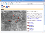 In honor of the 36th anniversary of the Apollo 11
moon landing on July 20, 1969, Google took public domain
imagery of the Moon
, integrated it into the Google Maps interface, and created a tool called Google Moon. By default this tool, with a reduced set of features, also displays the points of landing of all Apollo spacecraft to land on the Moon. It also included an easter egg, displaying a Swiss cheese
design at the highest zoom level, which Google has since removed. A recent collaborative project between NASA Ames Research Center
and Google is integrating and improving the data that is used for Google Moon. This is the Planetary Content Project. Google Moon was linked from a special commemorative version of the Google logo displayed at the top of the main Google search page for July 20, 2005 (UTC).
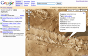 Google Mars provides a visible imagery
view, like Google Moon, as well as infrared
imagery and shaded relief (elevation
) of the planet Mars
. Users can toggle between the elevation, visible, and infrared data, in the same manner as switching between map, satellite, and hybrid modes of Google Maps. In collaboration with NASA
scientists at the Mars Space Flight Facility
located at Arizona State University
, Google has provided the public with data collected from two NASA Mars missions, Mars Global Surveyor
and 2001 Mars Odyssey
.
Now, with Google Earth
5 it is possible to access new improved Google Mars data at a much higher resolution, as well as being able to view the terrain in 3D, and viewing panoramas from various Mars landers in a similar way to Google Street View.
.
Google Transit on Google Labs
, a 20% project of Chris Harrelson and Avichal Garg. Google Transit launched initially with support for Portland, Oregon
, and now includes hundreds of cities in the United States, Canada, Europe, Asia, Africa, Australia, India (Pune & Delhi,NCR) New Zealand. The service calculates route, transit time and cost, and can compare the trip to one using a car. In October 2007 Google Transit graduated from Google Labs and became fully integrated into Google Maps.
The coverage of Google Transit is publicly available. It is spread worldwide, in hundreds of cities and sometimes in entire countries such as China, Japan, Switzerland. The coverage of major cities in the United States and in Canada is almost exhaustive.
In some areas, such as the United Kingdom, Google Transit covers only part of the transit agencies.
In other areas, Google Transit does not provide public transit directions, but still provides the Transit Layer which overlays the schematic of the transit lines on the map. Notable examples include Paris, Berlin, Mexico City and many other capitals around the world.
Each element added to a My Map has an editable tag. This tag can contain text, rich text or HTML. Embeddable video and other content can be included within the HTML tag.
Upon the launch of My Maps there was no facility to embed the created maps into a webpage or blog. A few independent websites have now produced tools to let users embed maps and add further functionality to their maps. This has been resolved with version 2.78.
Google Street View is currently available in parts of the following countries and regions:
*'**
National Museum of Iraq only * Tretyakov Gallery and Hermitage Museum only **
In August 2008, Australia was added to the Street View feature with nearly all Australian highways, roads and streets having the feature. In addition in that month Japan was added and the Tour de France route was added on July 2 of that year. In December 2008, New Zealand was added to street view. The United Kingdom, Australia and New Zealand are the only countries to date with almost all roads and highways featured.
July 2009, Google begins mapping college campuses and surrounding paths and trails. Mexico's main cities and tourist points are added to Street View.
Street View garnered much controversy after its release because of privacy concerns about the uncensored nature of the panoramic photographs. Since then, Google has begun blurring faces through automatic face detection.
" of cities. The first cities available were San Jose
and San Diego
. This feature was available only to developers via the Google Maps API. In February 2010 it was introduced as an experimental feature in Google Maps Labs.
In July 2010 Aerial View was made available in Google Maps in select cities in the United States and worldwide.
The complete list of cities available (as of March 2011) is:
and seasonal flu vaccines are available near a given address or ZIP code.
is a live worldwide version of the game Monopoly
using Google Maps as the game board. It was created by Google and Hasbro
. The game has now ended.
placed in Wikipedia articles. It also links to photos with GPS tags from Panoramio
.
Globe Genie displays Google Street View
imagery associated with a random location. Users can share notable locations with a public mapping function based on Google Maps.
Google has either purchased local map data from established companies, or has entered into lease agreements to use copyrighted map data. The owner of the copyright is listed at the bottom of zoomed maps. For example street maps in Japan are leased from Zenrin
. Street maps in China are leased from Mapabc. Russian street maps are leased from Geocentre Consulting and Tele Atlas. Data are unavailable for North Korea
, so the country is blank, though the companion project Google Map Maker
shows some information.
is available, for example, much of Asia, Africa, Latin America and East Europe as well as the United States, anyone who logs into their Google account can directly improve the map by fixing incorrect driving directions, adding biking trails, or adding a missing hospital. General map errors in Australia, Austria, Belgium, Canada, Denmark, France, Lichtenstein, Netherlands, New Zealand, Norway, South Africa, Switzerland, and the United States can be reported using the Report a Problem link in Google Maps and will be updated by Google. For areas where Google uses Tele Atlas
data, map errors can be reported using Tele Atlas map insight.
If imagery is missing, outdated, misaligned, or generally incorrect, you can notify Google through their contact request form. People can also choose to receive email notification of when imagery gets updated in their area using the Follow Your World application.
Sometimes the names of geographical locations are inaccurate. An example of this type of error may be found in Google Maps Laona, Wisconsin
. In this instance Google Maps identifies one of the town's two major lakes as "Dawson Lake"; the USGS, State of Wisconsin
, and local government maps all identify that map feature as "Scattered Rice Lake". Another example is Samoa
, labeled with "Western Samoa", accurate only as recently as 1997.
Google has also recruited volunteers to check and correct ground truth data.
. As a result, in March 2008 Google added a feature to edit the locations of houses and businesses.
Restrictions have been placed on Google Maps through the apparent censoring of locations deemed potential security threats. In some cases the area of redaction is for specific buildings, but in other cases, such as Washington, D.C., the restriction is to use outdated imagery. These locations are fully listed on Satellite map images with missing or unclear data
.
region claimed by China but administered by India as a large part of Arunachal Pradesh
is shown inside the Chinese frontier by Google Ditu, with Indian highways ending abruptly at the Chinese claim line. Google Ditu also shows Taiwan and the South China Sea Islands
as part of China. , Google Ditu's street map coverage of Taiwan also omits major state organs, such as the Presidential Palace, the five Yuans, and the Supreme Court.
There are some differences between ditu.google.cn and ditu.google.com. For example, the former does not feature My Maps. On the other hand, while the former displays virtually all text in Chinese, the latter displays most text (user-selectable real text as well as those on map) in English. This behavior of displaying English text is not consistent but intermittent – sometimes it is in English, sometimes it is in Chinese. The criteria for choosing which language is displayed is not known.
In October 2010, Nicaragua
n military commander Edén Pastora
stationed Nicaraguan troops on the Isla Calero
(in the delta of the San Juan River
), justifying his action on the border delineation given by Google Maps. Bing Maps depicts the island to be on the Costa Rican side of the border. Google has since updated its data which it found to be incorrect.
. If the earth were perfectly spherical, the projection would be the same as the Mercator. Google Maps uses the formulæ for the spherical Mercator, but the coordinates of features on Google Maps are the GPS
coordinates based on the WGS 84
datum
. The difference between a sphere and the WGS 84 ellipsoid causes the resultant projection not to be precisely conformal
. The discrepancy is meaningless at the global scale but causes maps of local areas to deviate slightly from true ellipsoidal Mercator maps at the same scale.
Because the Mercator projects the poles at infinity, Google Maps cannot show the poles. Instead it cuts off coverage at 85° north and south. This is not considered a limitation, given the purpose of the service. There are no roads at those latitudes.
Web mapping
Web mapping is the process of designing, implementing, generating and delivering maps on the World Wide Web and its product. While web mapping primarily deals with technological issues, web cartography additionally studies theoretic aspects: the use of web maps, the evaluation and optimization of...
service application and technology provided by Google
Google
Google Inc. is an American multinational public corporation invested in Internet search, cloud computing, and advertising technologies. Google hosts and develops a number of Internet-based services and products, and generates profit primarily from advertising through its AdWords program...
, free (for non-commercial use), that powers many map-based services, including the Google Maps website, Google Ride Finder, Google Transit, and maps embedded on third-party websites via the Google Maps API
Application programming interface
An application programming interface is a source code based specification intended to be used as an interface by software components to communicate with each other...
. It offers street maps, a route planner for traveling by foot, car, bike (beta) or public transport and an urban business locator for numerous countries around the world. Google Maps satellite images are not updated in real time; they are several months or years old.
Google Maps uses a close variant of the Mercator projection
Mercator projection
The Mercator projection is a cylindrical map projection presented by the Belgian geographer and cartographer Gerardus Mercator, in 1569. It became the standard map projection for nautical purposes because of its ability to represent lines of constant course, known as rhumb lines or loxodromes, as...
, so it cannot show areas around the poles. A related product is Google Earth
Google Earth
Google Earth is a virtual globe, map and geographical information program that was originally called EarthViewer 3D, and was created by Keyhole, Inc, a Central Intelligence Agency funded company acquired by Google in 2004 . It maps the Earth by the superimposition of images obtained from satellite...
, a stand-alone program which offers more globe-viewing features, including showing polar areas.
Satellite view
Google Maps provides high-resolution aerial or satellite images for most urban areas in the United StatesUnited States
The United States of America is a federal constitutional republic comprising fifty states and a federal district...
(including Hawaii, Alaska, Puerto Rico, and the U.S. Virgin Islands), Canada
Canada
Canada is a North American country consisting of ten provinces and three territories. Located in the northern part of the continent, it extends from the Atlantic Ocean in the east to the Pacific Ocean in the west, and northward into the Arctic Ocean...
, and the United Kingdom
United Kingdom
The United Kingdom of Great Britain and Northern IrelandIn the United Kingdom and Dependencies, other languages have been officially recognised as legitimate autochthonous languages under the European Charter for Regional or Minority Languages...
, as well as parts of Australia
Australia
Australia , officially the Commonwealth of Australia, is a country in the Southern Hemisphere comprising the mainland of the Australian continent, the island of Tasmania, and numerous smaller islands in the Indian and Pacific Oceans. It is the world's sixth-largest country by total area...
and many other countries. The high-resolution imagery has been used by Google Maps to cover all of Egypt
Egypt
Egypt , officially the Arab Republic of Egypt, Arabic: , is a country mainly in North Africa, with the Sinai Peninsula forming a land bridge in Southwest Asia. Egypt is thus a transcontinental country, and a major power in Africa, the Mediterranean Basin, the Middle East and the Muslim world...
's Nile Valley, Sahara desert and Sinai. Google Maps also covers many cities in the English speaking areas. However, Google Maps is not solely an English maps service, since its service is intended to cover the world.
Various governments have complained about the potential for terrorists to use the satellite images in planning attacks. Google has blurred some areas for security (mostly in the United States), including the U.S. Naval Observatory area (where the official residence of the Vice President
Vice President of the United States
The Vice President of the United States is the holder of a public office created by the United States Constitution. The Vice President, together with the President of the United States, is indirectly elected by the people, through the Electoral College, to a four-year term...
is located), and previously the United States Capitol
United States Capitol
The United States Capitol is the meeting place of the United States Congress, the legislature of the federal government of the United States. Located in Washington, D.C., it sits atop Capitol Hill at the eastern end of the National Mall...
and the White House
White House
The White House is the official residence and principal workplace of the president of the United States. Located at 1600 Pennsylvania Avenue NW in Washington, D.C., the house was designed by Irish-born James Hoban, and built between 1792 and 1800 of white-painted Aquia sandstone in the Neoclassical...
. Other well-known government installations, including Area 51
Area 51
Area 51 is a military base, and a remote detachment of Edwards Air Force Base. It is located in the southern portion of Nevada in the western United States, 83 miles north-northwest of downtown Las Vegas. Situated at its center, on the southern shore of Groom Lake, is a large military airfield...
in the Nevada
Nevada
Nevada is a state in the western, mountain west, and southwestern regions of the United States. With an area of and a population of about 2.7 million, it is the 7th-largest and 35th-most populous state. Over two-thirds of Nevada's people live in the Las Vegas metropolitan area, which contains its...
desert, are visible.
Not all areas on satellite images are covered in the same resolution; less populated areas usually get less detail. Some areas may be obscured by patches of clouds.
With the introduction of an easily pannable and searchable mapping and satellite imagery tool, Google's mapping engine prompted a surge of interest in satellite imagery. Sites were established which feature satellite images of interesting natural and man-made landmarks, including such novelties as "large type" writing visible in the imagery, as well as famous stadia and unique geological formations.
Although Google uses the word satellite, most of the high-resolution imagery of cities is aerial photography
Aerial photography
Aerial photography is the taking of photographs of the ground from an elevated position. The term usually refers to images in which the camera is not supported by a ground-based structure. Cameras may be hand held or mounted, and photographs may be taken by a photographer, triggered remotely or...
taken from aircraft flying at 800–1500 feet rather than from satellites; while most of the rest of the imagery is in fact from satellites.
Although the aerial views images are undated, they occasionally coincide with known events. For example, as of Oct. 8, 2011, the aerial view of the Hollywood region of Los Angeles
Los Ángeles
Los Ángeles is the capital of the province of Biobío, in the commune of the same name, in Region VIII , in the center-south of Chile. It is located between the Laja and Biobío rivers. The population is 123,445 inhabitants...
shows the street-closures and temporary structures related to the 2011 Academy Awards
83rd Academy Awards
The 83rd Academy Awards ceremony, presented by the Academy of Motion Picture Arts and Sciences , honored the best films of 2010 and took place February 27, 2011, at the Kodak Theatre in Hollywood, Los Angeles beginning at 5:30 p.m. PST / 8:30 p.m. EST. During the ceremony, Academy Awards ...
ceremony.
Directions
Google Maps provides a route plannerRoute planning software
Route planning software is a computer software programme, designed to plan a route between two geographical locations using a journey planning engine, typically specialised for road networks as a road route planner. It can typically provide a list of places one will pass by, with crossroads and...
under "Get Directions". Up to four modes of transportation are available depending on the area: driving, public transit
Public transport route planner
A public transport route planner is a type of journey planner designed to provide information about available public transport journeys, nowadays often made available as a Web application...
(see the Google Transit section below), walking, and bicycling. Driving directions are available:
- Contiguously in Europe, the Middle East, Asia and the African Mainland (except Bosnia and Herzegovina, Lesotho, Oman, North and South Korea): Afghanistan, Andorra, Albania, Armenia, Austria, Azerbaijan, Bahrain, Bangladesh, Belgium, Belarus, Bhutan, Bulgaria, Cambodia, Croatia, Czech Republic, Denmark (excluding the Faroe IslandsFaroe IslandsThe Faroe Islands are an island group situated between the Norwegian Sea and the North Atlantic Ocean, approximately halfway between Scotland and Iceland. The Faroe Islands are a self-governing territory within the Kingdom of Denmark, along with Denmark proper and Greenland...
), Estonia, France, Finland, Georgia, Germany, Greece, Gibraltar, Hungary, India, Iran, Iraq, Ireland, Italy, Kazakhstan, Kuwait, Kyrgyzstan, Laos, Latvia, Liechtenstein, Lithuania, Luxembourg, Macedonia, peninsular MalaysiaPeninsular MalaysiaPeninsular Malaysia , also known as West Malaysia , is the part of Malaysia which lies on the Malay Peninsula. Its area is . It shares a land border with Thailand in the north. To the south is the island of Singapore. Across the Strait of Malacca to the west lies the island of Sumatra...
, Moldova, Monaco, Montenegro, Myanmar, Nepal, The Netherlands, Norway (excluding SvalbardSvalbardSvalbard is an archipelago in the Arctic, constituting the northernmost part of Norway. It is located north of mainland Europe, midway between mainland Norway and the North Pole. The group of islands range from 74° to 81° north latitude , and from 10° to 35° east longitude. Spitsbergen is the...
), Pakistan, Poland, Portugal (including MadeiraMadeiraMadeira is a Portuguese archipelago that lies between and , just under 400 km north of Tenerife, Canary Islands, in the north Atlantic Ocean and an outermost region of the European Union...
, excluding the AzoresAzoresThe Archipelago of the Azores is composed of nine volcanic islands situated in the middle of the North Atlantic Ocean, and is located about west from Lisbon and about east from the east coast of North America. The islands, and their economic exclusion zone, form the Autonomous Region of the...
), Qatar, Romania, Russia, San Marino, Saudi Arabia, Singapore, Slovakia, Slovenia, Serbia, Spain (including the Canary Islands and Ceuta and Melilla), Sweden, Switzerland, Syria, Tajikistan, Thailand, Turkey, Turkmenistan, Ukraine, United Arab Emirates, United Kingdom, Uzbekistan, Vatican City, Vietnam and Yemen. In noncontiguous countries: China, Egypt, Hong Kong, Israel (and parts of the West Bank), Jordan, Lebanon, Macau and Mongolia. - Contiguously in North and Central America: Belize, Canada, Costa Rica, El Salvador, Guatemala, Honduras, Mexico, Nicaragua, Panama and the United States
- Contiguously in South America: Argentina, Bolivia, Brazil, Chile, Ecuador, Paraguay, Peru (most parts, except e.g. IquitosIquitosIquitos is the largest city in the Peruvian rainforest, with a population of 370,962. It is the capital of Loreto Region and Maynas Province.Located on the Amazon River, it is only above sea level, although it is more than from the mouth of the Amazon at Belém on the Atlantic Ocean...
and other places in the Loreto regionLoreto RegionLoreto is Peru's northernmost region. Covering almost one-third of Peru's territory, Loreto is by far the nation's largest region and also one of the most sparsely populated ones, due to its remote location in the Amazon Rainforest...
) and Uruguay. In noncontiguous countries: Colombia, French Guiana, Guyana, Suriname and Venezuela. - In the Caribbean region (except Saint Kitts and Nevis, Trinidad and Tobago): Bahamas, Turks and Caicos Islands, Cuba, Hispaniola (the Dominican Republic and Haiti), Jamaica, Cayman Islands, Puerto Rico, the US Virgin Islands, the British Virgin Islands, Anguilla, Antigua and Barbuda, Saint Martin, Saba, Sint Eustatius, Saint Barthélemy, Montserrat, Guadeloupe, Dominica, Martinique, Saint Lucia, Saint Vincent and the Grenadines, Grenada, Barbados, Aruba, Curaçao and Bonaire.
- Contiguously in Indonesia: Borneo (Indonesian part only), Java, Sulawesi, Sumatra,
- In certain noncontiguous countries and regions: Anguilla, Antigua, Australia, Azores, Bahamas (no inter-island ferries), Barbados, Barbuda, British Virgin Islands, Cape Verde, Comoros, Cyprus, Dominica, Faroe Islands, Fiji, Guam, Grenada, Guadeloupe, Hawaii, Iceland, Indonesia (Bali, Borneo, Java, Lombok, Madura, Sulawesi and Sumatra), Japan, Madagascar, Maldives, Malta, Martinique, Mauritius, Montserrat, New Caledonia, New Zealand, Nuuk (Greenland), Papua New Guinea, Philippines, Réunion, Sabah (Malaysia), Saipan (Northern Mariana Islands), São Tomé and Príncipe, Sarawak (Malaysia), Seychelles, Socotra (Yemen), Sri Lanka, St. Eustatius (Netherlands Antilles), St. Lucia, St. Vincent and the Grenadines, Taiwan, Timor-Leste (eastern half only), Turks and Caicos Islands (no inter-island ferries), Upolu (Samoa), and US Virgin Islands (no inter-island ferries).
- North America, Hawaii, Japan and Australia are humorously connected: Google Maps suggests to "kayak across the Pacific Ocean" between them.
In addition, public transit directions are available in South Korea.
Implementation
Like many other Google web applications, Google Maps uses JavaScriptJavaScript
JavaScript is a prototype-based scripting language that is dynamic, weakly typed and has first-class functions. It is a multi-paradigm language, supporting object-oriented, imperative, and functional programming styles....
extensively. As the user drags the map, the grid squares are downloaded from the server and inserted into the page. When a user searches for a business, the results are downloaded in the background for insertion into the side panel and map; the page is not reloaded. Locations are drawn dynamically by positioning a red pin (composed of several partially-transparent PNGs) on top of the map images.
A hidden IFrame
IFrame
iFrame can be:* I-frames, in video compression; see video compression picture types* iFrame * The HTML iframe element....
with form submission is used because it preserves browser history. The site also uses JSON
JSON
JSON , or JavaScript Object Notation, is a lightweight text-based open standard designed for human-readable data interchange. It is derived from the JavaScript scripting language for representing simple data structures and associative arrays, called objects...
for data transfer rather than XML
XML
Extensible Markup Language is a set of rules for encoding documents in machine-readable form. It is defined in the XML 1.0 Specification produced by the W3C, and several other related specifications, all gratis open standards....
, for performance reasons. These techniques both fall under the broad Ajax
Ajax (programming)
Ajax is a group of interrelated web development methods used on the client-side to create asynchronous web applications...
umbrella.
In October 2011, Google announced MapsGL, a WebGL
WebGL
WebGL is a software library that extends the capability of the JavaScript programming language to allow it to generate interactive 3D graphics within any compatible web browser...
version of Maps with better renderings and smoother transitions.
Extensibility and customization
As Google Maps is coded almost entirely in JavaScriptJavaScript
JavaScript is a prototype-based scripting language that is dynamic, weakly typed and has first-class functions. It is a multi-paradigm language, supporting object-oriented, imperative, and functional programming styles....
and XML
XML
Extensible Markup Language is a set of rules for encoding documents in machine-readable form. It is defined in the XML 1.0 Specification produced by the W3C, and several other related specifications, all gratis open standards....
, some end users have reverse-engineered the tool and produced client-side scripts and server-side hooks which allowed a user or website to introduce expanded or customized features into the Google Maps interface.
Using the core engine and the map/satellite images hosted by Google, such tools can introduce custom location icons, location coordinates and metadata
Metadata
The term metadata is an ambiguous term which is used for two fundamentally different concepts . Although the expression "data about data" is often used, it does not apply to both in the same way. Structural metadata, the design and specification of data structures, cannot be about data, because at...
, and even custom map image sources into the Google Maps interface. The script-insertion tool Greasemonkey
Greasemonkey
Greasemonkey is a Mozilla Firefox extension that allows users to install scripts that make on-the-fly changes to HTML web page content on the DOMContentLoaded event, which happens immediately after it is loaded in the browser .As Greasemonkey scripts are persistent, the changes made to the web...
provides a large number of client-side scripts to customize Google Maps data.
Combinations with photo sharing
Photo sharing
Photo sharing is the publishing or transfer of a user's digital photos online, thus enabling the user to share them with others . This function is provided through both websites and applications that facilitate the upload and display of images...
websites, such as Flickr
Flickr
Flickr is an image hosting and video hosting website, web services suite, and online community that was created by Ludicorp in 2004 and acquired by Yahoo! in 2005. In addition to being a popular website for users to share and embed personal photographs, the service is widely used by bloggers to...
, are used to create "memory maps". Using copies of the Keyhole
KH-11 Kennan
The KH-11 KENNAN, renamed CRYSTAL in 1982 and also referenced by the codenames 1010, and "Key Hole", is a type of reconnaissance satellite launched by the American National Reconnaissance Office since December 1976...
satellite
Spy satellite
A spy satellite is an Earth observation satellite or communications satellite deployed for military or intelligence applications....
photos, users have taken advantage of image annotation features to provide personal histories and information regarding particular points of the area.
Google Maps API
After the success of reverse-engineered mashups such as chicagocrime.org and housingmaps.com, Google launched the Google Maps API in June 2005 to allow developers to integrate Google Maps into their websites. It is a free service, and does not contain ads, but Google states in their terms of use that they reserve the right to display ads in the future.By using the Google Maps API
Application programming interface
An application programming interface is a source code based specification intended to be used as an interface by software components to communicate with each other...
, it is possible to embed Google Maps site into an external website, on to which site specific data can be overlaid. Although initially only a JavaScript
JavaScript
JavaScript is a prototype-based scripting language that is dynamic, weakly typed and has first-class functions. It is a multi-paradigm language, supporting object-oriented, imperative, and functional programming styles....
API, the Maps API has since expanded to include an API for Adobe Flash
Adobe Flash
Adobe Flash is a multimedia platform used to add animation, video, and interactivity to web pages. Flash is frequently used for advertisements, games and flash animations for broadcast...
applications, a service for retrieving static map images, and web services
Web service
A Web service is a method of communication between two electronic devices over the web.The W3C defines a "Web service" as "a software system designed to support interoperable machine-to-machine interaction over a network". It has an interface described in a machine-processable format...
for performing geocoding, generating driving directions, and obtaining elevation profiles. Over 350,000 web sites use the Google Maps API, making it the most heavily used web application development API.
The Google Maps API is free for commercial use providing that the site on which it is being used is publicly accessible and does not charge for access, and is not generating more than 25 000 map accesses a day. Sites that do not meet these requirements can purchase Google Maps API Premier.
The success of the Google Maps API has spawned a number of competing alternatives, including the Yahoo! Maps
Yahoo! Maps
Yahoo! Maps is a free online mapping portal provided by Yahoo!.-News:*On May 16, 2007, Yahoo! released a new map style designed by the cartography company...
API, Bing Maps Platform, MapQuest
MapQuest
MapQuest is an American free online web mapping service owned by AOL. The company was founded in 1967 as Cartographic Services, a division of R.R. Donnelley & Sons in Chicago, Illinois, United States. It moved to Lancaster, Pennsylvania in 1969. When it became an independent company in 1994, it was...
Development Platform, and OpenLayers
OpenLayers
OpenLayers is an open source JavaScript library for displaying map data in web browsers. It provides an API for building rich web-based geographic applications similar to Google Maps and Bing Maps...
.
In September 2011, Google announced it would discontinue a number of its products, including Google Maps API for Flash.
Google Maps for Mobile
In 2006, Google introduced a Java application called Google Maps for Mobile, intended to run on any Java-based phone or mobile device. Many of the web-based site's features are provided in the application.On November 28, 2007, Google Maps for Mobile 2.0 was released. It introduced a GPS-like location service that does not require a GPS receiver. The "my location" feature works by utilizing the GPS location of the mobile device, if it is available. This information is supplemented by the software determining the nearest wireless networks
Wi-Fi
Wi-Fi or Wifi, is a mechanism for wirelessly connecting electronic devices. A device enabled with Wi-Fi, such as a personal computer, video game console, smartphone, or digital audio player, can connect to the Internet via a wireless network access point. An access point has a range of about 20...
and cell site
Cell site
A cell site is a term used to describe a site where antennas and electronic communications equipment are placed, usually on a radio mast, tower or other high place, to create a cell in a cellular network...
s. The software then looks up the location of the cell site using a database of known wireless networks and cell sites. The Cell-site location method is used by triangulating the different signal strengths from different cell transmitters and then using their location property (retrieved from the online cell site database) to aid My Location in determining the user's current location. Wireless network location method is calculated by discovering the nearby WiFi hotspots and using their location property (retrieved from the online WiFi database, in the same way as the cell site database) to further discover the user's location.
The order in which these take precedence is:
- GPS-based services
- WLAN-, WiFi-based services
- Cell transmitter-based services
The software plots the streets in blue that are available with a yellow icon and a green circle around the estimated range of the cell site based on the transmitter's rated power (among other variables). The estimate is refined using the strength of the cell phone signal to estimate how close to the cell site the mobile device is.
, this service is available for the following platforms:
- Android
- iOS (iPhoneIPhoneThe iPhone is a line of Internet and multimedia-enabled smartphones marketed by Apple Inc. The first iPhone was unveiled by Steve Jobs, then CEO of Apple, on January 9, 2007, and released on June 29, 2007...
, iPod TouchIPod TouchThe iPod Touch is a portable media player, personal digital assistant, handheld game console, and Wi-Fi mobile device designed and marketed by Apple Inc. The iPod Touch adds the multi-touch graphical user interface to the iPod line...
, iPadIPadThe iPad is a line of tablet computers designed, developed and marketed by Apple Inc., primarily as a platform for audio-visual media including books, periodicals, movies, music, games, and web content. The iPad was introduced on January 27, 2010 by Apple's then-CEO Steve Jobs. Its size and...
) - Windows MobileWindows MobileWindows Mobile is a mobile operating system developed by Microsoft that was used in smartphones and Pocket PCs, but by 2011 was rarely supplied on new phones. The last version is "Windows Mobile 6.5.5"; it is superseded by Windows Phone, which does not run Windows Mobile software.Windows Mobile is...
(NOT Windows Phone 7 ) - NokiaNokiaNokia Corporation is a Finnish multinational communications corporation that is headquartered in Keilaniemi, Espoo, a city neighbouring Finland's capital Helsinki...
/SymbianSymbianSymbian is a mobile operating system and computing platform designed for smartphones and currently maintained by Accenture. The Symbian platform is the successor to Symbian OS and Nokia Series 60; unlike Symbian OS, which needed an additional user interface system, Symbian includes a user...
(S60 3rd edition only) - Symbian OS (UIQ v3)
- BlackBerryBlackBerryBlackBerry is a line of mobile email and smartphone devices developed and designed by Canadian company Research In Motion since 1999.BlackBerry devices are smartphones, designed to function as personal digital assistants, portable media players, internet browsers, gaming devices, and much more...
- Phones with Java-Platform (MIDP 2.0 and up), for example the Sony Ericsson K800i
- Palm OSPalm OSPalm OS is a mobile operating system initially developed by Palm, Inc., for personal digital assistants in 1996. Palm OS is designed for ease of use with a touchscreen-based graphical user interface. It is provided with a suite of basic applications for personal information management...
(CentroPalm CentroThe Palm Centro smartphone has been marketed by Palm, Inc. since its release on October 14, 2007 — offering the functionality of the larger Treo 755p in a smaller size....
and newer) - Palm webOSPalm webOSHP webOS is a mobile operating system based on a Linux kernel, initially developed by Palm, which was later acquired by Hewlett-Packard. Palm, HP, and most commentators and sources write the name webOS, as shown in the adjacent logo, and in HP resources, rather than "WebOS".webOS was introduced by...
(Palm PrePalm PreThe Palm Pre is a multimedia smartphone designed and marketed by Palm with a multi-touch screen and a sliding keyboard. The smartphone was the first to use Palm's Linux based mobile operating system, webOS...
and Palm PixiPalm PixiThe Palm Pixi and Pixi Plus are multimedia smartphones, developed by Palm, which was purchased in 2010 by HP. The device is viewed as a successor to the Palm Centro smartphone and was Palm's second webOS device, after the Palm Pre....
)
On November 4, 2009, Google Maps Navigation was released in conjunction with Google Android OS 2.0 Eclair on the Motorola Droid
Motorola Droid
The Motorola Droid is an Internet and multimedia enabled smartphone designed by Motorola, which runs Google's Android operating system. The Droid had been publicized under the codenames Sholes and Tao and the model number A855...
, adding voice commands, traffic reports, and street view support. The initial release was limited to the United States. The service was launched in the UK on 20 April 2010 and in large parts of continental Europe on June 9, 2010 (including Austria, Belgium, Canada, Denmark, France, Germany, Italy, the Netherlands, Portugal, Spain, and Switzerland).
In March 2011, Google Vice President of Location Service, Marissa Mayer announced that Google provides map services to 150 millions users.
Google Maps Android 2.0
Cell phones are being increasingly used for navigation assistance. Google Maps Navigation for Android 2.0 is free.Features provided in the application:
- Search in plain English
- Search by voice
- Traffic view
- Search along route
- Satellite view
- Street View
- Car dock mode
Impact
Google Maps Navigation is free. A potential drawback of Google Maps for Android is that maps are not included in the application file. An internet connection is required to get maps and related information from Google Maps, just like with iPhone’s Google Maps application. This drawback is mitigated by an automatic map caching feature which temporarily stores recently-viewed areas. There is also a 'Download Map Area' feature in the Labs section of Google Maps. The 'Download Map Area' feature enables the user to download the road map and landmark data for an area of 10 square miles (25.9 km²) around any point. The user can do this action multiple times to cover as much area as desired. Google suggests that users can make use of this feature to download the map of a foreign city before traveling to visit it, so that once the user arrives in the city, they can refer to the pre-downloaded road map without needing to use expensive international roaming data. However, the downloaded map area only includes the basic road map and its landmark labels. Google notes that even after you download a map area, "you still need a data connection to see satellite view and 3D buildings, search for Places and get directions."Google Maps parameters
In Google Maps, URL parameters are sometimes data-driven in their limits and the user interface presented by the web may or may not reflect those limits. In particular, the zoom level (denoted by the z parameter) supported varies. In less populated regions, the supported zoom levels might stop at around 18. In earlier versions of the API, specifying these higher values might result in no image being displayed. In Western cities, the supported zoom level generally stops at about 20. In some isolated cases, the data supports up to 23 or greater, as inthese elephants or this view of people at a well in Chad
Chad
Chad , officially known as the Republic of Chad, is a landlocked country in Central Africa. It is bordered by Libya to the north, Sudan to the east, the Central African Republic to the south, Cameroon and Nigeria to the southwest, and Niger to the west...
, Africa. Different versions of the API and web interfaces may or may not fully support these higher levels.
As of October 2010, the Google map viewer updates its zoom bar to allow the user to zoom all the way when centered over areas that support higher zoom levels.
Acquisition
Google Maps first started as a C++C++
C++ is a statically typed, free-form, multi-paradigm, compiled, general-purpose programming language. It is regarded as an intermediate-level language, as it comprises a combination of both high-level and low-level language features. It was developed by Bjarne Stroustrup starting in 1979 at Bell...
program designed by two Danish brothers Lars
Lars Rasmussen (Software Developer)
Lars Eilstrup Rasmussen is a Danish-born computer scientist, software developer, and co-founder of Google Maps.-Qualifications:In 1990, Rasmussen graduated from the University of Aarhus with a major in Mathematics...
and Jens Rasmussen at the Sydney-based company Where 2 Technologies. It was first designed to be separately downloaded by users but the company later pitched the idea for a purely Web-based product to Google management, changing the method of distribution. In October 2004 the company was acquired by Google
Google
Google Inc. is an American multinational public corporation invested in Internet search, cloud computing, and advertising technologies. Google hosts and develops a number of Internet-based services and products, and generates profit primarily from advertising through its AdWords program...
Inc where it transformed into the web application Google Maps. The application was first announced on the Google Blog on February 8, 2005, and was located at Google. It originally only supported users of Internet Explorer
Internet Explorer
Windows Internet Explorer is a series of graphical web browsers developed by Microsoft and included as part of the Microsoft Windows line of operating systems, starting in 1995. It was first released as part of the add-on package Plus! for Windows 95 that year...
and Mozilla
Mozilla
Mozilla is a term used in a number of ways in relation to the Mozilla.org project and the Mozilla Foundation, their defunct commercial predecessor Netscape Communications Corporation, and their related application software....
web browser
Web browser
A web browser is a software application for retrieving, presenting, and traversing information resources on the World Wide Web. An information resource is identified by a Uniform Resource Identifier and may be a web page, image, video, or other piece of content...
s, but support for Opera
Opera (web browser)
Opera is a web browser and Internet suite developed by Opera Software with over 200 million users worldwide. The browser handles common Internet-related tasks such as displaying web sites, sending and receiving e-mail messages, managing contacts, chatting on IRC, downloading files via BitTorrent,...
and Safari
Safari (web browser)
Safari is a web browser developed by Apple Inc. and included with the Mac OS X and iOS operating systems. First released as a public beta on January 7, 2003 on the company's Mac OS X operating system, it became Apple's default browser beginning with Mac OS X v10.3 "Panther". Safari is also the...
was added on February 25, 2005, but currently Opera is removed from the system requirements list. Internet Explorer
Internet Explorer
Windows Internet Explorer is a series of graphical web browsers developed by Microsoft and included as part of the Microsoft Windows line of operating systems, starting in 1995. It was first released as part of the add-on package Plus! for Windows 95 that year...
7.0+, Firefox 3.6+, Safari
Safari (web browser)
Safari is a web browser developed by Apple Inc. and included with the Mac OS X and iOS operating systems. First released as a public beta on January 7, 2003 on the company's Mac OS X operating system, it became Apple's default browser beginning with Mac OS X v10.3 "Panther". Safari is also the...
3.1+, and Google Chrome are supported. It was in beta for six months before becoming part of Google Local on October 6, 2005.
2005
In April 2005, Google created Google Ride Finder using Google Maps. In June 2005, Google released the Google Maps API. In July 2005, Google began Google Maps and Google Local services for Japan, including road maps. On July 22, 2005, Google released "Hybrid View". Together with this change, the satellite image data was converted from plate carrée to Mercator projectionMercator projection
The Mercator projection is a cylindrical map projection presented by the Belgian geographer and cartographer Gerardus Mercator, in 1569. It became the standard map projection for nautical purposes because of its ability to represent lines of constant course, known as rhumb lines or loxodromes, as...
, which makes for a less distorted image in the temperate climes latitudes. In July 2005, in honor of the thirty-sixth anniversary of the Apollo Moon landing, Google Moon
Google Moon
Google Moon is a service similar to Google Maps that shows satellite images of the Moon. It was launched by Google on July 20, 2005, the 36th anniversary of the Apollo 11 lunar landing...
was launched. In September 2005, in the aftermath of Hurricane Katrina
Hurricane Katrina
Hurricane Katrina of the 2005 Atlantic hurricane season was a powerful Atlantic hurricane. It is the costliest natural disaster, as well as one of the five deadliest hurricanes, in the history of the United States. Among recorded Atlantic hurricanes, it was the sixth strongest overall...
, Google Maps quickly updated its satellite imagery of New Orleans to allow users to view the extent of the flooding in various parts of that city. (Oddly, in March 2007, imagery showing hurricane damage was replaced with images from before the storm; this replacement was not made on Google Earth
Google Earth
Google Earth is a virtual globe, map and geographical information program that was originally called EarthViewer 3D, and was created by Keyhole, Inc, a Central Intelligence Agency funded company acquired by Google in 2004 . It maps the Earth by the superimposition of images obtained from satellite...
, which still uses post-Katrina imagery).
2006
From January 2006, Google Maps featured road maps for the United States, Puerto Rico, Canada, the United Kingdom, Japan, and certain cities in the Republic of Ireland. Coverage of the area around TurinTurin
Turin is a city and major business and cultural centre in northern Italy, capital of the Piedmont region, located mainly on the left bank of the Po River and surrounded by the Alpine arch. The population of the city proper is 909,193 while the population of the urban area is estimated by Eurostat...
was added in time for the 2006 Winter Olympics
2006 Winter Olympics
The 2006 Winter Olympics, officially known as the XX Olympic Winter Games, was a winter multi-sport event which was celebrated in Turin, Italy from February 10, 2006, through February 26, 2006. This marked the second time Italy hosted the Olympic Winter Games, the first being the VII Olympic Winter...
. On January 23, 2006, Google Maps was updated to use the same satellite image database as Google Earth
Google Earth
Google Earth is a virtual globe, map and geographical information program that was originally called EarthViewer 3D, and was created by Keyhole, Inc, a Central Intelligence Agency funded company acquired by Google in 2004 . It maps the Earth by the superimposition of images obtained from satellite...
. On March 12, 2006, Google Mars
Google Mars
Google Mars was at first an in-browser version of Google Maps which provides a visible imagery view, like Google Moon, as well as infrared imagery and shaded relief of the planet Mars. Users can toggle between the elevation, visible, and infrared data, in the same manner as switching between map,...
was launched, which features a draggable map and satellite imagery of the planet Mars. In April 2006, Google Local was merged into the main Google Maps site. On April 3, 2006, version 2 of the Maps API was released. On June 11, 2006, Google added geocoding capabilities to the API, satisfying the most developer-requested feature for this service. On June 14, 2006, Google Maps for Enterprise was officially launched. As a commercial service, it features intranet and advertisement-free implementations. In July 2006 Google started including Google Maps business listings in the form of Local OneBoxes in the main Google search results. On December 9 Google integrates the PlusBox in the main search results. On December 19 Google added a feature that lets you add multiple destinations to your driving directions. Beginning in February 2007, buildings and subway stops are displayed in Google Maps "map view" for parts of New York City, Washington, D.C.
Washington, D.C.
Washington, D.C., formally the District of Columbia and commonly referred to as Washington, "the District", or simply D.C., is the capital of the United States. On July 16, 1790, the United States Congress approved the creation of a permanent national capital as permitted by the U.S. Constitution....
, London, San Francisco, and some other cities.
2007
On January 29, 2007 Local Universal results were upgraded and more data included in the main Google results page. On February 28, 2007, Google Traffic info was officially launched to automatically include real-time traffic flowTraffic flow
Traffic flow, in mathematics and civil engineering, is the study of interactions between vehicles, drivers, and infrastructure , with the aim of understanding and developing an optimal road network with efficient movement of traffic and minimal traffic congestion problems.-History:Attempts to...
conditions to the maps of 30 major cities of the United States. On March 8, 2007, the Local Business Center was upgraded. On May 16, 2007 Google rolled out Universal search results, including more Map information on the main Google results page. On May 18, 2007 Google added neighborhood search capabilities. On May 29, 2007, Google driving directions support was added to the Google Maps API. On May 29, 2007, Street View was added, giving a ground-level 360-degree view of streets in some major cities in United States. On June 19, 2007, reviews were allowed to be added directly to businesses on Google Maps. On June 28, 2007, draggable driving directions were introduced. On July 31, 2007, support for the hCard
HCard
hCard is a microformat for publishing the contact details of people, companies, organizations, and places, in HTML, Atom, RSS, or arbitrary XML...
microformat
Microformat
A microformat is a web-based approach to semantic markup which seeks to re-use existing HTML/XHTML tags to convey metadata and other attributes in web pages and other contexts that support HTML, such as RSS...
was announced. Unfortunately, the implementation is broken. On August 21, 2007, Google announced a simple way to embed Google Maps into other websites. On September 13, 2007, 54 new countries were added to Google Maps in Latin America and Asia. On October 3, 2007, Google Transit was integrated into Google Maps making public transportation routing possible on Google Maps. On October 27, 2007, Google Maps started mapping the geoweb
Geoweb
The Geospatial Web or Geoweb is a relatively new term that implies the merging of geographical information with the abstract information that currently dominates the Internet...
and showing the results in Google Maps. On October 27, 2007, Google Maps added a searchable interface for coupons in the business listings. On November 27, 2007, "Terrain" view showing basic topographic features was added. The button for "Hybrid" view was removed, and replaced with a "Show labels" checkbox under the "Satellite" button to switch between "Hybrid" and "Satellite" views.
2008
On January 22, 2008, Google expanded the Local Onebox from 3 business listings to 10. On February 20, 2008, Google Maps allowed searches to be refined by User Rating & neighborhoods. On March 18, 2008, Google allowed end users to edit business listings and add new places. On March 19, 2008, Google added unlimited category options in the Local Business Center. On April 2, 2008, Google added contour lines to the Terrain view. In April 2008, a button to view recent Saved Locations was added to the right of the search field. In May 2008, a "More" button was added alongside the "Map", "Satellite", and "Terrain" buttons, permitting access to geographically-related photos on PanoramioPanoramio
Panoramio is a geolocation-oriented photo sharing website. Accepted photos uploaded to the site can be accessed as a layer in Google Earth and Google Maps, with new photos being added at the end of every month. The site's goal is to allow Google Earth users to learn more about a given area by...
and articles on Wikipedia
Wikipedia
Wikipedia is a free, web-based, collaborative, multilingual encyclopedia project supported by the non-profit Wikimedia Foundation. Its 20 million articles have been written collaboratively by volunteers around the world. Almost all of its articles can be edited by anyone with access to the site,...
. On May 15, 2008, Google Maps was ported to Flash and ActionScript 3 as a foundation for richer internet applications. On July 15, 2008, walking directions were added. On August 4, 2008, Street View launched in Japan and Australia. On August 5, 2008, the user interface was redesigned. On August 29, 2008, Google signed a deal under which GeoEye
GeoEye
GeoEye Inc. is a commercial satellite imagery company based in Herndon, Virginia that is the world's largest space imaging corporation....
would supply them with imagery from a satellite, and introduced the Map Maker tool, which allows any user to improve the map data seen by all. On September 9, 2008, a reverse business lookup feature was added. On September 23, 2008, information for the New York City Metropolitan Transit Authority
Metropolitan Transportation Authority (New York)
The Metropolitan Transportation Authority of the State of New York is a public benefit corporation responsible for public transportation in the U.S...
was added. On October 7, 2008, GeoEye-1 took its first image, a bird's-eye view of Kutztown University in Pennsylvania. On October 26, 2008, reverse geocoding was added to the Maps API. On November 11, 2008, Street View in Spain, Italy, and France was introduced. On November 23, 2008, AIR support for the Maps API for Flash was added. On November 25, 2008, a new user interface for Street View was introduced. On November 27, 2008, maps, local business information, and local trends for China were introduced. On December 9, 2008, 2x Street View coverage was introduced.
2009-10
In May, 2009, a new Google Maps logo was introduced. In early October 2009, Google replaced Tele AtlasTele Atlas
Tele Atlas is a Netherlands-based company founded in 1984 which delivers digital maps and other dynamic content for navigation and location-based services, including personal and in-car navigation systems, and provides data used in a wide range of mobile and Internet map applications...
as their primary supplier of geospatial data in the U.S. version of Maps and use their own data. In October 2009, the railroads were redone, featuring a slightly new look and updated, removing older lines. Also in the same month, maps in several areas were changed to include paper streets and other odd roads that don't exist, as well as lot lines showing up on the map interface. On February 11, 2010, Google Maps Labs was added. On March 11, 2010, Street View in the United Kingdom, Hong Kong, Macau, and more locations in Japan were launched. On May 25, 2010, public transportation routing for Denmark was added by integrating with Rejseplanen.dk.
Google's use of Google Maps
The main Google Maps site includes a local search feature (now deprecated), which can be used to locate businesses of a certain type in a geographic area. The functionality of the deprecated Google Local Search API is now contained in the Google Places API, currently in developer preview.Google Ditu
Google Ditu (谷歌地图 lit. "Google Maps") was released to the public on February 9, 2007, and replaced the old Google Bendi (谷歌本地 lit. "Google Local"). This is the Chinese localized version of Google Maps and Google Local services.In order to be compliant with the requirements of Chinese law, Google had to remove or modify some Google Maps features in Google Ditu:
- Google Ditu does not allow overlay of user-generated content from Panoramio, YouTube, Wikipedia and webcams.
- Google Ditu shows the disputed border areas between China and India as being part of China, while on Google Maps those disputed areas are shown inside dotted lines.
Google Moon
Apollo 11
In early 1969, Bill Anders accepted a job with the National Space Council effective in August 1969 and announced his retirement as an astronaut. At that point Ken Mattingly was moved from the support crew into parallel training with Anders as backup Command Module Pilot in case Apollo 11 was...
moon landing on July 20, 1969, Google took public domain
Public domain
Works are in the public domain if the intellectual property rights have expired, if the intellectual property rights are forfeited, or if they are not covered by intellectual property rights at all...
imagery of the Moon
Moon
The Moon is Earth's only known natural satellite,There are a number of near-Earth asteroids including 3753 Cruithne that are co-orbital with Earth: their orbits bring them close to Earth for periods of time but then alter in the long term . These are quasi-satellites and not true moons. For more...
, integrated it into the Google Maps interface, and created a tool called Google Moon. By default this tool, with a reduced set of features, also displays the points of landing of all Apollo spacecraft to land on the Moon. It also included an easter egg, displaying a Swiss cheese
Swiss cheese
Swiss cheese is a generic name in North America for several related varieties of cheese which resemble the Swiss Emmental. Some types of Swiss cheese have a distinctive appearance, as the blocks of the cheese are riddled with holes known as "eyes". Swiss cheese has a piquant, but not very sharp,...
design at the highest zoom level, which Google has since removed. A recent collaborative project between NASA Ames Research Center
NASA Ames Research Center
The Ames Research Center , is one of the United States of America's National Aeronautics and Space Administration 10 major field centers.The centre is located in Moffett Field in California's Silicon Valley, near the high-tech companies, entrepreneurial ventures, universities, and other...
and Google is integrating and improving the data that is used for Google Moon. This is the Planetary Content Project. Google Moon was linked from a special commemorative version of the Google logo displayed at the top of the main Google search page for July 20, 2005 (UTC).
Google Mars
Satellite imagery
Satellite imagery consists of photographs of Earth or other planets made by means of artificial satellites.- History :The first images from space were taken on sub-orbital flights. The U.S-launched V-2 flight on October 24, 1946 took one image every 1.5 seconds...
view, like Google Moon, as well as infrared
Infrared
Infrared light is electromagnetic radiation with a wavelength longer than that of visible light, measured from the nominal edge of visible red light at 0.74 micrometres , and extending conventionally to 300 µm...
imagery and shaded relief (elevation
Elevation
The elevation of a geographic location is its height above a fixed reference point, most commonly a reference geoid, a mathematical model of the Earth's sea level as an equipotential gravitational surface ....
) of the planet Mars
Mars
Mars is the fourth planet from the Sun in the Solar System. The planet is named after the Roman god of war, Mars. It is often described as the "Red Planet", as the iron oxide prevalent on its surface gives it a reddish appearance...
. Users can toggle between the elevation, visible, and infrared data, in the same manner as switching between map, satellite, and hybrid modes of Google Maps. In collaboration with NASA
NASA
The National Aeronautics and Space Administration is the agency of the United States government that is responsible for the nation's civilian space program and for aeronautics and aerospace research...
scientists at the Mars Space Flight Facility
Mars Space Flight Facility
The Mars Space Flight Facility is located at Arizona State University in Tempe, Arizona.The facility is a research center in Arizona State University's...
located at Arizona State University
Arizona State University
Arizona State University is a public research university located in the Phoenix Metropolitan Area of the State of Arizona...
, Google has provided the public with data collected from two NASA Mars missions, Mars Global Surveyor
Mars Global Surveyor
The Mars Global Surveyor was a US spacecraft developed by NASA's Jet Propulsion Laboratory and launched November 1996. It began the United States's return to Mars after a 10-year absence. It completed its primary mission in January 2001 and was in its third extended mission phase when, on 2...
and 2001 Mars Odyssey
2001 Mars Odyssey
2001 Mars Odyssey is a robotic spacecraft orbiting the planet Mars. The project was developed by NASA, and contracted out to Lockheed Martin, with an expected cost for the entire mission of US$297 million. Its mission is to use spectrometers and electronic imagers to hunt for evidence of past or...
.
Now, with Google Earth
Google Earth
Google Earth is a virtual globe, map and geographical information program that was originally called EarthViewer 3D, and was created by Keyhole, Inc, a Central Intelligence Agency funded company acquired by Google in 2004 . It maps the Earth by the superimposition of images obtained from satellite...
5 it is possible to access new improved Google Mars data at a much higher resolution, as well as being able to view the terrain in 3D, and viewing panoramas from various Mars landers in a similar way to Google Street View.
Google Sky
On August 27, 2007, Google introduced Google Sky, an online space mapping tool that allows users to pan through a map of the visible universe, using photographs taken by the Hubble Space TelescopeHubble Space Telescope
The Hubble Space Telescope is a space telescope that was carried into orbit by a Space Shuttle in 1990 and remains in operation. A 2.4 meter aperture telescope in low Earth orbit, Hubble's four main instruments observe in the near ultraviolet, visible, and near infrared...
.
Google Ride Finder
Google launched an experimental Google Maps-based tool called Ride Finder, tapping into in-car GPS units for a selection of participating taxi and limousine services. The tool displays the current location of all supported vehicles of the participating services in major U.S. cities, including Chicago and San Francisco, on a Google Maps street map. the tool seems to be discontinued. Not to be confused with carpooling.Google Transit
In December 2005, Google launched public transport route plannerPublic transport route planner
A public transport route planner is a type of journey planner designed to provide information about available public transport journeys, nowadays often made available as a Web application...
Google Transit on Google Labs
Google Labs
Google Labs was a page created by Google to demonstrate and test new Google projects. Google calls Google Labs,Google also uses an invitation-only phase for trusted testers to test projects including Gmail, Google Calendar and Google Wave and many of these have their own "labs" webpages for...
, a 20% project of Chris Harrelson and Avichal Garg. Google Transit launched initially with support for Portland, Oregon
Portland, Oregon
Portland is a city located in the Pacific Northwest, near the confluence of the Willamette and Columbia rivers in the U.S. state of Oregon. As of the 2010 Census, it had a population of 583,776, making it the 29th most populous city in the United States...
, and now includes hundreds of cities in the United States, Canada, Europe, Asia, Africa, Australia, India (Pune & Delhi,NCR) New Zealand. The service calculates route, transit time and cost, and can compare the trip to one using a car. In October 2007 Google Transit graduated from Google Labs and became fully integrated into Google Maps.
The coverage of Google Transit is publicly available. It is spread worldwide, in hundreds of cities and sometimes in entire countries such as China, Japan, Switzerland. The coverage of major cities in the United States and in Canada is almost exhaustive.
In some areas, such as the United Kingdom, Google Transit covers only part of the transit agencies.
In other areas, Google Transit does not provide public transit directions, but still provides the Transit Layer which overlays the schematic of the transit lines on the map. Notable examples include Paris, Berlin, Mexico City and many other capitals around the world.
Google Biking directions
On March 10, 2010, Google added the possibility to search for biking directions on Google Maps. Optimal routes are calculated from traffic, elevation change, bike paths, bike lanes, and preferred roads for biking. An optional layer also shows different types of biking paths, from bike-only trails to preferred roads. This service is available in the US and Canada, and is in beta testing in some other countries such as Singapore.Google My Maps
In April 2007, My Maps was a new feature added to Google's local search maps. My Maps lets users and businesses create their own map by positioning markers, polylines and polygons onto a map. The interface is a straightforward overlay on the map. A set of eighty-four pre-designed markers is available, ranging from bars and restaurants to webcam and earthquake symbols. Polyline and Polygon color, width and opacity are selectable. Maps modified using My Maps can be saved for later viewing and made public or marked as unlisted, in which case a user will need the saved URL with a 42 character unique ID.Each element added to a My Map has an editable tag. This tag can contain text, rich text or HTML. Embeddable video and other content can be included within the HTML tag.
Upon the launch of My Maps there was no facility to embed the created maps into a webpage or blog. A few independent websites have now produced tools to let users embed maps and add further functionality to their maps. This has been resolved with version 2.78.
Google Street View
On May 25, 2007, Google released Street View, a new feature of Google Maps which provides 360° panoramic street-level views of various U.S. cities. On this date, the feature only included five cities, but has since expanded to thousands of locations around the world.Google Street View is currently available in parts of the following countries and regions:
*'**
National Museum of Iraq only * Tretyakov Gallery and Hermitage Museum only **
In August 2008, Australia was added to the Street View feature with nearly all Australian highways, roads and streets having the feature. In addition in that month Japan was added and the Tour de France route was added on July 2 of that year. In December 2008, New Zealand was added to street view. The United Kingdom, Australia and New Zealand are the only countries to date with almost all roads and highways featured.
July 2009, Google begins mapping college campuses and surrounding paths and trails. Mexico's main cities and tourist points are added to Street View.
Street View garnered much controversy after its release because of privacy concerns about the uncensored nature of the panoramic photographs. Since then, Google has begun blurring faces through automatic face detection.
Google Aerial View
In December 2009 Google released Aerial View, consisting of angled aerial imagery, offering a "bird's eye viewBird's Eye View
"Bird's Eye View" is a single by Oakland Hip Hop group Zion I, released in 2005 on Live Up Records. The single was the first released from their third album True & Livin. The song, like Common's classic "I Used to Love H.E.R.", addresses the state of Hip Hop by comparing the culture to a woman. The...
" of cities. The first cities available were San Jose
San Jose, California
San Jose is the third-largest city in California, the tenth-largest in the U.S., and the county seat of Santa Clara County which is located at the southern end of San Francisco Bay...
and San Diego
San Diego, California
San Diego is the eighth-largest city in the United States and second-largest city in California. The city is located on the coast of the Pacific Ocean in Southern California, immediately adjacent to the Mexican border. The birthplace of California, San Diego is known for its mild year-round...
. This feature was available only to developers via the Google Maps API. In February 2010 it was introduced as an experimental feature in Google Maps Labs.
In July 2010 Aerial View was made available in Google Maps in select cities in the United States and worldwide.
The complete list of cities available (as of March 2011) is:
- Chile: SantiagoSantiago, ChileSantiago , also known as Santiago de Chile, is the capital and largest city of Chile, and the center of its largest conurbation . It is located in the country's central valley, at an elevation of above mean sea level...
and ValparaísoValparaísoValparaíso is a city and commune of Chile, center of its third largest conurbation and one of the country's most important seaports and an increasing cultural center in the Southwest Pacific hemisphere. The city is the capital of the Valparaíso Province and the Valparaíso Region...
. - Germany: DortmundDortmundDortmund is a city in Germany. It is located in the Bundesland of North Rhine-Westphalia, in the Ruhr area. Its population of 585,045 makes it the 7th largest city in Germany and the 34th largest in the European Union....
and StuttgartStuttgartStuttgart is the capital of the state of Baden-Württemberg in southern Germany. The sixth-largest city in Germany, Stuttgart has a population of 600,038 while the metropolitan area has a population of 5.3 million ....
. - Hungary: BudapestBudapestBudapest is the capital of Hungary. As the largest city of Hungary, it is the country's principal political, cultural, commercial, industrial, and transportation centre. In 2011, Budapest had 1,733,685 inhabitants, down from its 1989 peak of 2,113,645 due to suburbanization. The Budapest Commuter...
. - Italy: RomeRomeRome is the capital of Italy and the country's largest and most populated city and comune, with over 2.7 million residents in . The city is located in the central-western portion of the Italian Peninsula, on the Tiber River within the Lazio region of Italy.Rome's history spans two and a half...
and VeniceVeniceVenice is a city in northern Italy which is renowned for the beauty of its setting, its architecture and its artworks. It is the capital of the Veneto region...
. - New Zealand: HamiltonHamilton, New ZealandHamilton is the centre of New Zealand's fourth largest urban area, and Hamilton City is the country's fourth largest territorial authority. Hamilton is in the Waikato Region of the North Island, approximately south of Auckland...
. - South Africa: BloemfonteinBloemfonteinBloemfontein is the capital city of the Free State Province of South Africa; and, as the judicial capital of the nation, one of South Africa's three national capitals – the other two being Cape Town, the legislative capital, and Pretoria, the administrative capital.Bloemfontein is popularly and...
, Cape TownCape TownCape Town is the second-most populous city in South Africa, and the provincial capital and primate city of the Western Cape. As the seat of the National Parliament, it is also the legislative capital of the country. It forms part of the City of Cape Town metropolitan municipality...
, DurbanDurbanDurban is the largest city in the South African province of KwaZulu-Natal and the third largest city in South Africa. It forms part of the eThekwini metropolitan municipality. Durban is famous for being the busiest port in South Africa. It is also seen as one of the major centres of tourism...
, JohannesburgJohannesburgJohannesburg also known as Jozi, Jo'burg or Egoli, is the largest city in South Africa, by population. Johannesburg is the provincial capital of Gauteng, the wealthiest province in South Africa, having the largest economy of any metropolitan region in Sub-Saharan Africa...
, NelspruitNelspruitNelspruit is a city of more than 500,000 people situated in northeastern South Africa. It is the capital of the Mpumalanga province . Located on the Crocodile River, Nelspruit lies about west of the Mozambique border and east of Johannesburg. The towns of Nelspruit are Kanyamazane and Pienaar...
, PolokwanePolokwanePolokwane, meaning "Place of Safety",is a city in the Polokwane Local Municipality and the capital of the Limpopo province, South Africa. It is also often referred to by its former name, Pietersburg. Polokwane is a major urban centre, the biggest and most important north of Gauteng. The population...
, Port Elizabeth, PretoriaPretoriaPretoria is a city located in the northern part of Gauteng Province, South Africa. It is one of the country's three capital cities, serving as the executive and de facto national capital; the others are Cape Town, the legislative capital, and Bloemfontein, the judicial capital.Pretoria is...
and Rustenburg Surrounding Area. - Spain: SevilleSevilleSeville is the artistic, historic, cultural, and financial capital of southern Spain. It is the capital of the autonomous community of Andalusia and of the province of Seville. It is situated on the plain of the River Guadalquivir, with an average elevation of above sea level...
. - United States: AlbuquerqueAlbuquerque, New MexicoAlbuquerque is the largest city in the state of New Mexico, United States. It is the county seat of Bernalillo County and is situated in the central part of the state, straddling the Rio Grande. The city population was 545,852 as of the 2010 Census and ranks as the 32nd-largest city in the U.S. As...
, AuburnAuburn, CaliforniaAuburn is the county seat of Placer County, California. Its population at the 2010 census was 13,330. Auburn is known for its California Gold Rush history.Auburn is part of the Greater Sacramento area.- History :...
, AustinAustin, TexasAustin is the capital city of the U.S. state of :Texas and the seat of Travis County. Located in Central Texas on the eastern edge of the American Southwest, it is the fourth-largest city in Texas and the 14th most populous city in the United States. It was the third-fastest-growing large city in...
, Boulder CityBoulder City, NevadaBoulder City is a city in Clark County, Nevada, United States. It is approximately from the City of Las Vegas. As of the 2010 census the population of Boulder City was 15,023.Boulder City is one of only two cities in Nevada that prohibit gambling....
, Contra Costa CountyContra Costa County, CaliforniaContra Costa County is a primarily suburban county in the San Francisco Bay Area of the U.S. state of California. As of the 2010 census, it had a population of 1,049,025...
, EscondidoEscondido, CaliforniaEscondido is a city occupying a shallow valley ringed by rocky hills, just north of the city of San Diego, California. Founded in 1888, it is one of the oldest cities in San Diego County. The city had a population of 143,911 at the 2010 census. Its municipal government set itself an operating...
, FresnoFresno, CaliforniaFresno is a city in central California, United States, the county seat of Fresno County. As of the 2010 census, the city's population was 510,365, making it the fifth largest city in California, the largest inland city in California, and the 34th largest in the nation...
, GaltGalt, CaliforniaGalt is a city in Sacramento County, California, USA. It is part of the Sacramento–Arden-Arcade–Roseville Metropolitan Statistical Area...
, HonoluluHonolulu, HawaiiHonolulu is the capital and the most populous city of the U.S. state of Hawaii. Honolulu is the southernmost major U.S. city. Although the name "Honolulu" refers to the urban area on the southeastern shore of the island of Oahu, the city and county government are consolidated as the City and...
, Lake ForestLake Forest, CaliforniaLake Forest is a city in Orange County, California. The population was 77,264 at the 2010 census.Lake Forest incorporated as a city on December 20, 1991. Prior to a vote of the residents in that year, the community had formerly been known as El Toro since the 1880s...
, Lake Tahoe, Long BeachLong Beach, CaliforniaLong Beach is a city situated in Los Angeles County in Southern California, on the Pacific coast of the United States. The city is the 36th-largest city in the nation and the seventh-largest in California. As of 2010, its population was 462,257...
, ModestoModesto, CaliforniaModesto is a city in, and is the county seat of, Stanislaus County, California. With a population of approximately 201,165 at the 2010 census, Modesto ranks as the 18th largest city in the state of California....
New OrleansNew Orleans, LouisianaNew Orleans is a major United States port and the largest city and metropolitan area in the state of Louisiana. The New Orleans metropolitan area has a population of 1,235,650 as of 2009, the 46th largest in the USA. The New Orleans – Metairie – Bogalusa combined statistical area has a population...
, NorfolkNorfolk, VirginiaNorfolk is an independent city in the Commonwealth of Virginia in the United States. With a population of 242,803 as of the 2010 Census, it is Virginia's second-largest city behind neighboring Virginia Beach....
, Oakland AreaOakland, CaliforniaOakland is a major West Coast port city on San Francisco Bay in the U.S. state of California. It is the eighth-largest city in the state with a 2010 population of 390,724...
, Oklahoma CityOklahoma cityOklahoma City is the capital and largest city of the U.S. state of Oklahoma.Oklahoma City may also refer to:*Oklahoma City metropolitan area*Downtown Oklahoma City*Uptown Oklahoma City*Oklahoma City bombing*Oklahoma City National Memorial...
, OxnardOxnard, CaliforniaOxnard is the 113th largest city in the United States, 19th largest city in California and largest city in Ventura County, California, by way of population. It is located at the western edge of the fertile Oxnard Plain, and is an important agricultural center, with its distinction as the...
, Palm SpringsPalm Springs, CaliforniaPalm Springs is a desert city in Riverside County, California, within the Coachella Valley. It is located approximately 37 miles east of San Bernardino, 111 miles east of Los Angeles and 136 miles northeast of San Diego...
, PhoenixPhoenix, ArizonaPhoenix is the capital, and largest city, of the U.S. state of Arizona, as well as the sixth most populated city in the United States. Phoenix is home to 1,445,632 people according to the official 2010 U.S. Census Bureau data...
, PlacervillePlacerville, CaliforniaPlacerville is the county seat of El Dorado County, California. The population was 10,389 at the 2010 census, up from 9,610 at the 2000 census. It is part of the Sacramento–Arden-Arcade–Roseville Metropolitan Statistical Area.-Geography:...
, Portland, Oregon AreaPortland, OregonPortland is a city located in the Pacific Northwest, near the confluence of the Willamette and Columbia rivers in the U.S. state of Oregon. As of the 2010 Census, it had a population of 583,776, making it the 29th most populous city in the United States...
, Sacramento AreaSacramento, CaliforniaSacramento is the capital city of the U.S. state of California and the county seat of Sacramento County. It is located at the confluence of the Sacramento River and the American River in the northern portion of California's expansive Central Valley. With a population of 466,488 at the 2010 census,...
, Salt Lake CitySalt Lake City, UtahSalt Lake City is the capital and the most populous city of the U.S. state of Utah. The name of the city is often shortened to Salt Lake or SLC. With a population of 186,440 as of the 2010 Census, the city lies in the Salt Lake City metropolitan area, which has a total population of 1,124,197...
, San AntonioSan Antonio, TexasSan Antonio is the seventh-largest city in the United States of America and the second-largest city within the state of Texas, with a population of 1.33 million. Located in the American Southwest and the south–central part of Texas, the city serves as the seat of Bexar County. In 2011,...
, San Diego AreaSan Diego, CaliforniaSan Diego is the eighth-largest city in the United States and second-largest city in California. The city is located on the coast of the Pacific Ocean in Southern California, immediately adjacent to the Mexican border. The birthplace of California, San Diego is known for its mild year-round...
, San Jose AreaSan Jose, CaliforniaSan Jose is the third-largest city in California, the tenth-largest in the U.S., and the county seat of Santa Clara County which is located at the southern end of San Francisco Bay...
, Santa Clara AreaSanta Clara, CaliforniaSanta Clara , founded in 1777 and incorporated in 1852, is a city in Santa Clara County, in the U.S. state of California. The city is the site of the eighth of 21 California missions, Mission Santa Clara de Asís, and was named after the mission. The Mission and Mission Gardens are located on the...
, Santa Cruz AreaSanta Cruz, CaliforniaSanta Cruz is the county seat and largest city of Santa Cruz County, California in the US. As of the 2010 U.S. Census, Santa Cruz had a total population of 59,946...
, SausalitoSausalito, CaliforniaSausalito is a San Francisco Bay Area city, in Marin County, California, United States. Sausalito is south-southeast of San Rafael, at an elevation of 13 feet . The population was 7,061 as of the 2010 census. The community is situated near the northern end of the Golden Gate Bridge, and prior to...
, St. LouisSt. Louis, MissouriSt. Louis is an independent city on the eastern border of Missouri, United States. With a population of 319,294, it was the 58th-largest U.S. city at the 2010 U.S. Census. The Greater St...
, St. PetersburgSt. Petersburg, FloridaSt. Petersburg is a city in Pinellas County, Florida, United States. It is known as a vacation destination for both American and foreign tourists. As of 2008, the population estimate by the U.S. Census Bureau is 245,314, making St...
, TucsonTucson, ArizonaTucson is a city in and the county seat of Pima County, Arizona, United States. The city is located 118 miles southeast of Phoenix and 60 miles north of the U.S.-Mexico border. The 2010 United States Census puts the city's population at 520,116 with a metropolitan area population at 1,020,200...
and Van Nuys.Bakersfield, CA; Boise, ID; Canton, OH; Centennial, CO; Columbia, SC; Davenport, IA; Des Moines, IA; Enumclaw, WA; Grand Rapids, MI; Kansas City, KS/MO; Lawrence, KS; Los Angeles, CA; Merced, CA; New Orleans, LA; Omaha, NE; Payson, UT; Portland, OR; Springfield, MO; St. Louis, MO; The Woodlands, TX Augusta, GA; Badajoz, Spain; Boise, ID; Boston, MA; Fairfield, CA; Girona, Spain; Knoxville, TN; Lausanne, Switzerland; Little Rock, AR; Lodi, CA; Merida, Spain; Modesto, CA; Montgomery, AL; Murrieta Hot Springs, CA; Provo, UT; Reno, NV; Salem, OR; Sebastopol, CA; Spokane, WA; Tallahassee, FL; Vacaville , CA; Vallejo, CA; Victorville, CA; Wichita, KS; Yucaipa, CA;
Google Latitude
Google Latitude is a feature from Google that lets users share their physical locations with other people. This service is based on Google Maps, specifically on mobile devices. There's an iGoogle widget for Desktops and Laptops as well. Some concerns have been expressed about the privacy issues raised by the use of the service.Google Flu Shot Finder
Google Flu Shot Finder allows users in the United States to identify locations where both the pandemic H1N1/09 virusPandemic H1N1/09 virus
The Pandemic H1N1/09 virus is a swine origin Influenza A virus subtype H1N1 virus strain responsible for the 2009 flu pandemic. For other names see the Nomenclature section below.-Virus characteristics:...
and seasonal flu vaccines are available near a given address or ZIP code.
Monopoly City Streets
Monopoly City StreetsMonopoly City Streets
Monopoly City Streets was a live massive multiplayer online browser game using the Monopoly board game on real world streets using Google Maps and OpenStreetMap. The game was developed by Tribal DDB, Hasbro's digital agency, with support from Google. The game was launched on September 9, 2009 and...
is a live worldwide version of the game Monopoly
Monopoly (game)
Marvin Gardens, the leading yellow property on the board shown, is actually a misspelling of the original location name, Marven Gardens. The misspelling was said to be introduced by Charles Todd and passed on when his home-made Monopoly board was copied by Charles Darrow and thence to Parker...
using Google Maps as the game board. It was created by Google and Hasbro
Hasbro
Hasbro is a multinational toy and boardgame company from the United States of America. It is one of the largest toy makers in the world. The corporate headquarters is located in Pawtucket, Rhode Island, United States...
. The game has now ended.
Mashups
Google maps links to the geo-tagsGeoTagging
Geotagging is the process of adding geographical identification metadata to various media such as a geotagged photograph or video, websites, SMS messages, QR Codes or RSS feeds and is a form of geospatial metadata...
placed in Wikipedia articles. It also links to photos with GPS tags from Panoramio
Panoramio
Panoramio is a geolocation-oriented photo sharing website. Accepted photos uploaded to the site can be accessed as a layer in Google Earth and Google Maps, with new photos being added at the end of every month. The site's goal is to allow Google Earth users to learn more about a given area by...
.
Globe Genie displays Google Street View
Google Street View
Google Street View is a technology featured in Google Maps and Google Earth that provides panoramic views from various positions along many streets in the world...
imagery associated with a random location. Users can share notable locations with a public mapping function based on Google Maps.
Copyright
The Google Maps terms and conditions state that usage of material from Google Maps is regulated by Google Terms of Service and some additional restrictions.Google has either purchased local map data from established companies, or has entered into lease agreements to use copyrighted map data. The owner of the copyright is listed at the bottom of zoomed maps. For example street maps in Japan are leased from Zenrin
Zenrin
Zenrin Co. Ltd. is a Japanese map publisher. Founded in 1948, the company is known as a maker of residential maps and software used in personal computers and Automotive navigation systems...
. Street maps in China are leased from Mapabc. Russian street maps are leased from Geocentre Consulting and Tele Atlas. Data are unavailable for North Korea
North Korea
The Democratic People’s Republic of Korea , , is a country in East Asia, occupying the northern half of the Korean Peninsula. Its capital and largest city is Pyongyang. The Korean Demilitarized Zone serves as the buffer zone between North Korea and South Korea...
, so the country is blank, though the companion project Google Map Maker
Google Map Maker
Google Map Maker is a service launched by Google in June 2008, designed to expand the breadth of the service currently offered by Google Maps. In some countries mapping data is unavailable, and so to combat this problem Google has decided to open up Google Maps to a collaborative community effort...
shows some information.
Fixing and reporting errors
In areas where Google Map MakerGoogle Map Maker
Google Map Maker is a service launched by Google in June 2008, designed to expand the breadth of the service currently offered by Google Maps. In some countries mapping data is unavailable, and so to combat this problem Google has decided to open up Google Maps to a collaborative community effort...
is available, for example, much of Asia, Africa, Latin America and East Europe as well as the United States, anyone who logs into their Google account can directly improve the map by fixing incorrect driving directions, adding biking trails, or adding a missing hospital. General map errors in Australia, Austria, Belgium, Canada, Denmark, France, Lichtenstein, Netherlands, New Zealand, Norway, South Africa, Switzerland, and the United States can be reported using the Report a Problem link in Google Maps and will be updated by Google. For areas where Google uses Tele Atlas
Tele Atlas
Tele Atlas is a Netherlands-based company founded in 1984 which delivers digital maps and other dynamic content for navigation and location-based services, including personal and in-car navigation systems, and provides data used in a wide range of mobile and Internet map applications...
data, map errors can be reported using Tele Atlas map insight.
If imagery is missing, outdated, misaligned, or generally incorrect, you can notify Google through their contact request form. People can also choose to receive email notification of when imagery gets updated in their area using the Follow Your World application.
Maps data
Google Maps has difficulty processing road data when dealing with cross-boundary situations. For example, users are unable to obtain a route from Hong Kong to Shenzhen via Shatoujiao, because Google Maps does not display and plan the road map of two overlapping places.Sometimes the names of geographical locations are inaccurate. An example of this type of error may be found in Google Maps Laona, Wisconsin
Laona, Wisconsin
Laona is a town in Forest County, Wisconsin, United States. The population was 1,212 at the 2010 census. The census-designated place of Laona is located in the town...
. In this instance Google Maps identifies one of the town's two major lakes as "Dawson Lake"; the USGS, State of Wisconsin
Wisconsin
Wisconsin is a U.S. state located in the north-central United States and is part of the Midwest. It is bordered by Minnesota to the west, Iowa to the southwest, Illinois to the south, Lake Michigan to the east, Michigan to the northeast, and Lake Superior to the north. Wisconsin's capital is...
, and local government maps all identify that map feature as "Scattered Rice Lake". Another example is Samoa
Samoa
Samoa , officially the Independent State of Samoa, formerly known as Western Samoa is a country encompassing the western part of the Samoan Islands in the South Pacific Ocean. It became independent from New Zealand in 1962. The two main islands of Samoa are Upolu and one of the biggest islands in...
, labeled with "Western Samoa", accurate only as recently as 1997.
Business listings
Google collates business listings from multiple on-line and off-line sources. To reduce duplication in the index, Google's algorithm combines listings automatically based on address, phone number, or geocode, but sometimes information for separate businesses will be inadvertently merged with each other, resulting in listings inaccurately incorporating elements from multiple businesses.Google has also recruited volunteers to check and correct ground truth data.
Imagery
Street map overlays, in some areas, may not match up precisely with the corresponding satellite images. The street data may be entirely erroneous, or simply out of date: "The biggest challenge is the currency of data, the authenticity of data," said Google Earth representative Brian McClendonBrian McClendon
Brian McClendon is an American software designer, developer and engineer. He was a co-founder and angel investor in Keyhole, a geospatial data visualization tool; the start-up was purchased by Google in 2004 and later came to be known as Google Earth...
. As a result, in March 2008 Google added a feature to edit the locations of houses and businesses.
Restrictions have been placed on Google Maps through the apparent censoring of locations deemed potential security threats. In some cases the area of redaction is for specific buildings, but in other cases, such as Washington, D.C., the restriction is to use outdated imagery. These locations are fully listed on Satellite map images with missing or unclear data
Satellite map images with missing or unclear data
Some locations on free, publicly-viewable satellite map services, have missing, incomplete, or unclear map data. In some cases, these regions have been intentionally digitally obscured or blurred...
.
Different domains
There are some differences in frontier alignments between Google Ditu and Google Maps. On Google Maps, sections of the Chinese border with India and Pakistan are shown with dotted lines, indicating areas or frontiers in dispute. However, Google Ditu shows the Chinese frontier strictly according to Chinese claims with no dotted lines indicating the border with India and Pakistan. For example, the South TibetSouth Tibet
The Arunachal Pradesh dispute is a territorial dispute over the region located on the middle of the Yarlung Zangbo River, 300 km north of the Himalayas. It is entirely administered by India as part of its Arunachal Pradesh state; China claims it as a part of its Tibet Autonomous Region and...
region claimed by China but administered by India as a large part of Arunachal Pradesh
Arunachal Pradesh
Arunachal Pradesh is a state of India, located in the far northeast. It borders the states of Assam and Nagaland to the south, and shares international borders with Burma in the east, Bhutan in the west, and the People's Republic of China in the north. The majority of the territory is claimed by...
is shown inside the Chinese frontier by Google Ditu, with Indian highways ending abruptly at the Chinese claim line. Google Ditu also shows Taiwan and the South China Sea Islands
South China Sea Islands
The South China Sea Islands consist of over 250 around 1-km² islands, atolls, cays, shoals, reefs, and sandbars in the South China Sea, most of which have no indigenous people, many of which are naturally under water at high tide, some of which are permanently submerged...
as part of China. , Google Ditu's street map coverage of Taiwan also omits major state organs, such as the Presidential Palace, the five Yuans, and the Supreme Court.
There are some differences between ditu.google.cn and ditu.google.com. For example, the former does not feature My Maps. On the other hand, while the former displays virtually all text in Chinese, the latter displays most text (user-selectable real text as well as those on map) in English. This behavior of displaying English text is not consistent but intermittent – sometimes it is in English, sometimes it is in Chinese. The criteria for choosing which language is displayed is not known.
Miscellaneous
The Wikipedia option of Google Maps has introduced interesting errors by incorporating incorrect or wildly misleading data:- Chennai district of India found in the Arctic's Kara Sea
- Giraavaru (Kaafu Atoll) in the Arctic instead of Male' Atoll in the Indian OceanIndian OceanThe Indian Ocean is the third largest of the world's oceanic divisions, covering approximately 20% of the water on the Earth's surface. It is bounded on the north by the Indian Subcontinent and Arabian Peninsula ; on the west by eastern Africa; on the east by Indochina, the Sunda Islands, and...
- South Magnetic Pole located very near the North Magnetic PoleNorth Magnetic PoleThe Earth's North Magnetic Pole is the point on the surface of the Northern Hemisphere at which the Earth's magnetic field points vertically downwards . Though geographically in the north, it is, by the direction of the magnetic field lines, physically the south pole of the Earth's magnetic field...
In October 2010, Nicaragua
Nicaragua
Nicaragua is the largest country in the Central American American isthmus, bordered by Honduras to the north and Costa Rica to the south. The country is situated between 11 and 14 degrees north of the Equator in the Northern Hemisphere, which places it entirely within the tropics. The Pacific Ocean...
n military commander Edén Pastora
Edén Pastora
Edén Atanacio Pastora Gómez is a Nicaraguan politician and former guerrilla who ran for president as the candidate of the Alternative for Change party in the 2006 general elections...
stationed Nicaraguan troops on the Isla Calero
Isla Calero
Isla Calero is a Costa Rican island, the biggest island in Costa Rica, and the biggest along the San Juan River, which marks the border between Nicaragua and Costa Rica. The island lies between the San Juan , the Río Colorado of Costa Rica , and the Caribbean Sea...
(in the delta of the San Juan River
San Juan River (Nicaragua)
The San Juan River , also known as El Desaguadero , is a 192.06 km river that flows east out of Lake Nicaragua into the Caribbean Sea. A large section of the border between Nicaragua and Costa Rica runs on the right bank of the river...
), justifying his action on the border delineation given by Google Maps. Bing Maps depicts the island to be on the Costa Rican side of the border. Google has since updated its data which it found to be incorrect.
Map projection
Google Maps is based on a close variant of the Mercator projectionMercator projection
The Mercator projection is a cylindrical map projection presented by the Belgian geographer and cartographer Gerardus Mercator, in 1569. It became the standard map projection for nautical purposes because of its ability to represent lines of constant course, known as rhumb lines or loxodromes, as...
. If the earth were perfectly spherical, the projection would be the same as the Mercator. Google Maps uses the formulæ for the spherical Mercator, but the coordinates of features on Google Maps are the GPS
Global Positioning System
The Global Positioning System is a space-based global navigation satellite system that provides location and time information in all weather, anywhere on or near the Earth, where there is an unobstructed line of sight to four or more GPS satellites...
coordinates based on the WGS 84
World Geodetic System
The World Geodetic System is a standard for use in cartography, geodesy, and navigation. It comprises a standard coordinate frame for the Earth, a standard spheroidal reference surface for raw altitude data, and a gravitational equipotential surface that defines the nominal sea level.The latest...
datum
Datum
A geodetic datum is a reference from which measurements are made. In surveying and geodesy, a datum is a set of reference points on the Earth's surface against which position measurements are made, and an associated model of the shape of the earth to define a geographic coordinate system...
. The difference between a sphere and the WGS 84 ellipsoid causes the resultant projection not to be precisely conformal
Conformal map
In mathematics, a conformal map is a function which preserves angles. In the most common case the function is between domains in the complex plane.More formally, a map,...
. The discrepancy is meaningless at the global scale but causes maps of local areas to deviate slightly from true ellipsoidal Mercator maps at the same scale.
Because the Mercator projects the poles at infinity, Google Maps cannot show the poles. Instead it cuts off coverage at 85° north and south. This is not considered a limitation, given the purpose of the service. There are no roads at those latitudes.
Comparable services
- Bing Maps – Microsoft's mapping service with road maps and aerial/satellite imagery
- TerraServer-USATerraServer-USAMicrosoft Research Maps or MSR Maps is a free online repository of public domain aerial imagery and topographic maps provided by the U.S. Geological Survey . The site is a collaboration between Microsoft Research , Bing Maps, and the USGS. It has been under continuous operation since June 1998. It...
– Now MSRMaps.Com public domain (older than five years) satellite imagery and USGS Topographic maps via MicrosoftMicrosoftMicrosoft Corporation is an American public multinational corporation headquartered in Redmond, Washington, USA that develops, manufactures, licenses, and supports a wide range of products and services predominantly related to computing through its various product divisions...
servers - Bing Maps for EnterpriseBing Maps for EnterpriseBing Maps Platform is a geospatial mapping platform produced by Microsoft. It allows developers to create applications that layer location-relevant data on top of licensed map imagery...
– formerly Microsoft Virtual Earth
- TerraServer-USA
- GéoportailGéoportailGéoportail is a web mapping service of the French government whose aim is to publicise geographical data about the whole French territory. This service, developed by two public agencies , was officially inaugurated on June 23, 2006 by president Jacques Chirac...
– a French rival offering detailed aerial photographs of French territories - MapQuestMapQuestMapQuest is an American free online web mapping service owned by AOL. The company was founded in 1967 as Cartographic Services, a division of R.R. Donnelley & Sons in Chicago, Illinois, United States. It moved to Lancaster, Pennsylvania in 1969. When it became an independent company in 1994, it was...
- Multimap.comMultimap.comMultimap.com was a United Kingdom based provider of mapping and location-based services. It was acquired by Microsoft in 2007 and merged into Bing Maps in 2010.-History:...
– acquired by Microsoft, and now merged in to Bing Maps. - NearMapNearMapNearMap Pty Ltd is an Australian provider of high resolution aerial imagery .NearMap currently operates a web portal which serves up its imagery and terrain tiles, along with OpenStreetMap map tiles, all three of which are free for the public and most commercial businesses to use...
- Australia specific aerial photography, regularly updated. - OpenStreetMapOpenStreetMapOpenStreetMap is a collaborative project to create a free editable map of the world. Two major driving forces behind the establishment and growth of OSM have been restrictions on use or availability of map information across much of the world and the advent of inexpensive portable GPS devices.The...
– a royalty free, editable map of the world - Nokia MapsNokia MapsNokia Maps is a free mapping product and service by Nokia for its mobile phones and smartphone multimedia devices....
– a service offered by Nokia that allows synchronizing with user's mobile phones - Pictometry International – a birdseye imagery provider which can be integrated into all mapping programs
- Seat Pagine GialleSeat Pagine GialleSEAT Pagine Gialle is an Italian telephone directories and street maps publisher, active also in the online advertising sector. The UK subsidiary is Thomson Directories Ltd.-External links:***...
– an Italian competitor offering detailed satellite pictures of Italian territories and navigable street level panoramas of Rome (similar to Street View) - Terralink InternationalTerralink InternationalTerralink International is a New Zealand owned and operated provider of Geographic information systems and mapping solutions.- Overview :...
- ViaMichelinViaMichelinA wholly owned subsidiary of the Michelin Group, ViaMichelin designs, develops and markets digital travel assistance products and services for road users in Europe....
- WazeWazeWaze is a free GPS application featuring turn-by-turn navigation, developed by the Israeli start-up Waze Mobile for mobile phones. It currently supports iOS, Android, Windows Mobile, Symbian, and BlackBerry. Waze differs from traditional GPS navigation software as it is a community-driven...
- Yahoo! MapsYahoo! MapsYahoo! Maps is a free online mapping portal provided by Yahoo!.-News:*On May 16, 2007, Yahoo! released a new map style designed by the cartography company...
- ABmapsABmapsABmaps.com is a free web mapping server and portal.The website provides services such as address finding, route planner and others. The mapping engine behind the portal is developed by AtlasCT...
See also
- BhuvanBhuvanBhuvan, , is a software application which allows users to explore a 3D representation of the surface of the Earth. The browser is specifically tailored to view India, offering the highest resolution in this region. A beta version was launched on 12 August 2009.- Overview :ISRO launched the beta...
- Comparison of web map servicesComparison of Web Map Services- See also :* Navteq* Traffic Message Channel * Online virtual globes, with more web map services:Category:Street view services-Sources:**********...
- Google Maps Road TripGoogle Maps Road TripGoogle Maps Road Trip was a live-streaming documentary produced by Marc Horowitz and Peter Baldes between August 10 and August 18, 2009. The event represented the first virtual live-streaming broadcast cross-country road trip: using only Google Maps, the pair drove from Los Angeles to Richmond, VA...
(live-streaming documentary) - HistorypinHistorypinHistorypin is an online, user-generated archive of historical photos and personal recollections. Users are able to use the location and date of an image to 'pin' it to Google Maps. Where Google Street View is available, users can overlay the historical photograph and compare it with the...
- Open Street Map
- PlaceopediaPlaceopediaPlaceopedia was an online gazetteer which integrates Google Maps images and Wikipedia encyclopedia articles using user-generated content...
- PlaceSpottingPlaceSpottingPlaceSpotting is an online game, based on Google Maps. Its server is based in Switzerland and has English and German language versions. In international Media, PlaceSpotting is recommended as a challenging amusement and an educational way of wasting time on the internet.-Overview:The way...
- Ship location mapping serviceSailwxSailwx is an integrated maritime information service that aggregates worldwide ship locations into a single map. Weather conditions including ocean currents, wave height and tides are also available and can be integrated into ship location maps....
- WikiMapiaWikimapiaWikiMapia is a privately owned, online map and satellite imaging resource that combines Google Maps with a wiki system, allowing users to add information, in the form of a note, to any location on Earth. Users may currently use this information for free...
, a mashup combining Google Maps and a wikiWikiA wiki is a website that allows the creation and editing of any number of interlinked web pages via a web browser using a simplified markup language or a WYSIWYG text editor. Wikis are typically powered by wiki software and are often used collaboratively by multiple users. Examples include...
aimed at "describing the whole planet earth" - WikipediavisionWikipediavisionWikipediavision is a site that shows in semi-realtime where anonymous edits to Wikipedia are originating from. It was launched in the fall of 2007 by László Kozma, at that time a student in Finland. The site combines Wikipedia's recent changes feed with Google Maps for 2D view to visualize the...
External links
- Google Maps
- Google Maps Development
- Google Maps parameters
- Javascript-less Google Maps interface
- Fix an error on Google Maps
- Tele Atlas Map Insight
- Desktop client for Mars provided by NASA.
- Mars maps provided by the Mars Space Flight FacilityMars Space Flight FacilityThe Mars Space Flight Facility is located at Arizona State University in Tempe, Arizona.The facility is a research center in Arizona State University's...
Arizona State UniversityArizona State UniversityArizona State University is a public research university located in the Phoenix Metropolitan Area of the State of Arizona...