

Exit numbers in the United States
Encyclopedia
An exit number is a number assigned to a road junction, usually an exit from a freeway. It is usually marked on the same sign as the destinations of the exit, as well as a sign in the gore
.
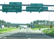 The Federal Highway Administration (FHWA) generally requires exit numbers (mile-based or consecutively) on the Interstate Highway System; the FHWA established that requirement in 1970. The Manual of Uniform Traffic Control Devices (MUTCD)
encouraged use of mileposts and exit numbering by 1961. The MUTCD mandated exit numbering in 1971. The FHWA granted California an exception due to the cost of installing and maintaining additional signage. California
was able to obtain a waiver because it had already built most of its freeways, although some freeways in Los Angeles County received junction numbers: Interstate 10 was the only freeway in the county that had a complete set of junction numbers. Interstate 5, US 101, and then CA 11 (now I-110/CA 110) were numbered for short distances from downtown Los Angeles. Freeway connections were unnumbered, and junction numbers were only shown on plates, not on gore signs. In 2002, the Cal-NExUS program began to completely number California's junctions. The program is not well-funded, especially because of California's budget woes, so exits are only being signed with numbers when signs need to be replaced. As the efficiency of an exit numbering system for navigational purposes depends on all exits being consistently numbered, the usefulness of the system while only some exits are numbered is limited. Originally, the initial completion date for this project was set as November 2004. The deadline was then extended to 2008. However, the 2006 edition of the California MUTCD removed any sort of compliance deadline for the exit numbers.
Eleven U.S. states use sequential numbering schemes, although the 2009 edition of the Manual on Uniform Traffic Control Devices
(MUTCD) requires these states to transition to distance-based numbering. Although a ten-year compliance date was proposed for the new edition of the MUTCD , a compliance date for this change was ultimately not adopted with the 2009 edition, meaning that the transition is accomplished through a systematic upgrading of existing signing and there is no specific date by which the change must be implemented.
Most other states began with sequential numbers and switched over later. Here is a list of these switches, in the order that they happened:
Two highways (Interstate 19
in Arizona and Delaware Route 1) have metric numbering, because they were constructed during the time when the U.S. was thought to be completely converting to metric. Delaware Route 1 currently uses standard milepost when the metric-based posts were replaced. I-19 currently has all exit numbers and distances in kilometers, but speed limits in miles per hour. The road has received funding for the distances to be changed back to miles.
between downtown Dallas
and the Oklahoma
border. Similarly, the U.S. Route 54
freeway from El Paso
to the New Mexico
border also uses sequential exit numbering.
Gore (road)
A gore, gore point, or gore zone is a triangular piece of land found where roads merge or split. When two roads merge, the area is sometimes referred to as a merge nose...
.
Interstate Highways
Manual on Uniform Traffic Control Devices
The Manual on Uniform Traffic Control Devices is a document issued by the Federal Highway Administration of the United States Department of Transportation to specify the standards by which traffic signs, road surface markings, and signals are designed, installed, and used...
encouraged use of mileposts and exit numbering by 1961. The MUTCD mandated exit numbering in 1971. The FHWA granted California an exception due to the cost of installing and maintaining additional signage. California
California
California is a state located on the West Coast of the United States. It is by far the most populous U.S. state, and the third-largest by land area...
was able to obtain a waiver because it had already built most of its freeways, although some freeways in Los Angeles County received junction numbers: Interstate 10 was the only freeway in the county that had a complete set of junction numbers. Interstate 5, US 101, and then CA 11 (now I-110/CA 110) were numbered for short distances from downtown Los Angeles. Freeway connections were unnumbered, and junction numbers were only shown on plates, not on gore signs. In 2002, the Cal-NExUS program began to completely number California's junctions. The program is not well-funded, especially because of California's budget woes, so exits are only being signed with numbers when signs need to be replaced. As the efficiency of an exit numbering system for navigational purposes depends on all exits being consistently numbered, the usefulness of the system while only some exits are numbered is limited. Originally, the initial completion date for this project was set as November 2004. The deadline was then extended to 2008. However, the 2006 edition of the California MUTCD removed any sort of compliance deadline for the exit numbers.
Eleven U.S. states use sequential numbering schemes, although the 2009 edition of the Manual on Uniform Traffic Control Devices
Manual on Uniform Traffic Control Devices
The Manual on Uniform Traffic Control Devices is a document issued by the Federal Highway Administration of the United States Department of Transportation to specify the standards by which traffic signs, road surface markings, and signals are designed, installed, and used...
(MUTCD) requires these states to transition to distance-based numbering. Although a ten-year compliance date was proposed for the new edition of the MUTCD , a compliance date for this change was ultimately not adopted with the 2009 edition, meaning that the transition is accomplished through a systematic upgrading of existing signing and there is no specific date by which the change must be implemented.
- AlaskaAlaskaAlaska is the largest state in the United States by area. It is situated in the northwest extremity of the North American continent, with Canada to the east, the Arctic Ocean to the north, and the Pacific Ocean to the west and south, with Russia further west across the Bering Strait...
- only numbers exits on the Johansen ExpresswayJohansen ExpresswayThe Johansen Expressway is an approximately 4.5-mile long expressway in Fairbanks, Alaska. The Johansen Expresway serves as a northern bypass to the city, and is notable for being the only highway in Alaska to have exit numbers...
in FairbanksFairbanks, AlaskaFairbanks is a home rule city in and the borough seat of the Fairbanks North Star Borough in the U.S. state of Alaska.Fairbanks is the largest city in the Interior region of Alaska, and second largest in the state behind Anchorage...
. Mile-based. - ConnecticutConnecticutConnecticut is a state in the New England region of the northeastern United States. It is bordered by Rhode Island to the east, Massachusetts to the north, and the state of New York to the west and the south .Connecticut is named for the Connecticut River, the major U.S. river that approximately...
- All sequential. Several non-Interstate freeways have interchanges without exit numbers. The state planned to convert Interstate 91Interstate 91Interstate 91 is an Interstate Highway in the New England region of the United States. It provides the primary north–south thoroughfare in the western part of New England...
to mileage-based exit numbering in 1974, but CONNDOT abandoned that initiative due to objections from local businesses. - DelawareDelawareDelaware is a U.S. state located on the Atlantic Coast in the Mid-Atlantic region of the United States. It is bordered to the south and west by Maryland, and to the north by Pennsylvania...
- On I-95Interstate 95 in DelawareIn Delaware, Interstate 95 runs diagonally from the border with Maryland northeast to the border with Pennsylvania. Between the Maryland state line and exit 5, I-95 is also designated as the Delaware Turnpike and the John F. Kennedy Memorial Highway. Along with its auxiliaries, I-95 is the only...
, I-495Interstate 495 (Delaware)Interstate 495 in Delaware is a six-lane bypass of Interstate 95 around the city of Wilmington, Delaware. Built in the mid-1970s and opened as the "Wilmington Bypass", the highway became, between 1978 and 1982, the route of I-95 around Wilmington, while the original highway through the city,...
, and Delaware Route 141Delaware Route 141Delaware Route 141 is a bypass around the western suburbs of Wilmington, Delaware. Its northern terminus is an interchange with U.S. Route 202 and Delaware Route 261 in Fairfax, and its southern terminus is at Delaware Route 9 and Delaware Route 273 in New Castle...
only. Delaware Route 1 uses kilometer-based exit numbers (despite using milemarkers), and I-295Interstate 295 (Delaware-New Jersey)Interstate 295 in New Jersey and Delaware is an auxiliary Interstate Highway, designated as a bypass around Philadelphia, Pennsylvania. The route begins at a junction with Interstate 95 south of Wilmington, Delaware, and runs to another junction with I-95 north of Trenton, New Jersey...
has no exit numbers at all. - District of Columbia - Historically, the only exit numbers posted in the District consisted of sequential numbers on Interstate 295Interstate 295 (District of Columbia)Interstate 295 in the U.S. state of Maryland and in Washington, D.C. is a spur route connecting I-95/I-495 and Maryland Route 210 on the Potomac River to Interstate 695 in downtown Washington.-Route description:Although I-295 technically begins at the Capital Beltway , a pair of mainline...
. The few other freeways within the District of Columbia did not have exit numbers, but in 2008 the District began posting sequential numbers on Interstate 395Interstate 395 (District of Columbia-Virginia)Interstate 395 in Washington, D.C., and Virginia is a 13 mile long spur route that begins at a junction with Interstate 95 in Springfield, Virginia and ends in northwest Washington, D.C. It passes underneath the National Mall near the United States Capitol and ends at a junction with U.S...
. , not all interchanges had received numbers. The close proximity of the interchanges on this short freeway, coupled with the lack of space for new interchanges, renders the sequential system more practical than the mileage-based. - MassachusettsMassachusettsThe Commonwealth of Massachusetts is a state in the New England region of the northeastern United States of America. It is bordered by Rhode Island and Connecticut to the south, New York to the west, and Vermont and New Hampshire to the north; at its east lies the Atlantic Ocean. As of the 2010...
- All sequential (experimented with dual exit/mile tabs in the 1970s). - MarylandMarylandMaryland is a U.S. state located in the Mid Atlantic region of the United States, bordering Virginia, West Virginia, and the District of Columbia to its south and west; Pennsylvania to its north; and Delaware to its east...
- The Baltimore BeltwayInterstate 695 (Maryland)Interstate 695 is a -long full beltway Interstate Highway extending around Baltimore, Maryland, USA. I-695 is officially designated the McKeldin Beltway, but is colloquially referred to as either the Baltimore Beltway or 695...
is sequentially numbered. - New HampshireNew HampshireNew Hampshire is a state in the New England region of the northeastern United States of America. The state was named after the southern English county of Hampshire. It is bordered by Massachusetts to the south, Vermont to the west, Maine and the Atlantic Ocean to the east, and the Canadian...
- All sequential. - New JerseyNew JerseyNew Jersey is a state in the Northeastern and Middle Atlantic regions of the United States. , its population was 8,791,894. It is bordered on the north and east by the state of New York, on the southeast and south by the Atlantic Ocean, on the west by Pennsylvania and on the southwest by Delaware...
- Sequential numbering on the New Jersey TurnpikeNew Jersey TurnpikeThe New Jersey Turnpike is a toll road in New Jersey, maintained by the New Jersey Turnpike Authority. According to the International Bridge, Tunnel and Turnpike Association, the Turnpike is the nation's sixth-busiest toll road and is among one of the most heavily traveled highways in the United...
, Palisades Interstate ParkwayPalisades Interstate ParkwayThe Palisades Interstate Parkway is a long limited-access highway in the U.S. states of New Jersey and New York. The parkway is a major commuter route into New York City from Rockland and Orange counties in New York and Bergen County in New Jersey...
, and I-676Interstate 676Interstate 676 is an Interstate Highway that serves as a major thoroughfare through Philadelphia, Pennsylvania, where it is known as the Vine Street Expressway, and Camden, New Jersey, where it is known as the northern segment of the North–South Freeway, as well as the Martin Luther King Jr....
; all other New Jersey exit numbering is mile-based. (The Brigantine Connector in Atlantic City uses letters for exits.) Many New Jersey freeways lack exit numbers. - New YorkNew YorkNew York is a state in the Northeastern region of the United States. It is the nation's third most populous state. New York is bordered by New Jersey and Pennsylvania to the south, and by Connecticut, Massachusetts and Vermont to the east...
- Sequential, except I-890Interstate 890Interstate 890 is a long auxiliary Interstate Highway in the vicinity of Schenectady, New York, United States. The highway runs southeast–northwest from an interchange with the New York State Thruway northwest of Schenectady to another junction with the Thruway south of the city and passes...
in SchenectadySchenectady, New YorkSchenectady is a city in Schenectady County, New York, United States, of which it is the county seat. As of the 2010 census, the city had a population of 66,135...
. and Interstate 95Interstate 95 in New YorkInterstate 95 is a part of the Interstate Highway System that runs from Miami, Florida, to the Canada – United States border near Houlton, Maine. In the U.S. state of New York, I-95 extends from the George Washington Bridge in New York City to the Connecticut state line at Port Chester...
in New York CityNew York CityNew York is the most populous city in the United States and the center of the New York Metropolitan Area, one of the most populous metropolitan areas in the world. New York exerts a significant impact upon global commerce, finance, media, art, fashion, research, technology, education, and...
south of the Pelham ParkwayPelham ParkwayThe Bronx and Pelham Parkway is a parkway in the borough of the Bronx in New York City. Despite the parkway moniker, Pelham Parkway is a local street, with two main roadways , and two service roads. Like other parkways in New York City, commercial traffic is disallowed, and is redirected to the...
. - Rhode IslandRhode IslandThe state of Rhode Island and Providence Plantations, more commonly referred to as Rhode Island , is a state in the New England region of the United States. It is the smallest U.S. state by area...
- All sequential; experimented with dual exit/mile tabs in the 1970s. - VermontVermontVermont is a state in the New England region of the northeastern United States of America. The state ranks 43rd in land area, , and 45th in total area. Its population according to the 2010 census, 630,337, is the second smallest in the country, larger only than Wyoming. It is the only New England...
- Route 289Vermont Route 289Vermont Route 289 is a state highway located within the town of Essex in Chittenden County, Vermont, United States. It is a long limited-access highway that extends from VT 2A southeast to VT 117 on the north bank of the Winooski River...
(Circumferential Highway) has mileage-based exit numbering.
Most other states began with sequential numbers and switched over later. Here is a list of these switches, in the order that they happened:
- ColoradoColoradoColorado is a U.S. state that encompasses much of the Rocky Mountains as well as the northeastern portion of the Colorado Plateau and the western edge of the Great Plains...
- Used dual mile/junction plates into the mid 1970s; initially used sequential numbering. - IndianaIndianaIndiana is a US state, admitted to the United States as the 19th on December 11, 1816. It is located in the Midwestern United States and Great Lakes Region. With 6,483,802 residents, the state is ranked 15th in population and 16th in population density. Indiana is ranked 38th in land area and is...
- Around 1980. - IowaIowaIowa is a state located in the Midwestern United States, an area often referred to as the "American Heartland". It derives its name from the Ioway people, one of the many American Indian tribes that occupied the state at the time of European exploration. Iowa was a part of the French colony of New...
- May have had sequential numbers on Interstate 80 in the early 1970s. Adopted distance-based exit numbering in 1977. - OhioOhioOhio is a Midwestern state in the United States. The 34th largest state by area in the U.S.,it is the 7th‑most populous with over 11.5 million residents, containing several major American cities and seven metropolitan areas with populations of 500,000 or more.The state's capital is Columbus...
- Between 1972 and 1974 (though the Ohio Turnpike continued to carry both systems until 2000). - New JerseyNew JerseyNew Jersey is a state in the Northeastern and Middle Atlantic regions of the United States. , its population was 8,791,894. It is bordered on the north and east by the state of New York, on the southeast and south by the Atlantic Ocean, on the west by Pennsylvania and on the southwest by Delaware...
- Around 1970. The New Jersey TurnpikeNew Jersey TurnpikeThe New Jersey Turnpike is a toll road in New Jersey, maintained by the New Jersey Turnpike Authority. According to the International Bridge, Tunnel and Turnpike Association, the Turnpike is the nation's sixth-busiest toll road and is among one of the most heavily traveled highways in the United...
kept sequential exit numbering. - MississippiMississippiMississippi is a U.S. state located in the Southern United States. Jackson is the state capital and largest city. The name of the state derives from the Mississippi River, which flows along its western boundary, whose name comes from the Ojibwe word misi-ziibi...
- 1980s. - VirginiaVirginiaThe Commonwealth of Virginia , is a U.S. state on the Atlantic Coast of the Southern United States. Virginia is nicknamed the "Old Dominion" and sometimes the "Mother of Presidents" after the eight U.S. presidents born there...
- Early 1990s. One exception is Route 267 (sequential). - GeorgiaGeorgia (U.S. state)Georgia is a state located in the southeastern United States. It was established in 1732, the last of the original Thirteen Colonies. The state is named after King George II of Great Britain. Georgia was the fourth state to ratify the United States Constitution, on January 2, 1788...
- Began January 4, 2000, now complete. (Interstate highways only). - PennsylvaniaPennsylvaniaThe Commonwealth of Pennsylvania is a U.S. state that is located in the Northeastern and Mid-Atlantic regions of the United States. The state borders Delaware and Maryland to the south, West Virginia to the southwest, Ohio to the west, New York and Ontario, Canada, to the north, and New Jersey to...
- Began April 2001 on Interstates and all highways of the Pennsylvania TurnpikePennsylvania TurnpikeThe Pennsylvania Turnpike is a toll highway system operated by the Pennsylvania Turnpike Commission in the Commonwealth of Pennsylvania, United States. The three sections of the turnpike system total . The main section extends from Ohio to New Jersey and is long...
system. - FloridaFloridaFlorida is a state in the southeastern United States, located on the nation's Atlantic and Gulf coasts. It is bordered to the west by the Gulf of Mexico, to the north by Alabama and Georgia and to the east by the Atlantic Ocean. With a population of 18,801,310 as measured by the 2010 census, it...
- Began January 28, 2002, now complete. However, I-110Interstate 110 (Florida)Interstate 110 is a auxiliary route of the Interstate Highway System in Pensacola, Florida, running north from U.S. Highway 98 to Interstate 10. I-110 carries the hidden Florida Department of Transportation designation of State Road 8A...
retained its sequential exit numbers. - CaliforniaCaliforniaCalifornia is a state located on the West Coast of the United States. It is by far the most populous U.S. state, and the third-largest by land area...
- Began January 2002. California was the only state not to require exit numbers or mileposts, because most of their highway system was built prior to the federal requirement. Before adopting statewide exit numbering, California relied on its system of county-based mileposts on all highways, without having explicitly numbered exits. - MaineMaineMaine is a state in the New England region of the northeastern United States, bordered by the Atlantic Ocean to the east and south, New Hampshire to the west, and the Canadian provinces of Quebec to the northwest and New Brunswick to the northeast. Maine is both the northernmost and easternmost...
- Early 2004 (experimented with dual exit/mile tabs in the 1970s). - New YorkNew YorkNew York is a state in the Northeastern region of the United States. It is the nation's third most populous state. New York is bordered by New Jersey and Pennsylvania to the south, and by Connecticut, Massachusetts and Vermont to the east...
- The state senate passed S.5358-A, sponsored by Tom Libous (R-C-I, Binghamton) on June 10, 2008. The bill directs the New York State Department of TransportationNew York State Department of TransportationThe New York State Department of Transportation is responsible for the development and operation of highways, railroads, mass transit systems, ports, waterways and aviation facilities in the U.S...
and the New York State Thruway Authority to convert the state's exit numbers from sequential to mileage-based by January 1, 2012. On April 23, 2008, the New York State Assembly began considering its own version (A10676) that was nearly identical to the bill passed in the Senate. The bill died in committee at the end of the 2008 legislative session.
Two highways (Interstate 19
Interstate 19
Interstate 19 is an intrastate Interstate Highway located entirely within the state of Arizona. I-19 runs from Nogales, roughly 1,500 feet from the Mexican border, to Tucson, at Interstate 10...
in Arizona and Delaware Route 1) have metric numbering, because they were constructed during the time when the U.S. was thought to be completely converting to metric. Delaware Route 1 currently uses standard milepost when the metric-based posts were replaced. I-19 currently has all exit numbers and distances in kilometers, but speed limits in miles per hour. The road has received funding for the distances to be changed back to miles.
Other highways
Exit numbering on non-Interstate highways is less consistent. For example, Texas, which normally uses mile-based exit numbering, uses sequential numbering on U.S. Route 75U.S. Route 75
U.S. Route 75 is a north–south U.S. Highway. The highway's northern terminus is in Kittson County, Minnesota, at the Canadian border, where it continues as Manitoba Highway 75 on the other side of a closed border crossing. Its southern terminus is at Interstate 30 and Interstate 45 in Dallas,...
between downtown Dallas
Dallas, Texas
Dallas is the third-largest city in Texas and the ninth-largest in the United States. The Dallas-Fort Worth Metroplex is the largest metropolitan area in the South and fourth-largest metropolitan area in the United States...
and the Oklahoma
Oklahoma
Oklahoma is a state located in the South Central region of the United States of America. With an estimated 3,751,351 residents as of the 2010 census and a land area of 68,667 square miles , Oklahoma is the 28th most populous and 20th-largest state...
border. Similarly, the U.S. Route 54
U.S. Route 54
U.S. Route 54 is an east–west United States highway that runs northeast-southwest for 1,197 miles from western Illinois to El Paso, Texas. It enters and leaves Texas twice...
freeway from El Paso
El Paso, Texas
El Paso, is a city in and the county seat of El Paso County, Texas, United States, and lies in far West Texas. In the 2010 census, the city had a population of 649,121. It is the sixth largest city in Texas and the 19th largest city in the United States...
to the New Mexico
New Mexico
New Mexico is a state located in the southwest and western regions of the United States. New Mexico is also usually considered one of the Mountain States. With a population density of 16 per square mile, New Mexico is the sixth-most sparsely inhabited U.S...
border also uses sequential exit numbering.
- AlabamaAlabamaAlabama is a state located in the southeastern region of the United States. It is bordered by Tennessee to the north, Georgia to the east, Florida and the Gulf of Mexico to the south, and Mississippi to the west. Alabama ranks 30th in total land area and ranks second in the size of its inland...
only has one numbered non-interstate highway, U.S. Route 78.
- In ArizonaArizonaArizona ; is a state located in the southwestern region of the United States. It is also part of the western United States and the mountain west. The capital and largest city is Phoenix...
, many of its non-interstate freeways utilize exit numbers such as the freeway loops (Arizona State Highway 101 and Arizona State Highway 202) around PhoenixPhoenix, ArizonaPhoenix is the capital, and largest city, of the U.S. state of Arizona, as well as the sixth most populated city in the United States. Phoenix is home to 1,445,632 people according to the official 2010 U.S. Census Bureau data...
, U.S. Route 60U.S. Route 60 in ArizonaU.S. Route 60 is an east–west United States highway within Arizona. The highway runs for from a junction with Interstate 10 near Quartzsite to the New Mexico State Line near Springerville...
and Arizona State Route 51.
- In ArkansasArkansasArkansas is a state located in the southern region of the United States. Its name is an Algonquian name of the Quapaw Indians. Arkansas shares borders with six states , and its eastern border is largely defined by the Mississippi River...
, U.S. Route 67U.S. Route 67 in ArkansasU.S. Route 67 in Arkansas runs from Texarkana to the Missouri state line in Northeastern Arkansas.-Route description:U.S. Route 67 runs parallel to Interstate 30 from Texarkana to Benton, where it then runs concurrent with I-30 to North Little Rock. It then runs east, concurrent with I-40, for...
and State Highway 549 are the only non-interstate freeways to have exit numbers.
- ColoradoColoradoColorado is a U.S. state that encompasses much of the Rocky Mountains as well as the northeastern portion of the Colorado Plateau and the western edge of the Great Plains...
does not use exit numbers on non-interstate highways. The exception is E-470E-470E-470 is a 46-mile limited-access tollway traversing the eastern portion of the Denver-Aurora Metropolitan Area in Colorado. The toll road is not a state highway, but is instead maintained by the E-470 Public Highway Authority.-Route description:...
and the Northwest ParkwayNorthwest ParkwayThe Northwest Parkway is an toll road running from the intersection of I-25 and E-470 to US 36 at 96th Street. Both termini are in Broomfield, Colorado, northwest of Denver. In combination with E-470 and SH 470 , the Northwest Parkway forms a partial beltway of approximately around the...
, which are separate toll highways.
- In FloridaFloridaFlorida is a state in the southeastern United States, located on the nation's Atlantic and Gulf coasts. It is bordered to the west by the Gulf of Mexico, to the north by Alabama and Georgia and to the east by the Atlantic Ocean. With a population of 18,801,310 as measured by the 2010 census, it...
, the TurnpikeFlorida's TurnpikeFlorida's Turnpike , designated as the Ronald Reagan Turnpike, and originally known as the Sunshine State Parkway is a north–south toll road that runs through 11 counties in the Florida peninsula, from U.S...
and other expressways owned and operated by the Florida Turnpike Enterprise use distance-number exits. Toll roads under the Orlando-Orange County Expressway AuthorityOrlando-Orange County Expressway AuthorityThe Orlando-Orange County Expressway Authority is an expressway authority responsible for construction, maintenance and operation of toll roads in Orange County, Florida, United States, which includes the city of Orlando. It was founded in 1963 for the purpose of building the Bee Line Expressway,...
also use distance-number exits. The Lee Roy Selmon Expressway in TampaTampa, FloridaTampa is a city in the U.S. state of Florida. It serves as the county seat for Hillsborough County. Tampa is located on the west coast of Florida. The population of Tampa in 2010 was 335,709....
uses a sequential-based exit numbering system. Expressways under the authority of the Miami-Dade Expressway AuthorityMiami-Dade Expressway AuthorityThe Miami-Dade Expressway Authority is an independent agency created in December 1994 by the State of Florida and the Miami-Dade County Commission...
have no exit numbers.
- GeorgiaGeorgia (U.S. state)Georgia is a state located in the southeastern United States. It was established in 1732, the last of the original Thirteen Colonies. The state is named after King George II of Great Britain. Georgia was the fourth state to ratify the United States Constitution, on January 2, 1788...
does not carry exit numbers on non-interstate expressways except for Georgia State Route 400Georgia State Route 400Georgia State Route 400 is a highway in the U.S. state of Georgia, concurrent with U.S. Route 19 from exit 4B until its terminus just south of Dahlonega. ST 400 goes from Atlanta, at Interstate 85 , to Buckhead, Sandy Springs, Roswell, Alpharetta, Cumming, Dawson County, and Dahlonega...
, which runs on a sequential system, and Georgia State Route 10 LoopGeorgia State Route 10 LoopState Route 10 Loop is a beltway around Athens, Georgia, United States. Except for a single at-grade intersection, it is built to freeway standards. Much of the road is concurrent with other routes - U.S. Route 29, U.S. Route 78, U.S. Route 129, U.S...
, running on a distance-numbers system.
- In Illinois, the Illinois Tollway system has begun numbering exits. They plan to all be numbered by the end of 2010.
- A number of small cities in Kentucky, mainly in the southeastern and south-central portions of the Commonwealth, mark traffic lights on a main commercial road with sequential numbers, usually beginning at an intersection with a primary highway:
- BereaBerea, Kentucky-Demographics:As of the census of 2000, there were 9,851 people, 3,693 households, and 2,426 families residing in the city. The population density was 1,055.4 people per square mile . There were 4,115 housing units at an average density of 440.9 per square mile...
— KY 21Kentucky Route 21Kentucky Route 21 is a west-east highway in Madison County, running from the Garrard County line near Paint Lick to Bighill, east of Berea.It begins at KY 52 at the Garrard County line at the Paint Lick Creek Bridge...
, starting at the I-75Interstate 75Interstate 75 is a major north–south Interstate Highway in the Great Lakes and Southeastern regions of the United States. It travels from State Road 826 and State Road 924 in Hialeah, Florida to Sault Ste. Marie, Michigan, at the Ontario, Canada, border...
interchange until KY 21 meets US 25U.S. Route 25U.S. Route 25 is a north–south United States highway that runs for from Brunswick, Georgia to the Ohio state line in Covington, Kentucky.-Georgia:...
. Numbering continues on US 25 until the road leaves the city limits. Throughout this stretch, numbering increases as one travels north. - CorbinCorbin, Kentucky- Economy :Originally formed by L&N Railroad, rail transport was the backbone of the local economy in the first half of the twentieth century. While the railroad continues to play an important role, the decline of the rail industry in the latter half of the twentieth century, as well as the loss...
— US 25EU.S. Route 25U.S. Route 25 is a north–south United States highway that runs for from Brunswick, Georgia to the Ohio state line in Covington, Kentucky.-Georgia:...
, starting at the I-75 interchange at North CorbinNorth Corbin, KentuckyNorth Corbin is a census-designated place in Knox and Laurel counties in the U.S. state of Kentucky. The population was 1,662 at the 2000 census....
and continuing for approximately 5 miles (8 km) until its intersection with KY 830 east of Corbin. Numbering increases as one travels east (which is signed as south on 25E). - LondonLondon, Kentucky-Education:All of the following schools are administered by the Laurel County School District.-Primary schools:* * * * * * * * * * * * -High schools:* * -Colleges:* Laurel Technical College* * -Notable natives:...
— Two separate roads:- The Hal Rogers ParkwayHal Rogers ParkwayThe Hal Rogers Parkway, formerly named the Daniel Boone Parkway, connects London and Hazard in southeastern Kentucky. This toll road opened in November 1971 and the tolls were removed June 1, 2003. The original extent of the highway was to be instead of today's 62.90, with that mileage to have...
, starting at KY 192 (which is not numbered, as it is a flashing yellow light for parkway traffic instead of a fully controlled signal) and ending at US 25. Numbering increases as one travels west. - KY 192, starting at the I-75 interchange and increasing as one travels east until reaching the Hal Rogers Parkway.
- The Hal Rogers Parkway
- ManchesterManchester, KentuckyAs of the census of 2000, there were 1,738 people, 778 households, and 455 families residing in the city. The population density was 1,148.4 people per square mile . There were 844 housing units at an average density of 557.7 per square mile...
— US 421U.S. Route 421U.S. Route 421 is a spur route of U.S. 21. It runs for from Michigan City, Indiana, at U.S. 20, to Fort Fisher in North Carolina. The highway goes through the cities of Indianapolis, Indiana, Lexington, Kentucky, Boone, North Carolina, Winston-Salem, North Carolina, Greensboro, North Carolina and...
, starting at the Hal Rogers Parkway and increasing as one travels north through the city. - Middlesboro — KY 74 through the downtown area, with numbering increasing as one travels west.
- MonticelloMonticello, KentuckyMonticello is a city in Wayne County, Kentucky, United States. The population was 5,981 at the 2000 census. It is the county seat of Wayne County. It advertises itself as "The Houseboat Capital of the World" due to the large number of houseboat manufacturers in the city...
— KY 90Kentucky Route 90Kentucky Route 90 originates at a junction with KY 70 near I-65 in Cave City in Barren County. The route continues through Metcalfe County, Cumberland County, Clinton County, Wayne County, Pulaski...
, starting at the northern end of the city and increasing until exiting the city. - SomersetSomerset, KentuckyThe major demographic differences between the city and the micropolitan area relate to income, housing composition and age. The micropolitan area, as compared to the incorporated city, is more suburban in flavor and has a significantly younger housing stock, a higher income, and contains most of...
— US 27U.S. Route 27U.S. Route 27 is a north–south United States highway in the southern and midwestern United States. The southern terminus is at US 1 in Miami, Florida. The northern terminus is at Interstate 69 in Fort Wayne, Indiana...
, starting at the northern limits of the city and increasing as one travels south. The numbering continues even after the road leaves the city limits, with the final numbered intersection occurring shortly before US 27 enters the city of BurnsideBurnside, KentuckyBurnside is a city in Pulaski County, Kentucky, United States. The population was 637 at the 2000 census. In 2005, Burnside became the only town in Pulaski County or any adjoining county to allow the sale of alcoholic beverages in qualified establishments...
. - RichmondRichmond, KentuckyThere were 10,795 households out of which 24.4% had children under the age of 18 living with them, 35.2% were married couples living together, 12.8% had a female householder with no husband present, and 48.6% were non-families. Of all households, 34.7% were made up of individuals and 8.8% had...
has two sets of numbered lights.- Business US 25U.S. Route 25U.S. Route 25 is a north–south United States highway that runs for from Brunswick, Georgia to the Ohio state line in Covington, Kentucky.-Georgia:...
through downtown numbers lights 1-6 from KY 52 at Lancaster Avenue and the next 5 consecutive lights south. Incidentally, the lights south of the railroad tracks and north of the KY 52 multiplex are not numbered. - The bypass route wrapping east around Richmond starting with KY 876 (locally known as Eastern Bypass) east of I-75Interstate 75Interstate 75 is a major north–south Interstate Highway in the Great Lakes and Southeastern regions of the United States. It travels from State Road 826 and State Road 924 in Hialeah, Florida to Sault Ste. Marie, Michigan, at the Ontario, Canada, border...
exit 87, and continues onto Dr. Robert R. Martin Highway US 25U.S. Route 25U.S. Route 25 is a north–south United States highway that runs for from Brunswick, Georgia to the Ohio state line in Covington, Kentucky.-Georgia:...
/US 421U.S. Route 421U.S. Route 421 is a spur route of U.S. 21. It runs for from Michigan City, Indiana, at U.S. 20, to Fort Fisher in North Carolina. The highway goes through the cities of Indianapolis, Indiana, Lexington, Kentucky, Boone, North Carolina, Winston-Salem, North Carolina, Greensboro, North Carolina and...
to I-75 exit 90. The traffic lights at the interstate are not numbered.
- Business US 25
- Berea
- MinnesotaMinnesotaMinnesota is a U.S. state located in the Midwestern United States. The twelfth largest state of the U.S., it is the twenty-first most populous, with 5.3 million residents. Minnesota was carved out of the eastern half of the Minnesota Territory and admitted to the Union as the thirty-second state...
distance-numbers its exits on Interstates, but leaves other freeways or expressways with unnumbered exits. The sole exception is US 52's freeway portion through RochesterRochester, MinnesotaRochester is a city in the U.S. state of Minnesota and is the county seat of Olmsted County. Located on both banks of the Zumbro River, The city has a population of 106,769 according to the 2010 United States Census, making it Minnesota's third-largest city and the largest outside of the...
, which received mileage-based exit numbers in 2004 as part of a major widening project.
- In MississippiMississippiMississippi is a U.S. state located in the Southern United States. Jackson is the state capital and largest city. The name of the state derives from the Mississippi River, which flows along its western boundary, whose name comes from the Ojibwe word misi-ziibi...
, exits from Interstate 69Interstate 69 in MississippiThe proposed Interstate 69 extension from Indianapolis southwest to Texas presently has a short piece completed in the U.S. state of Mississippi, south of Memphis, Tennessee. The south end is an at-grade intersection with the former route of MS 304 near Tunica Resorts, where Mississippi Highway 713...
and non-Interstate freeways are not currently numbered, with the exception of U.S. Highway 78/future Interstate 22Interstate 22Interstate 22 , when it is completed, will follow the U.S. Highway 78 corridor along a 213-mile-long route from Memphis, Tennessee, to Birmingham, Alabama, as an Interstate Highway. Interstate 22 will connect Interstate 240 and Interstate 40 in the northwest with Interstate 65 and Interstate...
, which received exit numbers as part of a signing replacement project in 2002.
- New HampshireNew HampshireNew Hampshire is a state in the New England region of the northeastern United States of America. The state was named after the southern English county of Hampshire. It is bordered by Massachusetts to the south, Vermont to the west, Maine and the Atlantic Ocean to the east, and the Canadian...
does not assign numbers to exits to Interstates (with the exception of I-393Interstate 393Interstate 393 is a spur extending east from Interstate 93 at Concord, New Hampshire, USA. The primary purpose of the road is to bypass a densely-built commercial strip on Route 9 in the eastern part of Concord. Several times a year, I-393 also serves traffic to events at New Hampshire Motor...
in ConcordConcord, New HampshireThe city of Concord is the capital of the state of New Hampshire in the United States. It is also the county seat of Merrimack County. As of the 2010 census, its population was 42,695....
, in which exit 15W from I-93Interstate 93Interstate 93 is an Interstate Highway in the New England section of the United States. Its southern terminus is in Canton, Massachusetts, in the Boston metropolitan area, at Interstate 95; its northern terminus is near St. Johnsbury, Vermont, at Interstate 91...
connected to the US 4/US 202 interchange prior to the construction of I-393). For example, I-293Interstate 293Interstate 293 is an long loop surrounding Manchester, New Hampshire, USA roughly shaped like two sides of a triangle. Completing the loop in the northeast is Interstate 93. The southern portion of the loop shares the road with NH 101 and passes near Manchester-Boston Regional Airport and the...
's southern exit from I-93Interstate 93Interstate 93 is an Interstate Highway in the New England section of the United States. Its southern terminus is in Canton, Massachusetts, in the Boston metropolitan area, at Interstate 95; its northern terminus is near St. Johnsbury, Vermont, at Interstate 91...
is between exits 5 and 6, but is not numbered; NH-101New Hampshire Route 101New Hampshire Route 101 is a state-maintained highway in southern New Hampshire extending from Keene to Hampton Beach. It is the major east–west highway in the southern portion of the state....
eastbound, however, despite being an interstate grade freeway, is assigned Exit 7. NH-101New Hampshire Route 101New Hampshire Route 101 is a state-maintained highway in southern New Hampshire extending from Keene to Hampton Beach. It is the major east–west highway in the southern portion of the state....
's own exit to Interstate 95Interstate 95 in New HampshireInterstate 95, the main Interstate Highway on the east coast of the United States, cuts through the Seacoast Region of New Hampshire. The majority of it, from the Massachusetts border to the Portsmouth Circle in Portsmouth, is the 14.29-mile Blue Star Turnpike or New Hampshire Turnpike, a toll...
in HamptonHampton, New HampshireHampton is a town in Rockingham County, New Hampshire, United States. The population was 14,976 at the 2010 census. Located beside the Atlantic Ocean, Hampton is home to Hampton Beach, a summer tourist destination....
is between exits 12 and 13, but is also not numbered.
- In New MexicoNew MexicoNew Mexico is a state located in the southwest and western regions of the United States. New Mexico is also usually considered one of the Mountain States. With a population density of 16 per square mile, New Mexico is the sixth-most sparsely inhabited U.S...
, US 84U.S. Route 84U.S. Route 84 is an east–west United States highway. It started as a short Georgia-Alabama route in the original 1926 scheme, but now extends all the way to Colorado. The highway's eastern terminus is a short distance east of Midway, Georgia, at an intersection with I-95. The road continues...
/285U.S. Route 285U.S. Route 285 is a north–south United States highway, running 845 miles through the states of Texas, New Mexico and Colorado. The highway's northern terminus is in Denver, Colorado, at exit 201 on Interstate 25. Its southern terminus is in Sanderson, Texas at an intersection with U.S....
between PojoaquePojoaque, New MexicoPojoaque is a census-designated place in Santa Fe County, New Mexico, United States. It is part of the Santa Fe, New Mexico Metropolitan Statistical Area. The population was 1,261 at the 2000 census. Pojoaque and Pojoaque Pueblo are neighboring communities...
and Santa FeSanta Fe, New MexicoSanta Fe is the capital of the U.S. state of New Mexico. It is the fourth-largest city in the state and is the seat of . Santa Fe had a population of 67,947 in the 2010 census...
is the only non-Interstate highway that uses exit numbers.
- New EnglandNew EnglandNew England is a region in the northeastern corner of the United States consisting of the six states of Maine, New Hampshire, Vermont, Massachusetts, Rhode Island, and Connecticut...
states, except for MaineMaineMaine is a state in the New England region of the northeastern United States, bordered by the Atlantic Ocean to the east and south, New Hampshire to the west, and the Canadian provinces of Quebec to the northwest and New Brunswick to the northeast. Maine is both the northernmost and easternmost...
(which assigned exit numbers based on mileage), post exit numbers on express highways of any significant length, regardless of designation. Occasionally, at-grade intersections have posted numbers - this can be seen, for example, on CT 9.
- In New YorkNew YorkNew York is a state in the Northeastern region of the United States. It is the nation's third most populous state. New York is bordered by New Jersey and Pennsylvania to the south, and by Connecticut, Massachusetts and Vermont to the east...
, all highways use sequential numbering. In addition: - All parkways on Long IslandLong IslandLong Island is an island located in the southeast part of the U.S. state of New York, just east of Manhattan. Stretching northeast into the Atlantic Ocean, Long Island contains four counties, two of which are boroughs of New York City , and two of which are mainly suburban...
, except the Southern State ParkwaySouthern State ParkwayThe Southern State Parkway is a long limited-access highway on Long Island, in the U.S. state of New York...
, Heckscher State ParkwayHeckscher State ParkwayThe Heckscher State Parkway is an long parkway in Suffolk County, New York. The western terminus is at the Sagtikos State Parkway in West Islip, where it continues west as the Southern State Parkway. The eastern terminus is at the entrance to Heckscher State Park in Great River...
, and Northern State ParkwayNorthern State ParkwayThe Northern State Parkway is a long limited-access state parkway on Long Island in the U.S. state of New York. The western terminus is at the Queens-Nassau County line, where the parkway continues westward into New York City as the Grand Central Parkway...
preface exit numbers with a one or two letter prefix indicating the parkway's name. For example, exits on the Meadowbrook Parkway are numbered M1 through M10, and exits on the Sunken Meadow Parkway are numbered SM1 through SM5. Some of these exits have a letter suffix as well (usually N, S, E, and/or W.) - Occasionally, at-grade intersections (level junctions) have posted numbers - this can be seen, for example, on the Taconic State ParkwayTaconic State ParkwayThe Taconic State Parkway , is a divided highway between Kensico Dam and Chatham, the longest parkway in the U.S. state of New York. It follows a generally northward route midway between the Hudson River and the Connecticut and Massachusetts state lines...
and the Bronx River ParkwayBronx River ParkwayThe Bronx River Parkway is a long parkway in downstate New York. It is named for the nearby Bronx River, which it parallels. The southern terminus of the parkway is at Story Avenue near Bruckner Expressway in the Bronx neighborhood of Soundview...
, as well as on parts of NY 17New York State Route 17New York State Route 17 is a state highway that extends for through the Southern Tier and Downstate regions of New York in the United States...
. - The Taconic State ParkwayTaconic State ParkwayThe Taconic State Parkway , is a divided highway between Kensico Dam and Chatham, the longest parkway in the U.S. state of New York. It follows a generally northward route midway between the Hudson River and the Connecticut and Massachusetts state lines...
numbers exits and at-grade intersections sequentially by county, with a one-letter prefix indicating the county. For example, interchanges in Westchester CountyWestchester County, New YorkWestchester County is a county located in the U.S. state of New York. Westchester covers an area of and has a population of 949,113 according to the 2010 Census, residing in 45 municipalities...
are prefixed with W (e.g., W5), and interchanges in Dutchess CountyDutchess County, New YorkDutchess County is a county located in the U.S. state of New York, in the state's Mid-Hudson Region of the Hudson Valley. The 2010 census lists the population as 297,488...
are prefixed with D (e.g., D10).
- Various districts within the Ohio Department of TransportationOhio Department of TransportationThe Ohio Department of Transportation is the organization of state government responsible for developing and maintaining all state and federal roadways in the state of Ohio with exception of the Ohio Turnpike. In addition to highways, the department also helps develop public transportation and...
have begun to employ exit numbers on non-Interstates using the south or west entrance into the state or highway beginning as the point of origin, though at least one district measures them from the south or west entrance into the respective county.
- Oklahoma posts exit numbers on its tollway system.
- Oregon originally did not post exit numbers on any of its non-Interstate freeways. In the 1990s, the Oregon Department of TransportationOregon Department of TransportationThe Oregon Department of Transportation is a department of the state government of the U.S. state of Oregon responsible for systems of transportation. It was first established in 1969. It had been preceded by the Oregon State Highway Department which, along with the Oregon State Highway...
began numbering most sections of its freeways with mile-based exits, starting with US-26U.S. Route 26U.S. Route 26 is an east–west United States highway. It started in Ogallala, Nebraska, and gradually grew to reach the West Coast in Oregon. When the U.S. highway system was first defined, it was limited to Nebraska and Wyoming; by the 1950s, it continued into Idaho and Oregon. The...
and OR-217 west of PortlandPortland, OregonPortland is a city located in the Pacific Northwest, near the confluence of the Willamette and Columbia rivers in the U.S. state of Oregon. As of the 2010 Census, it had a population of 583,776, making it the 29th most populous city in the United States...
. Now, almost all freeway interchanges in Oregon are numbered, and new interchanges built are given numbers. Note that exit numbers are based on internal highway mileage, not posted route mileage; see State highways in Oregon for an explanation on the difference between the two.
- Pennsylvania's non-Interstate highways that have numbered exits are still numbered sequentially, with the exception of the toll roads that are part of the Pennsylvania TurnpikePennsylvania Turnpike CommissionThe Pennsylvania Turnpike Commission was created in 1937 to construct, finance, operate and maintain the Pennsylvania Turnpike. The commission consists of five members. Four members are appointed by the Governor of Pennsylvania. The fifth member is the Pennsylvania Secretary of Transportation.In...
system. PA 60Pennsylvania Route 60Pennsylvania Route 60 is a state highway located in the western suburbs of Pittsburgh, Pennsylvania, in the United States. Although the route follows a mostly east–west alignment, it is signed as a north–south highway. The southern terminus of the route is at a pseudo-interchange with U.S...
was one of these roads, but the numbers were converted to the mileage-based system (and reversed) starting in November 2009 when I-376Interstate 376Interstate 376 is a major auxiliary route of the Interstate Highway System in the U.S. state of Pennsylvania, located entirely within the Allegheny Plateau. It runs from I-80 near Sharon south and east to a junction with the Pennsylvania Turnpike in Monroeville, after having crossed the Turnpike...
was extended along PA 60 to Mercer CountyMercer County, PennsylvaniaMercer County is a county located in the U.S. state of Pennsylvania. As of 2010, the population was 116,638. Its county seat is Mercer; Sharon is its largest city....
. The Pennsylvania Turnpike Northeast ExtensionInterstate 476Interstate 476 is a auxiliary Interstate Highway in the U.S. state of Pennsylvania designated between Interstate 95 near Chester and Interstate 81 near Scranton, serving as the primary north–south Interstate corridor through eastern Pennsylvania....
, opened in 1957, originally had a unique system in which the mileposts were separate from that of the mainline turnpike, starting at milepost A0.0 (the mainline turnpike went from 0 to 359), but used the sequential exit numbers 31 to 39 (the mainline turnpike went from 1 to 30). Upon the conversion to the mile-based system, the mainline turnpike uses the distance of I-76Interstate 76 (east)Interstate 76 is an Interstate Highway in the United States, running 435 miles from an interchange with Interstate 71 west of Akron, Ohio, east to Interstate 295 near Camden, New Jersey....
from the OhioOhioOhio is a Midwestern state in the United States. The 34th largest state by area in the U.S.,it is the 7th‑most populous with over 11.5 million residents, containing several major American cities and seven metropolitan areas with populations of 500,000 or more.The state's capital is Columbus...
state line to New Jersey (as I-276), while the Northeast Extension was converted in 2000-2003 using the mileage based on the southern junction of I-476 (with I-95Interstate 95 in PennsylvaniaInterstate 95 is an Interstate highway running from Miami, Florida north to Houlton, Maine. In the U.S. state of Pennsylvania, the route is known by many as the Delaware Expressway, but is officially named The Vietnam Veterans Memorial Highway. and locally known as "95"...
in ChesterChester, PennsylvaniaChester is a city in Delaware County, Pennsylvania, United States, with a population of 33,972 at the 2010 census. Chester is situated on the Delaware River, between the cities of Philadelphia and Wilmington, Delaware.- History :...
), with the southernmost Northeast Extension exit being numbered as Exit 20, using the I-476 mileage instead of Exit 333A or Exit 334 on the east–west mileage, thus making the highways separate, but distinct systems despite the use of the common ticket system. Additionally, freeway sections can have independent mileposting systems that apply exclusively to the freeway: an example of this being the Robert Casey Highway-US 6 extending northeast of Scranton, which has mileposts reflecting the length of the freeway section. Conversely, the US 22 Lehigh Valley ThruwayLehigh Valley ThruwayU.S. Route 22 is an east–west route stretching from Cincinnati, Ohio in the west to Newark, New Jersey in the east. In Pennsylvania, the route runs for between the West Virginia state line at Washington County, where it is a limited-access expressway-grade route through the western suburbs...
through Bethlehem has no exit numbering, but does have mileposts that reflect the appropriate distance from the state line.
- TennesseeTennesseeTennessee is a U.S. state located in the Southeastern United States. It has a population of 6,346,105, making it the nation's 17th-largest state by population, and covers , making it the 36th-largest by total land area...
generally does not post exit numbers on its non-Interstate freeways, with the exception of Nashville's two non-Interstate partial beltways: TN 155 (Briley Parkway) and TN 840.
- VermontVermontVermont is a state in the New England region of the northeastern United States of America. The state ranks 43rd in land area, , and 45th in total area. Its population according to the 2010 census, 630,337, is the second smallest in the country, larger only than Wyoming. It is the only New England...
does not use the mileage-based system. There are 2 exceptions: VT 127Vermont Route 127Vermont Route 127 is a state highway in Chittenden County, Vermont, United States. It currently exists in two segments: a signed, locally-maintained portion in the city of Burlington and the town of Colchester, and an unsigned, state-maintained portion within the town of Colchester. The...
and VT 289Vermont Route 289Vermont Route 289 is a state highway located within the town of Essex in Chittenden County, Vermont, United States. It is a long limited-access highway that extends from VT 2A southeast to VT 117 on the north bank of the Winooski River...
around BurlingtonBurlington, VermontBurlington is the largest city in the U.S. state of Vermont and the shire town of Chittenden County. Burlington lies south of the U.S.-Canadian border and some south of Montreal....
. The numbers would have been continuous if the Chittenden County Circumferential Highway were completed. The numbers start at Manhattan Drive just north of Burlington and end at Interstate 89Interstate 89Interstate 89 is an interstate highway in the New England region of the United States travelling between Bow, New Hampshire and Highgate Springs, Vermont. As with all odd-numbered primary interstates, I-89 is signed as a north–south highway...
near WillistonWilliston, VermontWilliston is a town in Chittenden County, Vermont, United States. The population was 8,698 at the 2010 census, an increase of over 1,000 people since the 2000 census...
. - Washington State does not number most of its non-Interstate freeway exits. Two exceptions are SR-14 from VancouverVancouver, WashingtonVancouver is a city on the north bank of the Columbia River in the U.S. state of Washington. Incorporated in 1857, it is the fourth largest city in the state with a 2010 census population of 161,791 as of April 1, 2010...
to CamasCamas, WashingtonCamas is a city in Clark County, Washington, with a population of 19,355 at the 2010 census. Officially incorporated on June 18, 1906, the city is named after the camas lily, a plant with an onion-like bulb prized by Native Americans. At the west end of downtown Camas is a large Georgia-Pacific...
(since the 1990s) and SR-16 from TacomaTacoma, WashingtonTacoma is a mid-sized urban port city and the county seat of Pierce County, Washington, United States. The city is on Washington's Puget Sound, southwest of Seattle, northeast of the state capital, Olympia, and northwest of Mount Rainier National Park. The population was 198,397, according to...
to near Gig HarborGig Harbor, WashingtonGig Harbor is the name of both a bay on Puget Sound and a city on its shore in Pierce County, Washington, United States. The population was 7,126 at the 2010 census....
(since 2006, possibly to extend along all of SR-16 to its northern terminus in Gorst), both milepost-based. It is unclear if other freeways will receive numbers in the future.
- West Virginia has only one non-interstate with exit numbers, the US 22 freeway in Weirton.
- WisconsinWisconsinWisconsin is a U.S. state located in the north-central United States and is part of the Midwest. It is bordered by Minnesota to the west, Iowa to the southwest, Illinois to the south, Lake Michigan to the east, Michigan to the northeast, and Lake Superior to the north. Wisconsin's capital is...
has exit numbers on the freeway and expressway portions of US 12 WIS 16, WIS 29, WIS 64, US 41, US 45, US 51, US 53, WIS 145 and US 151.
Early exit numbers
- In April 1938, the New York City Department of Parks installed exit numbers on New YorkNew York CityNew York is the most populous city in the United States and the center of the New York Metropolitan Area, one of the most populous metropolitan areas in the world. New York exerts a significant impact upon global commerce, finance, media, art, fashion, research, technology, education, and...
's parkways, specifically:- Grand Central ParkwayGrand Central ParkwayThe Grand Central Parkway is a parkway that stretches from the RFK-Triborough Bridge in New York City to Nassau County on Long Island. At the Queens-Nassau border, it becomes the Northern State Parkway, which runs across the northern part of Long Island through Nassau County and into Suffolk...
- 1 at Robert F. Kennedy Bridge to 11 at Kew GardensKew Gardens, QueensKew Gardens is a triangular-shaped neighborhood in central Queens bounded to the north by the Jackie Robinson Parkway , to the east by Van Wyck Expressway and 131st Street, to the south by Hillside Avenue, and to the west by Park Lane, Abingdon Road and 118th Street...
, and on to 24 at Marcus Avenue, then continuing from 25 (Lakeville Road) on the Northern State ParkwayNorthern State ParkwayThe Northern State Parkway is a long limited-access state parkway on Long Island in the U.S. state of New York. The western terminus is at the Queens-Nassau County line, where the parkway continues westward into New York City as the Grand Central Parkway...
(run by the Long Island State Park CommissionLong Island State Park CommissionThe Long Island State Park Commission was created in 1924 by the New York State Legislature to build and operate parks and parkways on Long Island. Governor Al Smith appointed as its first President, Robert Moses, who had drafted the bill creating the Commission and who served until 1953...
, which also planned numbers on its other parkways) - Interborough Parkway (now the Jackie Robinson ParkwayJackie Robinson ParkwayThe Jackie Robinson Parkway is a parkway in the New York City boroughs of Brooklyn and Queens. The western terminus of the parkway is at Jamaica Avenue in the Brooklyn neighborhood of East New York. It runs through Highland Park, along the north side of Ridgewood Reservoir, and through Forest Park...
) - 4 at Pennsylvania AvenuePennsylvania Avenue (Brooklyn)Pennsylvania Avenue is a major street in Brooklyn, New York. It generally runs north to south, from the Jackie Robinson Parkway in Broadway Triangle to the Belt Parkway in Starrett City...
to 11 at Kew GardensKew Gardens, QueensKew Gardens is a triangular-shaped neighborhood in central Queens bounded to the north by the Jackie Robinson Parkway , to the east by Van Wyck Expressway and 131st Street, to the south by Hillside Avenue, and to the west by Park Lane, Abingdon Road and 118th Street...
(Exits 1, 2, and 3 were intended for a formerly proposed extension to Belt ParkwayBelt ParkwayThe Belt System is a series of connected limited-access highways that form a belt-like circle around the New York City boroughs of Brooklyn and Queens. The system comprises four officially separate parkways; however, three of the four are signed as the Belt Parkway...
) - Henry Hudson ParkwayHenry Hudson ParkwayThe Henry Hudson Parkway is an long parkway in New York City. The southern terminus is at West 72nd Street in Manhattan, where the parkway continues south as the West Side Highway. It is often erroneously referred to as the West Side Highway throughout its entire course in Manhattan...
- 1 at 72nd Street72nd Street (Manhattan)72nd Street is one of the major bi-directional crosstown streets in the New York City borough of Manhattan. Where the west end of 72nd Street curves into the south end of Riverside Drive, the memorial to Eleanor Roosevelt stands in Riverside Park. At this end of the street is the landmarked...
to 19 at Mosholu ParkwayMosholu ParkwayThe Mosholu Parkway is a hybrid freeway-standard parkway and grade-level roadway in the New York City borough of the Bronx, constructed from 1935 to 1937 as part of the roadway network created under Robert Moses... - Hutchinson River ParkwayHutchinson River ParkwayThe Hutchinson River Parkway is a north–south parkway in southern New York, United States. It extends for from the massive Bruckner Interchange in the Throgs Neck section of the Bronx to the New York – Connecticut state line at Rye Brook...
- beginning with 7 in Pelham Bay ParkPelham Bay ParkPelham Bay Park, located in the northeast corner of the New York City borough of The Bronx and extending partially into Westchester County, is at the largest public park in New York City. The section of the park within New York City's borders is more than three times the size of Manhattan's...
- Grand Central Parkway
- As other NYC parkways were completed, they too got numbers.
- ConnecticutConnecticutConnecticut is a state in the New England region of the northeastern United States. It is bordered by Rhode Island to the east, Massachusetts to the north, and the state of New York to the west and the south .Connecticut is named for the Connecticut River, the major U.S. river that approximately...
's Merritt ParkwayMerritt ParkwayThe Merritt Parkway is a historic limited-access parkway in Fairfield County, Connecticut. The parkway is known for its scenic layout, its uniquely styled signage, and the architecturally elaborate overpasses along the route. It is designated as a National Scenic Byway and is also listed in the...
(Route 15) got sequential numbers in 1948, continuing the numbers of the Hutchinson River ParkwayHutchinson River ParkwayThe Hutchinson River Parkway is a north–south parkway in southern New York, United States. It extends for from the massive Bruckner Interchange in the Throgs Neck section of the Bronx to the New York – Connecticut state line at Rye Brook...
. The parkway still uses that system, although the Hutch has gone through a renumbering since then, making the numbers jump northbound at the state line from Exit 30 to Exit 27. The remainder of Route 15's exit numbers (Wilbur Cross Parkway/Highway) continue the Merrit sequence. - The Pennsylvania TurnpikePennsylvania TurnpikeThe Pennsylvania Turnpike is a toll highway system operated by the Pennsylvania Turnpike Commission in the Commonwealth of Pennsylvania, United States. The three sections of the turnpike system total . The main section extends from Ohio to New Jersey and is long...
had sequential numbers when it opened on October 1, 1940. - The New Jersey TurnpikeNew Jersey TurnpikeThe New Jersey Turnpike is a toll road in New Jersey, maintained by the New Jersey Turnpike Authority. According to the International Bridge, Tunnel and Turnpike Association, the Turnpike is the nation's sixth-busiest toll road and is among one of the most heavily traveled highways in the United...
had sequential numbers when it opened in late 1951. - In the early 1950s, New JerseyNew JerseyNew Jersey is a state in the Northeastern and Middle Atlantic regions of the United States. , its population was 8,791,894. It is bordered on the north and east by the state of New York, on the southeast and south by the Atlantic Ocean, on the west by Pennsylvania and on the southwest by Delaware...
's Garden State ParkwayGarden State ParkwayThe Garden State Parkway is a 172.4-mile limited-access toll parkway that stretches the length of New Jersey from the New York line at Montvale, New Jersey, to Cape May at New Jersey's southernmost tip. Its name refers to New Jersey's nickname, the "Garden State." Most New Jersey residents refer...
opened, probably the first road to use distance-based exit numbers. - The Gulf Freeway (US 75, later Interstate 45) in Houston, TexasHouston, TexasHouston is the fourth-largest city in the United States, and the largest city in the state of Texas. According to the 2010 U.S. Census, the city had a population of 2.1 million people within an area of . Houston is the seat of Harris County and the economic center of , which is the ...
had sequential numbers by 1956 The numbering scheme started at the freeway's northern end in downtown Houston, and counted up towards the southeast and Galveston. - MassachusettsMassachusettsThe Commonwealth of Massachusetts is a state in the New England region of the northeastern United States of America. It is bordered by Rhode Island and Connecticut to the south, New York to the west, and Vermont and New Hampshire to the north; at its east lies the Atlantic Ocean. As of the 2010...
started handing out exit numbers in the 1950s to its freeways in and around the Boston area, with an uncommon system of making sure every freeway's intersection with Route 128Route 128 (Massachusetts)Route 128, also known as the Yankee Division Highway , and originally the Circumferential Highway, is a partial beltway around Boston, Massachusetts, United States. The majority of the highway is built to freeway standards, and about 3/5 of it is part of the Interstate Highway System...
was an "Exit 25", numbers increasing away from Boston. Starting in 1976, these freeways started to receive more conventional numbering. As of 2007, only the US 3 freeway retains its original numbering with the older system, to avoid exit confusion with MA 3, whose northernmost non-multiplexed numbered exit is 20.
Further reading
- Signs Numbering Exits Installed on Parkways, New York Times April 24, 1938 page 26