
.gif)
Interstate 110 (Florida)
Encyclopedia
Interstate 110 is a 6.341 miles (10.2 km) auxiliary route of the Interstate Highway System in Pensacola, Florida
, running north from U.S. Highway 98 to Interstate 10. I-110 carries the hidden Florida Department of Transportation
designation of State Road 8A. It is also known as the Reubin O'Donovan Askew
Parkway, in honor of the former governor of Florida who is also a Pensacola native.
Past Exit 3, where the elevated freeway returns to ground level, there are two modified diamond interchange
s. The first is Exit 4, leading to Fairfield Drive (State Road 295
). The northbound ramps at Exit 4 have been moved entirely to the southeast quadrant of the intersection and directly connect to Davis Highway (State Road 291
) just south of Fairfield Drive. Approximately 1.5 miles to the north is Exit 5, an interchange with Brent Lane (State Road 296
) and Airport Boulevard. Originally, north of Exit 5 was an overpass for State Road 742
along Burgess Road. However, between 2004 and 2006, SR 742 was rerouted along a new wider overpass at Creighton Road and the old Burgess Road overpass was demolished.
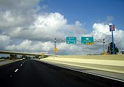
Interstate 110's northern terminus is at Interstate 10. There is a combination trumpet-directional T interchange at this location that is in close proximity to the I-10 interchange with Davis Highway to the east.
 Construction of the elevated portion of Interstate 110 caused controversy in that it threatened several historic landmarks. The freeway eliminated over 30 blocks
of dense existing development including the popular Dairy Bar ice cream shop and a centuries-old live oak
. A portion of the freeway also directly abuts St. Michael's Cemetery, which houses graves as old as the 18th century.
Between 2004 and 2009, Interstate 110 was fully rebuilt and expanded to six lanes from Interstate 10 south to Maxwell Street. Reconstruction of the freeway also added access to and from Airport Boulevard via a modification of the existing Brent Lane interchange.
in southwestern Alabama
, were discussed in the 1990s. Political and financial hurdles, however, have stalled serious consideration of the project.
Pensacola, Florida
Pensacola is the westernmost city in the Florida Panhandle and the county seat of Escambia County, Florida, United States of America. As of the 2000 census, the city had a total population of 56,255 and as of 2009, the estimated population was 53,752...
, running north from U.S. Highway 98 to Interstate 10. I-110 carries the hidden Florida Department of Transportation
Florida Department of Transportation
The Florida Department of Transportation is a decentralized agency charged with the establishment, maintenance, and regulation of public transportation in the state of Florida. The department was formed in 1969. It absorbed the powers of the Florida State Road Department...
designation of State Road 8A. It is also known as the Reubin O'Donovan Askew
Reubin O'Donovan Askew
Reubin O'Donovan Askew is an American politician, who served as the 37th Governor of the U.S. state of Florida from 1971 to 1979.-Early life and career:...
Parkway, in honor of the former governor of Florida who is also a Pensacola native.
Route description
Since its completion, Interstate 110 has consisted of six interchanges. Unlike most Florida interstates, it retained its sequential exit numbering system when most other interstates switched to a mile-log system. At the south end is Exit 1, a directional T interchange that connects the freeway with Garden, Chase and Gregory Streets. Exit 2 links I-110 to U.S. Highway 90/98, also known as Cervantes Street. There are only southbound exit and northbound entrance ramps at this interchange. This same ramp configuration can be found just to the north at Exit 3, an interchange with Maxwell and Jordan Streets.Past Exit 3, where the elevated freeway returns to ground level, there are two modified diamond interchange
Diamond interchange
A diamond interchange is a common type of road junction, used where a freeway crosses a minor road. The freeway itself is grade-separated from the minor road, one crossing the other over a bridge...
s. The first is Exit 4, leading to Fairfield Drive (State Road 295
State Road 295 (Florida)
State Road 295 is a major highway in the Pensacola metropolitan area. Locally, SR 295 is also called Navy Boulevard, New Warrington Road, and Fairfield Drive. The Southern terminus is at the entrance to Pensacola Naval Air Station, and the northern terminus is at an intersection with Fairfield...
). The northbound ramps at Exit 4 have been moved entirely to the southeast quadrant of the intersection and directly connect to Davis Highway (State Road 291
State Road 291 (Florida)
State Road 291 is a major thoroughfare in the Pensacola, Florida metropolitan area. Locally, it is known as Davis Street and Davis Highway. It runs from Wright Street in downtown Pensacola north to its terminus at Nine Mile Road near the University of West Florida...
) just south of Fairfield Drive. Approximately 1.5 miles to the north is Exit 5, an interchange with Brent Lane (State Road 296
State Road 296 (Florida)
State Road 296 is a major thoroughfare in the Pensacola, Florida metropolitan area. It is an east–west route running roughly through midtown Pensacola and West Pensacola. Locally, it is known as Michigan Avenue, Beverly Parkway, Brent Lane, Bayou Boulevard, and Perry Avenue. The...
) and Airport Boulevard. Originally, north of Exit 5 was an overpass for State Road 742
State Road 742 (Florida)
A six-mile-long east–west street serving Pensacola, State Road 742 is both a commuter road and a bypass route that also provides access for motorists to Pensacola Regional Airport...
along Burgess Road. However, between 2004 and 2006, SR 742 was rerouted along a new wider overpass at Creighton Road and the old Burgess Road overpass was demolished.
Interstate 110's northern terminus is at Interstate 10. There is a combination trumpet-directional T interchange at this location that is in close proximity to the I-10 interchange with Davis Highway to the east.
History
The portion of I-110 north of Maxwell Street was completed in 1969 as a four-lane, at-grade freeway. In 1978, the portion from Maxwell Street south to its current terminus at Garden and Chase Streets was opened to traffic. This portion is a four-lane, elevated freeway for its entire length.City block
A city block, urban block or simply block is a central element of urban planning and urban design. A city block is the smallest area that is surrounded by streets. City blocks are the space for buildings within the street pattern of a city, they form the basic unit of a city's urban fabric...
of dense existing development including the popular Dairy Bar ice cream shop and a centuries-old live oak
Live oak
Live oak , also known as the southern live oak, is a normally evergreen oak tree native to the southeastern United States...
. A portion of the freeway also directly abuts St. Michael's Cemetery, which houses graves as old as the 18th century.
Between 2004 and 2009, Interstate 110 was fully rebuilt and expanded to six lanes from Interstate 10 south to Maxwell Street. Reconstruction of the freeway also added access to and from Airport Boulevard via a modification of the existing Brent Lane interchange.
Future
Plans to extend Interstate 110 north from Interstate 10 to U.S. Highway 90 Alternate (Nine Mile Road), and possibly even as far as Interstate 65Interstate 65
Interstate 65 is a major Interstate Highway in the United States. The southern terminus is located at an intersection with Interstate 10 in Mobile, Alabama, and its northern terminus is at an interchange with Interstate 90 , U.S. Route 12, and U.S...
in southwestern Alabama
Alabama
Alabama is a state located in the southeastern region of the United States. It is bordered by Tennessee to the north, Georgia to the east, Florida and the Gulf of Mexico to the south, and Mississippi to the west. Alabama ranks 30th in total land area and ranks second in the size of its inland...
, were discussed in the 1990s. Political and financial hurdles, however, have stalled serious consideration of the project.