

U.S. Route 27
Encyclopedia
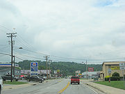
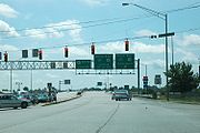
U.S. Route 27 is a north–south United States highway in the southern and midwestern United States
. The southern terminus is at US 1
in Miami
, Florida. The northern terminus is at Interstate 69
(I-69) in Fort Wayne
, Indiana. From Miami it goes up the center of Florida
, then west to Tallahassee
, Florida, and north through such cities and towns as Columbus
, Georgia; Rome
, Georgia; Chattanooga
, Tennessee; Lexington
, Kentucky; Cincinnati
, Ohio; Oxford
, Ohio; Richmond
, Indiana and Fort Wayne
, Indiana. It once extended north through Lansing
, Michigan, to Cheboygan
, Mackinaw City
, and for about 3 years as far as St. Ignace
.
US 27 appeared in 1926, replacing what had been the western route of the Dixie Highway
in many places.
.svg.png) In Florida
In Florida
, US 27 has been designated the Claude Pepper Memorial Highway by the Florida State Legislature. It was named after long-time Florida US Senator
and congressman Claude Pepper
. Nearly the entire length of US 27 in Florida is a divided highway.
US 27 begins as North 36th Street in Midtown
Miami, heading west from US 1 for 4.4 miles (7.1 km) before turning northwest to pass under the western terminus of the Airport Expressway (State Road 112, SR 112). It then proceeds northwest for five miles (8 km) as South Okeechobee Road, parallel to the Miami Canal
, forming the southwest boundary of the city of Hialeah
. After an interchange with the Palmetto Expressway (SR 826), it continues northwest as North Okeechobee Road for five miles (8 km) before an interchange with the Homestead Extension of the Florida Turnpike. After another four miles (6 km), the highway curves to the north and, after passing the northern terminus of Krome Avenue (SR 997), crosses into Broward County
.
In Broward County, the highway passes protected wetlands and heavy duty power lines on the west and the outer reaches of the suburban communities of Pembroke Pines
and Weston
on the east. US 27 then reaches an interchange with I-75
and Alligator Alley
before curving to the northwest toward South Bay
and Lake Okeechobee
.
The highway skirts the southwestern shore of Lake Okeechobee and then heads west at Clewiston
, before making a sharp turn to the north towards Moore Haven
. The road then proceeds in a northerly direction toward the central Florida communities of Lake Placid
, Sebring
, Avon Park
, and Lake Wales
.
Widening of US 27 to a six-lane highway continues in Polk County. The following sections have been completed and are open to six lanes of traffic:
North of I-4, US 27 contains un-numbered interchanges with US 192
and then County Road 474 (CR 474) in Citrus Ridge, SR 50 in Clermont, and SR 19
south of Howey-in-the-Hills, which also includes a southbound interchange with Florida's Turnpike
. The northbound Turnpike interchange can be found further northwest. US 441
later joins US 27 in Leesburg
and US 301
in Belleview
, only for the road to break away from both in Ocala
.
US 27 resumes its status as its own route until it reaches Williston and joins US 41. This concurrency continues northward until US 41 reaches High Springs
, and joins US 441. US 27 heads west along the unsigned SR 20
towards Perry
and joins US 19
until US 19 breaks away in Capps
, but not before resuming a westward direction. In Tallahassee
, the road becomes Apalachee Parkway is a major east–west thoroughfare. Constructed in 1957, the Apalachee Parkway starts at Monroe Street
in front of the Florida State Capitol
building. It has a short expressway section just east of the capitol, then is a busy four-lane surface boulevard with service roads for the next few miles, passing the Governor's Square Mall
and many state office buildings. Past Tallahassee, US 27 finally resumes its northwesterly direction. The highway goes through Havana
before entering Georgia.
, US 27 has been designated the Martha Berry Highway by the Georgia State Legislature. It was named after Martha Berry
, founder of Berry College
in Rome
.
US 27 is a designated Governor's Road Improvement Program (GRIP) developmental highway corridor which will eventually be widened to 4-lanes (mostly divided) from the Florida state line to the Tennessee state line.
, Tennessee, a portion of US 27 was once signed as I-124
. Though the designation still exists, it is no longer signed as such. In and around the Chattanooga area, US 27 is sometimes referred to as Corridor J, the designation of a road in the Appalachian Development Highway System
between Chattanooga and London
, Kentucky intended to follow the route of US 27.
From Chattanooga, the highway passes through Soddy-Daisy
and the small communities of Sale Creek
and Graysville
before reaching Dayton
, the site of the infamous Scopes Monkey Trial. It then passes through Evensville before arriving at Spring City
.
From here, US 27 enters Roane County, running concurrent with US 70 going through the city of Rockwood
. After US 70 splits to the east, US 27 runs concurrent with State Route 61
(SR 61) through Harriman
, where it is crossed by I-40
. During this stretch, it forms part of the Harvey H. Hannah Memorial Highway, and is signed as such.
In Morgan County, the highway passes through Wartburg
and Sunbright
.
It passes through Robbins
and Helenwood
before reaching Oneida
in Scott County.
Winfield
is the last sizable town that US 27 passes through in Tennessee before it reaches the community of Isham on the Kentucky
border.
 US 27 enters Kentucky near Whitley City
. The first major town it goes through is Somerset
, followed by Nicholasville
, and Lexington
, where it begins a concurrency with US 68
that continues to Paris
. US 27 continues north from there through Cynthiana
, Falmouth
, Alexandria
, Highland Heights
, Fort Thomas
, and Newport
before crossing into Ohio
at Cincinnati via Taylor-Southgate Bridge
. From its junction with Interstate 471
in Highland Heights through Campbell County, it is a four lane highway with a center turn lane for both directions of traffic. Near the "welcome to Alexandria" sign at KY 536, US 27 becomes a divided four lane highway with a grass median. It is currently being constructed as such for the rest of its length from 536 through southern Campbell county. Currently, US 27 is under-going a widening project near Garrard CR 1355 to HWY 34. The road will become a four lane into Lexington.
via the Taylor–Southgate Bridge. A section of US 27 from Cincinnati (Colerain) to Oxford
, Ohio is better known as the "Highway to Heaven
" because of the number of fatal accidents that have occurred on this stretch of the two-lane highway. The road continues Northwest from Oxford until reaching the Indiana
border at College Corner, Ohio
.
 US 27 enters the southeastern part of Indiana south of the village of Liberty
. At Liberty, US 27 turns north, paralleling the Ohio state line. It intersects I-70
at Richmond
, Indiana, and continues north to Decatur
. US 33
joins US 27 just south of Decatur and the two routes share a northwesterly alignment on a divided surface highway from Decatur to I-469
south of Fort Wayne. US 33 turns west and follows I-469, while US 27 continues north into downtown Fort Wayne as Clinton Street. North of downtown, US 27 follows Lima Road to its terminus at I-69
/US 30
(Lima Road continues north from this point as SR 3
).
.jpg) Originally, the southern terminus of US 27 was in Cincinnati, Ohio. In 1928, the route was extended south to Chattanooga
Originally, the southern terminus of US 27 was in Cincinnati, Ohio. In 1928, the route was extended south to Chattanooga
, Tennessee, then to Tallahassee
, Florida in 1934. In 1949, it was extended to its current terminus in Miami. At its northern end, US 27 originally terminated at Cheboygan
, Michigan. In 1937, the route was extended concurrently with US 23
to Mackinaw City
, where it ended at the Michigan State Auto Ferry Dock along with US 23 and US 31
. After the completion of the Mackinac Bridge
in 1957, US 27 was extended across the bridge to the current intersection of I-75
and US 2
near St. Ignace
. In 1961, what became I-75 was completed, enabling the roadway to be designated as I-75. At the same time, US 27 was truncated to an interchange with I-75 six miles (10 km) south of Grayling
. In 2002, the northern terminus was moved to its current location.
From Grayling to I-69
near Lansing
, the road is now designated US 127
. US 27 signs were removed from I-69 between Lansing and Fort Wayne in 2001. Officially, the current northern terminus is at the junction of I-69, US 30, and SR 3, but heading north on I-69 one will still see US 27 shields on some of the older overhead signs heading to the I-469 interchange on the northern edge of Fort Wayne.
to designate US 27 as historic highway. Richmond
, one of the cities US 27 passes through, would have two historic highways passing through it. The original National Road
(US 40
) runs through Richmond.
.
The at-grade routing of US 27 in Michigan has been largely superseded by I-75, which follows a roughly similar route and in some places actually replaced the older highway. From Lansing north to I-75, the former US 27 is now US 127; from Lansing south to Fort Wayne, US 27 was replaced by I-69. In many places the route markers and the highway itself serve to connect local communities bypassed by the Interstate Highway.
United States
The United States of America is a federal constitutional republic comprising fifty states and a federal district...
. The southern terminus is at US 1
U.S. Route 1
U.S. Route 1 is a major north–south U.S. Highway that serves the East Coast of the United States. It runs 2,377 miles from Fort Kent, Maine at the Canadian border south to Key West, Florida. U.S. 1 generally parallels Interstate 95, though it is significantly farther west between...
in Miami
Miami, Florida
Miami is a city located on the Atlantic coast in southeastern Florida and the county seat of Miami-Dade County, the most populous county in Florida and the eighth-most populous county in the United States with a population of 2,500,625...
, Florida. The northern terminus is at Interstate 69
Interstate 69
Interstate 69 is an Interstate Highway in the United States. It exists in two parts: a completed highway from Indianapolis, Indiana, northeast to the Canadian border in Port Huron, Michigan, and a mostly proposed extension southwest to the Mexican border in Texas...
(I-69) in Fort Wayne
Fort Wayne, Indiana
Fort Wayne is a city in the US state of Indiana and the county seat of Allen County. The population was 253,691 at the 2010 Census making it the 74th largest city in the United States and the second largest in Indiana...
, Indiana. From Miami it goes up the center of Florida
Florida
Florida is a state in the southeastern United States, located on the nation's Atlantic and Gulf coasts. It is bordered to the west by the Gulf of Mexico, to the north by Alabama and Georgia and to the east by the Atlantic Ocean. With a population of 18,801,310 as measured by the 2010 census, it...
, then west to Tallahassee
Tallahassee, Florida
Tallahassee is the capital of the U.S. state of Florida. It is the county seat and only incorporated municipality in Leon County, and is the 128th largest city in the United States. Tallahassee became the capital of Florida, then the Florida Territory, in 1824. In 2010, the population recorded by...
, Florida, and north through such cities and towns as Columbus
Columbus, Georgia
Columbus is a city in and the county seat of Muscogee County, Georgia, United States, with which it is consolidated. As of the 2010 census, the city had a population of 189,885. It is the principal city of the Columbus, Georgia metropolitan area, which, in 2009, had an estimated population of 292,795...
, Georgia; Rome
Rome, Georgia
Located in the foothills of the Appalachian Mountains, Rome is the largest city and the county seat of Floyd County, Georgia, United States. It is the principal city of the Rome, Georgia Metropolitan Statistical Area which encompasses all of Floyd County...
, Georgia; Chattanooga
Chattanooga, Tennessee
Chattanooga is the fourth-largest city in the US state of Tennessee , with a population of 169,887. It is the seat of Hamilton County...
, Tennessee; Lexington
Lexington, Kentucky
Lexington is the second-largest city in Kentucky and the 63rd largest in the US. Known as the "Thoroughbred City" and the "Horse Capital of the World", it is located in the heart of Kentucky's Bluegrass region...
, Kentucky; Cincinnati
Cincinnati, Ohio
Cincinnati is a city in the U.S. state of Ohio. Cincinnati is the county seat of Hamilton County. Settled in 1788, the city is located to north of the Ohio River at the Ohio-Kentucky border, near Indiana. The population within city limits is 296,943 according to the 2010 census, making it Ohio's...
, Ohio; Oxford
Oxford, Ohio
Oxford is a city in northwestern Butler County, Ohio, United States, in the southwestern portion of the state. It lies in Oxford Township, originally called the College Township. The population was 21,943 at the 2000 census. This college town was founded as a home for Miami University. Oxford...
, Ohio; Richmond
Richmond, Indiana
Richmond is a city largely within Wayne Township, Wayne County, in east central Indiana, United States, which borders Ohio. The city also includes the Richmond Municipal Airport, which is in Boston Township and separated from the rest of the city...
, Indiana and Fort Wayne
Fort Wayne, Indiana
Fort Wayne is a city in the US state of Indiana and the county seat of Allen County. The population was 253,691 at the 2010 Census making it the 74th largest city in the United States and the second largest in Indiana...
, Indiana. It once extended north through Lansing
Lansing, Michigan
Lansing is the capital of the U.S. state of Michigan. It is located mostly in Ingham County, although small portions of the city extend into Eaton County. The 2010 Census places the city's population at 114,297, making it the fifth largest city in Michigan...
, Michigan, to Cheboygan
Cheboygan, Michigan
Cheboygan is a city in the U.S. state of Michigan. As of the 2000 census, the city population was 5,295. It is the county seat of Cheboygan County....
, Mackinaw City
Mackinaw City, Michigan
Mackinaw City is a village in Emmet and Cheboygan counties in the U.S. state of Michigan. At the 2000 census the population was 859. The name "Mackinaw City" is a bit of a misnomer as it is actually a village...
, and for about 3 years as far as St. Ignace
St. Ignace, Michigan
Saint Ignace, usually written as St. Ignace, is a city in the U.S. state of Michigan. As of the 2000 census, the city population was 2,678. It is the county seat of Mackinac County. From the Lower Peninsula, St. Ignace is the gateway to the Upper Peninsula.St...
.
US 27 appeared in 1926, replacing what had been the western route of the Dixie Highway
Dixie Highway
The Dixie Highway was a United States automobile highway, first planned in 1914 to connect the US Midwest with the Southern United States. It was part of the National Auto Trail system, and grew out of an earlier Miami to Montreal highway. The final result is better understood as a small network of...
in many places.
Florida
Florida
Florida is a state in the southeastern United States, located on the nation's Atlantic and Gulf coasts. It is bordered to the west by the Gulf of Mexico, to the north by Alabama and Georgia and to the east by the Atlantic Ocean. With a population of 18,801,310 as measured by the 2010 census, it...
, US 27 has been designated the Claude Pepper Memorial Highway by the Florida State Legislature. It was named after long-time Florida US Senator
United States Senate
The United States Senate is the upper house of the bicameral legislature of the United States, and together with the United States House of Representatives comprises the United States Congress. The composition and powers of the Senate are established in Article One of the U.S. Constitution. Each...
and congressman Claude Pepper
Claude Pepper
Claude Denson Pepper was an American politician of the Democratic Party, and a spokesman for left-liberalism and the elderly. In foreign policy he shifted from pro-Soviet in the 1940s to anti-Communist in the 1950s...
. Nearly the entire length of US 27 in Florida is a divided highway.
US 27 begins as North 36th Street in Midtown
Midtown Miami
Midtown Miami is the collective term for the Wynwood and Edgewater neighborhoods of Miami, Florida, United States, north of Downtown and south of the Miami Design District. It is roughly bound by North 29th Street to the south, I-195 to the north, I-95 to the west and Biscayne Bay to the east.In...
Miami, heading west from US 1 for 4.4 miles (7.1 km) before turning northwest to pass under the western terminus of the Airport Expressway (State Road 112, SR 112). It then proceeds northwest for five miles (8 km) as South Okeechobee Road, parallel to the Miami Canal
Miami Canal
The Miami Canal, or C-6 Canal, flows from Lake Okeechobee in the U.S. state of Florida to its terminus at the Miami River, which flows through downtown Miami. The canal flows in a south and southeasterly direction for approximately 77 miles, and passes through three counties: Broward, Palm Beach,...
, forming the southwest boundary of the city of Hialeah
Hialeah, Florida
Hialeah is a city in Miami-Dade County, Florida, United States. As of the 2000 census, the city population was 226,419. As of 2009, the population estimate by the U. S...
. After an interchange with the Palmetto Expressway (SR 826), it continues northwest as North Okeechobee Road for five miles (8 km) before an interchange with the Homestead Extension of the Florida Turnpike. After another four miles (6 km), the highway curves to the north and, after passing the northern terminus of Krome Avenue (SR 997), crosses into Broward County
Broward County, Florida
-2000 Census:As of the census of 2000, there were 1,623,018 people, 654,445 households, and 411,645 families residing in the county. The population density was 1,346 people per square mile . There were 741,043 housing units at an average density of 615 per square mile...
.
In Broward County, the highway passes protected wetlands and heavy duty power lines on the west and the outer reaches of the suburban communities of Pembroke Pines
Pembroke Pines, Florida
Pembroke Pines is a city in Broward County, Florida, United States. The city had a population of 154,750 at the 2010 census, making it the second most populous city in Broward County, the tenth most populous in Florida, and the 150th most populous in the United States...
and Weston
Weston, Florida
Weston is a suburb of South Florida located in Broward County, Florida, USA. Established as a city in 1996, much of the community was developed by Arvida/JMB Realty and is located near the western developmental boundary of Broward County. It is the most western city in Broward County, and its...
on the east. US 27 then reaches an interchange with I-75
Interstate 75 in Florida
Interstate 75 is a part of the Interstate Highway System and runs from Hialeah, Florida, a few miles northwest of Miami to Sault Ste. Marie in the Upper Peninsula of Michigan...
and Alligator Alley
Alligator Alley
Alligator Alley is a section of Interstate 75 and State Road 84 extending from Naples on the west coast of Florida to Weston on the east...
before curving to the northwest toward South Bay
South Bay, Florida
South Bay is a city in Palm Beach County, Florida, United States. It is the westernmost municipality in the South Florida metropolitan area. The population was 3,859 at the 2000 census. As of 2007, the population recorded by the U.S. Census Bureau is 4,506...
and Lake Okeechobee
Lake Okeechobee
Lake Okeechobee , locally referred to as The Lake or The Big O, is the largest freshwater lake in the state of Florida. It is the seventh largest freshwater lake in the United States and the second largest freshwater lake contained entirely within the lower 48 states...
.
The highway skirts the southwestern shore of Lake Okeechobee and then heads west at Clewiston
Clewiston, Florida
Clewiston is a city in Hendry County, Florida. The population was 6,460 at the 2000 census. According to the U.S Census estimates of 2005, the city had a population of 7,173. Clewiston is home to the Ah-Tah-Thi-Ki Museum and the Clewiston Museum.-History:...
, before making a sharp turn to the north towards Moore Haven
Moore Haven, Florida
Moore Haven is a city in Glades County, Florida, United States. The population was 1,635 at the 2000 census. As of 2004, the population recorded by the U.S. Census Bureau is 1,726. It is the county seat of Glades County...
. The road then proceeds in a northerly direction toward the central Florida communities of Lake Placid
Lake Placid, Florida
Lake Placid is a town in Highlands County, Florida, United States. The U.S. Census Bureau estimated the town's population as 1,878 on 1 July 2007...
, Sebring
Sebring, Florida
Sebring is a city in Highlands County, Florida, United States, nicknamed "The City on the Circle", in reference to Circle Drive, the center of the Sebring Downtown Historic District...
, Avon Park
Avon Park, Florida
Avon Park is a city in Highlands County, Florida, United States. The U.S. Census Bureau estimated the city's population in 2009 at 8,824. It is the oldest city in Highlands County, and was named after Stratford-upon-Avon, England.-History:...
, and Lake Wales
Lake Wales, Florida
Lake Wales is a city in Polk County, Florida, United States. The population was 10,194 at the 2000 census. As of 2004, the population recorded by the U.S. Census Bureau is 11,802 . It is part of the Lakeland–Winter Haven Metropolitan Statistical Area...
.
Widening of US 27 to a six-lane highway continues in Polk County. The following sections have been completed and are open to six lanes of traffic:
- SR 60 to SR 540 in Lake Wales
- SR 542 in Dundee to north of I-4 in Davenport
North of I-4, US 27 contains un-numbered interchanges with US 192
U.S. Route 192
U.S. Route 192 is an east–west route of the United States Numbered Highway system in central Florida. It runs 75.04 miles from U.S. Route 27 in Citrus Ridge, Lake County, east past Walt Disney World and through Kissimmee, St. Cloud and Melbourne, to end at State Road A1A in Indialantic, one...
and then County Road 474 (CR 474) in Citrus Ridge, SR 50 in Clermont, and SR 19
Florida State Road 19
State Road 19 is a Florida State Road in Putnam, Marion, and Lake counties. It runs from Groveland to Palatka. It provides access to areas in Ocala National Forest, like Pittman.-Groveland to Tavares:...
south of Howey-in-the-Hills, which also includes a southbound interchange with Florida's Turnpike
Florida's Turnpike
Florida's Turnpike , designated as the Ronald Reagan Turnpike, and originally known as the Sunshine State Parkway is a north–south toll road that runs through 11 counties in the Florida peninsula, from U.S...
. The northbound Turnpike interchange can be found further northwest. US 441
U.S. Route 441 in Florida
U.S. Route 441 in Florida is a north–south United States Highway. It runs from Miami in South Florida northwest to the Georgia border north of the Lake City area....
later joins US 27 in Leesburg
Leesburg, Florida
Leesburg is a city in Lake County, Florida, United States. The population was 15,956 at the 2000 census. As of 2005, the population recorded by the U.S. Census Bureau is 19,086.. Leesburg is located in central Florida, between Lake Harris and Lake Griffin, at the head of the Oklawaha River system....
and US 301
U.S. Route 301 in Florida
U.S. Route 301 in Florida runs from the Sarasota-Bradenton-Venice, Florida Metropolitan Statistical Area northeast to the Greater Jacksonville Metropolitan Area. The road is a spur of U.S...
in Belleview
Belleview, Florida
Belleview is a city in Marion County, Florida. The population was 3,478 at the 2000 census. According to the U.S Census estimates of 2009, the city had a population of 4,483. It is part of the Ocala Metropolitan Statistical Area. The name, Belleview, which means beautiful view, came from one of...
, only for the road to break away from both in Ocala
Ocala, Florida
Ocala is a city in Marion County, Florida. As of 2007, the population recorded by the U.S. Census Bureau was 53,491. It is the county seat of Marion County, and the principal city of the Ocala, Florida Metropolitan Statistical Area, which had an estimated 2007 population of 324,857.-History:Ocala...
.
US 27 resumes its status as its own route until it reaches Williston and joins US 41. This concurrency continues northward until US 41 reaches High Springs
High Springs, Florida
High Springs is a city in Alachua County, Florida, United States. The population was 3,863 at the 2000 census. As of 2004, the population recorded by the U.S. Census Bureau is 4,139 .-Geography:High Springs is located at ....
, and joins US 441. US 27 heads west along the unsigned SR 20
Florida State Road 20
State Road 20 is an east–west route across northern Florida and the Florida Panhandle.-Route description:The western terminus of State Road 20 is at State Road 85 in Niceville. The route proceeds east through Blountstown, crossing the Apalachicola River on the Trammell Bridge, then proceeding...
towards Perry
Perry, Florida
Perry is a city in Taylor County, Florida, United States. The population was 7,017 at the 2010 census. As of 2010, the population recorded by the U.S. Census Bureau is 7,017....
and joins US 19
U.S. Route 19 in Florida
U.S. Route 19 in Florida runs along Florida's west coast from an interchange with U.S. Route 41 in Memphis, Florida, south of Tampa, and continues to the Georgia border north of Monticello, Florida....
until US 19 breaks away in Capps
Capps, Florida
Capps is an unincorporated community in Jefferson County, Florida, United States. It is located at the intersection of US 19 and US 27. During the 1940's and 50's, Capps was the headquarters of an agri-business known as Tungston Plantation, owned by Everett P. Larsh, an industrialist from Dayton,...
, but not before resuming a westward direction. In Tallahassee
Tallahassee, Florida
Tallahassee is the capital of the U.S. state of Florida. It is the county seat and only incorporated municipality in Leon County, and is the 128th largest city in the United States. Tallahassee became the capital of Florida, then the Florida Territory, in 1824. In 2010, the population recorded by...
, the road becomes Apalachee Parkway is a major east–west thoroughfare. Constructed in 1957, the Apalachee Parkway starts at Monroe Street
State Road 61 (Florida)
State Road 61 is located in the Big Bend area of Florida, running through the state capital of Tallahassee.-Route description:SR 61 begins at US 98 as an unsigned route, heading north on US 319, until it splits off with the highway in Crawfordville and becomes Wakulla County Road 61...
in front of the Florida State Capitol
Florida State Capitol
The Florida State Capitol, in Tallahassee, Florida, USA, is the state capitol of the U.S. state of Florida. The building is an architecturally and historically significant building, having been listed on the National Register of Historic Places....
building. It has a short expressway section just east of the capitol, then is a busy four-lane surface boulevard with service roads for the next few miles, passing the Governor's Square Mall
Governor's Square
Governor's Square is a super-regional shopping mall located on Apalachee Parkway in Tallahassee, Florida. Its two-level design was a first for northern Florida when it opened in 1979, and it remains the newest of two enclosed malls in the Tallahassee area, the other being Tallahassee Mall. Its...
and many state office buildings. Past Tallahassee, US 27 finally resumes its northwesterly direction. The highway goes through Havana
Havana, Florida
Havana is a town in Gadsden County, Florida, United States and suburb of Tallahassee. The population was 1,713 at the 2000 census. As of 2004, the population recorded by the U.S. Census Bureau is 1,703...
before entering Georgia.
Georgia
In GeorgiaGeorgia (U.S. state)
Georgia is a state located in the southeastern United States. It was established in 1732, the last of the original Thirteen Colonies. The state is named after King George II of Great Britain. Georgia was the fourth state to ratify the United States Constitution, on January 2, 1788...
, US 27 has been designated the Martha Berry Highway by the Georgia State Legislature. It was named after Martha Berry
Martha Berry
For the Cherokee bead artist, see Martha Berry Martha McChesney Berry was an United States educator and the founder of Berry College in Rome, Georgia.-Early years:...
, founder of Berry College
Berry College
Berry College is an American accredited, private, four-year liberal arts college located in Mount Berry, unincorporated Floyd County, Georgia, north of Rome. It was founded in 1902 by Martha Berry.-Location:Berry College is located on U.S...
in Rome
Rome, Georgia
Located in the foothills of the Appalachian Mountains, Rome is the largest city and the county seat of Floyd County, Georgia, United States. It is the principal city of the Rome, Georgia Metropolitan Statistical Area which encompasses all of Floyd County...
.
US 27 is a designated Governor's Road Improvement Program (GRIP) developmental highway corridor which will eventually be widened to 4-lanes (mostly divided) from the Florida state line to the Tennessee state line.
Tennessee
In ChattanoogaChattanooga, Tennessee
Chattanooga is the fourth-largest city in the US state of Tennessee , with a population of 169,887. It is the seat of Hamilton County...
, Tennessee, a portion of US 27 was once signed as I-124
Interstate 124
Interstate 124 is an unsigned designation for a short segment of a four-lane limited access highway located in Chattanooga, Tennessee, USA. During periods where this two miles long segment of U.S. Route 27 has been signed as I-124, it has served as a spur route of Interstate 24 to downtown...
. Though the designation still exists, it is no longer signed as such. In and around the Chattanooga area, US 27 is sometimes referred to as Corridor J, the designation of a road in the Appalachian Development Highway System
Appalachian Development Highway System
The Appalachian Development Highway System is part of the Appalachian Regional Commission in the United States. See: .-History:...
between Chattanooga and London
London, Kentucky
-Education:All of the following schools are administered by the Laurel County School District.-Primary schools:* * * * * * * * * * * * -High schools:* * -Colleges:* Laurel Technical College* * -Notable natives:...
, Kentucky intended to follow the route of US 27.
From Chattanooga, the highway passes through Soddy-Daisy
Soddy-Daisy, Tennessee
Soddy-Daisy is a city in Hamilton County, Tennessee, United States. The population was 11,530 at the 2000 census. The City was formed in 1969 when the communities of Soddy and Daisy, along with nearby developed areas along U.S. Highway 27, merged to form Soddy-Daisy. It is rapidly becoming a...
and the small communities of Sale Creek
Sale Creek, Tennessee
Sale Creek is a small unincorporated community in northern Hamilton County, Tennessee, United States. Sale Creek is home to Sale Creek High School, The Panthers, as well as the "haunted" Shipley Hollow Road...
and Graysville
Graysville, Tennessee
Graysville is a town in Rhea County, Tennessee, United States. The population was 1,411 at the 2000 census and 1,502 at the 2010 census.-Geography:Graysville is located at ....
before reaching Dayton
Dayton, Tennessee
Dayton is a city in Rhea County, Tennessee, United States. The population was 6,180 at the 2000 census. The Dayton, TN, Urban Cluster, which includes developed areas adjacent to the city and extends south to Graysville, Tennessee, had 9,050 people in 2000...
, the site of the infamous Scopes Monkey Trial. It then passes through Evensville before arriving at Spring City
Spring City, Tennessee
Spring City is a town in Rhea County, Tennessee, United States. The population was 2,025 at the 2000 census.-Geography:Spring City is located at ....
.
From here, US 27 enters Roane County, running concurrent with US 70 going through the city of Rockwood
Rockwood, Tennessee
Rockwood is a city in Roane County, Tennessee, United States. Its population was 5,774 at the 2000 census. It is included in the Harriman, Tennessee Micropolitan Statistical Area.-Geography:...
. After US 70 splits to the east, US 27 runs concurrent with State Route 61
Tennessee State Route 61
State Route 61 is a west-to-east highway in the U.S. state of Tennessee that is 69 miles long.State Route 61 begins in Roane County, and it ends in Union County.It overlaps Interstate 75 in Anderson County.-Counties traversed :...
(SR 61) through Harriman
Harriman, Tennessee
Harriman is a city in the U.S. state of Tennessee, primarily in Roane County, with a small extension into Morgan County. It is the principal city of and is included in the Harriman Micropolitan Statistical Area, which consists of Roane County and is a component of the Knoxville-Sevierville-La...
, where it is crossed by I-40
Interstate 40
Interstate 40 is the third-longest major east–west Interstate Highway in the United States, after I-90 and I-80. Its western end is at Interstate 15 in Barstow, California; its eastern end is at a concurrency of U.S. Route 117 and North Carolina Highway 132 in Wilmington, North Carolina...
. During this stretch, it forms part of the Harvey H. Hannah Memorial Highway, and is signed as such.
In Morgan County, the highway passes through Wartburg
Wartburg, Tennessee
Wartburg is a city in Morgan County, Tennessee, United States. The population was 890 at the 2000 census. It is the county seat of Morgan County.-Geography:...
and Sunbright
Sunbright, Tennessee
Sunbright is a city in Morgan County, Tennessee, United States. The population was 577 at the 2000 census.-Geography:Sunbright is located at . The city is situated atop the Cumberland Plateau approximately west of the plateau's Walden Ridge escarpment...
.
It passes through Robbins
Robbins, Tennessee
Robbins is an unincorporated community and census-designated place in Scott County, Tennessee. As of the 2010 census, its population is 287.-Notable people:...
and Helenwood
Helenwood, Tennessee
Helenwood is an unincorporated community in Scott County, Tennessee, United States. The population was 846 at the 2000 census, when Helenwood was treated as an incorporated municipality. For the 2010 census, it was a census designated place with a population of 865.-History:Helenwood was platted...
before reaching Oneida
Oneida, Tennessee
Oneida is a town in Scott County, Tennessee, United States. The population was 3,615 at the 2000 census.Oneida is known for its proximity to the Big South Fork National River and Recreation Area...
in Scott County.
Winfield
Winfield, Tennessee
Winfield is a town in Scott County, Tennessee, United States. The population was 911 at the 2000 census.-Geography:Winfield is located at ....
is the last sizable town that US 27 passes through in Tennessee before it reaches the community of Isham on the Kentucky
Kentucky
The Commonwealth of Kentucky is a state located in the East Central United States of America. As classified by the United States Census Bureau, Kentucky is a Southern state, more specifically in the East South Central region. Kentucky is one of four U.S. states constituted as a commonwealth...
border.
Kentucky
Whitley City, Kentucky
Whitley City is a census-designated place in McCreary County, Kentucky, United States. The population was 1,111 at the 2000 census. Despite its name, it is not an incorporated city; however, it is the county seat of McCreary County. Whitley City is one of two non-city county seats in Kentucky the...
. The first major town it goes through is Somerset
Somerset, Kentucky
The major demographic differences between the city and the micropolitan area relate to income, housing composition and age. The micropolitan area, as compared to the incorporated city, is more suburban in flavor and has a significantly younger housing stock, a higher income, and contains most of...
, followed by Nicholasville
Nicholasville, Kentucky
Nicholasville is the 11th largest city in state of Kentucky and the county seat of Jessamine County, Kentucky, United States. The population was 19,680 at the 2000 census...
, and Lexington
Lexington, Kentucky
Lexington is the second-largest city in Kentucky and the 63rd largest in the US. Known as the "Thoroughbred City" and the "Horse Capital of the World", it is located in the heart of Kentucky's Bluegrass region...
, where it begins a concurrency with US 68
U.S. Route 68
U.S. Route 68 is an east–west United States highway that runs for from northwest Ohio to western Kentucky. The highway's western terminus is at U.S. Route 62 in Reidland, Kentucky. Its eastern terminus is at Interstate 75 in Findlay, Ohio...
that continues to Paris
Paris, Kentucky
As of the census of 2000, there were 9,183 people, 3,857 households, and 2,487 families residing in the city. The population density was . There were 4,222 housing units at an average density of . The racial makeup of the city was 84.23% White, 12.71% African American, 0.16% Native American, 0.16%...
. US 27 continues north from there through Cynthiana
Cynthiana, Kentucky
As of the census of 2000, there were 6,258 people, 2,692 households, and 1,639 families residing in the city. The population density was 1,873.6 people per square mile . There were 2,909 housing units at an average density of 870.9 per square mile...
, Falmouth
Falmouth, Kentucky
Falmouth is a small city in Pendleton County, Kentucky, United States. The population was 2,058 at the 2000 census. It is the county seat of Pendleton County and is the meeting point of the South and Main forks of the Licking River.-Geography:...
, Alexandria
Alexandria, Kentucky
As of the census of 2000, there were 8,286 people, 2,884 households, and 2,275 families residing in the city. The population density was 1,538.7 people per square mile . There were 2,989 housing units at an average density of 555.1 per square mile...
, Highland Heights
Highland Heights, Kentucky
Highland Heights is a city in Campbell County, Kentucky, United States. The population was 6,554 at the 2000 census.Highland Heights is home to Northern Kentucky University...
, Fort Thomas
Fort Thomas, Kentucky
Fort Thomas is a city in Campbell County, Kentucky, on the southern bank of the Ohio River and the site of an 1890 US Army post. The population was 16,325 at the 2010 census, making it the largest city in Campbell County and it is officially part of the Cincinnati – Northern Kentucky metropolitan...
, and Newport
Newport, Kentucky
Newport is a city in Campbell County, Kentucky, United States, at the confluence of the Ohio and Licking rivers. The population was 15,273 at the 2010 census. Historically, it was one of four county seats of Campbell County. Newport is part of the Greater Cincinnati, Ohio Metro Area which...
before crossing into Ohio
Ohio
Ohio is a Midwestern state in the United States. The 34th largest state by area in the U.S.,it is the 7th‑most populous with over 11.5 million residents, containing several major American cities and seven metropolitan areas with populations of 500,000 or more.The state's capital is Columbus...
at Cincinnati via Taylor-Southgate Bridge
Taylor-Southgate Bridge
The Taylor–Southgate Bridge is a continuous truss bridge that was built in 1995. It has a main span of 850 feet , and a total span of 1850 feet . The bridge carries U.S...
. From its junction with Interstate 471
Interstate 471
Interstate 471 is a long United States Interstate Highway, linking Interstate 71 in downtown Cincinnati, Ohio to Interstate 275 in Highland Heights, Kentucky. South of I-275, the expressway continues south to U.S...
in Highland Heights through Campbell County, it is a four lane highway with a center turn lane for both directions of traffic. Near the "welcome to Alexandria" sign at KY 536, US 27 becomes a divided four lane highway with a grass median. It is currently being constructed as such for the rest of its length from 536 through southern Campbell county. Currently, US 27 is under-going a widening project near Garrard CR 1355 to HWY 34. The road will become a four lane into Lexington.
Ohio
US 27 crosses into Cincinnati, OhioCincinnati, Ohio
Cincinnati is a city in the U.S. state of Ohio. Cincinnati is the county seat of Hamilton County. Settled in 1788, the city is located to north of the Ohio River at the Ohio-Kentucky border, near Indiana. The population within city limits is 296,943 according to the 2010 census, making it Ohio's...
via the Taylor–Southgate Bridge. A section of US 27 from Cincinnati (Colerain) to Oxford
Oxford, Ohio
Oxford is a city in northwestern Butler County, Ohio, United States, in the southwestern portion of the state. It lies in Oxford Township, originally called the College Township. The population was 21,943 at the 2000 census. This college town was founded as a home for Miami University. Oxford...
, Ohio is better known as the "Highway to Heaven
Slaughter alley
Slaughter Alley is an American colloquial name given for sections of highway known for a high rates of fatal accidents. Other terms include Blood Alley, Massacre Mountain, Killer Highway and Route de la Mort and El Camino de la Muerte...
" because of the number of fatal accidents that have occurred on this stretch of the two-lane highway. The road continues Northwest from Oxford until reaching the Indiana
Indiana
Indiana is a US state, admitted to the United States as the 19th on December 11, 1816. It is located in the Midwestern United States and Great Lakes Region. With 6,483,802 residents, the state is ranked 15th in population and 16th in population density. Indiana is ranked 38th in land area and is...
border at College Corner, Ohio
College Corner, Ohio
College Corner is a village in the southwestern part of the U.S. state of Ohio in Butler and Preble Counties, five miles northwest of Oxford. It was settled in 1811 and takes its name from its position in the northwestern corner of the "College Township", the survey township designated the previous...
.
Indiana
Liberty, Indiana
Liberty is a town in Center Township, Union County, Indiana, United States. The population was 2,061 at the 2000 census. It is the county seat of Union County.-Geography:Liberty is located at ....
. At Liberty, US 27 turns north, paralleling the Ohio state line. It intersects I-70
Interstate 70
Interstate 70 is an Interstate Highway in the United States that runs from Interstate 15 near Cove Fort, Utah, to a Park and Ride near Baltimore, Maryland. It was the first Interstate Highway project in the United States. I-70 approximately traces the path of U.S. Route 40 east of the Rocky...
at Richmond
Richmond, Indiana
Richmond is a city largely within Wayne Township, Wayne County, in east central Indiana, United States, which borders Ohio. The city also includes the Richmond Municipal Airport, which is in Boston Township and separated from the rest of the city...
, Indiana, and continues north to Decatur
Decatur, Indiana
Decatur is a city in Root and Washington townships, Adams County, Indiana, United States. The city, which serves as the county seat of Adams County, takes its name after the prominent war hero Stephen Decatur, Jr., one of the captains of the original 6 frigates of the US navy...
. US 33
U.S. Route 33
U.S. Route 33 is a United States federal highway that runs northwest-southeast for 709 miles from northern Indiana to Richmond, Virginia, passing through Ohio and West Virginia en route. Although most odd-numbered U.S...
joins US 27 just south of Decatur and the two routes share a northwesterly alignment on a divided surface highway from Decatur to I-469
Interstate 469
Interstate 469 is an Interstate Highway in the northeastern portion of the mid-western U.S. state of Indiana. It is an auxiliary route of parent Interstate 69 that also carries portions of US 24, US 30 and US 33 around the urban parts of Fort Wayne, Indiana...
south of Fort Wayne. US 33 turns west and follows I-469, while US 27 continues north into downtown Fort Wayne as Clinton Street. North of downtown, US 27 follows Lima Road to its terminus at I-69
Interstate 69 in Indiana
Interstate 69 presently exists in two discontinuous segments in Indiana. The original highway, completed in November 1971, runs northeast from the state capital of Indianapolis, to the city of Fort Wayne, and then proceeds north to the state of Michigan...
/US 30
U.S. Route 30 in Indiana
In the state of Indiana, U.S. Route 30 is an east–west four-lane divided highway across northern Indiana. It runs from the Illinois state line at Dyer to east of Fort Wayne at the Ohio state line. This is a distance of 151.8 miles ....
(Lima Road continues north from this point as SR 3
Indiana State Road 3
State Road 3 in the U.S. State of Indiana is a discontinuous state road running through east central Indiana from near the Michigan state line to near the Ohio River...
).
History
Chattanooga, Tennessee
Chattanooga is the fourth-largest city in the US state of Tennessee , with a population of 169,887. It is the seat of Hamilton County...
, Tennessee, then to Tallahassee
Tallahassee, Florida
Tallahassee is the capital of the U.S. state of Florida. It is the county seat and only incorporated municipality in Leon County, and is the 128th largest city in the United States. Tallahassee became the capital of Florida, then the Florida Territory, in 1824. In 2010, the population recorded by...
, Florida in 1934. In 1949, it was extended to its current terminus in Miami. At its northern end, US 27 originally terminated at Cheboygan
Cheboygan, Michigan
Cheboygan is a city in the U.S. state of Michigan. As of the 2000 census, the city population was 5,295. It is the county seat of Cheboygan County....
, Michigan. In 1937, the route was extended concurrently with US 23
U.S. Route 23 in Michigan
US Highway 23 is a United States Numbered Highway that runs from Jacksonville, Florida to Mackinaw City, Michigan. In the US state of Michigan, it is a major north–south state trunkline highway that runs through the Lower Peninsula...
to Mackinaw City
Mackinaw City, Michigan
Mackinaw City is a village in Emmet and Cheboygan counties in the U.S. state of Michigan. At the 2000 census the population was 859. The name "Mackinaw City" is a bit of a misnomer as it is actually a village...
, where it ended at the Michigan State Auto Ferry Dock along with US 23 and US 31
U.S. Route 31 in Michigan
US Highway 31 is a part of the United States Numbered Highway System that runs from Alabama, to the Upper Peninsula of the US state of Michigan. In Michigan, it is a state trunkline highway that runs from the Indiana–Michigan state line at Bertrand Township to its terminus at Interstate 75 south...
. After the completion of the Mackinac Bridge
Mackinac Bridge
The Mackinac Bridge is a suspension bridge spanning the Straits of Mackinac to connect the non-contiguous Upper and Lower peninsulas of the U.S. state of Michigan. Opened in 1957, the bridge is the third longest in total suspension in the world and the longest suspension bridge between anchorages...
in 1957, US 27 was extended across the bridge to the current intersection of I-75
Interstate 75 in Michigan
Interstate 75 is a part of the Interstate Highway System and runs from Miami, Florida to Sault Ste. Marie in the Upper Peninsula of Michigan. I-75 enters the state from Ohio in the south, just to the north of Toledo. It runs generally north through Detroit, Pontiac and Bay City, crossing the...
and US 2
U.S. Route 2 in Michigan
US Highway 2 is a component of the United States Numbered Highway System that connects Everett, Washington, to the Upper Peninsula of the US state of Michigan, with a separate segment that runs from Rouses Point, New York, to Houlton, Maine...
near St. Ignace
St. Ignace, Michigan
Saint Ignace, usually written as St. Ignace, is a city in the U.S. state of Michigan. As of the 2000 census, the city population was 2,678. It is the county seat of Mackinac County. From the Lower Peninsula, St. Ignace is the gateway to the Upper Peninsula.St...
. In 1961, what became I-75 was completed, enabling the roadway to be designated as I-75. At the same time, US 27 was truncated to an interchange with I-75 six miles (10 km) south of Grayling
Grayling, Michigan
Grayling is a city in the U.S. state of Michigan and the county seat of Crawford County. The population was 1,952 at the 2000 census. Grayling takes its name from the Grayling fish that was once prevalent in its lakes and streams....
. In 2002, the northern terminus was moved to its current location.
From Grayling to I-69
Interstate 69 in Michigan
Interstate 69 is a part of the Interstate Highway System that currently runs from Indianapolis, Indiana, to the US–Canadian border at Port Huron, Michigan. In Michigan, it is a state trunkline highway that enters the state south of Coldwater and passes through the cities of Lansing and Flint...
near Lansing
Lansing, Michigan
Lansing is the capital of the U.S. state of Michigan. It is located mostly in Ingham County, although small portions of the city extend into Eaton County. The 2010 Census places the city's population at 114,297, making it the fifth largest city in Michigan...
, the road is now designated US 127
U.S. Route 127 in Michigan
US Highway 127 is a part of the United States Numbered Highway System that runs from Chattanooga, Tennessee, to the Lower Peninsula of the US state of Michigan. In Michigan, it is a state trunkline highway that runs for , entering from Ohio south of Hudson and ending at a partial interchange with...
. US 27 signs were removed from I-69 between Lansing and Fort Wayne in 2001. Officially, the current northern terminus is at the junction of I-69, US 30, and SR 3, but heading north on I-69 one will still see US 27 shields on some of the older overhead signs heading to the I-469 interchange on the northern edge of Fort Wayne.
Indiana
On March 9, 2007, legislation was introduced in the Indiana House of RepresentativesIndiana House of Representatives
The Indiana House of Representatives is the lower house of the Indiana General Assembly, the state legislature of the U.S. state of Indiana. The House is composed of 100 members representing an equal number of constituent districts. House members serve two-year terms without term limits...
to designate US 27 as historic highway. Richmond
Richmond, Indiana
Richmond is a city largely within Wayne Township, Wayne County, in east central Indiana, United States, which borders Ohio. The city also includes the Richmond Municipal Airport, which is in Boston Township and separated from the rest of the city...
, one of the cities US 27 passes through, would have two historic highways passing through it. The original National Road
National Road
The National Road or Cumberland Road was the first major improved highway in the United States to be built by the federal government. Construction began heading west in 1811 at Cumberland, Maryland, on the Potomac River. It crossed the Allegheny Mountains and southwestern Pennsylvania, reaching...
(US 40
U.S. Route 40
U.S. Route 40 is an east–west United States highway. As with most routes whose numbers end in a zero, U.S. 40 once traversed the entire United States. It is one of the original 1920s U.S. Highways, and its first termini were San Francisco, California, and Atlantic City, New Jersey...
) runs through Richmond.
Michigan
US 27 was one of the highways in Michigan to carry the TEMP I-75 designation when I-75 was being constructed along then M-76M-76 (Michigan highway)
M-76 is a former state trunkline highway designation in the Lower Peninsula of the US state of Michigan. The highway's designation was decommissioned when the last section of it was converted to freeway as a part of the present-day Interstate 75 . At that time, M-76 extended from US Highway 23 ...
.
The at-grade routing of US 27 in Michigan has been largely superseded by I-75, which follows a roughly similar route and in some places actually replaced the older highway. From Lansing north to I-75, the former US 27 is now US 127; from Lansing south to Fort Wayne, US 27 was replaced by I-69. In many places the route markers and the highway itself serve to connect local communities bypassed by the Interstate Highway.
Bannered routes
- ALT US 27 — Williston-Perry, Florida
- ALT US 27 — Columbus-Carrollton, Georgia