
Grand Central Parkway
Encyclopedia
The Grand Central Parkway (GCP) is a parkway
that stretches from the RFK-Triborough Bridge in New York City
to Nassau County
on Long Island
. At the Queens-Nassau border, it becomes the Northern State Parkway
, which runs across the northern part of Long Island through Nassau County and into Suffolk
County, where it ends in Hauppauge
. The westernmost stretch (from the Triborough Bridge to exit 4) also carries a short stretch of Interstate 278. The parkway runs through Queens
and passes the Cross Island Parkway
, Long Island Expressway, LaGuardia Airport
and Citi Field, home of the New York Mets
. The North Shore Towers
is situated on the parkway on the Queens-side along the Nassau County border. The parkway is designated New York State Route 907M, an unsigned reference route.
The Grand Central Parkway was first planned in 1922, as a connection between Queens Boulevard
and Nassau County
, helping city dwellers reach Jones Beach
more easily. The original section is a parallel route to the pre-existing Union Turnpike
, which was a congested street. Construction for the Parkway began in 1931, and the parkway was widened in 1961 in preparation for the 1964 New York World's Fair
in Flushing Meadows-Corona Park
.
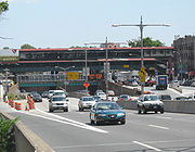 The Grand Central Parkway passes through the Kew Gardens Interchange
, where it connects with the Van Wyck Expressway (Interstate 678), Jackie Robinson Parkway
, Queens Boulevard
(NY 25); and Union Turnpike.
The Grand Central Parkway has a few unique distinctions. First, it is apparently the only parkway in New York City to carry an elliptical black-on-white design for its trailblazer. Parkways throughout The Bronx
, Manhattan
, and Staten Island
use the state-standard design, while the Belt system parkways use a modified version of the Long Island regional parkway shield with the Montauk Point Lighthouse
logo. Second, it is one of the few parkways in the state to allow truck traffic to any extent. The section shared with Interstate 278 allows for small trucks—larger ones still cannot pass under the intentionally-designed low underpasses. They have to travel on Astoria Boulevard
, the local service road, to reach the bridge.
Grand Central Parkway is not related in any way to Grand Central Terminal
.
.
|-
|Astoria
|0.00
|45
|31st Street, Astoria Boulevard
|
|-
|rowspan=2|Astoria, Woodside
, East Elmhurst
|0.80
|4
|
|
|-
|colspan=4 align="center"|East end of I-278 overlap
|-
|rowspan=4|East Elmhurst
|1.34
|5
|Astoria Boulevard east, 82nd Street - Marine Air Terminal
, Terminal A
|Exit Here for Delta Shuttle Flights to Boston, Chicago and Washington, DC
|-
|2.26
|6
|94th Street - Terminal B, parking
|Westbound exit is part of exit 7
|-
|2.51
|7
|LaGuardia Airport
Terminals B, C, and D
|
|-
|3.55
|8
|111th Street
|Eastbound exit only
|-
|rowspan=3|Corona
|rowspan=2|3.79
|9E
|
|
|-
|9W
|
|Westbound exit and eastbound entrance
|-
|
|9P
|Flushing Meadows-Corona Park
, Tennis Center
|Westbound exit and entrance
|-
|Corona, Forest Hills
|5.10
|10
|
|Signed as exits 10W (west) and 10E (east)
|-
|rowspan=2|Forest Hills
|5.94
|11
|69th Road, Jewel Avenue
|Signed as exits 11W (west) and 11E (east) westbound
|-
|6.50
|12
|
|Eastbound exit only
|-
|rowspan=2|Forest Hills, Kew Gardens
, Kew Gardens Hills
, Briarwood
|
|13W
|
|
|-
|7.19
|13
|
|Eastbound exit and westbound entrance
|-
|rowspan=2|Kew Gardens Hills, Briarwood
|7.53
|14
|Union Turnpike
, Main Street
|Eastbound exit and westbound entrance
|-
|
|15
|
|Westbound exit and eastbound entrance
|-
|rowspan=2|Briarwood, Jamaica Hills, Hillcrest
|8.11
|16
|Parsons Boulevard, 164th Street
|Eastbound exit only
|-
|
|17
|168th Street
|Westbound exit only
|-
|Jamaica Hills, Hillcrest, Jamaica Estates
|9.13
|18
|Utopia Parkway
|No westbound exit
|-
|Hillcrest, Jamaica Estates, Holliswood
(Terrace Heights)
|9.83
|19
|188th Street
|
|-
|Holliswood (Terrace Heights), Fresh Meadows
, Queens Village
|10.57
10.86
|20
|Francis Lewis Boulevard
|Signed as exits 20B (south) and 20A (north)
|-
|Queens Village, Hollis Hills
|11.10
|21S-N
|
|
|-
|Bellerose
, Oakland Gardens
|11.93
|22
|Union Turnpike
|Westbound exit is part of exit 23
|-
|Bellerose, Oakland Gardens, Douglaston
, Glen Oaks
|12.56
|23S-N
|
|
|-
|rowspan=2|Glen Oaks, Little Neck
|13.67
|24
|Little Neck Parkway
|
|-
|14.61
|
|
|Continuation into Nassau County
Parkway
The term parkway has several distinct principal meanings and numerous synonyms around the world, for either a type of landscaped area or a type of road.Type of landscaped area:...
that stretches from the RFK-Triborough Bridge in New York City
New York City
New York is the most populous city in the United States and the center of the New York Metropolitan Area, one of the most populous metropolitan areas in the world. New York exerts a significant impact upon global commerce, finance, media, art, fashion, research, technology, education, and...
to Nassau County
Nassau County, New York
Nassau County is a suburban county on Long Island, east of New York City in the U.S. state of New York, within the New York Metropolitan Area. As of the 2010 census, the population was 1,339,532...
on Long Island
Long Island
Long Island is an island located in the southeast part of the U.S. state of New York, just east of Manhattan. Stretching northeast into the Atlantic Ocean, Long Island contains four counties, two of which are boroughs of New York City , and two of which are mainly suburban...
. At the Queens-Nassau border, it becomes the Northern State Parkway
Northern State Parkway
The Northern State Parkway is a long limited-access state parkway on Long Island in the U.S. state of New York. The western terminus is at the Queens-Nassau County line, where the parkway continues westward into New York City as the Grand Central Parkway...
, which runs across the northern part of Long Island through Nassau County and into Suffolk
Suffolk County, New York
Suffolk County is a county located in the U.S. state of New York on the eastern portion of Long Island. As of the 2010 census, the population was 1,493,350. It was named for the county of Suffolk in England, from which its earliest settlers came...
County, where it ends in Hauppauge
Hauppauge, New York
Hauppauge is a hamlet and CDP in the Town of Islip and the Town of Smithtown in Suffolk County, New York, United States. The population of the CDP was 20,100 at the time of the 2000 census....
. The westernmost stretch (from the Triborough Bridge to exit 4) also carries a short stretch of Interstate 278. The parkway runs through Queens
Queens
Queens is the easternmost of the five boroughs of New York City. The largest borough in area and the second-largest in population, it is coextensive with Queens County, an administrative division of New York state, in the United States....
and passes the Cross Island Parkway
Cross Island Parkway
Cross Island Parkway, also known as the 100th Infantry Division Parkway, is a parkway within New York State. The parkway is a part of the Belt Parkway system that runs along the perimeter of the borough of Queens in New York City...
, Long Island Expressway, LaGuardia Airport
LaGuardia Airport
LaGuardia Airport is an airport located in the northern part of Queens County on Long Island in the City of New York. The airport is located on the waterfront of Flushing Bay and Bowery Bay, and borders the neighborhoods of Astoria, Jackson Heights and East Elmhurst. The airport was originally...
and Citi Field, home of the New York Mets
New York Mets
The New York Mets are a professional baseball team based in the borough of Queens in New York City, New York. They belong to Major League Baseball's National League East Division. One of baseball's first expansion teams, the Mets were founded in 1962 to replace New York's departed National League...
. The North Shore Towers
North Shore Towers
The North Shore Towers and Country Club is a three building residential complex located mostly in Glen Oaks, Queens along the Grand Central Parkway. It is on the border of Queens and Nassau County. A small part of the complex crosses the border and is in the Village of Lake Success...
is situated on the parkway on the Queens-side along the Nassau County border. The parkway is designated New York State Route 907M, an unsigned reference route.
The Grand Central Parkway was first planned in 1922, as a connection between Queens Boulevard
Queens Boulevard
Queens Boulevard is a major thoroughfare in the New York City boroughs of Manhattan and Queens connecting communities from Midtown Manhattan to Jamaica...
and Nassau County
Nassau County, New York
Nassau County is a suburban county on Long Island, east of New York City in the U.S. state of New York, within the New York Metropolitan Area. As of the 2010 census, the population was 1,339,532...
, helping city dwellers reach Jones Beach
Jones Beach State Park
Jones Beach State Park is a state park of the U.S. state of New York. It is located in southern Nassau County, in the hamlet of Wantagh, on Jones Beach Island, a barrier island linked to Long Island by the Meadowbrook State Parkway, Wantagh State Parkway and Ocean Parkway .The park is renowned for...
more easily. The original section is a parallel route to the pre-existing Union Turnpike
Union Turnpike (New York)
Union Turnpike is a thoroughfare stretching across central and eastern Queens in New York City. It runs from Myrtle Avenue in Glendale to Marcus Avenue in North New Hyde Park, about a mile into Nassau County, New York. Initially designed as a toll road, it takes a straight-arrow path from Kew...
, which was a congested street. Construction for the Parkway began in 1931, and the parkway was widened in 1961 in preparation for the 1964 New York World's Fair
1964 New York World's Fair
The 1964/1965 New York World's Fair was the third major world's fair to be held in New York City. Hailing itself as a "universal and international" exposition, the fair's theme was "Peace Through Understanding," dedicated to "Man's Achievement on a Shrinking Globe in an Expanding Universe";...
in Flushing Meadows-Corona Park
Flushing Meadows-Corona Park
Flushing Meadows-Corona Park, often referred to as Flushing Meadow Park, Flushing Meadows Park or Flushing Meadows, is a public park in New York City. It contains the USTA Billie Jean King National Tennis Center, the current venue for the U.S...
.
Kew Gardens Interchange
The Kew Gardens Interchange is a complex junction in Kew Gardens, in the center of the New York City borough of Queens.-Description:The Kew Gardens Interchange is located roughly midway between LaGuardia Airport and John F. Kennedy International Airport...
, where it connects with the Van Wyck Expressway (Interstate 678), Jackie Robinson Parkway
Jackie Robinson Parkway
The Jackie Robinson Parkway is a parkway in the New York City boroughs of Brooklyn and Queens. The western terminus of the parkway is at Jamaica Avenue in the Brooklyn neighborhood of East New York. It runs through Highland Park, along the north side of Ridgewood Reservoir, and through Forest Park...
, Queens Boulevard
Queens Boulevard
Queens Boulevard is a major thoroughfare in the New York City boroughs of Manhattan and Queens connecting communities from Midtown Manhattan to Jamaica...
(NY 25); and Union Turnpike.
The Grand Central Parkway has a few unique distinctions. First, it is apparently the only parkway in New York City to carry an elliptical black-on-white design for its trailblazer. Parkways throughout The Bronx
The Bronx
The Bronx is the northernmost of the five boroughs of New York City. It is also known as Bronx County, the last of the 62 counties of New York State to be incorporated...
, Manhattan
Manhattan
Manhattan is the oldest and the most densely populated of the five boroughs of New York City. Located primarily on the island of Manhattan at the mouth of the Hudson River, the boundaries of the borough are identical to those of New York County, an original county of the state of New York...
, and Staten Island
Staten Island
Staten Island is a borough of New York City, New York, United States, located in the southwest part of the city. Staten Island is separated from New Jersey by the Arthur Kill and the Kill Van Kull, and from the rest of New York by New York Bay...
use the state-standard design, while the Belt system parkways use a modified version of the Long Island regional parkway shield with the Montauk Point Lighthouse
Montauk Point Lighthouse
The Montauk Point Light is a lighthouse located in Montauk Point State Park at the easternmost point of Long Island, in the Town of East Hampton, Suffolk County, New York...
logo. Second, it is one of the few parkways in the state to allow truck traffic to any extent. The section shared with Interstate 278 allows for small trucks—larger ones still cannot pass under the intentionally-designed low underpasses. They have to travel on Astoria Boulevard
Astoria Boulevard
Astoria Boulevard is an important east-west commercial street in northwestern Queens, New York City. It runs from 21st Street and Main Avenue near the East River to the World's Fair Marina on Flushing Bay, where it merges with Northern Boulevard....
, the local service road, to reach the bridge.
Grand Central Parkway is not related in any way to Grand Central Terminal
Grand Central Terminal
Grand Central Terminal —often incorrectly called Grand Central Station, or shortened to simply Grand Central—is a terminal station at 42nd Street and Park Avenue in Midtown Manhattan in New York City, United States...
.
Exit list
The entire route is in QueensQueens
Queens is the easternmost of the five boroughs of New York City. The largest borough in area and the second-largest in population, it is coextensive with Queens County, an administrative division of New York state, in the United States....
.
|-
|Astoria
Astoria, Queens
Astoria is a neighborhood in the northwestern corner of the borough of Queens in New York City. Located in Community Board 1, Astoria is bounded by the East River and is adjacent to three other Queens neighborhoods: Long Island City, Sunnyside , and Woodside...
|0.00
|45
|31st Street, Astoria Boulevard
|
|-
|rowspan=2|Astoria, Woodside
Woodside, Queens
Woodside is a neighborhood in the western portion of the New York City borough of Queens. It is bordered on the south by Maspeth, on the north by Astoria, on the west by Sunnyside and on the east by Elmhurst and Jackson Heights. Some areas are widely residential and very quiet, while others are...
, East Elmhurst
East Elmhurst, Queens
East Elmhurst is a culturally diverse area in New York City, in the northwest of the borough of Queens. It is located north of Jackson Heights and Corona and is bounded on the east and north by Flushing Bay. Residents are mostly moderate-income families, but there are also low-income areas. It...
|0.80
|4
|
|
|-
|colspan=4 align="center"|East end of I-278 overlap
|-
|rowspan=4|East Elmhurst
|1.34
|5
|Astoria Boulevard east, 82nd Street - Marine Air Terminal
Marine Air Terminal
-External links:*...
, Terminal A
|Exit Here for Delta Shuttle Flights to Boston, Chicago and Washington, DC
|-
|2.26
|6
|94th Street - Terminal B, parking
|Westbound exit is part of exit 7
|-
|2.51
|7
|LaGuardia Airport
LaGuardia Airport
LaGuardia Airport is an airport located in the northern part of Queens County on Long Island in the City of New York. The airport is located on the waterfront of Flushing Bay and Bowery Bay, and borders the neighborhoods of Astoria, Jackson Heights and East Elmhurst. The airport was originally...
Terminals B, C, and D
|
|-
|3.55
|8
|111th Street
|Eastbound exit only
|-
|rowspan=3|Corona
Corona, Queens
Corona is a densely-populated neighborhood in the former Township of Newtown in the borough of Queens in New York City, New York, United States...
|rowspan=2|3.79
|9E
|
|
|-
|9W
|
|Westbound exit and eastbound entrance
|-
|
|9P
|Flushing Meadows-Corona Park
Flushing Meadows-Corona Park
Flushing Meadows-Corona Park, often referred to as Flushing Meadow Park, Flushing Meadows Park or Flushing Meadows, is a public park in New York City. It contains the USTA Billie Jean King National Tennis Center, the current venue for the U.S...
, Tennis Center
|Westbound exit and entrance
|-
|Corona, Forest Hills
Forest Hills, Queens
Forest Hills is a neighborhood in the borough of Queens in New York City, New York, United States.-Neighborhood:The neighborhood is home to upper-middle class residents, of whom the wealthier residents often live in the neighborhood's Forest Hills Gardens area...
|5.10
|10
|
|Signed as exits 10W (west) and 10E (east)
|-
|rowspan=2|Forest Hills
|5.94
|11
|69th Road, Jewel Avenue
|Signed as exits 11W (west) and 11E (east) westbound
|-
|6.50
|12
|
|Eastbound exit only
|-
|rowspan=2|Forest Hills, Kew Gardens
Kew Gardens, Queens
Kew Gardens is a triangular-shaped neighborhood in central Queens bounded to the north by the Jackie Robinson Parkway , to the east by Van Wyck Expressway and 131st Street, to the south by Hillside Avenue, and to the west by Park Lane, Abingdon Road and 118th Street...
, Kew Gardens Hills
Kew Gardens Hills, Queens
Kew Gardens Hills, also sometimes incorrectly referred to as Kew Garden Hills, is a one-square mile sub-neighborhood of Flushing in the New York City borough of Queens. The western border is Flushing Meadows-Corona Park, on the north is Jewel Avenue, on the south is Union Turnpike and to the east...
, Briarwood
Briarwood, Queens
Briarwood is a neighborhood in the New York City borough of Queens. It is located northwest of Jamaica and roughly bounded by Queens Boulevard, Parsons Boulevard, Union Turnpike, and Hillside Avenue. The neighborhood is part of Queens Community Board 8. It is serviced by the IND Queens Boulevard...
|
|13W
|
|
|-
|7.19
|13
|
|Eastbound exit and westbound entrance
|-
|rowspan=2|Kew Gardens Hills, Briarwood
|7.53
|14
|Union Turnpike
Union Turnpike (New York)
Union Turnpike is a thoroughfare stretching across central and eastern Queens in New York City. It runs from Myrtle Avenue in Glendale to Marcus Avenue in North New Hyde Park, about a mile into Nassau County, New York. Initially designed as a toll road, it takes a straight-arrow path from Kew...
, Main Street
|Eastbound exit and westbound entrance
|-
|
|15
|
|Westbound exit and eastbound entrance
|-
|rowspan=2|Briarwood, Jamaica Hills, Hillcrest
Hillcrest, Queens
Hillcrest is a small residential neighborhood in the New York City borough of Queens. The neighborhood is located between Flushing and Jamaica. Its name derives from its location on the hills between Jamaica and Flushing. The neighborhood runs from Grand Central Parkway to 73rd Ave., between...
|8.11
|16
|Parsons Boulevard, 164th Street
|Eastbound exit only
|-
|
|17
|168th Street
|Westbound exit only
|-
|Jamaica Hills, Hillcrest, Jamaica Estates
Jamaica Estates, Queens
Jamaica Estates is a neighborhood located in the New York City borough of Queens. Within Queens Community District 8, Jamaica Estates is served by Queens Community Board 8 It is bounded by Union Turnpike to the north, Hillside Avenue to the south, Utopia Parkway and Homelawn Street to the west...
|9.13
|18
|Utopia Parkway
|No westbound exit
|-
|Hillcrest, Jamaica Estates, Holliswood
Holliswood, Queens
Holliswood is a neighborhood in the New York City borough of Queens. Holliswood is in east central Queens bounded by the Grand Central Parkway to the north, Francis Lewis Boulevard to the east, Hillside Avenue to the south and 188th Street on the west. The neighborhood is part of Queens Community...
(Terrace Heights)
|9.83
|19
|188th Street
|
|-
|Holliswood (Terrace Heights), Fresh Meadows
Fresh Meadows, Queens
Fresh Meadows is a residential neighborhood in northeastern section of the New York City borough of Queens.-Location:Fresh Meadows is located on the northeast side of Hillcrest, bordered to the east by Cunningham Park, to the south by Union Turnpike and St. John's University, and to the west by...
, Queens Village
Queens Village, Queens
Queens Village is mostly a residential neighborhood in the eastern part of the New York City borough of Queens.The Queens Village Post Office serves the ZIP codes of 11427 , 11428 , and 11429...
|10.57
10.86
|20
|Francis Lewis Boulevard
Francis Lewis Boulevard
Francis Lewis Boulevard is a boulevard in the New York City borough of Queens. The roadway is named for Francis Lewis, a Queens resident who was a signer of the United States Declaration of Independence.-Route description:...
|Signed as exits 20B (south) and 20A (north)
|-
|Queens Village, Hollis Hills
Hollis Hills, Queens
Hollis Hills is an affluent neighborhood in the north-east section of the borough of Queens in New York City. As with most neighborhoods in New York City its existence is not official nor its boundaries fixed but Springfield Boulevard is commonly taken at the eastern boundary, Grand Central Parkway...
|11.10
|21S-N
|
|
|-
|Bellerose
Bellerose, Queens
Bellerose, also called Bellerose Manor, is a neighborhood on the eastern edge of the New York City borough of Queens, near the border with Nassau County. It is sometimes referred to as Bellerose Manor, to distinguish it from the adjacent Bellerose Village and Bellerose Terrace in Nassau County,...
, Oakland Gardens
Oakland Gardens, Queens
Oakland Gardens is a neighborhood in the northern part of the New York City borough of Queens. The neighborhood is bounded to the north by 48th Avenue, to the east by Alley Pond Park, to the south by Union Turnpike, and to the west by Cunningham Park. Bayside is to the north, and Queens Village and...
|11.93
|22
|Union Turnpike
Union Turnpike (New York)
Union Turnpike is a thoroughfare stretching across central and eastern Queens in New York City. It runs from Myrtle Avenue in Glendale to Marcus Avenue in North New Hyde Park, about a mile into Nassau County, New York. Initially designed as a toll road, it takes a straight-arrow path from Kew...
|Westbound exit is part of exit 23
|-
|Bellerose, Oakland Gardens, Douglaston
Douglaston, Queens
Douglaston, population 14,168 , is a community in the New York City borough of Queens. Douglaston comprises six distinct neighborhoods: Doug Bay, Douglas Manor, and Douglaston Hill, all located north of Northern Boulevard on the peninsula abutting Little Neck Bay; Douglaston Park, located between...
, Glen Oaks
Glen Oaks, Queens
Glen Oaks is a neighborhood in the easternmost portion of the New York City Borough of Queens. The neighborhood is part of Queens Community Board 13.-Location:...
|12.56
|23S-N
|
|
|-
|rowspan=2|Glen Oaks, Little Neck
Little Neck, Queens
Little Neck is a community in the northeast corner of Queens County, bordered on the north by Little Neck Bay and on the east by Great Neck in Nassau County. Due to this proximity to Nassau, Little Neck remains one of the most suburban-looking areas in New York City. The southern border is the...
|13.67
|24
|Little Neck Parkway
|
|-
|14.61
|
|
|Continuation into Nassau County
Nassau County, New York
Nassau County is a suburban county on Long Island, east of New York City in the U.S. state of New York, within the New York Metropolitan Area. As of the 2010 census, the population was 1,339,532...