

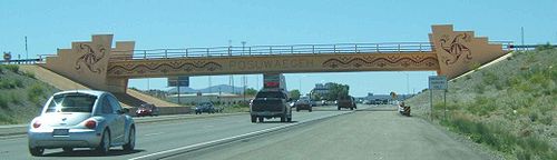
Pojoaque, New Mexico
Encyclopedia
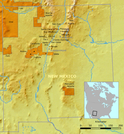
Pojoaque is a census-designated place
(CDP) in Santa Fe County
, New Mexico
, United States
. It is part of the Santa Fe, New Mexico
Metropolitan Statistical Area. The population was 1,261 at the 2000 census. Pojoaque and Pojoaque Pueblo are neighboring communities. Pojoaque Pueblo is an Indian Reservation
, and the town of Pojoaque is a collection of communities near the Pueblo
with people from various ethnic backgrounds.
-speaking Rio Grande
Pueblos, and a member of the Eight Northern Pueblos
. The Pueblo was settled around 500 AD, with the population peaking in the 15th and 16th centuries.
In the early 17th century the first Spanish mission San Francisco de Pojoaque was founded. During the Pueblo Revolt
of 1680, Pojoaque was abandoned, and was not resettled until about 1706. By 1712 the population had reached 79. In about 1900, a severe smallpox
epidemic caused the pueblo to be abandoned once again by 1912. In 1934, Pojoaque Pueblo was reoccupied, and became a federally-recognized Indian Reservation in 1936.
According to the United States Census Bureau
, the CDP has a total area of 2.9 square miles (7.5 km²), all of it land.
of 2000, there were 1,261 people, 493 households, and 332 families residing in the CDP. The population density
was 437.3 people per square mile (169.1/km²). There were 533 housing units at an average density of 184.8 per square mile (71.5/km²). The racial makeup of the CDP was 52.10% White, 0.56% African American, 17.37% Native American, 26.57% from other races
, and 3.41% from two or more races. Hispanic or Latino of any race were 62.17% of the population.
 There were 493 households out of which 38.3% had children under the age of 18 living with them, 46.7% were married couples
living together, 13.0% had a female householder with no husband present, and 32.5% were non-families. 26.6% of all households were made up of individuals and 6.9% had someone living alone who was 65 years of age or older. The average household size was 2.56 and the average family size was 3.10.
In the CDP the population was spread out with 28.9% under the age of 18, 9.3% from 18 to 24, 30.4% from 25 to 44, 23.3% from 45 to 64, and 8.1% who were 65 years of age or older. The median age was 34 years. For every 100 females there were 103.1 males. For every 100 females age 18 and over, there were 101.3 males.
The median income for a household in the CDP was $15,875, and the median income for a family was $24,719. Males had a median income of $19,830 versus $17,105 for females. The per capita income
for the CDP was $13,968. About 17.2% of families and 18.7% of the population were below the poverty line, including 23.4% of those under age 18 and 15.3% of those age 65 or over.
The Pueblo also operates the Cities of Gold Casino, and the Poeh Museum
.
Census-designated place
A census-designated place is a concentration of population identified by the United States Census Bureau for statistical purposes. CDPs are delineated for each decennial census as the statistical counterparts of incorporated places such as cities, towns and villages...
(CDP) in Santa Fe County
Santa Fe County, New Mexico
-2010:Whereas according to the 2010 U.S. Census Bureau:*76.2% White*0.9% Black*3.1% Native American*1.2% Asian*0.1% Native Hawaiian or Pacific Islander*3.6% Two or more races*14.9% Other races*50.6% Hispanic or Latino -2000:...
, New Mexico
New Mexico
New Mexico is a state located in the southwest and western regions of the United States. New Mexico is also usually considered one of the Mountain States. With a population density of 16 per square mile, New Mexico is the sixth-most sparsely inhabited U.S...
, United States
United States
The United States of America is a federal constitutional republic comprising fifty states and a federal district...
. It is part of the Santa Fe, New Mexico
Santa Fe, New Mexico
Santa Fe is the capital of the U.S. state of New Mexico. It is the fourth-largest city in the state and is the seat of . Santa Fe had a population of 67,947 in the 2010 census...
Metropolitan Statistical Area. The population was 1,261 at the 2000 census. Pojoaque and Pojoaque Pueblo are neighboring communities. Pojoaque Pueblo is an Indian Reservation
Indian reservation
An American Indian reservation is an area of land managed by a Native American tribe under the United States Department of the Interior's Bureau of Indian Affairs...
, and the town of Pojoaque is a collection of communities near the Pueblo
Pueblo
Pueblo is a term used to describe modern communities of Native Americans in the Southwestern United States of America. The first Spanish explorers of the Southwest used this term to describe the communities housed in apartment-like structures built of stone, adobe mud, and other local material...
with people from various ethnic backgrounds.
History
Pojoaque Pueblo is one of the six TewaTewa language
Tewa is a Kiowa–Tanoan language spoken by Pueblo people, mostly in the Rio Grande valley in New Mexico north of Santa Fe. The 1980 census counted 1,298 speakers, almost all of whom are bilingual in English...
-speaking Rio Grande
Rio Grande
The Rio Grande is a river that flows from southwestern Colorado in the United States to the Gulf of Mexico. Along the way it forms part of the Mexico – United States border. Its length varies as its course changes...
Pueblos, and a member of the Eight Northern Pueblos
Eight Northern Pueblos
The Eight Northern Pueblos of New Mexico are Taos, Picuris, Santa Clara, San Juan, San Ildefonso, Nambé, Pojoaque, and Tesuque.Taos and Picuris are Tiwa-speaking pueblos; the rest speak Tewa. Tiwa and Tewa are closely related languages of the Kiowa Tanoan language family...
. The Pueblo was settled around 500 AD, with the population peaking in the 15th and 16th centuries.
In the early 17th century the first Spanish mission San Francisco de Pojoaque was founded. During the Pueblo Revolt
Pueblo Revolt
The Pueblo Revolt of 1680, or Popé's Rebellion, was an uprising of several pueblos of the Pueblo people against Spanish colonization of the Americas in the province of Santa Fe de Nuevo México.-Background:...
of 1680, Pojoaque was abandoned, and was not resettled until about 1706. By 1712 the population had reached 79. In about 1900, a severe smallpox
Smallpox
Smallpox was an infectious disease unique to humans, caused by either of two virus variants, Variola major and Variola minor. The disease is also known by the Latin names Variola or Variola vera, which is a derivative of the Latin varius, meaning "spotted", or varus, meaning "pimple"...
epidemic caused the pueblo to be abandoned once again by 1912. In 1934, Pojoaque Pueblo was reoccupied, and became a federally-recognized Indian Reservation in 1936.
Geography
Pojoaque is located at 35°53′26"N 106°0′34"W (35.890581, -106.009511).According to the United States Census Bureau
United States Census Bureau
The United States Census Bureau is the government agency that is responsible for the United States Census. It also gathers other national demographic and economic data...
, the CDP has a total area of 2.9 square miles (7.5 km²), all of it land.
Demographics
As of the censusCensus
A census is the procedure of systematically acquiring and recording information about the members of a given population. It is a regularly occurring and official count of a particular population. The term is used mostly in connection with national population and housing censuses; other common...
of 2000, there were 1,261 people, 493 households, and 332 families residing in the CDP. The population density
Population density
Population density is a measurement of population per unit area or unit volume. It is frequently applied to living organisms, and particularly to humans...
was 437.3 people per square mile (169.1/km²). There were 533 housing units at an average density of 184.8 per square mile (71.5/km²). The racial makeup of the CDP was 52.10% White, 0.56% African American, 17.37% Native American, 26.57% from other races
Race (United States Census)
Race and ethnicity in the United States Census, as defined by the Federal Office of Management and Budget and the United States Census Bureau, are self-identification data items in which residents choose the race or races with which they most closely identify, and indicate whether or not they are...
, and 3.41% from two or more races. Hispanic or Latino of any race were 62.17% of the population.
Marriage
Marriage is a social union or legal contract between people that creates kinship. It is an institution in which interpersonal relationships, usually intimate and sexual, are acknowledged in a variety of ways, depending on the culture or subculture in which it is found...
living together, 13.0% had a female householder with no husband present, and 32.5% were non-families. 26.6% of all households were made up of individuals and 6.9% had someone living alone who was 65 years of age or older. The average household size was 2.56 and the average family size was 3.10.
In the CDP the population was spread out with 28.9% under the age of 18, 9.3% from 18 to 24, 30.4% from 25 to 44, 23.3% from 45 to 64, and 8.1% who were 65 years of age or older. The median age was 34 years. For every 100 females there were 103.1 males. For every 100 females age 18 and over, there were 101.3 males.
The median income for a household in the CDP was $15,875, and the median income for a family was $24,719. Males had a median income of $19,830 versus $17,105 for females. The per capita income
Per capita income
Per capita income or income per person is a measure of mean income within an economic aggregate, such as a country or city. It is calculated by taking a measure of all sources of income in the aggregate and dividing it by the total population...
for the CDP was $13,968. About 17.2% of families and 18.7% of the population were below the poverty line, including 23.4% of those under age 18 and 15.3% of those age 65 or over.
Attractions
Pojoaque Pueblo opened their new Buffalo Thunder resort http://www.buffalothunderresort.com/ in August 2008, New Mexico's largest and most expensive resort. The estimated cost for the resort project in 2004 was $250 million.The Pueblo also operates the Cities of Gold Casino, and the Poeh Museum
Poeh Museum
The Poeh Museum, founded by Pojoaque Pueblo in 1988, is devoted to the arts and culture of the Pueblo people, especially the Tewas of northern New Mexico. In Tewa, “Poeh” means pathway...
.