

Cannon Street (Hamilton, Ontario)
Encyclopedia
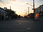
Cannon Street, is a Lower City collector road in Hamilton, Ontario
Hamilton, Ontario
Hamilton is a port city in the Canadian province of Ontario. Conceived by George Hamilton when he purchased the Durand farm shortly after the War of 1812, Hamilton has become the centre of a densely populated and industrialized region at the west end of Lake Ontario known as the Golden Horseshoe...
, Canada
Canada
Canada is a North American country consisting of ten provinces and three territories. Located in the northern part of the continent, it extends from the Atlantic Ocean in the east to the Pacific Ocean in the west, and northward into the Arctic Ocean...
. It starts off at Queen Street North
Queen Street (Hamilton, Ontario)
Queen Street, is a Lower City arterial road in Hamilton, Ontario, Canada. It starts off at Beckett Drive, a mountain-access road in the city and is a two-way street up to Herkimer Street and a one-way street the rest of the way north up to the Canadian National Railway Yard where the road turns...
as a one-way street (Westbound) up to Sherman Avenue North
Sherman Avenue (Hamilton, Ontario)
Sherman Avenue, is a Lower City collector road in Hamilton, Ontario, Canada. It starts off at the base of the Niagara Escarpment just south of Cumberland Avenue and is a one-way street northbound that cuts through the city's North End industrial neighbourhood and ends at Ship Street, the site of...
where it then switches over to a two-way street
Two-way street
A two-way street is a street that allows vehicles to travel in both directions. On most two-way streets, especially main streets, a line is painted down the middle of the road to remind drivers to stay on their side of the road. Sometimes one portion of a street is two-way, the other portion one-way...
the rest of the way Eastward and ends just past Kenilworth Avenue North
Kenilworth Avenue (Hamilton, Ontario)
Kenilworth Avenue, is a Lower City arterial road in Hamilton, Ontario, Canada. It starts off at the Kenilworth Traffic Circle and Kenilworth Access, a mountain-access road at the base of the Niagara Escarpment and is a two-way street throughout stretching northward through the city's North End...
on Barons Avenue and merges with Britannia Avenue, a street that runs parallel with Cannon Street from Ottawa Street North
Ottawa Street (Hamilton, Ontario)
Ottawa street, is a Lower City arterial road in Hamilton, Ontario, Canada. It starts off at Lawrence Road at the base of the Niagara Escarpment and is a two-way street throughout cutting through the Delta and Crown Point neighbourhoods and the City's North End industrial neighbourhood...
to Barons Avenue.
History
Bay Street (Hamilton)
Bay Street is a Lower City arterial road in Hamilton, Ontario, Canada. It starts at Inglewood Drive, just South of Aberdeen Avenue, as a collector road with only two lanes, then eventually becomes a six lane thoroughfare at its peak. Bay Street also passes through Downtown Hamilton, where many...
and James Streets
James Street (Hamilton, Ontario)
James Street is a Lower City arterial road in Hamilton, Ontario, Canada. It starts off at the base of the Niagara Escarpment from James Mountain Road, a mountain-access road in the city, originally was a one-way street going south throughout but now has sections of it that are two-way...
was called Miles Street. The origins of the Cannon street name remains a mystery for local historians. Cannon Street today at Brian Timmis/ Ivor Wynne Stadium location is also known as Bernie Faloney Way which is named after the quarterback
Quarterback
Quarterback is a position in American and Canadian football. Quarterbacks are members of the offensive team and line up directly behind the offensive line...
who played for the local CFL
Canadian Football League
The Canadian Football League or CFL is a professional sports league located in Canada. The CFL is the highest level of competition in Canadian football, a form of gridiron football closely related to American football....
team, Hamilton Ti-Cats, between the years of 1957-64.
On 24 May 1909 a Coney Island
Coney Island
Coney Island is a peninsula and beach on the Atlantic Ocean in southern Brooklyn, New York, United States. The site was formerly an outer barrier island, but became partially connected to the mainland by landfill....
-type amusement park
Amusement park
thumb|Cinderella Castle in [[Magic Kingdom]], [[Disney World]]Amusement and theme parks are terms for a group of entertainment attractions and rides and other events in a location for the enjoyment of large numbers of people...
was opened in Hamilton. It was known as Maple Leaf Park and was bounded by Barton Street
Barton Street (Hamilton, Ontario)
Barton Street is an arterial road in the Lower City of Hamilton, Ontario, Canada. It's also the longest street in the city. It starts off at the Western end of town at Locke Street North and is a two-way street that stretches eastward through a number of different and varied communities in the...
(north), Ottawa Street
Ottawa Street (Hamilton, Ontario)
Ottawa street, is a Lower City arterial road in Hamilton, Ontario, Canada. It starts off at Lawrence Road at the base of the Niagara Escarpment and is a two-way street throughout cutting through the Delta and Crown Point neighbourhoods and the City's North End industrial neighbourhood...
(east), Cannon Street (south), Rosslyn Avenue (west). It failed to attract enough visitors to keep the gates open and only lasted a year. Investors of the Park sold the land to local real estate speculators for $25,000 interested in the property because the land itself was a valuable commodity in the booming East Hamilton market.
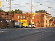
Landmarks
- Hess Street Elementary School
- Railway Street
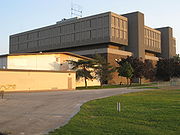
- Sir John A. Macdonald Secondary SchoolSir John A. Macdonald Secondary School (Hamilton)Sir John A. Macdonald Secondary is the largest high school in the Hamilton-Wentworth District School Board. The school opened in 1970 and presently has an enrollment of 1250 students. The student body represents over 80 countries of origin and has over 50 different native languages. The school has...
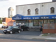
- Tan Thanh Supermarket Inc. (VietnameseVietnamese peopleThe Vietnamese people are an ethnic group originating from present-day northern Vietnam and southern China. They are the majority ethnic group of Vietnam, comprising 86% of the population as of the 1999 census, and are officially known as Kinh to distinguish them from other ethnic groups in Vietnam...
) - T & H Auto Electric Ltd., building
- Jamesville, which is shared by the ItalianItalian peopleThe Italian people are an ethnic group that share a common Italian culture, ancestry and speak the Italian language as a mother tongue. Within Italy, Italians are defined by citizenship, regardless of ancestry or country of residence , and are distinguished from people...
& PortuguesePortuguese peopleThe Portuguese are a nation and ethnic group native to the country of Portugal, in the west of the Iberian peninsula of south-west Europe. Their language is Portuguese, and Roman Catholicism is the predominant religion....
communities of Hamilton - Mixed Media, (building)
- site of the old Tivoli Theatre
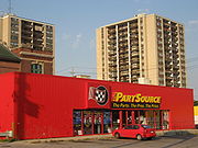
- Auto Part Source- (discount auto parts centre)
- Active Green + Ross: Complete Tire & Auto Centre
- Firth Brothers Ltd. (5-storey factory building)
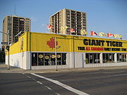
- Giant Tiger (All-Canadian family discount store)
- McLaren Park
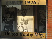
- United Trophy Mfg. (since 1926)
- Good Shepherd Centre
- 134 Mary Street Building (Cannon Knitting Mills Limited)
- ChevroletChevroletChevrolet , also known as Chevy , is a brand of vehicle produced by General Motors Company . Founded by Louis Chevrolet and ousted GM founder William C. Durant on November 3, 1911, General Motors acquired Chevrolet in 1918...
City, (car dealership) - Beasley ParkBeasley Park (Hamilton, Ontario)Beasley Park is a park in the Lower City of Hamilton, Ontario, Canada and named after Richard Beasley, , a soldier, political figure, farmer and businessman in Upper Canada. Richard Beasley was one of Hamilton's first settlers who came to Canada from New York in 1777...
- Beasley Park Community Centre
- Paper Fibres Inc., (company)
- Wellington Tavern
- Canada Post Corporation: Hamilton letter carrier depot 1
- St. Brigids Elementary School
- Hamilton Cab 777-7777 (headquarters)
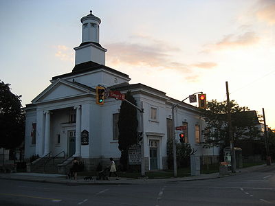
- Wentworth Baptist Church
- Hamilton Stirton TS Electrical complex
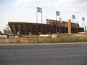
- Brian Timmis StadiumBrian Timmis StadiumBrian Timmis Stadium is a stadium in Hamilton, Ontario. The stadium was built in 1968, and seats 5,000 people. The stadium currently hosts association football teams Hamilton Croatia, a Canadian Soccer League club, and the Hamilton Avalanche, a club that plays in the W-League of the United Soccer...
,- Ivor Wynne StadiumIvor Wynne StadiumIvor Wynne Stadium is a Canadian football stadium located at the corner of Balsam and Beechwood Avenues, two blocks west of Gage Avenue North in Hamilton, Ontario, Canada...
(right behind Brian Timmis Stadium)
- Ivor Wynne Stadium
- Scott Park Secondary School
- Scott Park Arena
- Canadian Pacific railway line
- Holy Name of Jesus Elementary School
- Gospel Hall, (church)
- Ottawa Street Shopping DistrictOttawa Street (Hamilton, Ontario)Ottawa street, is a Lower City arterial road in Hamilton, Ontario, Canada. It starts off at Lawrence Road at the base of the Niagara Escarpment and is a two-way street throughout cutting through the Delta and Crown Point neighbourhoods and the City's North End industrial neighbourhood...
- "Textile District" - Laidlaw Memorial United Church
- Around the Bay Road RaceAround the Bay Road RaceAround the Bay Road Race, is the oldest long distance road race in North America, held in Hamilton, Ontario since 1894, nearly three years before the Boston Marathon, though is not marathon length...
5 kilometre marker - Queen Mary Elementary School
- Holy Family Roman Catholic Church
- Holy Family Elementary School (right behind Holy Family R.C. Church)
- Cannon Street ends and merges here with Britannia Avenue
- Andrew Warburton Park
Communities
- StrathconaStrathcona (Hamilton, Ontario)The Strathcona Neighbourhood is located west of downtown Hamilton, Ontario and is bounded by Highway 403, the CNR rail line, Queen Street York Boulevard and Main Street. The neighbourhood is also intersected by several other major street arteries: Dundurn Street , Locke Street, and King Street West...
- Central - The financial center of Hamilton, OntarioHamilton, OntarioHamilton is a port city in the Canadian province of Ontario. Conceived by George Hamilton when he purchased the Durand farm shortly after the War of 1812, Hamilton has become the centre of a densely populated and industrialized region at the west end of Lake Ontario known as the Golden Horseshoe...
- Beasley
- Landsdale
- Gibson
- Stipeley
- Crown Point West
- Crown Point East
- Homeside
Roads that are parallel with Cannon Street
- Burlington StreetBurlington StreetBurlington Street is a road in Hamilton, Ontario, stretching along the south shore of Hamilton Harbour in Lake Ontario. Burlington Street has four different statuses along the route. In its western terminus, it is a collector route ending at Bay Street North...
, West/East - Barton StreetBarton Street (Hamilton, Ontario)Barton Street is an arterial road in the Lower City of Hamilton, Ontario, Canada. It's also the longest street in the city. It starts off at the Western end of town at Locke Street North and is a two-way street that stretches eastward through a number of different and varied communities in the...
, West/East - Cannon Street, West/East
- Wilson StreetWilson Street (Hamilton, Ontario)Wilson Street is a Lower City collector road in Hamilton, Ontario, Canada. It starts off at James Street North and works its way East and ends at Sherman Avenue North...
- King William StreetKing William Street (Hamilton, Ontario)400px|thumb|Theatre AquariusKing William Street is a Lower City collector road in Hamilton, Ontario, Canada. It starts off at the western-end at James Street North and is a one-way street until Mary Street, where it becomes a two-way street that ends at Wentworth Street North.-History:In 1922,...
- King Street, West/East
- Main StreetMain Street (Hamilton, Ontario)Main Street, is a Lower City arterial road in Hamilton, Ontario, Canada. It starts east of Wilson Street in Ancaster at White Chapel Cemetery as a two-way street and switches over to a one-way street at Paradise Road South, in Westdale, where it continues up to the Delta where it once again...
, West/East; - Queenston RoadQueenston Road (Hamilton, Ontario)Queenston Road is a two-way Lower City arterial road in Hamilton, Ontario, Canada. Also known as Highway 8. It starts off at the Queenston Traffic Circle and travels eastward over the Red Hill Valley Parkway and into Stoney Creek past the Fruitland and Winona communities and into Niagara Region as... - Jackson StreetJackson Street (Hamilton, Ontario)Jackson Street, is a Lower City collector road in Hamilton, Ontario, Canada. It starts off West of Locke Street South at Jackson Playground as a one-way street up to Queen Street South where it then switches over to a two-way street and is interrupted at Bay Street South the site of the Hamilton...
, East - Hunter StreetHunter Street (Hamilton, Ontario)Hunter Street is a Lower City collector road in Hamilton, Ontario, Canada. It is a one-way street that starts West of Locke Street at Hill Street Park and ends two blocks East of Victoria Avenue at Emerald Street...
, West/East - Augusta StreetAugusta Street (Hamilton, Ontario)Augusta Street is a Lower City collector road in Hamilton, Ontario, Canada. A two-way collector road that starts off on James Street South and ends 4-blocks East at Shamrock Park just past Walnut Street South.-History:thumb|Augusta Street, landmark...
- Charlton AvenueCharlton Avenue (Hamilton, Ontario)Charlton Avenue, is a Lower City collector road in Hamilton, Ontario, Canada. This collector road starts of just West of Dundurn Street as a one-way street up to James Street South where it then switches over to a two-way street the rest of the way eastward and ends at Wentworth Street South right...
, West/East - Aberdeen AvenueAberdeen Avenue (Hamilton, Ontario)Aberdeen Avenue is a Lower City arterial road in Hamilton, Ontario, Canada. It starts off just West of Longwood Road South and East of Highway 403 as a two-way thoroughfare up to Queen Street South where it then switches over to a one-way collector road to Bay Street South and then to another...
Niagara Escarpment (Mountain) Roads:
- Concession StreetConcession Street (Hamilton, Ontario)Concession Street is an Upper City arterial road in Hamilton, Ontario, Canada. It starts at Belvidere Avenue, just West of Sam Lawrence Park, and extends eastward past Mountain Drive Park on Upper Gage Avenue and ends shortly thereafter at East 43rd Street.Note: East of East 43rd Street the road...
- Queensdale Avenue West/ East
- Scenic Drive - Fennell AvenueFennell Avenue (Hamilton, Ontario)Fennell Avenue, is an Upper City arterial road in Hamilton, Ontario, Canada. It starts of just West Garth Street on the West mountain and is a two-way street throughout that extends eastward and ends at Mountain Brow Boulevard, a road that wraps around the edge of the Niagara Escarpment on...
, West/East - Sanatorium Road
- Mohawk RoadMohawk Road (Hamilton, Ontario)Mohawk Road, is an Upper City arterial road in Hamilton, Ontario, Canada. It is a two-way street throughout that starts just West of Highway 403 & Meadowlands and travels eastward linking up with the Lincoln M. Alexander Parkway. Mohawk Road east of Highway 403 resumes again in front of Iroquoia...
, West/East - Limeridge RoadLimeridge Road (Hamilton, Ontario)Limeridge Road is a two-way Upper City collector road in Hamilton, Ontario, Canada. It starts off just West of Garth Street/William McCulloch Park as Limeridge Court and cuts across the Hamilton mountain eastward running parallel with the Lincoln M...
West/East - Lincoln M. Alexander ParkwayLincoln M. Alexander ParkwayThe Lincoln Alexander Parkway, officially nicknamed "The Linc", is a municipal expressway in the Canadian city of Hamilton, Ontario. Located on the Hamilton mountain, atop the Niagara Escarpment...
- Mud Street, (Hamilton City Road 11) - Stone Church RoadStone Church Road (Hamilton, Ontario)Stone Church Road, is a two-way Upper City east-west arterial road in Hamilton, Ontario, Canada. It starts at Golf Links Road, just east of Meadowlands, and goes across the Escarpment and ends at Upper Mount Albion Road....
, West/East  ; Rymal Road, West/East
- Twenty Road
Roads that cross Cannon Street
Note: Listing of streets from West to East.- Queen StreetQueen Street (Hamilton, Ontario)Queen Street, is a Lower City arterial road in Hamilton, Ontario, Canada. It starts off at Beckett Drive, a mountain-access road in the city and is a two-way street up to Herkimer Street and a one-way street the rest of the way north up to the Canadian National Railway Yard where the road turns...
, North - Hess StreetHess Street (Hamilton, Ontario)Hess Street, is a Lower City collector road in Hamilton, Ontario, Canada. It starts off at the base of the Niagara Escarpment right before Aberdeen Avenue, and is a one-way street going north past the Durand and Central neighbourhoods. Between Main and King Street West is where you will find Hess...
, North - Bay StreetBay Street (Hamilton)Bay Street is a Lower City arterial road in Hamilton, Ontario, Canada. It starts at Inglewood Drive, just South of Aberdeen Avenue, as a collector road with only two lanes, then eventually becomes a six lane thoroughfare at its peak. Bay Street also passes through Downtown Hamilton, where many...
, North - MacNab StreetMacNab Street (Hamilton, Ontario)MacNab Street, is a Lower City collector road in Hamilton, Ontario, Canada. It starts in the Durand neighbourhood on Markland Street, as a one-way street going north to Bold Street, where it becomes two-way for one block until Hurst Place where it's cut off by a wall for the Hunter Street railway...
, North - James StreetJames Street (Hamilton, Ontario)James Street is a Lower City arterial road in Hamilton, Ontario, Canada. It starts off at the base of the Niagara Escarpment from James Mountain Road, a mountain-access road in the city, originally was a one-way street going south throughout but now has sections of it that are two-way...
, North - Hughson StreetHughson Street (Hamilton, Ontario)Hughson Street is a Lower City collector road in Hamilton, Ontario, Canada. It starts at Charlton Avenue East at St. Joseph's hospital and runs north to Haymarket Street in the downtown where it's cut off by the Hamilton GO Transit station. Up to this point it is a two-way street...
, North - John StreetJohn Street (Hamilton, Ontario)John Street, is a Lower City arterial road in Hamilton, Ontario, Canada. Originally it was known as Mountain Road or Ancaster Road. It starts off at the base of Arkledun Avenue, a Mountain-access road in the city, just east of St.Joseph's Hospital where it's a one-way street going north and tunnels...
, North - Catharine StreetCatharine Street (Hamilton, Ontario)Catharine Street, is a Lower City collector road in Hamilton, Ontario, Canada. It starts off at Charlton Avenue East at Woolverton Park in the Corktown neighbourhood as a one-way street , tunnels underneath the Hunter Street Railway bridge and stretches up to Barton Street East where it then turns...
, North - Ferguson AvenueFerguson Avenue (Hamilton, Ontario)Ferguson Avenue, is a Lower City collector road in Hamilton, Ontario, Canada. Is a two-way street throughout that starts off at the base of the Mountain on Foster Street. It's interrupted 3-blocks north at Corktown Park where Canadian Pacific Railway lines passes through it...
, North - Wellington StreetWellington Street (Hamilton, Ontario)Wellington Street, is a Lower City arterial road in Hamilton, Ontario, Canada. It starts off at Charlton Avenue East as a two-way street for only one block where it's then blocked off by the Corktown Park and a couple of Canadian National Railway lines that cut through it...
, North - Victoria AvenueVictoria Avenue (Hamilton, Ontario)Victoria Avenue, is a Lower City arterial road in Hamilton, Ontario, Canada. It starts off as a ramp and part of a Mountain-access road, the Claremont Access, on Hunter Street East in the Stinson neighbourhood...
, North - Wentworth StreetWentworth Street (Hamilton, Ontario)Wentworth Street, is a Lower City arterial road in Hamilton, Ontario, Canada. It starts off at the base of the Niagara Escarpment on Charlton Avenue East just before the CP lines as a two-way street for 2-blocks up past Cumberland Avenue up to Rutherford Avenue where it then switches over to a...
, North - Sherman AvenueSherman Avenue (Hamilton, Ontario)Sherman Avenue, is a Lower City collector road in Hamilton, Ontario, Canada. It starts off at the base of the Niagara Escarpment just south of Cumberland Avenue and is a one-way street northbound that cuts through the city's North End industrial neighbourhood and ends at Ship Street, the site of...
, North - Gage AvenueGage Avenue (Hamilton, Ontario)thumb|right|350px|Gage Park WaterfountainGage Avenue, is a Lower City arterial road in Hamilton, Ontario, Canada. It starts off at Lawrence Road at the base of the Niagara Escarpment at the south end of Gage Park...
, North - Ottawa StreetOttawa Street (Hamilton, Ontario)Ottawa street, is a Lower City arterial road in Hamilton, Ontario, Canada. It starts off at Lawrence Road at the base of the Niagara Escarpment and is a two-way street throughout cutting through the Delta and Crown Point neighbourhoods and the City's North End industrial neighbourhood...
, North - Kenilworth AvenueKenilworth Avenue (Hamilton, Ontario)Kenilworth Avenue, is a Lower City arterial road in Hamilton, Ontario, Canada. It starts off at the Kenilworth Traffic Circle and Kenilworth Access, a mountain-access road at the base of the Niagara Escarpment and is a two-way street throughout stretching northward through the city's North End...
, North