

Barton Street (Hamilton, Ontario)
Encyclopedia
Hamilton, Ontario
Hamilton is a port city in the Canadian province of Ontario. Conceived by George Hamilton when he purchased the Durand farm shortly after the War of 1812, Hamilton has become the centre of a densely populated and industrialized region at the west end of Lake Ontario known as the Golden Horseshoe...
, Canada
Canada
Canada is a North American country consisting of ten provinces and three territories. Located in the northern part of the continent, it extends from the Atlantic Ocean in the east to the Pacific Ocean in the west, and northward into the Arctic Ocean...
. It's also the longest street (21.0 km) in the city. It starts off at the Western end of town at Locke Street North
Locke Street (Hamilton, Ontario)
Locke Street, is a Lower City collector road in Hamilton, Ontario, Canada. It starts off at Aberdeen Avenue as a two-way street going through the Locke Street shopping district up to Main Street where it then becomes a one-way street until it crosses King Street and becomes two-way again going...
and is a two-way street
Two-way street
A two-way street is a street that allows vehicles to travel in both directions. On most two-way streets, especially main streets, a line is painted down the middle of the road to remind drivers to stay on their side of the road. Sometimes one portion of a street is two-way, the other portion one-way...
that stretches eastward through a number of different and varied communities in the city and ends in Winona
Winona, Ontario
Winona is a small community in southern Ontario, that is officially a part of the city of Hamilton, Ontario.- International acclaim :Winona is home to these internationally known entities:...
at Fifty Road just West of the Hamilton/Niagara regional border.
History
England
England is a country that is part of the United Kingdom. It shares land borders with Scotland to the north and Wales to the west; the Irish Sea is to the north west, the Celtic Sea to the south west, with the North Sea to the east and the English Channel to the south separating it from continental...
. Barton Street is all that remains of the township. In 1816, Barton township Population was 668.
On 24 May 1909 a Coney Island
Coney Island
Coney Island is a peninsula and beach on the Atlantic Ocean in southern Brooklyn, New York, United States. The site was formerly an outer barrier island, but became partially connected to the mainland by landfill....
-type amusement Park was opened in Hamilton. It was known as Maple Leaf Park and was bounded by Barton Street (north), Ottawa Street
Ottawa Street (Hamilton, Ontario)
Ottawa street, is a Lower City arterial road in Hamilton, Ontario, Canada. It starts off at Lawrence Road at the base of the Niagara Escarpment and is a two-way street throughout cutting through the Delta and Crown Point neighbourhoods and the City's North End industrial neighbourhood...
(east), Cannon Street
Cannon Street (Hamilton, Ontario)
Cannon Street, is a Lower City collector road in Hamilton, Ontario, Canada. It starts off at Queen Street North as a one-way street up to Sherman Avenue North where it then switches over to a two-way street the rest of the way Eastward and ends just past Kenilworth Avenue North on Barons Avenue...
(south), Rosslyn Avenue (west). It failed to attract enough visitors to keep the gates open and only lasted a year. Investors of the Park sold the land to local real estate speculators for $25,000 interested in the property because the land itself was a valuable commodity in the booming East Hamilton market. It had a "Figure 8" roller coaster
Roller coaster
The roller coaster is a popular amusement ride developed for amusement parks and modern theme parks. LaMarcus Adna Thompson patented the first coasters on January 20, 1885...
. This was the most popular coaster model of the era, with many Canadian parks having one. Most were built by Fred Ingersoll.
Barton Street East actually "changed" locations in the late 1960s. Barton Street East heading east from Strathearne Avenue, ended at Walter Avenue, where you continued south on Walter Avenue (to present day Melvin Avenue) and it continued east to Fifty Road in Stoney Creek. The section east of Walter Avenue was called Superior Street (for the Superior Propane Company) and it ended close to Talbot Street. Some buildings on Melvin Avenue close to Woodward Avenue still have signage indicating their address as Barton Street East (i.e. Bar-Wood Apts. 2041 Barton Street East).
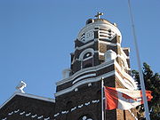
Hamilton's first artificial skating surface was The Forum. Locals referred to it as the Barton Street Arena
Barton Street Arena
Barton Street Arena, also known as the Hamilton Forum, was the main sports arena located in downtown Hamilton, Ontario, on Barton Street between Sanford Street and Wentworth Street...
. It was situated between Sanford Avenue and Wentworth Streets
Wentworth Street (Hamilton, Ontario)
Wentworth Street, is a Lower City arterial road in Hamilton, Ontario, Canada. It starts off at the base of the Niagara Escarpment on Charlton Avenue East just before the CP lines as a two-way street for 2-blocks up past Cumberland Avenue up to Rutherford Avenue where it then switches over to a...
. It opened 8 January 1913. Eventually, a few years down the line it was purchased by Kenneth D. Soble and then he announced a new rink would be built and the new Forum opened up for business 1 October 1953. The rink lasted until 1976. That's when the Junior A hockey club Hamilton Fincups
Hamilton Fincups
The Fincups were a junior ice hockey team in the Ontario Major Junior Hockey League for 4 years, from 1974 to 1978. The team played in Hamilton, Ontario for three years, and in St. Catharines, Ontario for one.-History:...
left Hamilton. Demolition started in September 1976.
Present-day Centre Mall
Centre Mall (Hamilton)
The Centre Mall was an outdoor shopping mall in the Lower City of Hamilton, Ontario, Canada, on Barton Street East bounded by Ottawa Street North in the western-end and Kenilworth Avenue North on the eastern-end.-History:...
use to be the site of the Jockey Club racetrack but in the years after the Second World War
World War II
World War II, or the Second World War , was a global conflict lasting from 1939 to 1945, involving most of the world's nations—including all of the great powers—eventually forming two opposing military alliances: the Allies and the Axis...
the push for Hamilton's eastward expansion had completely engulfed the Jockey Club property. On 26 September 1952 the racetrack was sold. The site would then become the site of the Greater Hamilton Shopping Centre.
Centre Mall reconstruction project
Centre Mall owners announce plans for a 23-building super centre on the property on Barton Street East. Cost is estimated to be around $100-million and will take up 700000 square feet (65,032.1 m²) of retail space. This will end up being the largest redevelopment project in the history of Hamilton's east-end. The buildings on the property will be grouped around the edge of the property and create a friendly, pedestrian-oriented design rather than a commercial island in a sea of parking. The overhaul will take about two-and-a-half years to complete but the bulk of the work is expected to be done by the end of the summer of 2008. Some new buildings will go up before the enclosed mall is torn down. The redevelopment of Centre Mall is transforming the entire neighbourhood from Ottawa StreetOttawa Street (Hamilton, Ontario)
Ottawa street, is a Lower City arterial road in Hamilton, Ontario, Canada. It starts off at Lawrence Road at the base of the Niagara Escarpment and is a two-way street throughout cutting through the Delta and Crown Point neighbourhoods and the City's North End industrial neighbourhood...
to Kenilworth Avenue
Kenilworth Avenue (Hamilton, Ontario)
Kenilworth Avenue, is a Lower City arterial road in Hamilton, Ontario, Canada. It starts off at the Kenilworth Traffic Circle and Kenilworth Access, a mountain-access road at the base of the Niagara Escarpment and is a two-way street throughout stretching northward through the city's North End...
. The $100-million investment in the mall has boosted Ottawa Street North - already the city's No.1 tourist destination. The garment district has also morphed into a holistic home decor destination area, complete with lighting, antique, design & glass stores. The Ottawa Street B.I.A. had the most application and grants under the commercial property improvement program in 2007 with thirty three and it had an effect on the property values and real estate activity in the district.
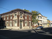
Landmarks


- Rheem Canada building
- Barton Street Hill
- Jamesville, which is shared by the Italian & Portuguese communities of Hamilton
- James North Art District
- site of the old Hanrahan's Hotel, now houses interesting entertainment.
- Hamilton-Wentworth Detention Centre
- Hamilton General HospitalHamilton General HospitalThe Hamilton General Hospital is a major teaching hospital in downtown Hamilton, Canada, on the corners of Barton Street East and Victoria Avenue North...
- Kennesky Sports & Cycle Co. Ltd.
- Woodlands Park
- Site of the old Barton Street ArenaBarton Street ArenaBarton Street Arena, also known as the Hamilton Forum, was the main sports arena located in downtown Hamilton, Ontario, on Barton Street between Sanford Street and Wentworth Street...
, across the street from Woodlands Park, now a row of houses occupy the site.
- Site of the old Barton Street Arena
- Canadian Westinghouse headquarters building (1903–1997), just North of Barton Street. (currently sits empty)
- Mohawk CollegeMohawk CollegeMohawk College is a public College of Applied Arts and Technology located in the Golden Horseshoe of Ontario, Canada. Mohawk has three main campuses: the Fennell Campus located in Hamilton, the Brantford Campus located in Brantford and the STARRT Institute located in Stoney Creek, as well as the...
- Wentworth campus - St. Ann's Catholic Church
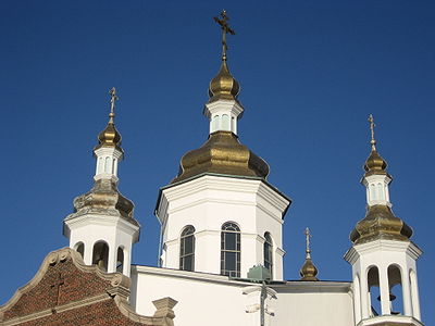
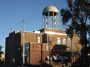
- Ukrainian Orthodox Cathedral of St. Vladimir
- St. Stanislaw Kostka Polish Roman Catholic Church
- Holy Spirit Church
- Ivor Wynne StadiumIvor Wynne StadiumIvor Wynne Stadium is a Canadian football stadium located at the corner of Balsam and Beechwood Avenues, two blocks west of Gage Avenue North in Hamilton, Ontario, Canada...
, home of the CFLCanadian Football LeagueThe Canadian Football League or CFL is a professional sports league located in Canada. The CFL is the highest level of competition in Canadian football, a form of gridiron football closely related to American football....
Hamilton Tiger-CatsHamilton Tiger-CatsThe Hamilton Tiger-Cats are a Canadian Football League team based in Hamilton, Ontario, founded in 1950 with the merger of the Hamilton Tigers and the Hamilton Wildcats. The Tiger-Cats play their home games at Ivor Wynne Stadium...
, one street South of Barton (2-blocks West of Gage Avenue) - Stadium Mall
- Centre MallCentre Mall (Hamilton)The Centre Mall was an outdoor shopping mall in the Lower City of Hamilton, Ontario, Canada, on Barton Street East bounded by Ottawa Street North in the western-end and Kenilworth Avenue North on the eastern-end.-History:...
, (Canada's first Mall), site of the old Jockey Club/Race track before Mall was built. - Ottawa Street Shopping DistrictOttawa Street (Hamilton, Ontario)Ottawa street, is a Lower City arterial road in Hamilton, Ontario, Canada. It starts off at Lawrence Road at the base of the Niagara Escarpment and is a two-way street throughout cutting through the Delta and Crown Point neighbourhoods and the City's North End industrial neighbourhood...
- "Textile District" - East Hamilton Radio (building)
- Slovak Assumption Byzantine Catholic Church
- Strathbarton Mall
- Coca-ColaCoca-ColaCoca-Cola is a carbonated soft drink sold in stores, restaurants, and vending machines in more than 200 countries. It is produced by The Coca-Cola Company of Atlanta, Georgia, and is often referred to simply as Coke...
bottling company - Mahony Park
- Hamilton Doublerink ArenaHamilton Doublerink ArenaThe Hamilton Doublerink Arena is an ice rink in Hamilton, Ontario. It is home to a men's ice hockey league. It is also the home of the PEI Oldtimers Hockey League and the Hamilton Oldtymers Hockey League....
(2 rinks) - Canada's First Lowe'sLowe'sLowe's Companies, Inc. is a U.S.-based chain of retail home improvement and appliance stores. Founded in 1946 in North Wilkesboro, North Carolina, the chain now serves more than 14 million customers a week in its 1,710 stores in the United States and 20 in Canada. Expansion into Canada began in...
Home Improvement Warehouse - Red Hill Creek Valley
- Red Hill Valley Trail
- Red Hill Creek
- Red Hill Valley ParkwayRed Hill Valley ParkwayThe Red Hill Valley Parkway , referred to as the Red Hill Creek Expressway during planning is a municipal expressway in the Canadian city of Hamilton, Ontario. The route connects the Lincoln M. Alexander Parkway, Hamilton's second municipal expressway, to the Queen Elizabeth Way near Hamilton...
, flows underneath Barton Street overpass. - Red Hill Creek Centre (shopping)
- Eastlawn Cemetery
- Comfort Inn (motel)
- Parkway Plaza (shopping)
- Mountainview Public School
- County Market (Stoney Creek)
- Mohawk CollegeMohawk CollegeMohawk College is a public College of Applied Arts and Technology located in the Golden Horseshoe of Ontario, Canada. Mohawk has three main campuses: the Fennell Campus located in Hamilton, the Brantford Campus located in Brantford and the STARRT Institute located in Stoney Creek, as well as the...
- Stoney Creek campus - Internet Mall
- Winona Park/ Winona Scout Hall
- Rice Monuments Works
Communities
- StrathconaStrathcona (Hamilton, Ontario)The Strathcona Neighbourhood is located west of downtown Hamilton, Ontario and is bounded by Highway 403, the CNR rail line, Queen Street York Boulevard and Main Street. The neighbourhood is also intersected by several other major street arteries: Dundurn Street , Locke Street, and King Street West...
- Central - The financial center of Hamilton, OntarioHamilton, OntarioHamilton is a port city in the Canadian province of Ontario. Conceived by George Hamilton when he purchased the Durand farm shortly after the War of 1812, Hamilton has become the centre of a densely populated and industrialized region at the west end of Lake Ontario known as the Golden Horseshoe...
- Beasley
- Landsdale
- Gibson
- Sanford
- Stipeley
- Crown Point West
- Crown Point East
- Homeside
- Normanhurst
- McQuesten West
- McQuesten East
- Parkview West
- Parkview East
- Nashdale/ Kentley, Barton cuts through these two neighbourhoods.
- Lakely/ Riverdale West, Barton cuts through these two neighbourhoods.
- Grayside/ Riverdale East, Barton cuts through these two neighbourhoods.
- Stoney CreekStoney Creek, OntarioStoney Creek is a community in Ontario, Canada.Note: This article will only deal with matters up to its amalgamation with Hamilton.-Geography and population:...
- FruitlandFruitland, OntarioFruitland, Ontario is a community in the western end of Hamilton, Ontario. Its adjacent community includes Beamsville, and Grimsby. The region became known as Fruitland due to its fertile soil, and the region is renowned for its winery industry. At the Eastern border is Fifty Road and its...
- WinonaWinona, OntarioWinona is a small community in southern Ontario, that is officially a part of the city of Hamilton, Ontario.- International acclaim :Winona is home to these internationally known entities:...
Roads that are parallel with Barton Street

- Burlington StreetBurlington StreetBurlington Street is a road in Hamilton, Ontario, stretching along the south shore of Hamilton Harbour in Lake Ontario. Burlington Street has four different statuses along the route. In its western terminus, it is a collector route ending at Bay Street North...
, West/East - Barton Street, West/East
- Cannon StreetCannon Street (Hamilton, Ontario)Cannon Street, is a Lower City collector road in Hamilton, Ontario, Canada. It starts off at Queen Street North as a one-way street up to Sherman Avenue North where it then switches over to a two-way street the rest of the way Eastward and ends just past Kenilworth Avenue North on Barons Avenue...
, West/East - Wilson StreetWilson Street (Hamilton, Ontario)Wilson Street is a Lower City collector road in Hamilton, Ontario, Canada. It starts off at James Street North and works its way East and ends at Sherman Avenue North...
- King William StreetKing William Street (Hamilton, Ontario)400px|thumb|Theatre AquariusKing William Street is a Lower City collector road in Hamilton, Ontario, Canada. It starts off at the western-end at James Street North and is a one-way street until Mary Street, where it becomes a two-way street that ends at Wentworth Street North.-History:In 1922,...
- King Street, West/East
- Main StreetMain Street (Hamilton, Ontario)Main Street, is a Lower City arterial road in Hamilton, Ontario, Canada. It starts east of Wilson Street in Ancaster at White Chapel Cemetery as a two-way street and switches over to a one-way street at Paradise Road South, in Westdale, where it continues up to the Delta where it once again...
, West/East; - Queenston RoadQueenston Road (Hamilton, Ontario)Queenston Road is a two-way Lower City arterial road in Hamilton, Ontario, Canada. Also known as Highway 8. It starts off at the Queenston Traffic Circle and travels eastward over the Red Hill Valley Parkway and into Stoney Creek past the Fruitland and Winona communities and into Niagara Region as... - Jackson StreetJackson Street (Hamilton, Ontario)Jackson Street, is a Lower City collector road in Hamilton, Ontario, Canada. It starts off West of Locke Street South at Jackson Playground as a one-way street up to Queen Street South where it then switches over to a two-way street and is interrupted at Bay Street South the site of the Hamilton...
, East - Hunter StreetHunter Street (Hamilton, Ontario)Hunter Street is a Lower City collector road in Hamilton, Ontario, Canada. It is a one-way street that starts West of Locke Street at Hill Street Park and ends two blocks East of Victoria Avenue at Emerald Street...
, West/East - Augusta StreetAugusta Street (Hamilton, Ontario)Augusta Street is a Lower City collector road in Hamilton, Ontario, Canada. A two-way collector road that starts off on James Street South and ends 4-blocks East at Shamrock Park just past Walnut Street South.-History:thumb|Augusta Street, landmark...
- Charlton AvenueCharlton Avenue (Hamilton, Ontario)Charlton Avenue, is a Lower City collector road in Hamilton, Ontario, Canada. This collector road starts of just West of Dundurn Street as a one-way street up to James Street South where it then switches over to a two-way street the rest of the way eastward and ends at Wentworth Street South right...
, West/East - Aberdeen AvenueAberdeen Avenue (Hamilton, Ontario)Aberdeen Avenue is a Lower City arterial road in Hamilton, Ontario, Canada. It starts off just West of Longwood Road South and East of Highway 403 as a two-way thoroughfare up to Queen Street South where it then switches over to a one-way collector road to Bay Street South and then to another...
Niagara Escarpment (Mountain) Roads:
- Concession StreetConcession Street (Hamilton, Ontario)Concession Street is an Upper City arterial road in Hamilton, Ontario, Canada. It starts at Belvidere Avenue, just West of Sam Lawrence Park, and extends eastward past Mountain Drive Park on Upper Gage Avenue and ends shortly thereafter at East 43rd Street.Note: East of East 43rd Street the road...
- Queensdale Avenue West/ East
- Scenic Drive - Fennell AvenueFennell Avenue (Hamilton, Ontario)Fennell Avenue, is an Upper City arterial road in Hamilton, Ontario, Canada. It starts of just West Garth Street on the West mountain and is a two-way street throughout that extends eastward and ends at Mountain Brow Boulevard, a road that wraps around the edge of the Niagara Escarpment on...
, West/East - Sanatorium Road
- Mohawk RoadMohawk Road (Hamilton, Ontario)Mohawk Road, is an Upper City arterial road in Hamilton, Ontario, Canada. It is a two-way street throughout that starts just West of Highway 403 & Meadowlands and travels eastward linking up with the Lincoln M. Alexander Parkway. Mohawk Road east of Highway 403 resumes again in front of Iroquoia...
, West/East - Limeridge RoadLimeridge Road (Hamilton, Ontario)Limeridge Road is a two-way Upper City collector road in Hamilton, Ontario, Canada. It starts off just West of Garth Street/William McCulloch Park as Limeridge Court and cuts across the Hamilton mountain eastward running parallel with the Lincoln M...
West/East - Lincoln M. Alexander ParkwayLincoln M. Alexander ParkwayThe Lincoln Alexander Parkway, officially nicknamed "The Linc", is a municipal expressway in the Canadian city of Hamilton, Ontario. Located on the Hamilton mountain, atop the Niagara Escarpment...
- Mud Street, (Hamilton City Road 11) - Stone Church RoadStone Church Road (Hamilton, Ontario)Stone Church Road, is a two-way Upper City east-west arterial road in Hamilton, Ontario, Canada. It starts at Golf Links Road, just east of Meadowlands, and goes across the Escarpment and ends at Upper Mount Albion Road....
, West/East  ; Rymal Road, West/East
- Twenty Road
Roads that cross Barton Street
Note: Listing of streets from West to East.Note - Barton does not cross Dundurn Street North.
- Locke StreetLocke Street (Hamilton, Ontario)Locke Street, is a Lower City collector road in Hamilton, Ontario, Canada. It starts off at Aberdeen Avenue as a two-way street going through the Locke Street shopping district up to Main Street where it then becomes a one-way street until it crosses King Street and becomes two-way again going...
, North - Queen StreetQueen Street (Hamilton, Ontario)Queen Street, is a Lower City arterial road in Hamilton, Ontario, Canada. It starts off at Beckett Drive, a mountain-access road in the city and is a two-way street up to Herkimer Street and a one-way street the rest of the way north up to the Canadian National Railway Yard where the road turns...
, North - Hess StreetHess Street (Hamilton, Ontario)Hess Street, is a Lower City collector road in Hamilton, Ontario, Canada. It starts off at the base of the Niagara Escarpment right before Aberdeen Avenue, and is a one-way street going north past the Durand and Central neighbourhoods. Between Main and King Street West is where you will find Hess...
, North - Bay StreetBay Street (Hamilton)Bay Street is a Lower City arterial road in Hamilton, Ontario, Canada. It starts at Inglewood Drive, just South of Aberdeen Avenue, as a collector road with only two lanes, then eventually becomes a six lane thoroughfare at its peak. Bay Street also passes through Downtown Hamilton, where many...
, North - MacNab StreetMacNab Street (Hamilton, Ontario)MacNab Street, is a Lower City collector road in Hamilton, Ontario, Canada. It starts in the Durand neighbourhood on Markland Street, as a one-way street going north to Bold Street, where it becomes two-way for one block until Hurst Place where it's cut off by a wall for the Hunter Street railway...
, North - James StreetJames Street (Hamilton, Ontario)James Street is a Lower City arterial road in Hamilton, Ontario, Canada. It starts off at the base of the Niagara Escarpment from James Mountain Road, a mountain-access road in the city, originally was a one-way street going south throughout but now has sections of it that are two-way...
, North - Hughson StreetHughson Street (Hamilton, Ontario)Hughson Street is a Lower City collector road in Hamilton, Ontario, Canada. It starts at Charlton Avenue East at St. Joseph's hospital and runs north to Haymarket Street in the downtown where it's cut off by the Hamilton GO Transit station. Up to this point it is a two-way street...
, North - John StreetJohn Street (Hamilton, Ontario)John Street, is a Lower City arterial road in Hamilton, Ontario, Canada. Originally it was known as Mountain Road or Ancaster Road. It starts off at the base of Arkledun Avenue, a Mountain-access road in the city, just east of St.Joseph's Hospital where it's a one-way street going north and tunnels...
, North - Catharine StreetCatharine Street (Hamilton, Ontario)Catharine Street, is a Lower City collector road in Hamilton, Ontario, Canada. It starts off at Charlton Avenue East at Woolverton Park in the Corktown neighbourhood as a one-way street , tunnels underneath the Hunter Street Railway bridge and stretches up to Barton Street East where it then turns...
, North - Ferguson AvenueFerguson Avenue (Hamilton, Ontario)Ferguson Avenue, is a Lower City collector road in Hamilton, Ontario, Canada. Is a two-way street throughout that starts off at the base of the Mountain on Foster Street. It's interrupted 3-blocks north at Corktown Park where Canadian Pacific Railway lines passes through it...
, North - Wellington StreetWellington Street (Hamilton, Ontario)Wellington Street, is a Lower City arterial road in Hamilton, Ontario, Canada. It starts off at Charlton Avenue East as a two-way street for only one block where it's then blocked off by the Corktown Park and a couple of Canadian National Railway lines that cut through it...
, North - Victoria AvenueVictoria Avenue (Hamilton, Ontario)Victoria Avenue, is a Lower City arterial road in Hamilton, Ontario, Canada. It starts off as a ramp and part of a Mountain-access road, the Claremont Access, on Hunter Street East in the Stinson neighbourhood...
, North - Wentworth StreetWentworth Street (Hamilton, Ontario)Wentworth Street, is a Lower City arterial road in Hamilton, Ontario, Canada. It starts off at the base of the Niagara Escarpment on Charlton Avenue East just before the CP lines as a two-way street for 2-blocks up past Cumberland Avenue up to Rutherford Avenue where it then switches over to a...
, North - Sherman AvenueSherman Avenue (Hamilton, Ontario)Sherman Avenue, is a Lower City collector road in Hamilton, Ontario, Canada. It starts off at the base of the Niagara Escarpment just south of Cumberland Avenue and is a one-way street northbound that cuts through the city's North End industrial neighbourhood and ends at Ship Street, the site of...
, North - Gage AvenueGage Avenue (Hamilton, Ontario)thumb|right|350px|Gage Park WaterfountainGage Avenue, is a Lower City arterial road in Hamilton, Ontario, Canada. It starts off at Lawrence Road at the base of the Niagara Escarpment at the south end of Gage Park...
, North - Ottawa StreetOttawa Street (Hamilton, Ontario)Ottawa street, is a Lower City arterial road in Hamilton, Ontario, Canada. It starts off at Lawrence Road at the base of the Niagara Escarpment and is a two-way street throughout cutting through the Delta and Crown Point neighbourhoods and the City's North End industrial neighbourhood...
, North - Kenilworth AvenueKenilworth Avenue (Hamilton, Ontario)Kenilworth Avenue, is a Lower City arterial road in Hamilton, Ontario, Canada. It starts off at the Kenilworth Traffic Circle and Kenilworth Access, a mountain-access road at the base of the Niagara Escarpment and is a two-way street throughout stretching northward through the city's North End...
, North - Parkdale AvenueParkdale Avenue (Hamilton, Ontario)Parkdale Avenue, is a Lower City arterial road in Hamilton, Ontario, Canada. It starts off just South of Lawrence Road at Hixon Road and is a two-way street throughout, stretching northward through the city's North End industrial neighbourhood and ends just north of the Burlington Street East...
, North - Woodward AvenueWoodward Avenue (Hamilton, Ontario)Woodward Avenue is an arterial road in Hamilton, Ontario, Canada. It starts in the north-end as Eastport Drive and the road changes its name south of Burlington Street beside the Museum of Steam & Technology to Woodward Avenue and extends southward and ends at Melvin Avenue...
- Red Hill Valley ParkwayRed Hill Valley ParkwayThe Red Hill Valley Parkway , referred to as the Red Hill Creek Expressway during planning is a municipal expressway in the Canadian city of Hamilton, Ontario. The route connects the Lincoln M. Alexander Parkway, Hamilton's second municipal expressway, to the Queen Elizabeth Way near Hamilton...
(Freeway passes underneath the Barton Street bridge) - Nash RoadNash Road (Hamilton, Ontario)Nash Road is a Lower City street in Hamilton, Ontario, Canada. It starts off at King Street East in front of the Father Sean O'Sullivan Memorial Park and is a two-way collector road throughout that extends north to the Nashdale neighbourhood past Bancroft Street where it then hangs a right and...
, North - Centennial ParkwayCentennial Parkway (Hamilton, Ontario)Centennial Parkway, is a Lower City arterial road in Hamilton, Ontario, Canada. It is best known as the western terminus of former King's Highway 20, now maintained by the City of Hamilton...
, North - Lake Avenue, North
- Grays Road
- Green Road
- Dewitt Road
- Fruitland Road
- Fifty Road
External links
- Barton Village BIA
- Closed Canadian Parks: Maple Leaf Park
- North End Neighbours
- Hamilton Centre Mall
- Google Maps: Barton Street (Hybrid)