

Hughson Street (Hamilton, Ontario)
Encyclopedia

Hughson Street is a Lower City collector road in Hamilton, Ontario
Hamilton, Ontario
Hamilton is a port city in the Canadian province of Ontario. Conceived by George Hamilton when he purchased the Durand farm shortly after the War of 1812, Hamilton has become the centre of a densely populated and industrialized region at the west end of Lake Ontario known as the Golden Horseshoe...
, Canada
Canada
Canada is a North American country consisting of ten provinces and three territories. Located in the northern part of the continent, it extends from the Atlantic Ocean in the east to the Pacific Ocean in the west, and northward into the Arctic Ocean...
. It starts at Charlton Avenue East at St. Joseph's hospital and runs north to Haymarket Street in the downtown where it's cut off by the Hamilton GO Transit
GO Transit
GO Transit is an inter-regional public transit system in Southern Ontario, Canada. It primarily serves the Greater Toronto and Hamilton Area conurbation, with operations extending to several communities beyond the GTHA proper in the Greater Golden Horseshoe...
station. Up to this point it is a two-way street
Two-way street
A two-way street is a street that allows vehicles to travel in both directions. On most two-way streets, especially main streets, a line is painted down the middle of the road to remind drivers to stay on their side of the road. Sometimes one portion of a street is two-way, the other portion one-way...
. It then starts up again north of the station on Hunter Street East, where it then becomes a one-way street going north just past Barton Street East to Murray Street where it's cut off again by a parking lot for LIUNA Station. It then starts up again one block north past the CN
Canadian National Railway
The Canadian National Railway Company is a Canadian Class I railway headquartered in Montreal, Quebec. CN's slogan is "North America's Railroad"....
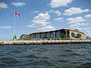
railway tracks on Strachan Street and from this point onwards becomes a two-way street again that extends to the city's North End to the waterfront on Guise Street West, the site of the Canada Marine Discovery Centre and Pier 9.
History
Nathaniel Hughson
Nathaniel Hughson, born: 16 July 1755 at New York. died: 1 November 1837 at Hamilton, Ontario. Farmer and hotel owner, Loyalist who moved to Canada following the American Revolution, one of the city founders of Hamilton, Ontario. Married to Rebecca Land...
(1755-1837) a farmer and hotel owner. Hughson was a Loyalist
United Empire Loyalists
The name United Empire Loyalists is an honorific given after the fact to those American Loyalists who resettled in British North America and other British Colonies as an act of fealty to King George III after the British defeat in the American Revolutionary War and prior to the Treaty of Paris...
who moved to Canada following the American Revolution
American Revolution
The American Revolution was the political upheaval during the last half of the 18th century in which thirteen colonies in North America joined together to break free from the British Empire, combining to become the United States of America...
, one of the city founders. Other streets in the city were named after his family members: James Street (son), Rebecca Street (wife) and Catharine Street (daughter).
The Sir John A. Macdonald
John A. Macdonald
Sir John Alexander Macdonald, GCB, KCMG, PC, PC , QC was the first Prime Minister of Canada. The dominant figure of Canadian Confederation, his political career spanned almost half a century...
Statue at Gore Park arrived in Hamilton from London, England on 30 October, 1893. Official dedication of the statue took place 1 November, 1893. Originally, the statue was located at the intersection of King and Hughson Streets and pointed West. Prime Minister Sir John Thompson was in attendance. Alexander Aitchison, a local Hamilton Fire Chief, died of injuries he sustained from crashing into the base of the statue with his horse and buggy and because of it, the statue was then relocated to Gore Park near King and John Streets only this time the statue instead of pointing West, now points East.
Canadian Canners Ltd., (1903-1986), used to be on 44 Hughson Street South across the street from the County Courthouse. Today it is the site of a parking lot.
In 1996, The refurbished TH&B Station became the GO Station, as well as the city's bus terminal.
Waterfront Trolley
The Hamilton Waterfront Trolley is a narrated tour along the 12 kilometre Hamilton Waterfront Trail. The main stop and departure spot is at the Hamilton Waterfront SCOOPS Ice Cream parlour, which provides the famous Stoney Creek Dairy Ice Cream. There are a dozen stops along the way between Princess Point at the western-end of the route to the eastern-end, the site of HMCS Haida. Also near this eastern-end route is the site of the Hamiltonian Tour Boat, which is a 12-passenger tour boat that offers a leisurely guided tour of Hamilton harbour with the captain providing interesting stories and history of one of North America's most noteworthy harbours. In addition to this there is also the Hamilton Harbour Queen Cruises which is another ship that offers 3-hour tour of the harbour along with Lunch, Dinner or other special events like Dance parties. This Harbour Queen Cruise was also the 2005 winner of the Hamilton Tourism Awards for "best tourism idea." It has a passenger capacity of 200.Landmarks


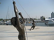
- Pier 8, Pier 9
- Hamilton Harbour Queen (seasonal cruise ship)
- Canada Parks Discovery Centre
- Hamilton/ Halton Police Marine Unit
- Waterfront trail
- Canadian National railway tracks (Hughson Street interrupted here, resumes again north of tracks on Strachan Street)
- LIUNA Station
- Downtown Arts Centre
- Hughson Street Baptist Church (http://www.hughson.ca)
- Downtown Bingo Hall
- Gore Park Waterfountain
- Gore Park
- Hamilton GO Transit station, Original site of the Toronto, Hamilton and Buffalo RailwayToronto, Hamilton and Buffalo RailwayThe Toronto, Hamilton and Buffalo Railway was a railway based in Hamilton that ran in Southern Ontario from 1894 to 1987. It never reached the other two cities in its name, although it did have branch lines extending to Dunnville and Port Maitland.-History:...
(1892-1987) - St.Joseph's Hospital
Communities
Note: Listing of neighbourhoods from North to South- North End - Everything north of the Canadian National Railway tracks
- Beasley
- Corktown
Major roads that cross Hughson Street
- Burlington Street East
- Barton StreetBarton Street (Hamilton, Ontario)Barton Street is an arterial road in the Lower City of Hamilton, Ontario, Canada. It's also the longest street in the city. It starts off at the Western end of town at Locke Street North and is a two-way street that stretches eastward through a number of different and varied communities in the...
East - Cannon StreetCannon Street (Hamilton, Ontario)Cannon Street, is a Lower City collector road in Hamilton, Ontario, Canada. It starts off at Queen Street North as a one-way street up to Sherman Avenue North where it then switches over to a two-way street the rest of the way Eastward and ends just past Kenilworth Avenue North on Barons Avenue...
East - One way street (Westbound only) - York BoulevardYork Boulevard (Hamilton, Ontario)York Boulevard is a Lower City arterial road in Hamilton, Ontario, Canada. Formerly known as Highway 2 and Highway 6,starts off in Burlington, Ontario at Plains Road West as a two-way arterial road that wraps around and over the Hamilton Harbour and enters the city of Hamilton in the West-end past...
- One way street (Eastbound Only) - King William StreetKing William Street (Hamilton, Ontario)400px|thumb|Theatre AquariusKing William Street is a Lower City collector road in Hamilton, Ontario, Canada. It starts off at the western-end at James Street North and is a one-way street until Mary Street, where it becomes a two-way street that ends at Wentworth Street North.-History:In 1922,...
- One way street (Eastbound Only) - King Street East - One way street (Westbound Only)
- Main StreetMain Street (Hamilton, Ontario)Main Street, is a Lower City arterial road in Hamilton, Ontario, Canada. It starts east of Wilson Street in Ancaster at White Chapel Cemetery as a two-way street and switches over to a one-way street at Paradise Road South, in Westdale, where it continues up to the Delta where it once again...
East - One way street (Eastbound Only) - Jackson StreetJackson Street (Hamilton, Ontario)Jackson Street, is a Lower City collector road in Hamilton, Ontario, Canada. It starts off West of Locke Street South at Jackson Playground as a one-way street up to Queen Street South where it then switches over to a two-way street and is interrupted at Bay Street South the site of the Hamilton...
East - Hunter StreetHunter Street (Hamilton, Ontario)Hunter Street is a Lower City collector road in Hamilton, Ontario, Canada. It is a one-way street that starts West of Locke Street at Hill Street Park and ends two blocks East of Victoria Avenue at Emerald Street...
East - One way street (Westbound Only) - Augusta StreetAugusta Street (Hamilton, Ontario)Augusta Street is a Lower City collector road in Hamilton, Ontario, Canada. A two-way collector road that starts off on James Street South and ends 4-blocks East at Shamrock Park just past Walnut Street South.-History:thumb|Augusta Street, landmark...
- Charlton AvenueCharlton Avenue (Hamilton, Ontario)Charlton Avenue, is a Lower City collector road in Hamilton, Ontario, Canada. This collector road starts of just West of Dundurn Street as a one-way street up to James Street South where it then switches over to a two-way street the rest of the way eastward and ends at Wentworth Street South right...
East - One way street (Westbound Only)
Roads that are parallel with Hughson Street
Note: Listing of streets from West to East.- Locke Street, North, South
- Queen StreetQueen Street (Hamilton, Ontario)Queen Street, is a Lower City arterial road in Hamilton, Ontario, Canada. It starts off at Beckett Drive, a mountain-access road in the city and is a two-way street up to Herkimer Street and a one-way street the rest of the way north up to the Canadian National Railway Yard where the road turns...
, North, South - Hess StreetHess Street (Hamilton, Ontario)Hess Street, is a Lower City collector road in Hamilton, Ontario, Canada. It starts off at the base of the Niagara Escarpment right before Aberdeen Avenue, and is a one-way street going north past the Durand and Central neighbourhoods. Between Main and King Street West is where you will find Hess...
, North, South - Bay StreetBay Street (Hamilton)Bay Street is a Lower City arterial road in Hamilton, Ontario, Canada. It starts at Inglewood Drive, just South of Aberdeen Avenue, as a collector road with only two lanes, then eventually becomes a six lane thoroughfare at its peak. Bay Street also passes through Downtown Hamilton, where many...
, North, South - MacNab StreetMacNab Street (Hamilton, Ontario)MacNab Street, is a Lower City collector road in Hamilton, Ontario, Canada. It starts in the Durand neighbourhood on Markland Street, as a one-way street going north to Bold Street, where it becomes two-way for one block until Hurst Place where it's cut off by a wall for the Hunter Street railway...
, North, South - James StreetJames Street (Hamilton, Ontario)James Street is a Lower City arterial road in Hamilton, Ontario, Canada. It starts off at the base of the Niagara Escarpment from James Mountain Road, a mountain-access road in the city, originally was a one-way street going south throughout but now has sections of it that are two-way...
, North, South - Hughson Street, North, South
- John StreetJohn Street (Hamilton, Ontario)John Street, is a Lower City arterial road in Hamilton, Ontario, Canada. Originally it was known as Mountain Road or Ancaster Road. It starts off at the base of Arkledun Avenue, a Mountain-access road in the city, just east of St.Joseph's Hospital where it's a one-way street going north and tunnels...
, North, South - Catharine StreetCatharine Street (Hamilton, Ontario)Catharine Street, is a Lower City collector road in Hamilton, Ontario, Canada. It starts off at Charlton Avenue East at Woolverton Park in the Corktown neighbourhood as a one-way street , tunnels underneath the Hunter Street Railway bridge and stretches up to Barton Street East where it then turns...
, North, South - Ferguson AvenueFerguson Avenue (Hamilton, Ontario)Ferguson Avenue, is a Lower City collector road in Hamilton, Ontario, Canada. Is a two-way street throughout that starts off at the base of the Mountain on Foster Street. It's interrupted 3-blocks north at Corktown Park where Canadian Pacific Railway lines passes through it...
, North, South - Wellington StreetWellington Street (Hamilton, Ontario)Wellington Street, is a Lower City arterial road in Hamilton, Ontario, Canada. It starts off at Charlton Avenue East as a two-way street for only one block where it's then blocked off by the Corktown Park and a couple of Canadian National Railway lines that cut through it...
, North, South - Victoria AvenueVictoria Avenue (Hamilton, Ontario)Victoria Avenue, is a Lower City arterial road in Hamilton, Ontario, Canada. It starts off as a ramp and part of a Mountain-access road, the Claremont Access, on Hunter Street East in the Stinson neighbourhood...
, North, South - Wentworth StreetWentworth Street (Hamilton, Ontario)Wentworth Street, is a Lower City arterial road in Hamilton, Ontario, Canada. It starts off at the base of the Niagara Escarpment on Charlton Avenue East just before the CP lines as a two-way street for 2-blocks up past Cumberland Avenue up to Rutherford Avenue where it then switches over to a...
, North, South
External links
- Downtown Hamilton
- Durand neighbourhood Association
- North End Neighbours
- Google Maps: Hughson Street (Hybrid)