

John Street (Hamilton, Ontario)
Encyclopedia
Hamilton, Ontario
Hamilton is a port city in the Canadian province of Ontario. Conceived by George Hamilton when he purchased the Durand farm shortly after the War of 1812, Hamilton has become the centre of a densely populated and industrialized region at the west end of Lake Ontario known as the Golden Horseshoe...
, Canada
Canada
Canada is a North American country consisting of ten provinces and three territories. Located in the northern part of the continent, it extends from the Atlantic Ocean in the east to the Pacific Ocean in the west, and northward into the Arctic Ocean...
. Originally it was known as Mountain Road or Ancaster Road. It starts off at the base of Arkledun Avenue, a Mountain-access road in the city, just east of St.Joseph's Hospital where it's a one-way street going north and tunnels underneath the Hunter Street
Hunter Street (Hamilton, Ontario)
Hunter Street is a Lower City collector road in Hamilton, Ontario, Canada. It is a one-way street that starts West of Locke Street at Hill Street Park and ends two blocks East of Victoria Avenue at Emerald Street...
Railway bridge and continues onward to the city's North End at the waterfront where it ends at Guise Street East, the site of Pier 9.
History
Talk of creating a townsite at what is now the intersection of John and Main streets arose as early as 1809, but the war delayed the scheme until 1816 when George HamiltonGeorge Hamilton (politician)
George Hamilton was a Canadian merchant and politician, who founded the city of Hamilton, Ontario.Hamiliton was born on October 1788 in Queenston Heights...
and Nathaniel Hughson
Nathaniel Hughson
Nathaniel Hughson, born: 16 July 1755 at New York. died: 1 November 1837 at Hamilton, Ontario. Farmer and hotel owner, Loyalist who moved to Canada following the American Revolution, one of the city founders of Hamilton, Ontario. Married to Rebecca Land...
successfully promoted Hamilton as the judicial centre for the counties of Halton and Wentworth (the Gore District).

Jackson Street (Hamilton, Ontario)
Jackson Street, is a Lower City collector road in Hamilton, Ontario, Canada. It starts off West of Locke Street South at Jackson Playground as a one-way street up to Queen Street South where it then switches over to a two-way street and is interrupted at Bay Street South the site of the Hamilton...
.
John Street is also one of the original native pathways in the area. In 1837, the police commission officially named it John Street - a name originally chosen by George Hamilton
George Hamilton (politician)
George Hamilton was a Canadian merchant and politician, who founded the city of Hamilton, Ontario.Hamiliton was born on October 1788 in Queenston Heights...
(City founder), apparently in honour of a family of early settlers.
The Sir John A. Macdonald
John A. Macdonald
Sir John Alexander Macdonald, GCB, KCMG, PC, PC , QC was the first Prime Minister of Canada. The dominant figure of Canadian Confederation, his political career spanned almost half a century...
Statue at Gore Park arrived in Hamilton from London, England on 30 October, 1893. Official dedication of the statue took place 1 November, 1893. Originally, the statue was located at the intersection of King and Hughson Streets
Hughson Street (Hamilton, Ontario)
Hughson Street is a Lower City collector road in Hamilton, Ontario, Canada. It starts at Charlton Avenue East at St. Joseph's hospital and runs north to Haymarket Street in the downtown where it's cut off by the Hamilton GO Transit station. Up to this point it is a two-way street...
and pointed West. Prime Minister Sir John Thompson was in attendance. Alexander Aitchison, a local Hamilton Fire Chief, died of injuries he sustained from crashing into the base of the statue with his horse and buggy and because of it, the statue was then relocated to Gore Park near King and John Streets only this time the statue instead of pointing West, now points East.
Ronnie Hawkins
Ronnie Hawkins
Ronald "Ronnie" Hawkins is a Juno Award-winning rockabilly musician whose career has spanned more than half a century. Though his career began in Arkansas, USA, where he'd been born and raised, it was in Ontario, Canada where he found success and settled for most of his life...
came to Canada in 1958. His first gig was at the Golden Rail in Hamilton near the corner of King and John Streets where he became an overnight success. It was a result of Hawkins success in Hamilton that he decided to move to Canada permanently. His career spans over five decades and 25 records. His hits include, “Forty Days”, “Mary Lou”, and “Hey Bo Diddley
Hey Bo Diddley
"Hey! Bo Diddley" is Bo Diddley's 8th Checker Records single released as a single in April 1957 by Checker Records. The single's b-side was "Mona" .-Recording:...
”.
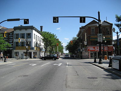
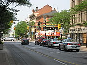
Landmarks


- Pier 9
- Hamilton Waterfront Trail
- McLaren Park
- Canadian National railway overpass
- Stewart Memorial Church (originally St. Paul's African Methodist Episcopal Church. 1961 became a Masonic Hall. North of Wilson StreetWilson Street (Hamilton, Ontario)Wilson Street is a Lower City collector road in Hamilton, Ontario, Canada. It starts off at James Street North and works its way East and ends at Sherman Avenue North...
) - Hamilton Urban Core Community Health Centre (originally downtown Bus terminal)
- Hamilton Hydro-Electric System Building
- Hamilton Central Fire Department
- Downtown Bike Hounds (bicycle shop)
- Gore Park
- Sir John A. Macdonald statue (Gore Park) Statue info. at myhamilton.ca
- War Memorial Monument (Gore Park)
- Royal Connaught HotelRoyal Connaught HotelThe Royal Connaught Hotel is a 13-storey building, 50 metres tall, at the corner of King Street East & John Street South in downtown Hamilton, Ontario, Canada...
/ Holiday InnHoliday InnHoliday Inn is a brand of hotels, formally a economy motel chain, forming part of the British InterContinental Hotels Group . It is one of the world's largest hotel chains with 238,440 bedrooms and 1,301 hotels globally. There are currently 5 hotels in the pipeline... - The London Tap House (5-storey entertainment complex including Hamilton's first rooftop patio restaurant)
- John SopinkaJohn SopinkaJohn Sopinka, QC was a Canadian lawyer and puisne justice on the Supreme Court of Canada, the first Ukrainian-Canadian appointed to the high court....
Courthouse - United Empire LoyalistsUnited Empire LoyalistsThe name United Empire Loyalists is an honorific given after the fact to those American Loyalists who resettled in British North America and other British Colonies as an act of fealty to King George III after the British defeat in the American Revolutionary War and prior to the Treaty of Paris...
statue (in front of the Hamilton Courthouse) Statue info. at myhamilton.ca - The Hamilton Courthouse
- New Horizon Office Building (Tailgate Charlie's restaurant/ bar)
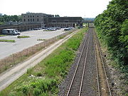
- T.H.& B. Railway Bridge
- Blue Line Taxi Cab Company
- Oakland Square (shopping plaza)
- Church of the Ascension
- Olympia Apartments, just east of John Street South on Charlton Avenue East (Hamilton's 3rd-tallest building)
- St. Joseph's Hospital
- Arkledun Avenue/ Jolley Cut, Mountain-access roads
Communities
Note: Listing of neighbourhoods from North to South- North End - Everything north of the Canadian National Railway tracks
- Central/ Beasley, John Street is the division between these two neighbourhoods.
- Corktown
Major roads that cross John Street

- Burlington Street East
- Barton StreetBarton Street (Hamilton, Ontario)Barton Street is an arterial road in the Lower City of Hamilton, Ontario, Canada. It's also the longest street in the city. It starts off at the Western end of town at Locke Street North and is a two-way street that stretches eastward through a number of different and varied communities in the...
East - Cannon StreetCannon Street (Hamilton, Ontario)Cannon Street, is a Lower City collector road in Hamilton, Ontario, Canada. It starts off at Queen Street North as a one-way street up to Sherman Avenue North where it then switches over to a two-way street the rest of the way Eastward and ends just past Kenilworth Avenue North on Barons Avenue...
East - One way street (Westbound only) - Wilson StreetWilson Street (Hamilton, Ontario)Wilson Street is a Lower City collector road in Hamilton, Ontario, Canada. It starts off at James Street North and works its way East and ends at Sherman Avenue North...
- One way street (Eastbound Only) - King William StreetKing William Street (Hamilton, Ontario)400px|thumb|Theatre AquariusKing William Street is a Lower City collector road in Hamilton, Ontario, Canada. It starts off at the western-end at James Street North and is a one-way street until Mary Street, where it becomes a two-way street that ends at Wentworth Street North.-History:In 1922,...
- One way street (Eastbound Only) - King Street East - One way street (Westbound Only)
- Main StreetMain Street (Hamilton, Ontario)Main Street, is a Lower City arterial road in Hamilton, Ontario, Canada. It starts east of Wilson Street in Ancaster at White Chapel Cemetery as a two-way street and switches over to a one-way street at Paradise Road South, in Westdale, where it continues up to the Delta where it once again...
East - One way street (Eastbound Only) - Jackson StreetJackson Street (Hamilton, Ontario)Jackson Street, is a Lower City collector road in Hamilton, Ontario, Canada. It starts off West of Locke Street South at Jackson Playground as a one-way street up to Queen Street South where it then switches over to a two-way street and is interrupted at Bay Street South the site of the Hamilton...
East - Hunter StreetHunter Street (Hamilton, Ontario)Hunter Street is a Lower City collector road in Hamilton, Ontario, Canada. It is a one-way street that starts West of Locke Street at Hill Street Park and ends two blocks East of Victoria Avenue at Emerald Street...
East - One way street (Westbound Only) - Augusta StreetAugusta Street (Hamilton, Ontario)Augusta Street is a Lower City collector road in Hamilton, Ontario, Canada. A two-way collector road that starts off on James Street South and ends 4-blocks East at Shamrock Park just past Walnut Street South.-History:thumb|Augusta Street, landmark...
- Charlton AvenueCharlton Avenue (Hamilton, Ontario)Charlton Avenue, is a Lower City collector road in Hamilton, Ontario, Canada. This collector road starts of just West of Dundurn Street as a one-way street up to James Street South where it then switches over to a two-way street the rest of the way eastward and ends at Wentworth Street South right...
East - One way street (Westbound Only)
Roads that are parallel with John Street
Note: Listing of streets from West to East.- Queen StreetQueen Street (Hamilton, Ontario)Queen Street, is a Lower City arterial road in Hamilton, Ontario, Canada. It starts off at Beckett Drive, a mountain-access road in the city and is a two-way street up to Herkimer Street and a one-way street the rest of the way north up to the Canadian National Railway Yard where the road turns...
, North, South - Hess StreetHess Street (Hamilton, Ontario)Hess Street, is a Lower City collector road in Hamilton, Ontario, Canada. It starts off at the base of the Niagara Escarpment right before Aberdeen Avenue, and is a one-way street going north past the Durand and Central neighbourhoods. Between Main and King Street West is where you will find Hess...
, North, South - Bay StreetBay Street (Hamilton)Bay Street is a Lower City arterial road in Hamilton, Ontario, Canada. It starts at Inglewood Drive, just South of Aberdeen Avenue, as a collector road with only two lanes, then eventually becomes a six lane thoroughfare at its peak. Bay Street also passes through Downtown Hamilton, where many...
, North, South - MacNab StreetMacNab Street (Hamilton, Ontario)MacNab Street, is a Lower City collector road in Hamilton, Ontario, Canada. It starts in the Durand neighbourhood on Markland Street, as a one-way street going north to Bold Street, where it becomes two-way for one block until Hurst Place where it's cut off by a wall for the Hunter Street railway...
, North, South - James StreetJames Street (Hamilton, Ontario)James Street is a Lower City arterial road in Hamilton, Ontario, Canada. It starts off at the base of the Niagara Escarpment from James Mountain Road, a mountain-access road in the city, originally was a one-way street going south throughout but now has sections of it that are two-way...
, North, South - Hughson StreetHughson Street (Hamilton, Ontario)Hughson Street is a Lower City collector road in Hamilton, Ontario, Canada. It starts at Charlton Avenue East at St. Joseph's hospital and runs north to Haymarket Street in the downtown where it's cut off by the Hamilton GO Transit station. Up to this point it is a two-way street...
, North, South - John Street, North, South
- Catharine StreetCatharine Street (Hamilton, Ontario)Catharine Street, is a Lower City collector road in Hamilton, Ontario, Canada. It starts off at Charlton Avenue East at Woolverton Park in the Corktown neighbourhood as a one-way street , tunnels underneath the Hunter Street Railway bridge and stretches up to Barton Street East where it then turns...
, North, South - Ferguson AvenueFerguson Avenue (Hamilton, Ontario)Ferguson Avenue, is a Lower City collector road in Hamilton, Ontario, Canada. Is a two-way street throughout that starts off at the base of the Mountain on Foster Street. It's interrupted 3-blocks north at Corktown Park where Canadian Pacific Railway lines passes through it...
, North, South - Wellington StreetWellington Street (Hamilton, Ontario)Wellington Street, is a Lower City arterial road in Hamilton, Ontario, Canada. It starts off at Charlton Avenue East as a two-way street for only one block where it's then blocked off by the Corktown Park and a couple of Canadian National Railway lines that cut through it...
, North, South - Victoria AvenueVictoria Avenue (Hamilton, Ontario)Victoria Avenue, is a Lower City arterial road in Hamilton, Ontario, Canada. It starts off as a ramp and part of a Mountain-access road, the Claremont Access, on Hunter Street East in the Stinson neighbourhood...
, North, South - Wentworth StreetWentworth Street (Hamilton, Ontario)Wentworth Street, is a Lower City arterial road in Hamilton, Ontario, Canada. It starts off at the base of the Niagara Escarpment on Charlton Avenue East just before the CP lines as a two-way street for 2-blocks up past Cumberland Avenue up to Rutherford Avenue where it then switches over to a...
, North, South - Sherman AvenueSherman Avenue (Hamilton, Ontario)Sherman Avenue, is a Lower City collector road in Hamilton, Ontario, Canada. It starts off at the base of the Niagara Escarpment just south of Cumberland Avenue and is a one-way street northbound that cuts through the city's North End industrial neighbourhood and ends at Ship Street, the site of...
, North, South
External links
- Beasley Neighbourhood (ourbeasley.com)
- Downtown Hamilton
- North End Neighbours
- Niagara Escarpment Commission (NEC) Official web site
- Google Maps: John Street (Hybrid)