
.gif)
Hurricane Dean (1989)
Encyclopedia
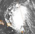
Hurricane Dean was the fourth named storm and second hurricane of the 1989 Atlantic hurricane season
. Dean formed on July 31 and reached tropical storm status the following day east of the Leeward Islands
. Dean brushed the northern Leeward Islands as a Category 1 hurricane on the Saffir–Simpson Hurricane Scale, bringing light rain but producing no damage, before turning northward and striking Bermuda
as a Category 2 hurricane. Dean continued northward before making landfall in southeastern Newfoundland.
Since Dean was initially difficult to forecast, it posed a possible threat to the Lesser Antilles, as a result, several evacuations occurred, and many hurricane watches and warning were issued. However, as Dean turned northward, all watches and warnings in the Lesser Antilles were discontinued. As Dean approached Bermuda, a hurricane watch was issued, and was later upgraded to a hurricane warning. After Dean tracked away from the island, the hurricane warning was discontinued. In addition, a hurricane warning was briefly in effect for Sable Island
, Nova Scotia
. The storm left $8.9 million (1989 USD, $ USD) and sixteen injuries across Bermuda, but no fatalities were reported. In Atlantic Canada
, Dean dropped light rain across Nova Scotia and Sable Island.
moved off the coast of Africa on July 27 as detected by Meteosat
imagery. By July 31 the tropical wave began being classified, using the Dvorak Technique
, by satellite analysts at the National Hurricane Center
, in part due to persistent deep convection. Shortly thereafter the system organized enough that the National Hurricane Center began classifying it as Tropical Depression Five, roughly halfway between Cape Verde
and the Lesser Antilles
. The depression moved westward at 17 mph (28 km/h), intensifying as it did so, and eventually intensified enough to be upgraded to a tropical storm, which was named Dean by the National Hurricane Center.
Continuing generally westward, Dean continued to gradually intensify and became a hurricane on August 2 after an Air Force reconnaissance flight had recorded hurricane force winds. The following day a decreasing ridge of high pressure to the north and a trough
of low pressure forming off the East Coast of the United States
caused Dean to slow in its forward motion and turn northwest. The trough of low pressure forming off the East Coast of the United States was deepening, causing Dean to curve northward while remaining nearly stationary. After remaining nearly stationary, Dean began to accelerate to a forward speed of 17 mph (28 km/h) as it headed toward Bermuda. Thereafter, Dean intensified into a Category 2 hurricane, whilst the eastern half of the eyewall brushed Bermuda. Dean continued to intensify slightly after passing the island of Bermuda and became a Category 2 hurricane on August 7. While Dean was a Category 2 hurricane, it attained its peak intensity with winds of 105 mph (165 km/h) and a minimum pressure of 968 mbar
(hPa;
28.59 inHg
).
After peak intensity, the forward speed of Dean continued to increase as it approached Atlantic Canada while weakening back to a Category 1 hurricane. While approaching southern Newfoundland, Dean had weakened enough to be downgraded to a tropical storm on August 8. Shortly thereafter, Dean then made landfall on the south coast of Newfoundland with winds of 65 mph (105 km/h). Later that day, Dean emerged into the far north Atlantic and rapidly transitioned into an extratropical cyclone on the following day.
. Even though most forecast models predicted that Dean would skirt the Leeward Islands, the track prediction models were not consistent and, as a result, uncertainty existed in justifying the posting of watches and warnings for the Leeward Islands and Puerto Rico
. One track predicted Dean to threaten South Florida
within three to four days.
Regardless, the National Hurricane Center issued hurricane warnings for Guadeloupe
on August 2 and the rest of the Leeward Islands extending to the Virgin Islands
. The uncertainty of the hurricanes forecast track forced residents and tourists in the Lesser Antilles to evacuate. In the British Virgin Islands
, 80 American and Canadian tourists evacuated to hotels. In Puerto Rico, residents were advised to secure or stow away loose objects and stock up on emergency supplies. 1.1 million residents in the city of San Juan
went to supermarkets to get much needed supplies in anticipation that the storm might hit Puerto Rico. In Humacao
, the National Guard
evacuated 1,966 people living along a coastal highway. The islands of Martinique
and Dominica
were placed under a hurricane watch. The warning for Guadeloupe
was discontinued at 2200 UTC when the hurricane posed no threat to the island. Simultaneously, the hurricane watches in effect for Martinique and Dominica were also discontinued. As Dean continued westward, the National Hurricane Center issued a hurricane watch for the Turks and Caicos Islands
. The watch was soon canceled as Dean made its northward turn towards Bermuda.
In Bermuda, the National Hurricane Center issued a hurricane watch on August 5. The hurricane watch was later changed to a hurricane warning the following day. Dean’s approach to the island canceled numerous inbound and outbound flights. In Atlantic Canada, the National Hurricane Center issued a hurricane warning for Nova Scotia and Sable Island, while the Canadian forecasters issued a high wind advisory.
 The outer bands of Hurricane Dean produced heavy rainfall and winds up to 75 mph (121 km/h) across Antigua
and Barbuda
. There was no reported damage in the Leeward Islands or the Virgin Islands
since the hurricane turned northward. In the Atlantic, a sailboat bound for Bermuda was caught off guard by the hurricane. The boat, which carried no radio equipment, was spotted by a hurricane hunter plane. The occupants of the boat suffered no injuries. In Bermuda, the hurricanes eastern eyewall produced 81 mph (130 km/h) sustained winds with gusts up to 113 mph (182 km/h). Bermuda highest rainfall total from Dean was 2.45 in
(50.8 mm
) while parts of the island received 3-5 in (76.2–127 mm) of rain.
Strong winds from Hurricane Dean caused considerable power line damage, leaving 65,000 residents without electricity
. The winds also caused minor roof damage. In Hamilton Harbor, 20 pleasure boats were damaged or sent adrift due to the rough seas. Flooding from the hurricane damaged fifteen houses. Sixteen people were injured by the hurricane, five of the injuries were considered serious. There were, however, no reports of fatalities from Dean’s impact on Bermuda. Damage in Bermuda amounted up to $8.9 million (1989 USD, $ USD).
Although Dean remained away from the United States
coastline, it produced storm tide
s of 1.7 ft (0.51 m) to North Carolina
. In Atlantic Canada, hurricane force winds were reported in Nova Scotia and Sable Island. Newfoundland reported winds of only 50 mph (80 km/h). Moderate rainfall was reported on Newfoundland, with most areas of the island experiencing at least 1 in (25.4 mm) of precipitation. Rainfall on Newfoundland peaked at 2.7 in (68.58 mm) on the south coast of the island, near the location of Dean's landfall. A majority of rainfall was reported on the west side of Dean, but minimal precipitation had been recorded to the east of the storm. High winds were reported on the eastern side of the storm, however, with lighter winds along the western quadrants of Dean. Offshore, waves up to 26 ft (7.92 m) were reported and Sable Island reported rainfall of 0.59 in (15 mm). Although there were no reports of damage in Atlantic Canada from Hurricane Dean, three sailors had to be rescued by the Canadian Coast Guard
when their boat got dismasted during the storm.
1989 Atlantic hurricane season
The 1989 Atlantic hurricane season was an active season that produced fifteen tropical cyclones, eleven named storms, seven hurricanes, and two major hurricanes. The season was officially designated from June 1, 1989, to November 30, 1989, dates which conventionally...
. Dean formed on July 31 and reached tropical storm status the following day east of the Leeward Islands
Leeward Islands
The Leeward Islands are a group of islands in the West Indies. They are the northern islands of the Lesser Antilles chain. As a group they start east of Puerto Rico and reach southward to Dominica. They are situated where the northeastern Caribbean Sea meets the western Atlantic Ocean...
. Dean brushed the northern Leeward Islands as a Category 1 hurricane on the Saffir–Simpson Hurricane Scale, bringing light rain but producing no damage, before turning northward and striking Bermuda
Bermuda
Bermuda is a British overseas territory in the North Atlantic Ocean. Located off the east coast of the United States, its nearest landmass is Cape Hatteras, North Carolina, about to the west-northwest. It is about south of Halifax, Nova Scotia, Canada, and northeast of Miami, Florida...
as a Category 2 hurricane. Dean continued northward before making landfall in southeastern Newfoundland.
Since Dean was initially difficult to forecast, it posed a possible threat to the Lesser Antilles, as a result, several evacuations occurred, and many hurricane watches and warning were issued. However, as Dean turned northward, all watches and warnings in the Lesser Antilles were discontinued. As Dean approached Bermuda, a hurricane watch was issued, and was later upgraded to a hurricane warning. After Dean tracked away from the island, the hurricane warning was discontinued. In addition, a hurricane warning was briefly in effect for Sable Island
Sable Island
Sable Island is a small Canadian island situated 300 km southeast of mainland Nova Scotia in the Atlantic Ocean. The island is a year-round home to approximately five people...
, Nova Scotia
Nova Scotia
Nova Scotia is one of Canada's three Maritime provinces and is the most populous province in Atlantic Canada. The name of the province is Latin for "New Scotland," but "Nova Scotia" is the recognized, English-language name of the province. The provincial capital is Halifax. Nova Scotia is the...
. The storm left $8.9 million (1989 USD, $ USD) and sixteen injuries across Bermuda, but no fatalities were reported. In Atlantic Canada
Atlantic Canada
Atlantic Canada is the region of Canada comprising the four provinces located on the Atlantic coast, excluding Quebec: the three Maritime provinces – New Brunswick, Prince Edward Island, and Nova Scotia – and Newfoundland and Labrador...
, Dean dropped light rain across Nova Scotia and Sable Island.
Meteorological history
A tropical waveTropical wave
Tropical waves, easterly waves, or tropical easterly waves, also known as African easterly waves in the Atlantic region, are a type of atmospheric trough, an elongated area of relatively low air pressure, oriented north to south, which move from east to west across the tropics causing areas of...
moved off the coast of Africa on July 27 as detected by Meteosat
Meteosat
The Meteosat series of satellites are geostationary meteorological satellites operated by EUMETSAT under the Meteosat Transition Programme and the Meteosat Second Generation program....
imagery. By July 31 the tropical wave began being classified, using the Dvorak Technique
Dvorak technique
The Dvorak technique is a widely used system to subjectively estimate tropical cyclone intensity based solely on visible and infrared satellite images. Several agencies issue Dvorak intensity numbers for cyclones of sufficient intensity...
, by satellite analysts at the National Hurricane Center
National Hurricane Center
The National Hurricane Center , located at Florida International University in Miami, Florida, is the division of the National Weather Service responsible for tracking and predicting weather systems within the tropics between the Prime Meridian and the 140th meridian west poleward to the 30th...
, in part due to persistent deep convection. Shortly thereafter the system organized enough that the National Hurricane Center began classifying it as Tropical Depression Five, roughly halfway between Cape Verde
Cape Verde
The Republic of Cape Verde is an island country, spanning an archipelago of 10 islands located in the central Atlantic Ocean, 570 kilometres off the coast of Western Africa...
and the Lesser Antilles
Lesser Antilles
The Lesser Antilles are a long, partly volcanic island arc in the Western Hemisphere. Most of its islands form the eastern boundary of the Caribbean Sea with the Atlantic Ocean, with the remainder located in the southern Caribbean just north of South America...
. The depression moved westward at 17 mph (28 km/h), intensifying as it did so, and eventually intensified enough to be upgraded to a tropical storm, which was named Dean by the National Hurricane Center.
Continuing generally westward, Dean continued to gradually intensify and became a hurricane on August 2 after an Air Force reconnaissance flight had recorded hurricane force winds. The following day a decreasing ridge of high pressure to the north and a trough
Trough (meteorology)
A trough is an elongated region of relatively low atmospheric pressure, often associated with fronts.Unlike fronts, there is not a universal symbol for a trough on a weather chart. The weather charts in some countries or regions mark troughs by a line. In the United States, a trough may be marked...
of low pressure forming off the East Coast of the United States
East Coast of the United States
The East Coast of the United States, also known as the Eastern Seaboard, refers to the easternmost coastal states in the United States, which touch the Atlantic Ocean and stretch up to Canada. The term includes the U.S...
caused Dean to slow in its forward motion and turn northwest. The trough of low pressure forming off the East Coast of the United States was deepening, causing Dean to curve northward while remaining nearly stationary. After remaining nearly stationary, Dean began to accelerate to a forward speed of 17 mph (28 km/h) as it headed toward Bermuda. Thereafter, Dean intensified into a Category 2 hurricane, whilst the eastern half of the eyewall brushed Bermuda. Dean continued to intensify slightly after passing the island of Bermuda and became a Category 2 hurricane on August 7. While Dean was a Category 2 hurricane, it attained its peak intensity with winds of 105 mph (165 km/h) and a minimum pressure of 968 mbar
Bar (unit)
The bar is a unit of pressure equal to 100 kilopascals, and roughly equal to the atmospheric pressure on Earth at sea level. Other units derived from the bar are the megabar , kilobar , decibar , centibar , and millibar...
(hPa;
Pascal (unit)
The pascal is the SI derived unit of pressure, internal pressure, stress, Young's modulus and tensile strength, named after the French mathematician, physicist, inventor, writer, and philosopher Blaise Pascal. It is a measure of force per unit area, defined as one newton per square metre...
28.59 inHg
Inch of mercury
Inches of mercury, ' is a unit of measurement for pressure. It is still widely used for barometric pressure in weather reports, refrigeration and aviation in the United States, but is seldom used elsewhere....
).
After peak intensity, the forward speed of Dean continued to increase as it approached Atlantic Canada while weakening back to a Category 1 hurricane. While approaching southern Newfoundland, Dean had weakened enough to be downgraded to a tropical storm on August 8. Shortly thereafter, Dean then made landfall on the south coast of Newfoundland with winds of 65 mph (105 km/h). Later that day, Dean emerged into the far north Atlantic and rapidly transitioned into an extratropical cyclone on the following day.
Preparations
Hurricane Dean was very difficult to forecast in its early stages as the storm approached the eastern CaribbeanCaribbean
The Caribbean is a crescent-shaped group of islands more than 2,000 miles long separating the Gulf of Mexico and the Caribbean Sea, to the west and south, from the Atlantic Ocean, to the east and north...
. Even though most forecast models predicted that Dean would skirt the Leeward Islands, the track prediction models were not consistent and, as a result, uncertainty existed in justifying the posting of watches and warnings for the Leeward Islands and Puerto Rico
Puerto Rico
Puerto Rico , officially the Commonwealth of Puerto Rico , is an unincorporated territory of the United States, located in the northeastern Caribbean, east of the Dominican Republic and west of both the United States Virgin Islands and the British Virgin Islands.Puerto Rico comprises an...
. One track predicted Dean to threaten South Florida
Florida
Florida is a state in the southeastern United States, located on the nation's Atlantic and Gulf coasts. It is bordered to the west by the Gulf of Mexico, to the north by Alabama and Georgia and to the east by the Atlantic Ocean. With a population of 18,801,310 as measured by the 2010 census, it...
within three to four days.
Regardless, the National Hurricane Center issued hurricane warnings for Guadeloupe
Guadeloupe
Guadeloupe is an archipelago located in the Leeward Islands, in the Lesser Antilles, with a land area of 1,628 square kilometres and a population of 400,000. It is the first overseas region of France, consisting of a single overseas department. As with the other overseas departments, Guadeloupe...
on August 2 and the rest of the Leeward Islands extending to the Virgin Islands
Virgin Islands
The Virgin Islands are the western island group of the Leeward Islands, which are the northern part of the Lesser Antilles, which form the border between the Caribbean Sea and the Atlantic Ocean...
. The uncertainty of the hurricanes forecast track forced residents and tourists in the Lesser Antilles to evacuate. In the British Virgin Islands
British Virgin Islands
The Virgin Islands, often called the British Virgin Islands , is a British overseas territory and overseas territory of the European Union, located in the Caribbean to the east of Puerto Rico. The islands make up part of the Virgin Islands archipelago, the remaining islands constituting the U.S...
, 80 American and Canadian tourists evacuated to hotels. In Puerto Rico, residents were advised to secure or stow away loose objects and stock up on emergency supplies. 1.1 million residents in the city of San Juan
San Juan, Puerto Rico
San Juan , officially Municipio de la Ciudad Capital San Juan Bautista , is the capital and most populous municipality in Puerto Rico, an unincorporated territory of the United States. As of the 2010 census, it had a population of 395,326 making it the 46th-largest city under the jurisdiction of...
went to supermarkets to get much needed supplies in anticipation that the storm might hit Puerto Rico. In Humacao
Humacao, Puerto Rico
Humacao is a city in Puerto Rico located in the eastern coast of the island, north of Yabucoa; south of Naguabo; east of Las Piedras; and west of Vieques Passage. Humacao is spread over 10 wards and Humacao Pueblo...
, the National Guard
United States National Guard
The National Guard of the United States is a reserve military force composed of state National Guard militia members or units under federally recognized active or inactive armed force service for the United States. Militia members are citizen soldiers, meaning they work part time for the National...
evacuated 1,966 people living along a coastal highway. The islands of Martinique
Martinique
Martinique is an island in the eastern Caribbean Sea, with a land area of . Like Guadeloupe, it is an overseas region of France, consisting of a single overseas department. To the northwest lies Dominica, to the south St Lucia, and to the southeast Barbados...
and Dominica
Dominica
Dominica , officially the Commonwealth of Dominica, is an island nation in the Lesser Antilles region of the Caribbean Sea, south-southeast of Guadeloupe and northwest of Martinique. Its size is and the highest point in the country is Morne Diablotins, which has an elevation of . The Commonwealth...
were placed under a hurricane watch. The warning for Guadeloupe
Guadeloupe
Guadeloupe is an archipelago located in the Leeward Islands, in the Lesser Antilles, with a land area of 1,628 square kilometres and a population of 400,000. It is the first overseas region of France, consisting of a single overseas department. As with the other overseas departments, Guadeloupe...
was discontinued at 2200 UTC when the hurricane posed no threat to the island. Simultaneously, the hurricane watches in effect for Martinique and Dominica were also discontinued. As Dean continued westward, the National Hurricane Center issued a hurricane watch for the Turks and Caicos Islands
Turks and Caicos Islands
The Turks and Caicos Islands are a British Overseas Territory and overseas territory of the European Union consisting of two groups of tropical islands in the Caribbean, the larger Caicos Islands and the smaller Turks Islands, known for tourism and as an offshore financial centre.The Turks and...
. The watch was soon canceled as Dean made its northward turn towards Bermuda.
In Bermuda, the National Hurricane Center issued a hurricane watch on August 5. The hurricane watch was later changed to a hurricane warning the following day. Dean’s approach to the island canceled numerous inbound and outbound flights. In Atlantic Canada, the National Hurricane Center issued a hurricane warning for Nova Scotia and Sable Island, while the Canadian forecasters issued a high wind advisory.
Impact
Antigua
Antigua , also known as Waladli, is an island in the West Indies, in the Leeward Islands in the Caribbean region, the main island of the country of Antigua and Barbuda. Antigua means "ancient" in Spanish and was named by Christopher Columbus after an icon in Seville Cathedral, Santa Maria de la...
and Barbuda
Barbuda
Barbuda is an island in the Eastern Caribbean, and forms part of the state of Antigua and Barbuda. It has a population of about 1,500, most of whom live in the town of Codrington.-Location:...
. There was no reported damage in the Leeward Islands or the Virgin Islands
Virgin Islands
The Virgin Islands are the western island group of the Leeward Islands, which are the northern part of the Lesser Antilles, which form the border between the Caribbean Sea and the Atlantic Ocean...
since the hurricane turned northward. In the Atlantic, a sailboat bound for Bermuda was caught off guard by the hurricane. The boat, which carried no radio equipment, was spotted by a hurricane hunter plane. The occupants of the boat suffered no injuries. In Bermuda, the hurricanes eastern eyewall produced 81 mph (130 km/h) sustained winds with gusts up to 113 mph (182 km/h). Bermuda highest rainfall total from Dean was 2.45 in
Inch
An inch is the name of a unit of length in a number of different systems, including Imperial units, and United States customary units. There are 36 inches in a yard and 12 inches in a foot...
(50.8 mm
Millimetre
The millimetre is a unit of length in the metric system, equal to one thousandth of a metre, which is the SI base unit of length....
) while parts of the island received 3-5 in (76.2–127 mm) of rain.
Strong winds from Hurricane Dean caused considerable power line damage, leaving 65,000 residents without electricity
Electricity
Electricity is a general term encompassing a variety of phenomena resulting from the presence and flow of electric charge. These include many easily recognizable phenomena, such as lightning, static electricity, and the flow of electrical current in an electrical wire...
. The winds also caused minor roof damage. In Hamilton Harbor, 20 pleasure boats were damaged or sent adrift due to the rough seas. Flooding from the hurricane damaged fifteen houses. Sixteen people were injured by the hurricane, five of the injuries were considered serious. There were, however, no reports of fatalities from Dean’s impact on Bermuda. Damage in Bermuda amounted up to $8.9 million (1989 USD, $ USD).
Although Dean remained away from the United States
United States
The United States of America is a federal constitutional republic comprising fifty states and a federal district...
coastline, it produced storm tide
Storm tide
A storm tide is a tide with a high flood period caused by a storm. Storm tides can be a severe danger to the coast and the people living along the coast. The water level can rise to more than 5 meters above the normal tide....
s of 1.7 ft (0.51 m) to North Carolina
North Carolina
North Carolina is a state located in the southeastern United States. The state borders South Carolina and Georgia to the south, Tennessee to the west and Virginia to the north. North Carolina contains 100 counties. Its capital is Raleigh, and its largest city is Charlotte...
. In Atlantic Canada, hurricane force winds were reported in Nova Scotia and Sable Island. Newfoundland reported winds of only 50 mph (80 km/h). Moderate rainfall was reported on Newfoundland, with most areas of the island experiencing at least 1 in (25.4 mm) of precipitation. Rainfall on Newfoundland peaked at 2.7 in (68.58 mm) on the south coast of the island, near the location of Dean's landfall. A majority of rainfall was reported on the west side of Dean, but minimal precipitation had been recorded to the east of the storm. High winds were reported on the eastern side of the storm, however, with lighter winds along the western quadrants of Dean. Offshore, waves up to 26 ft (7.92 m) were reported and Sable Island reported rainfall of 0.59 in (15 mm). Although there were no reports of damage in Atlantic Canada from Hurricane Dean, three sailors had to be rescued by the Canadian Coast Guard
Canadian Coast Guard
The Canadian Coast Guard is the coast guard of Canada. It is a federal agency responsible for providing maritime search and rescue , aids to navigation, marine pollution response, marine radio, and icebreaking...
when their boat got dismasted during the storm.
See also
- Other storms of the same name