
1989 Pacific typhoon season
Encyclopedia
The 1989 Pacific typhoon season has no official bounds; it ran year-round in 1989, but most tropical cyclones tend to form in the northwestern Pacific Ocean between May and November. These dates conventionally delimit the period of each year when most tropical cyclones form in the northwestern Pacific Ocean. Tropical Storms formed in the entire west pacific basin were assigned a name by the Joint Typhoon Warning Center
. Tropical depressions that enter or form in the Philippine area of responsibility are assigned a name by the Philippine Atmospheric, Geophysical and Astronomical Services Administration
or PAGASA. This can often result in the same storm having two names.
during the decade of the 1980s
.
out of the west, dissipating as a tropical cyclone on April 24. Andy became the second typhoon to form in April in nine years.
and southern Luzon
in the Philippines
that day. At least 4 ships sank and 50 people were killed in the Philippines
. Brenda became a typhoon and reached a peak of 85 mi/h winds before hitting southern China on the 20th. The storm brought torrential flooding, resulting in at least 84 casualties and widespread damage in China. In Hong Kong six people were killed and one was missing due to landslides and flooding.
from the monsoon trough. It became a tropical storm later on the 22nd, and reached typhoon strength on the 24th. Cecil initially tracked to the northwest, but ridging to the north forced the typhoon westward where it hit central Vietnam
on the 24th. Cecil rapidly dissipated, but not after bringing heavy flooding that killed 52 and left over 100,000 homeless.
, Dot moved steadily west-northwest across the Philippines
through the South China Sea
across southern Hainan
island into northern Vietnam
.
on June 18, the system moved westward initially and became a tropical depression late on June 20 and weakened on June 21. Early on June 23, the large system with gales well removed from its center became a tropical depression once more. A trough to its northwest had deepened, which was accelerating the cyclone northward. It became a minimal tropical storm during this acceleration. Late that day, it became a frontal wave before moving through Japan into the Sea of Japan
.
beneath the Tropical Upper Tropospheric Trough developed into a weak tropical depression on July 9. It tracked westward with a cold core upper level low aloft, a very unusual circumstance. Initially forecast to remain weak due to the lack of upper level outflow, it was able to strengthen into a tropical storm on the 12th. The cold low quickly warmed, and Gordon became a typhoon on the 13th. It rapidly intensified on the 14th and 15th to a 160 mi/h super typhoon, and hit northern Luzon
later that day at that intensity. It steadily weakened as hit moved westward, and made landfall on southern China, 100 miles (160.9 km) southwest of Hong Kong, as a 70 mi/h tropical storm on the 18th. Gordon caused 97 casualties and left 120,000 homeless.
west of the Philippines
on July 21. Although hampered by northerly sheer Irving intensified to a peak of 65 mi/h just before landfall in northern Vietnam
. In Vietnam
102 people were killed due to Tropical Storm Irving's passage.
.
while moving eastwards. The disturbance consolidated to a depression on the 24th of August and was named Tropical Storm Roger the next day. Roger then abruptly turned towards the northeast and accelerated. Roger reached peak intensity of 60 mi/h just before landfall at Cape Muroto on Shikoku Island. 19 inches of rain fell across Honshū Island as Tropical Storm Roger moved through, the resulting landslides and floods killed 3 people.
activity to the country. Sarah turned northward, where it rapidly intensified to a 145 mph typhoon on the 11th. The system had 2 main centers, causing it to loop while south of Taiwan
before crossing the island on the 12th. Sarah continued northwestward, and dissipated over eastern China on the 14th. 44 casualties can be attributed to this system.
, and tracked northeast until the subtropical ridge
blocked its motion in that direction. Rounding the western periphery of the ridge, Tip eventually recurved well offshore Japan and became an extratropical cyclone
.
an area of convection formed about 390 miles (627.6 km) southeast of Hong Kong. As the area of convection became stationary in the South China Sea
a tropical depression formed on the 28th of September. Tropical Storm Brian was named on the 29th as the storm moved towards the west-northwest, Brian strengthened to a typhoon the next day. Typhoon Brian reached peak intensity of 95 mi/h just 20 miles (32.2 km) off the southeast coast of Hainan Island. Typhoon Brian dropped heavy rains heavy flooding occurred and 31 people were killed as well as heavy damage to rice crops. After leaving Hainan Island Brian continued westward making a second landfall near Vinh, Vietnam before dissipating in the mountains of northern Vietnam
.
and left 232,555 people homeless.
as it was a large cyclone. Once it passed Guam by only 140 km/85 mi, it intensified into a typhoon, with maximum sustained winds peaking at 95 kt/110 mph. Tree limbs and power lines were downed as the system pulled away from Saipan. It then recurved, accelerating northeast to become of the strongest extratropical cyclones in the Pacific Ocean that year.
in early November. It continued westward, reaching a peak of 160 mi/h winds before hitting India and dissipating on the 10th. Gay killed over 1,000 people.
on the 16th of November. As the depression moved towards the northwest it strengthened into Tropical Storm Hunt which rapidly intensified becoming a typhoon while moving towards the northwest. Typhoon Hunt reached peak intensity of 105 mi/h just before turning due west towards the Philippines
. Hunt maintained peak intensity until landfall on central Luzon Island. 7 people were killed and minor damage occurred to U.S. Military operations. After departing the Philippines Hunt was downgraded and dissipated in the South China Sea
.
. The first storm of 1989 was named Winona and the final one was named Jack. Though the names Ken and Lola were used separately, they were in fact one system.
{|width="90%"
|
|
Joint Typhoon Warning Center
The Joint Typhoon Warning Center is a joint United States Navy – United States Air Force task force located at the Naval Maritime Forecast Center in Pearl Harbor, Hawaii...
. Tropical depressions that enter or form in the Philippine area of responsibility are assigned a name by the Philippine Atmospheric, Geophysical and Astronomical Services Administration
Philippine Atmospheric, Geophysical and Astronomical Services Administration
The Philippine Atmospheric, Geophysical and Astronomical Services Administration is a Philippine national institution dedicated to provide flood and typhoon warnings, public weather forecasts and advisories, meteorological, astronomical, climatological, and other specialized information and...
or PAGASA. This can often result in the same storm having two names.
Storms
A total of 35 tropical cyclones formed this year in the Western Pacific, of which 32 became tropical storms. They existed in every month of the year except February and March. Of the 35 cyclones, 21 reached typhoon intensity, and of these six reached super typhoon strength. Ten tropical cyclones struck the Philippines this season, making it the most active for the archipelagoArchipelago
An archipelago , sometimes called an island group, is a chain or cluster of islands. The word archipelago is derived from the Greek ἄρχι- – arkhi- and πέλαγος – pélagos through the Italian arcipelago...
during the decade of the 1980s
1980s
File:1980s decade montage.png|thumb|400px|From left, clockwise: The first Space Shuttle, Columbia, lifted off in 1981; American President Ronald Reagan and Soviet leader Mikhail Gorbachev eased tensions between the two superpowers, leading to the end of the Cold War; The Fall of the Berlin Wall in...
.
Tropical Storm Winona (Atring)
It formed east of the International Dateline on January 15. It dissipated on January 21 on North of Mindanao.Typhoon Andy
Thunderstorm activity increased in coverage near Truk/Chuuk in the Caroline Islands on April 13. The system slowly developed, organizing into a tropical depression on April 18 while moving slowly to the west. On April 19, Andy began to move northward while continuing to intensify. The intense cyclone missed Guam by 130 kilometres (80.8 mi) to the southeast, with winds peaking at68 knots (133.3 km/h) on Guam. Thereafter, Andy recurved to the northeast and steadily weakened due to increased vertical wind shearWind shear
Wind shear, sometimes referred to as windshear or wind gradient, is a difference in wind speed and direction over a relatively short distance in the atmosphere...
out of the west, dissipating as a tropical cyclone on April 24. Andy became the second typhoon to form in April in nine years.
Typhoon Brenda (Bining)
A tropical depression which formed in the monsoon trough on May 14 became a tropical storm on the 16th and struck Samar IslandSamar Island
Samar is an island in the Visayas, within the central Philippines. The island is divided into three provinces: Samar province, Northern Samar, and Eastern Samar. These three provinces, along with the provinces on the nearby islands of Leyte and Biliran are part of the Eastern Visayas region...
and southern Luzon
Luzon
Luzon is the largest island in the Philippines. It is located in the northernmost region of the archipelago, and is also the name for one of the three primary island groups in the country centered on the Island of Luzon...
in the Philippines
Philippines
The Philippines , officially known as the Republic of the Philippines , is a country in Southeast Asia in the western Pacific Ocean. To its north across the Luzon Strait lies Taiwan. West across the South China Sea sits Vietnam...
that day. At least 4 ships sank and 50 people were killed in the Philippines
Philippines
The Philippines , officially known as the Republic of the Philippines , is a country in Southeast Asia in the western Pacific Ocean. To its north across the Luzon Strait lies Taiwan. West across the South China Sea sits Vietnam...
. Brenda became a typhoon and reached a peak of 85 mi/h winds before hitting southern China on the 20th. The storm brought torrential flooding, resulting in at least 84 casualties and widespread damage in China. In Hong Kong six people were killed and one was missing due to landslides and flooding.
Typhoon Cecil
The day after Brenda dissipated another tropical depression formed in the South China SeaSouth China Sea
The South China Sea is a marginal sea that is part of the Pacific Ocean, encompassing an area from the Singapore and Malacca Straits to the Strait of Taiwan of around...
from the monsoon trough. It became a tropical storm later on the 22nd, and reached typhoon strength on the 24th. Cecil initially tracked to the northwest, but ridging to the north forced the typhoon westward where it hit central Vietnam
Vietnam
Vietnam – sometimes spelled Viet Nam , officially the Socialist Republic of Vietnam – is the easternmost country on the Indochina Peninsula in Southeast Asia. It is bordered by China to the north, Laos to the northwest, Cambodia to the southwest, and the South China Sea –...
on the 24th. Cecil rapidly dissipated, but not after bringing heavy flooding that killed 52 and left over 100,000 homeless.
Typhoon Dot (Kuring)
Forming south of the central Caroline IslandsCaroline Islands
The Caroline Islands are a widely scattered archipelago of tiny islands in the western Pacific Ocean, to the north of New Guinea. Politically they are divided between the Federated States of Micronesia in the eastern part of the group, and Palau at the extreme western end...
, Dot moved steadily west-northwest across the Philippines
Philippines
The Philippines , officially known as the Republic of the Philippines , is a country in Southeast Asia in the western Pacific Ocean. To its north across the Luzon Strait lies Taiwan. West across the South China Sea sits Vietnam...
through the South China Sea
South China Sea
The South China Sea is a marginal sea that is part of the Pacific Ocean, encompassing an area from the Singapore and Malacca Straits to the Strait of Taiwan of around...
across southern Hainan
Hainan
Hainan is the smallest province of the People's Republic of China . Although the province comprises some two hundred islands scattered among three archipelagos off the southern coast, of its land mass is Hainan Island , from which the province takes its name...
island into northern Vietnam
Vietnam
Vietnam – sometimes spelled Viet Nam , officially the Socialist Republic of Vietnam – is the easternmost country on the Indochina Peninsula in Southeast Asia. It is bordered by China to the north, Laos to the northwest, Cambodia to the southwest, and the South China Sea –...
.
Tropical Storm Ellis (Daling)
Developing as a disturbance in the Philippine SeaPhilippine Sea
The Philippine Sea is a marginal sea east and north of the Philippines occupying an estimated surface area of 2 million mi² on the western part of the North Pacific Ocean...
on June 18, the system moved westward initially and became a tropical depression late on June 20 and weakened on June 21. Early on June 23, the large system with gales well removed from its center became a tropical depression once more. A trough to its northwest had deepened, which was accelerating the cyclone northward. It became a minimal tropical storm during this acceleration. Late that day, it became a frontal wave before moving through Japan into the Sea of Japan
Sea of Japan
The Sea of Japan is a marginal sea of the western Pacific Ocean, between the Asian mainland, the Japanese archipelago and Sakhalin. It is bordered by Japan, North Korea, Russia and South Korea. Like the Mediterranean Sea, it has almost no tides due to its nearly complete enclosure from the Pacific...
.
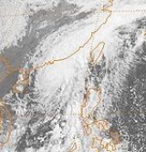
Typhoon Gordon (Goring)
A single Cumulonimbus cloudCumulonimbus cloud
Cumulonimbus is a towering vertical cloud that is very tall, dense, and involved in thunderstorms and other inclement weather. Cumulonimbus originates from Latin: Cumulus "Heap" and nimbus "rain". It is a result of atmospheric instability. These clouds can form alone, in clusters, or along a cold...
beneath the Tropical Upper Tropospheric Trough developed into a weak tropical depression on July 9. It tracked westward with a cold core upper level low aloft, a very unusual circumstance. Initially forecast to remain weak due to the lack of upper level outflow, it was able to strengthen into a tropical storm on the 12th. The cold low quickly warmed, and Gordon became a typhoon on the 13th. It rapidly intensified on the 14th and 15th to a 160 mi/h super typhoon, and hit northern Luzon
Luzon
Luzon is the largest island in the Philippines. It is located in the northernmost region of the archipelago, and is also the name for one of the three primary island groups in the country centered on the Island of Luzon...
later that day at that intensity. It steadily weakened as hit moved westward, and made landfall on southern China, 100 miles (160.9 km) southwest of Hong Kong, as a 70 mi/h tropical storm on the 18th. Gordon caused 97 casualties and left 120,000 homeless.
Tropical Storm Hope (Luming)
A tropical depression formed in the wake of Super Typhoon Gordon on the 16th of July. The depression moved towards the northwest and strengthened into Tropical Storm Hope. Hope moved approximately 100 miles (160.9 km) south of Okinawa and then strengthened to a peak of 65 mi/h while nearing the China coastline. Hope made landfall on the east China coastline on July 21. Heavy rains caused widespread flooding and landslides resulting in 24 casualties.Severe Tropical Storm Irving (Ibiang)
Tropical Storm Irving formed in the South China SeaSouth China Sea
The South China Sea is a marginal sea that is part of the Pacific Ocean, encompassing an area from the Singapore and Malacca Straits to the Strait of Taiwan of around...
west of the Philippines
Philippines
The Philippines , officially known as the Republic of the Philippines , is a country in Southeast Asia in the western Pacific Ocean. To its north across the Luzon Strait lies Taiwan. West across the South China Sea sits Vietnam...
on July 21. Although hampered by northerly sheer Irving intensified to a peak of 65 mi/h just before landfall in northern Vietnam
Vietnam
Vietnam – sometimes spelled Viet Nam , officially the Socialist Republic of Vietnam – is the easternmost country on the Indochina Peninsula in Southeast Asia. It is bordered by China to the north, Laos to the northwest, Cambodia to the southwest, and the South China Sea –...
. In Vietnam
Vietnam
Vietnam – sometimes spelled Viet Nam , officially the Socialist Republic of Vietnam – is the easternmost country on the Indochina Peninsula in Southeast Asia. It is bordered by China to the north, Laos to the northwest, Cambodia to the southwest, and the South China Sea –...
102 people were killed due to Tropical Storm Irving's passage.
Severe Tropical Storm Ken-Lola
The monsoon trough spawned a tropical depression on July 29. Poorly organized, it moved quickly northeastward and became a tropical storm on the 30th. Operationally, Tropical Storm Ken continued northeastward with the rest of the convection, with Tropical Storm Lola forming further westward, but the ill-defined circulation actually continued westward, leading to one storm with two names. Ken-Lola turned to the southwest, stalling before heading northwest again. Ken-Lola reached a peak of 65 mi/h winds before hitting eastern China on the 3rd, causing little damage as it slowly dissipated until the 7th. Ken-Lola shows the troubles of tracking poorly organized systems. A more recent example is Tropical Depression 32W/33W in 19951995 Pacific typhoon season
-Typhoon Faye:On July 19, Tropical Storm Faye became the first typhoon of the season, tied for the second latest date of the first typhoon with 1977, only behind Otto of 1998. It tracked northwestward and reached a peak of 120 mph winds 2 days later. Faye turned northward, and after...
.
Typhoon Mac
Moving around the northeast side of Ken-Lola, and then an upper tropospheric cyclone Mac moved along a wide northwest arc before settling on a north-northwest track into Japan as a typhoon on August 6, dissipating over Sakhalin Island on August 8.Severe Tropical Storm Roger
A tropical disturbance began to organize just to the north of TaiwanTaiwan
Taiwan , also known, especially in the past, as Formosa , is the largest island of the same-named island group of East Asia in the western Pacific Ocean and located off the southeastern coast of mainland China. The island forms over 99% of the current territory of the Republic of China following...
while moving eastwards. The disturbance consolidated to a depression on the 24th of August and was named Tropical Storm Roger the next day. Roger then abruptly turned towards the northeast and accelerated. Roger reached peak intensity of 60 mi/h just before landfall at Cape Muroto on Shikoku Island. 19 inches of rain fell across Honshū Island as Tropical Storm Roger moved through, the resulting landslides and floods killed 3 people.
Typhoon Sarah (Openg)
On September 9, Typhoon Sarah, which formed on the 3rd, stalled east of the Philippines, bringing heavy rain and rare tornadicTornado
A tornado is a violent, dangerous, rotating column of air that is in contact with both the surface of the earth and a cumulonimbus cloud or, in rare cases, the base of a cumulus cloud. They are often referred to as a twister or a cyclone, although the word cyclone is used in meteorology in a wider...
activity to the country. Sarah turned northward, where it rapidly intensified to a 145 mph typhoon on the 11th. The system had 2 main centers, causing it to loop while south of Taiwan
Taiwan
Taiwan , also known, especially in the past, as Formosa , is the largest island of the same-named island group of East Asia in the western Pacific Ocean and located off the southeastern coast of mainland China. The island forms over 99% of the current territory of the Republic of China following...
before crossing the island on the 12th. Sarah continued northwestward, and dissipated over eastern China on the 14th. 44 casualties can be attributed to this system.
Severe Tropical Storm Tip
Tip formed along the eastern portion of the monsoon troughMonsoon trough
The monsoon trough is that portion of the Intertropical Convergence Zone which extends into or through a monsoon circulation, as depicted by a line on a weather map showing the locations of minimum sea level pressure, and as such, is a convergence zone between the wind patterns of the southern and...
, and tracked northeast until the subtropical ridge
Subtropical ridge
The subtropical ridge is a significant belt of high pressure situated around the latitudes of 30°N in the Northern Hemisphere and 30°S in the Southern Hemisphere. It is characterized by mostly calm winds, which acts to reduce air quality under its axis by causing fog overnight, and haze during...
blocked its motion in that direction. Rounding the western periphery of the ridge, Tip eventually recurved well offshore Japan and became an extratropical cyclone
Extratropical cyclone
Extratropical cyclones, sometimes called mid-latitude cyclones or wave cyclones, are a group of cyclones defined as synoptic scale low pressure weather systems that occur in the middle latitudes of the Earth having neither tropical nor polar characteristics, and are connected with fronts and...
.
Severe Tropical Storm Vera
Tropical Storm Vera, which formed on September 11, hit eastern China on the 15th as a 45 mi/h storm. Torrential rains and flooding caused more than 500 casualties and extensive crop damage.Typhoon Wayne
Typhoon Wayne formed from a depression on the 17th of September about 100 miles (160.9 km) southwest of Okinawa. Tropical Storm Wayne was named the next day and into a typhoon on the 19th. Wayne reached peak intensity of 75 mi/h before beginning to accelerate toward the northeast. Typhoon Wayne skimmed the southeastern island of Japan while weakening into a tropical storm. Heavy rains fell throughout southern Japan and 7 people died from the resulting landslides and flooding.Typhoon Angela (Rubing)
When the small Super Typhoon Angela, which developed on September 28, hit northern Luzon on October 5, it caused 62 fatalities (with 50 missing) and massive damage from flooding and mudslides. Over the next 12 days, the Philippines would be hit by 2 more typhoons; Dan and Elsie.Typhoon Brian
While Super Typhoon Angela was forming in the Philippine SeaPhilippine Sea
The Philippine Sea is a marginal sea east and north of the Philippines occupying an estimated surface area of 2 million mi² on the western part of the North Pacific Ocean...
an area of convection formed about 390 miles (627.6 km) southeast of Hong Kong. As the area of convection became stationary in the South China Sea
South China Sea
The South China Sea is a marginal sea that is part of the Pacific Ocean, encompassing an area from the Singapore and Malacca Straits to the Strait of Taiwan of around...
a tropical depression formed on the 28th of September. Tropical Storm Brian was named on the 29th as the storm moved towards the west-northwest, Brian strengthened to a typhoon the next day. Typhoon Brian reached peak intensity of 95 mi/h just 20 miles (32.2 km) off the southeast coast of Hainan Island. Typhoon Brian dropped heavy rains heavy flooding occurred and 31 people were killed as well as heavy damage to rice crops. After leaving Hainan Island Brian continued westward making a second landfall near Vinh, Vietnam before dissipating in the mountains of northern Vietnam
Vietnam
Vietnam – sometimes spelled Viet Nam , officially the Socialist Republic of Vietnam – is the easternmost country on the Indochina Peninsula in Southeast Asia. It is bordered by China to the north, Laos to the northwest, Cambodia to the southwest, and the South China Sea –...
.
Typhoon Dan (Saling)
The 2nd of 3 typhoons to hit the Philippines in a 12 day period, Dan hit the central part of the country on October 10 as a 75 mi/h typhoon. It continued westward to hit Vietnam on the 13th where it dissipated. Dan, though a weak system, killed 41 people as it crossed the archipelagoArchipelago
An archipelago , sometimes called an island group, is a chain or cluster of islands. The word archipelago is derived from the Greek ἄρχι- – arkhi- and πέλαγος – pélagos through the Italian arcipelago...
and left 232,555 people homeless.
Super Typhoon Elsie (Tasing)
17 casualties can be attributed to Super Typhoon Elsie hitting Luzon as a 160 mi/h super typhoon on October 19, just weeks after Angela and Dan hit the same area.Typhoon Forrest
The last of the tropical cyclones in October and the 17th typhoon of the year, Forrest was slow to develop initially near the Marshall IslandsMarshall Islands
The Republic of the Marshall Islands , , is a Micronesian nation of atolls and islands in the middle of the Pacific Ocean, just west of the International Date Line and just north of the Equator. As of July 2011 the population was 67,182...
as it was a large cyclone. Once it passed Guam by only 140 km/85 mi, it intensified into a typhoon, with maximum sustained winds peaking at 95 kt/110 mph. Tree limbs and power lines were downed as the system pulled away from Saipan. It then recurved, accelerating northeast to become of the strongest extratropical cyclones in the Pacific Ocean that year.
Typhoon Gay
Typhoon Gay was a Western Pacific typhoon that crossed the Malay PeninsulaMalay Peninsula
The Malay Peninsula or Thai-Malay Peninsula is a peninsula in Southeast Asia. The land mass runs approximately north-south and, at its terminus, is the southern-most point of the Asian mainland...
in early November. It continued westward, reaching a peak of 160 mi/h winds before hitting India and dissipating on the 10th. Gay killed over 1,000 people.
Typhoon Hunt (Unsing)
A tropical disturbance began to organize and a tropical depression formed east of the PhilippinesPhilippines
The Philippines , officially known as the Republic of the Philippines , is a country in Southeast Asia in the western Pacific Ocean. To its north across the Luzon Strait lies Taiwan. West across the South China Sea sits Vietnam...
on the 16th of November. As the depression moved towards the northwest it strengthened into Tropical Storm Hunt which rapidly intensified becoming a typhoon while moving towards the northwest. Typhoon Hunt reached peak intensity of 105 mi/h just before turning due west towards the Philippines
Philippines
The Philippines , officially known as the Republic of the Philippines , is a country in Southeast Asia in the western Pacific Ocean. To its north across the Luzon Strait lies Taiwan. West across the South China Sea sits Vietnam...
. Hunt maintained peak intensity until landfall on central Luzon Island. 7 people were killed and minor damage occurred to U.S. Military operations. After departing the Philippines Hunt was downgraded and dissipated in the South China Sea
South China Sea
The South China Sea is a marginal sea that is part of the Pacific Ocean, encompassing an area from the Singapore and Malacca Straits to the Strait of Taiwan of around...
.
1989 storm names
Western North Pacific tropical cyclones were named by the Joint Typhoon Warning CenterJoint Typhoon Warning Center
The Joint Typhoon Warning Center is a joint United States Navy – United States Air Force task force located at the Naval Maritime Forecast Center in Pearl Harbor, Hawaii...
. The first storm of 1989 was named Winona and the final one was named Jack. Though the names Ken and Lola were used separately, they were in fact one system.
{|width="90%"
|
- Andy 2W
- Brenda 3W
- Cecil 4W
- Dot 5W
- Ellis 6W
- Faye 7W
- Gordon 8W
- Hope 9W
- Irving 10W
- Judy 11W
- Ken 13W-14W
- Lola 13W-14W
- Mac 15W
- Nancy 16W
- Owen 17W
- Peggy 18W
- Roger 20W
- Sarah 22W
- Tip 23W
- Vera 24W
- Wayne 25W
|
The 1989 Pacific typhoon season has no official bounds; it ran year-round in 1989, but most tropical cyclones tend to form in the northwestern Pacific Ocean between May and November. These dates conventionally delimit the period of each year when most tropical cyclones form in the northwestern Pacific Ocean. Tropical Storms formed in the entire west pacific basin were assigned a name by the Joint Typhoon Warning Center
Joint Typhoon Warning Center
The Joint Typhoon Warning Center is a joint United States Navy – United States Air Force task force located at the Naval Maritime Forecast Center in Pearl Harbor, Hawaii...
. Tropical depressions that enter or form in the Philippine area of responsibility are assigned a name by the Philippine Atmospheric, Geophysical and Astronomical Services Administration
Philippine Atmospheric, Geophysical and Astronomical Services Administration
The Philippine Atmospheric, Geophysical and Astronomical Services Administration is a Philippine national institution dedicated to provide flood and typhoon warnings, public weather forecasts and advisories, meteorological, astronomical, climatological, and other specialized information and...
or PAGASA. This can often result in the same storm having two names.
Storms
A total of 35 tropical cyclones formed this year in the Western Pacific, of which 32 became tropical storms. They existed in every month of the year except February and March. Of the 35 cyclones, 21 reached typhoon intensity, and of these six reached super typhoon strength. Ten tropical cyclones struck the Philippines this season, making it the most active for the archipelagoArchipelago
An archipelago , sometimes called an island group, is a chain or cluster of islands. The word archipelago is derived from the Greek ἄρχι- – arkhi- and πέλαγος – pélagos through the Italian arcipelago...
during the decade of the 1980s
1980s
File:1980s decade montage.png|thumb|400px|From left, clockwise: The first Space Shuttle, Columbia, lifted off in 1981; American President Ronald Reagan and Soviet leader Mikhail Gorbachev eased tensions between the two superpowers, leading to the end of the Cold War; The Fall of the Berlin Wall in...
.
Tropical Storm Winona (Atring)
It formed east of the International Dateline on January 15. It dissipated on January 21 on North of Mindanao.Typhoon Andy
Thunderstorm activity increased in coverage near Truk/Chuuk in the Caroline Islands on April 13. The system slowly developed, organizing into a tropical depression on April 18 while moving slowly to the west. On April 19, Andy began to move northward while continuing to intensify. The intense cyclone missed Guam by 130 kilometres (80.8 mi) to the southeast, with winds peaking at68 knots (133.3 km/h) on Guam. Thereafter, Andy recurved to the northeast and steadily weakened due to increased vertical wind shearWind shear
Wind shear, sometimes referred to as windshear or wind gradient, is a difference in wind speed and direction over a relatively short distance in the atmosphere...
out of the west, dissipating as a tropical cyclone on April 24. Andy became the second typhoon to form in April in nine years.
Typhoon Brenda (Bining)
A tropical depression which formed in the monsoon trough on May 14 became a tropical storm on the 16th and struck Samar IslandSamar Island
Samar is an island in the Visayas, within the central Philippines. The island is divided into three provinces: Samar province, Northern Samar, and Eastern Samar. These three provinces, along with the provinces on the nearby islands of Leyte and Biliran are part of the Eastern Visayas region...
and southern Luzon
Luzon
Luzon is the largest island in the Philippines. It is located in the northernmost region of the archipelago, and is also the name for one of the three primary island groups in the country centered on the Island of Luzon...
in the Philippines
Philippines
The Philippines , officially known as the Republic of the Philippines , is a country in Southeast Asia in the western Pacific Ocean. To its north across the Luzon Strait lies Taiwan. West across the South China Sea sits Vietnam...
that day. At least 4 ships sank and 50 people were killed in the Philippines
Philippines
The Philippines , officially known as the Republic of the Philippines , is a country in Southeast Asia in the western Pacific Ocean. To its north across the Luzon Strait lies Taiwan. West across the South China Sea sits Vietnam...
. Brenda became a typhoon and reached a peak of 85 mi/h winds before hitting southern China on the 20th. The storm brought torrential flooding, resulting in at least 84 casualties and widespread damage in China. In Hong Kong six people were killed and one was missing due to landslides and flooding.
Typhoon Cecil
The day after Brenda dissipated another tropical depression formed in the South China SeaSouth China Sea
The South China Sea is a marginal sea that is part of the Pacific Ocean, encompassing an area from the Singapore and Malacca Straits to the Strait of Taiwan of around...
from the monsoon trough. It became a tropical storm later on the 22nd, and reached typhoon strength on the 24th. Cecil initially tracked to the northwest, but ridging to the north forced the typhoon westward where it hit central Vietnam
Vietnam
Vietnam – sometimes spelled Viet Nam , officially the Socialist Republic of Vietnam – is the easternmost country on the Indochina Peninsula in Southeast Asia. It is bordered by China to the north, Laos to the northwest, Cambodia to the southwest, and the South China Sea –...
on the 24th. Cecil rapidly dissipated, but not after bringing heavy flooding that killed 52 and left over 100,000 homeless.
Typhoon Dot (Kuring)
Forming south of the central Caroline IslandsCaroline Islands
The Caroline Islands are a widely scattered archipelago of tiny islands in the western Pacific Ocean, to the north of New Guinea. Politically they are divided between the Federated States of Micronesia in the eastern part of the group, and Palau at the extreme western end...
, Dot moved steadily west-northwest across the Philippines
Philippines
The Philippines , officially known as the Republic of the Philippines , is a country in Southeast Asia in the western Pacific Ocean. To its north across the Luzon Strait lies Taiwan. West across the South China Sea sits Vietnam...
through the South China Sea
South China Sea
The South China Sea is a marginal sea that is part of the Pacific Ocean, encompassing an area from the Singapore and Malacca Straits to the Strait of Taiwan of around...
across southern Hainan
Hainan
Hainan is the smallest province of the People's Republic of China . Although the province comprises some two hundred islands scattered among three archipelagos off the southern coast, of its land mass is Hainan Island , from which the province takes its name...
island into northern Vietnam
Vietnam
Vietnam – sometimes spelled Viet Nam , officially the Socialist Republic of Vietnam – is the easternmost country on the Indochina Peninsula in Southeast Asia. It is bordered by China to the north, Laos to the northwest, Cambodia to the southwest, and the South China Sea –...
.
Tropical Storm Ellis (Daling)
Developing as a disturbance in the Philippine SeaPhilippine Sea
The Philippine Sea is a marginal sea east and north of the Philippines occupying an estimated surface area of 2 million mi² on the western part of the North Pacific Ocean...
on June 18, the system moved westward initially and became a tropical depression late on June 20 and weakened on June 21. Early on June 23, the large system with gales well removed from its center became a tropical depression once more. A trough to its northwest had deepened, which was accelerating the cyclone northward. It became a minimal tropical storm during this acceleration. Late that day, it became a frontal wave before moving through Japan into the Sea of Japan
Sea of Japan
The Sea of Japan is a marginal sea of the western Pacific Ocean, between the Asian mainland, the Japanese archipelago and Sakhalin. It is bordered by Japan, North Korea, Russia and South Korea. Like the Mediterranean Sea, it has almost no tides due to its nearly complete enclosure from the Pacific...
.
Typhoon Gordon (Goring)
A single Cumulonimbus cloudCumulonimbus cloud
Cumulonimbus is a towering vertical cloud that is very tall, dense, and involved in thunderstorms and other inclement weather. Cumulonimbus originates from Latin: Cumulus "Heap" and nimbus "rain". It is a result of atmospheric instability. These clouds can form alone, in clusters, or along a cold...
beneath the Tropical Upper Tropospheric Trough developed into a weak tropical depression on July 9. It tracked westward with a cold core upper level low aloft, a very unusual circumstance. Initially forecast to remain weak due to the lack of upper level outflow, it was able to strengthen into a tropical storm on the 12th. The cold low quickly warmed, and Gordon became a typhoon on the 13th. It rapidly intensified on the 14th and 15th to a 160 mi/h super typhoon, and hit northern Luzon
Luzon
Luzon is the largest island in the Philippines. It is located in the northernmost region of the archipelago, and is also the name for one of the three primary island groups in the country centered on the Island of Luzon...
later that day at that intensity. It steadily weakened as hit moved westward, and made landfall on southern China, 100 miles (160.9 km) southwest of Hong Kong, as a 70 mi/h tropical storm on the 18th. Gordon caused 97 casualties and left 120,000 homeless.
Tropical Storm Hope (Luming)
A tropical depression formed in the wake of Super Typhoon Gordon on the 16th of July. The depression moved towards the northwest and strengthened into Tropical Storm Hope. Hope moved approximately 100 miles (160.9 km) south of Okinawa and then strengthened to a peak of 65 mi/h while nearing the China coastline. Hope made landfall on the east China coastline on July 21. Heavy rains caused widespread flooding and landslides resulting in 24 casualties.Severe Tropical Storm Irving (Ibiang)
Tropical Storm Irving formed in the South China SeaSouth China Sea
The South China Sea is a marginal sea that is part of the Pacific Ocean, encompassing an area from the Singapore and Malacca Straits to the Strait of Taiwan of around...
west of the Philippines
Philippines
The Philippines , officially known as the Republic of the Philippines , is a country in Southeast Asia in the western Pacific Ocean. To its north across the Luzon Strait lies Taiwan. West across the South China Sea sits Vietnam...
on July 21. Although hampered by northerly sheer Irving intensified to a peak of 65 mi/h just before landfall in northern Vietnam
Vietnam
Vietnam – sometimes spelled Viet Nam , officially the Socialist Republic of Vietnam – is the easternmost country on the Indochina Peninsula in Southeast Asia. It is bordered by China to the north, Laos to the northwest, Cambodia to the southwest, and the South China Sea –...
. In Vietnam
Vietnam
Vietnam – sometimes spelled Viet Nam , officially the Socialist Republic of Vietnam – is the easternmost country on the Indochina Peninsula in Southeast Asia. It is bordered by China to the north, Laos to the northwest, Cambodia to the southwest, and the South China Sea –...
102 people were killed due to Tropical Storm Irving's passage.
Severe Tropical Storm Ken-Lola
The monsoon trough spawned a tropical depression on July 29. Poorly organized, it moved quickly northeastward and became a tropical storm on the 30th. Operationally, Tropical Storm Ken continued northeastward with the rest of the convection, with Tropical Storm Lola forming further westward, but the ill-defined circulation actually continued westward, leading to one storm with two names. Ken-Lola turned to the southwest, stalling before heading northwest again. Ken-Lola reached a peak of 65 mi/h winds before hitting eastern China on the 3rd, causing little damage as it slowly dissipated until the 7th. Ken-Lola shows the troubles of tracking poorly organized systems. A more recent example is Tropical Depression 32W/33W in 19951995 Pacific typhoon season
-Typhoon Faye:On July 19, Tropical Storm Faye became the first typhoon of the season, tied for the second latest date of the first typhoon with 1977, only behind Otto of 1998. It tracked northwestward and reached a peak of 120 mph winds 2 days later. Faye turned northward, and after...
.
Typhoon Mac
Moving around the northeast side of Ken-Lola, and then an upper tropospheric cyclone Mac moved along a wide northwest arc before settling on a north-northwest track into Japan as a typhoon on August 6, dissipating over Sakhalin Island on August 8.Severe Tropical Storm Roger
A tropical disturbance began to organize just to the north of TaiwanTaiwan
Taiwan , also known, especially in the past, as Formosa , is the largest island of the same-named island group of East Asia in the western Pacific Ocean and located off the southeastern coast of mainland China. The island forms over 99% of the current territory of the Republic of China following...
while moving eastwards. The disturbance consolidated to a depression on the 24th of August and was named Tropical Storm Roger the next day. Roger then abruptly turned towards the northeast and accelerated. Roger reached peak intensity of 60 mi/h just before landfall at Cape Muroto on Shikoku Island. 19 inches of rain fell across Honshū Island as Tropical Storm Roger moved through, the resulting landslides and floods killed 3 people.
Typhoon Sarah (Openg)
On September 9, Typhoon Sarah, which formed on the 3rd, stalled east of the Philippines, bringing heavy rain and rare tornadicTornado
A tornado is a violent, dangerous, rotating column of air that is in contact with both the surface of the earth and a cumulonimbus cloud or, in rare cases, the base of a cumulus cloud. They are often referred to as a twister or a cyclone, although the word cyclone is used in meteorology in a wider...
activity to the country. Sarah turned northward, where it rapidly intensified to a 145 mph typhoon on the 11th. The system had 2 main centers, causing it to loop while south of Taiwan
Taiwan
Taiwan , also known, especially in the past, as Formosa , is the largest island of the same-named island group of East Asia in the western Pacific Ocean and located off the southeastern coast of mainland China. The island forms over 99% of the current territory of the Republic of China following...
before crossing the island on the 12th. Sarah continued northwestward, and dissipated over eastern China on the 14th. 44 casualties can be attributed to this system.
Severe Tropical Storm Tip
Tip formed along the eastern portion of the monsoon troughMonsoon trough
The monsoon trough is that portion of the Intertropical Convergence Zone which extends into or through a monsoon circulation, as depicted by a line on a weather map showing the locations of minimum sea level pressure, and as such, is a convergence zone between the wind patterns of the southern and...
, and tracked northeast until the subtropical ridge
Subtropical ridge
The subtropical ridge is a significant belt of high pressure situated around the latitudes of 30°N in the Northern Hemisphere and 30°S in the Southern Hemisphere. It is characterized by mostly calm winds, which acts to reduce air quality under its axis by causing fog overnight, and haze during...
blocked its motion in that direction. Rounding the western periphery of the ridge, Tip eventually recurved well offshore Japan and became an extratropical cyclone
Extratropical cyclone
Extratropical cyclones, sometimes called mid-latitude cyclones or wave cyclones, are a group of cyclones defined as synoptic scale low pressure weather systems that occur in the middle latitudes of the Earth having neither tropical nor polar characteristics, and are connected with fronts and...
.
Severe Tropical Storm Vera
Tropical Storm Vera, which formed on September 11, hit eastern China on the 15th as a 45 mi/h storm. Torrential rains and flooding caused more than 500 casualties and extensive crop damage.Typhoon Wayne
Typhoon Wayne formed from a depression on the 17th of September about 100 miles (160.9 km) southwest of Okinawa. Tropical Storm Wayne was named the next day and into a typhoon on the 19th. Wayne reached peak intensity of 75 mi/h before beginning to accelerate toward the northeast. Typhoon Wayne skimmed the southeastern island of Japan while weakening into a tropical storm. Heavy rains fell throughout southern Japan and 7 people died from the resulting landslides and flooding.Typhoon Angela (Rubing)
When the small Super Typhoon Angela, which developed on September 28, hit northern Luzon on October 5, it caused 62 fatalities (with 50 missing) and massive damage from flooding and mudslides. Over the next 12 days, the Philippines would be hit by 2 more typhoons; Dan and Elsie.Typhoon Brian
While Super Typhoon Angela was forming in the Philippine SeaPhilippine Sea
The Philippine Sea is a marginal sea east and north of the Philippines occupying an estimated surface area of 2 million mi² on the western part of the North Pacific Ocean...
an area of convection formed about 390 miles (627.6 km) southeast of Hong Kong. As the area of convection became stationary in the South China Sea
South China Sea
The South China Sea is a marginal sea that is part of the Pacific Ocean, encompassing an area from the Singapore and Malacca Straits to the Strait of Taiwan of around...
a tropical depression formed on the 28th of September. Tropical Storm Brian was named on the 29th as the storm moved towards the west-northwest, Brian strengthened to a typhoon the next day. Typhoon Brian reached peak intensity of 95 mi/h just 20 miles (32.2 km) off the southeast coast of Hainan Island. Typhoon Brian dropped heavy rains heavy flooding occurred and 31 people were killed as well as heavy damage to rice crops. After leaving Hainan Island Brian continued westward making a second landfall near Vinh, Vietnam before dissipating in the mountains of northern Vietnam
Vietnam
Vietnam – sometimes spelled Viet Nam , officially the Socialist Republic of Vietnam – is the easternmost country on the Indochina Peninsula in Southeast Asia. It is bordered by China to the north, Laos to the northwest, Cambodia to the southwest, and the South China Sea –...
.
Typhoon Dan (Saling)
The 2nd of 3 typhoons to hit the Philippines in a 12 day period, Dan hit the central part of the country on October 10 as a 75 mi/h typhoon. It continued westward to hit Vietnam on the 13th where it dissipated. Dan, though a weak system, killed 41 people as it crossed the archipelagoArchipelago
An archipelago , sometimes called an island group, is a chain or cluster of islands. The word archipelago is derived from the Greek ἄρχι- – arkhi- and πέλαγος – pélagos through the Italian arcipelago...
and left 232,555 people homeless.
Super Typhoon Elsie (Tasing)
17 casualties can be attributed to Super Typhoon Elsie hitting Luzon as a 160 mi/h super typhoon on October 19, just weeks after Angela and Dan hit the same area.Typhoon Forrest
The last of the tropical cyclones in October and the 17th typhoon of the year, Forrest was slow to develop initially near the Marshall IslandsMarshall Islands
The Republic of the Marshall Islands , , is a Micronesian nation of atolls and islands in the middle of the Pacific Ocean, just west of the International Date Line and just north of the Equator. As of July 2011 the population was 67,182...
as it was a large cyclone. Once it passed Guam by only 140 km/85 mi, it intensified into a typhoon, with maximum sustained winds peaking at 95 kt/110 mph. Tree limbs and power lines were downed as the system pulled away from Saipan. It then recurved, accelerating northeast to become of the strongest extratropical cyclones in the Pacific Ocean that year.
Typhoon Gay
Typhoon Gay was a Western Pacific typhoon that crossed the Malay PeninsulaMalay Peninsula
The Malay Peninsula or Thai-Malay Peninsula is a peninsula in Southeast Asia. The land mass runs approximately north-south and, at its terminus, is the southern-most point of the Asian mainland...
in early November. It continued westward, reaching a peak of 160 mi/h winds before hitting India and dissipating on the 10th. Gay killed over 1,000 people.
Typhoon Hunt (Unsing)
A tropical disturbance began to organize and a tropical depression formed east of the PhilippinesPhilippines
The Philippines , officially known as the Republic of the Philippines , is a country in Southeast Asia in the western Pacific Ocean. To its north across the Luzon Strait lies Taiwan. West across the South China Sea sits Vietnam...
on the 16th of November. As the depression moved towards the northwest it strengthened into Tropical Storm Hunt which rapidly intensified becoming a typhoon while moving towards the northwest. Typhoon Hunt reached peak intensity of 105 mi/h just before turning due west towards the Philippines
Philippines
The Philippines , officially known as the Republic of the Philippines , is a country in Southeast Asia in the western Pacific Ocean. To its north across the Luzon Strait lies Taiwan. West across the South China Sea sits Vietnam...
. Hunt maintained peak intensity until landfall on central Luzon Island. 7 people were killed and minor damage occurred to U.S. Military operations. After departing the Philippines Hunt was downgraded and dissipated in the South China Sea
South China Sea
The South China Sea is a marginal sea that is part of the Pacific Ocean, encompassing an area from the Singapore and Malacca Straits to the Strait of Taiwan of around...
.
1989 storm names
Western North Pacific tropical cyclones were named by the Joint Typhoon Warning CenterJoint Typhoon Warning Center
The Joint Typhoon Warning Center is a joint United States Navy – United States Air Force task force located at the Naval Maritime Forecast Center in Pearl Harbor, Hawaii...
. The first storm of 1989 was named Winona and the final one was named Jack. Though the names Ken and Lola were used separately, they were in fact one system.
{|width="90%"
|
- Andy 2W
- Brenda 3W
- Cecil 4W
- Dot 5W
- Ellis 6W
- Faye 7W
- Gordon 8W
- Hope 9W
- Irving 10W
- Judy 11W
- Ken 13W-14W
- Lola 13W-14W
- Mac 15W
- Nancy 16W
- Owen 17W
- Peggy 18W
- Roger 20W
- Sarah 22W
- Tip 23W
- Vera 24W
- Wayne 25W
|
- AbbyBenCarmenDomEllenForrestGeorgiaHerbertIdaJoeKimLexMargeNorrisOrchidPercyRuthSperryThelmaVernonWynn
|- AlexBettyCaryDinahEdFredaGeraldHollyIanJuneKellyLynnMauryNinaOgdenPhyllisRoySusanThadVanessaWarren
|- AgnesBillClaraDoyleElsieFabianGayHalIrmaJeffKitLeeMamieNelsonOdessaPatRubySkipTessVal
- Winona 1W
|}
After List 1 ended, the following names were used, part of the following years' name listing.
{|width="90%"
|- Angela 26W
- Brian 27W
- Colleen 28W
- Dan 29W
- Elsie 30W
- Forrest 31W
|- Gay 32WTyphoon Gay (1989)Typhoon Gay was a powerful tropical cyclone which caused significant damage in Chumphon Province of Thailand and eastern India in November 1989. It was the worst typhoon to affect the Malay peninsula in 35 years...
- Hunt 33W
- Irma 34W
- Jack 36W
- KorynLewis
|- MarianNathanOfeliaPercyRobynSteve
|- TashaVernonWinonaYancyZola
|}
See also
- 1989 Pacific hurricane season1989 Pacific hurricane season-Tropical Storm Adolph:The first storm of the season developed out of a weak area of low pressure situated about 570 mi south-southwest of Acapulco, Mexico. Tracking towards the west, the circluation briefly dissipated on May 30, before redeveloping the following day into Tropical...
- 1989 Atlantic hurricane season1989 Atlantic hurricane seasonThe 1989 Atlantic hurricane season was an active season that produced fifteen tropical cyclones, eleven named storms, seven hurricanes, and two major hurricanes. The season was officially designated from June 1, 1989, to November 30, 1989, dates which conventionally...
- 1989 North Indian Ocean cyclone season
- Southern Hemisphere tropical cyclone seasons: 1988-89, 1989-90
External links
- Japan Meteorological Agency
- Joint Typhoon Warning Center.
- China Meteorological Agency
- National Weather Service Guam
- Hong Kong Observatory
- Macau Meteorological Geophysical Services
- Korea Meteorological Agency
- Philippine Atmospheric, Geophysical and Astronomical Services Administration
- Taiwan Central Weather Bureau
- Satellite movie of 1989 Pacific typhoon season
