

Timeline of the 1989 Atlantic hurricane season
Encyclopedia
Landfall (meteorology)
Landfall is the event of a tropical cyclone or a waterspout coming onto land after being over water. When a waterspout makes landfall it is reclassified as a tornado, which can then cause damage inland...
, extratropical transitions, as well as dissipation. The timeline also includes information which was not operationally released, meaning that information from post-storm reviews by the National Hurricane Center
National Hurricane Center
The National Hurricane Center , located at Florida International University in Miami, Florida, is the division of the National Weather Service responsible for tracking and predicting weather systems within the tropics between the Prime Meridian and the 140th meridian west poleward to the 30th...
, such as information on a storm that was not operationally warned on, has been included. The 1989 Atlantic hurricane season
1989 Atlantic hurricane season
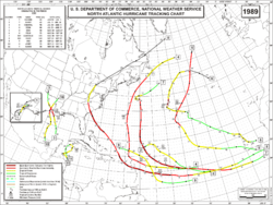
The 1989 Atlantic hurricane season was an active season that produced fifteen tropical cyclones, eleven named storms, seven hurricanes, and two major hurricanes. The season was officially designated from June 1, 1989, to November 30, 1989, dates which conventionally...
was very active in terms of activity, with 15 tropical cyclones, 11 named storm, 7 hurricanes, and 2 major hurricane (hurricanes that are classified as Category 3 or higher).
June
June 1- 12:00 a.m. EDTEastern Time ZoneThe Eastern Time Zone of the United States and Canada is a time zone that falls mostly along the east coast of North America. Its UTC time offset is −5 hrs during standard time and −4 hrs during daylight saving time...
(0400 UTC) - The 1989 Atlantic hurricane season1989 Atlantic hurricane seasonThe 1989 Atlantic hurricane season was an active season that produced fifteen tropical cyclones, eleven named storms, seven hurricanes, and two major hurricanes. The season was officially designated from June 1, 1989, to November 30, 1989, dates which conventionally...
officially began.
June 15
- Unknown time: - Tropical Depression One formed in the Gulf of MexicoGulf of MexicoThe Gulf of Mexico is a partially landlocked ocean basin largely surrounded by the North American continent and the island of Cuba. It is bounded on the northeast, north and northwest by the Gulf Coast of the United States, on the southwest and south by Mexico, and on the southeast by Cuba. In...
.
June 16
- Unknown time: - Tropical Depression One dissipated near the same location.
June 24
- 1:00 p.m. CDT (1800 UTC) - Tropical Depression Two also formed in the Gulf of Mexico.

- 7:00 p.m. CDT (0000 UTC June 26) - Tropical Depression Two strengthened into Tropical Storm AllisonTropical Storm Allison (1989)Tropical Storm Allison was a tropical cyclone that produced severe flooding in the southern United States. The second tropical cyclone and the first named storm of the 1989 Atlantic hurricane season, Allison formed on June 24 in the northwestern Gulf of Mexico. Development of Allison was a result...
.
June 26
- 8:00 a.m. CDT (1300 UTC) - Tropical Storm Allison made landfall near Freeport, TexasFreeport, TexasFreeport is a city in Brazoria County, Texas within the Houston–Sugar Land–Baytown metropolitan area and is situated in Southeast Texas. As of the 2000 U.S...
with winds of 45 mph (74 km/h). - 7:40 p.m. CDT (0040 UTC) - Tropical Storm Allison attained its peak intensity just inland with winds of 50 mph (85 km/h) and a minimum pressure of 999 mbar (hPa; 29.5 inHg).
June 27
- 7:00 a.m. CDT (1200 UTC) - Tropical Storm Allison weakened back to a tropical depression.
- 7;00 p.m. CDT (0000 UTC June 28) - Tropical Depression Allison became extratropical near the LouisianaLouisianaLouisiana is a state located in the southern region of the United States of America. Its capital is Baton Rouge and largest city is New Orleans. Louisiana is the only state in the U.S. with political subdivisions termed parishes, which are local governments equivalent to counties...
/TexasTexasTexas is the second largest U.S. state by both area and population, and the largest state by area in the contiguous United States.The name, based on the Caddo word "Tejas" meaning "friends" or "allies", was applied by the Spanish to the Caddo themselves and to the region of their settlement in...
border.
July
July 9- 2:00 p.m. EDT (1800 UTC) - Tropical Depression Three formed midway between AfricaAfricaAfrica is the world's second largest and second most populous continent, after Asia. At about 30.2 million km² including adjacent islands, it covers 6% of the Earth's total surface area and 20.4% of the total land area...
and the Lesser AntillesLesser AntillesThe Lesser Antilles are a long, partly volcanic island arc in the Western Hemisphere. Most of its islands form the eastern boundary of the Caribbean Sea with the Atlantic Ocean, with the remainder located in the southern Caribbean just north of South America...
.
July 10
- 8:00 p.m. EDT (0000 UTC July 11) - Tropical Depression Three strengthened into Tropical Storm Barry.
- 8:00 p.m. EDT (0000 UTC July 13) - Tropical Storm Barry attained its peak intensity with winds of 55 mph (85 km/h) and a minimum pressure of 1005 mbar (hPa; 29.68 inHg).
July 13
- 2:00 p.m. EDT (1800 UTC) - Tropical Storm Barry weakened back to a tropical depression.
July 14
- 2:00 a.m. EDT (0600 UTC) - Tropical Depression Barry 545 miles (880 km) northeast of the Lesser Antilles.
July 30
- 7:00 a.m. CDT (1200 UTC) - Tropical Depression Four formed in the Gulf of Mexico just north of the Yucatan PeninsulaYucatán PeninsulaThe Yucatán Peninsula, in southeastern Mexico, separates the Caribbean Sea from the Gulf of Mexico, with the northern coastline on the Yucatán Channel...
.
July 31
- 1:00 a.m. CDT (0600 UTC) - Tropical Depression Four strengthened into Tropical Storm Chantal.
- 2:00 a.m. EDT (0600 UTC) - Tropical Depression Five formed halfway between Africa and the Lesser Antilles.
- 7:00 p.m. CDT (0000 UTC August 1) - Tropical Storm Chantal strengthened into Hurricane ChantalHurricane Chantal (1989)Hurricane Chantal was one of three tropical cyclones to make landfall in Texas during the 1989 Atlantic hurricane season. The third named storm and the first hurricane of the season, Chantal slowly developed on July 30 in the southern Gulf of Mexico from a tropical disturbance within that was...
.
August
August 1- 3:00 a.m. NSTNewfoundland Standard Time ZoneNewfoundland Standard Time ' is a geographic region that keeps time by subtracting 3½ hours from Coordinated Universal Time , resulting in UTC−3:30, or 2½ hours during daylight saving time...
(0600 UTC) - Tropical Depression Five strengthened into Tropical Storm Dean. - 5:00 a.m. CDT (1000 UTC) - Hurricane Chantal attained its peak intensity with winds of 80 mph (130 km/h) and a minimum pressure of 986 mbar (hPa; 29.12 inHg).
- 8:00 a.m. CDT (1300 UTC) - Hurricane Chantal made landfall on High Island, TexasHigh Island, TexasHigh Island is an unincorporated area located in the Bolivar Peninsula census-designated place, Galveston County, Texas, United States. The community is located in the extreme eastern part of the county on Bolivar Peninsula, less than one mile from Chambers County and less than two miles from...
with winds of 80 mph (130 km/h). - 1:00 p.m. CDT (1800 UTC) - Hurricane Chantal weakened back to a tropical storm.
August 2
- 1:00 a.m. CDT (0600 UTC) - Tropical Storm Chantal weakened back to a tropical depression.
- 9:00 a.m. NST (1200 UTC) - Tropical Storm Dean strengthened into Hurricane DeanHurricane Dean (1989)Hurricane Dean was the fourth named storm and second hurricane of the 1989 Atlantic hurricane season. Dean formed on July 31 and reached tropical storm status the following day east of the Leeward Islands...
.
August 3
- 1:00 a.m. CDT (0600 UTC) - Tropical Depression Chantal dissipated over OklahomaOklahomaOklahoma is a state located in the South Central region of the United States of America. With an estimated 3,751,351 residents as of the 2010 census and a land area of 68,667 square miles , Oklahoma is the 28th most populous and 20th-largest state...
.
August 6
- 3:00 p.m. NST (1800 UTC) - Hurricane Dean strengthened into a category 2 hurricane.
- 9:00 p.m. NST (0000 UTC August 7) - Hurricane Dean attained its peak intensity with winds of 105 mph (165 km/h) and a minimum pressure of 968 mbar (hPa; 28.59 inHg).
August 7
- 3:00 p.m. NST (1800 UTC) - Hurricane Dean weakened back to a category 1 hurricane.
.jpg)
- 9:00 a.m. NST (1200 UTC) - Hurricane Dean weakened back to a tropical storm.
- 10:00 a.m. NST (1300 UTC) - Tropical Storm Dean made landfall in southeastern Newfoundland.
- 9:00 p.m. NST (0000 UTC August 9) - Tropical Storm Dean became extratropical south of GreenlandGreenlandGreenland is an autonomous country within the Kingdom of Denmark, located between the Arctic and Atlantic Oceans, east of the Canadian Arctic Archipelago. Though physiographically a part of the continent of North America, Greenland has been politically and culturally associated with Europe for...
.
August 16
- Unknown time: - Tropical Depression Six formed 600 miles (965 km) east of the Lesser Antilles.
August 17
- Unknown time: - Tropical Depression Six dissipated well east of the Lesser Antilles.
- 8:00 p.m. EDT (0000 UTC August 18) - Tropical Depression Seven formed near Cape VerdeCape VerdeThe Republic of Cape Verde is an island country, spanning an archipelago of 10 islands located in the central Atlantic Ocean, 570 kilometres off the coast of Western Africa...
.
August 19
- 2:00 p.m. EDT (1800 UTC) - Tropical Depression Seven strengthened into Tropical Storm Erin.
August 22
- 8:00 a.m. EDT (1200 UTC) - Tropical Storm Erin strengthened into Hurricane Erin.
August 23
- 8:00 p.m. EDT (0000 UTC August 24) - Hurricane Erin strengthened into a category 2 hurricane.
August 24
- 8:00 p.m. EDT (0000 UTC August 25) - Hurricane Erin attained its peak intensity with winds of 105 mph (165 km/h) and a minimum pressure of 968 mbar (hPa; 28.59 inHg).
August 25
- 8:00 p.m. EDT (0000 UTC August 26) - Hurricane Erin weakened back to a category 1 hurricane.
- 8:00 p.m. EDT (0000 UTC August 26) - Tropical Depression Eight also formed near Cape Verde.
August 26
- 2:00 p.m. EDT (1800 UTC) - Tropical Depression Eight strengthened into Tropical Storm Felix.
- 8:00 p.m. EDT (0000 UTC August 27) - Hurricane Erin weakened to a tropical storm, simultaneously becoming extratropical.
August 27
- Unknown time: - Tropical Depression Nine formed 490 miles (790 km) east of BarbadosBarbadosBarbados is an island country in the Lesser Antilles. It is in length and as much as in width, amounting to . It is situated in the western area of the North Atlantic and 100 kilometres east of the Windward Islands and the Caribbean Sea; therein, it is about east of the islands of Saint...
.
August 28
- Unknown time: - Tropical Depression Nine dissipated.
August 29
- 2:00 p.m. EDT (1800 UTC) - Tropical Storm Felix weakened back to a tropical depression.
August 30
- 2:00 a.m. EDT (0600 UTC) - Tropical Depression Ten formed near Cape Verde.
- 8:00 p.m. EDT (0000 UTC August 31) - Tropical Depression Ten strengthened into Tropical Storm Gabrielle.
August 31
- 8:00 p.m. EDT (0000 UTC September 1) - Tropical Storm Gabrielle strengthened into Hurricane GabrielleHurricane Gabrielle (1989)Hurricane Gabrielle was the seventh named storm, fourth hurricane and first major hurricane of the 1989 Atlantic hurricane season. Gabrielle formed from a tropical depression on August 30, 1989, and moved west-northwestward before recurving and becoming a Category 4 hurricane on September 5...
.
September
September 2- 8:00 a.m. EDT (1200 UTC) - Hurricane Gabrielle strengthened into a category 2 hurricane.
- 8:00 p.m. EDT (0000 UTC) - Tropical Depression Felix re-strengthened into Tropical Storm Felix.
September 3
- 2:00 a.m. EDT (0600 UTC) - Hurricane Gabrielle strengthened into a category 3 hurricane.
- 4:46 p.m. EDT (2046 UTC) - Hurricane Gabrielle attained its minimum pressure of 935 mbar (hPa; 27.61 inHg).
September 4
- 8:00 a.m. EDT (1200 UTC) - Hurricane Gabrielle strengthened into a category 4 hurricane.
- 2:00 a.m. EDT (0600 UTC) - Tropical Storm Felix strengthened into Hurricane Felix, the record longest time from formation to upgrade to hurricane status, in the Atlantic.
- 2:00 p.m. EDT (1800 UTC) - Hurricane Gabrielle attained its maximum sustained winds of 145 mph (230 km/h).
- 8:00 p.m. EDT (0000 UTC September 6) - Hurricane Felix attained its peak intensity with winds of 85 mph (140 km/h) and a minimum pressure of 979 mbar (hPa; 28.91 inHg).
September 7
- 2:00 a.m. EDT (0600 UTC) - Hurricane Felix weakened back to a tropical storm.
- 2:00 a.m. EDT (0600 UTC) - Hurricane Gabrielle weakened back to a category 3 hurricane.
- 8:00 a.m. EDT (1200 UTC) - Hurricane Gabrielle weakened back to a category 2 hurricane.
September 8
- 2:00 p.m. EDT (1800 UTC) - Hurricane Gabrielle weakened back to a category 1 hurricane.
September 9
- 8:00 a.m. EDT (1200 UTC) - Tropical Storm Felix became extratropical.
September 10
- 2:00 a.m. EDT (0600 UTC) - Hurricane Gabrielle weakened back to a tropical storm.
- 8:00 a.m. EDT (1200 UTC) - Tropical Depression Eleven formed near Cape Verde.
September 11
- 2:00 p.m. EDT (1800 UTC) - Tropical Depression Eleven strengthened into Tropical Storm Hugo.
September 12
- 8:00 a.m. EDT (1200 UTC) - Tropical Storm Gabrielle weakened back to a tropical depression.
September 13
- 2:00 p.m. EDT (1800 UTC) - Tropical Depression Gabrielle became extratropical.
- 2:00 p.m. EDT (1800 UTC) - Tropical Storm Hugo strengthened into Hurricane HugoHurricane HugoHurricane Hugo was a classical, destructive and rare Cape Verde-type hurricane which struck the Caribbean islands of Guadeloupe, Montserrat, St. Croix, Puerto Rico and the USA mainland in South Carolina as a Category 4 hurricane during September of the 1989 Atlantic hurricane season...
.
September 14
- 8:00 a.m. EDT (1200 UTC) - Hurricane Hugo strengthened into a category 2 hurricane.
- 8:00 p.m. EDT (0000 UTC September 15) - Hurricane Hugo strengthened into a category 3 hurricane.
September 15
- 8:00 a.m. EDT (1200 UTC) - Hurricane Hugo strengthened into a category 4 hurricane.
- 2:00 p.m. EDT (1800 UTC) - Hurricane Hugo strengthened into a category 5 hurricane. Simultaneously, Hurricane Hugo attained its peak intensity with winds of 160 mph (260 km/h) and a minimum pressure of 918 mbar (hPa; 27.11 inHg).
- 8:00 p.m. EDT (0000 UTC September 16) - Hurricane Hugo weakened back to a category 4 hurricane.
September 16
- 2:00 p.m. EDT (1800 UTC) - Tropical Depression Twelve formed a few hundred miles east of the Windward IslandsWindward IslandsThe Windward Islands are the southern islands of the Lesser Antilles, within the West Indies.-Name and geography:The Windward Islands are called such because they were more windward to sailing ships arriving in the New World than the Leeward Islands, given that the prevailing trade winds in the...
.
September 17
- 1:00 a.m. EDT (0500 UTC) - Hurricane Hugo made landfall on GuadeloupeGuadeloupeGuadeloupe is an archipelago located in the Leeward Islands, in the Lesser Antilles, with a land area of 1,628 square kilometres and a population of 400,000. It is the first overseas region of France, consisting of a single overseas department. As with the other overseas departments, Guadeloupe...
with winds of 140 mph (230 km/h). - 8:00 p.m. EDT (1800 UTC) - Tropical Depression Twelve strengthened into Tropical Storm Iris.
September 18
- 2:00 a.m. EDT (0600 UTC) - Hurricane Hugo made landfall on St. Croix with winds of 140 mph (230 km/h).
- 8:00 a.m. EDT (1200 UTC) - Hurricane Hugo weakened back to a category 2 hurricane. Simultaneously, Hurricane Hugo made landfall in Vieques, Puerto RicoVieques, Puerto RicoVieques , in full Isla de Vieques, is an island–municipality of Puerto Rico in the northeastern Caribbean, part of an island grouping sometimes known as the Spanish Virgin Islands...
with winds of 125 mph (205 km/h). - 9:00 a.m. EDT (1300 UTC) - Hurricane Hugo made landfall in Fajardo, Puerto RicoFajardo, Puerto RicoFajardo is a small city in Puerto Rico located in the east region of the island, bordering the Atlantic Ocean, north of Ceiba and east of Luquillo.Fajardo is spread over 7 wards and Downtown Fajardo , which serves as the administrative center of the city...
with winds of 125 mph (205 km/h).
September 19
- 2:00 a.m. EDT (0600 UTC) - Hurricane Hugo weakened back to a category 2 hurricane.
- 8:00 a.m. EDT (1200 UTC) - Tropical Storm Iris attained its peak intensity with winds of 70 mph (110 km/h) and a minimum pressure of 1001 mbar (hPa; 29.56 inHg).
September 20
- 8:00 p.m. EDT (0000 UTC September 21) - Hurricane Hugo re-strengthened into a category 3 hurricane.
- 8:00 p.m. EDT (0000 UTC September 21) - Tropical Storm Iris weakened back to a tropical depression.
September 21
- 2:00 p.m. EDT (1800 UTC) - Hurricane Hugo re-strengthened into a category 4 hurricane.
- 8:00 p.m. EDT (0000 UTC September 22) - Tropical Depression Iris dissipated a few hundred miles north of Puerto RicoPuerto RicoPuerto Rico , officially the Commonwealth of Puerto Rico , is an unincorporated territory of the United States, located in the northeastern Caribbean, east of the Dominican Republic and west of both the United States Virgin Islands and the British Virgin Islands.Puerto Rico comprises an...
.
September 22
- 12:00 a.m. EDT (0400 UTC) - Hurricane Hugo made landfall on Sullivan's Island, South CarolinaSullivan's Island, South CarolinaSullivan's Island is a town in Charleston County, South Carolina, United States, on a similarly named island at the entrance to Charleston Harbor. The population was 1,911 at the 2000 census. It is also the site of a major battle of the American Revolution at Fort Sullivan on June 28, 1776. As...
with winds of 140 mph (230 km/h). - 2:00 a.m. EDT (0600 UTC) - Hurricane Hugo rapidly weakened back to a category 2 hurricane.
- 8:00 a.m. EDT (1200 UTC) - Hurricane Hugo rapidly weakened back to a tropical storm.
- 8:00 p.m. EDT (0000 UTC September 23) - Tropical Storm Hugo transitioned into an extratropical storm.
October
- Unknown time: - Tropical Depression Thirteen formed 870 miles (1400 km) east of the Windward Islands.
October 3
- Unknown time: - Tropical Depression Thirteen dissipated north of area of formation.
October 12
- 8:00 a.m. EDT (1200 UTC) - Tropical Depression Fourteen formed in the Bay of CampecheBay of CampecheThe Bay of Campeche is the southern bight of the Gulf of Mexico. It is surrounded on three sides by the Mexican states of Campeche, Tabasco and Veracruz. It was named by Francisco Hernández de Córdoba and Antonio de Alaminos during their expedition in 1517...
. - 8:00 p.m. EDT (0000 UTC October 13) - Tropical Depression Fourteen strengthened into Tropical Storm Jerry.
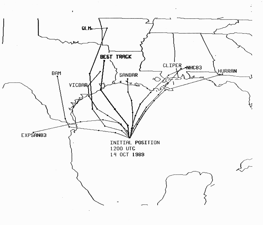
October 15
- 2:00 p.m. EDT (1800 UTC) - Tropical Storm Jerry strengthened into Hurricane JerryHurricane Jerry (1989)Hurricane Jerry was the tenth named storm and the sixth and final hurricane of the 1989 Atlantic hurricane season. Jerry was also the fourth U.S. landfalling storm and the third storm to strike Texas during the 1989 season; the two previous storms were Allison in June and Chantal in August. When it...
. - 5:00 p.m. EDT (2100 UTC) - Hurricane Jerry attained its peak intensity with winds of 85 mph (140 km/h) and a minimum pressure of 983 mbar (hPa; 29.03 inHg).
- 8:30 p.m. EDT (0030 UTC October 16) - Hurricane Jerry made landfall in Galveston, TexasGalveston, TexasGalveston is a coastal city located on Galveston Island in the U.S. state of Texas. , the city had a total population of 47,743 within an area of...
with winds of 85 mph (140 km/h).
October 16
- 2:00 a.m. EDT (0600 UTC) - Hurricane Jerry weakened back to a tropical storm.
- 8:00 a.m. EDT (1200 UTC) - Tropical Storm Jerry weakened back to a tropical depression.
- 2:00 p.m. EDT (1800 UTC) - Tropical Depression Jerry was absorbed by a frontal system.
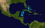
November
.jpg)
- 8:00 a.m. EDT (1200 UTC) - Tropical Depression Fifteen formed in the western Caribbean Sea.
November 29
- 8:00 p.m. EDT (0000 UTC November 30) - Tropical Depression Fifteen strengthened into Tropical Storm Karen.
November 30
- 2:00 p.m. EDT (1800 UTC) - Tropical Storm Karen attained its peak intensity with winds of 60 mph (95 km/h) and a minimum pressure of 1000 mbar (hPa; 29.53 inHg).
- 11:59 p.m. AST (0359 UTC December 1) – The 1989 Atlantic hurricane season officially ends, with Tropical Storm Karen still active.
December
- 2:00 a.m. EDT (0600 UTC) - Tropical Storm Karen dissipated just north of HondurasHondurasHonduras is a republic in Central America. It was previously known as Spanish Honduras to differentiate it from British Honduras, which became the modern-day state of Belize...
.