

Transportation in Virginia
Encyclopedia

Virginia
The Commonwealth of Virginia , is a U.S. state on the Atlantic Coast of the Southern United States. Virginia is nicknamed the "Old Dominion" and sometimes the "Mother of Presidents" after the eight U.S. presidents born there...
's extensive network of highway
Highway
A highway is any public road. In American English, the term is common and almost always designates major roads. In British English, the term designates any road open to the public. Any interconnected set of highways can be variously referred to as a "highway system", a "highway network", or a...
s and railroads were developed and built over a period almost 400 years, beginning almost immediately after the founding of Jamestown
Jamestown, Virginia
Jamestown was a settlement in the Colony of Virginia. Established by the Virginia Company of London as "James Fort" on May 14, 1607 , it was the first permanent English settlement in what is now the United States, following several earlier failed attempts, including the Lost Colony of Roanoke...
in 1607, and often incorporating old established trails of the Native American
Native Americans in the United States
Native Americans in the United States are the indigenous peoples in North America within the boundaries of the present-day continental United States, parts of Alaska, and the island state of Hawaii. They are composed of numerous, distinct tribes, states, and ethnic groups, many of which survive as...
s. They use cars, trains, boats, planes/and or helicopters.
Colonial period, 19th century
During the colonial period, the Virginia Colony was dependent upon the waterways as avenues of commerce, and James River PlantationsJames River plantations
James River plantations were established in the Virginia Colony along the James River between the mouth at Hampton Roads and the head of navigation at the fall line where Richmond is today.- History :...
such as John Rolfe
John Rolfe
John Rolfe was one of the early English settlers of North America. He is credited with the first successful cultivation of tobacco as an export crop in the Colony of Virginia and is known as the husband of Pocahontas, daughter of the chief of the Powhatan Confederacy.In 1961, the Jamestown...
's Varina Farms
Varina Farms
Varina Farms, also known as Varina Plantation or Varina Farms Plantation or "Varina on the James", is a plantation established by John Rolfe on the James River about 40 miles upstream from the first settlement at Jamestown in the Virginia Colony, and across the river from Sir Thomas Dale's 1611...
with their own wharf
Wharf
A wharf or quay is a structure on the shore of a harbor where ships may dock to load and unload cargo or passengers.Such a structure includes one or more berths , and may also include piers, warehouses, or other facilities necessary for handling the ships.A wharf commonly comprises a fixed...
s on the river
River
A river is a natural watercourse, usually freshwater, flowing towards an ocean, a lake, a sea, or another river. In a few cases, a river simply flows into the ground or dries up completely before reaching another body of water. Small rivers may also be called by several other names, including...
s of the fall line
Fall line
A fall line is a geomorphologic unconformity between an upland region of relatively hard crystalline basement rock and a coastal plain of softer sedimentary rock. A fall line is typically prominent when crossed by a river, for there will often be rapids or waterfalls...
(at present-day Richmond
Richmond, Virginia
Richmond is the capital of the Commonwealth of Virginia, in the United States. It is an independent city and not part of any county. Richmond is the center of the Richmond Metropolitan Statistical Area and the Greater Richmond area...
were soon shipping tobacco
Tobacco
Tobacco is an agricultural product processed from the leaves of plants in the genus Nicotiana. It can be consumed, used as a pesticide and, in the form of nicotine tartrate, used in some medicines...
and other export
Export
The term export is derived from the conceptual meaning as to ship the goods and services out of the port of a country. The seller of such goods and services is referred to as an "exporter" who is based in the country of export whereas the overseas based buyer is referred to as an "importer"...
crops abroad. Other important navigable rivers in this period were the Elizabeth
Elizabeth River (Virginia)
The Elizabeth River is a tidal estuary forming an arm of Hampton Roads harbor at the southern end of Chesapeake Bay in southeast Virginia in the United States. It is located along the southern side of the mouth of the James River, between the cities of Portsmouth and Norfolk...
, York
York River (Virginia)
The York River is a navigable estuary, approximately long, in eastern Virginia in the United States. It ranges in width from at its head to near its mouth on the west side of Chesapeake Bay. Its watershed drains an area including portions of 17 counties of the coastal plain of Virginia north...
, and Potomac
Potomac River
The Potomac River flows into the Chesapeake Bay, located along the mid-Atlantic coast of the United States. The river is approximately long, with a drainage area of about 14,700 square miles...
.
By the 19th century, the Virginia Board of Public Works
Virginia Board of Public Works
The Virginia Board of Public Works was a governmental agency which oversaw and helped finance the development of Virginia's internal transportation improvements during the 19th century. In that era, it was customary to invest public funds in private companies, which were the forerunners of the...
was funding transportation infrastructure improvements, stimulating such private enterprises as the James River and Kanawha Canal
James River and Kanawha Canal
The James River and Kanawha Canal was a canal in Virginia, which was built to facilitate shipments of passengers and freight by water between the western counties of Virginia and the coast....
, the Chesterfield Railroad
Chesterfield Railroad
The Chesterfield Railroad was located in Chesterfield County, Virginia. It was a 13-mile long mule-and-gravity powered line that connected the Midlothian coal mines with wharves that were located at the head of navigation on the James River just below the fall line at Manchester...
, and the Valley Turnpike. Claudius Crozet
Claudius Crozet
Benoit Claudius Crozet was an educator and civil engineer.Crozet was born in France. After serving in the French military, in 1816, he immigrated to the United States. He taught at the U.S. Military Academy at West Point, New York, and helped found the Virginia Military Institute at Lexington,...
's innovative tunnels under the Blue Ridge Mountains
Blue Ridge Mountains
The Blue Ridge Mountains are a physiographic province of the larger Appalachian Mountains range. This province consists of northern and southern physiographic regions, which divide near the Roanoke River gap. The mountain range is located in the eastern United States, starting at its southern-most...
were a key link in Collis P. Huntington
Collis P. Huntington
Collis Potter Huntington was one of the Big Four of western railroading who built the Central Pacific Railroad as part of the first U.S. transcontinental railroad...
's railroad linking Virginia to the Ohio River Valley
Ohio River
The Ohio River is the largest tributary, by volume, of the Mississippi River. At the confluence, the Ohio is even bigger than the Mississippi and, thus, is hydrologically the main stream of the whole river system, including the Allegheny River further upstream...
in 1873. Soon thereafter, Pocahontas coal
Bituminous coal
Bituminous coal or black coal is a relatively soft coal containing a tarlike substance called bitumen. It is of higher quality than lignite coal but of poorer quality than Anthracite...
was riding the rails from the mountains eastbound for export via the Chesapeake and Ohio
Chesapeake and Ohio Railway
The Chesapeake and Ohio Railway was a Class I railroad formed in 1869 in Virginia from several smaller Virginia railroads begun in the 19th century. Led by industrialist Collis P...
, Norfolk and Western and Virginian Railway
Virginian Railway
The Virginian Railway was a Class I railroad located in Virginia and West Virginia in the United States. The VGN was created to transport high quality "smokeless" bituminous coal from southern West Virginia to port at Hampton Roads....
s with coal piers on Hampton Roads
Hampton Roads
Hampton Roads is the name for both a body of water and the Norfolk–Virginia Beach metropolitan area which surrounds it in southeastern Virginia, United States...
.
20th-21st centuries
With urging from the state chapter founded in Roanoke in 1894 of the National Good Roads MovementGood Roads Movement
The Good Roads Movement occurred in the United States between the late 1870s and the 1920s. Advocates for improved roads led by bicyclists turned local agitation into a national political movement....
, in 1906 the Virginia General Assembly
Virginia General Assembly
The Virginia General Assembly is the legislative body of the Commonwealth of Virginia, and the oldest legislative body in the Western Hemisphere, established on July 30, 1619. The General Assembly is a bicameral body consisting of a lower house, the Virginia House of Delegates, with 100 members,...
created the first State Highway Commission. In 1932, the state's role was expanded when the provisions of the Byrd Road Act
Byrd Road Act
Byrd Road Act was an Act of Assembly passed in February, 1932 by the Virginia General Assembly. Named for former Governor Harry F. Byrd, the legislation was originally presented as measure to relieve the financial pressures of the Great Depression upon the counties, as the state offered to take...
during the Great Depression
Great Depression
The Great Depression was a severe worldwide economic depression in the decade preceding World War II. The timing of the Great Depression varied across nations, but in most countries it started in about 1929 and lasted until the late 1930s or early 1940s...
brought most secondary roads in the counties into the scope of state control and maintenance.
In the mid-20th century, Virginia's Henry G. Shirley Memorial Highway
Henry G. Shirley Memorial Highway
The Henry G. Shirley Memorial Highway consists of a portion of Interstates 95 and 395 in the U.S. state of Virginia. Shirley Highway was the first limited-access freeway in Virginia...
in Northern Virginia
Northern Virginia
Northern Virginia consists of several counties and independent cities in the Commonwealth of Virginia, in a widespread region generally radiating southerly and westward from Washington, D.C...
pioneered HOV and reversible traffic lane
Reversible lane
A reversible lane , called a counterflow lane or contraflow lane in transport engineering nomenclature, is a lane in which traffic may travel in either direction, depending on certain conditions...
s. Prior to the creation of the Interstate Highway System
Interstate Highway System
The Dwight D. Eisenhower National System of Interstate and Defense Highways, , is a network of limited-access roads including freeways, highways, and expressways forming part of the National Highway System of the United States of America...
, Virginia had some other notable roads to handle heavy traffic including Military Highway
Military Highway
Military Highway is a four-lane roadway built in the South Hampton Roads region of eastern Virginia, USA during World War II.- Original construction :...
in South Hampton Roads
South Hampton Roads
South Hampton Roads is a region located in the extreme southeastern portion of Virginia in the United States, and is part of the Virginia Beach-Norfolk-Newport News, VA-NC MSA with a population about 1.7 million....
, Mercury Boulevard
Mercury Boulevard
Mercury Boulevard in the cities of Hampton and Newport News in the Peninsula region of southeastern Virginia carries U.S. Highway 258 approximately south from Fort Monroe at Old Point Comfort on Hampton Roads to the north end of the James River Bridge...
on the Virginia Peninsula
Virginia Peninsula
The Virginia Peninsula is a peninsula in southeast Virginia, USA, bounded by the York River, James River, Hampton Roads and Chesapeake Bay.Hampton Roads is the common name for the metropolitan area that surrounds the body of water of the same name...
, and State Route 168, which extended from west of Williamsburg to the North Carolina border near the eastern edge of the Great Dismal Swamp
Great Dismal Swamp
The Great Dismal Swamp is a marshy area on the Coastal Plain Region of southeastern Virginia and northeastern North Carolina between Norfolk, Virginia, and Elizabeth City, North Carolina in the United States. It is located in parts of southern Chesapeake and Suffolk in Virginia, as well as northern...
, including Tidewater Drive in the Norfolk area. The Richmond-Petersburg Turnpike
Richmond-Petersburg Turnpike
The Richmond-Petersburg Turnpike was a toll road located in the Richmond-Petersburg region of central Virginia, USA.After World War II, major traffic congestion occurred in the area around Richmond and Petersburg along U.S. Route 1 and U.S. Route 301...
was built to relieve heavy traffic on US1-301 between those two cities.
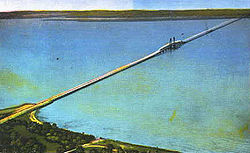
In 1957, The Hampton Roads Bridge-Tunnel
Hampton Roads Bridge-Tunnel
The Hampton Roads Bridge-Tunnel is the -long Hampton Roads crossing for Interstate 64 and U.S. Route 60. It is a four-lane facility comprising bridges, trestles, man-made islands, and tunnels under the main shipping channels for Hampton Roads harbor in the southeastern portion of Virginia in the...
, first of its kind, was completed, and was soon incorporated into Interstate 64
Interstate 64
Interstate 64 is an Interstate Highway in the Midwestern and Southeastern United States. Its western terminus is at I-70, U.S. 40, and U.S. 61 in Wentzville, Missouri. Its eastern terminus is at an interchange with I-264 and I-664 at Bowers Hill in Chesapeake, Virginia. As I-64 is concurrent with...
. The Chesapeake Bay Bridge-Tunnel
Chesapeake Bay Bridge-Tunnel
The Chesapeake Bay Bridge-Tunnel is a long fixed link crossing the mouth of the Chesapeake Bay and connecting the Delmarva Peninsula's Eastern Shore of Virginia with Virginia Beach and the metropolitan area of Hampton Roads, Virginia...
completed in 1964 is the longest bridge-tunnel
Bridge-tunnel
A fixed link, fixed crossing, or bridge-tunnel is a persistent, unbroken road or rail connection across water that uses some combination of bridges, tunnels, and causeways and does not involve intermittent connections such as drawbridges or ferries.The Confederation Bridge was commonly referred to...
in the world. Interstate highways I-81
Interstate 81
Interstate 81 is an Interstate Highway in the eastern part of the United States. Its southern terminus is at Interstate 40 in Dandridge, Tennessee; its northern terminus is on Wellesley Island at the Canadian border, where the Thousand Islands Bridge connects it to Highway 401, the main freeway...
and I-95
Interstate 95 in Virginia
In the Commonwealth of Virginia, Interstate 95 runs through the state. It runs concurrently for with Interstate 64 in Richmond, and meets the northern terminus of Interstate 85 in Petersburg. Though Interstate 95 was originally planned to go straight through Washington, D.C., it was instead...
are some of the busiest roads of commerce on the East Coast.
Of course, people and property continue to travel by ship
Ship
Since the end of the age of sail a ship has been any large buoyant marine vessel. Ships are generally distinguished from boats based on size and cargo or passenger capacity. Ships are used on lakes, seas, and rivers for a variety of activities, such as the transport of people or goods, fishing,...
, as the first settlers did. The Atlantic Ocean
Atlantic Ocean
The Atlantic Ocean is the second-largest of the world's oceanic divisions. With a total area of about , it covers approximately 20% of the Earth's surface and about 26% of its water surface area...
is accessed by the more sheltered Chesapeake Bay
Chesapeake Bay
The Chesapeake Bay is the largest estuary in the United States. It lies off the Atlantic Ocean, surrounded by Maryland and Virginia. The Chesapeake Bay's drainage basin covers in the District of Columbia and parts of six states: New York, Pennsylvania, Delaware, Maryland, Virginia, and West...
and Hampton Roads
Hampton Roads
Hampton Roads is the name for both a body of water and the Norfolk–Virginia Beach metropolitan area which surrounds it in southeastern Virginia, United States...
, with 5 major navigable rivers offering a wide choice of ports and industrial sites. International shipping traffic continues to grow as intermodal
Intermodal freight transport
Intermodal freight transport involves the transportation of freight in an intermodal container or vehicle, using multiple modes of transportation , without any handling of the freight itself when changing modes. The method reduces cargo handling, and so improves security, reduces damages and...
port and rail facilities are expanded. The Virginia Port Authority even operates an inland port
Inland port
The term inland port is used in two different but related ways to mean either a port on an inland waterway or an inland site carrying out some functions of a seaport.- As a port on an inland waterway :...
in the Shenandoah Valley
Shenandoah Valley
The Shenandoah Valley is both a geographic valley and cultural region of western Virginia and West Virginia in the United States. The valley is bounded to the east by the Blue Ridge Mountains, to the west by the eastern front of the Ridge-and-Valley Appalachians , to the north by the Potomac River...
.
The Wright Brothers
Wright brothers
The Wright brothers, Orville and Wilbur , were two Americans credited with inventing and building the world's first successful airplane and making the first controlled, powered and sustained heavier-than-air human flight, on December 17, 1903...
are credited with first flight just south of Virginia at Kitty Hawk, North Carolina
Kitty Hawk, North Carolina
Kitty Hawk is a town in Dare County, North Carolina, United States. The population was 3,000 at the 2000 census. It was established in the early 18th century as Chickahawk....
. Other early flights took place at Willoughby Spit
Willoughby Spit
Willoughby Spit is a peninsula of land in the independent city of Norfolk, Virginia in the United States. It is bordered by water on three sides: the Chesapeake Bay to the north, Hampton Roads to the west, and Willoughby Bay to the south.- History :...
near Norfolk. In modern times, major commercial airport
Airport
An airport is a location where aircraft such as fixed-wing aircraft, helicopters, and blimps take off and land. Aircraft may be stored or maintained at an airport...
s are located around the state, with many additional general aviation
General aviation
General aviation is one of the two categories of civil aviation. It refers to all flights other than military and scheduled airline and regular cargo flights, both private and commercial. General aviation flights range from gliders and powered parachutes to large, non-scheduled cargo jet flights...
facilities.
For those who wish to live in the past, at least for a visit, the Colonial Parkway
Colonial Parkway
Colonial Parkway is a scenic 23-mile parkway linking the three popular attractions of Virginia's Historic Triangle of colonial-era communities, Jamestown, Williamsburg, and Yorktown...
, carefully shielded from commercial development, joins Colonial Williamsburg
Colonial Williamsburg
Colonial Williamsburg is the private foundation representing the historic district of the city of Williamsburg, Virginia, USA. The district includes buildings dating from 1699 to 1780 which made colonial Virginia's capital. The capital straddled the boundary of the original shires of Virginia —...
with Yorktown
Yorktown, Virginia
Yorktown is a census-designated place in York County, Virginia, United States. The population was 220 in the 2000 census. It is the county seat of York County, one of the eight original shires formed in colonial Virginia in 1634....
and Jamestown, the three points of the Historic Triangle
Historic Triangle
The Historic Triangle is located on the Virginia Peninsula of the United States and includes the colonial communities of Jamestown, Colonial Williamsburg, and Yorktown, with many restored attractions linked by the Colonial Parkway in James City and York counties and the City of...
. By riding the toll free Jamestown Ferry
Jamestown Ferry
The Jamestown Ferry is a free automobile and bus ferry service across a navigable portion of the James River in Virginia...
service across the James River
James River (Virginia)
The James River is a river in the U.S. state of Virginia. It is long, extending to if one includes the Jackson River, the longer of its two source tributaries. The James River drains a catchment comprising . The watershed includes about 4% open water and an area with a population of 2.5 million...
, it is even possible to arrive at Jamestown Island by water, with a similar view to that of the first colonists. Virginia's scenic byway
National Scenic Byway
A National Scenic Byway is a road recognized by the United States Department of Transportation for its archeological, cultural, historic, natural, recreational, and/or scenic qualities. The program was established by Congress in 1991 to preserve and protect the nation's scenic but often...
s include the Skyline Drive
Skyline Drive
Skyline Drive is a 105-mile road that runs the entire length of the National Park Service's Shenandoah National Park in the Blue Ridge Mountains of Virginia, generally along the ridge of the mountains. The scenic drive is particularly popular in the fall when the leaves are changing colors...
in Shenandoah National Park
Shenandoah National Park
Shenandoah National Park encompasses part of the Blue Ridge Mountains in the U.S. state of Virginia. This national park is long and narrow, with the broad Shenandoah River and valley on the west side, and the rolling hills of the Virginia Piedmont on the east...
and the Blue Ridge Parkway
Blue Ridge Parkway
The Blue Ridge Parkway is a National Parkway and All-American Road in the United States, noted for its scenic beauty. It runs for 469 miles , mostly along the famous Blue Ridge, a major mountain chain that is part of the Appalachian Mountains...
. Even in busy Northern Virginia, a bucolic interlude is available inside the beltway
Interstate 495 (Capital Beltway)
Interstate 495 is a Interstate Highway that surrounds the United States' capital of Washington, D.C., and its inner suburbs in adjacent Maryland and Virginia. I-495 is widely known as the Capital Beltway or simply the Beltway, especially when the context of Washington, D.C., is clear...
on the George Washington Memorial Parkway
George Washington Memorial Parkway
The George Washington Memorial Parkway, known to local motorists simply as the "G.W. Parkway", is a parkway maintained by the U.S. National Park Service. It is located mostly in Northern Virginia, although a short section northwest of the Arlington Memorial Bridge passes over Columbia Island,...
. The state has literally dozens of other stretches of roads designated as scenic byways, and VDOT
Virginia Department of Transportation
The Virginia Department of Transportation is the agency of state government responsible for transportation in the state of Virginia in the United States. Headquartered in Downtown Richmond, VDOT is responsible for building, maintaining, and operating the roads, bridges and tunnels in the...
distributes a free map showing them.
In 2008, the first American State Litter Scorecard rated Virginia amongst the top "Best" states--the only one in the Southern United States
Southern United States
The Southern United States—commonly referred to as the American South, Dixie, or simply the South—constitutes a large distinctive area in the southeastern and south-central United States...
--for overall effectiveness and quality of its public space cleanliness—-primarily roadway and adjacent litter--from state and related debris removal efforts.
Highways and bridges
The Virginia State Highway System is an integrated system of roads maintained by the Virginia Department of TransportationVirginia Department of Transportation
The Virginia Department of Transportation is the agency of state government responsible for transportation in the state of Virginia in the United States. Headquartered in Downtown Richmond, VDOT is responsible for building, maintaining, and operating the roads, bridges and tunnels in the...
(VDOT). As of 2005, the VDOT maintains 57082 miles (91,864.3 km) of state highways — the third largest system in the United States
United States
The United States of America is a federal constitutional republic comprising fifty states and a federal district...
, after Texas
Texas
Texas is the second largest U.S. state by both area and population, and the largest state by area in the contiguous United States.The name, based on the Caddo word "Tejas" meaning "friends" or "allies", was applied by the Spanish to the Caddo themselves and to the region of their settlement in...
and North Carolina
North Carolina
North Carolina is a state located in the southeastern United States. The state borders South Carolina and Georgia to the south, Tennessee to the west and Virginia to the north. North Carolina contains 100 counties. Its capital is Raleigh, and its largest city is Charlotte...
. Interstate 95
Interstate 95 in Virginia
In the Commonwealth of Virginia, Interstate 95 runs through the state. It runs concurrently for with Interstate 64 in Richmond, and meets the northern terminus of Interstate 85 in Petersburg. Though Interstate 95 was originally planned to go straight through Washington, D.C., it was instead...
and Interstate 81
Interstate 81
Interstate 81 is an Interstate Highway in the eastern part of the United States. Its southern terminus is at Interstate 40 in Dandridge, Tennessee; its northern terminus is on Wellesley Island at the Canadian border, where the Thousand Islands Bridge connects it to Highway 401, the main freeway...
are the two major north-south highways through Virginia. The Capital Beltway, Interstate 495
Interstate 495 (Capital Beltway)
Interstate 495 is a Interstate Highway that surrounds the United States' capital of Washington, D.C., and its inner suburbs in adjacent Maryland and Virginia. I-495 is widely known as the Capital Beltway or simply the Beltway, especially when the context of Washington, D.C., is clear...
crosses the Potomac River in Alexandria and McLean
McLean, Virginia
McLean is an unincorporated community and census-designated place in Fairfax County in Northern Virginia. The community had a total population of 48,115 as of the 2010 census....
. The Springfield Interchange
Springfield Interchange
The Springfield Interchange, also known as the Mixing Bowl, is the interchange of Interstate 95, Interstate 395, and Interstate 495 in Springfield, Virginia, outside of Washington, D.C....
at the junction of I95, Interstate 395
Interstate 395 (District of Columbia-Virginia)
Interstate 395 in Washington, D.C., and Virginia is a 13 mile long spur route that begins at a junction with Interstate 95 in Springfield, Virginia and ends in northwest Washington, D.C. It passes underneath the National Mall near the United States Capitol and ends at a junction with U.S...
, and the Capital Beltway, in Springfield, Virginia
Springfield, Virginia
Springfield is a census-designated place in Fairfax County, Virginia, United States and a suburb of Washington, D.C. The Springfield CDP is recognized by the U.S. Census Bureau with a population of 30,484 as of the 2010 census. Homes and businesses in bordering CDPs including North Springfield,...
, south of Washington, D.C. has recently been reconstructed to improve traffic flow; widening of Woodrow Wilson Bridge
Woodrow Wilson Bridge
The Woodrow Wilson Memorial Bridge is a bascule bridge that spans the Potomac River between the independent city of Alexandria, Virginia and Oxon Hill in Prince George's County, Maryland, United States. While over the water near the Virginia shore, it crosses the southern tip of the District of...
will finish in mid-2008. Interstate 66
Interstate 66
Interstate 66 is an Interstate Highway in the eastern United States. As indicated by its even route number, it runs in an east–west direction. Its western terminus is at Middletown, Virginia, at an intersection with Interstate 81; its eastern terminus is in Washington, D.C., at an...
, another heavily traveled route into Washington, DC, connects the Capital Beltway to I81 at Front Royal, Virginia
Front Royal, Virginia
Front Royal is a town in Warren County, Virginia, United States. The population was 13,589 at the 2000 census. It is the county seat of Warren County.-Geography:Front Royal is roughly west of Washington, D.C....
. Interstate 64
Interstate 64
Interstate 64 is an Interstate Highway in the Midwestern and Southeastern United States. Its western terminus is at I-70, U.S. 40, and U.S. 61 in Wentzville, Missouri. Its eastern terminus is at an interchange with I-264 and I-664 at Bowers Hill in Chesapeake, Virginia. As I-64 is concurrent with...
runs east-west through the state, from the terminus in Virginia's southeast in Chesapeake
Chesapeake, Virginia
As of the census of 2000, there were 199,184 people, 69,900 households, and 54,172 families residing in the city. The population density was 584.6 people per square mile . There were 72,672 housing units at an average density of 213.3 per square mile...
running northwest into Richmond
Richmond, Virginia
Richmond is the capital of the Commonwealth of Virginia, in the United States. It is an independent city and not part of any county. Richmond is the center of the Richmond Metropolitan Statistical Area and the Greater Richmond area...
, then west through Charlottesville and into West Virginia and beyond.
Interstate highways
Virginia has an extensive network of Interstate Highways. The Interstate Highways, totaling 1118 miles (1,799.2 km) in VirginiaVirginia
The Commonwealth of Virginia , is a U.S. state on the Atlantic Coast of the Southern United States. Virginia is nicknamed the "Old Dominion" and sometimes the "Mother of Presidents" after the eight U.S. presidents born there...
, are freeways designated by the Federal Highway Administration
Federal Highway Administration
The Federal Highway Administration is a division of the United States Department of Transportation that specializes in highway transportation. The agency's major activities are grouped into two "programs," the Federal-aid Highway Program and the Federal Lands Highway Program...
and numbered by the American Association of State Highway and Transportation Officials
American Association of State Highway and Transportation Officials
AASHTO, the American Association of State Highway and Transportation Officials, is a standards setting body which publishes specifications, test protocols and guidelines which are used in highway design and construction throughout the United States...
. They are in a special class with respect to federal funding. These Interstate Highways are as follows:
- Major east-west routes (from south) are:
- I-74Interstate 74Interstate 74 is an Interstate Highway in the Midwestern and Southeastern United States. Its western end is at an intersection with Interstate 80 in Davenport, Iowa; the eastern end of its Midwest segment is at an intersection with Interstate 75 in Cincinnati, Ohio...
(planned, not yet built) - I-64Interstate 64Interstate 64 is an Interstate Highway in the Midwestern and Southeastern United States. Its western terminus is at I-70, U.S. 40, and U.S. 61 in Wentzville, Missouri. Its eastern terminus is at an interchange with I-264 and I-664 at Bowers Hill in Chesapeake, Virginia. As I-64 is concurrent with...
- I-66Interstate 66Interstate 66 is an Interstate Highway in the eastern United States. As indicated by its even route number, it runs in an east–west direction. Its western terminus is at Middletown, Virginia, at an intersection with Interstate 81; its eastern terminus is in Washington, D.C., at an...
- I-74
- Major north-south routes (from west) are:
- I-73Interstate 73Interstate 73 is a main route of the Interstate Highway System, currently located entirely within the U.S. state of North Carolina. It is part of a longer planned corridor, defined by various Federal laws to run from Myrtle Beach, South Carolina, to Grayling, Michigan, but only the part south of...
(planned, not yet built)) - I-77Interstate 77Interstate 77 is an Interstate Highway in the eastern United States. It traverses diverse terrain, from the mountainous state of West Virginia to the rolling farmlands of North Carolina and Ohio. It largely supplants the old U.S...
- I-81Interstate 81Interstate 81 is an Interstate Highway in the eastern part of the United States. Its southern terminus is at Interstate 40 in Dandridge, Tennessee; its northern terminus is on Wellesley Island at the Canadian border, where the Thousand Islands Bridge connects it to Highway 401, the main freeway...
- I-85Interstate 85Interstate 85 is a major interstate highway in the Southeastern United States. Its current southern terminus is at an interchange with Interstate 65 in Montgomery, Alabama; its northern terminus interchanges with Interstate 95 in Petersburg, Virginia, near Richmond...
- I-95Interstate 95 in VirginiaIn the Commonwealth of Virginia, Interstate 95 runs through the state. It runs concurrently for with Interstate 64 in Richmond, and meets the northern terminus of Interstate 85 in Petersburg. Though Interstate 95 was originally planned to go straight through Washington, D.C., it was instead...
- I-73
- Three-digit Interstates are:
- I-264Interstate 264 (Virginia)Interstate 264 is an Interstate Highway in the U.S. state of Virginia. It runs from a junction with Interstate 64 and Interstate 664 near Bowers Hill in Chesapeake east into Portsmouth and through the Downtown Tunnel under the South Branch of the Elizabeth River into Norfolk...
- I-195Interstate 195 (Virginia)Interstate 195 is an Interstate Highway in the U.S. state of Virginia. Known as the Beltline Expressway, the highway runs from Virginia State Route 195 , a toll road that continues south into Downtown Richmond, north to I-64 and I-95 on the northern edge of Richmond. I-195 passes through the West...
- I-295Interstate 295 (Virginia)Interstate 295 is an eastern and northern bypass of the cities of Richmond and Petersburg in the U.S. state of Virginia. The southern terminus is a junction with Interstate 95 southeast of Petersburg...
- I-395Interstate 395 (District of Columbia-Virginia)Interstate 395 in Washington, D.C., and Virginia is a 13 mile long spur route that begins at a junction with Interstate 95 in Springfield, Virginia and ends in northwest Washington, D.C. It passes underneath the National Mall near the United States Capitol and ends at a junction with U.S...
- I-464Interstate 464Interstate 464 is an Interstate Highway in the U.S. state of Virginia. The highway runs from U.S. Route 17 and Virginia State Route 168 in Chesapeake north to I-264 in Norfolk. I-464 connects two major highway junctions in the South Hampton Roads region...
- I-495Interstate 495 (Capital Beltway)Interstate 495 is a Interstate Highway that surrounds the United States' capital of Washington, D.C., and its inner suburbs in adjacent Maryland and Virginia. I-495 is widely known as the Capital Beltway or simply the Beltway, especially when the context of Washington, D.C., is clear...
- I-564Interstate 564Interstate 564 is an Interstate Highway in the U.S. state of Virginia. Known as Admiral Taussig Boulevard, the Interstate runs from Virginia State Route 337 east to I-64 within the city of Norfolk. I-564 is the primary access highway to Naval Station Norfolk, the world's largest naval base...
- I-581Interstate 581Interstate 581 is a spur off Interstate 81 into Roanoke, Virginia, United States, completely overlapping U.S. Route 220.-Route description:...
- I-664Interstate 664Interstate 664 is an Interstate Highway in the U.S. state of Virginia. The Interstate runs from I-64 and I-264 in Chesapeake north to I-64 in Hampton. I-664 forms the west side of the Hampton Roads Beltway, a circumferential highway serving the Hampton Roads metropolitan area...
- I-785Interstate 785In the U.S. state of North Carolina, Interstate 785 is the designation for a future spur interstate route. When completed, it will connect Greensboro to Danville, Virginia.-Route description:...
(partially built, but currently incomplete and not signed)
- I-264
-
- Another planned route, I-895 is currently signed as State Route 895 and operated as toll roadToll roadA toll road is a privately or publicly built road for which a driver pays a toll for use. Structures for which tolls are charged include toll bridges and toll tunnels. Non-toll roads are financed using other sources of revenue, most typically fuel tax or general tax funds...
under a public-private financing partnership.
- Another planned route, I-895 is currently signed as State Route 895 and operated as toll road
Primary highways
Primary highways, totaling 8111 miles (13,053.4 km), consist of U.S. Routes, designated and numbered by the American Association of State Highway and Transportation OfficialsAmerican Association of State Highway and Transportation Officials
AASHTO, the American Association of State Highway and Transportation Officials, is a standards setting body which publishes specifications, test protocols and guidelines which are used in highway design and construction throughout the United States...
, and primary State Routes, designated and numbered by VDOT. Alternate
Alternate route
An official alternate route is a special route in the United States that provides an alternate alignment for a highway. They are loop roads and found in many road systems in the United States including the U.S. Route system and various state route systems...
, business
Business route
A business route in the United States and Canada is a short special route connected to a parent numbered highway at its beginning, then routed through the central business district of a nearby city or town, and finally reconnecting with the same parent numbered highway again at its...
, and bypass bannered routes, as well as wye connections (with a "Y" suffix appended to the number), are all considered primary routes.
Primary routes are generally given numbers under 600. The two exceptions - State Route 785 and State Route 895 - are numbered as Interstate Highway spurs.
Major U.S. highways in Virginia include:
- US-1U.S. Route 1 in VirginiaU.S. Route 1 in the U.S. state of Virginia runs north–south through South Hill, Petersburg, Richmond, Fredericksburg, and Alexandria on its way from North Carolina to the 14th Street Bridge into the District of Columbia...
- US-11
- US-13
- US-15
- US-17U.S. Route 17 in VirginiaU.S. Route 17 is a part of the U.S. Highway System that runs from Punta Gorda, Florida to Winchester, Virginia. In Virginia, the U.S. Highway runs from the North Carolina state line in Chesapeake north to its northern terminus at US 11, US 50, and US 522 in Winchester. US 17 is a major highway...
- US-19
- US-21
- US-23
- US-29
- US-33
- US-48
- US-50
- US-52
- US-58
- US-60
- US-211
- US-219
- US-220
- US-221
- US-250
- US-258
- US-301U.S. Route 301 in VirginiaU.S. Route 301 is a part of the U.S. Highway System that runs from Sarasota, Florida to Glasgow, Delaware. In Virginia, the U.S. Highway runs from the North Carolina state line near Skippers north to the Maryland state line at the Potomac River near Dahlgren. US 301 forms the local complement...
- US-340
- US-360
- US-421
- US-460
- US-501U.S. Route 501-North Carolina business loops:-Virginia business loop:-External links:*...
- US-522
Secondary highways
Virginia has 48305 miles (77,739.2 km) of secondary routes. These roads, numbered 600 and up, receive less funding than primary routes. Numbers are only unique within each county, and routes that cross county lines generally keep their numbers.Under the provisions of the Byrd Road Act
Byrd Road Act
Byrd Road Act was an Act of Assembly passed in February, 1932 by the Virginia General Assembly. Named for former Governor Harry F. Byrd, the legislation was originally presented as measure to relieve the financial pressures of the Great Depression upon the counties, as the state offered to take...
of 1932, the secondary roads in most of Virginia's counties are maintained by the Virginia Department of Transportation
Virginia Department of Transportation
The Virginia Department of Transportation is the agency of state government responsible for transportation in the state of Virginia in the United States. Headquartered in Downtown Richmond, VDOT is responsible for building, maintaining, and operating the roads, bridges and tunnels in the...
, an arrangement that a 1998 study found " unusual among the 50 states." (The study also identified such issues as drainage, speed limits, and planning and coordination of roads with development as those local leaders felt should be within their control).
The streets and roads in two counties, Arlington
Arlington County, Virginia
Arlington County is a county in the Commonwealth of Virginia. The land that became Arlington was originally donated by Virginia to the United States government to form part of the new federal capital district. On February 27, 1801, the United States Congress organized the area as a subdivision of...
and Henrico
Henrico County, Virginia
Henrico is a county located in the Commonwealth of Virginia, a state of the United States. As of 2010, Henrico was home to 306,935 people. It is located in the Richmond-Petersburg region and is a portion of the Richmond Metropolitan Statistical Area...
, as well as some of the incorporated towns, and all of the independent cities are maintained by the various localities. In the early 21st century, the Virginia General Assembly
Virginia General Assembly
The Virginia General Assembly is the legislative body of the Commonwealth of Virginia, and the oldest legislative body in the Western Hemisphere, established on July 30, 1619. The General Assembly is a bicameral body consisting of a lower house, the Virginia House of Delegates, with 100 members,...
was considering legislation to allow some additional counties (most likely those in fast-growing areas) to choose to resume control and care for the secondary highways within their boundaries.
National parkways
Several national parkways are located in Virginia. These include:- Blue Ridge ParkwayBlue Ridge ParkwayThe Blue Ridge Parkway is a National Parkway and All-American Road in the United States, noted for its scenic beauty. It runs for 469 miles , mostly along the famous Blue Ridge, a major mountain chain that is part of the Appalachian Mountains...
- Colonial ParkwayColonial ParkwayColonial Parkway is a scenic 23-mile parkway linking the three popular attractions of Virginia's Historic Triangle of colonial-era communities, Jamestown, Williamsburg, and Yorktown...
- George Washington Parkway
- Skyline DriveSkyline DriveSkyline Drive is a 105-mile road that runs the entire length of the National Park Service's Shenandoah National Park in the Blue Ridge Mountains of Virginia, generally along the ridge of the mountains. The scenic drive is particularly popular in the fall when the leaves are changing colors...
Northern Virginia
The Capital BeltwayInterstate 495 (Capital Beltway)
Interstate 495 is a Interstate Highway that surrounds the United States' capital of Washington, D.C., and its inner suburbs in adjacent Maryland and Virginia. I-495 is widely known as the Capital Beltway or simply the Beltway, especially when the context of Washington, D.C., is clear...
circles Washington D.C. through Northern Virginia
Northern Virginia
Northern Virginia consists of several counties and independent cities in the Commonwealth of Virginia, in a widespread region generally radiating southerly and westward from Washington, D.C...
, Maryland
Maryland
Maryland is a U.S. state located in the Mid Atlantic region of the United States, bordering Virginia, West Virginia, and the District of Columbia to its south and west; Pennsylvania to its north; and Delaware to its east...
, and a tiny edge of the District of Columbia. The road is signed with Inner Loop and Outer Loop designations.
Hampton Roads
The Hampton Roads BeltwayHampton Roads Beltway
The Hampton Roads Beltway is a loop of Interstate 64 and Interstate 664, which links the communities of the Virginia Peninsula and South Hampton Roads which surround the body of water known as Hampton Roads and comprise much of the region of the same name in the southeastern portion of Virginia in...
extends 56 miles (90.1 km) on a long loop through the region, crossing the harbor on two toll-free bridge-tunnel
Bridge-tunnel
A fixed link, fixed crossing, or bridge-tunnel is a persistent, unbroken road or rail connection across water that uses some combination of bridges, tunnels, and causeways and does not involve intermittent connections such as drawbridges or ferries.The Confederation Bridge was commonly referred to...
facilities. These crossings are the Hampton Roads Bridge-Tunnel
Hampton Roads Bridge-Tunnel
The Hampton Roads Bridge-Tunnel is the -long Hampton Roads crossing for Interstate 64 and U.S. Route 60. It is a four-lane facility comprising bridges, trestles, man-made islands, and tunnels under the main shipping channels for Hampton Roads harbor in the southeastern portion of Virginia in the...
between Phoebus
Phoebus, Virginia
Phoebus was an incorporated town located in Elizabeth City County on the Virginia Peninsula in eastern Virginia. Upon incorporation in 1900, it was named in honor of local businessman Harrison Phoebus , who is credited with convincing the Chesapeake and Ohio Railway to extend its tracks to the...
in Hampton and Willoughby Spit
Willoughby Spit
Willoughby Spit is a peninsula of land in the independent city of Norfolk, Virginia in the United States. It is bordered by water on three sides: the Chesapeake Bay to the north, Hampton Roads to the west, and Willoughby Bay to the south.- History :...
in Norfolk and the Monitor-Merrimac Memorial Bridge-Tunnel
Monitor-Merrimac Memorial Bridge-Tunnel
Monitor-Merrimac Memorial Bridge-Tunnel is the 4.6 mile-long Hampton Roads crossing for Interstate 664 in the southeastern portion of Virginia in the United States...
between Newport News and Suffolk.
The Beltway connects with another Interstate highway and three arterial U.S. Highways at Bower's Hill
Bower's Hill, Virginia
Bower's Hill is a community located in the independent city of Chesapeake, Virginia in the United States. It is located in the South Hampton Roads region at the northeastern edge of the Great Dismal Swamp, an area consisting of generally low-lying sandy terrain of the coastal plain.Popular legend...
near the northeastern edge of the Great Dismal Swamp
Great Dismal Swamp
The Great Dismal Swamp is a marshy area on the Coastal Plain Region of southeastern Virginia and northeastern North Carolina between Norfolk, Virginia, and Elizabeth City, North Carolina in the United States. It is located in parts of southern Chesapeake and Suffolk in Virginia, as well as northern...
. The road is signed with Inner Loop and Outer Loop designations.
Also in Hampton Roads, the Williamsburg area has State Route 199, a semi-circular limited access roadway also named the Humelsine Parkway, which is sometimes locally referred to as the "Williamsburg Beltway."
Richmond
The RichmondRichmond, Virginia
Richmond is the capital of the Commonwealth of Virginia, in the United States. It is an independent city and not part of any county. Richmond is the center of the Richmond Metropolitan Statistical Area and the Greater Richmond area...
area does not officially have a beltway. However, it has two roads that effectively form portions of a beltway, though they do not completely encircle Richmond. These are Interstate 295
Interstate 295 (Virginia)
Interstate 295 is an eastern and northern bypass of the cities of Richmond and Petersburg in the U.S. state of Virginia. The southern terminus is a junction with Interstate 95 southeast of Petersburg...
in the northwest, northern, and eastern portions, and State Route 288 in the southwest and western areas.
Staunton
Staunton, Virginia's Staunton Beltway is a freeway-style 5-10 mile beltway highway making a complete circle around the city, except for about 5 miles (8 km) where it merges on with Interstate 81. The road is currently a 2 lane road, except for some areas to the far east and far west. In the future, the road will be expanded into a full 4 lane road.Bypasses
Many urban areas in Virginia have roads that bypass the central portions. In some cases, semi-circumferential roadways exist, such as State Route 37 in the WinchesterWinchester, Virginia
Winchester is an independent city located in the northwestern portion of the Commonwealth of Virginia in the USA. The city's population was 26,203 according to the 2010 Census...
area, and State Route 199 in the Williamsburg
Williamsburg, Virginia
Williamsburg is an independent city located on the Virginia Peninsula in the Hampton Roads metropolitan area of Virginia, USA. As of the 2010 Census, the city had an estimated population of 14,068. It is bordered by James City County and York County, and is an independent city...
and Historic Triangle
Historic Triangle
The Historic Triangle is located on the Virginia Peninsula of the United States and includes the colonial communities of Jamestown, Colonial Williamsburg, and Yorktown, with many restored attractions linked by the Colonial Parkway in James City and York counties and the City of...
area.
Major bridges, tunnels, and bridge-tunnels
Chesapeake Bay Bridge-Tunnel
The Chesapeake Bay Bridge-Tunnel is a long fixed link crossing the mouth of the Chesapeake Bay and connecting the Delmarva Peninsula's Eastern Shore of Virginia with Virginia Beach and the metropolitan area of Hampton Roads, Virginia...
is a toll
Toll bridge
A toll bridge is a bridge over which traffic may pass upon payment of a toll, or fee.- History :The practice of collecting tolls on bridges probably harks back to the days of ferry crossings where people paid a fee to be ferried across stretches of water. As boats became impractical to carry large...
facility that links the region with Virginia's Eastern Shore
Eastern Shore of Virginia
The Eastern Shore of Virginia consists of two counties on the Atlantic coast of the Commonwealth of Virginia in the United States. The region is part of the Delmarva Peninsula and is separated from the rest of Virginia by the Chesapeake Bay. Its population was 45,553 as of 2010...
, which carries US 13. Completed in 1964, at over 17 miles (27.4 km), it is the longest bridge-tunnel
Bridge-tunnel
A fixed link, fixed crossing, or bridge-tunnel is a persistent, unbroken road or rail connection across water that uses some combination of bridges, tunnels, and causeways and does not involve intermittent connections such as drawbridges or ferries.The Confederation Bridge was commonly referred to...
in the world. In the Hampton Roads area, there are three bridge-tunnel complexes known as the Hampton Roads Bridge-Tunnel
Hampton Roads Bridge-Tunnel
The Hampton Roads Bridge-Tunnel is the -long Hampton Roads crossing for Interstate 64 and U.S. Route 60. It is a four-lane facility comprising bridges, trestles, man-made islands, and tunnels under the main shipping channels for Hampton Roads harbor in the southeastern portion of Virginia in the...
, the Monitor-Merrimac Memorial Bridge-Tunnel
Monitor-Merrimac Memorial Bridge-Tunnel
Monitor-Merrimac Memorial Bridge-Tunnel is the 4.6 mile-long Hampton Roads crossing for Interstate 664 in the southeastern portion of Virginia in the United States...
, and the Chesapeake Bay Bridge-Tunnel
Chesapeake Bay Bridge-Tunnel
The Chesapeake Bay Bridge-Tunnel is a long fixed link crossing the mouth of the Chesapeake Bay and connecting the Delmarva Peninsula's Eastern Shore of Virginia with Virginia Beach and the metropolitan area of Hampton Roads, Virginia...
. Two tunnels and numerous bridges span portions of the Elizabeth River
Elizabeth River (Virginia)
The Elizabeth River is a tidal estuary forming an arm of Hampton Roads harbor at the southern end of Chesapeake Bay in southeast Virginia in the United States. It is located along the southern side of the mouth of the James River, between the cities of Portsmouth and Norfolk...
. The James River Bridge
James River Bridge
The James River Bridge is a four-lane divided highway lift bridge across the James River in the U.S. state of Virginia. Owned and operated by the Virginia Department of Transportation, it carries U.S. Route 17, U.S. Route 258, and State Route 32 across the river near its mouth at Hampton Roads...
, opened in 1928, and rebuilt in the 1970s, spans the James River
James River (Virginia)
The James River is a river in the U.S. state of Virginia. It is long, extending to if one includes the Jackson River, the longer of its two source tributaries. The James River drains a catchment comprising . The watershed includes about 4% open water and an area with a population of 2.5 million...
near its mouth and north of the Monitor-Merrimac
Battle of Hampton Roads
The Battle of Hampton Roads, often referred to as either the Battle of the Monitor and Merrimack or the Battle of Ironclads, was the most noted and arguably most important naval battle of the American Civil War from the standpoint of the development of navies...
Memorial Bridge-Tunnel.
Virginia has many crossings of its rivers and waterways. Listed alphabetically, some of the larger named crossings include:
- 14th Street Bridge (I-395) (across Potomac River)
- American Legion Memorial BridgeAmerican Legion Memorial Bridge (Potomac River)The American Legion Memorial Bridge, also known as the American Legion Bridge and formerly as the Cabin John Bridge, is a bridge in Montgomery County, Maryland, United States. It carries the Capital Beltway across the Potomac River between Montgomery County and Fairfax County, Virginia...
on I-495 across Potomac River - Arland D. Williams Jr. Memorial Bridge (part of the 14th St bridge complex, across Potomac River)
- Berkley BridgeBerkley Bridge (Virginia)The Berkley Bridge is a double-leaf bascule bridge across the Eastern Branch of the Elizabeth River in Norfolk, Virginia, United States. It carries Interstate 264, U.S. Route 460 Alternate, and State Route 337 across the river, connecting the Berkley neighborhood south of the river with downtown...
on I-264 at Elizabeth River, Norfolk - Boulevard BridgeBoulevard Bridge-External links:*...
in Richmond - Downtown TunnelDowntown TunnelThe Downtown Tunnel on Interstate 264 crosses the Southern Branch of the Elizabeth River in the South Hampton Roads area. It links the independent City of Portsmouth with the independent City of Norfolk...
joining Portsmouth and Norfolk - Edward E. Willey BridgeEdward E. Willey BridgeEdward E. Willey Bridge is a highway bridge which crosses the upper James River in the western portion of Henrico County, Virginia. It carries Chippenham Parkway between Parham Road in Henrico and the southwestern portion of the independent city of Richmond. It was named in honor of Edward E...
(across James River) - George P. Coleman Bridge (across York River)
- Governor Harry W. Nice Memorial BridgeGovernor Harry W. Nice Memorial BridgeThe Governor Harry W. Nice Memorial Bridge is a , two-lane continuous truss bridge that spans the Potomac River between Newburg in Charles County, Maryland and Dahlgren in King George County, Virginia, USA....
(mostly in Maryland) - Hampton Roads Bridge-TunnelHampton Roads Bridge-TunnelThe Hampton Roads Bridge-Tunnel is the -long Hampton Roads crossing for Interstate 64 and U.S. Route 60. It is a four-lane facility comprising bridges, trestles, man-made islands, and tunnels under the main shipping channels for Hampton Roads harbor in the southeastern portion of Virginia in the...
(across mouth of Hampton Roads joining cities of Hampton and Norfolk) - James River BridgeJames River BridgeThe James River Bridge is a four-lane divided highway lift bridge across the James River in the U.S. state of Virginia. Owned and operated by the Virginia Department of Transportation, it carries U.S. Route 17, U.S. Route 258, and State Route 32 across the river near its mouth at Hampton Roads...
(across James River) - Martin Luther King Jr. Memorial BridgeMartin Luther King Jr. Memorial BridgeThe Martin Luther King Jr. Memorial Bridge carries Jefferson Davis Highway across the Appomattox River at the fall line. It joins Colonial Heights and Petersburg, Virginia....
joining cities of Petersburg and Colonial Heights - Midtown Tunnel (joining Portsmouth and Norfolk)
- Monitor-Merrimac Memorial Bridge-TunnelMonitor-Merrimac Memorial Bridge-TunnelMonitor-Merrimac Memorial Bridge-Tunnel is the 4.6 mile-long Hampton Roads crossing for Interstate 664 in the southeastern portion of Virginia in the United States...
(across Hampton Roads between cities of Newport News and Suffolk) - Pocahontas Parkway Bridge (across James River)
- Powhite Parkway Bridge (across James River)
- Robert E. Lee Memorial BridgeRobert E. Lee Memorial BridgeThe Robert E. Lee Memorial Bridge in Richmond, Virginia carries U.S. Route 1 and U.S. Route 301 across the James River at the fall line.The city acquired the original bridge from Richmond Bridge Corp in 1933, and it was named the James River Bridge but was later renamed for the Confederate general....
(across James River) - Theodore Roosevelt BridgeTheodore Roosevelt BridgeThe Theodore Roosevelt Bridge is located in Washington, D.C. It carries Interstate 66 and U.S. Highway 50 over the Potomac River near the Kennedy Center, connecting the Rosslyn area of Arlington, Virginia, with Washington...
(mostly in DC) (across Potomac River) - Varina-Enon Bridge (across James River)
- Woodrow Wilson BridgeWoodrow Wilson BridgeThe Woodrow Wilson Memorial Bridge is a bascule bridge that spans the Potomac River between the independent city of Alexandria, Virginia and Oxon Hill in Prince George's County, Maryland, United States. While over the water near the Virginia shore, it crosses the southern tip of the District of...
(mostly in DC and Maryland) - Wilson Creek BridgeWilson Creek BridgeThe Wilson Creek Bridge is the tallest bridge in Virginia at tall, the second tallest being the Varina-Enon Bridge over the James River between Henrico County and Chesterfield County at tall....
(a.k.a. The Smart Road Bridge) - World War II Veterans Memorial Bridge (across James River)
Motor vehicle services
The Jamestown Ferry
Jamestown Ferry
The Jamestown Ferry is a free automobile and bus ferry service across a navigable portion of the James River in Virginia...
(also known as the Jamestown-Scotland Ferry) is an automobile ferry
Ferry
A ferry is a form of transportation, usually a boat, but sometimes a ship, used to carry primarily passengers, and sometimes vehicles and cargo as well, across a body of water. Most ferries operate on regular, frequent, return services...
system on the James River
James River (Virginia)
The James River is a river in the U.S. state of Virginia. It is long, extending to if one includes the Jackson River, the longer of its two source tributaries. The James River drains a catchment comprising . The watershed includes about 4% open water and an area with a population of 2.5 million...
connecting Jamestown
Jamestown, Virginia
Jamestown was a settlement in the Colony of Virginia. Established by the Virginia Company of London as "James Fort" on May 14, 1607 , it was the first permanent English settlement in what is now the United States, following several earlier failed attempts, including the Lost Colony of Roanoke...
in James City County
James City County, Virginia
James City County is a county located on the Virginia Peninsula in the Hampton Roads metropolitan area of the Commonwealth of Virginia, a state of the United States. Its population was 67,009 , and it is often associated with Williamsburg, an independent city, and Jamestown which is within the...
with Scotland in Surry County
Surry County, Virginia
As of the census of 2010, there were 7,058 people, 2,619 households, and 1,917 families residing in the county. The population density was 24 people per square mile . There were 3,294 housing units at an average density of 12 per square mile...
. It carries State Route 31. Operated by VDOT
Virginia Department of Transportation
The Virginia Department of Transportation is the agency of state government responsible for transportation in the state of Virginia in the United States. Headquartered in Downtown Richmond, VDOT is responsible for building, maintaining, and operating the roads, bridges and tunnels in the...
, it is the only 24-hour state-run ferry operation in Virginia and has over 90 employees. It operates four ferryboats, the Pocahontas, the Williamsburg, the Surry, and the Virginia. The facility is toll-free.
The VDOT operates other toll-free cable-guided ferries: the Merry Point ferry, which crosses the western end of the Corrotoman River
Corrotoman River
The Corrotoman River is a small river on the northern banks of the Rappahannock River in Virginia, United States. The Corrotoman River is about 8 miles from the mouth of the Rappahannock River, which drains into the Chesapeake Bay. The Corrotoman River cuts into the Northern Neck; a region of...
in Lancaster County
Lancaster County, Virginia
As of the census of 2000, there were 11,567 people, 5,004 households, and 3,412 families residing in the county. The population density was 87 people per square mile . There were 6,498 housing units at an average density of 49 per square mile...
; the Sunnybank Ferry, crossing the Little Wicomico River
Little Wicomico River
The Little Wicomico River is a river in the United States state of Virginia. The river, mostly tidal, lows into Chesapeake Bay at the junction of the south shore of the Potomac River, which is also the Maryland-Virginia boundary, with Chesapeake Bay....
in Northumberland County
Northumberland County, Virginia
Northumberland County is a county located on the Northern Neck in the Commonwealth of Virginia, a state in the United States. In 2010, its population was 12,330. Its county seat is Heathsville...
; and the Hatton Ferry
Hatton Ferry
Hatton Ferry is a cable ferry located 5.5 miles west of Scottsville, Virginia on the James River. It is the last poled ferry in the United States. The ferry crosses the river upstream of Scottsville between Albemarle County and Buckingham County....
, one of the last two poled ferries in the United States
United States
The United States of America is a federal constitutional republic comprising fifty states and a federal district...
.
Pedestrian ferry services
Additionally, Hampton Roads Transit
Hampton Roads Transit
Hampton Roads Transit a.k.a. "HRT" formed in October 1999 by the voluntary merging of PENTRAN on the Virginia Peninsula and TRT Hampton Roads Transit a.k.a. "HRT" formed in October 1999 by the voluntary merging of PENTRAN (Peninsula Transportation District Commission) on the Virginia Peninsula and...
's Paddlewheel Ferry on the Elizabeth River
Elizabeth River (Virginia)
The Elizabeth River is a tidal estuary forming an arm of Hampton Roads harbor at the southern end of Chesapeake Bay in southeast Virginia in the United States. It is located along the southern side of the mouth of the James River, between the cities of Portsmouth and Norfolk...
operates service (no motor vehicles) between Portsmouth
Portsmouth, Virginia
Portsmouth is located in the Hampton Roads metropolitan area of the U.S. Commonwealth of Virginia. As of 2010, the city had a total population of 95,535.The Norfolk Naval Shipyard, often called the Norfolk Navy Yard, is a historic and active U.S...
and Norfolk
Norfolk, Virginia
Norfolk is an independent city in the Commonwealth of Virginia in the United States. With a population of 242,803 as of the 2010 Census, it is Virginia's second-largest city behind neighboring Virginia Beach....
and boasts the world's first natural gas
Natural gas
Natural gas is a naturally occurring gas mixture consisting primarily of methane, typically with 0–20% higher hydrocarbons . It is found associated with other hydrocarbon fuel, in coal beds, as methane clathrates, and is an important fuel source and a major feedstock for fertilizers.Most natural...
-powered pedestrian ferry.
Commuter Bus Service
Northern Virginia has several commuter bus operations. They include- Fairfax ConnectorFairfax ConnectorFairfax Connector is a public bus service provided by Fairfax County, Virginia, and operated under contract by MV Transportation. The first buses rolled out in September 1985 as a lower-cost alternative to the Metrobus service of the regional Washington Metropolitan Area Transit Authority...
- Loudoun County Commuter BusLoudoun County Commuter BusThe Loudoun County Commuter Bus is a public transportation service provided by the Loudoun County, Virginia government. The buses operate from Dulles, Leesburg, and Purcellville to Washington Metro stations as well as directly to Rosslyn, Virginia, The Pentagon, and Washington, D.C....
- QUICKS
- MARTZ
- PRTC - OmniRide
- Shenandoah Valley Commuter BusShenandoah Valley Commuter BusThe Valley Connector Regional Shuttle and Commuter Bus is a public transportation service provided by S & W Tours, LLC and Valley Connector, Inc. which provided weekday commuter bus service in the United States from Northern Shenandoah Valley to Northern Virginia and Washington, D.C.. Commuter bus...
Transit bus and paratransit systems
Virginia has a number of publicly-funded providers of transit busTransit bus
A transit bus , also known as a commuter bus, city bus, or public bus, is a bus used for short-distance public transport purposes...
and paratransit
Paratransit
Paratransit is an alternative mode of flexible passenger transportation that does not follow fixed routes or schedules. Typically mini-buses are used to provide paratransit service, but also share taxis and jitneys are important providers....
services. They include:
- Bay Transit (Urbanna)
- Blacksburg TransitBlacksburg TransitBlacksburg Transit, or simply the BT, is a local government-owned urban-suburban bus line based in Blacksburg, Virginia. The system originated in 1983 with six buses, but has since expanded its operation to 50 buses and 11 vans in making 3.0 million trips per year...
- Bristol Transit
- Charlottesville Transit
- Colonial Beach Transit
- Danville Transit
- Farmville Bus
- Fredericksburg Regional Transit (FRED)
- Front Royal Area TransitFront Royal Area TransitFront Royal Area Transit provides weekday transit for the town of Front Royal. Routes start at the Visitor Center every 30 minutes.Front Royal is located in the Northern Shenandoah Valley in Warren County, Virginia....
- Greater Lynchburg Transit CompanyGreater Lynchburg Transit CompanyThe Greater Lynchburg Transit Company is the non-profit, publicly owned company responsible for providing bus service for Lynchburg, Virginia, since its creation in 1974. The GLTC sets and is responsible for both the general policies as well as the selection of the management company responsible...
- Greater Richmond Transit Company (GRTC)
- Greater Roanoke Transit
- Hampton Roads TransitHampton Roads TransitHampton Roads Transit a.k.a. "HRT" formed in October 1999 by the voluntary merging of PENTRAN on the Virginia Peninsula and TRT Hampton Roads Transit a.k.a. "HRT" formed in October 1999 by the voluntary merging of PENTRAN (Peninsula Transportation District Commission) on the Virginia Peninsula and...
- Harrisonburg TransitHarrisonburg TransitHarrisonburg Transit is the municipally-owned public transportation system for the City of Harrisonburg in the Shenandoah Valley region of Virginia. The system is operated by the Harrisonburg Department of Public Transportation . Funding for the bus service is provided by the Virginia Department...
- JAUNT (Charlottesville)
- Page County TransitPage County TransitPage County Transit, The People Movers. provides weekday transit for the town of Luray and weekday service between Luray and Front Royal.Located in the Northern Shenandoah Valley....
- Petersburg Area TransitPetersburg Area TransitPetersburg Area Transit is a bus system for the Petersburg Tri-cities Area. There are twelve color coded routes that extend to such destinations as Virginia State University, Southpark Mall, and Fort Lee....
- Valley Metro (Roanoke)Valley Metro (Roanoke)Valley Metro, the operational name for the Greater Roanoke Transit Company, is a local government-owned urban-suburban bus line based in Roanoke, Virginia with First Transit providing the general and assistant general managers. The staff is employed by Southwest Virginia Transit Management Company...
- Williamsburg Area TransportWilliamsburg Area TransportWilliamsburg Area Transit Authority is a governmentally-operated agency which provides transit bus and paratransit services in the City of Williamsburg, James City County, and York County in the Historic Triangle area of the Virginia Peninsula subregion of Hampton Roads in southeastern...
(Historic TriangleHistoric TriangleThe Historic Triangle is located on the Virginia Peninsula of the United States and includes the colonial communities of Jamestown, Colonial Williamsburg, and Yorktown, with many restored attractions linked by the Colonial Parkway in James City and York counties and the City of...
) - Winchester TransitWinchester TransitWinchester Transit provides weekday transit for the city of Winchester which is located in Frederick County, Virginia in the Northern Shenandoah Valley.-Bus Route List:*1 Berryville Ave*2 Valley Ave*3 Apple Blossom Mall*4 Northside*5 Amherst...
- WMATA (DC Metro area)
Light rail and streetcar projects
Light railLight rail
Light rail or light rail transit is a form of urban rail public transportation that generally has a lower capacity and lower speed than heavy rail and metro systems, but higher capacity and higher speed than traditional street-running tram systems...
service, called The Tide
Tide Light Rail
The Tide is a light rail line in Norfolk, Virginia, connecting Eastern Virginia Medical School, Norfolk State University, and Newtown Road. Service began on August 19, 2011....
started full service in Norfolk
Norfolk, Virginia
Norfolk is an independent city in the Commonwealth of Virginia in the United States. With a population of 242,803 as of the 2010 Census, it is Virginia's second-largest city behind neighboring Virginia Beach....
on August 19, 2011. A future extension to the Virginia Beach oceanfront is under consideration.
Richmond is working on plans for a heritage streetcar system.
Intercity bus services
Intercity bus service is provided by Greyhound LinesGreyhound Lines
Greyhound Lines, Inc., based in Dallas, Texas, is an intercity common carrier of passengers by bus serving over 3,700 destinations in the United States, Canada and Mexico, operating under the well-known logo of a leaping greyhound. It was founded in Hibbing, Minnesota, USA, in 1914 and...
, Megabus, Carolina Trailways, and a few Chinatown bus lines
Chinatown bus lines
Chinatown bus lines are discount intercity bus services that have been established in the Chinatown communities of the East Coast of the United States since 1998. Similar Chinese American-run bus services are cropping up on the West Coast...
.
Passenger rail
Virginia is served by passenger rail service provided by AmtrakAmtrak
The National Railroad Passenger Corporation, doing business as Amtrak , is a government-owned corporation that was organized on May 1, 1971, to provide intercity passenger train service in the United States. "Amtrak" is a portmanteau of the words "America" and "track". It is headquartered at Union...
and Virginia Railway Express
Virginia Railway Express
The Virginia Railway Express is a regional/ commuter rail service that connects the Northern Virginia suburbs to Union Station in Washington, D.C., via two lines: the Fredericksburg Line from Fredericksburg, Virginia, and the Manassas Line from Broad Run/Airport station in Bristow,...
. The Department of Rail and Public Transportation of the State of Virginia has studies underway for extending high speed passenger rail service to the Virginia Peninsula
Virginia Peninsula
The Virginia Peninsula is a peninsula in southeast Virginia, USA, bounded by the York River, James River, Hampton Roads and Chesapeake Bay.Hampton Roads is the common name for the metropolitan area that surrounds the body of water of the same name...
and South Hampton Roads
South Hampton Roads
South Hampton Roads is a region located in the extreme southeastern portion of Virginia in the United States, and is part of the Virginia Beach-Norfolk-Newport News, VA-NC MSA with a population about 1.7 million....
areas, as well as a rail connections in Virginia to both the Northeast Corridor
Northeast Corridor
The Northeast Corridor is a fully electrified railway line owned primarily by Amtrak serving the Northeast megalopolis of the United States from Boston in the north, via New York to Washington, D.C. in the south, with branches serving other cities...
and the Southeast High Speed Rail Corridor
Southeast High Speed Rail Corridor
The Southeast High Speed Rail Corridor is a passenger rail transportation project in the United States to extend high speed passenger rail services from Washington, DC south through Richmond and Petersburg in Virginia through Raleigh and Charlotte in North Carolina and connect with the existing...
. The Transdominion Express
Transdominion Express
thumb|450px|right|Map of proposed stations and routes of Virginia Transdominion ExpressThe Transdominion Express is a proposed passenger rail transportation project in Virginia in the United States....
would serve a large portion of the south central regions of the state.
Virginia is the northern point for Amtrak's Auto Train
Auto Train
Auto Train is an scheduled train service for passengers and their automobiles operated by Amtrak between Lorton, Virginia , and Sanford, Florida . Although there are similar services around the world, the Auto Train is the only one of its kind in the United States...
Service, which allows passengers to take a motor vehicle on an overnight trip to the southern stop in Sanford, Florida
Sanford, Florida
Sanford is a city in, and the county seat of, Seminole County, Florida, United States. The population was 38,291 at the 2000 census. As of 2009, the population recorded by the U.S. Census Bureau was 50,998...
just out side of Orlando, Florida
Orlando, Florida
Orlando is a city in the central region of the U.S. state of Florida. It is the county seat of Orange County, and the center of the Greater Orlando metropolitan area. According to the 2010 US Census, the city had a population of 238,300, making Orlando the 79th largest city in the United States...
.
Freight railroads
Virginia is served by major Class I railroadClass I railroad
A Class I railroad in the United States and Mexico, or a Class I rail carrier in Canada, is a large freight railroad company, as classified based on operating revenue.Smaller railroads are classified as Class II and Class III...
s Norfolk Southern and CSX. There are dozens of short line railroads, including the Buckingham Branch Railroad
Buckingham Branch Railroad
Buckingham Branch Railroad is a Class III short-line railroad operating over 200 miles of historic and strategic trackage in Central Virginia...
, the state's largest. Norfolk Southern, a Fortune 500
Fortune 500
The Fortune 500 is an annual list compiled and published by Fortune magazine that ranks the top 500 U.S. closely held and public corporations as ranked by their gross revenue after adjustments made by Fortune to exclude the impact of excise taxes companies collect. The list includes publicly and...
company, has its headquarters in Norfolk.
Air and Space
Virginia is served by a number of major commercial airportAirport
An airport is a location where aircraft such as fixed-wing aircraft, helicopters, and blimps take off and land. Aircraft may be stored or maintained at an airport...
s.
Top Virginia airports by total passengers boarded
| Airport | Metropolitan area | City | IATA airport code | CY2008 Boarding |
National rank |
|---|---|---|---|---|---|
| Washington Dulles International Airport Washington Dulles International Airport Washington Dulles International Airport is a public airport in Dulles, Virginia, 26 miles west of downtown Washington, D.C. The airport serves the Baltimore-Washington-Northern Virginia metropolitan area centered on the District of Columbia. It is named after John Foster Dulles, Secretary of... |
Washington, DC Washington Metropolitan Area The Washington Metropolitan Area is the metropolitan area centered on Washington, D.C., the capital of the United States. The area includes all of the federal district and parts of the U.S... |
Dulles Dulles, Virginia Dulles, Virginia is an unincorporated area located in Loudoun County, Virginia, part of the Washington Metropolitan Area. The headquarters of Orbital Sciences Corporation, GeoEye, and ODIN technologies and the former headquarters of MCI Inc... |
IAD | 11,348,775 | 21 |
| Ronald Reagan Washington National Airport Ronald Reagan Washington National Airport Ronald Reagan Washington National Airport is a public airport located south of downtown Washington, D.C., in Arlington County, Virginia. It is the commercial airport nearest to Washington, D.C. For many decades, it was called Washington National Airport, but this airport was renamed in 1998 to... |
Washington, DC Washington Metropolitan Area The Washington Metropolitan Area is the metropolitan area centered on Washington, D.C., the capital of the United States. The area includes all of the federal district and parts of the U.S... |
Arlington Arlington County, Virginia Arlington County is a county in the Commonwealth of Virginia. The land that became Arlington was originally donated by Virginia to the United States government to form part of the new federal capital district. On February 27, 1801, the United States Congress organized the area as a subdivision of... |
DCA | 8,704,466 | 28 |
| Norfolk International Airport Norfolk International Airport -Baggage Claims:Southwest Airlines #1,Delta Airlines #2,US Airways | American Airlines #3,Continental Airlines|United Express #5- Facilities and aircraft :... |
Hampton Roads Hampton Roads Hampton Roads is the name for both a body of water and the Norfolk–Virginia Beach metropolitan area which surrounds it in southeastern Virginia, United States... |
Norfolk Norfolk, Virginia Norfolk is an independent city in the Commonwealth of Virginia in the United States. With a population of 242,803 as of the 2010 Census, it is Virginia's second-largest city behind neighboring Virginia Beach.... |
ORF | 1,786,594 | 69 |
| Richmond International Airport Richmond International Airport - Accidents and incidents :*In 1996, Eastwind Airlines Flight 517 from Trenton experienced loss of rudder control while on approach to Richmond, however rudder control was regained shortly after and the aircraft landed normally. There was one minor injury.... |
Richmond Richmond-Petersburg The Greater Richmond Region is a region located in a central part of the state of Virginia in the United States. As of 2010, it had a population of 1,258,251, making it the 43rd largest MSA in the country... |
Richmond Richmond, Virginia Richmond is the capital of the Commonwealth of Virginia, in the United States. It is an independent city and not part of any county. Richmond is the center of the Richmond Metropolitan Statistical Area and the Greater Richmond area... |
RIC | 1,733,668 | 70 |
| Newport News/Williamsburg International Airport Newport News/Williamsburg International Airport Newport News/Williamsburg International Airport is an airport located 9 mi northwest of downtown Newport News, Virginia, and serves the entire Hampton Roads metropolitan area along with Norfolk International Airport in Norfolk... |
Hampton Roads Hampton Roads Hampton Roads is the name for both a body of water and the Norfolk–Virginia Beach metropolitan area which surrounds it in southeastern Virginia, United States... |
Newport News Newport News, Virginia Newport News is an independent city located in the Hampton Roads metropolitan area of Virginia. It is at the southeastern end of the Virginia Peninsula, on the north shore of the James River extending southeast from Skiffe's Creek along many miles of waterfront to the river's mouth at Newport News... |
PHF | 504,292 | 116 |
Other important airports include:
- Charlottesville-Albemarle AirportCharlottesville-Albemarle AirportCharlottesville-Albemarle Airport is a public airport located 8 miles north of Charlottesville, in Albemarle County, Virginia, USA that has operated commercial flights since 1955. The airport serves the Charlottesville/Albemarle region and surrounding counties with 46 daily non-stop flights to...
- Lynchburg Regional AirportLynchburg Regional AirportLynchburg Regional Airport , also known as Preston Glenn Field, is a public airport located five miles southwest of the city of Lynchburg in Campbell County, Virginia, USA...
- Roanoke Regional AirportRoanoke Regional AirportRoanoke Regional Airport , also known as Woodrum Field, is a public airport located approximately north of downtown Roanoke, Virginia, United States. It has two runways and over 60 scheduled flights each day...
- Shenandoah Valley Regional AirportShenandoah Valley Regional AirportShenandoah Valley Regional Airport is a public airport located in Weyers Cave, 10 miles northeast of the central business district of Staunton, in Augusta County, Virginia, United States. It is mostly used for general aviation, but is also served by one commercial airline...
- Stafford Regional AirportStafford Regional AirportStafford Regional Airport is a public airport located three miles southwest of the central business district of Stafford, the county seat of Stafford County, Virginia, United States. The airport is southwest of the intersection of Route 630 and U.S. Route 1 near Interstate 95, approximately ...
The state is also home to two spaceports:
- NASANASAThe National Aeronautics and Space Administration is the agency of the United States government that is responsible for the nation's civilian space program and for aeronautics and aerospace research...
Wallops Flight FacilityWallops Flight FacilityWallops Flight Facility , located on the Eastern Shore of Virginia, is operated by NASA’s Goddard Space Flight Center, primarily as a rocket launch site to support science and exploration missions for NASA and other U.S. government agencies... - Mid-Atlantic Regional SpaceportMid-Atlantic Regional SpaceportThe Mid-Atlantic Regional Spaceport is a commercial space launch facility located at the southern tip of NASA's Wallops Flight Facility on the Delmarva Peninsula south of Chincoteague, Virginia.-Background:...
(MARS)
Nautical
Hampton RoadsHampton Roads
Hampton Roads is the name for both a body of water and the Norfolk–Virginia Beach metropolitan area which surrounds it in southeastern Virginia, United States...
has become known as the "world's greatest natural harbor". The port is located only 18 miles (29 km) from open ocean on one of the world's deepest, natural ice-free harbors. Since 1989, Hampton Roads has been the mid-Atlantic leader in U.S. waterborne foreign commerce and is ranked second nationally behind the Port of South Louisiana
Port of South Louisiana
The Port of South Louisiana is the largest volume shipping port in the Western Hemisphere and 9th largest in the world. It is the largest bulk cargo port in the world....
based on export tonnage. When import and export tonnage are combined, the Port of Hampton Roads ranks as the third largest port in the country (following the ports of New Orleans/South Louisiana and Houston. In 1996, Hampton Roads was ranked ninth among major U.S. ports in vessel port calls with approximately 2,700. In addition, this port is the U.S. leader in coal exports. The coal loading facilities in the Port of Hampton Roads are able to load in excess of 65 million tons annually, giving the port the largest, most efficient and modern coal loading facilities in the world.
The Hampton Roads region's economic base is largely port-related, including shipbuilding, ship repair, naval installations, cargo transfer and storage, and manufacturing related to the processing of imports and exports. Associated with the ports' military role are almost 50,000 federal civilian employees.
The harbor of Hampton Roads is an important highway of commerce, especially for the cities of Norfolk
Norfolk, Virginia
Norfolk is an independent city in the Commonwealth of Virginia in the United States. With a population of 242,803 as of the 2010 Census, it is Virginia's second-largest city behind neighboring Virginia Beach....
, Portsmouth
Portsmouth, Virginia
Portsmouth is located in the Hampton Roads metropolitan area of the U.S. Commonwealth of Virginia. As of 2010, the city had a total population of 95,535.The Norfolk Naval Shipyard, often called the Norfolk Navy Yard, is a historic and active U.S...
, and Newport News
Newport News, Virginia
Newport News is an independent city located in the Hampton Roads metropolitan area of Virginia. It is at the southeastern end of the Virginia Peninsula, on the north shore of the James River extending southeast from Skiffe's Creek along many miles of waterfront to the river's mouth at Newport News...
. In Portsmouth, a few miles up the Elizabeth River, Norfolk Naval Shipyard
Norfolk Naval Shipyard
The Norfolk Naval Shipyard, often called the Norfolk Navy Yard and abbreviated as NNSY, is a U.S. Navy facility in Portsmouth, Virginia, for building, remodeling, and repairing the Navy's ships. It's the oldest and largest industrial facility that belongs to the U.S. Navy as well as the most...
is located. Newport News Shipbuilding & Dry Dock Company
Northrop Grumman Newport News
Newport News Shipbuilding , originally Newport News Shipbuilding and Drydock Company , was the largest privately-owned shipyard in the United States prior to being purchased by Northrop Grumman in 2001...
is located a short distance up the James River
James River (Virginia)
The James River is a river in the U.S. state of Virginia. It is long, extending to if one includes the Jackson River, the longer of its two source tributaries. The James River drains a catchment comprising . The watershed includes about 4% open water and an area with a population of 2.5 million...
. There are also several smaller shipyards, numerous docks and terminals. Massive coal
Coal
Coal is a combustible black or brownish-black sedimentary rock usually occurring in rock strata in layers or veins called coal beds or coal seams. The harder forms, such as anthracite coal, can be regarded as metamorphic rock because of later exposure to elevated temperature and pressure...
loading piers and facilities were established in the late 19th and early 20th century by the Chesapeake and Ohio Railway
Chesapeake and Ohio Railway
The Chesapeake and Ohio Railway was a Class I railroad formed in 1869 in Virginia from several smaller Virginia railroads begun in the 19th century. Led by industrialist Collis P...
(C&O), Norfolk and Western Railway
Norfolk and Western Railway
The Norfolk and Western Railway , a US class I railroad, was formed by more than 200 railroad mergers between 1838 and 1982. It had headquarters in Roanoke, Virginia for most of its 150 year existence....
(N&W), and Virginian Railway
Virginian Railway
The Virginian Railway was a Class I railroad located in Virginia and West Virginia in the United States. The VGN was created to transport high quality "smokeless" bituminous coal from southern West Virginia to port at Hampton Roads....
(VGN). The latter two were predecessors of the Norfolk Southern Railway
Norfolk Southern Railway
The Norfolk Southern Railway is a Class I railroad in the United States, owned by the Norfolk Southern Corporation. With headquarters in Norfolk, Virginia, the company operates 21,500 route miles in 22 eastern states, the District of Columbia and the province of Ontario, Canada...
, a Class I railroad
Class I railroad
A Class I railroad in the United States and Mexico, or a Class I rail carrier in Canada, is a large freight railroad company, as classified based on operating revenue.Smaller railroads are classified as Class II and Class III...
headquartered in Norfolk that exports coal from a large facility at Lambert's Point
Lambert's Point
Lamberts Point is a point of land on the south shore of the Elizabeth River near the downtown area of the independent city of Norfolk in the South Hampton Roads region of eastern Virginia, United States...
on the Elizabeth River. CSX Transportation
CSX Transportation
CSX Transportation operates a Class I railroad in the United States known as the CSX Railroad. It is the main subsidiary of the CSX Corporation. The company is headquartered in Jacksonville, Florida, and owns approximately 21,000 route miles...
now serves the former C&O facility at Newport News.
Virginia has extensive waterways. In addition to the lower portion of the Chesapeake Bay
Chesapeake Bay
The Chesapeake Bay is the largest estuary in the United States. It lies off the Atlantic Ocean, surrounded by Maryland and Virginia. The Chesapeake Bay's drainage basin covers in the District of Columbia and parts of six states: New York, Pennsylvania, Delaware, Maryland, Virginia, and West...
and the harbor of Hampton Roads, navigable rivers include:
- Elizabeth RiverElizabeth River (Virginia)The Elizabeth River is a tidal estuary forming an arm of Hampton Roads harbor at the southern end of Chesapeake Bay in southeast Virginia in the United States. It is located along the southern side of the mouth of the James River, between the cities of Portsmouth and Norfolk...
- James RiverJames River (Virginia)The James River is a river in the U.S. state of Virginia. It is long, extending to if one includes the Jackson River, the longer of its two source tributaries. The James River drains a catchment comprising . The watershed includes about 4% open water and an area with a population of 2.5 million...
- York RiverYork River (Virginia)The York River is a navigable estuary, approximately long, in eastern Virginia in the United States. It ranges in width from at its head to near its mouth on the west side of Chesapeake Bay. Its watershed drains an area including portions of 17 counties of the coastal plain of Virginia north...
- Rappahannock RiverRappahannock RiverThe Rappahannock River is a river in eastern Virginia, in the United States, approximately in length. It traverses the entire northern part of the state, from the Blue Ridge Mountains in the west, across the Piedmont, to the Chesapeake Bay, south of the Potomac River.An important river in American...
- Potomac RiverPotomac RiverThe Potomac River flows into the Chesapeake Bay, located along the mid-Atlantic coast of the United States. The river is approximately long, with a drainage area of about 14,700 square miles...
The Atlantic Intracoastal Waterway
Intracoastal Waterway
The Intracoastal Waterway is a 3,000-mile waterway along the Atlantic and Gulf coasts of the United States. Some lengths consist of natural inlets, salt-water rivers, bays, and sounds; others are artificial canals...
passes through eastern Virginia.
The state operates an inland port
Inland port
The term inland port is used in two different but related ways to mean either a port on an inland waterway or an inland site carrying out some functions of a seaport.- As a port on an inland waterway :...
facility near Front Royal
Front Royal, Virginia
Front Royal is a town in Warren County, Virginia, United States. The population was 13,589 at the 2000 census. It is the county seat of Warren County.-Geography:Front Royal is roughly west of Washington, D.C....
.
Trivia
State Routes 785 and 895 are the currently the only primary routes with numbers higher than 599, in order to match future interstate numbering designations.External links
- VDOT
- Virginia Department of Rail and Public Transportation
- Virginia Dept. of Motor Vehicles
- Amtrak
- Virginia Railway Express
- Greyhound and Carolina Trailways Buses
- Southeast High Speed Rail Corridor
- Virginia Department of Rail and Public Transportation
- Transdominion Express webpage
- VA Dept. of Transportation Ferry Information
- Hatton Ferry
- Hampton Roads Ferry Service