
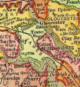
James City County, Virginia
Encyclopedia

County (United States)
In the United States, a county is a geographic subdivision of a state , usually assigned some governmental authority. The term "county" is used in 48 of the 50 states; Louisiana is divided into parishes and Alaska into boroughs. Parishes and boroughs are called "county-equivalents" by the U.S...
located on the Virginia Peninsula
Virginia Peninsula
The Virginia Peninsula is a peninsula in southeast Virginia, USA, bounded by the York River, James River, Hampton Roads and Chesapeake Bay.Hampton Roads is the common name for the metropolitan area that surrounds the body of water of the same name...
in the Hampton Roads
Hampton Roads
Hampton Roads is the name for both a body of water and the Norfolk–Virginia Beach metropolitan area which surrounds it in southeastern Virginia, United States...
metropolitan area of the Commonwealth of Virginia, a state
U.S. state
A U.S. state is any one of the 50 federated states of the United States of America that share sovereignty with the federal government. Because of this shared sovereignty, an American is a citizen both of the federal entity and of his or her state of domicile. Four states use the official title of...
of the United States
United States
The United States of America is a federal constitutional republic comprising fifty states and a federal district...
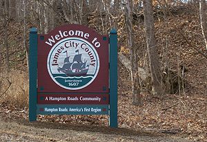
. Its population was 67,009 (as of Census 2010), and it is often associated with Williamsburg
Williamsburg, Virginia
Williamsburg is an independent city located on the Virginia Peninsula in the Hampton Roads metropolitan area of Virginia, USA. As of the 2010 Census, the city had an estimated population of 14,068. It is bordered by James City County and York County, and is an independent city...
, an independent city
Independent city
An independent city is a city that does not form part of another general-purpose local government entity. These type of cities should not be confused with city-states , which are fully sovereign cities that are not part of any other sovereign state.-Historical precursors:In the Holy Roman Empire,...
, and Jamestown
Jamestown, Virginia
Jamestown was a settlement in the Colony of Virginia. Established by the Virginia Company of London as "James Fort" on May 14, 1607 , it was the first permanent English settlement in what is now the United States, following several earlier failed attempts, including the Lost Colony of Roanoke...
which is within the county. As of 2007, the median household income was $70,487.
First settled by the English colonists in 1607 at Jamestown
Jamestown, Virginia
Jamestown was a settlement in the Colony of Virginia. Established by the Virginia Company of London as "James Fort" on May 14, 1607 , it was the first permanent English settlement in what is now the United States, following several earlier failed attempts, including the Lost Colony of Roanoke...
in the Virginia Colony, the County was formally created in 1634 as James City Shire
James City Shire
James City Shire was formed in the British colony of Virginia in 1634.During the 17th century, shortly after establishment of Jamestown in 1607, English settlers and explored and began settling the areas adjacent to Hampton Roads....
by order of King Charles I
Charles I of England
Charles I was King of England, King of Scotland, and King of Ireland from 27 March 1625 until his execution in 1649. Charles engaged in a struggle for power with the Parliament of England, attempting to obtain royal revenue whilst Parliament sought to curb his Royal prerogative which Charles...
. James City County is considered one of only five original shires of Virginia
Shires of Virginia
The eight Shires of Virginia were formed in 1634 in the Virginia Colony. These shires were based on a form of local government used in England at the time, and were redesignated as counties a few years later...
to still be extant today in essentially the same political form. The Jamestown 2007
Jamestown 2007
Jamestown 2007 is the name of the organization planning the events commemorating the 400th anniversary of the founding of Jamestown, Virginia in 1607, the first permanent English-speaking settlement in what is now the United States of America...
celebration marked the 400th anniversary of the founding of Jamestown.
Today, James City County remains an important site of growth and economic development. With an increasing population and a generous endowment of skilled labor, the County attracts not only new businesses and entrepreneurs looking to take advantage of an ideal mid-Atlantic location, and one of the northernmost right to work
Right to work
The right to work is the concept that people have a human right to work, or engage in productive employment, and may not be prevented from doing so...
counties in the country, but also successful retirees seeking the mild seasonal climate and the abundance of cultural events, economic opportunities and historic activities offered. The County is home to the Busch Gardens Europe
Busch Gardens Europe
Busch Gardens Williamsburg is a 383 acre theme park located in James City County, Virginia about 3 miles southeast of Williamsburg, originally developed by Anheuser-Busch and currently owned by SeaWorld Parks & Entertainment, a division of The Blackstone Group...
theme park, the massive Kingsmill Resort
Kingsmill
Kingsmill is a name which has been used in James City County, Virginia since the mid-18th century. Initially the name of a plantation, in modern times, the name is attached to a geographic area which includes a large planned residential community, a resort complex, a theme park, a brewery, and a...
, and the Williamsburg Pottery Factory
Williamsburg Pottery Factory
Williamsburg Pottery Factory is a large, multi-structure retail outlet store located in Lightfoot, Virginia, about west of Williamsburg. The Williamsburg Pottery Factory markets itself as one of Virginia's largest tourist attractions. Referred to by the locals as "the Pottery", the attraction...
. The Historic Jamestowne
Historic Jamestowne
Historic Jamestowne is the official name used for promotional purposes for the original site of the 1607 James Fort and the later 17th century city of Jamestown. It is located on the James River at Jamestown, Virginia and operated as a partnership between Preservation Virginia and the U.S...
and Jamestown Settlement
Jamestown Settlement
Jamestown Settlement is a name used by the Commonwealth of Virginia's portion of the historical sites and museums at Jamestown. Jamestown was the first successful English settlement on the mainland of North America...
attractions combine with Colonial Williamsburg
Colonial Williamsburg
Colonial Williamsburg is the private foundation representing the historic district of the city of Williamsburg, Virginia, USA. The district includes buildings dating from 1699 to 1780 which made colonial Virginia's capital. The capital straddled the boundary of the original shires of Virginia —...
, and are linked to Yorktown
Yorktown, Virginia
Yorktown is a census-designated place in York County, Virginia, United States. The population was 220 in the 2000 census. It is the county seat of York County, one of the eight original shires formed in colonial Virginia in 1634....
by the National Park Service's
National Park Service
The National Park Service is the U.S. federal agency that manages all national parks, many national monuments, and other conservation and historical properties with various title designations...
bucolic Colonial Parkway
Colonial Parkway
Colonial Parkway is a scenic 23-mile parkway linking the three popular attractions of Virginia's Historic Triangle of colonial-era communities, Jamestown, Williamsburg, and Yorktown...
, to make worldwide tourism to the Historic Triangle
Historic Triangle
The Historic Triangle is located on the Virginia Peninsula of the United States and includes the colonial communities of Jamestown, Colonial Williamsburg, and Yorktown, with many restored attractions linked by the Colonial Parkway in James City and York counties and the City of...
a major economic activity for the county. This highly developed tourist industry coupled with an open business climate, many favorable labor realities; high endowments of human capital from the nearby College of William and Mary
College of William and Mary
The College of William & Mary in Virginia is a public research university located in Williamsburg, Virginia, United States...
and the presence of NASA
Langley Research Center
Langley Research Center is the oldest of NASA's field centers, located in Hampton, Virginia, United States. It directly borders Poquoson, Virginia and Langley Air Force Base...
, Jefferson Laboratory, and numerous defense contractors which give the region the highest concentration of scientists and engineers per capita in the nation; ensure James City County will remain not only a national historic treasure but a premier location for continued opportunity and prosperity.
History
- This section incorporates text from the 1911 edition of the Encyclopædia Britannica, which is in the public domainPublic domainWorks are in the public domain if the intellectual property rights have expired, if the intellectual property rights are forfeited, or if they are not covered by intellectual property rights at all...
.
Proprietary colony
The Virginia Company of London was granted a proprietorship (charter) by King James I of EnglandJames I of England
James VI and I was King of Scots as James VI from 24 July 1567 and King of England and Ireland as James I from the union of the English and Scottish crowns on 24 March 1603...
to attempt to establish a colony in the area we now know as Virginia. England had been at war with Spain and was seeking both capital funds and income in the form of royalties. In December, 1606, three ships set sail from England, led by Captain Christopher Newport
Christopher Newport
Christopher Newport was an English seaman and privateer. He is best known as the captain of the Susan Constant, the largest of three ships which carried settlers for the Virginia Company in 1607 on the way to find the settlement at Jamestown in the Virginia Colony, which became the first permanent...
. Upon reaching the New World at Cape Henry
Cape Henry
Cape Henry is a cape on the Atlantic shore of Virginia north of Virginia Beach. It is the southern boundary of the entrance to Chesapeake Bay.Across the mouth of the bay to the north is Cape Charles...
, they selected a site to settle about 40 miles (64.4 km) inland from the coast along a river to be better protected from attacks by sea from other Europeans. Soon after the establishment of Jamestown in 1607 in the new Colony of Virginia, English
England
England is a country that is part of the United Kingdom. It shares land borders with Scotland to the north and Wales to the west; the Irish Sea is to the north west, the Celtic Sea to the south west, with the North Sea to the east and the English Channel to the south separating it from continental...
settlers first explored and then began settling more of the areas adjacent to Hampton Roads and along the James River
James River (Virginia)
The James River is a river in the U.S. state of Virginia. It is long, extending to if one includes the Jackson River, the longer of its two source tributaries. The James River drains a catchment comprising . The watershed includes about 4% open water and an area with a population of 2.5 million...
.
The first five years were very difficult, and the majority of the colonists perished. In 1612, imported strains of tobacco
Tobacco
Tobacco is an agricultural product processed from the leaves of plants in the genus Nicotiana. It can be consumed, used as a pesticide and, in the form of nicotine tartrate, used in some medicines...
cultivated in Virginia by colonist John Rolfe
John Rolfe
John Rolfe was one of the early English settlers of North America. He is credited with the first successful cultivation of tobacco as an export crop in the Colony of Virginia and is known as the husband of Pocahontas, daughter of the chief of the Powhatan Confederacy.In 1961, the Jamestown...
were successfully exported and a cash crop
Cash crop
In agriculture, a cash crop is a crop which is grown for profit.The term is used to differentiate from subsistence crops, which are those fed to the producer's own livestock or grown as food for the producer's family...
had been identified.
In 1619, the Virginia Company of London under a new leader, Sir Edwin Sandys
Edwin Sandys (American colonist)
Sir Edwin Sandys was an English politician, a leading figure in the parliaments of James I of England. He was also one of the founders of the proprietary Virginia Company of London, which in 1607 established the first permanent English settlement in what is now the United States in the colony of...
, instituted a number of changes, to help stimulate more investment and attract settlers from England. In the long view, foremost among these was the establishment of what became the House of Burgesses
House of Burgesses
The House of Burgesses was the first assembly of elected representatives of English colonists in North America. The House was established by the Virginia Company, who created the body as part of an effort to encourage English craftsmen to settle in North America...
, the first representative legislative body in the European settlement of North America, predecessor of today's Virginia General Assembly
Virginia General Assembly
The Virginia General Assembly is the legislative body of the Commonwealth of Virginia, and the oldest legislative body in the Western Hemisphere, established on July 30, 1619. The General Assembly is a bicameral body consisting of a lower house, the Virginia House of Delegates, with 100 members,...
, first convened by a Royal Governor, Sir George Yeardley
George Yeardley
Sir George Yeardley was a plantation owner and three time colonial Governor of the British Colony of Virginia. A survivor of the Virginia Company of London's ill-fated Third Supply Mission, whose flagship, the Sea Venture, was shipwrecked on Bermuda for 10 months in 1609-10, he is best remembered...
, of Flowerdew Hundred Plantation
Flowerdew Hundred Plantation
Flowerdew Hundred Plantation dates to 1618/19 with the patent by Sir George Yeardley, the Governor and Captain General of Virginia, of on the south side of the James River. Yeardley probably named the plantation after his wife's wealthy father, Anthony Flowerdew, just as he named another...
. Also in 1619, the plantation
Plantation
A plantation is a long artificially established forest, farm or estate, where crops are grown for sale, often in distant markets rather than for local on-site consumption...
s and developed portions of the Colony were divided into four "incorporations" or "citties," as they were then called. These were (east to west) Elizabeth Cittie
Elizabeth City (Virginia Company)
Elizabeth City was one of four incorporations established in the Virginia Colony in 1619 by the proprietor, the Virginia Company of London, acting in accordance with instructions issued by Sir George Yeardley, Governor.The plantations and developments were divided into four political divisions,...
(initially known as Kecoughtan), James Cittie
James City (Virginia Company)
James City was one of four incorporations established in the Virginia Colony in 1619 by the proprietor, the Virginia Company. The plantations and developments were divided into four "incorporations" or " ", as they were called...
, Charles Cittie
Charles City (Virginia Company)
Charles City was one of four incorporations established in the Virginia Colony in 1619 by the proprietor, the Virginia Company. The plantations and developments were divided into four "incorporations" or "citties" , as they were called. These were Charles City, Elizabeth City, Henrico City, and...
, and Henrico Cittie
Henrico City (Virginia Company)
Henrico City was one of four incorporations established in the Virginia Colony in 1619 North America by the proprietor, the Virginia Company. The plantations and developments were divided into four "incorporations" or "citties", as they were called. These were Charles City, Elizabeth City, Henrico...
. Each cittie covered a very large area. Elizabeth Cittie not only included land on both side of the James River, but most of what we now know as South Hampton Roads
South Hampton Roads
South Hampton Roads is a region located in the extreme southeastern portion of Virginia in the United States, and is part of the Virginia Beach-Norfolk-Newport News, VA-NC MSA with a population about 1.7 million....
and also included Virginia's Eastern Shore
Eastern Shore of Virginia
The Eastern Shore of Virginia consists of two counties on the Atlantic coast of the Commonwealth of Virginia in the United States. The region is part of the Delmarva Peninsula and is separated from the rest of Virginia by the Chesapeake Bay. Its population was 45,553 as of 2010...
.
The Virginia Company's "James Cittie" stretched across the Peninsula
Virginia Peninsula
The Virginia Peninsula is a peninsula in southeast Virginia, USA, bounded by the York River, James River, Hampton Roads and Chesapeake Bay.Hampton Roads is the common name for the metropolitan area that surrounds the body of water of the same name...
to the York River
York River (Virginia)
The York River is a navigable estuary, approximately long, in eastern Virginia in the United States. It ranges in width from at its head to near its mouth on the west side of Chesapeake Bay. Its watershed drains an area including portions of 17 counties of the coastal plain of Virginia north...
, and included the seat of government for the entire colony at Jamestown Island. Each of the four citties extended across the James River
James River (Virginia)
The James River is a river in the U.S. state of Virginia. It is long, extending to if one includes the Jackson River, the longer of its two source tributaries. The James River drains a catchment comprising . The watershed includes about 4% open water and an area with a population of 2.5 million...
, the major thoroughfare of commerce for the settlers, and included land on both the north and south shores. With the incentives of 1619, many new developments, known as "hundreds" were established.
Wolstenholme Towne, Carter's Grove Plantation
About this same time, downriver from Jamestown, in the southeastern end of what is now James City County near present-day GroveGrove, Virginia
Grove is an unincorporated community in the southeastern portion of James City County in the Peninsula subregion of Virginia in the United States. It is located in the center of the Historic Triangle of Colonial Virginia, communities linked by the Colonial Parkway; the area is one of the busiest...
, a fortified settlement known as Wolstenholme Towne
Wolstenholme Towne
Wolstenholme Towne was a fortified settlement in the Virginia Colony begun with a population of about 40 settlers of the Virginia Company of London which was located about 7 miles downstream from Jamestown. Named for Sir John Wolstenholme, one of the investors, it was established about 1618 on a...
was established near the river and just east of the confluence of Grove Creek on a land grant known as Martin's Hundred
Martin's Hundred
Martin's Hundred was an early 17th century plantation located along about ten miles of the north shore of the James River in the Virginia Colony east of Jamestown in the southeastern portion of present-day James City County, Virginia...
. However, the population of the town, named for Sir John Wolstenholme
Sir John Wolstenholme, 1st Baronet
Sir John Wolstenholme, 1st Baronet was an English politician who sat in the House of Commons in 1640. He supported the Royalist side in the English Civil War.Wolstenholme was the son of Sir John Wolstenholme and his wife Catherine Fanshaw...
, a principal of the Martin's Hundred Society investors back in England, was severely decimated during the Indian Massacre of 1622
Indian massacre of 1622
The Indian Massacre of 1622 occurred in the Colony of Virginia, in what now belongs to the United States of America, on Friday, March 22, 1622...
, and many men, women and children were killed or abducted. While it was rebuilt, Wolstenholme Towne was eventually abandoned about 1643, and soon even the location was forgotten as it became one of the lost towns of Virginia.
Over 100 years later, the property had become part of Carter's Grove Plantation, itself built around 1753 by the grandson of Robert "King" Carter
Robert Carter I
Robert "King" Carter , of Lancaster County, was a colonist in Virginia and became one of the wealthiest men in the colonies....
of Corotoman
Corotoman
Corotoman was a 17th and 18th century plantation on the Rappahannock River in Lancaster County, Virginia, United States. Corotoman was the residence of Robert Carter I , a colonial Governor of Virginia and one of the wealthiest men in the British colonies in North America...
, who had become one of the wealthiest planters and served for a period as Virginia's acting governor. Another 200 years later, the long-lost site of Wolstenholme Towne was rediscovered in 1976 during an archaeological dig overseen by Ivor Noel Hume
Ivor Noel Hume
Ivor Noël Hume is a British-born archaeologist and author, heralded by his peers as the "father" of Historical Archaeology. He studied at Farmingham College and St...
after the Carter's Grove Plantation property came under the ownership of Colonial Williamsburg Foundation.
Royal colony, creation of shires (counties)
Virginia Company
The Virginia Company refers collectively to a pair of English joint stock companies chartered by James I on 10 April1606 with the purposes of establishing settlements on the coast of North America...
lost its charter in 1624, and Virginia became a royal colony. In 1634, the English Crown created eight shire
Shires of Virginia
The eight Shires of Virginia were formed in 1634 in the Virginia Colony. These shires were based on a form of local government used in England at the time, and were redesignated as counties a few years later...
s (i.e., counties) in the colony of Virginia, with a total population of approximately 5,000 inhabitants. James City Shire
James City Shire
James City Shire was formed in the British colony of Virginia in 1634.During the 17th century, shortly after establishment of Jamestown in 1607, English settlers and explored and began settling the areas adjacent to Hampton Roads....
, as well as the James River and Jamestown which had been named earlier, took its name from King James I
James I of England
James VI and I was King of Scots as James VI from 24 July 1567 and King of England and Ireland as James I from the union of the English and Scottish crowns on 24 March 1603...
, the father of the then-king, Charles I
Charles I of England
Charles I was King of England, King of Scotland, and King of Ireland from 27 March 1625 until his execution in 1649. Charles engaged in a struggle for power with the Parliament of England, attempting to obtain royal revenue whilst Parliament sought to curb his Royal prerogative which Charles...
. About 1642-43, the name of the James City Shire was changed to James City County.
Middle Plantation, Williamsburg, Green Spring
On high ground midway across the Virginia Peninsula, Middle PlantationMiddle Plantation
Middle Plantation in the Virginia Colony, was the unincorporated town established in 1632 that became Williamsburg in 1699. It was located on high ground about half-way across the Virginia Peninsula between the James River and York River. Middle Plantation represented the first major inland...
was established in 1632 as a fortress in the ongoing conflicts with Native American
Native Americans in the United States
Native Americans in the United States are the indigenous peoples in North America within the boundaries of the present-day continental United States, parts of Alaska, and the island state of Hawaii. They are composed of numerous, distinct tribes, states, and ethnic groups, many of which survive as...
s. By 1634, a palisade or fortification had been completed across the peninsula with Middle Plantation at the center. This protected the lower peninsula to the east.
Middle Plantation and James City County were selected for the site of the College of William and Mary
College of William and Mary
The College of William & Mary in Virginia is a public research university located in Williamsburg, Virginia, United States...
in 1693 and became the location of the capital in 1699 after Jamestown was burned (again) in 1698. Shortly thereafter, Middle Plantation was renamed Williamsburg
Williamsburg, Virginia
Williamsburg is an independent city located on the Virginia Peninsula in the Hampton Roads metropolitan area of Virginia, USA. As of the 2010 Census, the city had an estimated population of 14,068. It is bordered by James City County and York County, and is an independent city...
in honor of King William III of England
William III of England
William III & II was a sovereign Prince of Orange of the House of Orange-Nassau by birth. From 1672 he governed as Stadtholder William III of Orange over Holland, Zeeland, Utrecht, Guelders, and Overijssel of the Dutch Republic. From 1689 he reigned as William III over England and Ireland...
. The capital was moved to Richmond
Richmond, Virginia
Richmond is the capital of the Commonwealth of Virginia, in the United States. It is an independent city and not part of any county. Richmond is the center of the Richmond Metropolitan Statistical Area and the Greater Richmond area...
in 1780 at the outset of the American Revolution
American Revolution
The American Revolution was the political upheaval during the last half of the 18th century in which thirteen colonies in North America joined together to break free from the British Empire, combining to become the United States of America...
. The Battle of Green Spring
Battle of Green Spring
The Battle of Green Spring took place near Green Spring Plantation in James City County, Virginia during the American Revolutionary War. On July 6, 1781 United States Brigadier General "Mad" Anthony Wayne, leading the advance forces of the Marquis de Lafayette, was ambushed near the plantation by...
was fought in the county just a short time before the British surrender at Yorktown. (Green Spring Plantation
Green Spring Plantation
Green Spring Plantation in James City County about five miles west of Williamsburg, was the 17th century plantation of one of the more popular governors of Colonial Virginia in North America, Sir William Berkeley, and his second wife....
was the former home of Royal Governor William Berkeley).
19th and 20th centuries
During the American Civil WarAmerican Civil War
The American Civil War was a civil war fought in the United States of America. In response to the election of Abraham Lincoln as President of the United States, 11 southern slave states declared their secession from the United States and formed the Confederate States of America ; the other 25...
, the Battle of Williamsburg
Battle of Williamsburg
The Battle of Williamsburg, also known as the Battle of Fort Magruder, took place on May 5, 1862, in York County, James City County, and Williamsburg, Virginia, as part of the Peninsula Campaign of the American Civil War...
was waged in York and James City County during the Peninsula Campaign
Peninsula Campaign
The Peninsula Campaign of the American Civil War was a major Union operation launched in southeastern Virginia from March through July 1862, the first large-scale offensive in the Eastern Theater. The operation, commanded by Maj. Gen. George B...
in 1862. Some earthworks remain at the site of the Confederate Fort Magruder
Fort Magruder
Fort Magruder was an high earthen fortification straddling the road between Yorktown and Williamsburg, Virginia, just outside the latter city during the American Civil War...
. After the War, Collis P. Huntington
Collis P. Huntington
Collis Potter Huntington was one of the Big Four of western railroading who built the Central Pacific Railroad as part of the first U.S. transcontinental railroad...
extended the new Chesapeake and Ohio Railway
Chesapeake and Ohio Railway
The Chesapeake and Ohio Railway was a Class I railroad formed in 1869 in Virginia from several smaller Virginia railroads begun in the 19th century. Led by industrialist Collis P...
through the county to reach new coal pier
Coal pier
A coal pier is a transloading facility designed for the transfer of coal between rail and ship.The typical facility for loading ships consists of a holding area and a system of conveyors for transferring the coal to dockside and loading it into the ship's cargo holds...
s he had built at Newport News
Newport News, Virginia
Newport News is an independent city located in the Hampton Roads metropolitan area of Virginia. It is at the southeastern end of the Virginia Peninsula, on the north shore of the James River extending southeast from Skiffe's Creek along many miles of waterfront to the river's mouth at Newport News...
on Hampton Roads
Hampton Roads
Hampton Roads is the name for both a body of water and the Norfolk–Virginia Beach metropolitan area which surrounds it in southeastern Virginia, United States...
. Railroad stations were established (listed west to east) at Diascund, Toano
Toano, Virginia
Toano is an unincorporated town in James City County, Virginia, United States.-History:Toano was established in the late 19th century in western James City County at the former site of Burnt Ordinary, which was named in the 18th century for a roadside tavern that had burned down...
, Vaiden's Crossing
Norge, Virginia
Norge is an unincorporated community in James City County, Virginia, United States.-Location:Norge was located on the old Richmond-Williamsburg Stage Road, which is U.S. Route 60 in modern times. Interstate 64 was built through the area in the 1970s, and passes nearby...
, Kelton, Ewell, Williamsburg, and Grove
Grove, Virginia
Grove is an unincorporated community in the southeastern portion of James City County in the Peninsula subregion of Virginia in the United States. It is located in the center of the Historic Triangle of Colonial Virginia, communities linked by the Colonial Parkway; the area is one of the busiest...
. In Williamsburg, the temporary tracks initially laid ran down the middle of Duke of Gloucester Street.
After a change in the Virginia constitution in 1871, Williamsburg became an independent city
Independent city
An independent city is a city that does not form part of another general-purpose local government entity. These type of cities should not be confused with city-states , which are fully sovereign cities that are not part of any other sovereign state.-Historical precursors:In the Holy Roman Empire,...
from James City County in 1884, although it remained the county seat
County seat
A county seat is an administrative center, or seat of government, for a county or civil parish. The term is primarily used in the United States....
. Williamsburg and James City County share a combined school system, courts, and some constitutional officers.
Beginning in the early 20th century, preservation and restoration efforts resulted in a major increase in tourism to the county and surrounding area. Attractions developed included Colonial Williamsburg
Colonial Williamsburg
Colonial Williamsburg is the private foundation representing the historic district of the city of Williamsburg, Virginia, USA. The district includes buildings dating from 1699 to 1780 which made colonial Virginia's capital. The capital straddled the boundary of the original shires of Virginia —...
, Jamestown Settlement
Jamestown Settlement
Jamestown Settlement is a name used by the Commonwealth of Virginia's portion of the historical sites and museums at Jamestown. Jamestown was the first successful English settlement on the mainland of North America...
, the Colonial Parkway
Colonial Parkway
Colonial Parkway is a scenic 23-mile parkway linking the three popular attractions of Virginia's Historic Triangle of colonial-era communities, Jamestown, Williamsburg, and Yorktown...
, Carter's Grove Plantation, and Busch Gardens Europe
Busch Gardens Europe
Busch Gardens Williamsburg is a 383 acre theme park located in James City County, Virginia about 3 miles southeast of Williamsburg, originally developed by Anheuser-Busch and currently owned by SeaWorld Parks & Entertainment, a division of The Blackstone Group...
.
Colonial Williamsburg
Perhaps the best-known of the 20th century changes of a local nature which affected James City County was the Restoration and development of Colonial WilliamsburgColonial Williamsburg
Colonial Williamsburg is the private foundation representing the historic district of the city of Williamsburg, Virginia, USA. The district includes buildings dating from 1699 to 1780 which made colonial Virginia's capital. The capital straddled the boundary of the original shires of Virginia —...
. Driven by the vision of an Episcopalian priest and initially funded by the heir to the Standard Oil
Standard Oil
Standard Oil was a predominant American integrated oil producing, transporting, refining, and marketing company. Established in 1870 as a corporation in Ohio, it was the largest oil refiner in the world and operated as a major company trust and was one of the world's first and largest multinational...
fortune, John D. Rockefeller, Jr.
John D. Rockefeller, Jr.
John Davison Rockefeller, Jr. was a major philanthropist and a pivotal member of the prominent Rockefeller family. He was the sole son among the five children of businessman and Standard Oil industrialist John D. Rockefeller and the father of the five famous Rockefeller brothers...
and his wife Abby Aldrich Rockefeller
Abby Aldrich Rockefeller
Abby Aldrich Rockefeller, , was a prominent socialite and philanthropist and the second-generation matriarch of the renowned Rockefeller family...
, Colonial Williamsburg (or "CW" as it is informally known locally) became a world-class attraction like no other.
While the Historic Area of Colonial Williamsburg is within the city limits of Williamsburg and not located within James City County, in the earliest periods, CW acquired vast acreage in the entire area, notably to the north and east of the Historic District. Foremost was a desire to preserve views and facilitate the effort to allow a visitor to experience as much of the late 18th century experience as possibly with regard to the surrounding environment.
The entrance roadways to the Historic Area were planned with great care. Even in modern times, pathways from the Colonial Parkway and from the relocated U.S. Route 60
U.S. Route 60 in Virginia
U.S. Route 60 in Virginia runs west to east through the central part of the state, generally close to and paralleling the Interstate 64 corridor, except for the crossing of the Blue Ridge Mountains, and in the South Hampton Roads area....
at Bypass Road and North Henry Street are without commercial development. The protected vista was extended along U.S. Route 132 in York County to the new road when Route 143 was built as the Merrimack Trail
Merrimack Trail
Merrimack Trail is the local name for State Route 143 as it passes through portions of York County and James City County and the independent city of Williamsburg in the Virginia Peninsula subregion of Hampton Roads in Virginia.-History:...
(originally State Route 168) in the 1930s. When Interstate 64
Interstate 64 in Virginia
In the U.S. state of Virginia, Interstate 64 runs east–west through the middle of the state from West Virginia to the Hampton Roads region, a total of . It is notable for crossing the mouth of the harbor of Hampton Roads on the Hampton Roads Bridge-Tunnel, the first bridge-tunnel to...
was planned and built in the 1960s and early 1970s, the additional land along Route 143 from the designated "Colonial Williamsburg" exit was similarly protected from development. Even in modern times, no commercial properties are encountered to reach the Visitor's Center, although the land is very valuable and the distance is several miles.
The area to the immediate east of the Historic Area in James City County included a vast tract known as the Kingsmill Plantation
Kingsmill
Kingsmill is a name which has been used in James City County, Virginia since the mid-18th century. Initially the name of a plantation, in modern times, the name is attached to a geographic area which includes a large planned residential community, a resort complex, a theme park, a brewery, and a...
property. It was bisected by the historic Quarterpath Road
Quarterpath Road
Quarterpath Road is one of the oldest roads in James City County and the independent city of Williamsburg, Virginia.-Colonial era:Established in the 17th century, Quarterpath Road extended from Middle Plantation through what later became Kingsmill Plantation to Burwell's Landing on the James...
, dating to the 17th century, which led from Williamsburg to the James River at Burwell's Landing. The manor house, built in the 1730s, had burned in 1843, but several brick dependencies survived (and still do into the 21st century). Immediately to the east of the Kingsmill tract was Carter's Grove Plantation
Carter's Grove
Carter's Grove, also known as Carter's Grove Plantation, is a 750 acre plantation located on the north shore of the James River in the Grove Community of southeastern James City County in the Virginia Peninsula area of the Hampton Roads region of Virginia in the US.The plantation was built for...
. It was begun by a grandson of Royal Governor Robert "King" Carter
Robert Carter I
Robert "King" Carter , of Lancaster County, was a colonist in Virginia and became one of the wealthiest men in the colonies....
. For over 200 years, it had gone through a succession of owners and modifications. Then, in the 1960s, after the death of its last resident, Ms. Molly McRae, Carter's Grove Plantation came the control of the Rockefeller Foundation, and was given to Colonial Williamsburg as a gift. At that point in time, the mid 1960s, CW owned land extended all the way from the Historic District to Skiffe's Creek
Skiffe's Creek
Skiffe's Creek is located in James City County and the independent city of Newport News in the Virginia Peninsula area of the Hampton Roads region of southeastern Virginia in the United States...
, at the edge of Newport News
Newport News, Virginia
Newport News is an independent city located in the Hampton Roads metropolitan area of Virginia. It is at the southeastern end of the Virginia Peninsula, on the north shore of the James River extending southeast from Skiffe's Creek along many miles of waterfront to the river's mouth at Newport News...
near Lee Hall
Lee Hall, Virginia
Lee Hall is a former unincorporated town long located in the former Warwick County. Since 1958, Lee Hall has been a suburban community in the extreme western portion of the independent city of Newport News in the Commonwealth of Virginia....
.
(Carter's Grove, at a distance of 8 miles (12.9 km), was operated as a satellite facility of Colonial Williamsburg, with several important programs there, until 2003. Eventually, most of the programs were relocated to be closer to the Historic Area, and the property was sold in 2007, with restrictive and conservation covenants to protect it. See separate article Carter's Grove
Carter's Grove
Carter's Grove, also known as Carter's Grove Plantation, is a 750 acre plantation located on the north shore of the James River in the Grove Community of southeastern James City County in the Virginia Peninsula area of the Hampton Roads region of Virginia in the US.The plantation was built for...
for more details).
Anheuser-Busch
In the second half of the 20th century, distant from the Historic Area and not along the carefully protected sight paths, the vacant land east of town which was owned by Colonial Williamsburg and locally known as the Kingsmill tract had been long unproductive for either CW or the community. That changed in the early 1970s, under the leadership of CW Chairman Winthrop Rockefeller
Winthrop Rockefeller
Winthrop Rockefeller was a politician and philanthropist who served as the first Republican Governor of Arkansas since Reconstruction. He was a third-generation member of the Rockefeller family.-Early life:...
.
Rockefeller, a son of Abby and John D. Rockefeller Jr., was a frequent visitor and particularly fond of Carter's Grove in the late 1960s. He also served as Governor of the State of Arkansas
Arkansas
Arkansas is a state located in the southern region of the United States. Its name is an Algonquian name of the Quapaw Indians. Arkansas shares borders with six states , and its eastern border is largely defined by the Mississippi River...
. He became aware of some expansion plans elsewhere on the Peninsula of his St. Louis-based neighbor, August Anheuser Busch, Jr.
Gussie Busch
August "Gussie" Anheuser Busch, Jr. was an American brewing magnate who built the Anheuser-Busch Companies into the largest brewery in the world as company chairman from 1946–75, and became a prominent sportsman as owner of the St...
, head of Anheuser-Busch
Anheuser-Busch
Anheuser-Busch Companies, Inc. , is an American brewing company. The company operates 12 breweries in the United States and 18 in other countries. It was, until December 2009, also one of America's largest theme park operators; operating ten theme parks across the United States through the...
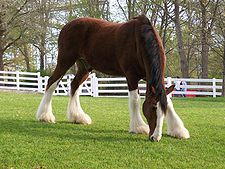
(AB). A businessman and promoter, he had originated the use of the now famous Clydesdale
Clydesdale (breed)
The Clydesdale is a breed of draught horse derived from the farm horses of Clydesdale, Scotland, and named after that region. Although originally one of the smaller breeds of draught horses, it is now a tall breed. Often bay in colour, they show significant white markings due to the presence of...
team as a company logo in the 1930s.
In 1959, the company had opened what today is known as a theme park in Tampa, Florida
Tampa, Florida
Tampa is a city in the U.S. state of Florida. It serves as the county seat for Hillsborough County. Tampa is located on the west coast of Florida. The population of Tampa in 2010 was 335,709....
which was known as simply "Busch Gardens". It was visionary, and predated the massive Walt Disney World development nearby by several years; today it is known as Busch Gardens Tampa Bay.
While details have never been widely publicized, by the time "Win" Rockefeller and "Gussie" Busch completed their discussions and negotiations, the biggest changes in the Williamsburg area since the Restoration began 40 years earlier were underway. Among the goals were to complement Colonial Williamsburg attractions and enhance the local economy.
The large tract consisting primarily of the Kingsmill land was sold by the Colonial Williamsburg Foundation to Anheuser-Busch
Anheuser-Busch
Anheuser-Busch Companies, Inc. , is an American brewing company. The company operates 12 breweries in the United States and 18 in other countries. It was, until December 2009, also one of America's largest theme park operators; operating ten theme parks across the United States through the...
(AB) for planned development. The AB investment included building a large brewery, the Busch Gardens Europe
Busch Gardens Europe
Busch Gardens Williamsburg is a 383 acre theme park located in James City County, Virginia about 3 miles southeast of Williamsburg, originally developed by Anheuser-Busch and currently owned by SeaWorld Parks & Entertainment, a division of The Blackstone Group...
theme park, the Kingsmill
Kingsmill
Kingsmill is a name which has been used in James City County, Virginia since the mid-18th century. Initially the name of a plantation, in modern times, the name is attached to a geographic area which includes a large planned residential community, a resort complex, a theme park, a brewery, and a...
planned resort community, and McLaws Circle, an office park. A 60 acres (242,811.6 m²) portion was donated by Anheuser-Busch in the late 1960s to develop the James City County office complex.
AB and related entities from that development plan now are the source of the area's largest employment base, surpassing both Colonial Williamsburg and the local military bases. In 2008, Anheuser-Busch ranked as the world's second largest brewer.
21st century
At the turn of the 21st century, new archaeological work was underway at Jamestown and nearby Green Spring PlantationGreen Spring Plantation
Green Spring Plantation in James City County about five miles west of Williamsburg, was the 17th century plantation of one of the more popular governors of Colonial Virginia in North America, Sir William Berkeley, and his second wife....
, with the premise of new historical discoveries. Each is especially attractive to archaeologists because of the lack of development after the mid 19th century.
Another archeological site, Wolstenholme Towne
Wolstenholme Towne
Wolstenholme Towne was a fortified settlement in the Virginia Colony begun with a population of about 40 settlers of the Virginia Company of London which was located about 7 miles downstream from Jamestown. Named for Sir John Wolstenholme, one of the investors, it was established about 1618 on a...
at Carter's Grove, was protected by covenants when it was sold in 2007, and may see future activity.
Geography
According to the U.S. Census BureauUnited States Census Bureau
The United States Census Bureau is the government agency that is responsible for the United States Census. It also gathers other national demographic and economic data...
, the county has a total area of 180 square miles (466.2 km²), of which 143 square miles (370.4 km²) is land, and 37 square miles (95.8 km²) (20.47%) is water. The James City County GIS office specifies the county as being 115,011.9 Acres
James City County straddles two major watersheds, the James River Watershed and the York River Watershed. (Both are sub watersheds of the Chesapeake Bay watershed, which stretches from Pennsylvania to Virginia). Within the James River and York watersheds are eleven sub watersheds: Diascund Creek, Ware Creek, Yarmouth Creek, Gordon Creek, Powhatan Creek, Mill Creek, College Creek
College Creek
College Creek is located in James City County in the Virginia Peninsula area of the Hampton Roads region of southeastern Virginia in the United States...
, James River
James River (Virginia)
The James River is a river in the U.S. state of Virginia. It is long, extending to if one includes the Jackson River, the longer of its two source tributaries. The James River drains a catchment comprising . The watershed includes about 4% open water and an area with a population of 2.5 million...
, York River
York River (Virginia)
The York River is a navigable estuary, approximately long, in eastern Virginia in the United States. It ranges in width from at its head to near its mouth on the west side of Chesapeake Bay. Its watershed drains an area including portions of 17 counties of the coastal plain of Virginia north...
, Skiffe's Creek
Skiffe's Creek
Skiffe's Creek is located in James City County and the independent city of Newport News in the Virginia Peninsula area of the Hampton Roads region of southeastern Virginia in the United States...
and Chickahominy River
Chickahominy River
The Chickahominy is an river in the eastern portion of the U.S. state of Virginia. The river rises about northwest of Richmond and flows southeast and south to the James River...
.
Adjacent counties and county-equivalent cities
- New Kent County, VirginiaNew Kent County, VirginiaAt the 2000 census, there were 13,462 people, 4,925 households and 3,895 families residing in the county. The population density was 64 per square mile . There were 5,203 housing units at an average density of 25 per square mile...
- northwest - King and Queen County, VirginiaKing and Queen County, VirginiaAs of the census of 2000, there were 6,630 people, 2,673 households, and 1,897 families residing in the county. The population density was 21 people per square mile . There were 3,010 housing units at an average density of 10 per square mile...
- northeast - Gloucester County, VirginiaGloucester County, VirginiaGloucester County is within the Commonwealth of Virginia in the Hampton Roads metropolitan area in the USA. Formed in 1651 in the Virginia Colony, the county was named for Henry Stuart, Duke of Gloucester, third son of King Charles I of Great Britain. Located in the Middle Peninsula region, it...
- northeast - York County, VirginiaYork County, VirginiaYork County is a county located on the north side of the Virginia Peninsula in the Hampton Roads metropolitan area of the Commonwealth of Virginia, a state of the United States. Situated on the York River and many tributaries, the county seat is the unincorporated town of Yorktown...
- east - Williamsburg, VirginiaWilliamsburg, VirginiaWilliamsburg is an independent city located on the Virginia Peninsula in the Hampton Roads metropolitan area of Virginia, USA. As of the 2010 Census, the city had an estimated population of 14,068. It is bordered by James City County and York County, and is an independent city...
- east - Newport News, VirginiaNewport News, VirginiaNewport News is an independent city located in the Hampton Roads metropolitan area of Virginia. It is at the southeastern end of the Virginia Peninsula, on the north shore of the James River extending southeast from Skiffe's Creek along many miles of waterfront to the river's mouth at Newport News...
- southeast - Surry County, VirginiaSurry County, VirginiaAs of the census of 2010, there were 7,058 people, 2,619 households, and 1,917 families residing in the county. The population density was 24 people per square mile . There were 3,294 housing units at an average density of 12 per square mile...
- south - Charles City County, VirginiaCharles City County, VirginiaAs of the census of 2000, there were 6,926 people, 2,670 households, and 1,975 families residing in the county. The population density was 38 people per square mile . There were 2,895 housing units at an average density of 16 per square mile...
- west
National protected areas
- Colonial National Historical ParkColonial National Historical ParkColonial National Historical Park is located in the Hampton Roads region of Virginia and is operated by the National Park Service of the United States government...
(part) - Jamestown National Historic Site
Cities, towns, and communities
From the establishment of Jamestown in 1607 through the middle of the 20th century, James City County's economy was based largely on an agriculture, with many farms and substantial tracts of undeveloped forests. After the decline of Jamestown in the 18th century, commerce was centered on Williamsburg, which was partially located within the county. Small unincorporated towns and villages were scattered throughout. The end of the Civil War in 1865 saw some of the larger farms divided into smaller tracts as freedmen established new homesteads. With the arrival of the railroad in 1881, new access to transportation stimulated more growth. In some areas, Americans from other parts of the country relocated to the county attracted by the land prices and access to markets. One such group of Scandanvian heritage founded NorgeNorge, Virginia
Norge is an unincorporated community in James City County, Virginia, United States.-Location:Norge was located on the old Richmond-Williamsburg Stage Road, which is U.S. Route 60 in modern times. Interstate 64 was built through the area in the 1970s, and passes nearby...
.
Williamsburg
Although it received its royal charterRoyal Charter
A royal charter is a formal document issued by a monarch as letters patent, granting a right or power to an individual or a body corporate. They were, and are still, used to establish significant organizations such as cities or universities. Charters should be distinguished from warrants and...
as a city in 1722, approximately one-half of Williamsburg was located in James City County for many years. The courthouse function was relocated there from Jamestown, where the newer but historic 1770 Courthouse building was erected on Market Square. It was replaced in 1933 with a newer building nearby, and the 1770 building, substantially restored in 1989, is today part of Colonial Williamsburg's attractions. Much more recently, another larger facility at 5201 Monticello Avenue, near State Route 199 has become the Williamsburg-James City County Courthouse.
In Colonial times, and for about 100 years thereafter, Duke of Gloucester Street actually formed a prominent portion of the James City County border with York County, dividing the city down its primary street. Although Williamsburg was established literally along the border of the two counties, the unincorporated town of Yorktown along the riverfront area at the York River
York River (Virginia)
The York River is a navigable estuary, approximately long, in eastern Virginia in the United States. It ranges in width from at its head to near its mouth on the west side of Chesapeake Bay. Its watershed drains an area including portions of 17 counties of the coastal plain of Virginia north...
has always been the county seat of York County.
After a new Virginia state constitution was adopted in 1871, independent cities
Independent city
An independent city is a city that does not form part of another general-purpose local government entity. These type of cities should not be confused with city-states , which are fully sovereign cities that are not part of any other sovereign state.-Historical precursors:In the Holy Roman Empire,...
, which were no longer located politically within counties, were created. Soon, Williamsburg's charter was modified, and it was no longer located within either county. However, although politically separate entities, Williamsburg has remained the county seat
County seat
A county seat is an administrative center, or seat of government, for a county or civil parish. The term is primarily used in the United States....
of James City County, and they continue to share many services, including courts, several constitutional officers and a joint public school system.
Towns and communities
There are no incorporated townIncorporated town
-Canada:Incorporated towns are a form of local government in Canada, which is a responsibility of provincial rather than federal government.-United States:...
s in the county. Unincorporated communities include:
- Centerville
- CroakerCroaker, VirginiaCroaker is an unincorporated community in James City County, Virginia, United States on the south bank of the York River 10 miles downstream from West Point. The York River is formed from the confluence of the Mattaponi River and the Pamunkey River at West Point...
- Diascund
- Five Forks
- GroveGrove, VirginiaGrove is an unincorporated community in the southeastern portion of James City County in the Peninsula subregion of Virginia in the United States. It is located in the center of the Historic Triangle of Colonial Virginia, communities linked by the Colonial Parkway; the area is one of the busiest...
- Indigo Park
- JamestownJamestown, VirginiaJamestown was a settlement in the Colony of Virginia. Established by the Virginia Company of London as "James Fort" on May 14, 1607 , it was the first permanent English settlement in what is now the United States, following several earlier failed attempts, including the Lost Colony of Roanoke...
- Kingspoint
- LightfootLightfoot, VirginiaLightfoot is an unincorporated community which straddles the James City–York county border, west of Williamsburg, in the U.S. state of Virginia....
- NorgeNorge, VirginiaNorge is an unincorporated community in James City County, Virginia, United States.-Location:Norge was located on the old Richmond-Williamsburg Stage Road, which is U.S. Route 60 in modern times. Interstate 64 was built through the area in the 1970s, and passes nearby...
- ToanoToano, VirginiaToano is an unincorporated town in James City County, Virginia, United States.-History:Toano was established in the late 19th century in western James City County at the former site of Burnt Ordinary, which was named in the 18th century for a roadside tavern that had burned down...
- LanexaLanexa, VirginiaLanexa is an unincorporated community partially in New Kent County, and partially in James City County, Virginia, United States.-References:*...
Gated residential communities in the county include:
- Colonial Heritage
- Ford's Colony
- KingsmillKingsmillKingsmill is a name which has been used in James City County, Virginia since the mid-18th century. Initially the name of a plantation, in modern times, the name is attached to a geographic area which includes a large planned residential community, a resort complex, a theme park, a brewery, and a...
- Governor's Land
Demographics
As of the 2010 censusCensus
A census is the procedure of systematically acquiring and recording information about the members of a given population. It is a regularly occurring and official count of a particular population. The term is used mostly in connection with national population and housing censuses; other common...
, there were 67,009 people, 19,003 households, and 13,986 families residing in the county. The population density
Population density
Population density is a measurement of population per unit area or unit volume. It is frequently applied to living organisms, and particularly to humans...
was 337/sq mi (130/km²). There were 20,772 housing units at an average density of 145/sq mi (56/km²). The racial makeup of the county was 80.3% White
Race (United States Census)
Race and ethnicity in the United States Census, as defined by the Federal Office of Management and Budget and the United States Census Bureau, are self-identification data items in which residents choose the race or races with which they most closely identify, and indicate whether or not they are...
, 13.1% Black
Race (United States Census)
Race and ethnicity in the United States Census, as defined by the Federal Office of Management and Budget and the United States Census Bureau, are self-identification data items in which residents choose the race or races with which they most closely identify, and indicate whether or not they are...
or African American
Race (United States Census)
Race and ethnicity in the United States Census, as defined by the Federal Office of Management and Budget and the United States Census Bureau, are self-identification data items in which residents choose the race or races with which they most closely identify, and indicate whether or not they are...
, 0.3% Native American
Race (United States Census)
Race and ethnicity in the United States Census, as defined by the Federal Office of Management and Budget and the United States Census Bureau, are self-identification data items in which residents choose the race or races with which they most closely identify, and indicate whether or not they are...
, 2.2% Asian
Race (United States Census)
Race and ethnicity in the United States Census, as defined by the Federal Office of Management and Budget and the United States Census Bureau, are self-identification data items in which residents choose the race or races with which they most closely identify, and indicate whether or not they are...
, 0.1% Pacific Islander
Race (United States Census)
Race and ethnicity in the United States Census, as defined by the Federal Office of Management and Budget and the United States Census Bureau, are self-identification data items in which residents choose the race or races with which they most closely identify, and indicate whether or not they are...
, 1.4% from other races
Race (United States Census)
Race and ethnicity in the United States Census, as defined by the Federal Office of Management and Budget and the United States Census Bureau, are self-identification data items in which residents choose the race or races with which they most closely identify, and indicate whether or not they are...
, and 2.6% from two or more races. 4.5% of the population were Hispanic
Race (United States Census)
Race and ethnicity in the United States Census, as defined by the Federal Office of Management and Budget and the United States Census Bureau, are self-identification data items in which residents choose the race or races with which they most closely identify, and indicate whether or not they are...
or Latino
Race (United States Census)
Race and ethnicity in the United States Census, as defined by the Federal Office of Management and Budget and the United States Census Bureau, are self-identification data items in which residents choose the race or races with which they most closely identify, and indicate whether or not they are...
of any race.
Of the total 19,003 households, 30.50% have children under the age of 18 living with them, 61.80% were married couples
Marriage
Marriage is a social union or legal contract between people that creates kinship. It is an institution in which interpersonal relationships, usually intimate and sexual, are acknowledged in a variety of ways, depending on the culture or subculture in which it is found...
living together, 8.90% had a female householder with no husband present, and 26.40% were non-families. 21.40% of all households were made up of individuals and 9.00% had someone living alone who was 65 years of age or older. The average household size was 2.47 and the average family size was 2.86.
In the county, the population was spread out with 23.30% under the age of 18, 6.40% from 18 to 24, 27.30% from 25 to 44, 26.10% from 45 to 64, and 16.80% who were 65 years of age or older. The median age was 41 years. For every 100 females there were 93.90 males. For every 100 females aged 18 and over, there are 91.00 males.
Economy

Per capita income
Per capita income or income per person is a measure of mean income within an economic aggregate, such as a country or city. It is calculated by taking a measure of all sources of income in the aggregate and dividing it by the total population...
for the county was $29,256. 6.40% of the population and 4.10% of families were below the poverty line. Out of the total people living in poverty, 7.30% are under the age of 18 and 4.80% are 65 or older.
Jamestown and the Busch Gardens Europe
Busch Gardens Europe
Busch Gardens Williamsburg is a 383 acre theme park located in James City County, Virginia about 3 miles southeast of Williamsburg, originally developed by Anheuser-Busch and currently owned by SeaWorld Parks & Entertainment, a division of The Blackstone Group...
theme park, each located within the county, combine with Colonial Williamsburg
Colonial Williamsburg
Colonial Williamsburg is the private foundation representing the historic district of the city of Williamsburg, Virginia, USA. The district includes buildings dating from 1699 to 1780 which made colonial Virginia's capital. The capital straddled the boundary of the original shires of Virginia —...
and other area attractions to share the Historic Triangle
Historic Triangle
The Historic Triangle is located on the Virginia Peninsula of the United States and includes the colonial communities of Jamestown, Colonial Williamsburg, and Yorktown, with many restored attractions linked by the Colonial Parkway in James City and York counties and the City of...
's status as one of the most popular tourist destinations in the world. With dozens of restaurants, hotels and motels, and resort and recreational facilities, the hospitality industry
Hospitality industry
The hospitality industry consists of broad category of fields within the service industry that includes lodging, restaurants, event planning, theme parks, transportation, cruise line, and additional fields within the tourism industry. The hospitality industry is a several billion dollar industry...
brings major economic activity to the county.
Elementary, secondary schools
The local public school divisionSchool division
-Canada:In Canada the term is used to the area controlled by a school board and is used interchangeably with school district, including in the formal name of the board. For example, see List of Alberta school boards.-United States:...
is jointly operated with City of Williamsburg, and is known as Williamsburg-James City County Public Schools
Williamsburg-James City County Public Schools
The Williamsburg-James City County Public Schools is a combined public school division which serves the independent city of Williamsburg and James City County in the Virginia Peninsula area of the Hampton Roads region in southeastern Virginia.The system consists approximately 10,000 students in 14...
(often abbreviated locally as simply "W-JCC").
The area is also served by Walsingham Academy
Walsingham Academy
Walsingham Academy is an independent Roman Catholic school in Williamsburg, Virginia, and founded by the Sisters of Mercy in 1947.-Mission statement:Walsingham's school mascot is the Trojan....
, and Williamsburg Christian Academy
Williamsburg Christian Academy
Williamsburg Christian Academy is an interdenominational Christian school located in Williamsburg, Virginia. Established in 1978, the school serves students from pre-kindergarten through 12th grade...
, each independent schools.
Higher education
A campus of Thomas Nelson Community CollegeThomas Nelson Community College
Thomas Nelson Community College is a two-year college located in Virginia. It has two campuses - one located in Hampton, and the other in James City County near Williamsburg. It also has two education centers The Southeast Higher Education Center in Newport News and the Williamsburg Discovery...
is located near Warhill High School
Warhill High School
Warhill High School is a public high school operated by the Williamsburg-James City County Public Schools . Serving the joint school division of the independent city of Williamsburg and James City County, Virginia, the school is located at 4615 Opportunity Way, in the Lightfoot area of the...
in the Lightfoot
Lightfoot, Virginia
Lightfoot is an unincorporated community which straddles the James City–York county border, west of Williamsburg, in the U.S. state of Virginia....
area.
Portions of the College of William and Mary
College of William and Mary
The College of William & Mary in Virginia is a public research university located in Williamsburg, Virginia, United States...
(which is actually a university with post-graduate programs) are located in the county, and the main campus straddles the city-county border with Williamsburg.
Industrial
James City County is located 45 minutes from the state capital in RichmondRichmond, Virginia
Richmond is the capital of the Commonwealth of Virginia, in the United States. It is an independent city and not part of any county. Richmond is the center of the Richmond Metropolitan Statistical Area and the Greater Richmond area...
and from the metropolitan port city of Norfolk
Norfolk, Virginia
Norfolk is an independent city in the Commonwealth of Virginia in the United States. With a population of 242,803 as of the 2010 Census, it is Virginia's second-largest city behind neighboring Virginia Beach....
. It is also two and a half hours from the nation's capital in Washington D.C .
A significant advantage for all import/export oriented commercial enterprises is James City County's close proximity to the deep-water ports of Hampton Roads. The County is within 40 minutes of the Port of Hampton Roads, the second largest commercial port on the East Coast with access to 75 international shipping lines.
Anheuser-Busch
Anheuser-Busch
Anheuser-Busch Companies, Inc. , is an American brewing company. The company operates 12 breweries in the United States and 18 in other countries. It was, until December 2009, also one of America's largest theme park operators; operating ten theme parks across the United States through the...
industries and developments have a major presence in James City County. These include a brewery, the Busch Gardens Europe
Busch Gardens Europe
Busch Gardens Williamsburg is a 383 acre theme park located in James City County, Virginia about 3 miles southeast of Williamsburg, originally developed by Anheuser-Busch and currently owned by SeaWorld Parks & Entertainment, a division of The Blackstone Group...
theme park and the Kingsmill
Kingsmill
Kingsmill is a name which has been used in James City County, Virginia since the mid-18th century. Initially the name of a plantation, in modern times, the name is attached to a geographic area which includes a large planned residential community, a resort complex, a theme park, a brewery, and a...
resort and planned community
Planned community
A planned community, or planned city, is any community that was carefully planned from its inception and is typically constructed in a previously undeveloped area. This contrasts with settlements that evolve in a more ad hoc fashion. Land use conflicts are less frequent in planned communities since...
.
Just to the east of the Anheuser-Busch properties, in the southeastern section of the county, on the south side of U.S. Route 60, the county's James River Enterprise Zone, an Urban Enterprise Zone
Urban Enterprise Zone
In the United States, Urban Enterprise Zones , also known as Enterprise Zones, are intended to encourage development in blighted neighborhoods through tax and regulatory relief to entrepreneurs and investors who launch businesses in the area. UEZs are areas where companies can locate free of...
is located in Grove
Grove, Virginia
Grove is an unincorporated community in the southeastern portion of James City County in the Peninsula subregion of Virginia in the United States. It is located in the center of the Historic Triangle of Colonial Virginia, communities linked by the Colonial Parkway; the area is one of the busiest...
. The 5.6 square miles (14.5 km²) area contains 2400 acres (9.7 km²) planned and zoned for industrial uses. James City County is actively seeking additional industrial business in this prime area of the county. The sites within a designated "enterprise zone" offer state and local incentives to businesses that locate in those zones, invest and create jobs.
Since the James River Enterprise Zone's inception in 1996, James River Commerce Center and Greenmount industrial park
Industrial park
An industrial park is an area zoned and planned for the purpose of industrial development...
s have added tenants such as a Ball Manufacturing plant, an aluminum can plant which supplies Anheuser-Busch's Williamsburg brewery. A distribution center for Wal-Mart
Wal-Mart
Wal-Mart Stores, Inc. , branded as Walmart since 2008 and Wal-Mart before then, is an American public multinational corporation that runs chains of large discount department stores and warehouse stores. The company is the world's 18th largest public corporation, according to the Forbes Global 2000...
and a Haynes furniture warehouse are also located there. Recently, a masonry supply firm and a Volvo equipment rental facility have each announced plans to establish facilities. Carter Machinery Company, a Caterpillar dealership with 17 locations in Virginia and West Virginia, announced in May 2007 that is building a new sales and service center on a 23 acres (93,077.8 m²) site. A large property adjacent to the James River which formerly housed BASF
BASF
BASF SE is the largest chemical company in the world and is headquartered in Germany. BASF originally stood for Badische Anilin- und Soda-Fabrik . Today, the four letters are a registered trademark and the company is listed on the Frankfurt Stock Exchange, London Stock Exchange, and Zurich Stock...
is currently vacant and other additional sites are also available for more development. http://www.jccecondev.com/pages/newsarchives/2003/haynes062703.html http://www.vagazette.com/news/va-news3_051207may12,0,2984439.story?coll=va-news
Transportation
The county is served by Interstate 64Interstate 64
Interstate 64 is an Interstate Highway in the Midwestern and Southeastern United States. Its western terminus is at I-70, U.S. 40, and U.S. 61 in Wentzville, Missouri. Its eastern terminus is at an interchange with I-264 and I-664 at Bowers Hill in Chesapeake, Virginia. As I-64 is concurrent with...
and U.S. Route 60
U.S. Route 60 in Virginia
U.S. Route 60 in Virginia runs west to east through the central part of the state, generally close to and paralleling the Interstate 64 corridor, except for the crossing of the Blue Ridge Mountains, and in the South Hampton Roads area....
along its east-west axis. A local transit bus
Transit bus
A transit bus , also known as a commuter bus, city bus, or public bus, is a bus used for short-distance public transport purposes...
service is offered by the county-owned Williamsburg Area Transport
Williamsburg Area Transport
Williamsburg Area Transit Authority is a governmentally-operated agency which provides transit bus and paratransit services in the City of Williamsburg, James City County, and York County in the Historic Triangle area of the Virginia Peninsula subregion of Hampton Roads in southeastern...
(WAT), with a central route system hub at the Williamsburg Transportation Center. The County is within 45 minutes of Interstate 95
Interstate 95
Interstate 95 is the main highway on the East Coast of the United States, running parallel to the Atlantic Ocean from Maine to Florida and serving some of the most populated urban areas in the country, including Boston, Providence, New Haven, New York City, Newark, Philadelphia, Baltimore,...
and has access to all major transportation arteries of the East Coast of the United States.
There are three international airports within a 45 minute drive from James City County: Richmond International Airport
Richmond International Airport
- Accidents and incidents :*In 1996, Eastwind Airlines Flight 517 from Trenton experienced loss of rudder control while on approach to Richmond, however rudder control was regained shortly after and the aircraft landed normally. There was one minor injury....
, Norfolk International Airport
Norfolk International Airport
-Baggage Claims:Southwest Airlines #1,Delta Airlines #2,US Airways | American Airlines #3,Continental Airlines|United Express #5- Facilities and aircraft :...
, and Newport News/Williamsburg International Airport
Newport News/Williamsburg International Airport
Newport News/Williamsburg International Airport is an airport located 9 mi northwest of downtown Newport News, Virginia, and serves the entire Hampton Roads metropolitan area along with Norfolk International Airport in Norfolk...
.
For additional information, including three regional airports, Amtrak
Amtrak
The National Railroad Passenger Corporation, doing business as Amtrak , is a government-owned corporation that was organized on May 1, 1971, to provide intercity passenger train service in the United States. "Amtrak" is a portmanteau of the words "America" and "track". It is headquartered at Union...
service, Intercity bus service (Greyhound Lines
Greyhound Lines
Greyhound Lines, Inc., based in Dallas, Texas, is an intercity common carrier of passengers by bus serving over 3,700 destinations in the United States, Canada and Mexico, operating under the well-known logo of a leaping greyhound. It was founded in Hibbing, Minnesota, USA, in 1914 and...
), and local services, please see article Transportation in Williamsburg, Virginia
Transportation in Williamsburg, Virginia
-Airports:Williamsburg is served by the Newport News/Williamsburg International Airport, in nearby Newport News, approximately 20 miles distant.The Norfolk International Airport and Richmond International Airport, each located about 55 miles away via Interstate highways, are larger and offer...
.
U.S. Route 60 Grove-Lee Hall traffic
For several years in the early 21st century, a major project of James City County officials and Supervisor Bruce Goodson, who represents the Roberts Magisterial District, has been to improve US Route 60 between Grove and Newport News to provide better (faster and more direct) access to Interstate 64Interstate 64 in Virginia
In the U.S. state of Virginia, Interstate 64 runs east–west through the middle of the state from West Virginia to the Hampton Roads region, a total of . It is notable for crossing the mouth of the harbor of Hampton Roads on the Hampton Roads Bridge-Tunnel, the first bridge-tunnel to...
from the industrial sites in Grove which generate a considerable volume of truck traffic, and reduce the same on the existing roadway.
Access for the industrial traffic to I-64 currently requires a drive of about 4 miles (6.4 km) in either direction on two-laned sections of U.S. 60 at non-highway speeds through residential areas, sharing the road with local traffic and school bus
School bus
A school bus is a type of bus designed and manufactured for student transport: carrying children and teenagers to and from school and school events...
es serving either the James River Elementary School's county-wide magnet program or alternatively, the large elementary school in the Lee Hall
Lee Hall, Virginia
Lee Hall is a former unincorporated town long located in the former Warwick County. Since 1958, Lee Hall has been a suburban community in the extreme western portion of the independent city of Newport News in the Commonwealth of Virginia....
community in neighboring Newport News, as well as school buses for other schools going into and out of neighborhoods along the route in both communities.
On a historical note, a very similar roads issue was earlier visited in the 1930s, when the current parallel State Route 143 (Merrimack Trail
Merrimack Trail
Merrimack Trail is the local name for State Route 143 as it passes through portions of York County and James City County and the independent city of Williamsburg in the Virginia Peninsula subregion of Hampton Roads in Virginia.-History:...
) was built as part of a four-laned through-route alternative to U.S. 60 for increasing volumes of east-west through traffic in the area. Once again, options have been chosen so that the two-laned bucolic nature of Route 60 through the Grove and Lee Hall communities to be preserved without the major impact a widening project would have upon these historic communities.
Skiffe's Creek Connector
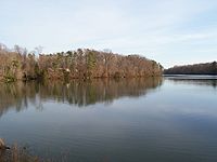
Commonwealth Transportation Board
The Commonwealth Transportation Board, formerly the State Highway and Transportation Board, regulates and funds transportation in Virginia. It oversees the Virginia Department of Transportation.-Membership:The Board consists of seventeen members:...
approved a major portion of the funding needed for the U.S. Route 60 relocation project. The relocated divided highway will begin on its western end near the current intersection of Blow Flats Road and, on a new alignment, will cross through the Greenmount Industrial Park to reach the Newport News city limits at the western edge of Skiffe's Creek Reservoir, part of the Newport News Waterworks. The portion of relocated roadway planned in James City County is being described as the Skiffe's Creek Connector.
A connection to State Route 143 and enhanced access to Interstate 64 nearby is also under consideration.
Newport News section
At the Newport News border, a new crossing of Skiffe's CreekSkiffe's Creek
Skiffe's Creek is located in James City County and the independent city of Newport News in the Virginia Peninsula area of the Hampton Roads region of southeastern Virginia in the United States...
will be built, and the remainder of the roadway will continue on a new alignment and effectively bypass the two lane portion of U.S. Route 60 through the historic Lee Hall community, rejoining the current highway near the cloverleaf intersection of Fort Eustis Boulevard near the entrance to Fort Eustis, where there is access four-laned access close by to exit 250 of Interstate 64 as well as an extant four-laned section of U.S. Route 60 which begins there and extends to the east as Warwick Boulevard.
In a separate project, portions of Warwick Boulevard east of Fort Eustis in Newport News are currently being widened to six lanes.
17th century
A fort was underway at Jamestown very shortly after the colonists began establishing themselves there in May, 1607. Archaeological work has been extensive, and is a major aspect of the current attractions there.By 1634, the settlers of the Colony of Virginia had completed a palisade
Palisade
A palisade is a steel or wooden fence or wall of variable height, usually used as a defensive structure.- Typical construction :Typical construction consisted of small or mid sized tree trunks aligned vertically, with no spacing in between. The trunks were sharpened or pointed at the top, and were...
of approximately 6 miles (9.7 km) length across the peninsula, anchored by College Creek (earlier known as Archer's Hope Creek) and Queen's Creek, which led to the James and York rivers respectively. The goal was to protect the lower peninsula to the east from attacks by the Native Americans, who were still a threat in the area until after 1644.
The exact location of this line of wooden defenses has been lost to time. A portion was found during archaeological research on the property occupied by the home of Colonel John Page
John Page (Middle Plantation)
Colonel John Page , a merchant in Middle Plantation on the Virginia Peninsula, was a member of the Virginia House of Burgesses and the Council of the Virginia Colony. A wealthy landowner, Page donated land and funds for the first brick Bruton Parish Church. Col...
, a person prominent in establishing Middle Plantation and what became Bruton Parish Church
Bruton Parish Church
Bruton Parish Church is located in the restored area of Colonial Williamsburg in Williamsburg, Virginia, USA. It was established in 1674 in the Virginia Colony, and remains an active Episcopal parish.-History of Bruton Parish Church:...
during the second half of the 17th century. That site is now part of the Bruton Heights School Educational Center, and within Williamsburg's city limits. Although all of the Page home site was originally in York County, the nearly 2500 feet (762 m) section across the property gives insight into its likely location southerly into James City County. Archaeologists noted its extremely straight orientation, rather following topological features such as ridges or ravines, giving another clue.
19th century
During the American Civil WarAmerican Civil War
The American Civil War was a civil war fought in the United States of America. In response to the election of Abraham Lincoln as President of the United States, 11 southern slave states declared their secession from the United States and formed the Confederate States of America ; the other 25...
, the 1862 Peninsula Campaign
Peninsula Campaign
The Peninsula Campaign of the American Civil War was a major Union operation launched in southeastern Virginia from March through July 1862, the first large-scale offensive in the Eastern Theater. The operation, commanded by Maj. Gen. George B...
was a move up the Virginia Peninsula from Fort Monroe
Fort Monroe
Fort Monroe was a military installation in Hampton, Virginia—at Old Point Comfort, the southern tip of the Virginia Peninsula...
at the eastern tip by Union troops in an attempt to take the Confederate capital of Richmond
Richmond, Virginia
Richmond is the capital of the Commonwealth of Virginia, in the United States. It is an independent city and not part of any county. Richmond is the center of the Richmond Metropolitan Statistical Area and the Greater Richmond area...
. The Williamsburg Line, a third Confederate line of defense, extended across the Peninsula just east of town. Construction of the line, largely consisting of a series of 14 redoubts, was overseen by College of William and Mary
College of William and Mary
The College of William & Mary in Virginia is a public research university located in Williamsburg, Virginia, United States...
President Benjamin S. Ewell, who had joined in the defense of Williamsburg. At Redoubt # 6, near the center, Fort Magruder
Fort Magruder
Fort Magruder was an high earthen fortification straddling the road between Yorktown and Williamsburg, Virginia, just outside the latter city during the American Civil War...
, an earthen fortification, was located at a strategic point at the juncture of the roads from Lee's Mill and Yorktown to Williamsburg.
At Fort Magruder, a few earthworks and a small memorial remain along present-day Penniman Road in a residential area. In early 2006, Riverside Health System
Riverside Health System
Riverside Health System is a non-profit healthcare organization based in Newport News, Virginia.-History:Founded in 1916, Riverside Health System was originally established as a small hospital...
donated 22 acres (89,030.9 m²) of the 350 acres (1.4 km²) of land that it had bought from Colonial Williamsburg in 2004, to create a public park. The land, located about 1.5 miles (2.4 km) south of Fort Magruder (towards the James River), includes two redoubts that were part of the line of defenses made up of 14 redoubts, of which Fort Magruder was the largest.
20th century
The Grove CommunityGrove, Virginia
Grove is an unincorporated community in the southeastern portion of James City County in the Peninsula subregion of Virginia in the United States. It is located in the center of the Historic Triangle of Colonial Virginia, communities linked by the Colonial Parkway; the area is one of the busiest...
in the southeastern end of the county was populated with many African-American families displaced during World War I
World War I
World War I , which was predominantly called the World War or the Great War from its occurrence until 1939, and the First World War or World War I thereafter, was a major war centred in Europe that began on 28 July 1914 and lasted until 11 November 1918...
and World War II
World War II
World War II, or the Second World War , was a global conflict lasting from 1939 to 1945, involving most of the world's nations—including all of the great powers—eventually forming two opposing military alliances: the Allies and the Axis...
as the military reservations for the Naval Weapons Station Yorktown
Naval Weapons Station Yorktown
Naval Weapons Station Yorktown is a United States Navy base in York County, James City County, and Newport News in the Hampton Roads region of Virginia...
and Camp Peary
Camp Peary
Camp Peary is a military reservation in York County near Williamsburg, Virginia. Officially it is referred to as the Armed Forces Experimental Training Activity under the auspices of the Department of Defense, but it is widely believed to be the location of a covert CIA training facility known...
respectively were created on the sites of the lost towns of Lackey
Lackey, Virginia
Lackey was a small unincorporated community near Yorktown in York County, Virginia, United States...
and Magruder
Magruder, Virginia
Magruder was a small unincorporated town in Virginia near Williamsburg in York County. Now extinct, it once had its own church, post office, cemetery, lodge, and homes. Magruder is considered one of the many lost towns of Virginia. The land on which it stood is now part of the US military...
.
At the southwestern edge of Grove, the U.S. Army's Camp Wallace
Camp Wallace
Camp Wallace was a facility of the United States Army located near the unincorporated town of Grove in southeastern James City County in the Virginia Peninsula portion of the Hampton Roads region of Virginia in the United States....
operated from 1918 to 1971. It was a satellite facility of Fort Eustis, which was established as Camp Abraham Eustis in neighboring Warwick County in 1918. In this hilly terrain, the base had its Upper Artillery Range. Some years after World War II, Camp Wallace became was the site of the Army's first installation of its aerial tramway
Aerial tramway
An aerial tramway , cable car , ropeway or aerial tram is a type of aerial lift which uses one or two stationary ropes for support while a third moving rope provides propulsion...
. The Camp Wallace property became part of the Anheuser Busch developments beginning in the 1970s.
21st century
No military installations are currently headquartered in the county. Small portions of Camp Peary and the Yorktown Naval Weapons Station are located in James City County, although most portions of each of these large installation are located in neighboring York County. Also, a very small portion of Fort Eustis property adjacent to Skiffe's Creek Reservoir and the southeastern tip of the Greenmount Industrial Park is also located in the county, although almost all of Fort Eustis is now located in the independent city of Newport NewsNewport News, Virginia
Newport News is an independent city located in the Hampton Roads metropolitan area of Virginia. It is at the southeastern end of the Virginia Peninsula, on the north shore of the James River extending southeast from Skiffe's Creek along many miles of waterfront to the river's mouth at Newport News...
(which consolidated with the former Warwick County in 1958 to form the present large city).
Further reading
- McCartney, Martha W. (1977) James City County: Keystone of the Commonwealth; James City County, Virginia; Donning and Company; ISBN 0-89865-999-X
- "Cast Down Your Buckets Where You Are" An Ethnohistorical Study of the African-American Community on the Lands of the Yorktown Naval Weapons Station 1865-1918
External links
- James City County (official website)
- Williamsburg-James City County Public Schools
- James City County Office of Economic Development - Open for Business since 1607
- James City County Comprehensive Plan