
Metacomet Trail
Encyclopedia
The Metacomet Trail is a 62.7 miles (100.9 km) Blue-Blazed
hiking
trail that traverses the Metacomet Ridge
of central Connecticut
and is a part of the newly designated 'New England National Scenic Trail
'. Despite being easily accessible and close to large population centers, the trail is considered remarkably rugged and scenic. The route includes many areas of unique ecologic, historic, and geologic interest. Notable features include waterfalls, dramatic cliff faces, woodlands, swamps, lakes, river flood plain, farmland, significant historic sites, and the summits of Talcott Mountain
and the Hanging Hills
. The Metacomet Trail is maintained largely through the efforts of the Connecticut Forest and Park Association
.
On March 30, 2009 President Barack Obama signed the 'Omnibus Public Land Management Act of 2009' establishing the New England National Scenic Trail
(and two other national scenic trails).
The combination of the Metacomet, Monadnock and Mattabesett trails is also often referred to as the '3-M', 'MMM' or Metacomet-Monadnock-Mattabesett trail. The New England National Scenic Trail
includes all or almost all of the 'MMM' trails as well as a the new extension trail from the southern-most point on the Mattabesett Trail through Guilford, Connecticut to the northern shore of Long Island Sound.
/ Massachusetts
border south through Hartford
and northern New Haven
counties in Connecticut. The southern terminus of the trail is located just east of the Hanging Hills
on U.S. Route 5
, 4 miles (6 km) north of the city of Meriden
, in the town of Berlin, Connecticut
; the northern terminus is located in the hamlet of Rising Corner, part of Suffield, Connecticut
, 7 miles (11 km) southwest of Springfield, Massachusetts
. The 110 miles (177 km) Metacomet-Monadnock Trail
in Massachusetts and the Monadnock-Sunapee Greenway
in New Hampshire
continue the footway north from the Metacomet Trail another 160 miles (257.5 km) to central New Hampshire. The 50 miles (80.5 km) Mattabesett Trail
picks up where the Metacomet Trail leaves off in Berlin and continues south to Totoket Mountain
then northeast to the Connecticut River
in Middletown
.
Significant networks of shorter hiking trails intersect the Metacomet Trail, most notably on Talcott Mountain
, the Hanging Hills
, and Ragged Mountain.
The Metacomet Trail is primarily used for hiking
, backpacking
, picnicking, and in the winter, snowshoe
ing. Portions of the trail are suitable for, and are used for, mountain biking
and cross-country skiing
. Site-specific activities enjoyed along the route include hunting
, fishing
, horseback riding, boating
, bouldering
, rock climbing
(access), and swimming.
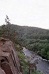 The Metacomet Trail traverses the trap rock
Metacomet Ridge
which extends from Long Island Sound
to the Massachusetts/ Vermont
border. This ridge, rising hundreds of feet above the Connecticut River
, Farmington River
, and Quinnipiac River
valleys, is a prominent landscape feature of central Connecticut. From south to north, the trail uses the ridges of the Hanging Hills
, Short Mountain
, Ragged Mountain, Bradley Mountain
, Pinnacle Rock
, Rattlesnake Mountain
, Farmington Mountain
, Talcott Mountain
, Hatchet Hill
, Peak Mountain
, and West Suffield Mountain
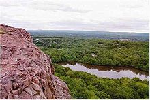
. Abrupt vertical cliffs with visible talus
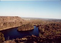
slopes and frequent viewpoints are common throughout. Views are generally to the west from West Suffield Mountain south through Ragged Mountain; with views in all directions at varying points in the Hanging Hills. The Farmington River cuts through the ridgeline between Hatchet Hill and Talcott Mountain in the Tariffville Gorge (east of Simsbury
). Historic features along the trail include Old Newgate Prison
museum and copper mine in East Granby; Heublein Tower
on Talcott Mountain with expansive view of four states; the Hill-Stead museum in Farmington, Connecticut
, notable for its French
impressionist painting collection and gardens; and Hubbard Park
of the Hanging Hills of Meriden, designed with the help of famous landscape architect Frederick Law Olmstead and crowned with a small observation tower known as Castle Craig. The trap rock ridges and talus slopes of the Metacomet Ridge are also home to several unique microclimate
ecosystems that support species of plants that are unusual or endangered in this part of New England
, and are a seasonal migration path for raptors. Viewshed
from the ledges include agrarian land, suburbs, small towns, river corridors, the eastern Berkshires
ridgeline, and metropolitan Meriden and Hartford.
, Meriden
, Southington
, New Britain
, Plainville
, Farmington
, West Hartford
, Avon
, Bloomfield
, Simsbury
, East Granby
, and Suffield, Connecticut
 The Metacomet Ridge that forms the spine of the Metacomet Trail was formed 200 million years ago during the late Triassic
and early Jurassic
periods, and is composed of trap rock, also known as basalt
, an extrusive volcanic rock
. Basalt is a dark colored rock, but the iron
within it weathers to a rusty brown when exposed to the air, lending the ledges a distinct reddish appearance. Basalt frequently breaks into octagonal and pentagonal columns, creating a unique "postpile" appearance. Huge slopes made of fractured basalt scree
are visible beneath many of the cliffs along the Metacomet Trail.
The Metacomet Ridge was the product of several massive lava
flows hundreds of feet deep that welled up in faults created by the rifting apart of North America
from Eurasia
and Africa
. The basalt floods of lava occurred over a period of 20 million years. Erosion occurring between the eruptions deposited deep layers of sediment between the lava flows, which eventually lithified into sedimentary rock
. The resulting "layer cake" of basalt and sedimentary sheets eventually faulted and tilted upward. Subsequent erosion wore away the weaker sedimentary layers a faster rate than the basalt layers, leaving the abruptly tilted edges of the basalt sheets exposed, creating the distinct linear ridge and dramatic cliff faces visible today. The best way to imagine this is to picture a layer cake tilted slightly up with some of the frosting (the sedimentary layer) removed in between. The sedimentary rock of the Metacomet ridge is well known for its fossils, especially dinosaur tracks.
The Metacomet Ridge hosts a combination of microclimate
s unusual in New England. Dry, hot upper ridges support oak savanna
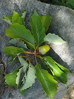
s, often dominated by chestnut oak
and a variety of understory grasses and ferns. Eastern red cedar
, a dry-loving species, clings to the barren edges of cliffs. Backslope plant communities tend to be more similar to the adjacent upland plateaus containing species common to the northern hardwood
and oak-hickory forest
types. Eastern hemlock crowds narrow ravines, blocking sunlight and creating damp, cooler growing conditions with associated cooler climate plant species. Talus slopes are especially rich in nutrients and support a number of calcium-loving plants uncommon in Massachusetts. Many bogs, ponds, and reservoirs lie cupped between trap rock ridge shelves, demonstrating the value of these ridges as important aquifers and wetland
ecosystem habitats. Because the Metacomet Ridge generates such varied terrain, it is the home of several plant and animal species that are state-listed or globally rare.
Other ecosystems on the southern sections of the Metacomet Trail include the northern riverine
community which supports species such as willow
, American elm
, and sycamore
; this ecosystem can be found along the Westfield and Connecticut Rivers.
http://www.outdoors.org/, the Green Mountain Club
http://www.greenmountainclub.org/, and the Connecticut Forest and Park Association
. Following the pioneering effort of the Green Mountain Club in the inauguration of Vermont's Long Trail
in 1918, the Connecticut Forest and Park Association, spearheaded by Edgar Laing Heermance, created the 23-mile (37 km) Quinnipiac Trail
on the Metacomet Ridge in southern Connecticut in 1928 and soon followed it up with the Metacomet Trail. Over 700 miles (1,126.5 km) of "blue blaze trails" in Connecticut were completed by the association by the end of the 20th century.
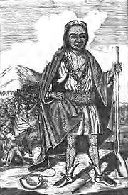
The name "Metacomet
" was borrowed from the 17th century sachem
of the Wampanoag Tribe of southern New England who led his people during King Philip's War
. According to popular folklore, Metacomet, dubbed "King Phillip" by the English
colonists, watched the burning of the village of Simsbury in 1676 from a cave on Talcott Mountain. The cave is now known as King Phillip's Cave, accessible via a side trail from the Metacomet Trail. Joseph Wadsworth is also said to have camped at the cave after saving the Charter of Connecticut
from being repossessed by the King's emissary.
 Old Newgate Prison
, located below Peak Mountain, was originally a copper mine, opened in 1705. After mining operations proved unprofitable, the colony of Connecticut
converted it to a prison and named it after Newgate Prison
of London
. The first prisoner, John Hinson, was committed for burglary in 1773. Later Tories
and Loyalists were held there during the Revolutionary War. In 1790 it became a state prison, the first such in the United States. After the prison closed in 1827 mining operations resumed for a time, but since the 1860s it has been mainly a tourist attraction. In 1972 Old Newgate Prison was declared a National Historic Landmark
.
The Hanging Hills' Hubbard Park
was financed by Walter Hubbard, local entrepreneur and president of the Bradley & Hubbard Manufacturing Company. Most of the land in the park was given to the town of Meriden by him, offered outright, with the stipulation that everything connected with the park was to remain free of charge for the people of Meriden, and that no concessions for profit would ever allowed within the park. Hubbard elicited the assistance of notable landscape architect Fredrick Law Olmstead in drawing up the design. Finished in 1900, It comprises approximately 1800 acres (7.3 km²) of carefully kept woodlands, streams, dramatic cliff faces, flower gardens, and the James Barry bandshell and picnic spots. Castle Craig
, a stone observation tower built on East Peak
, and Mirror Lake, nestled between the high ledges of East Peak and South Mountain
, are considered particularly scenic.
Heublein Tower
, 165 feet (50 m) tall and 1040 feet (317 m) above sea level, built for Gilbert F. Heublein in 1914 on the summit crest of Talcott Mountain as a summer retreat and home, was designed to withstand winds of 100 mph (160 km/h). Put up for sale in the 1960s and slated for residential development, the tower became part of the Talcott Mountain State Park
in 1965 through the efforts of conservation non-profit groups, the state of Connecticut, and the United States
government. The tower has been renovated as a museum with period artifacts and furnishings. Visitors may climb to the top of the tower for a 360-degree view encompassing four states.
_-_west_facade.jpg) Hill-Stead, now a museum, was created on 250 acres (1 km²) of Farmington Mountain as a country estate for wealthy industrialist Alfred Atmore Pope
Hill-Stead, now a museum, was created on 250 acres (1 km²) of Farmington Mountain as a country estate for wealthy industrialist Alfred Atmore Pope
, to the designs of his daughter Theodate Pope Riddle
in 1901. Theodate inherited the house after her parents' deaths, and prior to her own passing in 1946 willed Hill-Stead Museum as a memorial to her parents. Hill-Stead comprises 152 acre (0.61512272 km²). Buildings include the 33000 square feet (3,065.8 m²) colonial-revival style Pope-Riddle House; an 18th-century farm house; a carriage garage with an arts and crafts theater; and a barn and additional farm buildings. The house is extensively furnished with paintings, prints, and art. Highlights include works by Édouard Manet
, Claude Monet
, James McNeill Whistler
, Albrecht Dürer
and postcards including correspondence from Mary Cassatt
, Henry James
, and James McNeill Whistler.
, is an historic landmark of the town of Farmington. A plaque affixed to the cave reads, "Said Warren, according to legend, after being flogged for not going to church, tried to burn the village of Farmington. He was pursued into the mountains, where some Indian squaws hid him in this cave." The personage of Will Warren has never been vindicated historically, and may have been an amalgamation of several individuals. The cave is accessible from the Metacomet Trail.
The Hanging Hills are allegedly stalked by the supernatural presence of the "Black Dog of the Hanging Hills"; (a frequent spectre in folklore worldwide; see Black dog
). According to local mythology extant since at least the early 19th century, the Black Dog manifests as a small black dog, often gregarious in nature, who leaves no footprints and makes no sound. To see the Black Dog the first time results in joy; a second sighting, misfortune. Seeing the Black Dog a third time would result in one's death. At least six deaths have been blamed on third meetings with the Black Dog.
Weather along the route is typical of Connecticut
. Conditions on exposed ridge tops and summits may be harsher during cold or stormy weather. Lightning
is a hazard on exposed summits and ledges during thunderstorms. Snow is common in the winter and may necessitate the use of snowshoes. Ice can form on exposed ledges and summits, making hiking dangerous without special equipment.
Biting insects can be bothersome during warm weather. Parasitic deer tick
s (which are known to carry Lyme disease
) are a potential hazard. The northern copperhead snake
, while considered rare, does inhabit portions of the Metacomet Ridge in Connecticut. Poison ivy
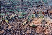
is native to the Metacomet Trail environs, prolific in some areas.
 The Metacomet Trail passes through public land (state parks, town parks, and municipal watershed areas), land managed by conservation non-profit organizations, private land under conservation easement, and unprotected private land via permission of individual land owners. Significant threats to the trail, its ecosystems, and its viewshed
included quarrying and suburban sprawl.
The footway of the Metacomet Trail is maintained by volunteer efforts largely facilitated by the Connecticut Forest and Park Association
. Many groups are invested in preserving the landscape and ecosystem of the Metacomet Trail, including the Connecticut Department of Environmental Protection, the Metropolitan District (responsible for the watershed properties on Talcott Mountain), Suffield Land Conservancy, East Granby Land Trust, Farmington Land Trust, Meriden Land Trust, Berlin Land Trust, Simsbury Land Trust, Ragged Mountain Foundation, and the Avon Land Trust.
In 2000, the Metacomet Trail was included in a study by the National Park Service
for possible inclusion in a new National Scenic Trail
, which was officially recognized in 2009 as the New England National Scenic Trail
, which also includes the Mattabesett Trail
and Metacomet-Monadnock Trail
.
(CFPA) provides commemorative patches as recognition to hikers completing the entire length of one of the three original Blue-Blazed trails in Connecticut (Quinnipiac, Metacomet and Mattabesett). The Metacomet Trail patch can be obtained for a small fee ($1) after the hiking the entire trail is completed by contacting the Connecticut Forest and Park Association
.
Blue-Blazed Trails
The Blue-Blazed trail system, managed by the Connecticut Forest and Park Association, and the related trail systems documented in the two volume 19th Edition of the "Connecticut Walk Book" comprise over 800 miles of hiking trails in Connecticut.There are now over 825 miles of CFPA Blue-Blazed...
hiking
Hiking
Hiking is an outdoor activity which consists of walking in natural environments, often in mountainous or other scenic terrain. People often hike on hiking trails. It is such a popular activity that there are numerous hiking organizations worldwide. The health benefits of different types of hiking...
trail that traverses the Metacomet Ridge
Metacomet Ridge
The Metacomet Ridge, Metacomet Ridge Mountains, or Metacomet Range of southern New England, United States, is a narrow and steep fault-block mountain ridge known for its extensive cliff faces, scenic vistas, microclimate ecosystems, and communities of plants considered rare or endangered...
of central Connecticut
Connecticut
Connecticut is a state in the New England region of the northeastern United States. It is bordered by Rhode Island to the east, Massachusetts to the north, and the state of New York to the west and the south .Connecticut is named for the Connecticut River, the major U.S. river that approximately...
and is a part of the newly designated 'New England National Scenic Trail
New England National Scenic Trail
The New England National Scenic Trail is a National Scenic Trail in southern New England, which includes most of the three single trails Metacomet-Monadnock Trail, Mattabesett Trail and Metacomet Trail. After the Metacomet-Monadnock-Mattabesett trail system, the trail is sometimes called Triple-M...
'. Despite being easily accessible and close to large population centers, the trail is considered remarkably rugged and scenic. The route includes many areas of unique ecologic, historic, and geologic interest. Notable features include waterfalls, dramatic cliff faces, woodlands, swamps, lakes, river flood plain, farmland, significant historic sites, and the summits of Talcott Mountain
Talcott Mountain
Talcott Montain of central Connecticut, with a high point of , is a long trap rock mountain ridge located west of the city of Hartford. The ridge, a prominent landscape feature, forms a continuous line of exposed western cliffs visible across the Farmington River valley from Farmington to Simsbury...
and the Hanging Hills
Hanging Hills
The Hanging Hills of south central Connecticut, USA are a range of mountainous trap rock ridges overlooking the city of Meriden and the Quinnipiac River Valley below. They are a sub-range of the narrow, linear Metacomet Ridge that extends from Long Island Sound near New Haven, Connecticut, north...
. The Metacomet Trail is maintained largely through the efforts of the Connecticut Forest and Park Association
Connecticut Forest and Park Association
The Connecticut Forest and Park Association , established in 1895, is the oldest private, nonprofit conservation organization in Connecticut. The organization is credited as an important early pioneer of the national land conservation movement and as an early advocate of long distance trail building...
.
On March 30, 2009 President Barack Obama signed the 'Omnibus Public Land Management Act of 2009' establishing the New England National Scenic Trail
New England National Scenic Trail
The New England National Scenic Trail is a National Scenic Trail in southern New England, which includes most of the three single trails Metacomet-Monadnock Trail, Mattabesett Trail and Metacomet Trail. After the Metacomet-Monadnock-Mattabesett trail system, the trail is sometimes called Triple-M...
(and two other national scenic trails).
The combination of the Metacomet, Monadnock and Mattabesett trails is also often referred to as the '3-M', 'MMM' or Metacomet-Monadnock-Mattabesett trail. The New England National Scenic Trail
New England National Scenic Trail
The New England National Scenic Trail is a National Scenic Trail in southern New England, which includes most of the three single trails Metacomet-Monadnock Trail, Mattabesett Trail and Metacomet Trail. After the Metacomet-Monadnock-Mattabesett trail system, the trail is sometimes called Triple-M...
includes all or almost all of the 'MMM' trails as well as a the new extension trail from the southern-most point on the Mattabesett Trail through Guilford, Connecticut to the northern shore of Long Island Sound.
Trail description
The Metacomet Trail extends from the ConnecticutConnecticut
Connecticut is a state in the New England region of the northeastern United States. It is bordered by Rhode Island to the east, Massachusetts to the north, and the state of New York to the west and the south .Connecticut is named for the Connecticut River, the major U.S. river that approximately...
/ Massachusetts
Massachusetts
The Commonwealth of Massachusetts is a state in the New England region of the northeastern United States of America. It is bordered by Rhode Island and Connecticut to the south, New York to the west, and Vermont and New Hampshire to the north; at its east lies the Atlantic Ocean. As of the 2010...
border south through Hartford
Hartford County, Connecticut
Hartford County is a county located in the north central part of the US state of Connecticut. The 2010 Census records show that the county population is at 894,014 making it the second most populated county in Connecticut....
and northern New Haven
New Haven County, Connecticut
New Haven County is a county located in the south central part of the U.S. state of Connecticut. As of the 2010 Census, the county population is 862,477 making it the third most populated county in Connecticut. There are 1,340 people per square mile...
counties in Connecticut. The southern terminus of the trail is located just east of the Hanging Hills
Hanging Hills
The Hanging Hills of south central Connecticut, USA are a range of mountainous trap rock ridges overlooking the city of Meriden and the Quinnipiac River Valley below. They are a sub-range of the narrow, linear Metacomet Ridge that extends from Long Island Sound near New Haven, Connecticut, north...
on U.S. Route 5
U.S. Route 5
U.S. Route 5 is a north–south United States highway running through the New England states of Connecticut, Massachusetts, and Vermont. Significant cities along the route include New Haven, Connecticut; Hartford, Connecticut; and Springfield, Massachusetts. From Hartford northward to St...
, 4 miles (6 km) north of the city of Meriden
Meriden, Connecticut
Meriden is a city in New Haven County, Connecticut, United States. According to 2005 Census Bureau estimates, the population of the city is 59,653.-History:...
, in the town of Berlin, Connecticut
Berlin, Connecticut
Berlin is a town in Hartford County, Connecticut, United States. The population was 19,866 at the 2010 census. It was incorporated in 1785. The geographic center of Connecticut is located in the town. Berlin is residential and industrial, and served by the Amtrak station of the same name...
; the northern terminus is located in the hamlet of Rising Corner, part of Suffield, Connecticut
Suffield, Connecticut
Suffield is a town in Hartford County, Connecticut, United States. It had once been within the boundaries of Massachusetts. The town is located in the Connecticut River Valley with the town of Enfield neighboring to the east. In 1900, 3,521 people lived in Suffield; and in 1910, 3,841. As of the...
, 7 miles (11 km) southwest of Springfield, Massachusetts
Springfield, Massachusetts
Springfield is the most populous city in Western New England, and the seat of Hampden County, Massachusetts, United States. Springfield sits on the eastern bank of the Connecticut River near its confluence with three rivers; the western Westfield River, the eastern Chicopee River, and the eastern...
. The 110 miles (177 km) Metacomet-Monadnock Trail
Metacomet-Monadnock Trail
The Metacomet-Monadnock Trail is a hiking trail that traverses the Metacomet Ridge of the Pioneer Valley region of Massachusetts and the central uplands of Massachusetts and southern New Hampshire...
in Massachusetts and the Monadnock-Sunapee Greenway
Monadnock-Sunapee Greenway
The Monadnock-Sunapee Greenway is a hiking trail that traverses the highlands of southern New Hampshire from Mount Monadnock in Jaffrey to Mount Sunapee in Newbury...
in New Hampshire
New Hampshire
New Hampshire is a state in the New England region of the northeastern United States of America. The state was named after the southern English county of Hampshire. It is bordered by Massachusetts to the south, Vermont to the west, Maine and the Atlantic Ocean to the east, and the Canadian...
continue the footway north from the Metacomet Trail another 160 miles (257.5 km) to central New Hampshire. The 50 miles (80.5 km) Mattabesett Trail
Mattabesett Trail
The Mattabesett Trail is a long, hook-shaped Blue-Blazed hiking trail in central Connecticut and a part of the newly designated New England National Scenic Trail. One half of the trail follows the high traprock ridges of the Metacomet Ridge, from Totoket Mountain in Guilford, Connecticut to...
picks up where the Metacomet Trail leaves off in Berlin and continues south to Totoket Mountain
Totoket Mountain
Totoket Mountain, with a high point of above sea level, is a traprock massif with several distinct summits, located northeast of New Haven, Connecticut. It is part of the Metacomet Ridge that extends from Long Island Sound near New Haven, north through the Connecticut River Valley of...
then northeast to the Connecticut River
Connecticut River
The Connecticut River is the largest and longest river in New England, and also an American Heritage River. It flows roughly south, starting from the Fourth Connecticut Lake in New Hampshire. After flowing through the remaining Connecticut Lakes and Lake Francis, it defines the border between the...
in Middletown
Middletown, Connecticut
Middletown is a city located in Middlesex County, Connecticut, along the Connecticut River, in the central part of the state, 16 miles south of Hartford. In 1650, it was incorporated as a town under its original Indian name, Mattabeseck. It received its present name in 1653. In 1784, the central...
.
Significant networks of shorter hiking trails intersect the Metacomet Trail, most notably on Talcott Mountain
Talcott Mountain
Talcott Montain of central Connecticut, with a high point of , is a long trap rock mountain ridge located west of the city of Hartford. The ridge, a prominent landscape feature, forms a continuous line of exposed western cliffs visible across the Farmington River valley from Farmington to Simsbury...
, the Hanging Hills
Hanging Hills
The Hanging Hills of south central Connecticut, USA are a range of mountainous trap rock ridges overlooking the city of Meriden and the Quinnipiac River Valley below. They are a sub-range of the narrow, linear Metacomet Ridge that extends from Long Island Sound near New Haven, Connecticut, north...
, and Ragged Mountain.
The Metacomet Trail is primarily used for hiking
Hiking
Hiking is an outdoor activity which consists of walking in natural environments, often in mountainous or other scenic terrain. People often hike on hiking trails. It is such a popular activity that there are numerous hiking organizations worldwide. The health benefits of different types of hiking...
, backpacking
Backpacking (wilderness)
Backpacking combines the activities of hiking and camping for an overnight stay in backcountry wilderness...
, picnicking, and in the winter, snowshoe
Snowshoe
A snowshoe is footwear for walking over the snow. Snowshoes work by distributing the weight of the person over a larger area so that the person's foot does not sink completely into the snow, a quality called "flotation"....
ing. Portions of the trail are suitable for, and are used for, mountain biking
Mountain biking
Mountain biking is a sport which consists of riding bicycles off-road, often over rough terrain, using specially adapted mountain bikes. Mountain bikes share similarities with other bikes, but incorporate features designed to enhance durability and performance in rough terrain.Mountain biking can...
and cross-country skiing
Cross-country skiing
Cross-country skiing is a winter sport in which participants propel themselves across snow-covered terrain using skis and poles...
. Site-specific activities enjoyed along the route include hunting
Hunting
Hunting is the practice of pursuing any living thing, usually wildlife, for food, recreation, or trade. In present-day use, the term refers to lawful hunting, as distinguished from poaching, which is the killing, trapping or capture of the hunted species contrary to applicable law...
, fishing
Fishing
Fishing is the activity of trying to catch wild fish. Fish are normally caught in the wild. Techniques for catching fish include hand gathering, spearing, netting, angling and trapping....
, horseback riding, boating
Boating
Boating is the leisurely activity of travelling by boat, or the recreational use of a boat whether powerboats, sailboats, or man-powered vessels , focused on the travel itself, as well as sports activities, such as fishing or water skiing...
, bouldering
Bouldering
Bouldering is a style of rock climbing undertaken without a rope and normally limited to very short climbs over a crash pad so that a fall will not result in serious injury. It is typically practiced on large natural boulders or artificial boulders in gyms and outdoor urban areas...
, rock climbing
Rock climbing
Rock climbing also lightly called 'The Gravity Game', is a sport in which participants climb up, down or across natural rock formations or artificial rock walls. The goal is to reach the summit of a formation or the endpoint of a pre-defined route without falling...
(access), and swimming.
Trail route
Trap rock
Trap rock is a form of igneous rock that tends to form polygonal vertical fractures, most typically hexagonal, but also four to eight sided. The fracture pattern forms when magma of suitable chemical composition intrudes as a sill or extrudes as a thick lava flow, and slowly cools.Because of the...
Metacomet Ridge
Metacomet Ridge
The Metacomet Ridge, Metacomet Ridge Mountains, or Metacomet Range of southern New England, United States, is a narrow and steep fault-block mountain ridge known for its extensive cliff faces, scenic vistas, microclimate ecosystems, and communities of plants considered rare or endangered...
which extends from Long Island Sound
Long Island Sound
Long Island Sound is an estuary of the Atlantic Ocean, located in the United States between Connecticut to the north and Long Island, New York to the south. The mouth of the Connecticut River at Old Saybrook, Connecticut, empties into the sound. On its western end the sound is bounded by the Bronx...
to the Massachusetts/ Vermont
Vermont
Vermont is a state in the New England region of the northeastern United States of America. The state ranks 43rd in land area, , and 45th in total area. Its population according to the 2010 census, 630,337, is the second smallest in the country, larger only than Wyoming. It is the only New England...
border. This ridge, rising hundreds of feet above the Connecticut River
Connecticut River
The Connecticut River is the largest and longest river in New England, and also an American Heritage River. It flows roughly south, starting from the Fourth Connecticut Lake in New Hampshire. After flowing through the remaining Connecticut Lakes and Lake Francis, it defines the border between the...
, Farmington River
Farmington River
The Farmington River is a river located in northwest Connecticut, with major tributaries extending into southwest Massachusetts. Via its longest branch , the Farmington's length increases to , making it the Connecticut River's longest tributary by a mere over the major river directly to its...
, and Quinnipiac River
Quinnipiac River
The Quinnipiac River is a river in the New England region of the United States, located entirely in the state of Connecticut.It rises in west central Connecticut from Dead Wood Swamp west of the city of New Britain...
valleys, is a prominent landscape feature of central Connecticut. From south to north, the trail uses the ridges of the Hanging Hills
Hanging Hills
The Hanging Hills of south central Connecticut, USA are a range of mountainous trap rock ridges overlooking the city of Meriden and the Quinnipiac River Valley below. They are a sub-range of the narrow, linear Metacomet Ridge that extends from Long Island Sound near New Haven, Connecticut, north...
, Short Mountain
Short Mountain
Short Mountain is a mountain ridge that runs southwest northeast through Hampshire and Hardy counties in West Virginia's Eastern Panhandle, rising to its greatest elevation at Bald Knob near Arkansas, West Virginia. Short Mountain's name is derived from its original name of Short Arse Mountain....
, Ragged Mountain, Bradley Mountain
Bradley Mountain
Bradley Mountain, , is a traprock mountain located west of New Britain, Connecticut, USA, in the town of Southington and PlainvilleIt is part of the narrow, linear Metacomet Ridge that extends from Long Island Sound near New Haven, Connecticut, north through the Connecticut River Valley of...
, Pinnacle Rock
Pinnacle Rock (Connecticut)
Pinnacle Rock, , is a traprock mountain peak located southwest of Hartford, Connecticut in the towns of Farmington and Plainville.It is part of the narrow, linear Metacomet Ridge that extends from Long Island Sound near New Haven, Connecticut, north through the Connecticut River Valley of...
, Rattlesnake Mountain
Rattlesnake Mountain (Connecticut)
Rattlesnake Mountain is a traprock mountain, above sea level, located southwest of Hartford, Connecticut in the town of Farmington. It is part of the narrow, linear Metacomet Ridge that extends from Long Island Sound near New Haven, Connecticut, north through the Connecticut River Valley of...
, Farmington Mountain
Farmington Mountain
Farmington Mountain, , is a traprock ridge located southwest of Hartford, Connecticut in the town of Farmington. It is part of the narrow, linear Metacomet Ridge that extends from Long Island Sound near New Haven, Connecticut, north through the Connecticut River Valley of Massachusetts to the...
, Talcott Mountain
Talcott Mountain
Talcott Montain of central Connecticut, with a high point of , is a long trap rock mountain ridge located west of the city of Hartford. The ridge, a prominent landscape feature, forms a continuous line of exposed western cliffs visible across the Farmington River valley from Farmington to Simsbury...
, Hatchet Hill
Hatchet Hill
Hatchet Hill, est. , is a trap rock ridge located in East Granby, Connecticut, northeast of Hartford, Connecticut. It is part of the narrow, linear Metacomet Ridge that extends from Long Island Sound near New Haven, Connecticut, north through the Connecticut River Valley of Massachusetts to the...
, Peak Mountain
Peak Mountain
Peak Mountain, also called Copper Mountain, est. , is a traprock mountain located in East Granby, Connecticut, south of the Massachusetts border and 6 miles west of the Connecticut River...
, and West Suffield Mountain
West Suffield Mountain
West Suffield Mountain, est. , is a traprock mountain ridge located between the Berkshires and the Connecticut River Valley in north-central Connecticut. It is part of the narrow, linear Metacomet Ridge that extends from Long Island Sound near New Haven, Connecticut, north through the Connecticut...
. Abrupt vertical cliffs with visible talus
Scree
Scree, also called talus, is a term given to an accumulation of broken rock fragments at the base of crags, mountain cliffs, or valley shoulders. Landforms associated with these materials are sometimes called scree slopes or talus piles...
slopes and frequent viewpoints are common throughout. Views are generally to the west from West Suffield Mountain south through Ragged Mountain; with views in all directions at varying points in the Hanging Hills. The Farmington River cuts through the ridgeline between Hatchet Hill and Talcott Mountain in the Tariffville Gorge (east of Simsbury
Simsbury, Connecticut
Simsbury is a suburban town in Hartford County, Connecticut, United States. The population was 23,234 at the 2000 census. The town was incorporated as Connecticut's twenty-first town in May 1670.-Early history:...
). Historic features along the trail include Old Newgate Prison
Old Newgate Prison
Old Newgate Prison was a Colonial American prison in what is now East Granby, Connecticut. It is now a historic site.The prison was originally a copper mine, opened in 1705, and is believed to be the first copper mine in America. After mining operations proved unprofitable, the colony of...
museum and copper mine in East Granby; Heublein Tower
Heublein Tower
The Heublein Tower located in Talcott Mountain State Park in Connecticut provides panoramic views of the Hartford skyline and the Farmington River Valley that are particularly spectacular in the fall.-Origin:...
on Talcott Mountain with expansive view of four states; the Hill-Stead museum in Farmington, Connecticut
Farmington, Connecticut
Farmington is a town located in Hartford County in the Farmington Valley area of central Connecticut in the United States. The population was 25,340 at the 2010 census. It is home to the world headquarters of several large corporations including Carrier Corporation, Otis Elevator Company, and Carvel...
, notable for its French
France
The French Republic , The French Republic , The French Republic , (commonly known as France , is a unitary semi-presidential republic in Western Europe with several overseas territories and islands located on other continents and in the Indian, Pacific, and Atlantic oceans. Metropolitan France...
impressionist painting collection and gardens; and Hubbard Park
Hubbard Park
Hubbard Park, located in the Hanging Hills of Connecticut, is a wooded, mountainous park located just north of downtown urban Meriden, Connecticut. It comprises approximately of carefully kept woodlands, streams, dramatic cliff faces, flower gardens, and the James Barry bandshell and picnic...
of the Hanging Hills of Meriden, designed with the help of famous landscape architect Frederick Law Olmstead and crowned with a small observation tower known as Castle Craig. The trap rock ridges and talus slopes of the Metacomet Ridge are also home to several unique microclimate
Microclimate
A microclimate is a local atmospheric zone where the climate differs from the surrounding area. The term may refer to areas as small as a few square feet or as large as many square miles...
ecosystems that support species of plants that are unusual or endangered in this part of New England
New England
New England is a region in the northeastern corner of the United States consisting of the six states of Maine, New Hampshire, Vermont, Massachusetts, Rhode Island, and Connecticut...
, and are a seasonal migration path for raptors. Viewshed
Viewshed
A viewshed is an area of land, water, or other environmental element that is visible to the human eye from a fixed vantage point. The term is used widely in such areas as urban planning, archaeology, and military science...
from the ledges include agrarian land, suburbs, small towns, river corridors, the eastern Berkshires
The Berkshires
The Berkshires , is a highland geologic region located in the western parts of Massachusetts and Connecticut.Also referred to as the Berkshire Hills, Berkshire Mountains, and Berkshire Plateau, the region enjoys a vibrant tourism industry based on music, arts, and recreation.-Definition:The term...
ridgeline, and metropolitan Meriden and Hartford.
Trail communities
The Metacomet Trail passes through land located within the following incorporated towns, from south to north: BerlinBerlin, Connecticut
Berlin is a town in Hartford County, Connecticut, United States. The population was 19,866 at the 2010 census. It was incorporated in 1785. The geographic center of Connecticut is located in the town. Berlin is residential and industrial, and served by the Amtrak station of the same name...
, Meriden
Meriden, Connecticut
Meriden is a city in New Haven County, Connecticut, United States. According to 2005 Census Bureau estimates, the population of the city is 59,653.-History:...
, Southington
Southington, Connecticut
Southington is a town in Hartford County, Connecticut, United States. It is part of Connecticut's 1st congressional district. It is situated about 20 miles southwest of Hartford, about 80 miles northeast of New York City, 105 miles southwest of Boston and 77 miles west of Providence...
, New Britain
New Britain, Connecticut
New Britain is a city in Hartford County, Connecticut, United States. It is located approximately 9 miles southwest of Hartford. According to 2006 Census Bureau estimates, the population of the city is 71,254....
, Plainville
Plainville, Connecticut
Plainville is a town in Hartford County, Connecticut, United States. The population was 17,328 at the 2000 census.-Geography:According to the United States Census Bureau, the town has a total area of 9.8 square miles , of which 9.8 square miles is land and 0.1 square miles is water...
, Farmington
Farmington, Connecticut
Farmington is a town located in Hartford County in the Farmington Valley area of central Connecticut in the United States. The population was 25,340 at the 2010 census. It is home to the world headquarters of several large corporations including Carrier Corporation, Otis Elevator Company, and Carvel...
, West Hartford
West Hartford, Connecticut
West Hartford is a town located in Hartford County, Connecticut, United States. The town was incorporated in 1854. Prior to that date, the town was a parish of Hartford....
, Avon
Avon, Connecticut
Avon is a town in the Farmington Valley region of Hartford County, Connecticut, United States. , the town had a population of 18,098.Avon is a suburb of Hartford. Avon Old Farms School, a prestigious boarding school, is located there. In 2005, Avon was named the third-safest town in America by...
, Bloomfield
Bloomfield, Connecticut
Bloomfield is a town in Hartford County, Connecticut, United States. The population was 20,626 at the 2009 census.-Geography:According to the United States Census Bureau, the town has a total area of , of which is land and 0.2 square miles is water.Bloomfield is bordered by Windsor to the...
, Simsbury
Simsbury, Connecticut
Simsbury is a suburban town in Hartford County, Connecticut, United States. The population was 23,234 at the 2000 census. The town was incorporated as Connecticut's twenty-first town in May 1670.-Early history:...
, East Granby
East Granby, Connecticut
East Granby is a town in Hartford County, Connecticut, United States. The population was estimated at 5,058 in 2005. The town recently celebrated its 150th anniversary with a three-day festival on June 7, 8, and 9, 2008.-Geography:...
, and Suffield, Connecticut
Suffield, Connecticut
Suffield is a town in Hartford County, Connecticut, United States. It had once been within the boundaries of Massachusetts. The town is located in the Connecticut River Valley with the town of Enfield neighboring to the east. In 1900, 3,521 people lived in Suffield; and in 1910, 3,841. As of the...
Landscape, geology, and natural environment
Triassic
The Triassic is a geologic period and system that extends from about 250 to 200 Mya . As the first period of the Mesozoic Era, the Triassic follows the Permian and is followed by the Jurassic. Both the start and end of the Triassic are marked by major extinction events...
and early Jurassic
Jurassic
The Jurassic is a geologic period and system that extends from about Mya to Mya, that is, from the end of the Triassic to the beginning of the Cretaceous. The Jurassic constitutes the middle period of the Mesozoic era, also known as the age of reptiles. The start of the period is marked by...
periods, and is composed of trap rock, also known as basalt
Basalt
Basalt is a common extrusive volcanic rock. It is usually grey to black and fine-grained due to rapid cooling of lava at the surface of a planet. It may be porphyritic containing larger crystals in a fine matrix, or vesicular, or frothy scoria. Unweathered basalt is black or grey...
, an extrusive volcanic rock
Volcanic rock
Volcanic rock is a rock formed from magma erupted from a volcano. In other words, it is an igneous rock of volcanic origin...
. Basalt is a dark colored rock, but the iron
Iron
Iron is a chemical element with the symbol Fe and atomic number 26. It is a metal in the first transition series. It is the most common element forming the planet Earth as a whole, forming much of Earth's outer and inner core. It is the fourth most common element in the Earth's crust...
within it weathers to a rusty brown when exposed to the air, lending the ledges a distinct reddish appearance. Basalt frequently breaks into octagonal and pentagonal columns, creating a unique "postpile" appearance. Huge slopes made of fractured basalt scree
Scree
Scree, also called talus, is a term given to an accumulation of broken rock fragments at the base of crags, mountain cliffs, or valley shoulders. Landforms associated with these materials are sometimes called scree slopes or talus piles...
are visible beneath many of the cliffs along the Metacomet Trail.
The Metacomet Ridge was the product of several massive lava
Lava
Lava refers both to molten rock expelled by a volcano during an eruption and the resulting rock after solidification and cooling. This molten rock is formed in the interior of some planets, including Earth, and some of their satellites. When first erupted from a volcanic vent, lava is a liquid at...
flows hundreds of feet deep that welled up in faults created by the rifting apart of North America
North America
North America is a continent wholly within the Northern Hemisphere and almost wholly within the Western Hemisphere. It is also considered a northern subcontinent of the Americas...
from Eurasia
Eurasia
Eurasia is a continent or supercontinent comprising the traditional continents of Europe and Asia ; covering about 52,990,000 km2 or about 10.6% of the Earth's surface located primarily in the eastern and northern hemispheres...
and Africa
Africa
Africa is the world's second largest and second most populous continent, after Asia. At about 30.2 million km² including adjacent islands, it covers 6% of the Earth's total surface area and 20.4% of the total land area...
. The basalt floods of lava occurred over a period of 20 million years. Erosion occurring between the eruptions deposited deep layers of sediment between the lava flows, which eventually lithified into sedimentary rock
Sedimentary rock
Sedimentary rock are types of rock that are formed by the deposition of material at the Earth's surface and within bodies of water. Sedimentation is the collective name for processes that cause mineral and/or organic particles to settle and accumulate or minerals to precipitate from a solution....
.
The Metacomet Ridge hosts a combination of microclimate
Microclimate
A microclimate is a local atmospheric zone where the climate differs from the surrounding area. The term may refer to areas as small as a few square feet or as large as many square miles...
s unusual in New England. Dry, hot upper ridges support oak savanna
Oak savanna
An oak savanna is a type of savanna, or lightly forested grassland, where oaks are the dominant tree species. These savannas were maintained historically through wildfires set by lightning, grazing, low precipitation, poor soil, and/or fires set by Native Americans...
s, often dominated by chestnut oak
Chestnut oak
Quercus prinus , the chestnut oak, is a species of oak in the white oak group, Quercus sect. Quercus. It is native to the eastern United States, where it is one of the most important ridgetop trees from southern Maine southwest to central Mississippi, with an outlying northwestern population in...
and a variety of understory grasses and ferns. Eastern red cedar
Juniperus virginiana
Juniperus virginiana is a species of juniper native to eastern North America, from southeastern Canada to the Gulf of Mexico, east of the Great Plains...
, a dry-loving species, clings to the barren edges of cliffs. Backslope plant communities tend to be more similar to the adjacent upland plateaus containing species common to the northern hardwood
Northern hardwood forest
The northern hardwood forest is a general type of North American forest ecosystem found over much of southeastern and south central Canada, extending south into the United States in northern New England and New York, and west along the Great Lakes to Minnesota and western Ontario...
and oak-hickory forest
Oak-hickory forest
The oak-hickory forest is a general type of North American forest ecosystem with a range extending from southern New England and New York, west to Iowa, and south to Northern Georgia. Smaller, isolated Oak-Hickory communities can also be found as far west as North Dakota, south to Florida and...
types. Eastern hemlock crowds narrow ravines, blocking sunlight and creating damp, cooler growing conditions with associated cooler climate plant species. Talus slopes are especially rich in nutrients and support a number of calcium-loving plants uncommon in Massachusetts. Many bogs, ponds, and reservoirs lie cupped between trap rock ridge shelves, demonstrating the value of these ridges as important aquifers and wetland
Wetland
A wetland is an area of land whose soil is saturated with water either permanently or seasonally. Wetlands are categorised by their characteristic vegetation, which is adapted to these unique soil conditions....
ecosystem habitats. Because the Metacomet Ridge generates such varied terrain, it is the home of several plant and animal species that are state-listed or globally rare.
Other ecosystems on the southern sections of the Metacomet Trail include the northern riverine
Northern riverine forest
The northern riverine forest is a type of forest ecology most dominant along waterways in the northeastern and north-central United States and bordering areas of Canada. Key species include willow, elm, American sycamore, and cottonwood....
community which supports species such as willow
Willow
Willows, sallows, and osiers form the genus Salix, around 400 species of deciduous trees and shrubs, found primarily on moist soils in cold and temperate regions of the Northern Hemisphere...
, American elm
American Elm
Ulmus americana, generally known as the American Elm or, less commonly, as the White Elm or Water Elm, is a species native to eastern North America, occurring from Nova Scotia west to Alberta and Montana, and south to Florida and central Texas. The American elm is an extremely hardy tree that can...
, and sycamore
American sycamore
Platanus occidentalis, also known as American Sycamore, American plane, Occidental plane, and Buttonwood, is one of the species of Platanus native to North America...
; this ecosystem can be found along the Westfield and Connecticut Rivers.
History and folklore
Origin and name
In the late 19th century, interests in mountains as places to build recreational footpaths took root in New England with organizations such as the Appalachian Mountain ClubAppalachian Mountain Club
The Appalachian Mountain Club is one of the United States' oldest outdoor groups. Created in 1876 to explore and preserve the White Mountains in New Hampshire, it has expanded throughout the northeastern U.S., with 12 chapters stretching from Maine to Washington, D.C...
http://www.outdoors.org/, the Green Mountain Club
Green Mountain Club
The Green Mountain Club is a non-profit membership organization dedicated to preserving and protecting Vermont's Long Trail - America's first long-distance hiking trail which stretches from Massachusetts to the Canadian border along Vermont's high ridgeline...
http://www.greenmountainclub.org/, and the Connecticut Forest and Park Association
Connecticut Forest and Park Association
The Connecticut Forest and Park Association , established in 1895, is the oldest private, nonprofit conservation organization in Connecticut. The organization is credited as an important early pioneer of the national land conservation movement and as an early advocate of long distance trail building...
. Following the pioneering effort of the Green Mountain Club in the inauguration of Vermont's Long Trail
Long Trail
The Long Trail is a hiking trail located in Vermont, running the length of the state. It is the oldest long-distance trail in the United States, constructed between 1910 and 1930 by the Green Mountain Club...
in 1918, the Connecticut Forest and Park Association, spearheaded by Edgar Laing Heermance, created the 23-mile (37 km) Quinnipiac Trail
Quinnipiac Trail
The Quinnipiac Trail is a Blue-Blazed hiking trail in New Haven County, Connecticut. It is the product of the evolution and growth of the first trail designated in Connecticut's Blue-Blazed Hiking Trail system, with its light-blue rectangular vertical painted blazes .-The route:From its...
on the Metacomet Ridge in southern Connecticut in 1928 and soon followed it up with the Metacomet Trail. Over 700 miles (1,126.5 km) of "blue blaze trails" in Connecticut were completed by the association by the end of the 20th century.
The name "Metacomet
Metacomet
Metacomet , also known as King Philip or Metacom, or occasionally Pometacom, was a war chief or sachem of the Wampanoag Indians and their leader in King Philip's War, a widespread Native American uprising against English colonists in New England.-Biography:Metacomet was the second son of Massasoit...
" was borrowed from the 17th century sachem
Sachem
A sachem[p] or sagamore is a paramount chief among the Algonquians or other northeast American tribes. The two words are anglicizations of cognate terms from different Eastern Algonquian languages...
of the Wampanoag Tribe of southern New England who led his people during King Philip's War
King Philip's War
King Philip's War, sometimes called Metacom's War, Metacomet's War, or Metacom's Rebellion, was an armed conflict between Native American inhabitants of present-day southern New England and English colonists and their Native American allies in 1675–76. The war is named after the main leader of the...
. According to popular folklore, Metacomet, dubbed "King Phillip" by the English
England
England is a country that is part of the United Kingdom. It shares land borders with Scotland to the north and Wales to the west; the Irish Sea is to the north west, the Celtic Sea to the south west, with the North Sea to the east and the English Channel to the south separating it from continental...
colonists, watched the burning of the village of Simsbury in 1676 from a cave on Talcott Mountain. The cave is now known as King Phillip's Cave, accessible via a side trail from the Metacomet Trail. Joseph Wadsworth is also said to have camped at the cave after saving the Charter of Connecticut
History of Connecticut
The U.S. state of Connecticut began as three distinct settlements, referred to at the time as "Colonies" or "Plantations". These ventures were eventually combined under a single royal charter in 1662.-Colonies in Connecticut:...
from being repossessed by the King's emissary.
Historic sites
Old Newgate Prison
Old Newgate Prison was a Colonial American prison in what is now East Granby, Connecticut. It is now a historic site.The prison was originally a copper mine, opened in 1705, and is believed to be the first copper mine in America. After mining operations proved unprofitable, the colony of...
, located below Peak Mountain, was originally a copper mine, opened in 1705. After mining operations proved unprofitable, the colony of Connecticut
Connecticut
Connecticut is a state in the New England region of the northeastern United States. It is bordered by Rhode Island to the east, Massachusetts to the north, and the state of New York to the west and the south .Connecticut is named for the Connecticut River, the major U.S. river that approximately...
converted it to a prison and named it after Newgate Prison
Newgate Prison
Newgate Prison was a prison in London, at the corner of Newgate Street and Old Bailey just inside the City of London. It was originally located at the site of a gate in the Roman London Wall. The gate/prison was rebuilt in the 12th century, and demolished in 1777...
of London
London
London is the capital city of :England and the :United Kingdom, the largest metropolitan area in the United Kingdom, and the largest urban zone in the European Union by most measures. Located on the River Thames, London has been a major settlement for two millennia, its history going back to its...
. The first prisoner, John Hinson, was committed for burglary in 1773. Later Tories
Loyalist (American Revolution)
Loyalists were American colonists who remained loyal to the Kingdom of Great Britain during the American Revolutionary War. At the time they were often called Tories, Royalists, or King's Men. They were opposed by the Patriots, those who supported the revolution...
and Loyalists were held there during the Revolutionary War. In 1790 it became a state prison, the first such in the United States. After the prison closed in 1827 mining operations resumed for a time, but since the 1860s it has been mainly a tourist attraction. In 1972 Old Newgate Prison was declared a National Historic Landmark
National Historic Landmark
A National Historic Landmark is a building, site, structure, object, or district, that is officially recognized by the United States government for its historical significance...
.
The Hanging Hills' Hubbard Park
Hubbard Park
Hubbard Park, located in the Hanging Hills of Connecticut, is a wooded, mountainous park located just north of downtown urban Meriden, Connecticut. It comprises approximately of carefully kept woodlands, streams, dramatic cliff faces, flower gardens, and the James Barry bandshell and picnic...
was financed by Walter Hubbard, local entrepreneur and president of the Bradley & Hubbard Manufacturing Company. Most of the land in the park was given to the town of Meriden by him, offered outright, with the stipulation that everything connected with the park was to remain free of charge for the people of Meriden, and that no concessions for profit would ever allowed within the park. Hubbard elicited the assistance of notable landscape architect Fredrick Law Olmstead in drawing up the design. Finished in 1900, It comprises approximately 1800 acres (7.3 km²) of carefully kept woodlands, streams, dramatic cliff faces, flower gardens, and the James Barry bandshell and picnic spots. Castle Craig
Castle Craig
Castle Craig, located on East Peak in the Hanging Hills, is constructed of trap rock and is in height and has a base in circumference . A metal interior stairway is used to ascend the observation deck on top...
, a stone observation tower built on East Peak
East Peak (New Haven County, Connecticut)
East Peak, , is a prominent traprock mountain in the Hanging Hills of Meriden, Connecticut. Rugged and scenic, the peak rises steeply above the city of Meriden below and is characterized by its vertical cliffs and sweeping views of southern Connecticut and Long Island Sound...
, and Mirror Lake, nestled between the high ledges of East Peak and South Mountain
South Mountain (New Haven County, Connecticut)
South Mountain, , is a prominent traprock peak in the Hanging Hills of Meriden, Connecticut. Rugged and scenic, the peak rises steeply above the city of Meriden below and is characterized by its vertical cliffs and sweeping views of southern Connecticut and Long Island Sound.Most of South Mountain...
, are considered particularly scenic.
Heublein Tower
Heublein Tower
The Heublein Tower located in Talcott Mountain State Park in Connecticut provides panoramic views of the Hartford skyline and the Farmington River Valley that are particularly spectacular in the fall.-Origin:...
, 165 feet (50 m) tall and 1040 feet (317 m) above sea level, built for Gilbert F. Heublein in 1914 on the summit crest of Talcott Mountain as a summer retreat and home, was designed to withstand winds of 100 mph (160 km/h). Put up for sale in the 1960s and slated for residential development, the tower became part of the Talcott Mountain State Park
Talcott Mountain State Park
Talcott Mountain State Park is a state park located in Bloomfield, Connecticut. The Heublein Tower, a 165 foot high lookout tower, sits atop Talcott Mountain. The Tower Trail is 1.25 miles long; a walk to the Tower takes approximately 30 – 40 minutes. Also running through the park is a section of...
in 1965 through the efforts of conservation non-profit groups, the state of Connecticut, and the United States
United States
The United States of America is a federal constitutional republic comprising fifty states and a federal district...
government. The tower has been renovated as a museum with period artifacts and furnishings. Visitors may climb to the top of the tower for a 360-degree view encompassing four states.
Alfred Atmore Pope
Alfred Atmore Pope was an American industrialist and art collector. He was the father of Theodate Pope Riddle, a noted American architect.-Family background:...
, to the designs of his daughter Theodate Pope Riddle
Theodate Pope Riddle
Theodate Pope Riddle was an American architect. She was one of the first American women architects as well as a survivor of the Lusitania.-Life:...
in 1901. Theodate inherited the house after her parents' deaths, and prior to her own passing in 1946 willed Hill-Stead Museum as a memorial to her parents. Hill-Stead comprises 152 acre (0.61512272 km²). Buildings include the 33000 square feet (3,065.8 m²) colonial-revival style Pope-Riddle House; an 18th-century farm house; a carriage garage with an arts and crafts theater; and a barn and additional farm buildings. The house is extensively furnished with paintings, prints, and art. Highlights include works by Édouard Manet
Édouard Manet
Édouard Manet was a French painter. One of the first 19th-century artists to approach modern-life subjects, he was a pivotal figure in the transition from Realism to Impressionism....
, Claude Monet
Claude Monet
Claude Monet was a founder of French impressionist painting, and the most consistent and prolific practitioner of the movement's philosophy of expressing one's perceptions before nature, especially as applied to plein-air landscape painting. . Retrieved 6 January 2007...
, James McNeill Whistler
James McNeill Whistler
James Abbott McNeill Whistler was an American-born, British-based artist. Averse to sentimentality and moral allusion in painting, he was a leading proponent of the credo "art for art's sake". His famous signature for his paintings was in the shape of a stylized butterfly possessing a long stinger...
, Albrecht Dürer
Albrecht Dürer
Albrecht Dürer was a German painter, printmaker, engraver, mathematician, and theorist from Nuremberg. His prints established his reputation across Europe when he was still in his twenties, and he has been conventionally regarded as the greatest artist of the Northern Renaissance ever since...
and postcards including correspondence from Mary Cassatt
Mary Cassatt
Mary Stevenson Cassatt was an American painter and printmaker. She lived much of her adult life in France, where she first befriended Edgar Degas and later exhibited among the Impressionists...
, Henry James
Henry James
Henry James, OM was an American-born writer, regarded as one of the key figures of 19th-century literary realism. He was the son of Henry James, Sr., a clergyman, and the brother of philosopher and psychologist William James and diarist Alice James....
, and James McNeill Whistler.
Folklore
Will Warren's Den, a boulder cave located on the west side of Rattlesnake MountainRattlesnake Mountain (Connecticut)
Rattlesnake Mountain is a traprock mountain, above sea level, located southwest of Hartford, Connecticut in the town of Farmington. It is part of the narrow, linear Metacomet Ridge that extends from Long Island Sound near New Haven, Connecticut, north through the Connecticut River Valley of...
, is an historic landmark of the town of Farmington. A plaque affixed to the cave reads, "Said Warren, according to legend, after being flogged for not going to church, tried to burn the village of Farmington. He was pursued into the mountains, where some Indian squaws hid him in this cave." The personage of Will Warren has never been vindicated historically, and may have been an amalgamation of several individuals. The cave is accessible from the Metacomet Trail.
The Hanging Hills are allegedly stalked by the supernatural presence of the "Black Dog of the Hanging Hills"; (a frequent spectre in folklore worldwide; see Black dog
Black dog (ghost)
A black dog is the name given to a being found primarily in the folklores of the British Isles. The black dog is essentially a nocturnal apparition, often said to be associated with the Devil, and its appearance was regarded as a portent of death. It is generally supposed to be larger than a normal...
). According to local mythology extant since at least the early 19th century, the Black Dog manifests as a small black dog, often gregarious in nature, who leaves no footprints and makes no sound. To see the Black Dog the first time results in joy; a second sighting, misfortune. Seeing the Black Dog a third time would result in one's death. At least six deaths have been blamed on third meetings with the Black Dog.
Hiking the trail
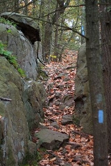
The trail is blazed with blue rectangles. It is regularly maintained, and is considered easy hiking, with sections of rugged and moderately difficult hiking. As the crow flies, the Metacomet Trail route is never more than a mile or two from a public road. However, cliffs and steep terrain make access much more difficult in some areas. There are no camping facilities along the trail and camping is generally prohibited. Trail descriptions are available from a number of commercial and non-commercial sources, and a complete guidebook is published by the Connecticut Forest and Park AssociationConnecticut Forest and Park Association
The Connecticut Forest and Park Association , established in 1895, is the oldest private, nonprofit conservation organization in Connecticut. The organization is credited as an important early pioneer of the national land conservation movement and as an early advocate of long distance trail building...
Weather along the route is typical of Connecticut
Connecticut
Connecticut is a state in the New England region of the northeastern United States. It is bordered by Rhode Island to the east, Massachusetts to the north, and the state of New York to the west and the south .Connecticut is named for the Connecticut River, the major U.S. river that approximately...
. Conditions on exposed ridge tops and summits may be harsher during cold or stormy weather. Lightning
Lightning
Lightning is an atmospheric electrostatic discharge accompanied by thunder, which typically occurs during thunderstorms, and sometimes during volcanic eruptions or dust storms...
is a hazard on exposed summits and ledges during thunderstorms. Snow is common in the winter and may necessitate the use of snowshoes. Ice can form on exposed ledges and summits, making hiking dangerous without special equipment.
Biting insects can be bothersome during warm weather. Parasitic deer tick
Deer Tick
Deer Tick is an American indie folk band from Providence, Rhode Island led by guitarist and singer-songwriter John McCauley. Deer Tick's music has been described as a combination of folk, blues, and country.-History:...
s (which are known to carry Lyme disease
Lyme disease
Lyme disease, or Lyme borreliosis, is an emerging infectious disease caused by at least three species of bacteria belonging to the genus Borrelia. Borrelia burgdorferi sensu stricto is the main cause of Lyme disease in the United States, whereas Borrelia afzelii and Borrelia garinii cause most...
) are a potential hazard. The northern copperhead snake
Agkistrodon contortrix mokasen
Agkistrodon contortrix mokasen is a venomous pitviper subspecies found in the eastern United States.-Description:The Northern copperhead grows to an average length of 61-91 cm , with a maximum of 134.6 cm ....
, while considered rare, does inhabit portions of the Metacomet Ridge in Connecticut. Poison ivy
Poison ivy
Toxicodendron radicans, better known as poison ivy , is a poisonous North American plant that is well known for its production of urushiol, a clear liquid compound found within the sap of the plant that causes an itching rash in most people who touch it...
is native to the Metacomet Trail environs, prolific in some areas.
Conservation and maintenance of the trail corridor
Viewshed
A viewshed is an area of land, water, or other environmental element that is visible to the human eye from a fixed vantage point. The term is used widely in such areas as urban planning, archaeology, and military science...
included quarrying and suburban sprawl.
The footway of the Metacomet Trail is maintained by volunteer efforts largely facilitated by the Connecticut Forest and Park Association
Connecticut Forest and Park Association
The Connecticut Forest and Park Association , established in 1895, is the oldest private, nonprofit conservation organization in Connecticut. The organization is credited as an important early pioneer of the national land conservation movement and as an early advocate of long distance trail building...
. Many groups are invested in preserving the landscape and ecosystem of the Metacomet Trail, including the Connecticut Department of Environmental Protection, the Metropolitan District (responsible for the watershed properties on Talcott Mountain), Suffield Land Conservancy, East Granby Land Trust, Farmington Land Trust, Meriden Land Trust, Berlin Land Trust, Simsbury Land Trust, Ragged Mountain Foundation, and the Avon Land Trust.
In 2000, the Metacomet Trail was included in a study by the National Park Service
National Park Service
The National Park Service is the U.S. federal agency that manages all national parks, many national monuments, and other conservation and historical properties with various title designations...
for possible inclusion in a new National Scenic Trail
National Scenic Trail
National Scenic Trail is a designation for protected areas in the United States that consist of trails of particular natural beauty.National Scenic Trails were authorized under the National Trails System Act of 1968 along with National Historic Trails and National Recreation Trails...
, which was officially recognized in 2009 as the New England National Scenic Trail
New England National Scenic Trail
The New England National Scenic Trail is a National Scenic Trail in southern New England, which includes most of the three single trails Metacomet-Monadnock Trail, Mattabesett Trail and Metacomet Trail. After the Metacomet-Monadnock-Mattabesett trail system, the trail is sometimes called Triple-M...
, which also includes the Mattabesett Trail
Mattabesett Trail
The Mattabesett Trail is a long, hook-shaped Blue-Blazed hiking trail in central Connecticut and a part of the newly designated New England National Scenic Trail. One half of the trail follows the high traprock ridges of the Metacomet Ridge, from Totoket Mountain in Guilford, Connecticut to...
and Metacomet-Monadnock Trail
Metacomet-Monadnock Trail
The Metacomet-Monadnock Trail is a hiking trail that traverses the Metacomet Ridge of the Pioneer Valley region of Massachusetts and the central uplands of Massachusetts and southern New Hampshire...
.
Recognition / Inspiration Programs
The Connecticut Forest and Park AssociationConnecticut Forest and Park Association
The Connecticut Forest and Park Association , established in 1895, is the oldest private, nonprofit conservation organization in Connecticut. The organization is credited as an important early pioneer of the national land conservation movement and as an early advocate of long distance trail building...
(CFPA) provides commemorative patches as recognition to hikers completing the entire length of one of the three original Blue-Blazed trails in Connecticut (Quinnipiac, Metacomet and Mattabesett). The Metacomet Trail patch can be obtained for a small fee ($1) after the hiking the entire trail is completed by contacting the Connecticut Forest and Park Association
Connecticut Forest and Park Association
The Connecticut Forest and Park Association , established in 1895, is the oldest private, nonprofit conservation organization in Connecticut. The organization is credited as an important early pioneer of the national land conservation movement and as an early advocate of long distance trail building...
.
See also
- Blue-Blazed TrailsBlue-Blazed TrailsThe Blue-Blazed trail system, managed by the Connecticut Forest and Park Association, and the related trail systems documented in the two volume 19th Edition of the "Connecticut Walk Book" comprise over 800 miles of hiking trails in Connecticut.There are now over 825 miles of CFPA Blue-Blazed...
- Metacomet RidgeMetacomet RidgeThe Metacomet Ridge, Metacomet Ridge Mountains, or Metacomet Range of southern New England, United States, is a narrow and steep fault-block mountain ridge known for its extensive cliff faces, scenic vistas, microclimate ecosystems, and communities of plants considered rare or endangered...
- Metacomet-Monadnock TrailMetacomet-Monadnock TrailThe Metacomet-Monadnock Trail is a hiking trail that traverses the Metacomet Ridge of the Pioneer Valley region of Massachusetts and the central uplands of Massachusetts and southern New Hampshire...
- Mattabesett TrailMattabesett TrailThe Mattabesett Trail is a long, hook-shaped Blue-Blazed hiking trail in central Connecticut and a part of the newly designated New England National Scenic Trail. One half of the trail follows the high traprock ridges of the Metacomet Ridge, from Totoket Mountain in Guilford, Connecticut to...
External links
- U.S. Congress New England National Scenic Trail Designation Act.
- NPS brochure for National Scenic Trail proposal.
- Map of Hubbard Park
- Connecticut Forest and Park Association
- The Traprock Wilderness Recovery Strategy
- Talcott Mountain State Park
- Talcott Mountain State Park map
- Penwood State Park map
- Penwood State Park
- MDC Talcott Mountain Reservoir area map
- MDC website
- MDC rules & regulations page
- Hill-Stead Museum
- Map of trails on Farmington Mountain
- Ragged Mountain trail map and driving directions (scroll down for map).
- Meriden Land Trust
- Berlin Land Trust
- Ragged Mountain Foundation
- Farmington Land Trust
- Avon Land Trust
- Simsbury Land Trust
- East Granby Land Trust
- The City of Meriden
- Legend of the Black Dog