
List of places in Norfolk
Encyclopedia
This is a list of cities, towns and villages in the ceremonial
and shire county
of Norfolk
, England. See the list of places in England for places in other counties.


Ceremonial counties of England
The ceremonial counties are areas of England to which are appointed a Lord Lieutenant, and are defined by the government as counties and areas for the purposes of the Lieutenancies Act 1997 with reference to the metropolitan and non-metropolitan counties of England and Lieutenancies Act 1997...
and shire county
Shire county
A non-metropolitan county, or shire county, is a county-level entity in England that is not a metropolitan county. The counties typically have populations of 300,000 to 1.4 million. The term shire county is, however, an unofficial usage. Many of the non-metropolitan counties bear historic names...
of Norfolk
Norfolk
Norfolk is a low-lying county in the East of England. It has borders with Lincolnshire to the west, Cambridgeshire to the west and southwest and Suffolk to the south. Its northern and eastern boundaries are the North Sea coast and to the north-west the county is bordered by The Wash. The county...
, England. See the list of places in England for places in other counties.
A
- AcleAcleAcle is a small market town on the River Bure on The Norfolk Broads in Norfolk, located halfway between Norwich and Great Yarmouth. It has the only bridge across the River Bure between Wroxham and Great Yarmouth. There is a high school Acle is a small market town on the River Bure on The Norfolk...
, AlburghAlburghAlburgh is a village and civil parish in the English county of Norfolk. The village is situated about four miles north-east of Harleston....
, AlbyAlby with ThwaiteAlby with Thwaite is a civil parish in the English county of Norfolk. The parish straddles the A140 some 10 km south of Cromer and 30 km north of Norwich, including the settlements of Alby and Thwaite....
, AldboroughAldborough, NorfolkAldborough is a village and civil parish in the English county of Norfolk. It is situated about eight miles south of Cromer.The civil parish has an area of 7.15 square kilometres and in 2001 had a population of 567 in 259 households. For the purposes of local government, the parish falls within...
, AldebyAldebyAldeby is a village and civil parish in the English county of Norfolk. It is bounded to the south by the River Waveney, on the other side of which is Suffolk. The village is about five miles by road from Beccles....
, Aldercarr Green, AlderfordAlderfordAlderford is a village and civil parish in the English county of Norfolk, about ten miles north-west of Norwich.The civil parish has an area of 1.80 square kilometres and in 2001 had a population of 43 in 16 households...
, AlethorpeAlethorpeAlethorpe is one of Norfolk’s lost medieval villages. The village was located within the parish of Little Snoring in mid North Norfolk just to the south of Great Snoring and east-northeast of the town Fakenham...
, Allwood, AlpingtonAlpingtonAlpington is a village and civil parish in the English county of Norfolk. It is situated about six miles south-east of Norwich and is closely associated with Yelverton just to the north....
, AmptonAmptonAmpton is a village and civil parish in the St Edmundsbury district of Suffolk, England, about five miles north of Bury St Edmunds.According to Eilert Ekwall the meaning of the village name is Amma's homestead. The Domesday Book records the population of Ampton in 1086 to be 23...
, AnmerAnmer, NorfolkAnmer is a small village and civil parish in the English county of Norfolk, situated about 12 miles north by north-east of the town of King's Lynn, and 35 miles north-west of the city of Norwich...
, AntinghamAntinghamAntingham is a village and civil parish in the north of the English county of Norfolk. The village is located about south of Cromer and north of North Walsham...
, ArminghallArminghallArminghall is a small village in the English county of Norfolk, around three miles southeast of Norwich in the parish of Bixley. Most of the houses in the village are located close to the church, which lies just west of the B1332 road from Norwich to Poringland. Syfer Technology, an electronic...
, AshbyAshby with ObyAshby with Oby is a civil parish in the English county of Norfolk, which is located some north of Acle and north-west of Great Yarmouth. The parish largely comprises scattered farms, and is named for the tiny settlements of Ashby and Oby....
, Ashby St MaryAshby St MaryAshby St Mary is a village and civil parish in the English county of Norfolk. The civil parish has an area of and in the 2001 census had a population of 297 in 115 households...
, AshillAshill, NorfolkAshill is a village and civil parish in the English county of Norfolk. The village is between Watton and Swaffham.-Parish:The civil parish has an area of 12.26 square kilometres and in the 2001 census had a population of 1,426 in 634 households...
, AshmanhaughAshmanhaughAshmanhaugh or Ashmanaugh is a village and civil parish in the English county of Norfolk, situated some 20 km north east of Norwich. Apart from Ashmanhaugh village itself, the parish also includes Beeston St Lawrence, which was a separate parish until 1935.The civil parish has an area of 4.82...
, AshwellthorpeAshwellthorpe and FundenhallAshwellthorpe and Fundenhall is a civil parish in the English county of Norfolk, situated some 6 km south-east of Wymondham and 20 km south-west of Norwich...
, AshwickenAshwickenAshwicken is a small village in Norfolk, England. The village sits astride the B1145 Kings Lynn to Mundesley road that dissects North Norfolk west to east....
, AslactonAslactonAslacton is a village and civil parish in the English county of Norfolk. It is situated between Norwich and Diss, and is near Great Moulton....
, AttleboroughAttleboroughAttleborough is a market town and civil parish in Norfolk, England situated between Norwich and Thetford. The parish falls within the district of Breckland and has an area of 21.90 km² with a Mainline to both Norwich and Cambridge....
, AttlebridgeAttlebridgeAttlebridge is a village and civil parish in the English county of Norfolk. It is situated about 8 miles north-west of Norwich, where the A1067 crosses the River Wensum....
, AylmertonAylmertonAylmerton is a village in the county of Norfolk, England. It is in the area of North Norfolk and lies south of the North Sea, south-west of Cromer and west of Holt. The parish is bordered by the parishes of Beeston Regis and Runton to the north, West Beckham to the west, Felbrigg to the east and...
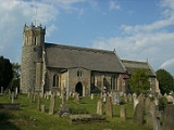
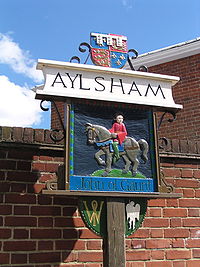
, AylshamAylshamAylsham is a historic market town and civil parish on the River Bure in north Norfolk, England, about north of Norwich. The river rises near Melton Constable, upstream from Aylsham and continues to Great Yarmouth and the North Sea, although it was only made navigable after 1779, allowing grain,...
B
- BabingleyBabingleyBabingley is one of Norfolk's lost villages. This small parish was located on the western side of the A149, 1 mile north-west of Castle Rising, and 5½ miles north-north-east of King's Lynn. Today, the village of Babingley is constituted by several houses on the A149 - the King's Lynn to Hunstanton...
, BaconsthorpeBaconsthorpeBaconsthorpe is a village and civil parish in the English county of Norfolk. It is 6 km south-east of Holt, 8 km south of Sheringham and 32 km north of Norwich....
, BactonBacton, NorfolkBacton is a village and civil parish in Norfolk, England. It is on the Norfolk coast, some 20 km south-east of Cromer, 40 km north-west of Great Yarmouth and 30 km north of Norwich. Besides the village of Bacton, the parish includes the nearby settlements of Bacton Green, Broomholm,...
, Bacton GreenBacton, NorfolkBacton is a village and civil parish in Norfolk, England. It is on the Norfolk coast, some 20 km south-east of Cromer, 40 km north-west of Great Yarmouth and 30 km north of Norwich. Besides the village of Bacton, the parish includes the nearby settlements of Bacton Green, Broomholm,...
, BagthorpeBagthorpe with BarmerBagthorpe with Barmer is a civil parish in the English county of Norfolk. The parish includes the hamlets of Bagthorpe and Barmer, and is situated some 15 km west of Fakenham and 20 km north east of King's Lynn....
, BanhamBanhamBanham is a village and civil parish in the English county of Norfolk. The village is about 7 miles north of Diss, 12 miles east of Thetford and 20 miles south west of Norwich. It is home to Banham Zoo....
, BanninghamBanninghamBanningham is a village within the civil parish of Colby in the English county of Norfolk.The village is 2.9 miles north east of Aylsham, 14.7 miles west north of Norwich and 129 miles north east of London. The nearest railway station is at North Walsham Railway station where the Bittern Line from...
, BarfordBarford, NorfolkBarford is a village and civil parish in the English county of Norfolk, situated some 4 miles north of Wymondham and 8 miles west of Norwich....
, BarmerBagthorpe with BarmerBagthorpe with Barmer is a civil parish in the English county of Norfolk. The parish includes the hamlets of Bagthorpe and Barmer, and is situated some 15 km west of Fakenham and 20 km north east of King's Lynn....
, Barnby, BarneyBarney, NorfolkBarney is a village within the civil parish of Fulmodeston in the English county of Norfolk.. The village lies to the south of the A148 King's Lynn to Cromer road near Thursford.The village is 7.2 miles east north east of the town of Fakenham, 17.1 miles west south west of Cromer and 121 miles...
, Barnham BroomBarnham BroomBarnham Broom is a village and civil parish in the English county of Norfolk. The village is situated on the River Yare, 9 miles West of Norwich. and 4 miles North-West of Wymondham....
, Barnhamcross, Barningham GreenBarningham GreenBarningham Green is a village in Norfolk, England....
, BarshamBarsham, NorfolkBarsham is a civil parish in the English county of Norfolk, and includes the villages of East Barsham, North Barsham, West Barsham and Houghton St Giles. The villages are all situated with 3 km of each other, about 5 km north of the town of Fakenham and 45 km north-west of the city...
, Barton BendishBarton BendishBarton Bendish is a village and a civil parish in the English county of Norfolk. The village is east of Downham Market, west of Norwich and north-east of London. The village lies south of the town of Kings Lynn.The nearest railway station is at Downham Market for the Fen Line which runs...
, Barton TurfBarton TurfBarton Turf is a village and civil parish in the English county of Norfolk. The village is situated some 20 km north-east of the city of Norwich, on the northwestern edge of Barton Broad, the second largest broad of the Norfolk Broads within The Broads National Park...
, BarwickBarwick, NorfolkBarwick is a hamlet and civil parish in the English county of Norfolk. It is situated adjacent to the slightly larger village of Stanhoe, some 30 km north-east of the town of King's Lynn and 60 km north-west of the city of Norwich....
, BastwickRepps with BastwickRepps with Bastwick is a civil parish in the English county of Norfolk. It comprises the adjacent villages of Bastwick and Repps, which are situated some north-west of the town of Great Yarmouth and north-east of the city of Norwich...
, Batesmoor, BawburghBawburghBawburgh is a village and civil parish in the South Norfolk district of Norfolk, England, lying in the valley of the River Yare about west of Norwich city centre. According to the 2001 census it had a population of 466...
, BawdeswellBawdeswellBawdeswell is a small rural village and civil parish in the Breckland district of the county of Norfolk, England. At the time of the 2001 census it had a population of 766 and an area of 487 hectares with some 316 households. As of August 2010 there are 354 dwellings some of which are holiday lets...
, BawseyBawseyBawsey is a village and civil parish in the English county of Norfolk. The village is about 4 miles east of the town of King's Lynn and 40 miles west of the city of Norwich...
, BeachamwellBeachamwellBeachamwell is a village and civil parish in the Breckland district of Norfolk, England. According to the 2001 census it had a population of 334. It is about 10 miles east of Downham Market.- Church of St Mary :...
, Beckett EndBeckett EndBeckett End is a village in Norfolk, England....
, Beckham, Beckhithe, Bedingham GreenBedingham GreenBedingham Green is a village in Norfolk, England....
, BeestonBeeston, NorfolkBeeston is a village in the county of Norfolk, England, in the civil parish of Beeston with Bittering, west of East Dereham and south of Fakenham...
, Beeston RegisBeeston RegisBeeston Regis is a village and civil parish in the North Norfolk district of Norfolk, England. It is about a mile east of Sheringham, Norfolk and near the coast. According to the 2001 census it had a population of 1,091...
, Beeston St LawrenceAshmanhaughAshmanhaugh or Ashmanaugh is a village and civil parish in the English county of Norfolk, situated some 20 km north east of Norwich. Apart from Ashmanhaugh village itself, the parish also includes Beeston St Lawrence, which was a separate parish until 1935.The civil parish has an area of 4.82...
, BeetleyBeetleyBeetley is a village and civil parish in the Breckland district of Norfolk, England. According to the 2001 census the parish had a population of 1,385. The village is situated four miles north of Toftwood....
, BeightonBeighton, NorfolkBeighton is a village and civil parish in the Broadland district of Norfolk, England, about two miles south of Acle. According to the 2001 census it had a population of 412....
, BelaughBelaughBelaugh is a small village that occupies a bend in the River Bure in Norfolk, England - within The Broads National Park. It is accessible via the road between Hoveton and Coltishall or from the river. It contains no pubs, bars or shops...
, Belaugh Green, BeltonBelton with BrowstonBelton with Browston is a civil parish in the English county of Norfolk. The parish consists of the villages of Belton and Browston Green, and is situated some 8 km south-west of the town of Great Yarmouth and 10 km north-west of the Suffolk town of Lowestoft.The civil parish has an area...
, BengateBengateBengate is a village in Norfolk, England.There is little in Bengate, but it is known for the Weaver's Way footpath trail. The nearest village is Worstead and is around 3 miles away from North Walsham....
, Bergh AptonBergh AptonBergh Apton is a village and civil parish in the South Norfolk district of Norfolk, England, 7 miles south-east of Norwich just south of the A146 between Yelverton and Thurton...
, Berney ArmsBerney ArmsBerney Arms is a place on the north bank of the River Yare, close to Breydon Water in the English county of Norfolk. It is part of the civil parish of Reedham, is administered by the district of Broadland and lies within The Broads National Park...
, BessinghamBessinghamBessingham is a village in the North Norfolk district of the English county of Norfolk. It lies 8 miles north-north-west of Aylsham and 5 miles south-south-west of Cromer. It forms part of the civil parish of Sustead....
, BesthorpeBesthorpe, NorfolkBesthorpe is a village and civil parish in the Breckland district of Norfolk, England, about a mile east of Attleborough, on the A11 road. According to the 2001 census it had a population of 561....
, BexfieldBexfieldBexfield is a village in Norfolk, England....
, BexwellBexwellBexwell is a small village in Norfolk, England.Its church, St. Mary, is one of 124 existing round-tower churches in Norfolk.-External links:*, a round-tower church...
, Billingford, South Norfolk, Billingford, BrecklandBillingford, BrecklandBillingford is a village and civil parish in the Breckland district of Norfolk, England, on the River Wensum, and between Norwich and Fakenham. According to the 2001 census it had a population of 223 in 91 households.-External links:...
, Billockby, BinhamBinhamBinham is a coastal village and a civil parish in the English county of Norfolk.The village is north west of Norwich, west of Cromer and north north east of London. The village lies east south east of the town of Wells-next-the-Sea.The nearest railway station is at Sheringham for the Bittern...
, BintreeBintreeBintree is a village and civil parish in the Breckland district of Norfolk, England, about nine miles south-east of Fakenham. According to the 2001 census it had a population of 300....
, Bircham NewtonBircham NewtonBircham Newton is the smallest of the three villages that make up the civil parish of Bircham, in the west of the English county of Norfolk. The village is located about 1 km north of the larger village of Great Bircham, 20 km north-east of the town of King's Lynn, and 60 km...
, Bircham ToftsBircham ToftsBircham Tofts is one of the three villages that make up the civil parish of Bircham, in the west of the English county of Norfolk. The village is located about 1 km east of the village of Great Bircham, 20 km north-east of the town of King's Lynn, and 60 km north-west of the city of...
, BitteringBitteringBittering is the name of two former parishes in the county of Norfolk, England, now in the civil parish of Beeston with Bittering, west of East Dereham and south of Fakenham.Little Bittering parish was annexed to the neighbouring Beeston....
, Blackborough, Blackmoor Row, BlakeneyBlakeney, NorfolkBlakeney is a coastal village and civil parish in the English county of Norfolk. Blakeney lies within the Norfolk Coast AONB and the North Norfolk Heritage Coast. The North Norfolk Coastal Path passes through the village...
, BlicklingBlicklingBlickling is a village and civil parish in the Broadland district of Norfolk, England, about north-west of Aylsham on the B1354 road. According to the 2001 census it had a population of 136 and covers . Since the 17th century the village has been concentrated in two areas, around the church and...
, BlofieldBlofieldBlofield is the village and civil parish in the Broadland district of Norfolk, England. The parish includes Blofield and the hamlets of Blofield Heath and Blofield Corner and, according to the 2001 census, had a population of 3,221. It is on the A47, five miles east of Norwich and west of Great...
, Bloodsman’s Corner, Bodham Street, BodneyBodneyBodney is a village in Norfolk, England.Bodney is recorded in the Domesday Book as Bredenaia. After the Norman Conquest it was held by the de Montfort family. In the fourteenth century Edmund Oldhall , father of the statesman Sir William Oldhall, was lord of the manor of Bodney and it passed in...
, BootonBooton, NorfolkBooton is a village and civil parish in the Broadland district of Norfolk, England, just east of Reepham and seven miles west of Aylsham. According to the 2001 census, it had a population of 100.- Notable residents :...
, Booton Street, BoughtonBoughton, NorfolkBoughton is a village and a civil parish in the English county of Norfolk. The village is west of Norwich, south-south-west of King’s Lynn and north-east of London. The nearest town is Downham Market which is east of the village. The village is a north of the route A134 which links King’s Lynn...
, BowthorpeBowthorpeBowthorpe is located in the west of Norwich, England. It is a primarily residential area, but includes a large Industrial Estate and one small out-of-town shopping centre, with a supermarket and various smaller, retail outlets. A police station and community hall are situated close to Bowthorpe...
, Bracon AshBracon AshBracon Ash is a village and civil parish in the South Norfolk district of Norfolk, England.According to the 2001 United Kingdom national census, the Bracon Ash and Hethel Parish covered an area of 9.84 km2 and had a population of 446 people, spread between 171 households.The B1113 road runs...
, BradenhamBradenham, NorfolkBradenham is a village and civil parish, a conglomeration of East & West Bradenham, in the English county of Norfolk. It is situated some south-west of the town of East Dereham and west of the city of Norwich....
, BradfieldBradfield, NorfolkBradfield is a village within the civil parish of Swafield, in the English county of Norfolk. The village is south south east of Cromer, north north east of Norwich and north east of London. The village lies north north west of the town of North Walsham. The nearest railway station is at Gunton...
, BradwellBradwell, NorfolkBradwell is a village and civil parish in the English county of Norfolk. The village is immediately to the west of, and largely indistinguishable from, the built-up urban area of the town of Great Yarmouth....
, Brakefield GreenBrakefield GreenBrakefield Green is a village in Norfolk, England....
, BramertonBramertonBramerton is a village in South Norfolk 4¾ miles south-east of Norwich, just north of the main A146 Norwich-Lowestoft road and on the south bank of the River Yare. In the 2001 census it contained 158 households and a population of 350.-The village:...
, BramptonBrampton, NorfolkBrampton is a small village and parish in the county of Norfolk, England, in the Bure Valley, east of Aylsham.Brampton station is an intermediate halt on the Bure Valley Railway.Its church, St Peter, is one of 124 existing round-tower churches in Norfolk...
, BrancasterBrancasterBrancaster is a village and civil parish on the north coast of the English county of Norfolk. The civil parish of Brancaster comprises Brancaster itself, together with Brancaster Staithe and Burnham Deepdale...
, Brancaster StaitheBrancasterBrancaster is a village and civil parish on the north coast of the English county of Norfolk. The civil parish of Brancaster comprises Brancaster itself, together with Brancaster Staithe and Burnham Deepdale...
, BrandistonBrandistonBrandiston is a small village and civil parish in the county of Norfolk, England, about two miles south-east of the small market town of Reepham, five miles south-west of the larger town of Aylsham and 10 miles north-west of the city of Norwich. For the purposes of local government, it falls within...
, Brandon ParvaBrandon ParvaBrandon Parva is a small village near East Dereham and Norwich in Norfolk, England.It is a separated village which consists of Brandon Parva near the church and Upper Brandon Parva further up the road with scattered housing....
, BrecklesBrecklesThe church of Breckles St Margaret is an Anglican church near Stow Bedon, Norfolk, England. It is one of 124 existing round-tower churches in Norfolk. The church is an active parish church in the Diocese of Norwich. It has been designated a Grade I listed building by English Heritage.-External...
, BressinghamBressinghamBressingham is a village and civil parish in the English county of Norfolk.It covers an area of and had a population of 751 in 305 households as of the 2001 census. For the purposes of local government, it falls within the district of South Norfolk....
, Breydon, BridghamBridghamBridgham is a village and civil parish in the English county of Norfolk.It covers an area of and had a population of 328 in 130 households as of the 2001 census.For the purposes of local government, it falls within the district of Breckland....
, BriggateBriggateBriggate is one of the pedestrianised principal shopping streets in central Leeds, England. Most of Leeds' department stores are on Briggate, including the Harvey Nichols branch. It is home to a number of major high street retailers as well as banks, restaurants and cafes. Recently there have been...
, BrininghamBrininghamBriningham is a village and a civil parish in the English county of Norfolk. The village is 9.9 miles east north east of the town of Fakenham, 13.3 miles west south west of Cromer, 22.3 miles north north west of the city of Norwich, and 124 miles north north east of London...
, BrintonBrinton, NorfolkBrinton is a village and a civil parish in the English county of Norfolk. The village is 10.8 miles east north east of the town of Fakenham, 13.1 miles west south west of Cromer and 125 miles north north east of London. The nearest railway station is at Sheringham for the Bittern Line which runs...
, BrisleyBrisleyBrisley is a village in the English county of Norfolk located about halfway between Fakenham and East Dereham. It covers an area of and had a population of 276 in 117 households as of the2001 census...
, BristonBristonBriston is a village and a civil parish in the English county of Norfolk. The village is east north east of the town of Fakenham, west south west of Cromer, north north west of the city of Norwich, and north north east of London. The nearest railway station is at Sheringham for the Bittern...
, Brome Street, BrookeBrooke, NorfolkBrooke is a village and civil parish in the South Norfolk district of Norfolk, England, about 7 miles south of Norwich and roughly equidistant from Norwich and Bungay...
, Broom Green, BroomeBroome, NorfolkBroome is a village and civil parish in the English county of Norfolk. It is situated on the north bank of the River Waveney, which forms the border with Suffolk, some 2 km north of the town of Bungay and 20 km south-east of the city of Norwich....
, Broome Street, BroomholmBacton, NorfolkBacton is a village and civil parish in Norfolk, England. It is on the Norfolk coast, some 20 km south-east of Cromer, 40 km north-west of Great Yarmouth and 30 km north of Norwich. Besides the village of Bacton, the parish includes the nearby settlements of Bacton Green, Broomholm,...
, BroomsthorpeBroomsthorpeBroomsthorpe is a village in Norfolk, England....
, Browston GreenBelton with BrowstonBelton with Browston is a civil parish in the English county of Norfolk. The parish consists of the villages of Belton and Browston Green, and is situated some 8 km south-west of the town of Great Yarmouth and 10 km north-west of the Suffolk town of Lowestoft.The civil parish has an area...
, Brumstead (Brunstead)BrumsteadBrumstead is a village and a civil parish in the English county of Norfolk. The village is North East of Norwich, south south east of Cromer and north-east of London. The village lies north of the town of Stalham.The nearest railway station is at North Walsham for the Bittern Line which runs...
, BrundallBrundallBrundall is a village and civil parish in the English county of Norfolk. It is located on the north bank of the River Yare opposite Surlingham Broad and about 7 miles east of the city of Norwich....
, BrundishBrundishBrundish is a village and civil parish in English county of Suffolk. The village is south-east of Stradbroke and north of Dennington in Mid Suffolk district. The B1118 runs through the village which had a population at the 2001 census of 192....
, BuckenhamBuckenhamBuckenham is a village in Norfolk, England, situated on the northern bank of the River Yare. The village is the location of the RSPB Buckenham Marshes nature reserve.Buckenham railway station serves the outlying communities and the RSPB reserve....
, Bull’s Green, Bunkers Hill, BunwellBunwellBunwell is a parish situated in the county of Norfolk, England, approximately 7 miles south-east of Attleborough. The parish includes the hamlets of Bunwell Hill, Bunwell Street, Great Green, Little Green and Low Common...
, Burfield, Burgh-next-Aylsham, Burgh CastleBurgh CastleBurgh Castle is a village and civil parish in the English county of Norfolk. It is situated on the east bank of the River Waveney, near Great Yarmouth, some 6 km west of Great Yarmouth and within the Broads National Park.-Roman Fort:...
, Burgh-near-Aylsham, Burgh St MargaretFleggburghFleggburgh is a village and civil parish in the English county of Norfolk, sometimes also known as Burgh St Margaret. It is situated to the west of the Trinity Broads complex with the Broads National Park, some north-west of the town of Great Yarmouth and east of the city of Norwich.The civil...
, Burgh St Peter, BurlinghamLingwood and BurlinghamLingwood and Burlingham is a civil parish in the English county of Norfolk, comprising the large village of Lingwood together with the smaller villages of Burlingham Green, North Burlingham and South Burlingham...
, Burlingham GreenLingwood and BurlinghamLingwood and Burlingham is a civil parish in the English county of Norfolk, comprising the large village of Lingwood together with the smaller villages of Burlingham Green, North Burlingham and South Burlingham...
, Burnham DeepdaleBrancasterBrancaster is a village and civil parish on the north coast of the English county of Norfolk. The civil parish of Brancaster comprises Brancaster itself, together with Brancaster Staithe and Burnham Deepdale...
, Burnham MarketBurnham MarketBurnham Market is a village with and civil parish near the north coast of Norfolk, England. Burnham Market is one of the Burnhams, a group of adjacent villages in North Norfolk...
, Burnham NortonBurnham NortonBurnham Norton is a village and civil parish in the English county of Norfolk. Burnham Norton is one of the Burnhams, a group of adjacent villages in North Norfolk...
, Burnham OveryBurnham OveryBurnham Overy is a civil parish on the north coast of Norfolk, England. In modern times a distinction is often made between the two settlements of Burnham Overy Town, the original village adjacent to the parish church and now reduced to a handful of houses, and Burnham Overy Staithe, a rather...
, Burnham ThorpeBurnham ThorpeBurnham Thorpe is a small village and civil parish on the River Burn and near the coast of Norfolk in the United Kingdom. It is famous for being the birthplace of Vice Admiral Horatio Nelson, victor at the Battle of Trafalgar and one of Britain's greatest heroes...
, Bush Green, Bustard’s Green, BuxtonBuxton, NorfolkBuxton is a village in Norfolk, located between Norwich and Aylsham. The village is mentioned in the Domesday Book of 1085. Buxton is adjacent to the village of Lammas. The two villages are separated by the River Bure at Buxton Mill but are otherwise indistinguishable...
, BylaughBylaughBylaugh is a village and civil parish in the Breckland district of Norfolk, England, about 6 miles north-east of East Dereham. According to the 2001 census it had a population of 65.-Buildings:...
C
- Caister-on-SeaCaister-on-SeaCaister-on-Sea, also known colloquially as Caister, is a settlement in Norfolk in the United Kingdom, close to the large town of Great Yarmouth. It is a seaside resort and busy holiday destination on the "Golden Mile", with its main attraction being its sandy "Georgian Beach". It is home to Great...
, Caistor St Edmund, CaliforniaOrmesby St. Margaret with ScratbyOrmesby St Margaret with Scratby is a civil parish in the English county of Norfolk. It is made up of the inland village of Ormesby St Margaret and the adjacent seaside resorts of Scratby and California...
, Calthorpe Street, CantleyCantley, NorfolkCantley is a village and civil parish in the English county of Norfolk. Cantley is within the Broads Special Protection Area. The village lies on the north bank of the River Yare, some 17 km east of the city of Norwich, 15 km south-west of the town of Great Yarmouth and the same distance...
, Cargate Green, Carleton RodeCarleton RodeCarleton Rode is a village in Norfolk, England, situated approximately five miles south-east of Attleborough. The village is extremely rural and is spread out over ....
, Castle AcreCastle AcreCastle Acre is a village and civil parish in the English county of Norfolk. The village is situated on the River Nar some north of the town of Swaffham...
, Castle RisingCastle RisingCastle Rising is a village and civil parish in the English county of Norfolk. It is best known as the location of Castle Rising Castle, which dominates the village...
, CastonCastonCaston is a village and civil parish in the English county of Norfolk.It covers an area of and had a population of 459 in 174 households as of the2001 censusFor the purposes of local government, it falls within the district of Breckland.- History :...
, Castor, (Old) Catton, CawstonCawston, NorfolkCawston is a small village located approximately North of Norwich, off the B1149 main road to Holt. Nearby villages are Reepham and Aylsham.-Church of St Agnes:...
, CessCess, NorfolkCess is a hamlet on the River Thurne in the southwestern part of the village of Martham, in Norfolk, England, within The Broads a member of the National Parks.-References:*...
, ChedgraveChedgraveChedgrave is a small village beside the River Chet, in Norfolk, England. It covers and had a population of 985 in 430 households as of the 2001 census.The Chet is known for its interesting ....
, ChoseleyChoseleyChoseley is a tiny hamlet and civil parish in the English county of Norfolk. It is situated between the villages of Titchwell and Docking and about from each...
, ClaxtonClaxton, NorfolkClaxton is a small village south-east of Norwich, and south of the River Yare, between Rockland St. Mary and Loddon in South Norfolk, England. In the 2001 census it contained 85 households and a population of 244...
, ClenchwartonClenchwartonClenchwarton is a village and civil parish in the English county of Norfolk. It is located on the west side of the River Great Ouse, about 2 km from the river and from the town of King's Lynn on the east side of the river....
, Cley next the SeaCley next the SeaCley next the Sea is a village on the River Glaven in Norfolk, England, 4 miles north-west of Holt and east of Blakeney. The main A149 coast road runs through the centre of the village, causing congestion in the summer months due to the tight, narrow streets. It lies within the Norfolk Coast AONB...
, Clint GreenYaxhamYaxham is a village and civil parish in centre of the English county of Norfolk. The parish includes the village of Yaxham, together with the neighbouring community of Clint Green. Together, they lay some south of Dereham and west of Norwich....
, ClippesbyClippesbyClippesby is a small village in Eastern England within the Great Yarmouth Borough Council area, Norfolk; located on the B1152 and surrounded by the Norfolk Broads. The village consists largely of a few rows of small cottages and houses with four buildings of historical relevance, the Church of St...
, Cobbler’s Green, Cobholm, Cockthorpe, Coldham Green, ColkirkColkirkColkirk is a village situated about two miles south of Fakenham in the county of Norfolk, England. Dating from at least the time of the Domesday Book the village currently has about 500 inhabitants living in about 200 dwellings. The village has a church, Colkirk is a village (population 547)...
, ColneyColneyColney is a village in the western outskirts of Norwich in Norfolk, England. It is in the administrative district of South Norfolk. It covers an area of and had a population of 124 in 35 households at the 2001 census....
, ColtishallColtishallColtishall is a village on the River Bure, west of Wroxham, in the English county of Norfolk, within the Norfolk Broads.Coltishall was a place of note even when the Domesday Book was compiled. For 250 years it was a centre of the malting industry...
, Coney WestonConey WestonConey Weston is a village in Suffolk, within the St. Edmundsbury district. It is a primarily rural residential town that has dormitory town status. It is north of Ixworth and from Bury St...
, ConghamConghamCongham is a village and civil parish in the English county of Norfolk. It is situated some 10 km west of the town of King's Lynn and 55 km west of the city of Norwich....
, Cordwell, CorpustyCorpustyCorpusty is a village and civil parish in North Norfolk, Norfolk in eastern England. Corpusty and its twin village Saxthorpe are situated either side of the river Bure which starts at Melton Constable and flows on to Yarmouth...
, CostesseyCostesseyCostessey is a civil parish situated west of Norwich in Norfolk, England. The parish comprises two settlements: the long-established village of Costessey , and New Costessey , which developed during the first half of the 20th century and has become a suburb of Norwich...
, Coston, Crabgate, CranworthCranworthCranworth is a village in the Breckland district of mid-Norfolk, East Anglia, England in the United Kingdom.It has an area of with an estimated population of 415 as of 2007.It has a church, St.Marys in the Benefice of Reymerston....
, CranwichCranwichCranwich is a village and civil parish in the English county of Norfolk, about 2 miles north west of Mundford.It covers an area of and had a population of 60 in 24 households as of the 2001 census...
, CrimpleshamCrimpleshamCrimplesham is a village and civil parish in the English county of Norfolk. It is situated 4 km west of the small town of Downham Market, 20 km south of the larger town of King's Lynn, and 60 km west of the city of Norwich....
, CringlefordCringlefordCringleford is a village in Norfolk, England on the outskirts of Norwich. The village is in the South Norfolk local government district but the Norwich South Parliamentary constituency....
, CromerCromerCromer is a coastal town and civil parish in north Norfolk, England. The local government authority is North Norfolk District Council, whose headquarters is in Holt Road in the town. The town is situated 23 miles north of the county town, Norwich, and is 4 miles east of Sheringham...
, CrostwickCrostwickCrostwick is a village and civil parish in the district of Broadland, Norfolk, England....
, Crowgate Street, Crowshill, Cuckoo Green
D
- Damgate, Darrow Green, DenverDenver, NorfolkDenver is a village and civil parish in the English county of Norfolk. It is located on the River Great Ouse, 1 mile south of the small town of Downham Market, 14 miles south of the larger town of King's Lynn, and 37 miles west of the city of Norwich.The civil parish has an area of...
, Deopham Green, DerehamDerehamDereham, also known as East Dereham, is a town and civil parish in the English county of Norfolk. It is situated on the A47 road, some 15 miles west of the city of Norwich and 25 miles east of King's Lynn. The civil parish has an area of and in the 2001 census had a population of...
, DersinghamDersinghamDersingham is a village and civil parish in the English county of Norfolk. It is situated some north of the town of King's Lynn and north-west of the city of Norwich, opening onto the Wash....
, DickleburghDickleburghDickleburgh is a village in South Norfolk situated six miles north of the Suffolk border. It lies on the old Roman road to Caistor St. Edmund which was the main road until a bypass was built in the early 1990s...
, DilhamDilhamDilham is a village and civil parish covering an area of with a population of 301 in 128 homes as of the 2001 census. It is on the River Ant just of the A149 road, near Stalham in Norfolk, England within The Broads...
, DissDissDiss is a town in Norfolk, England close to the border with the neighbouring East Anglian county of Suffolk.The town lies in the valley of the River Waveney, around a mere that covers . The mere is up to deep, although there is another of mud, making it one of the deepest natural inland lakes...
, DitchinghamDitchinghamDitchingham is a village and civil parish in the English county of Norfolk. It is located across the River Waveney from Bungay, Suffolk near to The Broads National Park.- Overview :...
, DockingDocking, NorfolkDocking is a village and civil parish in the English county of Norfolk and contains the highest point in North West Norfolk.It covers an area of and had a population of 1,150 in 469 households as of the 2001 census....
, Doughton, Downham Highlodge, Downham MarketDownham MarketDownham Market is a town and civil parish in Norfolk, England. It lies on the edge of the Fens, on the River Great Ouse, some 20 km south of the town of King's Lynn, 60 km west of the city of Norwich and the same distance north of the city of Cambridge....
, Drabblegate, DraytonDrayton, NorfolkDrayton, Norfolk, is a suburban village in the county of Norfolk and district of Broadland north west of Norwich. It is situated on the A1067 road between Hellesdon and Taverham.- History :...
, Drury Square, Dumpling Green, DuntonDunton, NorfolkDunton is a small village in the English county of Norfolk. It is located about west of the market town of Fakenham. It is close to the village of Sculthorpe and RAF Sculthorpe airfield....
E
- Earlham, EarshamEarshamEarsham is a small village in Norfolk, England. Its postal town is the nearby Bungay, Suffolk. It covers an area of and had a population of 907 in 357 households as of the 2001 census.Earsham has a number of local attractions, including:...
, East BarshamBarsham, NorfolkBarsham is a civil parish in the English county of Norfolk, and includes the villages of East Barsham, North Barsham, West Barsham and Houghton St Giles. The villages are all situated with 3 km of each other, about 5 km north of the town of Fakenham and 45 km north-west of the city...
, East BeckhamEast BeckhamEast Beckham is a village and a civil parish in the English county of Norfolk. The village is north of Norwich, south-west of Cromer and miles north-east of London. The nearest railway station is in the town of Sheringham where access to the national rail network can be made via the Bittern Line...
, East Bradenham, East Dereham, East HarlingEast HarlingEast Harling is a village in the English county of Norfolk. The village forms the principal settlement in the civil parish of Harling, and is located some 8 miles east of the town of Thetford and 25 miles south-west of the city of Norwich.The village is served by Harling Road railway...
, East LexhamEast LexhamEast Lexham is a village in the English county of Norfolk. It is north of the town of Swaffham, west north west of Norwich and north east of London.The village forms part of the civil parish of Lexham, which in turn is part of the district of Breckland...
, East RaynhamEast RaynhamEast Raynham is a village in the county of Norfolk. It is located on the A1065 some south-west of from Fakenham. The River Wensum flows close to the village...
, East RudhamEast RudhamEast Rudham is a village and civil parish in the English county of Norfolk. It covers an area of and had a population of 525 in 240 households as of the 2001 census....
, East RuntonEast RuntonEast Runton is a small village in Norfolk, England situated close to the North Sea. It was once a traditional fishing village outside Cromer but is now a popular holiday destination for camping and caravan holidays. The village is within the parish of Runton that also includes West Runton. The...
, East RustonEast RustonEast Ruston is a village and a civil parish in the English county of Norfolk. The village is North East of Norwich, South East of Cromer and north-east of London. The village lies East of the town of North Walsham.The nearest railway station is at North Walsham for the Bittern Line which runs...
, East SomertonSomerton, NorfolkSomerton is a civil parish in the English county of Norfolk. It comprises the twin villages of East Somerton and West Somerton and is situated some north of the town of Great Yarmouth, north-east of the city of Norwich, and from the sea....
, East TuddenhamEast TuddenhamEast Tuddenham is a village in the Breckland district of mid-Norfolk, East Anglia, England in the United Kingdom. It is around from the city of Norwich, and is close to the town of East Dereham...
, East WaltonEast WaltonEast Walton is a civil parish in the English county of Norfolk.It covers an area of and had a population of 90 in 40 households as of the 2001 census.For the purposes of local government, it falls within the district of King's Lynn and West Norfolk....
, East WrethamWrethamWretham is a civil parish and village in the English county of Norfolk. The village, which is also referred to as East Wretham, is situated some north east of the town of Thetford and south west of the city of Norwich....
, East WinchEast WinchEast Winch is a civil parish in the English county of Norfolk, a few miles southeast of King's LynnIt covers an area of and had a population of 782 in 325 households as of the 2001 census....
, Eastgate, Eastmoor, EastonEaston, NorfolkEaston is a small village in Norfolk, to the west of Norwich. It covers an area of and had a population of 1,141 in 445 households as of the 2001 census. Located close to the Royal Norfolk Showground and the A47, it also houses Easton College, a large agricultural college...
, EatonEaton, NorfolkEaton is a suburb of the city of Norwich, the county town of Norfolk in the East of England.Eaton lies to the southwest of the city centre on the A11 road, the main route to London/Cambridge...
, Eccles On SeaEccles on SeaEccles-on-Sea is an ancient Norfolk coastal fishing village, now virtually all swept into the North Sea.- History :...
, EdingthorpeEdingthorpeEdingthorpe is a small village in the county of Norfolk, England, about 10 miles south-east of Cromer. Edingthorpe civil parish was added to Bacton civil parish under the County of Norfolk Review Order, 1935....
, Egmere, Elling Green, ElvedenElvedenElveden is a village and civil parish in the Forest Heath district of Suffolk in eastern England. In 2005 it had a population of 270.The village is located on the A11 between Cambridge and Norwich and experiences a high volume of traffic...
, ErpinghamErpinghamErpingham is a village and civil parish in the English county of Norfolk.It covers an area of and had a population of 541 in 210 households as of the 2001 census.For the purposes of local government, it falls within the district of North Norfolk....
F
- Fairstead, FakenhamFakenhamFakenham is a town and civil parish in Norfolk, England. It is situated on the River Wensum, some north east of King's Lynn, south west of Cromer, and north west of Norwich....
, FelbriggFelbriggFelbrigg is a small village just south of Cromer in Norfolk, England. The Danish name means a 'plank bridge'.Historians believe that the original village was clustered around its Perpendicular church, in the grounds of Felbrigg Hall, a Jacobean mansion built in the early 17th century, a mile to the...
, FelthorpeFelthorpeFelthorpe is a civil parish in the English county of Norfolk.It covers an area of and had a population of 710 in 287 households as of the 2001 census.For the purposes of local government, it falls within the district of Broadland....
, FeltwellFeltwellFeltwell is a village 10 miles west of Thetford, Norfolk, England, and is in the borough of King's Lynn and West Norfolk.Feltwell is a small village with a thriving community. The village has a small primary school which was originally built as a hospital. The pubs, The Lodge and the West End, are...
, Fen Row, FersfieldFersfieldFersfield is a village in the English county of Norfolk. It was the home parish of Francis Blomefield, whose History of Norfolk documents the history of much of South Norfolk, and forms part of the parish of Bressingham and Fersfield .- Location :Fersfield is bounded on the east and south by the...
, Fiddler's Green, Field DallingField DallingField Dalling is a village and civil parish in the English county of Norfolk, situated about west of Holt and about miles from the coast.The parish also includes the village of Saxlingham, which is east of the village of Field Dalling...
, FilbyFilbyFilby is a civil parish in the English county of Norfolk.It covers an area of and had a population of 740 in 308 households as of the 2001 census.For the purposes of local government, it falls within the district of Great Yarmouth....
, FishleyFishleyNot to be confused with Fishley, WalsallFishley is a village in the English county of Norfolk. Administratively, it falls within the civil parish or Upton with Fishley which in turn is within the district of Broadland....
, FleggburghFleggburghFleggburgh is a village and civil parish in the English county of Norfolk, sometimes also known as Burgh St Margaret. It is situated to the west of the Trinity Broads complex with the Broads National Park, some north-west of the town of Great Yarmouth and east of the city of Norwich.The civil...
, Flitcham, FlordonFlordon-Parish data:It covers an area of and had a population of 263 in 110 households as of the 2001 census. This is not an especially significant increase from the 1881 census at which time 178 people were living there.-Village data:...
, Forncett St MaryForncett St MaryForncett St Mary is a village in Norfolk, England. It is close to Forncett St Peter. The two shared a railway station Forncett on the main line between London and Norwich. It was closed as part of the Beeching Axe....
, Forncett St Peter, Forncett End, FouldenFoulden, NorfolkFoulden is a civil parish in the English county of Norfolk.It covers an area of and had a population of 444 in 176 households as of the 2001 census. For the purposes of local government, it falls within the district of Breckland....
, FoulshamFoulshamThis article is about the place. For the publishing company see W. Foulsham & Company Limited.Foulsham is a village and civil parish in the English county of Norfolk. The Village is miles west south west of Cromer, miles north west of Norwich and miles north east of London. The village lies...
, FoxleyFoxleyFoxley is a village and civil parish in the English county of Norfolk. The village is about 15 miles north-west of Norwich and 9 miles south-east of Fakenham....
, Framingham EarlFramingham EarlFramingham Earl is a small village situated south of Norwich, in the English county of Norfolk. It is next to Poringland and Framingham Pigot. It covers an area of and had a population of 834 in 354 households as of the 2001 census....
, Freeland Corner, FrettenhamFrettenhamFrettenham is a civil parish in the English county of Norfolk. Known in the Domesday Book as 'Fretham', Frettenham is located six miles north-east of Norwich, surrounded by countryside...
, Friars Quay (Norwich)Friars Quay (Norwich)Friars Quay is a residential development which is recognised internationally as an outstanding example of a high density, high quality urban design of the 1970’s. The development is located in the Colegate area at the centre of Norwich, Norfolk, bounded on one side by the River Wensum and by a park...
, FringFring, NorfolkFring is a civil parish in the English county of Norfolk.It covers an area of and had a population of 94 in 41 households as of the 2001 census.For the purposes of local government, it falls within the district of King's Lynn and West Norfolk....
, Fritton (near Great Yarmouth)Fritton (near Great Yarmouth)Fritton is a village in the English county of Norfolk, situated some south-west of the town of Great Yarmouth and north-west of the Suffolk town of Lowestoft. It should not be confused with the village of the same name near Morning Thorpe in Norfolk....
, Fritton (near Morning Thorpe)Morning ThorpeMorningthorpe is a village and civil parish in the English county of Norfolk. It is situated some south of the city of Norwich. Besides the village of Morningthorpe itself, the parish also includes the village of Fritton. The two villages are 1 km apart.The civil parish has an area of and in...
, FrogshallFrogshallFrogshall is a small hamlet within the civil parish of Northrepps in the English county of Norfolk . The hamlet is southeast of Cromer, north of Norwich and north of London. Craft Lane runs through the hamlet between Northrepps and Southrepps. The nearest railway station is at Gunton on the...
, Frost Row, Fulmodestone, FundenhallAshwellthorpe and FundenhallAshwellthorpe and Fundenhall is a civil parish in the English county of Norfolk, situated some 6 km south-east of Wymondham and 20 km south-west of Norwich...
G
- GarboldishamGarboldishamGarboldisham is a village and civil parish, part of Guiltcross in the Breckland district, in Norfolk, England, near the boundary with Suffolk. In the 2001 census the parish had a population of 721.- Origin of name :...
, GateleyGateleyGateley is a village and civil parish in the Breckland district of Norfolk, England.-Location:The village is situated some north-east of the town of Swaffham, north of the town of Dereham and north-west of the city of Norwich. The parish of Gateley is within the Breckland district of Norfolk...
, Gayton ThorpeGayton ThorpeGayton Thorpe is a village in Norfolk, England, within the civil parish of Gayton in King's Lynn and West Norfolk.-Church of St Mary:Its church, St. Mary, is one of 124 existing round-tower churches in Norfolk, and a Grade I listed building....
, GeldestonGeldestonGeldeston is a parish in Norfolk. It is about 1 mile west of Gillingham and 2 miles north west of Beccles. Other nearby villages include Ellingham and Broome to the west. It covers an area of and had a population of 398 in 161 households as of the 2001 census....
, GillinghamGillingham, NorfolkGillingham is a small village located just off the A146 in South Norfolk, about 1 mile north of the market town of Beccles. The full name of the parish is Gillingham All Saints and St Mary...
, GiminghamGiminghamGimingham is a village and civil parish in the English county of Norfolk. The village is north of North Walsham and east of Cromer. It is north of the city of Norwich. Nearby road communications with Gimingham are the A140 to Norwich, the A148 and A149 to King's Lynn, and the A149 into the...
, GislinghamGislinghamGislingham is a village in the English county of Suffolk.-History:Gislingham is situated around the area of Stowmarket, Eye and Diss and dates from at least the 9th century. It is in the northern part of Suffolk that was once part of Norfolk...
, GissingGissing, NorfolkGissing is a village and civil parish in Norfolk, England, about six miles north of Diss. It covers an area of and had a population of 254 in 95 households as of the 2001 census...
, Glandford, GooderstoneGooderstoneGooderstone is a village situated in the Breckland District of Norfolk and covers an area of with an estimated population of 390 as of 2007. It lies south west from Swaffham.Gooderstone is served by St.Georges church in the Benefice of Cockley Cley....
, Gorleston-On-SeaGorlestonGorleston-On-Sea, also known colloquially as Gorleston, is a settlement in Norfolk in the United Kingdom, forming part of the larger town of Great Yarmouth. Situated at the mouth of the River Yare it was a port town at the time of the Domesday Book. The port then became a centre of fishing for...
, Great BirchamGreat BirchamGreat Bircham is the largest of the three villages that make up the civil parish of Bircham, in the west of the English county of Norfolk. The village is located about 1 km south of the village of Bircham Newton, the same distance west of the village of Bircham Tofts, 20 km north-east of...
, Great CressinghamGreat CressinghamGreat Cressingham is a village which lies about of Watton, south of Swaffham and only off the A1065 arterial road just north of Hilborough. It is north west by road from Little Cressingham...
, Great DunhamGreat DunhamGreat Dunham is a village situated in the Breckland District of Norfolk and covers an area of 818 hectares with an estimated population of 325...
, Great FranshamGreat FranshamGreat Fransham is a village in Norfolk roughly about an equal distance between Swaffham and Dereham. There is also a Little Fransham; the two villages, both a part of the civil parish of Fransham, were once served by Fransham railway station....
, Great HockhamGreat HockhamGreat Hockham is a village in the English county of Norfolk within the civil parish of Hockham, though the distinction between village and parish may now be moot as there is evidence to suggest that the other village in the parish, Little Hockham, is now deserted.The village lies north east of...
, Great MassinghamGreat MassinghamGreat Massingham is a village and civil parish in the English county of Norfolk.It has a primary school , a village shop, a pub , a village hall and a church . It is also notable for the number of ponds in the village - two large ones in the village centre and more in the outskirts...
, Great MoultonGreat MoultonGreat Moulton is a civil parish in the English county of Norfolk.It covers an area of and had a population of 699 in 289 households as of the 2001 census.For the purposes of local government, it falls within the district of South Norfolk....
, Great Plumstead, Great RyburghGreat RyburghGreat Ryburgh is a village in the English county of Norfolk. Administratively the village is within the civil parish of Ryburgh along with Little Ryburgh, in the district of North Norfolk....
, Great SnoringGreat SnoringGreat Snoring is a rural village in North Norfolk by the River Stiffkey, in the east of England. Its population in the 2001 census was 168, a dramatic decrease since 1841 when it was 556 .At the centre of the village is the 13th century St. Mary's Church and the Old Rectory...
, Great WalsinghamWalsinghamWalsingham is a village in the English county of Norfolk. The village is famed for its religious shrines in honour of the Virgin Mary and as a major pilgrimage centre...
, Great YarmouthGreat YarmouthGreat Yarmouth, often known to locals as Yarmouth, is a coastal town in Norfolk, England. It is at the mouth of the River Yare, east of Norwich.It has been a seaside resort since 1760, and is the gateway from the Norfolk Broads to the sea...
, Greensgate, GressenhallGressenhallGressenhall is a civil parish in the English county of Norfolk.It covers an area of and had a population of 1008 in 443 households as of the 2001 census...
, GristonGristonGriston is a village and civil parish in the Wayland area of the Breckland district within the English county of Norfolk.It covers an area of and had a population of 1,206 in 206 households as of the 2001 census. For the purposes of local government, it falls within the district of Breckland.It...
, GuistGuistGuist is a village and civil parish in the English county of Norfolk.It covers an area of and had a population of 242 in 102 households as of the 2001 census. For the purposes of local government, it falls within the district of Breckland....
, GunthorpeGunthorpe, NorfolkGunthorpe is a village and a civil parish in the English county of Norfolk. The village is 8.6 miles east north east of the town of Fakenham, 14.9 miles west south west of Cromer and 122 miles north north east of London. The nearest railway station is at Sheringham for the Bittern Line which runs...
, Great Ellingham,
H
- Hackford, HainfordHainfordHainford is a village and civil parish in the English county of Norfolk.It covers an area of and had a population of 951 in 365 households as of the 2001 census....
, HalesHalesHales is a small village in Norfolk, England. It covers an area of and had a population of 479 in 192 households as of the 2001 census.-Church of St Margaret:...
, Hales Street, HalvergateHalvergateHalvergate is a civil parish in the English county of Norfolk, north of Reedham., halfway between the Rivers Bure and Yare, within The Broads National Park.It covers an area of and had a population of 468 in 202 households as of the 2001 census....
, HanworthHanworth, NorfolkHanworth is a village and a civil parish in the English county of Norfolk. The village is north of Norwich, south-west of Cromer and north-east of London. The nearest railway station is in the town of Cromer where access to the national rail network can be made via the Bittern Line to Norwich...
, HappisburghHappisburghHappisburgh is a village and civil parish in the English county of Norfolk. It is situated off the B1159 coast road from Ingham to Bacton.The civil parish has an area of , although this is declining due to cliff erosion. In the 2001 census, before the creation of Walcott parish, it had a...
, HaptonHapton, NorfolkHapton is a village in Norfolk, England, located about nine miles south of Norwich. It is in the parish of Tharston and Hapton.-Description:The local church is dedicated to St...
, HardinghamHardinghamHardingham is a civil parish in the English county of Norfolk.It covers an area of and had a population of 274 in 110 households as of the 2001 census. For the purposes of local government, it falls within the district of Breckland....
, Hardwick, Harleston, Harpley, HassinghamHassinghamHassingham is a small village in the county of Norfolk, England, about ten miles east of Norwich.Its church, St Mary, is one of 124 existing round-tower churches in Norfolk. The bext-known former incumbent of Hassingham is the Rev. William Haslam, a nineteenth-Century evangelical, better known as...
, Haverscroft Street, Hawes Green, Hay Green, HeachamHeachamHeacham is a village of 4,707 inhabitants, located in north-west Norfolk, England, between King's Lynn, to the south and Hunstanton, about to the north, on The Wash.- History :...
, HedenhamHedenhamHedenham is a civil parish in the English county of Norfolk.It covers an area of and had a population of 173 in 70 households as of the 2001 census.For the purposes of local government, it falls within the district of South Norfolk....
, HellesdonHellesdonHellesdon is a thriving suburb of Norwich in the District of Broadland in Norfolk, England. It lies approximately 4 miles north-west of Norwich and has 11,177 inhabitants.- History :...
, HemblingtonHemblingtonHemblington is a civil parish in the English county of Norfolk, about miles east of Norwich.It covers an area of and had a population of 316 in 134 households as of the 2001 census....
, HempnallHempnallHempnall is a civil parish in the English county of Norfolk.It covers an area of and had a population of 1,310 in 522 households as of the 2001 census.For the purposes of local government, it falls within the district of South Norfolk.-External links:...
, HemsbyHemsbyHemsby is a village, civil parish and seaside resort in the English county of Norfolk. It is situated some north of the town of Great Yarmouth....
, HethersettHethersettHethersett is a large village in the county of Norfolk, England, about south-west of Norwich. It covers an area of and had a population of 5,441 in 2,321 households as of the 2001 census..-Features:...
, Hevingham, HeydonHeydon, NorfolkHeydon, Norfolk, is an English village in the county of Norfolk and district of Broadland.Heydon is about five miles north of Reepham, and has no through road, making it isolated except from the south...
, HicklingHickling, NorfolkHickling is a village and a civil parish in the English county of Norfolk. The village is 22 miles south-east of Cromer, 20.3 miles north-east of Norwich and 137 miles north-east of London. The village lies 3 miles east of the Broadlands town of Stalham...
, High Green, Highoak, HilgayHilgayHilgay is a civil parish in the English county of Norfolk, outside of Downham Market.It covers an area of and had a population of 1,174 in 500 households as of the 2001 census....
, HillingtonHillington, NorfolkHillington is a civil parish in the English county of Norfolk.It covers an area of and had a population of 287 in 123 households as of the 2001 census.For the purposes of local government, it falls within the district of King's Lynn and West Norfolk....
, HindringhamHindringhamHindringham is a village and a civil parish in the English county of Norfolk. The village is north east of the town of Fakenham, west of Cromer and north of London. The nearest railway station is at Sheringham for the Bittern Line which runs between Sheringham, Cromer and Norwich...
, HinghamHingham, NorfolkHingham is a market town and civil parish in the Forehoe district in the heart of rural Norfolk, in England. The civil parish covers an area of and had a population of 2,078 in 944 households as of the 2001 census. Grand architecture surrounds the market place and village green...
, HockeringHockeringHockering is a village and civil parish in Norfolk, England. At the 2001 census the parish had a population of 628. By 2007 the district estimated that this had risen to 665.-Geography:...
, HoeHoe, NorfolkHoe is a village situated in the Breckland District of Norfolk and covers an area of 925 hectares Acres) with an estimated population of 219 as of UK census 2001....
, HolkhamHolkhamHolkham is a village and civil parish in the north-west of the county of Norfolk, England. Besides the small village, the parish includes the major stately home and estate of Holkham Hall, and an attractive beach at Holkham Gap...
, Holme next the Sea, HoltHolt, NorfolkHolt is a market town and civil parish in the English county of Norfolk. The town is north of the city of Norwich, west of Cromer and east of King's Lynn. The town is on the route of the A148 King's Lynn to Cromer road. The nearest railway station is in the town of Sheringham where access to the...
, HoninghamHoninghamHoningham is a village and civil parish in the English county of Norfolk, located to the west of Norwich along the A47 trunk road. It covers an area of and had a population of 342 in 145 households as of the 2001 census....
, Hopton-on-SeaHopton-on-SeaHopton-on-Sea should not be confused with the village of Hopton which is still in Suffolk but near to the Norfolk town of Diss.There is also a British Holidays Caravan Park, named Hopton Holiday Village. There is also a Hopton near Wirksworth in Derbyshire...
, HorningHorningHorning is an ancient village and parish in the English county of Norfolk.It covers an area of 11 km2 and had a population of 1,033 in the 2001 census. Horning parish lies on the northern bank of the River Bure south of the River Thurne and is located in the The Broads National Park...
, HorningtoftHorningtoftHorningtoft is a village and civil parish in the English county of Norfolk.It covers an area of and had a population of 135 in 54 households as of the 2001 census. For the purposes of local government, it falls within the district of Breckland....
, HorseyHorsey, NorfolkHorsey is a village and civil parish in the English county of Norfolk within The Broads National Park.It covers an area of and had a population of 99 in 40 households as of the 2001 census....
, HorsfordHorsfordHorsford is a village six miles north of Norwich, England. Its population has seen a steady increase since the Second World War, growing from 750 in 1945 to just under 4000 today .There are various explanations of the village name...
, Horsham St Faith, Horstead, Houghton St GilesBarsham, NorfolkBarsham is a civil parish in the English county of Norfolk, and includes the villages of East Barsham, North Barsham, West Barsham and Houghton St Giles. The villages are all situated with 3 km of each other, about 5 km north of the town of Fakenham and 45 km north-west of the city...
, HovetonHovetonHoveton is a village and civil parish in the English county of Norfolk. It is located within the Norfolk Broads, and immediately across the River Bure from the village of Wroxham...
, HoweHowe, NorfolkHowe is a small village and civil parish in South Norfolk, England. It is situated between Poringland, Brooke and Shotesham. It covers an area of and had a population of 54 in 21 households as of the 2001 census....
, HunstantonHunstantonHunstanton, often pronounced by locals as and known colloquially as 'Sunny Hunny', is a seaside town in Norfolk, England, facing The Wash....
, Hunt’s Corner, HunworthHunworthHunworth is a village within the civil parish of Stody in the English county of Norfolk. The village is east-north-east of the town of Fakenham, west-south-west of Cromer and north-north-east of London. The nearest town is Holt which lies north of the village. The nearest railway station is at...
I
- IllingtonIllingtonIllington is a village and a civil parish in the English county of Norfolk. The village is 6.2 miles north east of Thetford, 24 miles west south west of Norwich and 92.3 miles north east of London. The nearest railway station is at Brandon for the Breckland Line which runs between Cambridge and...
, Ingate Place, InghamIngham, NorfolkIngham is a small village and civil parish in the English county of Norfolk. It lies close to the village of Stalham, and is about 2 miles from Sea Palling on the North Sea coast....
, IngoldisthorpeIngoldisthorpeIngoldisthorpe is a village and civil parish in the north-west of the English county of Norfolk. It is located approximately north-east of the town King's Lynn and from the county town of Norwich....
, IngleboroughIngleboroughIngleborough is the second highest mountain in the Yorkshire Dales. It is one of the Yorkshire Three Peaks, the other two being Whernside and Pen-y-ghent. Ingleborough is frequently climbed as part of the Yorkshire Three Peaks Challenge, which is a 24-mile circular challenge walk starting and...
, IngworthIngworthIngworth is a village and a civil parish in the English county of Norfolk. the nearest town is Aylsham which is south of the village. The village is north of Norwich, east of North Walsham and south-southwest of Cromer on the north Norfolk coast...
, IntwoodIntwoodIntwood is a small village in Norfolk, England, south west of Norwich. Its church, All Saints, is one of 124 extant round-tower churches in Norfolk.-External links:*, a round-tower church...
, IrsteadIrsteadIrstead is a village in The Broads National Park in the English county of Norfolk, England. The village is situated at Irstead Shoals, on the River Ant just south of Barton Broad, the second largest of the Norfolk Broads...
, Irstead Street, Ivy Todd
K
- KellingKellingKelling is a village and a civil parish in the English county of Norfolk. The village is west of Cromer, north of Norwich and north-east of London. The village straddles the A149 Coast road between Kings Lynn and Great Yarmouth...
, Keswick (near Norwich), Keswick (near Bacton)Bacton, NorfolkBacton is a village and civil parish in Norfolk, England. It is on the Norfolk coast, some 20 km south-east of Cromer, 40 km north-west of Great Yarmouth and 30 km north of Norwich. Besides the village of Bacton, the parish includes the nearby settlements of Bacton Green, Broomholm,...
, KettlestoneKettlestoneKettlestone is a village and civil parish in the English county of Norfolk.It covers an area of and had a population of 177 in 85 households as of the 2001 census.For the purposes of local government, it falls within the district of North Norfolk....
, KimberleyKimberley, NorfolkKimberley is a village in Norfolk, in England. It is within the civil parish of Kimberley and Carleton Forehoe in South Norfolk, situated about north-west of Wymondham, around the crossroads of the B1108 and B1135....
, King's LynnKing's LynnKing's Lynn is a sea port and market town in the ceremonial county of Norfolk in the East of England. It is situated north of London and west of Norwich. The population of the town is 42,800....
, Kirby BedonKirby BedonKirby Bedon is a small village in South Norfolk which lies approximately 3½ miles southeast of Norwich on the road to Bramerton. It covers an area of and had a population of 186 in 77 households as of the 2001 census....
, Kirby Row, Kirstead GreenKirstead GreenKirstead Green is a village in the English county of Norfolk. Administratively it is within the civil parish of Kirstead within the district of South Norfolk.- External links :*...
L
- LackfordLackfordLackford is a village and civil parish in the St Edmundsbury district of Suffolk in eastern England. Located around four miles north-west of Bury St Edmunds on the A1101, in 2005 it had a population of 270....
, Lamas, LanghamLangham, NorfolkLangham is a village and a civil parish in the English county of Norfolk. The village is 14.7 miles west of Cromer, 27.2 miles north north west of Norwich and 126 miles north north east of London. The village lies 5.2 miles west north west of the town of Holt. The village is 2 miles inland from...
, Langley Street, LarlingLarlingLarling is a village and part of the civil parish of Roundham and Larling, in the English county of Norfolk. The village is 8.5 miles east north east of Thetford, 21.4 miles west south west of Norwich and 94 miles north east of London. The nearest railway station is at Thetford for the Breckland...
, LenwadeLenwadeLenwade is a hamlet in the civil parish of Great Witchingham, Norfolk. Located in the Wensum Valley and adjacent to the A1067 road and being south-east of Fakenham and some north-west of Norwich.- Etymology:...
, LetheringsettLetheringsettLetheringsett is a village in the English county of Norfolk. It forms part of the civil parish of Letheringsett with Glanford, along with the hamlet of Glandford. The village straddles the A148 King’s Lynn to Cromer road. Letheringsett is 1.2 miles west of Holt, 32.2 west north east of King’s Lynn...
, Limpenhoe, LingwoodLingwood and BurlinghamLingwood and Burlingham is a civil parish in the English county of Norfolk, comprising the large village of Lingwood together with the smaller villages of Burlingham Green, North Burlingham and South Burlingham...
, Lingheath, LitchamLitchamLitcham is a village and civil parish in the English county of Norfolk. It is situated some north-east of the town of Swaffham and west of the city of Norwich....
, Little BarninghamLittle BarninghamLittle Barningham is a village and a civil parish in the English county of Norfolk. The village is north of Norwich, south-west of Cromer and north-east of London. The nearest railway station is in the town of Sheringham where access to the national rail network can be made via the Bittern Line...
, Little CressinghamLittle CressinghamLittle Cressingham lies south east by road from Great Cressingham, west of Watton and south of Swaffham in the Breckland District of Norfolk...
, Little EllinghamLittle EllinghamLittle Ellingham is a village and civil parish in the English county of Norfolk. The village is north west of Attleborough, north west of its sister village of Great Ellingham, west south west of Norwich and north east of London. The nearest railway station is at Attleborough for the Breckland...
, Little HautboisLittle HautboisLittle Hautbois is a small hamlet in Broadland, England, part of the parish of Lamas. The name is pronounced 'Hobbis', and can be seen thus spelled on a memorial on the outside of nearby Lamas Church. In the Middle Ages, the settlement of Great Hautbois was the head of the navigation on the river...
, Little London, Little MeltonLittle MeltonLittle Melton is a village on the outskirts of Norwich in the South Norfolk district of Norfolk, England. It covers an area of and had a population of 851 in 373 households as of the 2001 census....
, Little Ryburgh, Little SnoringLittle SnoringLittle Snoring is a village and a civil parish in the English county of Norfolk. The village is east-north-east of the town of Fakenham, west-south-west of Cromer and north-north-east of London. The nearest railway station is at Sheringham for the Bittern Line which runs between Sheringham,...
, Little Thornage, Little WalsinghamWalsinghamWalsingham is a village in the English county of Norfolk. The village is famed for its religious shrines in honour of the Virgin Mary and as a major pilgrimage centre...
, LoddonLoddon, NorfolkLoddon is a small market town about southeast of Norwich on the River Chet, a tributary of the River Yare within The Broads in Norfolk, England. The name "Loddon" is thought to mean muddy river in Celtic in reference to the Chet.-Origins:...
, Long Row, Long StrattonLong StrattonLong Stratton is a civil parish in South Norfolk, in the East of England, UK. It consists of two villages; the larger, Stratton St. Mary, is to the south, and the other, Stratton St. Michael, is to the north...
, LonghamLonghamLongham is a village situated in the Breckland District of Norfolk and covers an area of 540 hectares with a population of 219 in 100 households as of the 2001 census...
, Low Street, Low Thurltonlower Green, Lower Stow Bedon, Lower Street (Horning), Lower Street (Mundesley), Lower Tasburgh, Lower Thurlton, LudhamLudhamLudham is a village and civil parish in the English county of Norfolk, in The Broads, at the end of a dyke leading to Womack Water and flowing into the River Thurne...
, Lynch Green, LyngLyng, NorfolkLyng is a village and civil parish in the English county of Norfolk. It is situated on the River Wensum, some north-east of the town of East Dereham and north-west of the city of Norwich....
, Lyngate
M
- Manson Green, MarhamMarhamMarham is a village and civil parish in the English county of Norfolk. An RAF station, RAF Marham, is situated nearby at Upper Marham.The village covers an area of and had a population of 2,951 in 788 households as of the 2001 census....
, Marlingford, MarthamMarthamMartham is a village and civil parish in the English county of Norfolk and within the Broads National Park. It is situated some north-west of the town of Great Yarmouth and north-east of the city of Norwich....
, MatlaskeMatlaskeMatlaske is a village and a civil parish in the English county of Norfolk. The village is North-north-west of Norwich, south-west of Cromer and north-north-east of London. The nearest railway station is at Sheringham for the Bittern Line which runs between Sheringham, Cromer and Norwich. The...
, MautbyMautbyMautby is a civil parish in the English county of Norfolk. The parish comprises a largely rural area along the north bank of the River Bure, and includes the small villages of Mautby, Runham and Thrigby...
, Maypole Green, Melton ConstableMelton ConstableMelton Constable is a village and civil parish in the English county of Norfolk.It covers an area of and had a population of 518 in 225 households as of the 2001 census.For the purposes of local government, it falls within the district of North Norfolk...
, MertonMerton, NorfolkMerton is a civil parish in the English county of Norfolk.It covers an area of and had a population of 113 in 50 households as of the 2001 census. For the purposes of local government, it falls within the district of Breckland...
, Methwold Hythe, MettonMettonMetton is a runny French cheese made in Franche-Comté, mostly used as an ingredient for making the Cancoillotte. The traditional process to produce Cancoillotte with Metton is to cook it in an earthenware pot with some water or milk, then to add salt and butter .-External links :* ]]...
, Middle Street, MiddletonMiddleton, NorfolkMiddleton is a civil parish in the English county of Norfolk.It covers an area of and had a population of 1,516 in 621 households as of the 2001 census.For the purposes of local government, it falls within the district of King's Lynn and West Norfolk....
, MilehamMilehamMileham is a village approximately mid way between East Dereham and Fakenham in Mid Norfolk. The village sits astride of the B1145 Kings Lynn to Mundesley road that dissects Mid Norfolk west to east.It is the old coaching road from Kings Lynn to Norwich and then onto Great Yarmouth.The name Mileham...
, Millgate, Morley St Botolph, MorningthorpeMorning ThorpeMorningthorpe is a village and civil parish in the English county of Norfolk. It is situated some south of the city of Norwich. Besides the village of Morningthorpe itself, the parish also includes the village of Fritton. The two villages are 1 km apart.The civil parish has an area of and in...
, MorstonMorstonMorston is a village and civil parish in the English county of Norfolk.It covers an area of and had a population of 86 in 42 households as of the 2001 census.For the purposes of local government, it falls within the district of North Norfolk....
, Morton, Moulton St MaryMoulton St MaryMoulton St Mary is a small village in the county of Norfolk, England, about two miles south of Acle. The village has a garden centre and a car garage....
, Mousehold, MulbartonMulbarton, NorfolkMulbarton is a village and civil parish located south of Norwich in the English county of Norfolk. It covers an area of .The population at the 2001 census was 2,827....
, MundfordMundfordMundford is a village and civil parish in the English county of Norfolk. It is situated at the intersection of two major routes, the A134 Colchester to King's Lynn road and the A1065 Mildenhall to Fakenham road, about north west of Thetford...
, MundesleyMundesleyMundesley is a coastal village and a civil parish in the English county of Norfolk. The village is 20.3 miles north-north east of Norwich, 7.3 miles south east of Cromer and 136 miles north east of London. The village lies 5.6 miles north-north east of the town of North Walsham. The nearest...
.
N
- NarboroughNarborough-Places:*Narborough, Leicestershire*Narborough, Norfolk*Narborough, Northamptonshire, a historical name for Northborough in a small village near the city of Peterborough in the East of England....
, NarfordNarfordNarford is situated in the Breckland District of Norfolk and covers an area of 970 hectares .Narford village has all but disappeared, with a population of only 41, except for the large 18th century Narford Hall built by Andrew Fountaine, art collector and amateur architect. To the rear of the hall...
, NeatisheadNeatisheadNeatishead is a village and civil parish in the English county of Norfolk. The village is situated some north-east of the city of Norwich, within The Norfolk Broads and to the west of Barton Broad...
, NectonNectonNecton, commonly called Neeton, is a village situated on a turning off the A47 main road between Swaffham and East Dereham in the Breckland district of mid-Norfolk. As at the 2001 census it has a population of 1,865 residents and an area of...
, NethergateNethergate, NorfolkNethergate is a Hamlet within the civil parish of Hindolveston in the English county of Norfolk. The Hamlet is miles west south west of Cromer, miles north north west of Norwich and miles north east of London. The Hamlet lies miles south of the town of Holt. The nearest railway station is at...
, New BuckenhamNew BuckenhamNew Buckenham is a civil parish in the English county of Norfolk.It covers an area of and had a population of 468 in 197 households as of the 2001 census. For the purposes of local government, it falls within the district of Breckland....
, New CostesseyCostesseyCostessey is a civil parish situated west of Norwich in Norfolk, England. The parish comprises two settlements: the long-established village of Costessey , and New Costessey , which developed during the first half of the 20th century and has become a suburb of Norwich...
, New Holkham, New Houghton, New Rackheath, Newgate, Newton Greenways, Nogdam End, North Acre, North BarshamBarsham, NorfolkBarsham is a civil parish in the English county of Norfolk, and includes the villages of East Barsham, North Barsham, West Barsham and Houghton St Giles. The villages are all situated with 3 km of each other, about 5 km north of the town of Fakenham and 45 km north-west of the city...
, North BurlinghamLingwood and BurlinghamLingwood and Burlingham is a civil parish in the English county of Norfolk, comprising the large village of Lingwood together with the smaller villages of Burlingham Green, North Burlingham and South Burlingham...
, North CreakeNorth CreakeNorth Creake is a village and civil parish in the north west of the English county of Norfolk.It covers an area of and had a population of 414 in 184 households as of the 2001 census....
, North ElmhamNorth ElmhamNorth Elmham is a village and civil parish in the English county of Norfolk.It covers an area of and had a population of 1,428 in 624 households as of the 2001 census. For the purposes of local government, it falls within the district of Breckland....
, North PickenhamNorth PickenhamNorth Pickenham is a village in the Breckland district of mid-Norfolk, East Anglia, England in the United Kingdom. Named after its leader Pinca, Pica or maybe Piccea with ham meaning homestead, it became a pagan Anglo Saxon settlement in the 5th century AD...
, North RunctonNorth RunctonNorth Runcton is a village and a civil parish in the English county of Norfolk. The village is west of Norwich, south-south-west of King's Lynn and north of London. The village is located a small distance south-west of the A47 between King's Lynn and Swaffham. The nearest railway station is at...
, North TuddenhamNorth TuddenhamNorth Tuddenham is a civil parish in the English county of Norfolk, it has a parish church, that is named St Mary's.It covers an area of and had a population of 305 in 121 households as of the 2001 census. For the purposes of local government, it falls within the district of Breckland.North...
, North WalshamNorth WalshamNorth Walsham is a market town and civil parish in Norfolk, England in the North Norfolk district.-Demographics:The civil parish has an area of and in the 2001 census had a population of 11,998. For the purposes of local government, the parish falls within the district of North...
, North WoottonNorth Wootton, NorfolkNorth Wootton is a village near the town of King's Lynn in Norfolk, England, and remains a separate civil parish.It covers an area of and had a population of 2,387 in 935 households as of the 2001 census....
, Northall Green, NorthwoldNorthwoldNorthwold is a village and civil parish in the English county of Norfolk.It covers an area of and had a population of 1,070 in 448 households as of the 2001 census....
, Norton Corner, Norton SubcourseNorton SubcourseNorton Subcourse is a small village and parish in the county of Norfolk, England, about 9 miles south-west of Great Yarmouth. It covers an area of and had a population of 303 in 115 households as of the 2001 census....
, NorwichNorwichNorwich is a city in England. It is the regional administrative centre and county town of Norfolk. During the 11th century, Norwich was the largest city in England after London, and one of the most important places in the kingdom...
, NorthreppsNorthreppsNorthrepps is a village and a civil parish in the English county of Norfolk. The village is southeast of Cromer, north of Norwich and north of London. The village lies west of the A149 which runs between Kings Lynn and Great Yarmouth. The nearest railway station is at Cromer for the Bittern...
, Nowhere
O
- ObyAshby with ObyAshby with Oby is a civil parish in the English county of Norfolk, which is located some north of Acle and north-west of Great Yarmouth. The parish largely comprises scattered farms, and is named for the tiny settlements of Ashby and Oby....
, OccoldOccoldOccold is a village in Suffolk, England....
, Old BuckenhamOld BuckenhamOld Buckenham is a village and civil parish in the English county of Norfolk, approximately south-west of Norwich.It covers an area of and had a population of 1,294 in 658 households as of the2001 census...
, Old Catton, Old CostesseyCostesseyCostessey is a civil parish situated west of Norwich in Norfolk, England. The parish comprises two settlements: the long-established village of Costessey , and New Costessey , which developed during the first half of the 20th century and has become a suburb of Norwich...
, Old Hall Street, Ongar Hill, Ormesby St. MargaretOrmesby St. Margaret with ScratbyOrmesby St Margaret with Scratby is a civil parish in the English county of Norfolk. It is made up of the inland village of Ormesby St Margaret and the adjacent seaside resorts of Scratby and California...
, Ormesby St. MichaelOrmesby St. MichaelOrmesby St Michael is a small village and civil parish in the English county of Norfolk. It is situated some north-west of the town of Great Yarmouth and east of the city of Norwich. Nearby are Ormesby Broad and Ormesby Little Broad, both part of the Trinity Broads within The Broads.The civil...
, OstendOstend, NorfolkOstend is a coastal settlement in the English county of Norfolk.It is between the towns of Cromer and Caister-on-Sea being south of, and contiguous with, Walcott....
, OultonOulton, NorfolkOulton is a civil parish in the English county of Norfolk.It covers an area of and had a population of 196 in 74 households as of the 2001 census.For the purposes of local government, it falls within the district of Broadland....
, Oulton Street, OutwellOutwellOutwell is a village and a civil parish in the English county of Norfolk The village is west of Norwich, south-west of King's Lynn and north of London. The nearest town is Wisbech which is north west of the village. The Village is on the route of the A1101 Bury St. Edmunds to Long Sutton road...
, OverstrandOverstrandOverstrand is a village on the north coast of Norfolk in England, two miles east of Cromer. It was once a modest fishing station, with all or part of the fishing station being known as Beck Hythe...
, Overy Staithe, OvingtonOvington, NorfolkOvington is a civil parish in the English county of Norfolk.It covers an area of and had a population of 239 in 92 households as of the 2001 census. It is in the district of Breckland.-Clubs:...
, OxboroughOxboroughOxborough is a village and civil parish in the English county of Norfolk.It covers an area of and had a population of 240 in 106 households as of the 2001 census. For the purposes of local government, it falls within the district of Breckland....
, OxwickOxwickOxwick is a hamlet in the English county of Norfolk. It lies close to the source of the River Wensum and lies one mile south of the village of Colkirk.-External links:...
P
- PastonPaston, NorfolkPaston is a village and civil parish in the English county of Norfolk. The village is north-east of North Walsham and south-east of Cromer. It is north-east of the city of Norwich. The village sits astride the coast road between Mundesley and Bacton. The nearest railway station is at North...
, PattesleyPattesleyPattesley is a very small village in the English county of Norfolk. It is located about one mile south of the village of Oxwick and consists of a few scattered houses.- History :...
, Pedham, Pennygate, PettywellPettywellPettywell is a Hamlet within the a Civil Parish of Reepham in the English county of Norfolk . The Hamlet is west south west of Aylsham and north west of Norwich and north east of London. The Hamlet is on the north side of the B1145 which links Kings Lynn and Mundesley...
, PlumsteadPlumstead, NorfolkPlumstead is a village and a civil parish in the English county of Norfolk. The village is north north west of Norwich, south-west of Cromer and north-east of London. The nearest town is Holt which is to the north west of the village. The nearest railway station is in the town of Sheringham...
, Pockthorpe, Pollard StreetBacton, NorfolkBacton is a village and civil parish in Norfolk, England. It is on the Norfolk coast, some 20 km south-east of Cromer, 40 km north-west of Great Yarmouth and 30 km north of Norwich. Besides the village of Bacton, the parish includes the nearby settlements of Bacton Green, Broomholm,...
, PostwickPostwick with WittonPostwick with Witton is a civil parish on the Broads in the English county of Norfolk, comprising the two nearby villages of Postwick and Witton. Postwick is some east of the city of Norwich, just south of the eastern end of the A47 Norwich southern bypass on the north bank of the River Yare...
, Potter HeighamPotter HeighamPotter Heigham is a village and civil parish on the River Thurne in the English county of Norfolk. It is situated some north-east of the city of Norwich on the A149 road, and on The Broads....
, Potthorpe, PountneyPountneyPountney is a surname, and may refer to:* Budge Pountney * Christine Pountney * Dave Pountney * David Pountney * Graham Pountney...
, Pristow Green, Puddledock, Pulham MarketPulham MarketPulham Market and its sister village Pulham St Mary are situated approximately 9 miles north of Diss in Norfolk, England. It covers an area of and had a population of 999 in 443 households as of the 2001 census....
R
- RackheathRackheathRackheath is a civil parish in the English county of Norfolk, and is roughly outside of Norwich City Centre.It covers an area of and had a population of 1,551 in 625 households as of the 2001 census....
, RanworthRanworthRanworth is a village in Norfolk, England in The Broads, adjacent to Malthouse Broad and Ranworth Broad.-Church of St Helen:The 14th century St. Helen's church has a fine 15th century painted rood screen and a rare Antiphoner. It is a Grade I listed building From the top of Ranworth church's 100...
, East RaynhamEast RaynhamEast Raynham is a village in the county of Norfolk. It is located on the A1065 some south-west of from Fakenham. The River Wensum flows close to the village...
, South RaynhamSouth Raynham, NorfolkSouth Raynham is a village in the county of Norfolk. It is situated on the A1065 road some SW of Fakenham. The River Wensum flows nearby. The village can trace its origins back and before the Domesday survey of 1086 when the village was known as Reinham....
, West RaynhamWest RaynhamWest Raynham is a village in the county of Norfolk. Located close to the A1065 road, some 5 miles SW of Fakenham and is the largest village on the Raynham estate. The river Wensum flows nearby...
, ReedhamReedham, NorfolkReedham is a village and civil parish in the English county of Norfolk and within The Broads. It is situated on the north bank of the River Yare, some east of the city of Norwich, south-west of the town of Great Yarmouth and the same distance north-west of the Suffolk town of Lowestoft.The Romans...
, Reepham, ReppsRepps with BastwickRepps with Bastwick is a civil parish in the English county of Norfolk. It comprises the adjacent villages of Bastwick and Repps, which are situated some north-west of the town of Great Yarmouth and north-east of the city of Norwich...
, Reymerston, RinglandRingland, NorfolkRingland is a rural village in Norfolk, England, situated in the valley of the River Wensum, approximately north-west of Norwich...
, RingsteadRingstead, NorfolkRingstead is a village and civil parish in the English county of Norfolk.It covers an area of and had a population of 355 in 155 households as of the 2001 census....
, Road Green, Rockland St Mary, Rockland St PeterRockland St PeterRockland St Peter is a village within the civil parish of Rocklands in the English county of Norfolk. Its church is one of 124 existing round-tower churches in Norfolk.-External links:*, a round-tower church*...
, RollesbyRollesbyRollesby is a village and civil parish in the English county of Norfolk. It is situated on the A149 road, adjacent to Rollesby Broad and Ormesby Broad, about north-west of the town of Great Yarmouth and east of the city of Norwich....
, RoughamRoughamRougham is a village and civil parish in the English county of Norfolk.It covers an area of and had a population of 152 in 69 households as of the 2001 census.For the purposes of local government, it falls within the district of Breckland....
, RoughtonRoughton, NorfolkRoughton is a village and a civil parish in the English county of Norfolk. The village is south of Cromer, north of Norwich and north-west of North Walsham. The village straddles the A140 between Cromer and Norwich and the B1463. The nearest railway station is at Roughton Road for the Bittern...
, Rowley Corner, Runcton HolmeRuncton HolmeRuncton Holme is a civil parish in the English county of Norfolk.It covers an area of and had a population of 676 in 288 households as of the 2001 census.For the purposes of local government, it falls within the district of King's Lynn and West Norfolk....
, RunhamMautbyMautby is a civil parish in the English county of Norfolk. The parish comprises a largely rural area along the north bank of the River Bure, and includes the small villages of Mautby, Runham and Thrigby...
, RunhallRunhallRunhall is a village and civil parish in Norfolk, England. It covers an area of and had a population of 365 in 137 households as of the 2001 census.Its church, All Saints, is one of 124 existing round-tower churches in Norfolk....
, RushfordRushford, NorfolkRushford is a small village in the English county of Norfolk. It is situated on the north bank of the River Little Ouse, east of the town of Thetford and south of the main A1066 road. The river forms the boundary between Norfolk and Suffolk and, until 1894, Rushford was in both counties...
, RushallDickleburgh and RushallDickleburgh and Rushall is a parish in South Norfolk. It covers an area of and had a population of 1356 in 565 households as of the 2001 census.The church of Rushall St Mary the Virgin is one of 124 existing round-tower churches in Norfolk....
S
- Saham ToneySaham ToneySaham Toney is a village and a civil parish in the English county of Norfolk. The village is North of Thetford, west of Norwich and north-east of London. The village lies west of the town of Attleborough.The nearest railway station is at Attleborough for the Breckland Line which runs between...
, Salle, SalhouseSalhouseSalhouse is a village and civil parish within The Broads National Park in the English county of Norfolk. It lies south of the River Bure and Salhouse Broad, about north-east of Norwich....
, SalthouseSalthouseSalthouse is a village and a civil parish in the English county of Norfolk. It is situated on the salt marshes of North Norfolk. It is north of Holt, west of Sheringham and north of Norwich. The village is on the A149 coast road between King's Lynn and Great Yarmouth. The nearest railway station...
, SandringhamSandringham, NorfolkSandringham is a village and civil parish in the north of the English county of Norfolk. The village is situated some south of the village of Dersingham, north of the town of King's Lynn and north-west of the city of Norwich....
, Santon, SaxlinghamSaxlinghamSaxlingham is a village that is located civil parish of Field Dalling in the English county of Norfolk.The village is 13.1 miles west of Cromer, 26 miles north-west of Norwich and 126 miles north-east of London. The village lies 3.6 miles west of the nearby town of Holt.The nearest railway station...
, Saxlingham NethergateSaxlingham NethergateSaxlingham Nethergate is a village and civil parish in the English county of Norfolk, some south of Norwich.The civil parish has an area of and in 2001 had a population of 676 in 276 households. For the purposes of local government, the parish falls within the district of South Norfolk. The...
, SaxthorpeSaxthorpeSaxthorpe is a village within the civil parish of Corpusty in the English county of Norfolk. The village is west south west of Cromer, north north west of Norwich and north east of London. The village lies south west of the town of Holt. The village is passed to the north and east by the B1149...
, ScarningScarningScarning is a civil parish in the English county of Norfolk.It covers an area of and had a population of 2,932 in 1,092 households as of the 2001 census...
, ScratbyOrmesby St. Margaret with ScratbyOrmesby St Margaret with Scratby is a civil parish in the English county of Norfolk. It is made up of the inland village of Ormesby St Margaret and the adjacent seaside resorts of Scratby and California...
, Sco Ruston, ScottowScottowScottow is a village and civil parish in the English county of Norfolk. It is located some north of Coltishall and south of North Walsham.The civil parish has an area of and in 2001 had a population of 1,774 in 357 households...
, Scoulton, SculthorpeSculthorpe, NorfolkSculthorpe is a village and civil parish in the English county of Norfolk. The village is situated some north-west of Fakenham and south-east of South Creake.The civil parish has an area of and in 2001 had a population of 744 in 312 households...
, Sea PallingSea PallingSea Palling is a village and a civil parish covering in the English county of Norfolk. The village is south-east of Cromer, north-east of Norwich and north-east of London. The village lies east of the A149 between Kings Lynn and Great Yarmouth...
, SedgefordSedgefordSedgeford is a civil parish in the English county of Norfolk, about 6 km south of the North Sea and east of the Wash. It is approximately north east of Cambridge.It covers an area of and had a population of 540 in 224 households as of the 2001 census....
, Setchey, SharringtonSharringtonSharrington is a village within the civil parish of Brinton in the English county of Norfolk.. The village is laid out on the southern edge of the A148, 3.5 miles west of Holt. The village is 10 miles east north east of the town of Fakenham, 13.4 miles west south west of Cromer and 124 miles north...
, ShelfangerShelfangerShelfanger is a village situated about 3 miles from the town of Diss in Norfolk, England. There is a church and a village hall in the village. It covers an area of and had a population of 362 in 150 households as of the 2001 census....
, Shelton Green, SherefordSherefordShereford is a small village in the English county of Norfolk. It is located about west of the market town of Fakenham. It lies on the east bank of the River Wensum facing Dunton across the river....
, SheringhamSheringhamSheringham is a seaside town in Norfolk, England, west of Cromer.The motto of the town, granted in 1953 to the Sheringham Urban District Council, is Mare Ditat Pinusque Decorat, Latin for "The sea enriches and the pine adorns"....
, Shernbourne, Shipdham, Short Green, ShouldhamShouldhamShouldham is a civil parish in the English county of Norfolk.It covers an area of and had a population of 608 in 246 households as of the 2001 census....
, SidestrandSidestrandSidestrand is a village and a civil parish in the English county of Norfolk. The village is North of Norwich, South East of Cromer and north-east of London.The nearest railway station is at North Walsham for the Bittern Line which runs between Cromer and Norwich...
, Silfoeld, Silvergate, SkeytonSkeytonSkeyton is a village and a civil parish in the English county of Norfolk. The village is south of Cromer, north of Norwich and north-east of London. The village lies east of the nearby town of Aylsham. The nearest railway station is at North Walsham for the Bittern Line which runs between...
, SloleySloleySloley is a village and a civil parish in the English county of Norfolk. The village is north-northeast of Norwich, south- southeast of Cromer and north-east of London. The village lies south of the town of North Walsham.The nearest railway station is at Worstead for the Bittern Line which...
, SmallburghSmallburghSmallburgh is a village and a civil parish in the English county of Norfolk. The village is fourteen miles south-east of Cromer, fourteen miles north-east of Norwich and north-east of London. The village lies five miles south-east of the nearby town of North Walsham...
, Smallworth, SnettertonSnettertonSnetterton is a village and civil parish in the English county of Norfolk. The village is located some north-east of the town of Thetford and south-west of the city of Norwich....
, SnettishamSnettishamSnettisham is a village and civil parish in the English county of Norfolk. It is located near the west coast of Norfolk, some south of the seaside resort of Hunstanton, north of the town of King's Lynn and north-west of the city of Norwich....
, South BurlinghamLingwood and BurlinghamLingwood and Burlingham is a civil parish in the English county of Norfolk, comprising the large village of Lingwood together with the smaller villages of Burlingham Green, North Burlingham and South Burlingham...
, SomertonSomerton, NorfolkSomerton is a civil parish in the English county of Norfolk. It comprises the twin villages of East Somerton and West Somerton and is situated some north of the town of Great Yarmouth, north-east of the city of Norwich, and from the sea....
, South AcreSouth AcreSouth Acre is a village and civil parish in the English county of Norfolk. The village has almost disappeared, but the remnants are located about south-west of Castle Acre, north of the town of Swaffham, east of the town of King's Lynn and west of the city of Norwich...
, South CreakeSouth CreakeSouth Creake is a village and civil parish in north west Norfolk, England. The village lies south of its twin village of North Creake, and some five miles north-west of the town of Fakenham....
, South Denes, South Green, South PickenhamSouth PickenhamSouth Pickenham is a small village and civil parish in the Breckland district of mid Norfolk, East Anglia, England. It has an area of 758 hectares and a population of 101 in 40 households as of the 2001 census....
, South RaynhamSouth Raynham, NorfolkSouth Raynham is a village in the county of Norfolk. It is situated on the A1065 road some SW of Fakenham. The River Wensum flows nearby. The village can trace its origins back and before the Domesday survey of 1086 when the village was known as Reinham....
, South Runcton, South WalshamSouth WalshamSouth Walsham is a village and civil parish in the English county of Norfolk. It is adjacent to South Walsham Broad.It covers an area of and had a population of 738 in 303 households as of the 2001 census....
, South WoottonSouth WoottonSouth Wootton is a village and civil parish in the English county of Norfolk, approximately north-east of King's Lynn.It covers an area of and had a population of 3,717 in 1,450 households as of the 2001 census....
, SoutherySoutherySouthery is a civil parish in the English county of Norfolk.It covers an area of and had a population of 1,161 in 476 households as of the 2001 census.For the purposes of local government, it falls within the district of King's Lynn and West Norfolk....
, SouthreppsSouthreppsSouthrepps is a village and a civil parish in the English county of Norfolk. The village is 5.2 miles southeast of Cromer, 21.9 miles north of Norwich and 136 miles north of London. The village lies west of the A149 between Kings Lynn and Great Yarmouth. The nearest railway station is at Gunton for...
, Southwood, SparhamSparhamSparham is a civil parish in the English county of Norfolk.It covers an area of and had a population of 291 in 109 households as of the 2001 census...
, Sparrow Green, SpixworthSpixworthSpixworth is a civil parish in the English county of Norfolk. The village lies close to the B1150 road and is north of Norwich and some south of North Walsham.It covers an area of and had a population of 3,769 in 1,508 households as of the 2001 census....
, Spooner RowSpooner RowSpooner Row is a small village in the English county of Norfolk. It is situated some south-west of the town of Wymondham and south-west of the city of Norwich. The village is within the civil parish of Wymondham....
, SprowstonSprowstonSprowston is a small town bordering Norwich in Norfolk, England. It is bounded by Heartsease to the east, Mousehold Heath and the suburb of New Sprowston to the south , Old Catton to the west, and by the open farmland of Beeston St Andrew to the north.It was the largest parish in Norfolk and the...
, St. OlavesSt. OlavesSt Olaves is a village in the English county of Norfolk. The village is situated on the River Waveney in England, some south-west of the town of Great Yarmouth and the same distance north-west of the Suffolk town of Lowestoft...
, Stacksford, StalhamStalhamStalham is a market town on the River Ant in the English county of Norfolk, in East Anglia. It covers an area of and had a population of 2,951 in 1,333 households as of the 2001 census. It lies within the Norfolk Broads, about north-east of Norwich on the A149 road.For the purposes of local...
, Stalham Green, StandfordStanford, NorfolkStanford is a deserted village and civil parish in the English county of Norfolk. It is situated some north of the town of Thetford and south-west of the city of Norwich....
, StibbardStibbardStibbard is a village and civil parish in the English county of Norfolk. The village is south-west of Cromer, north-west of Norwich and north-east of London. The village lies south-east of the nearby town of Fakenham. The nearest railway station is at Sheringham for the Bittern Line which runs...
, StiffkeyStiffkeyStiffkey is a village and civil parish on the north coast of the English county of Norfolk. It is situated on the A149 coast road, some east of Wells-next-the-Sea, west of Blakeney, and north-west of the city of Norwich....
, StodyStodyStody is a village and a civil parish in the English county of Norfolk. The village is west south west of Cromer, north north west of Norwich and north north east of London. The village lies south west of the town of Holt.The nearest railway station is at Sheringham for the Bittern Line which...
, Stoke Holy CrossStoke Holy CrossStoke Holy Cross is a village in South Norfolk which lies approximately 4 miles south of Norwich.-Geography:It sits on the River Tas. It covers an area of and had a population of 1,568 in 674 households as of the 2001 census....
, StokesbyStokesby with HerringbyStokesby with Herringby is a civil parish in the English county of Norfolk. It comprises the village of Stokesby and the surrounding rural area. It is situated on the banks of the River Bure, some 10 km west of the town of Great Yarmouth and 25 km east of the city of Norwich.The civil parish has an...
, StonebridgeStonebridge, NorfolkStonebridge is a village in the English county of Norfolk. It is situated on the A1075 road, some north east of the town of Thetford and south west of the city of Norwich. The village forms part of the civil parish of Wretham, which in turn falls within the district of Breckland.-References:...
, Stow BedonStow BedonStow Bedon is a village of 287 inhabitants in the Breckland district of the English county of Norfolk.The Domesday Book mentions Stow Bedon, but in limited detail....
, StradsettStradsettStradsett is a village and civil parish in the English county of Norfolk The village is west of Norwich, south of King's Lynn and north of London. The nearest town is Downham Market which is east of the parish. The village is located on the A1122 which runs between Outwell and Swaffham. The...
, Stratton StrawlessStratton StrawlessStratton Strawless is a village in the county of Norfolk and district of Broadland. The civil parish covers and has a population of 495. Located close and to the east of the A140 road and being south of the market town of Aylsham and some north of Norwich...
, StrumpshawStrumpshawStrumpshaw is a village and civil parish in the English county of Norfolk, on the River Yare in Norfolk, England, within The Broads National Park.It covers an area of and had a population of 602 in 245 households as of the 2001 census....
, Stubb’s Green, SurlinghamSurlinghamSurlingham is a village and civil parish in South Norfolk situated on the Broads. It lies approximately 6½ miles south-east of Norwich on the south bank of the River Yare between Bramerton and Rockland St Mary. In the 2001 census it contained 266 households and a population of 637...
, SusteadSusteadSustead is a small village and parish in the county of Norfolk, England, about four miles south-west of Cromer.The parish also includes the villages of Bessingham and Metton. The parish is bounded by Aldborough and Hanworth to the south, Roughton to the east, Felbrigg and Aylmerton to the north...
, SuttonSutton, NorfolkSutton is a village in the English county of Norfolk. It lies next to the Norfolk Broads , about 16 miles north-east of Norwich on the A149 road, adjacent to the slightly larger market town of Stalham.Sutton has a Post Office, public house and hotel, primary...
, SwaffhamSwaffhamSwaffham is a market town and civil parish in the English county of Norfolk. The town is situated east of King's Lynn and west of Norwich.The civil parish has an area of and in the 2001 census had a population of 6,935 in 3,130 households...
, SwainsthorpeSwainsthorpeSwainsthorpe is a village in Norfolk, England. It lies about 5 miles south of Norwich. It covers an area of and had a population of 374 in 159 households as of the 2001 census.Its church, St Peter, is one of 124 existing round-tower churches in Norfolk....
, SwanningtonSwannington, NorfolkSwannington is a village and civil parish in the English county of Norfolk. The village is located approximately north of Norwich between the villages of Taverham, Felthorpe, Brandiston and Cawston....
, Swanton Abbot, Swanton MorleySwanton MorleySwanton Morley is a picturesque village situated in the heart of Norfolk. It is a village steeped in history documented back to the Domesday Book...
, Swanton NoversSwanton NoversSwanton Novers is a village and a civil parish in the English county of Norfolk. The village is west-south-west of Cromer, north-north-west of Norwich and north-north-east of London. The village lies south-west of the town of Holt. The nearest railway station is at Sheringham for the Bittern...
, Sweeting’s Green,
T
- TacolnestonTacolnestonTacolneston is a village in Norfolk, England. Tacolneston is a civil parish within the South Norfolk District with a population of around 700. The village name has also been spelt Tacolnestone....
, TasburghTasburghTasburgh is a civil parish and a village in the south of Norfolk, England. The River Tas flows nearby and Tasburgh Hall lies to the west of the village. The local church is dedicated to St...
, TatterfordTatterfordTatterford is a village within the civil parish of Tattersett in the English county of Norfolk.. The village is 4.8 miles south west of the town of Fakenham, 30.3 miles north west of Norwich and 112 miles north north east of London. The nearest railway station is at Sheringham for the Bittern Line...
, TattersettTattersettTattersett is a village and civil parish in the English county of Norfolk.It covers an area of and had a population of 902 in 390 households as of the 2001 census.For the purposes of local government, it falls within the district of North Norfolk....
, TaverhamTaverhamTaverham is a village and civil parish in Norfolk, in the UK. It is approximately 5 miles north-west of the City of Norwich. Taverham sits on the River Wensum.In 2001, Taverham had a population of 10,233...
, Terrington St ClementTerrington St ClementTerrington St Clement is a large village in Norfolk, in the UK. It is situated in the drained marshlands to the south of The Wash, 7 miles west of King's Lynn, Norfolk, and 5 miles east of Sutton Bridge, Lincolnshire, on the old route of the A47 trunk road. The parish covers an area of...
, Terrington St JohnTerrington St JohnTerrington St John is a village and civil parish in the English county of Norfolk. The village lies to the south of the route of the A47 between Peterborough and Kings Lynn....
, TestertonTestertonTesterton is a small village in the English county of Norfolk. It is located between the village of Great Ryburgh and the market town of Fakenham.Testerton is one of a clutch of deserted villages and associated churches within a few kilometres of Fakenham...
, ThetfordThetfordThetford is a market town and civil parish in the Breckland district of Norfolk, England. It is on the A11 road between Norwich and London, just south of Thetford Forest. The civil parish, covering an area of , has a population of 21,588.-History:...
, Tilney All SaintsTilney All SaintsTilney All Saints is a civil parish in the English county of Norfolk.It covers an area of and had a population of 563 in 230 households as of the 2001 census.For the purposes of local government, it falls within the district of King's Lynn and West Norfolk....
, Tilney High End, Tilney St Lawrence, TittleshallTittleshallTittleshall is a village and civil parish in the English county of Norfolk.-Location:The village and parish of Tittleshall has an area of 1376 hectares or . The parish is bordered to the north with the parishes of Raynham and Colkirk, to the west with Wellingham All Saints, to the south with the...
, ThornageThornageThornage is a village and a civil parish in the English county of Norfolk. The village is 2.7 miles south-west of Holt, 23.2 miles north-west of Norwich and 11.3 miles east of Fakenham, and straddles the B1110 road between Holt and Guist. The nearest railway station is at Sheringham for the Bittern...
, ThornhamThornham, NorfolkThornham is a village and civil parish in the English county of Norfolk. It is situated on the north Norfolk coast some north-east of the seaside resort of Hunstanton, north of the town of King's Lynn and north-west of the city of Norwich....
, Thorpe AbbotsThorpe AbbotsThorpe Abbotts is a village within the civil parish of Brockdish in the English county of Norfolk. The village is east of Diss, south south west of Norwich and north east of London. The village lies north of the of A143 Diss to Great Yarmouth road. The nearest railway station is at Diss for...
, Thorpe HamletThorpe HamletThorpe Hamlet is a suburb of Norwich, to the East of the city centre, in the Norwich District, in the English county of Norfolk. Until 1852 it was part of Thorpe St Andrew.- Amenities :...
, Thorpe Parva, Thorpe St AndrewThorpe St AndrewThorpe St Andrew is a small town and suburb of Norwich in the English county of Norfolk.It is situated about two miles east of the city centre, outside the city boundary in the district of Broadland...
, ThrandestonThrandestonThrandeston is a small village on the Norfolk/Suffolk border in England.- Overview :The village is split into two areas, Thrandeston Little Green and Thrandeston Great Green. Most of the housing, the church and rectory are situated in the former and grouped around the triangular green or the three...
, ThrigbyMautbyMautby is a civil parish in the English county of Norfolk. The parish comprises a largely rural area along the north bank of the River Bure, and includes the small villages of Mautby, Runham and Thrigby...
, ThurgartonThurgarton (Norfolk)Thurgarton is a village in the North Norfolk district of the English county of Norfolk. It lies north of Aylsham and south-west of Cromer, and was in the Erpingham Hundred. It forms part of the civil parish of Aldborough....
, ThurltonThurltonThe village should not be confused with Thurton which is 6 miles to the west.Thurlton is a small village in South Norfolk, located 14 miles south-east of the city of Norwich, and 9 miles west of the Suffolk coastal town of Lowestoft.Thurlton is on the edge of the Broadland marshes to the south...
, ThurneThurneThurne is a small village and civil parish in the English county of Norfolk. It is located on the River Thurne in The Broads, some west of the town of Great Yarmouth and east of the city of Norwich....
, ThurningThurning, NorfolkThurning, Norfolk, is a small village and civil parish in the English county of Norfolk and district of North Norfolk, near the border with Broadland.-Location and description:...
, ThursfordThursfordThursford is a village and a civil parish in the English county of Norfolk. The village is 16.3 miles south-west of Cromer, 24.5 miles north-west of Norwich and 121 miles north-east of London. The village lies 6.9 miles north-west of the nearby town of Fakenham. The nearest railway station is at...
, ThurtonThurtonThe village should not be confused with Thurlton which is 6 miles to the east.Thurton is a village in South Norfolk lying 8½ miles south-east of Norwich on the A146 Norwich to Lowestoft road between Framingham Pigot and Loddon. The A146 effectively divides the village in two; a 40 mph limit...
, ThwaiteAlby with ThwaiteAlby with Thwaite is a civil parish in the English county of Norfolk. The parish straddles the A140 some 10 km south of Cromer and 30 km north of Norwich, including the settlements of Alby and Thwaite....
, Thwaite St MaryThwaite St MarySurrounded by farmland, Thwaite St Mary is a rural hamlet in the English county of Norfolk, it sits just a few miles north of the Suffolk border...
, Tilney All SaintsTilney All SaintsTilney All Saints is a civil parish in the English county of Norfolk.It covers an area of and had a population of 563 in 230 households as of the 2001 census.For the purposes of local government, it falls within the district of King's Lynn and West Norfolk....
, TitchwellTitchwellTitchwell is a village and civil parish in the English county of Norfolk. It is situated on the north Norfolk coast some west of the village of Brancaster, north-east of the seaside resort of Hunstanton, north of the town of King's Lynn and north-west of the city of Norwich.The civil parish has...
, Tittlehall, Tivetshall St MargaretTivetshall St MargaretTivetshall St Margaret is a village and civil parish in Norfolk, England. It covers an area of and had a population of 266 in 104 households as of the 2001 census.- The church :...
, Toft MonksToft MonksToft Monks is a village and parish in Norfolk, England. It is located on the border of Norfolk and Suffolk about eleven miles southwest of Great Yarmouth and four miles north of Beccles....
, ToftwoodToftwoodToftwood is a locality within the town of Dereham, in the county of Norfolk in the United Kingdom....
, Topcroft Street, TottenhillTottenhillTottenhill is a civil parish in the English county of Norfolk.It covers an area of and had a population of 231 in 97 households as of the 2001 census.For the purposes of local government, it falls within the district of King's Lynn and West Norfolk....
, TottingtonTottington, NorfolkTottington is a deserted village and civil parish in the English county of Norfolk. It is situated some north of the town of Thetford and south-west of the city of Norwich.-Name:...
, Town Street, TriminghamTriminghamTrimingham is a village and a civil parish in the English county of Norfolk. The village is north of North Walsham, east of Cromer and north of the city of Norwich. The village straddles the B1159 coastal road between Cromer and Mundesley. Near-by road communications with Gimingham are the A140...
, TrunchTrunchTrunch is a village and parish in Norfolk, England, situated three miles north of North Walsham and two miles from the coast at Mundesley. At the Census 2001 the village had a population of 805, and 388 households. The parish covers an area of ....
, Tunstall, TuttingtonTuttingtonTuttington is a village is located in the civil parish of Burgh and Tuttington, in the English county of Norfolk. The village is 11.1 miles south of Cromer, 15 miles north of Norwich and 129 miles north-east of London. The village lies 3 miles east of the nearby town of Aylsham...
, TwyfordTwyford, NorfolkTwyford is a village and civil parish in the English county of Norfolk. It is situated on the A1067 road, some south-east of the town of Fakenham and north-west of the city of Norwich....
, Tyby
U
- Upgate, Upper Guist, Upper SheringhamUpper SheringhamUpper Sheringham is a village and a civil parish in the English county of Norfolk . The village is North-north-west of Norwich, west of Cromer and north-north-east of London. The village is from the town of Sheringham. The nearest railway station is at Sheringham for the Bittern Line which...
, Upper Street, Upthorpe, UptonUpton, NorfolkUpton is a village on the River Bure in Norfolk, England within The Broads National Park.Administratively it comes under the civil parish of Upton with Fishley which in turn comes under the district of Broadland. It is north of Acle, halfway between Norwich and Great Yarmouth.St. Margaret's Church...
, Upton Green
W
- WactonWacton, NorfolkWacton is a village in the English county of Norfolk. It is located about one mile south-west of Long Stratton. It covers an area of and had a population of 319 in 128 households as of the 2001 census....
, WalcottWalcott, NorfolkWalcott is a small village and civil parish on the North Norfolk coast in England between Mundesley and Happisburgh.The name derives from the Celtic word Walecote, which means village by the wood. The village is north east of Norwich, south east of Cromer and north east of London...
, Walpole Cross KeysWalpole Cross KeysWalpole Cross Keys is a civil parish in the English county of Norfolk.It covers an area of and had a population of 469 in 182 households as of the 2001 census....
, Walpole HighwayWalpole HighwayWalpole Highway is a village and civil parish in the English county of Norfolk.It covers an area of and had a population of 685 in 266 households as of the 2001 census.For the purposes of local government, it falls within the district of North Norfolk....
, Walpole Marsh, Walpole St Andrew, Walpole St Peter, WalsinghamWalsinghamWalsingham is a village in the English county of Norfolk. The village is famed for its religious shrines in honour of the Virgin Mary and as a major pilgrimage centre...
, WarhamWarham, NorfolkWarham is a village and civil parish in the English county of Norfolk. It is situated about inland from the north Norfolk coast, south-east of the town of Wells-next-the-Sea and north-west of the city of Norwich....
, WatlingtonWatlington, NorfolkWatlington is a civil parish in the English county of Norfolk.It covers an area of and had a population of 2,031 in 852 households as of the 2001 census.For the purposes of local government, it falls within the district of King's Lynn and West Norfolk....
, Wattlefield, WattonWatton, NorfolkWatton is a market town in the district of Breckland within the English county of Norfolk. It is situated on the crossroads of the A1075 Dereham-Thetford road and the B1108 Brandon-Norwich Road, about west of Norwich....
, WaxhamWaxhamWaxham is a small village in Norfolk in eastern England. It lies on the north-east coast of the county in Sea Palling parish. Buildings in the village include Waxham Hall, the 14th-century St. John's Church and the 16th-century Waxham Barn. One of the largest barns in the county, it has recently...
, Weasenham All SaintsWeasenham All SaintsWeasenham All Saints is a civil parish in the English county of Norfolk.It covers an area of and had a population of 178 in 76 households as of the 2001 census. For the purposes of local government, it falls within the district of Breckland....
, Weasenham St PeterWeasenham St PeterWeasenham St Peter is a civil parish in the English county of Norfolk.It covers an area of and had a population of 166 in 85 households as of the 2001 census. For the purposes of local government, it falls within the district of Breckland....
, WeetingWeetingWeeting is a village in Norfolk, England.Its church, St. Mary, stands close to Weeting Castle, and is one of 124 existing round-tower churches in Norfolk.During the 1920s and 1930s, Weeting housed a Ministry of Labour work camp...
, WelborneWelborneWelborne is a small village in Norfolk, England.Its church, All Saints, is one of 124 existing round-tower churches in Norfolk.-External links:*, a round-tower church...
, WellinghamWellinghamWellingham is a civil parish in the English county of Norfolk.It covers an area of and had a population of 55 in 27 households as of the 2001 census. For the purposes of local government, it falls within the district of Breckland....
, Wells-next-the-SeaWells-next-the-SeaWells-next-the-Sea, known locally simply as Wells, is a town, civil parish and seaport situated on the North Norfolk coast in England.The civil parish has an area of and in the 2001 census had a population of 2,451 in 1,205 households...
, WelneyWelneyWelney is a village and civil parish in the Fens of England, and the county of Norfolk. The village is situated immediately to the west of parallel Old Bedford River, River Delph and New Bedford River, which are here crossed by the A1101 road. The village is some south-west of the town of Downham...
, WendlingWendlingWendling is a municipality in the district of Grieskirchen in Upper Austria, Austria.-References:...
, WerehamWerehamWereham is a small village and civil parish in the English county of Norfolk.-Location:Wereham lies in the Wissey valley and is on the main A134 road; it is some five miles to the east of the town of Downham Market and thirteen miles from King's Lynn...
, West AcreWest AcreWest Acre is a village in the King's Lynn and West Norfolk district of the county of Norfolk, England.The village is on the Nar Valley Way pathway.-Billiards Club:...
, West BarshamBarsham, NorfolkBarsham is a civil parish in the English county of Norfolk, and includes the villages of East Barsham, North Barsham, West Barsham and Houghton St Giles. The villages are all situated with 3 km of each other, about 5 km north of the town of Fakenham and 45 km north-west of the city...
, West BeckhamWest BeckhamWest Beckham is a village and a civil parish in the English county of Norfolk The village is west south west of Cromer, north north west of Norwich and north north east of London. The village lies east of the town of Holt. The village is inland from the North Norfolk Coast to the north. The...
, West Bradenham, West CaisterWest CaisterWest Caister is a village and civil parish in the English county of Norfolk. It is situated just inland from the coast, some from the seaside resort of Caister-on-Sea and north of the town of Great Yarmouth....
, Westfield, West LexhamWest LexhamWest Lexham is a village in the English county of Norfolk. It is north of the town of Swaffham, west north west of Norwich and north east of London.The village forms part of the civil parish of Lexham, which in turn is part of the district of Breckland...
, West LynnWest Lynn, NorfolkWest Lynn is the part of the town of King's Lynn that is west of the River Great Ouse. It is linked to the main part of King's Lynn by a direct passenger ferry or by a circuitous 4 km road journey....
, West Newton, West RaynhamWest RaynhamWest Raynham is a village in the county of Norfolk. Located close to the A1065 road, some 5 miles SW of Fakenham and is the largest village on the Raynham estate. The river Wensum flows nearby...
, West RudhamWest RudhamWest Rudham is a civil parish in the English county of Norfolk. The village straddles the A148 King's Lynn to Cromer road.It covers an area of and had a population of 213 in 97 households as of the 2001 census....
, West RuntonWest RuntonWest Runton is a village in North Norfolk, England, approximately ¼ of a mile from the North Sea coast.-Overview:West Runton and East Runton together form the parish of Runton. The village straddles the A149 North Norfolk coast road and is 2½ miles west of Cromer and 1½ miles east of Sheringham...
, West SomertonSomerton, NorfolkSomerton is a civil parish in the English county of Norfolk. It comprises the twin villages of East Somerton and West Somerton and is situated some north of the town of Great Yarmouth, north-east of the city of Norwich, and from the sea....
, West WinchWest WinchWest Winch is a civil parish in the English county of Norfolk.It covers an area of and had a population of 2,596 in 1,068 households as of the 2001 census.For the purposes of local government, it falls within the district of King's Lynn and West Norfolk....
, Westgate Street, Weston GreenWeston GreenWeston Green is a village close to Thames Ditton and Long Ditton in the county of Surrey. It is just inside the southern part of the circle of the M25 near the larger towns of Esher and Sunbury-on-Thames....
, Weston LongvilleWeston LongvilleWeston Longville is a civil parish in the English county of Norfolk, approximately north-west of Norwich. Its name is derived from the Manor of Longaville in Normandy, France, which owned the local land in the 12th century....
, WestwickWestwick, NorfolkWestwick is a village and civil parish in the English county of Norfolk, situated to the south of North Walsham.It covers an area of and had a population of 72 in 33 households as of the 2001 census....
, Weybourne, WheatacreWheatacreWheatacre is a civil parish in the English county of Norfolk.It covers an area of and had a population of 112 in 43 households as of the 2001 census.For the purposes of local government, it falls within the district of South Norfolk....
, Whinburgh, WhissonsettWhissonsettWhissonsett is a village and a civil parish in the English county of Norfolk. The village is miles south of the of Fakenham, west north west of Norwich and miles north north east of London. The nearest railway station is at Wymondham for the Breckland Line which runs between Norwich and...
, White Horse Common, WicklewoodWicklewoodWicklewood is a village and civil parish in the South Norfolk district of Norfolk, England. It is located west of Norwich next to the Market town of Wymondham, neighbouring the villages of Deopham, Hackford and Kimberley...
, Wiggenhall St GermansWiggenhall St GermansWiggenhall St Germans is a civil parish in the English county of Norfolk.It covers an area of and had a population of 1,155 in 476 households as of the 2001 census....
, Wiggenhall St Mary The Virgin, WightonWightonWighton is a village and civil parish in the English county of Norfolk. The village is situated some south of the town of Wells-next-the-Sea, north of the town of Fakenham, and north-west of the city of Norwich. The medieval pilgrimage centre of Walsingham lies to the south.The civil parish has...
, WimbotshamWimbotshamWimbotsham is a village and civil parish in the English county of Norfolk. It is situated close to the River Great Ouse, north of the town of Downham Market, south of the town of King's Lynn, and west of the city of Norwich....
, WinfarthingWinfarthingWinfarthing is a village and civil parish in the English county of Norfolk. It is located 6 km north of the town of Diss, 20 km east of the town of Thetford, and 30 km south of the city of Norwich....
, Winterton-on-SeaWinterton-on-SeaWinterton-on-Sea is a village and civil parish in the English county of Norfolk. As its name suggests, it is situated on the coast some north of the town of Great Yarmouth and east of the city of Norwich.Ordnance Survey . OS Explorer Map 252 - Norfolk Coast East...
, Withergate, Witton BridgeWitton BridgeWitton is a village and civil parish in the English county of Norfolk. It is located east of the town of North Walsham and north of the city of Norwich...
, Witton (near Postwick)Postwick with WittonPostwick with Witton is a civil parish on the Broads in the English county of Norfolk, comprising the two nearby villages of Postwick and Witton. Postwick is some east of the city of Norwich, just south of the eastern end of the A47 Norwich southern bypass on the north bank of the River Yare...
, WivetonWivetonWiveton is a village and civil parish in the English county of Norfolk. It is situated on the west bank of the River Glaven, inland from the coast and directly across the river from the village of Cley next the Sea...
, WolfertonWolfertonWolferton is a village in the north of the English county of Norfolk. The village is situated some 3 km west of the village of Sandringham, 12 km north of the town of King's Lynn and 60 km north-west of the city of Norwich....
, Wood DallingWood DallingWood Dalling is a village and civil parish in the English county of Norfolk. It is situated some east of Fakenham, south-west of Cromer, and north-west of Norwich....
, Wood NortonWood Norton, NorfolkWood Norton is a village and civil parish in the English county of Norfolk. It is located some east of Fakenham and north-west of Norwich.The civil parish has an area of and in the 2001 census had a population of 221 in 94 households...
, WoodbastwickWoodbastwickWoodbastwick is a village and civil parish in the English county of Norfolk. It is located on the River Bure between Cockshoot Broad and Salhouse Broad, within The Broads National Park and close to Bure Marshes NNR . The city of Norwich lies to the south-east.The village name relates to bast, a...
, Woodrising, WoodtonWoodtonWoodton is a village and civil parish in the English county of Norfolk. It is situated some 7 km north-west of the Suffolk town of Bungay, and 20 km south-east of Norfolk's capital city of Norwich....
, WormegayWormegayWormegay is a civil parish in the English county of Norfolk. The village is situated some south of King's Lynn and west of Norwich.It covers an area of and had a population of 339 in 141 households as of the 2001 census....
, WorsteadWorsteadWorstead is a village and civil parish in the English county of Norfolk. It lies 5 km south of North Walsham, 9 km north of Wroxham, and 20 km north of Norwich. The village is served by Worstead railway station on the Bittern Line....
, WortwellWortwellWortwell is a village and civil parish in the English county of Norfolk and adjoining the county of Suffolk. It is located on both the River Waveney and the A143 road, some 20 km east of Diss and 30 km west of Lowestoft...
, WramplinghamWramplinghamWramplingham is a village and civil parish in the English county of Norfolk. It is situated on the River Tiffey some north of Wymondham and west of Norwich....
, WreninghamWreninghamWreningham is a village and civil parish in the English county of Norfolk. It is situated some south east of Wymondham and south west of Norwich.The civil parish has an area of 6.24 square kilometres and in 2001 had a population of 493 in 199 households...
, WrethamWrethamWretham is a civil parish and village in the English county of Norfolk. The village, which is also referred to as East Wretham, is situated some north east of the town of Thetford and south west of the city of Norwich....
, WrettonWrettonWretton is a village and civil parish in the English county of Norfolk.It covers an area of and had a population of 392 in 155 households as of the 2001 census....
, WroxhamWroxhamWroxham is a village and civil parish in the English county of Norfolk. The civil parish of Wroxham has an area of 6.21 square kilometres and in 2001 had a population of 1532 in 666 households. The village is situated within the Norfolk Broads on the south side of a loop in the middle reaches of...
, WymondhamWymondhamWymondham is a historic market town and civil parish in the English county of Norfolk. It lies 9.5 miles to the south west of the city of Norwich, on the A11 road to Thetford and London.- Before The Great Fire :...
, Walsoken
External links
- Guide to villages and communities in Norfolk from UKVillages