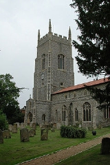
Saham Toney
Overview
Civil parish
In England, a civil parish is a territorial designation and, where they are found, the lowest tier of local government below districts and counties...
in the English
England
England is a country that is part of the United Kingdom. It shares land borders with Scotland to the north and Wales to the west; the Irish Sea is to the north west, the Celtic Sea to the south west, with the North Sea to the east and the English Channel to the south separating it from continental...
county of Norfolk
Norfolk
Norfolk is a low-lying county in the East of England. It has borders with Lincolnshire to the west, Cambridgeshire to the west and southwest and Suffolk to the south. Its northern and eastern boundaries are the North Sea coast and to the north-west the county is bordered by The Wash. The county...
. The village is 14.5 miles (23.3 km) North of Thetford
Thetford
Thetford is a market town and civil parish in the Breckland district of Norfolk, England. It is on the A11 road between Norwich and London, just south of Thetford Forest. The civil parish, covering an area of , has a population of 21,588.-History:...
, 27.3 miles (43.9 km) west of Norwich
Norwich
Norwich is a city in England. It is the regional administrative centre and county town of Norfolk. During the 11th century, Norwich was the largest city in England after London, and one of the most important places in the kingdom...
and 101 miles (162.5 km) north-east of London
London
London is the capital city of :England and the :United Kingdom, the largest metropolitan area in the United Kingdom, and the largest urban zone in the European Union by most measures. Located on the River Thames, London has been a major settlement for two millennia, its history going back to its...
. The village lies 13.1 miles (21.1 km) west of the town of Attleborough
Attleborough
Attleborough is a market town and civil parish in Norfolk, England situated between Norwich and Thetford. The parish falls within the district of Breckland and has an area of 21.90 km² with a Mainline to both Norwich and Cambridge....
.The nearest railway station is at Attleborough
Attleborough railway station
Attleborough railway station is a railway station serving the town of Attleborough in the English county of Norfolk. It is served by local services operated by East Midlands Trains and on the Breckland Line 16 miles west of Norwich to Peterborough and Cambridge.A new Ticket Office opened in 2008...
for the Breckland Line
Breckland Line
The Breckland Line runs from Cambridge in Cambridgeshire to Norwich in Norfolk, in East Anglia, England. It is so called because it runs through the Breckland region of Norfolk. The line also passes through Thetford Forest. The line is part of the Network Rail Strategic Route 5, SRS 05.09 and part...
which runs between Cambridge
Cambridge
The city of Cambridge is a university town and the administrative centre of the county of Cambridgeshire, England. It lies in East Anglia about north of London. Cambridge is at the heart of the high-technology centre known as Silicon Fen – a play on Silicon Valley and the fens surrounding the...
and Norwich. The nearest airport is Norwich International Airport
Norwich International Airport
Norwich International Airport , also known as Norwich Airport, is an airport in the City of Norwich within Norfolk, England north of the city centre and on the edge of the city's suburbs....
.
The civil parish has an area of 16.51 km² (6.4 sq mi) and in 2001 had a population of 1565 in 680 households.

