
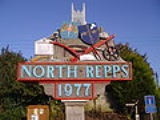
Northrepps
Encyclopedia
Northrepps is a village and a civil parish
in the English
county of Norfolk
. The village is 3.4 miles (5.5 km) southeast of Cromer
, 22.2 miles (35.7 km) north of Norwich
and 137 miles (220.5 km) north of London
. The village lies west of the A149
which runs between Kings Lynn and Great Yarmouth
. The nearest railway station is at Cromer
for the Bittern Line
which runs between Sheringham
, Cromer and Norwich. The nearest airport is Norwich International Airport
. The Village and parish of Northrepps had in the 2001 census
, a population of 839. For the purposes of local government, the village falls within the district
of North Norfolk
.
which lies to the north. The parish boundary to the north-west is with Cromer
, to the north-east with Sidestrand
. To the west are the boundaries with Felbrigg
and Roughton
whilst to the south is the parish of Southrepps
. At its nearest point the parish is just 500 meters from the coast on the north-eastern boundary, which partly follows the course of the disused Norfolk and Suffolk Joint Railway
between Cromer and North Walsham
which closed in 1953. Also in the north of the parish is Cottage Wood which is largely given over to the Forest Park Caravan Site. In the south east of the parish there is more woodland known as Fox Hills, bounded around its south-west edge by the Paston Way
footpath. The Bittern Line
railway cuts through the western section of the parish. The landscape of the parish is largely arable farmland made up of low hills and valleys; the soil is light, the subsoil gravel. The parish contains the village of Northrepps, as well as the Frogshall
which is within Fox Hills and Crossdale Street which straddles the A149
in the west of the parish. The A140
begins at a junction with the A149 within the parish. The name Northrepps is derived from the Old English word repel, meaning strips of land in a fen that can be tilled.
which has the village’s name listed as Norhrepes and Norrepes. The main tenant was William de Warenne
. The survey shows that the value of the parish was reasonably low. The survey also state that there was 1 free man of Ketel's, at 30 acres (121,405.8 m²) of land. Always 2 villagers, 5 smallholders, pannage
for 5 swine, always 1 plough, 2 acres (8,093.7 m²) of meadow
2 mills and 1 church, at 18 acres (72,843.5 m²). Value always 10s. The listing of the mills confirm the central role of farming in the community. In the Domesday Book the size of woodland was normally given as the number of swine a wood could support in this case pannage for 5 swine.
was the principal owner, Lord Suffield
was lord of the manor, and Samuel Hoare, Lord Templewood was the third. The manor of Northrepps therefore seems to have been governed by the Suffield family from 18th century Gunton Hall in the parish of Hanworth
which is 5 kilometres (3.1 mi) south of Northrepps village. Gurney, who was the principal land owner, was at that time resident at Northrepps Hall, not actually a hall or manor house but a converted farmhouse with a largely 19th century exterior. The Hall is now a listed building.
s region of France in the small village of St. Laurent d’Olt. The school building was built in 1879 and is a traditional flint and brick Victorian school. There is a first floor extension to the school accommodation which houses the staff room and resources room. There is also a mobile classroom which is used by the Gnomes Pre-School Playgroup. In 2004, new offices, reception and entrance were added to the school buildings.
The school has a playground which has a small grass playing area with climbing equipment, built with funds raised by the children and parents. This area is surrounded by security fencing which was installed in 2004. The school also has the use of a large playing field which is across the road. Also within the village there is an ongoing adult education programme including a computer club at the school.
is located on the south side of the village. The building is mainly 15th century but the chancel
has two lancet windows that date from the 13th century. The rood screen was given to the church in 1460 by John Playford and his wife Custance, their names being carved on its rail. The rood screen had at sometime been removed from the church and was found by the then rector of the church, John Cresswell, in a local barn. He had it restored into the church in 1912. The chancel has 14th century arcades of four bays supported on octagonal piers and double-chamfered arches. The tower is to the west and is compact and has a western doorway below. Above the doorway is a frieze of the royal arms with the lion and the unicorn. They are labelled for George III, but are actually the early Stuart
arms of a century and a half earlier of Charles I
. In the south aisle, the east window depicting the archangels St Gabriel, St Michael and St Raphael, a host of angels above them which dates from the early 20th century. The chancel also has some surviving Norman windows and some zig-zag in the stone. On top of the church, the weather vane depicts the Gallus plough produced at the old foundry, which was donated by local man, John Golden who had connections with the foundry.
Civil parish
In England, a civil parish is a territorial designation and, where they are found, the lowest tier of local government below districts and counties...
in the English
England
England is a country that is part of the United Kingdom. It shares land borders with Scotland to the north and Wales to the west; the Irish Sea is to the north west, the Celtic Sea to the south west, with the North Sea to the east and the English Channel to the south separating it from continental...
county of Norfolk
Norfolk
Norfolk is a low-lying county in the East of England. It has borders with Lincolnshire to the west, Cambridgeshire to the west and southwest and Suffolk to the south. Its northern and eastern boundaries are the North Sea coast and to the north-west the county is bordered by The Wash. The county...
. The village is 3.4 miles (5.5 km) southeast of Cromer
Cromer
Cromer is a coastal town and civil parish in north Norfolk, England. The local government authority is North Norfolk District Council, whose headquarters is in Holt Road in the town. The town is situated 23 miles north of the county town, Norwich, and is 4 miles east of Sheringham...
, 22.2 miles (35.7 km) north of Norwich
Norwich
Norwich is a city in England. It is the regional administrative centre and county town of Norfolk. During the 11th century, Norwich was the largest city in England after London, and one of the most important places in the kingdom...
and 137 miles (220.5 km) north of London
London
London is the capital city of :England and the :United Kingdom, the largest metropolitan area in the United Kingdom, and the largest urban zone in the European Union by most measures. Located on the River Thames, London has been a major settlement for two millennia, its history going back to its...
. The village lies west of the A149
A149 road
The A149 is a major route in Norfolk, linking Kings Lynn to Great Yarmouth. It runs via the coast rather than on a more direct route such as the A47. The eastern section runs through The Broads.-Kings Lynn to Wells next the Sea:...
which runs between Kings Lynn and Great Yarmouth
Great Yarmouth
Great Yarmouth, often known to locals as Yarmouth, is a coastal town in Norfolk, England. It is at the mouth of the River Yare, east of Norwich.It has been a seaside resort since 1760, and is the gateway from the Norfolk Broads to the sea...
. The nearest railway station is at Cromer
Cromer railway station
The fishing port and holiday resort of Cromer in the English county of Norfolk has had a rail service since 1877. It was served by three railway stations for many years, and is now served by two...
for the Bittern Line
Bittern Line
The Bittern Line is a railway line from Norwich to Cromer then Sheringham in Norfolk, England. It is one of the most scenic in the East of England traversing the Norfolk Broads on its route to the Area of Outstanding Natural Beauty on the North Norfolk Coast. The line is part of the Network Rail...
which runs between Sheringham
Sheringham
Sheringham is a seaside town in Norfolk, England, west of Cromer.The motto of the town, granted in 1953 to the Sheringham Urban District Council, is Mare Ditat Pinusque Decorat, Latin for "The sea enriches and the pine adorns"....
, Cromer and Norwich. The nearest airport is Norwich International Airport
Norwich International Airport
Norwich International Airport , also known as Norwich Airport, is an airport in the City of Norwich within Norfolk, England north of the city centre and on the edge of the city's suburbs....
. The Village and parish of Northrepps had in the 2001 census
United Kingdom Census 2001
A nationwide census, known as Census 2001, was conducted in the United Kingdom on Sunday, 29 April 2001. This was the 20th UK Census and recorded a resident population of 58,789,194....
, a population of 839. For the purposes of local government, the village falls within the district
Non-metropolitan district
Non-metropolitan districts, or colloquially shire districts, are a type of local government district in England. As created, they are sub-divisions of non-metropolitan counties in a so-called "two-tier" arrangement...
of North Norfolk
North Norfolk
North Norfolk is a local government district in Norfolk, United Kingdom. Its council is based in Cromer. The council headquarters can be found approximately out of the town of Cromer on the Holt Road.-History:...
.
Description
The parish of Northrepps was reduced in size in 1906, losing land to the parish of OverstrandOverstrand
Overstrand is a village on the north coast of Norfolk in England, two miles east of Cromer. It was once a modest fishing station, with all or part of the fishing station being known as Beck Hythe...
which lies to the north. The parish boundary to the north-west is with Cromer
Cromer
Cromer is a coastal town and civil parish in north Norfolk, England. The local government authority is North Norfolk District Council, whose headquarters is in Holt Road in the town. The town is situated 23 miles north of the county town, Norwich, and is 4 miles east of Sheringham...
, to the north-east with Sidestrand
Sidestrand
Sidestrand is a village and a civil parish in the English county of Norfolk. The village is North of Norwich, South East of Cromer and north-east of London.The nearest railway station is at North Walsham for the Bittern Line which runs between Cromer and Norwich...
. To the west are the boundaries with Felbrigg
Felbrigg
Felbrigg is a small village just south of Cromer in Norfolk, England. The Danish name means a 'plank bridge'.Historians believe that the original village was clustered around its Perpendicular church, in the grounds of Felbrigg Hall, a Jacobean mansion built in the early 17th century, a mile to the...
and Roughton
Roughton, Norfolk
Roughton is a village and a civil parish in the English county of Norfolk. The village is south of Cromer, north of Norwich and north-west of North Walsham. The village straddles the A140 between Cromer and Norwich and the B1463. The nearest railway station is at Roughton Road for the Bittern...
whilst to the south is the parish of Southrepps
Southrepps
Southrepps is a village and a civil parish in the English county of Norfolk. The village is 5.2 miles southeast of Cromer, 21.9 miles north of Norwich and 136 miles north of London. The village lies west of the A149 between Kings Lynn and Great Yarmouth. The nearest railway station is at Gunton for...
. At its nearest point the parish is just 500 meters from the coast on the north-eastern boundary, which partly follows the course of the disused Norfolk and Suffolk Joint Railway
Norfolk and Suffolk Joint Railway
The Norfolk and Suffolk Joint Railway was a British joint railway company.The NSJR was owned by the Great Eastern Railway and the Midland and Great Northern Joint Railway and consisted of two distinct sections: a line between North Walsham and Cromer via Mundesley, and a coastal section running...
between Cromer and North Walsham
North Walsham
North Walsham is a market town and civil parish in Norfolk, England in the North Norfolk district.-Demographics:The civil parish has an area of and in the 2001 census had a population of 11,998. For the purposes of local government, the parish falls within the district of North...
which closed in 1953. Also in the north of the parish is Cottage Wood which is largely given over to the Forest Park Caravan Site. In the south east of the parish there is more woodland known as Fox Hills, bounded around its south-west edge by the Paston Way
Paston Way
Paston Way is a footpath is entirely within the English county of Norfolk in the United Kingdom. The footpath is twenty miles in length, the portals to the path are Cromer at its northwestern end and North Walsham at it southeastern end.-The Designation:...
footpath. The Bittern Line
Bittern Line
The Bittern Line is a railway line from Norwich to Cromer then Sheringham in Norfolk, England. It is one of the most scenic in the East of England traversing the Norfolk Broads on its route to the Area of Outstanding Natural Beauty on the North Norfolk Coast. The line is part of the Network Rail...
railway cuts through the western section of the parish. The landscape of the parish is largely arable farmland made up of low hills and valleys; the soil is light, the subsoil gravel. The parish contains the village of Northrepps, as well as the Frogshall
Frogshall
Frogshall is a small hamlet within the civil parish of Northrepps in the English county of Norfolk . The hamlet is southeast of Cromer, north of Norwich and north of London. Craft Lane runs through the hamlet between Northrepps and Southrepps. The nearest railway station is at Gunton on the...
which is within Fox Hills and Crossdale Street which straddles the A149
A149 road
The A149 is a major route in Norfolk, linking Kings Lynn to Great Yarmouth. It runs via the coast rather than on a more direct route such as the A47. The eastern section runs through The Broads.-Kings Lynn to Wells next the Sea:...
in the west of the parish. The A140
A140 road
The A140 is an 'A-class' road in Norfolk and Suffolk, East Anglia, England partly following the route of the Roman Pye Road. It runs from the A14 near Needham Market to the A149 south of Cromer. It is of primary status for the entirety of its route. It is approximately 56 miles in length...
begins at a junction with the A149 within the parish. The name Northrepps is derived from the Old English word repel, meaning strips of land in a fen that can be tilled.
History
Evidence suggested that the occupants of Northrepps have always been agriculturally based. This is confirmed by entries in the Domesday BookDomesday Book
Domesday Book , now held at The National Archives, Kew, Richmond upon Thames in South West London, is the record of the great survey of much of England and parts of Wales completed in 1086...
which has the village’s name listed as Norhrepes and Norrepes. The main tenant was William de Warenne
William de Warenne, 1st Earl of Surrey
William de Warenne, 1st Earl of Surrey, Seigneur de Varennes is one of the very few proven Companions of William the Conqueror known to have fought at the Battle of Hastings in 1066...
. The survey shows that the value of the parish was reasonably low. The survey also state that there was 1 free man of Ketel's, at 30 acres (121,405.8 m²) of land. Always 2 villagers, 5 smallholders, pannage
Pannage
Pannage is the practice of turning out domestic pigs in a wood or forest, in order that they may feed on fallen acorns, beechmast, chestnuts or other nuts. Historically, it was a right or privilege granted to local people on common land or in royal forests...
for 5 swine, always 1 plough, 2 acres (8,093.7 m²) of meadow
2 mills and 1 church, at 18 acres (72,843.5 m²). Value always 10s. The listing of the mills confirm the central role of farming in the community. In the Domesday Book the size of woodland was normally given as the number of swine a wood could support in this case pannage for 5 swine.
19th Century
By 1881 records show that the parish was owned by three landlords. John Henry GurneyJohn Henry Gurney
John Henry Gurney was an English banker, amateur ornithologist, and Liberal Party politician.-Life:Gurney was the only son of Joseph John Gurney of Earlham Hall, Norwich, Norfolk. At the age of ten he was sent to a private tutor at Leytonstone near the Epping Forest, where he met Henry Doubleday,...
was the principal owner, Lord Suffield
Baron Suffield
Baron Suffield, of Suffield in the County of Norfolk, is a title in the Peerage of Great Britain. It was created in 1786 for Sir Harbord Harbord, 2nd Baronet, who had previously represented Norwich in the House of Commons for thirty years...
was lord of the manor, and Samuel Hoare, Lord Templewood was the third. The manor of Northrepps therefore seems to have been governed by the Suffield family from 18th century Gunton Hall in the parish of Hanworth
Hanworth
Hanworth lies to the south east of Feltham in the London Borough of Hounslow. The name is thought to come from the Anglo Saxon words “haen” and “worth”, meaning “small homestead”....
which is 5 kilometres (3.1 mi) south of Northrepps village. Gurney, who was the principal land owner, was at that time resident at Northrepps Hall, not actually a hall or manor house but a converted farmhouse with a largely 19th century exterior. The Hall is now a listed building.
The Foundry
The village once had a foundry and is best recalled for developing the Gallus plough in 1830. This design of plough was widely used well into the 1920s. There is an example of a Gallus plough that was manufactured at the foundry on display in the parish church.Smuggling
The village once had a gang of smugglers whose leader allegedly was a member of the large Summers family; hence his nickname Old Summers. Local folklore tells of the time that his gang tied up the chief 'prevention' officer to a post while they disposed of their contraband. A local woman called Sally Bean who lived in a cottage on Shucks Hill was an ally of the smuggling ring. Her cottage had a 20 miles (32.2 km) view of the countryside on the south side of the village which enabled her to give warnings to the smugglers of the 'prevention' men.The Primary school
Northrepps primary school is a feeder for Cromer High School and currently has approximately 35 students and is local authority maintained. The school is twinned with a small school in the AveyronAveyron
Aveyron is a département in southern France named after the Aveyron River.- History :Aveyron is one of the original 83 departments created during the French Revolution on 4 March 1790....
s region of France in the small village of St. Laurent d’Olt. The school building was built in 1879 and is a traditional flint and brick Victorian school. There is a first floor extension to the school accommodation which houses the staff room and resources room. There is also a mobile classroom which is used by the Gnomes Pre-School Playgroup. In 2004, new offices, reception and entrance were added to the school buildings.
The school has a playground which has a small grass playing area with climbing equipment, built with funds raised by the children and parents. This area is surrounded by security fencing which was installed in 2004. The school also has the use of a large playing field which is across the road. Also within the village there is an ongoing adult education programme including a computer club at the school.
The Village hall
The village hall was built in 1996 and plays host to a variety of clubs and organisations.The Foundry Arms
The village pub is located on Church Street and is called the Foundry Arms. The pub is so named after a once famous foundry that was in the village. Inside there are a bar, dining room and a games room. The pub has a good range of beers and good food is served; there is also a real log fire on cold nights. In the summer months the pub serves afternoon teas, Fridays through to Sundays.The parish church of Saint Mary
The parish church of Saint Mary the VirginMary (mother of Jesus)
Mary , commonly referred to as "Saint Mary", "Mother Mary", the "Virgin Mary", the "Blessed Virgin Mary", or "Mary, Mother of God", was a Jewish woman of Nazareth in Galilee...
is located on the south side of the village. The building is mainly 15th century but the chancel
Chancel
In church architecture, the chancel is the space around the altar in the sanctuary at the liturgical east end of a traditional Christian church building...
has two lancet windows that date from the 13th century. The rood screen was given to the church in 1460 by John Playford and his wife Custance, their names being carved on its rail. The rood screen had at sometime been removed from the church and was found by the then rector of the church, John Cresswell, in a local barn. He had it restored into the church in 1912. The chancel has 14th century arcades of four bays supported on octagonal piers and double-chamfered arches. The tower is to the west and is compact and has a western doorway below. Above the doorway is a frieze of the royal arms with the lion and the unicorn. They are labelled for George III, but are actually the early Stuart
House of Stuart
The House of Stuart is a European royal house. Founded by Robert II of Scotland, the Stewarts first became monarchs of the Kingdom of Scotland during the late 14th century, and subsequently held the position of the Kings of Great Britain and Ireland...
arms of a century and a half earlier of Charles I
Charles I of England
Charles I was King of England, King of Scotland, and King of Ireland from 27 March 1625 until his execution in 1649. Charles engaged in a struggle for power with the Parliament of England, attempting to obtain royal revenue whilst Parliament sought to curb his Royal prerogative which Charles...
. In the south aisle, the east window depicting the archangels St Gabriel, St Michael and St Raphael, a host of angels above them which dates from the early 20th century. The chancel also has some surviving Norman windows and some zig-zag in the stone. On top of the church, the weather vane depicts the Gallus plough produced at the old foundry, which was donated by local man, John Golden who had connections with the foundry.
See also
- Northrepps AerodromeNorthrepps AerodromeNorthrepps Aerodrome is a privately owned airfield south west of the village of Northrepps, North Norfolk, England approximately south south east of Cromer...
- River MunRiver MunThe River Mun or Mundesley Beck is a river in the north of the county of Norfolk, England. The source of the river can be found in the Parish of Northrepps. The river finally runs into the North Sea in the village of Mundesley.-The source:...
- FrogshallFrogshallFrogshall is a small hamlet within the civil parish of Northrepps in the English county of Norfolk . The hamlet is southeast of Cromer, north of Norwich and north of London. Craft Lane runs through the hamlet between Northrepps and Southrepps. The nearest railway station is at Gunton on the...
a hamlet within the parish. - Verily AndersonVerily AndersonVerily Anderson was a British writer, best known for writing the screenplay for No Kidding, based on the book Beware of Children, writing Brownie books and writing the genealogy books about the Gurney, Barclay and Buxton families...
Author of the Northrepps Grandchildren.