
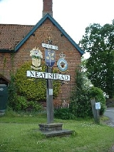
Neatishead
Encyclopedia
Neatishead is a village
and civil parish in the English
county
of Norfolk
. The village is situated some 20 km (12.4 mi) north-east of the city of Norwich
, within The Norfolk Broads
and to the west of Barton Broad
. Access to Neatishead from the broad is by way of Limekiln Dyke, a narrow channel leading off the broad.
The civil parish has an area of 7.71 km² (3 sq mi) and in the 2001 census
had a population of 537 in 235 households. For the purposes of local government, the parish falls within the district
of North Norfolk
.
It is famous due to the nearby RAF Neatishead
radar station.
Village
A village is a clustered human settlement or community, larger than a hamlet with the population ranging from a few hundred to a few thousand , Though often located in rural areas, the term urban village is also applied to certain urban neighbourhoods, such as the West Village in Manhattan, New...
and civil parish in the English
England
England is a country that is part of the United Kingdom. It shares land borders with Scotland to the north and Wales to the west; the Irish Sea is to the north west, the Celtic Sea to the south west, with the North Sea to the east and the English Channel to the south separating it from continental...
county
County
A county is a jurisdiction of local government in certain modern nations. Historically in mainland Europe, the original French term, comté, and its equivalents in other languages denoted a jurisdiction under the sovereignty of a count A county is a jurisdiction of local government in certain...
of Norfolk
Norfolk
Norfolk is a low-lying county in the East of England. It has borders with Lincolnshire to the west, Cambridgeshire to the west and southwest and Suffolk to the south. Its northern and eastern boundaries are the North Sea coast and to the north-west the county is bordered by The Wash. The county...
. The village is situated some 20 km (12.4 mi) north-east of the city of Norwich
Norwich
Norwich is a city in England. It is the regional administrative centre and county town of Norfolk. During the 11th century, Norwich was the largest city in England after London, and one of the most important places in the kingdom...
, within The Norfolk Broads
The Broads
The Broads are a network of mostly navigable rivers and lakes in the English counties of Norfolk and Suffolk. The Broads, and some surrounding land were constituted as a special area with a level of protection similar to a UK National Park by The Norfolk and Suffolk Broads Act of 1988...
and to the west of Barton Broad
Barton Broad
Barton Broad lies within The Broads in Norfolk, the United Kingdom. The broad is situated to the south and east of the village of Barton Turf, and is within the parish of Barton Turf....
. Access to Neatishead from the broad is by way of Limekiln Dyke, a narrow channel leading off the broad.
The civil parish has an area of 7.71 km² (3 sq mi) and in the 2001 census
United Kingdom Census 2001
A nationwide census, known as Census 2001, was conducted in the United Kingdom on Sunday, 29 April 2001. This was the 20th UK Census and recorded a resident population of 58,789,194....
had a population of 537 in 235 households. For the purposes of local government, the parish falls within the district
Non-metropolitan district
Non-metropolitan districts, or colloquially shire districts, are a type of local government district in England. As created, they are sub-divisions of non-metropolitan counties in a so-called "two-tier" arrangement...
of North Norfolk
North Norfolk
North Norfolk is a local government district in Norfolk, United Kingdom. Its council is based in Cromer. The council headquarters can be found approximately out of the town of Cromer on the Holt Road.-History:...
.
It is famous due to the nearby RAF Neatishead
RAF Neatishead
RRH Neatishead, is a Royal Air Force military radar station in the English county of Norfolk, East Anglia, and was established during the Second World War. It consists of the main technical site, and a number of remote, and sometimes unmanned sites....
radar station.
External links
.- Information from Genuki Norfolk on Neatishead.