

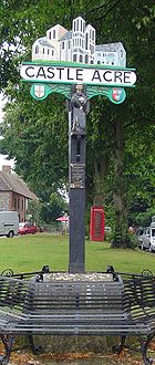
Castle Acre
Encyclopedia
Civil parish
In England, a civil parish is a territorial designation and, where they are found, the lowest tier of local government below districts and counties...
in the English
England
England is a country that is part of the United Kingdom. It shares land borders with Scotland to the north and Wales to the west; the Irish Sea is to the north west, the Celtic Sea to the south west, with the North Sea to the east and the English Channel to the south separating it from continental...
county
County
A county is a jurisdiction of local government in certain modern nations. Historically in mainland Europe, the original French term, comté, and its equivalents in other languages denoted a jurisdiction under the sovereignty of a count A county is a jurisdiction of local government in certain...
of Norfolk
Norfolk
Norfolk is a low-lying county in the East of England. It has borders with Lincolnshire to the west, Cambridgeshire to the west and southwest and Suffolk to the south. Its northern and eastern boundaries are the North Sea coast and to the north-west the county is bordered by The Wash. The county...
. The village is situated on the River Nar
River Nar
The River Nar is a river in England, and tributary of the River Great Ouse. It rises near Litcham in Norfolk and flows 15 miles west through Castle Acre and Narborough , joining the Ouse at King's Lynn. It has had a variety of alternative names, such as the Setch, the Sandringham, and Lynn Flu,...
some 4 miles (6.4 km) north of the town of Swaffham
Swaffham
Swaffham is a market town and civil parish in the English county of Norfolk. The town is situated east of King's Lynn and west of Norwich.The civil parish has an area of and in the 2001 census had a population of 6,935 in 3,130 households...
. It is 15 miles (24.1 km) east of the town of King's Lynn
King's Lynn
King's Lynn is a sea port and market town in the ceremonial county of Norfolk in the East of England. It is situated north of London and west of Norwich. The population of the town is 42,800....
, 33 miles (53.1 km) west of the city of Norwich
Norwich
Norwich is a city in England. It is the regional administrative centre and county town of Norfolk. During the 11th century, Norwich was the largest city in England after London, and one of the most important places in the kingdom...
, and 103 miles (165.8 km) from London
London
London is the capital city of :England and the :United Kingdom, the largest metropolitan area in the United Kingdom, and the largest urban zone in the European Union by most measures. Located on the River Thames, London has been a major settlement for two millennia, its history going back to its...
.
The village is best known today for the twin ruins of Castle Acre Castle
Castle Acre Castle
Castle Acre Castle is the remains of a motte-and-bailey castle, with extensive earthworks, at Castle Acre, in the English county of Norfolk . It is a Scheduled Ancient Monument, and a Grade I listed building....
and Castle Acre Priory
Castle Acre Priory
Castle Acre Priory, in the village of Castle Acre, Norfolk, England, is thought to have been founded in 1089 by William de Warenne the son the 1st Earl of Surrey who had founded England's first Cluniac priory at Lewes in 1077. The order originated from Burgundy...
, which lie immediately to the east and west of the village respectively. Both were founded soon after the Norman Conquest
Norman conquest of England
The Norman conquest of England began on 28 September 1066 with the invasion of England by William, Duke of Normandy. William became known as William the Conqueror after his victory at the Battle of Hastings on 14 October 1066, defeating King Harold II of England...
by William de Warenne
William de Warenne, 1st Earl of Surrey
William de Warenne, 1st Earl of Surrey, Seigneur de Varennes is one of the very few proven Companions of William the Conqueror known to have fought at the Battle of Hastings in 1066...
, the first Earl of Surrey
Earl of Surrey
The Earl of Surrey is a title in the Peerage of England, and has been created five times. It was first created for William de Warenne, a close companion of William the Conqueror...
. At its heyday, Castle Acre played an important role in the affairs of the State, with many visits from royalty. Castle Acre itself was once a fortified town and still possesses one of its gates, the Bailey Gate
Castle Acre Bailey Gate
Castle Acre Bailey Gate is the still surviving north gate of the medieval fortified village of Castle Acre, in the English county of Norfolk.The Bailey Gate is now in the care of English Heritage, along with the nearby Castle Acre Castle and Castle Acre Priory.-External links:* on Castle Acre...
. When first established, Castle Acre was one of the finest examples of Norman town planning in the country, and much of this can still be seen.
The former home of Alexander "Harry" Parry-Jones.
The civil parish has an area of 13.18 km² (5.1 sq mi) and in the 2001 census
United Kingdom Census 2001
A nationwide census, known as Census 2001, was conducted in the United Kingdom on Sunday, 29 April 2001. This was the 20th UK Census and recorded a resident population of 58,789,194....
had a population of 799 in 370 households. The parish shares boundaries with the adjacent parishes of Rougham
Rougham
Rougham is a village and civil parish in the English county of Norfolk.It covers an area of and had a population of 152 in 69 households as of the 2001 census.For the purposes of local government, it falls within the district of Breckland....
, Great Massingham
Great Massingham
Great Massingham is a village and civil parish in the English county of Norfolk.It has a primary school , a village shop, a pub , a village hall and a church . It is also notable for the number of ponds in the village - two large ones in the village centre and more in the outskirts...
, West Acre
West Acre
West Acre is a village in the King's Lynn and West Norfolk district of the county of Norfolk, England.The village is on the Nar Valley Way pathway.-Billiards Club:...
, South Acre
South Acre
South Acre is a village and civil parish in the English county of Norfolk. The village has almost disappeared, but the remnants are located about south-west of Castle Acre, north of the town of Swaffham, east of the town of King's Lynn and west of the city of Norwich...
, Newton by Castle Acre
Newton by Castle Acre
Newton by Castle Acre is a village and civil parish in the English county of Norfolk. It is situated on the A1065 Mildenhall to Fakenham road, about north of the town of Swaffham. The village is from the city of Norwich and from London.-Geography:...
and Lexham
Lexham
Lexham is a parish consisting of the twin villages of East Lexham and West Lexham situated in the Breckland District of Norfolk and covers an area of with a population of 157 as of the 2001 census...
. The parish falls within the district
Non-metropolitan district
Non-metropolitan districts, or colloquially shire districts, are a type of local government district in England. As created, they are sub-divisions of non-metropolitan counties in a so-called "two-tier" arrangement...
of King's Lynn and West Norfolk
King's Lynn and West Norfolk
King's Lynn and West Norfolk is a local government district and borough in Norfolk, England. Its council is based in the town of King's Lynn.-History:...
. Local government responsibilities are shared between the parish, district and county councils.
The village lies some 0.5 mile (0.80467 km) west of the A1065 Mildenhall to Fakenham road
A1065 road
The A1065 is a main road in the English region of East Anglia. It provides the principal road connection to parts of the west and north of the county of Norfolk from Newmarket and points south of there, including London...
, but is clearly visible from the road. The hamlet
Hamlet (place)
A hamlet is usually a rural settlement which is too small to be considered a village, though sometimes the word is used for a different sort of community. Historically, when a hamlet became large enough to justify building a church, it was then classified as a village...
of Fiddler's Green lies to the northeast of the village.
External links
- Photographs of Castle Acre
- Information from Genuki Norfolk on Castle Acre.