

List of U.S. states
Encyclopedia
The following table lists each of the 50 states of the United States
with the following information:
United States
The United States of America is a federal constitutional republic comprising fifty states and a federal district...
with the following information:
List
- The state name
- The preferred pronunciation of the common state name as transcribed with the International Phonetic AlphabetInternational Phonetic AlphabetThe International Phonetic Alphabet "The acronym 'IPA' strictly refers [...] to the 'International Phonetic Association'. But it is now such a common practice to use the acronym also to refer to the alphabet itself that resistance seems pedantic...
(see Help:IPA for English for a key) - The United States Postal ServiceUnited States Postal ServiceThe United States Postal Service is an independent agency of the United States government responsible for providing postal service in the United States...
(USPS) two-character state abbreviation
(also used as the International Organization for StandardizationInternational Organization for StandardizationThe International Organization for Standardization , widely known as ISO, is an international standard-setting body composed of representatives from various national standards organizations. Founded on February 23, 1947, the organization promulgates worldwide proprietary, industrial and commercial...
(ISO) Standard 3166-2ISO 3166-2ISO 3166-2 is part of the ISO 3166 standard published by the International Organization for Standardization , and defines codes for the names of the principal subdivisions of all countries coded in ISO 3166-1...
country subdivision codeISO 3166-2:USISO 3166-2:US is the entry for the United States in ISO 3166-2, part of the ISO 3166 standard published by the International Organization for Standardization , which defines codes for the names of the principal subdivisions of all countries coded in ISO 3166-1.Currently for the United States, ISO...
) - An image of the official state flagFlags of the U.S. statesThe flags of the U.S. states exhibit a wide variety of regional influences and local histories, as well as widely different styles and design principles. Modern state flags date from the 1890s when states wanted to have distinctive symbols at the 1893 World's Columbian Exposition in Chicago...
- The date the state ratified the United States ConstitutionUnited States ConstitutionThe Constitution of the United States is the supreme law of the United States of America. It is the framework for the organization of the United States government and for the relationship of the federal government with the states, citizens, and all people within the United States.The first three...
or was admitted to the UnionUnited StatesThe United States of America is a federal constitutional republic comprising fifty states and a federal district... - The total land and water area of the state
- The United States Census 2010 of state population as of
- The state capital
- The most populous incorporated place or Census Designated Place within the state as of , as estimated by the U.S. Census Bureau
- Preceding entity of the state, in which it does not account for the Ordinance of SecessionOrdinance of SecessionThe Ordinance of Secession was the document drafted and ratified in 1860 and 1861 by the states officially seceding from the United States of America...
during the American Civil WarAmerican Civil WarThe American Civil War was a civil war fought in the United States of America. In response to the election of Abraham Lincoln as President of the United States, 11 southern slave states declared their secession from the United States and formed the Confederate States of America ; the other 25...
of 13 states, 11 of which formed the Confederate States of AmericaConfederate States of AmericaThe Confederate States of America was a government set up from 1861 to 1865 by 11 Southern slave states of the United States of America that had declared their secession from the U.S...
, and the subsequent restoration of those states to representation in Congress (sometimes called "readmission") between 1866 and 1870, or the end of the reconstruction era of the United States.
| Name | IPA | USPS | Flag | Statehood | Area (sq mi) | Capital | Most populous city | Preceding entity | |
|---|---|---|---|---|---|---|---|---|---|
| Alabama Alabama Alabama is a state located in the southeastern region of the United States. It is bordered by Tennessee to the north, Georgia to the east, Florida and the Gulf of Mexico to the south, and Mississippi to the west. Alabama ranks 30th in total land area and ranks second in the size of its inland... |
/ˌæləˈbæmə/ | AL |  |
135765 km² (52,419.2 sq mi) | 4,779,736 | Montgomery Montgomery, Alabama Montgomery is the capital of the U.S. state of Alabama, and is the county seat of Montgomery County. It is located on the Alabama River southeast of the center of the state, in the Gulf Coastal Plain. As of the 2010 census, Montgomery had a population of 205,764 making it the second-largest city... |
Birmingham Birmingham, Alabama Birmingham is the largest city in Alabama. The city is the county seat of Jefferson County. According to the 2010 United States Census, Birmingham had a population of 212,237. The Birmingham-Hoover Metropolitan Area, in estimate by the U.S... |
Alabama Territory Alabama Territory The Territory of Alabama was an organized incorporated territory of the United States that existed from August 15, 1817, until December 14, 1819, when it was admitted to the Union as the State of Alabama.-History:... |
|
| Alaska Alaska Alaska is the largest state in the United States by area. It is situated in the northwest extremity of the North American continent, with Canada to the east, the Arctic Ocean to the north, and the Pacific Ocean to the west and south, with Russia further west across the Bering Strait... |
/əˈlæskə/ | AK |  |
1717854 km² (663,267.1 sq mi) | 710,231 | Juneau Juneau, Alaska The City and Borough of Juneau is a unified municipality located on the Gastineau Channel in the panhandle of the U.S. state of Alaska. It has been the capital of Alaska since 1906, when the government of the then-District of Alaska was moved from Sitka as dictated by the U.S. Congress in 1900... |
Anchorage Anchorage, Alaska Anchorage is a unified home rule municipality in the southcentral part of the U.S. state of Alaska. It is the northernmost major city in the United States... |
Alaska Territory Alaska Territory The Territory of Alaska was an organized incorporated territory of the United States that existed from August 24, 1912, until January 3, 1959, when it was admitted to the Union as the State of Alaska... |
|
| Arizona Arizona Arizona ; is a state located in the southwestern region of the United States. It is also part of the western United States and the mountain west. The capital and largest city is Phoenix... |
/ˌær |
AZ |  |
295254 km² (113,998.2 sq mi) | 6,392,017 | Phoenix Phoenix, Arizona Phoenix is the capital, and largest city, of the U.S. state of Arizona, as well as the sixth most populated city in the United States. Phoenix is home to 1,445,632 people according to the official 2010 U.S. Census Bureau data... |
Phoenix Phoenix, Arizona Phoenix is the capital, and largest city, of the U.S. state of Arizona, as well as the sixth most populated city in the United States. Phoenix is home to 1,445,632 people according to the official 2010 U.S. Census Bureau data... |
Arizona Territory Arizona Territory The Territory of Arizona was an organized incorporated territory of the United States that existed from February 24, 1863 until February 14, 1912, when it was admitted to the Union as the 48th state.... |
|
| Arkansas Arkansas Arkansas is a state located in the southern region of the United States. Its name is an Algonquian name of the Quapaw Indians. Arkansas shares borders with six states , and its eastern border is largely defined by the Mississippi River... |
/ˈɑrkənsɔː/ | AR | 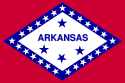 |
137002 km² (52,896.8 sq mi) | 2,915,918 | Little Rock Little Rock, Arkansas Little Rock is the capital and the largest city of the U.S. state of Arkansas. The Metropolitan Statistical Area had a population of 699,757 people in the 2010 census... |
Little Rock Little Rock, Arkansas Little Rock is the capital and the largest city of the U.S. state of Arkansas. The Metropolitan Statistical Area had a population of 699,757 people in the 2010 census... |
Arkansas Territory Arkansas Territory The Territory of Arkansas, initially organized as the Territory of Arkansaw, was an organized incorporated territory of the United States that existed from July 4, 1819 until June 15, 1836, when the final extent of the territory was admitted to the Union as the State of Arkansas.-History:The... |
|
| California California California is a state located on the West Coast of the United States. It is by far the most populous U.S. state, and the third-largest by land area... |
/ˌkæl |
CA |  |
423970 km² (163,695.7 sq mi) | 37,253,956 | Sacramento Sacramento, California Sacramento is the capital city of the U.S. state of California and the county seat of Sacramento County. It is located at the confluence of the Sacramento River and the American River in the northern portion of California's expansive Central Valley. With a population of 466,488 at the 2010 census,... |
Los Angeles Los Ángeles Los Ángeles is the capital of the province of Biobío, in the commune of the same name, in Region VIII , in the center-south of Chile. It is located between the Laja and Biobío rivers. The population is 123,445 inhabitants... |
Directly admitted from Mexican Cession Mexican Cession The Mexican Cession of 1848 is a historical name in the United States for the region of the present day southwestern United States that Mexico ceded to the U.S... |
|
| Colorado Colorado Colorado is a U.S. state that encompasses much of the Rocky Mountains as well as the northeastern portion of the Colorado Plateau and the western edge of the Great Plains... |
/ˌkɒləˈrædoʊ/ | CO |  |
269837 km² (104,184.6 sq mi) | 5,029,196 | Denver | Denver | Colorado Territory Colorado Territory The Territory of Colorado was an organized incorporated territory of the United States that existed from February 28, 1861, until August 1, 1876, when it was admitted to the Union as the State of Colorado.... |
|
| Connecticut Connecticut Connecticut is a state in the New England region of the northeastern United States. It is bordered by Rhode Island to the east, Massachusetts to the north, and the state of New York to the west and the south .Connecticut is named for the Connecticut River, the major U.S. river that approximately... |
/kəˈnɛt |
CT |  |
14356 km² (5,542.9 sq mi) | 3,574,097 | Hartford Hartford, Connecticut Hartford is the capital of the U.S. state of Connecticut. The seat of Hartford County until Connecticut disbanded county government in 1960, it is the second most populous city on New England's largest river, the Connecticut River. As of the 2010 Census, Hartford's population was 124,775, making... |
Bridgeport Bridgeport, Connecticut Bridgeport is the most populous city in the U.S. state of Connecticut. Located in Fairfield County, the city had an estimated population of 144,229 at the 2010 United States Census and is the core of the Greater Bridgeport area... |
Connecticut Colony Connecticut Colony The Connecticut Colony or Colony of Connecticut was an English colony located in British America that became the U.S. state of Connecticut. Originally known as the River Colony, it was organized on March 3, 1636 as a haven for Puritan noblemen. After early struggles with the Dutch, the English... , then sovereign state in Confederation |
|
| Delaware Delaware Delaware is a U.S. state located on the Atlantic Coast in the Mid-Atlantic region of the United States. It is bordered to the south and west by Maryland, and to the north by Pennsylvania... |
/ˈdɛləwɛər/ | DE |  |
6452 km² (2,491.1 sq mi) | 897,934 | Dover Dover, Delaware The city of Dover is the capital and second largest city in the U.S. state of Delaware. It is also the county seat of Kent County, and the principal city of the Dover, Delaware Metropolitan Statistical Area, which encompasses all of Kent County. It is located on the St. Jones River in the Delaware... |
Wilmington Wilmington, Delaware Wilmington is the largest city in the state of Delaware, United States, and is located at the confluence of the Christina River and Brandywine Creek, near where the Christina flows into the Delaware River. It is the county seat of New Castle County and one of the major cities in the Delaware Valley... |
Lower Counties on Delaware, then sovereign state in Confederation | |
| Florida Florida Florida is a state in the southeastern United States, located on the nation's Atlantic and Gulf coasts. It is bordered to the west by the Gulf of Mexico, to the north by Alabama and Georgia and to the east by the Atlantic Ocean. With a population of 18,801,310 as measured by the 2010 census, it... |
/ˈflɒr |
FL |  |
170304 km² (65,754.7 sq mi) | 18,801,310 | Tallahassee Tallahassee, Florida Tallahassee is the capital of the U.S. state of Florida. It is the county seat and only incorporated municipality in Leon County, and is the 128th largest city in the United States. Tallahassee became the capital of Florida, then the Florida Territory, in 1824. In 2010, the population recorded by... |
Jacksonville Jacksonville, Florida Jacksonville is the largest city in the U.S. state of Florida in terms of both population and land area, and the largest city by area in the contiguous United States. It is the county seat of Duval County, with which the city government consolidated in 1968... |
Florida Territory Florida Territory The Territory of Florida was an organized incorporated territory of the United States that existed from March 30, 1822, until March 3, 1845, when it was admitted to the Union as the State of Florida... |
|
| Georgia Georgia (U.S. state) Georgia is a state located in the southeastern United States. It was established in 1732, the last of the original Thirteen Colonies. The state is named after King George II of Great Britain. Georgia was the fourth state to ratify the United States Constitution, on January 2, 1788... |
/ˈdʒɔrdʒə/ | GA | .svg.png) |
153909 km² (59,424.6 sq mi) | 9,687,653 | Atlanta | Atlanta | Province of Georgia Province of Georgia The Province of Georgia was one of the Southern colonies in British America. It was the last of the thirteen original colonies established by Great Britain in what later became the United States... , then sovereign state in Confederation |
|
| Hawaii Hawaii Hawaii is the newest of the 50 U.S. states , and is the only U.S. state made up entirely of islands. It is the northernmost island group in Polynesia, occupying most of an archipelago in the central Pacific Ocean, southwest of the continental United States, southeast of Japan, and northeast of... |
/həˈwaɪ.iː/ | HI |  |
28311 km² (10,930.9 sq mi) | 1,360,301 | Honolulu | Honolulu | Territory of Hawaii Territory of Hawaii The Territory of Hawaii or Hawaii Territory was an organized incorporated territory of the United States that existed from July 7, 1898, until August 21, 1959, when its territory, with the exception of Johnston Atoll, was admitted to the Union as the fiftieth U.S. state, the State of Hawaii.The U.S... |
|
| Idaho Idaho Idaho is a state in the Rocky Mountain area of the United States. The state's largest city and capital is Boise. Residents are called "Idahoans". Idaho was admitted to the Union on July 3, 1890, as the 43rd state.... |
/ˈaɪdəhoʊ/ | ID |  |
216632 km² (83,642.1 sq mi) | 1,567,582 | Boise Boise, Idaho Boise is the capital and most populous city of the U.S. state of Idaho, as well as the county seat of Ada County. Located on the Boise River, it anchors the Boise City-Nampa metropolitan area and is the largest city between Salt Lake City, Utah and Portland, Oregon.As of the 2010 Census Bureau,... |
Boise Boise, Idaho Boise is the capital and most populous city of the U.S. state of Idaho, as well as the county seat of Ada County. Located on the Boise River, it anchors the Boise City-Nampa metropolitan area and is the largest city between Salt Lake City, Utah and Portland, Oregon.As of the 2010 Census Bureau,... |
Idaho Territory Idaho Territory The Territory of Idaho was an organized incorporated territory of the United States that existed from March 4, 1863, until July 3, 1890, when the final extent of the territory was admitted to the Union as the State of Idaho.-1860s:... |
|
| Illinois Illinois Illinois is the fifth-most populous state of the United States of America, and is often noted for being a microcosm of the entire country. With Chicago in the northeast, small industrial cities and great agricultural productivity in central and northern Illinois, and natural resources like coal,... |
/ɪl |
IL | 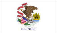 |
141998 km² (54,825.7 sq mi) | 12,830,632 | Springfield Springfield, Illinois Springfield is the third and current capital of the US state of Illinois and the county seat of Sangamon County with a population of 117,400 , making it the sixth most populated city in the state and the second most populated Illinois city outside of the Chicago Metropolitan Area... |
Chicago Chicago Chicago is the largest city in the US state of Illinois. With nearly 2.7 million residents, it is the most populous city in the Midwestern United States and the third most populous in the US, after New York City and Los Angeles... |
Illinois Territory Illinois Territory The Territory of Illinois was an organized incorporated territory of the United States that existed from March 1, 1809, until December 3, 1818, when the southern portion of the territory was admitted to the Union as the State of Illinois. The area was earlier known as "Illinois Country" while under... , formed from the Northwest Territory Northwest Territory The Territory Northwest of the River Ohio, more commonly known as the Northwest Territory, was an organized incorporated territory of the United States that existed from July 13, 1787, until March 1, 1803, when the southeastern portion of the territory was admitted to the Union as the state of Ohio... |
|
| Indiana Indiana Indiana is a US state, admitted to the United States as the 19th on December 11, 1816. It is located in the Midwestern United States and Great Lakes Region. With 6,483,802 residents, the state is ranked 15th in population and 16th in population density. Indiana is ranked 38th in land area and is... |
/ˌɪndiˈænə/ | IN |  |
94321 km² (36,417.5 sq mi) | 6,483,802 | Indianapolis Indianapolis Indianapolis is the capital of the U.S. state of Indiana, and the county seat of Marion County, Indiana. As of the 2010 United States Census, the city's population is 839,489. It is by far Indiana's largest city and, as of the 2010 U.S... |
Indianapolis Indianapolis Indianapolis is the capital of the U.S. state of Indiana, and the county seat of Marion County, Indiana. As of the 2010 United States Census, the city's population is 839,489. It is by far Indiana's largest city and, as of the 2010 U.S... |
Indiana Territory Indiana Territory The Territory of Indiana was an organized incorporated territory of the United States that existed from July 4, 1800, until November 7, 1816, when the southern portion of the territory was admitted to the Union as the state of Indiana.... , formed from the Northwest Territory Northwest Territory The Territory Northwest of the River Ohio, more commonly known as the Northwest Territory, was an organized incorporated territory of the United States that existed from July 13, 1787, until March 1, 1803, when the southeastern portion of the territory was admitted to the Union as the state of Ohio... |
|
| Iowa Iowa Iowa is a state located in the Midwestern United States, an area often referred to as the "American Heartland". It derives its name from the Ioway people, one of the many American Indian tribes that occupied the state at the time of European exploration. Iowa was a part of the French colony of New... |
/ˈaɪ.ɵwə/ | IA |  |
145743 km² (56,271.7 sq mi) | 3,046,355 | Des Moines Des Moines, Iowa Des Moines is the capital and the most populous city in the US state of Iowa. It is also the county seat of Polk County. A small portion of the city extends into Warren County. It was incorporated on September 22, 1851, as Fort Des Moines which was shortened to "Des Moines" in 1857... |
Des Moines Des Moines, Iowa Des Moines is the capital and the most populous city in the US state of Iowa. It is also the county seat of Polk County. A small portion of the city extends into Warren County. It was incorporated on September 22, 1851, as Fort Des Moines which was shortened to "Des Moines" in 1857... |
Iowa Territory Iowa Territory The Territory of Iowa was an organized incorporated territory of the United States that existed from July 4, 1838, until December 28, 1846, when the southeastern portion of the territory was admitted to the Union as the State of Iowa.-History:... |
|
| Kansas Kansas Kansas is a US state located in the Midwestern United States. It is named after the Kansas River which flows through it, which in turn was named after the Kansa Native American tribe, which inhabited the area. The tribe's name is often said to mean "people of the wind" or "people of the south... |
/ˈkænzəs/ | KS | 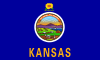 |
213096 km² (82,276.8 sq mi) | 2,853,118 | Topeka Topeka, Kansas Topeka |Kansa]]: Tó Pee Kuh) is the capital city of the U.S. state of Kansas and the county seat of Shawnee County. It is situated along the Kansas River in the central part of Shawnee County, located in northeast Kansas, in the Central United States. As of the 2010 census, the city population was... |
Wichita Wichita, Kansas Wichita is the largest city in the U.S. state of Kansas.As of the 2010 census, the city population was 382,368. Located in south-central Kansas on the Arkansas River, Wichita is the county seat of Sedgwick County and the principal city of the Wichita metropolitan area... |
Kansas Territory Kansas Territory The Territory of Kansas was an organized incorporated territory of the United States that existed from May 30, 1854, until January 29, 1861, when the eastern portion of the territory was admitted to the Union as the State of Kansas.... |
|
| Kentucky Kentucky The Commonwealth of Kentucky is a state located in the East Central United States of America. As classified by the United States Census Bureau, Kentucky is a Southern state, more specifically in the East South Central region. Kentucky is one of four U.S. states constituted as a commonwealth... |
/k |
KY |  |
104659 km² (40,409.1 sq mi) | 4,339,367 | Frankfort Frankfort, Kentucky Frankfort is a city in Kentucky that serves as the state capital and the county seat of Franklin County. The population was 27,741 at the 2000 census; by population it is the 5th smallest state capital in the United States... |
Louisville Louisville, Kentucky Louisville is the largest city in the U.S. state of Kentucky, and the county seat of Jefferson County. Since 2003, the city's borders have been coterminous with those of the county because of a city-county merger. The city's population at the 2010 census was 741,096... |
Split off from Virginia Virginia The Commonwealth of Virginia , is a U.S. state on the Atlantic Coast of the Southern United States. Virginia is nicknamed the "Old Dominion" and sometimes the "Mother of Presidents" after the eight U.S. presidents born there... with that state's consent. The former huge Kentucky County |
|
| Louisiana Louisiana Louisiana is a state located in the southern region of the United States of America. Its capital is Baton Rouge and largest city is New Orleans. Louisiana is the only state in the U.S. with political subdivisions termed parishes, which are local governments equivalent to counties... |
/luːˌiːziˈænə/ | LA |  |
135382 km² (52,271.3 sq mi) | 4,533,372 | Baton Rouge Baton Rouge, Louisiana Baton Rouge is the capital of the U.S. state of Louisiana. It is located in East Baton Rouge Parish and is the second-largest city in the state.Baton Rouge is a major industrial, petrochemical, medical, and research center of the American South... |
New Orleans | Territory of Orleans | |
| Maine Maine Maine is a state in the New England region of the northeastern United States, bordered by the Atlantic Ocean to the east and south, New Hampshire to the west, and the Canadian provinces of Quebec to the northwest and New Brunswick to the northeast. Maine is both the northernmost and easternmost... |
/ˈmeɪn/ | ME |  |
91646 km² (35,384.7 sq mi) | 1,328,361 | Augusta Augusta, Maine Augusta is the capital of the US state of Maine, county seat of Kennebec County, and center of population for Maine. The city's population was 19,136 at the 2010 census, making it the third-smallest state capital after Montpelier, Vermont and Pierre, South Dakota... |
Portland Portland, Maine Portland is the largest city in Maine and is the county seat of Cumberland County. The 2010 city population was 66,194, growing 3 percent since the census of 2000... |
Split off from Massachusetts Massachusetts The Commonwealth of Massachusetts is a state in the New England region of the northeastern United States of America. It is bordered by Rhode Island and Connecticut to the south, New York to the west, and Vermont and New Hampshire to the north; at its east lies the Atlantic Ocean. As of the 2010... with that state's consent (the former District of Maine District of Maine The District of Maine was a legal designation for what is now the U.S. state of Maine from American independence until the Missouri Compromise on March 4, 1820, after which it gained its independence from Massachusetts and became the 23rd state in the Union... ) |
|
| Maryland Maryland Maryland is a U.S. state located in the Mid Atlantic region of the United States, bordering Virginia, West Virginia, and the District of Columbia to its south and west; Pennsylvania to its north; and Delaware to its east... |
/ˈmɛrələnd/ | MD |  |
32133 km² (12,406.6 sq mi) | 5,773,552 | Annapolis Annapolis, Maryland Annapolis is the capital of the U.S. state of Maryland, as well as the county seat of Anne Arundel County. It had a population of 38,394 at the 2010 census and is situated on the Chesapeake Bay at the mouth of the Severn River, south of Baltimore and about east of Washington, D.C. Annapolis is... |
Baltimore Baltimore Baltimore is the largest independent city in the United States and the largest city and cultural center of the US state of Maryland. The city is located in central Maryland along the tidal portion of the Patapsco River, an arm of the Chesapeake Bay. Baltimore is sometimes referred to as Baltimore... |
Province of Maryland Province of Maryland The Province of Maryland was an English and later British colony in North America that existed from 1632 until 1776, when it joined the other twelve of the Thirteen Colonies in rebellion against Great Britain and became the U.S... , then sovereign state in Confederation |
|
| Massachusetts Massachusetts The Commonwealth of Massachusetts is a state in the New England region of the northeastern United States of America. It is bordered by Rhode Island and Connecticut to the south, New York to the west, and Vermont and New Hampshire to the north; at its east lies the Atlantic Ocean. As of the 2010... |
/ˌmæsəˈtʃuːs |
MA |  |
27336 km² (10,554.5 sq mi) | 6,547,629 | Boston Boston Boston is the capital of and largest city in Massachusetts, and is one of the oldest cities in the United States. The largest city in New England, Boston is regarded as the unofficial "Capital of New England" for its economic and cultural impact on the entire New England region. The city proper had... |
Boston Boston Boston is the capital of and largest city in Massachusetts, and is one of the oldest cities in the United States. The largest city in New England, Boston is regarded as the unofficial "Capital of New England" for its economic and cultural impact on the entire New England region. The city proper had... |
Province of Massachusetts Bay Province of Massachusetts Bay The Province of Massachusetts Bay was a crown colony in North America. It was chartered on October 7, 1691 by William and Mary, the joint monarchs of the kingdoms of England and Scotland... , then sovereign state in Confederation |
|
| Michigan Michigan Michigan is a U.S. state located in the Great Lakes Region of the United States of America. The name Michigan is the French form of the Ojibwa word mishigamaa, meaning "large water" or "large lake".... |
/ˈmɪʃ |
MI |  |
253793 km² (97,990 sq mi) | 9,883,640 | Lansing Lansing, Michigan Lansing is the capital of the U.S. state of Michigan. It is located mostly in Ingham County, although small portions of the city extend into Eaton County. The 2010 Census places the city's population at 114,297, making it the fifth largest city in Michigan... |
Detroit | Michigan Territory Michigan Territory The Territory of Michigan was an organized incorporated territory of the United States that existed from June 30, 1805, until January 26, 1837, when the final extent of the territory was admitted to the Union as the State of Michigan... , formed from the Northwest Territory Northwest Territory The Territory Northwest of the River Ohio, more commonly known as the Northwest Territory, was an organized incorporated territory of the United States that existed from July 13, 1787, until March 1, 1803, when the southeastern portion of the territory was admitted to the Union as the state of Ohio... |
|
| Minnesota Minnesota Minnesota is a U.S. state located in the Midwestern United States. The twelfth largest state of the U.S., it is the twenty-first most populous, with 5.3 million residents. Minnesota was carved out of the eastern half of the Minnesota Territory and admitted to the Union as the thirty-second state... |
/ˌmɪn |
MN |  |
225181 km² (86,942.9 sq mi) | 5,303,925 | Saint Paul Saint Paul, Minnesota Saint Paul is the capital and second-most populous city of the U.S. state of Minnesota. The city lies mostly on the east bank of the Mississippi River in the area surrounding its point of confluence with the Minnesota River, and adjoins Minneapolis, the state's largest city... |
Minneapolis | Minnesota Territory Minnesota Territory The Territory of Minnesota was an organized incorporated territory of the United States that existed from March 3, 1849, until May 11, 1858, when the eastern portion of the territory was admitted to the Union as the State of Minnesota.-History:... |
|
| Mississippi Mississippi Mississippi is a U.S. state located in the Southern United States. Jackson is the state capital and largest city. The name of the state derives from the Mississippi River, which flows along its western boundary, whose name comes from the Ojibwe word misi-ziibi... |
/ˌmɪs |
MS |  |
125443 km² (48,433.8 sq mi) | 2,967,297 | Jackson Jackson, Mississippi Jackson is the capital and the most populous city of the US state of Mississippi. It is one of two county seats of Hinds County ,. The population of the city declined from 184,256 at the 2000 census to 173,514 at the 2010 census... |
Jackson Jackson, Mississippi Jackson is the capital and the most populous city of the US state of Mississippi. It is one of two county seats of Hinds County ,. The population of the city declined from 184,256 at the 2000 census to 173,514 at the 2010 census... |
Mississippi Territory Mississippi Territory The Territory of Mississippi was an organized incorporated territory of the United States that existed from April 7, 1798, until December 10, 1817, when the final extent of the territory was admitted to the Union as the state of Mississippi.... , formed from land donated to the U.S. by Georgia Georgia (U.S. state) Georgia is a state located in the southeastern United States. It was established in 1732, the last of the original Thirteen Colonies. The state is named after King George II of Great Britain. Georgia was the fourth state to ratify the United States Constitution, on January 2, 1788... |
|
| Missouri Missouri Missouri is a US state located in the Midwestern United States, bordered by Iowa, Illinois, Kentucky, Tennessee, Arkansas, Oklahoma, Kansas and Nebraska. With a 2010 population of 5,988,927, Missouri is the 18th most populous state in the nation and the fifth most populous in the Midwest. It... |
/m |
MO |  |
180533 km² (69,704.2 sq mi) | 5,988,927 | Jefferson City Jefferson City, Missouri Jefferson City is the capital of the U.S. state of Missouri and the county seat of Cole County. Located in Callaway and Cole counties, it is the principal city of the Jefferson City metropolitan area, which encompasses the entirety of both counties. As of the 2010 census, the population was 43,079... |
Kansas City Kansas City, Missouri Kansas City, Missouri is the largest city in the U.S. state of Missouri and is the anchor city of the Kansas City Metropolitan Area, the second largest metropolitan area in Missouri. It encompasses in parts of Jackson, Clay, Cass, and Platte counties... |
Missouri Territory Missouri Territory The Territory of Missouri was an organized incorporated territory of the United States that existed from June 4, 1812 until August 10, 1821, when the southeastern portion of the territory was admitted to the Union as the State of Missouri.-History:... |
|
| Montana Montana Montana is a state in the Western United States. The western third of Montana contains numerous mountain ranges. Smaller, "island ranges" are found in the central third of the state, for a total of 77 named ranges of the Rocky Mountains. This geographical fact is reflected in the state's name,... |
/mɒnˈtænə/ | MT |  |
381156 km² (147,165.2 sq mi) | 989,415 | Helena Helena, Montana Helena is the capital city of the U.S. state of Montana and the county seat of Lewis and Clark County. The 2010 census put the population at 28,180. The local daily newspaper is the Independent Record. The Helena Brewers minor league baseball and Helena Bighorns minor league hockey team call the... |
Billings Billings, Montana Billings is the largest city in the U.S. state of Montana, and is the principal city of the Billings Metropolitan Area, the largest metropolitan area in over... |
Montana Territory Montana Territory The Territory of Montana was an organized incorporated territory of the United States that existed from May 28, 1864, until November 8, 1889, when it was admitted to the Union as the State of Montana.-History:... |
|
| Nebraska Nebraska Nebraska is a state on the Great Plains of the Midwestern United States. The state's capital is Lincoln and its largest city is Omaha, on the Missouri River.... |
/nəˈbræskə/ | NE |  |
200520 km² (77,421.2 sq mi) | 1,826,341 | Lincoln Lincoln, Nebraska The City of Lincoln is the capital and the second-most populous city of the US state of Nebraska. Lincoln is also the county seat of Lancaster County and the home of the University of Nebraska. Lincoln's 2010 Census population was 258,379.... |
Omaha Omaha, Nebraska Omaha is the largest city in the state of Nebraska, United States, and is the county seat of Douglas County. It is located in the Midwestern United States on the Missouri River, about 20 miles north of the mouth of the Platte River... |
Nebraska Territory Nebraska Territory The Territory of Nebraska was an organized incorporated territory of the United States that existed from May 30, 1854, until March 1, 1867, when the final extent of the territory was admitted to the Union as the State of Nebraska. The Nebraska Territory was created by the Kansas–Nebraska Act of 1854... |
|
| Nevada Nevada Nevada is a state in the western, mountain west, and southwestern regions of the United States. With an area of and a population of about 2.7 million, it is the 7th-largest and 35th-most populous state. Over two-thirds of Nevada's people live in the Las Vegas metropolitan area, which contains its... |
/nəˈvædə/ | NV |  |
286367 km² (110,566.9 sq mi) | 2,700,551 | Carson City Carson City, Nevada The Consolidated Municipality of Carson City is the capital of the state of Nevada. The words Consolidated Municipality refer to a series of changes in 1969 which abolished Ormsby County and merged all the settlements contained within its borders into Carson City. Since that time Carson City has... |
Las Vegas Las Vegas, Nevada Las Vegas is the most populous city in the U.S. state of Nevada and is also the county seat of Clark County, Nevada. Las Vegas is an internationally renowned major resort city for gambling, shopping, and fine dining. The city bills itself as The Entertainment Capital of the World, and is famous... |
Nevada Territory Nevada Territory The Territory of Nevada was an organized incorporated territory of the United States that existed from March 2, 1861, until October 31, 1864, when it was admitted to the Union as the State of Nevada.... |
|
| New Hampshire New Hampshire New Hampshire is a state in the New England region of the northeastern United States of America. The state was named after the southern English county of Hampshire. It is bordered by Massachusetts to the south, Vermont to the west, Maine and the Atlantic Ocean to the east, and the Canadian... |
/nuː ˈhæmpʃər/ | NH |  |
24217 km² (9,350.2 sq mi) | 1,316,470 | Concord Concord, New Hampshire The city of Concord is the capital of the state of New Hampshire in the United States. It is also the county seat of Merrimack County. As of the 2010 census, its population was 42,695.... |
Manchester Manchester, New Hampshire Manchester is the largest city in the U.S. state of New Hampshire, the tenth largest city in New England, and the largest city in northern New England, an area comprising the states of Maine, New Hampshire, and Vermont. It is in Hillsborough County along the banks of the Merrimack River, which... |
Province of New Hampshire Province of New Hampshire The Province of New Hampshire is a name first given in 1629 to the territory between the Merrimack and Piscataqua rivers on the eastern coast of North America. It was formally organized as an English royal colony on October 7, 1691, during the period of English colonization... , then sovereign state in Confederation |
|
| New Jersey New Jersey New Jersey is a state in the Northeastern and Middle Atlantic regions of the United States. , its population was 8,791,894. It is bordered on the north and east by the state of New York, on the southeast and south by the Atlantic Ocean, on the west by Pennsylvania and on the southwest by Delaware... |
/nuː ˈdʒɜrzi/ | NJ |  |
22608 km² (8,729 sq mi) | 8,791,894 | Trenton Trenton, New Jersey Trenton is the capital of the U.S. state of New Jersey and the county seat of Mercer County. As of the 2010 United States Census, Trenton had a population of 84,913... |
Newark Newark, New Jersey Newark is the largest city in the American state of New Jersey, and the seat of Essex County. As of the 2010 United States Census, Newark had a population of 277,140, maintaining its status as the largest municipality in New Jersey. It is the 68th largest city in the U.S... |
Province of New Jersey Province of New Jersey The Province of New Jersey was one of the Middle Colonies of Colonial America and became the U.S. state of New Jersey in 1776. The province had originally been settled by Europeans as part of New Netherland, but came under English rule after the surrender of Fort Amsterdam in 1664, becoming a... , then sovereign state in Confederation |
|
| New Mexico New Mexico New Mexico is a state located in the southwest and western regions of the United States. New Mexico is also usually considered one of the Mountain States. With a population density of 16 per square mile, New Mexico is the sixth-most sparsely inhabited U.S... |
/nuː ˈmɛks |
NM |  |
315194 km² (121,697.1 sq mi) | 2,059,179 | Santa Fe Santa Fe, New Mexico Santa Fe is the capital of the U.S. state of New Mexico. It is the fourth-largest city in the state and is the seat of . Santa Fe had a population of 67,947 in the 2010 census... |
Albuquerque Albuquerque, New Mexico Albuquerque is the largest city in the state of New Mexico, United States. It is the county seat of Bernalillo County and is situated in the central part of the state, straddling the Rio Grande. The city population was 545,852 as of the 2010 Census and ranks as the 32nd-largest city in the U.S. As... |
New Mexico Territory New Mexico Territory thumb|right|240px|Proposed boundaries for State of New Mexico, 1850The Territory of New Mexico was an organized incorporated territory of the United States that existed from September 9, 1850, until January 6, 1912, when the final extent of the territory was admitted to the Union as the State of... |
|
| New York New York New York is a state in the Northeastern region of the United States. It is the nation's third most populous state. New York is bordered by New Jersey and Pennsylvania to the south, and by Connecticut, Massachusetts and Vermont to the east... |
/nuː ˈjɔrk/ | NY |  |
141299 km² (54,555.8 sq mi) | 19,378,102 | Albany Albany, New York Albany is the capital city of the U.S. state of New York, the seat of Albany County, and the central city of New York's Capital District. Roughly north of New York City, Albany sits on the west bank of the Hudson River, about south of its confluence with the Mohawk River... |
New York City New York City New York is the most populous city in the United States and the center of the New York Metropolitan Area, one of the most populous metropolitan areas in the world. New York exerts a significant impact upon global commerce, finance, media, art, fashion, research, technology, education, and... |
Province of New York Province of New York The Province of New York was an English and later British crown territory that originally included all of the present U.S. states of New York, New Jersey, Delaware and Vermont, along with inland portions of Connecticut, Massachusetts, and Maine, as well as eastern Pennsylvania... , then sovereign state in Confederation |
|
| North Carolina North Carolina North Carolina is a state located in the southeastern United States. The state borders South Carolina and Georgia to the south, Tennessee to the west and Virginia to the north. North Carolina contains 100 counties. Its capital is Raleigh, and its largest city is Charlotte... |
/ˌnɔrθ kærəˈlaɪnə/ | NC |  |
139509 km² (53,864.7 sq mi) | 9,535,483 | Raleigh Raleigh, North Carolina Raleigh is the capital and the second largest city in the state of North Carolina as well as the seat of Wake County. Raleigh is known as the "City of Oaks" for its many oak trees. According to the U.S. Census Bureau, the city's 2010 population was 403,892, over an area of , making Raleigh... |
Charlotte Charlotte, North Carolina Charlotte is the largest city in the U.S. state of North Carolina and the seat of Mecklenburg County. In 2010, Charlotte's population according to the US Census Bureau was 731,424, making it the 17th largest city in the United States based on population. The Charlotte metropolitan area had a 2009... |
Province of North Carolina Province of North Carolina The Province of North Carolina was originally part of the Province of Carolina in British America, which was chartered by eight Lords Proprietor. The province later became the U.S. states of North Carolina and Tennessee.... , then sovereign state in Confederation |
|
| North Dakota North Dakota North Dakota is a state located in the Midwestern region of the United States of America, along the Canadian border. The state is bordered by Canada to the north, Minnesota to the east, South Dakota to the south and Montana to the west. North Dakota is the 19th-largest state by area in the U.S.... |
/ˌnɔrθ dəˈkoʊtə/ | ND |  |
183272 km² (70,761.7 sq mi) | 672,591 | Bismarck Bismarck, North Dakota Bismarck is the capital of the U.S. state of North Dakota and the county seat of Burleigh County. It is the second most populous city in North Dakota after Fargo. The city's population was 61,272 at the 2010 census, while its metropolitan population was 108,779... |
Fargo Fargo, North Dakota Fargo is the largest city in the U.S. state of North Dakota and the county seat of Cass County. In 2010, its population was 105,549, and it had an estimated metropolitan population of 208,777... |
Dakota Territory Dakota Territory The Territory of Dakota was an organized incorporated territory of the United States that existed from March 2, 1861, until November 2, 1889, when the final extent of the reduced territory was split and admitted to the Union as the states of North and South Dakota.The Dakota Territory consisted of... |
|
| Ohio Ohio Ohio is a Midwestern state in the United States. The 34th largest state by area in the U.S.,it is the 7th‑most populous with over 11.5 million residents, containing several major American cities and seven metropolitan areas with populations of 500,000 or more.The state's capital is Columbus... |
/oʊˈhaɪ.oʊ/ | OH |  |
116096 km² (44,824.9 sq mi) | 11,536,504 | Columbus Columbus, Ohio Columbus is the capital of and the largest city in the U.S. state of Ohio. The broader metropolitan area encompasses several counties and is the third largest in Ohio behind those of Cleveland and Cincinnati. Columbus is the third largest city in the American Midwest, and the fifteenth largest city... |
Columbus Columbus, Ohio Columbus is the capital of and the largest city in the U.S. state of Ohio. The broader metropolitan area encompasses several counties and is the third largest in Ohio behind those of Cleveland and Cincinnati. Columbus is the third largest city in the American Midwest, and the fifteenth largest city... |
Northwest Territory Northwest Territory The Territory Northwest of the River Ohio, more commonly known as the Northwest Territory, was an organized incorporated territory of the United States that existed from July 13, 1787, until March 1, 1803, when the southeastern portion of the territory was admitted to the Union as the state of Ohio... , land donated to the U.S. by Pennsylvania Pennsylvania The Commonwealth of Pennsylvania is a U.S. state that is located in the Northeastern and Mid-Atlantic regions of the United States. The state borders Delaware and Maryland to the south, West Virginia to the southwest, Ohio to the west, New York and Ontario, Canada, to the north, and New Jersey to... , Virginia Virginia The Commonwealth of Virginia , is a U.S. state on the Atlantic Coast of the Southern United States. Virginia is nicknamed the "Old Dominion" and sometimes the "Mother of Presidents" after the eight U.S. presidents born there... , and New York New York New York is a state in the Northeastern region of the United States. It is the nation's third most populous state. New York is bordered by New Jersey and Pennsylvania to the south, and by Connecticut, Massachusetts and Vermont to the east... |
|
| Oklahoma Oklahoma Oklahoma is a state located in the South Central region of the United States of America. With an estimated 3,751,351 residents as of the 2010 census and a land area of 68,667 square miles , Oklahoma is the 28th most populous and 20th-largest state... |
/ˌoʊkləˈhoʊmə/ | OK |  |
181195 km² (69,959.8 sq mi) | 3,751,351 | Oklahoma City Oklahoma city Oklahoma City is the capital and largest city of the U.S. state of Oklahoma.Oklahoma City may also refer to:*Oklahoma City metropolitan area*Downtown Oklahoma City*Uptown Oklahoma City*Oklahoma City bombing*Oklahoma City National Memorial... |
Oklahoma City Oklahoma city Oklahoma City is the capital and largest city of the U.S. state of Oklahoma.Oklahoma City may also refer to:*Oklahoma City metropolitan area*Downtown Oklahoma City*Uptown Oklahoma City*Oklahoma City bombing*Oklahoma City National Memorial... |
Oklahoma Territory Oklahoma Territory The Territory of Oklahoma was an organized incorporated territory of the United States that existed from May 2, 1890, until November 16, 1907, when it was joined with the Indian Territory under a new constitution and admitted to the Union as the State of Oklahoma.-Organization:Oklahoma Territory's... and Indian Territory Indian Territory The Indian Territory, also known as the Indian Territories and the Indian Country, was land set aside within the United States for the settlement of American Indians... |
|
| Oregon Oregon Oregon is a state in the Pacific Northwest region of the United States. It is located on the Pacific coast, with Washington to the north, California to the south, Nevada on the southeast and Idaho to the east. The Columbia and Snake rivers delineate much of Oregon's northern and eastern... |
/ˈɒr |
OR |  |
255026 km² (98,466.1 sq mi) | 3,831,074 | Salem Salem, Oregon Salem is the capital of the U.S. state of Oregon, and the county seat of Marion County. It is located in the center of the Willamette Valley alongside the Willamette River, which runs north through the city. The river forms the boundary between Marion and Polk counties, and the city neighborhood... |
Portland Portland, Oregon Portland is a city located in the Pacific Northwest, near the confluence of the Willamette and Columbia rivers in the U.S. state of Oregon. As of the 2010 Census, it had a population of 583,776, making it the 29th most populous city in the United States... |
Oregon Territory Oregon Territory The Territory of Oregon was an organized incorporated territory of the United States that existed from August 14, 1848, until February 14, 1859, when the southwestern portion of the territory was admitted to the Union as the State of Oregon. Originally claimed by several countries , the region was... |
|
| Pennsylvania Pennsylvania The Commonwealth of Pennsylvania is a U.S. state that is located in the Northeastern and Mid-Atlantic regions of the United States. The state borders Delaware and Maryland to the south, West Virginia to the southwest, Ohio to the west, New York and Ontario, Canada, to the north, and New Jersey to... |
/ˌpɛns |
PA |  |
119283 km² (46,055.4 sq mi) | 12,702,379 | Harrisburg Harrisburg, Pennsylvania Harrisburg is the capital of Pennsylvania. As of the 2010 census, the city had a population of 49,528, making it the ninth largest city in Pennsylvania... |
Philadelphia | Province of Pennsylvania Province of Pennsylvania The Province of Pennsylvania, also known as Pennsylvania Colony, was founded in British America by William Penn on March 4, 1681 as dictated in a royal charter granted by King Charles II... , then sovereign state in Confederation |
|
| Rhode Island Rhode Island The state of Rhode Island and Providence Plantations, more commonly referred to as Rhode Island , is a state in the New England region of the United States. It is the smallest U.S. state by area... |
/rɵd ˈaɪlənd/ | RI |  |
3140 km² (1,212.4 sq mi) | 1,052,567 | Providence Providence, Rhode Island Providence is the capital and most populous city of Rhode Island and was one of the first cities established in the United States. Located in Providence County, it is the third largest city in the New England region... |
Providence Providence, Rhode Island Providence is the capital and most populous city of Rhode Island and was one of the first cities established in the United States. Located in Providence County, it is the third largest city in the New England region... |
Colony of Rhode Island and Providence Plantations Colony of Rhode Island and Providence Plantations The Colony of Rhode Island and Providence Plantations was one of the original English Thirteen Colonies established on the east coast of North America that, after the American Revolution, became the modern U.S... , then sovereign state |
|
| South Carolina South Carolina South Carolina is a state in the Deep South of the United States that borders Georgia to the south, North Carolina to the north, and the Atlantic Ocean to the east. Originally part of the Province of Carolina, the Province of South Carolina was one of the 13 colonies that declared independence... |
/ˌsaʊθ kærəˈlaɪnə/ | SC |  |
82931 km² (32,019.8 sq mi) | 4,625,364 | Columbia Columbia, South Carolina Columbia is the state capital and largest city in the U.S. state of South Carolina. The population was 129,272 according to the 2010 census. Columbia is the county seat of Richland County, but a portion of the city extends into neighboring Lexington County. The city is the center of a metropolitan... |
Columbia Columbia, South Carolina Columbia is the state capital and largest city in the U.S. state of South Carolina. The population was 129,272 according to the 2010 census. Columbia is the county seat of Richland County, but a portion of the city extends into neighboring Lexington County. The city is the center of a metropolitan... |
Province of South Carolina Province of South Carolina The South Carolina Colony, or Province of South Carolina, was originally part of the Province of Carolina, which was chartered in 1663. The colony later became the U.S. state of South Carolina.... , then sovereign state in Confederation |
|
| South Dakota South Dakota South Dakota is a state located in the Midwestern region of the United States. It is named after the Lakota and Dakota Sioux American Indian tribes. Once a part of Dakota Territory, South Dakota became a state on November 2, 1889. The state has an area of and an estimated population of just over... |
/ˌsaʊθ dəˈkoʊtə/ | SD |  |
199905 km² (77,183.8 sq mi) | 814,180 | Pierre Pierre, South Dakota Pierre is the capital of the U.S. state of South Dakota and the county seat of Hughes County. The population was 13,646 at the 2010 census, making it the second least populous state capital after Montpelier, Vermont... |
Sioux Falls Sioux Falls, South Dakota Sioux Falls is the largest city in the U.S. state of South Dakota. Sioux Falls is the county seat of Minnehaha County, and also extends into Lincoln County to the south... |
Dakota Territory Dakota Territory The Territory of Dakota was an organized incorporated territory of the United States that existed from March 2, 1861, until November 2, 1889, when the final extent of the reduced territory was split and admitted to the Union as the states of North and South Dakota.The Dakota Territory consisted of... |
|
| Tennessee Tennessee Tennessee is a U.S. state located in the Southeastern United States. It has a population of 6,346,105, making it the nation's 17th-largest state by population, and covers , making it the 36th-largest by total land area... |
/ˌtɛn |
TN |  |
109247 km² (42,180.5 sq mi) | 6,346,105 | Nashville Nashville, Tennessee Nashville is the capital of the U.S. state of Tennessee and the county seat of Davidson County. It is located on the Cumberland River in Davidson County, in the north-central part of the state. The city is a center for the health care, publishing, banking and transportation industries, and is home... |
Memphis Memphis, Tennessee Memphis is a city in the southwestern corner of the U.S. state of Tennessee, and the county seat of Shelby County. The city is located on the 4th Chickasaw Bluff, south of the confluence of the Wolf and Mississippi rivers.... |
Formed from western land donated to the U.S. by North Carolina North Carolina North Carolina is a state located in the southeastern United States. The state borders South Carolina and Georgia to the south, Tennessee to the west and Virginia to the north. North Carolina contains 100 counties. Its capital is Raleigh, and its largest city is Charlotte... |
|
| Texas Texas Texas is the second largest U.S. state by both area and population, and the largest state by area in the contiguous United States.The name, based on the Caddo word "Tejas" meaning "friends" or "allies", was applied by the Spanish to the Caddo themselves and to the region of their settlement in... |
/ˈtɛksəs/ | TX |  |
696241 km² (268,820.2 sq mi) | 25,145,561 | Austin Austin, Texas Austin is the capital city of the U.S. state of :Texas and the seat of Travis County. Located in Central Texas on the eastern edge of the American Southwest, it is the fourth-largest city in Texas and the 14th most populous city in the United States. It was the third-fastest-growing large city in... |
Houston | Republic of Texas Republic of Texas The Republic of Texas was an independent nation in North America, bordering the United States and Mexico, that existed from 1836 to 1846.Formed as a break-away republic from Mexico by the Texas Revolution, the state claimed borders that encompassed an area that included all of the present U.S... |
|
| Utah Utah Utah is a state in the Western United States. It was the 45th state to join the Union, on January 4, 1896. Approximately 80% of Utah's 2,763,885 people live along the Wasatch Front, centering on Salt Lake City. This leaves vast expanses of the state nearly uninhabited, making the population the... |
/ˈjuːtɔː/ | UT |  |
219887 km² (84,898.8 sq mi) | 2,763,885 | Salt Lake City | Salt Lake City | Utah Territory Utah Territory The Territory of Utah was an organized incorporated territory of the United States that existed from September 9, 1850, until January 4, 1896, when the final extent of the territory was admitted to the Union as the State of Utah.... |
|
| Vermont Vermont Vermont is a state in the New England region of the northeastern United States of America. The state ranks 43rd in land area, , and 45th in total area. Its population according to the 2010 census, 630,337, is the second smallest in the country, larger only than Wyoming. It is the only New England... |
/vərˈmɒnt/ | VT | 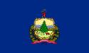 |
24923 km² (9,622.8 sq mi) | 625,741 | Montpelier Montpelier, Vermont Montpelier is a city in the U.S. state of Vermont that serves as the state capital and the shire town of Washington County. As the capital of Vermont, Montpelier is the site of the Vermont State House, seat of the legislative branch of Vermont government. The population was 7,855 at the 2010... |
Burlington Burlington, Vermont Burlington is the largest city in the U.S. state of Vermont and the shire town of Chittenden County. Burlington lies south of the U.S.-Canadian border and some south of Montreal.... |
Province of New York Province of New York The Province of New York was an English and later British crown territory that originally included all of the present U.S. states of New York, New Jersey, Delaware and Vermont, along with inland portions of Connecticut, Massachusetts, and Maine, as well as eastern Pennsylvania... and New Hampshire Grants New Hampshire Grants The New Hampshire Grants or Benning Wentworth Grants were land grants made between 1749 and 1764 by the provincial governor of New Hampshire, Benning Wentworth. The land grants, totaling about 135 , were made on land claimed by New Hampshire west of the Connecticut River, territory that was also... (ownership disputed); Vermont Republic Vermont Republic The term Vermont Republic has been used by later historians for the government of what became modern Vermont from 1777 to 1791. In July 1777 delegates from 28 towns met and declared independence from jurisdictions and land claims of British colonies in New Hampshire and New York. They also... |
|
| Virginia Virginia The Commonwealth of Virginia , is a U.S. state on the Atlantic Coast of the Southern United States. Virginia is nicknamed the "Old Dominion" and sometimes the "Mother of Presidents" after the eight U.S. presidents born there... |
/vərˈdʒɪnjə/ | VA |  |
110785 km² (42,774.3 sq mi) | 8,001,024 | Richmond Richmond, Virginia Richmond is the capital of the Commonwealth of Virginia, in the United States. It is an independent city and not part of any county. Richmond is the center of the Richmond Metropolitan Statistical Area and the Greater Richmond area... |
Virginia Beach Virginia Beach, Virginia Virginia Beach is an independent city located in the Hampton Roads metropolitan area of Virginia, on the Atlantic Ocean at the mouth of the Chesapeake Bay... |
Colony of Virginia, then sovereign state in Confederation | |
| Washington | /ˈwɒʃɪŋtən/ | WA |  |
184827 km² (71,362.1 sq mi) | 6,724,540 | Olympia Olympia, Washington Olympia is the capital city of the U.S. state of Washington and the county seat of Thurston County. It was incorporated on January 28, 1859. The population was 46,478 at the 2010 census... |
Seattle | Washington Territory Washington Territory The Territory of Washington was an organized incorporated territory of the United States that existed from February 8, 1853, until November 11, 1889, when the final extent of the territory was admitted to the Union as the State of Washington.... |
|
| West Virginia West Virginia West Virginia is a state in the Appalachian and Southeastern regions of the United States, bordered by Virginia to the southeast, Kentucky to the southwest, Ohio to the northwest, Pennsylvania to the northeast and Maryland to the east... |
/ˌwɛst vərˈdʒɪnjə/ | WV |  |
62755 km² (24,229.8 sq mi) | 1,852,994 | Charleston Charleston, West Virginia Charleston is the capital and largest city of the U.S. state of West Virginia. It is located at the confluence of the Elk and Kanawha Rivers in Kanawha County. As of the 2010 census, it has a population of 51,400, and its metropolitan area 304,214. It is the county seat of Kanawha County.Early... |
Charleston Charleston, West Virginia Charleston is the capital and largest city of the U.S. state of West Virginia. It is located at the confluence of the Elk and Kanawha Rivers in Kanawha County. As of the 2010 census, it has a population of 51,400, and its metropolitan area 304,214. It is the county seat of Kanawha County.Early... |
Divided off from Virginia Virginia The Commonwealth of Virginia , is a U.S. state on the Atlantic Coast of the Southern United States. Virginia is nicknamed the "Old Dominion" and sometimes the "Mother of Presidents" after the eight U.S. presidents born there... with the questionable consent of that state |
|
| Wisconsin Wisconsin Wisconsin is a U.S. state located in the north-central United States and is part of the Midwest. It is bordered by Minnesota to the west, Iowa to the southwest, Illinois to the south, Lake Michigan to the east, Michigan to the northeast, and Lake Superior to the north. Wisconsin's capital is... |
/wɪsˈkɒns |
WI |  |
169639 km² (65,498 sq mi) | 5,686,986 | Madison Madison, Wisconsin Madison is the capital of the U.S. state of Wisconsin and the county seat of Dane County. It is also home to the University of Wisconsin–Madison.... |
Milwaukee | Wisconsin Territory Wisconsin Territory The Territory of Wisconsin was an organized incorporated territory of the United States that existed from July 3, 1836, until May 29, 1848, when an eastern portion of the territory was admitted to the Union as the State of Wisconsin... , formed from the Northwest Territory Northwest Territory The Territory Northwest of the River Ohio, more commonly known as the Northwest Territory, was an organized incorporated territory of the United States that existed from July 13, 1787, until March 1, 1803, when the southeastern portion of the territory was admitted to the Union as the state of Ohio... |
|
| Wyoming Wyoming Wyoming is a state in the mountain region of the Western United States. The western two thirds of the state is covered mostly with the mountain ranges and rangelands in the foothills of the Eastern Rocky Mountains, while the eastern third of the state is high elevation prairie known as the High... |
/waɪˈoʊmɪŋ/ | WY |  |
253348 km² (97,818.2 sq mi) | 563,626 | Cheyenne Cheyenne, Wyoming Cheyenne is the capital and most populous city of the U.S. state of Wyoming and the county seat of Laramie County. It is the principal city of the Cheyenne, Wyoming, Metropolitan Statistical Area which encompasses all of Laramie County. The population is 59,466 at the 2010 census. Cheyenne is the... |
Cheyenne Cheyenne, Wyoming Cheyenne is the capital and most populous city of the U.S. state of Wyoming and the county seat of Laramie County. It is the principal city of the Cheyenne, Wyoming, Metropolitan Statistical Area which encompasses all of Laramie County. The population is 59,466 at the 2010 census. Cheyenne is the... |
Wyoming Territory Wyoming Territory The Territory of Wyoming was an organized incorporated territory of the United States that existed from July 25, 1868, until July 10, 1890, when it was admitted to the Union as the State of Wyoming. Cheyenne was the territorial capital... |
Lists
- List of capitals in the United States
- List of U.S. state constitutions
- List of U.S. state legislatures
- List of U.S. state name etymologies
- List of U.S. state residents names
- List of U.S. state tax levels
- List of U.S. states by area
- List of U.S. states by coastline
- List of U.S. states by date of statehood
- List of U.S. states by elevation
- List of U.S. states by fertility rate
- List of U.S. states by GDP (nominal)
- List of U.S. states by GDP per capita (nominal)
- List of U.S. states by income equality
- List of U.S. states by population
- List of U.S. states by population density
- List of U.S. states by time zone
- List of U.S. states by traditional abbreviation
- List of U.S. states by unemployment rate
- List of U.S. states that were never territories
- List of U.S. states' largest cities
- U.S. postal abbreviations
- U.S. state temperature extremesU.S. state temperature extremesThe following table lists the highest and lowest temperatures recorded in each state in the United States, in both Fahrenheit and Celsius.The following table lists the highest and lowest temperatures recorded in each state in the United States, in both Fahrenheit and Celsius.The following table...
- Codes: FIPS state codeFIPS state codeFIPS state codes were numeric and two-letter alphabetic codes defined in U.S. Federal Information Processing Standard Publication 5-2 to identify U.S. states and certain other associated areas...
, ISO 3166-2:USISO 3166-2:USISO 3166-2:US is the entry for the United States in ISO 3166-2, part of the ISO 3166 standard published by the International Organization for Standardization , which defines codes for the names of the principal subdivisions of all countries coded in ISO 3166-1.Currently for the United States, ISO... - Lists of U.S. state insignia:
- List of U.S. state amphibians
- List of U.S. state beverages
- List of U.S. state birds
- List of U.S. state butterflies
- List of U.S. state colors
- List of U.S. state crustaceans
- List of U.S. state dances
- List of U.S. state demonyms
- List of U.S. state dinosaurs
- List of U.S. state fish
- List of U.S. state flags
- List of U.S. state flowers
- List of U.S. state foods
- List of U.S. state fossils
- List of U.S. state grasses
- List of U.S. state insects
- List of U.S. state instruments
- List of U.S. state license plates
- List of U.S. state mammals
- List of U.S. state minerals, rocks, stones and gemstones
- List of U.S. state mottos
- List of U.S. state nicknames
- List of U.S. state poems
- List of U.S. state Poet Laureates
- List of U.S. state reptiles
- List of U.S. state seals
- List of U.S. state shells
- List of U.S. state ships
- List of U.S. state slogans
- List of U.S. state soils
- List of U.S. state songs
- List of U.S. state sports
- List of U.S. state tartans
- List of U.S. state toys
- List of U.S. state trees
See also
- List of fictional U.S. states
- List of regions of the United States
- List of U.S. counties that share names with U.S. states
External links
- Information about All States from UCB Libraries GovPubs
- State Resource Guides, from the Library of Congress
- Tables with areas, populations, densities and more (in order of population)
- Tables with areas, populations, densities and more (alphabetical)
- State and Territorial Governments on USA.gov
- StateMaster – statistical database for US States.
- U.S. States: Comparisons, rankings, demographics