

Vancouver Expedition
Encyclopedia
The Vancouver Expedition (1791–1795) was a four-and-a-half-year voyage of exploration and diplomacy, commanded by Captain George Vancouver
. The expedition circumnavigated the globe, touched five continents and changed the course of history for the indigenous nations and several European empires and their colonization of the Americas
. The expedition at various times included between two and four vessels, and up to 153 men, all but six of whom returned home safely.
and James Cook
, and the Spanish Manila-Acapulco galleons
trade route active since 1565, had established the strategic and commercial value of exploring and claiming the Pacific Ocean
access, both for its wealth in whales and furs and as a trade route to 'the Orient' - Asia
. Britain was especially interested in improving its knowledge of the Southern Pacific whale fisheries, and in particular the location of the strategically positioned Australia
, New Zealand
, the legendary Isla Grande, and the Northwest Passage
. A new ship was purchased, fitted out, and named Discovery
after one of Cook's ships. Her captain was Henry Roberts
and Vancouver his 1st Lieutenant.
Plans changed when the adventurer John Meares
reported that the Spanish had impounded his ship and hundreds of thousands of pounds' worth of goods at Nootka Sound
. Although it is now known that his claims of loss were somewhat exaggerated, Britain had recently beaten Spain at war and seemed ready for another go; Parliament readied the fleet in the Nootka Crisis
. Roberts and Vancouver left Discovery to serve in the Channel Fleet
while Discovery became a depot ship
for processing victims of the press gang
. The Spanish capitulated in the Nootka Sound Convention
, whose terms resulted in inconsistent instructions for the British and Spanish officers sent to implement them.
Vancouver returned to Discovery as the expedition's commander. According to his orders, he was "to receive back in form a restitution of the territories on which the Spaniards had seized, and also to make an accurate survey of the coast, from the 30th degree of north latitude northwestward toward Cook's River; and further, to obtain every possible information that could be collected respecting the natural and political state of that country." These explorations were in part to discover water communication into the North American interior (whether a Northwest Passage
or, more likely, navigable rivers) and to facilitate the researches of the expedition's politically well-connected botanist, Archibald Menzies
.
Following the mutiny on the Bounty
, the Admiralty had ordered the precaution that ships not make such long voyages alone; therefore the armed tender HMS Chatham
was assigned to the expedition. HMS Daedalus
would rendezvous at Nootka Sound
a year later with supplies. The expedition was supposed to take two or three years.
Most were naval officers or sailors, many of whom would distinguish themselves in future service, including Peter Puget
, Joseph Baker
, Joseph Whidbey
, William Broughton
, Zachary Mudge
, Thomas Manby
, and Robert Barrie
. There was a large detachment of Marines; whether these were to assist with exploration in hostile territory or to discourage mutiny is not recorded. Two 16-year-old aristocrats, the Honorable Thomas Pitt
(nephew of the Prime Minister) and the Honorable Charles Stuart (son of a Marquis), were brought aboard as able seamen; they proved troublesome.
Among the supernumeraries
were Menzies (who kept a meticulous journal of the expedition) and his servant John Ewin (or Ewing). A Hawaiian man named Towereroo
, whom Captain Charles Duncan had brought to England, was put on Discovery that he might return home. Finally, the Muster includes a Widow's Man, rated able seaman
, but in fact merely an accounting fiction.
on April 28; this was intended as a rest stop and opportunity to botanize, but ended in a drunken brawl in which several officers were thrown into the bay or beaten.
On May 7 the two ships left Tenerife; Chatham arrived at Cape Town
on June 6 and Discovery two days later. After more botanizing, socializing, and recruiting replacements for deserters, the ships left on August 17. The surgeon took ill during an outbreak of dysentery
(one sailor died); Menzies assumed his duties for the rest of the expedition.
On September 28 they landed in Australia
, at what Vancouver promptly named King George Sound
. They quickly surveyed the south coast of Australia and landed at Dusky Sound
, New Zealand on November 2 for resupplying and botanizing, before moving on on November 21. The ships proceeding separately, both discovered the sub-Antarctic Snares Islands (November 23) which Vancouver considered a severe shipping hazard (hence, the name). On route to Tahiti, the crew of Chatham furthermore discovered the Chatham Islands
before reaching the Polynesian island on November 26; Discovery arrived three days later.
Putting in at Tahiti, Vancouver enforced rigid discipline to avoid the personal connections that had led to Mutiny on the Bounty. Pitt was flogged for exchanging a piece of ship's iron for the romantic favors of a lady. Towareroo, not subject to such discipline, decided he preferred the comforts of Tahiti and had to be forced to leave.
He had been a young midshipman on Cook's fatal landing 13 years earlier, so avoided coming ashore at Kealakekua Bay
. He was disturbed by the frequent request for firearms, and tried to avoid escalating the on-going civil war, spending the winter in Oahu
.
He made arrangements for his tiny fleet to winter and re-supply in Hawaii for the duration of the expedition.
Discovery and Chatham proceeded to North America. On April 16 they made landfall at about 39°N and started a detailed survey northward. On April 28, they encountered the American Captain Gray of the Columbia Rediviva
with which they had a fruitful sharing of information; much of what Meares had told them about Gray's explorations, the latter said, was fiction.
In June of 1792, HMS Discovery
and Lieutenant Broughton's
HMS Chatham
lay anchored in a bay they named Birch Bay
.
Vancouver had decided to use his fleets' small boats for the detailed exploration and surveying of the region's complex and sometimes shallow waterways. On June 12, Vancouver, along with Puget and some of the crew, sailed north from Birch Bay in Discovery’s two smaller sailing yawls. In four days they found and charted a number of points and inlets, such as Point Roberts
, Point Grey
, Burrard Inlet
, Howe Sound
, and the Jervis Inlet
. On June 13, near Point Roberts
, Chatham
encountered the Sutil
and Mexicana
, of the Spanish exploring expedition.
On June 21, 1792, dealing with poor weather and dwindling food supplies, Vancouver decided to head back to HMS Discovery some 84 miles away; on their return they encountered the Spanish ships under the respective commands of Capt. Malaspina and Galiano (whom Lt. Broughton had already met), near present-day Vancouver
, British Columbia
. Both were exploring and mapping the Strait of Georgia, seeking a possible Northwest Passage and a determination of whether Vancouver Island was an island or part of the mainland. The two commanders established a friendly relationship and agreed to assist one another by dividing up the surveying work and sharing charts. They worked together in this way until July 13, after which each resumed circumnavigating Vancouver Island separately. Galiano's ships reached Nootka Sound
, completing the circuit, on August 31. Vancouver's ships had arrived earlier. Thus Vancouver was the first European to prove the insularity
of Vancouver Island (Meares' claims on the matter having been another casualty), while Galiano was the first to circumnavigate it. Vancouver had not set out from Nootka but rather began at the Strait of Juan de Fuca, while Galiano began his circumnavigation at Nootka.
In August, while Vancouver was exploring in small boats to the north, Daedalus arrived in Nootka Sound and dispatched the brig HMS Venus
with the news that her Captain, Richard Hergest, and William Gooch
, sent as astronomer
to the expedition, had been murdered on Oahu
. Vancouver and Whidbey shared astronomer duties, which later led to friction over pay. On August 11, the expedition sailed south, reaching Nootka Sound on August 28, where they exchanged friendly 13-gun salutes with a Spanish frigate commanded by Juan Francisco de la Bodega y Quadra
.
 Relations between Bodega y Quadra and Vancouver were very cordial and even friendly, but they could not reconcile their conflicting instructions and interpretations of the Nootka Convention
. They agreed to meet again at the Royal Presidio of Monterey, California
. On September 21 Bodega y Quadra left Nootka Sound and Salvador Fidalgo
became the commandant of the establishment there. Vancouver sent Lieutenant Mudge back to England on the tiny Portuguese-flagged trader Fenis and St. Joseph
to get further instructions.
The captain of the trading ship Jenny asked Vancouver to return two kidnapped girls to Hawaii. Thus enlarged, the expedition moved south; Whidbey in Daedelus surveying Grays Harbor while the other two ships dared the bar of the Columbia River
. The smaller Chatham made it over the bar and sent small boats upriver. Discovery, whose crew was beginning to suffer from scurvy
, proceeded to northern Spanish Las Californias
province, reaching the Golden Gate
and the Royal Presidio of San Francisco
on November 14 to a friendly and helpful reception from the Spanish. The other ships arrived by the 26th. Vancouver sailed south along the coast of Alta California
, visiting Chumash villages at Point Conception
and near Mission San Buenaventura
.
Bodega y Quadra offered to facilitate another message via New Spain
(Mexico) and the Atlantic route, however Vancouver sent Lt. Broughton. Puget took his place as HMS Chatham
s Commander, angering Menzies who preferred his friend James Johnstone
, sailing master of Chatham.
After resting and reprovisioning, the expedition returned to Hawaii to winter.
 The Discovery sailed around the north side of the Island of Hawaii
, and the Chatham the south, meeting at Kealakekua Bay
.
He left some cattle, sheep, and more plants that Menzies had collected in California. He met the British Sailor John Young
, who acted as an interpreter and helped negotiate with King Kamehameha I
. He conducted surveys and impressed Kamehameha I with the reach of British power while Menzies collected specimens.
Over the winter, Vancouver ordered numerous improvements to the small boats that did the detailed survey work, to provide better shelter and supplies for the crew. These improvements enabled the crews to continue their survey of one of the most complex coasts in the world, proceeding to about 56°30'N until weather ended the survey season.
They reached Fitz Hugh Sound
on May 26, arriving at what Vancouver named Restoration Cove two days later. Vancouver, with two of the boats, explored Cascade
, Cousins
and Roscoe Inlet
s and Fisher
and Dean Channel
s, while Johnstone explored Burke Channel
and North
and South Bentinck Arms. The former, in passing the north point of what he named King Island
, proved its insular nature. The day before leaving Restoration Cove (June 10), Johnstone was again sent out to explore. The ships meanwhile sailed to the rendezvous east of Yeo Island
, where Johnstone met them on June 18, having explored Spiller
and Mussel Inlet
s and Bullock
, Spiller
, Mathieson
, and Finlayson Channel
s—in doing so sailing around Yeo, Pooley
, Roderick
, Susan
, and Dowager Island
s.
They left their anchorage on June 19, proceeding up Finlayson and Princess Royal Channel
s along the east side of Princess Royal Island
, anchoring two-thirds up its east coast two days later. From here, Johnstone and Barrie were dispatched to the north, returning on the 29th. They explored the northern reaches of Princess Royal Channel, as well as Whale and Squally Channels, circumnavigating Gil Island
in the process—named by Jacinto Caamaño
the previous year. The day after their return they sailed out of their cove to another one further north, where they awaited Whidbey's return, who had been sent out to survey the continental shore a day after Johnstone and Barrie. He returned July 3, having circumnavigated what was named "Hawkesbury's Island" (really four islands: Gribbell
, Loretta, Hawkesbury
, and Maitland Islands) and explored Gardner Canal
, Ursula
, Devastation
and Douglas Channel
s and Kitimat and Kildala Arms.
After dispatching Whidbey and Barrie to the north, the ships anchored off the north coast of Gil Island
. They returned on the 15th, after having explored Gilttoyees Inlet
and the length of Grenville Channel
to the northwest point of Porcher Island
. The same day the ships left, sailing up Principe Channel
between Banks
and Pitt Islands. On the 21st they were hit by a storm, only being saved by the timely arrival of a whaleboat
sent out from the Butterworth of London, under William Brown, whose squardron was safely anchored off the north coast of Stephens Island. From Brown they learned of a "large opening" to the north (Clarence Strait
), which he had earlier investigated. With this news, the ships left the next day, reaching Salmon Cove, on the west side of Observatory Inlet
, two days later. The same day (July 24), Johnstone and Barrie were sent out; the following day Vancouver left. While Vancouver explored to the heads of Portland Canal
, Fillmore
and Nakat Inlet
s, and Boca de Quadra and circumnavigated Revillagigedo Island
(during which they were attacked by Tlingit near what was named Escape Point, having two of his men injured), Johnstone and Barrie explored the channels to the southeast, including Work Channel
and Khutzeymateen
and Quottoon Inlet
s.
They left Salmon Cove on August 18, arriving in Port Stewart, just to the west of Revillagigedo Island, a few days later. From here, Johnstone went to the north, circumnavigating what was named "Duke of York's Island" (in reality three islands: Wrangell
, Zarembo
, and Etolin Island
s), as well as sighting Mitkof Island
and exploring to the head of Duncan Canal
. On September 6, a few days after his return, they weighed anchor, sailing to what was named Port Protection, on the northwest coast of Prince of Wales Island—which they reached a couple days later. The boats were once again sent out: Johnstone charted the south coast of Kupreanof Island
, while Whidbey explored the southeast part of Kuiu Island
, reaching the head of Affleck Canal
. The latter returned on September 21; the ships left Port Protection the next day.
Again, the expedition visited Nootka Sound (where there was no resolution of the conflicting orders), Spanish Alta California, and Hawaii.
. They summitted on February 16 and, using a barometer, measured its height to within 50 feet of the modernly accepted value.
Vancouver continued to negotiate with Kamehameha; on February 25, the King made a formal proclamation of accession, declaring that they were "Tanata no Britanee" (People of Britain). Precisely what Kamehameha meant by this may not be entirely clear since Britain exerted no sovereignty over the islands during his reign. However, Vancouver's assistance to the King was helpful, particularly in lending tools and skilled workers for building him an armed 36-foot craft, the Britannia. The armaments may have aided Kamehameha's decisive win at Battle of Nu'uanu
.
The expedition left Hawaii for the final time on March 15, 1794. They spent late April and early May charting the furthest reaches of what Vancouver renamed Cook Inlet
; Vancouver himself reached the head of Knik Arm, while Whidbey reached the head of Turnagain Arm. The last days of May and the second half of June were spent charting Prince William Sound
: Whidbey the western half to Bligh Island, and Johnstone from there east and southwards. From here the expedition worked its way eastward. The weather was often freezing, as a result of which not only their store of live turtles (kept for meat) but Menzies' quarterdeck greenhouse froze, killing all his plants. While at Cook Inlet and Prince William Sound, they traded with the Russian settlements and natives alike.
By July 9 they had anchored in what was named Port Althorp, a cove on the northwest coast of Chichagof Island
. Soon Whidbey was dispatched to survey the area. He returned on the 27th. Despite constant rain and more than one hostile encounter with a large group of Tlingits, he was able to explore up Lynn Canal
to the heads of both Chilkat
and Chilkoot Inlet
s, and follow the length of the west coast of what was later named Admiralty Island
, rounding its southern point to spend a night near Point Townshend on its southeast coast.
They left Port Althorp a few days later, sailing south along the west coasts of Chichagof and Baranof Island
s. On the morning of August 2 they reached a cove on the southeast coast of the latter island, which Vancouver later named Port Conclusion. Two boat parties under Whidbey and Johnstone were sent out the next morning; both returned on the 20th "in the midst of a deluge of rain". While Whidbey proceeded up Stephens Passage
and completed the survey of the east coast of Admiralty Island (including Seymour Canal
and Glass Peninsula
) and the continental shore opposite it, Johnstone charted the west, north, and east coasts of Kuiu Island, proving its insularity; the two met each other off the northeast coast of Kupreanof Island, Whidbey having investigated the channel to the east of the island before being stopped by shoals. According to the diaries of several officers, with the completion of their survey, they felt great joy at realizing they could return home. A few days after their return they left Port Conclusion. Unfortunately, as they set out for Nootka, Isaac Wooden was lost in a boating accident off Cape Ommaney, one of the few to die on the expedition. The treacherous rocks off the Cape were accordingly named Wooden Rocks.
Vancouver advanced to post rank on August 28, 1794. Four days later, Discovery and Chatham put into Nootka; all were saddened to learn that Quadra had suddenly died. Brigadier General Don Jose Alava, the new Governor of Nootka, was cooperative and friendly, but no instructions had arrived to enable the commanders to resolve the situation. Alava and Vancouver were on friendly terms, jointly conducting local explorations, including a large celebration with Maquinna
. On October 6, the survey ships departed for Monterey. Daedelus was sent back to England with the troublesome Mr. Pitt, who had worn out his welcome with multiple disciplinary infractions.
On November 6, Discovery put into Monterey in Alta California, to learn that while negotiations had most likely been concluded in Europe, there were still no instructions. The expedition left on December 2, reached the Tres Maria Islands
on December 17 for provisions and botanizing, and spent Christmas at sea.
and the Juan Fernández Islands
, reprovisioning whenever possible but beginning to suffer from scurvy.
Although they had orders to avoid Spanish possessions in the Pacific, necessity required some refitting and they had, in addition, orders to survey as much of the coast as possible. Vancouver therefore put into Valparaiso
in the Viceroyalty of Peru
and present day Chile
, on March 25 for five weeks of repairs with the help of the Spanish. The expedition's officers enjoyed an official visit to the Capitan General and Royal Governor of Chile, Don Ambrosio O'Higgins de Vallenar
, at the capital St. Iago
.
On May 5, Discovery and Chatham sailed from Valparaiso, planning to reunite at St. Helena should weather separate them. The onset of Southern Hemisphere's winter and the badly worn condition of the ships made further survey of the Chilean coast impractical and passage for Cape Horn
hazardous. Nonetheless, Vancouver spent much time searching for the island of Isla Grande, previously reported at 46.40.S, and confirmed its nonexistence.
About this time, Lt. Broughton and Lt. Mudge left England in to assist Vancouver; they reached Monterey long after the expedition made its final departure. Deciding (correctly) that Vancouver would not have left his surveying task unfinished, they departed to chart the coast of east Asia.
On July 2, Discovery and Chatham put in at St. Helena and learned that the nation was at war; their battered ships were nearly the weakest vessels in the Atlantic. However, they captured a Dutch East Indiaman by surprise. This proved a mixed blessing; putting a crew on the prize required Vancouver to get additional hands where he could. During a storm, he ordered Menzies' servant aloft, leaving Menzies' plants to be damaged; this further angered Menzies.
Off the Cape Verde Islands, Discovery caught up with a British convey escorted by HMS Sceptre
and, in relative safety, arrived at Shannon. Vancouver departed the ship to report; Baker brought Discovery safely home to Long Reach on the Thames, completing her four-and-a-half-year mission on October 20, 1795.
challenged Vancouver to a duel and attempted to beat him on a London streetcorner. Vancouver was no match for the powers ranged against him, and he was dying besides. His massive cartographical work was a few hundred pages short of completion at his death on May 10, 1798, but finished by Puget.
Geopolitically, the expedition helped remove Spain as a power in the North Pacific and to define the boundaries of the Anglo-American conflict there. It also assisted the unification of the Kingdom of Hawai'i and further established British domination of Australia-New Zealand. The expedition left the world hundreds, perhaps thousands, of place-names and plant species
names.
George Vancouver
Captain George Vancouver RN was an English officer of the British Royal Navy, best known for his 1791-95 expedition, which explored and charted North America's northwestern Pacific Coast regions, including the coasts of contemporary Alaska, British Columbia, Washington and Oregon...
. The expedition circumnavigated the globe, touched five continents and changed the course of history for the indigenous nations and several European empires and their colonization of the Americas
European colonization of the Americas
The start of the European colonization of the Americas is typically dated to 1492. The first Europeans to reach the Americas were the Vikings during the 11th century, who established several colonies in Greenland and one short-lived settlement in present day Newfoundland...
. The expedition at various times included between two and four vessels, and up to 153 men, all but six of whom returned home safely.
Origin
Several previous voyages of exploration including those of Ferdinand MagellanFerdinand Magellan
Ferdinand Magellan was a Portuguese explorer. He was born in Sabrosa, in northern Portugal, and served King Charles I of Spain in search of a westward route to the "Spice Islands" ....
and James Cook
James Cook
Captain James Cook, FRS, RN was a British explorer, navigator and cartographer who ultimately rose to the rank of captain in the Royal Navy...
, and the Spanish Manila-Acapulco galleons
Manila Galleon
The Manila galleons or Manila-Acapulco galleons were Spanish trading ships that sailed once or twice per year across the Pacific Ocean between Manila in the Philippines, and Acapulco, New Spain . The name changed reflecting the city that the ship was sailing from...
trade route active since 1565, had established the strategic and commercial value of exploring and claiming the Pacific Ocean
Pacific Ocean
The Pacific Ocean is the largest of the Earth's oceanic divisions. It extends from the Arctic in the north to the Southern Ocean in the south, bounded by Asia and Australia in the west, and the Americas in the east.At 165.2 million square kilometres in area, this largest division of the World...
access, both for its wealth in whales and furs and as a trade route to 'the Orient' - Asia
Asia
Asia is the world's largest and most populous continent, located primarily in the eastern and northern hemispheres. It covers 8.7% of the Earth's total surface area and with approximately 3.879 billion people, it hosts 60% of the world's current human population...
. Britain was especially interested in improving its knowledge of the Southern Pacific whale fisheries, and in particular the location of the strategically positioned Australia
Australia
Australia , officially the Commonwealth of Australia, is a country in the Southern Hemisphere comprising the mainland of the Australian continent, the island of Tasmania, and numerous smaller islands in the Indian and Pacific Oceans. It is the world's sixth-largest country by total area...
, New Zealand
New Zealand
New Zealand is an island country in the south-western Pacific Ocean comprising two main landmasses and numerous smaller islands. The country is situated some east of Australia across the Tasman Sea, and roughly south of the Pacific island nations of New Caledonia, Fiji, and Tonga...
, the legendary Isla Grande, and the Northwest Passage
Northwest Passage
The Northwest Passage is a sea route through the Arctic Ocean, along the northern coast of North America via waterways amidst the Canadian Arctic Archipelago, connecting the Atlantic and Pacific Oceans...
. A new ship was purchased, fitted out, and named Discovery
HMS Discovery (1789)
HMS Discovery was a Royal Navy ship launched in 1789 and best known as the lead ship in George Vancouver's exploration of the west coast of North America in his famous 1791-1795 expedition. She was converted to a bomb vessel in 1798 and participated in the Battle of Copenhagen. Thereafter she...
after one of Cook's ships. Her captain was Henry Roberts
Henry Roberts (captain)
Henry Roberts was an officer in the Royal Navy who served with Captain Cook on his last two voyages.Roberts served as lieutenant on Cook's HMS Discovery, where he was entrusted with many hydrographic and cartographic tasks, and also met then-midshipman George Vancouver...
and Vancouver his 1st Lieutenant.
Plans changed when the adventurer John Meares
John Meares
John Meares was a navigator, explorer, and maritime fur trader, best known for his role in the Nootka Crisis, which brought Britain and Spain to the brink of war.- Career :...
reported that the Spanish had impounded his ship and hundreds of thousands of pounds' worth of goods at Nootka Sound
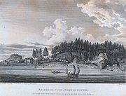
Nootka Sound
Nootka Sound is a complex inlet or sound of the Pacific Ocean on the rugged west coast of Vancouver Island, in the Canadian province of British Columbia. Historically also known as King George's Sound, as a strait it separates Vancouver Island and Nootka Island.-History:The inlet is part of the...
. Although it is now known that his claims of loss were somewhat exaggerated, Britain had recently beaten Spain at war and seemed ready for another go; Parliament readied the fleet in the Nootka Crisis
Nootka Crisis
The Nootka Crisis was an international incident and political dispute between the Kingdom of Great Britain and the Kingdom of Spain, triggered by a series of events that took place during the summer of 1789 at Nootka Sound...
. Roberts and Vancouver left Discovery to serve in the Channel Fleet
Channel Fleet
The Channel Fleet was the Royal Navy formation of warships that defended the waters of the English Channel from 1690 to 1909.-History:The Channel Fleet dates back at least to 1690 when its role was to defend England against the French threat under the leadership of Edward Russell, 1st Earl of...
while Discovery became a depot ship
Depot ship
A depot ship is a ship which acts as a mobile or fixed base for other ships and submarines or supports a naval base. Depot ships may be specifically designed for their purpose or be converted from another purpose...
for processing victims of the press gang
Impressment
Impressment, colloquially, "the Press", was the act of taking men into a navy by force and without notice. It was used by the Royal Navy, beginning in 1664 and during the 18th and early 19th centuries, in wartime, as a means of crewing warships, although legal sanction for the practice goes back to...
. The Spanish capitulated in the Nootka Sound Convention
Nootka Convention
The Nootka Conventions were a series of three agreements between the Kingdom of Spain and the Kingdom of Great Britain, signed in the 1790s which averted a war between the two empires over overlapping claims to portions of the Pacific Northwest coast of North America.The claims of Spain dated back...
, whose terms resulted in inconsistent instructions for the British and Spanish officers sent to implement them.
Vancouver returned to Discovery as the expedition's commander. According to his orders, he was "to receive back in form a restitution of the territories on which the Spaniards had seized, and also to make an accurate survey of the coast, from the 30th degree of north latitude northwestward toward Cook's River; and further, to obtain every possible information that could be collected respecting the natural and political state of that country." These explorations were in part to discover water communication into the North American interior (whether a Northwest Passage
Northwest Passage
The Northwest Passage is a sea route through the Arctic Ocean, along the northern coast of North America via waterways amidst the Canadian Arctic Archipelago, connecting the Atlantic and Pacific Oceans...
or, more likely, navigable rivers) and to facilitate the researches of the expedition's politically well-connected botanist, Archibald Menzies
Archibald Menzies
Archibald Menzies was a Scottish surgeon, botanist and naturalist.- Life and career :Menzies was born at Easter Stix in the parish of Weem, in Perthshire. While working with his elder brother William at the Royal Botanic Gardens, he drew the attention of Dr John Hope, professor of botany at...
.
Following the mutiny on the Bounty
Mutiny on the Bounty
The mutiny on the Bounty was a mutiny that occurred aboard the British Royal Navy ship HMS Bounty on 28 April 1789, and has been commemorated by several books, films, and popular songs, many of which take considerable liberties with the facts. The mutiny was led by Fletcher Christian against the...
, the Admiralty had ordered the precaution that ships not make such long voyages alone; therefore the armed tender HMS Chatham
HMS Chatham (1788)
HMS Chatham was a Royal Navy survey brig that accompanied HMS Discovery on George Vancouver's exploration of the west coast of North America in his 1791–1795 expedition. Chatham was built by King, of Dover and launched in early 1788...
was assigned to the expedition. HMS Daedalus
HMS Daedalus (1780)
HMS Daedalus was a 32-gun fifth rate frigate of the Royal Navy, launched in 1780 from the yards of John Fisher, of Liverpool. She went on to serve in the American War of Independence, as well as the French Revolutionary and Napoleonic Wars....
would rendezvous at Nootka Sound
Nootka Sound
Nootka Sound is a complex inlet or sound of the Pacific Ocean on the rugged west coast of Vancouver Island, in the Canadian province of British Columbia. Historically also known as King George's Sound, as a strait it separates Vancouver Island and Nootka Island.-History:The inlet is part of the...
a year later with supplies. The expedition was supposed to take two or three years.
The Muster
The Muster of the expedition lists 153 men.Most were naval officers or sailors, many of whom would distinguish themselves in future service, including Peter Puget
Peter Puget
Peter Puget was an officer in the Royal Navy, best known for his exploration of Puget Sound.-Mr. Midshipman Puget:Puget's ancestors had fled France for Britain during Louis XIV's persecution of the Huguenots. His father, John, was a successful merchant and banker, but died in 1767, leaving Puget's...
, Joseph Baker
Joseph Baker (captain)
Joseph Baker was an officer in the Royal Navy, best known for his role in the mapping of the Pacific Northwest Coast of America during the Vancouver Expedition of 1791-1795. Mt. Baker is named after him.-Voyaging with Vancouver:...
, Joseph Whidbey
Joseph Whidbey
Joseph Whidbey was a member of the Royal Navy who served on the Vancouver Expedition 1791–1795, and later achieved renown as a naval engineer. He is notable for having been the first European to discover and chart Admiralty Island in the Alexander Archipelago in 1794.Little is recorded of...
, William Broughton
William Robert Broughton
William Robert Broughton was a British naval officer in the late 18th century. As a Lieutenant in the Royal Navy, he commanded HMS Chatham as part of the Vancouver Expedition, a voyage of exploration through the Pacific Ocean led by Captain George Vancouver in the early 1790s.-With Vancouver:In...
, Zachary Mudge
Zachary Mudge
Zachary Mudge was an officer in the Royal Navy, best known for serving in the historic Vancouver Expedition.-Early life:...
, Thomas Manby
Thomas Manby
Thomas Moore Manby was a British naval officer who fought in the French Revolutionary Wars and Napoleonic Wars and later rose to the rank of rear admiral...
, and Robert Barrie
Robert Barrie
Sir Robert Barrie KCB, KCH was a British officer of the Royal Navy noted for his service in the War of 1812....
. There was a large detachment of Marines; whether these were to assist with exploration in hostile territory or to discourage mutiny is not recorded. Two 16-year-old aristocrats, the Honorable Thomas Pitt
Thomas Pitt, 2nd Baron Camelford
Thomas Pitt, 2nd Baron Camelford was a British peer, naval officer and wastrel, best known for bedevilling George Vancouver during and after the latter's great voyage of exploration.-Early life:...
(nephew of the Prime Minister) and the Honorable Charles Stuart (son of a Marquis), were brought aboard as able seamen; they proved troublesome.
Among the supernumeraries
Supernumerary
A Supernumerary is an additional member of an organization. A supernumerary is also a non-regular member of a staff, a member of the staff or an employee who works in a public office who is not part of the manpower complement...
were Menzies (who kept a meticulous journal of the expedition) and his servant John Ewin (or Ewing). A Hawaiian man named Towereroo
Towereroo
Towereroo was the first Hawaiian to visit Europe. He returned to the Hawaiian islands on the Vancouver Expedition in 1792. Although during his time the British spelled his name "Toweroo", it would probably be Kualelo with modern Hawaiian language spelling.-Travels:An inhabitant of the island of...
, whom Captain Charles Duncan had brought to England, was put on Discovery that he might return home. Finally, the Muster includes a Widow's Man, rated able seaman
Able seaman
An able seaman is an unlicensed member of the deck department of a merchant ship. An AB may work as a watchstander, a day worker, or a combination of these roles.-Watchstander:...
, but in fact merely an accounting fiction.
1791
On April 1, 1791 Discovery and Chatham set sail. They reached Santa Cruz in TenerifeTenerife
Tenerife is the largest and most populous island of the seven Canary Islands, it is also the most populated island of Spain, with a land area of 2,034.38 km² and 906,854 inhabitants, 43% of the total population of the Canary Islands. About five million tourists visit Tenerife each year, the...
on April 28; this was intended as a rest stop and opportunity to botanize, but ended in a drunken brawl in which several officers were thrown into the bay or beaten.
On May 7 the two ships left Tenerife; Chatham arrived at Cape Town
Cape Town
Cape Town is the second-most populous city in South Africa, and the provincial capital and primate city of the Western Cape. As the seat of the National Parliament, it is also the legislative capital of the country. It forms part of the City of Cape Town metropolitan municipality...
on June 6 and Discovery two days later. After more botanizing, socializing, and recruiting replacements for deserters, the ships left on August 17. The surgeon took ill during an outbreak of dysentery
Dysentery
Dysentery is an inflammatory disorder of the intestine, especially of the colon, that results in severe diarrhea containing mucus and/or blood in the faeces with fever and abdominal pain. If left untreated, dysentery can be fatal.There are differences between dysentery and normal bloody diarrhoea...
(one sailor died); Menzies assumed his duties for the rest of the expedition.
On September 28 they landed in Australia
Australia
Australia , officially the Commonwealth of Australia, is a country in the Southern Hemisphere comprising the mainland of the Australian continent, the island of Tasmania, and numerous smaller islands in the Indian and Pacific Oceans. It is the world's sixth-largest country by total area...
, at what Vancouver promptly named King George Sound
King George Sound
King George Sound is the name of a sound on the south coast of Western Australia. Located at , it is the site of the city of Albany.The sound covers an area of and varies in depth from to ....
. They quickly surveyed the south coast of Australia and landed at Dusky Sound
Dusky Sound
Dusky Sound is a fiord on the south west corner of New Zealand, in Fiordland National Park.-Geography:One of the most complex of the many fjords on this coast, it is also one of the largest, 40 kilometres in length and eight kilometres wide at its widest point...
, New Zealand on November 2 for resupplying and botanizing, before moving on on November 21. The ships proceeding separately, both discovered the sub-Antarctic Snares Islands (November 23) which Vancouver considered a severe shipping hazard (hence, the name). On route to Tahiti, the crew of Chatham furthermore discovered the Chatham Islands
Chatham Islands
The Chatham Islands are an archipelago and New Zealand territory in the Pacific Ocean consisting of about ten islands within a radius, the largest of which are Chatham Island and Pitt Island. Their name in the indigenous language, Moriori, means Misty Sun...
before reaching the Polynesian island on November 26; Discovery arrived three days later.
Putting in at Tahiti, Vancouver enforced rigid discipline to avoid the personal connections that had led to Mutiny on the Bounty. Pitt was flogged for exchanging a piece of ship's iron for the romantic favors of a lady. Towareroo, not subject to such discipline, decided he preferred the comforts of Tahiti and had to be forced to leave.
1792
Proceeding to winter in Hawaii, Vancouver arrived in March of 1792.He had been a young midshipman on Cook's fatal landing 13 years earlier, so avoided coming ashore at Kealakekua Bay
Kealakekua Bay
Kealakekua Bay is located on the Kona coast of the island of Hawaii about south of Kailua-Kona.Settled over a thousand years ago, the surrounding area contains many archeological and historical sites such as religious temples, and was listed in the National Register of Historic Places listings on...
. He was disturbed by the frequent request for firearms, and tried to avoid escalating the on-going civil war, spending the winter in Oahu
Oahu
Oahu or Oahu , known as "The Gathering Place", is the third largest of the Hawaiian Islands and most populous of the islands in the U.S. state of Hawaii. The state capital Honolulu is located on the southeast coast...
.
He made arrangements for his tiny fleet to winter and re-supply in Hawaii for the duration of the expedition.
Discovery and Chatham proceeded to North America. On April 16 they made landfall at about 39°N and started a detailed survey northward. On April 28, they encountered the American Captain Gray of the Columbia Rediviva
Columbia Rediviva
Columbia Rediviva was a privately owned ship under the command of John Kendrick, along with Captain Robert Gray, best known for going to the Pacific Northwest for the maritime fur trade. The "Rediviva" was added to her name upon a rebuilding in 1787...
with which they had a fruitful sharing of information; much of what Meares had told them about Gray's explorations, the latter said, was fiction.
In June of 1792, HMS Discovery
HMS Discovery (1789)
HMS Discovery was a Royal Navy ship launched in 1789 and best known as the lead ship in George Vancouver's exploration of the west coast of North America in his famous 1791-1795 expedition. She was converted to a bomb vessel in 1798 and participated in the Battle of Copenhagen. Thereafter she...
and Lieutenant Broughton's
William Robert Broughton
William Robert Broughton was a British naval officer in the late 18th century. As a Lieutenant in the Royal Navy, he commanded HMS Chatham as part of the Vancouver Expedition, a voyage of exploration through the Pacific Ocean led by Captain George Vancouver in the early 1790s.-With Vancouver:In...
HMS Chatham
HMS Chatham (1788)
HMS Chatham was a Royal Navy survey brig that accompanied HMS Discovery on George Vancouver's exploration of the west coast of North America in his 1791–1795 expedition. Chatham was built by King, of Dover and launched in early 1788...
lay anchored in a bay they named Birch Bay
Birch Bay, Washington
-External links:*...
.
Vancouver had decided to use his fleets' small boats for the detailed exploration and surveying of the region's complex and sometimes shallow waterways. On June 12, Vancouver, along with Puget and some of the crew, sailed north from Birch Bay in Discovery’s two smaller sailing yawls. In four days they found and charted a number of points and inlets, such as Point Roberts
Point Roberts, Washington
Point Roberts is an unincorporated community in Whatcom County, Washington, United States. It has a post office, with the ZIP code of 98281, whose ZIP Code Tabulation Area had a population of 1,314 at the 2010 census.A geopolitical oddity, Point Roberts is a part of the United States that is not...
, Point Grey
West Point Grey
West Point Grey is a neighbourhood on the western side of the city of Vancouver, British Columbia, Canada. It is bordered by 16th Avenue to the south, Alma Street to the east, English Bay to the north, and Blanca Street to the west...
, Burrard Inlet
Burrard Inlet
Burrard Inlet is a relatively shallow-sided coastal fjord in southwestern British Columbia, Canada. Formed during the last Ice Age, it separates the City of Vancouver and the rest of the low-lying Burrard Peninsula from the slopes of the North Shore Mountains, home to the communities of West...
, Howe Sound
Howe Sound
Howe Sound is a roughly triangular sound, actually a network of fjords situated immediately northwest of Vancouver.-Geography:Howe Sound's mouth at the Strait of Georgia is situated between West Vancouver and the Sunshine Coast. The sound is triangular shaped, open on its southeast towards the...
, and the Jervis Inlet
Jervis Inlet
Jervis Inlet is a principal inlet of the British Columbia Coast, about northwest of Vancouver.-Geography:It stretches from its head at the mouth of the short Skwakwa River to its opening into the Strait of Georgia near Texada Island...
. On June 13, near Point Roberts
Point Roberts, Washington
Point Roberts is an unincorporated community in Whatcom County, Washington, United States. It has a post office, with the ZIP code of 98281, whose ZIP Code Tabulation Area had a population of 1,314 at the 2010 census.A geopolitical oddity, Point Roberts is a part of the United States that is not...
, Chatham
HMS Chatham (1788)
HMS Chatham was a Royal Navy survey brig that accompanied HMS Discovery on George Vancouver's exploration of the west coast of North America in his 1791–1795 expedition. Chatham was built by King, of Dover and launched in early 1788...
encountered the Sutil
Sutil (ship)
The Sutil was a brig-rigged schooner built in 1791 by the Spanish Navy at San Blas, New Spain. It was nearly identical to the Mexicana, also built at San Blas in 1791...
and Mexicana
Mexicana (ship)
The Mexicana was a topsail schooner built in 1791 by the Spanish Navy at San Blas, New Spain. It was nearly identical to the Sutil, also built at San Blas later in 1791...
, of the Spanish exploring expedition.
On June 21, 1792, dealing with poor weather and dwindling food supplies, Vancouver decided to head back to HMS Discovery some 84 miles away; on their return they encountered the Spanish ships under the respective commands of Capt. Malaspina and Galiano (whom Lt. Broughton had already met), near present-day Vancouver
Vancouver
Vancouver is a coastal seaport city on the mainland of British Columbia, Canada. It is the hub of Greater Vancouver, which, with over 2.3 million residents, is the third most populous metropolitan area in the country,...
, British Columbia
British Columbia
British Columbia is the westernmost of Canada's provinces and is known for its natural beauty, as reflected in its Latin motto, Splendor sine occasu . Its name was chosen by Queen Victoria in 1858...
. Both were exploring and mapping the Strait of Georgia, seeking a possible Northwest Passage and a determination of whether Vancouver Island was an island or part of the mainland. The two commanders established a friendly relationship and agreed to assist one another by dividing up the surveying work and sharing charts. They worked together in this way until July 13, after which each resumed circumnavigating Vancouver Island separately. Galiano's ships reached Nootka Sound
Nootka Sound
Nootka Sound is a complex inlet or sound of the Pacific Ocean on the rugged west coast of Vancouver Island, in the Canadian province of British Columbia. Historically also known as King George's Sound, as a strait it separates Vancouver Island and Nootka Island.-History:The inlet is part of the...
, completing the circuit, on August 31. Vancouver's ships had arrived earlier. Thus Vancouver was the first European to prove the insularity
Insularity
Insularity reflects a wide range of physical and emotional meanings in accordance with a person or place:* For a place, it relates to an island or any physically isolated place distant and inaccessible without sufficient means of transport...
of Vancouver Island (Meares' claims on the matter having been another casualty), while Galiano was the first to circumnavigate it. Vancouver had not set out from Nootka but rather began at the Strait of Juan de Fuca, while Galiano began his circumnavigation at Nootka.
In August, while Vancouver was exploring in small boats to the north, Daedalus arrived in Nootka Sound and dispatched the brig HMS Venus
HMS Venus
Five ships of the Royal Navy have borne the name HMS Venus, after Venus, the goddess of love in Roman mythology: was a 36-gun fifth rate launched in 1758. She was reduced to 32 guns in 1792 and renamed HMS Heroine in 1809. She was sold in 1828. was a 36-gun fifth rate captured from the Danish in...
with the news that her Captain, Richard Hergest, and William Gooch
William Gooch
Sir William Gooch, 1st Baronet , born in Great Yarmouth, Norfolk, England, and died in London, served as Governor of Virginia from 1727 through 1749...
, sent as astronomer
Astronomer
An astronomer is a scientist who studies celestial bodies such as planets, stars and galaxies.Historically, astronomy was more concerned with the classification and description of phenomena in the sky, while astrophysics attempted to explain these phenomena and the differences between them using...
to the expedition, had been murdered on Oahu
Oahu
Oahu or Oahu , known as "The Gathering Place", is the third largest of the Hawaiian Islands and most populous of the islands in the U.S. state of Hawaii. The state capital Honolulu is located on the southeast coast...
. Vancouver and Whidbey shared astronomer duties, which later led to friction over pay. On August 11, the expedition sailed south, reaching Nootka Sound on August 28, where they exchanged friendly 13-gun salutes with a Spanish frigate commanded by Juan Francisco de la Bodega y Quadra
Juan Francisco de la Bodega y Quadra
Juan Francisco de la Bodega y Quadra was a Spanish naval officer born in Lima, Peru. Assigned to the Pacific coast Spanish Naval Department base at San Blas, in the Viceroyalty of New Spain , this navigator explored the Northwest Coast of North America as far north as present day Alaska.Juan...
.
Nootka Convention
The Nootka Conventions were a series of three agreements between the Kingdom of Spain and the Kingdom of Great Britain, signed in the 1790s which averted a war between the two empires over overlapping claims to portions of the Pacific Northwest coast of North America.The claims of Spain dated back...
. They agreed to meet again at the Royal Presidio of Monterey, California
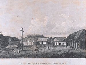
Monterey, California
The City of Monterey in Monterey County is located on Monterey Bay along the Pacific coast in Central California. Monterey lies at an elevation of 26 feet above sea level. As of the 2010 census, the city population was 27,810. Monterey is of historical importance because it was the capital of...
. On September 21 Bodega y Quadra left Nootka Sound and Salvador Fidalgo
Salvador Fidalgo
Salvador Fidalgo y Lopegarcía was a Spanish explorer who commanded an exploring expedition for Spain to Alaska and the Pacific Northwest during the late 18th century.-Early career:...
became the commandant of the establishment there. Vancouver sent Lieutenant Mudge back to England on the tiny Portuguese-flagged trader Fenis and St. Joseph
Fenis and St. Joseph
Fenis and St. Joseph, also known as the Sao Jao y Fenix or the San José el Fénix, was a 50 foot brig that visited Nootka Sound in 1792. It bore a Portuguese flag of convenience, possibly out of Macau and had a Portuguese captain, João de Barros Andrade, but had the Englishman Robert Duffin on board...
to get further instructions.
The captain of the trading ship Jenny asked Vancouver to return two kidnapped girls to Hawaii. Thus enlarged, the expedition moved south; Whidbey in Daedelus surveying Grays Harbor while the other two ships dared the bar of the Columbia River
Columbia River
The Columbia River is the largest river in the Pacific Northwest region of North America. The river rises in the Rocky Mountains of British Columbia, Canada, flows northwest and then south into the U.S. state of Washington, then turns west to form most of the border between Washington and the state...
. The smaller Chatham made it over the bar and sent small boats upriver. Discovery, whose crew was beginning to suffer from scurvy
Scurvy
Scurvy is a disease resulting from a deficiency of vitamin C, which is required for the synthesis of collagen in humans. The chemical name for vitamin C, ascorbic acid, is derived from the Latin name of scurvy, scorbutus, which also provides the adjective scorbutic...
, proceeded to northern Spanish Las Californias
Las Californias
The Californias, or in — - was the name given by the Spanish to their northwestern territory of New Spain, comprising the present day states of Baja California and Baja California Sur on the Baja California Peninsula in Mexico; and the present day U.S. state of California in the United States of...
province, reaching the Golden Gate
Golden Gate
The Golden Gate is the North American strait connecting San Francisco Bay to the Pacific Ocean. Since 1937 it has been spanned by the Golden Gate Bridge...
and the Royal Presidio of San Francisco
Presidio of San Francisco
The Presidio of San Francisco is a park on the northern tip of the San Francisco Peninsula in San Francisco, California, within the Golden Gate National Recreation Area...
on November 14 to a friendly and helpful reception from the Spanish. The other ships arrived by the 26th. Vancouver sailed south along the coast of Alta California
Alta California
Alta California was a province and territory in the Viceroyalty of New Spain and later a territory and department in independent Mexico. The territory was created in 1769 out of the northern part of the former province of Las Californias, and consisted of the modern American states of California,...
, visiting Chumash villages at Point Conception
Point Conception
Point Conception is a headland along the Pacific coast of U.S. state of California, located in southwestern Santa Barbara County. It is the point where the Santa Barbara Channel meets the Pacific Ocean, and as the corner between the mostly north-south trending portion of coast to the north and the...
and near Mission San Buenaventura
Mission San Buenaventura
Mission San Buenaventura was founded on Easter Sunday, March 31, 1782 in Las Californias, part of the Spanish Viceroyalty of New Spain. Named for a Franciscan theologian, Saint Bonaventure, it was the last of the missions founded by Father Serra...
.
Bodega y Quadra offered to facilitate another message via New Spain
New Spain
New Spain, formally called the Viceroyalty of New Spain , was a viceroyalty of the Spanish colonial empire, comprising primarily territories in what was known then as 'América Septentrional' or North America. Its capital was Mexico City, formerly Tenochtitlan, capital of the Aztec Empire...
(Mexico) and the Atlantic route, however Vancouver sent Lt. Broughton. Puget took his place as HMS Chatham
HMS Chatham (1788)
HMS Chatham was a Royal Navy survey brig that accompanied HMS Discovery on George Vancouver's exploration of the west coast of North America in his 1791–1795 expedition. Chatham was built by King, of Dover and launched in early 1788...
s Commander, angering Menzies who preferred his friend James Johnstone
James Johnstone (explorer)
James Johnstone was a British naval officer and explorer. He is noted for having served as sailing master of the armed tender HMS Chatham and later acting lieutenant during George Vancouver’s 1791-95 expedition to the Pacific Northwest...
, sailing master of Chatham.
After resting and reprovisioning, the expedition returned to Hawaii to winter.
1793
Hawaii (island)
The Island of Hawaii, also called the Big Island or Hawaii Island , is a volcanic island in the North Pacific Ocean...
, and the Chatham the south, meeting at Kealakekua Bay
Kealakekua Bay
Kealakekua Bay is located on the Kona coast of the island of Hawaii about south of Kailua-Kona.Settled over a thousand years ago, the surrounding area contains many archeological and historical sites such as religious temples, and was listed in the National Register of Historic Places listings on...
.
He left some cattle, sheep, and more plants that Menzies had collected in California. He met the British Sailor John Young
John Young (Hawaii)
John Young was a British subject who became an important military advisor to Kamehameha I during the formation of the Kingdom of Hawaii. He was left behind by Simon Metcalfe, captain of the American ship Eleanora, and along with a Welshmen Isaac Davis became a friend and advisor to Kamehameha...
, who acted as an interpreter and helped negotiate with King Kamehameha I
Kamehameha I
Kamehameha I , also known as Kamehameha the Great, conquered the Hawaiian Islands and formally established the Kingdom of Hawaii in 1810. By developing alliances with the major Pacific colonial powers, Kamehameha preserved Hawaii's independence under his rule...
. He conducted surveys and impressed Kamehameha I with the reach of British power while Menzies collected specimens.
Over the winter, Vancouver ordered numerous improvements to the small boats that did the detailed survey work, to provide better shelter and supplies for the crew. These improvements enabled the crews to continue their survey of one of the most complex coasts in the world, proceeding to about 56°30'N until weather ended the survey season.
They reached Fitz Hugh Sound
Fitz Hugh Sound
Fitz Hugh Sound, sometimes spelled Fitzhugh Sound, is a sound on the British Columbia Coast of Canada, located between Calvert Island and the mainland. Fitz Hugh Sound is part of a group of named bodies of water around the opening of Dean Channel, one of the coast's main fjords, where it...
on May 26, arriving at what Vancouver named Restoration Cove two days later. Vancouver, with two of the boats, explored Cascade
Cascade Inlet
Cascade Inlet is a fjord in the North Coast region of the Canadian province of British Columbia. It extends northwest from Dean Channel. It was first charted in 1793 by George Vancouver and Spelman Swaine during their 1791-95 expedition. Vancouver named it “Cascade Channel” due to the great number...
, Cousins
Cousins Inlet
Cousins Inlet is a fjord in the Central Coast region of the Canadian province of British Columbia. It extends north from Fisher Channel. At its head is the community of Ocean Falls. It was first charted in 1793 by George Vancouver and Spelman Swaine, during their 1791-95 expedition to survey the...
and Roscoe Inlet
Roscoe Inlet
Roscoe Inlet is a fjord in the North Coast region of the Canadian province of British Columbia. It lies east of the Florence Peninsula, north of Johnson Channel. Its southern half was first charted in 1793 by George Vancouver and Spelman Swaine during their 1791-95 expedition....
s and Fisher
Fisher Channel
Fisher Channel is a channel in the Central Coast region of the Canadian province of British Columbia. To its west are Hunter and Denny Islands, to its east King Island. It was first charted in 1793 by George Vancouver during his 1791-95 expedition. He named it "Fisher’s Channel" after "a...
and Dean Channel
Dean Channel
Dean Channel is the upper end of one of the longest inlets of the British Columbia Coast, from its head at the mouth of the Kimsquit River. The Dean River, one of the main rivers of the Coast Mountains, enters Dean Channel about below the head of the inlet, at the community of...
s, while Johnstone explored Burke Channel
Burke Channel
Burke Channel is a channel in the Central Coast region of the Canadian province of British Columbia, separating the south and east coasts of King Island from the mainland. It was first charted in 1792 by James Johnstone, one of George Vancouver’s officers during his 1791-95 expedition. Vancouver...
and North
North Bentinck Arm
North Bentinck Arm is short inlet about in length in the Central Coast region of British Columbia, Canada. It is a sidewater of Burke Channel and is linked via that waterway and Labouchere Channel to Dean Channel, which is one of the largest inlets of the BC Coast.A spot on North Bentinck Arm is...
and South Bentinck Arms. The former, in passing the north point of what he named King Island
King Island (British Columbia)
King Island is an island on the coast of the Canadian province of British Columbia. It is located south of Dean Channel and about east of Bella Bella.. A number of other islands separate King Island from the open sea of Queen Charlotte Sound....
, proved its insular nature. The day before leaving Restoration Cove (June 10), Johnstone was again sent out to explore. The ships meanwhile sailed to the rendezvous east of Yeo Island
Yeo Island
Yeo Island is an island in the North Coast region of British Columbia, Canada. It is separated from the Don Peninsula to its west by Spiller Channel, and from the Coldwell Peninsula to its east by Bullock Channel. It was first charted and circumnavigated in 1793 by James Johnstone, one of George...
, where Johnstone met them on June 18, having explored Spiller
Spiller Inlet
Spiller Inlet is an inlet in the North Coast region of the Canadian province of British Columbia. It forms the head of Spiller Channel. It was first charted in 1793 by James Johnstone, one of George Vancouver's officers 1791-95 expedition....
and Mussel Inlet
Mussel Inlet
Mussel Inlet is in inlet in the North Coast region of the Canadian province of British Columbia. It is a northeast extension of Sheep Passage. It was first charted in 1793 by James Johnstone, one of George Vancouver's officers during his 1791-95 expedition. It was here the men ate mussels that...
s and Bullock
Bullock Channel
Bullock Channel is a channel of the British Columbia Coast. It separates Yeo Island from the Coldwell Peninsula. It was first charted in 1793 by James Johnstone, one of George Vancouver’s lieutenants during his 1791-95 expedition....
, Spiller
Spiller Channel
Spiller Channel is a channel of the British Columbia Coast. It separates the Don Peninsula from Yeo Island. It was first charted in 1793 by James Johnstone, one of George Vancouver's lieutenants during his 1791-95 expedition....
, Mathieson
Mathieson Channel
Mathieson Channel is a channel of the British Columbia Coast. It is a northern extension of Milbanke Sound. To its west are Pooley, Roderick, Susan and Dowager Islands, to its east the Don Peninsula. It was first charted in 1793 by James Johnstone, one of George Vancouver's lieutenants during his...
, and Finlayson Channel
Finlayson Channel
Finlayson Channel is a channel of the British Columbia Coast. It is a northern extension of Milbanke Sound. To its west are Swindle and Sarah Islands, to its east Roderick, Susan and Dowager Islands. It was first charted in 1793 by James Johnstone, one of George Vancouver's lieutenants during his...
s—in doing so sailing around Yeo, Pooley
Pooley Island
Pooley Island is an island in the North Coast region of British Columbia, Canada. To its west and southwest is Roderick Island, to its east Mathieson Channel. James Johnstone, one of George Vancouver's lieutenants during his 1791-95 expedition, first charted its north and east coasts in 1793. The...
, Roderick
Roderick Island
Roderick Island is an island in the North Coast region of British Columbia. To its west is Finlayson Channel, to its northeast Pooley Island, and to its south Susan Island. James Johnstone, one of George Vancouver's lieutenants during his 1791-95 expedition, first charted its north and west coasts...
, Susan
Susan Island
Susan Island is an island in the North Coast of British Columbia, Canada. To its west is Finlayson Channel, to it east Mathieson Channel. Roderick Island lies to its north and Dowager Island to its south. James Johnstone, one of George Vancouver's lieutenants during his 1791-95 expedition, first...
, and Dowager Island
Dowager Island
Dowager Island is an island in the North Coast region of British Columbia. To its west is Finlayson Channel, to it east Mathieson Channel. Susan Island lies to its north and Lady Douglas Island to its south. James Johnstone, one of George Vancouver's lieutenants during his 1791-95 expedition, first...
s.
They left their anchorage on June 19, proceeding up Finlayson and Princess Royal Channel
Princess Royal Channel
Princess Royal Channel is a channel in the North Coast region of the Canadian province of British Columbia, separating Princess Royal Island from the mainland...
s along the east side of Princess Royal Island
Princess Royal Island
Princess Royal Island is the largest island on the North Coast of British Columbia, Canada. It is located amongst the isolated inlets and islands east of Hecate Strait on the British Columbia Coast. At , it is the fourth largest island in British Columbia...
, anchoring two-thirds up its east coast two days later. From here, Johnstone and Barrie were dispatched to the north, returning on the 29th. They explored the northern reaches of Princess Royal Channel, as well as Whale and Squally Channels, circumnavigating Gil Island
Gil Island (Canada)
Gil Island is an island on the North Coast of British Columbia, Canada, located on the west side of Whale Channel in the entrance to Douglas Channel, one of the main coastal inlets, on the route of the Inside Passage between Pitt Island and Princess Royal Island. It is 26 km long, with a width...
in the process—named by Jacinto Caamaño
Jacinto Caamaño
Jacinto Caamaño Moraleja was the leader of the last great Spanish exploration of Alaska and the Coast of British Columbia. He was a Knight of the Military Order of Calatrava. Born in Madrid, he came from an aristocratic Galician family, whose homestead was near Santiago de Compostela...
the previous year. The day after their return they sailed out of their cove to another one further north, where they awaited Whidbey's return, who had been sent out to survey the continental shore a day after Johnstone and Barrie. He returned July 3, having circumnavigated what was named "Hawkesbury's Island" (really four islands: Gribbell
Gribbell Island
Gribbell Island is an island on the North Coast of British Columbia, Canada, located on the east side of the entrance to Douglas Channel at Wright Sound. Gribble Island Indian Reserve No. 10 is on its west coast, between Verney and Ursula Channels....
, Loretta, Hawkesbury
Hawkesbury Island
Hawkesbury Island is an island in British Columbia, Canada. It is located in Douglas Channel, one of the major fjords of the British Columbia Coast. Hawkesbury is long and ranges in width from to . It is in area....
, and Maitland Islands) and explored Gardner Canal
Gardner Canal
The Gardner Canal is one of the principal inlets of the British Columbia Coast. Technically a side-inlet of the larger Douglas Channel, the Gardner is still 90 km in length in its own right; total length of the waterways converging on the Douglas Channel is 320 km making it one of the...
, Ursula
Ursula Channel
Ursula Channel is a channel in the North Coast region of the Canadian province of British Columbia. It separates the east coast of Gribbell Island from the mainland. It was first charted in 1793 by Joseph Whidbey, master of the Discovery during George Vancouver’s 1791-95 expedition....
, Devastation
Devastation Channel
Devastation Channel is a channel in the North Coast region of the Canadian province of British Columbia. It lies between Hawkesbury Island and the mainland. It was named in 1863 by Captain Daniel Pender after the H.M. paddle-sloop Devastation. It was first charted in 1793 by Joseph Whidbey, master...
and Douglas Channel
Douglas Channel
Douglas Channel is one of the principal inlets of the British Columbia Coast. Its official length from the head of Kitimat Arm, where the aluminum smelter town of Kitimat to Wright Sound, on the Inside Passage ferry route, is 90 km...
s and Kitimat and Kildala Arms.
After dispatching Whidbey and Barrie to the north, the ships anchored off the north coast of Gil Island
Gil Island (Canada)
Gil Island is an island on the North Coast of British Columbia, Canada, located on the west side of Whale Channel in the entrance to Douglas Channel, one of the main coastal inlets, on the route of the Inside Passage between Pitt Island and Princess Royal Island. It is 26 km long, with a width...
. They returned on the 15th, after having explored Gilttoyees Inlet
Gilttoyees Inlet
Gilttoyees Inlet is an inlet in the North Coast region of the Canadian province of British Columbia. It extends north from Douglas Channel. Its name derives from the Haisla term for the inlet, "Giltu'yis" . It was first charted in 1793 by Joseph Whidbey and Robert Barrie, two of George Vancouver's...
and the length of Grenville Channel
Grenville Channel
Grenville Channel is a strait on the North Coast of British Columbia, Canada, located between Pitt Island and the mainland to the south of Prince Rupert. It is part of the Inside Passage shipping route....
to the northwest point of Porcher Island
Porcher Island
Porcher Island is an island in Hecate Strait, British Columbia, Canada, near the mouth of the Skeena River and southwest of the port city of Prince Rupert.- Geography :...
. The same day the ships left, sailing up Principe Channel
Principe Channel
Principe Channel is a strait on the North Coast of British Columbia, Canada, located between Banks Island and Pitt Island . "Principe" means "prince" in Spanish....
between Banks
Banks Island (British Columbia)
Banks Island is an island on the coast of the Canadian province of British Columbia. It is located south of Prince Rupert, on Hecate Strait, east of and opposite the Queen Charlotte Islands. To the east of Banks Island is Pitt Island and McCauley Island, both across Principe Channel...
and Pitt Islands. On the 21st they were hit by a storm, only being saved by the timely arrival of a whaleboat
Whaleboat
A whaleboat is a type of open boat that is relatively narrow and pointed at both ends, enabling it to move either forwards or backwards equally well. It was originally developed for whaling, and later became popular for work along beaches, since it does not need to be turned around for beaching or...
sent out from the Butterworth of London, under William Brown, whose squardron was safely anchored off the north coast of Stephens Island. From Brown they learned of a "large opening" to the north (Clarence Strait
Clarence Strait
Clarence Strait, originally Duke of Clarence Strait, is a strait in southeastern Alaska, in the United States in the Alexander Archipelago. The strait separates Prince of Wales Island, on the west side, from Revillagigedo Island and Annette Island, on the east side...
), which he had earlier investigated. With this news, the ships left the next day, reaching Salmon Cove, on the west side of Observatory Inlet
Observatory Inlet
Observatory Inlet is an inlet on the North Coast of British Columbia. It is a northward extension of Portland Inlet, other sidewaters of which include the Portland Canal. The entrance of Observatory Inlet, from Portland Inlet, lies between Ramsden Point and Nass Point. Ramsden Point also marks, to...
, two days later. The same day (July 24), Johnstone and Barrie were sent out; the following day Vancouver left. While Vancouver explored to the heads of Portland Canal
Portland Canal
The Portland Canal is an arm of Portland Inlet, one of the principal inlets of the British Columbia Coast. It is approximately long. The Portland Canal forms part of the border between southeastern Alaska and British Columbia. The name of the entire inlet in the Nisga'a language is K'alii...
, Fillmore
Fillmore Inlet
Fillmore Inlet is an inlet in Southeast Alaska, U.S.A. The inlet separates Fillmore Island from the mainland. It was first charted in 1793 by George Vancouver....
and Nakat Inlet
Nakat Inlet
Nakat Inlet is an inlet in Southeast Alaska, U.S.A. The inlet extends north from Ledge Point, at the head of Nakat Bay. The inlet's name possibly derives from the Tlingit term "Nakatse" . It was first charted in 1793 by George Vancouver....
s, and Boca de Quadra and circumnavigated Revillagigedo Island
Revillagigedo Island
Revillagigedo Island is an island in the Alexander Archipelago in Ketchikan Gateway Borough of the southeastern region of the U.S. state of Alaska. Running about 89 km north-south and 48 km east-west, it is 2,754.835 km² in area, making it the 12th largest island in the United...
(during which they were attacked by Tlingit near what was named Escape Point, having two of his men injured), Johnstone and Barrie explored the channels to the southeast, including Work Channel
Work Channel
Work Channel is a channel in the North Coast region of the Canadian province of British Columbia. It lies to the northeast of the Tspimpsean Peninsula. It was named about 1837 by officers of the Hudson's Bay Company after John Wark. It was first charted in 1793 by James Johnstone and Robert Barrie,...
and Khutzeymateen
Khutzeymateen Inlet
Khutzeymateen Inlet is one of the lesser principal inlets of the British Columbia Coast. It is important in being part of the first area in Canada protected to preserve grizzly bears and their habitat via the Khutzeymateen Grizzly Bear Sanctuary...
and Quottoon Inlet
Quottoon Inlet
Quottoon Inlet is an inlet in the North Coast region of the Canadian province of British Columbia. It extends northeast from Work Channel. It was first charted in 1793 by James Johnstone and Robert Barrie, two of George Vancouver’s officers during his 1791-95 expedition....
s.
They left Salmon Cove on August 18, arriving in Port Stewart, just to the west of Revillagigedo Island, a few days later. From here, Johnstone went to the north, circumnavigating what was named "Duke of York's Island" (in reality three islands: Wrangell
Wrangell Island
Wrangell Island is in the Alexander Archipelago in the Alaska Panhandle of southeastern Alaska. It is long and 8–23 km wide. It has a land area of , making it the 29th largest island in the United States...
, Zarembo
Zarembo Island
Zarembo Island is an island in the Alexander Archipelago of southeastern Alaska, United States. It lies directly south of Mitkof Island and northwest of Etolin Island. To the northwest is Kupreanof Island and to the southwest is Prince of Wales Island. It has a land area of 183.14 sq mi , making it...
, and Etolin Island
Etolin Island
Etolin Island is an island in the Alexander Archipelago of southeastern Alaska, USA, at . It is between Prince of Wales Island, to its west, and the Alaska mainland, to its east. It is southwest of Wrangell Island. It was first charted in 1793 by James Johnstone, one of George Vancouver's...
s), as well as sighting Mitkof Island
Mitkof Island
Mitkof Island is an island in the Alexander Archipelago in southeast Alaska, at . between Kupreanof Island to the west and the Alaska mainland to the east. It is about wide and long with a land area of , making it the 30th largest island in the United States.The island is relatively flat with...
and exploring to the head of Duncan Canal
Duncan Canal, Alaska
The Duncan Canal is a naturally occurring inland waterway in the Alexander Archipelago in Alaska, USA. It deeply penetrates Kupreanof Island, separating the Lindenberg Peninsula, on the southeast side of the island from the main island. It was first charted in 1793 by James Johnstone, one of...
. On September 6, a few days after his return, they weighed anchor, sailing to what was named Port Protection, on the northwest coast of Prince of Wales Island—which they reached a couple days later. The boats were once again sent out: Johnstone charted the south coast of Kupreanof Island
Kupreanof Island
Kupreanof Island is an island in the Alexander Archipelago in southeastern Alaska. The island is long and wide with a total land area is , making it the 13th largest island in the United States and the 170th largest island in the world. The Lindenberg Peninsula, on the southeast side of the...
, while Whidbey explored the southeast part of Kuiu Island
Kuiu Island
Kuiu Island is an island in the Alexander Archipelago in southeastern Alaska. It lies between Kupreanof Island, to its east, and Baranof Island, to its west. The island is long, and 10–23 km wide. It is nearly cut in two by Affleck Canal. It has of land area, making it the 15th largest...
, reaching the head of Affleck Canal
Affleck Canal
Affleck Canal is an inlet in Southeast Alaska, U.S.A. It extends north from Sumner Strait, nearly cutting Kuiu Island in two. It was first charted in 1793 by Joseph Whidbey, master of the HMS Discovery during George Vancouver's 1791-95 expedition. Vancouver named it for Admiral Philip Affleck, RN....
. The latter returned on September 21; the ships left Port Protection the next day.
Again, the expedition visited Nootka Sound (where there was no resolution of the conflicting orders), Spanish Alta California, and Hawaii.
1794
During the expedition's final winter in Hawaii, Baker accompanied Menzies, Midshipman George McKenzie and another man whose name is not recorded, on the first recorded ascent of Mauna LoaMauna Loa
Mauna Loa is one of five volcanoes that form the Island of Hawaii in the U.S. state of Hawaii in the Pacific Ocean, and the largest on Earth in terms of volume and area covered. It is an active shield volcano, with a volume estimated at approximately , although its peak is about lower than that...
. They summitted on February 16 and, using a barometer, measured its height to within 50 feet of the modernly accepted value.
Vancouver continued to negotiate with Kamehameha; on February 25, the King made a formal proclamation of accession, declaring that they were "Tanata no Britanee" (People of Britain). Precisely what Kamehameha meant by this may not be entirely clear since Britain exerted no sovereignty over the islands during his reign. However, Vancouver's assistance to the King was helpful, particularly in lending tools and skilled workers for building him an armed 36-foot craft, the Britannia. The armaments may have aided Kamehameha's decisive win at Battle of Nu'uanu
Battle of Nu'uanu
The Battle of Nuuanu , fought in May 1795 on the southern part of the island of Oahu, was a key battle in the final days of King Kamehameha I's wars to unify the Hawaiian Islands...
.
The expedition left Hawaii for the final time on March 15, 1794. They spent late April and early May charting the furthest reaches of what Vancouver renamed Cook Inlet
Cook Inlet
Cook Inlet stretches from the Gulf of Alaska to Anchorage in south-central Alaska. Cook Inlet branches into the Knik Arm and Turnagain Arm at its northern end, almost surrounding Anchorage....
; Vancouver himself reached the head of Knik Arm, while Whidbey reached the head of Turnagain Arm. The last days of May and the second half of June were spent charting Prince William Sound
Prince William Sound
Prince William Sound is a sound off the Gulf of Alaska on the south coast of the U.S. state of Alaska. It is located on the east side of the Kenai Peninsula. Its largest port is Valdez, at the southern terminus of the Trans-Alaska Pipeline System...
: Whidbey the western half to Bligh Island, and Johnstone from there east and southwards. From here the expedition worked its way eastward. The weather was often freezing, as a result of which not only their store of live turtles (kept for meat) but Menzies' quarterdeck greenhouse froze, killing all his plants. While at Cook Inlet and Prince William Sound, they traded with the Russian settlements and natives alike.
By July 9 they had anchored in what was named Port Althorp, a cove on the northwest coast of Chichagof Island
Chichagof Island
Chichagof Island, or Shee Kaax, is an island in the Alexander Archipelago of the Alaska Panhandle. At long and wide, it has a land area of , making it the fifth largest island in the United States and the 109th largest island in the world. It's coastline measures 742 miles. There was a 2000...
. Soon Whidbey was dispatched to survey the area. He returned on the 27th. Despite constant rain and more than one hostile encounter with a large group of Tlingits, he was able to explore up Lynn Canal
Lynn Canal
Lynn Canal is an inlet into the mainland of southeast Alaska.Lynn Canal runs about from the inlets of the Chilkat River south to Chatham Strait and Stephens Passage...
to the heads of both Chilkat
Chilkat Inlet
Chilkat Inlet is an inlet in Lynn Canal in the Southeast region of the U.S. state of Alaska that includes the delta for the Chilkat River and borders Haines and the Chilkat Peninsula....
and Chilkoot Inlet
Chilkoot Inlet
Chilkoot Inlet is an inlet in the Southeast region of the U.S. state of Alaska, located on the eastern side of the Chilkat Peninsula in Lynn Canal. Chilkoot Inlet is the terminus of the Chilkoot River and its watershed, and also home to Lutak, Alaska....
s, and follow the length of the west coast of what was later named Admiralty Island
Admiralty Island
Admiralty Island is an island in the Alexander Archipelago in Southeast Alaska, at . It is 145 km long and 56 km wide with an area of 4,264.1 km² , making it the seventh largest island in the United States and the 132nd largest island in the world. It is one of the...
, rounding its southern point to spend a night near Point Townshend on its southeast coast.
They left Port Althorp a few days later, sailing south along the west coasts of Chichagof and Baranof Island
Baranof Island
Baranof Island, also sometimes called Baranov Island, Shee or Sitka Island, is an island in the northern Alexander Archipelago in the Alaska Panhandle, in Alaska. The name Baranof was given in 1805 by Imperial Russian Navy captain U. F. Lisianski to honor Alexander Andreyevich Baranov...
s. On the morning of August 2 they reached a cove on the southeast coast of the latter island, which Vancouver later named Port Conclusion. Two boat parties under Whidbey and Johnstone were sent out the next morning; both returned on the 20th "in the midst of a deluge of rain". While Whidbey proceeded up Stephens Passage
Stephens Passage
Stephens Passage is a channel in the Alexander Archipelago in the southeastern region of the U.S. state of Alaska. It runs between Admiralty Island to the west and the Alaska mainland and Douglas Island to the east, and is about 170 km long...
and completed the survey of the east coast of Admiralty Island (including Seymour Canal
Seymour Canal
Seymour Canal is an inlet penetrating deep into the southeastern part of Admiralty Island, Southeast Alaska, United States. The inlet was first charted in 1794 by Joseph Whidbey, master of the HMS Discovery during George Vancouver's 1791-95 expedition. Vancouver later named it "Seymour's Channel"...
and Glass Peninsula
Glass Peninsula
Glass Peninsula is a peninsula extending southeast from Admiralty Island, between Seymour Canal and Stephens Passage, Southeast Alaska, United States. It was named by the U.S. Coast and Geodetic Survey for Commander Henry Glass, USN, who had made surveys in the area in 1881...
) and the continental shore opposite it, Johnstone charted the west, north, and east coasts of Kuiu Island, proving its insularity; the two met each other off the northeast coast of Kupreanof Island, Whidbey having investigated the channel to the east of the island before being stopped by shoals. According to the diaries of several officers, with the completion of their survey, they felt great joy at realizing they could return home. A few days after their return they left Port Conclusion. Unfortunately, as they set out for Nootka, Isaac Wooden was lost in a boating accident off Cape Ommaney, one of the few to die on the expedition. The treacherous rocks off the Cape were accordingly named Wooden Rocks.
Vancouver advanced to post rank on August 28, 1794. Four days later, Discovery and Chatham put into Nootka; all were saddened to learn that Quadra had suddenly died. Brigadier General Don Jose Alava, the new Governor of Nootka, was cooperative and friendly, but no instructions had arrived to enable the commanders to resolve the situation. Alava and Vancouver were on friendly terms, jointly conducting local explorations, including a large celebration with Maquinna
Maquinna
Maquinna was the chief of the Nuu-chah-nulth people of Nootka Sound, during the heyday of the maritime fur trade in the 1780s and 1790s on the Pacific Northwest Coast...
. On October 6, the survey ships departed for Monterey. Daedelus was sent back to England with the troublesome Mr. Pitt, who had worn out his welcome with multiple disciplinary infractions.
On November 6, Discovery put into Monterey in Alta California, to learn that while negotiations had most likely been concluded in Europe, there were still no instructions. The expedition left on December 2, reached the Tres Maria Islands
Islas Marías
The Islas Marías are an archipelago of four islands that belong to Mexico. They are located in the Pacific Ocean, some off the coast of the state of Nayarit. They are part of the municipality of San Blas, Nayarit...
on December 17 for provisions and botanizing, and spent Christmas at sea.
1795
Returning home, the expedition put in at the Cocos Islands, Galapagos IslandsGalápagos Islands
The Galápagos Islands are an archipelago of volcanic islands distributed around the equator in the Pacific Ocean, west of continental Ecuador, of which they are a part.The Galápagos Islands and its surrounding waters form an Ecuadorian province, a national park, and a...
and the Juan Fernández Islands
Juan Fernández Islands
The Juan Fernández Islands are a sparsely inhabited island group reliant on tourism and fishing in the South Pacific Ocean, situated about off the coast of Chile, and is composed of three main volcanic islands; Robinson Crusoe Island, Alejandro Selkirk Island and Santa Clara Island, the first...
, reprovisioning whenever possible but beginning to suffer from scurvy.
Although they had orders to avoid Spanish possessions in the Pacific, necessity required some refitting and they had, in addition, orders to survey as much of the coast as possible. Vancouver therefore put into Valparaiso
Valparaíso
Valparaíso is a city and commune of Chile, center of its third largest conurbation and one of the country's most important seaports and an increasing cultural center in the Southwest Pacific hemisphere. The city is the capital of the Valparaíso Province and the Valparaíso Region...
in the Viceroyalty of Peru
Viceroyalty of Peru
Created in 1542, the Viceroyalty of Peru was a Spanish colonial administrative district that originally contained most of Spanish-ruled South America, governed from the capital of Lima...
and present day Chile
Chile
Chile ,officially the Republic of Chile , is a country in South America occupying a long, narrow coastal strip between the Andes mountains to the east and the Pacific Ocean to the west. It borders Peru to the north, Bolivia to the northeast, Argentina to the east, and the Drake Passage in the far...
, on March 25 for five weeks of repairs with the help of the Spanish. The expedition's officers enjoyed an official visit to the Capitan General and Royal Governor of Chile, Don Ambrosio O'Higgins de Vallenar
Ambrosio O'Higgins, Marquis of Osorno
Ambrosio Bernardo O'Higgins, 1st Marquis of Osorno born Ambrose Bernard O'Higgins , was a member of the O'Higgins family and an Irish-born Spanish colonial administrator...
, at the capital St. Iago
Santiago, Chile
Santiago , also known as Santiago de Chile, is the capital and largest city of Chile, and the center of its largest conurbation . It is located in the country's central valley, at an elevation of above mean sea level...
.
On May 5, Discovery and Chatham sailed from Valparaiso, planning to reunite at St. Helena should weather separate them. The onset of Southern Hemisphere's winter and the badly worn condition of the ships made further survey of the Chilean coast impractical and passage for Cape Horn
Cape Horn
Cape Horn is the southernmost headland of the Tierra del Fuego archipelago of southern Chile, and is located on the small Hornos Island...
hazardous. Nonetheless, Vancouver spent much time searching for the island of Isla Grande, previously reported at 46.40.S, and confirmed its nonexistence.
About this time, Lt. Broughton and Lt. Mudge left England in to assist Vancouver; they reached Monterey long after the expedition made its final departure. Deciding (correctly) that Vancouver would not have left his surveying task unfinished, they departed to chart the coast of east Asia.
On July 2, Discovery and Chatham put in at St. Helena and learned that the nation was at war; their battered ships were nearly the weakest vessels in the Atlantic. However, they captured a Dutch East Indiaman by surprise. This proved a mixed blessing; putting a crew on the prize required Vancouver to get additional hands where he could. During a storm, he ordered Menzies' servant aloft, leaving Menzies' plants to be damaged; this further angered Menzies.
Off the Cape Verde Islands, Discovery caught up with a British convey escorted by HMS Sceptre
HMS Sceptre
Five ships of the British Royal Navy have borne the name HMS Sceptre, after the sceptre, a symbol of royal authority.* The first Sceptre, launched in 1781, was a 64 gun third rate ship of the line...
and, in relative safety, arrived at Shannon. Vancouver departed the ship to report; Baker brought Discovery safely home to Long Reach on the Thames, completing her four-and-a-half-year mission on October 20, 1795.
Aftermath
The expedition returned to a Britain more interested in its ongoing war than in Pacific explorations. Vancouver was attacked by the politically well-connected Menzies for various slights. PittThomas Pitt, 2nd Baron Camelford
Thomas Pitt, 2nd Baron Camelford was a British peer, naval officer and wastrel, best known for bedevilling George Vancouver during and after the latter's great voyage of exploration.-Early life:...
challenged Vancouver to a duel and attempted to beat him on a London streetcorner. Vancouver was no match for the powers ranged against him, and he was dying besides. His massive cartographical work was a few hundred pages short of completion at his death on May 10, 1798, but finished by Puget.
Geopolitically, the expedition helped remove Spain as a power in the North Pacific and to define the boundaries of the Anglo-American conflict there. It also assisted the unification of the Kingdom of Hawai'i and further established British domination of Australia-New Zealand. The expedition left the world hundreds, perhaps thousands, of place-names and plant species
Flora
Flora is the plant life occurring in a particular region or time, generally the naturally occurring or indigenous—native plant life. The corresponding term for animals is fauna.-Etymology:...
names.