

Scottish place names in other countries
Encyclopedia
Scottish place names in other countries is a list of placenames in Scotland
which have subsequently been applied to other parts of the world by Scottish emigrants or explorers, or contain distinctive Scottish surnames as an element.

 For brevity, only major places are on this list - the remainder can be found at the .
 Note that, unless otherwise stated, province names are not Scottish.
For Nova Scotian names in Scottish Gaelic (not necessarily the same as the English versions) please see Canadian communities with Scottish Gaelic speakers and Scottish Gaelic placenames in Canada. A notable example of this phenomenon is Beinn Bhreagh
, former home of Alexander Graham Bell
.
Dominica


Note: The Falkland Islands
derive their English language name name from Falkland Sound
. This was named for Anthony Cary, 5th Viscount of Falkland
, who in turn took his title from Falkland Palace
. See also West Falkland
& East Falkland
, the two main islands. Stanley
is a location in Scotland, but the Falkland town is named after Edward Smith-Stanley, 14th Earl of Derby
.
Brenton Loch
(inlet) and Loch Head Pond are also rare examples of the Scottish word "loch
" being applied to bodies of water outside Europe.

The Isle of Man
like Ireland
also has its own Gaelic language
meaning that Scottish placename elements such as "glen" (Manx: "glione") frequently turn up there, e.g. Sulby Glen
, but these are indigenous.

 For brevity, only major places are on this list - the remainder can be found at the
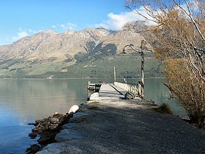
The South Island also contains the Strath-Taieri and the Ben Ohau Range
of mountains, both combining Scots Gaelic and Maori
origins. Invercargill
has the appearance of a Scottish name, since it combines the Scottish prefix "Inver" (Inbhir), meaning a river's mouth, with "Cargill", the name of a Scottish official. (Invercargill's main streets are named after Scottish rivers: Dee, Tay, Spey, Esk, Don, Doon, Clyde, etc.). Inchbonnie
is a hybrid of Lowland Scots
and Scottish Gaelic
 Due to the Darién scheme
, the Caribbean coast of Panama has various names which refer to the Scottish presence. The colony was called "New Caledonia", the settlement "New Edinburgh", the fort "Fort St Andrew" and the bay near it "Caledonia Bay". These names are defunct, although references remain in some of the Spanish language names of the region to the Scottish settlers.
The Salvesen Range
is named after Harold Salvesen, a director of Messrs. Chr. Salvesen and Co., an originally Norwegian company based in Leith
, Scotland.
 For brevity, only major places are on this list - the remainder can be found at the .
Some post-colonial renaming has taken place, e.g. Lake Chivero
was formerly known as Lake McIlwaine. It is uncertain whether the "Glen" of Glen Norah is Scottish inspired.

Scotland
Scotland is a country that is part of the United Kingdom. Occupying the northern third of the island of Great Britain, it shares a border with England to the south and is bounded by the North Sea to the east, the Atlantic Ocean to the north and west, and the North Channel and Irish Sea to the...
which have subsequently been applied to other parts of the world by Scottish emigrants or explorers, or contain distinctive Scottish surnames as an element.
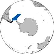
Antarctica
- Ailsa Craig (South Orkney Islands)Ailsa Craig (South Orkney Islands)Ailsa Craig is a precipitous island south of Point Rae, off the south coast of Laurie Island in the South Orkney Islands. Charted in 1903 by the Scottish National Antarctic Expedition under William Speirs Bruce, who named it for the island in the Firth of Clyde in Scotland....
- Anderson PeninsulaAnderson PeninsulaAnderson Peninsula is a low ice-covered peninsula, long, terminating in Belousov Point. It lies between Gillett Ice Shelf and Suvorov Glacier on the coastal margin of the Wilson Hills of Antarctica. It was mapped by the United States Geological Survey from surveys and from U.S...
- Dundee IslandDundee IslandDundee Island is an ice-covered island lying east of the northeastern tip of Antarctic Peninsula and south of Joinville Island.On January 8, 1893, during the Dundee Whaling Expedition, the island was named by Captain Thomas Robertson of the Active and named for the home port, Dundee, Scotland,...
and Firth of TayFirth of Tay (Antarctica)Firth of Tay is a sound, 12 miles long and 6 miles wide, extending in a NW-SE direction between the northeast side of Dundee Island and the east portion of Joinville Island. It merges to the northwest with Active Sound with which it completes the separation of Dundee and Joinville Islands... - Inverleith Harbour
- McDonald Ice RumplesMcDonald Ice RumplesThe McDonald Ice Rumples constitute an ice rise on the Brunt Ice Shelf bordering the Weddell Sea in Antarctica. It covers an area of 3 by 2 miles....
- McMurdo SoundMcMurdo SoundThe ice-clogged waters of Antarctica's McMurdo Sound extend about 55 km long and wide. The sound opens into the Ross Sea to the north. The Royal Society Range rises from sea level to 13,205 feet on the western shoreline. The nearby McMurdo Ice Shelf scribes McMurdo Sound's southern boundary...
, McMurdo Ice ShelfMcMurdo Ice ShelfMcMurdo Ice Shelf is the portion of the Ross Ice Shelf bounded by McMurdo Sound and Ross Island on the north and Minna Bluff on the south. Studies show this feature has characteristics quite distinct from the Ross Ice Shelf and merits individual naming. A.J...
& McMurdo StationMcMurdo StationMcMurdo Station is a U.S. Antarctic research center located on the southern tip of Ross Island, which is in the New Zealand-claimed Ross Dependency on the shore of McMurdo Sound in Antarctica. It is operated by the United States through the United States Antarctic Program, a branch of the National... - McIntyre IslandMcIntyre IslandMcIntyre Island is a small Antarctic island just west of Blakeney Point, Clark Peninsula, in the Windmill Islands. It was photographed from the air by USN Operation Highjump in 1946-47 and was included in a 1957 ground survey by C. R. Eklund...
- MacKenzie BayMacKenzie BayMacKenzie Bay is a relatively small embayment of the western extremity of the Amery Ice Shelf, about 20 miles northeast of Foley Promontory. On February 10, 1931, the British Australian New Zealand Antarctic Research Expedition sighted a much larger embayment here and made an airplane flight to...
- Mount Campbell
- Mount Crawford (Antarctica)Mount Crawford (Antarctica)Mount Crawford is a mountain with two summits, 2,360 and 2,255 m, standing northwest of Mount Dawson in the north part of the main ridge of the Sentinel Range. Discovered by Lincoln Ellsworth on his trans-Antarctic flight of November 23, 1935. Named by the Advisory Committee on Antarctic Names ...
- Mount Dalrymple
- Mount Douglas (Antarctica)Mount Douglas (Antarctica)Mount Douglas is a striking pyramidal peak, 1,750 m, near the head of Fry Glacier, on the divide between the Fry and Mawson Glaciers. The New Zealand Northern Survey Party of the Commonwealth Trans-Antarctic Expedition established a survey station on its summit in December 1957. Named for Murray...
- Mount Hamilton (Antarctica)
- Mount InverleithMount InverleithMount Inverleith is a mountain, , in West Antarctica standing near the edge of the plateau escarpment 2 miles east-northeast of the head of Skontorp Cove, on the west coast of Graham Land. First charted and named "Iverleith Hill" by Scottish geologist David Ferguson in 1913-14....
- Mount KirkpatrickMount KirkpatrickMount Kirkpatrick is a lofty, generally ice-free mountain in Antarctica's Queen Alexandra Range. Located 8 km west of Mount Dickerson, Mt. Kirkpatrick is the highest point in the Queen Alexandra Range, as well as in its parent range, the Transantarctic Mountains...
/Kilpatrick & Mount Kirkpatrick FormationMount Kirkpatrick FormationThe Mount Kirkpatrick Formation is one of only two major dinosaur-bearing rock formations yet found on the continent of Antarctica; the other is the Santa Marta Formation from the Late Cretaceous...
(named for a Glasgow businessman) - Mount StrathconaMount StrathconaMount Strathcona is a mountain, 1,380 m high, rising above the continental ice on the west side of Denman Glacier, 11 miles south of Mount Barr Smith, in Antarctica. It was discovered by the Australasian Antarctic Expedition under Douglas Mawson, 1911–14, and named by him for Lord Strathcona, High...
- Robertson IslandRobertson IslandRobertson Island is an ice-covered island, long in a northwest-southeast direction and wide, lying at the east end of the Seal Nunataks off the east coast of the Antarctic Peninsula. Captain Carl Anton Larsen discovered Robertson Island from the Jason on December 9, 1893...
- Robertson IslandsRobertson IslandsThe Robertson Islands or Robertsons Islands are a group of islands extending 4 miles southward of the southeastern extremity of Coronation Island in the South Orkney Islands. The Robertson Islands are located at . The Robertson Islands were discovered and roughly charted by Captain George Powell...
- Scotia ArcScotia ArcScotia Arc is the island arc system forming the north, east and south border of Scotia Sea. The arc comprises submarine ridges and the island groups of South Orkneys, South Sandwich Islands, Clerke Rocks, South Georgia, Shag Rocks, Isla de los Estados, and Burwood Bank linking the mountains of...
& Scotia SeaScotia SeaThe Scotia Sea is partly in the Southern Ocean and mostly in the South Atlantic Ocean.-Location and description:Habitually stormy and cold, the Scotia Sea is the area of water between Tierra del Fuego, South Georgia, South Sandwich Islands, South Orkney Islands and the Antarctic Peninsula, and... - South Orkneys
- Cape Geddes
- Laurie IslandLaurie IslandLaurie Island is an island in the Antarctic Circle, the second largest of the South Orkney Islands. The island is claimed by both Argentina as part of Argentine Antarctica, and the United Kingdom as part of the British Antarctic Territory...
(named by Scottish National Antarctic ExpeditionScottish National Antarctic ExpeditionThe Scottish National Antarctic Expedition , 1902–04, was organised and led by William Speirs Bruce, a natural scientist and former medical student from the University of Edinburgh. Although overshadowed in prestige terms by Robert Falcon Scott's concurrent Discovery Expedition, the SNAE completed...
) - Nigg RockNigg RockNigg Rock is an insular rock, 165 m high, lying 0.5 nautical miles northwest of Route Point, the northwest tip of Laurie Island in the South Orkney Islands...
http://sites.scran.ac.uk/voyage_of_the_scotia/scotia/vs032-020.htm - Orcadas BaseOrcadas BaseBase Orcadas is an Argentine station in Antarctica, and the first permanent Antarctic station in the area defined by the Antarctic Treaty System. It is located on Laurie Island, one of the South Orkney Islands , at above sea level and from the coastline....
- Omond House http://sites.scran.ac.uk/voyage_of_the_scotia/scotia/vs032-042.htm
- Scotia BayScotia BayScotia Bay is a bay 2.5 miles wide, lying immediately east of Mossman Peninsula on the south side of Laurie Island, in the South Orkney Islands. Discovered and roughly charted in the course of the joint cruise by Captain George Powell and Captain Nathaniel Palmer in 1821. Surveyed in 1903 by the...
- South Shetlands
- Barclay BayBarclay BayBarclay Bay is a bay lying between Cape Shirreff and Essex Point on the north side of Livingston Island, in the South Shetland Islands. The name appears on an 1825 chart of the British sealing expedition under James Weddell, and is now established in international usage.-Maps:* L.L. Ivanov et al....
- Duff PointDuff PointDuff Point is a point forming the west extremity of Greenwich Island, in the South Shetland Islands, Antarctica. The name Duffs Straits was applied to McFarlane Strait by James Weddell in 1820-23, after Captain Norwich Duff under whom Weddell served in HMS Espoir in 1814...
- Gibbs IslandGibbs Island (South Shetland Islands)Gibbs Island southwest of Elephant Island in the South Shetland Islands. James Weddell, Master, Royal Navy, whose chart of the islands appeared in 1825, seems first to have used the present name, which is now established in international usage....
- Livingston Island, McFarlane Strait (Livingston)
- McFarlane StraitMcFarlane StraitMcFarlane Strait is the 24.5 km long and 3.35 km wide strait lying between Greenwich and Livingston Island, in the South Shetland Islands...
- Morton StraitMorton StraitMorton Strait is the 9 km long and 6.2 km wide strait between Snow Island on the southwest and Rugged and Livingston Islands on the northeast, in the South Shetland Islands, Antarctica...
- South Shetland TroughSouth Shetland TroughThe South Shetland Trough is an undersea trough north of the South Shetland Islands....
- Barclay Bay
Argentina
- Armstrong, Santa FeArmstrong, Santa FeArmstrong is a city in the southwest of the province of Santa Fe, Argentina. It has 10,411 inhabitants as per the . It is located from the provincial capital Santa Fe, west of Rosario and from Cañada de Gómez, on National Route 9 near the intersection with National Route 178.The economy of the...
- Drysdale, Buenos Aires, a settlement in Carlos Tejador Partido, Argentina
- Henderson, Buenos AiresHenderson, Buenos AiresHenderson is a town in Buenos Aires Province, Argentina. It is the head town of the Hipolito Yrigoyen Partido.The economy of the town and locality is dominated by agriculture and farming.-People from Henderson:*Claudio Caniggia, former footballer...
- Munro, Buenos AiresMunro, Buenos AiresMunro is a quarter of the Vicente López Partido in northern Greater Buenos Aires, best known for its jeans and apparel stores and outlets, located some 18 km from the city of Buenos Aires and approximately 3 km from Avenida General Paz....
(Duncan Mackay Munro)
Australia
- New South WalesNew South WalesNew South Wales is a state of :Australia, located in the east of the country. It is bordered by Queensland, Victoria and South Australia to the north, south and west respectively. To the east, the state is bordered by the Tasman Sea, which forms part of the Pacific Ocean. New South Wales...
- Ben LomondBen Lomond, New South WalesBen Lomond is a village on the Northern Tablelands in the New England region of New South Wales, Australia. The village is situated 6 km off the New England Highway between Armidale and Glen Innes...
- Glen InnesGlen Innes, New South WalesGlen Innes is a parish and town on the Northern Tablelands, in the New England region of New South Wales, Australia. It is the centre of the Glen Innes Severn Shire Council. The town is located at the intersection of the New England Highway and the Gwydir Highway...
- DalgetyDalgety, New South WalesDalgety is a small town in New South Wales Australia, on the banks of the Snowy River between Melbourne and Sydney.The town is located at what was once an important river crossing along the Travelling Stock route from Gippsland to the Snowy Mountains High Country dating from the 1840s.- History...
- Ben Lomond
- Northern Territory
- MacDonnell RangesMacDonnell RangesThe MacDonnell Ranges of the Northern Territory, are a long series of mountain ranges located in the centre of Australia , and consist of parallel ridges running to the east and west of Alice Springs...
- MacDonnell Ranges
- Queensland
- BrisbaneBrisbaneBrisbane is the capital and most populous city in the Australian state of Queensland and the third most populous city in Australia. Brisbane's metropolitan area has a population of over 2 million, and the South East Queensland urban conurbation, centred around Brisbane, encompasses a population of...
(Thomas BrisbaneThomas BrisbaneMajor-General Sir Thomas Makdougall Brisbane, 1st Baronet GCH, GCB, FRS, FRSE was a British soldier, colonial Governor and astronomer.-Early life:...
)
- Brisbane
- TasmaniaTasmaniaTasmania is an Australian island and state. It is south of the continent, separated by Bass Strait. The state includes the island of Tasmania—the 26th largest island in the world—and the surrounding islands. The state has a population of 507,626 , of whom almost half reside in the greater Hobart...
- Ben Lomond
- Suburbs of Hobart-Glenorchy-
- GlenorchyGlenorchy, TasmaniaGlenorchy is a business district and suburb in the northern part of greater Hobart, capital of the state of Tasmania, Australia. The land was originally used for agriculture but is now a largely suburban, working-class area...
& City of GlenorchyCity of GlenorchyThe City of Glenorchy is a Local Government Area of Tasmania which covers several northern suburbs of Hobart including the suburb of Glenorchy by the same name. The city is managed by Glenorchy City Council. Current mayor is Stuart Slade.- History :...
- Glenorchy
- VictoriaVictoria (Australia)Victoria is the second most populous state in Australia. Geographically the smallest mainland state, Victoria is bordered by New South Wales, South Australia, and Tasmania on Boundary Islet to the north, west and south respectively....
- St. KildaSt Kilda, VictoriaSt Kilda is an inner city suburb of Melbourne, Victoria, Australia, 6 km south from Melbourne's central business district. Its Local Government Area is the City of Port Phillip...
- St. Kilda
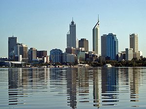
- Western AustraliaWestern AustraliaWestern Australia is a state of Australia, occupying the entire western third of the Australian continent. It is bounded by the Indian Ocean to the north and west, the Great Australian Bight and Indian Ocean to the south, the Northern Territory to the north-east and South Australia to the south-east...
- Marvel Loch, Western AustraliaMarvel Loch, Western AustraliaMarvel Loch is a small townsite of less than 100 people, some 401 km east of Perth, Western Australia. It is located 32 km south west of Southern Cross, along the Perth to Kalgoorlie Great Eastern Highway...
- PerthPerth, Western AustraliaPerth is the capital and largest city of the Australian state of Western Australia and the fourth most populous city in Australia. The Perth metropolitan area has an estimated population of almost 1,700,000....
- StirlingStirling, Western AustraliaThe City of Stirling is a Local Government Area in the northern suburbs of the Western Australian capital city of Perth, located about north of Perth's central business district...
- Stirling RangeStirling RangeThe Stirling Range or Koikyennuruff is a range of mountains and hills in the Great Southern region of Western Australia, 337 km south-east of Perth. It is located at approximately and is over 60 km wide from west to east, stretching from the highway between Mount Barker and Cranbrook...
- Marvel Loch, Western Australia
Barbados
- Names in Bridgetown, Barbados (not a Scottish name)http://www.rampantscotland.com/placenames/placename_bridgetown.htm
-
- Arthurs Seat
- Callendar
- Carrington
- Inch Marlowe (Inchmarlo)
- Montrose
- James TownHoletownHoletown , is a small town located in the Caribbean island nation of Barbados. Holetown is located in the parish of Saint James on the sheltered west coast of the island.-History:...
(King James VI of Scotland) - Saint James, Barbados
Bermuda
- Callan Glen
- HamiltonHamilton, BermudaHamilton is the capital of the British Overseas Territory of Bermuda. It is the territory's financial centre and a major port and tourist destination.-Geography:...
- Hamilton ParishHamilton Parish, BermudaHamilton Parish is one of the nine parishes of Bermuda. It was renamed for Scottish aristocrat James Hamilton, 2nd Marquess of Hamilton when he purchased the shares originally held in the Virginia Company by Lucy, Countess of Bedford.It is located in the northwest of the island chain, and is...
(note Hamilton is not in Hamilton Parish)
Bulgaria
- AtolovoAtolovoAtolovo is a village in southeastern Bulgaria, part of Straldzha municipality, Yambol Province. , it has a population of 184 and the mayor is Nikolay Spasov...
' onMouseout='HidePop("79977")' href="/topics/Atholl">AthollAthollAtholl or Athole is a large historical division in the Scottish Highlands. Today it forms the northern part of Perth and Kinross, Scotland bordering Marr, Badenoch, Breadalbane, Strathearn, Perth and Lochaber....
and the SlavicSlavic languagesThe Slavic languages , a group of closely related languages of the Slavic peoples and a subgroup of Indo-European languages, have speakers in most of Eastern Europe, in much of the Balkans, in parts of Central Europe, and in the northern part of Asia.-Branches:Scholars traditionally divide Slavic...
toponymic suffix "-ovo")
Canada
For brevity, only major places are on this list - the remainder can be found at the .- Alberta
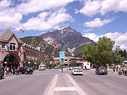
- BanffBanff, AlbertaBanff is a town within Banff National Park in Alberta, Canada. It is located in Alberta's Rockies along the Trans-Canada Highway, approximately west of Calgary and east of Lake Louise....
- named after town in north east Scotland - CalgaryCalgaryCalgary is a city in the Province of Alberta, Canada. It is located in the south of the province, in an area of foothills and prairie, approximately east of the front ranges of the Canadian Rockies...
- named after CalgaryCalgary, MullThe wide sand beach at Calgary is possibly the best in Mull, and its idyllic location makes it one of the finest in Scotland. Calgary Bay is located on the north west of Mull about past Dervaig, from the island's capital Tobermory, and is framed by low hills, partly wooded. A broad area of...
, in MullIsle of MullThe Isle of Mull or simply Mull is the second largest island of the Inner Hebrides, off the west coast of Scotland in the council area of Argyll and Bute....
- Banff
- New Brunswick
- Perth-Andover
- Nova ScotiaNova ScotiaNova Scotia is one of Canada's three Maritime provinces and is the most populous province in Atlantic Canada. The name of the province is Latin for "New Scotland," but "Nova Scotia" is the recognized, English-language name of the province. The provincial capital is Halifax. Nova Scotia is the...
- Latin for New Scotland- Arisaig
- Inverness County
- Glendale
- Inverness
- New GlasgowNew Glasgow, Nova ScotiaNew Glasgow is a town in Pictou County, in the province of Nova Scotia, Canada. It is situated on the banks of the East River of Pictou, which flows into Pictou Harbour, a sub-basin of the Northumberland Strait....
- Victoria CountyVictoria County, Nova ScotiaVictoria County is a county in the Canadian province of Nova Scotia.The shire town and largest municipality is the village of Baddeck.-History:Named after Queen Victoria, it was established by statute in 1851...
- Iona
- Ontario
- HamiltonHamilton, OntarioHamilton is a port city in the Canadian province of Ontario. Conceived by George Hamilton when he purchased the Durand farm shortly after the War of 1812, Hamilton has become the centre of a densely populated and industrialized region at the west end of Lake Ontario known as the Golden Horseshoe...
- Eglinton
- Port ElginPort Elgin, OntarioPort Elgin is a community in the Ontario municipality of Saugeen Shores. Close to MacGregor Point Provincial Park in Bruce County, the community has several beaches on Lake Huron....
- Hamilton
- Prince Edward Island
- New GlasgowNew Glasgow, Prince Edward IslandNew Glasgow is an unincorporated area located in Queens County in the central portion of Prince Edward Island, south-west of North Rustico. It is situated on the Hunter River.-Climate:-External links:*...
- New Glasgow
For Nova Scotian names in Scottish Gaelic (not necessarily the same as the English versions) please see Canadian communities with Scottish Gaelic speakers and Scottish Gaelic placenames in Canada. A notable example of this phenomenon is Beinn Bhreagh
Beinn Bhreagh, Nova Scotia
Beinn Bhreagh, generally pronounced "ban vreeagh", is the name of the estate founded by Dr. Alexander Graham Bell, which has become an unincorporated rural community located in Victoria County, Nova Scotia, Canada...
, former home of Alexander Graham Bell
Alexander Graham Bell
Alexander Graham Bell was an eminent scientist, inventor, engineer and innovator who is credited with inventing the first practical telephone....
.
Chile
- Alejandro Selkirk IslandAlejandro Selkirk IslandAlejandro Selkirk Island, previously known as Isla Más Afuera and renamed after Alexander Selkirk, is the second largest and most westernly island of the Juan Fernández Islands archipelago of the Valparaíso Region of Chile...
(Juan Fernández IslandsJuan Fernández IslandsThe Juan Fernández Islands are a sparsely inhabited island group reliant on tourism and fishing in the South Pacific Ocean, situated about off the coast of Chile, and is composed of three main volcanic islands; Robinson Crusoe Island, Alejandro Selkirk Island and Santa Clara Island, the first...
, named for Alexander SelkirkAlexander SelkirkAlexander Selkirk was a Scottish sailor who spent four years as a castaway when he was marooned on an uninhabited island. It is probable that his travels provided the inspiration for Daniel Defoe's novel Robinson Crusoe....
) - Cochrane Island
- Gordon IslandGordon IslandGordon Island is an island in the Tierra del Fuego archipelago. Politically, the island is located in the Commune of Cabo de Hornos, which belongs to the Magallanes y la Antártica Chilena Region, Chile. It has an area of 591 km²....
- Lennox & PictonPicton, Lennox and NuevaPicton, Lennox and Nueva is a group of three islands on the extreme south of South America, in the Chilean commune of Cabo de Hornos in Antártica Chilena Province, Magallanes and Antártica Chilena Region...
- Picton allegedly from "PictPICTPICT is a graphics file format introduced on the original Apple Macintosh computer as its standard metafile format. It allows the interchange of graphics , and some limited text support, between Mac applications, and was the native graphics format of QuickDraw.The original version, PICT 1, was...
", Lennox from the area north of Glasgow.
DominicaDominicaDominica , officially the Commonwealth of Dominica, is an island nation in the Lesser Antilles region of the Caribbean Sea, south-southeast of Guadeloupe and northwest of Martinique. Its size is and the highest point in the country is Morne Diablotins, which has an elevation of . The Commonwealth...
- Scotts Head, DominicaScotts Head, DominicaScotts Head is a village on the southwest coast of Dominica, in Saint Mark Parish. As of 2001, its population was 721. Predominantly a fishing village, Scotts Head overlooks Soufrière Bay, which is protected as the Soufrière Scotts Head Marine Reserve...
- Scott's Head Village
England
- Scotch CornerScotch CornerScotch Corner is an important junction of the A1 and A66 trunk roads near Richmond, North Yorkshire, England. It has been described as "the modern gateway to Cumbria, the North East and Scotland".-Geography:...
- Scotland YardScotland YardScotland Yard is a metonym for the headquarters of the Metropolitan Police Service of London, UK. It derives from the location of the original Metropolitan Police headquarters at 4 Whitehall Place, which had a rear entrance on a street called Great Scotland Yard. The Scotland Yard entrance became...
(London)
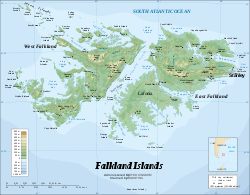
Falkland Islands
- DouglasDouglas, Falkland IslandsDouglas is a settlement on East Falkland, in the Falkland Islands, on the west shore of Salvador Water....
Note: The Falkland Islands
Falkland Islands
The Falkland Islands are an archipelago in the South Atlantic Ocean, located about from the coast of mainland South America. The archipelago consists of East Falkland, West Falkland and 776 lesser islands. The capital, Stanley, is on East Falkland...
derive their English language name name from Falkland Sound
Falkland Sound
The Falkland Sound is a sea strait in the Falkland Islands. Running south west - north east, it separates West and East Falkland.-Name:The sound was named by John Strong in 1690 for Viscount Falkland, the name only later being applied to the archipelago and its two largest islands...
. This was named for Anthony Cary, 5th Viscount of Falkland
Anthony Cary, 5th Viscount of Falkland
Anthony Cary, 5th Viscount of Falkland PC was a Scottish nobleman and English politician. He was the son of Henry Cary, 4th Viscount Falkland....
, who in turn took his title from Falkland Palace
Falkland Palace
Falkland Palace in Falkland, Fife, Scotland, is a former royal palace of the Scottish Kings. Today it is in the care of the National Trust for Scotland, and serves as a tourist attraction.-Early years:...
. See also West Falkland
West Falkland
West Falkland is the second largest of the Falkland Islands in the South Atlantic. It is a hilly island, separated from East Falkland by Falkland Sound. Its area is and its coastline is long. Including the adjacent small islands the land area is .-Population:The island has fewer than 200...
& East Falkland
East Falkland
East Falkland the largest of the Falkland Islands in the South Atlantic, has an area of and a coastline long. Most of the population of the Falklands live in East Falkland, almost all of them living in the northern half of the island...
, the two main islands. Stanley
Stanley, Perthshire
Stanley is a village on the right bank of the River Tay in Perthshire, Scotland. The section of River Tay nearby is a popular location for canoeing and fishing.-Etymology:...
is a location in Scotland, but the Falkland town is named after Edward Smith-Stanley, 14th Earl of Derby
Edward Smith-Stanley, 14th Earl of Derby
Edward George Geoffrey Smith-Stanley, 14th Earl of Derby, KG, PC was an English statesman, three times Prime Minister of the United Kingdom, and to date the longest serving leader of the Conservative Party. He was known before 1834 as Edward Stanley, and from 1834 to 1851 as Lord Stanley...
.
Brenton Loch
Brenton Loch
Brenton Loch is an inlet-cum-small fjord in the Falkland Islands. It is one of a handful of so-called sea lochs outside Scotland. It is sometimes known as "Brenton Sound". "Loch" is normally pronounced as "lock" in the English rather than Scottish manner, i.e. without a fricative "ch"...
(inlet) and Loch Head Pond are also rare examples of the Scottish word "loch
Loch
Loch is the Irish and Scottish Gaelic word for a lake or a sea inlet. It has been anglicised as lough, although this is pronounced the same way as loch. Some lochs could also be called a firth, fjord, estuary, strait or bay...
" being applied to bodies of water outside Europe.
Hong Kong
- Aberdeen Harbour
- Arbuthnot RoadArbuthnot RoadArbuthnot Road is a thoroughfare in Hong Kong's Central District. The road begins at the site of the former colony's first official home of the British justice, the Central Magistracy. The Central Magistracy, located at No. 1 Arbuthnot Road, is a declared monument of Hong Kong...
- Braemar HillBraemar HillBraemar Hill is a hill at the south of North Point on the Hong Kong Island, Hong Kong. The hill was likely named after the Scottish village of Braemar by the British officials....
- Jardine's LookoutJardine's LookoutJardine's Lookout is a mountain and a residential area on the Hong Kong Island in Hong Kong. It is located Southeast of the Wan Chai district and South of the Tai Hang area, at an altitude of about 433 metres. Nearby hills include Mount Nicholson, Violet Hill and Mount Butler etc.It is named after...
(William JardineWilliam Jardine (surgeon)William Jardine was a Scottish physician and merchant. He co-founded the Hong Kong conglomerate Jardine, Matheson and Company. From 1841 to 1843, he was Member of Parliament for Ashburton as a Whig....
)
Indonesia
- Jawa Timur (East Java)
- Glenmore (:fr:Glenmore (Indonésie), :id:Glenmore, Banyuwangi) - From a Gaelic placename both in Mull and Lismore, it was named by Scottish Highland soldiers serving in the Dutch East India Company of the 18th Century who were garrisoned in the area near Mount Raung and who eventually married locally and settled down.
Ireland
Because Scotland and Ireland have their own Gaelic languages, many of the same placename elements can be found in both countries.- Caledon, County TyroneCaledon, County TyroneCaledon , historically known as Kinnaird , is a small village and townland in County Tyrone, Northern Ireland. It is in the Clogher Valley on the banks of the River Blackwater, 7 miles from Armagh. It lies in the southeast of Tyrone and near the borders of County Armagh and County Monaghan. In the...
from CaledoniaCaledoniaCaledonia is the Latinised form and name given by the Romans to the land in today's Scotland north of their province of Britannia, beyond the frontier of their empire...
(Kinnaird). Named by 17th century Planters. - Scotch Quay (WaterfordWaterfordWaterford is a city in the South-East Region of Ireland. It is the oldest city in the country and fifth largest by population. Waterford City Council is the local government authority for the city and its immediate hinterland...
) - NewtownstewartNewtownstewartNewtownstewart is a village and townland in County Tyrone, Northern Ireland. It is overlooked by hills called Bessy Bell and Mary Gray and is at the confluence of the rivers Strule and Owenkillew. In the 2001 Census it had a population of 1,479 people. It lies within the Strabane District Council...
(Lislas) - StewartstownStewartstown, County TyroneStewartstown is a small village in County Tyrone, Northern Ireland, close to Lough Neagh and about from Cookstown, from Coalisland and from Dungannon. In the 2001 Census it had a population of 608 people.-History:...
(an Chraobh)
Jamaica
- Aberdeen
- Clydesdale
- Culloden (two places)
- Dundee
- Elgin Town (two places)
- Farquhar's Beach
- Glasgow
- Inverness
- Kilmarnoch (sic - from KilmarnockKilmarnockKilmarnock is a large burgh in East Ayrshire, Scotland, with a population of 44,734. It is the second largest town in Ayrshire. The River Irvine runs through its eastern section, and the Kilmarnock Water passes through it, giving rise to the name 'Bank Street'...
) - Suburbs of KingstonKingston, JamaicaKingston is the capital and largest city of Jamaica, located on the southeastern coast of the island. It faces a natural harbour protected by the Palisadoes, a long sand spit which connects the town of Port Royal and the Norman Manley International Airport to the rest of the island...
(possibly not itself a Scottish name) http://www.rampantscotland.com/placenames/placename_kingston.htm- Balmagie
- Braeton
- Dunrobin
- Pitcairn Valley
- PortmorePortmorePortmore is a coastal city in southern Jamaica in Saint Catherine, and a dormitory town for the neighbouring cities of Kingston and Spanish Town.-Geography:...
- Sterling Castle (Stirling CastleStirling CastleStirling Castle, located in Stirling, is one of the largest and most important castles, both historically and architecturally, in Scotland. The castle sits atop Castle Hill, an intrusive crag, which forms part of the Stirling Sill geological formation. It is surrounded on three sides by steep...
)
- Montego BayMontego BayMontego Bay is the capital of St. James Parish and the second largest city in Jamaica by area and the fourth by population .It is a tourist destination with duty free shopping, cruise line terminal and the beaches...
suburbs include Dunbar Pen and Glendevon. - Perth Town
- Stewart Town
- Tweedside
Malaysia
- Darvel BayDarvel BayDarvel Bay or Lahad Datu Bay is a bight on the east side of Sabah on the island of Borneo. It is the largest semi-enclosed bay on the east coast of Borneo and faces the Sulawesi Sea...
- Cameron HighlandsCameron HighlandsThe Cameron Highlands is one of Malaysia’s most extensive hill stations. It covers an area of .To the north, its boundary touches that of Kelantan; to the west, it shares part of its border with Perak....
- Fraser's HillFraser's HillFraser's Hill is a hill resort located on the Titiwangsa Ridge in the state of Pahang in Malaysia.- History :...
- Port DicksonPort DicksonPort Dickson or PD to locals is a beach and holiday destination situated about 32 km from Seremban and 90 km from Kuala Lumpur. It is located in the state of Negeri Sembilan in Peninsular Malaysia...
Isle of Man
- Atholl Street (financial district of Douglas. Douglas while also a Scottish name, is not of Scottish origin in this case)
- St Ninian's CrossroadsSt Ninian's CrossroadsSt Ninian's Crossroads is situated between the TT Grandstand and the 1st Milestone road-side marker on the Snaefell Mountain Course on the primary A2 Douglas to Ramsey road in the town of Douglas in the Isle of Man....
(Saint NinianSaint NinianSaint Ninian is a Christian saint first mentioned in the 8th century as being an early missionary among the Pictish peoples of what is now Scotland...
)
The Isle of Man
Isle of Man
The Isle of Man , otherwise known simply as Mann , is a self-governing British Crown Dependency, located in the Irish Sea between the islands of Great Britain and Ireland, within the British Isles. The head of state is Queen Elizabeth II, who holds the title of Lord of Mann. The Lord of Mann is...
like Ireland
Ireland
Ireland is an island to the northwest of continental Europe. It is the third-largest island in Europe and the twentieth-largest island on Earth...
also has its own Gaelic language
Manx language
Manx , also known as Manx Gaelic, and as the Manks language, is a Goidelic language of the Indo-European language family, historically spoken by the Manx people. Only a small minority of the Island's population is fluent in the language, but a larger minority has some knowledge of it...
meaning that Scottish placename elements such as "glen" (Manx: "glione") frequently turn up there, e.g. Sulby Glen
Sulby Glen
Sulby Glen is a wooded glen in Sulby, Isle of Man through which the Sulby River flows from the Sulby Reservoir to Ramsey....
, but these are indigenous.
New Caledonia
- New CaledoniaNew CaledoniaNew Caledonia is a special collectivity of France located in the southwest Pacific Ocean, east of Australia and about from Metropolitan France. The archipelago, part of the Melanesia subregion, includes the main island of Grande Terre, the Loyalty Islands, the Belep archipelago, the Isle of...
New Zealand
- North Island
- Hamilton, New ZealandHamilton, New ZealandHamilton is the centre of New Zealand's fourth largest urban area, and Hamilton City is the country's fourth largest territorial authority. Hamilton is in the Waikato Region of the North Island, approximately south of Auckland...
- Napier, New ZealandNapier, New ZealandNapier is a New Zealand city with a seaport, located in Hawke's Bay on the eastern coast of the North Island. The population of Napier is about About 18 kilometres south of Napier is the inland city of Hastings. These two neighboring cities are often called "The Twin Cities" or "The Bay Cities"...
- Hamilton, New Zealand
- South Island and Stewart Island/RakiuraStewart Island/RakiuraStewart Island/Rakiura is the third-largest island of New Zealand. It lies south of the South Island, across Foveaux Strait. Its permanent population is slightly over 400 people, most of whom live in the settlement of Oban.- History and naming :...
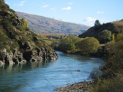
- BalcluthaBalclutha, New ZealandBalclutha is a town in Otago, it lies towards the end of the Clutha River on the east coast of the South Island of New Zealand. It is about halfway between Dunedin and Invercargill on the Main South Line railway, State Highway 1 and the Southern Scenic Route...
- from the Gaelic for 'Clydetown' (Baile Chluaidh) - DunedinDunedinDunedin is the second-largest city in the South Island of New Zealand, and the principal city of the Otago Region. It is considered to be one of the four main urban centres of New Zealand for historic, cultural, and geographic reasons. Dunedin was the largest city by territorial land area until...
, from Dun Eideann, Scottish Gaelic for Edinburgh - Lammerlaw Range (mountains)
- The Grampians (mountains)
- ObanOban, New ZealandOban is the principal settlement on Stewart Island/Rakiura, the southernmost inhabited island of the New Zealand archipelago. Oban is located on Halfmoon Bay , on Paterson Inlet...
, largest settlement in Stewart Island/Rakiura - Ulva IslandUlva Island, New ZealandUlva Island is a small island about long lying within Paterson Inlet, which is part of Stewart Island/Rakiura in New Zealand. It has an area of about , the majority of which is public land...
- Water of LeithWater of Leith, New ZealandThe Water of Leith , is a small river in the South Island of New Zealand.It rises to the north of the city of Dunedin, flowing for 14 kilometres southeast through the northern part of the city and the campus of the University of Otago before reaching the Otago Harbour...
(river)
- Balclutha
The South Island also contains the Strath-Taieri and the Ben Ohau Range
Ben Ohau Range
Ben Ohau Range is a mountain range in Canterbury Region, South Island, New Zealand. It lies west of Lake Pukaki, at .- External links :*...
of mountains, both combining Scots Gaelic and Maori
Maori language
Māori or te reo Māori , commonly te reo , is the language of the indigenous population of New Zealand, the Māori. It has the status of an official language in New Zealand...
origins. Invercargill
Invercargill
Invercargill is the southernmost and westernmost city in New Zealand, and one of the southernmost cities in the world. It is the commercial centre of the Southland region. It lies in the heart of the wide expanse of the Southland Plains on the Oreti or New River some 18 km north of Bluff,...
has the appearance of a Scottish name, since it combines the Scottish prefix "Inver" (Inbhir), meaning a river's mouth, with "Cargill", the name of a Scottish official. (Invercargill's main streets are named after Scottish rivers: Dee, Tay, Spey, Esk, Don, Doon, Clyde, etc.). Inchbonnie
Inchbonnie
Inchbonnie is a rural locality in the West Coast region of New Zealand's South Island."Inchbonnie" is a hybrid of Lowland Scots, bonnie meaning "pretty" and Scottish Gaelic innis meaning island, often anglicised as "Inch", as in Inchkeith or Inchkenneth in Scotland.It allegedly receives 6 m of rain...
is a hybrid of Lowland Scots
Scots language
Scots is the Germanic language variety spoken in Lowland Scotland and parts of Ulster . It is sometimes called Lowland Scots to distinguish it from Scottish Gaelic, the Celtic language variety spoken in most of the western Highlands and in the Hebrides.Since there are no universally accepted...
and Scottish Gaelic
Panama
Darién scheme
The Darién scheme was an unsuccessful attempt by the Kingdom of Scotland to become a world trading nation by establishing a colony called "New Caledonia" on the Isthmus of Panama in the late 1690s...
, the Caribbean coast of Panama has various names which refer to the Scottish presence. The colony was called "New Caledonia", the settlement "New Edinburgh", the fort "Fort St Andrew" and the bay near it "Caledonia Bay". These names are defunct, although references remain in some of the Spanish language names of the region to the Scottish settlers.
Pitcairn Islands
- Pitcairn
- Henderson IslandHenderson Island (Pitcairn Islands)Henderson Island is an uninhabited raised coral atoll in the south Pacific Ocean, that in 1902 was annexed to the Pitcairn Islands colony, a South Pacific Dependent Territory of the United Kingdom. Measuring long and wide, it has an area of and is located northeast of Pitcairn Island at . The...
(Scottish surname)
South Africa
- Eastern CapeEastern CapeThe Eastern Cape is a province of South Africa. Its capital is Bhisho, but its two largest cities are Port Elizabeth and East London. It was formed in 1994 out of the "independent" Xhosa homelands of Transkei and Ciskei, together with the eastern portion of the Cape Province...
- AberdeenAberdeen, Eastern CapeAberdeen is a small town in the Cacadu District Municipality of the Eastern Cape province of South Africa. set in the Camdeboo Mountains. With its numerous examples of Victorian architecture, it is one of the architectural conservation areas of the Karoo....
- Albany, South AfricaAlbany, South AfricaAlbany, South Africa was a district in the Eastern Cape, South Africa...
(named after Albany, New YorkAlbany, New YorkAlbany is the capital city of the U.S. state of New York, the seat of Albany County, and the central city of New York's Capital District. Roughly north of New York City, Albany sits on the west bank of the Hudson River, about south of its confluence with the Mohawk River...
, in turn from an old name for Scotland, Alba) - CathcartCathcart, Eastern CapeCathcart is a town in the Eastern Cape province of South Africa, named after Sir George Cathcart. Sir George Cathcart was governor of the Cape of Good Hope 1852-1853.The town is situated on the N6, just north of Stutterheim on route to Queenstown...
(George CathcartGeorge CathcartGeneral The Honourable Sir George Cathcart GCB was a British general and diplomat.-Military career:He was born in Renfrewshire, son of William Cathcart, 1st Earl Cathcart. After receiving his education at Eton and in Edinburgh, he was commissioned into the Life Guards in 1810...
) - GrahamstownGrahamstownGrahamstown is a city in the Eastern Cape Province of the Republic of South Africa and is the seat of the Makana municipality. The population of greater Grahamstown, as of 2003, was 124,758. The population of the surrounding areas, including the actual city was 41,799 of which 77.4% were black,...
(John Graham (British Army officer))
- Aberdeen
- KwaZulu-NatalKwaZulu-NatalKwaZulu-Natal is a province of South Africa. Prior to 1994, the territory now known as KwaZulu-Natal was made up of the province of Natal and the homeland of KwaZulu....
(native)- BalgowanBalgowan, KwaZulu-NatalBalgowan is a valley in the KwaZulu-Natal Midlands in South Africa.The town of Balgowan is not much more than an old trading store and a train station where locally grown timber is picked up. However, nearby is Michaelhouse, the Anglican boarding school for boys in the Diocese of Natal, an...
- Dundee
- Glencoe
- ScottburghScottburgh, KwaZulu-NatalScottburgh is a resort town situated on the mouth of the Mpambanyoni River , 58 km south of Durban on KwaZulu-Natal South Coast in South Africa...
- Balgowan
- GautengGautengGauteng is one of the nine provinces of South Africa. It was formed from part of the old Transvaal Province after South Africa's first all-race elections on 27 April 1994...
(native)- Suburbs of JohannesburgJohannesburgJohannesburg also known as Jozi, Jo'burg or Egoli, is the largest city in South Africa, by population. Johannesburg is the provincial capital of Gauteng, the wealthiest province in South Africa, having the largest economy of any metropolitan region in Sub-Saharan Africa...
http://www.rampantscotland.com/placenames/placename_johannesburg.htm- Abbotsford
- Argyll
- Balmoral
- Birnam
- Blairgowrie
- Brushwood Haugh (Haugh being a Lowland ScotsScots languageScots is the Germanic language variety spoken in Lowland Scotland and parts of Ulster . It is sometimes called Lowland Scots to distinguish it from Scottish Gaelic, the Celtic language variety spoken in most of the western Highlands and in the Hebrides.Since there are no universally accepted...
word for meadow) - Buccleuch
- Dunkeld
- Dunnotar
- Dunvegan
- Glen Atholl
- Glen Esk
- Heriotdale
- Kelvin
- Melrose
- Moffat View
- Strathavon
- Wattville
- Suburbs of Johannesburg
- Mpumalanga
- BalfourBalfour, MpumalangaBalfour is a small coal mining and maize farming town in Mpumalanga, South Africa. The town was established in 1898 as McHattiesburg after its founder Frederick McHattie. In 1905 the town changed its name when the British Prime Minister Arthur Balfour gave a speech at the local station platform...
(formerly "McHattiesburg")
- Balfour
- North West Province
- OrkneyOrkney, North WestThis article is about the mining town in South Africa. For other places with the same name, see Orkney .Orkney is a gold mining town with 157,324 inhabitants situated in the Klerksdorp district of the North West Province, South Africa....
- Orkney
- Northern CapeNorthern CapeThe Northern Cape is the largest and most sparsely populated province of South Africa. It was created in 1994 when the Cape Province was split up. Its capital is Kimberley. It includes the Kalahari Gemsbok National Park, part of an international park shared with Botswana...
- Alexander BayAlexander Bay, Northern CapeAlexander Bay is a town in the extreme north-west of South Africa, also known as the region of Little Namaqualand. It is located on the southern bank of the Orange River mouth. It was named for Sir James Alexander, who was the first person to map the area whilst on a Royal Geographical Society...
(James Edward AlexanderJames Edward AlexanderMajor-General Sir James Edward Alexander KStJ was a British soldier, traveller and author.-Background:Born in Clackmannanshire, he was the eldest son of Edward Alexander and his second wife, daughter of John Glas...
) - CampbellCampbell, Northern CapeCampbell is a small town situated on the edge of the Ghaap Plateau in the Northern Cape province of South Africa. It is located 48 km east of Griquatown. It was originally known as Grootfontein, but was renamed in honour of Reverend John Campbell who visited the Cape Colony in 1813...
- SutherlandSutherland, Northern Cape- External links :* * *...
- Alexander Bay
- Western CapeWestern CapeThe Western Cape is a province in the south west of South Africa. The capital is Cape Town. Prior to 1994, the region that now forms the Western Cape was part of the much larger Cape Province...
- ArnistonArniston, Western CapeArniston is a small seaside settlement in the Overberg region on the Cape South coast, close to Cape Agulhas, the southern-most tip of Africa. Prior to the loss of the Arniston, it was known as Waenhuiskrans, an Afrikaans name meaning literally "Wagon house cliff", after a local sea cave large...
(Arniston, Midlothian) - Clanwilliam
- ElginElgin, Western CapeElgin, situated in the Overberg region of South Africa, is an apple-growing area near Grabouw and is about 70 km southeast of Cape Town. A group of apple farms called Glen Elgin - owned by the Molteno family - gave the place its name...
- Gordon's BayGordon's BayGordon's Bay is a harbour town in the Western Cape province of South Africa, close to Strand. It is situated on the northeastern corner of False Bay about 50 km from Cape Town to the south of the N2 national road and is named after Robert Jacob Gordon , the Dutch explorer of Scottish descent...
- McGregorMcGregor, Western CapeMcGregor is a small village in the mountains of the Western Cape, South Africa. It is roughly 150 km east of Cape Town. It is located in Ward 5 of the Breede River Winelands Municipality. According the Census 2001, this Ward has a population of 10,254 people .The village was established in...
- NapierNapier, Western CapeThrough rolling hills of Canola, wheat and barley, you’ll find the charming village of Napier at the foot of the Soetmuisberg, between Caledon and Bredasdorp...
- Pringle BayPringle BayPringle Bay is a small coastal town of ca. 1600 inhabitants in the Overberg region of the Western Cape, in South Africa. It is situated at the foot of Hangklip, on the opposite side of False Bay from Cape Point. The town and surrounds are part of the Kogelberg Biosphere Reserve, a UNESCO Heritage...
- RobertsonRobertson, Western CapeRobertson is a town in the Western Cape Province of South Africa known as the valley of wine and roses. It was founded in 1853 and named after the Scottish Dutch Reformed Church Minister, Dr William Robertson....
(Rev William Robertson) - Suburbs of Cape Town http://www.rampantscotland.com/placenames/placename_cape_town.htm
- Airlie
- Balvenie
- Bellville (after Charles Davidson BellCharles Davidson BellCharles Davidson Bell was the Surveyor-General in the Cape, an artist, heraldist, and designer of Cape medals and stamps.-Life history:...
, Surveyor-General of the Cape from 1848 to 1872) - Bonnie Brook (Burn is the normal form in Scotland)
- Clunie
- Crawford
- Crofters' Valley
- Dunoon
- Dunrobin
- Glencairn
- Kelvingrove
- Lochiel
- Schotsche Kloof - AfrikaansAfrikaansAfrikaans is a West Germanic language, spoken natively in South Africa and Namibia. It is a daughter language of Dutch, originating in its 17th century dialects, collectively referred to as Cape Dutch .Afrikaans is a daughter language of Dutch; see , , , , , .Afrikaans was historically called Cape...
for "Scottish Ravine". - St Kilda
- The Glen
- Finlay's Point
- Murray's Bay, on Robbin Island, named after John Murray, a Scottish whaler http://www.rampantscotland.com/placenames/placename_cape_town.htm
- Arniston
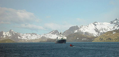
South Georgia
- Allardyce RangeAllardyce RangeThe Allardyce Range is a mountain range rising south of Cumberland Bay and dominating the central part of South Georgia, a UK overseas territory. Mount Paget is the highest peak of the range and also the highest point in the UK territory...
- Geikie GlacierGeikie GlacierGeikie Glacier is a glacier which flows northeast to Mercer Bay, at the southwest end of Cumberland West Bay, South Georgia. First charted by the Swedish Antarctic Expedition, 1901–04, under Nordenskjold, who named it after Sir Archibald Geikie , noted Scottish geologist and Director-General of...
(Archibald GeikieArchibald GeikieSir Archibald Geikie, OM, KCB, PRS, FRSE , was a Scottish geologist and writer.-Early life:Geikie was born in Edinburgh in 1835, the eldest son of musician and music critic James Stuart Geikie...
) - Leith HarbourLeith HarbourLeith Harbour , also known as Port Leith, was a whaling station up on the northeast coast of South Georgia, established and operated by Christian Salvesen Ltd, Edinburgh. The station was in operation from 1909 until 1965. It was the largest of seven whaling stations, situated near the mouth of...
(former whaling base) - Lyell Glacier, South GeorgiaLyell Glacier, South GeorgiaFor the glacier located on Mount Lyell in California, see Lyell GlacierLyell Glacier is a glacier flowing in a north direction to Harpon Bay at the southeast head of Cumberland West Bay, South Georgia...
(Charles LyellCharles LyellSir Charles Lyell, 1st Baronet, Kt FRS was a British lawyer and the foremost geologist of his day. He is best known as the author of Principles of Geology, which popularised James Hutton's concepts of uniformitarianism – the idea that the earth was shaped by slow-moving forces still in operation...
) - McNish IslandMcNish IslandMcNish Island is the larger of two islands lying at the east side of Cheapman Bay on the south side of South Georgia. It was surveyed by the South Georgia Survey in the period 1951-57, and named by the United Kingdom Antarctic Place-Names Committee for Harry McNish , carpenter on Sir Ernest...
(Harry McNishHarry McNishHarry McNish was the carpenter on Sir Ernest Shackleton's Imperial Trans-Antarctic Expedition of 1914–1917...
) - Mount CarseMount CarseMount Carse is a mountain having several peaks, the highest , standing north of the head of Drygalski Fjord in the south part of the Salvesen Range of South Georgia. Surveyed by the South Georgia Survey between 1951 and 1957 and named for V. Duncan Carse, leader of the four SGS expeditions during...
- Mount CunninghamMount CunninghamMount Cunningham is a mountain, , at the west end of South Georgia's Esmark Glacier, between Jossac Bight and Queen Maud Bay. The mountain was named after John C. Cunningham as a memorial when he died in 1980. John was a well known Scottish climber who spent many years developing innovative ice...
(John C. Cunningham) - Ross GlacierRoss GlacierNot to be confused with Ross Ice Shelf in AntarcticaRoss Glacier is a glacier 6 miles long, flowing east from the juncture of Allardyce and Salvesen Ranges to Little Moltke Harbour, Royal Bay, on the north coast of South Georgia...
- St Andrews BaySt Andrews Bay, South GeorgiaSaint Andrews Bay is a bight 2 miles wide, indenting the north coast of South Georgia immediately south of Mount Skittle. Probably first sighted by the British expedition under Cook which explored the north coast of South Georgia in 1775. The name dates back to at least 1920 and is now well...
- StromnessStromness (South Georgia)Stromness is a former whaling station on the northern coast of South Georgia Island in the South Atlantic. Its historical significance is that it represents the destination of Ernest Shackleton's epic rescue journey in 1916. See also Stromness Bay...
& Stromness BayStromness BayStromness Bay is a bay wide, entered between Cape Saunders and Busen Point on the north coast of South Georgia.Stromness Bay, like Leith Harbour takes its name from a location in Scotland, Stromness, on the Orkney Mainland... - Scotia ArcScotia ArcScotia Arc is the island arc system forming the north, east and south border of Scotia Sea. The arc comprises submarine ridges and the island groups of South Orkneys, South Sandwich Islands, Clerke Rocks, South Georgia, Shag Rocks, Isla de los Estados, and Burwood Bank linking the mountains of...
- Scotia SeaScotia SeaThe Scotia Sea is partly in the Southern Ocean and mostly in the South Atlantic Ocean.-Location and description:Habitually stormy and cold, the Scotia Sea is the area of water between Tierra del Fuego, South Georgia, South Sandwich Islands, South Orkney Islands and the Antarctic Peninsula, and...
The Salvesen Range
Salvesen Range
The Salvesen Mountains or Salvesen Range is a mountain range on the southern tip of South Georgia, rising to a maximum elevation of . They were created 127 million years ago and are made mainly from granite. The Cretaceous granite is pretruded into the Jurassic basaltic lavas and dolerite dykes....
is named after Harold Salvesen, a director of Messrs. Chr. Salvesen and Co., an originally Norwegian company based in Leith
Leith
-South Leith v. North Leith:Up until the late 16th century Leith , comprised two separate towns on either side of the river....
, Scotland.
Sri Lanka
For brevity, only major places are on this list - the remainder can be found at the- AberdeenAberdeen, Sri LankaAberdeen, Sri Lanka is a tea estate in Sri Lanka, is famous for its picturesque waterfall Aberdeen Falls which situated in Ginigathhena, Nuwara Eliya District. Aberdeen is named after Aberdeen, the third largest city of Scotland and the capital of Aberdeenshire.-Aberdeen Falls:Aberdeen Falls is a...
- Balmoral
- Caledonia
- DalhousieDalhousie, Sri LankaDalhousie or Delhousie is a town in Nuwara Eliya District, Sri Lanka. The town is situated en route to Adam's Peak. The town borrowed its name from a nearby tea estate.-See also:*Adam's Peak*Scottish place names in Sri Lanka...
- Elgin FallsElgin FallsElgin Falls is a waterfall in Sri Lanka, located in the Elgin tea estate which is 18 km from the city of Nuwara Eliya, Sri Lanka. The waterfall is 25m in height. Elgin Falls named after Elgin major town of Moray in Scotland. the falls is at about 1,900m above sea level. There are several ways...
- Glasgow
- Highland
- Iona
- Macduff
- Maitland Crescent
- St.Andrew's
- Sanquar
Tristan da Cunha
- Edinburgh of the Seven SeasEdinburgh of the Seven SeasEdinburgh of the Seven Seas is the main settlement of the island of Tristan da Cunha, in the Saint Helena, Ascension and Tristan da Cunha overseas territory of the United Kingdom, in the South Atlantic Ocean...
Trinidad and Tobago
- [Glencoe] (Suburb of Port of Spain)
- Caledonia Island & Craig Island (joined by a reef)
United States
- California
- InvernessInverness, CaliforniaInverness is an unincorporated community and census-designated place located in western Marin County, California. Inverness is located on the southwest shore of Tomales Bay northwest of Point Reyes Station, at an elevation of 43 feet . In the 2010 census, the population was 1,304...
- Inverness
- Florida
- DunedinDunedin, FloridaDunedin is a city in Pinellas County, Florida, United States. The name comes from Dùn Èideann, the Scottish Gaelic name for Edinburgh, the capital of Scotland. The population was 35,691 at the 2000 census. As of 2004, the population recorded by the U.S. Census Bureau is 36,632...
, from Dun Eideann, Scottish Gaelic for Edinburgh
- Dunedin
- Texas
- DallasDallas, TexasDallas is the third-largest city in Texas and the ninth-largest in the United States. The Dallas-Fort Worth Metroplex is the largest metropolitan area in the South and fourth-largest metropolitan area in the United States...
north east Scotland - HoustonHouston, TexasHouston is the fourth-largest city in the United States, and the largest city in the state of Texas. According to the 2010 U.S. Census, the city had a population of 2.1 million people within an area of . Houston is the seat of Harris County and the economic center of , which is the ...
- Houston suburbs include MontroseNeartown HoustonNeartown is an area located in west-central Houston, Texas, United States and is one of the city's major cultural areas. Neartown is roughly bounded by U.S. Highway 59 to the south, Allen Parkway to the north, Bagby Street on the east, and Shepherd Drive to the west...
- Dallas
- Washington State
- AberdeenAberdeen, WashingtonAberdeen is a city in Grays Harbor County, Washington, United States, founded by Samuel Benn in 1884. Aberdeen was incorporated on May 12, 1890. The city is the economic center of Grays Harbor County, bordering the cities of Hoquiam and Cosmopolis...
- Home of Kurt CobainKurt CobainKurt Donald Cobain was an American singer-songwriter, musician and artist, best known as the lead singer and guitarist of the grunge band Nirvana...
- Aberdeen
Wales
- ButetownButetownButetown is a community in the south of the city of Cardiff, the capital of Wales. It was originally a model housing estate built in the early nineteenth century by John Crichton-Stuart, 2nd Marquess of Bute, for whose title the area was named...
("Tiger Bay"), in Cardiff (named after the Marquess of ButeMarquess of ButeMarquess of the County of Bute, shortened in general usage to Marquess of Bute, is a title in the Peerage of Great Britain. It was created in 1796 for John Stuart, 4th Earl of Bute.-Family history:...
) - WattstownWattstownWattstown is a village located in the Rhondda Valley in the county borough of Rhondda Cynon Taf, Wales. Located in the Rhondda Fach valley it is a district of the community of Ynyshir. Prior to mid 19th century industrialisation the area was once little more than a wooded area, sparsely populated...
(Cwtch)
Zambia
- Livingstone, ZambiaLivingstone, ZambiaLivingstone or Maramba is a historic colonial city and present capital of the Southern Province of Zambia, a tourism centre for the Victoria Falls lying north of the Zambezi River, and a border town with road and rail connections to Zimbabwe on the other side of the Falls...
(David LivingstoneDavid LivingstoneDavid Livingstone was a Scottish Congregationalist pioneer medical missionary with the London Missionary Society and an explorer in Africa. His meeting with H. M. Stanley gave rise to the popular quotation, "Dr...
)
Zimbabwe
- Bannockburn
- Craigmore, Zimbabwe
- Glendale, ZimbabweGlendale, ZimbabweGlendale is a village in the province of Mashonaland Central, Zimbabwe. The village of Glendale in Zimbabwe was named after a town of the same name in Northumberland, England. Glendale is located in the Mazowe valley of Zimbabwe, about 85 km north east of Harare...
- West NicholsonWest NicholsonWest Nicholson or Tshabezi is a village in the province of Matabeleland South, Zimbabwe. It is located about halfway between Zimbabwe's second largest city, Bulawayo, and the border town to South Africa, Beitbridge, along the main road and rail link to South Africa.According to the 1982 Population...
- BulawayoBulawayoBulawayo is the second largest city in Zimbabwe after the capital Harare, with an estimated population in 2010 of 2,000,000. It is located in Matabeleland, 439 km southwest of Harare, and is now treated as a separate provincial area from Matabeleland...
is a native name, but 38 of the 156 suburbs have names of some kind of Scottish origin.http://www.rampantscotland.com/placenames/placename_bulawayo.htm- Barbourfields
- Burnside
- Douglasdale
- Glencoe
- Glengarry
- Kelvin, Kelvin East, Kelvin North and Kelvin West (River KelvinRiver KelvinThe Kelvin rises on watershed of Scotland on the moor south east of the village of Banton, east of Kilsyth - . At almost 22 miles long, it initially flows south to Dullatur Bog where it falls into a man made trench and takes a ninety degree turn flowing west along the northern boundary of the bog...
) - Lochview - in reference to Lakeside Dam.
- Montrose Old Church
- Morningside
- Paddonhurst
- Southdale (Shetland Islands).
- HarareHarareHarare before 1982 known as Salisbury) is the largest city and capital of Zimbabwe. It has an estimated population of 1,600,000, with 2,800,000 in its metropolitan area . Administratively, Harare is an independent city equivalent to a province. It is Zimbabwe's largest city and its...
also a native name - suburbs include http://www.rampantscotland.com/placenames/placename_harare.htm- Ardbennie
- Braeside
- Glen Lorne
- Lochinvar
- Strathaven
Some post-colonial renaming has taken place, e.g. Lake Chivero
Lake Chivero
Lake Chivero is a reservoir on the Manyame River. It was formerly called Lake McIlwaine in memory of the late Sir Robert Mcllwaine, a former judge of the High Court and founder of Zimbabwe's soil and water conservation movement...
was formerly known as Lake McIlwaine. It is uncertain whether the "Glen" of Glen Norah is Scottish inspired.
Outer Space
- The MoonMoonThe Moon is Earth's only known natural satellite,There are a number of near-Earth asteroids including 3753 Cruithne that are co-orbital with Earth: their orbits bring them close to Earth for periods of time but then alter in the long term . These are quasi-satellites and not true moons. For more...
- Dorsa GeikieDorsa GeikieDorsa Geikie is a wrinkle ridge at in Mare Fecunditatis on the Moon. It is 228 km long and was named after Sir Archibald Geikie in 1976....
, a wrinkle ridge system on the Moon, is named after Sir Archibald GeikieArchibald GeikieSir Archibald Geikie, OM, KCB, PRS, FRSE , was a Scottish geologist and writer.-Early life:Geikie was born in Edinburgh in 1835, the eldest son of musician and music critic James Stuart Geikie...
.
- Dorsa Geikie
- EuropaEuropa (moon)Europa Slightly smaller than Earth's Moon, Europa is primarily made of silicate rock and probably has an iron core. It has a tenuous atmosphere composed primarily of oxygen. Its surface is composed of ice and is one of the smoothest in the Solar System. This surface is striated by cracks and...
- Arran Chaos
- Callanish
- Tormsdale (TormsdaleTormsdaleTormsdale is a megalithic site on the banks of the River Thurso, in Caithness, Scotland. It is 3 km south of Westerdale.The site consist of some low stone rows which are difficult to trace as the stones are small and have been partly overgrown by grass. Tormsdale is near to another stone row...
, Caithness)
- Martian craters
- Ayr
- Balvicar
- Banff
- Darvel
- Doon
- Echt
- Leuk
- 253 Mathilde253 Mathilde253 Mathilde is a main-belt asteroid about 50 km in diameter that was discovered by Johann Palisa in 1885. It has a relatively elliptical orbit that requires more than four years to circle the Sun. This asteroid has an unusually slow rate of rotation, requiring 17.4 days to complete a...
(asteroid) - 243 Ida243 Ida243 Ida is an asteroid in the Koronis family of the asteroid belt. It was discovered on 29 September 1884 by Johann Palisa and named after a nymph from Greek mythology. Later telescopic observations categorized Ida as an S-type asteroid, the most numerous type in the inner asteroid belt. On 28...
(asteroid)- Fingal (features are named after caves, in this case Fingal's CaveFingal's CaveFingal's Cave is a sea cave on the uninhabited island of Staffa, in the Inner Hebrides of Scotland, part of a National Nature Reserve owned by the National Trust for Scotland. It is formed entirely from hexagonally jointed basalt columns, similar in structure to the Giant's Causeway in Northern...
on StaffaStaffaStaffa from the Old Norse for stave or pillar island, is an island of the Inner Hebrides in Argyll and Bute, Scotland. The Vikings gave it this name as its columnar basalt reminded them of their houses, which were built from vertically placed tree-logs....
)
- Fingal (features are named after caves, in this case Fingal's Cave