

List of largest reservoirs in the United States
Encyclopedia
This is a list of the largest reservoirs in the United States
, ranked by volume. All reservoirs over 1000000 acre.ft are listed.
This is a work in progress.
United States
The United States of America is a federal constitutional republic comprising fifty states and a federal district...
, ranked by volume. All reservoirs over 1000000 acre.ft are listed.
This is a work in progress.
| Key to watersheds | ||||||
| Mississippi | Missouri | Columbia | Colorado | Rio Grande | Sacramento | Other |
List of reservoirs by volume in America
| Name | Capacity | State(s) | Dam | Watercourse | Image |
|---|---|---|---|---|---|
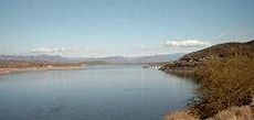
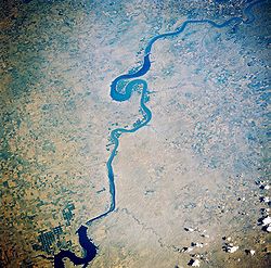
| Lake Mead Lake Mead Lake Mead is the largest reservoir in the United States. It is located on the Colorado River about southeast of Las Vegas, Nevada, in the states of Nevada and Arizona. Formed by water impounded by the Hoover Dam, it extends behind the dam, holding approximately of water.-History:The lake was... |
28537000 acre.ft | Arizona Arizona Arizona ; is a state located in the southwestern region of the United States. It is also part of the western United States and the mountain west. The capital and largest city is Phoenix... , Nevada Nevada Nevada is a state in the western, mountain west, and southwestern regions of the United States. With an area of and a population of about 2.7 million, it is the 7th-largest and 35th-most populous state. Over two-thirds of Nevada's people live in the Las Vegas metropolitan area, which contains its... |
Hoover Dam Hoover Dam Hoover Dam, once known as Boulder Dam, is a concrete arch-gravity dam in the Black Canyon of the Colorado River, on the border between the US states of Arizona and Nevada. It was constructed between 1931 and 1936 during the Great Depression and was dedicated on September 30, 1935, by President... |
Colorado River Colorado River The Colorado River , is a river in the Southwestern United States and northwestern Mexico, approximately long, draining a part of the arid regions on the western slope of the Rocky Mountains. The watershed of the Colorado River covers in parts of seven U.S. states and two Mexican states... |
 |
| Lake Powell Lake Powell Lake Powell is a huge reservoir on the Colorado River, straddling the border between Utah and Arizona . It is the second largest man-made reservoir in the United States behind Lake Mead, storing of water when full... |
24322000 acre.ft | Utah Utah Utah is a state in the Western United States. It was the 45th state to join the Union, on January 4, 1896. Approximately 80% of Utah's 2,763,885 people live along the Wasatch Front, centering on Salt Lake City. This leaves vast expanses of the state nearly uninhabited, making the population the... , Arizona Arizona Arizona ; is a state located in the southwestern region of the United States. It is also part of the western United States and the mountain west. The capital and largest city is Phoenix... |
Glen Canyon Dam Glen Canyon Dam Glen Canyon Dam is a concrete arch dam on the Colorado River in northern Arizona in the United States, just north of Page. The dam was built to provide hydroelectricity and flow regulation from the upper Colorado River Basin to the lower. Its reservoir is called Lake Powell, and is the second... |
Colorado River Colorado River The Colorado River , is a river in the Southwestern United States and northwestern Mexico, approximately long, draining a part of the arid regions on the western slope of the Rocky Mountains. The watershed of the Colorado River covers in parts of seven U.S. states and two Mexican states... |
 |
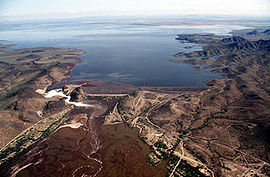
| Lake Sakakawea Lake Sakakawea Lake Sakakawea is a reservoir in the Missouri River basin in central North Dakota. Named for the Shoshone-Hidatsa woman Sakakawea, it is the third largest man-made lake in the United States, after Lake Mead and Lake Powell. The lake lies in parts of six counties in western North Dakota: Dunn,... |
24200000 acre.ft | North Dakota North Dakota North Dakota is a state located in the Midwestern region of the United States of America, along the Canadian border. The state is bordered by Canada to the north, Minnesota to the east, South Dakota to the south and Montana to the west. North Dakota is the 19th-largest state by area in the U.S.... |
Garrison Dam Garrison Dam Garrison Dam is an earth-fill embankment dam on the Missouri River in central North Dakota. At over two miles in length, it is the fifth-largest earthen dam in the world, constructed by the U.S. Army Corps of Engineers from 1947-53... |
Missouri River Missouri River The Missouri River flows through the central United States, and is a tributary of the Mississippi River. It is the longest river in North America and drains the third largest area, though only the thirteenth largest by discharge. The Missouri's watershed encompasses most of the American Great... |
 |
| Lake Oahe Lake Oahe Lake Oahe is a large reservoir behind Oahe Dam on the Missouri River beginning in central South Dakota and continuing north into North Dakota in the United States. The lake has an area of and a maximum depth of . By volume, it is the fourth-largest reservoir in the US. Lake Oahe has a length of... |
23500000 acre.ft | South Dakota South Dakota South Dakota is a state located in the Midwestern region of the United States. It is named after the Lakota and Dakota Sioux American Indian tribes. Once a part of Dakota Territory, South Dakota became a state on November 2, 1889. The state has an area of and an estimated population of just over... , North Dakota North Dakota North Dakota is a state located in the Midwestern region of the United States of America, along the Canadian border. The state is bordered by Canada to the north, Minnesota to the east, South Dakota to the south and Montana to the west. North Dakota is the 19th-largest state by area in the U.S.... |
Oahe Dam Oahe Dam The Oahe Dam is a large dam along the Missouri River, just north of Pierre, South Dakota in the United States. It creates Lake Oahe, the fourth largest artificial reservoir in the United States, which stretches up the course of the Missouri to Bismarck, North Dakota. The dam's powerplant provides... |
Missouri River Missouri River The Missouri River flows through the central United States, and is a tributary of the Mississippi River. It is the longest river in North America and drains the third largest area, though only the thirteenth largest by discharge. The Missouri's watershed encompasses most of the American Great... |
 |
| Fort Peck Lake Fort Peck Lake Fort Peck Lake, or Lake Fort Peck, is a major reservoir in Montana, formed by the Fort Peck Dam on the Missouri River. The lake lies in the eastern prairie region of Montana approximately east of Great Falls and north of Billings, reaching into portions of six counties.The dam and reservoir were... |
18700000 acre.ft | Montana Montana Montana is a state in the Western United States. The western third of Montana contains numerous mountain ranges. Smaller, "island ranges" are found in the central third of the state, for a total of 77 named ranges of the Rocky Mountains. This geographical fact is reflected in the state's name,... |
Fort Peck Dam Fort Peck Dam The Fort Peck Dam is the highest of six major dams along the Missouri River, located in northeast Montana in the United States, near Glasgow, and adjacent to the community of Fort Peck... |
Missouri River Missouri River The Missouri River flows through the central United States, and is a tributary of the Mississippi River. It is the longest river in North America and drains the third largest area, though only the thirteenth largest by discharge. The Missouri's watershed encompasses most of the American Great... |
_1986_01.jpg) |
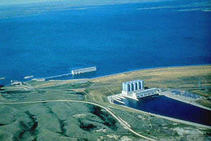
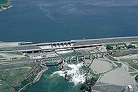
| Franklin Delano Roosevelt Lake | 9562000 acre.ft | Washington | Grand Coulee Dam Grand Coulee Dam Grand Coulee Dam is a gravity dam on the Columbia River in the U.S. state of Washington built to produce hydroelectric power and provide irrigation. It was constructed between 1933 and 1942, originally with two power plants. A third power station was completed in 1974 to increase its energy... |
Columbia River Columbia River The Columbia River is the largest river in the Pacific Northwest region of North America. The river rises in the Rocky Mountains of British Columbia, Canada, flows northwest and then south into the U.S. state of Washington, then turns west to form most of the border between Washington and the state... |
|
| Kentucky Lake Kentucky Lake Kentucky Lake is a major navigable reservoir along the Tennessee River in Kentucky and Tennessee. Created in 1944 by the Tennessee Valley Authority's impounding of the Tennessee River by Kentucky Dam, the lake is the largest artificial lake by surface area in the United States east of the... |
6129000 acre.ft | Kentucky Kentucky The Commonwealth of Kentucky is a state located in the East Central United States of America. As classified by the United States Census Bureau, Kentucky is a Southern state, more specifically in the East South Central region. Kentucky is one of four U.S. states constituted as a commonwealth... , Tennessee Tennessee Tennessee is a U.S. state located in the Southeastern United States. It has a population of 6,346,105, making it the nation's 17th-largest state by population, and covers , making it the 36th-largest by total land area... |
Kentucky Dam Kentucky Dam Kentucky Dam is a hydroelectric dam on the Tennessee River on the county line between Livingston County and Marshall County in the U.S. state of Kentucky... |
Tennessee River Tennessee River The Tennessee River is the largest tributary of the Ohio River. It is approximately 652 miles long and is located in the southeastern United States in the Tennessee Valley. The river was once popularly known as the Cherokee River, among other names... |
|
| Lake Cumberland Lake Cumberland Lake Cumberland is a reservoir in Clinton, Laurel, McCreary, Pulaski, Russell, and Wayne counties in Kentucky. The primary reasons for its construction were a means for flood control and the production of hydroelectric power. Its shoreline measures 1,255 miles and the lake is spread over at the... |
6089000 acre.ft | Kentucky Kentucky The Commonwealth of Kentucky is a state located in the East Central United States of America. As classified by the United States Census Bureau, Kentucky is a Southern state, more specifically in the East South Central region. Kentucky is one of four U.S. states constituted as a commonwealth... |
Wolf Creek Dam Wolf Creek Dam The Wolf Creek Dam is a multi-purpose dam on the Cumberland River in the western part of Russell County, Kentucky, United States. The dam serves at once four distinct purposes: it generates hydroelectricity; it regulates and limits flooding; it releases stored water to permit year-round navigation... |
Cumberland River Cumberland River The Cumberland River is a waterway in the Southern United States. It is long. It starts in Harlan County in far southeastern Kentucky between Pine and Cumberland mountains, flows through southern Kentucky, crosses into northern Tennessee, and then curves back up into western Kentucky before... |
 |
| Lake Koocanusa Lake Koocanusa Lake Koocanusa is a reservoir in British Columbia and Montana formed by the damming of the Kootenai River by the Libby Dam in 1975.... |
5805000 acre.ft | Montana Montana Montana is a state in the Western United States. The western third of Montana contains numerous mountain ranges. Smaller, "island ranges" are found in the central third of the state, for a total of 77 named ranges of the Rocky Mountains. This geographical fact is reflected in the state's name,... , British Columbia British Columbia British Columbia is the westernmost of Canada's provinces and is known for its natural beauty, as reflected in its Latin motto, Splendor sine occasu . Its name was chosen by Queen Victoria in 1858... |
Libby Dam Libby Dam Libby Dam is a dam on the Kootenai River in the U.S. state of Montana.Dedicated on August 24, 1975, Libby Dam spans the Kootenai River upstream from the town of Libby, Montana. Libby Dam is tall and long. Lake Koocanusa is the name of the reservoir behind the dam; it extends upriver from... |
Kootenai River Kootenay River The Kootenay is a major river in southeastern British Columbia, Canada and the northern part of the U.S. states of Montana and Idaho. It is one of the uppermost major tributaries of the Columbia River, which is the largest North American river that empties into the Pacific Ocean... |
|
| Lake Francis Case Lake Francis Case Lake Francis Case is a large reservoir behind Fort Randall Dam on the Missouri River in south-central South Dakota, USA. The lake has an area of and a maximum depth of . Lake Francis Case has a length of approximately and has a shoreline of . The reservoir is named for former South Dakota Senator... |
5700000 acre.ft | South Dakota South Dakota South Dakota is a state located in the Midwestern region of the United States. It is named after the Lakota and Dakota Sioux American Indian tribes. Once a part of Dakota Territory, South Dakota became a state on November 2, 1889. The state has an area of and an estimated population of just over... |
Fort Randall Dam Fort Randall Dam The Fort Randall Dam is an earth embankment dam impounding the Missouri River in South Dakota, United States and forming Lake Francis Case. It is one of six Missouri River dams, four being located in South Dakota.... |
Missouri River Missouri River The Missouri River flows through the central United States, and is a tributary of the Mississippi River. It is the longest river in North America and drains the third largest area, though only the thirteenth largest by discharge. The Missouri's watershed encompasses most of the American Great... |
|
| Amistad Reservoir Amistad Reservoir Amistad Reservoir is a reservoir on the Rio Grande at its confluence with the Devils River 12 miles northwest of Del Rio, Texas, USA. The lake is bounded by Val Verde County on the Texas side of the international border, and the state of Coahuila on the Mexican side of the border... |
5535600 acre.ft | Texas Texas Texas is the second largest U.S. state by both area and population, and the largest state by area in the contiguous United States.The name, based on the Caddo word "Tejas" meaning "friends" or "allies", was applied by the Spanish to the Caddo themselves and to the region of their settlement in... , Coahuila Coahuila Coahuila, formally Coahuila de Zaragoza , officially Estado Libre y Soberano de Coahuila de Zaragoza is one of the 31 states which, with the Federal District, comprise the 32 Federal Entities of Mexico... |
Amistad Dam Amistad Dam Amistad Dam is a large dam across the Rio Grande on the United States-Mexico border. It serves to store water for irrigation and generate hydroelectricity. The dam was first proposed in a 1944 treaty between the United States and Mexico. Construction began in 1963 and was finished in 1969, with the... |
Rio Grande Rio Grande The Rio Grande is a river that flows from southwestern Colorado in the United States to the Gulf of Mexico. Along the way it forms part of the Mexico – United States border. Its length varies as its course changes... |
 |
| Shasta Lake Shasta Lake Shasta Lake, also called Lake Shasta, is an artificial lake created by the construction of Shasta Dam across the Sacramento River in the Shasta-Trinity National Forest of Shasta County, California... |
4552000 acre.ft | California California California is a state located on the West Coast of the United States. It is by far the most populous U.S. state, and the third-largest by land area... |
Shasta Dam Shasta Dam Shasta Dam is an arch dam across the Sacramento River in the northern part of the U.S. state of California, at the north end of the Sacramento Valley. The dam mainly serves long-term water storage and flood control in its reservoir, Shasta Lake, and also generates hydroelectric power... |
Sacramento River Sacramento River The Sacramento River is an important watercourse of Northern and Central California in the United States. The largest river in California, it rises on the eastern slopes of the Klamath Mountains, and after a journey south of over , empties into Suisun Bay, an arm of the San Francisco Bay, and... |
|
| Toledo Bend Reservoir Toledo Bend Reservoir Toledo Bend Reservoir is a reservoir on the Sabine River between Texas and Louisiana. The lake has an area of 185,000 acres , the largest man-made body of water in Texas, the largest in the South, and the fifth largest in the United States. The dam is capable of generating 92 megawatts of... |
4477000 acre.ft | Texas Texas Texas is the second largest U.S. state by both area and population, and the largest state by area in the contiguous United States.The name, based on the Caddo word "Tejas" meaning "friends" or "allies", was applied by the Spanish to the Caddo themselves and to the region of their settlement in... , Louisiana Louisiana Louisiana is a state located in the southern region of the United States of America. Its capital is Baton Rouge and largest city is New Orleans. Louisiana is the only state in the U.S. with political subdivisions termed parishes, which are local governments equivalent to counties... |
Toledo Bend Dam | Sabine River Sabine River (Texas-Louisiana) The Sabine River is a river, long, in the U.S. states of Texas and Louisiana. In its lower course, it forms part of the boundary between the two states and empties into Sabine Lake, an estuary of the Gulf of Mexico. The river formed part of the United States-Mexican international boundary during... |
|
| Truman Reservoir | 3999300 acre.ft | Missouri Missouri Missouri is a US state located in the Midwestern United States, bordered by Iowa, Illinois, Kentucky, Tennessee, Arkansas, Oklahoma, Kansas and Nebraska. With a 2010 population of 5,988,927, Missouri is the 18th most populous state in the nation and the fifth most populous in the Midwest. It... |
Harry S. Truman Dam | Osage River Osage River The Osage River is a tributary of the Missouri River in central Missouri in the United States. The Osage River is one of the larger rivers in Missouri. The river drains a mostly rural area of . The watershed includes an area of east-central Kansas and a large portion of west-central and central... |
 |
| Sam Rayburn Reservoir Sam Rayburn Reservoir Sam Rayburn Reservoir is a reservoir in the United States located in Southeast Texas, north of Beaumont. The reservoir is fed by the Angelina River, the major tributary of the Neches River. The capacity of the reservoir is , and is the largest lake wholly located within the state of Texas... |
3997600 acre.ft | Texas Texas Texas is the second largest U.S. state by both area and population, and the largest state by area in the contiguous United States.The name, based on the Caddo word "Tejas" meaning "friends" or "allies", was applied by the Spanish to the Caddo themselves and to the region of their settlement in... |
McGee Bend Dam | Angelina River Angelina River The Angelina River is formed by the junction of Barnhardt and Shawnee creeks three miles northwest of Laneville in southwest central Rusk County, Texas .... |
 |
| Flaming Gorge Reservoir Flaming Gorge Reservoir Flaming Gorge Reservoir is a reservoir in Wyoming and Utah, on the Green River, created by Flaming Gorge Dam. Construction on the dam began in 1958 and was completed in 1964... |
3788700 acre.ft | Wyoming Wyoming Wyoming is a state in the mountain region of the Western United States. The western two thirds of the state is covered mostly with the mountain ranges and rangelands in the foothills of the Eastern Rocky Mountains, while the eastern third of the state is high elevation prairie known as the High... , Utah Utah Utah is a state in the Western United States. It was the 45th state to join the Union, on January 4, 1896. Approximately 80% of Utah's 2,763,885 people live along the Wasatch Front, centering on Salt Lake City. This leaves vast expanses of the state nearly uninhabited, making the population the... |
Flaming Gorge Dam Flaming Gorge Dam The Flaming Gorge Dam is a concrete thin-arch dam in the Flaming Gorge of the Green River, a major tributary of the Colorado River, in the U.S. state of Utah. One of the largest dams in the American West, Flaming Gorge Dam forms the Flaming Gorge Reservoir, which extends into southern Wyoming,... |
Green River Green River (Utah) The Green River, located in the western United States, is the chief tributary of the Colorado River. The watershed of the river, known as the Green River Basin, covers parts of Wyoming, Utah, and Colorado. The Green River is long, beginning in the Wind River Mountains of Wyoming and flowing... |
|
| Lake Oroville Lake Oroville Lake Oroville, also known as Lake Edmonston, is a reservoir in the U.S. state of California, formed by the Oroville Dam across the Feather River. The lake is situated in the foothills of the Sierra Nevada about northeast of Oroville. At over , it is one of the largest reservoirs in California,... |
3537577 acre.ft | California California California is a state located on the West Coast of the United States. It is by far the most populous U.S. state, and the third-largest by land area... |
Oroville Dam Oroville Dam Oroville Dam spans the Feather River about northeast of the city of Oroville, California. It forms Lake Oroville, which stores water for irrigation, flood control, municipal water supply and hydroelectricity generation in California's Sacramento Valley. The dam lies in the foothills of the Sierra... |
Feather River Feather River The Feather River is the principal tributary of the Sacramento River, in the Sacramento Valley of Northern California. The river's main stem is about long. Its length to its most distant headwater tributary is about . Its drainage basin is about... |
|
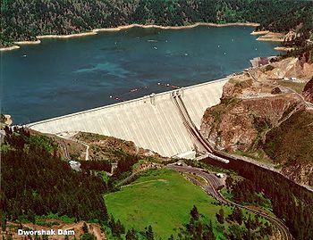
| Dworshak Reservoir | 3468000 acre.ft | Idaho Idaho Idaho is a state in the Rocky Mountain area of the United States. The state's largest city and capital is Boise. Residents are called "Idahoans". Idaho was admitted to the Union on July 3, 1890, as the 43rd state.... |
Dworshak Dam Dworshak Dam Dworshak Dam is a hydroelectric, concrete gravity dam in Clearwater County, Idaho, United States on the North Fork Clearwater River. The dam is located northwest of the city of Orofino, and east of Lewiston. The dam is the highest straight-axis concrete dam in the Western Hemisphere and the 22nd... |
North Fork Clearwater River North Fork Clearwater River The North Fork Clearwater River is a major tributary of the Clearwater River in the U.S. state of Idaho.From its headwaters in the Bitterroot Mountains of eastern Idaho, it flows southwest, north, then again southwest, and is dammed by the Dworshak Dam just above its mouth at the Clearwater in... |
 |
| Hungry Horse Reservoir | 3467179 acre.ft | Montana Montana Montana is a state in the Western United States. The western third of Montana contains numerous mountain ranges. Smaller, "island ranges" are found in the central third of the state, for a total of 77 named ranges of the Rocky Mountains. This geographical fact is reflected in the state's name,... |
Hungry Horse Dam Hungry Horse Dam Hungry Horse Dam is an arch dam on the South Fork Flathead River in the Rocky Mountains of the U.S. state of Montana. It is located in Flathead National Forest, in Flathead County, about south of the west entrance to Glacier National Park, southeast of Columbia Falls, and northeast of Kalispell... |
South Fork Flathead River South Fork Flathead River The South Fork Flathead River is a major river in Northwestern Montana in the northwest United States. It is one of the three main forks of the Flathead River, a tributary of the Clark Fork River... |
|
| Theodore Roosevelt Lake Theodore Roosevelt Lake Theodore Roosevelt Lake is a large reservoir formed by Theodore Roosevelt Dam on the Salt River in Arizona as part of the Salt River Project... |
2910200 acre.ft | Arizona Arizona Arizona ; is a state located in the southwestern region of the United States. It is also part of the western United States and the mountain west. The capital and largest city is Phoenix... |
Roosevelt Dam | Salt River Salt River (Arizona) The Salt River is a stream in the U.S. state of Arizona. It is the largest tributary of the Gila River. The river is about long. Its drainage basin is about large. The longest of the Salt River's many tributaries is the Verde River... |
 |
| Lake Ouachita Lake Ouachita Lake Ouachita is a reservoir created by the damming of the Ouachita River by Blakely Mountain Dam . The lake is located near Hot Springs, Arkansas. Lake Ouachita is the largest lake completely in Arkansas, as the larger Bull Shoals Lake extends into Missouri. Lake Ouachita has over of shoreline... |
2768000 acre.ft | Arkansas Arkansas Arkansas is a state located in the southern region of the United States. Its name is an Algonquian name of the Quapaw Indians. Arkansas shares borders with six states , and its eastern border is largely defined by the Mississippi River... |
Blakely Mountain Dam | Ouachita River Ouachita River The Ouachita River is a river that runs south and east through the U.S. states of Arkansas and Louisiana, joining the Tensas River to form the Black River near Jonesville, Louisiana.-Course:... |
|
| Falcon International Reservoir Falcon International Reservoir Falcon International Reservoir, commonly called Falcon Lake, is a reservoir on the Rio Grande 40 miles southeast of Laredo, Texas, USA, and Nuevo Laredo, Tamaulipas, Mexico. The huge lake is bounded by Starr and Zapata counties on the Texas side of the international border and the municipality and... |
2645646 acre.ft | Texas Texas Texas is the second largest U.S. state by both area and population, and the largest state by area in the contiguous United States.The name, based on the Caddo word "Tejas" meaning "friends" or "allies", was applied by the Spanish to the Caddo themselves and to the region of their settlement in... , Tamaulipas Tamaulipas Tamaulipas officially Estado Libre y Soberano de Tamaulipas is one of the 31 states which, with the Federal District, comprise the 32 Federal Entities of Mexico. It is divided in 43 municipalities and its capital city is Ciudad Victoria. The capital city was named after Guadalupe Victoria, the... |
Falcon Dam Falcon Dam Falcon Dam is an earthen embankment dam on the Rio Grande between Starr County in the U.S. state of Texas and the city of Nueva Ciudad Guerrero in the Mexican state of Tamaulipas... |
Rio Grande Rio Grande The Rio Grande is a river that flows from southwestern Colorado in the United States to the Gulf of Mexico. Along the way it forms part of the Mexico – United States border. Its length varies as its course changes... |
|
| Lake Texoma Lake Texoma Lake Texoma is one of the largest reservoirs in the United States, the 12th largest Corps of Engineers lake, and the largest in USACE Tulsa District.... |
2525568 acre.ft | Oklahoma Oklahoma Oklahoma is a state located in the South Central region of the United States of America. With an estimated 3,751,351 residents as of the 2010 census and a land area of 68,667 square miles , Oklahoma is the 28th most populous and 20th-largest state... , Texas Texas Texas is the second largest U.S. state by both area and population, and the largest state by area in the contiguous United States.The name, based on the Caddo word "Tejas" meaning "friends" or "allies", was applied by the Spanish to the Caddo themselves and to the region of their settlement in... |
Denison Dam Denison Dam Denison Dam, also known as Lake Texoma Dam, is a dam located on the Red River between Texas and Oklahoma that impounds Lake Texoma. The purpose of the dam is flood control, water supply, hydroelectric power production, river regulation, navigation and recreation.-History:Completed in 1943 primarily... |
Red River |  |
| Painted Rock Reservoir | 2491700 acre.ft | Arizona Arizona Arizona ; is a state located in the southwestern region of the United States. It is also part of the western United States and the mountain west. The capital and largest city is Phoenix... |
Painted Rock Dam | Gila River Gila River The Gila River is a tributary of the Colorado River, 650 miles long, in the southwestern states of New Mexico and Arizona.-Description:... |
 |
| New Melones Lake New Melones Lake New Melones Lake is an artificial lake in the central Sierra Nevada foothills of Calaveras- and Tuolumne County, California near Jamestown. This reservoir created by the construction of the New Melones Dam across the Stanislaus River has a capacity with a surface area of... |
2460000 acre.ft | California California California is a state located on the West Coast of the United States. It is by far the most populous U.S. state, and the third-largest by land area... |
New Melones Dam New Melones Dam New Melones Dam is an earth and rock filled dam across the Stanislaus River creating New Melones Lake. Situated between Calaveras and Tuolumne County, California in the Sierra Nevada foothills near Jamestown, the dam was completed in 1979 replacing the old Melones Dam.-Background:The dam was... |
Stanislaus River Stanislaus River The Stanislaus River in California is one of the largest tributaries of the San Joaquin River. The river is long and has north, middle and south forks... |
 |
| Trinity Lake Trinity Lake Trinity Lake, previously called Clair Engle Lake, is a lake on the Trinity River formed by the Trinity Dam and located in Trinity County, California, The dam was built by the U.S. Bureau of Reclamation. The lake has a capacity of , making it one of the largest reservoirs in California. The lake's... |
2447650 acre.ft | California California California is a state located on the West Coast of the United States. It is by far the most populous U.S. state, and the third-largest by land area... |
Trinity Dam Trinity Dam Trinity Dam is an earth dam on the Trinity River that forms Trinity Lake near Weaverville, California. Trinity Lake was previously called Clair Engle Lake. The earthfill dam was built by the U.S. Bureau of Reclamation. Construction was completed in 1962. Trinity Lake has a capacity of , making it... |
Trinity River Trinity River (California) The Trinity River is the longest tributary of the Klamath River, approximately long, in northwestern California in the United States. It drains an area of the Coast Ranges, including the southern Klamath Mountains, northwest of the Sacramento Valley... |
|
| Smith Mountain Lake Smith Mountain Lake Smith Mountain Lake is a large reservoir in the Roanoke Region of Virginia, located southeast of the City of Roanoke and southwest of Lynchburg. The lake was created in 1963 by the Smith Mountain Dam impounding the Roanoke River. The majority of the south shore of the lake lies in Franklin County... |
2270018 acre.ft | Virginia Virginia The Commonwealth of Virginia , is a U.S. state on the Atlantic Coast of the Southern United States. Virginia is nicknamed the "Old Dominion" and sometimes the "Mother of Presidents" after the eight U.S. presidents born there... |
Smith Mountain Dam Smith Mountain Dam Smith Mountain Dam is concrete arch dam located on the Roanoke River in Virginia, creating Smith Mountain Lake. The dam was built by Appalachian Power between 1960 and 1963 for the purposes of hydroelectricity via pumped-storage hydroelectricity... |
Roanoke River Roanoke River The Roanoke River is a river in southern Virginia and northeastern North Carolina in the United States, 410 mi long. A major river of the southeastern United States, it drains a largely rural area of the coastal plain from the eastern edge of the Appalachian Mountains southeast across the Piedmont... |
|
| Eufaula Lake Eufaula Lake Eufaula Lake is a reservoir in Oklahoma. It is located on the Canadian River, upstream from its confluence with the Arkansas River and near the town of Eufaula. It is the largest lake in the state of Oklahoma with and of shoreline.... |
2099000 acre.ft | Oklahoma Oklahoma Oklahoma is a state located in the South Central region of the United States of America. With an estimated 3,751,351 residents as of the 2010 census and a land area of 68,667 square miles , Oklahoma is the 28th most populous and 20th-largest state... |
Eufaula Dam Eufaula Dam Eufaula Dam is a dam across the Canadian River in Oklahoma. Completed in 1964, it impounds Eufaula Lake, one of the world’s largest man-made lakes, covering 102,500 acres . The dam serves to provide flood control, water supply, navigation and hydroelectric power generation. It supports a 90 MW... |
Canadian River Canadian River The Canadian River is the longest tributary of the Arkansas River. It is about long, starting in Colorado and traveling through New Mexico, the Texas Panhandle, and most of Oklahoma.... |
 |
| Elephant Butte Reservoir Elephant Butte Reservoir Elephant Butte Reservoir is a reservoir on the Rio Grande in the U.S. state of New Mexico, north of Truth or Consequences. It is impounded by Elephant Butte Dam and is the largest reservoir in New Mexico... |
2065010 acre.ft | New Mexico New Mexico New Mexico is a state located in the southwest and western regions of the United States. New Mexico is also usually considered one of the Mountain States. With a population density of 16 per square mile, New Mexico is the sixth-most sparsely inhabited U.S... |
Elephant Butte Dam Elephant Butte Dam Elephant Butte Dam or Elephant Butte Dike is a concrete gravity dam on the Rio Grande near Truth or Consequences, New Mexico. The river was dammed here, impounding the Elephant Butte Reservoir for recreation and agriculture, lessening the downstream flow from a Rio Bravo to a stream a foot deep.The... |
Rio Grande Rio Grande The Rio Grande is a river that flows from southwestern Colorado in the United States to the Gulf of Mexico. Along the way it forms part of the Mexico – United States border. Its length varies as its course changes... |
|
| Canyon Ferry Lake Canyon Ferry Lake thumb|Canyon Ferry LakeCanyon Ferry Lake is a reservoir on the Missouri River near Helena, Montana and Townsend, Montana. It is Montana's third largest body of water, covering 35,181 acres and 76 miles of shore . The dam was completed in 1954 and has been used for... |
2051000 acre.ft | Montana Montana Montana is a state in the Western United States. The western third of Montana contains numerous mountain ranges. Smaller, "island ranges" are found in the central third of the state, for a total of 77 named ranges of the Rocky Mountains. This geographical fact is reflected in the state's name,... |
Canyon Ferry Dam Canyon Ferry Dam Canyon Ferry Dam is a concrete gravity dam in a narrow valley of the Missouri River where the Big Belt Mountains and the Spokane Hills merge, approximately downstream from the confluence of the Gallatin, Madison, and Jefferson Rivers, and about east of the city of Helena, Montana... |
Missouri River Missouri River The Missouri River flows through the central United States, and is a tributary of the Mississippi River. It is the longest river in North America and drains the third largest area, though only the thirteenth largest by discharge. The Missouri's watershed encompasses most of the American Great... |
|
| San Luis Reservoir San Luis Reservoir The San Luis Reservoir is an off-stream artificial lake in the eastern slopes of the Diablo Range of Merced County, California, approximately west of Los Banos on State Route 152, which crosses Pacheco Pass and runs along its north shore. The reservoir stores water taken from the San... |
2041000 acre.ft | California California California is a state located on the West Coast of the United States. It is by far the most populous U.S. state, and the third-largest by land area... |
San Luis Dam San Luis Dam San Luis Dam is a dam that creates San Luis Reservoir, which serves as an off-stream reservoir for the California State Water Project and the Central Valley Project. It is also known as the B.F. Sisk Dam, after Bernie Sisk. The earth-fill gravity embankment dam is 305 feet tall and was completed... |
Offstream/San Luis Creek | |
| Don Pedro Reservoir | 2030000 acre.ft | California California California is a state located on the West Coast of the United States. It is by far the most populous U.S. state, and the third-largest by land area... |
New Don Pedro Dam New Don Pedro Dam New Don Pedro Dam is built across the Tuolumne River and creates Lake Don Pedro in the foothills of the Sierra Nevada mountain range in the U.S. state of California. The New Don Pedro Dam takes its name from Don Pedros Bar which was named after Pierre "Don Pedro" Sainsevain... |
Tuolumne River Tuolumne River The Tuolumne River is a California river that flows nearly from the central Sierra Nevada to the San Joaquin River in the Central Valley... |
 |
| Lake McConaughy Lake McConaughy Lake McConaughy is a reservoir on the North Platte River. It is located north of Ogallala, Nebraska, United States, near U.S. Highway 26 and Nebraska Highway 61. The reservoir was named for Charles W. McConaughy, a grain merchant and mayor of Holdrege, Nebraska, one of the leading promoters of... |
1948000 acre.ft | Nebraska Nebraska Nebraska is a state on the Great Plains of the Midwestern United States. The state's capital is Lincoln and its largest city is Omaha, on the Missouri River.... |
Kingsley Dam Kingsley Dam Kingsley Dam is located on the east side of Lake McConaughy in central Keith County, Nebraska, and is the second largest hydraulic fill dam in the world. It was built as part of the New Deal project. The dam is tall, long, and 1,100 wide at its base. On the east side of the dam is Lake Ogallala... |
North Platte River North Platte River The North Platte River is a major tributary of the Platte River and is approximately long counting its many curves, It travels about distance. Its course lies in the U.S... |
 |
| Lake Sharpe Lake Sharpe Lake Sharpe is a large reservoir behind Big Bend Dam on the Missouri River in central South Dakota, USA. The lake has an area of and a maximum depth of . Lake Sharpe is approximately long, with a shoreline of .... |
1910000 acre.ft | South Dakota South Dakota South Dakota is a state located in the Midwestern region of the United States. It is named after the Lakota and Dakota Sioux American Indian tribes. Once a part of Dakota Territory, South Dakota became a state on November 2, 1889. The state has an area of and an estimated population of just over... |
Big Bend Dam Big Bend Dam Big Bend Dam is a major rolled earth dam along the Missouri River in central South Dakota.The dam, 95 feet high and 10,570 feet in length, was constructed as part of the Pick-Sloan Plan for Missouri watershed development authorized by the Flood Control Act of 1944. Construction began in 1959 and... |
Missouri River Missouri River The Missouri River flows through the central United States, and is a tributary of the Mississippi River. It is the longest river in North America and drains the third largest area, though only the thirteenth largest by discharge. The Missouri's watershed encompasses most of the American Great... |
 |
| Lake Mohave Lake Mohave Lake Mohave is a reservoir formed by Davis Dam on the Colorado River, which defines the border between Nevada and Arizona in the United States. The lake lies at an elevation of near Laughlin, Nevada, Searchlight, Nevada, Cottonwood Cove, Nevada, and Bullhead City, Arizona, about downstream from... |
1818300 acre.ft | Nevada Nevada Nevada is a state in the western, mountain west, and southwestern regions of the United States. With an area of and a population of about 2.7 million, it is the 7th-largest and 35th-most populous state. Over two-thirds of Nevada's people live in the Las Vegas metropolitan area, which contains its... , Arizona Arizona Arizona ; is a state located in the southwestern region of the United States. It is also part of the western United States and the mountain west. The capital and largest city is Phoenix... |
Davis Dam Davis Dam Davis Dam is a dam on the Colorado River about downstream from Hoover Dam. It stretches across the border between Arizona and Nevada. Originally called Bullhead Dam, Davis Dam was renamed after Arthur Powell Davis, who was the director of the U.S. Bureau of Reclamation from 1914 to 1932... |
Colorado River Colorado River The Colorado River , is a river in the Southwestern United States and northwestern Mexico, approximately long, draining a part of the arid regions on the western slope of the Rocky Mountains. The watershed of the Colorado River covers in parts of seven U.S. states and two Mexican states... |
 |
| Navajo Lake Navajo Lake Navajo Lake is a reservoir located in San Juan County and Rio Arriba County in northwestern New Mexico, in the southwestern United States. Portions of the reservoir extend into Archuleta County in southern Colorado... |
1708600 acre.ft | New Mexico New Mexico New Mexico is a state located in the southwest and western regions of the United States. New Mexico is also usually considered one of the Mountain States. With a population density of 16 per square mile, New Mexico is the sixth-most sparsely inhabited U.S... |
Navajo Dam Navajo Dam Navajo Dam is an earthen dam on the San Juan River, a tributary of the Colorado River, in northwestern New Mexico in the United States. The dam and its reservoir, Navajo Lake, lie in the arid western foothills of the Rocky Mountains about east of Farmington.... |
San Juan River | 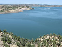 |
| Riffe Lake Riffe Lake Riffe Lake is a long reservoir on the Cowlitz River in the U.S. state of Washington. Originally named Davisson Lake, it was created in 1968 with the construction of Mossyrock Dam. The lake was renamed in 1976 after the community of Riffe, which was inundated by the lake.... |
1685000 acre.ft | Washington | Mossyrock Dam Mossyrock Dam Mossyrock Dam is a concrete arch-gravity dam on the Cowlitz River near Mossyrock in Lewis County, Washington. The reservoir created by the dam is called Riffe Lake and the primary purpose of the dam is hydroelectric production while flood control is secondary... |
Cowlitz River Cowlitz River The Cowlitz River is a river in the state of Washington in the United States, a tributary of the Columbia River. Its tributaries drain a large region including the slopes of Mount Rainier, Mount Adams, and Mount St. Helens.... |
 |
| American Falls Reservoir | 1671300 acre.ft | Idaho Idaho Idaho is a state in the Rocky Mountain area of the United States. The state's largest city and capital is Boise. Residents are called "Idahoans". Idaho was admitted to the Union on July 3, 1890, as the 43rd state.... |
American Falls Dam American Falls Dam The American Falls Dam is a concrete gravity-type dam located near the town of American Falls, Idaho, on river mile 714.7 of the Snake River. The dam and reservoir are a part of the Minidoka Project on the Snake River Plain and are used primarily for flood control, irrigation, and recreation... |
Snake River Snake River The Snake is a major river of the greater Pacific Northwest in the United States. At long, it is the largest tributary of the Columbia River, the largest North American river that empties into the Pacific Ocean... |
 |
| Lake Berryessa Lake Berryessa Lake Berryessa is the largest lake in Napa County, California. This reservoir is formed by the Monticello Dam, which provides water and hydroelectricity to the North Bay region of the San Francisco Bay Area.... |
1602000 acre.ft | California California California is a state located on the West Coast of the United States. It is by far the most populous U.S. state, and the third-largest by land area... |
Monticello Dam Monticello Dam Monticello Dam is a dam in Napa County, California, United States constructed between 1953 and 1957. It is a medium concrete-arch dam with a structural height of 304 ft and a crest length of . It contains 326,000 cubic yards of concrete... |
Putah Creek Putah Creek Putah Creek is a major stream in Northern California, a tributary of the Yolo Bypass. The creek has its headwaters in the Mayacamas Mountains, a part of the Coast Range... |
|
| Brownlee Reservoir | 1426700 acre.ft | Idaho Idaho Idaho is a state in the Rocky Mountain area of the United States. The state's largest city and capital is Boise. Residents are called "Idahoans". Idaho was admitted to the Union on July 3, 1890, as the 43rd state.... , Oregon Oregon Oregon is a state in the Pacific Northwest region of the United States. It is located on the Pacific coast, with Washington to the north, California to the south, Nevada on the southeast and Idaho to the east. The Columbia and Snake rivers delineate much of Oregon's northern and eastern... |
Brownlee Dam Brownlee Dam Brownlee Dam is a hydroelectric earth fill embankment dam on the Snake River on the Idaho-Oregon border, in Hells Canyon . It impounds the Snake River in the long Brownlee Reservoir... |
Snake River Snake River The Snake is a major river of the greater Pacific Northwest in the United States. At long, it is the largest tributary of the Columbia River, the largest North American river that empties into the Pacific Ocean... |
 |
| Bighorn Lake Bighorn Lake Bighorn Lake is a reservoir in the United States located in Southern Montana and Northern Wyoming in the Bighorn Canyon National Recreation Area. The lake is 40 mi south of Billings, Montana. Bighorn Lake was created by the construction of Yellowtail Dam near Fort Smith, Montana in 1965... |
1381189 acre.ft | Montana Montana Montana is a state in the Western United States. The western third of Montana contains numerous mountain ranges. Smaller, "island ranges" are found in the central third of the state, for a total of 77 named ranges of the Rocky Mountains. This geographical fact is reflected in the state's name,... |
Yellowtail Dam Yellowtail Dam Yellowtail Dam is a dam across the Bighorn River in southwestern Montana in the United States. The mid-1960s era concrete arch dam serves to regulate the flow of the Bighorn for irrigation purposes and to generate hydroelectric power. The dam and its reservoir, Bighorn Lake, are owned by the U.S... |
Bighorn River Bighorn River The Bighorn River is a tributary of the Yellowstone, approximately long, in the western United States in the states of Wyoming and Montana. The river was named in 1805 by fur trader François Larocque for the Bighorn Sheep he saw along its banks as he explored the Yellowstone River.The upper... |
|
| Lake Wallula Lake Wallula Lake Wallula is a reservoir on the Columbia River in the United States, between the U.S. states of Washington and Oregon. It was created in 1954 with the construction of McNary Dam. It reaches from McNary Dam near the city of Umatilla, Oregon, to the Tri-Cities of Washington.-See also:* Wallula... |
1350000 acre.ft | Oregon Oregon Oregon is a state in the Pacific Northwest region of the United States. It is located on the Pacific coast, with Washington to the north, California to the south, Nevada on the southeast and Idaho to the east. The Columbia and Snake rivers delineate much of Oregon's northern and eastern... , Washington |
McNary Dam McNary Dam McNary Dam is a 1.4-mile long concrete gravity run-of-the-river dam which spans the Columbia River. It joins Umatilla County, Oregon with Benton County, Washington, 292 miles upriver from the mouth of the Columbia at Astoria, Oregon. It is operated by the U.S. Army Corps of Engineers' McNary... |
Columbia River Columbia River The Columbia River is the largest river in the Pacific Northwest region of North America. The river rises in the Rocky Mountains of British Columbia, Canada, flows northwest and then south into the U.S. state of Washington, then turns west to form most of the border between Washington and the state... |
|
| Banks Lake Banks Lake Banks Lake is a long reservoir in central Washington in the United States.Part of the Columbia Basin Project, Banks Lake occupies the northern portion of the Grand Coulee, a formerly dry coulee near the Columbia River, formed by the Missoula Floods during the Pleistocene epoch. Grand Coulee Dam,... |
1297153 acre.ft | Washington | Dry Falls Dam Dry Falls Dam Dry Falls Dam is a rockfaced earthfill-type dam in the U.S. state of Washington. Located in Grant County near Coulee City, it was built as part of the Bureau of Reclamation's Columbia Basin Project. Water from the Columbia River, impounded by Grand Coulee Dam, is pumped into Grand Coulee, a... |
Offstream/Grand Coulee Grand Coulee The Grand Coulee is an ancient river bed in the U.S. state of Washington. This National Natural Landmark stretches for about sixty miles southwest from Grand Coulee Dam to Soap Lake, being bisected by Dry Falls into the Upper and Lower Grand Coulee.... |
 |
| Quabbin Reservoir Quabbin Reservoir The Quabbin Reservoir is the largest inland body of water in the Commonwealth of Massachusetts and was built between 1930 and 1939. Today along with the Wachusett Reservoir, it is the primary water supply for Boston, some to the east, as well as 40 other communities in Greater Boston... |
1265000 acre.ft | Massachusetts | Winsor Dam Winsor Dam The Winsor Dam and the Goodnough Dike impound the waters of the Swift River and the Ware River Diversion forming the Quabbin Reservoir, the largest water body in Massachusetts. According to the Massachusetts Department of Conservation and Recreation the Winsor Dam is one of the largest dams in the... and Goodnough Dike Goodnough Dike The Goodnough Dike is on the southeastern end of the Quabbin Reservoir, the largest water body in Massachusetts. It impounds the waters of Beaver Brook and therefore closes that exit to the Chicopee River Watershed. The Goodnough Dike is not as large as the Winsor Dam, but it is equally important... |
Chicopee River Chicopee River The Chicopee River is an tributary of the Connecticut River in Metropolitan Springfield, Massachusetts, known for fast-moving water and its extraordinarily large basin: the Connecticut River's largest tributary basin... |
|
| Lake McClure Lake McClure Lake McClure is a artificial lake in western Mariposa County, California, about east of Modesto. It is formed by New Exchequer Dam on the Merced River, a tributary of the San Joaquin River, and its capacity is . It is a rock-fill dam with a reinforced concrete face and was completed in 1967... |
1032000 acre.ft | California California California is a state located on the West Coast of the United States. It is by far the most populous U.S. state, and the third-largest by land area... |
New Exchequer Dam New Exchequer Dam New Exchequer Dam is an earthfill dam on the Merced River in central California. It is mainly used by the Merced Irrigation District to provide irrigation water to several hundred square miles of the San Joaquin Valley surrounding the line of the Merced River.The dam was built to increase the... |
Merced River Merced River The Merced River , in the central part of the U.S. state of California, is a -long tributary of the San Joaquin River flowing from the Sierra Nevada into the Central Valley. It is most well known for its swift and steep course through the southern part of Yosemite National Park, and the... |
|
| Seminoe Reservoir | 1017279 acre.ft | Wyoming Wyoming Wyoming is a state in the mountain region of the Western United States. The western two thirds of the state is covered mostly with the mountain ranges and rangelands in the foothills of the Eastern Rocky Mountains, while the eastern third of the state is high elevation prairie known as the High... |
Seminoe Dam Seminoe Dam Seminoe Dam is a concrete arch dam on the North Platte River in the U.S. state of Wyoming. The dam stores irrigation water and generates hydroelectricity, and is owned and operated by the U.S. Bureau of Reclamation. It lies in a narrow canyon in the semiarid, windswept hinterlands of the... |
North Platte River North Platte River The North Platte River is a major tributary of the Platte River and is approximately long counting its many curves, It travels about distance. Its course lies in the U.S... |
|
| Pathfinder Reservoir Pathfinder Reservoir Pathfinder Reservoir is located in the U.S. state of Wyoming on the North Platte River between Casper and Rawlins. It sits 47 miles southwest of Casper, in Carbon County and Natrona County. The reservoir was created by Pathfinder Dam and has a storage capacity of . The shoreline consists of 117... |
1016000 acre.ft | Wyoming Wyoming Wyoming is a state in the mountain region of the Western United States. The western two thirds of the state is covered mostly with the mountain ranges and rangelands in the foothills of the Eastern Rocky Mountains, while the eastern third of the state is high elevation prairie known as the High... |
Pathfinder Dam Pathfinder Dam Pathfinder Dam is a cyclopean masonry dam, located on the North Platte River, approximately southwest of Casper, Wyoming. It was originally constructed between 1905 and 1909 as part of the North Platte Project and has been modified several times since then. It is included on the National Register... |
North Platte River North Platte River The North Platte River is a major tributary of the Platte River and is approximately long counting its many curves, It travels about distance. Its course lies in the U.S... |
|
| Folsom Lake Folsom Lake Folsom Lake is a reservoir in Northern California about northeast of Sacramento in Placer, El Dorado, and Sacramento Counties. The lake is formed by Folsom Dam, constructed in 1955 to control the American River. The dam and lake are part of the Folsom Project, which also includes the Nimbus... |
1010000 acre.ft | California California California is a state located on the West Coast of the United States. It is by far the most populous U.S. state, and the third-largest by land area... |
Folsom Dam Folsom Dam Folsom Dam is a concrete gravity dam on the American River in Northern California, about northeast of Sacramento. Folsom Dam is high concrete and long, flanked by earthen wing dams... |
American River American River The American River is a California watercourse noted as the site of Sutter's Mill, northwest of Placerville, California, where gold was found in 1848, leading to the California Gold Rush... |
|
| Pine Flat Lake Pine Flat Lake Pine Flat Lake is an artificial lake in the Sierra Nevada foothills of eastern Fresno County, California and provides the western north-south border to the Sierra- and Sequoia National Forests, about east of Fresno.... |
1000000 acre.ft | California California California is a state located on the West Coast of the United States. It is by far the most populous U.S. state, and the third-largest by land area... |
Pine Flat Dam Pine Flat Dam Pine Flat Dam is on the Kings River in the San Joaquin Valley, near Piedra in Fresno County, California, and forms Pine Flat Lake. It is a concrete gravity dam. The dam is owned and operated by the U.S. Army Corps of Engineers. Construction of the dam began in 1949 and was completed in 1954... |
Kings River Kings River (California) The Kings River is a major river of south-central California. About long, it drains an area of the high western Sierra Nevada and the Central Valley. A large alluvial fan has formed where the river's gradient decreases in the Central Valley so the river divides into distributaries... |