
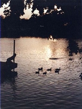
Putah Creek
Encyclopedia
Putah Creek is a major stream in Northern California
, a tributary of the Yolo Bypass
. The 85 miles (136.8 km) creek has its headwaters in the Mayacamas Mountains, a part of the Coast Range
. The true meaning of "Putah" in Putah Creek has been the subject of discussion and speculation.
south of the town of Cobb
in southwestern Lake County
. It descends eastward to the town of Whispering Pines, where it turns southeast, parallelling State Route 175. It passes the town of Anderson Springs, where it joins Bear Canyon Creek. North of Middletown
, it curves counterclockwise around Harbin Mountain, merging in close succession with Dry Creek, Helena Creek, Crazy Creek, Harbin Creek, and Big Canyon Creek. From Harbin Mountain, it flows east again, joining Bucksnort Creek, then enters Napa County
at a confluence with Hunting Creek about 11 mi (18 km) east of Middletown. In Napa County, the creek flows southeast, merging with Butts Creek just before it empties into Lake Berryessa
.
Downstream of Monticello Dam
, on the southeastern corner of the lake, Putah Creek leaves Napa County and becomes the boundary between Yolo County
and Solano County
. In this section it offers excellent fishing
/fly fishing
opportunities year round. The stream continues East along State Route 128
, meeting Pleasants Creek, McCune Creek, and Dry Creek and passing through the town of Winters
to reach Interstate 505
. From there it continues eastward, parallelling Putah Creek Road to Stevenson Bridge Road. A few miles east of Davis, the county line turns south, but the creek continues eastward, passing south of Davis to feed into the Yolo Bypass about a quarter mile (400 m) west of the Sacramento Deep Water Channel.
arch dam, is the only major storage dam on the creek. It forms Lake Berryessa, which has a capacity of 1602000 acre.ft, making it one of the largest reservoirs in the state of California. The dam and lake are part of the United States Bureau of Reclamation
's Solano Project. The project's purpose is to provide water for irrigation, though it also supplies municipal and industrial water to major cities in Solano County. About 32000 acre.ft is provided by the project annually. An 11 MW hydroelectric
plant generates electricity for the Solano Irrigation District, which owns and operates the dam.
Putah Diversion Dam diverts water into Putah South Canal about 6 miles (9.7 km) downstream of Monticello Dam. The dam is a gated concrete weir
structure with an earth-fill embankment wing. It creates the small Lake Solano, which has a capacity of only 750 acre.ft. The canal
is entirely concrete-lined except for a mile (1.6 km) of pipe called the Putah South Pipeline. Most of the lands are below the level of the canal and are served by gravity. Lands above pump water straight from the canal. The canal ends at Terminal Dam, which is made from earth-fill. The dam forms a small 119 acre.foot reservoir. The reservoir supplies drinking water
to the city of Vallejo
. Most of the canal is operated by Solano Irrigation District, but the Bureau of Reclamation operates the headworks.
song Green River
and served as a vacation spot for John Fogerty
.
puta, meaning whore. Some consider the resemblance to be "purely accidental". "Puta wuwwe" may also mean "grassy creek" in native Miwok
, but other possibilities (including "whore") are discussed by historical sources.
Northern California
Northern California is the northern portion of the U.S. state of California. The San Francisco Bay Area , and Sacramento as well as its metropolitan area are the main population centers...
, a tributary of the Yolo Bypass
Yolo Bypass
The Yolo Bypass is one of two flood bypasses in the Sacramento Valley located in Yolo and Solano Counties. It protects Sacramento and other riverside communities from flooding through a system of weirs...
. The 85 miles (136.8 km) creek has its headwaters in the Mayacamas Mountains, a part of the Coast Range
Pacific Coast Ranges
The Pacific Coast Ranges and the Pacific Mountain System are the series of mountain ranges that stretch along the West Coast of North America from Alaska south to Northern and Central Mexico...
. The true meaning of "Putah" in Putah Creek has been the subject of discussion and speculation.
Geography
The creek originates from springs on the east side of Cobb MountainCobb Mountain
Cobb Mountain is the tallest mountain in the Mayacamas Mountains of California. Its 4720+ feet, main summit is located in Lake County, west of the town of Cobb...
south of the town of Cobb
Cobb, California
Cobb is a census-designated place in Lake County, California, United States. Cobb is located northwest of Whispering Pines, at an elevation of 2631 feet...
in southwestern Lake County
Lake County, California
Lake County is a county located in the north central portion of the U.S. state of California, north of the San Francisco Bay Area. It takes its name from Clear Lake, the dominant geographic feature in the county and the largest natural lake wholly within California...
. It descends eastward to the town of Whispering Pines, where it turns southeast, parallelling State Route 175. It passes the town of Anderson Springs, where it joins Bear Canyon Creek. North of Middletown
Middletown, California
Middletown is a census-designated place in Lake County, California, United States. Middletown is located south of Lower Lake, at an elevation of 1099 feet . The population was 1,323 at the 2010 census, up from 1,020 at the 2000 census...
, it curves counterclockwise around Harbin Mountain, merging in close succession with Dry Creek, Helena Creek, Crazy Creek, Harbin Creek, and Big Canyon Creek. From Harbin Mountain, it flows east again, joining Bucksnort Creek, then enters Napa County
Napa County, California
Napa County is a county located north of the San Francisco Bay Area in the U.S. state of California. It is coterminous with the Napa, California, Metropolitan Statistical Area. As of 2010 the population is 136,484. The county seat is Napa....
at a confluence with Hunting Creek about 11 mi (18 km) east of Middletown. In Napa County, the creek flows southeast, merging with Butts Creek just before it empties into Lake Berryessa
Lake Berryessa
Lake Berryessa is the largest lake in Napa County, California. This reservoir is formed by the Monticello Dam, which provides water and hydroelectricity to the North Bay region of the San Francisco Bay Area....
.
Downstream of Monticello Dam
Monticello Dam
Monticello Dam is a dam in Napa County, California, United States constructed between 1953 and 1957. It is a medium concrete-arch dam with a structural height of 304 ft and a crest length of . It contains 326,000 cubic yards of concrete...
, on the southeastern corner of the lake, Putah Creek leaves Napa County and becomes the boundary between Yolo County
Yolo County, California
Yolo County is a county located in the northern part of the U.S. state of California, bordered by the other counties of Sacramento, Solano, Napa, Lake, Colusa, and Sutter. The city of Woodland is its county seat, though Davis is its largest city....
and Solano County
Solano County, California
Solano County is a county located in Bay-Delta region of the U.S. state of California, about halfway between San Francisco and Sacramento and is one of the nine San Francisco Bay Area counties. The county's population was reported by the U.S. Census to be 413,344 in 2010...
. In this section it offers excellent fishing
Fishing
Fishing is the activity of trying to catch wild fish. Fish are normally caught in the wild. Techniques for catching fish include hand gathering, spearing, netting, angling and trapping....
/fly fishing
Fly fishing
Fly fishing is an angling method in which an artificial 'fly' is used to catch fish. The fly is cast using a fly rod, reel, and specialized weighted line. Casting a nearly weightless fly or 'lure' requires casting techniques significantly different from other forms of casting...
opportunities year round. The stream continues East along State Route 128
California State Route 128
State Route 128 is a state highway in the U.S. state of California, connecting the Mendocino coast to the Central Valley through the state's Wine Country.-Route description:...
, meeting Pleasants Creek, McCune Creek, and Dry Creek and passing through the town of Winters
Winters, California
Winters is a city in Yolo County, California. The population was 6,624 as of the 2010 census. It is part of the Sacramento–Arden-Arcade–Roseville Metropolitan Statistical Area. The city is near Lake Berryessa. It is noted as the one-time residence of cartoonist R...
to reach Interstate 505
Interstate 505
Interstate 505 is an Interstate Highway in California between Interstate 80 in Vacaville and Interstate 5 near Dunnigan. I-505 is primarily a rural interstate, but travels through Vacaville and the city of Winters. The interstate is the primary route connecting the San Francisco Bay Area and the...
. From there it continues eastward, parallelling Putah Creek Road to Stevenson Bridge Road. A few miles east of Davis, the county line turns south, but the creek continues eastward, passing south of Davis to feed into the Yolo Bypass about a quarter mile (400 m) west of the Sacramento Deep Water Channel.
Dams and diversions
Monticello Dam, a concreteConcrete
Concrete is a composite construction material, composed of cement and other cementitious materials such as fly ash and slag cement, aggregate , water and chemical admixtures.The word concrete comes from the Latin word...
arch dam, is the only major storage dam on the creek. It forms Lake Berryessa, which has a capacity of 1602000 acre.ft, making it one of the largest reservoirs in the state of California. The dam and lake are part of the United States Bureau of Reclamation
United States Bureau of Reclamation
The United States Bureau of Reclamation , and formerly the United States Reclamation Service , is an agency under the U.S...
's Solano Project. The project's purpose is to provide water for irrigation, though it also supplies municipal and industrial water to major cities in Solano County. About 32000 acre.ft is provided by the project annually. An 11 MW hydroelectric
Hydroelectricity
Hydroelectricity is the term referring to electricity generated by hydropower; the production of electrical power through the use of the gravitational force of falling or flowing water. It is the most widely used form of renewable energy...
plant generates electricity for the Solano Irrigation District, which owns and operates the dam.
Putah Diversion Dam diverts water into Putah South Canal about 6 miles (9.7 km) downstream of Monticello Dam. The dam is a gated concrete weir
Weir
A weir is a small overflow dam used to alter the flow characteristics of a river or stream. In most cases weirs take the form of a barrier across the river that causes water to pool behind the structure , but allows water to flow over the top...
structure with an earth-fill embankment wing. It creates the small Lake Solano, which has a capacity of only 750 acre.ft. The canal
Canal
Canals are man-made channels for water. There are two types of canal:#Waterways: navigable transportation canals used for carrying ships and boats shipping goods and conveying people, further subdivided into two kinds:...
is entirely concrete-lined except for a mile (1.6 km) of pipe called the Putah South Pipeline. Most of the lands are below the level of the canal and are served by gravity. Lands above pump water straight from the canal. The canal ends at Terminal Dam, which is made from earth-fill. The dam forms a small 119 acre.foot reservoir. The reservoir supplies drinking water
Drinking water
Drinking water or potable water is water pure enough to be consumed or used with low risk of immediate or long term harm. In most developed countries, the water supplied to households, commerce and industry is all of drinking water standard, even though only a very small proportion is actually...
to the city of Vallejo
Vallejo, California
Vallejo is the largest city in Solano County, California, United States. The population was 115,942 at the 2010 census. It is located in the San Francisco Bay Area on the northeastern shore of San Pablo Bay...
. Most of the canal is operated by Solano Irrigation District, but the Bureau of Reclamation operates the headworks.
Green River
Putah Creek is also known as the Green River due to the buildup of algae and vascular plants in the late summer. Putah Creek is the subject of the Creedence Clearwater RevivalCreedence Clearwater Revival
Creedence Clearwater Revival was an American rock band that gained popularity in the late 1960s and early 1970s with a number of successful singles drawn from various albums....
song Green River
Green River (song)
"Green River" is a song by American rock band Creedence Clearwater Revival. The song was written by John Fogerty and was released as a single in July 1969, one month before the album of the same name was released .- Background :...
and served as a vacation spot for John Fogerty
John Fogerty
John Cameron Fogerty is an American rock singer, songwriter, and guitarist, best known for his time with the swamp rock/roots rock band Creedence Clearwater Revival and as a #1 solo recording artist. Fogerty has a rare distinction of being named on Rolling Stone magazine's list of 100 Greatest...
.
Meaning of name
The true meaning of "Putah" in Putah Creek has been the subject of discussion and speculation. It was originally called "Arroyo de los Putos" (1844) and "Puta Creek" (1845), but the "Puta" form was rejected by the United States Board on Geographic Names, likely because of the resemblance to the SpanishSpanish language
Spanish , also known as Castilian , is a Romance language in the Ibero-Romance group that evolved from several languages and dialects in central-northern Iberia around the 9th century and gradually spread with the expansion of the Kingdom of Castile into central and southern Iberia during the...
puta, meaning whore. Some consider the resemblance to be "purely accidental". "Puta wuwwe" may also mean "grassy creek" in native Miwok
Miwok
Miwok can refer to any one of four linguistically related groups of Native Americans, native to Northern California, who spoke one of the Miwokan languages in the Utian family...
, but other possibilities (including "whore") are discussed by historical sources.