

List of Australian Air Force installations
Encyclopedia
This is a list of current and previous Royal Australian Air Force
bases. The air force also owns and maintains "bare bases"
in remote areas of Australia. These bases have runways and buildings, but only a caretaker staff. They are generally only used for exercises as there are no units permanently based there.
for operational flying but which did not have a permanent RAAF Station Headquarters.
.
.
Royal Australian Air Force
The Royal Australian Air Force is the air force branch of the Australian Defence Force. The RAAF was formed in March 1921. It continues the traditions of the Australian Flying Corps , which was formed on 22 October 1912. The RAAF has taken part in many of the 20th century's major conflicts...
bases. The air force also owns and maintains "bare bases"
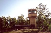
RAAF Bare Bases
The Royal Australian Air Force currently maintains three Bare Bases in remote areas of Northern Australia. These bases were developed in the 1980s and 1990s in line with the Defence of Australia Policy in order to enhance the RAAF's ability to conduct combat operations from the Australian mainland...
in remote areas of Australia. These bases have runways and buildings, but only a caretaker staff. They are generally only used for exercises as there are no units permanently based there.
Queensland
- RAAF Base AmberleyRAAF Base AmberleyRAAF Base Amberley is a Royal Australian Air Force base located southwest of Ipswich, Queensland and southwest of Brisbane. It is currently home to No. 1 Squadron and No. 6 Squadron , No. 33 Squadron and No. 36 Squadron...
, IpswichIpswich, QueenslandIpswich is a city in South-East Queensland, Australia. Situated along the Bremer River Valley approximately 40 kilometres away from the state's capital Brisbane. The suburb by the same name forms the city's Central Business District and administrative centre...
(near BrisbaneBrisbaneBrisbane is the capital and most populous city in the Australian state of Queensland and the third most populous city in Australia. Brisbane's metropolitan area has a population of over 2 million, and the South East Queensland urban conurbation, centred around Brisbane, encompasses a population of...
) - RAAF SchergerRAAF SchergerRAAF Base Scherger is the newest of the Royal Australian Air Force's three 'bare bases', completing a chain of bases across Australia’s ‘top end’...
near WeipaWeipa, QueenslandWeipa is the largest town on the Gulf of Carpentaria coast of the Cape York Peninsula in Queensland, Australia. At the 2006 census, Weipa had a population of 2,830; the largest community on Cape York Peninsula. It exists because of the enormous bauxite deposits along the coast...
(bare baseRAAF Bare BasesThe Royal Australian Air Force currently maintains three Bare Bases in remote areas of Northern Australia. These bases were developed in the 1980s and 1990s in line with the Defence of Australia Policy in order to enhance the RAAF's ability to conduct combat operations from the Australian mainland...
) - RAAF Base TownsvilleRAAF Base TownsvilleRAAF Base Townsville is, along with RAAF Base Tindal and RAAF Base Darwin, one of northern Australia's primary defence installations. It is also Headquarters for No...
, Townsville
New South Wales
- RAAF Base GlenbrookRAAF Base GlenbrookRAAF Base Glenbrook is home to Headquarters Air Command of the Royal Australian Air Force. There is no airfield at Glenbrook, although it is an HLS . It is a small base in the Lower Blue Mountains outside Sydney, New South Wales, with most administrative services located on the nearby RAAF Base...
, GlenbrookGlenbrook, New South WalesGlenbrook is a suburb of the Lower Blue Mountains of New South Wales, Australia. It is located 70 kilometres west of Sydney in the local government area of the City of Blue Mountains. At the 2006 census, Glenbrook had a population of 5,138 people....
(near SydneySydneySydney is the most populous city in Australia and the state capital of New South Wales. Sydney is located on Australia's south-east coast of the Tasman Sea. As of June 2010, the greater metropolitan area had an approximate population of 4.6 million people...
) - Defence Establishment Orchard HillsDefence Establishment Orchard HillsDefence Establishment Orchard Hills is a tri-service base of particular importance to the Royal Australian Air Force. The main role of the establishment is for storage and distribution. The base is also home to the RAAF-run Defence Explosive Ordnance Training School, which provides training in...
, Orchard HillsOrchard Hills, New South WalesOrchard Hills is a suburb of Sydney, in the state of New South Wales, Australia. Orchard Hills is located 56 kilometres west of the Sydney central business district, in the local government area of the City of Penrith and is part of the Greater Western Sydney region.-History:Orchard Hills takes its...
(near Sydney) - RAAF Base RichmondRAAF Base RichmondRAAF Base Richmond is one of Australia's oldest and largest air force bases. It is located within the City of Hawkesbury in the north-western fringe of Sydney, New South Wales, between the towns of Windsor and Richmond. The base is home to the Royal Australian Air Force's transport headquarters,...
, RichmondRichmond, New South WalesRichmond is a town in New South Wales, north-west of Sydney, in the Local Government Area of the City of Hawkesbury. It is located at a latitude of 33° 35' 54" South and a longitude of 150°45' 04" east, 19 metres above sea level on the alluvial Hawkesbury River flats, at the foot of the Blue...
(near Sydney) - RAAF Base WaggaRAAF Base WaggaRAAF Base Wagga is located in the New South Wales town of Wagga Wagga, in the suburb of Forest Hill.The RAAF no longer controls the airfield which, although still owned by the Commonwealth of Australia, is currently leased to the Wagga Wagga City Council...
, Wagga Wagga - RAAF Base WilliamtownRAAF Base WilliamtownRAAF Base Williamtown is a Royal Australian Air Force base and headquarters to Australia's Tactical Fighter group. The base is located north of the coastal city of Newcastle, New South Wales in the Local Government Area of Port Stephens. The military base shares its runway facilities with...
, WilliamtownWilliamtown, New South WalesWilliamtown is a rural suburb of the Port Stephens Local Government Area in the Hunter Region of New South Wales, Australia. It is located on the main road between Newcastle and Nelson Bay.-Geography:...
(near Newcastle)
Victoria
- RAAF Base East SaleRAAF Base East SaleRAAF Base East Sale is one of the main training establishments of the Royal Australian Air Force, including where Australian Air Force Cadets have their annual General Service Training. It is home to the Roulettes aerobatic team. It is also now the home of the RAAF's Officers' Training School ...
, SaleSale, VictoriaSale is a city in the Gippsland region of the Australian state of Victoria. It is the seat of the Shire of Wellington as well as the Roman Catholic Diocese of Sale and the Anglican Diocese of Gippsland. It has a population of around 13,336, and is expected to reach a population of 14,000 soon... - RAAF Williams, Laverton Base, LavertonLaverton, VictoriaLaverton is a suburb in Melbourne, Victoria, Australia, 17 km south-west from Melbourne's central business district. Its Local Government Area are the Cities of Hobsons Bay and Wyndham. At the 2006 Census, Laverton had a population of 4508.-History:...
(near MelbourneMelbourneMelbourne is the capital and most populous city in the state of Victoria, and the second most populous city in Australia. The Melbourne City Centre is the hub of the greater metropolitan area and the Census statistical division—of which "Melbourne" is the common name. As of June 2009, the greater...
) - RAAF Williams, Point Cook Base, Point CookPoint Cook, VictoriaPoint Cook is a suburb in Melbourne, Victoria, Australia, 25 km south-west from Melbourne's central business district. Its Local Government Area is the City of Wyndham. At the 2006 Census, Point Cook had a population of 14,162, now it is estimated that the population of Point Cook is 32,167...
(near Melbourne)
South Australia
- RAAF Base EdinburghRAAF Base EdinburghRAAF Base Edinburgh is located in Edinburgh, 25km north of the centre of Adelaide.It is primarily home to No 92 Wing's AP-3C Orion maritime patrol aircraft that conduct surveillance operations throughout Australia's airspace....
, SalisburySalisbury, South AustraliaSalisbury is a northern suburb in Adelaide, South Australia. It is the seat of the City of Salisbury, and in the South Australian Legislative Assembly electoral district of Ramsay and the Australian House of Representatives divisions of Wakefield and Port Adelaide...
(near AdelaideAdelaideAdelaide is the capital city of South Australia and the fifth-largest city in Australia. Adelaide has an estimated population of more than 1.2 million...
) - Woomera AirfieldWoomera AirfieldRAAF Woomera Airfield is an operational Royal Australian Air Force airfield located 4 km north of the Woomera Defence Village, in South Australia...
near WoomeraWoomera, South AustraliaThe town, or village, of Woomera is located in the south east corner of the Woomera Prohibited Area ; colloquially known as the Woomera Rocket Range...
(training area and live fire range)
Western Australia
- RAAF CurtinRAAF CurtinRAAF Base Curtin is a Royal Australian Air Force base located near the town of Derby on the north coast of Western Australia. As it is one of the RAAF's three 'bare bases' no Air Force units are currently based at Curtin and it is maintained by a small caretaker staff during peacetime...
near DerbyDerby, Western AustraliaDerby is a town in the Kimberley region of Western Australia. At the 2006 census, Derby had a population of 3,093. Along with Broome and Kununurra, it is one of only three towns in the Kimberley to have a population over 2,000...
(bare baseRAAF Bare BasesThe Royal Australian Air Force currently maintains three Bare Bases in remote areas of Northern Australia. These bases were developed in the 1980s and 1990s in line with the Defence of Australia Policy in order to enhance the RAAF's ability to conduct combat operations from the Australian mainland...
) - RAAF Gingin, GinginGingin, Western AustraliaGingin is an agricultural town in Western Australia. The town is located north of Perth along the Brand Highway.The town is well suited for agriculture with a mild climate and available water sources...
(airfield only) - RAAF LearmonthRAAF LearmonthRAAF Learmonth, also known as Learmonth Airport , is a joint use Royal Australian Air Force base and civil airport. It is located near the town of Exmouth on the north-west coast of Western Australia. As an RAAF base, Learmonth is one of the RAAF's three 'bare bases'...
near ExmouthExmouth, Western Australia-Further reading:* Western Australia. Ministry for Planning. Exmouth-Learmonth structure plan. Perth, W.A. : Western Australian Planning Commission...
(bare base) - RAAF Base PearceRAAF Base PearceRAAF Base Pearce is the main RAAF base in Western Australia. The base is located in Bullsbrook, north of Perth. It is used for training by the Royal Australian Air Force and the Republic of Singapore Air Force...
, BullsbrookBullsbrook, Western AustraliaBullsbrook is a suburb of Perth, Western Australia in the outer metropolitan area. It is located with the City of Swan. The original Bullsbrook townsite is located slightly west of the current town, on the 17 km mark of the Midland Railway...
(near PerthPerth, Western AustraliaPerth is the capital and largest city of the Australian state of Western Australia and the fourth most populous city in Australia. The Perth metropolitan area has an estimated population of almost 1,700,000....
)
Northern Territory
- RAAF Base DarwinRAAF Base DarwinRAAF Base Darwin is a Royal Australian Air Force base located in the city of Darwin, Northern Territory. The base shares its runway with Darwin International Airport.-History:...
, DarwinDarwin, Northern TerritoryDarwin is the capital city of the Northern Territory, Australia. Situated on the Timor Sea, Darwin has a population of 127,500, making it by far the largest and most populated city in the sparsely populated Northern Territory, but the least populous of all Australia's capital cities... - RAAF Base TindalRAAF Base TindalRAAF Base Tindal is a Royal Australian Air Force air base located near the town of Katherine in the Northern Territory. The base is currently home to No...
, KatherineKatherine, Northern TerritoryKatherine is a town situated southeast of Darwin in the "Top End" of Australia in the Northern Territory. It is the fourth largest settlement in the Territory after the capital Darwin, Palmerston and Alice Springs...
Former Headquarters
- RAAF Area Combined Headquarters, North-Eastern area, Townsville, QueenslandQueenslandQueensland is a state of Australia, occupying the north-eastern section of the mainland continent. It is bordered by the Northern Territory, South Australia and New South Wales to the west, south-west and south respectively. To the east, Queensland is bordered by the Coral Sea and Pacific Ocean...
. Relocated from Port MoresbyPort MoresbyPort Moresby , or Pot Mosbi in Tok Pisin, is the capital and largest city of Papua New Guinea . It is located on the shores of the Gulf of Papua, on the southeastern coast of the island of New Guinea, which made it a prime objective for conquest by the Imperial Japanese forces during 1942–43...
, Papua New GuineaPapua New GuineaPapua New Guinea , officially the Independent State of Papua New Guinea, is a country in Oceania, occupying the eastern half of the island of New Guinea and numerous offshore islands...
. - RAAF Area Combined Headquarters, North-Western area, DarwinDarwin, Northern TerritoryDarwin is the capital city of the Northern Territory, Australia. Situated on the Timor Sea, Darwin has a population of 127,500, making it by far the largest and most populated city in the sparsely populated Northern Territory, but the least populous of all Australia's capital cities...
, Northern TerritoryNorthern TerritoryThe Northern Territory is a federal territory of Australia, occupying much of the centre of the mainland continent, as well as the central northern regions...
. - RAAF Area Combined Headquarters, South-Eastern area, MelbourneMelbourneMelbourne is the capital and most populous city in the state of Victoria, and the second most populous city in Australia. The Melbourne City Centre is the hub of the greater metropolitan area and the Census statistical division—of which "Melbourne" is the common name. As of June 2009, the greater...
, VictoriaVictoria (Australia)Victoria is the second most populous state in Australia. Geographically the smallest mainland state, Victoria is bordered by New South Wales, South Australia, and Tasmania on Boundary Islet to the north, west and south respectively....
. - RAAF Area Combined Headquarters, South-Western area, FremantleFremantle, Western AustraliaFremantle is a city in Western Australia, located at the mouth of the Swan River. Fremantle Harbour serves as the port of Perth, the state capital. Fremantle was the first area settled by the Swan River colonists in 1829...
, Western AustraliaWestern AustraliaWestern Australia is a state of Australia, occupying the entire western third of the Australian continent. It is bounded by the Indian Ocean to the north and west, the Great Australian Bight and Indian Ocean to the south, the Northern Territory to the north-east and South Australia to the south-east...
.
Australian Capital Territory
- RAAF Base Fairbairn, Canberra, Australian Capital TerritoryCanberraCanberra is the capital city of Australia. With a population of over 345,000, it is Australia's largest inland city and the eighth-largest city overall. The city is located at the northern end of the Australian Capital Territory , south-west of Sydney, and north-east of Melbourne...
, now Fairbairn Business Park and part of Canberra International AirportCanberra International AirportCanberra International Airport , now trading as Canberra Airport, is the airport serving Australia's capital city, Canberra, and the city of Queanbeyan, NSW. Located at the eastern edge of North Canberra, it is the 8th busiest airport in Australia. The airport is the main hub for Brindabella Airlines...
. Decommissioned as an RAAF base in 2003 although No. 34 SquadronNo. 34 Squadron RAAFNo. 34 Squadron is a Royal Australian Air Force transport squadron. It is currently based at Canberra International Airport in the Australian capital Canberra, where it operates two Boeing 737 Business Jets and three Bombardier Challenger 604s.-History:...
(VIP transport) is still based there.
New South Wales
- RAAF Base Albion Park, Albion Park, New South WalesAlbion Park, New South WalesAlbion Park is a suburb in the City of Shellharbour, which is in turn one of the three local government areas that comprise the Wollongong Metropolitan Area, New South Wales, Australia...
- RAAF Base Coffs HarbourCoffs Harbour Airport-Statistics:The airport currently handles over 26,000 aircraft movements per annum, 5,000 of which are for passenger aircraft.-Operations:-Incidents and accidents:...
, Coffs Harbour, New South WalesNew South WalesNew South Wales is a state of :Australia, located in the east of the country. It is bordered by Queensland, Victoria and South Australia to the north, south and west respectively. To the east, the state is bordered by the Tasman Sea, which forms part of the Pacific Ocean. New South Wales... - RAAF Base Evans Head, Evans HeadEvans Head, New South WalesEvans Head is a town in the Northern Rivers region of New South Wales, Australia in Richmond Valley Shire. At the 2006 census, Evans Head had a population of 2,631 people. It is 726 kilometres north of Sydney, and 11 kilometres east off the Pacific Highway from Woodburn...
, New South WalesNew South WalesNew South Wales is a state of :Australia, located in the east of the country. It is bordered by Queensland, Victoria and South Australia to the north, south and west respectively. To the east, the state is bordered by the Tasman Sea, which forms part of the Pacific Ocean. New South Wales... - RAAF Jervis BayJervis Bay AirportJervis Bay Territory Airport is the only airport of the Jervis Bay Territory, Australia. It is located about 10 kilometres east of Sussex Inlet and about 2 kilometres south of Jervis Bay Village and HMAS Creswell....
, Jervis Bay, New South Wales - RAAF Base MoruyaMoruya AirportMoruya Airport is an airport located Moruya, New South Wales, Australia.-History:Built in 1942, at Moruya Heads by the RAAF consisting of three runways...
, MoruyaMoruya, New South WalesMoruya is a small regional centre in New South Wales, Australia, situated on the Moruya River, approximately 300 kilometers south of Sydney. At the 2006 census, Moruya had a population of 10,278 people. The town relies predominantly on agriculture, aquaculture, and tourism...
, New South WalesNew South WalesNew South Wales is a state of :Australia, located in the east of the country. It is bordered by Queensland, Victoria and South Australia to the north, south and west respectively. To the east, the state is bordered by the Tasman Sea, which forms part of the Pacific Ocean. New South Wales... - RAAF Base NabiacRAAF Base NabiacRAAF Base Nabiac was an advanced operating base for the Royal Australian Air Force , during the Second World War, near Nabiac, New South Wales, Australia. Constructed in 1942 by the NSW Public Works Department to the south east of Nabiac...
, NabiacNabiacNabiac is a small town on the Mid North Coast, New South Wales, Australia mainly in Great Lakes Council. A small part of the locality is in the City of Greater Taree: the border is defined by the Pacific Highway. It is north-west of Forster, and south of Taree.Nabiac is the central town of the...
, New South WalesNew South WalesNew South Wales is a state of :Australia, located in the east of the country. It is bordered by Queensland, Victoria and South Australia to the north, south and west respectively. To the east, the state is bordered by the Tasman Sea, which forms part of the Pacific Ocean. New South Wales... - RAAF Base RathminesRAAF Base RathminesRAAF Base Rathmines was a Royal Australian Air Force base located on Lake Macquarie in New South Wales.RAAF Base Rathmines was established in 1939 and was the RAAF's main flying boat base during World War II and the early 1950s...
, Lake MacquarieLake Macquarie (New South Wales)Lake Macquarie is Australia's largest coastal salt water lake, covering an area of in the Hunter Region of New South Wales with most of the City of Lake Macquarie's residents living near its shores. It is connected to the Tasman Sea by a short channel. Lake Macquarie is twice as large as Sydney...
near NewcastleNewcastle, New South WalesThe Newcastle metropolitan area is the second most populated area in the Australian state of New South Wales and includes most of the Newcastle and Lake Macquarie Local Government Areas...
, New South WalesNew South WalesNew South Wales is a state of :Australia, located in the east of the country. It is bordered by Queensland, Victoria and South Australia to the north, south and west respectively. To the east, the state is bordered by the Tasman Sea, which forms part of the Pacific Ocean. New South Wales...
. The largest flying boat base in Australia. - RAAF Base Temora, TemoraTemora, New South WalesTemora is a town located in north east part of the Riverina area of New South Wales, south-west of the state capital, Sydney. At the 2006 census the population of Temora was 4,086.-History:...
- RAAF Base UranquintyRAAF Base UranquintyRAAF Base Uranquinty was a Royal Australian Air Force base located at Uranquinty, New South Wales, Australia. Land was requisitioned in 1940 as part of the Empire Air Training Scheme during the Second World War for the formation of the No. 5 Service Flying Training School.The base was closed in...
, Uranquinty, 1941–45 Pilot training, and 1947–52 No.1 Basic Flying Training School for RAAF & RAN
Queensland
- RAAF Base Bowen, BowenBowen, QueenslandBowen is a town on the eastern coast of Queensland, Australia. At the 2006 census, Bowen had a population of 7,484.-Geography:Bowen is located on the north-east coast of Australia, at exactly twenty degrees south of the equator. In fact, the twentieth parallel crosses the main street...
, QueenslandQueenslandQueensland is a state of Australia, occupying the north-eastern section of the mainland continent. It is bordered by the Northern Territory, South Australia and New South Wales to the west, south-west and south respectively. To the east, Queensland is bordered by the Coral Sea and Pacific Ocean...
. - RAAF Base CairnsCairns International AirportCairns Airport is an international airport in Cairns, Queensland, Australia. Formerly operated by the Cairns Port Authority, the airport was sold by the Queensland Government in December 2008 to a private consortium. It is the seventh busiest airport in Australia. The airport is located north of...
, Cairns, QueenslandQueenslandQueensland is a state of Australia, occupying the north-eastern section of the mainland continent. It is bordered by the Northern Territory, South Australia and New South Wales to the west, south-west and south respectively. To the east, Queensland is bordered by the Coral Sea and Pacific Ocean...
.
Northern Territory
- RAAF Daly WatersDaly Waters AirfieldDaly Waters Airfield was an airfield located at Daly Waters, Northern Territory, Australia.-History:Daly Waters was Australia's first international airfield...
, Daly Waters, Northern Territory.
South Australia
- RAAF Base MallalaRAAF Base MallalaRAAF Base Mallala was a Royal Australian Air Force base located at Mallala, South Australia.-History:The base was built in 1941 as the home of No. 6 Service Flying Training School during World War II...
, MallalaMallala, South AustraliaMallala is a small town about 58 kilometres north of Adelaide in South Australia. The name Mallala is thought to be derived from the local Aboriginal word 'madlola' which supposedly meant 'place of the ground frog'. At the 2006 census, Mallala had a population of 737.In 1939 the Royal Australian...
, South AustraliaSouth AustraliaSouth Australia is a state of Australia in the southern central part of the country. It covers some of the most arid parts of the continent; with a total land area of , it is the fourth largest of Australia's six states and two territories.South Australia shares borders with all of the mainland...
.
Stations in Australia
RAAF Stations were principally civil airfields with a permanent RAAF Station Headquarters and used for operational flying.- RAAF Station ArcherfieldRAAF Station ArcherfieldRAAF Station Archerfield was a permanent Royal Australian Air Force station at Archerfield Airport in Brisbane, Queensland, Australia, from 1939 to 1956.- 1939 - 1945 :...
, Archerfield AirportArcherfield AirportArcherfield Airport is a small airport located 7 1/2 miles at Archerfield in the south west of Brisbane, Queensland, Australia. For some time it was the primary airport in Brisbane. During World War II it was used as a Royal Australian Air Force station. Airport traffic peaked in the 1980s...
, BrisbaneBrisbaneBrisbane is the capital and most populous city in the Australian state of Queensland and the third most populous city in Australia. Brisbane's metropolitan area has a population of over 2 million, and the South East Queensland urban conurbation, centred around Brisbane, encompasses a population of...
, QueenslandQueenslandQueensland is a state of Australia, occupying the north-eastern section of the mainland continent. It is bordered by the Northern Territory, South Australia and New South Wales to the west, south-west and south respectively. To the east, Queensland is bordered by the Coral Sea and Pacific Ocean...
. - RAAF Station Bairnsdale, Bairnsdale, VictoriaBairnsdale, VictoriaBairnsdale is a small city in Gippsland, Victoria, Australia. With a population at the 2006 census of 11,282, it is a major regional centre of eastern Victoria along with Traralgon and Sale....
. - RAAF Station Bowen, BowenBowen, QueenslandBowen is a town on the eastern coast of Queensland, Australia. At the 2006 census, Bowen had a population of 7,484.-Geography:Bowen is located on the north-east coast of Australia, at exactly twenty degrees south of the equator. In fact, the twentieth parallel crosses the main street...
, QueenslandQueenslandQueensland is a state of Australia, occupying the north-eastern section of the mainland continent. It is bordered by the Northern Territory, South Australia and New South Wales to the west, south-west and south respectively. To the east, Queensland is bordered by the Coral Sea and Pacific Ocean...
. Disbanded and reformed as RAAF Base Bowen. - RAAF Station BundabergBundaberg AirportBundaberg Airport is a regional airport serving Bundaberg, a city in the Australian state of Queensland. It is located from the town centre, on North Childers Road and Takalvan Street. The airport is owned and operated by the Bundaberg Regional Council...
, Bundaberg, QueenslandBundaberg, QueenslandBundaberg is a city in Queensland, Australia. It is part of the Local Government Area of the Bundaberg Region and is a major centre within Queensland's broader Wide Bay-Burnett geographical region...
. - RAAF Station Camden, CamdenCamden, New South Wales-Education:Camden is the location of research facilities for the veterinary and agricultural schools of the University of Sydney. The local government area has two public high schools, Camden High School and Elderslie High School, as well as eight Catholic and three Anglican schools.-Culture:The...
, New South WalesNew South WalesNew South Wales is a state of :Australia, located in the east of the country. It is bordered by Queensland, Victoria and South Australia to the north, south and west respectively. To the east, the state is bordered by the Tasman Sea, which forms part of the Pacific Ocean. New South Wales... - RAAF Station CunderdinRAAF Station CunderdinRAAF Station Cunderdin was a Royal Australian Air Force airfield located at Cunderdin, Western Australia during World War II.-History:Cunderdin was home to No. 9 Elementary Flying Training School and No. 17 Repair and Salvage Unit...
, CunderdinCunderdin, Western AustraliaCunderdin is a town located in the Wheatbelt region of Western Australia 156 km east of Perth, on Great Eastern Highway.- History :The first European visitor to the area was Charles Cooke Hunt, who explored the area in 1864 and recorded the name Cunderdin, from the Aboriginal name of a nearby...
, Western AustraliaWestern AustraliaWestern Australia is a state of Australia, occupying the entire western third of the Australian continent. It is bounded by the Indian Ocean to the north and west, the Great Australian Bight and Indian Ocean to the south, the Northern Territory to the north-east and South Australia to the south-east...
. - RAAF Station Deniliquin, Deniliquin, New South Wales
- RAAF Station Evans HeadEvans Head Memorial AerodromeEvans Head Memorial Aerodrome is an airport in Evans Head, New South Wales. The airport is approximately 1 km north of the village, and was formerly a RAAF base during World War II housing the RAAF No 1 Bombing and Gunnery School; and the RAAF No 1 Air Observers School...
, Evans HeadEvans Head, New South WalesEvans Head is a town in the Northern Rivers region of New South Wales, Australia in Richmond Valley Shire. At the 2006 census, Evans Head had a population of 2,631 people. It is 726 kilometres north of Sydney, and 11 kilometres east off the Pacific Highway from Woodburn...
, New South WalesNew South WalesNew South Wales is a state of :Australia, located in the east of the country. It is bordered by Queensland, Victoria and South Australia to the north, south and west respectively. To the east, the state is bordered by the Tasman Sea, which forms part of the Pacific Ocean. New South Wales...
. - RAAF Station Guildford, Guildford, Western AustraliaGuildford, Western AustraliaGuildford is a suburb of Perth, Western Australia, located 13 km northeast of the city. Its Local Government Area is the City of Swan.-History:Guildford was established in 1829 on the Swan River, being sited near a permanent fresh water supply...
- RAAF Station MascotRAAF Station MascotRAAF Station Mascot was a Royal Australian Air Force station which operated from Sydney's civilian aerodrome at Mascot, New South Wales during World War II.-History:...
, MascotMascot, New South WalesMascot is a suburb in south-eastern Sydney, in the state of New South Wales, Australia. Mascot is located 7 kilometres south of the Sydney central business district and is the administrative centre of the City of Botany Bay...
, New South WalesNew South WalesNew South Wales is a state of :Australia, located in the east of the country. It is bordered by Queensland, Victoria and South Australia to the north, south and west respectively. To the east, the state is bordered by the Tasman Sea, which forms part of the Pacific Ocean. New South Wales... - RAAF Station Narrandera, Narrandera, New South Wales
- RAAF Station NarromineRAAF Station NarromineRAAF Station Narromine was a Royal Australian Air Force station located at Narromine, New South Wales, Australia. Narromine Airfield was requisitioned in July 1940 as part of the Empire Air Training Scheme during the Second World War....
, Narromine, New South WalesNew South WalesNew South Wales is a state of :Australia, located in the east of the country. It is bordered by Queensland, Victoria and South Australia to the north, south and west respectively. To the east, the state is bordered by the Tasman Sea, which forms part of the Pacific Ocean. New South Wales... - RAAF Station Nowra, Nowra, New South WalesNowra, New South WalesNowra is a city in the South Coast region of New South Wales, Australia. Located SSW and approximately by road south of the state capital of Sydney, it has an estimated population together with its twin-town of Bomaderry of 34,479. It is also the seat and commercial centre of the City of Shoalhaven...
- RAAF Station Pokolbin, Cessnock, New South WalesCessnock, New South WalesCessnock is a city in the Hunter Region of New South Wales, Australia, about by road west of Newcastle. It is the administrative centre of the Cessnock City Council LGA and was named after an 1826 grant of land called Cessnock Estate, which was owned by John Campbell...
- RAAF Station SandgateRAAF Station SandgateRAAF Station Sandgate was a Royal Australian Air Force station located at Brighton, Queensland during World War II.The Station was formed on 16 December 1940 under the command of Squadron Leader H.A. Rigby, MC. An advance party arrived at Sandgate prior to the Station's formation and found that...
, BrisbaneBrisbaneBrisbane is the capital and most populous city in the Australian state of Queensland and the third most populous city in Australia. Brisbane's metropolitan area has a population of over 2 million, and the South East Queensland urban conurbation, centred around Brisbane, encompasses a population of...
, QueenslandQueenslandQueensland is a state of Australia, occupying the north-eastern section of the mainland continent. It is bordered by the Northern Territory, South Australia and New South Wales to the west, south-west and south respectively. To the east, Queensland is bordered by the Coral Sea and Pacific Ocean...
. - RAAF Station SchofieldsRAAF Station SchofieldsRAAF Station Schofields was an aerodrome built by the Royal Australian Air Force between 1942-1944 at Schofields, New South Wales, Australia during World War II.The aerodrome was constructed for use as a satellite aerodrome for RAAF Station Richmond...
, Schofields, New South WalesSchofields, New South WalesSchofields is a suburb of Sydney, in the state of New South Wales, Australia. Schofields is located 45 kilometres west of the Sydney central business district, in the local government area of the City of Blacktown...
. - RAAF Station Tocumwal, TocumwalTocumwal, New South WalesTocumwal is a town in the southern Riverina region of New South Wales, Australia in the Berrigan Shire Local Government Area, near the Victorian border. The town is situated on the banks of the Murray River, north of the city of Melbourne. The Newell Highway, part of the main road route between...
, New South WalesNew South WalesNew South Wales is a state of :Australia, located in the east of the country. It is bordered by Queensland, Victoria and South Australia to the north, south and west respectively. To the east, the state is bordered by the Tasman Sea, which forms part of the Pacific Ocean. New South Wales...
. - RAAF Station WaggaRAAF Base WaggaRAAF Base Wagga is located in the New South Wales town of Wagga Wagga, in the suburb of Forest Hill.The RAAF no longer controls the airfield which, although still owned by the Commonwealth of Australia, is currently leased to the Wagga Wagga City Council...
, Wagga Wagga, New South WalesNew South WalesNew South Wales is a state of :Australia, located in the east of the country. It is bordered by Queensland, Victoria and South Australia to the north, south and west respectively. To the east, the state is bordered by the Tasman Sea, which forms part of the Pacific Ocean. New South Wales...
. - RAAF Station West Sale, West Sale, Victoria.
Airfields in Australia
Civil or temporary airfields used by the RAAF and allied air forces during World War IIWorld War II
World War II, or the Second World War , was a global conflict lasting from 1939 to 1945, involving most of the world's nations—including all of the great powers—eventually forming two opposing military alliances: the Allies and the Axis...
for operational flying but which did not have a permanent RAAF Station Headquarters.
Sydney Basin
- Bankstown AerodromeBankstown AirportBankstown Airport is a general aviation airport and business park located in the City of Bankstown, from the central business district of Sydney, Australia...
, Bankstown, New South WalesBankstown, New South WalesBankstown is a suburb of south-western Sydney, in the state of New South Wales, Australia. Bankstown is located 20 kilometres south-west of the Sydney central business district and is the administrative centre of the local government area of the City of Bankstown.-History:Prior to European... - Bargo
- Bringelly Emergency Landing Ground, Bringelly, New South WalesNew South WalesNew South Wales is a state of :Australia, located in the east of the country. It is bordered by Queensland, Victoria and South Australia to the north, south and west respectively. To the east, the state is bordered by the Tasman Sea, which forms part of the Pacific Ocean. New South Wales...
. - Calwalla
- Camden see RAAF Station Camden
- Castlereagh AerodromeCastlereagh AerodromeCastlereagh Aerodrome was a Royal Australian Air Force emergency landing ground and dispersal ground during World War II at Castlereagh, New South Wales, Australia. The runway was x . The airfield was to become home to No. 94 Squadron's Mosquito aircraft and had been upgraded by No. 9 Airfield...
, Castlereagh, New South WalesCastlereagh, New South WalesCastlereagh is a suburb of Sydney, in the state of New South Wales, Australia. Castlereagh is located 67 kilometres west of the Sydney central business district, in the local government area of the City of Penrith and is part of the Greater Western Sydney region.-History:The suburb is one of the... - Fleurs AerodromeFleurs AerodromeFleurs Aerodrome was a parent aerodrome built on behalf of the Royal Australian Air Force near Penrith, New South Wales, Australia during World War II....
, Kemps Creek, New South WalesKemps Creek, New South WalesKemps Creek is a suburb of Sydney, in the state of New South Wales, Australia. Kemps Creek is located 39 kilometres west of the Sydney central business district, in the local government areas of the City of Penrith and City of Liverpool... - Hoxton Park Landing GroundHoxton Park AirportHoxton Park Airport was a general aviation aerodrome in south-western Sydney, New South Wales, Australia.The aerodrome was non-towered, and so operated according to Common Traffic Advisory Frequency procedures....
, Hoxton ParkHoxton Park, New South WalesHoxton Park is a suburb of Sydney, in the state of New South Wales, Australia. Hoxton Park is located 38 kilometres west of the Sydney central business district, in the local government area of the City of Liverpool and is part of the Greater Western Sydney region.Hoxton Park also had a small...
, SydneySydneySydney is the most populous city in Australia and the state capital of New South Wales. Sydney is located on Australia's south-east coast of the Tasman Sea. As of June 2010, the greater metropolitan area had an approximate population of 4.6 million people...
, New South WalesNew South WalesNew South Wales is a state of :Australia, located in the east of the country. It is bordered by Queensland, Victoria and South Australia to the north, south and west respectively. To the east, the state is bordered by the Tasman Sea, which forms part of the Pacific Ocean. New South Wales...
. Emergency and training field. - Marsden Park AerodromeMarsden Park AerodromeMarsden Park Aerodrome was an aerodrome constructed by the Royal Australian Air Force near Marsden Park, New South Wales, Australia during World War II....
- Mascot see RAAF Station MascotRAAF Station MascotRAAF Station Mascot was a Royal Australian Air Force station which operated from Sydney's civilian aerodrome at Mascot, New South Wales during World War II.-History:...
- Menangle Aerodrome
- Mittagong Aerodrome
- Moss Vale
- Mount Druitt AerodromeMount Druitt AerodromeMount Druitt Aerodrome was a Royal Australian Air Force landing ground during World War II at Mount Druitt, New South Wales, Australia.Land was resumed in March 1942, for the construction of an aerodrome, two aircraft hangars and workshops on the site...
, Mount Druitt, New South WalesMount Druitt, New South WalesMount Druitt is a suburb of Sydney, in the state of New South Wales, Australia. Mount Druitt is located 43 kilometres west of the Sydney central business district, in the local government area of the City of Blacktown, and is part of the Greater Western Sydney region.There are numerous... - Nepean Dam
- Pitt Town
- Ravenswood - Satellite of Fleur (not proceeded with)
- Richmond Aerodrome see RAAF Base RichmondRAAF Base RichmondRAAF Base Richmond is one of Australia's oldest and largest air force bases. It is located within the City of Hawkesbury in the north-western fringe of Sydney, New South Wales, between the towns of Windsor and Richmond. The base is home to the Royal Australian Air Force's transport headquarters,...
- Schofields Aerodrome see RAAF Station SchofieldsRAAF Station SchofieldsRAAF Station Schofields was an aerodrome built by the Royal Australian Air Force between 1942-1944 at Schofields, New South Wales, Australia during World War II.The aerodrome was constructed for use as a satellite aerodrome for RAAF Station Richmond...
- The Oaks Airport websitehttp://www.TheOaksAirport.com, The Oaks, New South WalesThe Oaks, New South WalesThe Oaks is a town located in the Macarthur Region of New South Wales, Australia in Wollondilly Shire on the south western edge of the Sydney Basin. The Oaks is located south-west of Sydney via the Hume Highway, west of Camden and 290m above sea-level...
- Wallgrove AerodromeWallgrove AerodromeWallgrove Aerodrome was a Royal Australian Air Force satellite and emergency airfield at Doonside, New South Wales, Australia during World War II.The aerodrome was built in 1942 and the runway was 5000ft long and 150ft wide running NW-SW...
(Doonside), Doonside, New South WalesDoonside, New South WalesDoonside is a suburb of Sydney, in the state of New South Wales, Australia. Doonside is located 40 kilometres west of the Sydney central business district, in the local government area of the City of Blacktown and is part of the Greater Western Sydney region. Featherdale Wildlife Park and the...
.
Hunter & Central Coast
- Broke Aerodrome
- Bulga Aerodrome
- Cessnock Aerodrome
- Dungog Aerodrome
- Glendon Aerodrome
- Hexham Aerodrome
- Hotham Aerodrome
- Newcastle AerodromeBroadmeadow AerodromeBroadmeadow Aerodrome was a aerodrome located at District Park, Broadmeadow, Newcastle, Australia. It began operating in 1929 and closed in 1963....
(Broadmeadow, District Park), BroadmeadowBroadmeadow, New South WalesBroadmeadow is the geographic centre of Newcastle city. Its main commercial hub is located at the “Nineways”.-Origins:Broadmeadow was originally part of the Newcastle Pasturage Reserve of 648 hectares...
, NewcastleNewcastle, New South WalesThe Newcastle metropolitan area is the second most populated area in the Australian state of New South Wales and includes most of the Newcastle and Lake Macquarie Local Government Areas... - Pokolbin Aerodrome see RAAF Station Pokolbin
- Rathmines see RAAF Base RathminesRAAF Base RathminesRAAF Base Rathmines was a Royal Australian Air Force base located on Lake Macquarie in New South Wales.RAAF Base Rathmines was established in 1939 and was the RAAF's main flying boat base during World War II and the early 1950s...
- Rothbury Aerodrome
- Ringwood Emergency Landing Ground, Ringwood, New South Wales
- Nandowra AerodromeScone AirportScone Airport, previously known as Nandowra Aerodrome, is a public airport in the Upper Hunter Valley, 4km northwest of Scone, Australia.-History:In 1937, No...
, Scone, New South WalesScone, New South WalesScone is a town in the Upper Hunter Shire in the Hunter Valley region of New South Wales, Australia. At the 2006 census, Scone had a population of 4,624 people. It is located on the New England Highway north of Muswellbrook about 270 kilometres north of Sydney, and is part of the Hunter and Upper... - Strowan Aerodrome,
- Tuggerah AerodromeTuggerah AerodromeTuggerah Aerodrome was a aerodrome constructed in 1942 by the Royal Australian Air Force as a dispersal ground and landing ground at Tuggerah, New South Wales, Australia during World War II....
, Tuggerah, New South WalesTuggerah, New South WalesTuggerah is a suburb of the Central Coast region of New South Wales, Australia, situated on the Main North Line and Sydney-Newcastle Freeway about 90 km north of Sydney. It is part of the Wyong Shire local government area....
. Satellite of Fleur. - Williamtown see RAAF Base WilliamtownRAAF Base WilliamtownRAAF Base Williamtown is a Royal Australian Air Force base and headquarters to Australia's Tactical Fighter group. The base is located north of the coastal city of Newcastle, New South Wales in the Local Government Area of Port Stephens. The military base shares its runway facilities with...
- Warkworth Aerodrome
- Weston Aerodrome
- Woy Woy Aerodrome, Woy Woy, New South WalesWoy Woy, New South WalesWoy Woy is a coastal town and a southern suburb of the Central Coast region of New South Wales, Australia, located on the southern reaches of Brisbane Water north of Sydney...
. Satellite of RAAF Station SchofieldsRAAF Station SchofieldsRAAF Station Schofields was an aerodrome built by the Royal Australian Air Force between 1942-1944 at Schofields, New South Wales, Australia during World War II.The aerodrome was constructed for use as a satellite aerodrome for RAAF Station Richmond...
& HMS NabthorpeHMS NabthorpeHMS Nabthorpe was a Royal Navy Mobile Naval Operating Air Base at the Royal Australian Air Force base RAAF Station Schofields at Schofields, New South Wales...
.
North Coast & New England
- Coffs Harbour AerodromeCoffs Harbour Airport-Statistics:The airport currently handles over 26,000 aircraft movements per annum, 5,000 of which are for passenger aircraft.-Operations:-Incidents and accidents:...
, Coffs Harbour, New South WalesCoffs Harbour, New South Wales-History:By the early 1900s, the Coffs Harbour area had become an important timber production centre. Before the opening of the North Coast Railway Line, the only way to transport large items of heavy but low value, such as timber, was by coastal shipping. This meant sawmillers on the North Coast... - Clairville Aerodrome, Glen Innes, New South WalesGlen Innes, New South WalesGlen Innes is a parish and town on the Northern Tablelands, in the New England region of New South Wales, Australia. It is the centre of the Glen Innes Severn Shire Council. The town is located at the intersection of the New England Highway and the Gwydir Highway...
- Evans Head Aerodrome, see RAAF Station Evans HeadEvans Head Memorial AerodromeEvans Head Memorial Aerodrome is an airport in Evans Head, New South Wales. The airport is approximately 1 km north of the village, and was formerly a RAAF base during World War II housing the RAAF No 1 Bombing and Gunnery School; and the RAAF No 1 Air Observers School...
- Glen Innes AerodromeGlen Innes AirportGlen Innes Airport is a small airport in Glen Innes, New South Wales, Australia.Unusually for a small town airport the runway is sealed and of a reasonable length , this runway was constructed around World War 2 as a possible northern base for the Brisbane Line in the case of Japanese invasion....
, Glen Innes, New South WalesGlen Innes, New South WalesGlen Innes is a parish and town on the Northern Tablelands, in the New England region of New South Wales, Australia. It is the centre of the Glen Innes Severn Shire Council. The town is located at the intersection of the New England Highway and the Gwydir Highway... - Guyra Aerodrome, Guyra, New South WalesGuyra, New South Wales-References:...
- Nabiac Aerodrome, see RAAF Base NabiacRAAF Base NabiacRAAF Base Nabiac was an advanced operating base for the Royal Australian Air Force , during the Second World War, near Nabiac, New South Wales, Australia. Constructed in 1942 by the NSW Public Works Department to the south east of Nabiac...
- Wellingrove Aerodrome, Wellingrove, New South WalesWellingrove, New South WalesWellingrove is a village located on the Wellingrove Road about 20 kilometres north west of Glen Innes, New South Wales on the Northern Tablelands, New South Wales, Australia. At the 2006 census, Wellingrove had a population of 113....
Darling Plains
- Burroway
- Buckwoodlands
- CalalaCalala, New South WalesCalala is a small suburb of the Northern New South Wales city of Tamworth, administered by Tamworth Regional Council.The area is 4.5 kilometres, from the CBD of Tamworth and is connected to the city by Calala Lane, the main road, which often becomes flooded in times of heavy rain, usually...
- Dandaloo
- Dubbo
- Gidley
- Iowa
- Jones
- Minore
- MogriguyMogriguy, New South WalesMogriguy is a small village located approximately 30 km north of Dubbo in central west New South Wales, Australia. Situated on the Mogriguy Road, and the main Dubbo-Lightning Ridge railway line, it has a population of about 25....
- Narromine, see RAAF Station NarromineRAAF Station NarromineRAAF Station Narromine was a Royal Australian Air Force station located at Narromine, New South Wales, Australia. Narromine Airfield was requisitioned in July 1940 as part of the Empire Air Training Scheme during the Second World War....
- Piggot
- TamworthTamworth, New South WalesTamworth is a city in the New England region of New South Wales, Australia. Straddling the Peel River, Tamworth, which contains an estimated population of 47,595 people, is the major regional centre for southern New England and in the local government area of Tamworth Regional Council. The city...
- Timbrebongie
- TrangieTrangie, New South WalesTrangie is a small country town in regional New South Wales. It is part of Narromine Shire Local Government Area. At the 2006 census, Trangie had a population of 866....
- Trescowthick
- WoodlandsWoodlands, New South WalesWoodlands is a small village situated at the T-intersection of Wombeyan Caves Road and Spring Hill Road in the Southern Highlands of New South Wales, Australia, in Wingecarribee Shire. At the 2006 census, Woodlands had a population of 303....
Central West
- Blowclear
- Brolgan
- Copper Ridge
- Fish River Aerodrome, Fish RiverFish River (New South Wales)- Rivers :There are two rivers in New South Wales called the Fish River.The Fish River rises on the plateau south east of Oberon, New South Wales, and flows generally to the north-west, becoming the main headwater of the Macquarie River just east of Bathurst, New South Wales. There is a reservoir...
. - Goulburn Landing GroundGoulburn AirportGoulburn Airport is a general aviation airport located 7 km south of Goulburn, New South Wales. Throughout the 1990s, suggestions were put forward to have Goulburn airport as a secondary international airport to service Sydney...
, Goulburn, New South WalesGoulburn, New South WalesGoulburn is a provincial city in the Southern Tablelands of New South Wales, Australia in Goulburn Mulwaree Council Local Government Area. It is located south-west of Sydney on the Hume Highway and above sea-level. On Census night 2006, Goulburn had a population of 20,127 people...
. - Goobang East
- Lake CargelligoLake Cargelligo, New South WalesLake Cargelligo is a town in the Central West region of New South Wales, Australia, on Lake Cargelligo. It is in Lachlan Shire. At the 2006 census, Lake Cargelligo had a population of 1,146 people. Its name is said to be a corruption of the Aboriginal word 'Kartjellakoo' meaning 'he had a...
- MillthorpeMillthorpe, New South WalesMillthorpe is a town located between Orange and Blayney in New South Wales, Australia in the Blayney Shire. At the 2006 census, Millthorpe had a population of 725 people....
- OrangeOrange, New South WalesOrange is a city in the Central West region of New South Wales, Australia. It is west of the state capital, Sydney, at an altitude of . Orange has an estimated population of 39,329 and the city is a major provincial centre....
- Parkes, see RAAF Station ParkesRAAF Station ParkesRAAF Station Parkes was a Royal Australian Air Force station located at Parkes, New South Wales, Australia. Formed in 1941 as part of the Empire Air Training Scheme as a training station during the Second World War. After the conclusion of hostilities, the training units ceased to operate from the...
. - Raglan
- Spring Creek Reservoir
- Tichbourne
Murrumbidgee
- Belfrayden
- Bundidjarie
- Combaning
- CootamundraCootamundra, New South WalesCootamundra is a town and Local Government Area in the South West Slopes region of New South Wales, Australia and within the Riverina. At the 2006 census, Cootamundra had a population of 5,566. It is located on the Olympic Highway at the point where it crosses the Muttama Creek, between Junee and...
- Cudjello
- Forest Hill
- Gobbabaula
- Grong Grong Road
- Junee Road
- Kendalls
- Lake Albert
- Lake Coolah
- Narrandera, see RAAF Station Narrandera
- Pucawan
- TemoraTemora, New South WalesTemora is a town located in north east part of the Riverina area of New South Wales, south-west of the state capital, Sydney. At the 2006 census the population of Temora was 4,086.-History:...
- Tootool
- Uranquinty, see RAAF Base UranquintyRAAF Base UranquintyRAAF Base Uranquinty was a Royal Australian Air Force base located at Uranquinty, New South Wales, Australia. Land was requisitioned in 1940 as part of the Empire Air Training Scheme during the Second World War for the formation of the No. 5 Service Flying Training School.The base was closed in...
- Wagga Road
- Wagga Wagga RAAF
- Yarragundry
- Young Road
Murray
- Allandale
- AlburyAlbury, New South WalesAlbury is a major regional city in New South Wales, Australia, located on the Hume Highway on the northern side of the Murray River. It is located wholly within the boundaries of the City of Albury Local Government Area...
- Bradley Field
- CorowaCorowa, New South WalesCorowa is a town in the state of New South Wales in Australia. It is on the bank of the Murray River, the border between New South Wales and Victoria, opposite the Victorian town of Wahgunyah. Corowa is the administrative centre of Corowa Shire...
- Deniliquin, see RAAF Station Deniliquin.
- Denison
- Dry Forest
- Hopefield
- Leetham Field
- Moroco
- Stud Park
- TocumwalTocumwal, New South WalesTocumwal is a town in the southern Riverina region of New South Wales, Australia in the Berrigan Shire Local Government Area, near the Victorian border. The town is situated on the banks of the Murray River, north of the city of Melbourne. The Newell Highway, part of the main road route between...
- Wait O While
- Wandook
- Wangonilla
- Warbreccan
South Coast
- Albion Park Aerodrome, see RAAF Base Albion Park
- Cordeaux Aerodrome, Cordeux Dam, New South WalesNew South WalesNew South Wales is a state of :Australia, located in the east of the country. It is bordered by Queensland, Victoria and South Australia to the north, south and west respectively. To the east, the state is bordered by the Tasman Sea, which forms part of the Pacific Ocean. New South Wales...
. - Jervis BayJervis BayJervis Bay is a large bay bounded by the state of New South Wales, the Jervis Bay Territory, and a detached enclave of the Australian Capital Territory. HMAS Creswell is located between Jervis Bay Village and Greenpatch in the Jervis Bay Territory.-History:...
, see RAAF Base Jervis BayJervis Bay AirportJervis Bay Territory Airport is the only airport of the Jervis Bay Territory, Australia. It is located about 10 kilometres east of Sussex Inlet and about 2 kilometres south of Jervis Bay Village and HMAS Creswell.... - NowraNowra, New South WalesNowra is a city in the South Coast region of New South Wales, Australia. Located SSW and approximately by road south of the state capital of Sydney, it has an estimated population together with its twin-town of Bomaderry of 34,479. It is also the seat and commercial centre of the City of Shoalhaven...
, see RAAF Station Nowra - Vineyards Aerodrome
Western Plains
- Broken HillBroken Hill, New South Wales-Geology:Broken Hill's massive orebody, which formed about 1,800 million years ago, has proved to be among the world's largest silver-lead-zinc mineral deposits. The orebody is shaped like a boomerang plunging into the earth at its ends and outcropping in the centre. The protruding tip of the...
- CobarCobar, New South Wales-Notable people:*Nik Kosef, former rugby league player for the Manly-Warringah Sea Eagles, 1996 premiership player, NSW & Australia representative*Ernie Toshack, cricketer, member of Bradman's Invincibles* Jemma Heather, state representative 4 times....
- Lake Victoria
- North BourkeBourke, New South Wales-Transportation:Bourke can be reached by the Mitchell Highway, with additional sealed roads from town to the north , east and south . The town is also served by Bourke Airport and has Countrylink bus service to other regional centres, like Dubbo...
- Roto
- WentworthWentworth, New South WalesWentworth is a small border town in the far south west of the state of New South Wales, Australia. It lies at the confluence of Australia's two most important rivers, the Darling and the Murray, the latter forming the border with the state of Victoria to the south. The border with the state of...
Northern Territory
- Adelaide River Emergency Landing Ground, near Adelaide RiverAdelaide River, Northern TerritoryAdelaide River is a town where the Stuart Highway crosses the Adelaide River in the Northern Territory of Australia, upstream of the Adelaide and Mary River Floodplains Important Bird Area. At the 2006 census, Adelaide River had a population of 190...
, Northern TerritoryNorthern TerritoryThe Northern Territory is a federal territory of Australia, occupying much of the centre of the mainland continent, as well as the central northern regions...
. - Alice Springs AirfieldAlice Springs AirportAlice Springs Airport is a small regional airport 14 kilometres south of Alice Springs in the Northern Territory of Australia.The airport has two runways, the largest of which can accommodate a Boeing 747 or 777 landing...
(7 Mile), Alice Springs, Northern TerritoryNorthern TerritoryThe Northern Territory is a federal territory of Australia, occupying much of the centre of the mainland continent, as well as the central northern regions...
. - Austin StripSnake Bay AirportSnake Bay Airport is located at Milikapiti, Northern Territory on the northern coast of Melville Island, Australia.-World War II:The Royal Australian Air Force built the airfield as a forward fighter aerodrome, during World War II as part of the proposed strategic amphibious operations by Allied...
(RAAF Melville Island), MilikapitiMilikapiti, Northern TerritoryMilikapiti is a village on the northern coast of Melville Island, Northern Territory, Australia. It is by air from Darwin.Tiwi Travel fly twice daily to and from Darwin servicing Milikapiti.The flight takes approximately 25 minutes...
, Melville Island, Northern TerritoryMelville Island, Northern TerritoryMelville Island or Yermalner Island lies in the eastern Timor Sea, off the coast of the Northern Territory of Australia. It is west of the Cobourg Peninsula in Arnhem Land and north of Darwin.... - Batchelor AirfieldBatchelor AirfieldBatchelor Airfield, is an airport located south of Batchelor, Northern Territory, Australia. Currently, it has no commercial air service and is utilised by the Northern Australian Gliding Club.-History:...
, Batchelor, Northern TerritoryBatchelor, Northern TerritoryBatchelor is a town in the Northern Territory of Australia. The town is located in the Coomalie Shire Local Government Area, 98 kilometres south of the territory capital, Darwin... - Bathurst Island AirfieldBathurst Island AirportBathurst Island Airport is located at Wurrumiyanga, on the south east coast of Bathurst Island, Australia. The airport has a sealed runway, which is 4770 ft in length, making it unsuitable for commercial jets. However, there are regular, smaller commercial tours to the Island. Bathurst Island...
, Bathurst Island, Northern TerritoryNorthern TerritoryThe Northern Territory is a federal territory of Australia, occupying much of the centre of the mainland continent, as well as the central northern regions...
. - Berry SpringsBerry Springs, Northern TerritoryBerry Springs is an outer suburban area in Darwin. The name "Berry Springs" derived from "Berry Creek", named by Goyder in 1870, after his Chief Draftsman, Edwin S Berry....
- Birdum Airfield, BirdumBirdum, Northern TerritoryBirdum was a railway settlement in the Northern Territory and the terminus of the North Australia Railway from 1929 until the outbreak of World War II....
, Northern TerritoryNorthern TerritoryThe Northern Territory is a federal territory of Australia, occupying much of the centre of the mainland continent, as well as the central northern regions...
. - Blyth No. 1 E.L.G.
- Brunette Downs
- Coomalie Creek AirfieldCoomalie Creek AirfieldCoomalie Creek Airfield was a Royal Australian Air Force airfield built in 1942 near Coomalie Creek, Northern Territory, Australia during World War II.-History:...
, Coomalie Creek, Northern TerritoryNorthern TerritoryThe Northern Territory is a federal territory of Australia, occupying much of the centre of the mainland continent, as well as the central northern regions... - Cape Fourcroy
- Carson's Field, Katherine, Northern TerritoryKatherine, Northern TerritoryKatherine is a town situated southeast of Darwin in the "Top End" of Australia in the Northern Territory. It is the fourth largest settlement in the Territory after the capital Darwin, Palmerston and Alice Springs...
- Daly Waters AirfieldDaly Waters AirfieldDaly Waters Airfield was an airfield located at Daly Waters, Northern Territory, Australia.-History:Daly Waters was Australia's first international airfield...
, see RAAF Daly WatersDaly Waters AirfieldDaly Waters Airfield was an airfield located at Daly Waters, Northern Territory, Australia.-History:Daly Waters was Australia's first international airfield...
. - Fenton AirfieldFenton AirfieldFenton Airfield is a World War II military airfield located at Tipperary Station, Hayes Creek, Northern Territory, Australia.Abandoned since 1945, the site is an outstanding example of a World War II heavy bomber airfield construction and layout, and is one of three surviving examples of heavy...
, Hayes Creek, Northern Territory - Gorrie AirfieldGorrie AirfieldGorrie Airfield was a Royal Australian Air Force airfield, north of Larrimah, Northern Territory, Australia during World War II.The establishment at Gorrie comprised over 6,000 RAAF personnel responsible for aircraft and vehicle maintenance for the RAAF and United States Army Air Forces. A large...
, Larrimah, Northern TerritoryLarrimah, Northern TerritoryLarrimah is a tiny hamlet in the Northern Territory of Australia. It has a population of 18. It is built along the Stuart Highway and offers petrol and supplies to passing motorists. It was the railhead on the North Australia Railway during World War II.... - Gould AirfieldGould AirfieldGould Airfield was an airfield south of Batchelor Airfield at Batchelor, Northern Territory, Australia during World War II.The runway was long and wide....
, Batchelor, Northern TerritoryBatchelor, Northern TerritoryBatchelor is a town in the Northern Territory of Australia. The town is located in the Coomalie Shire Local Government Area, 98 kilometres south of the territory capital, Darwin... - Gove Airfield (Melville Bay Airfield), Gove PeninsulaGove PeninsulaThe Gove Peninsula is at the northeastern corner of Arnhem Land in the Northern Territory of Australia. The peninsula became strategically important during World War II when an airforce base was constructed at what is now Gove Airport. The peninsula was named after Pilot Officer William Gove, who...
, Northern TerritoryNorthern TerritoryThe Northern Territory is a federal territory of Australia, occupying much of the centre of the mainland continent, as well as the central northern regions...
. - Groote Eylandt AirfieldGroote Eylandt AirportGroote Eylandt Airport is an airport serving Groote Eylandt, an island in the Gulf of Carpentaria in Northern Territory, Australia. The airport is operated by the Groote Eylandt Mining Co. and is located north of the community of Angurugu.-Facilities:...
, Groote EylandtGroote EylandtGroote Eylandt is the largest island in the Gulf of Carpentaria in northeastern Australia. It is the homeland of, and is owned by, the Anindilyakwa people who speak the isolated Anindilyakwa language)....
, Northern TerritoryNorthern TerritoryThe Northern Territory is a federal territory of Australia, occupying much of the centre of the mainland continent, as well as the central northern regions...
. - Hughes AirfieldHughes AirfieldHughes Airfield was an airfield at Noonamah, Northern Territory, Australia during World War II.The airfield was built by the 808th Engineer Aviation Battalion between 10 March 1942 until 13 April 1942. The runway was long and wide....
(32 Mile), Noonamah, Northern TerritoryNoonamah, Northern TerritoryNoonamah is an outer rural suburban area of Darwin. it is 45km SE of the Darwin CBD. Its Local Government Area is the Litchfield Municipality. The suburb is mostly a rural area, but has been experiencing strong growth in population and development.... - Katherine AirfieldKatherine Airfield-World War II:The civil airfield was requisitioned by Royal Australian Air Force and the 808th Engineer Aviation Battalion extended the airfield from 19 February 1942 to 13 April 1942. The runway was extended to long and wide and 18 dispersals without revetments were constructed.-References:*...
, Katherine, Northern TerritoryKatherine, Northern TerritoryKatherine is a town situated southeast of Darwin in the "Top End" of Australia in the Northern Territory. It is the fourth largest settlement in the Territory after the capital Darwin, Palmerston and Alice Springs... - Koolpinyah H.S. E.L.G.
- Livingstone AirfieldLivingstone AirfieldLivingstone Airfield was an airfield at Livingstone, Northern Territory, Australia during World War II.The airfield was built by the 808th Engineer Aviation Battalion, less Company A and HQ Detachment, between 16 March 1942 until 13 April 1942. The runway was long and wide...
(34 Mile), Livingstone, Northern TerritoryLivingstone, Northern TerritoryLivingstone is an outer rural locality Darwin. The name "Livingstone" derived from the war-time airstrip which was named after John D Livingstone, Jnr. On 4 April 1942, Livingstone was wounded during action over Darwin, but flew to the newly completed 34 mile airstrip where he crash landed, but... - Long AirfieldLong AirfieldLong Airfield is a World War II military airfield located near Hayes Creek, Northern Territory, Australia.Also known as "Long Strip", the airfield was constructed in late 1943 by No.14 Airfield Construction Squadron RAAF. The bitumen surfaced runway was long and wide...
, Hayes Creek, Northern Territory - Manbulloo AirfieldManbulloo AirfieldManbulloo Airfield is a World War II airfield built at Manbulloo Station, near Katherine, Northern Territory.Works on the airfield were initially undertaken by the 43rd Engineer Regiment in April 1942. The Allied Works Council completed the works and the airfield was operational by 19 May 1942...
, Manbulloo Station, Katherine, Northern TerritoryKatherine, Northern TerritoryKatherine is a town situated southeast of Darwin in the "Top End" of Australia in the Northern Territory. It is the fourth largest settlement in the Territory after the capital Darwin, Palmerston and Alice Springs... - MacDonald AirfieldMacDonald AirfieldMacDonald Airfield was an airfield built alongside the former northern road, west of Stuart Highway, north of Pine Creek, Northern Territory, Australia during World War II....
, North of Pine Creek, Northern TerritoryPine Creek, Northern TerritoryPine Creek is a small town in the Katherine region of the Northern Territory, Australia. According to the 2001 Australian census 665 people live in Pine Creek, which is the fourth largest town between Darwin and Alice Springs.... - Maranboy E.L.G.
- Milingimbi AirfieldMilingimbi AirportMilingimbi Airport is an airport on Milingimbi Island in Australia. The airport received funding for security upgrades in 2006.-History:The airfield was constructed by Milingimbi Mission's Aboriginal residents on behalf of the Royal Australian Air Force during World War II.-Units based at...
, Milingimbi IslandMilingimbi IslandMilingimbi Island is an island off the coast of Arnhem Land, Northern Territory, Australia. It is located approximately 500 km east of Darwin and 250 km west of Nhulunbuy. Its largest community is also called Milingimbi. The island is approximately half a kilometer off the mainland and forms part...
, Northern TerritoryNorthern TerritoryThe Northern Territory is a federal territory of Australia, occupying much of the centre of the mainland continent, as well as the central northern regions...
. - O'Connor's Field, Howard IslandHoward IslandHoward Island is an island in the Arafura Sea, Northern Territory, Australia. It belongs to East Arnhem Shire, and is evenly divided between Gumurr Gatjirrk Ward in the west and Gumurr Marthakal Ward in the east. The only settlements are two family outstations...
, Northern TerritoryNorthern TerritoryThe Northern Territory is a federal territory of Australia, occupying much of the centre of the mainland continent, as well as the central northern regions...
. - Oenpelli Emergency Landing Ground, Alligator RiverAlligator RiversThe Alligator Rivers is the name of a region in the Arnhem Land region of the Northern Territory of Australia, containing three rivers the East, West and South Alligator River...
, Northern TerritoryNorthern TerritoryThe Northern Territory is a federal territory of Australia, occupying much of the centre of the mainland continent, as well as the central northern regions...
. - Parap AirfieldParap AirfieldParap Airfield was the civilian airport/aerodrome at Parap a suburb of Darwin, Northern Territory, in Australia between 1919 and 1946. It was also known as Darwin Aerodrome and Ross Smith Aerodrome.-History:...
(Darwin Aerodrome/Ross Smith Aerodrome), Parap, Northern TerritoryParap, Northern TerritoryParap is an inner suburb of the city of Darwin, Northern Territory, Australia.-History:Parap derived its name from that applied by Dr John A Gilruth, first Commonwealth Administrator in 1912. He applied the name Paraparap , but had to abbreviate it to Parap later during his term... - Pell AirfieldPell AirfieldPell Airfield was an airfield southeast of Batchelor Airfield, built near the Stuart Highway in Northern Territory, Australia during World War II.The airfield was constructed in 1942 as an aircraft salvage, repair and servicing facility...
, SE of Batchelor, Northern TerritoryBatchelor, Northern TerritoryBatchelor is a town in the Northern Territory of Australia. The town is located in the Coomalie Shire Local Government Area, 98 kilometres south of the territory capital, Darwin...
east of Stuart HighwayStuart HighwayThe Stuart Highway is one of Australia's major highways. It is a segment of Australia's Highway 1 extending from Darwin, Northern Territory, in the north, via Tennant Creek and Alice Springs, to Port Augusta, South Australia, in the south—a distance of...
. - Pine Creek AirfieldPine Creek AirfieldPine Creek Airfield was an emergency landing ground at Pine Creek, Northern Territory, Australia during World War II.Civil airfield extended by B Company and HQ Detachment of the 808th Engineer Aviation Battalion between 11 May 1942 to 16 July 1942...
, Pine Creek, Northern TerritoryPine Creek, Northern TerritoryPine Creek is a small town in the Katherine region of the Northern Territory, Australia. According to the 2001 Australian census 665 people live in Pine Creek, which is the fourth largest town between Darwin and Alice Springs....
. - Port Keats AirfieldPort Keats AirfieldPort Keats Airfield is an airport at Wadeye, Northern Territory in Australia.-World War II:During World War II, the airfield was utilised as an emergency landing ground for Royal Australian Air Force fighters and bombers returning from flying operations over the Netherlands East...
, Port Keats, Northern TerritoryNorthern TerritoryThe Northern Territory is a federal territory of Australia, occupying much of the centre of the mainland continent, as well as the central northern regions... - Reynolds No. 4 Emergency Landing Ground, Reynolds, Northern TerritoryNorthern TerritoryThe Northern Territory is a federal territory of Australia, occupying much of the centre of the mainland continent, as well as the central northern regions...
. - Strauss Airfield (27 Mile Field, Humpty Doo Strip)Strauss AirfieldStrauss Airfield was an airfield constructed between 19 March to 27 April 1942 near Noonamah, Northern Territory, Australia during World War II. It was also known as 27 Mile Field or Humpty Doo Strip.-History:...
, Noonamah, Northern TerritoryNoonamah, Northern TerritoryNoonamah is an outer rural suburban area of Darwin. it is 45km SE of the Darwin CBD. Its Local Government Area is the Litchfield Municipality. The suburb is mostly a rural area, but has been experiencing strong growth in population and development....
. - Tennant Creek AirfieldTennant Creek AirportTennant Creek Airport is a small regional airport located near Tennant Creek, Northern Territory, Australia.Located one kilometre from the remote outback township of Tennant Creek, the airport caters to mining companies and small predominantly Aboriginal communities in the surrounding area,...
, Tennant CreekTennant Creek, Northern TerritoryTennant Creek is a town located in the Northern Territory of Australia. It is the fifth largest town in the Northern Territory and it is located on the Stuart Highway, just south of the intersection with the western terminus of the Barkly Highway....
, Northern TerritoryNorthern TerritoryThe Northern Territory is a federal territory of Australia, occupying much of the centre of the mainland continent, as well as the central northern regions...
. - Tipperary No. 9 Emergency Landing Ground
- Venn
- Willing
- Woolyanna No. 8B Emergency Landing Ground
Queensland
- Aitkenvale AerodromeAitkenvale AerodromeAitkenvale Aerodrome was an aerodrome located southwest of Townsville, Queensland, Australia near Aitkenvale Weir on the banks of the Ross River...
(Weir), AitkenvaleAitkenvale, QueenslandAitkenvale is a suburb of Townsville, North Queensland, Australia. It is named after Thomas Aitken, the original grantee of Portion 38, Parish of Coonambelah. He began subdividing the property during the 1880s, putting 440 quarter-acre residential allotments on the market in 1885...
, Townsville - Antil Plains AerodromeAntil Plains AerodromeAntil Plains Aerdodrome was an aerodrome located south of Townsville, Queensland, Australia near Antill Plains.The aerodrome was constructed in 1942, during World War II, for the Royal Australian Air Force as part of a group of airfields to be used as aircraft dispersal fields in the event of...
, Antill Plains - AmberleyAmberley, QueenslandAmberley is a small community located in South East Queensland, south of Ipswich.The origin of the suburb name is from Amberley in the United Kingdom...
, see RAAF Base AmberleyRAAF Base AmberleyRAAF Base Amberley is a Royal Australian Air Force base located southwest of Ipswich, Queensland and southwest of Brisbane. It is currently home to No. 1 Squadron and No. 6 Squadron , No. 33 Squadron and No. 36 Squadron... - ArcherfieldArcherfield, QueenslandArcherfield is an outer suburb of Brisbane, Australia. Archerfield is a sparsely populated suburb, with most of the land being occupied by Archerfield Airport.-Airport:...
, see RAAF Station ArcherfieldRAAF Station ArcherfieldRAAF Station Archerfield was a permanent Royal Australian Air Force station at Archerfield Airport in Brisbane, Queensland, Australia, from 1939 to 1956.- 1939 - 1945 :... - Augustus Downs
- Balfe's Creek
- BarcaldineBarcaldine, QueenslandBarcaldine is a small town in Western Queensland, Australia, approximately by road west of the city of Rockhampton. The town is situated on Lagoon Creek, which flows into the Alice River approximately five kilometres south of the Barcaldine. This is the administrative centre of the Barcaldine...
- BeenleighBeenleigh, QueenslandBeenleigh is a suburb in the Logan City area of Queensland, Australia. Beenleigh and adjoining suburbs are located near the confluence of the Logan and Albert rivers...
- BlackallBlackall, Queensland-External links:*...
- Bohle River AerodromeBohle River AerodromeBohle River Aerodrome was an aerodrome located west of Townsville, Queensland, Australia.The aerodrome was constructed in 1942, during World War II, for the Royal Australian Air Force as part of a group of airfields to be used as aircraft dispersal fields in the event of Imperial Japanese attack...
, Townsville - BowenBowen, QueenslandBowen is a town on the eastern coast of Queensland, Australia. At the 2006 census, Bowen had a population of 7,484.-Geography:Bowen is located on the north-east coast of Australia, at exactly twenty degrees south of the equator. In fact, the twentieth parallel crosses the main street...
, see RAAF Base Bowen - Breddan AerodromeBreddan AerodromeBreddan Aerodrome is an abandoned aerodrome located north of Charters Towers, Queensland, Australia.The airfield was constructed by the USAAF 38th Bomb Group in August 1942 as a satellite field for Charters Towers Airport, and later used by the Royal Australian Air Force during World War II as a...
, Breddan, Charters TowersCharters Towers, QueenslandCharters Towers is a city in northern Queensland, Australia. It is located 137 kilometres inland from Townsville on the Flinders Highway. In 2006 the population was 7,979 people, some 450 fewer than in the 2001 census. During the last quarter of the 19th century the town boomed as the rich gold... - Brunette Downs
- Brymaroo
- Bundaberg, see RAAF Station BundabergBundaberg AirportBundaberg Airport is a regional airport serving Bundaberg, a city in the Australian state of Queensland. It is located from the town centre, on North Childers Road and Takalvan Street. The airport is owned and operated by the Bundaberg Regional Council...
- Cairns, see RAAF Base CairnsCairns International AirportCairns Airport is an international airport in Cairns, Queensland, Australia. Formerly operated by the Cairns Port Authority, the airport was sold by the Queensland Government in December 2008 to a private consortium. It is the seventh busiest airport in Australia. The airport is located north of...
- CamoowealCamooweal, QueenslandCamooweal is a small town in north-western Queensland, Australia, located 188 km north-west of the city of Mount Isa and 12 km east of the Northern Territory border. Local government is provided by the Mount Isa City Council. The town lies on the Barkly Highway, and is adjacent to the Georgina River...
- Canobie Station
- Carpentaria Downs
- Cecil PlainsCecil Plains, QueenslandCecil Plains is a town in the Darling Downs region of Queensland, Australia.The town is located in the Toowoomba Region, 217 kilometres west of the state capital, Brisbane. At the 2006 census, Cecil Plains had a population of 236...
- Charleville AerodromeCharleville AirportCharleville Airport is an airport in Charleville, a town in the state of Queensland in Australia.-Airlines and destinations:-History:During World War II, the United States Army Air Force 63d Bombardment Squadron, assigned to the Fifth Air Force 43d Bombardment Group, flew B-17 Flying Fortresses...
, CharlevilleCharleville, QueenslandCharleville is a town in south western Queensland, Australia, 758 kilometres by road west of Brisbane . It is the largest town and administrative centre of the Murweh Shire, which covers an area of 43,905 square kilometres... - Charters TowersCharters Towers, QueenslandCharters Towers is a city in northern Queensland, Australia. It is located 137 kilometres inland from Townsville on the Flinders Highway. In 2006 the population was 7,979 people, some 450 fewer than in the 2001 census. During the last quarter of the 19th century the town boomed as the rich gold...
- Cloncurry AerodromeCloncurry AirportCloncurry Airport is an airport in Cloncurry, Queensland, Australia.-History:Cloncurry Airport has been the focal point for many of Australia’s greatest innovations...
, CloncurryCloncurry, Queensland-Notable residents:*Writer Alexis Wright grew up in Cloncurry.*Association Footballer Kasey Wehrman was born in Cloncurry . He went on to play domestically and in Scandinavia. His achievements include winning a NSL Championship in 1996-1997 with the Brisbane Strikers and being capped several times... - CoenCoen, QueenslandCoen is a small inland town on the main road heading up the Cape York Peninsula in far northern Queensland, Australia. It is in the Cook Shire Local Government Area. At the 2006 census, Coen had a population of 253....
- CondamineCondamine, QueenslandCondamine is a small town in Queensland, Australia, located from Miles. At the 2006 census, Condamine had a population of 373.Condamine is claimed to be the location of the invention of the 'Condamine Bell', a small bell made from sheet metal used to locate herds of cattle.Condamine is serviced by...
- Cooktown AerodromeCooktown AirportCooktown Airport is an airport in Cooktown, Queensland, Australia and is the gateway to Cape York Peninsula. The airport is 7.5 km from the town center....
(Cooktown Mission), Cooktown - CoominyaCoominya, QueenslandCoominya is a town in South East Queensland, Australia. The town is located in the Somerset Region LGA, west of the state capital, Brisbane and approximately 2 km from Wivenhoe Dam. At the 2006 census, Coominya had a population of 467....
- CunnamullaCunnamulla, QueenslandCunnamulla is a small town that lies on the Warrego River in south west Queensland, Australia, south of Charleville, and approximately west of the state capital, Brisbane....
- Dunk Island
- Eagle Farm AirfieldEagle Farm AirportEagle Farm Airport was a small airport located south-west of Brisbane, Queensland, Australia.-History:An area located near Eagle Farm Racecourse was initially used as a landing field in 1922 and Eagle Farm Aerodrome was officially opened in 1925...
, Brisbane, Queensland - Elliot
- Fanning
- GailesGailes, QueenslandGailes is a suburb of Brisbane, Queensland, Australia.The origin of the suburb name is from the Western Gailes Golf Course in Ayrshire, Scotland as it was the name given to the local Gailes Golf Club...
- GarbuttGarbutt, QueenslandGarbutt is a residential and industrial suburb in the city of Townsville, in northern Queensland, Australia. Townsville International Airport is located there....
, see RAAF Base GarbuttRAAF Base TownsvilleRAAF Base Townsville is, along with RAAF Base Tindal and RAAF Base Darwin, one of northern Australia's primary defence installations. It is also Headquarters for No... - GiruGiru, QueenslandGiru is a small town in Queensland, Australia, situated on the Haughton River 56 km south-east of Townsville. The Bruce Highway bypasses the town. Giru is noted for its sugar mill, crushing some three million tonnes of sugar cane annually, the highest in the Southern Hemisphere...
- Goolman
- Higgins Field (Red Island Point, Red Point, Jacky Jacky or Bamaga)
- Horn Island AerodromeHorn Island AirportHorn Island Airport is an airport in Horn Island, Queensland, Australia.-World War II:The Civil Constructional Corps and the Department of Main Roads began construction of an advanced operational airbase on the island during World War II, commencing in 1940. The aerodrome was completed in January...
, Horn Island - Inverleigh
- Iron Range AerodromeIron Range National ParkIron Range is a National Park located in Queensland, Australia, 1940 km northwest of Brisbane and 100 km east of Weipa in the Cape York Peninsula, Queensland. Within the National Park is the Iron Range , Scrubby Creek mining site and the Lockhart River Aboriginal Reserve...
(Claudie & Gordon), Iron RangeIron Range National ParkIron Range is a National Park located in Queensland, Australia, 1940 km northwest of Brisbane and 100 km east of Weipa in the Cape York Peninsula, Queensland. Within the National Park is the Iron Range , Scrubby Creek mining site and the Lockhart River Aboriginal Reserve... - Jondaryan
- Kingaroy
- KingstonKingston, QueenslandKingston is a suburb of Logan City, Queensland, Australia. Kingston is a predominantly residential suburb, with a low mix of commercial and retail areas. It is the home of the Kingston Butter Factory...
(WoodridgeWoodridge, QueenslandWoodridge is a suburb of Logan City in the South East of Queensland, Australia, located within the Brisbane metropolitan area and had a population of 18,039 as of the 1996 census....
) - LauraLaura, QueenslandLaura is a small town north of Lakeland in Cook Shire, Cape York Peninsula in northern Queensland, Australia. It is on the only road north towards the tip of the peninsula, and is the centre for the largest collection of prehistoric rock art in the world. It also forms the northern apex of the...
- LeyburnLeyburn, QueenslandLeyburn is a town in the Southern Downs region of Queensland, Australia. At the 2006 census, Leyburn and the surrounding area had a population of 348.-History:...
- LoganleaLoganlea, QueenslandLoganlea is a suburb of Logan City, Queensland, Australia.-Transport:Loganlea railway station provides access to regular Citytrain services to Brisbane, Beenleigh and Gold Coast.-External links:* *...
- Longreach
- LowoodLowood, QueenslandLowood is a town in south east Queensland, Australia. The town is located on the Brisbane River, 66 kilometres west of the state capital, Brisbane or 17 km birds line and 31 kilometres north of Ipswich...
- MackayMackay, QueenslandMackay is a city on the eastern coast of Queensland, Australia, about north of Brisbane, on the Pioneer River. Mackay is nicknamed the sugar capital of Australia because its region produces more than a third of Australia's cane sugar....
- Macrossan
- MareebaMareeba, QueenslandMareeba is a town on the Atherton Tableland in Far North Queensland, Australia. The town is above sea level on the confluence of the Barron River, Granite Creek and Emerald Creek. The town's name is derived from an Aboriginal word meaning meeting of the waters...
- MaryboroughMaryborough, QueenslandMaryborough is a city located on the Mary River in South East Queensland, Australia, approximately north of the state capital, Brisbane. The city is serviced by the Bruce Highway, and has a population of approximately 22,000 . It is closely tied to its neighbour city Hervey Bay which is...
- Milgarra station
- Mount Hedlow
- Mitchell River Mission
- Mornington Island AirfieldMornington Island AirportMornington Island Airport is an airport on Mornington Island, Queensland, Australia. in 2006 the airport received $200,853 in funds to improve security.-Airlines and destinations:...
, Mornington IslandMornington IslandMornington Island is the northern most of 22 islands that form the Wellesley Islands group. The island is located in the Gulf of Carpentaria at and is part of the Gulf Country region in the Australian state of Queensland. The Manowar and Rocky Islands Important Bird Area lies about 40 km to...
, QueenslandQueenslandQueensland is a state of Australia, occupying the north-eastern section of the mainland continent. It is bordered by the Northern Territory, South Australia and New South Wales to the west, south-west and south respectively. To the east, Queensland is bordered by the Coral Sea and Pacific Ocean...
. - Mount Isa
- Mount St. John
- Mount SurpriseMount Surprise, QueenslandMount Surprise is a town in the Gulf Savannah, Far North Queensland, Australia. The town is located in the Shire of Etheridge Local Government Area, on the Gulf Developmental Road, north west of the state capital, Brisbane and west of the regional centre of Cairns...
- NormantonNormanton, Queensland-External links:****...
- OakeyOakey, QueenslandOakey is a rural town situated in the Darling Downs region of Queensland, Australia. It is situated west of the state capital, Brisbane, and west of the regional city of Toowoomba. At the 2006 census, Oakey had a population of 3,657.-History:...
- Palm IslandPalm Island, QueenslandPalm Island is an Aboriginal community located on Great Palm Island, also called by the Aboriginal name "Bwgcolman", an island on the Great Barrier Reef in North Queensland, Australia The settlement is also known by a variety of other names including "the Mission", Palm Island Settlement or Palm...
- PetriePetrie, QueenslandPetrie is a suburb north of Brisbane, Queensland, Australia. Its Local Government Area is the Moreton Bay Region. It is located in the North Pine River section of its local council 24 kilometres north of Brisbane City....
- Powlathunga
- Reid River
- RockhamptonRockhamptonRockhampton can refer to:* Rockhampton, Queensland is a city in Queensland, Australia* Rockhampton City, Queensland, a suburb of Rockhampton, Queensland* Electoral district of Rockhampton, Queensland, Australia...
- Ross River
- RuncornRuncorn, QueenslandRuncorn is a suburb on the south side of Brisbane, Queensland, and is about from Brisbane’s central business district. The Jagera Aboriginal people occupied most of the land south of the Brisbane River and Runcorn would have been in the territory of the Chepara clan of Eight Mile Plains, Queensland...
(ELG) - Southport Waterfield
- Strathglass
- StrathpineStrathpine, QueenslandStrathpine is a suburb north of Brisbane, Queensland, Australia. Its Local Government Area is the Moreton Bay Region. It is home to the Pine Rivers District offices of the Moreton Bay Region as well as many businesses. The area contains a medium-sized Westfield shopping centre...
- Stock Route
- ToogoolawahToogoolawah, QueenslandToogoolawah is a small town in South East Queensland, Australia. Toogoolawah is a centre for gliding and parachuting and in the past the centre of a dairying industry. Cressbrook Creek, a tributary of the Brisbane River, passes through the town as does the Brisbane Valley Highway...
- Toowoomba
- Torrens Creek
- Upper Ross River (Kelso Field)
- Waterford
- WintonWinton, Queensland-Qantas:Winton was one of the founding towns of the Australian airline Qantas. The first board meeting was held at the Winton Club on 10 February 1921.-Waltzing Matilda:...
- Wivenhoe
- Wondoola Station
- WoodstockWoodstock, QueenslandWoodstock is a small rural community and suburb 40 km west in the rural area of Townsville, Queensland, Australia. The Woodstock General Store is the local shop, cafe, news agent, service station, bank and post office...
- Wrotham Park
South Australia
- Ceduna AirfieldCeduna AirportCeduna Airport is an airport in Ceduna, South Australia.-Airlines and destinations:...
, Ceduna, South AustraliaCeduna, South AustraliaCeduna is a small town in the West Coast region of South Australia. It is situated in the northwest corner of Eyre Peninsula, facing the islands of the Nuyts Archipelago. It lies west of the junction of the Flinders and Eyre Highways around 786 km northwest of the capital Adelaide. The port...
. - Gawler AerodromeGawler AerodromeGawler Aerodrome is an aerodrome located at Gawler, South Australia, Australia. The aerodrome is owned by the Light Regional Council of South Australia and operated by the Adelaide Soaring Club.-History:...
, Gawler, South AustraliaGawler, South AustraliaGawler is the first country town in the state of South Australia, and is named after the second Governor of the colony of South Australia, George Gawler. It is located north of the centre of the state capital, Adelaide, and is close to the major wine producing district of the Barossa Valley...
. - Kingscote AirfieldKingscote AirportKingscote Airport is roughly 13 km out of Kingscote, South Australia the main town on Kangaroo Island. The airport is the main airport for Kangaroo Island. The airport is serviced by RPT and many charter flights...
, Kangaroo IslandKangaroo IslandKangaroo Island is Australia's third-largest island after Tasmania and Melville Island. It is southwest of Adelaide at the entrance of Gulf St Vincent. Its closest point to the mainland is off Cape Jervis, on the tip of the Fleurieu Peninsula in the state of South Australia. The island is long...
, South AustraliaSouth AustraliaSouth Australia is a state of Australia in the southern central part of the country. It covers some of the most arid parts of the continent; with a total land area of , it is the fourth largest of Australia's six states and two territories.South Australia shares borders with all of the mainland...
. - Mount Gambier AirfieldMount Gambier AirportMount Gambier Airport is an airport in Mount Gambier, South Australia.Located north of Mount Gambier, it is situated on the Riddoch Highway, and is the only commercial airport servicing the south east of South Australia...
, Mount Gambier, South AustraliaMount Gambier, South AustraliaMount Gambier is the largest regional city in South Australia located approximately 450 kilometres south of the capital Adelaide and just 17 kilometres from the Victorian border....
. - Oodnadatta AirfieldOodnadatta AirportOodnadatta Airport is an aerodrome that services Oodnadatta, South Australia, Australia.-History:It was utilised by the Royal Australian Air Force's No. 34 Squadron to courier equipment and stores, transport troops and utilised by RAAF and United States Army Air Force fighter and bomber aircraft en...
, Oodnadatta, South AustraliaOodnadatta, South AustraliaOodnadatta, South Australia, is a small town surrounded by an area of with cattle stations in arid pastoral rangelands close to the Simpson Desert, north of Adelaide and 112 m above sea level. It can be reached by an unsealed road from Coober Pedy or via the unsealed Oodnadatta Track from...
. - Parafield AirfieldParafield AirportParafield Airport is on the edge of the residential suburb of Parafield, South Australia, 18 kilometres north of the Adelaide Central business district and adjacent to the Mawson Lakes campus of the University of South Australia. It is Adelaide's second airport and the fifth busiest airport in...
, AdelaideAdelaideAdelaide is the capital city of South Australia and the fifth-largest city in Australia. Adelaide has an estimated population of more than 1.2 million...
, South AustraliaSouth AustraliaSouth Australia is a state of Australia in the southern central part of the country. It covers some of the most arid parts of the continent; with a total land area of , it is the fourth largest of Australia's six states and two territories.South Australia shares borders with all of the mainland...
. - Port Lincoln AirfieldPort Lincoln AirportPort Lincoln Airport is an airport serving Port Lincoln, a city in the Australian state of South Australia. It is located north of Port Lincoln, near the township of North Shields. The airport is owned and operated by the District Council of Lower Eyre Peninsula...
, Port Lincoln, South AustraliaPort Lincoln, South Australia- Transport :Port Lincoln is the port for the isolated narrow gauge Eyre Peninsular Railway.There is also a subsidiary port at Proper Bay which may be restored to use for iron ore traffic. The export of iron ore through Port Lincoln has been approved by the South Australian Government. Port...
. - Port Pirie AirfieldPort Pirie AirportPort Pirie Airport is an airport that serves Port Pirie, South Australia, Australia. The airport is owned by the Port Pirie Regional Council.-History:...
, Port Pirie.
Tasmania
- Auburn Landing Ground, TasmaniaTasmaniaTasmania is an Australian island and state. It is south of the continent, separated by Bass Strait. The state includes the island of Tasmania—the 26th largest island in the world—and the surrounding islands. The state has a population of 507,626 , of whom almost half reside in the greater Hobart...
. - Cambridge AerodromeCambridge AerodromeCambridge Aerodrome , also known as Cambridge Airport, is a minor airport serving Hobart, Tasmania, Australia. It is located only a few kilometres from the primary airport, Hobart International Airport....
, HobartHobartHobart is the state capital and most populous city of the Australian island state of Tasmania. Founded in 1804 as a penal colony,Hobart is Australia's second oldest capital city after Sydney. In 2009, the city had a greater area population of approximately 212,019. A resident of Hobart is known as...
, TasmaniaTasmaniaTasmania is an Australian island and state. It is south of the continent, separated by Bass Strait. The state includes the island of Tasmania—the 26th largest island in the world—and the surrounding islands. The state has a population of 507,626 , of whom almost half reside in the greater Hobart...
. - Currie Aerodrome, CurrieCurrie, TasmaniaCurrie is the largest township on King Island, Tasmania, at the western entrance to Bass Strait. At the 2006 census, Currie had a population of 746.-Geography:...
, King Island, TasmaniaTasmaniaTasmania is an Australian island and state. It is south of the continent, separated by Bass Strait. The state includes the island of Tasmania—the 26th largest island in the world—and the surrounding islands. The state has a population of 507,626 , of whom almost half reside in the greater Hobart...
. - Nile Airfield, Nile, TasmaniaTasmaniaTasmania is an Australian island and state. It is south of the continent, separated by Bass Strait. The state includes the island of Tasmania—the 26th largest island in the world—and the surrounding islands. The state has a population of 507,626 , of whom almost half reside in the greater Hobart...
. - Pats River Aerodrome, Flinders IslandFlinders IslandFlinders Island may refer to:In Australia:* Flinders Island , in the Furneaux Group, is the largest and best known* Flinders Island * Flinders Island , in the Investigator Group* Flinders Island...
, TasmaniaTasmaniaTasmania is an Australian island and state. It is south of the continent, separated by Bass Strait. The state includes the island of Tasmania—the 26th largest island in the world—and the surrounding islands. The state has a population of 507,626 , of whom almost half reside in the greater Hobart...
. - Quorn Hall, Campbell TownCampbell Town, TasmaniaCampbell Town is a town in Tasmania, Australia, located on the Midland Highway. At the 2006 census, the town had a population of 772.Campbell Town was originally one of the four garrison towns linking Hobart and Launceston. Today, it acts as the only major rest area on the Midland Highway, with...
, TasmaniaTasmaniaTasmania is an Australian island and state. It is south of the continent, separated by Bass Strait. The state includes the island of Tasmania—the 26th largest island in the world—and the surrounding islands. The state has a population of 507,626 , of whom almost half reside in the greater Hobart...
. - TunbridgeTunbridge, TasmaniaTunbridge is a town in the midlands of Tasmania, Australia that was originally a coaching stop on the Hobart to Launceston road, now known as the Midlands Highway. It was named after one of its three original coaching inns, the Tunbridge Wells, which in turn was named after Tunbridge Wells in...
, TasmaniaTasmaniaTasmania is an Australian island and state. It is south of the continent, separated by Bass Strait. The state includes the island of Tasmania—the 26th largest island in the world—and the surrounding islands. The state has a population of 507,626 , of whom almost half reside in the greater Hobart...
. - Valleyfield Airfield, Valleyfield (near Epping Forest), TasmaniaTasmaniaTasmania is an Australian island and state. It is south of the continent, separated by Bass Strait. The state includes the island of Tasmania—the 26th largest island in the world—and the surrounding islands. The state has a population of 507,626 , of whom almost half reside in the greater Hobart...
. - Western Junction AerodromeLaunceston AirportLaunceston Airport is a regional airport on the outskirts of Launceston, Tasmania. The airport is located in the rural area of Western Junction from Launceston city centre...
, LauncestonLaunceston, TasmaniaLaunceston is a city in the north of the state of Tasmania, Australia at the junction of the North Esk and South Esk rivers where they become the Tamar River. Launceston is the second largest city in Tasmania after the state capital Hobart...
, TasmaniaTasmaniaTasmania is an Australian island and state. It is south of the continent, separated by Bass Strait. The state includes the island of Tasmania—the 26th largest island in the world—and the surrounding islands. The state has a population of 507,626 , of whom almost half reside in the greater Hobart...
.
Victoria
- Ararat AerodromeArarat AirportArarat Airport is located five kilometres south of Ararat, Victoria, Australia on the Western Highway....
, AraratArarat, VictoriaArarat is a city in south-west Victoria, Australia, about west of Melbourne, on the Western Highway on the eastern slopes of the Ararat Hills and Cemetery Creek valley between Victoria's Western District and the Wimmera...
. - Bacchus Marsh AirfieldBacchus Marsh AirfieldBacchus Marsh Airfield is located Bacchus Marsh, Victoria, Australia.The airfield is owned by the Shire of Moorabool, but is operated by the Bacchus Marsh Airfield Management...
, Bacchus MarshBacchus Marsh, VictoriaBacchus Marsh is an urban centre and suburban locality in Victoria, Australia located approximately west of Melbourne and west of Melton. The population of the urban area is estimated at over 17,000 people, while the central locality is home to 5,566 people... - BairnsdaleBairnsdale, VictoriaBairnsdale is a small city in Gippsland, Victoria, Australia. With a population at the 2006 census of 11,282, it is a major regional centre of eastern Victoria along with Traralgon and Sale....
, see RAAF Station Bairnsdale - Ballarat, see RAAF Station BallaratBallarat Airport-Motorsport:The airfield had a brief motor racing career, beginning on Australia Day in 1947 when it held its first motor race meeting. Racing returned in November of both 1950 and 1951, then finally for an International Formula Libre race in February 1961, which was attended by some European...
- Benalla AirportBenalla AirportBenalla Airport is located east of Benalla, Victoria, Australia.Benalla Airport is the home of the Gliding Club of Victoria...
, BenallaBenalla, VictoriaBenalla is a city of just over 9,000 people located just off the Hume Freeway in north-eastern Victoria, Australia, about southwest of Wangaratta. Its Local Government Area is the Rural City of Benalla.- Overview :... - Craigieburn Airfield, CraigieburnCraigieburn, VictoriaCraigieburn is a suburb in Melbourne, Victoria, Australia, 26 km north from Melbourne's central business district. Its Local Government Area is the City of Hume. At the 2006 Census, Craigieburn had a population of 20,784....
, VictoriaVictoria (Australia)Victoria is the second most populous state in Australia. Geographically the smallest mainland state, Victoria is bordered by New South Wales, South Australia, and Tasmania on Boundary Islet to the north, west and south respectively....
. - Cressy Airfield, CressyCressy, VictoriaCressy is a country town in Victoria, Australia, about 38 km north of Colac on the Ballarat road. At the 2006 census, Cressy and the surrounding area had a population of 122.-History:...
, VictoriaVictoria (Australia)Victoria is the second most populous state in Australia. Geographically the smallest mainland state, Victoria is bordered by New South Wales, South Australia, and Tasmania on Boundary Islet to the north, west and south respectively....
. - EssendonEssendon AirportEssendon Airport is located at Essendon, in Melbourne's northern suburbs, Victoria, Australia. It is located next to the Tullamarine Freeway on , from the Melbourne Central Business District and from Melbourne Airport.-History:...
- Fishermen's Bend
- Gifford
- Greenhills
- Koo-wee-rup
- MallacootaMallacoota, Victoria-External links:***...
- Mangalore
- Mildura
- Monomeith Airfield, near MonomeithMonomeith, VictoriaMonomeith is a bounded rural locality in Victoria, Australia. Its Local Government Area is the Shire of Cardinia.In 1942, during World War II a military airfield was constructed for the air defence of Melbourne, located south of Spencers Rd, and is still visible to this day using Google...
, VictoriaVictoria (Australia)Victoria is the second most populous state in Australia. Geographically the smallest mainland state, Victoria is bordered by New South Wales, South Australia, and Tasmania on Boundary Islet to the north, west and south respectively....
. - Murchison East
- Nhill Airfield, Nhill, VictoriaNhill, VictoriaNhill is a town in the Wimmera, in western Victoria, Australia. Nhill is located on the Western Highway, half-way between Adelaide and Melbourne. At the 2006 census Nhill had a population of 1915.-History:...
. - Swan HillSwan Hill, VictoriaSwan Hill is a city in the northwest of Victoria, Australia. It is located on the Murray Valley Highway, on the south bank of the Murray River, downstream from the junction of the Loddon River. At the 2006 census, Swan Hill had a population of 9,684.-History:...
- Warrnambool
- WerribeeWerribee, VictoriaWerribee is a city in Melbourne, Australia, 32 km south-west from Melbourne's central business district. Its Local Government Area is the City of Wyndham. At the 2006 Census, Werribee had a population of 36,641. Statistically, Werribee is considered part of Greater Melbourne.Werribee is...
- West SaleWest Sale AirportWest Sale Airport is located about 5 km west of Sale, Victoria, Australia, off the Princes Highway....
- Wilsons PromontoryWilsons PromontoryWilsons Promontory is a peninsula that forms the southernmost part of the Australian mainland and is located at . South Point at is the southernmost tip of Wilsons Promontory and hence of mainland Australia...
- Wooloomanata Aerodrome, near Geelong, VictoriaVictoria (Australia)Victoria is the second most populous state in Australia. Geographically the smallest mainland state, Victoria is bordered by New South Wales, South Australia, and Tasmania on Boundary Islet to the north, west and south respectively....
.
Western Australia
- AjanaAjana, Western AustraliaAjana is a small town in Western Australia located on the Ajana Back Road north-west of Perth in the Mid West RegionThe name of the town is Aboriginal in origin and is thought either to be the local name for the area or to come from the Aboriginal word meaning "mine".The townsite was declared in...
- Albany Airfield, AlbanyAlbany, Western AustraliaAlbany is a port city in the Great Southern region of Western Australia, some 418 km SE of Perth, the state capital. As of 2009, Albany's population was estimated at 33,600, making it the 6th-largest city in the state....
- Anna PlainsAnna Plains StationAnna Plains Station is a cattle station on the Western Australian coast 250 km south of Broome. It lies in the Shire of Broome in the Kimberley region and in the Dampierland bioregion...
- BeverleyBeverley, Western AustraliaBeverley is a town located in the Wheatbelt region of Western Australia, south-east of the state capital, Perth, between York and Brookton on the Great Southern Highway...
- BindoonBindoon, Western AustraliaBindoon is a town located from Perth city on the Great Northern Highway within the Shire of Chittering.Bindoon is where the majority of training and selection takes place for the Australian Special Air Service Regiment...
- Broome AirfieldBroome International AirportBroome International Airport is a regional airport located at Broome, Australia.Broome International Airport is the regional hub of the northwestern part of Western Australia. It is considered the gateway to the Kimberley. In the year ending 30 June 2009 the airport handled 391 914 passengers...
, BroomeBroome, Western AustraliaBroome is a pearling and tourist town in the Kimberley region of Western Australia, north of Perth. The year round population is approximately 14,436, growing to more than 45,000 per month during the tourist season... - Bunbury AerodromeBunbury AirportBunbury Airport is the airport servicing the Western Australian city of Bunbury.-History:Bunbury Airport serves the immediate region consisting of the city of Bunbury and the surrounding local authorities of Harvey, Dardanup and Capel, and also provides access to the South West region.Bunbury...
, BunburyBunbury, Western AustraliaThe port city of Bunbury is the third largest city in Western Australia after the State Capital Perth and Mandurah. It is situated south of Perth's central business district... - Busselton AirfieldBusselton Regional AirportBusselton Regional Airport is located from Busselton's town centre. Busselton is located in the South West of Western Australia, about south of Perth in the heart of the Margaret River wine region.-Facilities:...
, BusseltonBusselton, Western Australia-Growth and development:According to the Australian Bureau of Statistics the Shire had a permanent resident population of 25,950 in 2004 with the town of Busselton accounting for 67% or 17,400 of the total. The Shire's permanent population is expected to continue to increase significantly to... - Campbell
- Cape LevequeCape LevequeCape Leveque is the northernmost tip of the Dampier Peninsula in the Kimberley region of Western Australia. Cape Leveque is 240 km north of Broome, and is remote with few facilities. Nevertheless, the Cape's sandy beaches are attracting an increasing number of visitors.A 13-metre-tall...
- Carnarvon AirfieldCarnarvon AirportCarnarvon Airport is an airport at Carnarvon, Western Australia.-Airlines and destinations:...
, CarnarvonCarnarvon, Western AustraliaCarnarvon is a coastal town situated approximately 900 kilometres north of Perth, Western Australia. It lies at the mouth of the Gascoyne River on the Indian Ocean. The popular Shark Bay world heritage area lies to the south of the town and the Ningaloo Reef lies to the north... - Corunna Downs AirfieldCorunna Downs AirfieldCorunna Downs Airfield was a Royal Australian Air Force base at Corunna Downs, 35 kilometres south west of Marble Bar, Western Australia in the Pilbara Region during World War II....
, Corunna Downs - CueCue, Western Australia- Further reading:* 'Along the Cue railway. Inspection of line with suggested improvements, visit to Georgina Siding'. West Australian, 11 June 1898, p. 5-External links:* *...
- DerbyDerby, Western AustraliaDerby is a town in the Kimberley region of Western Australia. At the 2006 census, Derby had a population of 3,093. Along with Broome and Kununurra, it is one of only three towns in the Kimberley to have a population over 2,000...
- DowerinDowerin, Western AustraliaDowerin is a town and shire located north-east of Perth in the central Wheatbelt region of Western Australia.-History:In 1906 the government extended the railway from Goomalling to the developing Dowerin Agricultural Area and decided to develop a townsite at the terminus...
South - Drysdale Mission AirfieldKalumburu, Western AustraliaKalumburu and Kalumburu Community are both bounded localities within the Shire of Wyndham-East Kimberley Western Australia. Kalumburu Community is the northernmost settlement in Western Australia...
- Esperance AirfieldEsperance AirportEsperance Airport is an airport in Esperance, Western Australia. The airport is 23 km north of the city, near the locality of Gibson.- External links :*...
, EsperanceEsperance, Western AustraliaEsperance is a large town in the Goldfields-Esperance region of Western Australia, located on the Southern Ocean coastline approximately east-southeast of the state capital, Perth. The shire of Esperance is home to 9,536 people as of the 2006 census, its major industries are tourism, agriculture,... - Exmouth GulfExmouth GulfExmouth Gulf is a gulf in the north west of Western Australia. It lies between North West Cape and the main coastline of Western Australia. It is considered to be part of the region of the North West Shelf and in the Canning Basin area.-Environment:...
- Exmouth Gulf No. 2
- ForrestForrest, Western AustraliaForrest is a small settlement and railway station on the Trans-Australian Railway in Western Australia. At the 2006 census, Forrest had a population of 18....
- Geraldton
- GinginGingin, Western AustraliaGingin is an agricultural town in Western Australia. The town is located north of Perth along the Brand Highway.The town is well suited for agriculture with a mild climate and available water sources...
North - Guildford, Western AustraliaGuildford, Western AustraliaGuildford is a suburb of Perth, Western Australia, located 13 km northeast of the city. Its Local Government Area is the City of Swan.-History:Guildford was established in 1829 on the Swan River, being sited near a permanent fresh water supply...
, see RAAF Station Guildford - Hillman
- Kalgoorlie
- Kununoppin
- Maylands AirfieldMaylands, Western AustraliaMaylands is a suburb located approximately northeast of Perth centred on the Midland railway line and located on the northern bank of the Swan River....
, MaylandsMaylands, Western AustraliaMaylands is a suburb located approximately northeast of Perth centred on the Midland railway line and located on the northern bank of the Swan River.... - MeckeringMeckering, Western AustraliaMeckering is a town 130 km east of Perth, Western Australia along the Great Eastern Highway. Meckering is located within the Shire of Cunderdin.A railway line was completed in the area in 1895 and Meckering was selected as a station site...
- MeekatharraMeekatharra, Western AustraliaMeekatharra is a town in the Mid West region of Western Australia. Meekatharra is an Australian Aboriginal word meaning 'place of little water'. At the 2006 census, Meekatharra had a population of 798, with 44.0% being Aboriginal....
- Merredin ELG
- MooraMoora, Western AustraliaMoora is a townsite located 177 km north of Perth in the Wheatbelt region of Western Australia. Moora was one of the original stations on the Midland railway line to Walkaway, and the townsite was gazetted in 1895...
- Middle Swan (Caversham)Caversham AirfieldCaversham Airfield, also known as Middle Swan Airfield was an airfield constructed at Caversham, Western Australia during World War II as a parent aerodrome for the United States Fleet Air Arm of the 7th Fleet....
, CavershamCaversham, Western AustraliaCaversham is a suburb of Perth, Western Australia, located in the City of Swan.... - Muchea East
- Minderoo
- MooliabeeneeMooliabeenee, Western AustraliaMooliabeenee is a locality in Western Australia, East of Gingin, within the Shire of Chittering.The nearby Mooliabeenie Siding between Gingin and Mogumber is a railway siding on the now defunct private Midland Railway which ran from Midland Junction to Walkaway.Also nearby is a disused 1500 metre...
- NarroginNarrogin, Western AustraliaNarrogin is a large town in the Wheatbelt region of Western Australia, southeast of Perth on the Great Southern Highway between Pingelly and Wagin...
West - NarroginNarrogin, Western AustraliaNarrogin is a large town in the Wheatbelt region of Western Australia, southeast of Perth on the Great Southern Highway between Pingelly and Wagin...
East - Nookanbah (Noonkanbah) AirfieldNoonkanbah StationNoonkanbah Station is a cattle station on the Fitzroy River between Camballin and Fitzroy Crossing. The station was pegged out in the 1880s and covered approximately 4,000 square kilometres or 1,000,000 Acres in the south central Kimberley of Western Australia...
, Noonkanbah StationNoonkanbah StationNoonkanbah Station is a cattle station on the Fitzroy River between Camballin and Fitzroy Crossing. The station was pegged out in the 1880s and covered approximately 4,000 square kilometres or 1,000,000 Acres in the south central Kimberley of Western Australia... - North West CapeNorth West CapeNorth West Cape is a large peninsula of land in the north west coast of Western Australia. Cape Range runs down the spine of the peninsula and Ningaloo Reef runs along the western edge...
- OnslowOnslow, Western AustraliaOnslow is a coastal town in the Pilbara region of Western Australia, north of Perth. It currently has a population of around 573 people and is in the Shire of Ashburton Local Government Area....
- PearceRAAF Base PearceRAAF Base Pearce is the main RAAF base in Western Australia. The base is located in Bullsbrook, north of Perth. It is used for training by the Royal Australian Air Force and the Republic of Singapore Air Force...
- PerthPerth, Western AustraliaPerth is the capital and largest city of the Australian state of Western Australia and the fourth most populous city in Australia. The Perth metropolitan area has an estimated population of almost 1,700,000....
- Pinjarra North
- Port HedlandPort Hedland, Western AustraliaPort Hedland is the highest tonnage port in Australia and largest town in the Pilbara region of Western Australia, with a population of approximately 14,000 ....
- Rockwell
- RoebourneRoebourne, Western AustraliaRoebourne is an old gold rush town in Western Australia's Pilbara region. It is 202 km from Port Hedland and 1,563 km from Perth, the state's capital. It prospered during its gold boom of the late 19th century and was once the biggest settlement between Darwin and Perth...
- Three SpringsThree Springs, Western AustraliaThree Springs is located 313 km north of Perth, Western Australia on the Midlands Road. Wheat farming is the main industry.The first Europeans to pass through the Three Springs area were Lieutenant George Grey and his party in 1839. The next exploration of the area in 1846 was undertaken by...
- Truscott AirfieldMungalalu Truscott AirbaseMungalalu Truscott Airbase, which during World War II was known as Truscott Airfield is today a commercial air field in the remote Kimberley region of Western Australia. The airbase falls under the traditional ownership of the Wunambal Gaambera people...
, Anjo Peninsula - Upper SwanUpper Swan, Western AustraliaUpper Swan is a suburb of Perth, Western Australia, located in the City of Swan local government area.It contains Upper Swan Primary School....
- WaginWagin, Western AustraliaWagin is a town and shire in the Great Southern region of Western Australia, approximately 225 km south-east of Perth on the Great Southern Highway between Narrogin and Katanning. It is also on State Route 107. The main industries are wheat and sheep farming.-History:The name of the town is...
- WyndhamWyndham, Western AustraliaWyndham is the oldest and northernmost town in the Kimberley region of Western Australia, located on the Great Northern Highway, northeast of Perth. It was established in 1885 as a result of a gold rush at Halls Creek, and it is now a port and service centre for the east Kimberley with a...
- YalgooYalgoo, Western Australia-Further reading:* Palmer, Alex. Yalgoo Fremantle, W.A: Lap Industries. ISBN 0959058400- See also :* Yalgoo - the ecological region* Thundelarra* Shire of Yalgoo - the local government region...
- Yanrey
Flying boat stations in Australia
- Broome Flying Boat Base, BroomeBroome, Western AustraliaBroome is a pearling and tourist town in the Kimberley region of Western Australia, north of Perth. The year round population is approximately 14,436, growing to more than 45,000 per month during the tourist season...
, Western AustraliaWestern AustraliaWestern Australia is a state of Australia, occupying the entire western third of the Australian continent. It is bounded by the Indian Ocean to the north and west, the Great Australian Bight and Indian Ocean to the south, the Northern Territory to the north-east and South Australia to the south-east...
. - Colmslie Flying Boat Base, BrisbaneBrisbaneBrisbane is the capital and most populous city in the Australian state of Queensland and the third most populous city in Australia. Brisbane's metropolitan area has a population of over 2 million, and the South East Queensland urban conurbation, centred around Brisbane, encompasses a population of...
, QueenslandQueenslandQueensland is a state of Australia, occupying the north-eastern section of the mainland continent. It is bordered by the Northern Territory, South Australia and New South Wales to the west, south-west and south respectively. To the east, Queensland is bordered by the Coral Sea and Pacific Ocean...
. Shared with US Naval Air Station, Brisbane. - Doctor's Gully Flying Boat Base, DarwinDarwin, Northern TerritoryDarwin is the capital city of the Northern Territory, Australia. Situated on the Timor Sea, Darwin has a population of 127,500, making it by far the largest and most populated city in the sparsely populated Northern Territory, but the least populous of all Australia's capital cities...
, Northern TerritoryNorthern TerritoryThe Northern Territory is a federal territory of Australia, occupying much of the centre of the mainland continent, as well as the central northern regions...
. - Hamilton Flying Boat Base, BrisbaneBrisbaneBrisbane is the capital and most populous city in the Australian state of Queensland and the third most populous city in Australia. Brisbane's metropolitan area has a population of over 2 million, and the South East Queensland urban conurbation, centred around Brisbane, encompasses a population of...
, QueenslandQueenslandQueensland is a state of Australia, occupying the north-eastern section of the mainland continent. It is bordered by the Northern Territory, South Australia and New South Wales to the west, south-west and south respectively. To the east, Queensland is bordered by the Coral Sea and Pacific Ocean...
. - Karumba Flying Boat Base, KarumbaKarumba, QueenslandKarumba is a town in the Gulf Country region of Queensland, Australia, 71 km by road from Normanton and 2159 km from the state capital, Brisbane. The settlement was previously known as Norman Mouth and Kimberely. Karumba was used by the local aborigines to describe the place...
, QueenslandQueenslandQueensland is a state of Australia, occupying the north-eastern section of the mainland continent. It is bordered by the Northern Territory, South Australia and New South Wales to the west, south-west and south respectively. To the east, Queensland is bordered by the Coral Sea and Pacific Ocean...
. - Lake Boga Flying Boat BaseLake Boga Flying Boat BaseLake Boga Flying Boat Base was a Royal Australian Air Force flying boat base at Lake Boga, Victoria, Australia during World War II.When the Imperial Japanese attacked Darwin and Broome in 1942 resulting in the loss of 16 flying boats, the establishment of a safe haven for flying boats was required...
, Lake BogaLake Boga, VictoriaLake Boga is a town in Victoria, Australia. It is situated within the Rural City of Swan Hill within the Mallee region of north-west Victoria. At the 2006 census, Lake Boga had a population of 725...
, VictoriaVictoria (Australia)Victoria is the second most populous state in Australia. Geographically the smallest mainland state, Victoria is bordered by New South Wales, South Australia, and Tasmania on Boundary Islet to the north, west and south respectively....
. Flying boat repair facility. - Melville Bay Flying Boat Base, Melville BayMelville BayMelville Bay , is a large bay off the coast of northwestern Greenland. Located to the north of the Upernavik Archipelago, it opens to the south-west into Baffin Bay. Its Kalaallisut name, Qimusseriarsuaq, means "the great dog sledding place"....
, Northern TerritoryNorthern TerritoryThe Northern Territory is a federal territory of Australia, occupying much of the centre of the mainland continent, as well as the central northern regions...
. - RAAF Marine Section Adelaide, AdelaideAdelaideAdelaide is the capital city of South Australia and the fifth-largest city in Australia. Adelaide has an estimated population of more than 1.2 million...
, South AustraliaSouth AustraliaSouth Australia is a state of Australia in the southern central part of the country. It covers some of the most arid parts of the continent; with a total land area of , it is the fourth largest of Australia's six states and two territories.South Australia shares borders with all of the mainland...
. - RAAF Marine Section Brisbane, BrisbaneBrisbaneBrisbane is the capital and most populous city in the Australian state of Queensland and the third most populous city in Australia. Brisbane's metropolitan area has a population of over 2 million, and the South East Queensland urban conurbation, centred around Brisbane, encompasses a population of...
, QueenslandQueenslandQueensland is a state of Australia, occupying the north-eastern section of the mainland continent. It is bordered by the Northern Territory, South Australia and New South Wales to the west, south-west and south respectively. To the east, Queensland is bordered by the Coral Sea and Pacific Ocean...
. - RAAF Marine Section Bowen, BowenBowen, QueenslandBowen is a town on the eastern coast of Queensland, Australia. At the 2006 census, Bowen had a population of 7,484.-Geography:Bowen is located on the north-east coast of Australia, at exactly twenty degrees south of the equator. In fact, the twentieth parallel crosses the main street...
, QueenslandQueenslandQueensland is a state of Australia, occupying the north-eastern section of the mainland continent. It is bordered by the Northern Territory, South Australia and New South Wales to the west, south-west and south respectively. To the east, Queensland is bordered by the Coral Sea and Pacific Ocean...
. - RAAF Marine Section Bundaberg, Bundaberg, QueenslandQueenslandQueensland is a state of Australia, occupying the north-eastern section of the mainland continent. It is bordered by the Northern Territory, South Australia and New South Wales to the west, south-west and south respectively. To the east, Queensland is bordered by the Coral Sea and Pacific Ocean...
. - RAAF Marine Section Cairns, Cairns, QueenslandQueenslandQueensland is a state of Australia, occupying the north-eastern section of the mainland continent. It is bordered by the Northern Territory, South Australia and New South Wales to the west, south-west and south respectively. To the east, Queensland is bordered by the Coral Sea and Pacific Ocean...
. - RAAF Marine Section Cockatoo Island, Cockatoo Island, Western AustraliaWestern AustraliaWestern Australia is a state of Australia, occupying the entire western third of the Australian continent. It is bounded by the Indian Ocean to the north and west, the Great Australian Bight and Indian Ocean to the south, the Northern Territory to the north-east and South Australia to the south-east...
. - RAAF Marine Section East Arm, DarwinDarwin, Northern TerritoryDarwin is the capital city of the Northern Territory, Australia. Situated on the Timor Sea, Darwin has a population of 127,500, making it by far the largest and most populated city in the sparsely populated Northern Territory, but the least populous of all Australia's capital cities...
, Northern TerritoryNorthern TerritoryThe Northern Territory is a federal territory of Australia, occupying much of the centre of the mainland continent, as well as the central northern regions...
. - RAAF Marine Section Evans Head, Evans HeadEvans Head, New South WalesEvans Head is a town in the Northern Rivers region of New South Wales, Australia in Richmond Valley Shire. At the 2006 census, Evans Head had a population of 2,631 people. It is 726 kilometres north of Sydney, and 11 kilometres east off the Pacific Highway from Woodburn...
, New South WalesNew South WalesNew South Wales is a state of :Australia, located in the east of the country. It is bordered by Queensland, Victoria and South Australia to the north, south and west respectively. To the east, the state is bordered by the Tasman Sea, which forms part of the Pacific Ocean. New South Wales...
. - RAAF Marine Section Fremantle, FremantleFremantle, Western AustraliaFremantle is a city in Western Australia, located at the mouth of the Swan River. Fremantle Harbour serves as the port of Perth, the state capital. Fremantle was the first area settled by the Swan River colonists in 1829...
, Western AustraliaWestern AustraliaWestern Australia is a state of Australia, occupying the entire western third of the Australian continent. It is bounded by the Indian Ocean to the north and west, the Great Australian Bight and Indian Ocean to the south, the Northern Territory to the north-east and South Australia to the south-east...
. - RAAF Marine Section Geraldton, Geraldton, Western AustraliaWestern AustraliaWestern Australia is a state of Australia, occupying the entire western third of the Australian continent. It is bounded by the Indian Ocean to the north and west, the Great Australian Bight and Indian Ocean to the south, the Northern Territory to the north-east and South Australia to the south-east...
. - RAAF Marine Section Groote Island, Groote EylandtGroote EylandtGroote Eylandt is the largest island in the Gulf of Carpentaria in northeastern Australia. It is the homeland of, and is owned by, the Anindilyakwa people who speak the isolated Anindilyakwa language)....
, Northern TerritoryNorthern TerritoryThe Northern Territory is a federal territory of Australia, occupying much of the centre of the mainland continent, as well as the central northern regions...
. - RAAF Marine Section Jervis Bay, Jervis BayJervis Bay TerritoryThe Jervis Bay Territory is a territory of the Commonwealth of Australia. It was surrendered by the state of New South Wales to the Commonwealth Government in 1915 so that the Federal capital at Canberra would have "access to the sea"....
. - RAAF Marine Section Lake Boga, Lake BogaLake Boga, VictoriaLake Boga is a town in Victoria, Australia. It is situated within the Rural City of Swan Hill within the Mallee region of north-west Victoria. At the 2006 census, Lake Boga had a population of 725...
, VictoriaVictoria (Australia)Victoria is the second most populous state in Australia. Geographically the smallest mainland state, Victoria is bordered by New South Wales, South Australia, and Tasmania on Boundary Islet to the north, west and south respectively....
. - RAAF Marine Section Melbourne, MelbourneMelbourneMelbourne is the capital and most populous city in the state of Victoria, and the second most populous city in Australia. The Melbourne City Centre is the hub of the greater metropolitan area and the Census statistical division—of which "Melbourne" is the common name. As of June 2009, the greater...
, VictoriaVictoria (Australia)Victoria is the second most populous state in Australia. Geographically the smallest mainland state, Victoria is bordered by New South Wales, South Australia, and Tasmania on Boundary Islet to the north, west and south respectively....
. - RAAF Marine Section Millingimbi, Milingimbi, Northern TerritoryNorthern TerritoryThe Northern Territory is a federal territory of Australia, occupying much of the centre of the mainland continent, as well as the central northern regions...
. - RAAF Marine Section Newcastle, NewcastleNewcastle, New South WalesThe Newcastle metropolitan area is the second most populated area in the Australian state of New South Wales and includes most of the Newcastle and Lake Macquarie Local Government Areas...
, New South WalesNew South WalesNew South Wales is a state of :Australia, located in the east of the country. It is bordered by Queensland, Victoria and South Australia to the north, south and west respectively. To the east, the state is bordered by the Tasman Sea, which forms part of the Pacific Ocean. New South Wales...
. - RAAF Marine Section Paynesville, PaynesvillePaynesville, VictoriaPaynesville is a tourist/holiday resort town in the Gippsland region of Victoria, Australia. At the 2006 census, Paynesville had a population of 2967. The town is located east of the state capital, Melbourne. It is known as the boating capital of Victoria....
, VictoriaVictoria (Australia)Victoria is the second most populous state in Australia. Geographically the smallest mainland state, Victoria is bordered by New South Wales, South Australia, and Tasmania on Boundary Islet to the north, west and south respectively....
. - RAAF Marine Section Perth, PerthPerth, Western AustraliaPerth is the capital and largest city of the Australian state of Western Australia and the fourth most populous city in Australia. The Perth metropolitan area has an estimated population of almost 1,700,000....
, Western AustraliaWestern AustraliaWestern Australia is a state of Australia, occupying the entire western third of the Australian continent. It is bounded by the Indian Ocean to the north and west, the Great Australian Bight and Indian Ocean to the south, the Northern Territory to the north-east and South Australia to the south-east...
. - RAAF Marine Section Point Cook, Point CookPoint Cook, VictoriaPoint Cook is a suburb in Melbourne, Victoria, Australia, 25 km south-west from Melbourne's central business district. Its Local Government Area is the City of Wyndham. At the 2006 Census, Point Cook had a population of 14,162, now it is estimated that the population of Point Cook is 32,167...
, VictoriaVictoria (Australia)Victoria is the second most populous state in Australia. Geographically the smallest mainland state, Victoria is bordered by New South Wales, South Australia, and Tasmania on Boundary Islet to the north, west and south respectively....
. - RAAF Marine Section Potshot, near ExmouthExmouth, Western Australia-Further reading:* Western Australia. Ministry for Planning. Exmouth-Learmonth structure plan. Perth, W.A. : Western Australian Planning Commission...
, Western AustraliaWestern AustraliaWestern Australia is a state of Australia, occupying the entire western third of the Australian continent. It is bounded by the Indian Ocean to the north and west, the Great Australian Bight and Indian Ocean to the south, the Northern Territory to the north-east and South Australia to the south-east...
. - RAAF Marine Section Thursday Island, Thursday Island, QueenslandQueenslandQueensland is a state of Australia, occupying the north-eastern section of the mainland continent. It is bordered by the Northern Territory, South Australia and New South Wales to the west, south-west and south respectively. To the east, Queensland is bordered by the Coral Sea and Pacific Ocean...
. - RAAF Marine Section Townsville, Townsville, QueenslandQueenslandQueensland is a state of Australia, occupying the north-eastern section of the mainland continent. It is bordered by the Northern Territory, South Australia and New South Wales to the west, south-west and south respectively. To the east, Queensland is bordered by the Coral Sea and Pacific Ocean...
. - Redland Bay Flying Boat Base, Redland BayRedland Bay, QueenslandRedland Bay is a suburb south-east of Brisbane, the capital of Queensland, Australia, and is part of the Redland City local government area. It is named for the bay it sits on, which forms part of larger Moreton Bay...
, near BrisbaneBrisbaneBrisbane is the capital and most populous city in the Australian state of Queensland and the third most populous city in Australia. Brisbane's metropolitan area has a population of over 2 million, and the South East Queensland urban conurbation, centred around Brisbane, encompasses a population of...
, QueenslandQueenslandQueensland is a state of Australia, occupying the north-eastern section of the mainland continent. It is bordered by the Northern Territory, South Australia and New South Wales to the west, south-west and south respectively. To the east, Queensland is bordered by the Coral Sea and Pacific Ocean...
. - Rathmines Flying Boat Base, Lake Macquarie, New South Wales, South of NewcastleNewcastle, New South WalesThe Newcastle metropolitan area is the second most populated area in the Australian state of New South Wales and includes most of the Newcastle and Lake Macquarie Local Government Areas...
. - Rose Bay Flying Boat Base, Rose BayRose Bay, New South WalesRose Bay is a harbourside, eastern suburb of Sydney, in the state of New South Wales, Australia. Rose Bay is located 7 kilometres east of the Sydney central business district, in the local government areas of Waverley Municipal Council and Woollahra Council .Rose Bay has views of both the Sydney...
, SydneySydneySydney is the most populous city in Australia and the state capital of New South Wales. Sydney is located on Australia's south-east coast of the Tasman Sea. As of June 2010, the greater metropolitan area had an approximate population of 4.6 million people...
, New South WalesNew South WalesNew South Wales is a state of :Australia, located in the east of the country. It is bordered by Queensland, Victoria and South Australia to the north, south and west respectively. To the east, the state is bordered by the Tasman Sea, which forms part of the Pacific Ocean. New South Wales...
. - St George's Basin Flying Boat Base, near Jervis BayJervis Bay TerritoryThe Jervis Bay Territory is a territory of the Commonwealth of Australia. It was surrendered by the state of New South Wales to the Commonwealth Government in 1915 so that the Federal capital at Canberra would have "access to the sea"....
.
Bases overseas
Australian or allied bases at which RAAF units were permanently stationed.- RAAF Area Combined Headquarters, North-Eastern area, Port MoresbyPort MoresbyPort Moresby , or Pot Mosbi in Tok Pisin, is the capital and largest city of Papua New Guinea . It is located on the shores of the Gulf of Papua, on the southeastern coast of the island of New Guinea, which made it a prime objective for conquest by the Imperial Japanese forces during 1942–43...
, Papua New GuineaPapua New GuineaPapua New Guinea , officially the Independent State of Papua New Guinea, is a country in Oceania, occupying the eastern half of the island of New Guinea and numerous offshore islands...
. Later moved to Townsville, QueenslandQueenslandQueensland is a state of Australia, occupying the north-eastern section of the mainland continent. It is bordered by the Northern Territory, South Australia and New South Wales to the west, south-west and south respectively. To the east, Queensland is bordered by the Coral Sea and Pacific Ocean...
. - Butterworth Air Base, ButterworthButterworth, PenangButterworth is the principal town of Seberang Perai in the state of Penang in Malaysia. Named after William John Butterworth, Governor of the Straits Settlements , Butterworth was established in the mid-19th century as a landing place across the channel from the capital of Penang, George Town...
, PenangPenangPenang is a state in Malaysia and the name of its constituent island, located on the northwest coast of Peninsular Malaysia by the Strait of Malacca. It is bordered by Kedah in the north and east, and Perak in the south. Penang is the second smallest Malaysian state in area after Perlis, and the...
, Malaysia (formerly RAAF Base ButterworthRAAF Base ButterworthRMAF Butterworth is an Air Force Station of the Royal Malaysian Air Force situated near the town of Butterworth in the state of Penang, directly opposite the island itself.-RAF Butterworth:...
). Some RAAF units were based at Butterworth Air Base as part of the Five Power Defence ArrangementsFive Power Defence ArrangementsThe Five Power Defence Arrangements are a series of defence relationships established by a series of bilateral agreements between the United Kingdom, Australia, New Zealand, Malaysia and Singapore signed in 1971, whereby the five states will consult each other in the event of external aggression...
. - RAAF Base Cocos Island, Cocos (Keeling) IslandsCocos (Keeling) IslandsThe Territory of the Cocos Islands, also called Cocos Islands and Keeling Islands, is a territory of Australia, located in the Indian Ocean, southwest of Christmas Island and approximately midway between Australia and Sri Lanka....
, Indian OceanIndian OceanThe Indian Ocean is the third largest of the world's oceanic divisions, covering approximately 20% of the water on the Earth's surface. It is bounded on the north by the Indian Subcontinent and Arabian Peninsula ; on the west by eastern Africa; on the east by Indochina, the Sunda Islands, and...
. - RAAF Base Tengah was collocated with RAF Tengah in the 1950s at what is now Tengah AirbaseTengah AirbaseTengah Air Base is a military airbase of the Republic of Singapore Air Force located at Tengah, in the western part of Singapore. The airbase is the most important airfield of the RSAF as it houses the bulk of RSAF's fixed-wing frontline squadrons, home to all of RSAF's E-2C Hawkeyes , most of the...
, SingaporeSingaporeSingapore , officially the Republic of Singapore, is a Southeast Asian city-state off the southern tip of the Malay Peninsula, north of the equator. An island country made up of 63 islands, it is separated from Malaysia by the Straits of Johor to its north and from Indonesia's Riau Islands by the...
. No 1 Squadron Lincoln BombersAvro LincolnThe Avro Type 694, better known as the Avro Lincoln, was a British four-engined heavy bomber, which first flew on 9 June 1944. Developed from the Avro Lancaster, the first Lincoln variants were known initially as the Lancaster IV and V, but were renamed Lincoln I and II...
were based there for most of the 1950s, and other units were also there at times. - RAAF Base Port Moresby, Port MoresbyPort MoresbyPort Moresby , or Pot Mosbi in Tok Pisin, is the capital and largest city of Papua New Guinea . It is located on the shores of the Gulf of Papua, on the southeastern coast of the island of New Guinea, which made it a prime objective for conquest by the Imperial Japanese forces during 1942–43...
, Papua New GuineaPapua New GuineaPapua New Guinea , officially the Independent State of Papua New Guinea, is a country in Oceania, occupying the eastern half of the island of New Guinea and numerous offshore islands...
. - RAAF UbonUbon Royal Thai Air Force BaseUbon Royal Thai Air Force Base is a Royal Thai Air Force facility and is the home of Wing 21 of the RTAF 2nd Air Division. It is located in East-Central Thailand, near the city of Ubon Ratchathani, in the Ubon Ratchathani Province. It is approximately 305 miles North-East of Bangkok...
, Ubon RatchathaniUbon RatchathaniUbon Ratchathani is a city on the Mun River in the south-east of the Isan region of Thailand. It is known as Ubon for short. The name means "Royal Lotus City." The provincial seal features a pond with a lotus flower and leaves in a circular frame. Ubon is the administrative centre of Ubon...
, ThailandThailandThailand , officially the Kingdom of Thailand , formerly known as Siam , is a country located at the centre of the Indochina peninsula and Southeast Asia. It is bordered to the north by Burma and Laos, to the east by Laos and Cambodia, to the south by the Gulf of Thailand and Malaysia, and to the...
.
Airfields overseas
Civil, temporary or captured airfields used by the RAAF during World War IIWorld War II
World War II, or the Second World War , was a global conflict lasting from 1939 to 1945, involving most of the world's nations—including all of the great powers—eventually forming two opposing military alliances: the Allies and the Axis...
.
- Dilli Airfield, DiliDiliDili, spelled Díli in Portuguese, is the capital, largest city, chief port and commercial centre of East Timor.-Geography and Administration:Dili lies on the northern coast of Timor island, the easternmost of the Lesser Sunda Islands....
, TimorTimorTimor is an island at the southern end of Maritime Southeast Asia, north of the Timor Sea. It is divided between the independent state of East Timor, and West Timor, belonging to the Indonesian province of East Nusa Tenggara. The island's surface is 30,777 square kilometres...
. - Kila Kila Airfield, near Port MoresbyPort MoresbyPort Moresby , or Pot Mosbi in Tok Pisin, is the capital and largest city of Papua New Guinea . It is located on the shores of the Gulf of Papua, on the southeastern coast of the island of New Guinea, which made it a prime objective for conquest by the Imperial Japanese forces during 1942–43...
, Papua New GuineaPapua New GuineaPapua New Guinea , officially the Independent State of Papua New Guinea, is a country in Oceania, occupying the eastern half of the island of New Guinea and numerous offshore islands...
. - Milne Bay Airbase, Milne BayMilne BayMilne Bay is a large bay in Milne Bay Province, southeastern Papua New Guinea. The bay is named after Sir Alexander Milne.The area was a site of the Battle of Milne Bay in 1942....
, Papua New GuineaPapua New GuineaPapua New Guinea , officially the Independent State of Papua New Guinea, is a country in Oceania, occupying the eastern half of the island of New Guinea and numerous offshore islands...
. Two airfields and Gurney Flying Boat Base. - Mokmer Airfield, Biak Island, Dutch New GuineaNetherlands New GuineaNetherlands New Guinea refers to the West Papua region while it was an overseas territory of the Kingdom of the Netherlands from 1949 to 1962. Until 1949 it was a part of the Netherlands Indies. It was commonly known as Dutch New Guinea...
. - Sandakan Airfield, SabahSabahSabah is one of 13 member states of Malaysia. It is located on the northern portion of the island of Borneo. It is the second largest state in the country after Sarawak, which it borders on its southwest. It also shares a border with the province of East Kalimantan of Indonesia in the south...
, British North Borneo. - Tarakan Airfield, TarakanTarakan IslandTarakan is an island off the coast of East Kalimantan, Indonesia. It is a marshy island situated in the eastern Celebes Sea, off the northeastern coast of Borneo. The island occupies an area of .-Petroleum:...
, Kalimantan Timur, IndonesiaIndonesiaIndonesia , officially the Republic of Indonesia , is a country in Southeast Asia and Oceania. Indonesia is an archipelago comprising approximately 13,000 islands. It has 33 provinces with over 238 million people, and is the world's fourth most populous country. Indonesia is a republic, with an...
. - Wards AirfieldWards AirfieldWards Airfield is a former World War II airfield near Port Moresby, Papua New Guinea. The airfield was abandoned after the war and was developed into the Waigani area of Port Moresby....
, near Port MoresbyPort MoresbyPort Moresby , or Pot Mosbi in Tok Pisin, is the capital and largest city of Papua New Guinea . It is located on the shores of the Gulf of Papua, on the southeastern coast of the island of New Guinea, which made it a prime objective for conquest by the Imperial Japanese forces during 1942–43...
, Papua New GuineaPapua New GuineaPapua New Guinea , officially the Independent State of Papua New Guinea, is a country in Oceania, occupying the eastern half of the island of New Guinea and numerous offshore islands...
.
Flying boat stations overseas
Australian and allied flying boat bases used by the RAAF during World War IIWorld War II
World War II, or the Second World War , was a global conflict lasting from 1939 to 1945, involving most of the world's nations—including all of the great powers—eventually forming two opposing military alliances: the Allies and the Axis...
.
- Cape Chater Flying Boat Base, Cape Chater, TimorTimorTimor is an island at the southern end of Maritime Southeast Asia, north of the Timor Sea. It is divided between the independent state of East Timor, and West Timor, belonging to the Indonesian province of East Nusa Tenggara. The island's surface is 30,777 square kilometres...
. - Gorontalo Flying Boat Base, GorontaloGorontalo (province)Gorontalo is a province of Indonesia on the northern part of Sulawesi. The province was established in December 2000 after being split from North Sulawesi province...
, SulawesiSulawesiSulawesi is one of the four larger Sunda Islands of Indonesia and is situated between Borneo and the Maluku Islands. In Indonesia, only Sumatra, Borneo, and Papua are larger in territory, and only Java and Sumatra have larger Indonesian populations.- Etymology :The Portuguese were the first to...
, IndonesiaIndonesiaIndonesia , officially the Republic of Indonesia , is a country in Southeast Asia and Oceania. Indonesia is an archipelago comprising approximately 13,000 islands. It has 33 provinces with over 238 million people, and is the world's fourth most populous country. Indonesia is a republic, with an...
. - Gurney Flying Boat Base, Milne BayMilne BayMilne Bay is a large bay in Milne Bay Province, southeastern Papua New Guinea. The bay is named after Sir Alexander Milne.The area was a site of the Battle of Milne Bay in 1942....
, , Papua New GuineaPapua New GuineaPapua New Guinea , officially the Independent State of Papua New Guinea, is a country in Oceania, occupying the eastern half of the island of New Guinea and numerous offshore islands...
. Part of Milne Bay Airbase. - Lingayen Gulf Flying Boat Base, Lingayen GulfLingayen GulfThe Lingayen Gulf is an extension of the South China Sea on Luzon in the Philippines stretching . It is framed by the provinces of Pangasinan and La Union and sits between the Zambales Mountains and the Cordillera Central...
, LuzonLuzonLuzon is the largest island in the Philippines. It is located in the northernmost region of the archipelago, and is also the name for one of the three primary island groups in the country centered on the Island of Luzon...
, PhilippinesPhilippinesThe Philippines , officially known as the Republic of the Philippines , is a country in Southeast Asia in the western Pacific Ocean. To its north across the Luzon Strait lies Taiwan. West across the South China Sea sits Vietnam...
. - Port Vila Flying Boat Base, Port VilaPort VilaPort Vila is the capital and largest city of Vanuatu. Situated on the south coast of the island of Efate, in Shefa Province, the city population at last was 29,356, an increase of 55% on the previous census result . This suggests a 2007 population of about 40,000 or around 65% of the province's...
, New HebridesNew HebridesNew Hebrides was the colonial name for an island group in the South Pacific that now forms the nation of Vanuatu. The New Hebrides were colonized by both the British and French in the 18th century shortly after Captain James Cook visited the islands...
. - Port Moresby Flying Boat Base, Port MoresbyPort MoresbyPort Moresby , or Pot Mosbi in Tok Pisin, is the capital and largest city of Papua New Guinea . It is located on the shores of the Gulf of Papua, on the southeastern coast of the island of New Guinea, which made it a prime objective for conquest by the Imperial Japanese forces during 1942–43...
, Papua New GuineaPapua New GuineaPapua New Guinea , officially the Independent State of Papua New Guinea, is a country in Oceania, occupying the eastern half of the island of New Guinea and numerous offshore islands...
. - Fakfak Flying Boat Base, FakfakFakfakFakfak is a city in Indonesia and seat of the Fakfak Regency. It is served by Fakfak Airport. It is the only town in West Papua with a Muslim Indian and Arab Indonesian presence.-History:...
, Dutch New GuineaNetherlands New GuineaNetherlands New Guinea refers to the West Papua region while it was an overseas territory of the Kingdom of the Netherlands from 1949 to 1962. Until 1949 it was a part of the Netherlands Indies. It was commonly known as Dutch New Guinea...
. - Yampi Sound Flying Boat Base, Yampi SoundYampi SoundYampi Sound is a part of the Indian Ocean off the coast of northwestern Australia, located between King Sound and Collier Bay. The islands of the Buccaneer Archipelago, located in the sound, contain rich silver and iron ore deposits. The high grade iron ore deposits has been mined in the Sound...
, Indian OceanIndian OceanThe Indian Ocean is the third largest of the world's oceanic divisions, covering approximately 20% of the water on the Earth's surface. It is bounded on the north by the Indian Subcontinent and Arabian Peninsula ; on the west by eastern Africa; on the east by Indochina, the Sunda Islands, and...
.