Alligator Rivers
Encyclopedia

Arnhem Land
The Arnhem Land Region is one of the five regions of the Northern Territory of Australia. It is located in the north-eastern corner of the territory and is around 500 km from the territory capital Darwin. The region has an area of 97,000 km² which also covers the area of Kakadu National...
region of the Northern Territory
Northern Territory
The Northern Territory is a federal territory of Australia, occupying much of the centre of the mainland continent, as well as the central northern regions...
of Australia
Australia
Australia , officially the Commonwealth of Australia, is a country in the Southern Hemisphere comprising the mainland of the Australian continent, the island of Tasmania, and numerous smaller islands in the Indian and Pacific Oceans. It is the world's sixth-largest country by total area...
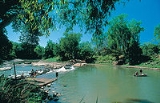
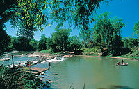
, containing three rivers the East, West and South Alligator River. It is regarded as one of the richest biological regions in Australia with part of the region in the Kakadu National Park
Kakadu National Park
Kakadu National Park is in the Northern Territory of Australia, 171 km southeast of Darwin.Kakadu National Park is located within the Alligator Rivers Region of the Northern Territory of Australia. It covers an area of , extending nearly 200 kilometres from north to south and over 100 kilometres...
, and is an Important Bird Area
Important Bird Area
An Important Bird Area is an area recognized as being globally important habitat for the conservation of bird populations. Currently there are about 10,000 IBAs worldwide. The program was developed and sites are identified by BirdLife International...
(IBA) lying to the east of the Adelaide and Mary River Floodplains IBA. It also contains mineral deposits especially uranium with the Ranger Uranium Mine
Ranger Uranium Mine
The Ranger uranium mine is surrounded by Kakadu National Park, in the Northern Territory of Australia, 230 km east of Darwin. The orebody was discovered in 1969, and the mine commenced operation in 1980, reaching full production of uranium oxide in 1981...
located there. The area is also rich in Australian Aboriginal art
Australian Aboriginal art
Indigenous Australian art is art made by the Indigenous peoples of Australia and in collaborations between Indigenous and Non-Indigenous Australians . It includes works in a wide range of media including painting on leaves, wood carving, rock carving, sculpture, ceremonial clothing and sandpainting...
with 1500 sites. The Kakadu National Park is one of the few World Heritage sites
World Heritage Site
A UNESCO World Heritage Site is a place that is listed by the UNESCO as of special cultural or physical significance...
on the list because of both its natural and human heritage values. They were explored by Lieutenant Phillip Parker King in 1820 who named them in the mistaken belief that the crocodile
Crocodile
A crocodile is any species belonging to the family Crocodylidae . The term can also be used more loosely to include all extant members of the order Crocodilia: i.e...
s in the estuaries were alligator
Alligator
An alligator is a crocodilian in the genus Alligator of the family Alligatoridae. There are two extant alligator species: the American alligator and the Chinese alligator ....
s.
Rivers

Arnhem Land
The Arnhem Land Region is one of the five regions of the Northern Territory of Australia. It is located in the north-eastern corner of the territory and is around 500 km from the territory capital Darwin. The region has an area of 97,000 km² which also covers the area of Kakadu National...
Plateau, it flows with tributary streams towards the north-west through magnificent canyons towards the Van Diemen Gulf
Van Diemen Gulf
Van Diemen Gulf is a gulf between Arnhem Land, of the attached Cobourg Peninsula and Melville Island in northern Australia. It is connected to the Timor Sea in the west by the Clarence Strait , and to the Arafura Sea in the north by Dundas Strait...
which it meets at Point Farewell.
The South Alligator River is also about 160 km long. It rises north of Mount Stow also on the Arnhem Land plateau. It flows north-westerly in a valley containing a number of disused uranium mines developed between 1955 and 1965. It also finishes in the Van Diemen Gulf of the Timor Sea
Timor Sea
The Timor Sea is a relatively shallow sea bounded to the north by the island of Timor, to the east by the Arafura Sea, to the south by Australia and to the west by the Indian Ocean....
.
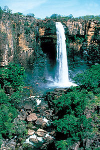
The West Alligator River rises in the lowlands and is 80 km long. The Wildman River also flows in the region. The river system has a number of spectacular waterfalls including the Jim Jim Falls
Jim Jim Falls
Jim Jim Falls is a 200 m high waterfall located in the Kakadu National Park, in the Northern Territory, Australia. It is believed that 140 million years ago much of Kakadu was under a shallow sea. The prominent escarpment wall formed sea cliffs and the Arnhem Land plateau formed a flat land...
on Jim Jim Creek and the Twin Falls
Twin Falls, Australia
Twin Falls is located in the Kakadu National Park in the Northern Territory, Australia. It is located near the eastern boundary of the park and 80 km south of Jabiru. It is also known as Gungkurdul...
on Twin Falls Creek.
The rivers have created the alluvial plains, including the mangrove
Mangrove
Mangroves are various kinds of trees up to medium height and shrubs that grow in saline coastal sediment habitats in the tropics and subtropics – mainly between latitudes N and S...
swamps, in the past 20,000 years.
Climate

Monsoon
Monsoon is traditionally defined as a seasonal reversing wind accompanied by corresponding changes in precipitation, but is now used to describe seasonal changes in atmospheric circulation and precipitation associated with the asymmetric heating of land and sea...
climate. The dry season
Dry season
The dry season is a term commonly used when describing the weather in the tropics. The weather in the tropics is dominated by the tropical rain belt, which oscillates from the northern to the southern tropics over the course of the year...
lasts between May and September while the wet season
Wet season
The the wet season, or rainy season, is the time of year, covering one or more months, when most of the average annual rainfall in a region occurs. The term green season is also sometimes used as a euphemism by tourist authorities. Areas with wet seasons are dispersed across portions of the...
lasts between November and March. April and October are transitional periods between the two seasons. Annual rainfall at Jabiru
Jabiru, Northern Territory
Jabiru is a town in the Northern Territory of Australia. It was originally built in 1982 as a closed town to house the community living at Jabiru East near the Ranger Uranium Mine eight kilometres away. Both the mine and the town are completely surrounded by Kakadu National Park.- Overview :Jabiru...
is approximately 1540 mm with almost all of it falling during the wet season. During the wet season, the prevailing winds are westerly to north-westerly while they are easterly to south-easterly during the dry season.
The three Alligator Rivers are perennial rivers flowing even during the dry season as is the Wildman River. All of the tributaries dry up in places during that period. The land dries out, and the wildlife concentrates around the permanent water sources such as the rivers, springs, waterholes and billabong
Billabong
Billabong is an Australian English word meaning a small lake, specifically an oxbow lake, a section of still water adjacent to a river, cut off by a change in the watercourse. Billabongs are usually formed when the path of a creek or river changes, leaving the former branch with a dead end...
s. The duration of the dry period depends on the rainfall during the wet season. In a normal year, the tributaries will start flowing around the middle of December and finish at the end of June, but the flow will start in November and finish in August if the rainfall has been particularly heavy.
During the wet season, the savanna
Savanna
A savanna, or savannah, is a grassland ecosystem characterized by the trees being sufficiently small or widely spaced so that the canopy does not close. The open canopy allows sufficient light to reach the ground to support an unbroken herbaceous layer consisting primarily of C4 grasses.Some...
turns green, the wildlife spreads out, the bird life returns and the streams flood into adjacent lands turning them into swamps. The flood plains leave behind silt when they gradually dry up during the wet season.
During the wet season, the water has a higher temperature and is relatively low in turbidity. In the dry season, there is an increase in turbidity especially in the shallower water sources.
The Alligator Rivers Region is also subject to cyclones
Tropical cyclone
A tropical cyclone is a storm system characterized by a large low-pressure center and numerous thunderstorms that produce strong winds and heavy rain. Tropical cyclones strengthen when water evaporated from the ocean is released as the saturated air rises, resulting in condensation of water vapor...
between October and May like other parts of the Australian Indian Southeast region.
Wildlife

The region also features high populations of the dusky rat and its predator the water python
Liasis
Liasis is a genus of non-venomous pythons found in Indonesia, New Guinea and Australia. Currently, 3 extant species are recognized and one fossil species L. dubudingala -Geographic range:...
. New vertebrate species are still being discovered in the region notably the Kakadu dunnart
Dunnart
Dunnarts are furry narrow-footed marsupials the size of a mouse, members of the genus Sminthopsis. They are mainly insectivorous. A male dunnart's Y chromosome has only 4 genes, making it the smallest known mammalian Y chromosome....
and the Kakadu Pebble-mound Mouse
Kakadu Pebble-mound Mouse
The Kakadu Pebble-mound Mouse is a rodent native to Australia. It is one of the pebble-mound mice....
. The potential for discovery of invertebrate species such as ants is even greater.
There is some threat to the ecosystems from introduced flora and fauna. Introduced species of plant such as the giant sensitive plant
Mimosa pudica
Mimosa pudica , is a creeping annual or perennial herb often grown for its curiosity value: the compound leaves fold inward and droop when touched or shaken, re-opening minutes later...
and Mission grass are threatening habitats. Pest species such as feral water buffalo and Cane Toad
Cane Toad
The Cane Toad , also known as the Giant Neotropical Toad or Marine Toad, is a large, terrestrial true toad which is native to Central and South America, but has been introduced to various islands throughout Oceania and the Caribbean...
s are also causing problems.
Birds
The region features a wide variety of birdlife with over one in three of Australia's species having been sighted in the region. In particular, the Alligator Rivers area is known for its rich collection of waterfowl such as Magpie GeeseMagpie-goose
The Magpie Goose is a waterbird species found in coastal northern Australia and savannah in southern New Guinea. It is a unique member of the order Anseriformes, and arranged in a family and genus distinct from all other living waterfowl...
, duck
Duck
Duck is the common name for a large number of species in the Anatidae family of birds, which also includes swans and geese. The ducks are divided among several subfamilies in the Anatidae family; they do not represent a monophyletic group but a form taxon, since swans and geese are not considered...
s, heron
Heron
The herons are long-legged freshwater and coastal birds in the family Ardeidae. There are 64 recognised species in this family. Some are called "egrets" or "bitterns" instead of "heron"....
s, ibis
Ibis
The ibises are a group of long-legged wading birds in the family Threskiornithidae....
es and spoonbill
Spoonbill
Spoonbills are a group of large, long-legged wading birds in the family Threskiornithidae, which also includes the Ibises.All have large, flat, spatulate bills and feed by wading through shallow water, sweeping the partly opened bill from side to side...
s. The Alligators Rivers floodplains form a 383,000 ha Important Bird Area
Important Bird Area
An Important Bird Area is an area recognized as being globally important habitat for the conservation of bird populations. Currently there are about 10,000 IBAs worldwide. The program was developed and sites are identified by BirdLife International...
which it is estimated to support some five million waterbirds, including over 1% of the global population of 22 species, significant numbers of three near threatened
Near Threatened
Near Threatened is a conservation status assigned to species or lower taxa that may be considered threatened with extinction in the near future, although it does not currently qualify for the threatened status...
species, with another 11 restricted-range or savanna
Savanna
A savanna, or savannah, is a grassland ecosystem characterized by the trees being sufficiently small or widely spaced so that the canopy does not close. The open canopy allows sufficient light to reach the ground to support an unbroken herbaceous layer consisting primarily of C4 grasses.Some...
-biome
Biome
Biomes are climatically and geographically defined as similar climatic conditions on the Earth, such as communities of plants, animals, and soil organisms, and are often referred to as ecosystems. Some parts of the earth have more or less the same kind of abiotic and biotic factors spread over a...
-restricted species.
Aboriginal Heritage
Aboriginal peopleAustralian Aborigines
Australian Aborigines , also called Aboriginal Australians, from the latin ab originem , are people who are indigenous to most of the Australian continentthat is, to mainland Australia and the island of Tasmania...
have lived continuously in the Alligator Rivers Region for 50,000 years. The region accordingly has a rich heritage with cave paintings and rock carvings common with over 1500 sites. Many aboriginal artefacts have been found in old camping grounds in the region.
The southern part of Kakadu contain a number of sites relating to Bula a god associated with creation and these sites are considered to be both sacred and dangerous to the aboriginal people because of this association. There is also art relating to contact with Makassan
Makassar
Makassar, is the provincial capital of South Sulawesi, Indonesia, and the largest city on Sulawesi Island. From 1971 to 1999, the city was named Ujung Pandang, after a precolonial fort in the city, and the two names are often used interchangeably...
traders and Europeans.
At Ubirr
Ubirr
Ubirr is located in the East Alligator region of Kakadu National Park in the Northern Territory of Australia, and is famous for its rock art. It consists of a group of rock outcrops on the edge of the Nadab floodplain where there are several natural shelters that have a collection of Aboriginal...
Rock near Cahill's Crossing on the East Alligator River, there are paintings dating from 20,000 years ago with figures throwing spears and wearing headdresses to first contact with European settlement.
The Gagudju people live in the area between the East and South Alligator Rivers. They share responsibility for Kakadu National Park which lies within their country. Gunbalunya (formerly Oenpelli
Oenpelli, Northern Territory
Oenpelli is an Aboriginal community in west Arnhem Land in the Northern Territory of Australia.-Access:The sealed Arnhem Highway links Darwin to Jabiru, the town within Kakadu National Park...
), a settlement in the area, is run by an Aboriginal council and is an important centre for arts and crafts. The Gagudju language is no longer widely spoken but was common up until the early twentieth century.
The Jawoyn
Jawoyn
The Jawoyn people are a group of Indigenous Australians living in the Northern Territory of Australia.Their country is around the Katherine Gorge area, which they have always called Nitmiluk, which means place of cicada dreaming....
people live in the South Alligator and South Mary regions as well as around Katherine
Katherine, Northern Territory
Katherine is a town situated southeast of Darwin in the "Top End" of Australia in the Northern Territory. It is the fourth largest settlement in the Territory after the capital Darwin, Palmerston and Alice Springs...
. The Jawoyn negotiated an agreement in 1993 for the Coronation Hill uranium mine where they would allow further exploration of the area in return for employment and training for the Jawoyn and a partnership arrangement.
The Gunwinggu
Gunwinggu
Kunwinjku, also spelt Gunwinggu or Gunwinjgu and also known as Bininj Gunwok or Mayali, is an Australian Aboriginal language in northern Australia...
people live between the Liverpool River and the East Alligator River. Traditional beliefs remain important to the Gunwinggu with Ngalyod, the Rainbow Serpent playing an important part in their art and traditions. The Gunwinggu have received royalties from the Nabarlek Uranium Mine
Nabarlek Uranium Mine
The Nabarlek Mine is a past producing uranium mine in the Northern Territory of Australia. The deposit sits within the Alligator Rivers Uranium Field approximately northeast of Jabiru. It was discovered by Queensland Mines Limited in 1970 by following up an intense airborne radiometric...
in recent years. The Gunwinggu live in Gunbalunya and Maningrida
Maningrida, Northern Territory
Maningrida is a self-governing indigenous community in the heart of the Arnhem Land region of Australia's Northern Territory. Maningrida is located 500 km east of Darwin and 300 km north east of Jabiru. It is on the North Central Arnhem Land coast of the Arafura Sea, on the estuary of the Liverpool...
.
Exploration
The explorer Phillip Parker King was the first English navigator to enter the Gulf of CarpentariaGulf of Carpentaria
The Gulf of Carpentaria is a large, shallow sea enclosed on three sides by northern Australia and bounded on the north by the Arafura Sea...
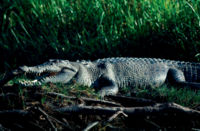
. He made a number of explorations in the area between 1818 and 1822 and named the rivers after the crocodiles which he mistook for alligators as his journals note. "On our course up and down the river, we encountered several very large alligators and some were noticed sleeping on the mud. This was the first time we had seen these animals, excepting that at Goulburn Island, and, as they appeared to be very numerous and large, it was not thought safe to stop all night up the River."
Ludwig Leichhardt
Ludwig Leichhardt
Friedrich Wilhelm Ludwig Leichhardt, known as Ludwig Leichhardt, was a Prussian explorer and naturalist, most famous for his exploration of northern and central Australia.-Early life:...
was the first European explorer to visit the area in 1845 on route to Port Essington
Port Essington
Port Essington is an inlet and historic site located on the Cobourg Peninsula in the Garig Gunak Barlu National Park in Australia's Northern Territory...
. Leichhardt followed a creek down from the Arnhem Land
Arnhem Land
The Arnhem Land Region is one of the five regions of the Northern Territory of Australia. It is located in the north-eastern corner of the territory and is around 500 km from the territory capital Darwin. The region has an area of 97,000 km² which also covers the area of Kakadu National...
escarpment before crossing the South and East Alligator Rivers. John McDouall Stuart
John McDouall Stuart
John McDouall Stuart was one of the most accomplished and famous of all Australia's inland explorers. Stuart led the first successful expedition to traverse the Australian mainland from south to north and return, and the first to do so from a starting point in South Australia, achieving this...
also visited the area in 1862.
Settlement
See Kakadu National ParkKakadu National Park
Kakadu National Park is in the Northern Territory of Australia, 171 km southeast of Darwin.Kakadu National Park is located within the Alligator Rivers Region of the Northern Territory of Australia. It covers an area of , extending nearly 200 kilometres from north to south and over 100 kilometres...
for more information on settlement
The settlement of the area by Europeans was slow and sporadic as it was very remote and illnesses were also a problem. The commercial harvesting of water buffalo hides and horns had begun by the 1880s. Paddy Cahill, who came to the area to set up a cattle station was the first buffalo hunter to operate in the region. The buffalo industry lasted for approximately 70 years until the late 1950s until the development of synthetic substitutes. Crocodile hunting was also operating in the area until the hunting of freshwater crocodile was made illegal in 1964 and estuarine crocodiles in 1971.
Paddy Cahill had established his cattle station at Oenpelli by 1906 and by 1913 it had become successful. Indeed, Cahill's success at Oenpelli was often cited as an example for others to follow. Other stations were set up but did not always enjoy the same success. Goodparla operated as a cattle and buffalo station and operated with mixed success until the Federal Government acquired the land as part of Kakadu National Park.
Missionaries
Missionary
A missionary is a member of a religious group sent into an area to do evangelism or ministries of service, such as education, literacy, social justice, health care and economic development. The word "mission" originates from 1598 when the Jesuits sent members abroad, derived from the Latin...
provided much of the schooling for the aboriginal people for much of the twentieth century. The Kapalga Native Industrial Mission was established in 1899 near the South Alligator River but only lasted four years. The Church of England Missionary Society established a mission station in 1925 at Oenpelli which lasted for 45 years. In 1975, an aboriginal town council took over responsibility for running the township of Oenpelli.
Small scale gold mining started in the region in the 1920s at Imarlkba near Barramundi Creek and at Moline in the 1930s. However, it was the discovery of uranium at the headlands of the South Alligator River in 1953 that started the mining industries. By 1957, there were 13 uranium mines operating employing 150 people including at Coronation Hill. The discovery of large uranium mines at Jabiluka
Jabiluka
Jabiluka is a uranium deposit and mine development in the Northern Territory of Australia that was to have been built on land belonging to the Mirarr Aboriginal people...
, Ranger
Ranger Uranium Mine
The Ranger uranium mine is surrounded by Kakadu National Park, in the Northern Territory of Australia, 230 km east of Darwin. The orebody was discovered in 1969, and the mine commenced operation in 1980, reaching full production of uranium oxide in 1981...
and Koongarra. The Federal Government established the Ranger Uranium Environmental Inquiry otherwise known as the Fox Inquiry which recommended the development of the Ranger site, consideration of the other two sites and establishment of Jabiru
Jabiru, Northern Territory
Jabiru is a town in the Northern Territory of Australia. It was originally built in 1982 as a closed town to house the community living at Jabiru East near the Ranger Uranium Mine eight kilometres away. Both the mine and the town are completely surrounded by Kakadu National Park.- Overview :Jabiru...
as a support centre. Royalties are paid to the traditional owners in compensation for the loss of their country.

