
Lake Cargelligo, New South Wales
Encyclopedia
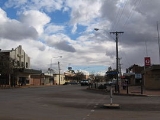
Lake Cargelligo is a town in the Central West
region of New South Wales
, Australia
, on Lake Cargelligo. It is in Lachlan Shire
. At the 2006 census
, Lake Cargelligo had a population of 1,146 people. Its name is said to be a corruption of the Aboriginal word 'Kartjellakoo' meaning 'he had a coolamon'. A coolamon is a shallow wooden dish. Alternatively it is derived from Wiradhuri and Ngiyambaa 'gajal' for water container with suffix 'lugu' for 'her' or 'his'. In 2001 it had an indigenous population of 220 (18.0%) and a foreign born population of 45 (3.7%). The explorers, John Oxley
and George Evans
, followed the Lachlan River
down to Lake Cargelligo in 1817.
from Cootamundra
to Wyalong
was extended to Lake Cargelligo in 1917. The railway station opened as 'Cargelligo' in 1917 and was renamed 'Lake Cargelligo' in 1919. Rail-motor passenger services operated to the town until 1983.. Since then the railway link has been used for cargo transport, especially for bulk grain which the surrounding farms cultivate.
It also has a strong World War I
background and ANZAC heritage.
through Lake Curlew. The lake was originally named Regent's Lake by the explorer John Oxley
after the prince regent of England at the time. The lake was the primary water source for the early mining town, and has continued to remain an integral source of water for Lake Cargelligo's inhabitants. These days the lake serves recreational uses as well, most commonly boating and water skiing
, which is a large part of the town's tourism industry.
After many years of drought, it was reported in early 2010 that the lake ran dry for the first time since 1902.
Central West, New South Wales
The Central West region refers to the area west of the Blue Mountains, New South Wales, Australia. It has an area of 63,262 square kilometers....
region of New South Wales
New South Wales
New South Wales is a state of :Australia, located in the east of the country. It is bordered by Queensland, Victoria and South Australia to the north, south and west respectively. To the east, the state is bordered by the Tasman Sea, which forms part of the Pacific Ocean. New South Wales...
, Australia
Australia
Australia , officially the Commonwealth of Australia, is a country in the Southern Hemisphere comprising the mainland of the Australian continent, the island of Tasmania, and numerous smaller islands in the Indian and Pacific Oceans. It is the world's sixth-largest country by total area...
, on Lake Cargelligo. It is in Lachlan Shire
Lachlan Shire
Lachlan Shire is a Local Government Area in the Central West of New South Wales on the Lachlan River and the Broken Hill railway line.The largest town and council seat is Condobolin. The Shire also includes the towns and villages of Tottenham, Lake Cargelligo, Tullibigeal, Albert, Burcher and...
. At the 2006 census
Census in Australia
The Australian census is administered once every five years by the Australian Bureau of Statistics. The most recent census was conducted on 9 August 2011; the next will be conducted in 2016. Prior to the introduction of regular censuses in 1961, they had also been run in 1901, 1911, 1921, 1933,...
, Lake Cargelligo had a population of 1,146 people. Its name is said to be a corruption of the Aboriginal word 'Kartjellakoo' meaning 'he had a coolamon'. A coolamon is a shallow wooden dish. Alternatively it is derived from Wiradhuri and Ngiyambaa 'gajal' for water container with suffix 'lugu' for 'her' or 'his'. In 2001 it had an indigenous population of 220 (18.0%) and a foreign born population of 45 (3.7%). The explorers, John Oxley
John Oxley
John Joseph William Molesworth Oxley was an explorer and surveyor of Australia in the early period of English colonisation.October 1802 he was engaged in coastal survey work including an expedition to Western Port in 1804-05...
and George Evans
George Evans (explorer)
George William Evans was a surveyor and early explorer in the colony of New South Wales. Evans was born in Warwick, England, migrating to Australia in October 1802.-Early Career:...
, followed the Lachlan River
Lachlan River
- Course :The river rises in the central highland of New South Wales, part of the Great Dividing Range, 13 km east of Gunning. Its major headwaters, the Carcoar River, the Belubula River and the Abercrombie River converge near the town of Cowra. Minor tributaries include the Morongla Creek...
down to Lake Cargelligo in 1817.
Transport
The railwayLake Cargelligo railway line, New South Wales
The Lake Cargelligo railway line is a railway line in Central Western New South Wales, Australia. The line opened in 1917, and branches from the Main South line at Cootamundra and travels in a north-westerly direction to the small town of Lake Cargelligo...
from Cootamundra
Cootamundra, New South Wales
Cootamundra is a town and Local Government Area in the South West Slopes region of New South Wales, Australia and within the Riverina. At the 2006 census, Cootamundra had a population of 5,566. It is located on the Olympic Highway at the point where it crosses the Muttama Creek, between Junee and...
to Wyalong
Wyalong, New South Wales
Wyalong is part of the Bland Shire located in the Northern Riverina Region of New South Wales, Australia. Established as a gold mining town, it is now a quiet town with historic buildings a few kilometres east of West Wyalong, the major district service centre...
was extended to Lake Cargelligo in 1917. The railway station opened as 'Cargelligo' in 1917 and was renamed 'Lake Cargelligo' in 1919. Rail-motor passenger services operated to the town until 1983.. Since then the railway link has been used for cargo transport, especially for bulk grain which the surrounding farms cultivate.
It also has a strong World War I
World War I
World War I , which was predominantly called the World War or the Great War from its occurrence until 1939, and the First World War or World War I thereafter, was a major war centred in Europe that began on 28 July 1914 and lasted until 11 November 1918...
background and ANZAC heritage.
The lake
As its name would suggest, the town of Lake Cargelligo is situated on a lake fed by the Lachlan RiverLachlan River
- Course :The river rises in the central highland of New South Wales, part of the Great Dividing Range, 13 km east of Gunning. Its major headwaters, the Carcoar River, the Belubula River and the Abercrombie River converge near the town of Cowra. Minor tributaries include the Morongla Creek...
through Lake Curlew. The lake was originally named Regent's Lake by the explorer John Oxley
John Oxley
John Joseph William Molesworth Oxley was an explorer and surveyor of Australia in the early period of English colonisation.October 1802 he was engaged in coastal survey work including an expedition to Western Port in 1804-05...
after the prince regent of England at the time. The lake was the primary water source for the early mining town, and has continued to remain an integral source of water for Lake Cargelligo's inhabitants. These days the lake serves recreational uses as well, most commonly boating and water skiing
Water skiing
thumb|right|A slalom skier making a turn on a slalom waterski.Waterskiing is a sport where an individual is pulled behind a boat or a cable ski installation on a body of water, skimming the surface.-History:...
, which is a large part of the town's tourism industry.
After many years of drought, it was reported in early 2010 that the lake ran dry for the first time since 1902.