
1991 Atlantic hurricane season
Encyclopedia
The 1991 Atlantic hurricane season was the first season
in over 24 years in which no hurricanes developed from tropical wave
s, which are the source for most North Atlantic tropical cyclones. The hurricane season
officially began on June 1, and ended on November 30. It was the least active in four years due to higher than usual wind shear across the Atlantic Ocean. The first storm, Ana, developed on July 2 off the southeast United States
and dissipated without causing significant effects. Two other tropical storms in the season – Danny and Erika – did not significantly affect land. Danny dissipated east of the Lesser Antilles
, and Erika passed through the Azores
before becoming extratropical
. In addition, there were four non-developing tropical depressions
. The second depression of the season struck Mexico
with significant accompanying rains.
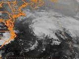
The most significant storm of the season was Hurricane Bob
, which at the time was among the ten costliest United States hurricanes. After brushing the Outer Banks
of North Carolina
and Long Island
in New York
, the hurricane made landfall
on Rhode Island
. It caused $1.5 billion in damage (1991 USD), mostly in Massachusetts, and 17 fatalities. The strongest hurricane of the season was Claudette, which reached peak winds of 135 mph (215 km/h) near Bermuda
. It passed near the island but did not cause any damage. Tropical Storm Fabian
was the only tropical storm to move over or near Cuba
or Florida
, producing heavy rainfall but no damage. Hurricane Grace
, the final named storm of the season, provided the energy that led to the development of a powerful nor'easter
known as the Perfect Storm. Originating from an extratropical storm, the Perfect Storm intensified while moving westward toward New England
, leaving $200 million in damage and causing coastal damage from Puerto Rico
to Florida and northward through Canada. It later transitioned into a hurricane over the Gulf Stream, finally dissipating over Nova Scotia
on November 2.
Before the start of the season, hurricane expert William M. Gray
released his forecast for the year's activity, a yearly practice that he began in 1984. In early April, Gray anticipated a "mild" season with fewer than ten tropical storms
, of which less than six would become hurricanes. Later that month, the Weather Research Center forecast ten named storms and six hurricanes, of which five would become major hurricanes while three would hit the United States. In early June, Gray released an updated report that predicted the formation of eight tropical storms, four hurricanes, and one major hurricane. The revised June total was very close to the actual season activity, with the exception of forecasting one fewer major hurricane. However, a later revision in August incorrectly anticipated less activity, when Gray predicted seven storms and three hurricanes.
Overall activity in 1991 was below normal. This was partially due to decreased tropical cyclogenesis
from African tropical waves, which are troughs
that move across the ocean with associated convection. In most seasons, the majority of storms develop from tropical waves. Of the season's twelve tropical cyclones, only five originated from tropical waves; in addition, only three of the eight tropical storms were from tropical waves, and none had the characteristics of a Cape Verde-type hurricane
. From late April to late November, there were 73 tropical waves that exited the west coast of Africa. The total was higher than average, although many of them were poorly defined and had little thunderstorm activity. The waves traversed the Atlantic Ocean further south than normal, typically not becoming convectively active until moving across northern South America. Cyclogenesis was also suppressed by higher than normal wind shear
, as well as low rainfall amounts across the Sahel
. There were also no tropical storms in the Gulf of Mexico for only the third time in the 20th century, after 1927
and 1962
. The season produced twelve tropical depressions, which was the lowest in five years. The eight tropical storms was the lowest amount in four years. Four of the storms developed into hurricanes, although for the first time in over 24 years none were from tropical waves.
The season's activity was reflected with a low cumulative accumulated cyclone energy
(ACE) rating of 36. ACE is, broadly speaking, a measure of the power of the hurricane multiplied by the length of time it existed, so storms that last a long time, as well as particularly strong hurricanes, have high ACEs. ACE is only calculated for full advisories on tropical systems at or exceeding 34 knots (39 mph, 63 km/h) or tropical storm strength. Subtropical cyclone
s are excluded from the total.
that persisted east of Jacksonville, Florida
by June 25. With an anticyclone
located over Florida, The system moved in a clockwise motion around an anticyclone
located over Florida. The cold-core low gradually developed to the surface, and on June 29, a low pressure area
formed within a surface trough
over the Bahamas. It moved westward across southern Florida, dropping heavy rainfall along its path. Punta Gorda
recorded a statewide peak of 7.86 in (199.6 mm) of precipitation. The low moved northwestward and later curved northeastward, exiting into the Atlantic Ocean near Saint Augustine by early on July 2. Although it was initially disorganized as it moved offshore, the convection quickly developed in organization, and by 1800 UTC
that day it had developed into Tropical Depression One about 85 mi (135 km) south of Charleston, South Carolina
.
As the depression moved northeastward parallel to the southeast United States coastline, it dropped light rainfall, although portions of Virginia recorded more than 5 inches (130 mm). Late on July 3, a buoy reported sustained winds
of 38 mph (61 km/h) over a period of eight and a half minutes. As a result, the National Hurricane Center upgraded the depression to Tropical Storm Ana. The storm accelerated east-northeastward toward a stalled frontal zone, entering an area of increased wind shear
. Despite hostile conditions, Ana strengthened slightly, reaching peak winds of 50 mph (85 km/h). Moving over cooler waters and interacting with the frontal zone, the circulation
became broad as the thunderstorms diminished. On July 5, Ana became extratropical
(non-tropical) in the northern Atlantic Ocean about 680 mi (1,090 km) to the south of Cape Race
.
emerged off the coast of Africa on June 20, and no significant development occurred until it became Tropical Depression Two in the western Gulf of Mexico on July 5. On its first advisory, a tropical storm watch was issued for from Baffin Bay, Texas
southward to Tampico, Tamaulipas. Nearing the coast of Mexico, the depression attained its peak intensity with winds of 35 mph (55 km/h) and a minimum pressure of 1007 mbar (29.7 inHg). Failing to intensify further, Tropical Depression Two made landfall near La Pesca, Tamaulipas
, Mexico
on July 6. The National Hurricane Center issued the final advisory on July 7, although the circulation persisted until July 9 southwest of Texas. The depression had only minor impacts in Mexico and Texas, other than rainfall. Rainfall was heaviest in San Luis Potosí
, where the precipitation associated peaked at 17.47 in (444 mm) in Tamazunchale
, Mexico.
, and based on reports from the Hurricane Hunters
, Bob attained hurricane status on August 17. Shortly thereafter, the hurricane began to turn towards the north-northeast in response to a subtropical ridge
over the Atlantic and the trough over the southeastern United States. After further intensification off the Carolinas, Bob reached peak winds of 115 mph (185 km/h) to the east of Virginia on August 19, making it a major hurricane. Significantly cooler sea surface temperatures resulted in weakening. After brushing Long Island
, the center of Bob moved over Block Island, Rhode Island. About 40 minutes later it struck Newport, Rhode Island
with winds of 100 mph (155 km/h), making it a Category 2 hurricane. It rapidly weakened to tropical storm intensity while moving through the remainder of New England, hitting Rockport, Maine
early on August 20. After crossing New Brunswick
, Bob became extratropical in the Gulf of St. Lawrence and lasted another nine days before dissipating west of Portugal
.
The hurricane first affected the Carolinas, spawning four confirmed and nine unconfirmed tornadoes in North Carolina. One person each died in North and South Carolina, and about 10% of houses in the Outer Banks
sustained minor roof damage. As the storm moved up the coast, heavy rain fell on the western side of the center. High winds left 300,000 people without power on Long Island
. In neighboring Connecticut, strong winds downed trees across the region, with damage heaviest in the southeastern portion near the coast. Damage was heaviest as Bob made its final landfall, with wind gusts of 105 mph (168 km/h) reported on Block Island
, Rhode Island
. The hurricane produced extensive beach erosion
which destroyed coastal roads in the state. Monetary damage was greatest in Massachusetts, and along Bob's path through southeastern New England more than 60% of people were left without power. High tides and strong winds destroyed boats and houses along the Massachusetts coastline. The heaviest rainfall from the hurricane fell at the Portland International Jetport
in Maine
, where 8.24 in (209.3 mm) fell during its passage. Across the United States, damage totaled $1.5 billion (1991 USD), including over $1 billion in Massachusetts. The high damage total made Bob among the ten costliest U.S. hurricanes at the time. In addition, there were 15 fatalities in the country. In Canada, high waves killed two people. In Fredericton, New Brunswick
, tropical storm-force winds downed trees and power lines.
. Upon developing, the depression had a small area of convection with a spiral rainband, and the NHC anticipated slow strengthening to tropical storm status. With a ridge
to the north, the depression maintained a general westward track. Ultimately, the depression failed to organize significantly. By August 29, it had a broad and poorly organized circulation with only scattered convection. Due to cool water temperatures, the system was unable to maintain deep convection, and on August 31 the depression degenerated into a tropical wave about 400 miles (645 km) east of the Lesser Antilles.
from an upper-level disturbance. Following its formation, it developed slowly while moving southwestward, and on September 5 it intensified into Tropical Storm Claudette. Conditions were favorable for development, with low wind shear and a large anticyclone providing outflow
, or the outward wind flow from a storm. On September 6 at 0600 UTC, Claudette attained hurricane status. It underwent rapid intensification, and early on September 7 a reconnaissance flight reported that Claudette attained major hurricane status with winds of 115 mph (185.1 km/h). Based on satellite estimates, Hurricane Claudette attained its peak intensity with winds of 135 mph (215 km/h) and a minimum pressure 944 mbar (27.9 inHg).
After peaking, Claudette began steady weakening. Around that time, a hurricane watch
was issued for the island of Bermuda, which was later upgraded to a warning. The hurricane turned to the northwest, passing 136 miles (218.9 km) east of Bermuda as a Category 1 hurricane on September 8. Winds on the island peaked at 23 mph (37 km/h), with gusts to 32 mph (14.3 m/s), and waves reached up to 8 ft (2.43 m) in height. By September 10, Claudette weakened to tropical storm status as it accelerated eastward. The next day it deteriorated further to tropical depression status, and the next day Claudette became extratropical to the southwest of the Azores. It persisted two more days until dissipating over the Azores.
, moving into the tropical Atlantic Ocean with rainbands around its convection. By early on September 7, the system organized into Tropical Depression Seven about 300 mi (482.8 km) south-southwest of Cape Verde. Upon developing, the depression had a broad circulation, located in an environment generally favorable for intensification. With a strong ridge to the north, the depression tracked steadily westward. After remaining a tropical depression for about 36 hours, the system became better organized and developed well-defined banding features
. Based on satellite intensity estimates, the NHC upgraded it to Tropical Storm Danny on September 8.
Upon becoming a tropical storm, only slow strengthening was forecast, due to the presence of an upper-level trough to its west. The storm ultimately reached peak winds of 50 mph (85 km/h), which it maintained for about 36 hours. On September 10 it attained its organizational maximum after developing a central dense overcast. Later that day, an upper-level low increased wind shear over the storm, which exposed the circulation from the deep convection. As Danny approached the Lesser Antilles, it weakened to tropical depression status on September 11. Later that day, a Hurricane Hunters flight was unable to locate a closed circulation, which indicated that Danny degenerated into a tropical wave about 150 mi (241.4 km) east of the Lesser Antilles. The remnants tracked to the northwest and later to the north before being absorbed by a frontal system.
Upon becoming a tropical storm, Erika began a motion to the northeast. There was initial uncertainty whether Erika or nearby Claudette would become the dominant system through their interaction
. On September 10, the storm developed a central dense overcast as it attained its peak winds of 60 mph (95 km/h). It accelerated east-northeastward toward the Azores along the northern periphery of a ridge, briefly interacting with Claudette. By September 11, the convection had diminished, leaving the center exposed as Erika underwent extratropical transition. Shortly thereafter it passed through the Azores, striking São Miguel Island
. Nearby Santa Maria Island
reported tropical storm force winds with gusts to 67 mph (107 km/h), prompting the closure of the airfield for several hours. On September 12, Erika weakened to a tropical depression before completing the transition into an extratropical cyclone. It dissipated later that day.
imparted a northeast motion as well as unfavorable wind shear
. After reaching peak winds of 45 mph (75 km/h), Fabian crossed the Isle of Youth
before crossing western Cuba. There, it dropped heavy rainfall, including 5 in (127 mm) in a six hour period in one location. By early on October 16, the center was becoming difficult to locate as Fabian moved through the Florida Straits. It passed just southeast of the Florida coastline, prompting the closure of two state parks and dropping 4.19 in (106.4 mm) of rainfall in Conch Key
. Effects were minimal, with winds gusting to 32 mph (52 km/h) in Key West
. The storm later moved through the Bahamas and became extratropical as it interacted with an approaching front.
, which is a method of estimating the intensity of tropical cyclones via satellite. At the time of development, the depression had a small area of convection near and east of the center, and due to the wind shear it was never expected to intensify. By October 25, the circulation had become dissociated from the convection. The depression dissipated soon after without affecting land.
. By two days later it had become a surface low, and on October 26 it developed into a subtropical storm. The system was labeled as such due to the initial lack of deep convection over the center, although following an increase in thunderstorms the NHC reclassified it as Tropical Storm Grace late on October 27. By that time, the storm had executed a path generally to the northwest. Grace continued to intensify and organize, and based on Hurricane Hunter reports the storm was upgraded to a hurricane early on October 28. Shortly thereafter, Grace turned sharply to the east due to the influence of a rapidly intensifying extratropical cyclone off the New England
coast. An eye developed in the center of Grace, despite shallow convection.
As the hurricane accelerated eastward, it attained a peak intensity of 100 mph (155 km/h) on October 29. The rapid motion caused an asymmetry in the wind field, and the center passed approximately 50 mi (80.5 km) south of Bermuda without significantly affecting the island. A rapidly approaching cold front absorbed Grace on October 29, contributing moisture to the developing extratropical storm that was eventually known as the Perfect Storm. As a tropical cyclone, Grace produced squally conditions across Bermuda, but no damage was reported. The hurricane generated large swells along the East Coast of the United States, causing minor beach erosion.
on October 28. It moved southward and westward as an extratropical cyclone
due to a ridge to its north, and reached its peak intensity. The storm lashed the East Coast of the United States
with high waves and coastal flooding, before turning to the southwest and weakening. Moving over warmer waters, the system transitioned into a subtropical cyclone
before becoming a tropical storm. It executed a loop off the Mid-Atlantic states
and turned toward the northeast. On November 1 the system evolved into a full-fledged hurricane with peak winds of 75 mph (120.7 km/h). The tropical system weakened, striking Nova Scotia as a tropical storm before dissipating.
Damage totaled over $200 million (1991 USD) and the death toll was thirteen. Most of the damage occurred while the storm was extratropical, after waves up to 30 ft (9.1 m) struck the coastline from Canada to Florida and southeastward to Puerto Rico. In Massachusetts, where damage was heaviest, over 100 homes were destroyed or severely damaged. To the north, more than 100 homes were affected in Maine, including the vacation home of George H.W. Bush, the president
at the time. More than 38,000 people were left without power, and along the coast high waves inundated roads and buildings. In portions of New England, damage was worse than had occurred from Hurricane Bob
two months prior. However, aside from tidal flooding along rivers, the storm's effects were primarily along the coastline. A buoy off the coast of Nova Scotia reported a wave height of 100.7 ft (30.7 m), the highest ever recorded in the province's offshore waters. In the middle of the storm, the Andrea Gail
sunk, killing its crew of six and inspiring the book and later movie
The Perfect Storm. Off the coast of New York, a Coast Guard helicopter lost fuel and crashed, and although four members of its crew were rescued, one was killed. Two people died after their boat sank off Staten Island
. High waves swept a person to their death in both Rhode Island and Puerto Rico, and another person was blown off a bridge in New York. The tropical cyclone that formed late in the storm's duration caused little impact, limited to power outages and slick roads; one person was killed in Newfoundland from a traffic accident related to the storm.
in 1991. Although the Perfect Storm later evolved into a hurricane, the National Hurricane Center left it unnamed due to the heavy damage and media interest in the predecessor extratropical storm. It later received the name the Perfect Storm after a conversation between Boston National Weather Service
forecaster Robert Case
and author Sebastian Junger
. The names not retired from this list were used again in the 1997 season
. This is the same list used for the 1985 season
except for Erika and Grace, which were used for the first time after they replaced Elena
and Gloria
. Names that were not assigned are marked in .
retired the name Bob in the spring of 1992 due to its high impact. It was replaced in the 1997 season
by Bill.
Atlantic hurricane season
The Atlantic hurricane season is the period in a year when hurricanes usually form in the Atlantic Ocean. Tropical cyclones in the North Atlantic are called hurricanes, tropical storms, or tropical depressions. In addition, there have been several storms over the years that have not been fully...
in over 24 years in which no hurricanes developed from tropical wave
Tropical wave
Tropical waves, easterly waves, or tropical easterly waves, also known as African easterly waves in the Atlantic region, are a type of atmospheric trough, an elongated area of relatively low air pressure, oriented north to south, which move from east to west across the tropics causing areas of...
s, which are the source for most North Atlantic tropical cyclones. The hurricane season
Atlantic hurricane season
The Atlantic hurricane season is the period in a year when hurricanes usually form in the Atlantic Ocean. Tropical cyclones in the North Atlantic are called hurricanes, tropical storms, or tropical depressions. In addition, there have been several storms over the years that have not been fully...
officially began on June 1, and ended on November 30. It was the least active in four years due to higher than usual wind shear across the Atlantic Ocean. The first storm, Ana, developed on July 2 off the southeast United States
Southeastern United States
The Southeastern United States, colloquially referred to as the Southeast, is the eastern portion of the Southern United States. It is one of the most populous regions in the United States of America....
and dissipated without causing significant effects. Two other tropical storms in the season – Danny and Erika – did not significantly affect land. Danny dissipated east of the Lesser Antilles
Lesser Antilles
The Lesser Antilles are a long, partly volcanic island arc in the Western Hemisphere. Most of its islands form the eastern boundary of the Caribbean Sea with the Atlantic Ocean, with the remainder located in the southern Caribbean just north of South America...
, and Erika passed through the Azores
Azores
The Archipelago of the Azores is composed of nine volcanic islands situated in the middle of the North Atlantic Ocean, and is located about west from Lisbon and about east from the east coast of North America. The islands, and their economic exclusion zone, form the Autonomous Region of the...
before becoming extratropical
Extratropical cyclone
Extratropical cyclones, sometimes called mid-latitude cyclones or wave cyclones, are a group of cyclones defined as synoptic scale low pressure weather systems that occur in the middle latitudes of the Earth having neither tropical nor polar characteristics, and are connected with fronts and...
. In addition, there were four non-developing tropical depressions
Tropical cyclone scales
Tropical systems are officially ranked on one of several tropical cyclone scales according to their maximum sustained winds and in what oceanic basin they are located...
. The second depression of the season struck Mexico
Mexico
The United Mexican States , commonly known as Mexico , is a federal constitutional republic in North America. It is bordered on the north by the United States; on the south and west by the Pacific Ocean; on the southeast by Guatemala, Belize, and the Caribbean Sea; and on the east by the Gulf of...
with significant accompanying rains.
The most significant storm of the season was Hurricane Bob
Hurricane Bob
Hurricane Bob was one of the costliest hurricanes in New England history. The second named storm and first hurricane of the 1991 Atlantic hurricane season, Bob developed from an area of low pressure near The Bahamas on August 16. The depression steadily intensified, and became Tropical Storm Bob...
, which at the time was among the ten costliest United States hurricanes. After brushing the Outer Banks
Outer Banks
The Outer Banks is a 200-mile long string of narrow barrier islands off the coast of North Carolina, beginning in the southeastern corner of Virginia Beach on the east coast of the United States....
of North Carolina
North Carolina
North Carolina is a state located in the southeastern United States. The state borders South Carolina and Georgia to the south, Tennessee to the west and Virginia to the north. North Carolina contains 100 counties. Its capital is Raleigh, and its largest city is Charlotte...
and Long Island
Long Island
Long Island is an island located in the southeast part of the U.S. state of New York, just east of Manhattan. Stretching northeast into the Atlantic Ocean, Long Island contains four counties, two of which are boroughs of New York City , and two of which are mainly suburban...
in New York
New York
New York is a state in the Northeastern region of the United States. It is the nation's third most populous state. New York is bordered by New Jersey and Pennsylvania to the south, and by Connecticut, Massachusetts and Vermont to the east...
, the hurricane made landfall
Landfall (meteorology)
Landfall is the event of a tropical cyclone or a waterspout coming onto land after being over water. When a waterspout makes landfall it is reclassified as a tornado, which can then cause damage inland...
on Rhode Island
Rhode Island
The state of Rhode Island and Providence Plantations, more commonly referred to as Rhode Island , is a state in the New England region of the United States. It is the smallest U.S. state by area...
. It caused $1.5 billion in damage (1991 USD), mostly in Massachusetts, and 17 fatalities. The strongest hurricane of the season was Claudette, which reached peak winds of 135 mph (215 km/h) near Bermuda
Bermuda
Bermuda is a British overseas territory in the North Atlantic Ocean. Located off the east coast of the United States, its nearest landmass is Cape Hatteras, North Carolina, about to the west-northwest. It is about south of Halifax, Nova Scotia, Canada, and northeast of Miami, Florida...
. It passed near the island but did not cause any damage. Tropical Storm Fabian
Tropical Storm Fabian (1991)
Tropical Storm Fabian was a short-lived tropical storm during the 1991 Atlantic hurricane season. The sixth named storm of the year, it formed in the northwest Caribbean southwest of Cuba. The storm reached a peak intensity of 45 mph , shortly before crossing over Cuba as it moved northeast...
was the only tropical storm to move over or near Cuba
Cuba
The Republic of Cuba is an island nation in the Caribbean. The nation of Cuba consists of the main island of Cuba, the Isla de la Juventud, and several archipelagos. Havana is the largest city in Cuba and the country's capital. Santiago de Cuba is the second largest city...
or Florida
Florida
Florida is a state in the southeastern United States, located on the nation's Atlantic and Gulf coasts. It is bordered to the west by the Gulf of Mexico, to the north by Alabama and Georgia and to the east by the Atlantic Ocean. With a population of 18,801,310 as measured by the 2010 census, it...
, producing heavy rainfall but no damage. Hurricane Grace
Hurricane Grace (1991)
Hurricane Grace was a short-lived Category 2 hurricane that contributed to the formation of the powerful 1991 Perfect Storm. Forming on October 26, Grace initially had subtropical origins, meaning it was partially tropical and partially extratropical in nature. It became a tropical cyclone on...
, the final named storm of the season, provided the energy that led to the development of a powerful nor'easter
Nor'easter
A nor'easter is a type of macro-scale storm along the East Coast of the United States and Atlantic Canada, so named because the storm travels to the northeast from the south and the winds come from the northeast, especially in the coastal areas of the Northeastern United States and Atlantic Canada...
known as the Perfect Storm. Originating from an extratropical storm, the Perfect Storm intensified while moving westward toward New England
New England
New England is a region in the northeastern corner of the United States consisting of the six states of Maine, New Hampshire, Vermont, Massachusetts, Rhode Island, and Connecticut...
, leaving $200 million in damage and causing coastal damage from Puerto Rico
Puerto Rico
Puerto Rico , officially the Commonwealth of Puerto Rico , is an unincorporated territory of the United States, located in the northeastern Caribbean, east of the Dominican Republic and west of both the United States Virgin Islands and the British Virgin Islands.Puerto Rico comprises an...
to Florida and northward through Canada. It later transitioned into a hurricane over the Gulf Stream, finally dissipating over Nova Scotia
Nova Scotia
Nova Scotia is one of Canada's three Maritime provinces and is the most populous province in Atlantic Canada. The name of the province is Latin for "New Scotland," but "Nova Scotia" is the recognized, English-language name of the province. The provincial capital is Halifax. Nova Scotia is the...
on November 2.
Season summary
| Source | Date | Named storms | Hurricanes | Major hurricanes | |
|---|---|---|---|---|---|
| CSU Colorado State University Colorado State University is a public research university located in Fort Collins, Colorado. The university is the state's land grant university, and the flagship university of the Colorado State University System.The enrollment is approximately 29,932 students, including resident and... |
April | <10 | <6 | Unknown | |
| WRC | April | 9-10 | 6 | 5 | |
| CSU | June | 8 | 4 | 1 | |
| CSU | August | 7 | 3 | Unknown | |
| Record high activity | 28 2005 Atlantic hurricane season The 2005 Atlantic hurricane season was the most active Atlantic hurricane season in recorded history, repeatedly shattering numerous records. The impact of the season was widespread and ruinous with an estimated 3,913 deaths and record damage of about $159.2 billion... |
15 2005 Atlantic hurricane season The 2005 Atlantic hurricane season was the most active Atlantic hurricane season in recorded history, repeatedly shattering numerous records. The impact of the season was widespread and ruinous with an estimated 3,913 deaths and record damage of about $159.2 billion... |
8 1950 Atlantic hurricane season The 1950 Atlantic hurricane season was the first year in which tropical cyclones were given official names in the Atlantic basin. Names were taken from the Joint Army/Navy Phonetic Alphabet, with the first named storm being designated "Able", the second "Baker", and so on. It was an active season... |
||
| Record low activity | 1 1914 Atlantic hurricane season The 1914 Atlantic hurricane season was the least active Atlantic hurricane season on record, with only one known tropical storm. Although hurricane season typically encompasses a much larger time-span, actual activity was confined to the middle of September... |
0 1914 Atlantic hurricane season The 1914 Atlantic hurricane season was the least active Atlantic hurricane season on record, with only one known tropical storm. Although hurricane season typically encompasses a much larger time-span, actual activity was confined to the middle of September... (tie 1907 Atlantic hurricane season The 1907 Atlantic hurricane season ran through the summer and the first half of fall in 1907. The season was a very quiet with only five tropical storms forming, with none of them reaching hurricane strength. This feat has only been accomplished one other season, the 1914 season... ) |
0 | ||
| Actual activity | 8 | 3 | 2 | ||
Before the start of the season, hurricane expert William M. Gray
William M. Gray
William M. "Bill" Gray is Emeritus Professor of Atmospheric Science at Colorado State University , and head of the Tropical Meteorology Project at CSU's Department of Atmospheric Sciences. He is a pioneer in the science of forecasting hurricanes and one of the world's leading experts on tropical...
released his forecast for the year's activity, a yearly practice that he began in 1984. In early April, Gray anticipated a "mild" season with fewer than ten tropical storms
Tropical cyclone
A tropical cyclone is a storm system characterized by a large low-pressure center and numerous thunderstorms that produce strong winds and heavy rain. Tropical cyclones strengthen when water evaporated from the ocean is released as the saturated air rises, resulting in condensation of water vapor...
, of which less than six would become hurricanes. Later that month, the Weather Research Center forecast ten named storms and six hurricanes, of which five would become major hurricanes while three would hit the United States. In early June, Gray released an updated report that predicted the formation of eight tropical storms, four hurricanes, and one major hurricane. The revised June total was very close to the actual season activity, with the exception of forecasting one fewer major hurricane. However, a later revision in August incorrectly anticipated less activity, when Gray predicted seven storms and three hurricanes.
Overall activity in 1991 was below normal. This was partially due to decreased tropical cyclogenesis
Tropical cyclogenesis
Tropical cyclogenesis is the term that describes the development and strengthening of a tropical cyclone in the atmosphere. The mechanisms through which tropical cyclogenesis occurs are distinctly different from those through which mid-latitude cyclogenesis occurs...
from African tropical waves, which are troughs
Trough (meteorology)
A trough is an elongated region of relatively low atmospheric pressure, often associated with fronts.Unlike fronts, there is not a universal symbol for a trough on a weather chart. The weather charts in some countries or regions mark troughs by a line. In the United States, a trough may be marked...
that move across the ocean with associated convection. In most seasons, the majority of storms develop from tropical waves. Of the season's twelve tropical cyclones, only five originated from tropical waves; in addition, only three of the eight tropical storms were from tropical waves, and none had the characteristics of a Cape Verde-type hurricane
Cape Verde-type hurricane
A Cape Verde-type hurricane is an Atlantic hurricane that develops near the Cape Verde islands, off the west coast of Africa. The average hurricane season has about two Cape Verde-type hurricanes, which are usually the largest and most intense storms of the season because they often have plenty of...
. From late April to late November, there were 73 tropical waves that exited the west coast of Africa. The total was higher than average, although many of them were poorly defined and had little thunderstorm activity. The waves traversed the Atlantic Ocean further south than normal, typically not becoming convectively active until moving across northern South America. Cyclogenesis was also suppressed by higher than normal wind shear
Wind shear
Wind shear, sometimes referred to as windshear or wind gradient, is a difference in wind speed and direction over a relatively short distance in the atmosphere...
, as well as low rainfall amounts across the Sahel
Sahel
The Sahel is the ecoclimatic and biogeographic zone of transition between the Sahara desert in the North and the Sudanian Savannas in the south.It stretches across the North African continent between the Atlantic Ocean and the Red Sea....
. There were also no tropical storms in the Gulf of Mexico for only the third time in the 20th century, after 1927
1927 Atlantic hurricane season
The 1927 Atlantic hurricane season ran through the summer and the first half of fall in 1927. The season was relatively inactive. There were eight tropical cyclones that formed during the season; four became hurricanes; one became a major hurricane. The first storm of the season was also the...
and 1962
1962 Atlantic hurricane season
The 1962 Atlantic hurricane season was the least active since 1939, with only five named storms. Although the season officially began on June 15, the first storm did not form until August 26. Hurricane Alma brushed the outer banks before becoming extratropical southeast of New England,...
. The season produced twelve tropical depressions, which was the lowest in five years. The eight tropical storms was the lowest amount in four years. Four of the storms developed into hurricanes, although for the first time in over 24 years none were from tropical waves.
The season's activity was reflected with a low cumulative accumulated cyclone energy
Accumulated cyclone energy
Accumulated cyclone energy is a measure used by the National Oceanic and Atmospheric Administration to express the activity of individual tropical cyclones and entire tropical cyclone seasons, particularly the North Atlantic hurricane season. It uses an approximation of the energy used by a...
(ACE) rating of 36. ACE is, broadly speaking, a measure of the power of the hurricane multiplied by the length of time it existed, so storms that last a long time, as well as particularly strong hurricanes, have high ACEs. ACE is only calculated for full advisories on tropical systems at or exceeding 34 knots (39 mph, 63 km/h) or tropical storm strength. Subtropical cyclone
Subtropical cyclone
A subtropical cyclone is a weather system that has some characteristics of a tropical and an extratropical cyclone. As early as the 1950s, meteorologists were unclear whether they should be characterized as tropical or extratropical cyclones. They were officially recognized by the National...
s are excluded from the total.
Tropical Storm Ana
The first storm of the season was Ana, which originated from a cold-core lowCold-core low
A cold-core low, also known as a cold low or cold-core cyclone, is a cyclone aloft which has an associated cold pool of air residing at high altitude within the Earth's troposphere. It is a low pressure system which strengthens with height in accordance with the thermal wind relationship. These...
that persisted east of Jacksonville, Florida
Jacksonville, Florida
Jacksonville is the largest city in the U.S. state of Florida in terms of both population and land area, and the largest city by area in the contiguous United States. It is the county seat of Duval County, with which the city government consolidated in 1968...
by June 25. With an anticyclone
Anticyclone
An anticyclone is a weather phenomenon defined by the United States' National Weather Service's glossary as "[a] large-scale circulation of winds around a central region of high atmospheric pressure, clockwise in the Northern Hemisphere, counterclockwise in the Southern Hemisphere"...
located over Florida, The system moved in a clockwise motion around an anticyclone
Anticyclone
An anticyclone is a weather phenomenon defined by the United States' National Weather Service's glossary as "[a] large-scale circulation of winds around a central region of high atmospheric pressure, clockwise in the Northern Hemisphere, counterclockwise in the Southern Hemisphere"...
located over Florida. The cold-core low gradually developed to the surface, and on June 29, a low pressure area
Low pressure area
A low-pressure area, or "low", is a region where the atmospheric pressure at sea level is below that of surrounding locations. Low-pressure systems form under areas of wind divergence which occur in upper levels of the troposphere. The formation process of a low-pressure area is known as...
formed within a surface trough
Trough (meteorology)
A trough is an elongated region of relatively low atmospheric pressure, often associated with fronts.Unlike fronts, there is not a universal symbol for a trough on a weather chart. The weather charts in some countries or regions mark troughs by a line. In the United States, a trough may be marked...
over the Bahamas. It moved westward across southern Florida, dropping heavy rainfall along its path. Punta Gorda
Punta Gorda, Florida
Punta Gorda is a city in Charlotte County, Florida, United States. According to the U.S. Census Bureau estimates of 2007, the city had a population of 16,762. It is the county seat of Charlotte County and the only incorporated municipality in the county...
recorded a statewide peak of 7.86 in (199.6 mm) of precipitation. The low moved northwestward and later curved northeastward, exiting into the Atlantic Ocean near Saint Augustine by early on July 2. Although it was initially disorganized as it moved offshore, the convection quickly developed in organization, and by 1800 UTC
Coordinated Universal Time
Coordinated Universal Time is the primary time standard by which the world regulates clocks and time. It is one of several closely related successors to Greenwich Mean Time. Computer servers, online services and other entities that rely on having a universally accepted time use UTC for that purpose...
that day it had developed into Tropical Depression One about 85 mi (135 km) south of Charleston, South Carolina
Charleston, South Carolina
Charleston is the second largest city in the U.S. state of South Carolina. It was made the county seat of Charleston County in 1901 when Charleston County was founded. The city's original name was Charles Towne in 1670, and it moved to its present location from a location on the west bank of the...
.
As the depression moved northeastward parallel to the southeast United States coastline, it dropped light rainfall, although portions of Virginia recorded more than 5 inches (130 mm). Late on July 3, a buoy reported sustained winds
Maximum sustained wind
The maximum sustained winds associated with a tropical cyclone are a common indicator of the intensity of the storm. Within a mature tropical cyclone, they are found within the eyewall at a distance defined as the radius of maximum wind, or RMW. Unlike gusts, the value of these winds are...
of 38 mph (61 km/h) over a period of eight and a half minutes. As a result, the National Hurricane Center upgraded the depression to Tropical Storm Ana. The storm accelerated east-northeastward toward a stalled frontal zone, entering an area of increased wind shear
Wind shear
Wind shear, sometimes referred to as windshear or wind gradient, is a difference in wind speed and direction over a relatively short distance in the atmosphere...
. Despite hostile conditions, Ana strengthened slightly, reaching peak winds of 50 mph (85 km/h). Moving over cooler waters and interacting with the frontal zone, the circulation
Atmospheric circulation
Atmospheric circulation is the large-scale movement of air, and the means by which thermal energy is distributed on the surface of the Earth....
became broad as the thunderstorms diminished. On July 5, Ana became extratropical
Extratropical cyclone
Extratropical cyclones, sometimes called mid-latitude cyclones or wave cyclones, are a group of cyclones defined as synoptic scale low pressure weather systems that occur in the middle latitudes of the Earth having neither tropical nor polar characteristics, and are connected with fronts and...
(non-tropical) in the northern Atlantic Ocean about 680 mi (1,090 km) to the south of Cape Race
Cape Race
Cape Race is a point of land located at the southeastern tip of the Avalon Peninsula on the island of Newfoundland, Canada. Its name is thought to come from the original Portuguese name for this cape, "Raso", or "bare"...
.
Tropical Depression Two
A tropical waveTropical wave
Tropical waves, easterly waves, or tropical easterly waves, also known as African easterly waves in the Atlantic region, are a type of atmospheric trough, an elongated area of relatively low air pressure, oriented north to south, which move from east to west across the tropics causing areas of...
emerged off the coast of Africa on June 20, and no significant development occurred until it became Tropical Depression Two in the western Gulf of Mexico on July 5. On its first advisory, a tropical storm watch was issued for from Baffin Bay, Texas
Baffin Bay, Texas
Baffin Bay is a bay in South Texas, an inlet of the larger Laguna Madre. Located near the Gulf of Mexico, Baffin Bay forms part of the boundary between Kenedy County and Kleberg County.-Etymology:The history of the bay name is unclear...
southward to Tampico, Tamaulipas. Nearing the coast of Mexico, the depression attained its peak intensity with winds of 35 mph (55 km/h) and a minimum pressure of 1007 mbar (29.7 inHg). Failing to intensify further, Tropical Depression Two made landfall near La Pesca, Tamaulipas
La Pesca, Tamaulipas
La Pesca is a small town in the Mexican state of Tamaulipas. It is located on the Gulf of Mexico, at the mouth of the Río Soto La Marina, between the Laguna Madre to the north and the Laguna Morales to the south....
, Mexico
Mexico
The United Mexican States , commonly known as Mexico , is a federal constitutional republic in North America. It is bordered on the north by the United States; on the south and west by the Pacific Ocean; on the southeast by Guatemala, Belize, and the Caribbean Sea; and on the east by the Gulf of...
on July 6. The National Hurricane Center issued the final advisory on July 7, although the circulation persisted until July 9 southwest of Texas. The depression had only minor impacts in Mexico and Texas, other than rainfall. Rainfall was heaviest in San Luis Potosí
San Luis Potosí
San Luis Potosí officially Estado Libre y Soberano de San Luis Potosí is one of the 31 states which, with the Federal District, comprise the 32 Federal Entities of Mexico. It is divided in 58 municipalities and its capital city is San Luis Potosí....
, where the precipitation associated peaked at 17.47 in (444 mm) in Tamazunchale
Tamazunchale
Tamazunchale is a town and municipality in the state of San Luis Potosí, central Mexico.-Etymology:The name Tamazunchale comes from the Huastec language, and means "Place of the Government"; it was the Huastec capital around the 1400s.-History:...
, Mexico.
Hurricane Bob
Hurricane Bob originated from a decaying cold front, developing into a tropical depression early on August 16 near the Bahamas. It produced an area of organized convection, and the depression intensified into Tropical Storm Bob roughly 18 hours after forming. It gradually organized over the Gulf StreamGulf Stream
The Gulf Stream, together with its northern extension towards Europe, the North Atlantic Drift, is a powerful, warm, and swift Atlantic ocean current that originates at the tip of Florida, and follows the eastern coastlines of the United States and Newfoundland before crossing the Atlantic Ocean...
, and based on reports from the Hurricane Hunters
Hurricane Hunters
The Hurricane Hunters are aircraft that fly into tropical cyclones in the North Atlantic Ocean and Northeastern Pacific Ocean for the specific purpose of directly measuring weather data in and around those storms. In the United States, the Air Force, Navy, and NOAA units have all participated in...
, Bob attained hurricane status on August 17. Shortly thereafter, the hurricane began to turn towards the north-northeast in response to a subtropical ridge
Subtropical ridge
The subtropical ridge is a significant belt of high pressure situated around the latitudes of 30°N in the Northern Hemisphere and 30°S in the Southern Hemisphere. It is characterized by mostly calm winds, which acts to reduce air quality under its axis by causing fog overnight, and haze during...
over the Atlantic and the trough over the southeastern United States. After further intensification off the Carolinas, Bob reached peak winds of 115 mph (185 km/h) to the east of Virginia on August 19, making it a major hurricane. Significantly cooler sea surface temperatures resulted in weakening. After brushing Long Island
Long Island
Long Island is an island located in the southeast part of the U.S. state of New York, just east of Manhattan. Stretching northeast into the Atlantic Ocean, Long Island contains four counties, two of which are boroughs of New York City , and two of which are mainly suburban...
, the center of Bob moved over Block Island, Rhode Island. About 40 minutes later it struck Newport, Rhode Island
Newport, Rhode Island
Newport is a city on Aquidneck Island in Newport County, Rhode Island, United States, about south of Providence. Known as a New England summer resort and for the famous Newport Mansions, it is the home of Salve Regina University and Naval Station Newport which houses the United States Naval War...
with winds of 100 mph (155 km/h), making it a Category 2 hurricane. It rapidly weakened to tropical storm intensity while moving through the remainder of New England, hitting Rockport, Maine
Rockport, Maine
Rockport is a town in Knox County, Maine, United States. The population was 3,209 at the 2000 census. Rockport is a popular tourist destination and art colony.-History:...
early on August 20. After crossing New Brunswick
New Brunswick
New Brunswick is one of Canada's three Maritime provinces and is the only province in the federation that is constitutionally bilingual . The provincial capital is Fredericton and Saint John is the most populous city. Greater Moncton is the largest Census Metropolitan Area...
, Bob became extratropical in the Gulf of St. Lawrence and lasted another nine days before dissipating west of Portugal
Portugal
Portugal , officially the Portuguese Republic is a country situated in southwestern Europe on the Iberian Peninsula. Portugal is the westernmost country of Europe, and is bordered by the Atlantic Ocean to the West and South and by Spain to the North and East. The Atlantic archipelagos of the...
.
The hurricane first affected the Carolinas, spawning four confirmed and nine unconfirmed tornadoes in North Carolina. One person each died in North and South Carolina, and about 10% of houses in the Outer Banks
Outer Banks
The Outer Banks is a 200-mile long string of narrow barrier islands off the coast of North Carolina, beginning in the southeastern corner of Virginia Beach on the east coast of the United States....
sustained minor roof damage. As the storm moved up the coast, heavy rain fell on the western side of the center. High winds left 300,000 people without power on Long Island
Long Island
Long Island is an island located in the southeast part of the U.S. state of New York, just east of Manhattan. Stretching northeast into the Atlantic Ocean, Long Island contains four counties, two of which are boroughs of New York City , and two of which are mainly suburban...
. In neighboring Connecticut, strong winds downed trees across the region, with damage heaviest in the southeastern portion near the coast. Damage was heaviest as Bob made its final landfall, with wind gusts of 105 mph (168 km/h) reported on Block Island
Block Island
Block Island is part of the U.S. state of Rhode Island and is located in the Atlantic Ocean approximately south of the coast of Rhode Island, east of Montauk Point on Long Island, and is separated from the Rhode Island mainland by Block Island Sound. The United States Census Bureau defines Block...
, Rhode Island
Rhode Island
The state of Rhode Island and Providence Plantations, more commonly referred to as Rhode Island , is a state in the New England region of the United States. It is the smallest U.S. state by area...
. The hurricane produced extensive beach erosion
Coastal erosion
Coastal erosion is the wearing away of land and the removal of beach or dune sediments by wave action, tidal currents, wave currents, or drainage...
which destroyed coastal roads in the state. Monetary damage was greatest in Massachusetts, and along Bob's path through southeastern New England more than 60% of people were left without power. High tides and strong winds destroyed boats and houses along the Massachusetts coastline. The heaviest rainfall from the hurricane fell at the Portland International Jetport
Portland International Jetport
Portland International Jetport is a public airport located two miles west of the central business district of Portland, in Cumberland County, Maine, United States. It is owned by the city of Portland...
in Maine
Maine
Maine is a state in the New England region of the northeastern United States, bordered by the Atlantic Ocean to the east and south, New Hampshire to the west, and the Canadian provinces of Quebec to the northwest and New Brunswick to the northeast. Maine is both the northernmost and easternmost...
, where 8.24 in (209.3 mm) fell during its passage. Across the United States, damage totaled $1.5 billion (1991 USD), including over $1 billion in Massachusetts. The high damage total made Bob among the ten costliest U.S. hurricanes at the time. In addition, there were 15 fatalities in the country. In Canada, high waves killed two people. In Fredericton, New Brunswick
New Brunswick
New Brunswick is one of Canada's three Maritime provinces and is the only province in the federation that is constitutionally bilingual . The provincial capital is Fredericton and Saint John is the most populous city. Greater Moncton is the largest Census Metropolitan Area...
, tropical storm-force winds downed trees and power lines.
Tropical Depression Four
One of the few vigorous tropical waves of the season emerged from the western coast of Africa with a large area of convection in late August. On August 24 it developed into a tropical depression near Cape Verde. Upon first forming, the depression had a circular area of convection near the center. It was initially well-organized, but the depression was not expected to intensify due to marginal water temperatures; tropical cyclones generally require warm waters to develop. By August 25, the system lost much of its deep convection, and on August 26 the depression dissipated to the west-southwest of the Cape Verde islands.Tropical Depression Five
Around the same time as the previous system dissipated, another tropical wave moved off the coast of Africa on August 26. On August 28 it formed into a tropical depression about 560 mi (901.2 km) southwest of Cape VerdeCape Verde
The Republic of Cape Verde is an island country, spanning an archipelago of 10 islands located in the central Atlantic Ocean, 570 kilometres off the coast of Western Africa...
. Upon developing, the depression had a small area of convection with a spiral rainband, and the NHC anticipated slow strengthening to tropical storm status. With a ridge
Ridge (meteorology)
A ridge is an elongated region of relatively high atmospheric pressure, the opposite of a trough....
to the north, the depression maintained a general westward track. Ultimately, the depression failed to organize significantly. By August 29, it had a broad and poorly organized circulation with only scattered convection. Due to cool water temperatures, the system was unable to maintain deep convection, and on August 31 the depression degenerated into a tropical wave about 400 miles (645 km) east of the Lesser Antilles.
Hurricane Claudette
The origins of Claudette were non-tropical, developing on September 4 about 650 mi (1,000 km) southeast of BermudaBermuda
Bermuda is a British overseas territory in the North Atlantic Ocean. Located off the east coast of the United States, its nearest landmass is Cape Hatteras, North Carolina, about to the west-northwest. It is about south of Halifax, Nova Scotia, Canada, and northeast of Miami, Florida...
from an upper-level disturbance. Following its formation, it developed slowly while moving southwestward, and on September 5 it intensified into Tropical Storm Claudette. Conditions were favorable for development, with low wind shear and a large anticyclone providing outflow
Outflow (meteorology)
Outflow, in meteorology, is air that flows outwards from a storm system. It is associated with ridging, or anticyclonic flow. In the low levels of the troposphere, outflow radiates from thunderstorms in the form of a wedge of rain-cooled air, which is visible as a thin rope-like cloud on weather...
, or the outward wind flow from a storm. On September 6 at 0600 UTC, Claudette attained hurricane status. It underwent rapid intensification, and early on September 7 a reconnaissance flight reported that Claudette attained major hurricane status with winds of 115 mph (185.1 km/h). Based on satellite estimates, Hurricane Claudette attained its peak intensity with winds of 135 mph (215 km/h) and a minimum pressure 944 mbar (27.9 inHg).
After peaking, Claudette began steady weakening. Around that time, a hurricane watch
Tropical cyclone warnings and watches
Warnings and watches are two levels of alert issued by national weather forecasting bodies to coastal areas threatened by the imminent approach of a tropical cyclone of tropical storm or hurricane intensity. They are notices to the local population and civil authorities to make appropriate...
was issued for the island of Bermuda, which was later upgraded to a warning. The hurricane turned to the northwest, passing 136 miles (218.9 km) east of Bermuda as a Category 1 hurricane on September 8. Winds on the island peaked at 23 mph (37 km/h), with gusts to 32 mph (14.3 m/s), and waves reached up to 8 ft (2.43 m) in height. By September 10, Claudette weakened to tropical storm status as it accelerated eastward. The next day it deteriorated further to tropical depression status, and the next day Claudette became extratropical to the southwest of the Azores. It persisted two more days until dissipating over the Azores.
Tropical Storm Danny
One of the most vigorous tropical waves of the season was first observed in western Africa on September 2. Three days later it emerged from the coast at DakarDakar
Dakar is the capital city and largest city of Senegal. It is located on the Cap-Vert Peninsula on the Atlantic coast and is the westernmost city on the African mainland...
, moving into the tropical Atlantic Ocean with rainbands around its convection. By early on September 7, the system organized into Tropical Depression Seven about 300 mi (482.8 km) south-southwest of Cape Verde. Upon developing, the depression had a broad circulation, located in an environment generally favorable for intensification. With a strong ridge to the north, the depression tracked steadily westward. After remaining a tropical depression for about 36 hours, the system became better organized and developed well-defined banding features
Rainband
A rainband is a cloud and precipitation structure associated with an area of rainfall which is significantly elongated. Rainbands can be stratiform or convective, and are generated by differences in temperature. When noted on weather radar imagery, this precipitation elongation is referred to as...
. Based on satellite intensity estimates, the NHC upgraded it to Tropical Storm Danny on September 8.
Upon becoming a tropical storm, only slow strengthening was forecast, due to the presence of an upper-level trough to its west. The storm ultimately reached peak winds of 50 mph (85 km/h), which it maintained for about 36 hours. On September 10 it attained its organizational maximum after developing a central dense overcast. Later that day, an upper-level low increased wind shear over the storm, which exposed the circulation from the deep convection. As Danny approached the Lesser Antilles, it weakened to tropical depression status on September 11. Later that day, a Hurricane Hunters flight was unable to locate a closed circulation, which indicated that Danny degenerated into a tropical wave about 150 mi (241.4 km) east of the Lesser Antilles. The remnants tracked to the northwest and later to the north before being absorbed by a frontal system.
Tropical Storm Erika
The origins of Tropical Storm Erika were from a tropical wave that exited the coast of Africa on September 2. It moved northwestward, passing through Cape Verde the following day. The system had most of the thunderstorms along the southern portion of the wave as it maintained a very large low-level circulation. Thunderstorms began developing on September 7, and the system organized into Tropical Depression Eight the following day about 920 mi (1480 km) northeast of the Lesser Antilles; at the same time, it was located about midway between Hurricane Claudette and Tropical Storm Danny. Initially the center was difficult to locate on satellite imagery, but despite the proximity with Claudette, conditions were generally favorable for intensification. By late on September 9, the depression had become much better organized, and based on satellite estimates the NHC upgraded it to Tropical Storm Erika.Upon becoming a tropical storm, Erika began a motion to the northeast. There was initial uncertainty whether Erika or nearby Claudette would become the dominant system through their interaction
Fujiwhara effect
The Fujiwhara effect or Fujiwara interaction, named after Sakuhei Fujiwhara, is a type of interaction between two nearby cyclonic vortices, causing them to appear to "orbit" each other.-Description:...
. On September 10, the storm developed a central dense overcast as it attained its peak winds of 60 mph (95 km/h). It accelerated east-northeastward toward the Azores along the northern periphery of a ridge, briefly interacting with Claudette. By September 11, the convection had diminished, leaving the center exposed as Erika underwent extratropical transition. Shortly thereafter it passed through the Azores, striking São Miguel Island
São Miguel Island
São Miguel Island , nicknamed "The Green Island", is the largest and most populous island in the Portuguese Azores archipelago. The island covers and has around 140,000 inhabitants, 45,000 of these people located in the largest city in the archipelago: Ponta Delgada.-History:In 1427, São Miguel...
. Nearby Santa Maria Island
Santa Maria Island
Santa Maria , Portuguese for Saint Mary, is an island located in the eastern group of the Azores archipelago and the southernmost island in the Azores...
reported tropical storm force winds with gusts to 67 mph (107 km/h), prompting the closure of the airfield for several hours. On September 12, Erika weakened to a tropical depression before completing the transition into an extratropical cyclone. It dissipated later that day.
Tropical Storm Fabian
Tropical Storm Fabian developed on October 15 in the western Caribbean from the interaction of a cold front and a tropical wave. Initially the storm was disorganized, with its strongest winds located primarily east of the center. An eastward-moving upper-level troughTrough (meteorology)
A trough is an elongated region of relatively low atmospheric pressure, often associated with fronts.Unlike fronts, there is not a universal symbol for a trough on a weather chart. The weather charts in some countries or regions mark troughs by a line. In the United States, a trough may be marked...
imparted a northeast motion as well as unfavorable wind shear
Wind shear
Wind shear, sometimes referred to as windshear or wind gradient, is a difference in wind speed and direction over a relatively short distance in the atmosphere...
. After reaching peak winds of 45 mph (75 km/h), Fabian crossed the Isle of Youth
Isle of Youth
Isla de la Juventud is the second-largest Cuban island and the seventh-largest island in the West Indies . The island has an area and is 100 km south of the island of Cuba, across the Gulf of Batabanó...
before crossing western Cuba. There, it dropped heavy rainfall, including 5 in (127 mm) in a six hour period in one location. By early on October 16, the center was becoming difficult to locate as Fabian moved through the Florida Straits. It passed just southeast of the Florida coastline, prompting the closure of two state parks and dropping 4.19 in (106.4 mm) of rainfall in Conch Key
Conch Key, Florida
Conch Key is an island and unincorporated community in Monroe County, Florida, United States. It is located in the middle Florida Keys. U.S. 1 crosses the key at approximately mile markers 62-63, between Long Key and Duck Key...
. Effects were minimal, with winds gusting to 32 mph (52 km/h) in Key West
Key West, Florida
Key West is a city in Monroe County, Florida, United States. The city encompasses the island of Key West, the part of Stock Island north of U.S. 1 , Sigsbee Park , Fleming Key , and Sunset Key...
. The storm later moved through the Bahamas and became extratropical as it interacted with an approaching front.
Tropical Depression Ten
A tropical wave moved off the coast of Africa on October 19. Moving westward, it developed a weak circulation on October 23. Despite the presence of strong shear, the system was upgraded to a tropical depression at 2200 UTC on October 24 about 1100 miles (1775 km) east of the Lesser Antilles. This was based on a rating of 1.5 on the Dvorak techniqueDvorak technique
The Dvorak technique is a widely used system to subjectively estimate tropical cyclone intensity based solely on visible and infrared satellite images. Several agencies issue Dvorak intensity numbers for cyclones of sufficient intensity...
, which is a method of estimating the intensity of tropical cyclones via satellite. At the time of development, the depression had a small area of convection near and east of the center, and due to the wind shear it was never expected to intensify. By October 25, the circulation had become dissociated from the convection. The depression dissipated soon after without affecting land.
Hurricane Grace
On October 23 a mid-level low formed south of BermudaBermuda
Bermuda is a British overseas territory in the North Atlantic Ocean. Located off the east coast of the United States, its nearest landmass is Cape Hatteras, North Carolina, about to the west-northwest. It is about south of Halifax, Nova Scotia, Canada, and northeast of Miami, Florida...
. By two days later it had become a surface low, and on October 26 it developed into a subtropical storm. The system was labeled as such due to the initial lack of deep convection over the center, although following an increase in thunderstorms the NHC reclassified it as Tropical Storm Grace late on October 27. By that time, the storm had executed a path generally to the northwest. Grace continued to intensify and organize, and based on Hurricane Hunter reports the storm was upgraded to a hurricane early on October 28. Shortly thereafter, Grace turned sharply to the east due to the influence of a rapidly intensifying extratropical cyclone off the New England
New England
New England is a region in the northeastern corner of the United States consisting of the six states of Maine, New Hampshire, Vermont, Massachusetts, Rhode Island, and Connecticut...
coast. An eye developed in the center of Grace, despite shallow convection.
As the hurricane accelerated eastward, it attained a peak intensity of 100 mph (155 km/h) on October 29. The rapid motion caused an asymmetry in the wind field, and the center passed approximately 50 mi (80.5 km) south of Bermuda without significantly affecting the island. A rapidly approaching cold front absorbed Grace on October 29, contributing moisture to the developing extratropical storm that was eventually known as the Perfect Storm. As a tropical cyclone, Grace produced squally conditions across Bermuda, but no damage was reported. The hurricane generated large swells along the East Coast of the United States, causing minor beach erosion.
The Perfect Storm
The origins of the Perfect Storm were from an area of low pressure that developed off Atlantic CanadaAtlantic Canada
Atlantic Canada is the region of Canada comprising the four provinces located on the Atlantic coast, excluding Quebec: the three Maritime provinces – New Brunswick, Prince Edward Island, and Nova Scotia – and Newfoundland and Labrador...
on October 28. It moved southward and westward as an extratropical cyclone
Extratropical cyclone
Extratropical cyclones, sometimes called mid-latitude cyclones or wave cyclones, are a group of cyclones defined as synoptic scale low pressure weather systems that occur in the middle latitudes of the Earth having neither tropical nor polar characteristics, and are connected with fronts and...
due to a ridge to its north, and reached its peak intensity. The storm lashed the East Coast of the United States
East Coast of the United States
The East Coast of the United States, also known as the Eastern Seaboard, refers to the easternmost coastal states in the United States, which touch the Atlantic Ocean and stretch up to Canada. The term includes the U.S...
with high waves and coastal flooding, before turning to the southwest and weakening. Moving over warmer waters, the system transitioned into a subtropical cyclone
Subtropical cyclone
A subtropical cyclone is a weather system that has some characteristics of a tropical and an extratropical cyclone. As early as the 1950s, meteorologists were unclear whether they should be characterized as tropical or extratropical cyclones. They were officially recognized by the National...
before becoming a tropical storm. It executed a loop off the Mid-Atlantic states
Mid-Atlantic States
The Mid-Atlantic states, also called middle Atlantic states or simply the mid Atlantic, form a region of the United States generally located between New England and the South...
and turned toward the northeast. On November 1 the system evolved into a full-fledged hurricane with peak winds of 75 mph (120.7 km/h). The tropical system weakened, striking Nova Scotia as a tropical storm before dissipating.
Damage totaled over $200 million (1991 USD) and the death toll was thirteen. Most of the damage occurred while the storm was extratropical, after waves up to 30 ft (9.1 m) struck the coastline from Canada to Florida and southeastward to Puerto Rico. In Massachusetts, where damage was heaviest, over 100 homes were destroyed or severely damaged. To the north, more than 100 homes were affected in Maine, including the vacation home of George H.W. Bush, the president
President of the United States
The President of the United States of America is the head of state and head of government of the United States. The president leads the executive branch of the federal government and is the commander-in-chief of the United States Armed Forces....
at the time. More than 38,000 people were left without power, and along the coast high waves inundated roads and buildings. In portions of New England, damage was worse than had occurred from Hurricane Bob
Hurricane Bob
Hurricane Bob was one of the costliest hurricanes in New England history. The second named storm and first hurricane of the 1991 Atlantic hurricane season, Bob developed from an area of low pressure near The Bahamas on August 16. The depression steadily intensified, and became Tropical Storm Bob...
two months prior. However, aside from tidal flooding along rivers, the storm's effects were primarily along the coastline. A buoy off the coast of Nova Scotia reported a wave height of 100.7 ft (30.7 m), the highest ever recorded in the province's offshore waters. In the middle of the storm, the Andrea Gail
Andrea Gail
The F/V Andrea Gail was a commercial fishing vessel that was lost at sea with all hands during the "Perfect Storm" of 1991. The vessel and her six-man crew had been fishing the North Atlantic Ocean out of Gloucester, Massachusetts. Her last reported position was northeast of Sable Island on...
sunk, killing its crew of six and inspiring the book and later movie
The Perfect Storm (film)
The Perfect Storm is a 2000 dramatic disaster film directed by Wolfgang Petersen. It is an adaptation of the 1997 non-fiction book of the same title by Sebastian Junger about the crew of the Andrea Gail that got caught in the Perfect Storm of 1991. The film stars George Clooney, Mark Wahlberg,...
The Perfect Storm. Off the coast of New York, a Coast Guard helicopter lost fuel and crashed, and although four members of its crew were rescued, one was killed. Two people died after their boat sank off Staten Island
Staten Island
Staten Island is a borough of New York City, New York, United States, located in the southwest part of the city. Staten Island is separated from New Jersey by the Arthur Kill and the Kill Van Kull, and from the rest of New York by New York Bay...
. High waves swept a person to their death in both Rhode Island and Puerto Rico, and another person was blown off a bridge in New York. The tropical cyclone that formed late in the storm's duration caused little impact, limited to power outages and slick roads; one person was killed in Newfoundland from a traffic accident related to the storm.
Storm names
The following names were used for named storms that formed in the Atlantic basinAtlantic Basin
The Atlantic Basin is the Atlantic Ocean.Atlantic Basin may also refer to:* Atlantic Basin Iron Works, an ironworks that operated in Brooklyn, New York, in the early to mid-20th century...
in 1991. Although the Perfect Storm later evolved into a hurricane, the National Hurricane Center left it unnamed due to the heavy damage and media interest in the predecessor extratropical storm. It later received the name the Perfect Storm after a conversation between Boston National Weather Service
National Weather Service
The National Weather Service , once known as the Weather Bureau, is one of the six scientific agencies that make up the National Oceanic and Atmospheric Administration of the United States government...
forecaster Robert Case
Robert Case
Robert Allen "Bob" Case was a meteorologist who worked for the National Weather Service for 28 years. Over the course of his career, he worked in NWS various offices, developing a diverse background in various types of weather forecasting, including a lengthy stint as a hurricane forecaster...
and author Sebastian Junger
Sebastian Junger
Sebastian Junger is an American author, journalist and documentarian, most famous for the best-selling book The Perfect Storm: A True Story of Men Against the Sea, his award-winning chronicle of the war in Afghanistan in the 2010 movie Restrepo, and his 2010 book War.-Background:Junger was born...
. The names not retired from this list were used again in the 1997 season
1997 Atlantic hurricane season
The 1997 Atlantic hurricane season is the most recent Atlantic hurricane season to feature no tropical cyclones in August. The season officially began on June 1, 1997, and lasted until November 30, 1997...
. This is the same list used for the 1985 season
1985 Atlantic hurricane season
The 1985 Atlantic hurricane season had the most U.S. landfalling tropical cyclones since 1916. The season officially began on June 1, 1985, and lasted until November 30, 1985...
except for Erika and Grace, which were used for the first time after they replaced Elena
Hurricane Elena
Hurricane Elena was a category 3 major hurricane that produced heavy damage along the Gulf Coast of the United States in August and September of the 1985 Atlantic hurricane season. The fifth tropical storm, fourth hurricane, and first major hurricane of the season, Elena developed near Cuba from a...
and Gloria
Hurricane Gloria
Hurricane Gloria was a powerful Cape Verde-type hurricane that formed during the 1985 Atlantic hurricane season and prowled the Atlantic Ocean from September 16 to September 28. Gloria reached Category 4 status on the Saffir-Simpson Hurricane Scale near the Bahamas, but weakened significantly...
. Names that were not assigned are marked in .
|
Retirement
The World Meteorological OrganizationWorld Meteorological Organization
The World Meteorological Organization is an intergovernmental organization with a membership of 189 Member States and Territories. It originated from the International Meteorological Organization , which was founded in 1873...
retired the name Bob in the spring of 1992 due to its high impact. It was replaced in the 1997 season
1997 Atlantic hurricane season
The 1997 Atlantic hurricane season is the most recent Atlantic hurricane season to feature no tropical cyclones in August. The season officially began on June 1, 1997, and lasted until November 30, 1997...
by Bill.
See also
- List of Atlantic hurricanes
- List of Atlantic hurricane seasons
- 1991 Pacific hurricane season1991 Pacific hurricane seasonThe 1991 Pacific hurricane season was an event in tropical cyclone meteorology. The worst storm this year was Tropical Depression Five-E, which killed one person in Mexico. Elsewhere, Tropical Storm Ignacio injured forty people in Mexico, and Hurricane Fefa caused flooding in Hawaii...
- 1991 Pacific typhoon season1991 Pacific typhoon seasonTropical Storm Enrique formed in the eastern Pacific basin, where it reached it's peak intensity as a category 1 Hurricane, becoming Hurricane Enrique. Enrique lasted for 6 days before becoming a remnant low, shortly after entering in the central Pacific....
- 1991 North Indian Ocean cyclone season1991 North Indian Ocean cyclone seasonThe 1991 North Indian Ocean Cyclone season was the period in which tropical cyclones formed to the north of the equator in the Indian ocean. During the season tropical cyclones were monitored by the India Meteorological Department and the Joint Typhoon Warning Center. The IMD assigned all...
- Southern Hemisphere tropical cyclone seasons: 1990–91, 1991–92