
1991 Pacific hurricane season
Encyclopedia
The 1991 Pacific hurricane season was an event in tropical cyclone
meteorology. The worst storm this year was Tropical Depression Five-E, which killed one person in Mexico
. Elsewhere, Tropical Storm Ignacio injured forty people in Mexico, and Hurricane Fefa
caused flooding in Hawaii
. Hurricane Kevin was the strongest system of the season and became resulted the then longest-lasting hurricane in the eastern north Pacific basin. Hurricane Nora was the strongest November storm at that time.
The season officially started on May 15, 1991 in the eastern Pacific, and on June 1, 1991 in the central Pacific. It lasted until November 30, 1991 in both basins. These dates conventionally delimit the period of each year when most tropical cyclones form in the northeastern Pacific Ocean
.
averages established since 1966, when satellite surveillance began.
Nevertheless, 1991 had some important peculiarities. First of all, this season had the second earliest start, after the 1990 season
. The season also ended late with the first November hurricane since good satellite coverage began in 1966. On the other hand, the months of July and August, often the most active ones in this basin, only produced two tropical cyclones each. This low level of activity was attributed to unusual circulation patterns aloft over the tropical Pacific. A shorter gap from late August to early September was attributed to anomalous flow patterns near the Baja California Peninsula
.
None of the tropical storms or hurricanes made landfall. One of the two tropical depressions of the season, Five-E, came ashore near Salina Cruz
, Mexico
, on the last day of June. The depression caused the only fatality of the season, injured five hundred, with two people missing. Delores, Ignacio and Marty threatened the coast of Mexico
. Of these, Ignacio was also responsible for 40 injuries as the system passed just offshore of Lázaro Cárdenas
, Mexico
.
Several tropical cyclones grew into specially long-lived and intense overwater systems. In fact, Hurricane Kevin endured as a hurricane for 12½ days to the east of 140°W
, establishing a new record for longevity in the eastern Pacific. Most of the cyclones this season originated from African tropical waves.
The season began with the formation of Tropical Depression One-E on May 16 and ended with the dissipation of Tropical Depression Nora on November 12. The seson lasted a total of 149 days. One named storm formed in May, three in June, two in July, two in August, three in September, two in October, and one in November.
formed about 1,149.5 miles (1,850 km) southwest of the southern tip of Baja California
on May 16. A tropical disturbance organized into Tropical Depression One-E on May 16. The depression moved into a slow cyclonic loop and became Tropical Storm Andres May 17. Andres then developed rapidly, with a minimum pressure of 994 mbar (29.4 inHg) and corresponding maximum sustained winds of 60 mph (95 km/h). This intensity was maintained for a day and subsequently weakened as upper level shear
increased. Andres was downgraded to a tropical depression on May 19 and finally dissipated on May 20.
There were no reported damages or casualties caused by Andres. The formation of Tropical Depression One-E on May 16 was the second earliest date for a tropical depression to form in this basin since weather satellite monitoring started in 1966. The earliest was the previous season
, when the depression which later became Hurricane Alma formed on May 12. As of 2011, Andres remains the third-earliest overall.
over northern Africa
entered the Atlantic Ocean
on May 31. The wave never showed signs of organization while crossing the Atlantic. It emerged into the eastern north Pacific on June 10. It was not until June 13 when the convection associated with the wave became better organized. On June 14, Tropical Depression Two-E formed at a location about 515.7 miles (830 km) from Acapulco
, Mexico.
For the next 48 hours, the depression moved toward the west and then northwest in response to a weakening ridge to the northwest. On June 17, the strong shear relaxed somewhat and the exposed center moved under the deep convection again. Thus, the depression strengthened into a tropical storm about 723.9 miles (1,165 km) south of the southern tip of Baja California. Tropical Storm Blanca experienced limited development, reaching its peak windspeed of 60 mph (95 km/h) early on June 20. Then, the center of Blanca became exposed again and weakened into a tropical depression on June 21. Finally, it dissipated on June 22 over colder waters about 1285.9 miles (2,380 km) southwest of the southern tip of Baja California. There were no casualties or damages attributed to this tropical cyclone.
six days later, where a low-to-mid wind shift was detected. The wave was followed by a low level wind surge which was observed in Curaçao
on June 12. Most of the shower activity associated with the wave moved westward over South America
, and then over Panama
on June 14. The convection became organized and developed into Tropical Depression Three-E on June 16 while it was located 348 miles (560 km) south of Salina Cruz
. It became a tropical storm one day later. Carlos reached minimal hurricane strength on June 18. Two days later, Carlos was briefly downgraded to tropical storm status. A strong high pressure system forced Carlos to move over warmer waters and Carlos began to reintensify. Carlos regained hurricane status and developed a well-defined eye
and excellent upper level outflow
. On June 24, Carlos peaked at 955 mbar (28.2 inHg) central pressure and 115 mph (185 km/h) maximum sustained winds. The hurricane then weakened when it moved west over colder waters and encountered upper level shear. Carlos dissipated on June 27. The National Hurricane Center
received no reports of impact due to this tropical cyclone.
to the Atlantic on June 7. And it was not until June 22 when it gained organization and was identified as an area of disturbed weather south of Mexico
.
The system immediately showed signs of rotation and it was designated Tropical Depression Four-E the same day. It was centered about 516 miles (830.4 km) south-southeast of Manzanillo
, Mexico
. Then, the depression reached storm strength, and was named Delores on June 24 while 143 miles (230 km) from the coast of Mexico
. It rapidly intensified to a hurricane on June 25 as it approached to the coast. However it repidly weakened and on June 27 it was downgraded to tropical storm status as it was moving over colder waters. Its deep convection gradually diminished and its west-northwestward motion abruptly halted as the system was being sheared. It weakened to a depression on June 28 near Socorro Island
and it dissipated on June 29.
In response to Delores' approach, the Mexican government issued a tropical storm warning
and a hurricane watch from Ixtapa
to Manzanillo on June 24. The watch and the warning were dropped the next day. The cyclone remained far away enough that no reports of high winds were received. Satellite observations indicated that heavy rain
s fell in affected areas from June 23 to 26. However, no damages or casualties were reported.
became better organized on June 29 and became a tropical depression. Strengthening was very limited as the depression was approaching to land. It made landfall later that day very near of Salina Cruz, Oaxaca. As it continued its west-northwest track, it dissipated inland after bringing torrential rains.
Five-E caused the year's lone fatality and caused the most significant damage. Five-E destroyed up to 118 homes, injured 500, and also caused two people to go missing. Rainfall
totals as high as 9.2 inches (233.7 mm) in 24 hours accompanied the depression over Mexico
.
from June 30 to July 8. A short-lived cyclonic circulation center within the wave was detected on satellite imagery when the system was over the eastern Atlantic. However, persistent deep convection did not occur until the wave neared the Gulf of Tehuantepec
in the eastern Pacific Ocean
on July 11. On July 12, the convection became more concentrated about 500 nautical miles (926 km) south of Acapulco
, near a mid-level vortex within the wave; however, it had diminished the next day. On July 14 it became better organized. Based on reports from satellite imagery
the low had developed into the seasons season's sixth tropical depression on July 15. The depression intensified further and was upgraded to Tropical Storm Enrique the next day as it became better organized.
Enrique steadily intensified and by early on July 16, the National Hurricane Center
was anticipating for the system to reach hurricane
intensity. Continuing to strengthen, it reached hurricane status On July 17. However, this was for a short period of time as it developed an eye
. Due to uncertainties of the storms intensity that day, it is possible that it could have been a hurricane earlier than originally estimated. Wind shear
associated with a trough
and passage over cooler waters caused Enrique to begin weakening and the cyclone
center soon became exposed. Enrique was downgraded to a depression on July 19 and the weakening cyclone crossed into the central Pacific on July 20. Enrique dissipated shortly thereafter. Enrique's remnants mange to maintain a very weak center as it passed well to the north of the Hawaiian Islands
and then passed near Midway Island. As the storm approached the International Dateline, the system started to redevelop. Shortly after crossing the dateline, Enrique became a tropical storm again on August 1. It lasted for less than 24 hours before it lost its convection and thus the cyclone began to dissipate. No damages or casualties were caused by Enrique. It is one of only six tropical cyclones to exist in all three tropical cyclone basins in the Pacific Ocean. The others are 1986's Georgette, 1994's Li and John
, 1999's Dora
, and 2003's Jimena
.
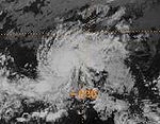
on July 29. The depression intensified quickly and became Tropical Storm Fefa the same day. Fefa continued to strengthen over the warm Pacific water and reached hurricane status on July 31. Satellite imagery showed the appearance of an eye on August 1. Fefa peaked on August 2 with a central pressure of 959 mbar (28.3 inHg) and winds of 120 mph (195 km/h), making it a Category 3 hurricane in the Saffir-Simpson Hurricane Scale
. Fefa crossed into the north central Pacific basin on August 5. As it crossed, wind shear increased and Fefa began to weaken as it approached the Hawaiian Islands
as a tropical storm on August 7. Fefa passed over the Big Island
and rapidly weakened back to a tropical depression later that day. It finally dissipated on August 9 when northwest Kauai
.
The remnants of Fefa caused heavy rain
s and strong winds in the counties of Hawaii
and Kauai
. Flash flood
ing was reported in the Kohala
and Hamakua
districts. Lightning
injured two persons on the Big Island
.
on July 28 and crossing Central America
on July 31.
Signs of organization were evident late on August 2 when the wave was south of the Gulf of Tehuantepec
. Then, on August 4, Tropical Depression Eight-E was formed while centered 348 miles (560 km) south-southeast of Acapulco
. Despite the presence of easterly shear
, the depression gradually intensified as the center moved toward the west-northwest, paralleling the coast of Mexico. Then, it reached tropical storm strength the same day. At that time, it was centered south-southwest of Acapulco. It peaked on August 5 with a central pressure of 993 mbar (29.3 inHg) and maximum sustained winds of 75 mi/h while 255 miles (410.4 km) of Manzanillo, Colima
.
After its peak, Guillermo weakened to tropical storm status as it began losing convection. It subsequently weakened to a tropical depression and dissipated after that on August 10. There were no damages or casualties associated with this tropical cyclone.
on July 22. The convection gradually diminished as the system moved west-southwest into the Atlantic. On July 31, the wave passed south of Trinidad
, where a low-level wind shift was detected. For the next couple of days, this system passed over Venezuela
and Colombia
. Then it crossed into the Pacific basin. It was not until August 6, while it was south of Guatemala
, when the convection became organized. Then, the wave strengthened into a tropical depression about 230 miles (370 km/h) south-southwest of Acapulco
, on August 8. The system intensified further and became Tropical Storm Hilda August 9. The storm reached its peak intensity on August 11 with estimated 60 mi/h maximum winds and a pressure of 993 hectopascals (29.3 inHg). The tropical storm moved on a general west-northwest track for the next couple of days and then turned toward the north on August 13 as it was under the influence of an upper level trough
. Later on that day, tropical storm force winds were reported on Guadalupe Island
as the center of Hilda was located about 150 nautical miles (280 km) from the island.
Hilda gradually weakened over cool waters but maintained a rather large level of circulation. This caused its dissipation to be slower than normal. Tropical Depression Hilda dissipated on August 14. It large remnant circulation continued northwards and eventually passed over California
. There were no casualties or damages attributed to this tropical cyclone. Hilda's remnants caused rain as far north as San Francisco
.
became a tropical depression on September 12 when its convection
became persistent around a newly formed center of circulation. Conditions were not favorable for development because of strong wind shear environment caused by a trough
. The depression took a northward track and dissipates on September 13 as it was being sheared just south of the Gulf of California
.
Tropical Depression Ten-E brought heavy showers
to parts of Mexico. There were no reported deaths or damages.
. A trough axis extended southward from the low to the west of the convection. By September 15, the area of disturbed weather included some convective bands. The organization of the convection improved and the cloud system became Tropical Depression Eleven-E the next day. The trough that was near the depression moved the cyclone to the north-northwest and during that period it strengthened and became Tropical Storm Ignacio, all on the same day. With time, the influence of the trough over Tropical Storm Ignacio diminished. The track of the tropical storm transcribed a small clockwise loop, and Ignacio reached the northernmost point of the loop on September 17. The storm was centered about 28 miles (45 km) offshore and was near its peak intensity, 60 mi/h. Further intensification was precluded by the storm's proximity to land and by shear associated with the upper level low near the Baja California peninsula. As Ignacio turned toward the east, its forward motion slowed. When the storm began moving to the south, it lost its identity very rapidly. Ignacio weakened to depression status and dissipated six hours later. The remnants of Ignacio moved toward the west-southwest over the next two days.
When Ignacio was closely approaching the coast of Mexico, a tropical storm warning
was issued from Zihuatenajo to Cuyutan on September 16. When Ignacio was forecast to move up the coast, the warnings were extended to Cabo Corrientes
on September 17. The warnings were dropped when the cyclone dissipated. Ignacio caused street flooding in Acapulco
. Forty people were injured, but no further casualties or damage were reported. Rain fell over a large area of Mexico. The highest amount recorded was 15.43 inches (391.9 mm) at Pasa de San Antonio.
crossed over the Isthmus of Panama and became a disturbance in the Intertropical Convergence Zone
during mid to late September. On September 20 the cloud pattern had increased in organization and the system was designated a tropical depression.
Continuing to strengthen, the depression became a tropical storm on September 21. The tropical storm then headed towards the northwest. Development was rapid, especially after September 22 as a banding type eye
was forming. Further rapid development took place by the following day and the maximum sustained wind
s increased to near 130 mi/h by the afternoon of September 23. Later, on September 24, Jimena reached its peak with maximum winds of 140 mi/h and a minimum central pressure of 945 hectopascals (27.9 inHg). Jimena maintained itself as a powerful hurricane for three days, moving west until September 26, when it turned toward the west-northwest. Jimena began to weaken on September 27. A northwestward movement commenced on September 29 in response to a large upper level trough which developed in its northwest. It continued to weaken and on September 30 it regained tropical storm intensity before becoming downgraded to a depression. On October 2, Jimena dissipated as a tropical cyclone. Hurricane Jimena caused no reported damage or casualties.
on September 11. The wave crossed into the Pacific basin on September 21 with no signs of development. Cloudiness and convection became better organized on the first hours of September 24, becoming Tropical Depression Thirteen-E the next day as it was located about 404 miles (650.2 km) southeast of Acapulco
. Then the depression moved toward the west. The banding pattern became more pronounced and the depression was upgraded to Tropical Storm Kevin later that day, being centered about 316 miles (509 km) south-southeast of Acapulco. The convective banding increased for the next 24 hours and Kevin strengthened to hurricane status on September 26, while 230 miles (370.1 km) south-southwest of Acapulco
. Kevin continued to strengthen and an eye intermittently appeared on September 27 and 28. By September 29, Kevin had a well-defined eye and this feature persisted for several days. The hurricane continued to strengthen and on October 1 reached its peak intensity while centered 404 miles (650.2 km) south-southwest of the southern tip of Baja California
, with estimated 145 mi/h maximum winds and a minimum pressure of 935 mbar (27.6 inHg). Kevin was moving toward the west at this time. It turned toward the west-southwest due to a strong high pressure system located northwest of the hurricane. Then, Kevin began to weaken gradually and its eye became poorly defined on October 4. It weakened on October 6 as the hurricane began turning toward the northwest and continued this general motion for the next few days.
However, a well-defined eye reappeared in the system and Kevin reintensified to a low-end Category 3 hurricane with maximum winds of 115 mi/h and a minimum pressure of 960 hectopascals (28.3 inHg) on October 7. But this was short-lived and on October 8 the hurricane began to weaken again and on October 9 it had entered into the Central Pacific basin as a waning Category 1
hurricane. After this crossing, it was subsequently downgraded to storm strength the same day and on October 11, to a depression. It dissipated as a tropical cyclone that same day. The remnant circulation did persist a while longer as it slowly drifted north to finally lose its identity late on October 14.
Hurricane Kevin caused no known damage or casualties. Kevin was a hurricane for 12½ days while over the Eastern Pacific basin. This is the longest a system has remained as a hurricane in the basin since improved satellite imagery began. All in all, Kevin was a tropical cyclone for 17½ days, the second longest at the time (after Hurricane Fico
) and still the fourth longest, as of 2010.
on September 16 and tracked westward across the tropical Atlantic
. The convection increased markedly upon approaching the Lesser Antilles
on September 21. The tropical wave's northern portion split off to the north and caused showers in Jamaica
, the Bahamas
and Cuba
while the southern part continued and crossed Panama
into the Pacific basin on September 25 as a group of disorganized cloud clusters. It took many days to organize and it was not until October 3 when organization improved and the wave became Tropical Depression Fourteen-E.
The tropical depression moved toward the northwest while strengthening and became Tropical Storm Linda within 12 hours. As Linda then drifted to the north it was upgraded to a hurricane on October 5. Then, the hurricane reached its estimated peak intensity of 120 mi/h and a minimum central pressure of 957 hectopascals (28.3 inHg) that same day. Linda began to weaken as it was following Kevin's track and entered to colder waters. Linda turned the west-northwest and passed 50 nautical miles (92.6 km) from Socorro Island
, where it caused 80 mi/h sustained winds on October 7. Later that day, Linda weakened to a tropical storm. On October 9, as Linda was following Kevin's track, the cyclone continued to weaken and was downgraded to a depression, although deep convection continued to intermittently appear. Finally, on early October 14, Linda dissipated. There were no reported casualties or damages from Linda.
and it began to organize the next day. Based on satellite classifications, the weather system was upgraded to tropical depression status about 273 miles (439.3 km) south of the Gulf of Tehuantepec
on October 7. It became a tropical storm on October 8 and was named Marty. It reached hurricane status early on October 10 while moving parallel to the coast of Mexico
. There were several occasions when an eye was becoming apparent in satellite imagery but it never fully developed. An upper trough over the Western United States
forced Marty to moved toward the northwest and north for a while, bringing the hurricane to waters previously cooled by hurricanes Kevin and Linda. Then, Marty disorganized and weakened into a tropical storm. Also, the trough which forced Marty northward moved out of the area, which made that Marty turned sharply to the west, then west-southwest around a high pressure system. Marty weakened further and remained as a tropical depression. It finally dissipated on October 18.
On October 8, Marty was threatening enough to prompt the Mexican government to issue a tropical storm watch
from Manzanillo to Acapulco. The warning was dropped on October 9 when Marty moved away. There were no associated casualties or damages with this tropical cyclone.
moved in from the west and formed a low
. Shear increased and disrupted Nora's convection. The low also caused an abrupt change of course to the northeast. Nora weakened to a depression on November 11 and dissipated the next day. Nora's remnants continued to the northeast, showing brief flare-ups of convection, causing rain in Sinaloa
and Nayarit
. Rainfall was likely around 3 in (76.2 mm), but effects were minor with no casualties or damage.
At the time, Hurricane Nora was the strongest known tropical cyclone to occur in the Pacific Ocean east of the dateline during the month of November. That record was later broken by 2006's Hurricane Sergio
.
The table on the right shows the ACE
for each storm in the season. ACE is, broadly speaking, a measure of the power of the hurricane multiplied by the length of time
it existed, so storms that last a long time, as well as particularly strong hurricanes, have high ACEs. ACE is only calculated for full advisories on tropical systems at or exceeding 34 knots (39 mph, 63 km/h) or tropical storm strength and it is used to rank hurricane seasons as above-normal, near-normal, and below-normal. It defines below-normal as having an ACE less than 95*104 kt²; It defines above normal as having an ACE above 150*104 kt² along with the numbers of any two of the following above average: tropical storms (15), hurricanes (9), or major hurricanes (4); It defines near-normal as having an ACE between 100*104 kt² and 150*104 kt², or an ACE above 150*104 kt² with fewer than two of the numbers of the following above average: tropical storms (15), hurricanes (9), or major hurricanes (4).
The cumulative ACE for the Eastern Pacific this season fell within the official "Above Normal" grading, being one of the most active. This occurred because the season had many intense storms that lasted for a long period of time, including Kevin that took almost the third part of the total season ACE, as it held hurricane status for 12½ days in the basin.
. This is the same list used for the 1985 season
. In previous seasons, "Delores" was spelled "Dolores", but it was misspelled this year. After this season, the typo was corrected. No central Pacific names were used; the first name used would have been Ekeka. Names that were not assigned are marked in gray.
retired one name in the spring of 1992: Fefa. It was replaced in the 1997 season
by Felicia.
Tropical cyclone
A tropical cyclone is a storm system characterized by a large low-pressure center and numerous thunderstorms that produce strong winds and heavy rain. Tropical cyclones strengthen when water evaporated from the ocean is released as the saturated air rises, resulting in condensation of water vapor...
meteorology. The worst storm this year was Tropical Depression Five-E, which killed one person in Mexico
Mexico
The United Mexican States , commonly known as Mexico , is a federal constitutional republic in North America. It is bordered on the north by the United States; on the south and west by the Pacific Ocean; on the southeast by Guatemala, Belize, and the Caribbean Sea; and on the east by the Gulf of...
. Elsewhere, Tropical Storm Ignacio injured forty people in Mexico, and Hurricane Fefa
Hurricane Fefa
Hurricane Fefa was a major Pacific hurricane of the 1991 Pacific hurricane season that despite causing minimal effects its name was removed from the list of tropical cyclone names. The sixth tropical storm, fourth hurricane, and second major hurricane of the season, the storm developed from a...
caused flooding in Hawaii
Hawaii
Hawaii is the newest of the 50 U.S. states , and is the only U.S. state made up entirely of islands. It is the northernmost island group in Polynesia, occupying most of an archipelago in the central Pacific Ocean, southwest of the continental United States, southeast of Japan, and northeast of...
. Hurricane Kevin was the strongest system of the season and became resulted the then longest-lasting hurricane in the eastern north Pacific basin. Hurricane Nora was the strongest November storm at that time.
The season officially started on May 15, 1991 in the eastern Pacific, and on June 1, 1991 in the central Pacific. It lasted until November 30, 1991 in both basins. These dates conventionally delimit the period of each year when most tropical cyclones form in the northeastern Pacific Ocean
Pacific Ocean
The Pacific Ocean is the largest of the Earth's oceanic divisions. It extends from the Arctic in the north to the Southern Ocean in the south, bounded by Asia and Australia in the west, and the Americas in the east.At 165.2 million square kilometres in area, this largest division of the World...
.
Season summary
The 1991 season in the eastern North Pacific Ocean had a total of sixteen tropical cyclones developed, featuring ten hurricanes, four tropical storms and two tropical depressions. These totals are close to the climatologicalClimate
Climate encompasses the statistics of temperature, humidity, atmospheric pressure, wind, rainfall, atmospheric particle count and other meteorological elemental measurements in a given region over long periods...
averages established since 1966, when satellite surveillance began.
Nevertheless, 1991 had some important peculiarities. First of all, this season had the second earliest start, after the 1990 season
1990 Pacific hurricane season
The 1990 Pacific hurricane season is the fifth most active season on record. The 1990 season officially started on May 15 in the eastern Pacific, and on June 1 in the central Pacific, and lasted until November 30. These dates conventionally delimit the period of each year when most tropical...
. The season also ended late with the first November hurricane since good satellite coverage began in 1966. On the other hand, the months of July and August, often the most active ones in this basin, only produced two tropical cyclones each. This low level of activity was attributed to unusual circulation patterns aloft over the tropical Pacific. A shorter gap from late August to early September was attributed to anomalous flow patterns near the Baja California Peninsula
Baja California Peninsula
The Baja California peninsula , is a peninsula in northwestern Mexico. Its land mass separates the Pacific Ocean from the Gulf of California. The Peninsula extends from Mexicali, Baja California in the north to Cabo San Lucas, Baja California Sur in the south.The total area of the Baja California...
.
None of the tropical storms or hurricanes made landfall. One of the two tropical depressions of the season, Five-E, came ashore near Salina Cruz
Salina Cruz
Salina Cruz is a major seaport on the Pacific coast of the Mexican state of Oaxaca. It is the state's third-largest city and is municipal seat of the municipality of the same name.It is part of the Tehuantepec District in the west of the Istmo Region....
, Mexico
Mexico
The United Mexican States , commonly known as Mexico , is a federal constitutional republic in North America. It is bordered on the north by the United States; on the south and west by the Pacific Ocean; on the southeast by Guatemala, Belize, and the Caribbean Sea; and on the east by the Gulf of...
, on the last day of June. The depression caused the only fatality of the season, injured five hundred, with two people missing. Delores, Ignacio and Marty threatened the coast of Mexico
Mexico
The United Mexican States , commonly known as Mexico , is a federal constitutional republic in North America. It is bordered on the north by the United States; on the south and west by the Pacific Ocean; on the southeast by Guatemala, Belize, and the Caribbean Sea; and on the east by the Gulf of...
. Of these, Ignacio was also responsible for 40 injuries as the system passed just offshore of Lázaro Cárdenas
Lázaro Cárdenas, Michoacán
Lázaro Cárdenas is a port city that with its surrounding municipality is located in the southern part of the Mexican state of Michoacán. It was formerly known as Los Llanitos, but changed its name as a tribute to Lázaro Cárdenas del Río, a Michoacán-born politician who was president of Mexico from...
, Mexico
Mexico
The United Mexican States , commonly known as Mexico , is a federal constitutional republic in North America. It is bordered on the north by the United States; on the south and west by the Pacific Ocean; on the southeast by Guatemala, Belize, and the Caribbean Sea; and on the east by the Gulf of...
.
Several tropical cyclones grew into specially long-lived and intense overwater systems. In fact, Hurricane Kevin endured as a hurricane for 12½ days to the east of 140°W
140th meridian west
The meridian 140° west of Greenwich is a line of longitude that extends from the North Pole across the Arctic Ocean, North America, the Pacific Ocean, the Southern Ocean, and Antarctica to the South Pole....
, establishing a new record for longevity in the eastern Pacific. Most of the cyclones this season originated from African tropical waves.
The season began with the formation of Tropical Depression One-E on May 16 and ended with the dissipation of Tropical Depression Nora on November 12. The seson lasted a total of 149 days. One named storm formed in May, three in June, two in July, two in August, three in September, two in October, and one in November.
Tropical Storm Andres
The first tropical depression of 1991 in the eastern PacificPacific Ocean
The Pacific Ocean is the largest of the Earth's oceanic divisions. It extends from the Arctic in the north to the Southern Ocean in the south, bounded by Asia and Australia in the west, and the Americas in the east.At 165.2 million square kilometres in area, this largest division of the World...
formed about 1,149.5 miles (1,850 km) southwest of the southern tip of Baja California
Baja California Peninsula
The Baja California peninsula , is a peninsula in northwestern Mexico. Its land mass separates the Pacific Ocean from the Gulf of California. The Peninsula extends from Mexicali, Baja California in the north to Cabo San Lucas, Baja California Sur in the south.The total area of the Baja California...
on May 16. A tropical disturbance organized into Tropical Depression One-E on May 16. The depression moved into a slow cyclonic loop and became Tropical Storm Andres May 17. Andres then developed rapidly, with a minimum pressure of 994 mbar (29.4 inHg) and corresponding maximum sustained winds of 60 mph (95 km/h). This intensity was maintained for a day and subsequently weakened as upper level shear
Wind shear
Wind shear, sometimes referred to as windshear or wind gradient, is a difference in wind speed and direction over a relatively short distance in the atmosphere...
increased. Andres was downgraded to a tropical depression on May 19 and finally dissipated on May 20.
There were no reported damages or casualties caused by Andres. The formation of Tropical Depression One-E on May 16 was the second earliest date for a tropical depression to form in this basin since weather satellite monitoring started in 1966. The earliest was the previous season
1990 Pacific hurricane season
The 1990 Pacific hurricane season is the fifth most active season on record. The 1990 season officially started on May 15 in the eastern Pacific, and on June 1 in the central Pacific, and lasted until November 30. These dates conventionally delimit the period of each year when most tropical...
, when the depression which later became Hurricane Alma formed on May 12. As of 2011, Andres remains the third-earliest overall.
Tropical Storm Blanca
A well organized tropical waveTropical wave
Tropical waves, easterly waves, or tropical easterly waves, also known as African easterly waves in the Atlantic region, are a type of atmospheric trough, an elongated area of relatively low air pressure, oriented north to south, which move from east to west across the tropics causing areas of...
over northern Africa
Africa
Africa is the world's second largest and second most populous continent, after Asia. At about 30.2 million km² including adjacent islands, it covers 6% of the Earth's total surface area and 20.4% of the total land area...
entered the Atlantic Ocean
Atlantic Ocean
The Atlantic Ocean is the second-largest of the world's oceanic divisions. With a total area of about , it covers approximately 20% of the Earth's surface and about 26% of its water surface area...
on May 31. The wave never showed signs of organization while crossing the Atlantic. It emerged into the eastern north Pacific on June 10. It was not until June 13 when the convection associated with the wave became better organized. On June 14, Tropical Depression Two-E formed at a location about 515.7 miles (830 km) from Acapulco
Acapulco
Acapulco is a city, municipality and major sea port in the state of Guerrero on the Pacific coast of Mexico, southwest from Mexico City. Acapulco is located on a deep, semi-circular bay and has been a port since the early colonial period of Mexico’s history...
, Mexico.
For the next 48 hours, the depression moved toward the west and then northwest in response to a weakening ridge to the northwest. On June 17, the strong shear relaxed somewhat and the exposed center moved under the deep convection again. Thus, the depression strengthened into a tropical storm about 723.9 miles (1,165 km) south of the southern tip of Baja California. Tropical Storm Blanca experienced limited development, reaching its peak windspeed of 60 mph (95 km/h) early on June 20. Then, the center of Blanca became exposed again and weakened into a tropical depression on June 21. Finally, it dissipated on June 22 over colder waters about 1285.9 miles (2,380 km) southwest of the southern tip of Baja California. There were no casualties or damages attributed to this tropical cyclone.
Hurricane Carlos
A tropical wave left the African coast on June 4 showing some cyclonic curvature in the low clouds. It passed BarbadosBarbados
Barbados is an island country in the Lesser Antilles. It is in length and as much as in width, amounting to . It is situated in the western area of the North Atlantic and 100 kilometres east of the Windward Islands and the Caribbean Sea; therein, it is about east of the islands of Saint...
six days later, where a low-to-mid wind shift was detected. The wave was followed by a low level wind surge which was observed in Curaçao
Curaçao
Curaçao is an island in the southern Caribbean Sea, off the Venezuelan coast. The Country of Curaçao , which includes the main island plus the small, uninhabited island of Klein Curaçao , is a constituent country of the Kingdom of the Netherlands...
on June 12. Most of the shower activity associated with the wave moved westward over South America
South America
South America is a continent situated in the Western Hemisphere, mostly in the Southern Hemisphere, with a relatively small portion in the Northern Hemisphere. The continent is also considered a subcontinent of the Americas. It is bordered on the west by the Pacific Ocean and on the north and east...
, and then over Panama
Panama
Panama , officially the Republic of Panama , is the southernmost country of Central America. Situated on the isthmus connecting North and South America, it is bordered by Costa Rica to the northwest, Colombia to the southeast, the Caribbean Sea to the north and the Pacific Ocean to the south. The...
on June 14. The convection became organized and developed into Tropical Depression Three-E on June 16 while it was located 348 miles (560 km) south of Salina Cruz
Salina Cruz
Salina Cruz is a major seaport on the Pacific coast of the Mexican state of Oaxaca. It is the state's third-largest city and is municipal seat of the municipality of the same name.It is part of the Tehuantepec District in the west of the Istmo Region....
. It became a tropical storm one day later. Carlos reached minimal hurricane strength on June 18. Two days later, Carlos was briefly downgraded to tropical storm status. A strong high pressure system forced Carlos to move over warmer waters and Carlos began to reintensify. Carlos regained hurricane status and developed a well-defined eye
Eye (cyclone)
The eye is a region of mostly calm weather found at the center of strong tropical cyclones. The eye of a storm is a roughly circular area and typically 30–65 km in diameter. It is surrounded by the eyewall, a ring of towering thunderstorms where the second most severe weather of a cyclone...
and excellent upper level outflow
Outflow (meteorology)
Outflow, in meteorology, is air that flows outwards from a storm system. It is associated with ridging, or anticyclonic flow. In the low levels of the troposphere, outflow radiates from thunderstorms in the form of a wedge of rain-cooled air, which is visible as a thin rope-like cloud on weather...
. On June 24, Carlos peaked at 955 mbar (28.2 inHg) central pressure and 115 mph (185 km/h) maximum sustained winds. The hurricane then weakened when it moved west over colder waters and encountered upper level shear. Carlos dissipated on June 27. The National Hurricane Center
National Hurricane Center
The National Hurricane Center , located at Florida International University in Miami, Florida, is the division of the National Weather Service responsible for tracking and predicting weather systems within the tropics between the Prime Meridian and the 140th meridian west poleward to the 30th...
received no reports of impact due to this tropical cyclone.
Hurricane Dolores
Delores developed from a tropical wave which moved from AfricaAfrica
Africa is the world's second largest and second most populous continent, after Asia. At about 30.2 million km² including adjacent islands, it covers 6% of the Earth's total surface area and 20.4% of the total land area...
to the Atlantic on June 7. And it was not until June 22 when it gained organization and was identified as an area of disturbed weather south of Mexico
Mexico
The United Mexican States , commonly known as Mexico , is a federal constitutional republic in North America. It is bordered on the north by the United States; on the south and west by the Pacific Ocean; on the southeast by Guatemala, Belize, and the Caribbean Sea; and on the east by the Gulf of...
.
The system immediately showed signs of rotation and it was designated Tropical Depression Four-E the same day. It was centered about 516 miles (830.4 km) south-southeast of Manzanillo
Manzanillo, Colima
The name Manzanillo refers to the city as well as its surrounding municipality in the Mexican state of Colima. The city, located on the Pacific Ocean, contains Mexico's busiest port. Manzanillo was the third port created by the Spanish in the Pacific during the New Spain period...
, Mexico
Mexico
The United Mexican States , commonly known as Mexico , is a federal constitutional republic in North America. It is bordered on the north by the United States; on the south and west by the Pacific Ocean; on the southeast by Guatemala, Belize, and the Caribbean Sea; and on the east by the Gulf of...
. Then, the depression reached storm strength, and was named Delores on June 24 while 143 miles (230 km) from the coast of Mexico
Mexico
The United Mexican States , commonly known as Mexico , is a federal constitutional republic in North America. It is bordered on the north by the United States; on the south and west by the Pacific Ocean; on the southeast by Guatemala, Belize, and the Caribbean Sea; and on the east by the Gulf of...
. It rapidly intensified to a hurricane on June 25 as it approached to the coast. However it repidly weakened and on June 27 it was downgraded to tropical storm status as it was moving over colder waters. Its deep convection gradually diminished and its west-northwestward motion abruptly halted as the system was being sheared. It weakened to a depression on June 28 near Socorro Island
Socorro Island
Socorro Island is a small volcanic island in the Revillagigedo Islands, a Mexican possession lying some 600 kilometers off the country's western coast at 18°48'N, 110°59'W. The size is 16.5 by 11.5 km, with an area of 132 km².- Geology :...
and it dissipated on June 29.
In response to Delores' approach, the Mexican government issued a tropical storm warning
Tropical cyclone warnings and watches
Warnings and watches are two levels of alert issued by national weather forecasting bodies to coastal areas threatened by the imminent approach of a tropical cyclone of tropical storm or hurricane intensity. They are notices to the local population and civil authorities to make appropriate...
and a hurricane watch from Ixtapa
Ixtapa
Ixtapa is a beach resort in the municipality of Zihuatanejo de Azueta, in the Mexican state of Guerrero. It is located to the northwest of the municipal seat, Zihuatanejo, and some northwest of Acapulco....
to Manzanillo on June 24. The watch and the warning were dropped the next day. The cyclone remained far away enough that no reports of high winds were received. Satellite observations indicated that heavy rain
Rain
Rain is liquid precipitation, as opposed to non-liquid kinds of precipitation such as snow, hail and sleet. Rain requires the presence of a thick layer of the atmosphere to have temperatures above the melting point of water near and above the Earth's surface...
s fell in affected areas from June 23 to 26. However, no damages or casualties were reported.
Tropical Depression Five-E
A tropical disturbance south of the Gulf of TehuantepecGulf of Tehuantepec
Gulf of Tehuantepec is a large body of water on the Pacific coast of the Isthmus of Tehuantepec, southeastern Mexico, at . Most of the hurricanes that form in the Eastern Pacific organize in or near this body of water...
became better organized on June 29 and became a tropical depression. Strengthening was very limited as the depression was approaching to land. It made landfall later that day very near of Salina Cruz, Oaxaca. As it continued its west-northwest track, it dissipated inland after bringing torrential rains.
Five-E caused the year's lone fatality and caused the most significant damage. Five-E destroyed up to 118 homes, injured 500, and also caused two people to go missing. Rainfall
Precipitation (meteorology)
In meteorology, precipitation In meteorology, precipitation In meteorology, precipitation (also known as one of the classes of hydrometeors, which are atmospheric water phenomena is any product of the condensation of atmospheric water vapor that falls under gravity. The main forms of precipitation...
totals as high as 9.2 inches (233.7 mm) in 24 hours accompanied the depression over Mexico
Mexico
The United Mexican States , commonly known as Mexico , is a federal constitutional republic in North America. It is bordered on the north by the United States; on the south and west by the Pacific Ocean; on the southeast by Guatemala, Belize, and the Caribbean Sea; and on the east by the Gulf of...
.
Hurricane Enrique
Enrique formed from a westward-moving tropical wave that crossed the AtlanticAtlantic Ocean
The Atlantic Ocean is the second-largest of the world's oceanic divisions. With a total area of about , it covers approximately 20% of the Earth's surface and about 26% of its water surface area...
from June 30 to July 8. A short-lived cyclonic circulation center within the wave was detected on satellite imagery when the system was over the eastern Atlantic. However, persistent deep convection did not occur until the wave neared the Gulf of Tehuantepec
Gulf of Tehuantepec
Gulf of Tehuantepec is a large body of water on the Pacific coast of the Isthmus of Tehuantepec, southeastern Mexico, at . Most of the hurricanes that form in the Eastern Pacific organize in or near this body of water...
in the eastern Pacific Ocean
Pacific Ocean
The Pacific Ocean is the largest of the Earth's oceanic divisions. It extends from the Arctic in the north to the Southern Ocean in the south, bounded by Asia and Australia in the west, and the Americas in the east.At 165.2 million square kilometres in area, this largest division of the World...
on July 11. On July 12, the convection became more concentrated about 500 nautical miles (926 km) south of Acapulco
Acapulco
Acapulco is a city, municipality and major sea port in the state of Guerrero on the Pacific coast of Mexico, southwest from Mexico City. Acapulco is located on a deep, semi-circular bay and has been a port since the early colonial period of Mexico’s history...
, near a mid-level vortex within the wave; however, it had diminished the next day. On July 14 it became better organized. Based on reports from satellite imagery
Satellite imagery
Satellite imagery consists of photographs of Earth or other planets made by means of artificial satellites.- History :The first images from space were taken on sub-orbital flights. The U.S-launched V-2 flight on October 24, 1946 took one image every 1.5 seconds...
the low had developed into the seasons season's sixth tropical depression on July 15. The depression intensified further and was upgraded to Tropical Storm Enrique the next day as it became better organized.
Enrique steadily intensified and by early on July 16, the National Hurricane Center
National Hurricane Center
The National Hurricane Center , located at Florida International University in Miami, Florida, is the division of the National Weather Service responsible for tracking and predicting weather systems within the tropics between the Prime Meridian and the 140th meridian west poleward to the 30th...
was anticipating for the system to reach hurricane
Tropical cyclone
A tropical cyclone is a storm system characterized by a large low-pressure center and numerous thunderstorms that produce strong winds and heavy rain. Tropical cyclones strengthen when water evaporated from the ocean is released as the saturated air rises, resulting in condensation of water vapor...
intensity. Continuing to strengthen, it reached hurricane status On July 17. However, this was for a short period of time as it developed an eye
Eye (cyclone)
The eye is a region of mostly calm weather found at the center of strong tropical cyclones. The eye of a storm is a roughly circular area and typically 30–65 km in diameter. It is surrounded by the eyewall, a ring of towering thunderstorms where the second most severe weather of a cyclone...
. Due to uncertainties of the storms intensity that day, it is possible that it could have been a hurricane earlier than originally estimated. Wind shear
Wind shear
Wind shear, sometimes referred to as windshear or wind gradient, is a difference in wind speed and direction over a relatively short distance in the atmosphere...
associated with a trough
Trough (meteorology)
A trough is an elongated region of relatively low atmospheric pressure, often associated with fronts.Unlike fronts, there is not a universal symbol for a trough on a weather chart. The weather charts in some countries or regions mark troughs by a line. In the United States, a trough may be marked...
and passage over cooler waters caused Enrique to begin weakening and the cyclone
Tropical cyclone
A tropical cyclone is a storm system characterized by a large low-pressure center and numerous thunderstorms that produce strong winds and heavy rain. Tropical cyclones strengthen when water evaporated from the ocean is released as the saturated air rises, resulting in condensation of water vapor...
center soon became exposed. Enrique was downgraded to a depression on July 19 and the weakening cyclone crossed into the central Pacific on July 20. Enrique dissipated shortly thereafter. Enrique's remnants mange to maintain a very weak center as it passed well to the north of the Hawaiian Islands
Hawaiian Islands
The Hawaiian Islands are an archipelago of eight major islands, several atolls, numerous smaller islets, and undersea seamounts in the North Pacific Ocean, extending some 1,500 miles from the island of Hawaii in the south to northernmost Kure Atoll...
and then passed near Midway Island. As the storm approached the International Dateline, the system started to redevelop. Shortly after crossing the dateline, Enrique became a tropical storm again on August 1. It lasted for less than 24 hours before it lost its convection and thus the cyclone began to dissipate. No damages or casualties were caused by Enrique. It is one of only six tropical cyclones to exist in all three tropical cyclone basins in the Pacific Ocean. The others are 1986's Georgette, 1994's Li and John
Hurricane John (1994)
Hurricane John formed during the 1994 Pacific hurricane season and became both the longest-lasting and the farthest-traveling tropical cyclone ever observed...
, 1999's Dora
Hurricane Dora (1999)
Hurricane Dora was the longest-lasting tropical cyclone of the 1999 Pacific hurricane season. The fourth named storm, third hurricane, and second major hurricane of the season, Dora developed on August 6 from a tropical wave to the south of Mexico...
, and 2003's Jimena
Hurricane Jimena (2003)
Hurricane Jimena was the tenth named storm and second hurricane of the 2003 Pacific hurricane season. Jimena formed on August 28 in the far Eastern Pacific Ocean as a tropical depression and moved westward where it rapidly became a hurricane the following day...
.
Hurricane Fefa
A tropical wave became better organized and it developed into Tropical Depression Seven-E while 976 miles (1570 km) south-southeast of Cabo San LucasCabo San Lucas
Cabo San Lucas , commonly called Cabo, is a city at the southern tip of the Baja California peninsula, in the municipality of Los Cabos in the Mexican state of Baja California Sur. As of the 2010 census, the population was 68,463 people...
on July 29. The depression intensified quickly and became Tropical Storm Fefa the same day. Fefa continued to strengthen over the warm Pacific water and reached hurricane status on July 31. Satellite imagery showed the appearance of an eye on August 1. Fefa peaked on August 2 with a central pressure of 959 mbar (28.3 inHg) and winds of 120 mph (195 km/h), making it a Category 3 hurricane in the Saffir-Simpson Hurricane Scale
Saffir-Simpson Hurricane Scale
The Saffir–Simpson Hurricane Scale , or the Saffir–Simpson Hurricane Wind Scale , classifies hurricanes — Western Hemisphere tropical cyclones that exceed the intensities of tropical depressions and tropical storms — into five categories distinguished by the intensities of their sustained winds...
. Fefa crossed into the north central Pacific basin on August 5. As it crossed, wind shear increased and Fefa began to weaken as it approached the Hawaiian Islands
Hawaiian Islands
The Hawaiian Islands are an archipelago of eight major islands, several atolls, numerous smaller islets, and undersea seamounts in the North Pacific Ocean, extending some 1,500 miles from the island of Hawaii in the south to northernmost Kure Atoll...
as a tropical storm on August 7. Fefa passed over the Big Island
Hawaii (island)
The Island of Hawaii, also called the Big Island or Hawaii Island , is a volcanic island in the North Pacific Ocean...
and rapidly weakened back to a tropical depression later that day. It finally dissipated on August 9 when northwest Kauai
Kauai
Kauai or Kauai, known as Tauai in the ancient Kaua'i dialect, is geologically the oldest of the main Hawaiian Islands. With an area of , it is the fourth largest of the main islands in the Hawaiian archipelago, and the 21st largest island in the United States. Known also as the "Garden Isle",...
.
The remnants of Fefa caused heavy rain
Rain
Rain is liquid precipitation, as opposed to non-liquid kinds of precipitation such as snow, hail and sleet. Rain requires the presence of a thick layer of the atmosphere to have temperatures above the melting point of water near and above the Earth's surface...
s and strong winds in the counties of Hawaii
Hawaii
Hawaii is the newest of the 50 U.S. states , and is the only U.S. state made up entirely of islands. It is the northernmost island group in Polynesia, occupying most of an archipelago in the central Pacific Ocean, southwest of the continental United States, southeast of Japan, and northeast of...
and Kauai
Kauai
Kauai or Kauai, known as Tauai in the ancient Kaua'i dialect, is geologically the oldest of the main Hawaiian Islands. With an area of , it is the fourth largest of the main islands in the Hawaiian archipelago, and the 21st largest island in the United States. Known also as the "Garden Isle",...
. Flash flood
Flash flood
A flash flood is a rapid flooding of geomorphic low-lying areas—washes, rivers, dry lakes and basins. It may be caused by heavy rain associated with a storm, hurricane, or tropical storm or meltwater from ice or snow flowing over ice sheets or snowfields...
ing was reported in the Kohala
Kohala, Hawaii
thumb|right|300px|The districts of the [[Hawaii |Big Island]]. From Northernmost, clockwise; Kohala , [[Hamakua|Hāmākua]], [[Hilo, Hawaii|Hilo]], [[Puna, Hawaii|Puna]], [[Kau, Hawaii|Kaū]], [[Kona District, Hawaii|Kona]]...
and Hamakua
Hamakua
thumb|right|280px|Districts of [[Hawaii |Hawaii island]]: from northernmost, clockwise; [[Kohala, Hawaii|Kohala]], Hāmākua , [[Hilo, Hawaii|Hilo]], [[Puna, Hawaii|Puna]], [[Kau, Hawaii|Kaū]], [[Kona District, Hawaii|Kona]]...
districts. Lightning
Lightning
Lightning is an atmospheric electrostatic discharge accompanied by thunder, which typically occurs during thunderstorms, and sometimes during volcanic eruptions or dust storms...
injured two persons on the Big Island
Hawaii (island)
The Island of Hawaii, also called the Big Island or Hawaii Island , is a volcanic island in the North Pacific Ocean...
.
Hurricane Guillermo
A significant tropical wave with very little deep convection left Africa on July 22. It crossed the Atlantic, with convection associated with its southern part passing over the Windward IslandsWindward Islands
The Windward Islands are the southern islands of the Lesser Antilles, within the West Indies.-Name and geography:The Windward Islands are called such because they were more windward to sailing ships arriving in the New World than the Leeward Islands, given that the prevailing trade winds in the...
on July 28 and crossing Central America
Central America
Central America is the central geographic region of the Americas. It is the southernmost, isthmian portion of the North American continent, which connects with South America on the southeast. When considered part of the unified continental model, it is considered a subcontinent...
on July 31.
Signs of organization were evident late on August 2 when the wave was south of the Gulf of Tehuantepec
Gulf of Tehuantepec
Gulf of Tehuantepec is a large body of water on the Pacific coast of the Isthmus of Tehuantepec, southeastern Mexico, at . Most of the hurricanes that form in the Eastern Pacific organize in or near this body of water...
. Then, on August 4, Tropical Depression Eight-E was formed while centered 348 miles (560 km) south-southeast of Acapulco
Acapulco
Acapulco is a city, municipality and major sea port in the state of Guerrero on the Pacific coast of Mexico, southwest from Mexico City. Acapulco is located on a deep, semi-circular bay and has been a port since the early colonial period of Mexico’s history...
. Despite the presence of easterly shear
Wind shear
Wind shear, sometimes referred to as windshear or wind gradient, is a difference in wind speed and direction over a relatively short distance in the atmosphere...
, the depression gradually intensified as the center moved toward the west-northwest, paralleling the coast of Mexico. Then, it reached tropical storm strength the same day. At that time, it was centered south-southwest of Acapulco. It peaked on August 5 with a central pressure of 993 mbar (29.3 inHg) and maximum sustained winds of 75 mi/h while 255 miles (410.4 km) of Manzanillo, Colima
Manzanillo, Colima
The name Manzanillo refers to the city as well as its surrounding municipality in the Mexican state of Colima. The city, located on the Pacific Ocean, contains Mexico's busiest port. Manzanillo was the third port created by the Spanish in the Pacific during the New Spain period...
.
After its peak, Guillermo weakened to tropical storm status as it began losing convection. It subsequently weakened to a tropical depression and dissipated after that on August 10. There were no damages or casualties associated with this tropical cyclone.
Tropical Storm Hilda
Satellite imagery showed a convective area with some cyclonic turning in connection with a tropical wave over AfricaAfrica
Africa is the world's second largest and second most populous continent, after Asia. At about 30.2 million km² including adjacent islands, it covers 6% of the Earth's total surface area and 20.4% of the total land area...
on July 22. The convection gradually diminished as the system moved west-southwest into the Atlantic. On July 31, the wave passed south of Trinidad
Trinidad
Trinidad is the larger and more populous of the two major islands and numerous landforms which make up the island nation of Trinidad and Tobago. It is the southernmost island in the Caribbean and lies just off the northeastern coast of Venezuela. With an area of it is also the fifth largest in...
, where a low-level wind shift was detected. For the next couple of days, this system passed over Venezuela
Venezuela
Venezuela , officially called the Bolivarian Republic of Venezuela , is a tropical country on the northern coast of South America. It borders Colombia to the west, Guyana to the east, and Brazil to the south...
and Colombia
Colombia
Colombia, officially the Republic of Colombia , is a unitary constitutional republic comprising thirty-two departments. The country is located in northwestern South America, bordered to the east by Venezuela and Brazil; to the south by Ecuador and Peru; to the north by the Caribbean Sea; to the...
. Then it crossed into the Pacific basin. It was not until August 6, while it was south of Guatemala
Guatemala
Guatemala is a country in Central America bordered by Mexico to the north and west, the Pacific Ocean to the southwest, Belize to the northeast, the Caribbean to the east, and Honduras and El Salvador to the southeast...
, when the convection became organized. Then, the wave strengthened into a tropical depression about 230 miles (370 km/h) south-southwest of Acapulco
Acapulco
Acapulco is a city, municipality and major sea port in the state of Guerrero on the Pacific coast of Mexico, southwest from Mexico City. Acapulco is located on a deep, semi-circular bay and has been a port since the early colonial period of Mexico’s history...
, on August 8. The system intensified further and became Tropical Storm Hilda August 9. The storm reached its peak intensity on August 11 with estimated 60 mi/h maximum winds and a pressure of 993 hectopascals (29.3 inHg). The tropical storm moved on a general west-northwest track for the next couple of days and then turned toward the north on August 13 as it was under the influence of an upper level trough
Trough (meteorology)
A trough is an elongated region of relatively low atmospheric pressure, often associated with fronts.Unlike fronts, there is not a universal symbol for a trough on a weather chart. The weather charts in some countries or regions mark troughs by a line. In the United States, a trough may be marked...
. Later on that day, tropical storm force winds were reported on Guadalupe Island
Guadalupe Island
Guadalupe Island, or Isla Guadalupe is a volcanic island located 241 kilometers off the west coast of Mexico's Baja California peninsula and some 400 kilometers southwest of the city of Ensenada in Baja California state, in the Pacific Ocean...
as the center of Hilda was located about 150 nautical miles (280 km) from the island.
Hilda gradually weakened over cool waters but maintained a rather large level of circulation. This caused its dissipation to be slower than normal. Tropical Depression Hilda dissipated on August 14. It large remnant circulation continued northwards and eventually passed over California
California
California is a state located on the West Coast of the United States. It is by far the most populous U.S. state, and the third-largest by land area...
. There were no casualties or damages attributed to this tropical cyclone. Hilda's remnants caused rain as far north as San Francisco
San Francisco, California
San Francisco , officially the City and County of San Francisco, is the financial, cultural, and transportation center of the San Francisco Bay Area, a region of 7.15 million people which includes San Jose and Oakland...
.
Tropical Depression Ten-E
A tropical disturbance southwest of Manzanillo, ColimaManzanillo, Colima
The name Manzanillo refers to the city as well as its surrounding municipality in the Mexican state of Colima. The city, located on the Pacific Ocean, contains Mexico's busiest port. Manzanillo was the third port created by the Spanish in the Pacific during the New Spain period...
became a tropical depression on September 12 when its convection
Convection
Convection is the movement of molecules within fluids and rheids. It cannot take place in solids, since neither bulk current flows nor significant diffusion can take place in solids....
became persistent around a newly formed center of circulation. Conditions were not favorable for development because of strong wind shear environment caused by a trough
Trough (meteorology)
A trough is an elongated region of relatively low atmospheric pressure, often associated with fronts.Unlike fronts, there is not a universal symbol for a trough on a weather chart. The weather charts in some countries or regions mark troughs by a line. In the United States, a trough may be marked...
. The depression took a northward track and dissipates on September 13 as it was being sheared just south of the Gulf of California
Gulf of California
The Gulf of California is a body of water that separates the Baja California Peninsula from the Mexican mainland...
.
Tropical Depression Ten-E brought heavy showers
Rain
Rain is liquid precipitation, as opposed to non-liquid kinds of precipitation such as snow, hail and sleet. Rain requires the presence of a thick layer of the atmosphere to have temperatures above the melting point of water near and above the Earth's surface...
to parts of Mexico. There were no reported deaths or damages.
Tropical Storm Ignacio
Sometime between September 10 and September 12, a tropical wave entered the eastern Pacific. An area of convection developed when it was 286 miles (460.3 km) west of the southern tip of Baja California PeninsulaBaja California Peninsula
The Baja California peninsula , is a peninsula in northwestern Mexico. Its land mass separates the Pacific Ocean from the Gulf of California. The Peninsula extends from Mexicali, Baja California in the north to Cabo San Lucas, Baja California Sur in the south.The total area of the Baja California...
. A trough axis extended southward from the low to the west of the convection. By September 15, the area of disturbed weather included some convective bands. The organization of the convection improved and the cloud system became Tropical Depression Eleven-E the next day. The trough that was near the depression moved the cyclone to the north-northwest and during that period it strengthened and became Tropical Storm Ignacio, all on the same day. With time, the influence of the trough over Tropical Storm Ignacio diminished. The track of the tropical storm transcribed a small clockwise loop, and Ignacio reached the northernmost point of the loop on September 17. The storm was centered about 28 miles (45 km) offshore and was near its peak intensity, 60 mi/h. Further intensification was precluded by the storm's proximity to land and by shear associated with the upper level low near the Baja California peninsula. As Ignacio turned toward the east, its forward motion slowed. When the storm began moving to the south, it lost its identity very rapidly. Ignacio weakened to depression status and dissipated six hours later. The remnants of Ignacio moved toward the west-southwest over the next two days.
When Ignacio was closely approaching the coast of Mexico, a tropical storm warning
Tropical cyclone warnings and watches
Warnings and watches are two levels of alert issued by national weather forecasting bodies to coastal areas threatened by the imminent approach of a tropical cyclone of tropical storm or hurricane intensity. They are notices to the local population and civil authorities to make appropriate...
was issued from Zihuatenajo to Cuyutan on September 16. When Ignacio was forecast to move up the coast, the warnings were extended to Cabo Corrientes
Cabo Corrientes
Cabo Corrientes is a cape on the Pacific coast of the Mexican state of Jalisco. It marks the southernmost point of the Bahía de Banderas, upon which the port and resort city of Puerto Vallarta stands. The municipality in which the cape lies is also called Cabo Corrientes.Cabo Corrientes is a...
on September 17. The warnings were dropped when the cyclone dissipated. Ignacio caused street flooding in Acapulco
Acapulco
Acapulco is a city, municipality and major sea port in the state of Guerrero on the Pacific coast of Mexico, southwest from Mexico City. Acapulco is located on a deep, semi-circular bay and has been a port since the early colonial period of Mexico’s history...
. Forty people were injured, but no further casualties or damage were reported. Rain fell over a large area of Mexico. The highest amount recorded was 15.43 inches (391.9 mm) at Pasa de San Antonio.
Hurricane Jimena
Part of the same tropical wave that formed Tropical Storm Danny in the AtlanticAtlantic Ocean
The Atlantic Ocean is the second-largest of the world's oceanic divisions. With a total area of about , it covers approximately 20% of the Earth's surface and about 26% of its water surface area...
crossed over the Isthmus of Panama and became a disturbance in the Intertropical Convergence Zone
Intertropical Convergence Zone
The Intertropical Convergence Zone , known by sailors as The Doldrums, is the area encircling the earth near the equator where winds originating in the northern and southern hemispheres come together....
during mid to late September. On September 20 the cloud pattern had increased in organization and the system was designated a tropical depression.
Continuing to strengthen, the depression became a tropical storm on September 21. The tropical storm then headed towards the northwest. Development was rapid, especially after September 22 as a banding type eye
Eye (cyclone)
The eye is a region of mostly calm weather found at the center of strong tropical cyclones. The eye of a storm is a roughly circular area and typically 30–65 km in diameter. It is surrounded by the eyewall, a ring of towering thunderstorms where the second most severe weather of a cyclone...
was forming. Further rapid development took place by the following day and the maximum sustained wind
Maximum sustained wind
The maximum sustained winds associated with a tropical cyclone are a common indicator of the intensity of the storm. Within a mature tropical cyclone, they are found within the eyewall at a distance defined as the radius of maximum wind, or RMW. Unlike gusts, the value of these winds are...
s increased to near 130 mi/h by the afternoon of September 23. Later, on September 24, Jimena reached its peak with maximum winds of 140 mi/h and a minimum central pressure of 945 hectopascals (27.9 inHg). Jimena maintained itself as a powerful hurricane for three days, moving west until September 26, when it turned toward the west-northwest. Jimena began to weaken on September 27. A northwestward movement commenced on September 29 in response to a large upper level trough which developed in its northwest. It continued to weaken and on September 30 it regained tropical storm intensity before becoming downgraded to a depression. On October 2, Jimena dissipated as a tropical cyclone. Hurricane Jimena caused no reported damage or casualties.
Hurricane Kevin
Kevin formed from a westward-moving tropical wave which emerged from the northwest coast of AfricaAfrica
Africa is the world's second largest and second most populous continent, after Asia. At about 30.2 million km² including adjacent islands, it covers 6% of the Earth's total surface area and 20.4% of the total land area...
on September 11. The wave crossed into the Pacific basin on September 21 with no signs of development. Cloudiness and convection became better organized on the first hours of September 24, becoming Tropical Depression Thirteen-E the next day as it was located about 404 miles (650.2 km) southeast of Acapulco
Acapulco
Acapulco is a city, municipality and major sea port in the state of Guerrero on the Pacific coast of Mexico, southwest from Mexico City. Acapulco is located on a deep, semi-circular bay and has been a port since the early colonial period of Mexico’s history...
. Then the depression moved toward the west. The banding pattern became more pronounced and the depression was upgraded to Tropical Storm Kevin later that day, being centered about 316 miles (509 km) south-southeast of Acapulco. The convective banding increased for the next 24 hours and Kevin strengthened to hurricane status on September 26, while 230 miles (370.1 km) south-southwest of Acapulco
Acapulco
Acapulco is a city, municipality and major sea port in the state of Guerrero on the Pacific coast of Mexico, southwest from Mexico City. Acapulco is located on a deep, semi-circular bay and has been a port since the early colonial period of Mexico’s history...
. Kevin continued to strengthen and an eye intermittently appeared on September 27 and 28. By September 29, Kevin had a well-defined eye and this feature persisted for several days. The hurricane continued to strengthen and on October 1 reached its peak intensity while centered 404 miles (650.2 km) south-southwest of the southern tip of Baja California
Baja California
Baja California officially Estado Libre y Soberano de Baja California is one of the 31 states which, with the Federal District, comprise the 32 Federal Entities of Mexico. It is both the northernmost and westernmost state of Mexico. Before becoming a state in 1953, the area was known as the North...
, with estimated 145 mi/h maximum winds and a minimum pressure of 935 mbar (27.6 inHg). Kevin was moving toward the west at this time. It turned toward the west-southwest due to a strong high pressure system located northwest of the hurricane. Then, Kevin began to weaken gradually and its eye became poorly defined on October 4. It weakened on October 6 as the hurricane began turning toward the northwest and continued this general motion for the next few days.
However, a well-defined eye reappeared in the system and Kevin reintensified to a low-end Category 3 hurricane with maximum winds of 115 mi/h and a minimum pressure of 960 hectopascals (28.3 inHg) on October 7. But this was short-lived and on October 8 the hurricane began to weaken again and on October 9 it had entered into the Central Pacific basin as a waning Category 1
Saffir-Simpson Hurricane Scale
The Saffir–Simpson Hurricane Scale , or the Saffir–Simpson Hurricane Wind Scale , classifies hurricanes — Western Hemisphere tropical cyclones that exceed the intensities of tropical depressions and tropical storms — into five categories distinguished by the intensities of their sustained winds...
hurricane. After this crossing, it was subsequently downgraded to storm strength the same day and on October 11, to a depression. It dissipated as a tropical cyclone that same day. The remnant circulation did persist a while longer as it slowly drifted north to finally lose its identity late on October 14.
Hurricane Kevin caused no known damage or casualties. Kevin was a hurricane for 12½ days while over the Eastern Pacific basin. This is the longest a system has remained as a hurricane in the basin since improved satellite imagery began. All in all, Kevin was a tropical cyclone for 17½ days, the second longest at the time (after Hurricane Fico
Hurricane Fico
Hurricane Fico was the longest-lived hurricane of the 1978 Pacific hurricane season and at the time was the longest-lasting Pacific hurricane on record, the record being held today by Hurricane John of 1994. The sixth tropical storm, fourth hurricane, and third major hurricane, Fico developed from...
) and still the fourth longest, as of 2010.
Hurricane Linda
The tropical wave that ultimately produced Hurricane Linda emerged from the northwest coast of AfricaAfrica
Africa is the world's second largest and second most populous continent, after Asia. At about 30.2 million km² including adjacent islands, it covers 6% of the Earth's total surface area and 20.4% of the total land area...
on September 16 and tracked westward across the tropical Atlantic
Atlantic Ocean
The Atlantic Ocean is the second-largest of the world's oceanic divisions. With a total area of about , it covers approximately 20% of the Earth's surface and about 26% of its water surface area...
. The convection increased markedly upon approaching the Lesser Antilles
Lesser Antilles
The Lesser Antilles are a long, partly volcanic island arc in the Western Hemisphere. Most of its islands form the eastern boundary of the Caribbean Sea with the Atlantic Ocean, with the remainder located in the southern Caribbean just north of South America...
on September 21. The tropical wave's northern portion split off to the north and caused showers in Jamaica
Jamaica
Jamaica is an island nation of the Greater Antilles, in length, up to in width and 10,990 square kilometres in area. It is situated in the Caribbean Sea, about south of Cuba, and west of Hispaniola, the island harbouring the nation-states Haiti and the Dominican Republic...
, the Bahamas
The Bahamas
The Bahamas , officially the Commonwealth of the Bahamas, is a nation consisting of 29 islands, 661 cays, and 2,387 islets . It is located in the Atlantic Ocean north of Cuba and Hispaniola , northwest of the Turks and Caicos Islands, and southeast of the United States...
and Cuba
Cuba
The Republic of Cuba is an island nation in the Caribbean. The nation of Cuba consists of the main island of Cuba, the Isla de la Juventud, and several archipelagos. Havana is the largest city in Cuba and the country's capital. Santiago de Cuba is the second largest city...
while the southern part continued and crossed Panama
Panama
Panama , officially the Republic of Panama , is the southernmost country of Central America. Situated on the isthmus connecting North and South America, it is bordered by Costa Rica to the northwest, Colombia to the southeast, the Caribbean Sea to the north and the Pacific Ocean to the south. The...
into the Pacific basin on September 25 as a group of disorganized cloud clusters. It took many days to organize and it was not until October 3 when organization improved and the wave became Tropical Depression Fourteen-E.
The tropical depression moved toward the northwest while strengthening and became Tropical Storm Linda within 12 hours. As Linda then drifted to the north it was upgraded to a hurricane on October 5. Then, the hurricane reached its estimated peak intensity of 120 mi/h and a minimum central pressure of 957 hectopascals (28.3 inHg) that same day. Linda began to weaken as it was following Kevin's track and entered to colder waters. Linda turned the west-northwest and passed 50 nautical miles (92.6 km) from Socorro Island
Socorro Island
Socorro Island is a small volcanic island in the Revillagigedo Islands, a Mexican possession lying some 600 kilometers off the country's western coast at 18°48'N, 110°59'W. The size is 16.5 by 11.5 km, with an area of 132 km².- Geology :...
, where it caused 80 mi/h sustained winds on October 7. Later that day, Linda weakened to a tropical storm. On October 9, as Linda was following Kevin's track, the cyclone continued to weaken and was downgraded to a depression, although deep convection continued to intermittently appear. Finally, on early October 14, Linda dissipated. There were no reported casualties or damages from Linda.
Hurricane Marty
On October 5, a tropical wave crossed Central AmericaCentral America
Central America is the central geographic region of the Americas. It is the southernmost, isthmian portion of the North American continent, which connects with South America on the southeast. When considered part of the unified continental model, it is considered a subcontinent...
and it began to organize the next day. Based on satellite classifications, the weather system was upgraded to tropical depression status about 273 miles (439.3 km) south of the Gulf of Tehuantepec
Gulf of Tehuantepec
Gulf of Tehuantepec is a large body of water on the Pacific coast of the Isthmus of Tehuantepec, southeastern Mexico, at . Most of the hurricanes that form in the Eastern Pacific organize in or near this body of water...
on October 7. It became a tropical storm on October 8 and was named Marty. It reached hurricane status early on October 10 while moving parallel to the coast of Mexico
Mexico
The United Mexican States , commonly known as Mexico , is a federal constitutional republic in North America. It is bordered on the north by the United States; on the south and west by the Pacific Ocean; on the southeast by Guatemala, Belize, and the Caribbean Sea; and on the east by the Gulf of...
. There were several occasions when an eye was becoming apparent in satellite imagery but it never fully developed. An upper trough over the Western United States
Western United States
.The Western United States, commonly referred to as the American West or simply "the West," traditionally refers to the region comprising the westernmost states of the United States. Because the U.S. expanded westward after its founding, the meaning of the West has evolved over time...
forced Marty to moved toward the northwest and north for a while, bringing the hurricane to waters previously cooled by hurricanes Kevin and Linda. Then, Marty disorganized and weakened into a tropical storm. Also, the trough which forced Marty northward moved out of the area, which made that Marty turned sharply to the west, then west-southwest around a high pressure system. Marty weakened further and remained as a tropical depression. It finally dissipated on October 18.
On October 8, Marty was threatening enough to prompt the Mexican government to issue a tropical storm watch
Tropical cyclone warnings and watches
Warnings and watches are two levels of alert issued by national weather forecasting bodies to coastal areas threatened by the imminent approach of a tropical cyclone of tropical storm or hurricane intensity. They are notices to the local population and civil authorities to make appropriate...
from Manzanillo to Acapulco. The warning was dropped on October 9 when Marty moved away. There were no associated casualties or damages with this tropical cyclone.
Hurricane Nora
A tropical wave organized into a tropical depression on November 7 to the south of Mexico. It moved to the northwest and strengthened into Tropical Storm Nora the next day. On November 9, Nora became the first hurricane to form in November in the northern East Pacific basin since satellite observations began in 1966. It peaked as a Category 2 hurricane on November 10. A large troughTrough (meteorology)
A trough is an elongated region of relatively low atmospheric pressure, often associated with fronts.Unlike fronts, there is not a universal symbol for a trough on a weather chart. The weather charts in some countries or regions mark troughs by a line. In the United States, a trough may be marked...
moved in from the west and formed a low
Low pressure area
A low-pressure area, or "low", is a region where the atmospheric pressure at sea level is below that of surrounding locations. Low-pressure systems form under areas of wind divergence which occur in upper levels of the troposphere. The formation process of a low-pressure area is known as...
. Shear increased and disrupted Nora's convection. The low also caused an abrupt change of course to the northeast. Nora weakened to a depression on November 11 and dissipated the next day. Nora's remnants continued to the northeast, showing brief flare-ups of convection, causing rain in Sinaloa
Sinaloa
Sinaloa officially Estado Libre y Soberano de Sinaloa is one of the 31 states which, with the Federal District, comprise the 32 Federal Entities of Mexico. It is divided in 18 municipalities and its capital city is Culiacán Rosales....
and Nayarit
Nayarit
Nayarit officially Estado Libre y Soberano de Nayarit is one of the 31 states which, with the Federal District, comprise the 32 Federal Entities of Mexico. It is divided in 20 municipalities and its capital city is Tepic.It is located in Western Mexico...
. Rainfall was likely around 3 in (76.2 mm), but effects were minor with no casualties or damage.
At the time, Hurricane Nora was the strongest known tropical cyclone to occur in the Pacific Ocean east of the dateline during the month of November. That record was later broken by 2006's Hurricane Sergio
Hurricane Sergio (2006)
Hurricane Sergio was the second strongest Pacific hurricane in the month of November on record, just after 2011's Kenneth. The nineteenth named storm and eleventh hurricane of the 2006 Pacific hurricane season, Sergio developed from a tropical wave on November 13 about 460 miles south of...
.
Accumulated Cyclone Activity (ACE)
| ACE (104 kt²) – Storm | |||||
|---|---|---|---|---|---|
| 1 | 52.14 | Kevin | 8 | 6.00 | Guillermo |
| 2 | 33.3 | Jimena | 9 | 5.50 | Delores |
| 3 | 22.13 | Carlos | 10 | 3.51 | Enrique |
| 4 | 19.57 | Fefa Hurricane Fefa Hurricane Fefa was a major Pacific hurricane of the 1991 Pacific hurricane season that despite causing minimal effects its name was removed from the list of tropical cyclone names. The sixth tropical storm, fourth hurricane, and second major hurricane of the season, the storm developed from a... |
11 | 3.47 | Blanca |
| 5 | 10.34 | Linda | 12 | 3.14 | Hilda |
| 6 | 7.62 | Marty | 13 | 2.53 | Andres |
| 7 | 7.18 | Nora | 14 | 1.92 | Ignacio |
| Total= 177.93 | |||||
The table on the right shows the ACE
Accumulated cyclone energy
Accumulated cyclone energy is a measure used by the National Oceanic and Atmospheric Administration to express the activity of individual tropical cyclones and entire tropical cyclone seasons, particularly the North Atlantic hurricane season. It uses an approximation of the energy used by a...
for each storm in the season. ACE is, broadly speaking, a measure of the power of the hurricane multiplied by the length of time
Time
Time is a part of the measuring system used to sequence events, to compare the durations of events and the intervals between them, and to quantify rates of change such as the motions of objects....
it existed, so storms that last a long time, as well as particularly strong hurricanes, have high ACEs. ACE is only calculated for full advisories on tropical systems at or exceeding 34 knots (39 mph, 63 km/h) or tropical storm strength and it is used to rank hurricane seasons as above-normal, near-normal, and below-normal. It defines below-normal as having an ACE less than 95*104 kt²; It defines above normal as having an ACE above 150*104 kt² along with the numbers of any two of the following above average: tropical storms (15), hurricanes (9), or major hurricanes (4); It defines near-normal as having an ACE between 100*104 kt² and 150*104 kt², or an ACE above 150*104 kt² with fewer than two of the numbers of the following above average: tropical storms (15), hurricanes (9), or major hurricanes (4).
The cumulative ACE for the Eastern Pacific this season fell within the official "Above Normal" grading, being one of the most active. This occurred because the season had many intense storms that lasted for a long period of time, including Kevin that took almost the third part of the total season ACE, as it held hurricane status for 12½ days in the basin.
1991 storm names
The following names were used for named storms that formed in the eastern Pacific in 1991. The names not retired from this list were used again in the 1997 season1997 Pacific hurricane season
The 1997 Pacific hurricane season was a very active hurricane season. With hundreds of deaths and billions of dollars in damage, this season was the costliest and one of the deadliest Pacific hurricane seasons. This was due to a strong El Niño...
. This is the same list used for the 1985 season
1985 Pacific hurricane season
The 1985 Pacific hurricane season was an event in tropical cyclone meteorology. It officially started on May 15, 1985 in the eastern Pacific, and on June 1, 1985 in the central Pacific, and lasted until November 30, 1985...
. In previous seasons, "Delores" was spelled "Dolores", but it was misspelled this year. After this season, the typo was corrected. No central Pacific names were used; the first name used would have been Ekeka. Names that were not assigned are marked in gray.
|
|
|
Retirement
The World Meteorological OrganizationWorld Meteorological Organization
The World Meteorological Organization is an intergovernmental organization with a membership of 189 Member States and Territories. It originated from the International Meteorological Organization , which was founded in 1873...
retired one name in the spring of 1992: Fefa. It was replaced in the 1997 season
1997 Pacific hurricane season
The 1997 Pacific hurricane season was a very active hurricane season. With hundreds of deaths and billions of dollars in damage, this season was the costliest and one of the deadliest Pacific hurricane seasons. This was due to a strong El Niño...
by Felicia.
See also
- List of Pacific hurricanes
- List of Pacific hurricane seasons
- 1991 Atlantic hurricane season1991 Atlantic hurricane seasonThe 1991 Atlantic hurricane season was the first season in over 24 years in which no hurricanes developed from tropical waves, which are the source for most North Atlantic tropical cyclones. The hurricane season officially began on June 1, and ended on November 30. It was the least...
- 1991 Pacific typhoon season1991 Pacific typhoon seasonTropical Storm Enrique formed in the eastern Pacific basin, where it reached it's peak intensity as a category 1 Hurricane, becoming Hurricane Enrique. Enrique lasted for 6 days before becoming a remnant low, shortly after entering in the central Pacific....
- 1991 North Indian Ocean cyclone season1991 North Indian Ocean cyclone seasonThe 1991 North Indian Ocean Cyclone season was the period in which tropical cyclones formed to the north of the equator in the Indian ocean. During the season tropical cyclones were monitored by the India Meteorological Department and the Joint Typhoon Warning Center. The IMD assigned all...
- Southern Hemisphere tropical cyclone seasons: 1990–91, 1991–92