
1997 Atlantic hurricane season
Encyclopedia
The 1997 Atlantic hurricane season is the most recent Atlantic hurricane season
to feature no tropical cyclones in August. The season officially began on June 1, 1997, and lasted until November 30, 1997. These dates conventionally delimit the period of each year when most tropical cyclones form in the Atlantic basin
.
The 1997 season was inactive, with only seven named storms forming, with an additional tropical depression and an unnumbered subtropical storm. It was the first time since the 1961 season
that there were no active tropical cyclones in the Atlantic basin during the entire month of August. A strong El Niño is credited with reducing the number of storms in the Atlantic, while increasing the number of storms in the Eastern
and Western
Pacific basin to 19 and 29 storms, respectively. As is common in El Niño years, tropical cyclogenesis
was suppressed in the tropical latitudes, with only two becoming tropical storms south of 25°N
.
The most notable storm was Hurricane Danny
, which killed nine people and caused an estimated $100 million (1997 USD, $ USD) in damage when it made landfall near the mouth of the Mississippi River
and the Mobile Bay
area. Hurricane Erika
, the strongest storm of the season, passed within 85 mi (136.8 km) of the Lesser Antilles
, far enough away to prevent hurricane conditions from reaching land, although minor damage still occurred. In addition, Hurricane Bill, Tropical Storm Claudette, and the precursor of Tropical Storm Grace also caused minor affects on land.
Forecasts of hurricane activity are issued before each hurricane season by noted hurricane experts such as Dr. William M. Gray
and his associates at Colorado State University
(CSU). A normal season as defined by the National Oceanic and Atmospheric Administration
(NOAA), has eleven named storms, of which six reach hurricane strength, and two major hurricanes. The May 1997 forecast stated that eleven storms would form and that seven would reach hurricane status. In addition, it was predicted that three of the seven hurricanes would intensify into a major hurricane (Category 3+ on the Saffir–Simpson Hurricane Scale).
, which began in 1995
. Only nine tropical depressions formed. Eight of the depressions attained tropical storm status, and just three of these attained hurricane status. There was only one tropical cyclone to reach major hurricane status, which was slightly below the 1950
-2005
average of two per season. Only Danny
made landfall at hurricane strength during the season, although Hurricane Erika and Tropical Storm Grace
also caused damage and fatalities. Those three cyclones collectively caused 11 deaths and $111.46 million (1997 USD, $ USD) in damage. The last storm of the season, Tropical Storm Grace, dissipated on October 17, over a month before the official end of the season on November 30.
The 1997 Atlantic hurricane season had a very active beginning, with five tropical cyclones developing by mid-July. With Tropical Depression Four (later Hurricane Danny) developing on July 16, it was the earliest date of the fifth season tropical cyclone, that record would later be broken by Hurricane Emily
in 2005, which formed on July 11. Despite the active start, the other months of the season featured record low activity, especially in August and September, both of which combined produced only one tropical cyclone. As a result of the active start and subsequent lack of activity, it showed that early season activity has no correlation to the entire season. In October, two short-lived tropical cyclones developed. Thereafter, tropical cyclogenesis ceased.
The season's activity was reflected with a low accumulated cyclone energy
(ACE) rating of 42. ACE is, broadly speaking, a measure of the power of the hurricane multiplied by the length of time it existed, so storms that last a long time, as well as particularly strong hurricanes, have high ACEs. ACE is only calculated for full advisories on tropical systems at or exceeding 34 knots (39 mph, 63 km/h) or tropical storm strength. Subtropical cyclone
s, such as the unnamed storm, are excluded from the total.
in late May. A shortwave trough
brought it to the northeast, enhancing convection around a developing center of circulation. The low pressure area
, which formed on May 31, developed into a subtropical depression on June 1. It reached subtropical storm strength six hours later as it moved rapidly parallel to the East Coast of the United States
. The convection continued to wrap around the center, and despite unfavorable conditions from an approaching cold front it continued to intensify. Late on June 1, it reached its peak intensity with maximum sustained winds of 50 mph (85 km/h) while off the coast of North Carolina
. The storm turned to the east, and transitioned extratropical
late on June 2 southeast of Massachusetts
. Shortly thereafter, the remnants of the storm merged with a cold front
.
Operationally, it was treated as a frontal low, but post-analysis suggested it remained separate throughout its lifetime, and was classified as an unnamed subtropical storm.
developed into Tropical Depression One on June 30 1200 UTC. It moved slowly eastward, and attained tropical storm status on July 1. After becoming a tropical storm, Ana slightly intensified. Early on July 2, Ana attained its peak intensity with maximum sustained winds of 50 mph (85 km/h) and a minimum central pressure of 1000 mbar (hPa; 29.53 inHg). Later on July 2, a shortwave trough forced Ana to northeastward, into a region of increasing vertical wind shear. Simultaneously, Ana began to weaken, as it was moving into an area of decreasing sea surface temperature
s (SST).
By late on July 3, Ana weakened to a tropical depression and became extratropical early on July 4, over the western Atlantic Ocean. Minimal impact was reported as a result of Ana, other than rip currents in coastal North Carolina. Due to the rough seas, 14 rescues and one serious injury occurred at Carolina Beach
. In addition, five rescues were made at Kure Beach
and at least one person was hospitalized. However, there were no fatalities at either location.
north of Puerto Rico
in early July. Convection increased on July 7 after a surface trough developed, and a low pressure area formed east of the Bahamas once the upper-level low retreated to the southwest. Wind shear
decreased across the region, allowing the convection to increase and organize, and it is estimated the system developed into a tropical depression on July 11 about 330 mi (530 km) southwest of Bermuda
. After developing, the cyclone moved northeastward in advance of an approaching cold front
. It quickly intensified into Tropical Storm Bill, and briefly threatened to pass near Bermuda. As a result, a tropical storm warning was issued, although it was quickly dropped; there was no impact on the island from Bill.
Bill quickly intensified as it continued northeastward. By midday on July 12, an eye feature
was observed on satellite images, which suggested that Bill intensified into hurricane status at a relatively high latitude. Bill had in fact intensified into a hurricane, and the storm had attained its peak intensity with maximum sustained winds of 75 mph (120 km/h) minimum pressure of 986 mbar
(hPa
; 29.12 inHg
). After only 12 hours at hurricane status, Bill weakened back to tropical storm status, and on July 13 was absorbed by the cold front about 185 mi (297.7 km) south of Cape Race
, Newfoundland. Bill dropped very light rainfall on Newfoundland, peaking at slightly less than 1 inch (25 mm).
that influenced the track of Hurricane Bill also spawned a non-tropical low off the southeast United States. The flow remained nearly stationary as the front dissipated, and it developed into Tropical Depression Three on July 13 about 325 mi (523 km) south-southeast of Wilmington, North Carolina
. The depression quickly intensified into Tropical Storm Claudette, based on measurements from a reconnaissance aircraft mission. It moved northeastward, passing southeast of the Outer Banks
. Claudette developed banding features
despite the presence of wind shear
, and on July 14 reached peak winds of 45 mph (72.4 km/h). Thereafter, Claudette turned eastward ahead of a frontal system. Its associated thunderstorm activity was sporadic and relatively disorganized, and the storm weakened to a tropical depression on July 16. Claudette briefly re-intensified into a tropical storm before becoming extratropical later that day. Shortly thereafter, it merged with a cold front, although the remnants persisted until July 23 when they were near the Azores
.
Tropical Storm Claudette had minimal effects on land. Severe rip currents from Tropical Storm Claudette in North Carolina caused several rescues and one person was injured, although no fatalities occurred. Some residents of coastal North Carolina were even disappointed that Claudette was to remain offshore, as the region was suffering from dry conditions.
developed into Tropical Depression Four on July 16. The depression headed slowly east-northeastward, and intensified into Tropical Storm Danny on the following day. Danny continued east-northeastward, and reached hurricane strength just before landfall near Buras, Louisiana. Because of the narrowness of that piece of land, most of Danny remained over water and it lost little strength. Danny re-emerged into the Gulf of Mexico, and strengthened slightly making two landfalls in Alabama as a low-end Category 1 hurricane on July 19. After remaining stationary for a day, Danny moved northward and weakened to a tropical depression. Heading northward across Alabama
, Danny turned to the east and crossed over the Southeastern United States. While centered over North Carolina, Danny interacted with a developing trough, which caused it to re-intensify into a tropical storm. Shortly thereafter, Danny emerged over the Atlantic Ocean
near the North Carolina/Virginia
border on July 24. Danny took a northward turn, and came within 30 mi (48.3 km) of Nantucket Island on July 26. It then turned out to sea and was absorbed by a front on July 27.
Although Danny was a hurricane upon landfall, strong winds were confined to a small area, with only portions of extreme eastern Louisiana reporting hurricane force winds. Danny also dropped torrential amounts of rain in Louisiana, peaking at 11.4 in (289.6 mm) of rain in Buras-Triumph, Louisiana
. Flooding occurred in portions of the state due to heavy rainfall. The floods and high winds produced by Danny damaged over 300 houses and more than 170 businesses in Louisiana alone. In Mississippi
, Danny dropped heavy rainfall on the southern portion of the state, resulting in minor street and house flooding. As Danny crossed Dauphin Island, Alabama
on July 19, it dropped 37.75 inches (958.9 mm) of rain. This made Danny the wettest tropical cyclone on record in Alabama. Hurricane force-winds were reported on Dauphin Island and the western shores of Mobile Bay
. In the same area, many buildings had sustained roof damage. In addition, many homes on the Fowl
and Fish
Rivers reported significant damage. Further north in South Carolina
and Virginia
, Danny spawned several tornadoes; some of them caused significant damage. Heavy rainfall also occurred in some isolated areas; in central North Carolina between 8–12 inches (200–300 mm) of rain was reported. Danny eventually affected Massachusetts
, bring light rainfall and tropical storm-force winds to the southeastern portions of the state. Overall, Danny caused nine fatalities, and approximately $100 million (1997 USD) in damage.
that emerged from the west coast of Africa on July 11. The wave moved westward across the tropical Atlantic, and finally began to show consistent evidence of a cloud system center. Deep convection associated with the wave became concentrated on satellite images on July 17, and it is estimated that the disturbance became Tropical Depression Five around 0600 UTC on that day while centered about 547 mi (880.3 km) east of Barbados
.
The tropical depression moved west-northwestward and started showing signs of falling apart on July 18. Early on July 19, the depression degenerated into a tropical wave. Recon observations
before the storm fell apart suggested that it may have briefly reached tropical storm strength. The tropical wave continued westward without regenerating and lost its identity on July 23 over the eastern Gulf of Mexico.
developed into Tropical Depression Six while it was centered about 1150 mi (1850 km) east of the southernmost Lesser Antilles. Later that day, the depression intensified enough to be upgraded to Tropical Storm Erika. It moved west-northwestward and steadily intensified to attain hurricane status on September 4. Erika passed a short distance to the north of the Lesser Antilles
, and later turned to the north in response to an approaching trough
. The hurricane quickly strengthen to reach peak winds of 125 mph (195 km/h) on September 8, and after maintaining peak strength for 24 hours Erika weakened over cooler waters. It turned to the east, weakened to a tropical storm, and became extratropical after passing near the Azores
.
The hurricane produced light rainfall and winds throughout the northern Lesser Antilles
. The passage of Erika brought a cloud of ash to Antigua
from the eruption of the Soufrière Hills Volcano
on Montserrat
, a rare occurrence. Strong waves from the hurricane produced beach erosion and coastal flooding in northern Puerto Rico
, and also killed two surfers. Moderate wind gusts in Puerto Rico left thousands without power, and the hurricane resulted in $10 million (1997 USD, $12.6 million 2006 USD) in damage in the Caribbean territory of the United States
. Erika also produced gusty winds and light rain in the Azores. Erika was the only tropical cyclone in the Atlantic Ocean
in the months of August and September, the first such occurrence in a hurricane season
since 1929
.
that emerged into the Atlantic from the coast of Dakar, Senegal on September 22. As the system headed westward, minimal change in convective activity occurred. While the system was in the vicinity of the Lesser Antilles on September 27, heavy rainfall and strong winds were reported. The system heading north-northwestward and began organizing, as wind shear was decreasing. At 1800 UTC October 4, it is estimated that system developed into Tropical Depression Seven, while 410 mi (659.8 km) north of Puerto Rico.
The depression intensified, and about 24 hours later, it upgraded to Tropical Storm Fabian on October 5. Wind shear
did not allow Fabian to strengthen past minimal tropical storm status. On October 7, Fabian attained its peak intensity with maximum sustained winds of 40 mph (65 km/h) and a minimum central pressure of 1004 mbar (hPa; 29.65 inHg). It moved northeast and became extratropical on October 8.
formed just north of Hispaniola
on October 14, and on the following day, it attained gale force winds. In addition, the system was also acquiring tropical characteristics, and was classified as Tropical Storm Grace on October 16 at 0000 UTC. Strong vertical wind shear prevented further intensification, and Grace immediately peaked with maximum sustained winds of 45 mph (75 km/h) and a minimum barometric pressure of 999 mbar (29.5 inHg). Though Grace was classified as a tropical cyclone, it still held onto some extratropical characteristics. Thereafter, Grace steadily weakened and eventually degenerated into an extratropical low on October 17.
The precursor disturbance of Grace dropped moderate to heavy rainfall across Puerto Rico
, peaking at 12.69 inches (322.3 mm) in Aibonito
. As a result, flash flooding occurred throughout the island of Puerto Rico, while landslides caused damage to roads and bridges. In addition, numerous rivers overflowed their banks, which forced 37 people to seek shelter across the island. One fatality occurred, and damage amounted to $1.46 million (1997 USD). In addition, the extratropical system produced light to moderate rainfall in the U.S. Virgin Islands, and precipitation reached 7 inches (177.8 mm) along western sides of the islands.
. This is the same list used for the 1991 season
except for Bill, which replaced Bob
. A storm was named Bill for the first time in 1997. Names that were not assigned are marked in .
retired no names used in the 1997 season.
Atlantic hurricane season
The Atlantic hurricane season is the period in a year when hurricanes usually form in the Atlantic Ocean. Tropical cyclones in the North Atlantic are called hurricanes, tropical storms, or tropical depressions. In addition, there have been several storms over the years that have not been fully...
to feature no tropical cyclones in August. The season officially began on June 1, 1997, and lasted until November 30, 1997. These dates conventionally delimit the period of each year when most tropical cyclones form in the Atlantic basin
Atlantic Basin
The Atlantic Basin is the Atlantic Ocean.Atlantic Basin may also refer to:* Atlantic Basin Iron Works, an ironworks that operated in Brooklyn, New York, in the early to mid-20th century...
.
The 1997 season was inactive, with only seven named storms forming, with an additional tropical depression and an unnumbered subtropical storm. It was the first time since the 1961 season
1961 Atlantic hurricane season
The 1961 Atlantic hurricane season officially began on June 15, 1961, and lasted until November 15, 1961. These dates conventionally delimit the period of each year when most tropical cyclones form in the Atlantic basin. The season had seven major hurricanes, the second highest number on...
that there were no active tropical cyclones in the Atlantic basin during the entire month of August. A strong El Niño is credited with reducing the number of storms in the Atlantic, while increasing the number of storms in the Eastern
1997 Pacific hurricane season
The 1997 Pacific hurricane season was a very active hurricane season. With hundreds of deaths and billions of dollars in damage, this season was the costliest and one of the deadliest Pacific hurricane seasons. This was due to a strong El Niño...
and Western
1997 Pacific typhoon season
The 1997 Pacific typhoon season has no official bounds; it ran year-round in 1997, but most tropical cyclones tend to form in the northwestern Pacific Ocean between May and November. These dates conventionally delimit the period of each year when most tropical cyclones form in the northwestern...
Pacific basin to 19 and 29 storms, respectively. As is common in El Niño years, tropical cyclogenesis
Tropical cyclogenesis
Tropical cyclogenesis is the term that describes the development and strengthening of a tropical cyclone in the atmosphere. The mechanisms through which tropical cyclogenesis occurs are distinctly different from those through which mid-latitude cyclogenesis occurs...
was suppressed in the tropical latitudes, with only two becoming tropical storms south of 25°N
25th parallel north
The 25th parallel north is a circle of latitude that is 25 degrees north of the Earth's equatorial plane. It crosses Africa, Asia, the Indian Ocean, the Pacific Ocean, North America and the Atlantic Ocean....
.
The most notable storm was Hurricane Danny
Hurricane Danny (1997)
Hurricane Danny was the only hurricane to make landfall in the United States during the 1997 Atlantic hurricane season, and the second hurricane and fourth tropical storm of the season...
, which killed nine people and caused an estimated $100 million (1997 USD, $ USD) in damage when it made landfall near the mouth of the Mississippi River
Mississippi River
The Mississippi River is the largest river system in North America. Flowing entirely in the United States, this river rises in western Minnesota and meanders slowly southwards for to the Mississippi River Delta at the Gulf of Mexico. With its many tributaries, the Mississippi's watershed drains...
and the Mobile Bay
Mobile Bay
Mobile Bay is an inlet of the Gulf of Mexico, lying within the state of Alabama in the United States. Its mouth is formed by the Fort Morgan Peninsula on the eastern side and Dauphin Island, a barrier island on the western side. The Mobile River and Tensaw River empty into the northern end of the...
area. Hurricane Erika
Hurricane Erika (1997)
Hurricane Erika was the strongest and longest-lasting tropical cyclone in the 1997 Atlantic hurricane season. Erika developed from a tropical wave on September 3 and moved west-northwestward across the tropical Atlantic Ocean; it steadily intensified until it attained hurricane status on September...
, the strongest storm of the season, passed within 85 mi (136.8 km) of the Lesser Antilles
Lesser Antilles
The Lesser Antilles are a long, partly volcanic island arc in the Western Hemisphere. Most of its islands form the eastern boundary of the Caribbean Sea with the Atlantic Ocean, with the remainder located in the southern Caribbean just north of South America...
, far enough away to prevent hurricane conditions from reaching land, although minor damage still occurred. In addition, Hurricane Bill, Tropical Storm Claudette, and the precursor of Tropical Storm Grace also caused minor affects on land.
Pre-season forecasts
| Source | Date | b>Named storms |
b>Hurricanes | b>Major hurricanes |
| CSU Colorado State University Colorado State University is a public research university located in Fort Collins, Colorado. The university is the state's land grant university, and the flagship university of the Colorado State University System.The enrollment is approximately 29,932 students, including resident and... |
May 31, 1997 | 11 | 7 | 3 |
| Record high activity | 28 2005 Atlantic hurricane season The 2005 Atlantic hurricane season was the most active Atlantic hurricane season in recorded history, repeatedly shattering numerous records. The impact of the season was widespread and ruinous with an estimated 3,913 deaths and record damage of about $159.2 billion... |
15 2005 Atlantic hurricane season The 2005 Atlantic hurricane season was the most active Atlantic hurricane season in recorded history, repeatedly shattering numerous records. The impact of the season was widespread and ruinous with an estimated 3,913 deaths and record damage of about $159.2 billion... |
8 1950 Atlantic hurricane season The 1950 Atlantic hurricane season was the first year in which tropical cyclones were given official names in the Atlantic basin. Names were taken from the Joint Army/Navy Phonetic Alphabet, with the first named storm being designated "Able", the second "Baker", and so on. It was an active season... |
|
| Record low activity | 1 1914 Atlantic hurricane season The 1914 Atlantic hurricane season was the least active Atlantic hurricane season on record, with only one known tropical storm. Although hurricane season typically encompasses a much larger time-span, actual activity was confined to the middle of September... |
0 1914 Atlantic hurricane season The 1914 Atlantic hurricane season was the least active Atlantic hurricane season on record, with only one known tropical storm. Although hurricane season typically encompasses a much larger time-span, actual activity was confined to the middle of September... (tie 1907 Atlantic hurricane season The 1907 Atlantic hurricane season ran through the summer and the first half of fall in 1907. The season was a very quiet with only five tropical storms forming, with none of them reaching hurricane strength. This feat has only been accomplished one other season, the 1914 season... ) |
0 | |
| Actual activity | 8 | 3 | 1 | |
Forecasts of hurricane activity are issued before each hurricane season by noted hurricane experts such as Dr. William M. Gray
William M. Gray
William M. "Bill" Gray is Emeritus Professor of Atmospheric Science at Colorado State University , and head of the Tropical Meteorology Project at CSU's Department of Atmospheric Sciences. He is a pioneer in the science of forecasting hurricanes and one of the world's leading experts on tropical...
and his associates at Colorado State University
Colorado State University
Colorado State University is a public research university located in Fort Collins, Colorado. The university is the state's land grant university, and the flagship university of the Colorado State University System.The enrollment is approximately 29,932 students, including resident and...
(CSU). A normal season as defined by the National Oceanic and Atmospheric Administration
National Oceanic and Atmospheric Administration
The National Oceanic and Atmospheric Administration , pronounced , like "noah", is a scientific agency within the United States Department of Commerce focused on the conditions of the oceans and the atmosphere...
(NOAA), has eleven named storms, of which six reach hurricane strength, and two major hurricanes. The May 1997 forecast stated that eleven storms would form and that seven would reach hurricane status. In addition, it was predicted that three of the seven hurricanes would intensify into a major hurricane (Category 3+ on the Saffir–Simpson Hurricane Scale).
Season activity
The Atlantic hurricane season officially began on June 1, and an unnamed subtropical storm developed on the same day. 1997 was the least active hurricane season in above average era of tropical cyclogenesisTropical cyclogenesis
Tropical cyclogenesis is the term that describes the development and strengthening of a tropical cyclone in the atmosphere. The mechanisms through which tropical cyclogenesis occurs are distinctly different from those through which mid-latitude cyclogenesis occurs...
, which began in 1995
1995 Atlantic hurricane season
The 1995 Atlantic hurricane season was the third most active Atlantic hurricane season on record. It officially began on June 1, 1995, and lasted until November 30, 1995. These dates conventionally delimit the period of each year when most tropical cyclones form in the north Atlantic ocean...
. Only nine tropical depressions formed. Eight of the depressions attained tropical storm status, and just three of these attained hurricane status. There was only one tropical cyclone to reach major hurricane status, which was slightly below the 1950
1950 Atlantic hurricane season
The 1950 Atlantic hurricane season was the first year in which tropical cyclones were given official names in the Atlantic basin. Names were taken from the Joint Army/Navy Phonetic Alphabet, with the first named storm being designated "Able", the second "Baker", and so on. It was an active season...
-2005
2005 Atlantic hurricane season
The 2005 Atlantic hurricane season was the most active Atlantic hurricane season in recorded history, repeatedly shattering numerous records. The impact of the season was widespread and ruinous with an estimated 3,913 deaths and record damage of about $159.2 billion...
average of two per season. Only Danny
Hurricane Danny (1997)
Hurricane Danny was the only hurricane to make landfall in the United States during the 1997 Atlantic hurricane season, and the second hurricane and fourth tropical storm of the season...
made landfall at hurricane strength during the season, although Hurricane Erika and Tropical Storm Grace
Tropical Storm Grace
The name Grace has been used for four tropical cyclones in the Atlantic OceanIt is used on the modern six-year lists, where it replaced Gloria:...
also caused damage and fatalities. Those three cyclones collectively caused 11 deaths and $111.46 million (1997 USD, $ USD) in damage. The last storm of the season, Tropical Storm Grace, dissipated on October 17, over a month before the official end of the season on November 30.
The 1997 Atlantic hurricane season had a very active beginning, with five tropical cyclones developing by mid-July. With Tropical Depression Four (later Hurricane Danny) developing on July 16, it was the earliest date of the fifth season tropical cyclone, that record would later be broken by Hurricane Emily
Hurricane Emily (2005)
Hurricane Emily was a powerful, early season tropical cyclone that caused significant damage across the Caribbean Sea to Mexico. A Cape Verde-type hurricane, the storm formed on July 10, 2005, in the central Atlantic Ocean before passing through the Windward Islands on July 14...
in 2005, which formed on July 11. Despite the active start, the other months of the season featured record low activity, especially in August and September, both of which combined produced only one tropical cyclone. As a result of the active start and subsequent lack of activity, it showed that early season activity has no correlation to the entire season. In October, two short-lived tropical cyclones developed. Thereafter, tropical cyclogenesis ceased.
The season's activity was reflected with a low accumulated cyclone energy
Accumulated cyclone energy
Accumulated cyclone energy is a measure used by the National Oceanic and Atmospheric Administration to express the activity of individual tropical cyclones and entire tropical cyclone seasons, particularly the North Atlantic hurricane season. It uses an approximation of the energy used by a...
(ACE) rating of 42. ACE is, broadly speaking, a measure of the power of the hurricane multiplied by the length of time it existed, so storms that last a long time, as well as particularly strong hurricanes, have high ACEs. ACE is only calculated for full advisories on tropical systems at or exceeding 34 knots (39 mph, 63 km/h) or tropical storm strength. Subtropical cyclone
Subtropical cyclone
A subtropical cyclone is a weather system that has some characteristics of a tropical and an extratropical cyclone. As early as the 1950s, meteorologists were unclear whether they should be characterized as tropical or extratropical cyclones. They were officially recognized by the National...
s, such as the unnamed storm, are excluded from the total.
Unnamed Subtropical Storm
A cluster of thunderstorms developed over FloridaFlorida
Florida is a state in the southeastern United States, located on the nation's Atlantic and Gulf coasts. It is bordered to the west by the Gulf of Mexico, to the north by Alabama and Georgia and to the east by the Atlantic Ocean. With a population of 18,801,310 as measured by the 2010 census, it...
in late May. A shortwave trough
Shortwave (meteorology)
A shortwave or shortwave trough is an embedded kink in the trough / ridge pattern. This is the opposite of longwaves, which are responsible for synoptic scale systems, although shortwaves may be contained within or found ahead of longwaves and range from the mesocale to the synoptic scale...
brought it to the northeast, enhancing convection around a developing center of circulation. The low pressure area
Low pressure area
A low-pressure area, or "low", is a region where the atmospheric pressure at sea level is below that of surrounding locations. Low-pressure systems form under areas of wind divergence which occur in upper levels of the troposphere. The formation process of a low-pressure area is known as...
, which formed on May 31, developed into a subtropical depression on June 1. It reached subtropical storm strength six hours later as it moved rapidly parallel to the East Coast of the United States
East Coast of the United States
The East Coast of the United States, also known as the Eastern Seaboard, refers to the easternmost coastal states in the United States, which touch the Atlantic Ocean and stretch up to Canada. The term includes the U.S...
. The convection continued to wrap around the center, and despite unfavorable conditions from an approaching cold front it continued to intensify. Late on June 1, it reached its peak intensity with maximum sustained winds of 50 mph (85 km/h) while off the coast of North Carolina
North Carolina
North Carolina is a state located in the southeastern United States. The state borders South Carolina and Georgia to the south, Tennessee to the west and Virginia to the north. North Carolina contains 100 counties. Its capital is Raleigh, and its largest city is Charlotte...
. The storm turned to the east, and transitioned extratropical
Extratropical cyclone
Extratropical cyclones, sometimes called mid-latitude cyclones or wave cyclones, are a group of cyclones defined as synoptic scale low pressure weather systems that occur in the middle latitudes of the Earth having neither tropical nor polar characteristics, and are connected with fronts and...
late on June 2 southeast of Massachusetts
Massachusetts
The Commonwealth of Massachusetts is a state in the New England region of the northeastern United States of America. It is bordered by Rhode Island and Connecticut to the south, New York to the west, and Vermont and New Hampshire to the north; at its east lies the Atlantic Ocean. As of the 2010...
. Shortly thereafter, the remnants of the storm merged with a cold front
Cold front
A cold front is defined as the leading edge of a cooler mass of air, replacing a warmer mass of air.-Development of cold front:The cooler and denser air wedges under the less-dense warmer air, lifting it...
.
Operationally, it was treated as a frontal low, but post-analysis suggested it remained separate throughout its lifetime, and was classified as an unnamed subtropical storm.
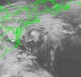
Tropical Storm Ana
A frontal low pressure system off the coast of South CarolinaSouth Carolina
South Carolina is a state in the Deep South of the United States that borders Georgia to the south, North Carolina to the north, and the Atlantic Ocean to the east. Originally part of the Province of Carolina, the Province of South Carolina was one of the 13 colonies that declared independence...
developed into Tropical Depression One on June 30 1200 UTC. It moved slowly eastward, and attained tropical storm status on July 1. After becoming a tropical storm, Ana slightly intensified. Early on July 2, Ana attained its peak intensity with maximum sustained winds of 50 mph (85 km/h) and a minimum central pressure of 1000 mbar (hPa; 29.53 inHg). Later on July 2, a shortwave trough forced Ana to northeastward, into a region of increasing vertical wind shear. Simultaneously, Ana began to weaken, as it was moving into an area of decreasing sea surface temperature
Sea surface temperature
Sea surface temperature is the water temperature close to the oceans surface. The exact meaning of surface varies according to the measurement method used, but it is between and below the sea surface. Air masses in the Earth's atmosphere are highly modified by sea surface temperatures within a...
s (SST).
By late on July 3, Ana weakened to a tropical depression and became extratropical early on July 4, over the western Atlantic Ocean. Minimal impact was reported as a result of Ana, other than rip currents in coastal North Carolina. Due to the rough seas, 14 rescues and one serious injury occurred at Carolina Beach
Carolina Beach, North Carolina
Carolina Beach is a town in New Hanover County, North Carolina, United States. The population was 4,701 at the 2000 census. It is located on part of the Wilmington metropolitan area...
. In addition, five rescues were made at Kure Beach
Kure Beach, North Carolina
Kure Beach (ˈkjʊərɪ KYUR-ee) is a town in New Hanover County, North Carolina about 15 miles south of Wilmington. It is part of the Wilmington Metropolitan Statistical Area. The population was 1,507 at the 2000 census...
and at least one person was hospitalized. However, there were no fatalities at either location.
Hurricane Bill
A large upper-level low separated from a troughTrough (meteorology)
A trough is an elongated region of relatively low atmospheric pressure, often associated with fronts.Unlike fronts, there is not a universal symbol for a trough on a weather chart. The weather charts in some countries or regions mark troughs by a line. In the United States, a trough may be marked...
north of Puerto Rico
Puerto Rico
Puerto Rico , officially the Commonwealth of Puerto Rico , is an unincorporated territory of the United States, located in the northeastern Caribbean, east of the Dominican Republic and west of both the United States Virgin Islands and the British Virgin Islands.Puerto Rico comprises an...
in early July. Convection increased on July 7 after a surface trough developed, and a low pressure area formed east of the Bahamas once the upper-level low retreated to the southwest. Wind shear
Wind shear
Wind shear, sometimes referred to as windshear or wind gradient, is a difference in wind speed and direction over a relatively short distance in the atmosphere...
decreased across the region, allowing the convection to increase and organize, and it is estimated the system developed into a tropical depression on July 11 about 330 mi (530 km) southwest of Bermuda
Bermuda
Bermuda is a British overseas territory in the North Atlantic Ocean. Located off the east coast of the United States, its nearest landmass is Cape Hatteras, North Carolina, about to the west-northwest. It is about south of Halifax, Nova Scotia, Canada, and northeast of Miami, Florida...
. After developing, the cyclone moved northeastward in advance of an approaching cold front
Cold front
A cold front is defined as the leading edge of a cooler mass of air, replacing a warmer mass of air.-Development of cold front:The cooler and denser air wedges under the less-dense warmer air, lifting it...
. It quickly intensified into Tropical Storm Bill, and briefly threatened to pass near Bermuda. As a result, a tropical storm warning was issued, although it was quickly dropped; there was no impact on the island from Bill.
Bill quickly intensified as it continued northeastward. By midday on July 12, an eye feature
Eye (cyclone)
The eye is a region of mostly calm weather found at the center of strong tropical cyclones. The eye of a storm is a roughly circular area and typically 30–65 km in diameter. It is surrounded by the eyewall, a ring of towering thunderstorms where the second most severe weather of a cyclone...
was observed on satellite images, which suggested that Bill intensified into hurricane status at a relatively high latitude. Bill had in fact intensified into a hurricane, and the storm had attained its peak intensity with maximum sustained winds of 75 mph (120 km/h) minimum pressure of 986 mbar
Bar (unit)
The bar is a unit of pressure equal to 100 kilopascals, and roughly equal to the atmospheric pressure on Earth at sea level. Other units derived from the bar are the megabar , kilobar , decibar , centibar , and millibar...
(hPa
Pascal (unit)
The pascal is the SI derived unit of pressure, internal pressure, stress, Young's modulus and tensile strength, named after the French mathematician, physicist, inventor, writer, and philosopher Blaise Pascal. It is a measure of force per unit area, defined as one newton per square metre...
; 29.12 inHg
Inch of mercury
Inches of mercury, ' is a unit of measurement for pressure. It is still widely used for barometric pressure in weather reports, refrigeration and aviation in the United States, but is seldom used elsewhere....
). After only 12 hours at hurricane status, Bill weakened back to tropical storm status, and on July 13 was absorbed by the cold front about 185 mi (297.7 km) south of Cape Race
Cape Race
Cape Race is a point of land located at the southeastern tip of the Avalon Peninsula on the island of Newfoundland, Canada. Its name is thought to come from the original Portuguese name for this cape, "Raso", or "bare"...
, Newfoundland. Bill dropped very light rainfall on Newfoundland, peaking at slightly less than 1 inch (25 mm).
Tropical Storm Claudette
On July 11, the same frontal systemWeather front
A weather front is a boundary separating two masses of air of different densities, and is the principal cause of meteorological phenomena. In surface weather analyses, fronts are depicted using various colored lines and symbols, depending on the type of front...
that influenced the track of Hurricane Bill also spawned a non-tropical low off the southeast United States. The flow remained nearly stationary as the front dissipated, and it developed into Tropical Depression Three on July 13 about 325 mi (523 km) south-southeast of Wilmington, North Carolina
Wilmington, North Carolina
Wilmington is a port city in and is the county seat of New Hanover County, North Carolina, United States. The population is 106,476 according to the 2010 Census, making it the eighth most populous city in the state of North Carolina...
. The depression quickly intensified into Tropical Storm Claudette, based on measurements from a reconnaissance aircraft mission. It moved northeastward, passing southeast of the Outer Banks
Outer Banks
The Outer Banks is a 200-mile long string of narrow barrier islands off the coast of North Carolina, beginning in the southeastern corner of Virginia Beach on the east coast of the United States....
. Claudette developed banding features
Rainband
A rainband is a cloud and precipitation structure associated with an area of rainfall which is significantly elongated. Rainbands can be stratiform or convective, and are generated by differences in temperature. When noted on weather radar imagery, this precipitation elongation is referred to as...
despite the presence of wind shear
Wind shear
Wind shear, sometimes referred to as windshear or wind gradient, is a difference in wind speed and direction over a relatively short distance in the atmosphere...
, and on July 14 reached peak winds of 45 mph (72.4 km/h). Thereafter, Claudette turned eastward ahead of a frontal system. Its associated thunderstorm activity was sporadic and relatively disorganized, and the storm weakened to a tropical depression on July 16. Claudette briefly re-intensified into a tropical storm before becoming extratropical later that day. Shortly thereafter, it merged with a cold front, although the remnants persisted until July 23 when they were near the Azores
Azores
The Archipelago of the Azores is composed of nine volcanic islands situated in the middle of the North Atlantic Ocean, and is located about west from Lisbon and about east from the east coast of North America. The islands, and their economic exclusion zone, form the Autonomous Region of the...
.
Tropical Storm Claudette had minimal effects on land. Severe rip currents from Tropical Storm Claudette in North Carolina caused several rescues and one person was injured, although no fatalities occurred. Some residents of coastal North Carolina were even disappointed that Claudette was to remain offshore, as the region was suffering from dry conditions.
Hurricane Danny
A tropical low over the northern Gulf of MexicoGulf of Mexico
The Gulf of Mexico is a partially landlocked ocean basin largely surrounded by the North American continent and the island of Cuba. It is bounded on the northeast, north and northwest by the Gulf Coast of the United States, on the southwest and south by Mexico, and on the southeast by Cuba. In...
developed into Tropical Depression Four on July 16. The depression headed slowly east-northeastward, and intensified into Tropical Storm Danny on the following day. Danny continued east-northeastward, and reached hurricane strength just before landfall near Buras, Louisiana. Because of the narrowness of that piece of land, most of Danny remained over water and it lost little strength. Danny re-emerged into the Gulf of Mexico, and strengthened slightly making two landfalls in Alabama as a low-end Category 1 hurricane on July 19. After remaining stationary for a day, Danny moved northward and weakened to a tropical depression. Heading northward across Alabama
Alabama
Alabama is a state located in the southeastern region of the United States. It is bordered by Tennessee to the north, Georgia to the east, Florida and the Gulf of Mexico to the south, and Mississippi to the west. Alabama ranks 30th in total land area and ranks second in the size of its inland...
, Danny turned to the east and crossed over the Southeastern United States. While centered over North Carolina, Danny interacted with a developing trough, which caused it to re-intensify into a tropical storm. Shortly thereafter, Danny emerged over the Atlantic Ocean
Atlantic Ocean
The Atlantic Ocean is the second-largest of the world's oceanic divisions. With a total area of about , it covers approximately 20% of the Earth's surface and about 26% of its water surface area...
near the North Carolina/Virginia
Virginia
The Commonwealth of Virginia , is a U.S. state on the Atlantic Coast of the Southern United States. Virginia is nicknamed the "Old Dominion" and sometimes the "Mother of Presidents" after the eight U.S. presidents born there...
border on July 24. Danny took a northward turn, and came within 30 mi (48.3 km) of Nantucket Island on July 26. It then turned out to sea and was absorbed by a front on July 27.
Although Danny was a hurricane upon landfall, strong winds were confined to a small area, with only portions of extreme eastern Louisiana reporting hurricane force winds. Danny also dropped torrential amounts of rain in Louisiana, peaking at 11.4 in (289.6 mm) of rain in Buras-Triumph, Louisiana
Buras-Triumph, Louisiana
Buras-Triumph is a census-designated place in Plaquemines Parish, Louisiana, United States. The population was 3,358 at the 2000 census. On the peninsula, Buras has been located higher, with Triumph located southeast of Buras.-History:...
. Flooding occurred in portions of the state due to heavy rainfall. The floods and high winds produced by Danny damaged over 300 houses and more than 170 businesses in Louisiana alone. In Mississippi
Mississippi
Mississippi is a U.S. state located in the Southern United States. Jackson is the state capital and largest city. The name of the state derives from the Mississippi River, which flows along its western boundary, whose name comes from the Ojibwe word misi-ziibi...
, Danny dropped heavy rainfall on the southern portion of the state, resulting in minor street and house flooding. As Danny crossed Dauphin Island, Alabama
Dauphin Island, Alabama
Dauphin Island is a town in Mobile County, Alabama , on a barrier island also named Dauphin Island , at the Gulf of Mexico. The population was 1,371 at the 2000 census. The town is included in the Mobile metropolitan statistical area...
on July 19, it dropped 37.75 inches (958.9 mm) of rain. This made Danny the wettest tropical cyclone on record in Alabama. Hurricane force-winds were reported on Dauphin Island and the western shores of Mobile Bay
Mobile Bay
Mobile Bay is an inlet of the Gulf of Mexico, lying within the state of Alabama in the United States. Its mouth is formed by the Fort Morgan Peninsula on the eastern side and Dauphin Island, a barrier island on the western side. The Mobile River and Tensaw River empty into the northern end of the...
. In the same area, many buildings had sustained roof damage. In addition, many homes on the Fowl
Fowl River
Fowl River is a brackish river in Mobile County, Alabama. It originates near Theodore and then splits into the East Fowl River and the West Fowl River. The East Fowl River discharges into Mobile Bay south of Belle Fontaine. The West Fowl River discharges into the Mississippi Sound east of Coden...
and Fish
Fish River (Alabama)
Fish River is a river in Baldwin County, Alabama. It originates at , near Stapleton, and discharges into Weeks Bay at in Magnolia Springs. It was named by the original French colonists as the Riviere Aux Poissons, which can be translated into English as Fish River....
Rivers reported significant damage. Further north in South Carolina
South Carolina
South Carolina is a state in the Deep South of the United States that borders Georgia to the south, North Carolina to the north, and the Atlantic Ocean to the east. Originally part of the Province of Carolina, the Province of South Carolina was one of the 13 colonies that declared independence...
and Virginia
Virginia
The Commonwealth of Virginia , is a U.S. state on the Atlantic Coast of the Southern United States. Virginia is nicknamed the "Old Dominion" and sometimes the "Mother of Presidents" after the eight U.S. presidents born there...
, Danny spawned several tornadoes; some of them caused significant damage. Heavy rainfall also occurred in some isolated areas; in central North Carolina between 8–12 inches (200–300 mm) of rain was reported. Danny eventually affected Massachusetts
Massachusetts
The Commonwealth of Massachusetts is a state in the New England region of the northeastern United States of America. It is bordered by Rhode Island and Connecticut to the south, New York to the west, and Vermont and New Hampshire to the north; at its east lies the Atlantic Ocean. As of the 2010...
, bring light rainfall and tropical storm-force winds to the southeastern portions of the state. Overall, Danny caused nine fatalities, and approximately $100 million (1997 USD) in damage.
Tropical Depression Five
Tropical Depression Five formed from a tropical waveTropical wave
Tropical waves, easterly waves, or tropical easterly waves, also known as African easterly waves in the Atlantic region, are a type of atmospheric trough, an elongated area of relatively low air pressure, oriented north to south, which move from east to west across the tropics causing areas of...
that emerged from the west coast of Africa on July 11. The wave moved westward across the tropical Atlantic, and finally began to show consistent evidence of a cloud system center. Deep convection associated with the wave became concentrated on satellite images on July 17, and it is estimated that the disturbance became Tropical Depression Five around 0600 UTC on that day while centered about 547 mi (880.3 km) east of Barbados
Barbados
Barbados is an island country in the Lesser Antilles. It is in length and as much as in width, amounting to . It is situated in the western area of the North Atlantic and 100 kilometres east of the Windward Islands and the Caribbean Sea; therein, it is about east of the islands of Saint...
.
The tropical depression moved west-northwestward and started showing signs of falling apart on July 18. Early on July 19, the depression degenerated into a tropical wave. Recon observations
Hurricane Hunters
The Hurricane Hunters are aircraft that fly into tropical cyclones in the North Atlantic Ocean and Northeastern Pacific Ocean for the specific purpose of directly measuring weather data in and around those storms. In the United States, the Air Force, Navy, and NOAA units have all participated in...
before the storm fell apart suggested that it may have briefly reached tropical storm strength. The tropical wave continued westward without regenerating and lost its identity on July 23 over the eastern Gulf of Mexico.
Hurricane Erika
A tropical waveTropical wave
Tropical waves, easterly waves, or tropical easterly waves, also known as African easterly waves in the Atlantic region, are a type of atmospheric trough, an elongated area of relatively low air pressure, oriented north to south, which move from east to west across the tropics causing areas of...
developed into Tropical Depression Six while it was centered about 1150 mi (1850 km) east of the southernmost Lesser Antilles. Later that day, the depression intensified enough to be upgraded to Tropical Storm Erika. It moved west-northwestward and steadily intensified to attain hurricane status on September 4. Erika passed a short distance to the north of the Lesser Antilles
Lesser Antilles
The Lesser Antilles are a long, partly volcanic island arc in the Western Hemisphere. Most of its islands form the eastern boundary of the Caribbean Sea with the Atlantic Ocean, with the remainder located in the southern Caribbean just north of South America...
, and later turned to the north in response to an approaching trough
Trough (meteorology)
A trough is an elongated region of relatively low atmospheric pressure, often associated with fronts.Unlike fronts, there is not a universal symbol for a trough on a weather chart. The weather charts in some countries or regions mark troughs by a line. In the United States, a trough may be marked...
. The hurricane quickly strengthen to reach peak winds of 125 mph (195 km/h) on September 8, and after maintaining peak strength for 24 hours Erika weakened over cooler waters. It turned to the east, weakened to a tropical storm, and became extratropical after passing near the Azores
Azores
The Archipelago of the Azores is composed of nine volcanic islands situated in the middle of the North Atlantic Ocean, and is located about west from Lisbon and about east from the east coast of North America. The islands, and their economic exclusion zone, form the Autonomous Region of the...
.
The hurricane produced light rainfall and winds throughout the northern Lesser Antilles
Lesser Antilles
The Lesser Antilles are a long, partly volcanic island arc in the Western Hemisphere. Most of its islands form the eastern boundary of the Caribbean Sea with the Atlantic Ocean, with the remainder located in the southern Caribbean just north of South America...
. The passage of Erika brought a cloud of ash to Antigua
Antigua
Antigua , also known as Waladli, is an island in the West Indies, in the Leeward Islands in the Caribbean region, the main island of the country of Antigua and Barbuda. Antigua means "ancient" in Spanish and was named by Christopher Columbus after an icon in Seville Cathedral, Santa Maria de la...
from the eruption of the Soufrière Hills Volcano
Soufrière Hills
The Soufrière Hills volcano is an active complex stratovolcano with many lava domes forming its summit on the Caribbean island of Montserrat. After a long period of dormancy, it became active in 1995, and has continued to erupt ever since...
on Montserrat
Montserrat
Montserrat is a British overseas territory located in the Leeward Islands, part of the chain of islands called the Lesser Antilles in the West Indies. This island measures approximately long and wide, giving of coastline...
, a rare occurrence. Strong waves from the hurricane produced beach erosion and coastal flooding in northern Puerto Rico
Puerto Rico
Puerto Rico , officially the Commonwealth of Puerto Rico , is an unincorporated territory of the United States, located in the northeastern Caribbean, east of the Dominican Republic and west of both the United States Virgin Islands and the British Virgin Islands.Puerto Rico comprises an...
, and also killed two surfers. Moderate wind gusts in Puerto Rico left thousands without power, and the hurricane resulted in $10 million (1997 USD, $12.6 million 2006 USD) in damage in the Caribbean territory of the United States
United States
The United States of America is a federal constitutional republic comprising fifty states and a federal district...
. Erika also produced gusty winds and light rain in the Azores. Erika was the only tropical cyclone in the Atlantic Ocean
Atlantic Ocean
The Atlantic Ocean is the second-largest of the world's oceanic divisions. With a total area of about , it covers approximately 20% of the Earth's surface and about 26% of its water surface area...
in the months of August and September, the first such occurrence in a hurricane season
Atlantic hurricane season
The Atlantic hurricane season is the period in a year when hurricanes usually form in the Atlantic Ocean. Tropical cyclones in the North Atlantic are called hurricanes, tropical storms, or tropical depressions. In addition, there have been several storms over the years that have not been fully...
since 1929
1929 Atlantic hurricane season
The 1929 Atlantic hurricane season ran through the summer and the first half of fall in 1929. It was a mostly quiet season in the Atlantic as only five tropical cyclones formed during the season, with the distance between the first and second storms being nearly three months...
.
Tropical Storm Fabian
Fabian formed from a tropical waveTropical wave
Tropical waves, easterly waves, or tropical easterly waves, also known as African easterly waves in the Atlantic region, are a type of atmospheric trough, an elongated area of relatively low air pressure, oriented north to south, which move from east to west across the tropics causing areas of...
that emerged into the Atlantic from the coast of Dakar, Senegal on September 22. As the system headed westward, minimal change in convective activity occurred. While the system was in the vicinity of the Lesser Antilles on September 27, heavy rainfall and strong winds were reported. The system heading north-northwestward and began organizing, as wind shear was decreasing. At 1800 UTC October 4, it is estimated that system developed into Tropical Depression Seven, while 410 mi (659.8 km) north of Puerto Rico.
The depression intensified, and about 24 hours later, it upgraded to Tropical Storm Fabian on October 5. Wind shear
Wind shear
Wind shear, sometimes referred to as windshear or wind gradient, is a difference in wind speed and direction over a relatively short distance in the atmosphere...
did not allow Fabian to strengthen past minimal tropical storm status. On October 7, Fabian attained its peak intensity with maximum sustained winds of 40 mph (65 km/h) and a minimum central pressure of 1004 mbar (hPa; 29.65 inHg). It moved northeast and became extratropical on October 8.
Tropical Storm Grace
An extratropical lowExtratropical cyclone
Extratropical cyclones, sometimes called mid-latitude cyclones or wave cyclones, are a group of cyclones defined as synoptic scale low pressure weather systems that occur in the middle latitudes of the Earth having neither tropical nor polar characteristics, and are connected with fronts and...
formed just north of Hispaniola
Hispaniola
Hispaniola is a major island in the Caribbean, containing the two sovereign states of the Dominican Republic and Haiti. The island is located between the islands of Cuba to the west and Puerto Rico to the east, within the hurricane belt...
on October 14, and on the following day, it attained gale force winds. In addition, the system was also acquiring tropical characteristics, and was classified as Tropical Storm Grace on October 16 at 0000 UTC. Strong vertical wind shear prevented further intensification, and Grace immediately peaked with maximum sustained winds of 45 mph (75 km/h) and a minimum barometric pressure of 999 mbar (29.5 inHg). Though Grace was classified as a tropical cyclone, it still held onto some extratropical characteristics. Thereafter, Grace steadily weakened and eventually degenerated into an extratropical low on October 17.
The precursor disturbance of Grace dropped moderate to heavy rainfall across Puerto Rico
Puerto Rico
Puerto Rico , officially the Commonwealth of Puerto Rico , is an unincorporated territory of the United States, located in the northeastern Caribbean, east of the Dominican Republic and west of both the United States Virgin Islands and the British Virgin Islands.Puerto Rico comprises an...
, peaking at 12.69 inches (322.3 mm) in Aibonito
Aibonito, Puerto Rico
Aibonito is a small mountain town in Puerto Rico located in the Mountain range of Cayey, north of Salinas; south of Barranquitas and Comerio; east of Coamo; and west of Cidra, and Cayey. Aibonito is spread over 8 wards and Aibonito Pueblo...
. As a result, flash flooding occurred throughout the island of Puerto Rico, while landslides caused damage to roads and bridges. In addition, numerous rivers overflowed their banks, which forced 37 people to seek shelter across the island. One fatality occurred, and damage amounted to $1.46 million (1997 USD). In addition, the extratropical system produced light to moderate rainfall in the U.S. Virgin Islands, and precipitation reached 7 inches (177.8 mm) along western sides of the islands.
Storm names
The following names were used for named storms that formed in the north Atlantic in 1997. No names were retired, so it was used again in the 2003 season2003 Atlantic hurricane season
The 2003 Atlantic hurricane season was an active Atlantic hurricane season with tropical activity before and after the official bounds of the season – the first such occurrence in 50 years. The season produced 21 tropical cyclones, of which 16 developed into named storms; seven...
. This is the same list used for the 1991 season
1991 Atlantic hurricane season
The 1991 Atlantic hurricane season was the first season in over 24 years in which no hurricanes developed from tropical waves, which are the source for most North Atlantic tropical cyclones. The hurricane season officially began on June 1, and ended on November 30. It was the least...
except for Bill, which replaced Bob
Hurricane Bob
Hurricane Bob was one of the costliest hurricanes in New England history. The second named storm and first hurricane of the 1991 Atlantic hurricane season, Bob developed from an area of low pressure near The Bahamas on August 16. The depression steadily intensified, and became Tropical Storm Bob...
. A storm was named Bill for the first time in 1997. Names that were not assigned are marked in .
|
Retirement
The World Meteorological OrganizationWorld Meteorological Organization
The World Meteorological Organization is an intergovernmental organization with a membership of 189 Member States and Territories. It originated from the International Meteorological Organization , which was founded in 1873...
retired no names used in the 1997 season.
Season effects
This is a table of all of the storms that formed in the 1997 Atlantic hurricane season. It includes their duration, names, landfall(s) – denoted by bold location names – damages, and death totals. Deaths in parentheses are additional and indirect (an example of an indirect death would be a traffic accident), but are still related to that storm. Damage and deaths include totals while the storm was extratropical or a wave or low, and all of the damage figures are in 1997 USD.See also
- List of Atlantic hurricanes
- List of Atlantic hurricane seasons
- 1997 Pacific hurricane season1997 Pacific hurricane seasonThe 1997 Pacific hurricane season was a very active hurricane season. With hundreds of deaths and billions of dollars in damage, this season was the costliest and one of the deadliest Pacific hurricane seasons. This was due to a strong El Niño...
- 1997 Pacific typhoon season1997 Pacific typhoon seasonThe 1997 Pacific typhoon season has no official bounds; it ran year-round in 1997, but most tropical cyclones tend to form in the northwestern Pacific Ocean between May and November. These dates conventionally delimit the period of each year when most tropical cyclones form in the northwestern...
- 1997 North Indian Ocean cyclone season1997 North Indian Ocean cyclone seasonThe 1997 North Indian Ocean cyclone season had no bounds, but cyclones tend to form between April and December, with peaks in May and November. These dates conventionally delimit the period of each year when most tropical cyclones form in the northern Indian Ocean.-Season summary:Five tropical...
- South-West Indian Ocean cyclone seasons: 1996–97, 1997–98
- Australian region cyclone seasons: 1996–97, 1997–98
- South Pacific cyclone seasons: 1996–971996–97 South Pacific cyclone seasonThe 1996–97 South Pacific cyclone season was one of the most active tropical cyclone seasons on record, with 12 tropical cyclones officially occurring within the South Pacific Ocean basin between 160°E and 120°W...
, 1997–98