

U.S. Route 29
Encyclopedia
U.S. Route 29 is a north–south United States highway that runs for 1036 miles (1,667.3 km) from the western suburbs of Baltimore, Maryland, to Pensacola, Florida
. This highway's northern terminus is at Maryland Route 99
in Ellicott City, Maryland
. Its southern terminus is at US 90 and US 98 in Pensacola, Florida
.
The section of US 29 between Greensboro, North Carolina
, and Danville, Virginia
, has been designated as Future Interstate 785
and has received "Future Interstate" signs in several locations along that route. It will become an official Interstate Highway once improvements have been completed.
From Greensboro, North Carolina
to Tuskegee, Alabama
, Interstate 85
(I-85) runs parallel with US 29, which along that stretch, serves primarily as a local route.
|FL
|-
|AL
|-
|GA
|-
|SC
|-
|NC
|-
|VA
|-
|DC
|-
|MD
|-
|Total
|1,036
|1,667
|}
, Florida
. Throughout the state, U.S. 29 is twinned with the unsigned State Road 95.
The entire route in Florida runs within Escambia County
. From its terminus north to State Road 296, it is known as North Palafox Street. From this point it is known as Pensacola Boulevard north to Ten Mile Road, approximately one mile north of U.S. 90 Alternate. Between SR 296 and the Molino
community, U.S. 29 runs parallel to its former routing, which is now Escambia County Road 95A (Old Palafox Highway).
as State Route 15 (SR-15), is a southwest-northeast state highway
across the southeastern part of the U.S. state
of Alabama
. SR-15 ends in Brewton at a junction with US-31 (SR-3) and SR-41, but US-29 continues west with US-31/SR-3 to Flomaton and south on SR-113 to the Florida
state line.
U.S. Highway 29 and SR-15 traverse Alabama in a general northeast/southwest slope. It has never been a major route in the state; its significance was completely overshadowed with the completion of Interstate 65 and Interstate 85 during the 1970s. Today, US-29 and SR-15 serve primarily to connect numerous smaller towns and cities in the southwest, south-central, and eastern parts of Alabama.
, serving Atlanta
and Athens
. The highway passes by notable universities, such as Georgia Tech in Atlanta and the University of Georgia
in Athens. US 29 also meanders through Hartwell
and the Lake Hartwell
region near the South Carolina border. From West Point, Georgia
(Just south of LaGrange, Georgia
) at the Alabama-Georgia Line to downtown Atlanta, Georgia State Route 8
and Georgia State Route 14
are paired with US 29 at various points in the state. US 29 has also been named Roosevelt Hwy.
, US 29 maintains a northeasterly routing, passing through Anderson
, Greenville
, and Spartanburg
.
From Greenville
through Greer
, US 29 is known as Wade Hampton
Boulevard. It is a major commercial artery for both Greer and Taylors
. A six-lane highway, the road forms the western border of Bob Jones University
and then passes near Chick Springs
, a mineral springs
that served as the focus of a small but important resort community during the nineteenth century.
US 29 was built as the main highway between Greenville and the other city of northwestern South Carolina, Spartanburg. The construction of Interstate 85
connecting Greenville to Spartanburg left US 29 underused until recent decades.
, US 29 connects the cities of Charlotte
, Concord
, and Greensboro
. US 29 routes through Charlotte along Tryon Street
, one of the main arteries that runs through uptown Charlotte.
, part of U.S. 29 is named the Lee Highway
. U.S. 29 connects the historic small cities and large towns of west-central Virginia, including Danville, Lynchburg, Charlottesville, Culpeper, Warrenton, Manassas, and Fairfax, with Arlington, Virginia, and Washington, D.C.
, to the northeast, and with North Carolina to the southwest.
Along its route in Virginia, U.S. 29 provides significant access to and from several major colleges and universities, including the University of Virginia
in Charlottesville, George Mason University
in Fairfax, Sweet Briar College
in Sweet Briar, and Liberty University
, Lynchburg College
, and Randolph College
in Lynchburg.
, via the Francis Scott Key Bridge
adjacent to Georgetown University
. The designation turns east onto the Whitehurst Freeway, bypassing Georgetown
to the south. Upon crossing Rock Creek
, the freeway ends, becoming the at-grade K Street
. US 29 remains on K Street to 11th Street, where US 29 turns north onto 11th for seven blocks. At Rhode Island Avenue, US 29 turns right. US 29 northbound turns left at 6th Street NW (touching US 1 where it turns from Rhode Island Avenue to 6th Street); it follows 6th Street NW for two blocks and then turns left onto Florida Avenue NW, where it then turns right onto Georgia Avenue NW. US 29 southbound at this point, however, follows 7th Street, NW
to Rhode Island Avenue NW. The route maintains a northerly routing as it passes through northern Washington, D.C. and enters Maryland
. During its alignment with Georgia Avenue NW, US 29 bypasses the Howard University
campus to the west.
, US 29 turns northeast onto Colesville Road, interchanges with the Capital Beltway (Interstate 495)
, becomes Columbia Pike, and interchanges with New Hampshire Avenue
(Maryland Route 650
), Maryland Route 198
, Maryland Route 32
, Maryland Route 175
, Maryland Route 100
, US 40
and I-70
before terminating at Maryland Route 99
northwest of Ellicott City
. There are plans to extend the northern terminus to Taneytown
, near the Pennsylvania
-Maryland
border.
.svg.png) Warrenton Turnpike is the former name of US 29 through Prince William County, Virginia
Warrenton Turnpike is the former name of US 29 through Prince William County, Virginia
. This is the name that was used for this road during the Civil War
. Although the road has been expanded past Manassas into four lanes, it remains a rural two lane highway through Manassas National Battlefield Park
, where Interstate 66
carries through traffic. On either side of the road through the battlefield, split rail fences define property borders.
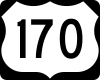 The portion of US 29 from US 70 at Charlotte, North Carolina
northeast to Lynchburg, Virginia
was U.S. Route 170 from 1926 until 1931, when US 29 was extended over it.
Pensacola, Florida
Pensacola is the westernmost city in the Florida Panhandle and the county seat of Escambia County, Florida, United States of America. As of the 2000 census, the city had a total population of 56,255 and as of 2009, the estimated population was 53,752...
. This highway's northern terminus is at Maryland Route 99
Maryland Route 99
Maryland Route 99 is a state highway in the U.S. state of Maryland. Known as Old Frederick Road, the state highway runs from MD 32 near West Friendship east to U.S. Route 29 in Ellicott City. MD 99 parallels the north side of Interstate 70 through a rural and suburban area in northeastern...
in Ellicott City, Maryland
Ellicott City, Maryland
Ellicott City is an unincorporated community and census-designated place in Howard County, Maryland, United States. It is part of the Baltimore-Washington Metropolitan Area. The population was 65,834 at the 2010 census. It is the county seat of Howard County...
. Its southern terminus is at US 90 and US 98 in Pensacola, Florida
Pensacola, Florida
Pensacola is the westernmost city in the Florida Panhandle and the county seat of Escambia County, Florida, United States of America. As of the 2000 census, the city had a total population of 56,255 and as of 2009, the estimated population was 53,752...
.
The section of US 29 between Greensboro, North Carolina
Greensboro, North Carolina
Greensboro is a city in the U.S. state of North Carolina. It is the third-largest city by population in North Carolina and the largest city in Guilford County and the surrounding Piedmont Triad metropolitan region. According to the 2010 U.S...
, and Danville, Virginia
Danville, Virginia
Danville is an independent city in Virginia, United States, bounded by Pittsylvania County, Virginia and Caswell County, North Carolina. It was the last capital of the Confederate States of America. The Bureau of Economic Analysis combines the city of Danville with Pittsylvania county for...
, has been designated as Future Interstate 785
Interstate 785
In the U.S. state of North Carolina, Interstate 785 is the designation for a future spur interstate route. When completed, it will connect Greensboro to Danville, Virginia.-Route description:...
and has received "Future Interstate" signs in several locations along that route. It will become an official Interstate Highway once improvements have been completed.
From Greensboro, North Carolina
Greensboro, North Carolina
Greensboro is a city in the U.S. state of North Carolina. It is the third-largest city by population in North Carolina and the largest city in Guilford County and the surrounding Piedmont Triad metropolitan region. According to the 2010 U.S...
to Tuskegee, Alabama
Tuskegee, Alabama
Tuskegee is a city in Macon County, Alabama, United States. At the 2000 census the population was 11,846 and is designated a Micropolitan Statistical Area. Tuskegee has been an important site in various stages of African American history....
, Interstate 85
Interstate 85
Interstate 85 is a major interstate highway in the Southeastern United States. Its current southern terminus is at an interchange with Interstate 65 in Montgomery, Alabama; its northern terminus interchanges with Interstate 95 in Petersburg, Virginia, near Richmond...
(I-85) runs parallel with US 29, which along that stretch, serves primarily as a local route.
Route description
|-|FL
|-
|AL
|-
|GA
|-
|SC
|-
|NC
U.S. Route 29 in North Carolina
U.S. Route 29 is an north–south United States highway that runs for from the South Carolina state line, near Blacksburg, to the commonwealth of Virginia, near Danville...
|-
|VA
U.S. Route 29 in Virginia
U.S. Route 29 is a major north–south route in the Commonwealth of Virginia. It covers from the North Carolina border at the city of Danville to the Key Bridge in Washington, D.C....
|-
|DC
U.S. Route 29 in the District of Columbia
U.S. Route 29 passes through the District of Columbia between Arlington, Virginia, and Silver Spring, Maryland, predominantly along surface streets.-Route description:...
|-
|MD
U.S. Route 29 in Maryland
U.S. Route 29 is a north–south United States highway that runs for from the western suburbs of Baltimore, Maryland, to Pensacola, Florida. In the U.S. state of Maryland, US 29 is a major highway that emerges from Washington D.C. and runs north into eastern Montgomery County, stretching...
|-
|Total
|1,036
|1,667
|}
Florida
US 29 begins at U.S. Route 90 and U.S. Route 98 in downtown PensacolaPensacola
Pensacola is a city in the western part of the U.S. state of Florida.Pensacola may also refer to:* Pensacola people, a group of Native Americans* A number of places in the Florida:** Pensacola Bay** Pensacola Regional Airport...
, Florida
Florida
Florida is a state in the southeastern United States, located on the nation's Atlantic and Gulf coasts. It is bordered to the west by the Gulf of Mexico, to the north by Alabama and Georgia and to the east by the Atlantic Ocean. With a population of 18,801,310 as measured by the 2010 census, it...
. Throughout the state, U.S. 29 is twinned with the unsigned State Road 95.
The entire route in Florida runs within Escambia County
Escambia County, Florida
Escambia County is the westernmost county in the U.S. state of Florida. The 2010 population was 297,619. The U.S. Census Bureau 2005 estimate for the county is 296,772. Its county seat is Pensacola.- History :...
. From its terminus north to State Road 296, it is known as North Palafox Street. From this point it is known as Pensacola Boulevard north to Ten Mile Road, approximately one mile north of U.S. 90 Alternate. Between SR 296 and the Molino
Molino, Florida
Molino is a census-designated place in Escambia County, Florida, United States. The population was 1,312 at the 2000 census. It is part of the Pensacola–Ferry Pass–Brent Metropolitan Statistical Area.-Geography:...
community, U.S. 29 runs parallel to its former routing, which is now Escambia County Road 95A (Old Palafox Highway).
Alabama
US 29, internally designated by the Alabama Department of TransportationAlabama Department of Transportation
The Alabama Department of Transportation is the government agency responsible for transportation infrastructure in Alabama. The department is divided into nine geographical divisions, with a central office located in Montgomery.-External links:...
as State Route 15 (SR-15), is a southwest-northeast state highway
State highway
State highway, state road or state route can refer to one of three related concepts, two of them related to a state or provincial government in a country that is divided into states or provinces :#A...
across the southeastern part of the U.S. state
U.S. state
A U.S. state is any one of the 50 federated states of the United States of America that share sovereignty with the federal government. Because of this shared sovereignty, an American is a citizen both of the federal entity and of his or her state of domicile. Four states use the official title of...
of Alabama
Alabama
Alabama is a state located in the southeastern region of the United States. It is bordered by Tennessee to the north, Georgia to the east, Florida and the Gulf of Mexico to the south, and Mississippi to the west. Alabama ranks 30th in total land area and ranks second in the size of its inland...
. SR-15 ends in Brewton at a junction with US-31 (SR-3) and SR-41, but US-29 continues west with US-31/SR-3 to Flomaton and south on SR-113 to the Florida
Florida
Florida is a state in the southeastern United States, located on the nation's Atlantic and Gulf coasts. It is bordered to the west by the Gulf of Mexico, to the north by Alabama and Georgia and to the east by the Atlantic Ocean. With a population of 18,801,310 as measured by the 2010 census, it...
state line.
U.S. Highway 29 and SR-15 traverse Alabama in a general northeast/southwest slope. It has never been a major route in the state; its significance was completely overshadowed with the completion of Interstate 65 and Interstate 85 during the 1970s. Today, US-29 and SR-15 serve primarily to connect numerous smaller towns and cities in the southwest, south-central, and eastern parts of Alabama.
Georgia
US 29 passes through the northern portion of GeorgiaGeorgia (U.S. state)
Georgia is a state located in the southeastern United States. It was established in 1732, the last of the original Thirteen Colonies. The state is named after King George II of Great Britain. Georgia was the fourth state to ratify the United States Constitution, on January 2, 1788...
, serving Atlanta
Atlanta, Georgia
Atlanta is the capital and most populous city in the U.S. state of Georgia. According to the 2010 census, Atlanta's population is 420,003. Atlanta is the cultural and economic center of the Atlanta metropolitan area, which is home to 5,268,860 people and is the ninth largest metropolitan area in...
and Athens
Athens, Georgia
Athens-Clarke County is a consolidated city–county in U.S. state of Georgia, in the northeastern part of the state, comprising the former City of Athens proper and Clarke County. The University of Georgia is located in this college town and is responsible for the initial growth of the city...
. The highway passes by notable universities, such as Georgia Tech in Atlanta and the University of Georgia
University of Georgia
The University of Georgia is a public research university located in Athens, Georgia, United States. Founded in 1785, it is the oldest and largest of the state's institutions of higher learning and is one of multiple schools to claim the title of the oldest public university in the United States...
in Athens. US 29 also meanders through Hartwell
Hartwell, Georgia
Hartwell is a city in Hart County, Georgia, United States. The population was 4,188 at the 2000 census. The city is the county seat of Hart County.-Geography:Hartwell is located at . It sits upon the southern border of Lake Hartwell...
and the Lake Hartwell
Lake Hartwell
Lake Hartwell is a reservoir bordering Georgia and South Carolina on the Savannah, Tugaloo, and Seneca Rivers. The lake is created by Hartwell Dam located on the Savannah River seven miles below the point at which the Tugaloo and Seneca Rivers join to form the Savannah...
region near the South Carolina border. From West Point, Georgia
West Point, Georgia
West Point is a town in Troup County, with a small tail of the south end of town in Harris County, in the U.S. state of Georgia. As of the 2000 U.S. Census, this town had a total population of just 3,382 people...
(Just south of LaGrange, Georgia
LaGrange, Georgia
LaGrange is a city in Troup County, Georgia, United States. It is named after the country estate near Paris of the Marquis de La Fayette, who visited the area in 1825. The population was 24,998 at the 2000 census...
) at the Alabama-Georgia Line to downtown Atlanta, Georgia State Route 8
Georgia State Route 8
State Route 8 is a west–east route located in the U.S. state of Georgia. The route is cosigned with either U.S. 29 or U.S. 78 for much of its entire length.-Major intersections:...
and Georgia State Route 14
Georgia State Route 14
State Route 14 begins in West Point and ends at Spring Street in southwest Atlanta. It overlaps U.S. 29 for its entire length, except for its last mile in Downtown Atlanta .In south Fulton County, S.R. 14 has a spur route State Route 14 begins in West Point (Troup County) and ends at Spring Street...
are paired with US 29 at various points in the state. US 29 has also been named Roosevelt Hwy.
South Carolina
In South CarolinaSouth Carolina
South Carolina is a state in the Deep South of the United States that borders Georgia to the south, North Carolina to the north, and the Atlantic Ocean to the east. Originally part of the Province of Carolina, the Province of South Carolina was one of the 13 colonies that declared independence...
, US 29 maintains a northeasterly routing, passing through Anderson
Anderson, South Carolina
Anderson is a city in and the county seat of Anderson County, South Carolina, United States. The population was estimated at 26,242 in 2006, and the city was the center of an urbanized area of 70,530...
, Greenville
Greenville, South Carolina
-Law and government:The city of Greenville adopted the Council-Manager form of municipal government in 1976.-History:The area was part of the Cherokee Nation's protected grounds after the Treaty of 1763, which ended the French and Indian War. No White man was allowed to enter, though some families...
, and Spartanburg
Spartanburg, South Carolina
thgSpartanburg is the largest city in and the county seat of Spartanburg County, South Carolina, United States. It is the second-largest city of the three primary cities in the Upstate region of South Carolina, and is located northwest of Columbia, west of Charlotte, and about northeast of...
.
From Greenville
Greenville, South Carolina
-Law and government:The city of Greenville adopted the Council-Manager form of municipal government in 1976.-History:The area was part of the Cherokee Nation's protected grounds after the Treaty of 1763, which ended the French and Indian War. No White man was allowed to enter, though some families...
through Greer
Greer, South Carolina
Greer is a city in Greenville and Spartanburg counties in the U.S. state of South Carolina, between the cities of Greenville and Spartanburg. The population was 25,515 at the 2010 census. It is projected to hit 30,000 within 4 years. Each day, more than three times that number of people pass...
, US 29 is known as Wade Hampton
Wade Hampton III
Wade Hampton III was a Confederate cavalry leader during the American Civil War and afterward a politician from South Carolina, serving as its 77th Governor and as a U.S...
Boulevard. It is a major commercial artery for both Greer and Taylors
Taylors, South Carolina
Taylors is a census-designated place in Greenville County, United States. The population was 20,125 at the 2000 census. Taylors is the Greenville/Spartanburg area's largest suburb although it is not incorporated as a city. It is part of the Greenville–Mauldin–Easley Metropolitan...
. A six-lane highway, the road forms the western border of Bob Jones University
Bob Jones University
Bob Jones University is a private, for-profit, non-denominational Protestant university in Greenville, South Carolina.The university was founded in 1927 by Bob Jones, Sr. , an evangelist and contemporary of Billy Sunday...
and then passes near Chick Springs
Chick Springs
Chick Springs is a mineral springs in present-day Taylors, Greenville County, South Carolina, which from the mid-nineteenth to the early twentieth century served as the focus of a small Upstate South Carolina resort community....
, a mineral springs
Mineral Springs
Mineral Springs is the name of several locations in the United States:* Mineral Springs, Arkansas* Mineral Springs, North Carolina* Mineral Springs Township, North Dakota* Mineral Springs at Green Springs, Ohio...
that served as the focus of a small but important resort community during the nineteenth century.
US 29 was built as the main highway between Greenville and the other city of northwestern South Carolina, Spartanburg. The construction of Interstate 85
Interstate 85
Interstate 85 is a major interstate highway in the Southeastern United States. Its current southern terminus is at an interchange with Interstate 65 in Montgomery, Alabama; its northern terminus interchanges with Interstate 95 in Petersburg, Virginia, near Richmond...
connecting Greenville to Spartanburg left US 29 underused until recent decades.
North Carolina
In North CarolinaNorth Carolina
North Carolina is a state located in the southeastern United States. The state borders South Carolina and Georgia to the south, Tennessee to the west and Virginia to the north. North Carolina contains 100 counties. Its capital is Raleigh, and its largest city is Charlotte...
, US 29 connects the cities of Charlotte
Charlotte, North Carolina
Charlotte is the largest city in the U.S. state of North Carolina and the seat of Mecklenburg County. In 2010, Charlotte's population according to the US Census Bureau was 731,424, making it the 17th largest city in the United States based on population. The Charlotte metropolitan area had a 2009...
, Concord
Concord, North Carolina
Concord is a city in the U.S. state of North Carolina. According to Census 2010, the city has a current population of 79,066. It is the largest city in Cabarrus County and is the county seat. In terms of population, the city of Concord is the second largest city in the Charlotte Metropolitan Area...
, and Greensboro
Greensboro, North Carolina
Greensboro is a city in the U.S. state of North Carolina. It is the third-largest city by population in North Carolina and the largest city in Guilford County and the surrounding Piedmont Triad metropolitan region. According to the 2010 U.S...
. US 29 routes through Charlotte along Tryon Street
Tryon Street
Tryon Street is a major north-south street of Charlotte, North Carolina. It traverses through the center of Uptown Charlotte and is the address for some of the city's tallest buildings like the Bank of America Corporate Center and Hearst Tower. U.S...
, one of the main arteries that runs through uptown Charlotte.
Virginia
In VirginiaVirginia
The Commonwealth of Virginia , is a U.S. state on the Atlantic Coast of the Southern United States. Virginia is nicknamed the "Old Dominion" and sometimes the "Mother of Presidents" after the eight U.S. presidents born there...
, part of U.S. 29 is named the Lee Highway
Lee Highway
The Lee Highway was a National Auto Trail in the United States connecting New York City and San Francisco, California via the South and Southwest. It was named after Robert E...
. U.S. 29 connects the historic small cities and large towns of west-central Virginia, including Danville, Lynchburg, Charlottesville, Culpeper, Warrenton, Manassas, and Fairfax, with Arlington, Virginia, and Washington, D.C.
Washington, D.C.
Washington, D.C., formally the District of Columbia and commonly referred to as Washington, "the District", or simply D.C., is the capital of the United States. On July 16, 1790, the United States Congress approved the creation of a permanent national capital as permitted by the U.S. Constitution....
, to the northeast, and with North Carolina to the southwest.
Along its route in Virginia, U.S. 29 provides significant access to and from several major colleges and universities, including the University of Virginia
University of Virginia
The University of Virginia is a public research university located in Charlottesville, Virginia, United States, founded by Thomas Jefferson...
in Charlottesville, George Mason University
George Mason University
George Mason University is a public university based in unincorporated Fairfax County, Virginia, United States, south of and adjacent to the city of Fairfax. Additional campuses are located nearby in Arlington County, Prince William County, and Loudoun County...
in Fairfax, Sweet Briar College
Sweet Briar College
Sweet Briar College is a liberal arts women's college in Sweet Briar, Virginia, about north of Lynchburg, Virginia. The school's Latin motto translates as: "She who has earned the rose may bear it."...
in Sweet Briar, and Liberty University
Liberty University
Liberty University is a private Christian university located in Lynchburg, Virginia. Liberty's annual enrollment is around 72,000 students, 12,000 of whom are residential students and 60,000+ studying through Liberty University Online...
, Lynchburg College
Lynchburg College
Lynchburg College is a private college in Lynchburg, Virginia, USA, related by covenant to the Christian Church with approximately 2,500 undergraduate and graduate students. The Princeton Review lists it as one of the 368 best colleges in the nation...
, and Randolph College
Randolph College
Randolph College is a private liberal arts and sciences college located in Lynchburg, Virginia. Founded in 1891 as Randolph-Macon Woman's College, it was renamed on July 1, 2007, when it became coeducational....
in Lynchburg.
District of Columbia
US 29 enters the District of Columbia and Washington, D.C.Washington, D.C.
Washington, D.C., formally the District of Columbia and commonly referred to as Washington, "the District", or simply D.C., is the capital of the United States. On July 16, 1790, the United States Congress approved the creation of a permanent national capital as permitted by the U.S. Constitution....
, via the Francis Scott Key Bridge
Francis Scott Key Bridge (Washington)
The Francis Scott Key Bridge, more commonly known as the Key Bridge, is a six-lane reinforced concrete arch bridge conveying U.S. Route 29 traffic across the Potomac River between the Rosslyn neighborhood of Arlington County, Virginia and the Georgetown neighborhood of Washington, D.C...
adjacent to Georgetown University
Georgetown University
Georgetown University is a private, Jesuit, research university whose main campus is in the Georgetown neighborhood of Washington, D.C. Founded in 1789, it is the oldest Catholic university in the United States...
. The designation turns east onto the Whitehurst Freeway, bypassing Georgetown
Georgetown, Washington, D.C.
Georgetown is a neighborhood located in northwest Washington, D.C., situated along the Potomac River. Founded in 1751, the port of Georgetown predated the establishment of the federal district and the City of Washington by 40 years...
to the south. Upon crossing Rock Creek
Rock Creek
-Streams:* Rock Creek * Rock Creek , disambiguation* Rock Creek * Rock Creek , in Illinois* Rock Creek , in Maryland and the District of Columbia* Rock Creek , in Missoula County...
, the freeway ends, becoming the at-grade K Street
K Street (Washington, D.C.)
K Street is a major thoroughfare in the United States capital of Washington, D.C. known as a center for numerous think tanks, lobbyists, and advocacy groups.-Location:...
. US 29 remains on K Street to 11th Street, where US 29 turns north onto 11th for seven blocks. At Rhode Island Avenue, US 29 turns right. US 29 northbound turns left at 6th Street NW (touching US 1 where it turns from Rhode Island Avenue to 6th Street); it follows 6th Street NW for two blocks and then turns left onto Florida Avenue NW, where it then turns right onto Georgia Avenue NW. US 29 southbound at this point, however, follows 7th Street, NW
7th Street (Washington, D.C.)
There are four north-south arteries in Washington, D.C. named Seventh Street that are differentiated by the quadrants of the city in which they are located. Historically, 7th Street has been a main north-south road in Washington, being the main route for travelers and farmers coming into the city...
to Rhode Island Avenue NW. The route maintains a northerly routing as it passes through northern Washington, D.C. and enters Maryland
Maryland
Maryland is a U.S. state located in the Mid Atlantic region of the United States, bordering Virginia, West Virginia, and the District of Columbia to its south and west; Pennsylvania to its north; and Delaware to its east...
. During its alignment with Georgia Avenue NW, US 29 bypasses the Howard University
Howard University
Howard University is a federally chartered, non-profit, private, coeducational, nonsectarian, historically black university located in Washington, D.C., United States...
campus to the west.
Maryland
In MarylandMaryland
Maryland is a U.S. state located in the Mid Atlantic region of the United States, bordering Virginia, West Virginia, and the District of Columbia to its south and west; Pennsylvania to its north; and Delaware to its east...
, US 29 turns northeast onto Colesville Road, interchanges with the Capital Beltway (Interstate 495)
Interstate 495 (Capital Beltway)
Interstate 495 is a Interstate Highway that surrounds the United States' capital of Washington, D.C., and its inner suburbs in adjacent Maryland and Virginia. I-495 is widely known as the Capital Beltway or simply the Beltway, especially when the context of Washington, D.C., is clear...
, becomes Columbia Pike, and interchanges with New Hampshire Avenue
New Hampshire Avenue
New Hampshire Avenue is a diagonal street in Washington, D.C., beginning at the Kennedy Center and extending northeast for about 5 miles and then continuing into Maryland where it is designated Maryland Route 650. New Hampshire Avenue, however, is not contiguous...
(Maryland Route 650
Maryland Route 650
Maryland Route 650 is a state highway in the U.S. state of Maryland. Known as New Hampshire Avenue for most of its length, the state highway runs from Eastern Avenue at the Washington, D.C. border north to MD 108 in Etchison...
), Maryland Route 198
Maryland Route 198
Maryland Route 198 is an east–west state highway in the central part of the U.S. state of Maryland that connects Fort Meade at Maryland Route 32 to Maryland Route 28 and Maryland Route 650 near Spencerville.-Spencerville Road:...
, Maryland Route 32
Maryland Route 32
Maryland Route 32 is a state highway in the U.S. state of Maryland. The state highway runs from Interstate 97 and MD 3 in Millersville west and north to Washington Road in Westminster. The east–west portion of MD 32 is the Patuxent Freeway, a four- to six-lane...
, Maryland Route 175
Maryland Route 175
-Annapolis Road:MD 175 begins at MD 3, just south of the latter's northern terminus at Interstate 97, known as Annapolis Road. It runs west as a two-lane suburban highway, passing through local neighborhoods and south of Arundel High School before widening into a four-lane suburban arterial south...
, Maryland Route 100
Maryland Route 100
Maryland Route 100 is a major east–west highway connecting U.S. Route 29 in Ellicott City and MD 177 in Pasadena. MD 100 also connects to Interstate 95 , US 1, the Baltimore-Washington Parkway , and I-97...
, US 40
U.S. Route 40 in Maryland
U.S. Route 40 in the U.S. state of Maryland runs from western Maryland to Cecil County in the state's northeastern corner. With a total length of over , it is the longest numbered highway in Maryland. Almost half of the road overlaps with Interstate 68 or Interstate 70, while the old alignment...
and I-70
Interstate 70 in Maryland
Interstate 70 is a part of the Interstate Highway System that runs from Cove Fort, Utah to Baltimore, Maryland. In Maryland, the Interstate Highway runs from the Pennsylvania state line in Hancock east to the Interstate's eastern terminus near its junction with I-695 at a park and ride in...
before terminating at Maryland Route 99
Maryland Route 99
Maryland Route 99 is a state highway in the U.S. state of Maryland. Known as Old Frederick Road, the state highway runs from MD 32 near West Friendship east to U.S. Route 29 in Ellicott City. MD 99 parallels the north side of Interstate 70 through a rural and suburban area in northeastern...
northwest of Ellicott City
Ellicott City, Maryland
Ellicott City is an unincorporated community and census-designated place in Howard County, Maryland, United States. It is part of the Baltimore-Washington Metropolitan Area. The population was 65,834 at the 2010 census. It is the county seat of Howard County...
. There are plans to extend the northern terminus to Taneytown
Taneytown, Maryland
Taneytown is a city in Carroll County, Maryland, United States. The population was 5,128 at the 2000 census. was founded in 1754. Of the town George Washington once wrote "Tan-nee town is but a small place with only the Street through wch. the road passes, built on...
, near the Pennsylvania
Pennsylvania
The Commonwealth of Pennsylvania is a U.S. state that is located in the Northeastern and Mid-Atlantic regions of the United States. The state borders Delaware and Maryland to the south, West Virginia to the southwest, Ohio to the west, New York and Ontario, Canada, to the north, and New Jersey to...
-Maryland
Maryland
Maryland is a U.S. state located in the Mid Atlantic region of the United States, bordering Virginia, West Virginia, and the District of Columbia to its south and west; Pennsylvania to its north; and Delaware to its east...
border.
History
Virginia
The Commonwealth of Virginia , is a U.S. state on the Atlantic Coast of the Southern United States. Virginia is nicknamed the "Old Dominion" and sometimes the "Mother of Presidents" after the eight U.S. presidents born there...
. This is the name that was used for this road during the Civil War
American Civil War
The American Civil War was a civil war fought in the United States of America. In response to the election of Abraham Lincoln as President of the United States, 11 southern slave states declared their secession from the United States and formed the Confederate States of America ; the other 25...
. Although the road has been expanded past Manassas into four lanes, it remains a rural two lane highway through Manassas National Battlefield Park
Manassas National Battlefield Park
Manassas National Battlefield Park, located north of Manassas, in Prince William County, Virginia preserves the site of two major American Civil War battles: the First Battle of Bull Run on July 21, 1861, and the Second Battle of Bull Run which was fought between August 28 and August 30, 1862...
, where Interstate 66
Interstate 66
Interstate 66 is an Interstate Highway in the eastern United States. As indicated by its even route number, it runs in an east–west direction. Its western terminus is at Middletown, Virginia, at an intersection with Interstate 81; its eastern terminus is in Washington, D.C., at an...
carries through traffic. On either side of the road through the battlefield, split rail fences define property borders.
U.S. Route 170
Charlotte, North Carolina
Charlotte is the largest city in the U.S. state of North Carolina and the seat of Mecklenburg County. In 2010, Charlotte's population according to the US Census Bureau was 731,424, making it the 17th largest city in the United States based on population. The Charlotte metropolitan area had a 2009...
northeast to Lynchburg, Virginia
Lynchburg, Virginia
Lynchburg is an independent city in the Commonwealth of Virginia. The population was 75,568 as of 2010. Located in the foothills of the Blue Ridge Mountains along the banks of the James River, Lynchburg is known as the "City of Seven Hills" or "The Hill City." Lynchburg was the only major city in...
was U.S. Route 170 from 1926 until 1931, when US 29 was extended over it.
Major intersections
- Interstate 10 in Ensley, FloridaEnsley, FloridaEnsley is a census-designated place in Escambia County, Florida, United States. The population was 18,752 at the 2000 census. It is part of the Pensacola–Ferry Pass–Brent Metropolitan Statistical Area.-Geography:...
- U.S. Route 31U.S. Route 31U.S. Route 31 is a long north–south highway connecting northern Michigan to southern Alabama, with its northern terminus at Interstate 75 near Mackinaw City, Michigan, and southern terminus at the combined U.S. Route 90 & U.S. Route 98 at Spanish Fort, Alabama...
in FlomatonFlomaton, AlabamaFlomaton is a town in Escambia County, Alabama, United States. At the 2000 census the population was 1,588.-Geography:Flomaton is located at .According to the U.S...
and Brewton, AlabamaBrewton, AlabamaBrewton is a city in Escambia County, Alabama, United States. At the 2000 census the population was 5,498. The city is the county seat of Escambia County.-History:... - U.S. Route 84U.S. Route 84U.S. Route 84 is an east–west United States highway. It started as a short Georgia-Alabama route in the original 1926 scheme, but now extends all the way to Colorado. The highway's eastern terminus is a short distance east of Midway, Georgia, at an intersection with I-95. The road continues...
in Andalusia, AlabamaAndalusia, AlabamaAndalusia is a city in and the county seat of Covington County, Alabama, United States. At the 2000 census the population was 8,794.According to the 2007 U.S. Census estimates, the city had a population of 8,705... - U.S. Route 82U.S. Route 82U.S. Route 82 is an east–west United States highway in the southern United States. What started as a 1932 addition to the system across central Mississippi and southern Arkansas eventually became a 1,609 mile route extending from the White Sands of New Mexico to Georgia's Atlantic coast.The...
in Union Springs, AlabamaUnion Springs, AlabamaUnion Springs is a town in Bullock County, Alabama, United States. The population was 3,670 at the 2000 census.-History:The area that became Union Springs was first settled by white men after the Creek Indian removal of the 1830s. Twenty-seven springs watered the land, giving rise to the name of... - U.S. Route 80U.S. Route 80U.S. Route 80 is an east–west United States highway, much of which was once part of the early auto trail known as the Dixie Overland Highway. As the "0" in the route number indicates, it was originally a cross-country route, from the Atlantic to the Pacific...
in TuskegeeTuskegee, AlabamaTuskegee is a city in Macon County, Alabama, United States. At the 2000 census the population was 11,846 and is designated a Micropolitan Statistical Area. Tuskegee has been an important site in various stages of African American history....
and near Auburn, AlabamaAuburn, AlabamaAuburn is a city in Lee County, Alabama, United States. It is the largest city in eastern Alabama with a 2010 population of 53,380. It is a principal city of the Auburn-Opelika Metropolitan Area... - U.S. Route 27U.S. Route 27U.S. Route 27 is a north–south United States highway in the southern and midwestern United States. The southern terminus is at US 1 in Miami, Florida. The northern terminus is at Interstate 69 in Fort Wayne, Indiana...
in Lagrange, GeorgiaLaGrange, GeorgiaLaGrange is a city in Troup County, Georgia, United States. It is named after the country estate near Paris of the Marquis de La Fayette, who visited the area in 1825. The population was 24,998 at the 2000 census... - U.S. Route 27 Alternate in Newnan, GeorgiaNewnan, GeorgiaNewnan is a city in Coweta County, Georgia, about 30 miles southwest of Atlanta. The population was 16,242 at the 2000 Census. Newnan is one of the fastest growing cities in Georgia, with an estimated population of 27,097 in 2006 and 33,293 in July 2008...
- Interstate 75Interstate 75Interstate 75 is a major north–south Interstate Highway in the Great Lakes and Southeastern regions of the United States. It travels from State Road 826 and State Road 924 in Hialeah, Florida to Sault Ste. Marie, Michigan, at the Ontario, Canada, border...
/Interstate 85Interstate 85Interstate 85 is a major interstate highway in the Southeastern United States. Its current southern terminus is at an interchange with Interstate 65 in Montgomery, Alabama; its northern terminus interchanges with Interstate 95 in Petersburg, Virginia, near Richmond...
(the Downtown ConnectorDowntown ConnectorIn Atlanta, Georgia, the Downtown Connector or 75/85 is the concurrent section of Interstate 75 and Interstate 85 through the core of the city. Beginning at the I-85/Langford Parkway interchange, the Downtown Connector runs generally due north, meeting the east-west Interstate 20 in the middle....
) in Atlanta, GeorgiaAtlanta, GeorgiaAtlanta is the capital and most populous city in the U.S. state of Georgia. According to the 2010 census, Atlanta's population is 420,003. Atlanta is the cultural and economic center of the Atlanta metropolitan area, which is home to 5,268,860 people and is the ninth largest metropolitan area in... - U.S. Route 78U.S. Route 78U.S. Highway 78 is an east–west United States highway that runs for 715 miles from Memphis, Tennessee, to Charleston, South Carolina. Between Memphis and Birmingham, Alabama, it is being upgraded to become Interstate 22....
at Decatur, GeorgiaDecatur, GeorgiaDecatur is a city in, and county seat of, DeKalb County, Georgia, United States. With a population of 19,335 in the 2010 census, the city is sometimes assumed to be larger since multiple zip codes in unincorporated DeKalb County bear the Decatur name... - Interstate 285Interstate 285Interstate 285 is an Interstate Highway loop encircling Atlanta, Georgia, for . I-285 is also known as unsigned State Route 407 and is colloquially referred to as the Perimeter. Suburban sprawl has made it one of the most heavily traveled roadways in the United States, and portions of the highway...
at Tucker, GeorgiaTucker, GeorgiaTucker is a census-designated place in DeKalb County, Georgia, United States. The population was 27,581 at the 2010 Census. Although central Tucker, also known as "Main Street Tucker", is laid out as a planned "railroad town," it has never been formally incorporated. Municipal services such as... - U.S. Route 78U.S. Route 78U.S. Highway 78 is an east–west United States highway that runs for 715 miles from Memphis, Tennessee, to Charleston, South Carolina. Between Memphis and Birmingham, Alabama, it is being upgraded to become Interstate 22....
/U.S. Route 129U.S. Route 129U.S. Route 129 is an offshoot route of U.S. Route 29, which it intersects near Athens, Georgia. US 129 currently runs for 582 miles from Knoxville, Tennessee, to Chiefland, Florida, at U.S. Route 19 and U.S. Route 98. It passes through the states of Tennessee, North Carolina, Georgia and Florida...
/U.S. Route 441U.S. Route 441U.S. Route 441 is a spur route of U.S. Route 41. It currently runs for 939 miles from U.S. Route 41 in Miami, Florida to U.S. Route 25W in Lake City, Tennessee. Between its termini, US 441 passes through the states of Florida, Georgia, North Carolina, and Tennessee...
at Athens, GeorgiaAthens, GeorgiaAthens-Clarke County is a consolidated city–county in U.S. state of Georgia, in the northeastern part of the state, comprising the former City of Athens proper and Clarke County. The University of Georgia is located in this college town and is responsible for the initial growth of the city... - State Route 17 (Georgia) at Royston, GeorgiaRoyston, GeorgiaRoyston is a city in Franklin, Hart, and Madison counties in the U.S. state of Georgia. The population was 2,493 at the 2000 census.-Geography:Royston is located at ....
- State Route 77 (Georgia) at Hartwell, GeorgiaHartwell, GeorgiaHartwell is a city in Hart County, Georgia, United States. The population was 4,188 at the 2000 census. The city is the county seat of Hart County.-Geography:Hartwell is located at . It sits upon the southern border of Lake Hartwell...
- U.S. Route 76U.S. Route 76U.S. Route 76 is an east–west United States highway that runs for from Chattanooga, Tennessee to Wrightsville Beach, North Carolina.-Tennessee:...
/U.S. Route 178U.S. Route 178U.S. Highway 178 is a spur of U.S. Highway 78. It currently runs for 237 miles from Dorchester, South Carolina at U.S. Highway 78 to Rosman, North Carolina at U.S. Highway 64. It passes through the states of South Carolina and North Carolina...
at Anderson, South CarolinaAnderson, South CarolinaAnderson is a city in and the county seat of Anderson County, South Carolina, United States. The population was estimated at 26,242 in 2006, and the city was the center of an urbanized area of 70,530... - U.S. Route 25U.S. Route 25U.S. Route 25 is a north–south United States highway that runs for from Brunswick, Georgia to the Ohio state line in Covington, Kentucky.-Georgia:...
/U.S. Route 123U.S. Route 123U.S. Route 123 is a spur of U.S. Route 23. It currently runs for from Greenville, South Carolina to Dicks Hill, Georgia at U.S. Route 23. It passes through the states of South Carolina and Georgia and before the construction of I-85, it was the main route between Greenville, South Carolina and...
/U.S. Route 276U.S. Route 276U.S. Route 276 is an United States highway that runs for from Mauldin, South Carolina to Cove Creek, North Carolina. It is known both as a busy urban highway in Greenville, South Carolina and a scenic back-road in Western North Carolina.-Route description:...
at Greenville, South CarolinaGreenville, South Carolina-Law and government:The city of Greenville adopted the Council-Manager form of municipal government in 1976.-History:The area was part of the Cherokee Nation's protected grounds after the Treaty of 1763, which ended the French and Indian War. No White man was allowed to enter, though some families... - Interstate 26Interstate 26Interstate 26 is a nominally east–west main route of the Interstate Highway System in the Southeastern United States. I-26 runs from the junction of U.S. Route 11W and U.S. Route 23 in Kingsport, Tennessee, generally southeastward to U.S. Route 17 in Charleston, South Carolina...
at SpartanburgSpartanburg, South CarolinathgSpartanburg is the largest city in and the county seat of Spartanburg County, South Carolina, United States. It is the second-largest city of the three primary cities in the Upstate region of South Carolina, and is located northwest of Columbia, west of Charlotte, and about northeast of... - U.S. Route 74U.S. Route 74U.S. Route 74 is an east–west United States highway that runs for from Cleveland, Tennessee to Wrightsville Beach, North Carolina.-Tennessee:Established in 1987, US-74 western terminus is exit 20 on I-75 in Cleveland...
in GastoniaGastonia, North CarolinaGastonia is the largest city and county seat of Gaston County, North Carolina, United States. It is also the third largest suburb of the Charlotte Area, behind Concord and Rock Hill. The population was 71,226 as of Gastonia is the largest city and county seat of Gaston County, North Carolina,...
and Charlotte, North CarolinaCharlotte, North CarolinaCharlotte is the largest city in the U.S. state of North Carolina and the seat of Mecklenburg County. In 2010, Charlotte's population according to the US Census Bureau was 731,424, making it the 17th largest city in the United States based on population. The Charlotte metropolitan area had a 2009... - Interstate 77Interstate 77Interstate 77 is an Interstate Highway in the eastern United States. It traverses diverse terrain, from the mountainous state of West Virginia to the rolling farmlands of North Carolina and Ohio. It largely supplants the old U.S...
/U.S. Route 21U.S. Route 21U.S. Route 21 is a north–south United States highway of , from Hunting Island State Park, South Carolina to Wytheville, Virginia.-South Carolina:...
in Charlotte, North CarolinaCharlotte, North CarolinaCharlotte is the largest city in the U.S. state of North Carolina and the seat of Mecklenburg County. In 2010, Charlotte's population according to the US Census Bureau was 731,424, making it the 17th largest city in the United States based on population. The Charlotte metropolitan area had a 2009... - Interstate 485Interstate 485Interstate 485 is an Interstate Highway and a nearly completed beltway around Charlotte, North Carolina.-Route description:The western, southern and eastern segments of the beltway are complete and open to traffic...
in Charlotte, North CarolinaCharlotte, North CarolinaCharlotte is the largest city in the U.S. state of North Carolina and the seat of Mecklenburg County. In 2010, Charlotte's population according to the US Census Bureau was 731,424, making it the 17th largest city in the United States based on population. The Charlotte metropolitan area had a 2009... - Interstate 85Interstate 85Interstate 85 is a major interstate highway in the Southeastern United States. Its current southern terminus is at an interchange with Interstate 65 in Montgomery, Alabama; its northern terminus interchanges with Interstate 95 in Petersburg, Virginia, near Richmond...
in Concord, North CarolinaConcord, North CarolinaConcord is a city in the U.S. state of North Carolina. According to Census 2010, the city has a current population of 79,066. It is the largest city in Cabarrus County and is the county seat. In terms of population, the city of Concord is the second largest city in the Charlotte Metropolitan Area... - U.S. Route 52U.S. Route 52U.S. Route 52 is a United States highway that runs across the northern, eastern and southeastern regions of the United States. Contrary to most other even-numbered U.S...
in SalisburySalisbury, North CarolinaSalisbury is a city in Rowan County in North Carolina, a state of the United States of America. The population was 33,663 in the 2010 Census . It is the county seat of Rowan County...
and Lexington, North CarolinaLexington, North CarolinaLexington is the county seat of Davidson County, North Carolina, United States. As of the 2000 census, the city had a total population of 19,953. It is located in central North Carolina, twenty miles south of Winston-Salem. Major highways include I-85, U.S. Route 29, U.S. Route 70, U.S. Route 52 ... - Interstate 85Interstate 85Interstate 85 is a major interstate highway in the Southeastern United States. Its current southern terminus is at an interchange with Interstate 65 in Montgomery, Alabama; its northern terminus interchanges with Interstate 95 in Petersburg, Virginia, near Richmond...
in Greensboro, North CarolinaGreensboro, North CarolinaGreensboro is a city in the U.S. state of North Carolina. It is the third-largest city by population in North Carolina and the largest city in Guilford County and the surrounding Piedmont Triad metropolitan region. According to the 2010 U.S... - U.S. Route 70U.S. Route 70U.S. Route 70 is an east–west United States highway that runs for 2,385 miles from eastern North Carolina to east-central Arizona. As can be derived from its number, it is a major east–west highway of the Southern and Southwestern United States...
in GreensboroGreensboro, North CarolinaGreensboro is a city in the U.S. state of North Carolina. It is the third-largest city by population in North Carolina and the largest city in Guilford County and the surrounding Piedmont Triad metropolitan region. According to the 2010 U.S...
and Salisbury, North CarolinaSalisbury, North CarolinaSalisbury is a city in Rowan County in North Carolina, a state of the United States of America. The population was 33,663 in the 2010 Census . It is the county seat of Rowan County... - Interstate 40Interstate 40Interstate 40 is the third-longest major east–west Interstate Highway in the United States, after I-90 and I-80. Its western end is at Interstate 15 in Barstow, California; its eastern end is at a concurrency of U.S. Route 117 and North Carolina Highway 132 in Wilmington, North Carolina...
in Greensboro, North CarolinaGreensboro, North CarolinaGreensboro is a city in the U.S. state of North Carolina. It is the third-largest city by population in North Carolina and the largest city in Guilford County and the surrounding Piedmont Triad metropolitan region. According to the 2010 U.S... - U.S. Route 58U.S. Route 58U.S. Route 58 is an east–west U.S. Highway that runs for from U.S. Route 25E just northwest of Harrogate, Tennessee to U.S. Route 60 in Virginia Beach, Virginia. Until 1996, when the Cumberland Gap Tunnel opened, US 58 ran only inside the commonwealth of Virginia...
/U.S. Route 360U.S. Route 360U.S. Route 360 is a spur of US 60 in the U.S. state of Virginia. The U.S. Highway runs from US 58 Business, Virginia State Route 293, and SR 360 in Danville east to SR 644 in Reedville. US 360 connects Danville, South Boston, and Keysville in Southside Virginia with the state capital of...
in Danville, VirginiaDanville, VirginiaDanville is an independent city in Virginia, United States, bounded by Pittsylvania County, Virginia and Caswell County, North Carolina. It was the last capital of the Confederate States of America. The Bureau of Economic Analysis combines the city of Danville with Pittsylvania county for... - U.S. Route 60U.S. Route 60U.S. Route 60 is an east–west United States highway, running from the Atlantic Ocean on the east coast in Virginia to western Arizona. Despite the final "0" in its number, indicating a transcontinental designation, the 1926 route formerly ended in Springfield, Missouri, at its intersection...
in Amherst, VirginiaAmherst, VirginiaAmherst is a town in Amherst County, Virginia, United States. The population was 2,251 at the 2000 census. It is the county seat of Amherst County.Amherst is part of the Lynchburg Metropolitan Statistical Area.-Geography:... - Interstate 64Interstate 64Interstate 64 is an Interstate Highway in the Midwestern and Southeastern United States. Its western terminus is at I-70, U.S. 40, and U.S. 61 in Wentzville, Missouri. Its eastern terminus is at an interchange with I-264 and I-664 at Bowers Hill in Chesapeake, Virginia. As I-64 is concurrent with...
in Charlottesville, VirginiaCharlottesville, VirginiaCharlottesville is an independent city geographically surrounded by but separate from Albemarle County in the Commonwealth of Virginia, United States, and named after Charlotte of Mecklenburg-Strelitz, the queen consort of King George III of the United Kingdom.The official population estimate for... - U.S. Route 250U.S. Route 250U.S. Route 250 is a route of the United States Numbered Highway System, and is a spur of U.S. Route 50. It currently runs for from Sandusky, Ohio to Richmond, Virginia. It passes through the states of Virginia, West Virginia, and Ohio. It goes through the cities of Richmond, Virginia,...
in Charlottesville, VirginiaCharlottesville, VirginiaCharlottesville is an independent city geographically surrounded by but separate from Albemarle County in the Commonwealth of Virginia, United States, and named after Charlotte of Mecklenburg-Strelitz, the queen consort of King George III of the United Kingdom.The official population estimate for... - U.S. Route 33U.S. Route 33U.S. Route 33 is a United States federal highway that runs northwest-southeast for 709 miles from northern Indiana to Richmond, Virginia, passing through Ohio and West Virginia en route. Although most odd-numbered U.S...
in Ruckersville, VirginiaRuckersville, VirginiaRuckersville is a census-designated place in Greene County, Virginia, United States, located in a rural area on the outskirts of Charlottesville. The population as of the 2010 Census was 1,141. The community lies amidst hills, mountain views, trees, and farmland. It is located at the intersection... - U.S. Route 15U.S. Route 15U.S. Route 15 is a -long United States highway, designated along South Carolina, North Carolina, Virginia, Maryland, Pennsylvania, and New York. The route is signed north–south, from U.S. Route 17 Alternate in Walterboro, South Carolina to Interstate 86 and NY 17 in Painted Post, New York.US...
in CulpeperCulpeper, VirginiaCulpeper is an incorporated town in Culpeper County, Virginia, United States. The population was 9,664 at the 2000 census. It is the county seat of Culpeper County. Culpeper is part of the Culpeper Micropolitan Statistical Area, which includes all of Culpeper County. Both the Town of Culpeper and...
and Gainesville, VirginiaGainesville, Virginia-Demographics:Gainesville is currently the third-largest CDP in Prince William County. As of the census estimate of 2009, there were 28,662 people, 10,300 households, and 8,604 families residing in the CDP. The population density was 1,150.2 people per square mile . There were 10,300 housing units... - U.S. Route 17U.S. Route 17U.S. Route 17 or U.S. Highway 17 is a north–south United States highway. The highway spans the southeastern United States and is close to the Atlantic Coast for much of its length. The highway's southern terminus is at Punta Gorda, Florida, at an intersection with U.S. Route 41...
in OpalOpal, VirginiaOpal is a census-designated place in Fauquier County, Virginia, on U.S. Highway 15/U.S. Route 17 and Virginia State Route 28, at an elevation of 449 feet . The population as of the 2010 Census was 691....
and Warrenton, VirginiaWarrenton, VirginiaWarrenton is a town in Fauquier County, Virginia, United States. The population was 6,670 at the 2000 census, and 14,634 at the 2010 estimate. It is the county seat of Fauquier County. Public schools in the town include Fauquier High School, Warrenton Middle School, Taylor Middle School and two... - Interstate 66Interstate 66Interstate 66 is an Interstate Highway in the eastern United States. As indicated by its even route number, it runs in an east–west direction. Its western terminus is at Middletown, Virginia, at an intersection with Interstate 81; its eastern terminus is in Washington, D.C., at an...
at Gainesville, VirginiaGainesville, Virginia-Demographics:Gainesville is currently the third-largest CDP in Prince William County. As of the census estimate of 2009, there were 28,662 people, 10,300 households, and 8,604 families residing in the CDP. The population density was 1,150.2 people per square mile . There were 10,300 housing units... - U.S. Route 50U.S. Route 50U.S. Route 50 is a major east–west route of the U.S. Highway system, stretching just over from Ocean City, Maryland on the Atlantic Ocean to West Sacramento, California. Until 1972, when it was replaced by Interstate Highways west of the Sacramento area, it extended to San Francisco, near...
at Fairfax, VirginiaFairfax, VirginiaThe City of Fairfax is an independent city forming an enclave within the confines of Fairfax County, in the Commonwealth of Virginia in the United States. Although politically independent of the surrounding county, the City is nevertheless the county seat.... - Interstate 495Interstate 495 (Capital Beltway)Interstate 495 is a Interstate Highway that surrounds the United States' capital of Washington, D.C., and its inner suburbs in adjacent Maryland and Virginia. I-495 is widely known as the Capital Beltway or simply the Beltway, especially when the context of Washington, D.C., is clear...
at Silver Spring, MarylandSilver Spring, MarylandSilver Spring is an unincorporated area and census-designated place in Montgomery County, Maryland, United States. It had a population of 71,452 at the 2010 census, making it the fourth most populous place in Maryland, after Baltimore, Columbia, and Germantown.The urbanized, oldest, and... - Interstate 70Interstate 70Interstate 70 is an Interstate Highway in the United States that runs from Interstate 15 near Cove Fort, Utah, to a Park and Ride near Baltimore, Maryland. It was the first Interstate Highway project in the United States. I-70 approximately traces the path of U.S. Route 40 east of the Rocky...
at Ellicott City, MarylandEllicott City, MarylandEllicott City is an unincorporated community and census-designated place in Howard County, Maryland, United States. It is part of the Baltimore-Washington Metropolitan Area. The population was 65,834 at the 2010 census. It is the county seat of Howard County...